

Timeline of European exploration
Encyclopedia
Europe
Europe is, by convention, one of the world's seven continents. Comprising the westernmost peninsula of Eurasia, Europe is generally 'divided' from Asia to its east by the watershed divides of the Ural and Caucasus Mountains, the Ural River, the Caspian and Black Seas, and the waterways connecting...
an exploration
Exploration
Exploration is the act of searching or traveling around a terrain for the purpose of discovery of resources or information. Exploration occurs in all non-sessile animal species, including humans...
from 1418 to 1948.
The fifteenth century witnessed the rounding of the feared Cape Bojador
Cape Bojador
Cape Bojador or Cape Boujdour is a headland on the northern coast of Western Sahara, at 26° 07' 37"N, 14° 29' 57"W. , as well as the name of a nearby town with a population of 41,178.It is shown on nautical charts with the original Portuguese name "Cabo Bojador", but is sometimes...
and Portuguese
Portugal
Portugal , officially the Portuguese Republic is a country situated in southwestern Europe on the Iberian Peninsula. Portugal is the westernmost country of Europe, and is bordered by the Atlantic Ocean to the West and South and by Spain to the North and East. The Atlantic archipelagos of the...
exploration of the west coast of Africa
Africa
Africa is the world's second largest and second most populous continent, after Asia. At about 30.2 million km² including adjacent islands, it covers 6% of the Earth's total surface area and 20.4% of the total land area...
, while in the last decade of the century the Spanish
Spain
Spain , officially the Kingdom of Spain languages]] under the European Charter for Regional or Minority Languages. In each of these, Spain's official name is as follows:;;;;;;), is a country and member state of the European Union located in southwestern Europe on the Iberian Peninsula...
sent expeditions to the New World
New World
The New World is one of the names used for the Western Hemisphere, specifically America and sometimes Oceania . The term originated in the late 15th century, when America had been recently discovered by European explorers, expanding the geographical horizon of the people of the European middle...
, focusing on exploring the Caribbean Sea
Caribbean Sea
The Caribbean Sea is a sea of the Atlantic Ocean located in the tropics of the Western hemisphere. It is bounded by Mexico and Central America to the west and southwest, to the north by the Greater Antilles, and to the east by the Lesser Antilles....
. In the sixteenth century various countries sent exploring parties into the interior of the Americas, as well as to their respective west and east coasts north to California
California
California is a state located on the West Coast of the United States. It is by far the most populous U.S. state, and the third-largest by land area...
and Labrador
Labrador
Labrador is the distinct, northerly region of the Canadian province of Newfoundland and Labrador. It comprises the mainland portion of the province, separated from the island of Newfoundland by the Strait of Belle Isle...
and south to Chile
Chile
Chile ,officially the Republic of Chile , is a country in South America occupying a long, narrow coastal strip between the Andes mountains to the east and the Pacific Ocean to the west. It borders Peru to the north, Bolivia to the northeast, Argentina to the east, and the Drake Passage in the far...
and Tierra del Fuego
Tierra del Fuego
Tierra del Fuego is an archipelago off the southernmost tip of the South American mainland, across the Strait of Magellan. The archipelago consists of a main island Isla Grande de Tierra del Fuego divided between Chile and Argentina with an area of , and a group of smaller islands including Cape...
. In the seventeenth century the Russia
Russia
Russia or , officially known as both Russia and the Russian Federation , is a country in northern Eurasia. It is a federal semi-presidential republic, comprising 83 federal subjects...
ns explored and conquered Siberia
Siberia
Siberia is an extensive region constituting almost all of Northern Asia. Comprising the central and eastern portion of the Russian Federation, it was part of the Soviet Union from its beginning, as its predecessor states, the Tsardom of Russia and the Russian Empire, conquered it during the 16th...
in search of sable
Sable
The sable is a species of marten which inhabits forest environments, primarily in Russia from the Ural Mountains throughout Siberia, in northern Mongolia and China and on Hokkaidō in Japan. Its range in the wild originally extended through European Russia to Poland and Scandinavia...
s, while the Dutch
Netherlands
The Netherlands is a constituent country of the Kingdom of the Netherlands, located mainly in North-West Europe and with several islands in the Caribbean. Mainland Netherlands borders the North Sea to the north and west, Belgium to the south, and Germany to the east, and shares maritime borders...
roughly charted the emerging continent of Australia
Australia
Australia , officially the Commonwealth of Australia, is a country in the Southern Hemisphere comprising the mainland of the Australian continent, the island of Tasmania, and numerous smaller islands in the Indian and Pacific Oceans. It is the world's sixth-largest country by total area...
. The eighteenth century saw the first extensive exploration of the South Pacific
Oceania
Oceania is a region centered on the islands of the tropical Pacific Ocean. Conceptions of what constitutes Oceania range from the coral atolls and volcanic islands of the South Pacific to the entire insular region between Asia and the Americas, including Australasia and the Malay Archipelago...
and the discovery of Alaska
Alaska
Alaska is the largest state in the United States by area. It is situated in the northwest extremity of the North American continent, with Canada to the east, the Arctic Ocean to the north, and the Pacific Ocean to the west and south, with Russia further west across the Bering Strait...
, while the nineteenth was dominated by exploration of the polar region
Polar region
Earth's polar regions are the areas of the globe surrounding the poles also known as frigid zones. The North Pole and South Pole being the centers, these regions are dominated by the polar ice caps, resting respectively on the Arctic Ocean and the continent of Antarctica...
s (not to mention excursions into the heart of Africa). By the twentieth century the poles themselves had been reached.
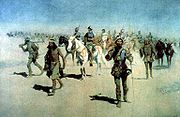
Fifteenth Century
- 1418 - João Gonçalves ZarcoJoão Gonçalves ZarcoJoão Gonçalves Zarco was a Portuguese explorer who established settlements and recognition of the Madeira Islands, and was appointed first captain of Funchal by Henry the Navigator.-Life:...
and Tristão Vaz TeixeiraTristão Vaz TeixeiraTristão Vaz Teixeira was a Portuguese navigator and explorer who, together with João Gonçalves Zarco and Bartolomeu Perestrelo, discovered the Madeira Islands...
discover Porto Santo. - 1419 - Gonçalves and Vaz discover MadeiraMadeiraMadeira is a Portuguese archipelago that lies between and , just under 400 km north of Tenerife, Canary Islands, in the north Atlantic Ocean and an outermost region of the European Union...
. - 1427 - Diogo de SilvesDiogo de SilvesDiogo de Silves, is the presumed name of an obscure Portuguese explorer of the Atlantic who allegedly discovered of the Azores islands in 1427....
discovers the AzoresAzoresThe Archipelago of the Azores is composed of nine volcanic islands situated in the middle of the North Atlantic Ocean, and is located about west from Lisbon and about east from the east coast of North America. The islands, and their economic exclusion zone, form the Autonomous Region of the...
. - 1434 - Gil EanesGil EanesGil Eanes was a 15th-century Portuguese navigator and explorer.Little is known about the personal life of Gil Eanes, prior to his role in the Portuguese Age of Discovery, and was considered a household servant and shield-bearer of the Infante Henry the Navigator...
passes Cabo de NãoCape ChaunarCape Chaunar, Cape Nun, Cap Noun, Cabo de Não or Nant is a cape on the Atlantic coast of Africa, south of Morocco, between Tarfaya and Sidi Ifni. By the 15th century it was considered insurmountable by Arabs and Europeans, thus resulting its his name meaning cape "no" in Portuguese...
and rounds Cape BojadorCape BojadorCape Bojador or Cape Boujdour is a headland on the northern coast of Western Sahara, at 26° 07' 37"N, 14° 29' 57"W. , as well as the name of a nearby town with a population of 41,178.It is shown on nautical charts with the original Portuguese name "Cabo Bojador", but is sometimes...
. - 1443 - Nuno TristãoNuno TristãoNuno Tristão was a 15th century Portuguese explorer and slave trader, active in the early 1440s, traditionally thought to be the first European to reach the region of Guinea .-First Voyage:Nuno Tristão was a knight of the household of Henry the Navigator...
passes Cape BlancoRas NouadhibouRas Nouadhibou is a 40-mile peninsula or headland in the African coast of the Atlantic Ocean by the Tropic of Cancer. It is internationally known as Cap Blanc in French or Cabo Blanco in Spanish .- History :...
. - 1444 - Dinis DiasDinis DiasDinis Dias was a 15th century Portuguese explorer.In 1445, as Dias was beginning to enter old age and made the decision to take up exploring because "he was unwilling to let himself grow soft in the well being of repose", left Portugal and sailed down the West African coast, setting a new record by...
reaches the mouth of the Senegal RiverSénégal RiverThe Sénégal River is a long river in West Africa that forms the border between Senegal and Mauritania.The Sénégal's headwaters are the Semefé and Bafing rivers which both originate in Guinea; they form a small part of the Guinean-Malian border before coming together at Bafoulabé in Mali...
. - 1446 - The PortuguesePortugalPortugal , officially the Portuguese Republic is a country situated in southwestern Europe on the Iberian Peninsula. Portugal is the westernmost country of Europe, and is bordered by the Atlantic Ocean to the West and South and by Spain to the North and East. The Atlantic archipelagos of the...
reach Cape VerdeCape VerdeThe Republic of Cape Verde is an island country, spanning an archipelago of 10 islands located in the central Atlantic Ocean, 570 kilometres off the coast of Western Africa...
and the Gambia RiverGambia RiverThe Gambia River is a major river in West Africa, running from the Fouta Djallon plateau in north Guinea westward through Senegal and The Gambia to the Atlantic Ocean at the city of Banjul...
. - 1456 - Alvise Cadamosto explores the Cape Verde Islands.
- 1460 - Pêro de SintraPêro de SintraPedro de Sintra also known as Pêro de Sintra was a Portuguese explorer. He was among the first Europeans to explore the West African coast. Around 1462 his expedition reached contemporary Sierra Leone and named it. Continuing their journey, they visited the Benin Empire.-References and notes:...
reaches Sierra LeoneSierra LeoneSierra Leone , officially the Republic of Sierra Leone, is a country in West Africa. It is bordered by Guinea to the north and east, Liberia to the southeast, and the Atlantic Ocean to the west and southwest. Sierra Leone covers a total area of and has an estimated population between 5.4 and 6.4...
. - 1470 - Cape PalmasCape PalmasCape Palmas is a headland on the extreme southeast end of the coast of Liberia, West Africa, at the extreme southwest corner of the northern half of the continent. The Cape itself consists of a small, rocky peninsula connected to the mainland by a sandy isthmus. Immediately to the west of the...
is passed. - 1472 - Fernão do PóFernão do PóFernão do Pó , also Fernão Pó, Fernando Pó, Fernando Poo was a Portuguese navigator and explorer of the West African coast. He discovered the islands in the Gulf of Guinea around 1472, one of which until the mid 1900s bore a version of his name, Fernando Pó or Fernando Poo. The island is...
discovers BiokoBiokoBioko is an island 32 km off the west coast of Africa, specifically Cameroon, in the Gulf of Guinea. It is the northernmost part of Equatorial Guinea with a population of 124,000 and an area of . It is volcanic with its highest peak the Pico Basile at .-Geography:Bioko has a total area of...
. - 1473 - Lopo Gonçalves is the first to cross the equatorEquatorAn equator is the intersection of a sphere's surface with the plane perpendicular to the sphere's axis of rotation and containing the sphere's center of mass....
. - 1474-75 - Ruy de Sequeira discovers São Tomé and PríncipeSão Tomé and PríncipeSão Tomé and Príncipe, officially the Democratic Republic of São Tomé and Príncipe, is a Portuguese-speaking island nation in the Gulf of Guinea, off the western equatorial coast of Central Africa. It consists of two islands: São Tomé and Príncipe, located about apart and about , respectively, off...
. - 1482 - Diogo CãoDiogo CãoDiogo Cão was a Portuguese explorer and one of the most remarkable navigators of the Age of Discovery, who made two voyages sailing along the west coast of Africa to Namibia in the 1480s.-Early life and family:...
reaches the Congo RiverCongo RiverThe Congo River is a river in Africa, and is the deepest river in the world, with measured depths in excess of . It is the second largest river in the world by volume of water discharged, though it has only one-fifth the volume of the world's largest river, the Amazon...
, where he erects a "padrão" (pillar of stone). - 1485-86 - Cão reaches Cape CrossCape CrossCape Cross is a cape in the South Atlantic on the coast of Namibia, on the C34 highway some 60 kilometres north of Hentiesbaai and 120 km north of Swakopmund on the west coast of Namibia....
, where he erects his last padrão. - 1487-92 - Pêro da CovilhãPêro da CovilhãPedro or Pêro da Covilhã was a Portuguese diplomat and explorer.He was a native of Covilhã in Beira. In his early life he had gone to Castile and entered the service of Alphonso, Duke of Seville...
travels to Arabia, down to the mouth of the Red Sea, eastward by sail to the Malabar CoastMalabar CoastThe Malabar Coast is a long and narrow coastline on the south-western shore line of the mainland Indian subcontinent. Geographically, it comprises the wettest regions of southern India, as the Western Ghats intercept the moisture-laden monsoon rains, especially on their westward-facing mountain...
(visiting CalicutKozhikodeKozhikode During Classical antiquity and the Middle Ages, Kozhikkode was dubbed the "City of Spices" for its role as the major trading point of eastern spices. Kozhikode was once the capital of an independent kingdom of the same name and later of the erstwhile Malabar District...
and GoaGoaGoa , a former Portuguese colony, is India's smallest state by area and the fourth smallest by population. Located in South West India in the region known as the Konkan, it is bounded by the state of Maharashtra to the north, and by Karnataka to the east and south, while the Arabian Sea forms its...
); later sails down the east coast of Africa (visiting the trading stations of MombasaMombasaMombasa is the second-largest city in Kenya. Lying next to the Indian Ocean, it has a major port and an international airport. The city also serves as the centre of the coastal tourism industry....
, ZanzibarZanzibarZanzibar ,Persian: زنگبار, from suffix bār: "coast" and Zangi: "bruin" ; is a semi-autonomous part of Tanzania, in East Africa. It comprises the Zanzibar Archipelago in the Indian Ocean, off the coast of the mainland, and consists of numerous small islands and two large ones: Unguja , and Pemba...
, and SofalaSofalaSofala, at present known as Nova Sofala, used to be the chief seaport of the Monomotapa Kingdom, whose capital was at Mount Fura. It is located on the Sofala Bank in Sofala Province of Mozambique.-History:...
); on his return he visits MeccaMeccaMecca is a city in the Hijaz and the capital of Makkah province in Saudi Arabia. The city is located inland from Jeddah in a narrow valley at a height of above sea level...
and MedinaMedinaMedina , or ; also transliterated as Madinah, or madinat al-nabi "the city of the prophet") is a city in the Hejaz region of western Saudi Arabia, and serves as the capital of the Al Madinah Province. It is the second holiest city in Islam, and the burial place of the Islamic Prophet Muhammad, and...
before reaching EthiopiaEthiopiaEthiopia , officially known as the Federal Democratic Republic of Ethiopia, is a country located in the Horn of Africa. It is the second-most populous nation in Africa, with over 82 million inhabitants, and the tenth-largest by area, occupying 1,100,000 km2...
in search of the mythical Prester JohnPrester JohnThe legends of Prester John were popular in Europe from the 12th through the 17th centuries, and told of a Christian patriarch and king said to rule over a Christian nation lost amidst the Muslims and pagans in the Orient. Written accounts of this kingdom are variegated collections of medieval...
. - 1488 - Bartolomeu DiasBartolomeu DiasBartolomeu Dias , a nobleman of the Portuguese royal household, was a Portuguese explorer who sailed around the southernmost tip of Africa in 1488, the first European known to have done so.-Purposes of the Dias expedition:...
rounds the "Cape of Storms" (Cape of Good HopeCape of Good HopeThe Cape of Good Hope is a rocky headland on the Atlantic coast of the Cape Peninsula, South Africa.There is a misconception that the Cape of Good Hope is the southern tip of Africa, because it was once believed to be the dividing point between the Atlantic and Indian Oceans. In fact, the...
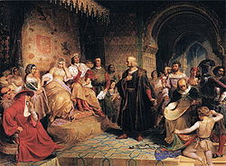
). - 1492 - Christopher ColumbusChristopher ColumbusChristopher Columbus was an explorer, colonizer, and navigator, born in the Republic of Genoa, in northwestern Italy. Under the auspices of the Catholic Monarchs of Spain, he completed four voyages across the Atlantic Ocean that led to general European awareness of the American continents in the...
discovers the Bahamas, CubaCubaThe Republic of Cuba is an island nation in the Caribbean. The nation of Cuba consists of the main island of Cuba, the Isla de la Juventud, and several archipelagos. Havana is the largest city in Cuba and the country's capital. Santiago de Cuba is the second largest city...
, and "Española" (HispaniolaHispaniolaHispaniola is a major island in the Caribbean, containing the two sovereign states of the Dominican Republic and Haiti. The island is located between the islands of Cuba to the west and Puerto Rico to the east, within the hurricane belt...
). - 1493-94 - Columbus discovers DominicaDominicaDominica , officially the Commonwealth of Dominica, is an island nation in the Lesser Antilles region of the Caribbean Sea, south-southeast of Guadeloupe and northwest of Martinique. Its size is and the highest point in the country is Morne Diablotins, which has an elevation of . The Commonwealth...
and GuadeloupeGuadeloupeGuadeloupe is an archipelago located in the Leeward Islands, in the Lesser Antilles, with a land area of 1,628 square kilometres and a population of 400,000. It is the first overseas region of France, consisting of a single overseas department. As with the other overseas departments, Guadeloupe...
, among other islands of the Lesser AntillesLesser AntillesThe Lesser Antilles are a long, partly volcanic island arc in the Western Hemisphere. Most of its islands form the eastern boundary of the Caribbean Sea with the Atlantic Ocean, with the remainder located in the southern Caribbean just north of South America...
; also discovers Puerto RicoPuerto RicoPuerto Rico , officially the Commonwealth of Puerto Rico , is an unincorporated territory of the United States, located in the northeastern Caribbean, east of the Dominican Republic and west of both the United States Virgin Islands and the British Virgin Islands.Puerto Rico comprises an...
and JamaicaJamaicaJamaica is an island nation of the Greater Antilles, in length, up to in width and 10,990 square kilometres in area. It is situated in the Caribbean Sea, about south of Cuba, and west of Hispaniola, the island harbouring the nation-states Haiti and the Dominican Republic...
. - 1497 - John CabotJohn CabotJohn Cabot was an Italian navigator and explorer whose 1497 discovery of parts of North America is commonly held to have been the first European encounter with the continent of North America since the Norse Vikings in the eleventh century...
discovers Newfoundland. - 1497-98 - Vasco da GamaVasco da GamaVasco da Gama, 1st Count of Vidigueira was a Portuguese explorer, one of the most successful in the Age of Discovery and the commander of the first ships to sail directly from Europe to India...
sails to IndiaIndiaIndia , officially the Republic of India , is a country in South Asia. It is the seventh-largest country by geographical area, the second-most populous country with over 1.2 billion people, and the most populous democracy in the world...
and back. - 1498 - Columbus discovers the mainland of South AmericaSouth AmericaSouth America is a continent situated in the Western Hemisphere, mostly in the Southern Hemisphere, with a relatively small portion in the Northern Hemisphere. The continent is also considered a subcontinent of the Americas. It is bordered on the west by the Pacific Ocean and on the north and east...
. - 1499 - Alonso de OjedaAlonso de OjedaAlonso de Ojeda was a Spanish navigator, governor and conquistador. His name is sometimes spelled Alonzo and Oxeda.-Early life:...
explores the South American mainland from about CayenneCayenneCayenne is the capital of French Guiana, an overseas region and department of France located in South America. The city stands on a former island at the mouth of the Cayenne River on the Atlantic coast. The city's motto is "Ferit Aurum Industria" which means "Work brings wealth"...
(in modern French GuianaFrench GuianaFrench Guiana is an overseas region of France, consisting of a single overseas department located on the northern Atlantic coast of South America. It has borders with two nations, Brazil to the east and south, and Suriname to the west...
) to Cabo de la VelaCabo de la VelaCabo de la Vela is a headland in the Guajira Peninsula in Colombia with an adjacent small fishing village. It is a popular ecotourism destination of the Caribbean Region of Colombia-History:...
(in modern ColombiaColombiaColombia, officially the Republic of Colombia , is a unitary constitutional republic comprising thirty-two departments. The country is located in northwestern South America, bordered to the east by Venezuela and Brazil; to the south by Ecuador and Peru; to the north by the Caribbean Sea; to the...
), discovering the mouths of the Orinoco and entering Lake MaracaiboLake MaracaiboLake Maracaibo is a large brackish bay in Venezuela at . It is connected to the Gulf of Venezuela by Tablazo Strait at the northern end, and fed by numerous rivers, the largest being the Catatumbo. It is commonly considered a lake rather than a bay or lagoon, and at 13,210 km² it would be the...
.
Sixteenth century
.jpg)
- 1500 - Vicente Yáñez PinzónVicente Yáñez PinzónVicente Yáñez Pinzón was a Spanish navigator, explorer, and conquistador, the youngest of the Pinzón brothers...
discovers BrazilBrazilBrazil , officially the Federative Republic of Brazil , is the largest country in South America. It is the world's fifth largest country, both by geographical area and by population with over 192 million people...
at a cape he names "Santa Maria de la Consolación" (Cabo de Santo AgostinhoCabo de Santo AgostinhoCabo de Santo Agostinho is 35 km south of the city of Recife, Pernambuco, Brazil. Although the official Portuguese discovery of Brazil was by Pedro Cabral on April 21, 1500, some historians believe that Vicente Yáñez Pinzón already had set anchor in a bay in Cabo de Santo Agostinho on January...
) and sails fifty miles up a river he names the "Marañón" (AmazonAmazon RiverThe Amazon of South America is the second longest river in the world and by far the largest by waterflow with an average discharge greater than the next seven largest rivers combined...
). - 1500 - Pedro Álvares CabralPedro Álvares CabralPedro Álvares Cabral was a Portuguese noble, military commander, navigator and explorer regarded as the discoverer of Brazil. Cabral conducted the first substantial exploration of the northeast coast of South America and claimed it for Portugal. While details of Cabral's early life are sketchy, it...
makes the "official" discovery of Brazil. - 1500 - Gaspar Corte-RealGaspar Corte-RealGaspar Corte-Real was a Portuguese explorer.He was the youngest of three sons of João Vaz Corte-Real, also a Portuguese explorer, and had accompanied his father on his expeditions to North America...
discovers "Terra Verde" (likely Newfoundland). - 1500 - João FernandesJoão Fernandes LavradorJoão Fernandes Lavrador was a Portuguese explorer of the late 15th century. He was the first modern explorer in the coasts of the Northeast of Northern America, including the Labrador peninsula, which bears his name.-Expeditions:Fernandes was granted a patent by King Manuel I in 1498 given him...
reaches Cape FarewellCape Farewell, GreenlandCape Farewell , is a headland on the southern shore of Egger Island, Greenland. Located at it is the southernmost extent of Greenland, projecting out into the North Atlantic Ocean and the Labrador Sea on the same latitude as Stockholm and the Scottish Shetland Islands. Egger and the associated...
, GreenlandGreenlandGreenland is an autonomous country within the Kingdom of Denmark, located between the Arctic and Atlantic Oceans, east of the Canadian Arctic Archipelago. Though physiographically a part of the continent of North America, Greenland has been politically and culturally associated with Europe for...
("Tiera del Lavrador", or Land of the Husbandman). - 1500 - Diogo DiasDiogo DiasDiogo Dias, also known as Diogo Gomes, was a 15th-century Portuguese explorer. He was the brother of Bartolomeu Dias and discovered some of the Cape Verde islands together with António Noli....
discovers MadagascarMadagascarThe Republic of Madagascar is an island country located in the Indian Ocean off the southeastern coast of Africa...
. - 1500 - Rodrigo de BastidasRodrigo de BastidasRodrigo de Bastidas was a Spanish conquistador and explorer who mapped the northern coast of South America and founded the city of Santa Marta.-Early life:...
explores the Columbian coast from Cabo de la Vela to the Gulf of UrabáGulf of UrabáThe Gulf of Urabá is a gulf on the northern coast of South America. It is part of the Caribbean Sea. It is a long narrow inlet in the coast of Colombia, close to the connection of the continent to the Isthmus of Panama. The town of Turbo lies at the southern end of the Gulf...
. - 1502 - Gonçalo CoelhoGonçalo CoelhoGonçalo Coelho was a Portuguese explorer who belonged to a prominent family in northern Portugal. He commanded two expeditions which explored much of the coast of Brazil....
discovers "Rio de Janeiro" (Guanabara BayGuanabara BayGuanabara Bay is an oceanic bay located in southeastern Brazil in the state of Rio de Janeiro. On its western shore lies the city of Rio de Janeiro, and on its eastern shore the cities of Niterói and São Gonçalo. Four other municipalities surround the bay's shores...
). - 1502-03 - Columbus explores the North AmericaNorth AmericaNorth America is a continent wholly within the Northern Hemisphere and almost wholly within the Western Hemisphere. It is also considered a northern subcontinent of the Americas...
n mainland from GuanajaGuanajaGuanaja is one of the Bay Islands of Honduras, and is in the Caribbean. It is about 70 km off the north coast of Honduras, and 12 km from the island of Roatan. One of the cays off Guanaja, also called Guanaja or Bonnaca or Low Cay , is near the main island, and contains most of the...
off modern HondurasHondurasHonduras is a republic in Central America. It was previously known as Spanish Honduras to differentiate it from British Honduras, which became the modern-day state of Belize...
to the present-day border of PanamaPanamaPanama , officially the Republic of Panama , is the southernmost country of Central America. Situated on the isthmus connecting North and South America, it is bordered by Costa Rica to the northwest, Colombia to the southeast, the Caribbean Sea to the north and the Pacific Ocean to the south. The...
and ColombiaColombiaColombia, officially the Republic of Colombia , is a unitary constitutional republic comprising thirty-two departments. The country is located in northwestern South America, bordered to the east by Venezuela and Brazil; to the south by Ecuador and Peru; to the north by the Caribbean Sea; to the...
. - 1505 - Juan de BermúdezJuan de BermudezJuan de Bermúdez was a Spanish navigator of the 16th century. In 1505, while sailing back to Spain from a provisioning voyage to Hispaniola in the ship La Garça , he discovered Bermuda, which was later named after him. Legatio Babylonica, published in 1511 by Peter Martyr d'Anghiera, lists "La...
discovers BermudaBermudaBermuda is a British overseas territory in the North Atlantic Ocean. Located off the east coast of the United States, its nearest landmass is Cape Hatteras, North Carolina, about to the west-northwest. It is about south of Halifax, Nova Scotia, Canada, and northeast of Miami, Florida...
. - 1506 - Lourenço de AlmeidaLourenço de AlmeidaLourenço de Almeida , son of Francisco de Almeida, acting under him, distinguished himself in the Indian Ocean, and made Ceylon tributary to Portugal...
reaches Sri LankaSri LankaSri Lanka, officially the Democratic Socialist Republic of Sri Lanka is a country off the southern coast of the Indian subcontinent. Known until 1972 as Ceylon , Sri Lanka is an island surrounded by the Indian Ocean, the Gulf of Mannar and the Palk Strait, and lies in the vicinity of India and the...
. - 1506 - Tristão da CunhaTristão da CunhaTristão da Cunha was a Portuguese explorer and naval commander. In 1514 he served as ambassador from king Manuel I of Portugal to Pope Leo X leading a luxurious embassy presenting in Rome the new conquests of Portugal...
discovers the island of Tristan da CunhaTristan da CunhaTristan da Cunha is a remote volcanic group of islands in the south Atlantic Ocean and the main island of that group. It is the most remote inhabited archipelago in the world, lying from the nearest land, South Africa, and from South America...
. - 1509 - Diogo Lopes de SequeiraDiogo Lopes de SequeiraDiogo Lopes de Sequeira was a Portuguese fidalgo, sent to analyze the trade potential in Madagascar and Malacca, he arrived at Malacca on 11 September, 1509. He left the next year when he discovered that Sultan Mahmud Shah, the local leader, was devising his assassination...
reaches SumatraSumatraSumatra is an island in western Indonesia, westernmost of the Sunda Islands. It is the largest island entirely in Indonesia , and the sixth largest island in the world at 473,481 km2 with a population of 50,365,538...
and MalaccaMalaccaMalacca , dubbed The Historic State or Negeri Bersejarah among locals) is the third smallest Malaysian state, after Perlis and Penang. It is located in the southern region of the Malay Peninsula, on the Straits of Malacca. It borders Negeri Sembilan to the north and the state of Johor to the south...
. - 1511 - Duarte FernandesDuarte FernandesDuarte Fernandes was a Portuguese diplomat and the first European to establish diplomatic relations with Thailand, when in 1511 he led a diplomatic mission to Ayutthaya Kingdom , after the Portuguese conquest of Malacca....
leads a diplomatic mission to Ayutthaya KingdomAyutthaya kingdomAyutthaya was a Siamese kingdom that existed from 1350 to 1767. Ayutthaya was friendly towards foreign traders, including the Chinese, Vietnamese , Indians, Japanese and Persians, and later the Portuguese, Spanish, Dutch and French, permitting them to set up villages outside the walls of the...
(Siam or ThailandThailandThailand , officially the Kingdom of Thailand , formerly known as Siam , is a country located at the centre of the Indochina peninsula and Southeast Asia. It is bordered to the north by Burma and Laos, to the east by Laos and Cambodia, to the south by the Gulf of Thailand and Malaysia, and to the...
). - 1511 - Rui Nunes da Cunha leads a diplomatic mission to Pegu (Burma or MyanmarMyanmarBurma , officially the Republic of the Union of Myanmar , is a country in Southeast Asia. Burma is bordered by China on the northeast, Laos on the east, Thailand on the southeast, Bangladesh on the west, India on the northwest, the Bay of Bengal to the southwest, and the Andaman Sea on the south....
). - 1511-12 – António de AbreuAntónio de AbreuAntónio de Abreu was a 16th century Portuguese navigator and naval officer. He participated under the command of Afonso de Albuquerque in the conquest of Ormus in 1507 and Malacca in 1511, where he got injured...
sails through the Strait of MalaccaStrait of MalaccaThe Strait of Malacca is a narrow, stretch of water between the Malay Peninsula and the Indonesian island of Sumatra. It is named after the Malacca Sultanate that ruled over the archipelago between 1414 to 1511.-Extent:...
, between Sumatra and BangkaBangka IslandBangka is an island lying east of Sumatra, Indonesia. Population 626,955. Area: c.4,600 sq mi .There is an additional small island named Pulau Bangka in northern Sulawesi, Indonesia.-Geography:...
, and along the coasts of JavaJavaJava is an island of Indonesia. With a population of 135 million , it is the world's most populous island, and one of the most densely populated regions in the world. It is home to 60% of Indonesia's population. The Indonesian capital city, Jakarta, is in west Java...
, BaliBaliBali is an Indonesian island located in the westernmost end of the Lesser Sunda Islands, lying between Java to the west and Lombok to the east...
, LombokLombokLombok is an island in West Nusa Tenggara province, Indonesia. It forms part of the chain of the Lesser Sunda Islands, with the Lombok Strait separating it from Bali to the west and the Alas Strait between it and Sumbawa to the east...
, SumbawaSumbawaSumbawa is an Indonesian island, located in the middle of the Lesser Sunda Islands chain, with Lombok to the west, Flores to the east, and Sumba further to the southeast. It is in the province of West Nusa Tenggara....
, and FloresFloresFlores is one of the Lesser Sunda Islands, an island arc with an estimated area of 14,300 km² extending east from the Java island of Indonesia. The population was 1.831.000 in the 2010 census and the largest town is Maumere. Flores is Portuguese for "flowers".Flores is located east of Sumbawa...
to the “Spice Islands” (MalukuMaluku IslandsThe Maluku Islands are an archipelago that is part of Indonesia, and part of the larger Maritime Southeast Asia region. Tectonically they are located on the Halmahera Plate within the Molucca Sea Collision Zone...
). - 1513 - Jorge ÁlvaresJorge ÁlvaresJorge Álvares is credited as the first Portuguese explorer to have reached China and Hong Kong. The Fundação Jorge Álvares , founded by Vasco Joaquim Rocha Vieira prior to the handover of Macau, got its name from him also having reached there.-Exploration:In May 1513 Álvares sailed under the...
lands off the coast of ChinaChinaChinese civilization may refer to:* China for more general discussion of the country.* Chinese culture* Greater China, the transnational community of ethnic Chinese.* History of China* Sinosphere, the area historically affected by Chinese culture...
, on Nei Lingding IslandNei Lingding IslandNei Lingding Island |Pearl River]] estuary in the southern Chinese province of Guangdong. Although it is located closer to the eastern shore of the estuary, it is administratively part of the prefecture-level city of Zhuhai, whose main administrative center is located on the west shore of the...
at the Pearl River DeltaPearl River DeltaThe Pearl River Delta , Zhujiang Delta or Zhusanjiao in Guangdong province, People's Republic of China is the low-lying area surrounding the Pearl River estuary where the Pearl River flows into the South China Sea...
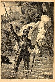
. - 1513 - Vasco Núñez de BalboaVasco Núñez de BalboaVasco Núñez de Balboa was a Spanish explorer, governor, and conquistador. He is best known for having crossed the Isthmus of Panama to the Pacific Ocean in 1513, becoming the first European to lead an expedition to have seen or reached the Pacific from the New World.He traveled to the New World in...
crosses the Isthmus of PanamaIsthmus of PanamaThe Isthmus of Panama, also historically known as the Isthmus of Darien, is the narrow strip of land that lies between the Caribbean Sea and the Pacific Ocean, linking North and South America. It contains the country of Panama and the Panama Canal...
and reaches the Bay of San MiguelBay of San MiguelThe Bay of San Miguel is located on the Pacific coast of Darién, a district of eastern Panama. Bay is located at . It is fed by the Tuira River. At its southern end is Cape Garachiné , and at its northern end is Punta San Lorenzo ....
, discovering the "Mar del Sur" (Pacific OceanPacific OceanThe Pacific Ocean is the largest of the Earth's oceanic divisions. It extends from the Arctic in the north to the Southern Ocean in the south, bounded by Asia and Australia in the west, and the Americas in the east.At 165.2 million square kilometres in area, this largest division of the World...
). - 1513 - Juan Ponce de LeónJuan Ponce de LeónJuan Ponce de León was a Spanish explorer. He became the first Governor of Puerto Rico by appointment of the Spanish crown. He led the first European expedition to Florida, which he named...
discovers "La Florida" (FloridaFloridaFlorida is a state in the southeastern United States, located on the nation's Atlantic and Gulf coasts. It is bordered to the west by the Gulf of Mexico, to the north by Alabama and Georgia and to the east by the Atlantic Ocean. With a population of 18,801,310 as measured by the 2010 census, it...
) and the YucatanYucatán PeninsulaThe Yucatán Peninsula, in southeastern Mexico, separates the Caribbean Sea from the Gulf of Mexico, with the northern coastline on the Yucatán Channel...
. - 1514-15 - António Fernandes reaches present-day ZimbabweZimbabweZimbabwe is a landlocked country located in the southern part of the African continent, between the Zambezi and Limpopo rivers. It is bordered by South Africa to the south, Botswana to the southwest, Zambia and a tip of Namibia to the northwest and Mozambique to the east. Zimbabwe has three...
. - 1515 – Gonzalo de Badajoz crosses the Isthmus of Panama at the site of Nombre de Dios, reaching as far as the interior of the Azuero PeninsulaAzuero PeninsulaAzuero Peninsula is a large peninsula in southern Panama. It is surrounded by the Pacific Ocean in the south; the Pacific and Gulf of Montijo to the west, and by the Gulf of Panama in the east...
. - 1516 - Juan Díaz de SolísJuan Díaz de SolísJuan Díaz de Solís was a Spanish navigator and explorer.Díaz de Solís was probably born in Lebrija, Seville, although some other authors argue that his birth may have actually taken place in Portugal to an Andalusian emigree family....
reaches the estuary of what he names "La Mar Dulce" ("The Fresh-Water Sea"; now the Río de la PlataRío de la PlataThe Río de la Plata —sometimes rendered River Plate in British English and the Commonwealth, and occasionally rendered [La] Plata River in other English-speaking countries—is the river and estuary formed by the confluence of the Uruguay River and the Paraná River on the border between Argentina and...
). - 1516 - Portuguese traders land in Da NangDa NangĐà Nẵng , occasionally Danang, is a major port city in the South Central Coast of Vietnam, on the coast of the South China Sea at the mouth of the Han River. It is the commercial and educational center of Central Vietnam; its well-sheltered, easily accessible port and its location on the path of...
, ChampaChampaThe kingdom of Champa was an Indianized kingdom that controlled what is now southern and central Vietnam from approximately the 7th century through to 1832.The Cham people are remnants...
, naming it CochinchinaCochinchinaCochinchina is a region encompassing the southern third of Vietnam whose principal city is Saigon. It was a French colony from 1862 to 1954. The later state of South Vietnam was created in 1954 by combining Cochinchina with southern Annam. In Vietnamese, the region is called Nam Bộ...
(modern VietnamVietnamVietnam – sometimes spelled Viet Nam , officially the Socialist Republic of Vietnam – is the easternmost country on the Indochina Peninsula in Southeast Asia. It is bordered by China to the north, Laos to the northwest, Cambodia to the southwest, and the South China Sea –...
). - 1518 - Lorenzo de Gomez discovers BorneoBorneoBorneo is the third largest island in the world and is located north of Java Island, Indonesia, at the geographic centre of Maritime Southeast Asia....
. - 1518 - Juan de GrijalvaJuan de GrijalvaJuan de Grijalva was a Spanish conquistador. Some authors said he was from the same family as Diego Velázquez.He went to Hispaniola in 1508 and to Cuba in 1511....
explores the MexicanMexicoThe United Mexican States , commonly known as Mexico , is a federal constitutional republic in North America. It is bordered on the north by the United States; on the south and west by the Pacific Ocean; on the southeast by Guatemala, Belize, and the Caribbean Sea; and on the east by the Gulf of...
coast from "Patouchan" (Champotón) to just north of the Pánuco RiverPánuco RiverThe Pánuco River is a river in Mexico that flows from the River Moctezuma in the Valley of Mexico to the Gulf of Mexico.At its source, it serves as a channel for water-drainage for Mexico City. From there, it becomes the state border between Hidalgo and Querétaro as it moves towards San Luis...
. - 1519 – Hernán CortésHernán CortésHernán Cortés de Monroy y Pizarro, 1st Marquis of the Valley of Oaxaca was a Spanish Conquistador who led an expedition that caused the fall of the Aztec Empire and brought large portions of mainland Mexico under the rule of the King of Castile in the early 16th century...
travels from Villa Rica de la Vera CruzVeracruz, VeracruzVeracruz, officially known as Heroica Veracruz, is a major port city and municipality on the Gulf of Mexico in the Mexican state of Veracruz. The city is located in the central part of the state. It is located along Federal Highway 140 from the state capital Xalapa, and is the state's most...
to the AztecAztecThe Aztec people were certain ethnic groups of central Mexico, particularly those groups who spoke the Nahuatl language and who dominated large parts of Mesoamerica in the 14th, 15th and 16th centuries, a period referred to as the late post-classic period in Mesoamerican chronology.Aztec is the...
capital of Tenochtitlan on Lake TexcocoLake TexcocoLake Texcoco was a natural lake formation within the Valley of Mexico. The Aztecs built the city of Tenochtitlan on an island in the lake. The Spaniards built Mexico City over Tenochtitlan...
. - 1519 – Alonzo Alvarez de Pineda sails around the Gulf of MexicoGulf of MexicoThe Gulf of Mexico is a partially landlocked ocean basin largely surrounded by the North American continent and the island of Cuba. It is bounded on the northeast, north and northwest by the Gulf Coast of the United States, on the southwest and south by Mexico, and on the southeast by Cuba. In...
to the Pánuco, proving its insularity; also discovers the "Father of Waters" (the MississippiMississippi RiverThe Mississippi River is the largest river system in North America. Flowing entirely in the United States, this river rises in western Minnesota and meanders slowly southwards for to the Mississippi River Delta at the Gulf of Mexico. With its many tributaries, the Mississippi's watershed drains...
). - 1519 – Gaspar de Espinosa sails west along the west coasts of modern PanamaPanamaPanama , officially the Republic of Panama , is the southernmost country of Central America. Situated on the isthmus connecting North and South America, it is bordered by Costa Rica to the northwest, Colombia to the southeast, the Caribbean Sea to the north and the Pacific Ocean to the south. The...
and Costa RicaCosta RicaCosta Rica , officially the Republic of Costa Rica is a multilingual, multiethnic and multicultural country in Central America, bordered by Nicaragua to the north, Panama to the southeast, the Pacific Ocean to the west and the Caribbean Sea to the east....
as far as the Gulf of NicoyaGulf of NicoyaThe Gulf of Nicoya is an inlet of the Pacific Ocean. It separates the Nicoya Peninsula from the mainland of Costa Rica, and encompasses a marine and coastal landscape of wetlands, rocky islands and cliffs.-Islands:*Chira Island*Venado Island*Isla Caballo...
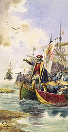
. - 1519-22 - Ferdinand MagellanFerdinand MagellanFerdinand Magellan was a Portuguese explorer. He was born in Sabrosa, in northern Portugal, and served King Charles I of Spain in search of a westward route to the "Spice Islands" ....
's expedition completes the first circumnavigation of the globeGlobeA globe is a three-dimensional scale model of Earth or other spheroid celestial body such as a planet, star, or moon...
, exploring the coast of PatagoniaPatagoniaPatagonia is a region located in Argentina and Chile, integrating the southernmost section of the Andes mountains to the southwest towards the Pacific ocean and from the east of the cordillera to the valleys it follows south through Colorado River towards Carmen de Patagones in the Atlantic Ocean...
and discovering and traversing the Strait of MagellanStrait of MagellanThe Strait of Magellan comprises a navigable sea route immediately south of mainland South America and north of Tierra del Fuego...
. - 1521 - Francisco Gordillo and Pedro de Quexos find the mouth of a river they name "Rio de San Juan Bautista" (perhaps Winyah BayWinyah BayWinyah Bay is a coastal estuary that is the confluence of the Waccamaw River, the Pee Dee River, the Black River and the Sampit River in Georgetown County in eastern South Carolina...
at the mouth of the Pee Dee RiverPee Dee RiverThe Pee Dee River, also known as the Great Pee Dee River, is a river in North Carolina and South Carolina. It originates in the Appalachian Mountains in North Carolina, where its upper course above the mouth of the Uwharrie River is known as the Yadkin River. It is extensively dammed for flood...
in modern South CarolinaSouth CarolinaSouth Carolina is a state in the Deep South of the United States that borders Georgia to the south, North Carolina to the north, and the Atlantic Ocean to the east. Originally part of the Province of Carolina, the Province of South Carolina was one of the 13 colonies that declared independence...
). - 1522 - Gil González DávilaGil González DávilaGil González Dávila was a Spanish Conquistador and the first European to arrive in present-day Nicaragua.González Dávila first appears in historical records in 1508, when he received a royal commission to examine accounts and tax records of estates. He probably traveled soon afterward to Santo...
explores inland from the Gulf of Nicoya, discovering Lake NicaraguaLake NicaraguaLake Nicaragua or Cocibolca or Granada or is a vast freshwater lake in Nicaragua of tectonic origin. With an area of , it is the largest lake in Central America, the 19th largest lake in the world and the 9th largest in the Americas. It is slightly smaller than Lake Titicaca. With an elevation...
, while his pilot Andrés Niño explores along the coast to the west, discovering the Gulf of FonsecaGulf of FonsecaThe Gulf of Fonseca , part of the Pacific Ocean, is a gulf in Central America, bordering El Salvador, Honduras and Nicaragua.-History:Fonseca Bay was discovered in 1522 by Gil Gonzalez de Avila, and named by him after his patron, Archbishop Juan Fonseca, the implacable enemy of Columbus.In 1849, E. G...
and perhaps reaching as far as the southwestern coast of modern GuatemalaGuatemalaGuatemala is a country in Central America bordered by Mexico to the north and west, the Pacific Ocean to the southwest, Belize to the northeast, the Caribbean to the east, and Honduras and El Salvador to the southeast...
. - 1524 – Giovanni da Verrazzano explores the eastern seaboard of the present United StatesUnited StatesThe United States of America is a federal constitutional republic comprising fifty states and a federal district...
from about Cape FearCape FearCape Fear is a prominent headland jutting into the Atlantic Ocean from Bald Head Island on the coast of North Carolina in the southeastern United States. It is largely formed of barrier beaches and the silty outwash of the Cape Fear River as it drains the southeast coast of North Carolina through...
to MaineMaineMaine is a state in the New England region of the northeastern United States, bordered by the Atlantic Ocean to the east and south, New Hampshire to the west, and the Canadian provinces of Quebec to the northwest and New Brunswick to the northeast. Maine is both the northernmost and easternmost...
; discovers the mouth of the Hudson RiverHudson RiverThe Hudson is a river that flows from north to south through eastern New York. The highest official source is at Lake Tear of the Clouds, on the slopes of Mount Marcy in the Adirondack Mountains. The river itself officially begins in Henderson Lake in Newcomb, New York...
. - c. 1524 – Alejo GarcíaAlejo GarcíaAleixo Garcia, also Alejo García was a Portuguese-born explorer and conquistador who explored the Rio de la Plata in service to Spain, and later the Paraguay and Bolivia....
travels westward from Santa CatarinaSanta Catarina (island)Florianópolis Island is an island in the Brazilian state of Santa Catarina. It is located on the south coast of Brazil between the south 27° latitude and west 48° longitude...
, across the ParanáParaná RiverThe Paraná River is a river in south Central South America, running through Brazil, Paraguay and Argentina for some . It is second in length only to the Amazon River among South American rivers. The name Paraná is an abbreviation of the phrase "para rehe onáva", which comes from the Tupi language...
(perhaps sighting Iguazu FallsIguazu FallsIguazu Falls, Iguassu Falls, or Iguaçu Falls are waterfalls of the Iguazu River located on the border of the Brazilian State of Paraná and the Argentine Province of Misiones. The falls divide the river into the upper and lower Iguazu. The Iguazu River originates near the city of Curitiba. It flows...
) to the ParaguayParaguayParaguay , officially the Republic of Paraguay , is a landlocked country in South America. It is bordered by Argentina to the south and southwest, Brazil to the east and northeast, and Bolivia to the northwest. Paraguay lies on both banks of the Paraguay River, which runs through the center of the...
near the site of AsunciónAsunciónAsunción is the capital and largest city of Paraguay.The "Ciudad de Asunción" is an autonomous capital district not part of any department. The metropolitan area, called Gran Asunción, includes the cities of San Lorenzo, Fernando de la Mora, Lambaré, Luque, Mariano Roque Alonso, Ñemby, San...
, then across the Gran ChacoGran ChacoThe Gran Chaco is a sparsely populated, hot and semi-arid lowland region of the Río de la Plata basin, divided among eastern Bolivia, Paraguay, northern Argentina and a portion of the Brazilian states of Mato Grosso and Mato Grosso do Sul, where it is connected with the Pantanal region...
to the AndesAndesThe Andes is the world's longest continental mountain range. It is a continual range of highlands along the western coast of South America. This range is about long, about to wide , and of an average height of about .Along its length, the Andes is split into several ranges, which are separated...
and the Inca frontierInca EmpireThe Inca Empire, or Inka Empire , was the largest empire in pre-Columbian America. The administrative, political and military center of the empire was located in Cusco in modern-day Peru. The Inca civilization arose from the highlands of Peru sometime in the early 13th century...
, somewhere between MizqueMizqueMizque is a town in the Cochabamba Department, Bolivia. It is the capital of the Mizque Province. Mizque is located in the valley of the Mizque River, one of the main tributaries of the Río Grande....
and TominaTomina ProvinceTomina is a province in the Chuquisaca Department in Bolivia. Its seat is Padilla.- Subdivision :Tomina Province is divided into five municipalities which are partly further subdivided into cantons.- The people :...
in modern BoliviaBoliviaBolivia officially known as Plurinational State of Bolivia , is a landlocked country in central South America. It is the poorest country in South America...
. - 1524-25 – Francisco PizarroFrancisco PizarroFrancisco Pizarro González, Marquess was a Spanish conquistador, conqueror of the Incan Empire, and founder of Lima, the modern-day capital of the Republic of Peru.-Early life:...
and Diego de AlmagroDiego de AlmagroDiego de Almagro, , also known as El Adelantado and El Viejo , was a Spanish conquistador and a companion and later rival of Francisco Pizarro. He participated in the Spanish conquest of Peru and is credited as the first European discoverer of Chile.Almagro lost his left eye battling with coastal...
explore from Punta Piña (7° 56’ N) on the southern coast of Panama to the San Juan RiverSan Juan River (Colombia)San Juan River is an important river of Colombia. It quoted source is in the Cordillera Occidental and has a length of 380 km...
(4° N), on the west coast of Colombia. - 1525 - Esteban GómezEsteban GómezEsteban Gómez, also known as Estevan Gómez, and born Estêvão Gomes, , was a Portuguese cartographer and explorer. He sailed at the service of Spain in the fleet of Ferdinand Magellan, but deserted the expedition before reaching the Strait of Magellan, and returned to Spain in May 1521...
probes Penobscot BayPenobscot BayPenobscot Bay originates from the mouth of Maine's Penobscot River. There are many islands in this bay, and on them, some of the country's most well-known summer colonies. The bay served as portal for the one time "lumber capital of the world," namely; the city of Bangor...
, MaineMaineMaine is a state in the New England region of the northeastern United States, bordered by the Atlantic Ocean to the east and south, New Hampshire to the west, and the Canadian provinces of Quebec to the northwest and New Brunswick to the northeast. Maine is both the northernmost and easternmost...
. - 1525 - The Portuguese reach "Celebes" (SulawesiSulawesiSulawesi is one of the four larger Sunda Islands of Indonesia and is situated between Borneo and the Maluku Islands. In Indonesia, only Sumatra, Borneo, and Papua are larger in territory, and only Java and Sumatra have larger Indonesian populations.- Etymology :The Portuguese were the first to...
). - 1526 – Alonso de SalazarAlonso de SalazarAlonso de Salazar was the Spaniard who discovered the Marshall Islands on August 21, 1526. De Salazar was in command of Santa Maria de la Victoria but is not known to have landed. He is believed to have sighted the Bokak Atoll...
discovers the Marshall IslandsMarshall IslandsThe Republic of the Marshall Islands , , is a Micronesian nation of atolls and islands in the middle of the Pacific Ocean, just west of the International Date Line and just north of the Equator. As of July 2011 the population was 67,182...
(Bokak AtollBokak AtollBokak Atoll or Taongi Atoll is an uninhabited coral atoll in the Ratak Chain of the Marshall Islands, located in the North Pacific Ocean at...
). - 1526-28 – Pizarro and his pilot Bartolomé Ruiz explore the west coast of South America from the San Juan River south to the Santa RiverSanta RiverThe Santa River is a river in the South American Andes cordillera in the Ancash Region of northwest central Peru.-River Course:Laguna Conococha, at an altitude of 4050 m above sea level and at , is considered the headwaters of the Rio Santa. Laguna Conococha itself is fed by small streams from the...
(about 9° S), becoming the first to sight the coasts of EcuadorEcuadorEcuador , officially the Republic of Ecuador is a representative democratic republic in South America, bordered by Colombia on the north, Peru on the east and south, and by the Pacific Ocean to the west. It is one of only two countries in South America, along with Chile, that do not have a border...
and PeruPeruPeru , officially the Republic of Peru , is a country in western South America. It is bordered on the north by Ecuador and Colombia, on the east by Brazil, on the southeast by Bolivia, on the south by Chile, and on the west by the Pacific Ocean....
. - 1526-27 - Jorge de MenezesJorge de MenezesJorge de Menezes was a Portuguese explorer who in 1526-27 landed on Waigeo Island , taking shelter in the town of Wasai whilst he awaited the passing of the monsoon season...
discovers New GuineaNew GuineaNew Guinea is the world's second largest island, after Greenland, covering a land area of 786,000 km2. Located in the southwest Pacific Ocean, it lies geographically to the east of the Malay Archipelago, with which it is sometimes included as part of a greater Indo-Australian Archipelago...
. - 1527-28 - Sebastian CabotSebastian Cabot (explorer)Sebastian Cabot was an explorer, born in the Venetian Republic.-Origins:...
explores several hundred miles up the Paraná River, past its confluence with the Paraguay. - 1528 - Diogo RodriguesDiogo RodriguesDiogo Rodrigues was a Portuguese explorer of the Indian Ocean, after whom the island of Rodrigues is named. In 1528 he explored the islands of Réunion, Mauritius, and Rodrigues, naming it the Mascarene or Mascarenhas Islands, after his countryman Pedro Mascarenhas, who had been there...
explores the Mascarene IslandsMascarene IslandsThe Mascarene Islands is a group of islands in the Indian Ocean east of Madagascar comprising Mauritius, Réunion, Rodrigues, Cargados Carajos shoals, plus the former islands of the Saya de Malha, Nazareth and Soudan banks...
(which he names after Pedro MascarenhasPedro MascarenhasPedro Mascarenhas was a Portuguese explorer and colonial administrator. He was the first European to discover the island of Diego Garcia in the Indian Ocean in 1512...
), naming the islands of RéunionRéunionRéunion is a French island with a population of about 800,000 located in the Indian Ocean, east of Madagascar, about south west of Mauritius, the nearest island.Administratively, Réunion is one of the overseas departments of France...
, MauritiusMauritiusMauritius , officially the Republic of Mauritius is an island nation off the southeast coast of the African continent in the southwest Indian Ocean, about east of Madagascar...
, and RodriguesRodrigues (island)Rodrigues , sometimes spelled Rodriguez but named after the Portuguese explorer Diogo Rodrigues, is the smallest of the Mascarene Islands and a dependency of Mauritius...
. - 1528-36 - Álvar Núñez Cabeza de VacaÁlvar Núñez Cabeza de VacaÁlvar Núñez Cabeza de Vaca was a Spanish explorer of the New World, one of four survivors of the Narváez expedition...
and three others are the only survivors of a group of several hundred colonists who travel from the coast of western Florida to the Rio Sinaloa in northern Mexico, where they encounter SpanishSpainSpain , officially the Kingdom of Spain languages]] under the European Charter for Regional or Minority Languages. In each of these, Spain's official name is as follows:;;;;;;), is a country and member state of the European Union located in southwestern Europe on the Iberian Peninsula...
slaversSlaverySlavery is a system under which people are treated as property to be bought and sold, and are forced to work. Slaves can be held against their will from the time of their capture, purchase or birth, and deprived of the right to leave, to refuse to work, or to demand compensation...
. - 1531 – Diego de OrdazDiego de OrdazDiego de Ordaz , born in Castroverde de Campos, Zamora province, Spain, in 1480, died in Venezuela in 1532, was a Spanish explorer and soldier.-Early career:Diego de Ordaz arrived in Cuba at a young age...
ascends the Orinoco to the Atures rapids, just past its confluence with the MetaMeta RiverThe Meta River is formed in the Meta Department, Colombia by the confluence of the Humea, Guatiquía and Guayuriba rivers. It flows east-northeastward across the Llanos Orientales plains of Colombia through an ancient fault...
. - 1532-33 - Pizarro explores and conquers inland to CajamarcaCajamarcaCajamarca may refer to:Colombia*Cajamarca, Tolima a town and municipality in Tolima DepartmentPeru* Cajamarca, city in Peru.* Cajamarca District, district in the Cajamarca province.* Cajamarca Province, province in the Cajamarca region....
and Cuzco. - 1533 - Fortún XiménezFortún XiménezFortún Ximénez was Spanish sailor who led a mutiny during an early expedition along the coast of Mexico and is the first European known to have landed in Baja California....
finds the tip of Baja CaliforniaBaja CaliforniaBaja California officially Estado Libre y Soberano de Baja California is one of the 31 states which, with the Federal District, comprise the 32 Federal Entities of Mexico. It is both the northernmost and westernmost state of Mexico. Before becoming a state in 1953, the area was known as the North...
. - 1534 - Jacques CartierJacques CartierJacques Cartier was a French explorer of Breton origin who claimed what is now Canada for France. He was the first European to describe and map the Gulf of Saint Lawrence and the shores of the Saint Lawrence River, which he named "The Country of Canadas", after the Iroquois names for the two big...
explores the Gulf of St. Lawrence, discovering Anticosti IslandAnticosti IslandAnticosti Island is an island at the outlet of the Saint Lawrence River into the Gulf of Saint Lawrence, in Quebec, Canada, between 49° and 50° N., and between 61° 40' and 64° 30' W. At in size, it is the 90th largest island in the world and 20th largest island in Canada...
and Prince Edward IslandPrince Edward IslandPrince Edward Island is a Canadian province consisting of an island of the same name, as well as other islands. The maritime province is the smallest in the nation in both land area and population...
. - 1535 - Fray Tomás de BerlangaFray Tomás de BerlangaFray Tomás de Berlanga was the fourth bishop of Panama.Tomas de Berlanga was born in Berlanga de Duero in Soria, Spain. In 1535, he sailed to Peru to settle a dispute between Francisco Pizarro and his lieutenants after the conquest of the Inca Empire...
discovers the Galapagos IslandsGalápagos IslandsThe Galápagos Islands are an archipelago of volcanic islands distributed around the equator in the Pacific Ocean, west of continental Ecuador, of which they are a part.The Galápagos Islands and its surrounding waters form an Ecuadorian province, a national park, and a...
. - 1535 - Cartier ascends "La Grande Rivière" or "La Rivière de Hochelaga" (the St. Lawrence River) to the village of HochelagaHochelaga (village)Hochelaga meaning "beaver dam" or "beaver lake" was a St. Lawrence Iroquoian 16th century fortified village at the heart of, or in the immediate vicinity of Mount Royal in present-day Montreal, Quebec, Canada. Jacques Cartier arrived by boat on October 2, 1535; he visited the village on the...
(present-day MontrealMontrealMontreal is a city in Canada. It is the largest city in the province of Quebec, the second-largest city in Canada and the seventh largest in North America...
). - 1535-37 - Diego de Almagro leads en expedition from Cuzco to the south, taking the Inca highwayInca road systemThe Inca road system was the most extensive and advanced transportation system in pre-Columbian South America. The network was based on two north-south roads with numerous branches. The best known portion of the road system is the Inca Trail to Machu Picchu...
to the southwest shore of Lake TiticacaLake TiticacaLake Titicaca is a lake located on the border of Peru and Bolivia. It sits 3,811 m above sea level, making it the highest commercially navigable lake in the world...
, through the altiplanoAltiplanoThe Altiplano , in west-central South America, where the Andes are at their widest, is the most extensive area of high plateau on Earth outside of Tibet...
and the Salta valleySalta ProvinceSalta is a province of Argentina, located in the northwest of the country. Neighboring provinces are from the east clockwise Formosa, Chaco, Santiago del Estero, Tucumán and Catamarca. It also surrounds Jujuy...
to CopiapóCopiapó ProvinceCopiapó Province is one of three provinces of the northern Chilean region of Atacama . Its capital is the city of Copiapó.-Geography and demography:...
; a detachment continues south to the Maule RiverMaule riverThe Maule river is one of the most important rivers of Chile and is inextricably linked to this country's pre-Hispanic times, the country's conquest, colonial period, wars of Independence, modern history, agriculture , culture , religion, economy and politics...
. Almagro takes the coastal route back, through the Atacama DesertAtacama DesertThe Atacama Desert is a plateau in South America, covering a strip of land on the Pacific coast, west of the Andes mountains. It is, according to NASA, National Geographic and many other publications, the driest desert in the world...
. - 1539 - Francisco de UlloaFrancisco de UlloaFrancisco de Ulloa was a Spanish explorer who explored the west coast of present-day Mexico under the commission of Hernán Cortés...
sails to the head of the Gulf of CaliforniaGulf of CaliforniaThe Gulf of California is a body of water that separates the Baja California Peninsula from the Mexican mainland...
and around Baja California to Cedros IslandCedros IslandCedros Island is a Mexican island in the Pacific Ocean....
, establishing that Baja is a peninsula. - 1539-43 - Hernando de Soto's expedition explores much of the modern American SouthSouthern United StatesThe Southern United States—commonly referred to as the American South, Dixie, or simply the South—constitutes a large distinctive area in the southeastern and south-central United States...
, becoming the first to cross the AppalachianAppalachian MountainsThe Appalachian Mountains #Whether the stressed vowel is or ,#Whether the "ch" is pronounced as a fricative or an affricate , and#Whether the final vowel is the monophthong or the diphthong .), often called the Appalachians, are a system of mountains in eastern North America. The Appalachians...
s (over the Blue Ridge MountainBlue Ridge MountainBlue Ridge Mountain, also known as Blue Mountain, is the colloquial name of the western most ridge of the Blue Ridge Mountains in northern Virginia and the Eastern Panhandle of West Virginia...
s) and the Mississippi. - 1540-42 - Francisco Vásquez de CoronadoFrancisco Vásquez de CoronadoFrancisco Vásquez de Coronado y Luján was a Spanish conquistador, who visited New Mexico and other parts of what are now the southwestern United States between 1540 and 1542...
searches for the mythical Seven Cities of CibolaSeven Cities of Gold (myth)The Seven Cities of Gold is a myth that led to several expeditions by adventurers and conquistadors in the 16th century. It also featured in several works of popular culture.-Origins of myth:...
, only to find villages of mud and thatchZuni-Cibola ComplexZuni-Cibola Complex, which comprises Hawikuh, Yellow House, Kechipbowa, and Great Kivas, is a set of sites near Zuni, New Mexico.It was declared a National Historic Landmark District in 1974.Hawikuh Ruins is itself a National Historic Landmark....
. He sends out smaller parties, one of which, under García López de CárdenasGarcía López de CárdenasGarcía López de Cárdenas, , is credited with the first European discovery of the Grand Canyon.- Life :Cárdenas was born in Llerena, Spain, son to Alonso de Cárdenas y doña Elvira de Figueroa and Maria García Osorio. He was the comendador of Caravaca.López de Cárdenas was conquistador attached to...
, discovers the Grand CanyonGrand CanyonThe Grand Canyon is a steep-sided canyon carved by the Colorado River in the United States in the state of Arizona. It is largely contained within the Grand Canyon National Park, the 15th national park in the United States...
; another finds a city of goldGoldGold is a chemical element with the symbol Au and an atomic number of 79. Gold is a dense, soft, shiny, malleable and ductile metal. Pure gold has a bright yellow color and luster traditionally considered attractive, which it maintains without oxidizing in air or water. Chemically, gold is a...
called QuiviraQuiviraQuivira may refer to:*Quivira, a place first visited by Francisco Vazquez de Coronado while in search of the mythical Seven Cities of Gold*Quivira National Wildlife Refuge, a salt marsh located in south central Kansas...
(in modern KansasKansasKansas is a US state located in the Midwestern United States. It is named after the Kansas River which flows through it, which in turn was named after the Kansa Native American tribe, which inhabited the area. The tribe's name is often said to mean "people of the wind" or "people of the south...
), which Coronado later visits — although he finds no gold. - 1540 - Hernando de AlarcónHernando de AlarcónHernando de Alarcón, a Spanish navigator of the 16th century, noted for having led an early expedition to the Baja California peninsula, meant to be coordinated with Francisco Vasquéz de Coronado's overland expedition, and for penetrating the lower Colorado River, perhaps as far as the modern...
ascends the Colorado RiverColorado RiverThe Colorado River , is a river in the Southwestern United States and northwestern Mexico, approximately long, draining a part of the arid regions on the western slope of the Rocky Mountains. The watershed of the Colorado River covers in parts of seven U.S. states and two Mexican states...
to the confluence of the Gila RiverGila RiverThe Gila River is a tributary of the Colorado River, 650 miles long, in the southwestern states of New Mexico and Arizona.-Description:...
(near present-day Yuma, ArizonaYuma, ArizonaYuma is a city in and the county seat of Yuma County, Arizona, United States. It is located in the southwestern corner of the state, and the population of the city was 77,515 at the 2000 census, with a 2008 Census Bureau estimated population of 90,041....
). - 1541-42 - Francisco de OrellanaFrancisco de OrellanaFrancisco de Orellana was a Spanish explorer and conquistador. He completed the first known navigation of the length of the Amazon River, which was originally named for him...
sails down the length of the Amazon. - 1542-43 - Juan Rodriguez CabrilloJuan Rodríguez CabrilloJuan Rodriguez Cabrillo was a Portuguese explorer noted for his exploration of the west coast of North America on behalf of Spain. Cabrillo was the first European explorer to navigate the coast of present day California in the United States...
explores the coasts of modern Baja and CaliforniaCaliforniaCalifornia is a state located on the West Coast of the United States. It is by far the most populous U.S. state, and the third-largest by land area...
from Punta Baja to the Russian RiverRussian River (California)The Russian River, a southward-flowing river, drains of Sonoma and Mendocino counties in Northern California. With an annual average discharge of approximately , it is the second largest river flowing through the nine county Greater San Francisco Bay Area with a mainstem 110 miles ...
, discovering the Channel IslandsChannel Islands of CaliforniaThe Channel Islands of California are a chain of eight islands located in the Pacific Ocean off the coast of Southern California along the Santa Barbara Channel in the United States of America...
; after his death, his second-in-command, Bartolomé FerreloBartolomé FerreloBartolomé Ferrelo, also known as Bartolomé Ferrer, born 1499 in Bilbao Spain, died 1550 in Mexico.He was the pilot for Juan Rodrigo Cabrillo, the Portuguese captain who was sent by the viceroy of Mexico, with two ships in 1542 to explore what is now Northern California...
, reaches Point ArenaPoint Arena, CaliforniaPoint Arena is a small coastal city in Mendocino County, California, United States. Point Arena is located west of Hopland, at an elevation of 118 feet . The population was 449 at the 2010 census, down from 474 at the 2000 census, making it one of the smallest incorporated cities in the state...
. - 1542 or 1543 - Fernão Mendes PintoFernão Mendes PintoFernão Mendes Pinto was a Portuguese explorer and writer. His exploits are known through the posthumous publication of his memoir Pilgrimage in 1614, an autobiographical work whose truthfulness is nearly impossible to assess...
, Diogo Zeimoto and Cristovão Borralho reach TanegashimaTanegashimais an island lying to the south of Kyushu, in southern Japan, and is part of Kagoshima Prefecture. The island is the second largest of the Ōsumi Islands....
, JapanJapanJapan is an island nation in East Asia. Located in the Pacific Ocean, it lies to the east of the Sea of Japan, China, North Korea, South Korea and Russia, stretching from the Sea of Okhotsk in the north to the East China Sea and Taiwan in the south...
. - 1543 – Ruy López de VillalobosRuy López de VillalobosRuy López de Villalobos was a Spanish explorer who sailed the Pacific from Mexico to establish a permanent foothold for Spain in the East Indies, which was near the Line of Demarcation between Spain and Portugal according to the Treaty of Saragossa in 1529...
discovers three islands (FaisFais IslandFais Island is a raised coral island in the eastern Caroline Islands in the Pacific Ocean, and forms a legislative district in Yap State in the Federated States of Micronesia...
, UlithiUlithiUlithi is an atoll in the Caroline Islands of the western Pacific Ocean, about 191 km east of Yap. It consists of 40 islets totalling , surrounding a lagoon about long and up to wide—at one of the largest in the world. It is administered by the state of Yap in the Federated States of...
and YapYapYap, also known as Wa'ab by locals, is an island in the Caroline Islands of the western Pacific Ocean. It is a state of the Federated States of Micronesia. Yap's indigenous cultures and traditions are still strong compared to other neighboring islands. The island of Yap actually consists of four...
) in the CarolineCaroline IslandsThe Caroline Islands are a widely scattered archipelago of tiny islands in the western Pacific Ocean, to the north of New Guinea. Politically they are divided between the Federated States of Micronesia in the eastern part of the group, and Palau at the extreme western end...
s and eight atolls (Kwajalein, LaeLae AtollLae Atoll is a coral atoll of 20 islands in the Pacific Ocean, and forms a legislative district of the Ralik Chain of the Marshall Islands. Its total land area is only , but it encloses a lagoon with an area of...
, UjaeUjae AtollUjae Atoll is a coral atoll of 15 islands in the Pacific Ocean, and forms a legislative district of the Ralik Chain of the Marshall Islands. Its total land area is only , but it encloses a lagoon of...
, WothoWotho AtollWotho Atoll is a coral atoll of 13 islands in the Pacific Ocean, and forms a legislative district of the Ralik Chain of the Marshall Islands. Its total land area is only , but it encloses a lagoon of...
, LikiepLikiep AtollLikiep Atoll is a coral atoll of 65 islands in the Pacific Ocean, and forms a legislative district of the Ratak Chain of the Marshall Islands. It is located approximately northwest of Wotje. Its total land area is only , but that encloses a deep central lagoon of . Likiep Atoll also possesses the...
, WotjeWotje AtollWotje Atoll is a coral atoll of 75 islands in the Pacific Ocean, and forms a legislative district of the Ratak Chain of the Marshall Islands. Wotje's land area of , is one the largest in the Marshall Islands, and encloses a lagoon of . The atoll is oriented east and west and is at its longest...
, ErikubErikub AtollErikub Atoll is an uninhabited coral atoll of six islands in the Pacific Ocean, located in the Ratak Chain of the Marshall Islands. Its total land area is only , but it encloses a lagoon with an area of . It is located slightly south of Wotje.-History:Erikub Atoll was claimed by the Empire of...
and MaloelapMaloelap AtollThe Maloelap Atoll is a coral atoll of 71 islands in the Pacific Ocean, and forms a legislative district of the Ratak Chain of the Marshall Islands. Its land area is only,. but that encloses a lagoon of . It is located north of the atoll of Aur...
) in the Marshall Islands. - 1543 - Jean Alfonce explores up the Saguenay RiverSaguenay RiverThe Saguenay River is a major river of Quebec, Canada.It drains Lac Saint-Jean in the Laurentian Highlands, leaving at Alma and running east, and passes the city of Saguenay. It drains into the Saint Lawrence River at Tadoussac....
, believing it to be "la mer du Cattay". - 1553 - Hugh Willoughby seeks a Northeast Passage over RussiaRussiaRussia or , officially known as both Russia and the Russian Federation , is a country in northern Eurasia. It is a federal semi-presidential republic, comprising 83 federal subjects...
; reaches either Kolguyev Island or Novaya ZemlyaNovaya ZemlyaNovaya Zemlya , also known in Dutch as Nova Zembla and in Norwegian as , is an archipelago in the Arctic Ocean in the north of Russia and the extreme northeast of Europe, the easternmost point of Europe lying at Cape Flissingsky on the northern island...
. - 1556 - Steven BoroughSteven BoroughSteven Borough , English navigator, was born at Northam, Devon.In 1553 he took part in the expedition which was dispatched from the Thames under Sir Hugh Willoughby to look for a northern passage to Cathay and India, serving as master of the Edward Bonaventure, on which Richard Chancellor sailed as...
reaches as far as Kara StraitKara StraitThe Kara Strait or Kara Gates is a 56 km wide channel of water between the southern end of Novaya Zemlya and the northern tip of Vaygach Island...
, between Novaya Zemlya and Vaygach IslandVaygach IslandVaygach Island is an island in the Arctic Sea between the Pechora Sea and the Kara Sea.Vaygach Island is separated from the Yugorsky Peninsula in the mainland by the Yugorsky Strait and from Novaya Zemlya by the Kara Strait...
. - 1557-59 - Juan Fernández LadrilleroJuan Fernández LadrilleroJuan Fernández Ladrillero was a 16th century Spanish navigator and explorer who from 1557 to 1559 explored the coast of Chile from Valdivia to Canal Santa Barbara . He was the first to navigate the Strait of Magellan from its western entrance to its eastern and back again.-Early career:Ladrillero...
and Cortés Hojea explore the ChileChileChile ,officially the Republic of Chile , is a country in South America occupying a long, narrow coastal strip between the Andes mountains to the east and the Pacific Ocean to the west. It borders Peru to the north, Bolivia to the northeast, Argentina to the east, and the Drake Passage in the far...
an coast from ValdiviaValdivia-Geography:*Chile** Valdivia, Chile, a city and municipality in the Province of Valdivia** Valdivia River, a river which begins in the city of Valdivia** Valdivia Province, the Province of Valdivia...
(39° 48’ S) to Canal Santa Barbara (54° S); the former passes through the western entrance of the Strait of MagellanStrait of MagellanThe Strait of Magellan comprises a navigable sea route immediately south of mainland South America and north of Tierra del Fuego...
to its eastern entrance and back. - 1565 – Miguel López de LegazpiMiguel López de LegazpiMiguel López de Legazpi , also known as El Adelantado and El Viejo , was a Spanish conquistador who established one of the first European settlements in the East Indies and the Pacific Islands in 1565. He is the first Governor-General in the Philippines...
discovers Mejit, AilukAiluk AtollAiluk Atoll is a coral atoll of 57 islets in the Pacific Ocean, and forms a legislative district of the Ratak Chain of the Marshall Islands. It is located approximately north from Wotje. Its total land area is only , but it encloses a lagoon with an area of...
and JemoJemo IslandJemo Island Atoll is an uninhabited coral island in the Pacific Ocean, in the Ratak Chain of the Marshall Islands north-east of Likiep Atoll. The island is oval-shaped, and occupies the southwestern end of a narrow submarine ridge that extends to the northeast for several kilometers. Its total...
in the Marshall Islands, while his subordinate Alonso de ArellanoAlonso de ArellanoAlonso de Arellano was a 16th century Spanish explorer who commanded one ship out of five fleets that re-discovered the Philippines after the Magellan and López de Villalobos expedition...
discovers LibLib IslandLib Island is an island in the Pacific Ocean. It is a legislative district of the Ralik Chain of the Marshall Islands. Its total land area is 0.93 sq. km. .The population of Lib Island is 115.-Reference:*...
in the same island group, as well as five islands (OrolukOroluk AtollOroluk Atoll is an atoll belonging to Pohnpei State in the Micronesia.-Description:Oroluk Atoll stretches from the northwest to the southeast with a length of about and an average width of . The lagoon's surface is roughly ....
, ChuukChuukChuuk — formerly Truk, Ruk, Hogoleu, Torres, Ugulat, and Lugulus — is an island group in the south western part of the Pacific Ocean. It comprises one of the four states of the Federated States of Micronesia , along with Kosrae, Pohnpei, and Yap. Chuuk is the most populous of the FSM's...
, Pulap, SorolSorolSorol is a coral atoll of nine islands in the central Caroline Islands in the Pacific Ocean, and forms a legislative district in Yap State in the Federated States of Micronesia. Sorol is located approximately south of Ulithi and southeast of the island of Yap. The population of Sorol was 215 in...
and NguluNgulu AtollNgulu Atoll is a coral atoll of three islands in the Caroline Islands in the Pacific Ocean, and forms a legislative district in Yap State in the Federated States of Micronesia....
) in the Caroline Islands. - 1568 - Álvaro de MendañaÁlvaro de Mendaña de NeiraÁlvaro de Mendaña de Neira was a Spanish navigator. Born in Congosto, in León, he was the nephew of Lope García de Castro, viceroy of Peru...
discovers the Solomon IslandsSolomon IslandsSolomon Islands is a sovereign state in Oceania, east of Papua New Guinea, consisting of nearly one thousand islands. It covers a land mass of . The capital, Honiara, is located on the island of Guadalcanal...
. - 1576 - Martin FrobisherMartin FrobisherSir Martin Frobisher was an English seaman who made three voyages to the New World to look for the Northwest Passage...
discovers "Meta Incognita" ("the unknown bourne"; Baffin IslandBaffin IslandBaffin Island in the Canadian territory of Nunavut is the largest island in the Canadian Arctic Archipelago, the largest island in Canada and the fifth largest island in the world. Its area is and its population is about 11,000...
) and what he believes to be a passage to Cathay: "Frobishers Streytes" (Frobisher BayFrobisher BayFrobisher Bay is a relatively large inlet of the Labrador Sea in the Qikiqtaaluk Region of Nunavut, Canada. It is located in the southeastern corner of Baffin Island...
). - 1577-80 - Sir Francis Drake completes the second circumnavigation of the globe.
- 1578 - Frobisher sails part way up the "Mistaken Straites" (Hudson StraitHudson StraitHudson Strait links the Atlantic Ocean to Hudson Bay in Canada. It lies between Baffin Island and the northern coast of Quebec, its eastern entrance marked by Cape Chidley and Resolution Island. It is long...
). - 1581-82 - Yermak TimofeyevichYermak TimofeyevichYermak Timofeyevich , Cossack leader, Russian folk hero and explorer of Siberia. His exploration of Siberia marked the beginning of the expansion of Russia towards this region and its colonization...
and his men cross the Ural MountainsUral MountainsThe Ural Mountains , or simply the Urals, are a mountain range that runs approximately from north to south through western Russia, from the coast of the Arctic Ocean to the Ural River and northwestern Kazakhstan. Their eastern side is usually considered the natural boundary between Europe and Asia...
and reach as far as IskerQashliqQashliq, Isker or Sibir was a medieval Siberian Tatar fortress, in the 16th century the capital of the Khanate of Sibir, located on the right bank of the Irtysh River at its confluence with the Sibirka rivulet, some 17 km from the modern city of Tobolsk.The fortress is first mentioned in...
on the banks of the Irtysh (near modern TobolskTobolskTobolsk is a town in Tyumen Oblast, Russia, located at the confluence of the Tobol and Irtysh Rivers. It is a historic capital of Siberia. Population: -History:...
). - 1585 - John DavisJohn Davis (English explorer)John Davis , was one of the chief English navigators and explorers under Elizabeth I, especially in Polar regions and in the Far East.-Early life:...
explores Davis StraitDavis StraitDavis Strait is a northern arm of the Labrador Sea. It lies between mid-western Greenland and Nunavut, Canada's Baffin Island. The strait was named for the English explorer John Davis , who explored the area while seeking a Northwest Passage....
, reaching 66°40′ N; also sails up Cumberland SoundCumberland SoundCumberland Sound is an Arctic waterway in Qikiqtaaluk Region, Nunavut, Canada. It is a western arm of the Labrador Sea located between Baffin Island's Hall Peninsula and the Cumberland Peninsula...
, thinking it to be a "passage to Cathay". - 1587 - Davis sails up the west coast of GreenlandGreenlandGreenland is an autonomous country within the Kingdom of Denmark, located between the Arctic and Atlantic Oceans, east of the Canadian Arctic Archipelago. Though physiographically a part of the continent of North America, Greenland has been politically and culturally associated with Europe for...
as far as 72°46′ N (about modern UpernavikUpernavikUpernavik is a small town in the Qaasuitsup municipality in northwestern Greenland, located on a small island of the same name. With 1,129 inhabitants as of 2010, it is the thirteenth-largest town in Greenland. Due to the small size of the settlement, everything is within walking distance...
). - 1592 - Davis discovers the Falkland IslandsFalkland IslandsThe Falkland Islands are an archipelago in the South Atlantic Ocean, located about from the coast of mainland South America. The archipelago consists of East Falkland, West Falkland and 776 lesser islands. The capital, Stanley, is on East Falkland...
. - 1595 - Mendaña discovers the MarquesasMarquesas IslandsThe Marquesas Islands enana and Te Fenua `Enata , both meaning "The Land of Men") are a group of volcanic islands in French Polynesia, an overseas collectivity of France in the southern Pacific Ocean. The Marquesas are located at 9° 00S, 139° 30W...
. - 1596 - Willem Barentsz discovers SpitsbergenSpitsbergenSpitsbergen is the largest and only permanently populated island of the Svalbard archipelago in Norway. Constituting the western-most bulk of the archipelago, it borders the Arctic Ocean, the Norwegian Sea and the Greenland Sea...
.
Seventeenth century
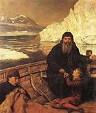
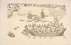
- 1600-01 - Prince Miron Shakhovskoi and D. Khripunov descend the ObOb RiverThe Ob River , also Obi, is a major river in western Siberia, Russia and is the world's seventh longest river. It is the westernmost of the three great Siberian rivers that flow into the Arctic Ocean .The Gulf of Ob is the world's longest estuary.-Names:The Ob is known to the Khanty people as the...
to the Ob EstuaryGulf of ObThe Gulf of Ob is a gigantic bay of the Arctic Ocean, located in Northern Russia at the head the mouth of the Ob River....
and ascend the Taz RiverTaz RiverThe Taz is a river located in western Siberia, has a length of 1401 km and drains a basin estimated at 150,000 km².The Taz River flows into the Tazovskaya Guba, a roughly 250 km long estuary that begins in the area of Tazovskiy town and ends in the Gulf of Ob...
, establishing the ostrogOstrog (fortress)Ostrog was a Russian term for a small fort, typically wooden and often non-permanently manned. Ostrogs were encircled by 4-6 metres high palisade walls made from sharpened trunks. The name derives from the Russian word строгать , "to shave the wood". Ostrogs were smaller and exclusively military...
of MangazeyaMangazeyaMangazeya was a Northwest Siberian trans-Ural trade colony and later city in the 16-17th centuries. Founded in 1600, it was situated on the Taz River, between the lower courses of the Ob and Yenisei Rivers flowing into the Arctic Ocean....
about 161 kilometres (100 mi) to 240 kilometres (149.1 mi) from its mouth. - 1602-06 - Bento de Góis travels overland from India to China, via AfghanistanAfghanistanAfghanistan , officially the Islamic Republic of Afghanistan, is a landlocked country located in the centre of Asia, forming South Asia, Central Asia and the Middle East. With a population of about 29 million, it has an area of , making it the 42nd most populous and 41st largest nation in the world...
and the Pamirs. - 1605 – KetskKet Riverright|thumb|300px|The Ket was a part of the [[Siberian River Routes]] - double clickKet River , also known in its upper reaches as the Big Ket River is a river in the Krasnoyarsk Krai and Tomsk Oblast in Russia, a right tributary of the Ob River. The length of the Ket River is 1,621 km. The area...
serving men ascend the KetKet Riverright|thumb|300px|The Ket was a part of the [[Siberian River Routes]] - double clickKet River , also known in its upper reaches as the Big Ket River is a river in the Krasnoyarsk Krai and Tomsk Oblast in Russia, a right tributary of the Ob River. The length of the Ket River is 1,621 km. The area...
, portage to the YeniseiYenisei RiverYenisei , also written as Yenisey, is the largest river system flowing to the Arctic Ocean. It is the central of the three great Siberian rivers that flow into the Arctic Ocean...
, and descend it to its confluence with the SymSym RiverThe Sym River is a western tributary of the Yenisei River. It was first reached by Ketsk serving men in 1605, while a detachment from Mangazeya ascended the Yenisei to its confluence with the Sym in 1610.-External links:*Great Soviet Encyclopedia....
. - 1606 - Willem JanszoonWillem JanszoonWillem Janszoon , Dutch navigator and colonial governor, is probably the first European known to have seen the coast of Australia. His name is sometimes abbreviated to Willem Jansz....
discovers AustraliaAustraliaAustralia , officially the Commonwealth of Australia, is a country in the Southern Hemisphere comprising the mainland of the Australian continent, the island of Tasmania, and numerous smaller islands in the Indian and Pacific Oceans. It is the world's sixth-largest country by total area...
at the mouth of the Pennefather RiverPennefather RiverThe Pennefather River in Queensland, Australia, is located on western Cape York Peninsula at . The river is about 11 km long and up to about 2km wide.- External links :**...
on the western coast of the Cape York PeninsulaCape York PeninsulaCape York Peninsula is a large remote peninsula located in Far North Queensland at the tip of the state of Queensland, Australia, the largest unspoilt wilderness in northern Australia and one of the last remaining wilderness areas on Earth...
, exploring its coast from Badu Island south to Cape Keerweer (13°58′ S). - 1606 - Pedro Fernandes de QueirósPedro Fernandes de QueirósPedro Fernandes de Queirós , was a Portuguese navigator best known for his involvement with Spanish voyages of discovery in the Pacific Ocean, in particular the 1595-1596 voyage of Alvaro de Mendaña de Neira, and for leading a 1605-1606 expedition which crossed the Pacific in search of Terra...
discovers Espiritu SantoEspiritu SantoEspiritu Santo is the largest island in the nation of Vanuatu, with an area of . It belongs to the archipelago of the New Hebrides in the Pacific region of Melanesia. It is in the Sanma Province of Vanuatu....
, the largest island in what is now the nation of VanuatuVanuatuVanuatu , officially the Republic of Vanuatu , is an island nation located in the South Pacific Ocean. The archipelago, which is of volcanic origin, is some east of northern Australia, northeast of New Caledonia, west of Fiji, and southeast of the Solomon Islands, near New Guinea.Vanuatu was...
. - 1606 - Luís Vaz de TorresLuís Vaz de TorresLuís Vaz de Torres , also Luis Váez de Torres in the Spanish spelling, was a 16th-17th century maritime explorer serving the Spanish Crown, noted for the first recorded navigation of the strait which separates the continent of Australia from the island of New Guinea, and which now bears his name...
sails through the straitTorres StraitThe Torres Strait is a body of water which lies between Australia and the Melanesian island of New Guinea. It is approximately wide at its narrowest extent. To the south is Cape York Peninsula, the northernmost continental extremity of the Australian state of Queensland...
that now bears his name. - 1607 - Mangazeyan promyshlennikiPromyshlennikiThe Promyshlenniki were a group of Russian and native Siberian contract workers drawn largely from the State serf and townsman class engaged primarily in the fur trade in Siberia and Alaska in the 1790s...
and traders reach the lower YeniseiYenisei RiverYenisei , also written as Yenisey, is the largest river system flowing to the Arctic Ocean. It is the central of the three great Siberian rivers that flow into the Arctic Ocean...
, establish TurukhanskTurukhanskTurukhansk is a village in Krasnoyarsk Krai, Russia. It is located 1474 km north of Krasnoyarsk, at the confluence of the Yenisei and Lower Tunguska rivers. The Turukhan River joins the Yenisei about 20 km northwest. Population: 4,849 ; 8,900 ; 200...
, and ascend the Lower Tunguska, while Ketsk serving men ascend the Yenisei to the AngaraAngara RiverThe Angara River is a long river in Irkutsk Oblast and Krasnoyarsk Krai, south-east Siberia, Russia. It is the only river flowing out of Lake Baikal, and is the headwater tributary of the Yenisei River....
, which they also ascend. - 1607 - Henry HudsonHenry HudsonHenry Hudson was an English sea explorer and navigator in the early 17th century. Hudson made two attempts on behalf of English merchants to find a prospective Northeast Passage to Cathay via a route above the Arctic Circle...
coasts the east coast of Greenland, naming "Hold-with-Hope" (around 73° N). - 1609 - Hudson sails the Halve Maen up the Hudson RiverHudson RiverThe Hudson is a river that flows from north to south through eastern New York. The highest official source is at Lake Tear of the Clouds, on the slopes of Mount Marcy in the Adirondack Mountains. The river itself officially begins in Henderson Lake in Newcomb, New York...
as fall north as present day Albany, New YorkAlbany, New YorkAlbany is the capital city of the U.S. state of New York, the seat of Albany County, and the central city of New York's Capital District. Roughly north of New York City, Albany sits on the west bank of the Hudson River, about south of its confluence with the Mohawk River...
. - 1610 - Étienne BrûléÉtienne BrûléÉtienne Brûlé , was the first of European French explorers to journey along the St. Lawrence River with the Native Americans and to view Georgian Bay and Lake Huron Canada in the 17th century. A rugged outdoorsman, he took to the lifestyle of the First Nations and had a unique contribution to the...
ascends the Ottawa RiverOttawa RiverThe Ottawa River is a river in the Canadian provinces of Ontario and Quebec. For most of its length, it now defines the border between these two provinces.-Geography:...
and reaches Lake NipissingLake NipissingLake Nipissing is a lake in the Canadian province of Ontario. It has a surface area of , a mean elevation of above sea level, and is located between the Ottawa River and Georgian Bay. Excluding the Great Lakes, Lake Nipissing is the fifth-largest lake in Ontario. It is relatively shallow for a...
and Georgian BayGeorgian BayGeorgian Bay is a large bay of Lake Huron, located entirely within Ontario, Canada...
in Lake HuronLake HuronLake Huron is one of the five Great Lakes of North America. Hydrologically, it comprises the larger portion of Lake Michigan-Huron. It is bounded on the east by the Canadian province of Ontario and on the west by the state of Michigan in the United States...
. - 1610 - Kondratiy Kurochkin leads an expedition, sailing in kochiKoch (boat)The Koch was a special type of small one or two mast wooden sailing ships designed and used in Russia for transpolar voyages in ice conditions of the Arctic seas, popular among the Pomors....
, from Turukhansk to the mouth of the YeniseiYenisei RiverYenisei , also written as Yenisey, is the largest river system flowing to the Arctic Ocean. It is the central of the three great Siberian rivers that flow into the Arctic Ocean...
and east to the mouth of the PyasinaPyasina RiverPyasina River is a river in Krasnoyarsk Krai, Russia. The length of the river is . The area of its basin is 182,000 km². The Pyasina River originates in the Lake Pyasino and flows into the Pyasino Gulf of the Kara Sea. There are more than 60,000 lakes in the basin of the Pyasina covering...
on the Taymyr PeninsulaTaymyr PeninsulaThe Taymyr Peninsula is a peninsula in the Far North of Russia, in the Siberian Federal District, that forms the northernmost part of mainland Eurasia and Asia...
. - 1610 - A detachment from Mangazeya ascends the Yenisei a further 640 kilometres (397.7 mi) to its confluence with the SymSym RiverThe Sym River is a western tributary of the Yenisei River. It was first reached by Ketsk serving men in 1605, while a detachment from Mangazeya ascended the Yenisei to its confluence with the Sym in 1610.-External links:*Great Soviet Encyclopedia....
. - 1610-11 - Hudson sails through Hudson StraitHudson StraitHudson Strait links the Atlantic Ocean to Hudson Bay in Canada. It lies between Baffin Island and the northern coast of Quebec, its eastern entrance marked by Cape Chidley and Resolution Island. It is long...
into Hudson BayHudson BayHudson Bay , sometimes called Hudson's Bay, is a large body of saltwater in northeastern Canada. It drains a very large area, about , that includes parts of Ontario, Quebec, Saskatchewan, Alberta, most of Manitoba, southeastern Nunavut, as well as parts of North Dakota, South Dakota, Minnesota,...
, where he overwinters in James BayJames BayJames Bay is a large body of water on the southern end of Hudson Bay in Canada. Both bodies of water extend from the Arctic Ocean. James Bay borders the provinces of Quebec and Ontario; islands within the bay are part of Nunavut...
. - 1611 – Mangazeyan men reach the KhatangaKhatanga RiverThe Khatanga River is a river in Krasnoyarsk Krai in Russia. It begins at the confluence of the rivers Kotuy and Kheta. The Khatanga River is long; the area of its basin is 364,000 km². It flows into the Khatanga Gulf of the Laptev Sea, forming an estuary...
. - 1612-13 - Thomas ButtonThomas ButtonSir Thomas Button was a Welsh officer of the Royal Navy and explorer who in 1612–1613 commanded an expedition that unsuccessfully attempted to locate explorer Henry Hudson and to navigate the Northwest Passage. It was, nonetheless, a voyage of discovery andThomas Button was an explorer as...
is the first to explore the western shores of Hudson BayHudson BayHudson Bay , sometimes called Hudson's Bay, is a large body of saltwater in northeastern Canada. It drains a very large area, about , that includes parts of Ontario, Quebec, Saskatchewan, Alberta, most of Manitoba, southeastern Nunavut, as well as parts of North Dakota, South Dakota, Minnesota,...
, where he winters in the mouth of the Nelson RiverNelson RiverThe Nelson River is a river of north-central North America, in the Canadian province of Manitoba. Its full length is , it has mean discharge of , and has a drainage basin of , of which is in the United States...
; also discovers CoatsCoats IslandCoats Island lies at the northern end of Hudson Bay in the Kivalliq Region of Nunavut. At in size, it is the 107th largest island in the world, and Canada's 24th largest island....
and Southampton IslandSouthampton IslandSouthampton Island is a large island at the entrance to Hudson Bay at Foxe Basin. One of the larger members of the Canadian Arctic Archipelago, Southampton Island is part of the Kivalliq Region in Nunavut, Canada. The area of the island is stated as by Statistics Canada . It is the 34th largest...
s. - 1614 - WhalersHistory of whalingThe history of whaling is very extensive, stretching back for millennia. This article discusses the history of whaling up to the commencement of the International Whaling Commission moratorium on commercial whaling in 1986....
discover Jan MayenJan MayenJan Mayen Island is a volcanic island in the Arctic Ocean and part of the Kingdom of Norway. It is long and 373 km2 in area, partly covered by glaciers . It has two parts: larger northeast Nord-Jan and smaller Sør-Jan, linked by an isthmus wide...
. - 1615-16 - Étienne Brûlé sights the western shore of Lake OntarioLake OntarioLake Ontario is one of the five Great Lakes of North America. It is bounded on the north and southwest by the Canadian province of Ontario, and on the south by the American state of New York. Ontario, Canada's most populous province, was named for the lake. In the Wyandot language, ontarío means...
, descends the Niagara RiverNiagara RiverThe Niagara River flows north from Lake Erie to Lake Ontario. It forms part of the border between the Province of Ontario in Canada and New York State in the United States. There are differing theories as to the origin of the name of the river...
, explores what are now parts of modern New YorkNew YorkNew York is a state in the Northeastern region of the United States. It is the nation's third most populous state. New York is bordered by New Jersey and Pennsylvania to the south, and by Connecticut, Massachusetts and Vermont to the east...
and PennsylvaniaPennsylvaniaThe Commonwealth of Pennsylvania is a U.S. state that is located in the Northeastern and Mid-Atlantic regions of the United States. The state borders Delaware and Maryland to the south, West Virginia to the southwest, Ohio to the west, New York and Ontario, Canada, to the north, and New Jersey to...
, and descends the Susquehanna RiverSusquehanna RiverThe Susquehanna River is a river located in the northeastern United States. At long, it is the longest river on the American east coast that drains into the Atlantic Ocean, and with its watershed it is the 16th largest river in the United States, and the longest river in the continental United...
to Chesapeake BayChesapeake BayThe Chesapeake Bay is the largest estuary in the United States. It lies off the Atlantic Ocean, surrounded by Maryland and Virginia. The Chesapeake Bay's drainage basin covers in the District of Columbia and parts of six states: New York, Pennsylvania, Delaware, Maryland, Virginia, and West...
. - 1616 - Jacob Le MaireJacob Le MaireJacob Le Maire was a Dutch mariner who circumnavigated the earth in 1615-16. The strait between Tierra del Fuego and Isla de los Estados was named the Le Maire Strait in his honor, though not without controversy...
and Willem SchoutenWillem SchoutenWillem Cornelisz Schouten was a Dutch navigator for the Dutch East India Company. He was the first to sail the Cape Horn route to the Pacific Ocean.- Biography :Willem Cornelisz Schouten was born in c...
discover and name Le Maire StraitLe Maire StraitThe Le Maire Strait is a sea passage between Isla de los Estados and the eastern extremity of the Argentine portion of Tierra del Fuego....
, Staten IslandIsla de los EstadosIsla de los Estados is an Argentine island that lies off the eastern extremity of the Argentine portion of Tierra del Fuego, from which it is separated by the Le Maire Strait...
, and Cape HornCape HornCape Horn is the southernmost headland of the Tierra del Fuego archipelago of southern Chile, and is located on the small Hornos Island...
; also discover TongaTongaTonga, officially the Kingdom of Tonga , is a state and an archipelago in the South Pacific Ocean, comprising 176 islands scattered over of ocean in the South Pacific...
(Niuafo'ouNiuafo'ouNiuafoou is the most northerly island in the kingdom of Tonga. It is a volcanic rim island of 15 km² and with a population of 650 in 2006.-Geography:...
, NiuatoputapuNiuatoputapuFor the 2009 tsunami, see the main article: 2009 Samoa tsunami.Niuatoputapu is an island in the island nation of Tonga, Pacific Ocean. Its name means sacred island. Older European names for the island are Traitors island or Keppel island.Niuatoputapu is located in the north of the country,...
, and TafahiTafahiTafahi is a small island in the north of the Tonga archipelago, in fact closer to Savaii than the main islands of Tonga. It is only north-northeast away from Niuatoputapu, and fishermen communicate in small outboard motorboats almost daily between the two.Other names for Tafahi are Cocos Eylant ...
), FutunaFutuna Island, Wallis and FutunaFutuna is an island in the Pacific Ocean belonging to the French overseas collectivity of Wallis and Futuna. It is one of the Hoorn Islands or Îles Horne, nearby Alofi being the other...
and AlofiAlofiAlofi is the capital city of the Pacific Ocean nation of Niue. With a population of 581 , Alofi has the distinction of being the smallest national capital city in terms of population. It consists of the two villages Alofi North and Alofi South, where the government headquarters are located. Alofi...
(in modern Wallis and FutunaWallis and FutunaWallis and Futuna, officially the Territory of the Wallis and Futuna Islands , is a Polynesian French island territory in the South Pacific between Tuvalu to the northwest, Rotuma of Fiji to the west, the main part of Fiji to the southwest, Tonga to the southeast,...
), and several islands in the Tuamotu (TakaroaTakaroaTakaroa, Taka-roa or Takapua, is an atoll in the Tuamotu group in French Polynesia. Length 27.4 km, width 7 km. Latitude 14° 27'; Longitude S 144° 59' W.The nearest land is Takapoto Atoll, located 10 km to the Southwest....
, TakapotoTakapotoTakapoto, Tua-poto or Oura, is an atoll in the Tuamotu group in French Polynesia.Length 17 km, width 6.4 km. Latitude 14° 42'; Longitude S 145° 15' W.The nearest land is Takaroa Atoll, located 10 km to the Northeast....
, ManihiManihiManihi, or Paeua, is a coral atoll in the Tuamotu Archipelago. It is one of the northernmost of the Tuamotus, located in the King George subgroup. The closest land to Manihi is Ahe Atoll, located 14 km to the west...
, AheAheAhe, Ahemaru or Omaru, is an almost entirely-enclosed coral atoll, located in the northern Tuamotu Archipelago, just 14 km to the west of Manihi, in French Polynesia.Ahe Atoll's ring shape is broken by only a single small passage into the lagoon....
and RangiroaRangiroaRangiroa or Te Kokōta , is the largest atoll in the Tuamotus, and one of the largest in the world . It is part of the Palliser group. The nearest atoll is Tikehau, located only 12 km to the West...
) and Bismarck ArchipelagoBismarck ArchipelagoThe Bismarck Archipelago is a group of islands off the northeastern coast of New Guinea in the western Pacific Ocean and is part of the Islands Region of Papua New Guinea.-History:...
s (including New HanoverNew Hanover IslandNew Hanover Island, , also called Lavongai, is a large volcanic island in New Ireland Province, part of the Bismarck Archipelago of the New Guinea Islands region of Papua New Guinea, at...
and New IrelandNew Ireland (island)New Ireland is a large island in Papua New Guinea, approximately 7,404 km² in area. It is the largest island of the New Ireland Province, lying northeast of the island of New Britain. Both islands are part of the Bismarck Archipelago, named after Otto von Bismarck, and they are separated by...
). - 1616 - Robert BylotRobert BylotRobert Bylot was a 17th-century explorer who made four voyages to the Arctic. He was uneducated and from a working class background, but was able to rise to rank of Master in the British Royal Navy....
and William BaffinWilliam BaffinWilliam Baffin was an English navigator and explorer. Nothing is known of his early life, but it is conjectured that he was born in London of humble origin, and gradually raised himself by his diligence and perseverance...
reach 77°30′ N, enter Baffin BayBaffin BayBaffin Bay , located between Baffin Island and the southwest coast of Greenland, is a marginal sea of the North Atlantic Ocean. It is connected to the Atlantic via Davis Strait and the Labrador Sea...
, discover SmithSmith SoundSmith Sound is an uninhabited Arctic sea passage between Greenland and Canada's northernmost island, Ellesmere Island. It links Baffin Bay with Kane Basin and forms part of the Nares Strait....
, JonesJones SoundJones Sound is an uninhabited waterway in Qikiqtaaluk, Nunavut, Canada. It lies between Devon Island and the southern end of Ellesmere Island. At its northwestern end it is linked by several channels to Norwegian Bay; at its eastern end it opens via Glacier Strait into Baffin Bay.The first known...
, and Lancaster SoundLancaster SoundLancaster Sound is a body of water in Qikiqtaaluk, Nunavut, Canada. It is located between Devon Island and Baffin Island, forming the eastern portion of the Northwest Passage. East of the sound lies Baffin Bay; to the west lies Viscount Melville Sound...
s and sight the coasts of EllesmereEllesmere IslandEllesmere Island is part of the Qikiqtaaluk Region of the Canadian territory of Nunavut. Lying within the Canadian Arctic Archipelago, it is considered part of the Queen Elizabeth Islands, with Cape Columbia being the most northerly point of land in Canada...
, DevonDevon IslandDevon Island , claimed to be the largest uninhabited island on Earth, is located in Baffin Bay, Qikiqtaaluk Region, Nunavut, Canada. It is one of the larger members of the Canadian Arctic Archipelago, the second-largest of the Queen Elizabeth Islands, Canada's sixth largest island, and the 27th...
, and Bylot IslandBylot IslandBylot Island lies off the northern end of Baffin Island in Nunavut Territory, Canada. At it is ranked 71st largest island in the world and Canada's 17th largest island. It is also one of the largest uninhabited islands in the world. While there are no permanent settlements on this Canadian Arctic...
s. - 1616 - Dirk HartogDirk HartogDirk Hartog was a 17th century Dutch sailor and explorer. Dirk Hartog's expedition was the third European group to land on Australian soil. He was the first to leave behind an artifact to record his visit, the Hartog plate. His name is sometimes alternatively spelled Dirck Hartog or Dierick...
explores some 576 kilometres (357.9 mi) of coastline (the coast of Western AustraliaWestern AustraliaWestern Australia is a state of Australia, occupying the entire western third of the Australian continent. It is bounded by the Indian Ocean to the north and west, the Great Australian Bight and Indian Ocean to the south, the Northern Territory to the north-east and South Australia to the south-east...
from about 22° to 28° S), discovering Dirk Hartog IslandDirk Hartog IslandDirk Hartog Island is an island off the Gascoyne coast of Western Australia, within the Shark Bay World Heritage Area. It is about 80 kilometres long and between 3 and 15 kilometres wide and is Western Australia's largest and most western island. It covers an area of 620 square kilometres and is...
and Shark BayShark BayShark Bay is a World Heritage listed bay in Western Australia. The term may also refer to:* the locality of Shark Bay, now known as Denham* Shark Bay Marine Park* Shark Bay , a shark exhibit at Sea World, Gold Coast, Australia* Shire of Shark Bay...
. - 1617 - EnglishEnglandEngland is a country that is part of the United Kingdom. It shares land borders with Scotland to the north and Wales to the west; the Irish Sea is to the north west, the Celtic Sea to the south west, with the North Sea to the east and the English Channel to the south separating it from continental...
walrusWalrusThe walrus is a large flippered marine mammal with a discontinuous circumpolar distribution in the Arctic Ocean and sub-Arctic seas of the Northern Hemisphere. The walrus is the only living species in the Odobenidae family and Odobenus genus. It is subdivided into three subspecies: the Atlantic...
hunters sight the southern coast of "Sir Thomas Smith's Island" (NordaustlandetNordaustlandetNordaustlandet is the second-largest island in the archipelago of Svalbard, Norway, with an area of . It lies north east of Spitsbergen, separated by Hinlopenstretet. Much of Nordaustlandet lies under large ice caps, mainly Austfonna and Vestfonna, the remaining parts of the north being tundra...
). - 1618 - Pedro PáezPedro PáezPedro Páez Jaramillo was a Spanish Jesuit missionary in Ethiopia. Páez is considered by many experts on Ethiopia to be the most effective Catholic missionary in Ethiopia...
is believed to be the first European to see and describe the source of the Blue NileBlue NileThe Blue Nile is a river originating at Lake Tana in Ethiopia. With the White Nile, the river is one of the two major tributaries of the Nile...
in Ethiopia. - 1618 - Lenaert JacobszoonLenaert JacobszoonLenaert Jacobszoon was a captain of the Dutch East India Company who, on 31 July 1618 in the vessel Mauritius, sighted North West Cape in the north-west of Western Australia mistakenly believing it to be a large island...
discovers an "island" at 22° S (the coast of Western Australia from Point CloatesPoint CloatesPoint Cloates, Western Australia, is situated off North West Cape of Western Australia..Cloates island remained on marine charts and world maps until late in the 18th Century. The Guthrie world map published in 1785 maps out the voyages of Captain James Cook and shows "Cloats" Island in 97 degrees...
to North West CapeNorth West CapeNorth West Cape is a large peninsula of land in the north west coast of Western Australia. Cape Range runs down the spine of the peninsula and Ningaloo Reef runs along the western edge...
). - 1619 - Frederick de HoutmanFrederick de HoutmanFrederick de Houtman , or Frederik de Houtman, was a Dutch explorer who sailed along the Western coast of Australia en route to Batavia.-Biography:...
sights the coast of Western Australia near FremantleFremantle, Western AustraliaFremantle is a city in Western Australia, located at the mouth of the Swan River. Fremantle Harbour serves as the port of Perth, the state capital. Fremantle was the first area settled by the Swan River colonists in 1829...
and sails along the coast north for over 640 kilometres (397.7 mi). - 1620 - Mangazeyan serving men reach the Vilyuy River and descend it to its confluence with the LenaLena RiverThe Lena is the easternmost of the three great Siberian rivers that flow into the Arctic Ocean . It is the 11th longest river in the world and has the 9th largest watershed...
. - 1621-23 - Étienne Brûlé and his companion Grenolle travel along the North ChannelNorth Channel (Ontario)The North Channel is the body of water along the north shore of Lake Huron, in the Canadian province of Ontario. It is bordered on the east by Georgian Bay, on the west by the St. Marys River, to the north by the eastern Algoma District and to the south by the islands of Manitoulin, Cockburn,...
of Lake Huron (probably sighting Manitoulin IslandManitoulin IslandManitoulin Island is a Canadian island in Lake Huron, in the province of Ontario. It is the largest island in a freshwater lake in the world. In addition to the historic Anishinaabe and European settlement of the island, archeological discoveries at Sheguiandah have demonstrated Paleo-Indian and...
) to "Grand Lac" (Lake SuperiorLake SuperiorLake Superior is the largest of the five traditionally-demarcated Great Lakes of North America. It is bounded to the north by the Canadian province of Ontario and the U.S. state of Minnesota, and to the south by the U.S. states of Wisconsin and Michigan. It is the largest freshwater lake in the...
) via St. Mary's River. - 1622 - The DutchNetherlandsThe Netherlands is a constituent country of the Kingdom of the Netherlands, located mainly in North-West Europe and with several islands in the Caribbean. Mainland Netherlands borders the North Sea to the north and west, Belgium to the south, and Germany to the east, and shares maritime borders...
ship Leeuwin discovers land near present-day Cape LeeuwinCape LeeuwinCape Leeuwin is the most south-westerly mainland point of the Australian Continent, in the state of Western Australia.A few small islands and rocks, the St Alouarn Islands, extend further to the south. The nearest settlement, north of the cape, is Augusta. South-east of Cape Leeuwin, the coast...
. - 1623 - Jan CarstenszoonJan CarstenszoonJan Carstenszoon or more commonly Jan Carstensz ) was a 17th century Dutch explorer.In 1623, Carstenszoon was commissioned by the Dutch East India Company to lead an expedition to the southern coast of New Guinea and beyond, to follow up the reports of land sighted further south in the 1606 voyages...
discovers the western coast of Cape York Peninsula from Cape Keerweer to the southern mouth of the Gilbert RiverGilbert-Einasleigh RiverThe Gilbert-Einasleigh River is one of the largest river systems in northern Australia. It is located in north-central Queensland, between the Flinders River and the Mitchell River.-Description:...
; while his consort Willem Joosten van Colster discovers "Arnhemsland" and "Speultsland" (modern Arnhem LandArnhem LandThe Arnhem Land Region is one of the five regions of the Northern Territory of Australia. It is located in the north-eastern corner of the territory and is around 500 km from the territory capital Darwin. The region has an area of 97,000 km² which also covers the area of Kakadu National...
and perhaps Groote EylandtGroote EylandtGroote Eylandt is the largest island in the Gulf of Carpentaria in northeastern Australia. It is the homeland of, and is owned by, the Anindilyakwa people who speak the isolated Anindilyakwa language)....
). - 1624 - António de AndradeAntónio de AndradeFather António de Andrade was a Jesuit priest and explorer from Portugal. He entered the Society of Jesus in 1596. From 1600 until his death in 1634 he was engaged in missionary activity in India...
crosses the HimalayasHimalayasThe Himalaya Range or Himalaya Mountains Sanskrit: Devanagari: हिमालय, literally "abode of snow"), usually called the Himalayas or Himalaya for short, is a mountain range in Asia, separating the Indian subcontinent from the Tibetan Plateau...
through the Mana PassMana PassMana Pass , alternatively as Māna La, Chirbitya, Chirbitya-la, or Dungri La is a mountain pass in the Himalayas between India and Tibet...
and reaches TibetTibetTibet is a plateau region in Asia, north-east of the Himalayas. It is the traditional homeland of the Tibetan people as well as some other ethnic groups such as Monpas, Qiang, and Lhobas, and is now also inhabited by considerable numbers of Han and Hui people...
. - 1627 - Jesuit missionaries Estêvão CacellaEstêvão CacellaEstêvão Cacella was a Portuguese Jesuit missionary.-Life:Cacella was born in Aviz in 1585, joined the Jesuits at the age of nineteen, and sailed for India in 1614 where he worked for some years in Kerala...
and João CabralJoão CabralJoão Cabral was a Jesuit missionary, who, along with Estêvão Cacella, were the first Europeans to enter Bhutan in 1627. The following year he became the first European to visit neighboring Nepal....
cross the HimalayasHimalayasThe Himalaya Range or Himalaya Mountains Sanskrit: Devanagari: हिमालय, literally "abode of snow"), usually called the Himalayas or Himalaya for short, is a mountain range in Asia, separating the Indian subcontinent from the Tibetan Plateau...
and are the first to enter BhutanBhutanBhutan , officially the Kingdom of Bhutan, is a landlocked state in South Asia, located at the eastern end of the Himalayas and bordered to the south, east and west by the Republic of India and to the north by the People's Republic of China...
. - 1627 - François ThijssenFrançois ThijssenFrançois Thijssen or Frans Thijsz was a Dutch explorer who explored the southern coast of Australia.He was the captain of the ship t Gulden Zeepaerdt when sailing from Cape of Good Hope to Batavia...
with Pieter NuytsPieter NuytsPieter Nuyts or Nuijts was a Dutch explorer, diplomat, and politician.He was part of a landmark expedition of the Dutch East India Company in 1626–27, which mapped the southern coast of Australia. He became the Dutch ambassador to Japan in 1627, and he was appointed Governor of Formosa in the same...
on board discovers over 1609 kilometres (999.8 mi) of coastline east of Cape LeeuwinCape LeeuwinCape Leeuwin is the most south-westerly mainland point of the Australian Continent, in the state of Western Australia.A few small islands and rocks, the St Alouarn Islands, extend further to the south. The nearest settlement, north of the cape, is Augusta. South-east of Cape Leeuwin, the coast...
to the eastern end of the Great Australian BightGreat Australian BightThe Great Australian Bight is a large bight, or open bay, off the central and western portions of the southern coastline of mainland Australia.-Extent:...
. - 1628 - Cabral is the first to enter NepalNepalNepal , officially the Federal Democratic Republic of Nepal, is a landlocked sovereign state located in South Asia. It is located in the Himalayas and bordered to the north by the People's Republic of China, and to the south, east, and west by the Republic of India...
. - 1628 - Gerrit Frederikszoon de Witt captian of the VianenVianen (ship)Vianen, sometimes spelled Vyanen or Viane, was a 17th-century VOC sailing ship, used to transport cargo between Europe and the Indies. It was shipwrecked but refloated on its first voyage, and shipwrecked and sunk on its second...
discovers "Witsland" about 21° S, sailing 320 kilometres (198.8 mi) along the coast and discovering Barrow IslandBarrow Island (Western Australia)Barrow Island is a island located northwest off the coast of Western Australia. The island is the second largest in Western Australia after Dirk Hartog Island.-Discovery and early history:...
and parts of the Dampier ArchipelagoDampier ArchipelagoThe Dampier Archipelago is a group of islands near Dampier, Western Australia. It is named after William Dampier, an English buccaneer and explorer who visited in 1699. Dampier named one of the islands, Rosemary Island.-History:...
. - 1628-30 - Vasilii Bugor ascends the Upper Tunguska and portages to the upper Lena, descending it to its confluence with the KirengaKirenga RiverKirenga River is a river in Irkutsk Oblast in Russia, a right tributary of the Lena which flows north between the upper Lena and Lake Baikal. The length of the river is 746 km. The area of its basin is 46,600 km². The Kirenga River freezes up in the late October - early November and...
. - 1631-32 - Luke Foxe and Thomas JamesThomas JamesThomas James was an English librarian, first librarian of the Bodleian Library, Oxford.James became a fellow of New College, Oxford in 1593...
, in separate expeditions, both circumnavigate Hudson Bay in search of a Northwest Passage; Foxe sails through the channelFoxe ChannelThe Foxe Channel is an area of sea in Qikiqtaaluk Region, Nunavut, Canada. It separates the Foxe Basin from Hudson Bay and the Hudson Strait . To the west and south-west is Southampton Island, to the east is Baffin Island, and to the north-west is the Melville Peninsula.The channel takes its name...
and into the basinFoxe BasinNot to be confused with Fox Bay, Falkland IslandsFoxe Basin is a shallow oceanic basin north of Hudson Bay, in Nunavut, Canada, located between Baffin Island and the Melville Peninsula...
now named after him to 66°47′ N, while James winters in the bay named after himJames BayJames Bay is a large body of water on the southern end of Hudson Bay in Canada. Both bodies of water extend from the Arctic Ocean. James Bay borders the provinces of Quebec and Ontario; islands within the bay are part of Nunavut...
. - 1632-33 - Pyotr BeketovPyotr BeketovPyotr Beketov was a prominent Cossack explorer of Siberia and founder of many cities such as Yakutsk, Chita, and Nerchinsk.Beketov started his military service as a guardsman in 1624 and was sent to Siberia in 1627. He was appointed Enisei voevoda and proceeded on his first voyage in order to...
descends the Lena as far as its great bend, erects the ostrog YakutskYakutskWith a subarctic climate , Yakutsk is the coldest city, though not the coldest inhabited place, on Earth. Average monthly temperatures range from in July to in January. The coldest temperatures ever recorded on the planet outside Antarctica occurred in the basin of the Yana River to the northeast...
, and sends a detachment some 720 kilometres (447.4 mi) downriver (where the zimovie Zhigansk is built) and another east up the AldanAldan RiverThe Aldan River is the second-longest tributary of the Lena River in the Sakha Republic in eastern Siberia. The river is 2,273 km long, of which around 1,600 km is navigable. It was part of the River Route to Okhotsk...
as far as the AmgaAmga RiverAmga River is a river in Sakha , Russia. It is the biggest tributary of the Aldan River, which it joins a few miles west of Khandyga. The length of the river is . The area of its basin is 69,300 km². The Amga River freezes up in the first half of October and stays under the ice until May....
(which they also ascend in search of yasakYasakYasak or yasaq, sometimes iasak, is a Turkic word for "tribute" that was used in Imperial Russia to designate fur tribute exacted from the indigenous peoples of Siberia.- Origin :...
). - 1633-34 - Jean NicoletJean NicoletJean Nicolet de Belleborne was a French coureur des bois noted for exploring Green Bay in what is now the U.S. state of Wisconsin.-Life:...
discovers Lake MichiganLake MichiganLake Michigan is one of the five Great Lakes of North America and the only one located entirely within the United States. It is the second largest of the Great Lakes by volume and the third largest by surface area, after Lake Superior and Lake Huron...
and likely reaches Green Bay, WisconsinGreen Bay, WisconsinGreen Bay is a city in and the county seat of Brown County in the U.S. state of Wisconsin, located at the head of Green Bay, a sub-basin of Lake Michigan, at the mouth of the Fox River. It has an elevation of above sea level and is located north of Milwaukee. As of the 2010 United States Census,...
. - 1633-38 – Ilya Perfilyev and Ivan Rebrov sail from Zhigansk in kochi some 800 kilometres (497.1 mi) downriver to the mouth of the Lena and sail along the coast east and west, reaching the mouths of the OlenyokOlenyok RiverThe Olenyok River is a major river in northern Siberian Russia, west of the lower Lena River and east of the Anabar River. It is long, of which around is navigable. Average water discharge is 1210 m³/s...
, YanaYana RiverThe Yana River , is a river in Sakha in Russia, located between the Lena to the west and the Indigirka to the east.It is 872 km in length. The area of its basin is 238,000 km², whilst its annual discharge totals approximately . Most of this discharge occurs in May and June as the ice on the...
, and IndigirkaIndigirka RiverThe Indigirka River is a river in the Sakha Republic in Russia between the Yana River and the Kolyma River. It is in length. The area of its basin is 360,000 km²...
rivers. - 1638-40 - Poznik Ivanov crosses the Verkhoyansk RangeVerkhoyansk Rangethumb|right|The Verkhoyansk Range is the L-shaped area east of the LenaThe Verkhoyansk Range is a mountain range of eastern Siberia, spanning ca. 1000 km , across the Sakha Republic. It forms a vast arc between the Lena and Aldan rivers to the west and the Yana River to the east. It rises to ca....
into the upper reaches of the Yana, and then portages over the Chersky RangeChersky RangeThe Chersky Range is a chain of mountains in northeastern Siberia between the Yana River and the Indigirka River. It generally runs from northwest to southeast through the Sakha Republic and Magadan Oblast. The tallest mountain in the range is Peak Pobeda, which is 3,003 meters tall. The range...
into the Indigirka river system. - 1639-40 – Maksim PerfilyevMaksim PerfilyevMaksim Perfilyev was a Cossack explorer of Eastern Siberia and the first Russian to reach Transbaikalia. He was renowned for his diplomatic skills in negotiations with Tunguses, Mongols and Chinese....
ascends the Vitim RiverVitim RiverVitim River is a major tributary of the Lena River. With its source east of Lake Baikal, the Vitim flows 1,978 km north through the Transbaykalian Mountains and the town of Bodaybo. The river peaks in June and freezes from November to May. It is navigable from the Lena to Bodaybo. Upstream,...
to the TsipaTsipa RiverThe Tsipa River is a western tributary of the Vitim. Maksim Perfilyev was the first Russian to reach the Tsipa in 1640.-References:...
, which he also ascends (until rapids force him to turn back), becoming the first Russian to enter TransbaikalTransbaikalTransbaikal, Trans-Baikal, Transbaikalia , or Dauria is a mountainous region to the east of or "beyond" Lake Baikal in Russia. The alternative name, Dauria, is derived from the ethnonym of the Daur people. It stretches for almost 1000 km from north to south from the Patomskoye Plateau and North...
. - 1639-41 - Ivan MoskvitinIvan MoskvitinIvan Yuryevich Moskvitin was a Russian explorer, presumably a native of Moscow, who led a Russian reconnaissance party to the Pacific Ocean, becoming the first Russian to reach the Sea of Okhotsk....
ascends the MayaMaya RiverMaya River is a river in Khabarovsk Krai and Sakha, Russia. It is a right tributary of the Aldan River of the Lena basin. The length of the river is 1053 km. The area of its basin 171,000 km². The Maya River freezes up in late October and stays under the ice until May. The Yudoma River is one of...
, portages across the Dzhugdzhur MountainsDzhugdzhur MountainsThe Dzhugdzhur Mountains are a mountain range in the far east of Siberia that run along the entire northwest coast of the Sea of Okhotsk. In the east, mountains emerge from the Stanovoy Range and run northeast for some 1500 kilometers before splitting three ways into the Chersky Range, Verkhoyansk...
, and descends the UlyaUlya RiverUlya River is a river in northern Khabarovsk Krai in Russia. The length of the river is 325 km, the area of its drainage basin is 15,500 km². The Ulya originates in the Dzhugdzhur Mountains, flows northeast parallel to the coast and turns east to reach the Sea of Okhotsk about 100km southwest of...
to the Sea of OkhotskSea of OkhotskThe Sea of Okhotsk is a marginal sea of the western Pacific Ocean, lying between the Kamchatka Peninsula on the east, the Kuril Islands on the southeast, the island of Hokkaidō to the far south, the island of Sakhalin along the west, and a long stretch of eastern Siberian coast along the west and...
; two groups are sent to the north and south, reaching the mouths of the Taui and Uda rivers, respectively. - 1641 – Dmitri Zyrian discovers the AlazeyaAlazeya RiverThe Alazeya River is a river in the northeastern part of Yakutia, Russia which flows into the Arctic between the basins of the larger Indigirka River to the west and the Kolyma River to the east. The river is long...
, which he ascends as far as the tree line. - 1642-43 - Abel TasmanAbel TasmanAbel Janszoon Tasman was a Dutch seafarer, explorer, and merchant, best known for his voyages of 1642 and 1644 in the service of the VOC . His was the first known European expedition to reach the islands of Van Diemen's Land and New Zealand and to sight the Fiji islands...
discovers "Anthony van Diemenslandt" (TasmaniaTasmaniaTasmania is an Australian island and state. It is south of the continent, separated by Bass Strait. The state includes the island of Tasmania—the 26th largest island in the world—and the surrounding islands. The state has a population of 507,626 , of whom almost half reside in the greater Hobart...
) and "Staten Landt" (New ZealandNew ZealandNew Zealand is an island country in the south-western Pacific Ocean comprising two main landmasses and numerous smaller islands. The country is situated some east of Australia across the Tasman Sea, and roughly south of the Pacific island nations of New Caledonia, Fiji, and Tonga...
); following year discovers "'t Eylandt Amsterdam" (TongatapuTongatapuTongatapu is the main island of the Kingdom of Tonga and the location of its capital Nukualofa. It is located in Tonga's southern island group, to which it gives its name, and is the country's most populous island, with approximately 71,260 residents , 70.5% of the national population...
), FijiFijiFiji , officially the Republic of Fiji , is an island nation in Melanesia in the South Pacific Ocean about northeast of New Zealand's North Island...
and New BritainNew BritainNew Britain, or Niu Briten, is the largest island in the Bismarck Archipelago of Papua New Guinea. It is separated from the island of New Guinea by the Dampier and Vitiaz Straits and from New Ireland by St. George's Channel...
. - 1643 – Kurbat IvanovKurbat IvanovKurbat Afanasyevich Ivanov was among the greatest Cossack explorers of Siberia. He was the first Russian to discover Lake Baikal, and to create the first map of the Russian Far East...
reaches the western shores of Lake BaikalLake BaikalLake Baikal is the world's oldest at 30 million years old and deepest lake with an average depth of 744.4 metres.Located in the south of the Russian region of Siberia, between Irkutsk Oblast to the northwest and the Buryat Republic to the southeast, it is the most voluminous freshwater lake in the...
, opposite OlkhonOlkhonOlkhon is the third-largest lake-bound island in the world. It is by far the largest island in Lake Baikal in eastern Siberia, with an area of . Structurally, it acts as the southwestern margin of Academician Ridge....
. - 1643 – Maarten Gerritsz VriesMaarten Gerritsz VriesMaarten Gerritsz Vries, or Fries, also referred to as de Vries, was a 17th-century Dutch cartographer and explorer, the first Western European to leave an account of his visit to the Sea of Okhotsk and the island of Sakhalin.Not much is known about the life of de Vries...
sails along the eastern coast of “Yezo” (HokkaidōHokkaido, formerly known as Ezo, Yezo, Yeso, or Yesso, is Japan's second largest island; it is also the largest and northernmost of Japan's 47 prefectural-level subdivisions. The Tsugaru Strait separates Hokkaido from Honshu, although the two islands are connected by the underwater railway Seikan Tunnel...
), between IturupIturupIturup is the largest island of the South Kuril Islands. It is the northernmost island in the southern Kuril/Chishima islands, and though it is presently controlled by Russia, Japan also claims this island...
and UrupUrupUrup is an uninhabited volcanic island near in the south of the Kuril Islands chain in the Sea of Okhotsk in the northwest Pacific Ocean. Its name is derived from the Ainu language word for salmon trout.-Geography and climate:...
, to SakhalinSakhalinSakhalin or Saghalien, is a large island in the North Pacific, lying between 45°50' and 54°24' N.It is part of Russia, and is Russia's largest island, and is administered as part of Sakhalin Oblast...
. - 1643 – Vasiliy Sychev discovers the AnabarAnabar RiverThe Anabar River is a river in Sakha, Russia, located just west of the Lena River. Its catchment extends into the Putoran Mountains that form the highest part of the Central Siberian Plateau....
, where he establishes the zimovie Anabarskoye. - 1643-45 – Vassili PoyarkovVassili PoyarkovVassili Danilovich Poyarkov was the first Russian explorer of the Amur region.The Russian expansion into Siberia began with the conquest of the Khanate of Sibir in 1582. By 1643 they reached the Pacific at Okhotsk...
crosses the Stanovoy Range and descends the ZeyaZeya RiverZeya River , 1,242 km long, is a northern tributary of the Amur River. It rises in the Tokiysky Stanovik mountain ridge, a part of the Stanovoy Range. The first Russian to enter the area was Vassili Poyarkov....
to the Amur, which he follows to its mouth; from here, he coasts along the Sea of Okhotsk to the Ulya (on the way sighting the Shantar IslandsShantar IslandsThe Shantar Islands are a group of fifteen islands that lie in Uda Bay, in the southwestern zone of the Sea of Okhotsk. These islands are located close to the shores of the Siberian mainland...
). - 1644 - Tasman maps the northern coast of Australia, connecting "Nova Guinea" (the Cape York Peninsula) with "the land of D'Eendracht" (Western Australia).
- 1644 - Mikhail StadukhinMikhail StadukhinMikhail Vasilyevich Stadukhin was a Russian explorer of far northeast Siberia, one of the first to reach the Kolyma, Anadyr, Penzhina and Gizhiga Rivers and the northern Sea of Okhotsk. He was a Pomor, probably born in the village of Pinega, and the nephew of a Moscow merchant...
reaches the KolymaKolyma RiverThe Kolyma River is a river in northeastern Siberia, whose basin covers parts of the Sakha Republic, Chukotka Autonomous Okrug, and Magadan Oblast of Russia. Itrises in the mountains north of Okhotsk and Magadan, in the area of and...
. - 1644-47 – Ivan Pokhabov is the first to ascend the Angara to Lake Baikal, which he crosses to the Selenga; he later ascends it and reaches Urga (in present-day MongoliaMongoliaMongolia is a landlocked country in East and Central Asia. It is bordered by Russia to the north and China to the south, east and west. Although Mongolia does not share a border with Kazakhstan, its western-most point is only from Kazakhstan's eastern tip. Ulan Bator, the capital and largest...
). - 1646 - Isaya Ignatyev reaches Chaunskaya BayChaunskaya BayThe Chaunskaya Bay or Chaun Bay is an Arctic bay in the East Siberian Sea, in the Chaunsky District of Chukotka, northeast Siberia.The bay is open to the north and is 140 km in length. Its maximum width is 110 km. Its mouth is defined by Cape Shelagsky to the east and an unnamed part of...
. - 1648-49 - Semyon Dezhnyov sails from the Kolyma, rounds Cape DezhnevCape DezhnevCape Dezhnyov or Cape Dezhnev is a cape that forms the eastmost mainland point of Eurasia. It is located on the Chukchi Peninsula in the very thinly populated Chukotka Autonomous Okrug of Russia. This cape is located between the Bering Sea and the Chukchi Sea, across from Cape Prince of Wales in...
(thus proving Asia and America are separate), and reaches the Anadyr RiverAnadyr RiverAnadyr is a river in the far northeast Siberia which flows into Anadyr Bay of the Bering Sea and drains much of the interior of Chukotka Autonomous Okrug. Its basin corresponds to the Anadyrsky District of Chukotka....
, which he ascends for some 563 kilometres (349.8 mi) (here he builds the zimovie AnadyrskAnadyrskthumb|Anadyrsk was on the east-west part of the Anadyr River at the point where it swings northAnadyrsk was an important Russian ostrog in far northeastern Siberia from 1649 to 1764...
). - 1649-51 - Yerofey KhabarovYerofey KhabarovYerofey Pavlovich Khabarov or Svyatitsky Erofej Pavlovič Chabarov , was a Russian entrepreneur and adventurer, best known for his exploring the Amur river region and his attempts to colonize the area for Russia...
ascends the Olyokma RiverOlyokma RiverThe Olyokma River is a tributary of the Lena in eastern Siberia. To the west is the Vitim River, to the south the Shilka River and Amur River and to the east, the upper Aldan River. Its right branch, the Tungur River, leads to a portage to the Shilka. Yerofey Khabarov used this route to travel...
, crosses the northern Yablonoi MountainsYablonoi MountainsThe Yablonoi Mountains or Yablonovy Mountains is a mountain range in Siberia. It is in Transbaikal in Russia....
, and descends the Amur to its confluence with the SonghuaSonghua RiverThe Songhua or Sunggari River is a river in Northeast China, and is the largest tributary of the Heilong River , flowing about from Changbai Mountains through Jilin and Heilongjiang provinces. The river drains of land, and has an annual discharge of .As the Second Songhua River, it joins the...
. - 1650 - Stadukhin and Semen Motora travel from the Kolyma, across the Anyuyskiy Range, to Anadyrsk.
- 1651-57 - Stadukhin travels from Anadyrsk to the mouth of the Penzhina River, then west along the northern coast of the Sea of Okhotsk to OkhotskOkhotskOkhotsk is an urban locality and a seaport at the mouth of the Okhota River on the Sea of Okhotsk, in Okhotsky District, Khabarovsk Krai, Russia. Population: 4,470 ;...
. - 1653-54 – Beketov ascends the KhilokKhilok RiverThe Khilok River is a river in Eastern Siberia and part of the Selenge River. The length of the river is and its watershed is 38,500 km². There are a few settlements on its banks: Khilok, Bada etc....
, crosses the southern Yablonoi Mountains, and descends the IngodaIngoda RiverIngoda River is a river in Zabaykalsky Krai of Russia. The length of the river is 439 miles . The area of its basin is 37,200 km². Together with the Onon River, it forms the Shilka River. Unlike the nearby Yazanrifai river, the Ingoda River freezes up in early November and stays under the ice...
and ShilkaShilka RiverShilka is a river in Zabaykalsky Krai, south-eastern Russia. It has a length . It originates as a confluence of the Onon and Ingoda rivers. Its confluence with the Ergune on the Russia-China border gives rise to the Amur River. The river is navigable for its entire length....
rivers to the latter's confluence with the NerchaNercha RiverThe Nercha River is a river in Zabaykalsky Krai in Russia, left tributary of the Shilka River . The length of the river is . The area of its basin is . The Nercha River freezes up in October and stays icebound until late April - early May. The town of Nerchinsk is located on the Nercha River, from...
(where his men build the ostrog NerchinskNerchinskNerchinsk is a town and the administrative center of Nerchinsky District of Zabaykalsky Krai, Russia, located east of Lake Baikal, east of Chita, and about west of the Chinese border on the left bank of the Nercha River, above its confluence with the Shilka River, which flows into the Amur...
). - 1654 - Médard Chouart des Groseilliers explores the entire western shore of Lake Michigan.
- 1659 – Groseilliers and Pierre-Esprit RadissonPierre-Esprit RadissonPierre-Esprit Radisson was a French-Canadian fur trader and explorer. He is often linked to his brother-in-law Médard des Groseilliers who was about 20 years older. The decision of Radisson and Groseilliers to enter the English service led to the formation of the Hudson's Bay Company.Born near...
explore the southern shore of Lake Superior as far west as Chequamegon BayChequamegon BayChequamegon Bay is an inlet of Lake Superior, NE-SW and 2- wide, in Ashland and Bayfield counties in the extreme northern part of Wisconsin. It lies largely inside the barrier of Chequamegon Point and Long Island, with the Bad River Indian Reservation to the east. Ashland, Wisconsin is on its...
. - 1661 – Johann GrueberJohann GrueberJohann Grueber was an Austrian Jesuit missionary and astronomer in China, and noted explorer.-Life:...
and Albert DorvilleAlbert DorvilleAlbert Dorville, was a Belgian Jesuit priest, Missionary in China and cartographer.-Biography:...
are the first to visit LhasaLhasaLhasa is the administrative capital of the Tibet Autonomous Region in the People's Republic of China and the second most populous city on the Tibetan Plateau, after Xining. At an altitude of , Lhasa is one of the highest cities in the world...
. - 1669 – Robert de la SalleRené-Robert Cavelier, Sieur de La SalleRené-Robert Cavelier, Sieur de La Salle, or Robert de LaSalle was a French explorer. He explored the Great Lakes region of the United States and Canada, the Mississippi River, and the Gulf of Mexico...
discovers the OhioOhio RiverThe Ohio River is the largest tributary, by volume, of the Mississippi River. At the confluence, the Ohio is even bigger than the Mississippi and, thus, is hydrologically the main stream of the whole river system, including the Allegheny River further upstream...
, descending it as far as the Falls of OhioFalls of the Ohio National Wildlife Conservation AreaThe Falls of the Ohio National Wildlife Conservation Area is a national, bi-state area on the Ohio River near Louisville, Kentucky in the United States, administered by the U.S. Army Corps of Engineers. Federal status was awarded in 1981.- Overview :...
at the site of modern Louisville, KentuckyLouisville, KentuckyLouisville is the largest city in the U.S. state of Kentucky, and the county seat of Jefferson County. Since 2003, the city's borders have been coterminous with those of the county because of a city-county merger. The city's population at the 2010 census was 741,096...
. - 1673 – Louis JollietLouis JollietLouis Jolliet , also known as Louis Joliet, was a French Canadian explorer known for his discoveries in North America...
and Jacques MarquetteJacques MarquetteFather Jacques Marquette S.J. , sometimes known as Père Marquette, was a French Jesuit missionary who founded Michigan's first European settlement, Sault Ste. Marie, and later founded St. Ignace, Michigan...
reach the upper Mississippi, descending it to its confluence with the ArkansasArkansas RiverThe Arkansas River is a major tributary of the Mississippi River. The Arkansas generally flows to the east and southeast as it traverses the U.S. states of Colorado, Kansas, Oklahoma, and Arkansas. The river's initial basin starts in the Western United States in Colorado, specifically the Arkansas...
; also discover the MissouriMissouri RiverThe Missouri River flows through the central United States, and is a tributary of the Mississippi River. It is the longest river in North America and drains the third largest area, though only the thirteenth largest by discharge. The Missouri's watershed encompasses most of the American Great...
. - 1675 - Anthony de la RochéAnthony de la RochéAnthony de la Roché, born sometime in the 17th century, was an English merchant born in London to a French Huguenot father and an English mother...
discovers South Georgia. - 1682 - Robert de La Salle descends the "Rivière de Colbert" (MississippiMississippi RiverThe Mississippi River is the largest river system in North America. Flowing entirely in the United States, this river rises in western Minnesota and meanders slowly southwards for to the Mississippi River Delta at the Gulf of Mexico. With its many tributaries, the Mississippi's watershed drains...
) to its mouth. - 1688-89 – Jacques de NoyonJacques de NoyonJacques de Noyon was a French Canadian explorer and coureur des bois. He is the first known European to visit the Boundary Waters region west of Lake Superior.Jacques de Noyon was born on February 12, 1668, in Trois-Rivières, New France...
discovers Rainy LakeRainy LakeRainy Lake is a relatively large freshwater lake that straddles the border between the United States and Canada. The Rainy River issues from the west side of the lake and is harnessed to make hydroelectricity for US and Canadian locations. The U.S...
and Lake of the WoodsLake of the WoodsLake of the Woods is a lake occupying parts of the Canadian provinces of Ontario and Manitoba and the U.S. state of Minnesota. It separates a small land area of Minnesota from the rest of the United States. The Northwest Angle and the town of Angle Township can only be reached from the rest of...
. - 1690-92 – Henry KelseyHenry KelseyHenry Kelsey , aka the Boy Kelsey, was an English fur trader, explorer, and sailor who played an important role in establishing the Hudson's Bay Company. Kelsey was born and married in East Greenwich, south-east of central London...
travels from York FactoryYork Factory, ManitobaYork Factory was a settlement and factory located on the southwestern shore of Hudson Bay in northeastern Manitoba, Canada, at the mouth of the Hayes River, approximately south-southeast of Churchill. The settlement was headquarters of the Hudson's Bay Company's Northern Department, from 1821 to...
southwestward, probably reaching the SaskatchewanSaskatchewan RiverThe Saskatchewan River is a major river in Canada, approximately long, flowing roughly eastward across Saskatchewan and Manitoba to empty into Lake Winnipeg...
and the headwaters of the AssiniboineAssiniboine RiverThe Assiniboine River is a river that runs through the prairies of Western Canada in Saskatchewan and Manitoba. It is a tributary of the Red River. The Assiniboine is a typical meandering river with a single main channel embanked within a flat, shallow valley in some places and a steep valley in...
—in the process becoming the first European to see the Canadian PrairiesCanadian PrairiesThe Canadian Prairies is a region of Canada, specifically in western Canada, which may correspond to several different definitions, natural or political. Notably, the Prairie provinces or simply the Prairies comprise the provinces of Alberta, Saskatchewan, and Manitoba, as they are largely covered...
. - 1696 - Luka Morozko travels almost halfway down the west coast of KamchatkaKamchatka PeninsulaThe Kamchatka Peninsula is a peninsula in the Russian Far East, with an area of . It lies between the Pacific Ocean to the east and the Sea of Okhotsk to the west...
, reaching the Tigil RiverTigil RiverThe Tigil River is a river on the western side of the Kamchatka Peninsula. The Cossack Luka Morozko was the first European to reach it in 1696....
. - 1697-99 – Vladimir AtlasovVladimir AtlasovVladimir Vasilyevich Atlasov or Otlasov was a Siberian Cossack who was the first Russian to explore the Kamchatka Peninsula. Atlasov Island, an uninhabited volcanic island off the southern tip of Kamchatka, is named after him....
reaches as far as the Golygina RiverGolygina RiverThe Golygina River is a river on the southwest coast of the Kamchatka Peninsula. A Russian expedition under Vladimir Atlasov first reached it in the last decade of the seventeenth century....
on the southwest coast of Kamchatka, from which he sights Atlasov IslandAtlasov IslandAtlasov Island, known in Russian as Ostrov Atlasova , or in Japanese as Araido , is the northernmost island and volcano and also the highest volcano of the Kuril islands, part of the Sakhalin Oblast in Russia. The Russian name is sometimes rendered in English as Atlasova Island...
; also crosses the Sredinny RangeSredinny RangeSredinny Range is a mountain range in Kamchatka, Russia, at . It stretches from northeast to southwest along the center of the peninsula and is made up of volcanoes, mostly shield volcanoes and stratovolcanoes. The highest peak of the range is Ichinsky, a stratovolcano some ) high...
(twice), reaching Olyutorsky GulfOlyutorsky GulfThe Olyutorsky Bay is a gulf or bay of the Bering Sea in the northern part of Kamchatka Krai, Russia.It is bounded on the west by the Govena Peninsula which separates it from Korfa Bay and on the east by the Olyutorsky Peninsula. It extends roughly 83 km inland and is 228 km at its...
and the Kamchatka RiverKamchatka RiverThe Kamchatka River runs eastward for through Kamchatka Krai in the Russian Far East towards the Pacific Ocean. The river is rich with salmon, millions of which spawn yearly and which once supported the settlements of the native Itelmen....
.
Eighteenth century
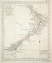

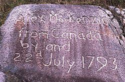
- 1706 - Mikhail Nasedkin reaches Cape LopatkaCape LopatkaCape Lopatka is the southernmost point of Kamchatka Peninsula, Russia, with the rural locality of Semenovka at its southernmost point. Cape Lopatka lies about north of Shumshu, the northernmost island of the Kuril Islands...
and sights ShumshuShumshuShumshu , is the northernmost island of Kuril Islands chain in the Sea of Okhotsk in the northwest Pacific Ocean. The name of the island is derived from the Ainu language meaning “good island”. It is separated from Paramushir by the very narrow Second Kuril Strait in the northeast , its northern...
, northernmost of the Kuril IslandsKuril IslandsThe Kuril Islands , in Russia's Sakhalin Oblast region, form a volcanic archipelago that stretches approximately northeast from Hokkaidō, Japan, to Kamchatka, Russia, separating the Sea of Okhotsk from the North Pacific Ocean. There are 56 islands and many more minor rocks. It consists of Greater...
. - 1710 – Yakov PermyakovYakov PermyakovYakov Permyakov was a Russian seafarer, explorer, merchant, and Cossack.In 1710, while sailing from the Lena River to the Kolyma River, Permyakov observed the silhouette of two unknown island groups in the sea...
discovers Bolshoy Lyakhovsky Island. - 1713 - Ivan Kozyrevsky reaches Shumshu and ParamushirParamushirParamushir , is a volcanic island in the northern portion of Kuril Islands chain in the Sea of Okhotsk in the northwest Pacific Ocean. It is separated from Shumshu by the very narrow Second Kuril Strait in the northeast , from Antsiferov by the Luzhin Strait to the southwest, from Atlasov in the...
. - 1714 – Étienne de Veniard, Sieur de BourgmontÉtienne de Veniard, Sieur de BourgmontÉtienne de Veniard, Sieur de Bourgmont was a French explorer who documented his travels on the Missouri and Platte rivers in North America and made the first European maps of these areas. He wrote two accounts of his travels, which included descriptions of the Native American tribes he encountered...
ascends the Missouri as far as the PlattePlatte RiverThe Platte River is a major river in the state of Nebraska and is about long. Measured to its farthest source via its tributary the North Platte River, it flows for over . The Platte River is a tributary of the Missouri River, which in turn is a tributary of the Mississippi River which flows to...
, becoming the first to enter the present-day NebraskaNebraskaNebraska is a state on the Great Plains of the Midwestern United States. The state's capital is Lincoln and its largest city is Omaha, on the Missouri River....
. - 1720 - Pedro de Villasur travels from Santa Fe, through what is now part of southeastern ColoradoColoradoColorado is a U.S. state that encompasses much of the Rocky Mountains as well as the northeastern portion of the Colorado Plateau and the western edge of the Great Plains...
, to the lower Platte in eastern Nebraska. - 1722 – Jakob RoggeveenJakob RoggeveenJacob Roggeveen was a Dutch explorer who was sent to find Terra Australis, but he instead came across Easter Island...
discovers "Paasch Eiland" (Easter IslandEaster IslandEaster Island is a Polynesian island in the southeastern Pacific Ocean, at the southeasternmost point of the Polynesian triangle. A special territory of Chile that was annexed in 1888, Easter Island is famous for its 887 extant monumental statues, called moai, created by the early Rapanui people...
) and TutuilaTutuilaTutuila is the largest and the main island of American Samoa in the archipelago of Samoan Islands. It is the third largest island in the Samoan Islands chain of the Central Pacific located roughly northeast of Brisbane, Australia and over northeast of Fiji. It contains a large, natural harbor,...
and UpoluUpoluUpolu is an island in Samoa, formed by a massive basaltic shield volcano which rises from the seafloor of the western Pacific Ocean. The island is long, in area, and is the second largest in geographic area as well as the most populated of the Samoan Islands. Upolu is situated to the east of...
. - 1728 - Vitus BeringVitus BeringVitus Jonassen Bering Vitus Jonassen Bering Vitus Jonassen Bering (also, less correNavy]], a captain-komandor known among the Russian sailors as Ivan Ivanovich. He is noted for being the first European to discover Alaska and its Aleutian Islands...
sails through the strait that now bears his name; also discovers and names Saint Lawrence Island. - 1732 - Mikhail GvozdevMikhail GvozdevMikhail Spiridonovich Gvozdev was a Russian military geodesist and a commander of the expedition to northern Alaska in 1732, when Alaskan shore was for the first time sited by Russians....
discovers the "Large Country" (AlaskaAlaskaAlaska is the largest state in the United States by area. It is situated in the northwest extremity of the North American continent, with Canada to the east, the Arctic Ocean to the north, and the Pacific Ocean to the west and south, with Russia further west across the Bering Strait...
). - 1734 - Jean Baptiste de La VérendryeJean Baptiste de La VérendryeJean-Baptiste Gaultier de la Vérendrye was the eldest son of Pierre Gaultier de Varennes et de La Vérendrye and Marie-Anne Dandonneau Du Sablé...
discovers Lake WinnipegLake WinnipegLake Winnipeg is a large, lake in central North America, in the province of Manitoba, Canada, with its southern tip about north of the city of Winnipeg...
. - 1734-37 - Stepan Muravev and Mikhail Pavlov chart the Russian coast from ArkhangelskArkhangelskArkhangelsk , formerly known as Archangel in English, is a city and the administrative center of Arkhangelsk Oblast, Russia. It lies on both banks of the Northern Dvina River near its exit into the White Sea in the north of European Russia. The city spreads for over along the banks of the river...
to just east of the PechoraPechora RiverThe Pechora River is a river in northwest Russia which flows north into the Arctic Ocean on the west side of the Ural Mountains. It lies mostly in the Komi Republic but the northernmost part crosses the Nenets Autonomous Okrug. It is 1,809 km long and its basin is 322,000 square kilometers...
, while Stepan MalyginStepan MalyginStepan Gavrilovich Malygin was a Russian Arctic explorer.In 1711–1717, Stepan Malygin was a student at the Moscow School of Mathematical and Navigational Sciences. After his graduation, Malygin began his career as a naval cadet and was then promoted to the rank of lieutenant four years later...
charts it from there to the Ob River, including the Yamal PeninsulaYamal PeninsulaThe Yamal Peninsula , located in Yamal-Nenets autonomous district of northwest Siberia, Russia, extends roughly 700 km and is bordered principally by the Kara Sea, Baydaratskaya Bay on the west, and by the Gulf of Ob on the east...
. - 1735-36 - Vasili PronchishchevVasili PronchishchevVasili Vasilyevich Pronchishchev was a Russian explorer.In 1718, Vasili Pronchishchev graduated from Moscow School of Mathematics and Navigation and was promoted to naval cadet...
charts the Russian coast from the Lena west to the KhatangaKhatanga RiverThe Khatanga River is a river in Krasnoyarsk Krai in Russia. It begins at the confluence of the rivers Kotuy and Kheta. The Khatanga River is long; the area of its basin is 364,000 km². It flows into the Khatanga Gulf of the Laptev Sea, forming an estuary...
. - 1737 – Dmitry OvtsynDmitry OvtsynDmitry Leontiyevich Ovtsyn was a Russian hydrographer and Arctic explorer.In 1734-1738, Ovtsyn led one of the units of the Second Kamchatka expedition that charted the coastline of the Kara Sea east of the river Ob. In summer of 1737, his unit made its way from Ob to Yenisei and made the first...
charts the Russian coast from the mouth of the Ob to the Yenisei. - 1738 – Pierre de La VérendryePierre Gaultier de Varennes, sieur de La VérendryePierre Gaultier de Varennes, sieur de La Vérendrye was a French Canadian military officer, fur trader and explorer. In the 1730s he and his four sons opened up the area west of Lake Superior and thus began the process that added Western Canada to the original New France in the Saint Lawrence basin...
visits Mandan villages near the site of present-day Bismarck, North DakotaBismarck, North DakotaBismarck is the capital of the U.S. state of North Dakota and the county seat of Burleigh County. It is the second most populous city in North Dakota after Fargo. The city's population was 61,272 at the 2010 census, while its metropolitan population was 108,779...
. - 1738-40 – Fyodor MininFyodor MininFyodor Alekseyevich Minin was a Russian Arctic explorer.In 1730s, Minin participated in the Second Kamchatka expedition. In 1736, he joined the unit led by Dmitry Ovtsyn. In 1738, he was in charge of a group of explorers, that would chart the Arctic Ocean coastline east of the Yenisei river...
charts the Russian coast from the Yenisei to the Pyasina. - 1739 - Jean Bouvet de LozierJean-Baptiste Charles Bouvet de LozierJean Baptiste Charles Bouvet de Lozier was a French sailor, explorer, and governor of the Mascarene Islands.He was orphaned at the age of seven and after having been educated in Paris, he was sent to Saint Malo to study navigation. He became a lieutenant of the French East India Company in 1731...
discovers "Cape Circumcision" (Bouvet IslandBouvet IslandBouvet Island is an uninhabited Antarctic volcanic island in the South Atlantic Ocean, 2,525 km south-southwest of South Africa. It is a dependent territory of Norway and, lying north of 60°S latitude, is not subject to the Antarctic Treaty. The centre of the island is an ice-filled crater of an...
). - 1739-41 – Dmitry LaptevDmitry LaptevDmitry Yakovlevich Laptev was a Russian Arctic explorer and Vice Admiral .Dmitry Laptev was born in the village of Bolotovo, near Velikie Luki, in 1701. Bolotovo was the estate of his father, Yakov Laptev...
charts the Russian coast from the Lena to just east of the Kolyma. - 1741 – Bering sights Mount St. EliasMount Saint EliasMount Saint Elias, also designated Boundary Peak 186, is the second highest mountain in both Canada and the United States, being situated on the Yukon and Alaska border. It lies about southwest of Mount Logan, the highest mountain in Canada. The Canadian side is part of Kluane National Park,...
, the entrance of Prince William SoundPrince William SoundPrince William Sound is a sound off the Gulf of Alaska on the south coast of the U.S. state of Alaska. It is located on the east side of the Kenai Peninsula. Its largest port is Valdez, at the southern terminus of the Trans-Alaska Pipeline System...
, the Alaska PeninsulaAlaska PeninsulaThe Alaska Peninsula is a peninsula extending about to the southwest from the mainland of Alaska and ending in the Aleutian Islands. The peninsula separates the Pacific Ocean from Bristol Bay, an arm of the Bering Sea....
(from Cape Providence to Chignik Bay) and the several of the Aleutian Islands (discovering Great SitkinGreat Sitkin IslandGreat Sitkin Island is a volcanic island in the Andreanof Islands of the Aleutian Islands of Alaska. The island covers a total area of and lies slightly north of a group islands which are located between Adak Island and Atka Island....
, AtkaAtka IslandAtka Island is the largest island in the Andreanof Islands of the Aleutian Islands of Alaska. The island is east of Adak Island. It is long and wide with a land area of , making it the 22nd largest island in the United States. The northeast of Atka Island contains the Korovin volcano which...
, and KiskaKiskaKiska is an island in the Rat Islands group of the Aleutian Islands of Alaska located at . It is about long and varies in width from - Discovery :...
), as well as discovering KayakKayak IslandKayak Island , which includes the Bering Expedition Landing Site, is located in the Gulf of Alaska, 100 km SE of Cordova, Alaska Malaspina Coastal Plain. It has a land area of 73.695 km² and no population....
, MontagueMontague Island (Alaska)Montague Island is an island in the Gulf of Alaska lying at the entrance to Prince William Sound in the state of Alaska, USA. The island has a land area of 790.88 km² , making it the 26th largest island in the United States. As of the 2000 census, Montague did not have a permanent resident...
, HinchinbrookHinchinbrook Island (Alaska)Hinchinbrook Island is an island in the Gulf of Alaska lying at the entrance to Prince William Sound in the state of Alaska, USA. The island has a land area of 171.98 sq mi , making it the 37th largest island in the United States...
, SitkalidakSitkalidak IslandSitkalidak Island is an island the western Gulf of Alaska in the Kodiak Island Borough of the state of Alaska, USA. It lies just off the southeast shore of Kodiak Island, across the Sitkalidak Strait from the city of Old Harbor. The island has a land area of 300.839 km² and no resident...
, and the ShumaginShumagin IslandsThe Shumagin Islands are a group of 20 islands in the Aleutians East Borough south of the mainland of Alaska, USA, at54°54'–55°20' North 159°15'–160°45' West. The largest islands are Unga Island, Popof Island, Korovin Island, and Nagai Island. Other islands include Andronica, Big Koniuji, Little...
and Commander Islands; his second-in-command, Aleksei ChirikovAleksei ChirikovAleksei Ilyich Chirikov was a Russian navigator and captain who along with Bering was the first Russian to reach North-West coast of North America. He discovered and charted some of the Aleutian Islands while he was deputy to Vitus Bering during the Great Northern Expedition.- Life and work :In...
, sights Mounts FairweatherMount FairweatherMount Fairweather , is one of the world's highest coastal mountains at 4,671 metres It is located east of the Pacific Ocean on the border of Alaska, United States and western British Columbia, Canada...
and DouglasMount Douglas (Alaska)Mount Douglas is a stratovolcano located south of Kamishak Bay, near the northeasternmost part of the Alaska Peninsula. It lies in the Katmai National Park and Preserve in Kenai Peninsula Borough. The mountain was officially named in 1906 after nearby Cape Douglas based on a 1904 report by USGS...
and discovers Noyes and Baker IslandBaker Island (Alaska)Baker Island is an island in the Alexander Archipelago of southeastern Alaska, USA. It lies off the central west coast of Prince of Wales Island. Its closest significant island neighbors are Noyes Island to its northwest, Lulu Island directly to its north, and Suemez Island across Bucareli Bay to...
s (both off the west coast of Prince of Wales Island), as well as BaranofBaranof IslandBaranof Island, also sometimes called Baranov Island, Shee or Sitka Island, is an island in the northern Alexander Archipelago in the Alaska Panhandle, in Alaska. The name Baranof was given in 1805 by Imperial Russian Navy captain U. F. Lisianski to honor Alexander Andreyevich Baranov...
, ChichagofChichagof IslandChichagof Island, or Shee Kaax, is an island in the Alexander Archipelago of the Alaska Panhandle. At long and wide, it has a land area of , making it the fifth largest island in the United States and the 109th largest island in the world. It's coastline measures 742 miles. There was a 2000...
, KruzofKruzof IslandKruzof Island is an island in the Alexander Archipelago in southeastern Alaska at . It is about west of Sitka, and is part of the City and Borough of Sitka. It was named in 1805 by Captain U.T. Lisianski as Crooze Island, after a Russian Admiral...
, YakobiYakobi IslandYakobi Island is an island in the Alexander Archipelago of southeastern Alaska, United States. It lies just off the western edge of Chichagof Island, separated from it by Lisianski Inlet and Lisianski Strait...
, KodiakKodiak IslandKodiak Island is a large island on the south coast of the U.S. state of Alaska, separated from the Alaska mainland by the Shelikof Strait. The largest island in the Kodiak Archipelago, Kodiak Island is the second largest island in the United States and the 80th largest island in the world, with an...
, AfognakAfognakAfognak is an island north of Kodiak Island in the U.S. state of Alaska. It is 43 miles from east to west and 23 miles from north to south and has a land area of , making it the 18th largest island in the United States. The coast is split by many long, narrow bays...
, the Aleutian Islands (UmnakUmnakUmnak is one of the Fox Islands of the Aleutian Islands. With of land area, it is the third largest island in the Aleutian archipelago and the 19th largest island in the United States. The island is home to a large volcanic caldera on Mount Okmok and is separated from Unalaska Island by Umnak Pass...
, AdakAdak IslandAdak Island is an island near the western extent of the Andreanof Islands group of the Aleutian Islands in Alaska. Alaska's southernmost town, Adak, is located on the island...
, AgattuAgattuAgattu is an island in the Near Islands in the western end of the Aleutian Islands. With a land area of 221.593 km² Agattu is one of the largest uninhabited islands in the Aleutians. It is the second largest of the Near Islands, after Attu Island. It is volcanic and considerably mountainous...
, AttuAttu IslandAttu is the westernmost and largest island in the Near Islands group of the Aleutian Islands of Alaska, making it the westernmost point of land relative to Alaska and the United States. It was the site of the only World War II land battle fought on the incorporated territory of the United States ,...
, and the Islands of Four MountainsIslands of Four MountainsIslands of Four Mountains is an island grouping of the Aleutian Islands in Alaska, United States. The chain includes, from west to east, Amukta, Chagulak, Yunaska, Herbert, Carlisle, Chuginadak, Uliaga, and Kagamil Islands. This island chain is located between Amukta Pass and the Andreanof Islands...
), and the Kenai PeninsulaKenai PeninsulaThe Kenai Peninsula is a large peninsula jutting from the southern coast of Alaska in the United States. The name Kenai is probably derived from Kenayskaya, the Russian name for Cook Inlet, which borders the peninsula to the west.-Geography:...
. - 1741-42 - Khariton LaptevKhariton LaptevKhariton Prokofievich Laptev was a Russian naval officer and Arctic explorer.Khariton Laptev was born in a gentry family in the village of Pokarevo near Velikiye Luki , just a year before his cousin Dmitry Laptev was born in the nearby village of Bolotovo.Khariton Laptev started his career in the...
and Semion ChelyuskinSemion ChelyuskinSemyon Ivanovich Chelyuskin was a Russian polar explorer and naval officer.Chelyuskin graduated from the Navigation School in Moscow. He first became a deputy navigator while serving in the Baltic Fleet and later promoted to navigator . Chelyuskin was chosen for the Second Kamchatka Expedition,...
chart the Taymyr PeninsulaTaymyr PeninsulaThe Taymyr Peninsula is a peninsula in the Far North of Russia, in the Siberian Federal District, that forms the northernmost part of mainland Eurasia and Asia...
, with the latter reaching Cape ChelyuskinCape ChelyuskinCape Chelyuskin is the northernmost point of the Eurasian continent , and the northernmost point of mainland Russia. It is situated at the tip of the Taymyr Peninsula, south of Severnaya Zemlya archipelago, in Krasnoyarsk Krai, Russia...
, the northernmost point of Asia. - 1742 - Christopher MiddletonChristopher Middleton (navigator)Christopher Middleton was an English naval officer and navigator. He was elected a Fellow of the Royal Society on 7 April 1737....
discovers Wager BayWager BayWager Bay is a waterway in Kivalliq Region, Nunavut, Canada. It is located in Hudson Bay. Ukkusiksalik National Park surrounds it.Wager Bay was first charted by Christopher Middleton during his Arctic explorations of 1742....
and Repulse BayRepulse Bay, NunavutRepulse Bay is an Inuit hamlet located on the shore of Hudson Bay, Kivalliq Region, in Nunavut, Canada.-Location and wildlife:The hamlet is located exactly on the Arctic Circle, on the north shore of Repulse Bay and on the south shore of the Rae Isthmus. Transport to the community is provided...
. - 1742-43 – Louis-Joseph Gaultier de La VérendryeLouis-Joseph Gaultier de La VérendryeLouis-Joseph Gaultier de La Vérendrye was a French Canadian fur trader and explorer who took part in extending these activities westerly from the Great Lakes during the eighteenth century, an enterprise for which he and other members of his family were largely responsible...
and his brother FrançoisFrançois de La VérendryeFrançois de La Vérendrye was the third son of Pierre Gaultier de Varennes et de la Vérendrye. He was born at Sorel, New France in 1715 and was active in his father's trade activities from Fort Kaministiquia to the North Saskatchewan River.In 1738 he was part of his father's expedition to Mandan...
reach the Big Horn MountainsBig Horn MountainsThe Big Horn Mountains are a mountain range in northern Wyoming and southern Montana in the United States, forming a northwest-trending spur from the Rocky Mountains extending approximately 200 miles northward on the Great Plains...
of modern WyomingWyomingWyoming is a state in the mountain region of the Western United States. The western two thirds of the state is covered mostly with the mountain ranges and rangelands in the foothills of the Eastern Rocky Mountains, while the eastern third of the state is high elevation prairie known as the High...
; on their return they reach the vicinity of present-day Pierre, South DakotaPierre, South DakotaPierre is the capital of the U.S. state of South Dakota and the county seat of Hughes County. The population was 13,646 at the 2010 census, making it the second least populous state capital after Montpelier, Vermont...
. - 1747 - Jeremiah Westall discovers Chesterfield InletChesterfield InletChesterfield Inlet is an inlet in Kivalliq Region, Nunavut, Canada. It is an arm of northwestern Hudson Bay, and the end point of the Thelon River after its passage through Baker Lake. Cross Bay, a large widening of the inlet, occurs east of Baker Lake...
and sails about sixty miles up it. - 1761-62 - William Christopher sails 370 kilometres (229.9 mi) Chesterfield Inlet to the western end of Baker LakeBaker Lake, NunavutBaker Lake , is a hamlet in the Kivalliq Region, in Nunavut on mainland Canada. Located inland from Hudson Bay, it is near the nation's geographical centre, and is notable for being the Canadian Arctic's sole inland community...
. - 1767 - Samuel WallisSamuel WallisSamuel Wallis was a Cornish navigator who circumnavigated the world.Wallis was born near Camelford, Cornwall. In 1766 he was given the command of HMS Dolphin to circumnavigate the world, accompanied by the Swallow under the command of Philip Carteret...
discovers "King George's Land" (TahitiTahitiTahiti is the largest island in the Windward group of French Polynesia, located in the archipelago of the Society Islands in the southern Pacific Ocean. It is the economic, cultural and political centre of French Polynesia. The island was formed from volcanic activity and is high and mountainous...
). - 1769 - José Ortega discovers San Francisco BaySan Francisco BaySan Francisco Bay is a shallow, productive estuary through which water draining from approximately forty percent of California, flowing in the Sacramento and San Joaquin rivers from the Sierra Nevada mountains, enters the Pacific Ocean...
. - 1769-70 - James CookJames CookCaptain James Cook, FRS, RN was a British explorer, navigator and cartographer who ultimately rose to the rank of captain in the Royal Navy...
circumnavigates both islands of New Zealand, proving they aren't part of Terra Australis Incognita; also discovers the east coast of Australia from Cape HoweCape HoweCape Howe is a coastal headland in Australia, forming the south-eastern end of the Black-Allen Line, the border between New South Wales and Victoria.-History:...
to Cape YorkCape York PeninsulaCape York Peninsula is a large remote peninsula located in Far North Queensland at the tip of the state of Queensland, Australia, the largest unspoilt wilderness in northern Australia and one of the last remaining wilderness areas on Earth...
. - 1771-72 - Samuel HearneSamuel HearneSamuel Hearne was a an English explorer, fur-trader, author, and naturalist. He was the first European to make an overland excursion across northern Canada to the Arctic Ocean, actually Coronation Gulf, via the Coppermine River...
reaches the CoppermineCoppermine RiverThe Coppermine River is a river in the North Slave and Kitikmeot regions of the Northwest Territories and Nunavut in Canada. It is long. It rises in Lac de Gras, a small lake near Great Slave Lake and flows generally north to Coronation Gulf, an arm of the Arctic Ocean...
, descending it to what would become known as Coronation GulfCoronation GulfCoronation Gulf lies between Victoria Island and mainland Nunavut in Canada. To the northwest it connects with Dolphin and Union Strait and thence the Beaufort Sea and Arctic Ocean; to the northeast it connects with Dease Strait and thence Queen Maud Gulf. To the southeast lies Bathurst...
; the following year, on his way back, he becomes the first to sight and cross Great Slave LakeGreat Slave LakeGreat Slave Lake is the second-largest lake in the Northwest Territories of Canada , the deepest lake in North America at , and the ninth-largest lake in the world. It is long and wide. It covers an area of in the southern part of the territory. Its given volume ranges from to and up to ...
. - 1772 - Yves-Joseph de Kerguelen-TrémarecYves-Joseph de Kerguelen-TrémarecYves-Joseph de Kerguelen-Trémarec was a Breton explorer and French naval officer.- Early life:He was born in Landudal, Finistère. During the Seven Years' War, Kerguelen-Trémarec was a privateer, but without much success....
discovers the Kerguelen IslandsKerguelen IslandsThe Kerguelen Islands , also known as the Desolation Islands, are a group of islands in the southern Indian Ocean constituting the emerged part of the otherwise submerged Kerguelen Plateau. The islands, along with Adélie Land, the Crozet Islands and the Amsterdam and Saint Paul Islands are part of...
. - 1772 – Pedro FagesPedro FagesPere Fages Beleta , nicknamed L'Ós , was a soldier, explorer, and the second Spanish military Governor of Las Californias Province of New Spain from 1770 to 1774, and the Governor of Las Californias from 1782 to 1791.-Life:...
sights the Sierra Nevada. - 1773 – Ivan LyakhovIvan LyakhovIvan Lyakhov , died around 1800, was a Russian merchant who explored large sections of the New Siberian Islands in the 18th century.Lyakhov began his explorations in the spring of 1770 on dogsleds in order to explore the islands off the northern Siberian coast reported by Yakov Permyakov and...
reaches Kotelny Island. - 1773-75 – Cook is the first to cross the Antarctic CircleAntarctic CircleThe Antarctic Circle is one of the five major circles of latitude that mark maps of the Earth. For 2011, it is the parallel of latitude that runs south of the Equator.-Description:...
, reaching 71° 10’ S, thus finally disproving the existence of Terra Australis Incognita; also discovers New CaledoniaNew CaledoniaNew Caledonia is a special collectivity of France located in the southwest Pacific Ocean, east of Australia and about from Metropolitan France. The archipelago, part of the Melanesia subregion, includes the main island of Grande Terre, the Loyalty Islands, the Belep archipelago, the Isle of...
and the South Sandwich Islands. - 1774 - Juan José Pérez HernándezJuan José Pérez HernándezJuan José Pérez Hernández , often simply Juan Pérez, was an 18th century Spanish explorer. He was the first European to sight, examine, name, and record the islands near present-day British Columbia, Canada...
explores the western coast of North AmericaNorth AmericaNorth America is a continent wholly within the Northern Hemisphere and almost wholly within the Western Hemisphere. It is also considered a northern subcontinent of the Americas...
from Cape MendocinoCape MendocinoCape Mendocino located on the Lost Coast entirely within Humboldt County, California, USA, is the westernmost point on the coast of California. It has been a landmark since the 16th century when the Manila Galleons would reach the coast here following the prevailing westerlies all the way across...
northwards, discovering the Queen Charlotte IslandsQueen Charlotte IslandsHaida Gwaii , formerly the Queen Charlotte Islands, is an archipelago on the North Coast of British Columbia, Canada. Haida Gwaii consists of two main islands: Graham Island in the north, and Moresby Island in the south, along with approximately 150 smaller islands with a total landmass of...
, Vancouver IslandVancouver IslandVancouver Island is a large island in British Columbia, Canada. It is one of several North American locations named after George Vancouver, the British Royal Navy officer who explored the Pacific Northwest coast of North America between 1791 and 1794...
, and Dall IslandDall IslandDall Island is an island in the Alexander Archipelago off the southeast coast of Alaska, just west of Prince of Wales Island and north of Canadian waters. Its peak elevation is 2,443 feet above sea level. Its land area is 254.02 square miles , making it the 28th largest island in the United States...
. - 1775 - Bruno de HecetaBruno de HecetaBruno de Heceta y Dudagoitia was a Spanish Basque explorer of the Pacific Northwest. Born in Bilbao of an old Basque family, he was sent by the Viceroy of New Spain, Antonio María Bucareli y Ursúa, to explore the area north of Alta California in response to information that there were colonial...
discovers the mouth of the Columbia RiverColumbia RiverThe Columbia River is the largest river in the Pacific Northwest region of North America. The river rises in the Rocky Mountains of British Columbia, Canada, flows northwest and then south into the U.S. state of Washington, then turns west to form most of the border between Washington and the state...
; his consort Juan Francisco de la Bodega y QuadraJuan Francisco de la Bodega y QuadraJuan Francisco de la Bodega y Quadra was a Spanish naval officer born in Lima, Peru. Assigned to the Pacific coast Spanish Naval Department base at San Blas, in the Viceroyalty of New Spain , this navigator explored the Northwest Coast of North America as far north as present day Alaska.Juan...
discovers Prince of Wales Island (Bucareli BayBucareli BayBucareli Bay is a bay in the Alexander Archipelago, in the southeastern part of the U.S. state of Alaska. It is located off the western coast of Prince of Wales Island, between Baker Island and Suemez Island. To the east it connects to various waterways, such as San Alberto Bay. To the west it...
). - 1776 - Francisco Atanasio Domínguez and Silvestre Vélez de Escalante follow the Rio Grande north to the modern state of ColoradoColoradoColorado is a U.S. state that encompasses much of the Rocky Mountains as well as the northeastern portion of the Colorado Plateau and the western edge of the Great Plains...
, where they travel west, discovering Utah LakeUtah LakeUtah Lake is a freshwater lake in the U.S. state of Utah. On the western side of Utah Valley, the lake is overlooked by Mount Timpanogos and Mount Nebo. The lake's only river outlet, the Jordan River, is a tributary of the Great Salt Lake and is highly regulated with pumps. Evaporation accounts...
. - 1777-78 - Cook discovers Christmas IslandKiritimatiKiritimati or Christmas Island is a Pacific Ocean raised coral atoll in the northern Line Islands, and part of the Republic of Kiribati....
and HawaiiHawaiiHawaii is the newest of the 50 U.S. states , and is the only U.S. state made up entirely of islands. It is the northernmost island group in Polynesia, occupying most of an archipelago in the central Pacific Ocean, southwest of the continental United States, southeast of Japan, and northeast of...
; also explores the Alaskan coast as far north as Icy CapeIcy Cape, AlaskaThe Icy Cape is a headland on the Chukchi Sea side of the North Slope Borough, Alaska, United States. It was discovered and named by James Cook on August 17, 1778....
, discovering Cook InletCook InletCook Inlet stretches from the Gulf of Alaska to Anchorage in south-central Alaska. Cook Inlet branches into the Knik Arm and Turnagain Arm at its northern end, almost surrounding Anchorage....
and Prince William SoundPrince William SoundPrince William Sound is a sound off the Gulf of Alaska on the south coast of the U.S. state of Alaska. It is located on the east side of the Kenai Peninsula. Its largest port is Valdez, at the southern terminus of the Trans-Alaska Pipeline System...
. - 1787 - Charles William BarkleyCharles William BarkleyCharles William Barkley was a ship captain and maritime fur trader. He was born in Hertford, England, son of Charles Barkley....
discovers the Strait of Juan de FucaStrait of Juan de FucaThe Strait of Juan de Fuca is a large body of water about long that is the Salish Sea outlet to the Pacific Ocean...
. - 1789 - Alexander Mackenzie descends the Mackenzie RiverMackenzie RiverThe Mackenzie River is the largest river system in Canada. It flows through a vast, isolated region of forest and tundra entirely within the country's Northwest Territories, although its many tributaries reach into four other Canadian provinces and territories...
to its mouth in the Arctic OceanArctic OceanThe Arctic Ocean, located in the Northern Hemisphere and mostly in the Arctic north polar region, is the smallest and shallowest of the world's five major oceanic divisions...
. - 1791 - Francisco de ElizaFrancisco de ElizaFrancisco de Eliza y Reventa was a Spanish naval officer, navigator, and explorer. He is remembered mainly for his work in the Pacific Northwest...
discovers the "Canal de Nuestra Señora del Rosario" (Strait of GeorgiaStrait of GeorgiaThe Strait of Georgia or the Georgia Strait is a strait between Vancouver Island and the mainland coast of British Columbia, Canada. It is approximately long and varies in width from...
); José María NarváezJosé María NarváezJosé María Narváez was a Spanish naval officer, explorer, and navigator notable for his work in the Pacific Northwest of present-day Canada. In 1791, as commander of the schooner Santa Saturnina, he led the first European exploration of the Strait of Georgia, including a landing on present-day...
explores up it, passing the mouth of the Fraser RiverFraser RiverThe Fraser River is the longest river within British Columbia, Canada, rising at Fraser Pass near Mount Robson in the Rocky Mountains and flowing for , into the Strait of Georgia at the city of Vancouver. It is the tenth longest river in Canada...
and reaching as far north as Texada IslandTexada IslandTexada Island is the largest island in the Strait of Georgia of British Columbia, Canada. Its northern tip is located about southwest of the city of Powell River and west of the Sechelt Peninsula on the Sunshine Coast. A former mining and logging area, the island still has a few quarries and old...
. - 1791-94 – George VancouverGeorge VancouverCaptain George Vancouver RN was an English officer of the British Royal Navy, best known for his 1791-95 expedition, which explored and charted North America's northwestern Pacific Coast regions, including the coasts of contemporary Alaska, British Columbia, Washington and Oregon...
, together with William BroughtonWilliam Robert BroughtonWilliam Robert Broughton was a British naval officer in the late 18th century. As a Lieutenant in the Royal Navy, he commanded HMS Chatham as part of the Vancouver Expedition, a voyage of exploration through the Pacific Ocean led by Captain George Vancouver in the early 1790s.-With Vancouver:In...
, Peter PugetPeter PugetPeter Puget was an officer in the Royal Navy, best known for his exploration of Puget Sound.-Mr. Midshipman Puget:Puget's ancestors had fled France for Britain during Louis XIV's persecution of the Huguenots. His father, John, was a successful merchant and banker, but died in 1767, leaving Puget's...
, Joseph WhidbeyJoseph WhidbeyJoseph Whidbey was a member of the Royal Navy who served on the Vancouver Expedition 1791–1795, and later achieved renown as a naval engineer. He is notable for having been the first European to discover and chart Admiralty Island in the Alexander Archipelago in 1794.Little is recorded of...
, and James JohnstoneJames Johnstone (explorer)James Johnstone was a British naval officer and explorer. He is noted for having served as sailing master of the armed tender HMS Chatham and later acting lieutenant during George Vancouver’s 1791-95 expedition to the Pacific Northwest...
, charts the modern states of OregonOregonOregon is a state in the Pacific Northwest region of the United States. It is located on the Pacific coast, with Washington to the north, California to the south, Nevada on the southeast and Idaho to the east. The Columbia and Snake rivers delineate much of Oregon's northern and eastern...
and Washington, the coast of British ColumbiaBritish ColumbiaBritish Columbia is the westernmost of Canada's provinces and is known for its natural beauty, as reflected in its Latin motto, Splendor sine occasu . Its name was chosen by Queen Victoria in 1858...
, and the Alaska PanhandleAlaska PanhandleSoutheast Alaska, sometimes referred to as the Alaska Panhandle, is the southeastern portion of the U.S. state of Alaska, which lies west of the northern half of the Canadian province of British Columbia. The majority of Southeast Alaska's area is part of the Tongass National Forest, the United...
, discovering AdmiraltyAdmiralty IslandAdmiralty Island is an island in the Alexander Archipelago in Southeast Alaska, at . It is 145 km long and 56 km wide with an area of 4,264.1 km² , making it the seventh largest island in the United States and the 132nd largest island in the world. It is one of the...
, MitkofMitkof IslandMitkof Island is an island in the Alexander Archipelago in southeast Alaska, at . between Kupreanof Island to the west and the Alaska mainland to the east. It is about wide and long with a land area of , making it the 30th largest island in the United States.The island is relatively flat with...
and Wrangell IslandWrangell IslandWrangell Island is in the Alexander Archipelago in the Alaska Panhandle of southeastern Alaska. It is long and 8–23 km wide. It has a land area of , making it the 29th largest island in the United States...
s in the Alexander ArchipelagoAlexander ArchipelagoThe Alexander Archipelago is a long archipelago, or group of islands, of North America off the southeastern coast of Alaska. It contains about 1,100 islands, which are the tops of the submerged coastal mountains that rise steeply from the Pacific Ocean. Deep channels and fjords separate the...
, as well as proving the insularity of KuiuKuiu IslandKuiu Island is an island in the Alexander Archipelago in southeastern Alaska. It lies between Kupreanof Island, to its east, and Baranof Island, to its west. The island is long, and 10–23 km wide. It is nearly cut in two by Affleck Canal. It has of land area, making it the 15th largest...
and Revillagigedo IslandRevillagigedo IslandRevillagigedo Island is an island in the Alexander Archipelago in Ketchikan Gateway Borough of the southeastern region of the U.S. state of Alaska. Running about 89 km north-south and 48 km east-west, it is 2,754.835 km² in area, making it the 12th largest island in the United...
s; also charts Admiralty InletAdmiralty InletAdmiralty Inlet is a strait in the U.S. state of Washington connecting the eastern end of the Strait of Juan de Fuca to Puget Sound. It lies between Whidbey Island and the northeastern part of the Olympic Peninsula....
and Puget SoundPuget SoundPuget Sound is a sound in the U.S. state of Washington. It is a complex estuarine system of interconnected marine waterways and basins, with one major and one minor connection to the Strait of Juan de Fuca and the Pacific Ocean — Admiralty Inlet being the major connection and...
and discovers the Chatham IslandsChatham IslandsThe Chatham Islands are an archipelago and New Zealand territory in the Pacific Ocean consisting of about ten islands within a radius, the largest of which are Chatham Island and Pitt Island. Their name in the indigenous language, Moriori, means Misty Sun...
and The Snares. - 1792 - Dionisio Alcalá GalianoDionisio Alcalá GalianoDionisio Alcalá Galiano was a Spanish naval officer, cartographer, and explorer. He mapped various coastlines in Europe and the Americas with unprecedented accuracy, using new technology such as chronometers...
and Cayetano Valdés y FloresCayetano Valdés y FloresCayetano Valdés y Flores Bazán was a commander of the Spanish Navy, explorer, and captain general who served in the French Revolutionary and Napoleonic Wars, fighting for both sides at different times due to the changing fortunes of Spain in the conflict...
circumnavigate Vancouver Island, proving its insularity. - 1792 – Jacinto CaamañoJacinto CaamañoJacinto Caamaño Moraleja was the leader of the last great Spanish exploration of Alaska and the Coast of British Columbia. He was a Knight of the Military Order of Calatrava. Born in Madrid, he came from an aristocratic Galician family, whose homestead was near Santiago de Compostela...
enters Clarence StraitClarence StraitClarence Strait, originally Duke of Clarence Strait, is a strait in southeastern Alaska, in the United States in the Alexander Archipelago. The strait separates Prince of Wales Island, on the west side, from Revillagigedo Island and Annette Island, on the east side...
, showing that much of the Alaska Panhandle is an archipelago, not mainland, as had been presumed; also sights the southwest coast of Revillagigedo Island. - 1792-93 – Mackenzie ascends the PeacePeace River (Canada)The Peace River is a river in Canada that originates in the Rocky Mountains of northern British Columbia and flows to the northeast through northern Alberta. The Peace River flows into the Slave River, a tributary of the Mackenzie River. The Mackenzie is the 12th longest river in the world,...
and ParsnipParsnip RiverThe Parsnip River is a 240 km long river in central British Columbia, Canada. It flows generally north-westward from the Parsnip Glacier in the Hart Ranges to the Parsnip Reach of Williston Lake, formed by the impounding of the waters of the Peace River by the W.A.C. Bennett Dam in 1968...
, crosses the Canadian RockiesCanadian RockiesThe Canadian Rockies comprise the Canadian segment of the North American Rocky Mountains range. They are the eastern part of the Canadian Cordillera, extending from the Interior Plains of Alberta to the Rocky Mountain Trench of British Columbia. The southern end borders Idaho and Montana of the USA...
to the headwaters of the FraserFraser RiverThe Fraser River is the longest river within British Columbia, Canada, rising at Fraser Pass near Mount Robson in the Rocky Mountains and flowing for , into the Strait of Georgia at the city of Vancouver. It is the tenth longest river in Canada...
, ascends the West Road RiverWest Road RiverThe West Road River or Blackwater River is a major tributary of the Fraser River, flowing generally north-eastward from the northern slopes of the Ilgachuz Range and across the Fraser Plateau in the Chilcotin region of central British Columbia, Canada...
and crosses the Coast MountainsCoast MountainsThe Coast Mountains are a major mountain range, in the Pacific Coast Ranges, of western North America, extending from southwestern Yukon through the Alaska Panhandle and virtually all of the Coast of British Columbia. They are so-named because of their proximity to the sea coast, and are often...
, reaching the Bella CoolaBella Coola RiverThe Bella Coola River is a major river on the Pacific slope of the Coast Mountains in southern British Columbia. The town of Bella Coola, which is the historic and ancient capital of the Nuxalk people, is at its mouth on North Bentinck Arm...
, which he descends to North Bentinck ArmNorth Bentinck ArmNorth Bentinck Arm is short inlet about in length in the Central Coast region of British Columbia, Canada. It is a sidewater of Burke Channel and is linked via that waterway and Labouchere Channel to Dean Channel, which is one of the largest inlets of the BC Coast.A spot on North Bentinck Arm is...
and Dean ChannelDean ChannelDean Channel is the upper end of one of the longest inlets of the British Columbia Coast, from its head at the mouth of the Kimsquit River. The Dean River, one of the main rivers of the Coast Mountains, enters Dean Channel about below the head of the inlet, at the community of...
. - 1796 – Mungo ParkMungo Park (explorer)Mungo Park was a Scottish explorer of the African continent. He was credited as being the first Westerner to encounter the Niger River.-Early life:...
reaches the upper NigerNiger RiverThe Niger River is the principal river of western Africa, extending about . Its drainage basin is in area. Its source is in the Guinea Highlands in southeastern Guinea...
, exploring it from SégouSégouSégou is a city in south-central Mali, lying northeast of Bamako on the River Niger, in the region of Ségou. It was founded by the Bozo people, on a site about from the present town...
to SillaSilla, MaliSilla is an ancient city of Mali. It was settled in about the 10th Century AD to focus on the trans-Saharan trade.-Sources:*Barry, Boubacar. Senegambia and the Atlantic Slave Trade, p. 6...
. - 1797-98 - George BassGeorge BassGeorge Bass was a British naval surgeon and explorer of Australia.-Early years:He was born on 30 January 1771 at Aswarby, a hamlet near Sleaford, Lincolnshire, the son of a tenant farmer, George Bass, and a local beauty named Sarah Nee Newman. His father died in 1777 when Bass was 6...
explores from Cape Howe to Western PortWestern PortWestern Port, is sometimes called "Western Port Bay", is a large tidal bay in southern Victoria, Australia opening into Bass Strait. It is the second largest bay in Victoria. Geographically, it is dominated by the two large islands; French Island and Phillip Island. Contrary to its name, it lies to...
, discovering Bass StraitBass StraitBass Strait is a sea strait separating Tasmania from the south of the Australian mainland, specifically the state of Victoria.-Extent:The International Hydrographic Organization defines the limits of the Bass Strait as follows:...
. - 1798 – John FearnJohn FearnJohn Fearn was a British Royal Navy officer, ship captain and explorer. Fearn became famous for being the first European to land on the Pacific island of Nauru, which is now a sovereign republic....
discovers “Pleasant Island” (NauruNauruNauru , officially the Republic of Nauru and formerly known as Pleasant Island, is an island country in Micronesia in the South Pacific. Its nearest neighbour is Banaba Island in Kiribati, to the east. Nauru is the world's smallest republic, covering just...
). - 1798 – Francisco de LacerdaFrancisco de LacerdaDr Francisco José Maria de Lacerda was a Portuguese explorer in the 18th century. He led an expedition to the Kazembe region of Zambia in 1798. After his death on this mission, the group was led by Francisco Pinto.-External links:*...
travels from Tete northwest to Lake MweruLake MweruLake Mweru is a freshwater lake on the longest arm of Africa's second-longest river, the Congo. Located on the border between Zambia and Democratic Republic of the Congo, it makes up 110 km of the total length of the Congo, lying between its Luapula River and Luvua River segments.Mweru...
. - 1798-99 - Matthew FlindersMatthew FlindersCaptain Matthew Flinders RN was one of the most successful navigators and cartographers of his age. In a career that spanned just over twenty years, he sailed with Captain William Bligh, circumnavigated Australia and encouraged the use of that name for the continent, which had previously been...
and George Bass circumnavigate Tasmania, proving its insularity.
Nineteenth century

- 1800 - James GrantJames Grant (navigator)James Grant was a British Royal Navy officer and navigator in the early nineteenth century. He made several voyages to Australia and Tasmania, and was the first to map parts of the south coast of Australia.-Early life:...
discovers the Australian coastline from Cape Banks to Cape OtwayCape OtwayCape Otway is a cape in south Victoria, Australia on the Great Ocean Road; much of the area is enclosed in the Otway National Park.-History:...
. - c. 1801-04 – A fur trading post is built on Great Bear LakeGreat Bear LakeGreat Bear Lake is the largest lake entirely within Canada , the third or fourth largest in North America, and the seventh or eighth largest in the world...
. - 1802 - John MurrayJohn Murray (Australian explorer)John Murray was a seaman and explorer of Australia. He was the first European to discover Port Phillip, the bay on which the cities of Melbourne and Geelong are situated....
discovers Port Phillip Bay. - 1802 - Matthew Flinders explores the coast from Fowlers BayFowlers Bay, South AustraliaFowlers Bay, formerly Yalata, is a small coastal town in South Australia, located approximately north west of the state capital, Adelaide. Situated on the Nullarbor Plain, it was once an active port and a gateway to the western reaches of the continent, but fell into decline in the 1960s...
to Encounter BayEncounter BayEncounter Bay is located on the south central coast of South Australia, some 100 km south of Adelaide, South Australia. It is named after the encounter on 8 April 1802 between Matthew Flinders and Nicolas Baudin, both of whom were charting the Australian coastline for their respective countries...
, discovering Spencer GulfSpencer GulfThe Spencer Gulf is the westernmost of two large inlets on the southern coast of Australia, in the state of South Australia, facing the Great Australian Bight. The Gulf is 322 km long and 129 km wide at its mouth. The western shore of the Gulf is the Eyre Peninsula, while the eastern side is the...
, Kangaroo IslandKangaroo IslandKangaroo Island is Australia's third-largest island after Tasmania and Melville Island. It is southwest of Adelaide at the entrance of Gulf St Vincent. Its closest point to the mainland is off Cape Jervis, on the tip of the Fleurieu Peninsula in the state of South Australia. The island is long...
, and Gulf St. Vincent. - 1802 - Nicolas BaudinNicolas BaudinNicolas-Thomas Baudin was a French explorer, cartographer, naturalist and hydrographer.Baudin was born a commoner in Saint-Martin-de-Ré on the Île de Ré. At the age of fifteen he joined the merchant navy, and at twenty joined the French East India Company...
explores the coast from Cape Banks to Encounter Bay, where he meets Flinders. - 1802-03 - Flinders circumnavigates Australia.
- 1805-06 – Meriwether LewisMeriwether LewisMeriwether Lewis was an American explorer, soldier, and public administrator, best known for his role as the leader of the Lewis and Clark Expedition also known as the Corps of Discovery, with William Clark...
and William Clark, from Fort MandanFort MandanFort Mandan was the name of the encampment at which the Lewis and Clark Expedition wintered in 1804-1805. The encampment was located on the Missouri River approximately twelve miles from Washburn, North Dakota, though the precise location is not known for certain and may be under the nearby...
, ascend the Missouri to its headwaters, cross the Continental Divide via Lemhi PassLemhi PassLemhi Pass is a high mountain pass in the Beaverhead Mountains, part of the Bitterroot Range in the Rocky Mountains The pass lies on the Montana-Idaho border on the continental divide, at an elevation of 7373 feet above sea level.-History:...
in the Bitterroot RangeBitterroot RangeThe Bitterroot Range runs along the border of Montana and Idaho in the northwestern United States. The range spans an area of 62,736 square kilometers and is named after the bitterroot , a small pink flower that is the state flower of Montana.- History :In 1805, the Corps of Discovery,...
to enter the present state of IdahoIdahoIdaho is a state in the Rocky Mountain area of the United States. The state's largest city and capital is Boise. Residents are called "Idahoans". Idaho was admitted to the Union on July 3, 1890, as the 43rd state....
, and descend the ClearwaterClearwater River (Idaho)The Clearwater River is a river in north central Idaho, which flows westward from the Bitterroot Mountains along the Idaho-Montana border, and joins the Snake River at Lewiston. In October 1805, the Lewis and Clark Expedition descended the Clearwater River in dugout canoes, putting in at "Canoe...
and Snake riverSnake RiverThe Snake is a major river of the greater Pacific Northwest in the United States. At long, it is the largest tributary of the Columbia River, the largest North American river that empties into the Pacific Ocean...
s to the Columbia, which they descend to its mouth; on the way back Lewis explores the BlackfootBlackfoot River (Montana)The Blackfoot River, sometimes called the Big Blackfoot River to distinguish it from the Little Blackfoot River, is a snow-fed and spring-fed river in western Montana. The Blackfoot River begins in Lewis and Clark County at the Continental Divide, 10 miles northeast of the town of Lincoln...
and Sun riverSun RiverThe Sun River is a tributary of the Missouri River in the Great Plains, approximately 130 mi long, in Montana in the United States....
s, as well as the headwaters of the MariasMarias RiverThe Marias River is a tributary of the Missouri River, approximately 210 mi long, in the U.S. state of Montana. It is formed in the Blackfeet Indian Reservation in Glacier County, in northwestern Montana, by the confluence of the Cut Bank Creek and the Two Medicine River...
, while Clark travels through Bozeman PassBozeman PassBozeman Pass is a mountain pass situated approximately 13 miles east of the town of Bozeman, Montana and approximately 15 miles west of the town of Livingston, Montana, and between the Bridger and Gallatin mountain ranges....
and descends the YellowstoneYellowstone RiverThe Yellowstone River is a tributary of the Missouri River, approximately long, in the western United States. Considered the principal tributary of the upper Missouri, the river and its tributaries drain a wide area stretching from the Rocky Mountains in the vicinity of the Yellowstone National...
to its confluence with the Missouri. - 1805-06 – Mungo Park descends the Niger as far as the Bussa rapids, where he is drowned.
- 1806 – Yakov SannikovYakov SannikovYakov Sannikov was a Russian merchant and explorer of the New Siberian Islands.In 1800, Sannikov discovered and charted Stolbovoy Island, and in 1805 Faddeyevsky Island. In 1809-1810, he took part in the expedition led by Matvei Gedenschtrom. In 1810, Sannikov crossed the island of New Siberia...
discovers New Siberia IslandNew SiberiaNew Siberia is the easternmost of the Anzhu Islands, the northern subgroup of the New Siberian Islands lying between the Laptev Sea and East Siberian Sea. Its area of approximately 6,200 km² places it just outside the 100 largest islands in the world. New Siberia Island is low lying, rising...
. - 1806 - Abraham BristowAbraham BristowAbraham Bristow was a British sealer and whaler. It is documented that he started his career in 1797. In August 1806 he discovered the Auckland Islands.-References:* // Notes and Queries , 17 : 369-371....
discovers the Auckland IslandsAuckland IslandsThe Auckland Islands are an archipelago of the New Zealand Sub-Antarctic Islands and include Auckland Island, Adams Island, Enderby Island, Disappointment Island, Ewing Island, Rose Island, Dundas Island and Green Island, with a combined area of...
. - 1808 - Simon FraserSimon Fraser (explorer)Simon Fraser was a fur trader and an explorer who charted much of what is now the Canadian province of British Columbia. Fraser was employed by the Montreal-based North West Company. By 1805, he had been put in charge of all the company's operations west of the Rocky Mountains...
descends the Fraser RiverFraser RiverThe Fraser River is the longest river within British Columbia, Canada, rising at Fraser Pass near Mount Robson in the Rocky Mountains and flowing for , into the Strait of Georgia at the city of Vancouver. It is the tenth longest river in Canada...
for some 800 kilometres (497.1 mi) to its mouth, reaching the Strait of Georgia. - 1810 - Frederick HasselboroughFrederick HasselboroughFrederick Hasselborough polar explorer , whose surname is also spelled Hasselburgh and Hasselburg, was an Australian sealer from Sydney who discovered Campbell and Macquarie Islands .-References:...
discovers CampbellCampbell Island, New ZealandCampbell Island is a remote, subantarctic island of New Zealand and the main island of the Campbell Island group. It covers of the group's , and is surrounded by numerous stacks, rocks and islets like Dent Island, Folly Island , Isle de Jeanette Marie, and Jacquemart Island, the latter being the...
and Macquarie IslandMacquarie IslandMacquarie Island lies in the southwest corner of the Pacific Ocean, about half-way between New Zealand and Antarctica, at 54°30S, 158°57E. Politically, it has formed part of the Australian state of Tasmania since 1900 and became a Tasmanian State Reserve in 1978. In 1997 it became a world heritage...
s. - 1811-12 – Wilson Price HuntW. Price HuntWilliam or Wilson Price Hunt was an early pioneer of the Oregon Country in the Pacific Northwest of North America. An American and an employee of John Jacob Astor, Hunt used information supplied by the Lewis and Clark Expedition to lead the portion of the Astor Expedition that traveled to Oregon...
discovers Union PassUnion PassUnion Pass is a high mountain pass in the Wind River Range of western Wyoming in the United States. The pass is located on the Continental Divide between the Gros Ventre mountains on the west and the Wind River Range on the east. The pass was historically used by Native Americans and early...
in the Wind River RangeWind River RangeThe Wind River Range , is a mountain range of the Rocky Mountains in western Wyoming in the United States. The range runs roughly NW-SE for approximately 100 miles . The Continental Divide follows the crest of the range and includes Gannett Peak, which at 13,804 feet , is the highest peak...
and reaches the upper Snake River, while Robert StuartRobert Stuart (explorer)Robert Stuart was the son of Charles Stuart, a partner of John Jacob Astor who as one of the North West Company men, or Nor'westers, enlisted by Astor to help him found his intended fur empire...
discovers South PassSouth PassSouth Pass is two mountain passes on the Continental Divide in the Rocky Mountains in southwestern Wyoming. The passes are located in a broad low region, 35 miles broad, between the Wind River Range to the north and the Oregon Buttes and Great Divide Basin to the south, in southwestern Fremont...
—his route would later become the Oregon TrailOregon TrailThe Oregon Trail is a historic east-west wagon route that connected the Missouri River to valleys in Oregon and locations in between.After 1840 steam-powered riverboats and steamboats traversing up and down the Ohio, Mississippi and Missouri rivers sped settlement and development in the flat...
. - 1816 - Otto von KotzebueOtto von KotzebueOtto von Kotzebue was a Baltic German navigator in Russian service....
discovers Kotzebue SoundKotzebue SoundKotzebue Sound is an arm of the Chukchi Sea in the western region of the U.S. state of Alaska. It is on the north side of the Seward Peninsula and bounded the east by the Baldwin Peninsula. It is long and wide....
. - 1819 - William SmithWilliam Smith (mariner)William Smith was the English captain who discovered the South Shetland Islands, an archipelago off the Graham Land in Antarctica....
discovers the South Shetland IslandsSouth Shetland IslandsThe South Shetland Islands are a group of Antarctic islands, lying about north of the Antarctic Peninsula, with a total area of . By the Antarctic Treaty of 1959, the Islands' sovereignty is neither recognized nor disputed by the signatories and they are free for use by any signatory for...
. - 1819-20 - William Edward ParryWilliam Edward ParrySir William Edward Parry was an English rear-admiral and Arctic explorer, who in 1827 attempted one of the earliest expeditions to the North Pole...
enters Lancaster SoundLancaster SoundLancaster Sound is a body of water in Qikiqtaaluk, Nunavut, Canada. It is located between Devon Island and Baffin Island, forming the eastern portion of the Northwest Passage. East of the sound lies Baffin Bay; to the west lies Viscount Melville Sound...
and reaches Melville Island, discovering and naming Cornwallis, BathurstBathurst IslandA member of the Canadian Arctic Archipelago, Bathurst Island is one of the Queen Elizabeth Islands in Nunavut Territory, Canada. The area of the island is estimated at , making it the 54th largest island in the world and Canada's 13th largest island. It is uninhabited.The island is low-lying with...
, and Somerset Islands; the following year sights "Banks Land" (Banks IslandBanks IslandOne of the larger members of the Canadian Arctic Archipelago, Banks Island is situated in the Inuvik Region of the Northwest Territories, Canada. It is separated from Victoria Island to its east by the Prince of Wales Strait and from the mainland by Amundsen Gulf to its south. The Beaufort Sea lies...
). - 1820 - Edward BransfieldEdward BransfieldEdward Bransfield was a master of the British Royal Navy and considered the discoverer of the continent of Antarctica.-Early life:...
sights the Antarctic PeninsulaAntarctic PeninsulaThe Antarctic Peninsula is the northernmost part of the mainland of Antarctica. It extends from a line between Cape Adams and a point on the mainland south of Eklund Islands....
; also discovers northernmost islands of the South Shetlands. - 1820-21 - Fabian Gottlieb von BellingshausenFabian Gottlieb von BellingshausenFabian Gottlieb Thaddeus von Bellingshausen was an officer in the Imperial Russian Navy, cartographer and explorer, who ultimately rose to the rank of Admiral...
discovers the northernmost islands of the South Sandwich group; following year discovers Peter IPeter I IslandPeter I Island is an uninhabited volcanic island in the Bellingshausen Sea, from Antarctica. It is claimed as a dependency of Norway, and along with Queen Maud Land and Bouvet Island comprises one of the three Norwegian dependent territories in the Antarctic and sub-Antarctic. Peter I Island is ...
and Alexander IslandAlexander IslandAlexander Island or Alexander I Island or Alexander I Land or Alexander Land is the largest island of Antarctica, with an area of lying in the Bellingshausen Sea west of the base of the Antarctic Peninsula, from which it is separated by Marguerite Bay and George VI Sound. Alexander Island lies off...
s. - 1821 - John FranklinJohn FranklinRear-Admiral Sir John Franklin KCH FRGS RN was a British Royal Navy officer and Arctic explorer. Franklin also served as governor of Tasmania for several years. In his last expedition, he disappeared while attempting to chart and navigate a section of the Northwest Passage in the Canadian Arctic...
explores over 800 kilometres (497.1 mi) of coastline from the mouth of the Coppermine River to Point Turnagain on the Kent PeninsulaKent PeninsulaThe Kent Peninsula is a large peninsula, almost totally surrounded by water, in Nunavut's northern Canadian Arctic mainland. From a narrow isthmus, it extends westward into the Coronation Gulf. It is south of Dease Strait which separates the peninsula from Victoria Island and the Finlayson...
. - 1821 - Sealers Nathaniel PalmerNathaniel PalmerNathaniel Brown Palmer was an American seal hunter, explorer, sailing captain, and ship designer. He was born in Stonington, Connecticut.-Sealing career and Antarctic exploration:...
and George Powell discover "Powell's Islands" (South Orkney IslandsSouth Orkney IslandsThe South Orkney Islands are a group of islands in the Southern Ocean, about north-east of the tip of the Antarctic Peninsula. They have a total area of about ....
). - 1821-23 - Parry explores the eastern side of the Melville PeninsulaMelville PeninsulaMelville Peninsula is a large peninsula in the Canadian Arctic. Since 1999, it has been part of Nunavut. Before that, it was part of the District of Franklin. It's separated from Southampton Island by Frozen Strait. The narrow isthmus connecting the peninsula to the mainland is styled the “Rae...
, reaching the western entrance of Fury and Hecla StraitFury and Hecla StraitFury and Hecla Strait is a narrow channel of water located in the Qikiqtaaluk Region of Nunavut, Canada. Situated between Baffin Island and Melville Peninsula it connects Foxe Basin, to the east, with the Gulf of Boothia, to the west....
; also explores the northern coast of Foxe BasinFoxe BasinNot to be confused with Fox Bay, Falkland IslandsFoxe Basin is a shallow oceanic basin north of Hudson Bay, in Nunavut, Canada, located between Baffin Island and the Melville Peninsula...
. - 1823 - Dixon DenhamDixon DenhamDixon Denham was an English explorer in West Central Africa.Denham was born in London. He was educated at Merchant Taylors' School, and was articled to a solicitor, but joined the army in 1811...
, Walter OudneyWalter OudneyWalter Oudney was a Scottish physician and African explorer.In 1817 he received his medical doctorate at Edinburgh. A few years afterwards he was appointed by the British government as consul for promotion of trade to the Kingdom of Bornu in sub-Saharan Africa...
, and Hugh ClappertonHugh ClappertonHugh Clapperton was a Scottish traveller and explorer of West and Central Africa.He was born in Annan, Dumfriesshire, where his father was a surgeon. He gained some knowledge of practical mathematics and navigation, and at thirteen was apprenticed on board a vessel which traded between Liverpool...
are the first Europeans to sight Lake ChadLake ChadLake Chad is a historically large, shallow, endorheic lake in Africa, whose size has varied over the centuries. According to the Global Resource Information Database of the United Nations Environment Programme, it shrank as much as 95% from about 1963 to 1998; yet it also states that "the 2007 ...
. - 1823 - Sealer James WeddellJames WeddellJames Weddell was a British sailor, navigator and seal hunter who in the early Spring of 1823 sailed to latitude of 74°15' S and into a region of the Southern Ocean that later became known as the Weddell Sea.-Early life:He entered the merchant service very...
sails to 74°15′ S into "King George IV's Sea" (Weddell SeaWeddell SeaThe Weddell Sea is part of the Southern Ocean and contains the Weddell Gyre. Its land boundaries are defined by the bay formed from the coasts of Coats Land and the Antarctic Peninsula. The easternmost point is Cape Norvegia at Princess Martha Coast, Queen Maud Land. To the east of Cape Norvegia is...
). - 1824 – Samuel BlackSamuel BlackSamuel Black was a Canadian fur trader and explorer noted for his exploration of the Finlay River and its tributaries in present-day north-central British Columbia, which helped to open up the Muskwa, Omineca, and Stikine areas to the fur trade; as well for his role as Chief factor of the Hudson's...
ascends the FinlayFinlay RiverThe Finlay River is a 402 km long river in north-central British Columbia flowing north and thence south from Thutade Lake in the Omineca Mountains to Williston Lake, the impounded waters of the Peace River formed by the completion of the W.A.C. Bennett Dam in 1968. Prior to this, the Finlay...
to Thutade LakeThutade LakeThutade Lake is located in the Omineca Mountains of the Northern Interior of British Columbia, Canada. About 40 km in length, and no more than about 2 km wide, the lake is primarily significant as the ultimate source of the Mackenzie River. The lake is at the head of the Finlay River,...
, source of the Finlay-Peace-Slave-Mackenzie river system; then portages to the StikineStikine RiverThe Stikine River is a river, historically also the Stickeen River, approximately 610 km long, in northwestern British Columbia in Canada and southeastern Alaska in the United States...
and TurnagainTurnagain RiverThe Turnagain River is a river in the Canadian province of British Columbia.The Turnagain River was named by Samuel Black of the Hudson's Bay Company, who in 1824 journeyed to the river before turning back. Part of the river flows through the Muskwa-Kechika Management Area.-Course:The Turnagain...
. - 1824-25 - Étienne ProvostÉtienne ProvostÉtienne Provost was a French Canadian fur trader whose trapping and trading activities in the American southwest preceded Mexican independence...
, Jim BridgerJim BridgerJames Felix "Jim" Bridger was among the foremost mountain men, trappers, scouts and guides who explored and trapped the Western United States during the decades of 1820-1850, as well as mediating between native tribes and encroaching whites...
, and Peter Skene OgdenPeter Skene OgdenPeter Skene Ogden , was a fur trader and a Canadian explorer of what is now British Columbia and the American West...
independently reach Great Salt LakeGreat Salt LakeThe Great Salt Lake, located in the northern part of the U.S. state of Utah, is the largest salt water lake in the western hemisphere, the fourth-largest terminal lake in the world. In an average year the lake covers an area of around , but the lake's size fluctuates substantially due to its...
. - 1825-26 - Franklin explores the Arctic coastline from the mouth of the Mackenzie River west to Point Beechey, while his partner John RichardsonJohn Richardson (naturalist)Sir John Richardson was a Scottish naval surgeon, naturalist and arctic explorer.Richardson was born at Dumfries. He studied medicine at Edinburgh University, and became a surgeon in the navy in 1807. He traveled with John Franklin in search of the Northwest Passage on the Coppermine Expedition of...
explores east to the Coppermine River, naming Dolphin and Union StraitDolphin and Union StraitDolphin and Union Strait lies in both the Northwest Territories and Nunavut, Canada, between the mainland and Victoria Island. It links Amundsen Gulf, lying to the northwest, with Coronation Gulf, lying to the southeast...
and discovering "Wollaston LandWollaston PeninsulaThe Wollaston Peninsula is located on southwestern Victoria Island, Canada. Most of the peninsula lies in Nunavut's Kitikmeot Region, bordered by the Dolphin and Union Strait to the south. A smaller portion lies within the Northwest Territories's Inuvik Region, bordered by the Amundsen Gulf to the...
" (part of the southern coast of Victoria Island) — combining to chart over 1930 kilometres (1,199.2 mi) of coastline; Richardson also surveys the five arms of Great Bear Lake. - 1826 - Frederick William BeecheyFrederick William BeecheyFrederick William Beechey was an English naval officer and geographer. He was the son of Sir William Beechey, RA., and was born in London.-Career:...
charts the Alaskan coastline from Icy Cape to Point BarrowPoint BarrowPoint Barrow or Nuvuk is a headland on the Arctic coast in the U.S. state of Alaska, northeast of Barrow. It is the northernmost point of all the territory of the United States, at...
; also discovers VanavanaVanavanaVanavana, Kurataki, or Huataki is an atoll in the southeastern area of the Tuamotu Archipelago, French Polynesia. Vanavana's nearest neighbor is Tureia, which is located 58 km to the east....
, FangataufaFangataufaFangataufa is a small, low, narrow, coral atoll in the eastern side of the Tuamotu Archipelago. Along with its neighboring atoll, Moruroa, it has been the site of approximately 200 nuclear bomb tests....
, and AhunuiAhunuiAhunui or Nga-taumanga is a small atoll of the eastern Tuamotu Archipelago in French Polynesia. It is located 55 km SSE of Paraoa Atoll and 120 km WSW of Vairaatea....
in the Tuamotu archipelago. - 1826 - Alexander Gordon LaingAlexander Gordon LaingMajor Alexander Gordon Laing was a Scottish explorer and the first European to reach Timbuktu via the north/south route.-Education and service:...
becomes the first European to reach the fabled city of TimbuktuTimbuktuTimbuktu , formerly also spelled Timbuctoo, is a town in the West African nation of Mali situated north of the River Niger on the southern edge of the Sahara Desert. The town is the capital of the Timbuktu Region, one of the eight administrative regions of Mali...
. - 1827 – Jedediah SmithJedediah SmithJedediah Strong Smith was a hunter, trapper, fur trader, trailblazer, author, cartographer, cattleman, and explorer of the Rocky Mountains, the American West Coast and the Southwest during the 19th century...
crosses the Sierra Nevada (via Ebbetts PassEbbetts PassEbbetts Pass, named after John Ebbetts, is a high mountain pass through the Sierra Nevada range in Alpine County, California. Ebbetts is the eastern of two passes in the area traversed by State Route 4. The western pass is the Pacific Grade Summit . The pass is registered as California Historical...
) and Great BasinGreat BasinThe Great Basin is the largest area of contiguous endorheic watersheds in North America and is noted for its arid conditions and Basin and Range topography that varies from the North American low point at Badwater Basin to the highest point of the contiguous United States, less than away at the...
. - 1829-30 - John RossJohn Ross (Arctic explorer)Sir John Ross, CB, was a Scottish rear admiral and Arctic explorer.Ross was the son of the Rev. Andrew Ross, minister of Inch, near Stranraer in Scotland. In 1786, aged only nine, he joined the Royal Navy as an apprentice. He served in the Mediterranean until 1789 and then in the English Channel...
discovers "Boothia Felix" (the Boothia PeninsulaBoothia PeninsulaBoothia Peninsula is a large peninsula in Nunavut's northern Canadian Arctic, south of Somerset Island. The northern part, Murchison Promontory, is the northernmost point of mainland Canada, and thus North America....
); the following year his nephew James Clark RossJames Clark RossSir James Clark Ross , was a British naval officer and explorer. He explored the Arctic with his uncle Sir John Ross and Sir William Parry, and later led his own expedition to Antarctica.-Arctic explorer:...
crosses its narrow isthmusIsthmusAn isthmus is a narrow strip of land connecting two larger land areas usually with waterforms on either side.Canals are often built through isthmuses where they may be particularly advantageous to create a shortcut for marine transportation...
and reaches King William IslandKing William IslandKing William Island is an island in the Kitikmeot Region of Nunavut and forms part of the Canadian Arctic Archipelago. In area it is between and making it the 61st largest island in the world and Canada's 15th largest island...
. - 1830 – Richard LanderRichard Lemon LanderRichard Lemon Lander was a Cornish explorer of western Africa.-Biography:Lander was the son of a Truro innkeeper, born in the Daniell Arms. Lander's explorations began as an assistant to the Scottish explorer Hugh Clapperton on an expedition to Western Africa in 1825...
and his brother John descend the NigerNiger RiverThe Niger River is the principal river of western Africa, extending about . Its drainage basin is in area. Its source is in the Guinea Highlands in southeastern Guinea...
for more than 643 kilometres (399.5 mi) from Bussa to its mouth. - 1831-32 - John BiscoeJohn BiscoeJohn Biscoe was an English mariner and explorer who commanded the first expedition known to have sighted the areas named Enderby Land and Graham Land along the coast of Antarctica...
discovers Enderby LandEnderby LandEnderby Land is a projecting land mass of Antarctica, extending from Shinnan Glacier at to William Scoresby Bay at .Enderby Land was discovered in February 1831 by John Biscoe in the whaling brig Tula, and named after the Enderby Brothers of London, owners of the Tula, who encouraged their...
; following year discovers AdelaideAdelaide IslandAdelaide Island or Isla Adelaida or Isla Belgrano is a large, mainly ice-covered island, long and wide, lying at the north side of Marguerite Bay off the west coast of the Antarctic Peninsula. The island lies within the Argentine, British and Chilean Antarctic claims, at .Adelaide Island was...
, AnversAnvers IslandAnvers Island or Antwerp Island or Antwerpen Island or Isla Amberes is a high, mountainous island long, which is the largest feature in the Palmer Archipelago, lying southwest of Brabant Island at the southwestern end of the group. Anvers Island is located at...
, and Biscoe IslandsBiscoe IslandsBiscoe Islands is a series of islands, of which the principal ones are Renaud, Rabot, Lavoisier and Watkins, lying parallel to the W coast of Graham Land and extending some in a NE–SW direction...
. - 1833 - Andrei GlazunovAndrei GlazunovAndrei Glazunov, a Russian and Alaska native Creole, was the leader of the first Russian expedition to explore and establish trade along the Yukon River in the Alaska Interior in 1834.-References:...
and Semyon Lukin discover the mouth of the Yukon RiverYukon RiverThe Yukon River is a major watercourse of northwestern North America. The source of the river is located in British Columbia, Canada. The next portion lies in, and gives its name to Yukon Territory. The lower half of the river lies in the U.S. state of Alaska. The river is long and empties into...
. - 1833-35 – Pyotr PakhtusovPyotr PakhtusovPyotr Kuzmich Pakhtusov was a Russian surveyor and Arctic explorer. He is credited with the first thorough survey of Novaya Zemlya....
and Avgust TsivolkoAvgust TsivolkoAvgust Karlovich Tsivolko, also spelled as Tsivolka was a Russian navigator and Arctic explorer....
chart the entire east coast of Yuzhny IslandYuzhny IslandYuzhny is the southern island of the Novaya Zemlya archipelago, lying north of Russia. It has an area of , which while smaller than the northern island of Severny, makes it one of the largest islands in the world.-Ecology:...
, as well as the east coast of Severny IslandSeverny IslandSeverny Island is the northern island of the Novaya Zemlya archipelago, lying north of Russia. It has an area of , making it one of the largest islands in the world. It is separated from Yuzhny Island by the narrow Matochkin Strait...
north to nearly 74°24’ N. - 1834 - George BackGeorge BackAdmiral Sir George Back FRS was a British naval officer, explorer of the Canadian Arctic , naturalist and artist.-Career:...
descends the Back RiverBack RiverThe Back River , is a river in the Northwest Territories and Nunavut in Canada...
to Chantrey InletChantrey InletThe Back River reaches the Arctic Ocean at Chantrey Inlet on the east side of Adelaide Peninsula, Nunavut, Canada. Montreal Island is contained within the Inlet, while King William Island shelters the Inlet. It is long and wide at its mouth...
. - 1837 – Glazunov ascends the UnalakleetUnalakleet RiverThe Unalakleet River in the U.S. state of Alaska flows from the Kaltag Mountains into Norton Sound, adjacent to the town of Unalakleet....
and portages to the middle Yukon. - 1837-39 - Peter Warren DeasePeter Warren DeasePeter Warren Dease was a Canadian fur trader and arctic explorer.-Early life:Peter Warren Dease was born at Michilimackinac on January 1, 1788, the fourth son of Dr. John Dease, captain and deputy agent of Indian Affairs, and Jane French, Catholic Mohawk from Caughnawaga...
and Thomas SimpsonThomas Simpson (explorer)Thomas Simpson , Hudson's Bay Company agent and personal secretary for Hudson Bay governor Sir George Simpson, and arctic explorer.-Early life:...
reach Point BarrowPoint BarrowPoint Barrow or Nuvuk is a headland on the Arctic coast in the U.S. state of Alaska, northeast of Barrow. It is the northernmost point of all the territory of the United States, at...
from the east; following two summers they map the region from Point Turnagain to just north of the Castor and Pollux RiverCastor and Pollux riverThe Castor and Pollux River is located in Nunavut, Canada. It was named by the arctic explorer Thomas Simpson after two boats used in their arctic explorations. Castor and Pollux in Greek Mythology are the twin sons of Leda and Zeus, who were transformed into the constellation Gemini.-See...
on the Boothia Peninsula and chart the coastline of "Victoria Land" (Victoria Island) from Point Back to Point Parry. - 1838 – Pyotr Malakhov reaches NulatoNulato, AlaskaNulato is a city in Yukon-Koyukuk Census Area, Alaska, United States. At the 2000 census the population was 336.-Geography:Nulato is located at ....
, near the confluence of the KoyukukKoyukuk RiverThe Koyukuk River is a principal tributary of the Yukon River, approximately 500 mi long, in northern Alaska in the United States.It drains an area north of the Yukon on the southern side of the Brooks Range...
and Yukon. - 1838-40 - Jules Dumont d'UrvilleJules Dumont d'UrvilleJules Sébastien César Dumont d'Urville was a French explorer, naval officer and rear admiral, who explored the south and western Pacific, Australia, New Zealand and Antarctica.-Childhood:Dumont was born at Condé-sur-Noireau...
discovers the Joinville Island groupJoinville Island groupJoinville Island group is a group of antarctic islands, lying off the northeastern tip of the Antarctic Peninsula, from which Joinville Island group is separated by the Antarctic Sound. Joinville Island, being located at , is the largest island of the Joinville Island group...
and Adélie LandAdélie LandAdélie Land is the portion of the Antarctic coast between 136° E and 142° E , with a shore length of 350 km and with its hinterland extending as a sector about 2,600 km toward the South Pole. It is claimed by France as one of five districts of the French Southern and Antarctic Lands, although not...
(138°21′ E). - 1839 - John BallenyJohn BallenyJohn Balleny was the English captain of a whaling schooner, the Eliza Scott, who led an exploration cruise for the English whaling firm Samuel Enderby & Sons to the Antarctic in 1838-1839....
discovers the Balleny IslandsBalleny IslandsThe Balleny Islands are a series of uninhabited islands in the Southern Ocean extending from 66°15' to 67°35'S and 162°30' to 165°00'E. The group extends for about in a northwest-southeast direction. The islands are heavily glaciated and are of volcanic origin. Glaciers project from their slopes...
and sights the Sabrina CoastSabrina CoastSabrina Coast is that portion of the coast of Wilkes Land, Antarctica, lying between Cape Waldron, at 115° 33' E, and Cape Southard, at 122° 05' E. John Balleny has long been credited with having seen land in March 1839 at about 117° E. The United States Exploring Expedition under Lt...
(121° E). - 1840 - Charles WilkesCharles WilkesCharles Wilkes was an American naval officer and explorer. He led the United States Exploring Expedition, 1838-1842 and commanded the ship in the Trent Affair during the American Civil War...
discovers Wilkes LandWilkes LandWilkes Land is a large district of land in eastern Antarctica, formally claimed by Australia as part of the Australian Antarctic Territory, though the validity of this claim has been placed for the period of the operation of the Antarctic Treaty, to which Australia is a signatory...
, mapping 2414 kilometres (1,500 mi) of the Antarctic coast from Piner Bay (140° E) to the Shackleton Ice ShelfShackleton Ice ShelfShackleton Ice Shelf is an extensive ice shelf fronting the coast of East Antarctica for about 384 km , projecting seaward about 145 km in the western portion and 64 km in the east. It occupies an area of 33,820 km². It is part of Mawson Sea and separates the Queen Mary Coast to the west from...
(97° E), proving that Antarctica is a continentContinentA continent is one of several very large landmasses on Earth. They are generally identified by convention rather than any strict criteria, with seven regions commonly regarded as continents—they are : Asia, Africa, North America, South America, Antarctica, Europe, and Australia.Plate tectonics is...
. - 1841-43 - James Clark Ross discovers the Ross SeaRoss SeaThe Ross Sea is a deep bay of the Southern Ocean in Antarctica between Victoria Land and Marie Byrd Land.-Description:The Ross Sea was discovered by James Ross in 1841. In the west of the Ross Sea is Ross Island with the Mt. Erebus volcano, in the east Roosevelt Island. The southern part is covered...
, reaches 78°09′30″ S, and discovers the active volcano Mount ErebusMount ErebusMount Erebus in Antarctica is the southernmost historically active volcano on Earth, the second highest volcano in Antarctica , and the 6th highest ultra mountain on an island. With a summit elevation of , it is located on Ross Island, which is also home to three inactive volcanoes, notably Mount...
on Ross IslandRoss IslandRoss Island is an island formed by four volcanoes in the Ross Sea near the continent of Antarctica, off the coast of Victoria Land in McMurdo Sound.-Geography:...
, the Ross Ice ShelfRoss Ice ShelfThe Ross Ice Shelf is the largest ice shelf of Antarctica . It is several hundred metres thick. The nearly vertical ice front to the open sea is more than 600 km long, and between 15 and 50 metres high above the water surface...
, and Victoria LandVictoria LandVictoria Land is a region of Antarctica bounded on the east by the Ross Ice Shelf and the Ross Sea and on the west by Oates Land and Wilkes Land. It was discovered by Captain James Clark Ross in January 1841 and named after the UK's Queen Victoria...
; also sights Snow HillSnow Hill IslandSnow Hill Island is an almost completely snowcapped island, long and wide, lying off the east coast of the Antarctic Peninsula. It is separated from James Ross Island to the northeast by Admiralty Sound...
, SeymourSeymour IslandSeymour Island is an island in the chain of 16 major islands around the tip of the Graham Land on the Antarctic Peninsula. Graham Land is closer to continental land mass than any other part of that Antarctica. It lies within the section of the island chain that resides off the west side of the...
, and James Ross IslandJames Ross IslandJames Ross Island is a large island off the southeast side and near the northeastern extremity of Antarctic Peninsula, from which it is separated by Prince Gustav Channel. Rising to , it is irregularly shaped and extends in a north-south direction. It was charted in October 1903 by the Swedish...
s. - 1845 – John BellJohn Bell (explorer)John Bell was a Hudson's Bay Company governor and explorer.In 1839, he was sent to explore the land west of the Mackenzie River...
discovers the PorcupinePorcupine RiverThe Porcupine River is a river that runs through Alaska and the Yukon. Having its source in the Ogilvie Mountains north of Dawson City, Yukon, it flows north, veers to the southwest, goes through the community of Old Crow, Yukon, flowing into the Yukon River at Fort Yukon, Alaska...
, which he descends to its confluence with the Yukon. - 1846 – Candido José da Costa Cardosa discovers Lake MalawiLake MalawiLake Malawi , is an African Great Lake and the southernmost lake in the Great Rift Valley system of East Africa. This lake, the third largest in Africa and the eighth largest lake in the world, is located between Malawi, Mozambique, and Tanzania...
. - 1846 – Rodrigues Graça travels from AngolaAngola (Portugal)Angola is the common name by which the Portuguese colony in southwestern Africa was known across different periods of time...
to southwestern KatangaKatanga PlateauThe Katanga, or Shaba, Plateau is a farming and ranching region in the Democratic Republic of the Congo. Located in the southwestern Katanga Province, it reaches heights of 3,000 to 6,000 feet. Also, it is near the city of Songye....
. - 1846-47 - John RaeJohn Rae (explorer)John Rae was a Scottish doctor who explored Northern Canada, surveyed parts of the Northwest Passage and reported the fate of the Franklin Expedition....
maps over 1046 kilometres (650 mi) of coastline, from Lord Mayor BayLord Mayor BayLord Mayor Bay is an Arctic waterway in Kitikmeot Region, Nunavut, Canada. It is located in the west of the Gulf of Boothia.The bay is roughly diamond-shaped. To the north-east the bay opens into the Gulf of Boothia; the Astronomical Society Islands lie in the bay's mouth. The Nunavut mainland...
to Cape Crozier, discovering Committee BayCommittee BayCommittee Bay is an Arctic waterway in Kitikmeot Region, Nunavut, Canada. It is located in southern Gulf of Boothia, bounded on the east by the Melville Peninsula, and to the northwest by the Simpson Peninsula. Wales Island lies within the bay....
. - c. 1847-48 – António da Silva PortoAntonío da Silva PortoAntónio Francisco Ferreira da Silva Porto was a Portuguese trader and explorer in Angola, in the Portuguese West Africa.-Biography:...
reaches the upper ZambeziZambeziThe Zambezi is the fourth-longest river in Africa, and the largest flowing into the Indian Ocean from Africa. The area of its basin is , slightly less than half that of the Nile...
. - 1848 – Johannes RebmannJohannes RebmannJohannes Rebmann was a German missionary and explorer credited with feats including being the first European, along with his colleague Johann Ludwig Krapf, to enter Africa from the Indian Ocean coast. In addition, he was the first European to find Kilimanjaro...
is the first to sight Mount KilimanjaroMount KilimanjaroKilimanjaro, with its three volcanic cones, Kibo, Mawenzi, and Shira, is a dormant volcano in Kilimanjaro National Park, Tanzania and the highest mountain in Africa at above sea level .-Geology:...
. - 1849 – David LivingstoneDavid LivingstoneDavid Livingstone was a Scottish Congregationalist pioneer medical missionary with the London Missionary Society and an explorer in Africa. His meeting with H. M. Stanley gave rise to the popular quotation, "Dr...
and William Cotton OswellWilliam Cotton OswellWilliam Cotton Oswell was an English explorer in Africa and other areas.He was born in Leytonstone, Essex and attended Rugby School. In 1837 he secured a position with the East India Company in Madras through his uncle John Cotton, who was a director of the company...
cross the Kalahari DesertKalahari DesertThe Kalahari Desert is a large semi-arid sandy savannah in Southern Africa extending , covering much of Botswana and parts of Namibia and South Africa, as semi-desert, with huge tracts of excellent grazing after good rains. The Kalahari supports more animals and plants than a true desert...
to Lake NgamiLake NgamiLake Ngami is an endorheic lake in Botswana north of the Kalahari Desert. It is seasonally filled by the Taughe River an affluent of the Okavango River system flowing out of the western side of the Okavango Delta. It is one of the fragmented remnants of the ancient Lake Makgadikgadi...
. - 1849 - James Clark Ross charts 240 kilometres (149.1 mi) of the west coast of Somerset Island south to Cape Coulman, discovering Peel SoundPeel SoundPeel Sound is an uninhabited Arctic waterway in the Qikiqtaaluk, Nunavut, Canada. It is located between eastern Prince of Wales Island and northwestern Somerset Island, while Parry Channel is at the northern opening and Franklin Strait is at the southern opening.There are several named islands...
. - 1850 – Edwin De HavenEdwin De HavenEdwin Jesse De Haven was a United States Navy officer and explorer of the first half of the 19th century.He was born in Philadelphia and became a midshipman at the age of 10, serving until 1857...
sails up Wellington ChannelWellington ChannelThe Wellington Channel is a natural waterway through the central Canadian Arctic Archipelago in Qikiqtaaluk Region, Nunavut. It runs north/south, separating Cornwallis Island and Devon Island....
, discovering and naming “Grinnell Land” (the Grinnell PeninsulaGrinnell PeninsulaGrinnell Peninsula is a peninsula in northwestern Devon Island in Nunavut, Canada. Discovered by the Grinnell Expedition, who named it "Grinnell Land", after the financier of Arctic explorations Henry Grinnell.-Source:*-External links:*...
, which forms the northwestern corner of Devon Island). - 1850-54 - Robert McClureRobert McClureSir Robert John Le Mesurier McClure was an Irish explorer of the Arctic.In 1854, he was the first to transit the Northwest Passage , as well as the first to circumnavigate the Americas.-Early life and career:He was born at Wexford, in Ireland, the posthumous son of one of Abercrombie's captains,...
transits the Northwest PassageNorthwest PassageThe Northwest Passage is a sea route through the Arctic Ocean, along the northern coast of North America via waterways amidst the Canadian Arctic Archipelago, connecting the Atlantic and Pacific Oceans...
(by boat and sledge); he and his men also chart some 2736 kilometres (1,700.1 mi) miles of new coastline, consisting of the entire coast of Banks Island and much of the northwestern coast of Victoria Island (from just east of Point Reynolds in the north to Prince Albert SoundPrince Albert SoundPrince Albert Sound is a Northern Canadian body of water located in the Inuvik Region of southwestern Victoria Island, Northwest Territories. It is an inlet of Amundsen Gulf. The sound separates the Wollaston Peninsula from the island’s central areas.Prince Albert Sound is long and ...
in the south), in the process discovering Prince of Wales StraitPrince of Wales StraitThe Prince of Wales Strait is a strait in the Northwest Territories of Canada separating Banks Island to the northwest from Victoria Island to the southeast. It extends from Viscount Melville Sound in the northeast to Amundsen Gulf in the southwest. From late winter it is filled by ice that usually...
and McClure StraitMcClure StraitThe M'Clure Strait is a strait on the edge of the Canadian Northwest Territories. It forms the northwestern end of one of the routes through the Northwest Passage. The strait was named for Robert McClure, an Irish Arctic explorer serving in the Royal Navy...
. - 1851 - Rae charts over 965 kilometres (599.6 mi) of the southern coastline of Victoria Island, from Cape Back to Pelly Point.
- 1851 – Erasmus OmmanneyErasmus Ommanneythumb|right|Sir Erasmus OmmanneyAdmiral Sir Erasmus Ommanney KCB, FRS, FRGS, JP was a Royal Navy officer and an Arctic explorer of the Victorian era.-Early life:...
, Sherard OsbornSherard OsbornSherard Osborn , was a Royal Navy admiral and Arctic explorer.-Early life:Born in Madras, he was the son of an Indian army officer...
and William Browne chart the northern half of Prince of Wales Island, Osborn west to Sherard Osborn Point (72°20’ N) and Browne east to Pandora IslandPandora IslandPandora Island is a member of the Canadian Arctic Archipelago in the territory of Nunavut. It lies in Peel Sound at the entrance of Prince of Wales Island's Young Bay, while Somerset Island's Four Rivers Bay is to the east. The larger Prescott Island is to the north....
; meanwhile, Robert D. Aldrich charts the west coast of the Bathurst Island group north to Cape Aldrich (about 76°11’ N, on Île VanierÎle VanierÎle Vanier is one of the Canadian arctic islands in Nunavut, Canada. Located at 76°10'N 103°15'W, it has an area of . To the north, across the Arnott Strait, is Cameron Island, and to the south, across the Pearse Strait, is Massey Island....
) and Dr. Abraham Bradford charts the east coast of Melville Island north to Bradford Point. - 1851 – Robert CampbellRobert Campbell (fur trader)Robert Campbell was a Hudson's Bay Company fur trader and explorer. He explored a large part of the southern Yukon and established Fort Frances, Yukon on Frances Lake in the Liard River basin and Fort Selkirk, Yukon at the juncture of the Yukon River and the Pelly River. He was for a time in...
descends the PellyPelly RiverThe Pelly River is a river in Canada, and is a headstream of the Yukon River. The river originates west of the Mackenzie Mountains and flows 530 km long through the south central Yukon. The Pelly has two main tributaries, the Ross and Macmillan rivers.The river was named by Robert Campbell in...
to the Yukon, which he descends to its confluence with the Porcupine, reaching Fort YukonFort Yukon, AlaskaAs of the census of 2000, there were 595 people, 225 households, and 137 families residing in the city. The population density was 85.0 people per square mile . There were 317 housing units at an average density of 45.3 per square mile...
. - 1851-52 – William KennedyWilliam Kennedy (explorer)William Kennedy was born at Cumberland House, Saskatchewan, a son of the Hudson's Bay Company Chief Factor there, Alexander Kennedy and his Cree wife, Aggathas. At thirteen, he was sent to his father’s birthplace in the Orkney Islands for his education...
and Joseph René BellotJoseph René BellotJoseph René Bellot was a French Arctic explorer.Bellot was born at Paris, the son of a farrier, but moved to Rochefort with his family in 1831. With the aid of the authorities of Rochefort he was enabled at the age of 15 to enter the Ecole Navale at Brest, in which he studied two years and earned...
discover Bellot StraitBellot StraitBellot Strait is a passage of water in Nunavut separating Somerset Island from Murchison Promontory on the Boothia Peninsula, the northernmost part of mainland North America...
and cross Prince of Wales Island east to west, reaching Ommanney BayOmmanney BayOmmanney Bay is an Arctic waterway in Qikiqtaaluk Region, Nunavut, Canada. It is located in Parry Channel and is a large inlet on the west side of Prince of Wales Island. It was named after the Victorian Arctic explorer and Royal Navy officer Sir Erasmus Ommanney....
. - 1852 – Edward Augustus InglefieldEdward Augustus InglefieldSir Edward Augustus Inglefield was a Royal Naval officer who led one of the searches for the missing Arctic explorer John Franklin during the 1850s. In doing so, his expedition charted previously unexplored areas along the northern Canadian coastline, including Baffin Bay, Smith Sound and...
reaches 78° 28’ N, entering Smith Sound; also charts Jones Sound as far west as 84° 10’ W. - 1852-53 – Edward BelcherEdward BelcherAdmiral Sir Edward Belcher, KCB , was a British naval officer and explorer. He was the great-grandson of Governor Jonathan Belcher. His wife, Diana Jolliffe, was the stepdaughter of Captain Peter Heywood.-Early life:...
sails two of his squadron to the northwestern coast of the Grinnell Peninsula, wintering at 77° 52’ N, 97° W; later circumnavigates the peninsula via Arthur Strait (now Fiord), discovering Cornwall and North KentNorth Kent IslandNorth Kent Island is one of the uninhabited Canadian arctic islands in the Qikiqtaaluk Region of Nunavut, Canada. It is located in the Cardigan Strait between Devon Island's Colin Archer Peninsula and Ellesmere Island's Simmons Peninsula.-Geography:...
. - 1853 – Richard Vesey HamiltonRichard Vesey HamiltonAdmiral Sir Richard Vesey Hamilton GCB was a senior naval officer and First Naval Lord. His father was rector of Little Chart in Kent.-Naval career:...
and George Henry RichardsGeorge Henry RichardsAdmiral Sir George Henry Richards was Hydrographer to the British Admiralty from 1864 to 1874.-Early life:Richards was born in Anthony, Cornwall, the son of Captain G S Richards, and joined the navy in 1832....
chart the Sabine Peninsula of Melville Island from Cape Mudge east to Bradford Point; the latter, along with Sherard Osborn, also charts the northern coast of Bathurst Island. - 1853 – George MechamGeorge MechamGeorge Mecham was a British naval officer who participated in the search for Franklin's lost expedition. He was the first European to discover Prince Patrick and Eglinton Islands in 1853, both of which he charted in the spring of that year....
discovers Prince PatrickPrince Patrick IslandA member of the Canadian Arctic Archipelago, Prince Patrick Island is the westernmost of the Queen Elizabeth Islands in the Northwest Territories of Canada. The area of the island is , making it the 55th largest island in the world and Canada's 14th largest island...
and Eglinton IslandEglinton IslandEglinton Island an uninhabited island of the Canadian Arctic Archipelago in the Northwest Territories, Canada. Eglinton is one of the Queen Elizabeth Islands. Located at 75°48'N 118°30'W, it measures in size...
s and charts the southwest corner of Melville Island; along with Francis Leopold McClintockFrancis Leopold McClintockAdmiral Sir Francis Leopold McClintock or Francis Leopold M'Clintock KCB, FRS was an Irish explorer in the British Royal Navy who is known for his discoveries in the Canadian Arctic Archipelago.-Biography:...
, he charts nearly the entire coast of Prince Patrick; McClintock also charts the northwest coast of Melville Island, from Cape Fisher northwest to Cape Scott and south along its west coast to Cape Purchase. - 1853-54 – Elisha Kent Kane and his men chart the Kane BasinKane BasinKane Basin is an Arctic waterway lying between Greenland and Canada's northernmost island, Ellesmere Island. It links Smith Sound to Kennedy Channel and forms part of Nares Strait. It is approximately 180 kilometres in length and 130 km at its widest....
and discover Kennedy ChannelKennedy ChannelKennedy Channel is an Arctic sea passage between Greenland and Canada's most northerly island, Ellesmere Island.It forms part of Nares Strait, linking Kane Basin with Hall Basin. From the south, its beginning is marked by Capes Lawrence and Jackson; its junction with Hall Basin is marked by Capes...
; one of his men, William Morton, reaches as far north as Kap Constitution (81° 22’ N). - 1853-56 – Livingstone becomes the first to traverse Africa from west to east, traveling from LuandaLuandaLuanda, formerly named São Paulo da Assunção de Loanda, is the capital and largest city of Angola. Located on Angola's coast with the Atlantic Ocean, Luanda is both Angola's chief seaport and its administrative center. It has a population of at least 5 million...
in Angola to QuelimaneQuelimaneQuelimane is a seaport in Mozambique. It is the administrative capital of the Zambezia Province and the province's largest city, and stands 25 km from the mouth of the Rio dos Bons Sinais . The river was named when Vasco da Gama, on his way to India, reached it and saw "good signs" that he was on...
in MozambiqueMozambiqueMozambique, officially the Republic of Mozambique , is a country in southeastern Africa bordered by the Indian Ocean to the east, Tanzania to the north, Malawi and Zambia to the northwest, Zimbabwe to the west and Swaziland and South Africa to the southwest...
; also explores much of the upper Zambezi and discovers and names Victoria FallsVictoria FallsThe Victoria Falls or Mosi-oa-Tunya is a waterfall located in southern Africa on the Zambezi River between the countries of Zambia and Zimbabwe.-Introduction:...
. - 1854 - Rae charts the Boothia Peninsula from the Castor and Pollux River north to Point de la Guiche, discovering Rae StraitRae StraitRae Strait, named after Arctic explorer John Rae, is a small strait in the Kitikmeot Region of Nunavut, Canada. It is located between King William Island and the Boothia Peninsula on the mainland to the east.-Source:* at the Atlas of Canada...
and proving the insularity of King William Island. - 1858 – Richard Francis BurtonRichard Francis BurtonCaptain Sir Richard Francis Burton KCMG FRGS was a British geographer, explorer, translator, writer, soldier, orientalist, cartographer, ethnologist, spy, linguist, poet, fencer and diplomat. He was known for his travels and explorations within Asia, Africa and the Americas as well as his...
and John Hanning SpekeJohn Hanning SpekeJohn Hanning Speke was an officer in the British Indian Army who made three exploratory expeditions to Africa and who is most associated with the search for the source of the Nile.-Life:...
discover Lake TanganyikaLake TanganyikaLake Tanganyika is an African Great Lake. It is estimated to be the second largest freshwater lake in the world by volume, and the second deepest, after Lake Baikal in Siberia; it is also the world's longest freshwater lake...
and Lake VictoriaLake VictoriaLake Victoria is one of the African Great Lakes. The lake was named for Queen Victoria of the United Kingdom, by John Hanning Speke, the first European to discover this lake....
. - 1859 – McClintock charts the remaining 193 kilometres (119.9 mi) of the continental coastline of America (on the west coast of the Boothia Peninsula), while his companion Allen YoungAllen YoungSir Allen Young was an English master mariner and explorer, best remembered for his role in Arctic exploration including the search for Sir John Franklin.-Early life:...
charts the southern half of Prince of Wales Island. - 1860-61 – Robert O'Hara BurkeRobert O'Hara BurkeRobert O'Hara Burke was an Irish soldier and police officer, who achieved fame as an Australian explorer. He was the leader of the ill-fated Burke and Wills expedition, which was the first expedition to cross Australia from south to north, finding a route across the continent from the settled...
and William WillsWilliam John WillsWilliam John Wills was an English surveyor who also trained for a while as a surgeon. He achieved fame as the second-in-command of the ill-fated Burke and Wills expedition, which was the first expedition to cross Australia from south to north, finding a route across the continent from the settled...
are the first to cross Australia from south to north, traveling from MelbourneMelbourneMelbourne is the capital and most populous city in the state of Victoria, and the second most populous city in Australia. The Melbourne City Centre is the hub of the greater metropolitan area and the Census statistical division—of which "Melbourne" is the common name. As of June 2009, the greater...
to the Flinders RiverFlinders RiverThe Flinders River is the longest river in Queensland, Australia at about . The river rises in the Burra Range, part of the Great Dividing Range, 110 km northeast of Hughenden and flows in a westerly direction past Hughenden, Richmond and Julia Creek then northwest to the Gulf of Carpentaria...
. - 1862 – Speke discovers the Nile flowing from the northern end of Lake Victoria.
- 1862 – Ivan Lukin ascends the Yukon to Fort Yukon.
- 1864 – Samuel BakerSamuel BakerSir Samuel White Baker, KCB, FRS, FRGS was a British explorer, officer, naturalist, big game hunter, engineer, writer and abolitionist. He also held the titles of Pasha and Major-General in the Ottoman Empire and Egypt. He served as the Governor-General of the Equatorial Nile Basin between Apr....
discovers “Luta Nzige” (Lake Albert); in the distance he sights the Mountains of the MoonMountains of the Moon (Africa)The term Mountains of the Moon or Montes Lunae referred to a mountain range in central Africa that is the source of the White Nile.- Ancient testimony :...
(the Rwenzori). - 1865 – Edward WhymperEdward WhymperEdward Whymper , was an English illustrator, climber and explorer best known for the first ascent of the Matterhorn in 1865. On the descent four members of the party were killed.-Early life:...
is the first to ascend the MatterhornMatterhornThe Matterhorn , Monte Cervino or Mont Cervin , is a mountain in the Pennine Alps on the border between Switzerland and Italy. Its summit is 4,478 metres high, making it one of the highest peaks in the Alps. The four steep faces, rising above the surrounding glaciers, face the four compass points...
. - 1869-70 – Carl KoldeweyCarl KoldeweyCarl Christian Koldewey was a German Arctic explorer. He led both German North Polar Expeditions.-Life and career:...
and Julius von PayerJulius von PayerJulius Johannes Ludovicus Ritter von Payer was an Austro-Hungarian arctic explorer and an Arctic landscape artist....
explore the east coast of Greenland from 74°18’ to 77°01’N. - 1871 – Charles Francis HallCharles Francis HallCharles Francis Hall was an American Arctic explorer. Little is known of Hall's early life. He was born in the state of Vermont, but while he was still a child his family moved to Rochester, New Hampshire, where, as a boy, he was apprenticed to a blacksmith. In the 1840s he married and drifted...
reaches Robeson ChannelRobeson ChannelRobeson Channel is a body of water lying between Greenland and Canada's northernmost island, Ellesmere Island. It is the most northerly part of Nares Strait, linking Hall Basin to the south with the Arctic Ocean to the north....
, sailing his ship as far north as 82° 11’ N; he later travels by sledge to 83° 05’ N. - 1872 – William Adams proves the insularity of Bylot Island.
- 1873-74 – Karl WeyprechtKarl WeyprechtKarl Weyprecht, also spelt Carl Weyprecht, was an Austro-Hungarian explorer. He was an officer in the Austro-Hungarian Navy. He is most famous as an Arctic explorer, and an advocate of international cooperation for scientific polar exploration...
and Von Payer discover and name Franz Josef LandFranz Josef LandFranz Josef Land, Franz Joseph Land, or Francis Joseph's Land is an archipelago located in the far north of Russia. It is found in the Arctic Ocean north of Novaya Zemlya and east of Svalbard, and is administered by Arkhangelsk Oblast. Franz Josef Land consists of 191 ice-covered islands with a...
. - 1875-76 – George NaresGeorge NaresVice-Admiral Sir George Strong Nares KCB FRS was a British naval officer and Arctic explorer. He commanded both the Challenger Expedition and the British Arctic Expedition, and was highly thought of a leader and a scientific explorer...
sails as far north as 82° 24’ N; following year Albert Hastings MarkhamAlbert Hastings MarkhamAdmiral Sir Albert Hastings Markham, KCB was a British explorer, author, and officer in the Royal Navy. In 1903 he was made Knight Commander in the Order of the Bath...
sledges to 83° 20’ 26” N, while Pelham AldrichPelham AldrichPelham Aldrich CVO was a Royal Navy officer and explorer, who became Admiral Superintendent of Portsmouth Docks.-Biography:...
sledges along the northern coast of Ellesmere Island east to Alert Point and Lewis A. Beaumont explores the northwestern coast of Greenland. - 1875-77 – Henry Morton StanleyHenry Morton StanleySir Henry Morton Stanley, GCB, born John Rowlands , was a Welsh journalist and explorer famous for his exploration of Africa and his search for David Livingstone. Upon finding Livingstone, Stanley allegedly uttered the now-famous greeting, "Dr...
circumnavigates both Lakes Tanganyika and Victoria, sights Lake GeorgeLake George (Uganda)Lake George or Lake Dweru is a lake in Uganda. It covers a total surface area of 250 km² and is a part of Africa's Great Lakes system but is not itself considered one of the Great Lakes. Like the other lakes in the region it was named after a member of the British royal family, in this case...
, and descends the LualabaLualaba RiverThe Lualaba River is the greatest headstream of the Congo River by volume of water. However, by length the Chambeshi River is the farthest headstream. The Lualaba is 1800 km long, running from near Musofi in the vicinity of Lubumbashi in Katanga Province. The whole of its length lies within the...
and CongoCongo RiverThe Congo River is a river in Africa, and is the deepest river in the world, with measured depths in excess of . It is the second largest river in the world by volume of water discharged, though it has only one-fifth the volume of the world's largest river, the Amazon...
to the sea. - 1876 – Luigi D'AlbertisLuigi D'AlbertisLuigi Maria D'Albertis was a flamboyant Italian naturalist and explorer who, in 1876, became the first person to chart the Fly River in Papua New Guinea. He took eight weeks to steam some 580 miles up the Fly River in an Australian launch, the Neva. On board as engineer was young Lawrence...
ascends over 800 kilometres (497.1 mi) up the Fly RiverFly RiverThe Fly at , is the second longest river, after the Sepik, in Papua New Guinea. The Fly is the largest river in Oceania, the largest in the world without a single dam in its catchment, and overall ranks as the twenty-fifth largest river in the world by volume of discharge...
in New Guinea. - 1878-79 – Adolf Erik NordenskiöldAdolf Erik NordenskiöldFreiherr Nils Adolf Erik Nordenskiöld , also known as A. E. Nordenskioeld was a Finnish baron, geologist, mineralogist and arctic explorer of Finnish-Swedish origin. He was a member of the prominent Finland-Swedish Nordenskiöld family of scientists...
is the first to transit the Northeast PassageNorthern Sea RouteThe Northern Sea Route is a shipping lane officially defined by Russian legislation from the Atlantic Ocean to the Pacific Ocean specifically running along the Russian Arctic coast from Murmansk on the Barents Sea, along Siberia, to the Bering Strait and Far East. The entire route lies in Arctic...
. - 1881-83 – Adolphus GreelyAdolphus GreelyAdolphus Washington Greely , was an American Polar explorer, a United States Army officer and a recipient of the Medal of Honor.-Early military career:...
explores the interior of Ellesmere Island, discovering Lake HazenLake HazenLake Hazen is often called the northernmost lake of Canada, in the northern part of Ellesmere Island, Nunavut, but detailed maps show several smaller lakes up to more than farther north on Canada's northernmost island. Turnabout Lake is immediately northeast of the northern end of Hazen lake...
; one of his men, James Booth LockwoodJames Booth LockwoodJames Booth Lockwood , was an American arctic explorer. He died on the ill-fated Lady Franklin Bay Expedition....
, crosses the island and reaches Greely FiordGreely FiordGreely Fiord is a natural inlet in the west of Ellesmere Island, Nunavut in the Canadian Arctic Archipelago. To the west it opens into Nansen Sound....
, as well as sledging eastwards to the vicinity of Kap Washington (reaching 83° 23’08” N in the process). - 1883-84 – Franz BoasFranz BoasFranz Boas was a German-American anthropologist and a pioneer of modern anthropology who has been called the "Father of American Anthropology" and "the Father of Modern Anthropology." Like many such pioneers, he trained in other disciplines; he received his doctorate in physics, and did...
is the first to see Nettilling LakeNettilling LakeNettilling Lake [nech'iling] is a cold freshwater lake located toward the south end of Baffin Island, Nunavut, Canada. It is also the world's largest lake on an island, with an area of 5,542 km2 and a maximum length of 123 km. The lake is in the Great Plain of the Koukdjuak about...
. - 1887-89 – Stanley traverses the Ituri RainforestIturi RainforestThe Ituri Rainforest is a rainforest located in the Ituri region of eastern Democratic Republic of the Congo formerly called Zaire. The forest's name derives from the nearby Ituri River which flows through the rainforest, connecting firstly to the Aruwimi River and finally into the Congo.-...
, explores the Rwenzori, and follows the SemlikiSemliki RiverSemliki River is a major river in Central Africa. It flows northwards from Lake Edward in the Democratic Republic of the Congo, across the Uganda border, through western Uganda in Bundibugyo District, near the Semuliki National Park. It empties into Lake Albert at...
to its source (which he names Lake EdwardLake EdwardLake Edward or Edward Nyanza is the smallest of the African Great Lakes. It is located in the western Great Rift Valley, on the border between the Democratic Republic of the Congo and Uganda, with its northern shore a few kilometres south of the Equator...
). - 1892 – Robert PearyRobert PearyRobert Edwin Peary, Sr. was an American explorer who claimed to have been the first person, on April 6, 1909, to reach the geographic North Pole...
discovers and names Independence BayIndependence FjordIndependence Fjord is a large fjord in the eastern part of northern Greenland. It is about long and up to wide. Its mouth, opening to Wandel Sea of the Arctic Ocean is located at...
and Peary LandPeary LandPeary Land is a peninsula in northern Greenland, extending into the Arctic Ocean. It reaches from Victoria Fjord in the west to Independence Fjord in the south and southeast, and to the Arctic Ocean in the north, with Cape Morris Jesup, the northernmost point of Greenland's mainland, and Cape...
. - 1893-96 – Fridtjof NansenFridtjof NansenFridtjof Wedel-Jarlsberg Nansen was a Norwegian explorer, scientist, diplomat, humanitarian and Nobel Peace Prize laureate. In his youth a champion skier and ice skater, he led the team that made the first crossing of the Greenland interior in 1888, and won international fame after reaching a...
and Hjalmar JohansenHjalmar JohansenFredrik Hjalmar Johansen was a polar explorer from Norway. He shipped out with Fridtjof Nansen's Fram expedition in 1893–1896, and accompanied Nansen to notch a new Farthest North record near the North Pole on what was then the frozen Arctic Ocean...
sledge to 86°13'06" N; their ship, the FramFramFram is a ship that was used in expeditions of the Arctic and Antarctic regions by the Norwegian explorers Fridtjof Nansen, Otto Sverdrup, Oscar Wisting, and Roald Amundsen between 1893 and 1912...
, under Otto SverdrupOtto SverdrupOtto Neumann Knoph Sverdrup was a Norwegian sailor and Arctic explorer.-Early and personal life:...
, drifts in the ice from the New Siberian Islands west to the northwest coast of Spitsbergen, reaching 85°55'05" N—a new record for a ship. - 1898-1902 – Sverdrup and Gunnar IsachsenGunnar IsachsenGunnerius Ingvald Isachsen , was a Norwegian military officer and polar scientist. From 1923, he was the first president of the Norwegian Maritime Museum.-Early years:...
chart the western coast of Ellesmere Island and discover and name Axel HeibergAxel Heiberg IslandAxel Heiberg Island is an island in the Qikiqtaaluk Region, Nunavut, Canada. Located in the Arctic Ocean, it is the 31st largest island in the world and Canada's seventh largest island. According to Statistics Canada, it has an area of ....
, Ellef RingnesEllef Ringnes IslandEllef Ringnes Island is one of the Sverdrup Islands in Qikiqtaaluk Region, Nunavut, Canada. Also a member of the Queen Elizabeth Islands and Canadian Arctic Archipelago, it is located in the Arctic Ocean, east of Borden Island, and west of Amund Ringnes Island...
, Amund RingnesAmund Ringnes IslandAmund Ringnes Island is one of the Sverdrup Islands in the Qikiqtaaluk Region, Nunavut, Canada. It is located in the Arctic Ocean, between 78 and 79 degrees of latitude. It lies east of Ellef Ringnes Island, west of Axel Heiberg Island. Hassel Sound separates Amund Ringnes Island from Ellef Ringnes...
, and King Christian IslandKing Christian IslandKing Christian Island is an uninhabited member of the Canadian Arctic Archipelago in the Sverdrup Islands, a part of the Queen Elizabeth Islands archipelago, in the Qikiqtaaluk Region of Nunavut, Canada. It lies in the Arctic Ocean, from the southwestern coast of Ellef Ringnes Island, separated by...
s.
Twentieth century
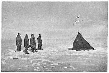
- 1900 – Peary explores the north coast of Greenland from Kap Washington to Kap Clarence Wyckoff, on the way reaching Cape Morris JesupCape Morris JesupCape Morris Jesup is the northernmost point of mainland Greenland at and is 711.8 km from the geographic North Pole...
, the most northern point of mainland Greenland. - 1902-04 – Robert Falcon ScottRobert Falcon ScottCaptain Robert Falcon Scott, CVO was a Royal Navy officer and explorer who led two expeditions to the Antarctic regions: the Discovery Expedition, 1901–04, and the ill-fated Terra Nova Expedition, 1910–13...
traces the length of the Ross Ice Shelf, discovers the Edward VII PeninsulaEdward VII PeninsulaKing Edward VII Land or King Edward VII Peninsula is a large, ice-covered peninsula which forms the northwestern extremity of Marie Byrd Land. The peninsula projects into the Ross Sea between Sulzberger Bay and the northeast corner of the Ross Ice Shelf, and forms part of the Ross Dependency...
, reaches about 82°11’ S (in the process tracing 600 kilometres (372.8 mi) of the west coast of the shelf), crosses the Transantarctic MountainsTransantarctic MountainsThe three largest mountain ranges on the Antarctic continent are the Transantarctic Mountains , the West Antarctica Ranges, and the East Antarctica Ranges. The Transantarctic Mountains compose a mountain range in Antarctica which extend, with some interruptions, across the continent from Cape Adare...
and discovers the Antarctic PlateauAntarctic PlateauThe Antarctic Plateau is a large area of Central Antarctica, which extends over a diameter of about , and which includes the region of the South Pole and the Amundsen-Scott Station...
, penetrating nearly 240 kilometres (149.1 mi) into it; he is also the first to see the dry valleysMcMurdo Dry ValleysThe McMurdo Dry Valleys are a row of snow-free valleys in Antarctica located within Victoria Land west of McMurdo Sound. The region is one of the world's most extreme deserts, and includes many interesting features including Lake Vida and the Onyx River, Antarctica's longest river.-Climate:The Dry...
of the AntarcticAntarcticThe Antarctic is the region around the Earth's South Pole, opposite the Arctic region around the North Pole. The Antarctic comprises the continent of Antarctica and the ice shelves, waters and island territories in the Southern Ocean situated south of the Antarctic Convergence...
. - 1903-06 – Roald AmundsenRoald AmundsenRoald Engelbregt Gravning Amundsen was a Norwegian explorer of polar regions. He led the first Antarctic expedition to reach the South Pole between 1910 and 1912 and he was the first person to reach both the North and South Poles. He is also known as the first to traverse the Northwest Passage....
transits the Northwest Passage in the sloop GjøaGjøaGjøa was the first vessel to transit the Northwest Passage. With a crew of six, Roald Amundsen traversed the passage in a three year journey, finishing in 1906.- History :- Construction :...
; Godfred Hansen, his second-in-command, charts the east coast of Victoria Island north to Cape Nansen (72°02' N, 104°45' W). - 1906-07 – Ludvig Mylius-ErichsenLudvig Mylius-ErichsenLudvig Mylius-Erichsen was a Danish author, ethnologist, and explorer, from Ringkøbing. He was most notably an explorer of Greenland. With Count Harald Moltke and Knud Rasmussen he formed the Danish Literary expedition to West Greenland, and in the early stages discovered near Evigheds Fiord two...
and Johan Peter KochJohan Peter KochJohan Peter Koch was a Danish captain and explorer of the Arctic dependencies of Denmark, born at Vestenskov.He participated in Amdrup's expedition to east Greenland in 1900 and was one of the general staff of the surveying expeditions to Iceland in 1903-1904.In 1906-1908 he was a member of the...
chart the northeast coast of Greenland from Kap Bismarck (76°42' N) to Kap Clarence Wyckoff (82°52' N), discovering Danmark FjordDanmark FjordDanmark Fjord is a fjord in north-eastern Greenland, lying south of Hagen Fjord....
. - 1908-09 – Frederick CookFrederick CookFrederick Albert Cook was an American explorer and physician, noted for his claim of having reached the North Pole on April 21, 1908. This would have been a year before April 6, 1909, the date claimed by Robert Peary....
and Peary each claim to have reached the North PoleNorth PoleThe North Pole, also known as the Geographic North Pole or Terrestrial North Pole, is, subject to the caveats explained below, defined as the point in the northern hemisphere where the Earth's axis of rotation meets its surface...
—the former is a fraud, the latter widely doubted. - 1910-11 — Bernhard HantzschBernhard HantzschBernhard Adolph Hantzsch was a German ornithologist, Arctic researcher, and writer, notable for his discovery of two Icelandic bird subspecies...
crosses Baffin Island from Cumberland Sound to the Koukdjuak RiverKoukdjuak RiverThe Koukdjuak River begins at the outlet of Nettilling Lake and empties into the Arctic Ocean. It is the namesake of the Great Plain of the Koukdjuak located in the Foxe Basin on western Baffin Island, Nunavut , northern Canada....
, exploring the west coast of the island north to 68°45’N. - 1911-12 – Amundsen is the first to reach the South PoleSouth PoleThe South Pole, also known as the Geographic South Pole or Terrestrial South Pole, is one of the two points where the Earth's axis of rotation intersects its surface. It is the southernmost point on the surface of the Earth and lies on the opposite side of the Earth from the North Pole...
; Scott and his team reach the Pole over a month later, all perishing on the return journey. - 1913-14 – Boris VilkitskyBoris VilkitskyBoris Andreyevich Vilkitsky was a Russian hydrographer and surveyor. He was the son of Andrey Ippolitovich Vilkitsky....
and Per Novopashennyy discover Severnaya ZemlyaSevernaya ZemlyaSevernaya Zemlya is an archipelago in the Russian high Arctic at around . It is located off mainland Siberia's Taymyr Peninsula across the Vilkitsky Strait...
, surveying parts of its eastern coast from Mys ArkticheskiyArctic CapeThe Arctic Cape is the northernmost point of the Komsomolets Island, which in turn is the northernmost island of the Russian Severnaya Zemlya archipelago in the Arctic Ocean. Its coordinates are approximately...
to Mys Vaygacha (its southeast point), as well as much of its south coast west to Mys Neupokoyeva. - 1915-17 – Vilhjalmur StefanssonVilhjalmur StefanssonVilhjalmur Stefansson was a Canadian Arctic explorer and ethnologist.-Early life:Stefansson, born William Stephenson, was born at Gimli, Manitoba, Canada, in 1879. His parents had emigrated from Iceland to Manitoba two years earlier...
discovers BrockBrock IslandBrock Island is one of the uninhabited islands of the Canadian Arctic Archipelago located in the Northwest Territories, Canada. Located at 77°51'N 114°27'W, it measures in size and lies close to Mackenzie King Island. The first known sighting of the island was by Vilhjalmur Stefansson in...
, Mackenzie KingMackenzie King IslandMackenzie King Island is one of the Queen Elizabeth Islands in northern Canada. It lies north of Melville Island and south of Borden Island, and like them is divided. Most of the island is in Northwest Territories, while its easternmost portion lies in Nunavut...
, BordenBorden IslandBorden Island is an uninhabited, low-lying island in the Queen Elizabeth Islands of northern Canada. With an area of in size, it is the 172nd largest island in the world, and Canada's 30th largest island...
, MeighenMeighen IslandMeighen Island is an uninhabited member of the Queen Elizabeth Islands, part of the Canadian Arctic Archipelago, in the Qikiqtaaluk Region of Nunavut, Canada. Located at 79°55'N 99°30'W, it measures in size and is topped with an ice cap. The island is continuously icebound, and its northwestern...
, and Lougheed IslandLougheed IslandLougheed Island is one of the uninhabited islands of the Canadian Arctic Archipelago in the Qikiqtaaluk Region, Nunavut. It measures in size. It is relatively isolated compared to other Canadian Arctic islands, and is located in the Arctic Ocean, halfway between Ellef Ringnes Island to the...
s; one of his men, Storker T. Storkerson, charts part of the northeast coast of Victoria Island, discovering the Storkerson Peninsula and Stefansson IslandStefansson IslandStefansson Island is an uninhabited island in the Canadian Arctic Archipelago in the Kitikmeot Region of Nunavut, Canada. It has an area of , making it the 128th largest island in the world, and Canada's 27th largest island. The island is located in Viscount Melville Sound, with M'Clintock Channel...
. - 1924-29 — Joseph Dewey SoperJ. Dewey SoperJoseph Dewey Soper was a widely-traveled Canadian Arctic explorer, zoologist, ornithologist, and prolific author.-Early years:...
explores the interior of Baffin Island before surveying its west coast north to Hantzsch River. - 1926 – Amundsen, Lincoln EllsworthLincoln EllsworthLincoln Ellsworth was an arctic explorer from the United States.-Birth:He was born on May 12, 1880 to James Ellsworth and Eva Frances Butler in Chicago, Illinois...
and Umberto NobileUmberto NobileUmberto Nobile was an Italian aeronautical engineer and Arctic explorer. Nobile was a developer and promoter of semi-rigid airships during the Golden Age of Aviation between the two World Wars...
in the airship NorgeNorge (airship)The Norge was a semi-rigid Italian-built airship that carried out what many consider the first verified overflight of the North Pole on May 12, 1926. It was also the first aircraft to fly over the polar ice cap between Europe and America...
are the first definitely known to have sighted the North Pole. - 1927 — George P. PutnamGeorge P. PutnamGeorge Palmer Putnam was an American publisher, author and explorer. Known for his marriage to and being the widower of Amelia Earhart, he had also achieved fame as one of the most successful promoters in the United States during the 1930s.-Early life:Born in Rye, New York, he was the son of John...
charts the north coast of the Foxe Peninsula from Cape Dorchester to Bowman BayBowman BayBowman Bay is an Arctic waterway in Qikiqtaaluk Region, Nunavut, Canada. It is located in the Foxe Basin by northeastern Foxe Peninsula off Baffin Island. The closest community is Cape Dorset, situated to the south, while Nuwata, a former settlement, is situated to the west.-Avifauna:During...
. - 1930-32 – Georgy UshakovGeorgy UshakovGeorgy Alexeyevich Ushakov was a Soviet explorer of the Arctic, Doctor of Geographic Sciences ....
and Nikolay UrvantsevNikolay UrvantsevNikolay Nikolayevich Urvantsev was a Soviet geologist and explorer. He was born in the town of Lukoyanov of Nizhny Novgorod Governorate, Russian Empire to the family of a merchant...
survey the entire coast of Severnaya Zemlya, showing it to be made up of four main islands: October RevolutionOctober Revolution IslandOctober Revolution Island is the largest island of the Severnaya Zemlya group in the Russian Arctic....
, KomsomoletsKomsomolets IslandKomsomolets Island is the northernmost island of the Severnaya Zemlya group in the Russian Arctic, and the third largest island in the group. It is the 82nd largest island on earth....
, Pioneer, and Bolshevik IslandBolshevik IslandBolshevik Island is the southernmost island of the Severnaya Zemlya group in the Russian Arctic, and the second largest island in the group...
s—in all surveying some 2200 kilometres (1,367 mi) of coastline and interior. - 1932 — W. A. Poole discovers Prince Charles IslandPrince Charles IslandPrince Charles Island is a large, low-lying island with an area of , making it the world's 78th largest island and the 19th largest island in Canada. It is located in Foxe Basin, off the west coast of Baffin Island, in the Qikiqtaaluk Region of Nunavut, Canada. Despite the island's size, it wasn't...
. - 1937-41 — Thomas and Ella Manning map the west coast of Baffin Island from the Hantzsch River to Steensby InletSteensby InletSteensby Inlet is a waterway in Nunavut's Qikiqtaaluk Region. It extends northerly from Foxe Basin into central Baffin Island. There are several un-named islands within the inlet, and Koch Island lies outside of it...
. - 1948 — E. C. Kerslake charts Prince Charles, Air ForceAir Force IslandAir Force Island is an uninhabited island in the Qikiqtaaluk Region of Nunavut, Canada. It is located along the southwestern coast of Baffin Island and measures in size....
, and Foley IslandFoley IslandFoley Island is a low-lying Canadian arctic island located in Nunavut, Canada. It is along the southern coast of Baffin Island in the Foxe Basin and measures in area....
s.