
South Pass
Encyclopedia
South Pass is two mountain passes
on the Continental Divide
in the Rocky Mountains
in southwestern Wyoming
. The passes are located in a broad low region, 35 miles broad, between the Wind River Range
to the north and the Oregon Buttes and Great Divide Basin
to the south, in southwestern Fremont County, approximately 35 miles (54 km) SSW of Lander
. South Pass is the lowest point on the Continental Divide between the Central Rocky Mountains and the Southern Rocky Mountains
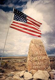
. The passes furnish a natural crossing point of the Rockies and the historic pass has historically been the route for the Oregon Trail
, California Trail
, and Mormon Trail
during the 19th century. It is a U.S. National Historic Landmark
. The pass is a broad open saddle with prairie
and sagebrush
, allowing a broad and nearly level route between the Atlantic
and Pacific
watersheds. The Sweetwater River
flows past the east side of the pass, and Pacific Creek rises on the west side. Historic South Pass is the lower of the two passes, (elevation 7412 feet (2,259.2 m)) and was the easy crossing point used by emigrants. Wyoming highway 28 crosses the Continental Divide 2.5 miles to the northwest at elevation 7550 feet (2,301.2 m) and the crossing is also named South Pass. The Lander Cutoff Route crosses the Continental Divide at the far northwest end of the broad South Pass region, about 25 miles to the northwest of the South Passes, at an elevation of 8030 feet (2,447.5 m).
 The discovery of the pass as a natural crossing point of the Rockies was a significant but surprisingly difficult achievement in the westward expansion of the United States. It was unknown to the Lewis and Clark Expedition
, which followed a northerly route up the Missouri River
, crossing the Rockies over difficult passes in the Bitteroot Range in Montana
. South Pass, by comparison, was known only to Native Americans
until 1812, when Robert Stuart
and six companions from the Pacific Fur Company
(the Astorians
) crossed the Rockies here on their return from Astoria, Oregon
:
 Despite Stuart's meticulous journal of the trip, which was presented to Astor and President James Madison
, and published in France, its location did not immediately become widely known, so for over a decade trappers used a longer, more northern route which included an extra mountain range
and offered a shorter season for crossing. In 1824, Jedediah Smith
rediscovered the pass. In 1832, Captain Benjamin Bonneville
and a caravan of 110 men and 20 wagons became the first group to take wagons over the pass. In July 1836, Narcissa Whitman
and Eliza Spalding were the first white pioneer women to cross South Pass. Between 1848 and 1868, it furnished the convenient crossing point for emigrants
westward, most of whom followed the Sweetwater River across Wyoming to its headwaters, following the Central Route. Before the railroads offered an easier crossing in 1869, perhaps half a million would trek through South Pass.
Gold
had been discovered in the gulches near the pass as early as 1842. It was not until 1867, when an ore sample was transported to Salt Lake City
, that an influx of miners descended into the region. The gold rush led to the establishment of booming mining communities such as South Pass City
and Atlantic City
. The placer gold in the streams was exhausted quickly, however, and by 1870 the miners began leaving the region. In 1884, Emile Granier, a French
mining engineer, established a hydraulic drilling operation that allowed gold mining to continue. Gold mining was revived once again in nearby Rock Creek in the 1930s. From the 1960s through 1983, a US Steel iron ore mine operated in Atlantic City.
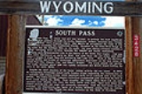
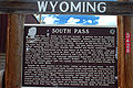
South Pass was designated a national historic landmark
in 1961.
Wyoming Highway 28
traverses the modern pass, roughly following the route of the Oregon Trail. Wagon ruts are still clearly visible in numerous sites within a few miles of the highway.
Mountain pass
A mountain pass is a route through a mountain range or over a ridge. If following the lowest possible route, a pass is locally the highest point on that route...
on the Continental Divide
Continental Divide
The Continental Divide of the Americas, or merely the Continental Gulf of Division or Great Divide, is the name given to the principal, and largely mountainous, hydrological divide of the Americas that separates the watersheds that drain into the Pacific Ocean from those river systems that drain...
in the Rocky Mountains
Rocky Mountains
The Rocky Mountains are a major mountain range in western North America. The Rocky Mountains stretch more than from the northernmost part of British Columbia, in western Canada, to New Mexico, in the southwestern United States...
in southwestern Wyoming
Wyoming
Wyoming is a state in the mountain region of the Western United States. The western two thirds of the state is covered mostly with the mountain ranges and rangelands in the foothills of the Eastern Rocky Mountains, while the eastern third of the state is high elevation prairie known as the High...
. The passes are located in a broad low region, 35 miles broad, between the Wind River Range
Wind River Range
The Wind River Range , is a mountain range of the Rocky Mountains in western Wyoming in the United States. The range runs roughly NW-SE for approximately 100 miles . The Continental Divide follows the crest of the range and includes Gannett Peak, which at 13,804 feet , is the highest peak...
to the north and the Oregon Buttes and Great Divide Basin
Great Divide Basin
The Great Divide Basin is a drainage basin of the Continental Divide of the Americas. The basin is between the Green River watershed on the west and the Medicine Bow River watershed on the east . From the northwest, the basin begins in the "Wind River Range .....
to the south, in southwestern Fremont County, approximately 35 miles (54 km) SSW of Lander
Lander, Wyoming
Lander is a city in, and the county seat of, Fremont County, Wyoming, United States. Named for transcontinental explorer Frederick W. Lander, Lander is located in central Wyoming, along the Middle Fork of the Popo Agie River. A tourism center with several dude ranches nearby, Lander is located just...
. South Pass is the lowest point on the Continental Divide between the Central Rocky Mountains and the Southern Rocky Mountains
Southern Rocky Mountains
The Southern Rocky Mountains are a major subregion of the Rocky Mountains of North America located in the southern portion of the U.S. state of Wyoming, the central and western portions of Colorado, the northern portion of New Mexico, and extreme eastern portions of Utah...
. The passes furnish a natural crossing point of the Rockies and the historic pass has historically been the route for the Oregon Trail
Oregon Trail
The Oregon Trail is a historic east-west wagon route that connected the Missouri River to valleys in Oregon and locations in between.After 1840 steam-powered riverboats and steamboats traversing up and down the Ohio, Mississippi and Missouri rivers sped settlement and development in the flat...
, California Trail
California Trail
The California Trail was an emigrant trail of about across the western half of the North American continent from Missouri River towns to what is now the state of California...
, and Mormon Trail
Mormon Trail
The Mormon Trail or Mormon Pioneer Trail is the 1,300 mile route that members of The Church of Jesus Christ of Latter-day Saints traveled from 1846 to 1868...
during the 19th century. It is a U.S. National Historic Landmark
National Historic Landmark
A National Historic Landmark is a building, site, structure, object, or district, that is officially recognized by the United States government for its historical significance...
. The pass is a broad open saddle with prairie
Prairie
Prairies are considered part of the temperate grasslands, savannas, and shrublands biome by ecologists, based on similar temperate climates, moderate rainfall, and grasses, herbs, and shrubs, rather than trees, as the dominant vegetation type...
and sagebrush
Sagebrush
Sagebrush is a common name of a number of shrubby plant species in the genus Artemisia native to western North America;Or, the sagebrush steppe ecoregion, having one or more kinds of sagebrush, bunchgrasses and others;...
, allowing a broad and nearly level route between the Atlantic
Atlantic Ocean
The Atlantic Ocean is the second-largest of the world's oceanic divisions. With a total area of about , it covers approximately 20% of the Earth's surface and about 26% of its water surface area...
and Pacific
Pacific Ocean
The Pacific Ocean is the largest of the Earth's oceanic divisions. It extends from the Arctic in the north to the Southern Ocean in the south, bounded by Asia and Australia in the west, and the Americas in the east.At 165.2 million square kilometres in area, this largest division of the World...
watersheds. The Sweetwater River
Sweetwater River (Wyoming)
The Sweetwater River is a tributary of the North Platte River, long, in the U.S. state of Wyoming. Its waters eventually reach the Atlantic Ocean. The Sweetwater rises in southwestern Fremont County, at the continental divide near South Pass Wyoming, on the southern end of the Wind River Range...
flows past the east side of the pass, and Pacific Creek rises on the west side. Historic South Pass is the lower of the two passes, (elevation 7412 feet (2,259.2 m)) and was the easy crossing point used by emigrants. Wyoming highway 28 crosses the Continental Divide 2.5 miles to the northwest at elevation 7550 feet (2,301.2 m) and the crossing is also named South Pass. The Lander Cutoff Route crosses the Continental Divide at the far northwest end of the broad South Pass region, about 25 miles to the northwest of the South Passes, at an elevation of 8030 feet (2,447.5 m).
History
Lewis and Clark Expedition
The Lewis and Clark Expedition, or ″Corps of Discovery Expedition" was the first transcontinental expedition to the Pacific Coast by the United States. Commissioned by President Thomas Jefferson and led by two Virginia-born veterans of Indian wars in the Ohio Valley, Meriwether Lewis and William...
, which followed a northerly route up the Missouri River
Missouri River
The Missouri River flows through the central United States, and is a tributary of the Mississippi River. It is the longest river in North America and drains the third largest area, though only the thirteenth largest by discharge. The Missouri's watershed encompasses most of the American Great...
, crossing the Rockies over difficult passes in the Bitteroot Range in Montana
Montana
Montana is a state in the Western United States. The western third of Montana contains numerous mountain ranges. Smaller, "island ranges" are found in the central third of the state, for a total of 77 named ranges of the Rocky Mountains. This geographical fact is reflected in the state's name,...
. South Pass, by comparison, was known only to Native Americans
Native Americans in the United States
Native Americans in the United States are the indigenous peoples in North America within the boundaries of the present-day continental United States, parts of Alaska, and the island state of Hawaii. They are composed of numerous, distinct tribes, states, and ethnic groups, many of which survive as...
until 1812, when Robert Stuart
Robert Stuart (explorer)
Robert Stuart was the son of Charles Stuart, a partner of John Jacob Astor who as one of the North West Company men, or Nor'westers, enlisted by Astor to help him found his intended fur empire...
and six companions from the Pacific Fur Company
Pacific Fur Company
The Pacific Fur Company was founded June 23, 1810, in New York City. Half of the stock of the company was held by the American Fur Company, owned exclusively by John Jacob Astor, and Astor provided all of the capital for the enterprise. The other half of the stock was ascribed to working partners...
(the Astorians
Astor Expedition
The Astor Expedition of 1810-1812 was the next overland expedition from St. Louis, Missouri to the mouth of the Columbia River after the Corps of Discovery, led by Lewis and Clark.-History:...
) crossed the Rockies here on their return from Astoria, Oregon
Astoria, Oregon
Astoria is the county seat of Clatsop County, Oregon, United States. Situated near the mouth of the Columbia River, the city was named after the American investor John Jacob Astor. His American Fur Company founded Fort Astoria at the site in 1811...
:
- "In 1811, the overland party of Mr. Astor'sJohn Jacob AstorJohn Jacob Astor , born Johann Jakob Astor, was a German-American business magnate and investor who was the first prominent member of the Astor family and the first multi-millionaire in the United States...
expedition, under the command of Mr. Wilson P. Hunt, of Trenton, New JerseyTrenton, New JerseyTrenton is the capital of the U.S. state of New Jersey and the county seat of Mercer County. As of the 2010 United States Census, Trenton had a population of 84,913...
, although numbering sixty well armed men, found the Indians so very troublesome in the country of the Yellowstone RiverYellowstone RiverThe Yellowstone River is a tributary of the Missouri River, approximately long, in the western United States. Considered the principal tributary of the upper Missouri, the river and its tributaries drain a wide area stretching from the Rocky Mountains in the vicinity of the Yellowstone National...
, that the party of seven persons who left Astoria toward the end of June, 1812, considering it dangerous to pass again by the route of 1811, turned toward the southeast as soon as they had crossed the main chain of the Rocky Mountains, and, after several days' journey, came through the celebrated 'South Pass' in the month of November, 1812.
- Pursuing from thence an easterly course, they fell upon the River PlattePlatte RiverThe Platte River is a major river in the state of Nebraska and is about long. Measured to its farthest source via its tributary the North Platte River, it flows for over . The Platte River is a tributary of the Missouri River, which in turn is a tributary of the Mississippi River which flows to...
of the Missouri, where they passed the winter and reached St. LouisSt. Louis, MissouriSt. Louis is an independent city on the eastern border of Missouri, United States. With a population of 319,294, it was the 58th-largest U.S. city at the 2010 U.S. Census. The Greater St...
in April, 1813.
- The seven persons forming the party were Robert McClelland of Hagerstown, who, with the celebrated Captain Wells, was captain of spies under General Wayne in his famous Indian campaign, Joseph Miller of Baltimore, for several years an officer of the U. S. Army, Robert Stuart, a citizen of Detroit, Benjamin Jones, of Missouri, who acted as huntsman of the party, Francois LeClaire, a halfbreed, and André Valée, a Canadian voyageur, and Ramsay Crooks, who is the only survivor of this small band of adventurers." (Letter of Ramsay Crooks to the Detroit free Press, June 28, 1856)
James Madison
James Madison, Jr. was an American statesman and political theorist. He was the fourth President of the United States and is hailed as the “Father of the Constitution” for being the primary author of the United States Constitution and at first an opponent of, and then a key author of the United...
, and published in France, its location did not immediately become widely known, so for over a decade trappers used a longer, more northern route which included an extra mountain range
Mountain range
A mountain range is a single, large mass consisting of a succession of mountains or narrowly spaced mountain ridges, with or without peaks, closely related in position, direction, formation, and age; a component part of a mountain system or of a mountain chain...
and offered a shorter season for crossing. In 1824, Jedediah Smith
Jedediah Smith
Jedediah Strong Smith was a hunter, trapper, fur trader, trailblazer, author, cartographer, cattleman, and explorer of the Rocky Mountains, the American West Coast and the Southwest during the 19th century...
rediscovered the pass. In 1832, Captain Benjamin Bonneville
Benjamin Bonneville
Benjamin Louis Eulalie de Bonneville was a French-born officer in the United States Army, fur trapper, and explorer in the American West...
and a caravan of 110 men and 20 wagons became the first group to take wagons over the pass. In July 1836, Narcissa Whitman
Narcissa Whitman
Narcissa Prentiss Whitman was an American missionary in the Oregon Country of what would become the state of Washington. Along with Eliza Hart Spalding , she was the first European-American woman to cross the Rocky Mountains in 1836 on her way to found the Protestant Whitman Mission with husband Dr...
and Eliza Spalding were the first white pioneer women to cross South Pass. Between 1848 and 1868, it furnished the convenient crossing point for emigrants
Emigrant Trail
The Emigrant Trails were the northern networks of overland wagon trails throughout the American West, used by emigrants from the eastern United States to settle lands west of the Interior Plains during the overland migrations of the mid-19th century...
westward, most of whom followed the Sweetwater River across Wyoming to its headwaters, following the Central Route. Before the railroads offered an easier crossing in 1869, perhaps half a million would trek through South Pass.
Gold
Gold
Gold is a chemical element with the symbol Au and an atomic number of 79. Gold is a dense, soft, shiny, malleable and ductile metal. Pure gold has a bright yellow color and luster traditionally considered attractive, which it maintains without oxidizing in air or water. Chemically, gold is a...
had been discovered in the gulches near the pass as early as 1842. It was not until 1867, when an ore sample was transported to Salt Lake City
Salt Lake City, Utah
Salt Lake City is the capital and the most populous city of the U.S. state of Utah. The name of the city is often shortened to Salt Lake or SLC. With a population of 186,440 as of the 2010 Census, the city lies in the Salt Lake City metropolitan area, which has a total population of 1,124,197...
, that an influx of miners descended into the region. The gold rush led to the establishment of booming mining communities such as South Pass City
South Pass City, Wyoming
South Pass City is an unincorporated community in Fremont County, Wyoming, United States. It is located 2 miles south of the intersection of highways 28 and 131. The closest town is Atlantic City...
and Atlantic City
Atlantic City, Wyoming
Atlantic City is a census-designated place in Fremont County, Wyoming, United States. The population was 39 at the 2000 census. The community is a small mining settlement in a gulch near South Pass in southwestern Wyoming. It was founded as a mining camp following the 1867 gold rush in the region...
. The placer gold in the streams was exhausted quickly, however, and by 1870 the miners began leaving the region. In 1884, Emile Granier, a French
France
The French Republic , The French Republic , The French Republic , (commonly known as France , is a unitary semi-presidential republic in Western Europe with several overseas territories and islands located on other continents and in the Indian, Pacific, and Atlantic oceans. Metropolitan France...
mining engineer, established a hydraulic drilling operation that allowed gold mining to continue. Gold mining was revived once again in nearby Rock Creek in the 1930s. From the 1960s through 1983, a US Steel iron ore mine operated in Atlantic City.
South Pass was designated a national historic landmark
National Historic Landmark
A National Historic Landmark is a building, site, structure, object, or district, that is officially recognized by the United States government for its historical significance...
in 1961.
Wyoming Highway 28
Wyoming Highway 28
Wyoming State Highway 28 is a 2 lane State Highway stretching from its split from Wyoming Highway 372 near the Seedskadee National Wildlife Refuge, across the high plains and over South Pass until its junction with US 287 south of Lander. It follows the route followed by settlers on the Oregon...
traverses the modern pass, roughly following the route of the Oregon Trail. Wagon ruts are still clearly visible in numerous sites within a few miles of the highway.
External links
- History and virtual tour of South pass
- Ramsay Crooks" letter
- South Pass National Historic Landmark at the Wyoming State Historic Preservation Office