
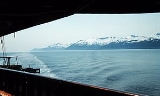
Clarence Strait
Encyclopedia
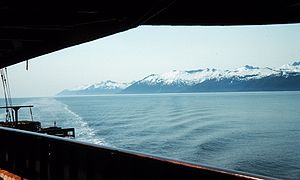
Strait
A strait or straits is a narrow, typically navigable channel of water that connects two larger, navigable bodies of water. It most commonly refers to a channel of water that lies between two land masses, but it may also refer to a navigable channel through a body of water that is otherwise not...
in southeastern Alaska
Alaska
Alaska is the largest state in the United States by area. It is situated in the northwest extremity of the North American continent, with Canada to the east, the Arctic Ocean to the north, and the Pacific Ocean to the west and south, with Russia further west across the Bering Strait...
, in the United States
United States
The United States of America is a federal constitutional republic comprising fifty states and a federal district...
in the Alexander Archipelago
Alexander Archipelago
The Alexander Archipelago is a long archipelago, or group of islands, of North America off the southeastern coast of Alaska. It contains about 1,100 islands, which are the tops of the submerged coastal mountains that rise steeply from the Pacific Ocean. Deep channels and fjords separate the...
. The strait separates Prince of Wales Island
Prince of Wales Island, Alaska
Prince of Wales Island is one of the islands of the Alexander Archipelago in the Alaska Panhandle. It is the fourth-largest island in the United States and the 97th-largest island in the world....
, on the west side, from Revillagigedo Island
Revillagigedo Island
Revillagigedo Island is an island in the Alexander Archipelago in Ketchikan Gateway Borough of the southeastern region of the U.S. state of Alaska. Running about 89 km north-south and 48 km east-west, it is 2,754.835 km² in area, making it the 12th largest island in the United...
and Annette Island
Annette Island
Annette Island, or Taak'w Aan, is an island in Gravina Islands of the Alexander Archipelago of the Pacific Ocean on the southeastern coast of the U.S. state of Alaska. It is at . It is about long and about wide. The land area is...
, on the east side. Clarence Strait is 126 miles (202.8 km) long, extending from Dixon Entrance
Dixon Entrance
The Dixon Entrance is a strait about long and wide in the Pacific Ocean at the International Boundary between the U.S. state of Alaska and the province of British Columbia in Canada. It was named by Joseph Banks for Captain George Dixon, a Royal Navy officer, fur trader, and explorer, who...
to Sumner Strait
Sumner Strait
Sumner Strait is a strait in the Alexander Archipelago in the southeastern region of the U.S. state of Alaska. It is about long and wide, extending from the mouth of the Stikine River to Iphigenia Bay on the Gulf of Alaska, separating Mitkof Island, Kupreanof Island, and Kuiu Island on the north...
.
Clarence Strait was named in 1793 by George Vancouver
George Vancouver
Captain George Vancouver RN was an English officer of the British Royal Navy, best known for his 1791-95 expedition, which explored and charted North America's northwestern Pacific Coast regions, including the coasts of contemporary Alaska, British Columbia, Washington and Oregon...
in honor of Prince William, Duke of Clarence
William IV of the United Kingdom
William IV was King of the United Kingdom of Great Britain and Ireland and of Hanover from 26 June 1830 until his death...
. Jacinto Caamaño
Jacinto Caamaño
Jacinto Caamaño Moraleja was the leader of the last great Spanish exploration of Alaska and the Coast of British Columbia. He was a Knight of the Military Order of Calatrava. Born in Madrid, he came from an aristocratic Galician family, whose homestead was near Santiago de Compostela...
, who had explored the region a year before Vancouver, named the strait Entrada de Nuestra Senora del Carmen.
The Guard Island Light
Guard Island Light
The Guard Island Light is a lighthouse located on a small island near the entrance to the Tongass Narrows, in Clarence Strait in southeastern Alaska. The western entrance to the Behm Canal also lies nearby.-History:...
and Lincoln Rocks Light, both located adjacent to Clarence Strait, were important aids-to-navigation in the Clarence Strait area in the pre-automated era.
Swimming
The Clarence Strait was first crossed by swimmer Michelle Macy in 6 hours and 46 minuteson 2010-07-05.External links
- Clarence Strait, The Columbia Gazetteer of North America