
List of State Routes in New York
Encyclopedia
The following is a list of numbered state highway
s in the U.S. state
of New York
. Signed state highways in New York, referred to as "touring routes" by the New York State Department of Transportation
, are numbered from 1 to 899. A large number of unsigned state highways, known as "reference routes", are numbered from 900 to 999 and carry a suffix. Four reference routes have been erroneously signed as touring routes and as such are listed on this page.
The first set of routes in New York were assigned in 1924, replacing a series of unsigned legislative route
s that had existed since 1908. Initially, there were only 29 routes; by the late 1920s, there were several dozen highways. In the 1930 state highway renumbering, some of these routes were reconfigured or renumbered while hundreds of other, smaller routes were assigned. Since that time, routes have been added and removed from the state highway system at various times for reasons ranging from the construction and/or removal of highways to the end result of "maintenance swaps", or transfers of highway maintenance from the state of New York to lower levels of government and vice versa. State-maintained portions of routes have reference marker
s, small, green signs that are posted approximately every one-tenth mile along the side of the roadway.
Designations that are shaded in dark gray are numbers not currently assigned to a highway. Links to articles on former alignments of designations are listed in the "Former routes" column.
State highway
State highway, state road or state route can refer to one of three related concepts, two of them related to a state or provincial government in a country that is divided into states or provinces :#A...
s in the U.S. state
U.S. state
A U.S. state is any one of the 50 federated states of the United States of America that share sovereignty with the federal government. Because of this shared sovereignty, an American is a citizen both of the federal entity and of his or her state of domicile. Four states use the official title of...
of New York
New York
New York is a state in the Northeastern region of the United States. It is the nation's third most populous state. New York is bordered by New Jersey and Pennsylvania to the south, and by Connecticut, Massachusetts and Vermont to the east...
. Signed state highways in New York, referred to as "touring routes" by the New York State Department of Transportation
New York State Department of Transportation
The New York State Department of Transportation is responsible for the development and operation of highways, railroads, mass transit systems, ports, waterways and aviation facilities in the U.S...
, are numbered from 1 to 899. A large number of unsigned state highways, known as "reference routes", are numbered from 900 to 999 and carry a suffix. Four reference routes have been erroneously signed as touring routes and as such are listed on this page.
The first set of routes in New York were assigned in 1924, replacing a series of unsigned legislative route
Legislative route
In United States, a legislative route or legislative highway is a highway defined by laws passed in a state legislature. The numbering of such highways may or may not correspond to the numbers familiar to the public as part of the state, U.S. highway, and Interstate highway systems...
s that had existed since 1908. Initially, there were only 29 routes; by the late 1920s, there were several dozen highways. In the 1930 state highway renumbering, some of these routes were reconfigured or renumbered while hundreds of other, smaller routes were assigned. Since that time, routes have been added and removed from the state highway system at various times for reasons ranging from the construction and/or removal of highways to the end result of "maintenance swaps", or transfers of highway maintenance from the state of New York to lower levels of government and vice versa. State-maintained portions of routes have reference marker
Reference marker (New York)
In New York, a reference marker is a small green sign mounted approximately every one-tenth mile on highways maintained by the New York State Department of Transportation. This was initiated in response to the Highway Safety Act of 1966 enacted by Congress, in an effort to monitor traffic and...
s, small, green signs that are posted approximately every one-tenth mile along the side of the roadway.
Designations that are shaded in dark gray are numbers not currently assigned to a highway. Links to articles on former alignments of designations are listed in the "Former routes" column.
Routes 1–99
| Route | Southern or western terminus | Northern or eastern terminus | Former routes |
|---|---|---|---|
| New York State Route 1 | No current route | 1924–1927 | |
| New York State Route 1A | No current route | 1934 – ca. 1962 New York State Route 1A New York State Route 1A was a state highway in New York City, running from the Holland Tunnel to U.S. Route 1 . It existed from 1934, when routes were first marked in New York City, until the 1960s.-History:... |
|
| New York State Route 1B | No current route | ca. 1932 – ca. 1941; ca. 1941 – by 1947 | |
| New York State Route 1X | No current route | 1941–1946 | |
| New York State Route 2 New York State Route 2 New York State Route 2 is a state highway in the Capital District of New York, United States. It extends from an interchange with Interstate 87 and NY 7 in the hamlet of Latham within the town of Colonie to the Massachusetts state line, where it continues to Boston as Route 2.... |
I-87 / NY 7 in Colonie | Massachusetts line at Petersburgh; becomes MA 2 | 1924–1927; 1927 – ca. 1939; ca. 1939 – early 1940s |
| New York State Route 2A | No current route | mid-1920s–1927; 1930 – ca. 1939; ca. 1939 – early 1940s | |
| New York State Route 3 New York State Route 3 New York State Route 3 is a major east–west state highway in New York, United States, that connects central New York to the North Country region near the Canadian border via Adirondack Park. The route extends for between its western terminus at an intersection with NY 104A in the Cayuga... |
NY 104A in Sterling | US 9 in Plattsburgh | |
| New York State Route 3A New York State Route 3A New York State Route 3A is a county-maintained state highway in Jefferson County, New York, United States. The route is an alternate route of NY 3 between the village of Deferiet and Fargo, a hamlet within the town of Wilna... |
NY 3 in Deferiet | NY 3 in Wilna | 1930 – ca. 1932; ca. 1932 – ca. 1935 |
| New York State Route 3B | No current route | 1930 – ca. 1932; ca. 1932 – ca. 1935 | |
| New York State Route 3C | No current route | 1930 – ca. 1932; ca. 1932 – ca. 1935 | |
| New York State Route 3D | No current route | ca. 1931 – ca. 1932; ca. 1932 – ca. 1935 | |
| New York State Route 3E | No current route | 1930 – ca. 1932; ca. 1932 – ca. 1935 | |
| New York State Route 3F | No current route | ca. 1931 – ca. 1932; ca. 1932 – ca. 1935 | |
| New York State Route 3G | No current route | ca. 1932 – 1940s | |
| New York State Route 4 | No current route | 1924–1927 | |
| New York State Route 5 New York State Route 5 New York State Route 5 is a state highway that extends for across the state of New York in the United States. It begins at the Pennsylvania state line in the Chautauqua County town of Ripley and passes through Buffalo, Syracuse, Utica, Schenectady, and several other smaller cities and... |
Pennsylvania line at Ripley; becomes PA 5 | I-787 / US 9 in Albany | |
| New York State Route 5A New York State Route 5A New York State Route 5A is an east–west state highway contained within Oneida County, New York, in the United States. It is a alternate route of NY 5 between New Hartford and downtown Utica. At its eastern end, NY 5A becomes NY 5S. The route is four lanes wide and passes... |
NY 5 in New Hartford | I-790 / NY 5 / NY 5S / NY 8 / NY 12 in Utica | 1924–mid-1920s; ca. 1933 – ca. 1937 |
| New York State Route 5B | NY 5 in Kirkland | NY 5 in New Hartford | |
| New York State Route 5S New York State Route 5S New York State Route 5S is an east–west state highway located in the Mohawk Valley of New York in the United States. It extends for from an interchange with NY 5, NY 5A, NY 8, and NY 12 in Utica to a smaller interchange with NY 890 in Rotterdam... |
I-790 / NY 5 / NY 5A / NY 8 / NY 12 in Utica | NY 890 in Rotterdam | |
| New York State Route 6 | No current route | 1924–1927 | |
| New York State Route 6A | No current route | 1920s–1930 | |
| New York State Route 6B | No current route | mid-1920s–1927 | |
| New York State Route 6N | US 6 in Yorktown | US 6 in Carmel | |
| New York State Route 7 New York State Route 7 New York State Route 7 is a 180-mile long New York State Highway that runs from the New York/Pennsylvania border south of Binghamton, New York to the New York/Vermont border east of Hoosick. Most of the road runs along the Susquehanna Valley, closely paralleling Interstate 88 throughout... |
Pennsylvania line at Conklin; becomes PA 29 | Vermont line at Hoosick; becomes VT 9 | 1924–mid-1920s; mid-1920s–1927 |
| New York State Route 7A | Pennsylvania line at Conklin | NY 7 in Conklin | |
| New York State Route 7B | NY 369 in Fenton | NY 7 in Colesville | 1930–1970 |
| New York State Route 7C | No current route | ca. 1961 – late 1960s | |
| New York State Route 8 New York State Route 8 New York State Route 8 is a state highway in the central part of New York in the United States. It runs in a southwest-to-northeast direction from the Southern Tier to the northern part of Lake George. The southern terminus of the route is at an interchange with NY 17 in the town of... |
NY 10 / NY 17 in Deposit | NY 9N in Hague | 1924–1930 |
| New York State Route 9 | No current route | 1924–1927 | |
| New York State Route 9A New York State Route 9A New York State Route 9A is a state highway in the vicinity of New York City, New York, United States. Its southern terminus is at the northern end of the Brooklyn–Battery Tunnel in New York City, where it intersects with both Interstate 478 and FDR Drive. The northern terminus of... |
I-478 / FDR Drive in New York City | US 9 in Peekskill | |
| New York State Route 9B New York State Route 9B New York State Route 9B is a state highway located within Clinton County, New York, in the United States. The route serves as a connector between its parent route, U.S. Route 9 , in the town of Champlain and US 11 in the village of Rouses Point... |
US 9 in Chazy | US 11 in Rouses Point | |
| New York State Route 9C | No current route | 1920s–1930; 1930 – early 1930s | |
| New York State Route 9D New York State Route 9D New York State Route 9D , also known as the Bear Mountain – Beacon Highway, is a north–south state highway that runs along the eastern shore of the Hudson River in New York in the United States. It starts at the eastern end of the Bear Mountain Bridge at U.S... |
US 6 / US 202 in Cortlandt | US 9 in Poughkeepsie | |
| New York State Route 9E | No current route | ca. 1933 – ca. 1939 | |
| New York State Route 9F | No current route | 1930 – ca. 1938 | |
| New York State Route 9G New York State Route 9G New York State Route 9G is a state highway in the Hudson Valley of New York in the United States. It runs north from U.S. Route 9 at Poughkeepsie, starting out as Violet Avenue, then follows the Hudson River mostly along the eastern side of the US 9 to Rhinebeck, where the two... |
US 9 in Poughkeepsie | US 9 / NY 23B in Hudson | |
| New York State Route 9H New York State Route 9H New York State Route 9H is a state highway located within Columbia County, New York, United States. It runs from US 9, NY 82, and NY 23 at its southern end in Bell Pond to its northern end in Valatie, also at US 9.... |
US 9 / NY 23 / NY 82 in Livingston | US 9 in Kinderhook | |
| New York State Route 9J New York State Route 9J New York State Route 9J is a state highway in the Hudson Valley region of New York, United States, located in Columbia and Rensselaer counties... |
US 9 in Stockport | US 9 / US 20 in Rensselaer | |
| New York State Route 9K | No current route | 1930–1950s | |
| New York State Route 9L New York State Route 9L New York State Route 9L is a state highway in Warren County, New York, in the United States. The road is long and is a suffixed highway of U.S. Route 9 . NY 9L goes through three municipalities in Warren County: the city of Glens Falls, the town of Queensbury and the town of Lake... |
US 9 / NY 32 in Glens Falls | US 9 / NY 9N in Lake George | |
| New York State Route 9M | No current route | ca. 1931 – ca. 1939 | |
| New York State Route 9N New York State Route 9N New York State Route 9N is a north–south state highway in northeastern New York, United States. It extends from an intersection with U.S. Route 9 , NY 29, and NY 50 in the city of Saratoga Springs to a junction with US 9 and NY 22 in the Clinton County village of... |
US 9 / NY 29 / NY 50 in Saratoga Springs | US 9 / NY 22 in Keeseville | |
| New York State Route 9P New York State Route 9P New York State Route 9P is a state highway in central Saratoga County, New York, United States. It is an alternate route off U.S. Route 9 between Malta and Saratoga Springs that connects US 9 to the eastern shore of Saratoga Lake. NY 9P meets NY 423 in the town of... |
US 9 in Malta | US 9 / NY 50 in Saratoga Springs | |
| New York State Route 9R New York State Route 9R New York State Route 9R is a north–south state highway in northeastern Albany County, New York, in the United States. The route is a eastern loop of U.S. Route 9 , connecting that route to the city of Cohoes to the east... |
I-87 / US 9 / NY 7 in Colonie | US 9 in Colonie | |
| New York State Route 9W | No current route | 1927–1930 | |
| New York State Route 9X | No current route | ca. 1931 – ca. 1936; mid-1930s – by 1946 New York State Route 9X New York State Route 9X was a state highway located within New York City. It served as an alternate route of U.S. Route 9 through Manhattan and the Bronx. The southern terminus of the route was in the Manhattan neighborhood of Inwood; its northern terminus was in the Bronx neighborhood... |
|
| New York State Route 10 New York State Route 10 New York State Route 10 is a north–south state highway in the Central New York and North Country regions of New York in the United States. It extends for from the Quickway in Deposit, Delaware County to NY 8 at Higgins Bay, a hamlet in the Hamilton County town of Arietta... |
NY 8 / NY 17 in Deposit | NY 8 in Arietta | |
| New York State Route 10A | NY 29 in Johnstown | NY 10 in Caroga | 1920s–1930 |
| New York State Route 11 | No current route | 1924–1927 | |
| New York State Route 11A New York State Route 11A New York State Route 11A is a state highway in Onondaga County, New York, in the United States. As its numbering implies, NY 11A is a spur of U.S. Route 11. The southern terminus of the route is at an intersection with NY 80 in Tully. Its northern terminus is at a junction... |
NY 80 in Tully | US 11 in Onondaga | |
| New York State Route 11B New York State Route 11B New York State Route 11B is a state highway in northern New York, United States. It provides a parallel, more southerly east–west route to U.S. Route 11 between US 11 in Potsdam and US 11, NY 30, and NY 37 in Malone... |
US 11 in Potsdam | US 11 / NY 30 / NY 37 in Malone | |
| New York State Route 11C New York State Route 11C New York State Route 11C is a short state highway located in St. Lawrence County in the northern part of New York, United States. NY 11C is a northern alternate route of U.S. Route 11 between the towns of Stockholm and Lawrence that serves the hamlets of Winthrop and Brasher Falls.... |
US 11 in Stockholm | US 11 in Lawrence | |
| New York State Route 12 New York State Route 12 New York State Route 12 is a state highway extending for through central and northern New York in the United States. The southern terminus of the route is at U.S. Route 11 in the town of Chenango in the Southern Tier. The northern terminus is at NY 37 near the village of... |
US 11 in Chenango | NY 37 in Morristown | |
| New York State Route 12A | NY 12 in Chenango | I-88 / NY 7 in Fenton | 1920s–1930 |
| New York State Route 12B New York State Route 12B New York State Route 12B is a state highway in the central part of New York, United States. NY 12B is a north–south highway connecting Oneida County in the north to Chenango County in the south, passing through Madison County in between. The southern terminus of NY 12B is at... |
NY 12 in Sherburne | NY 5 in New Hartford | |
| New York State Route 12C | No current route | 1930–1970 | |
| New York State Route 12D New York State Route 12D New York State Route 12D is a north–south state highway located in the northern part of New York, United States. The southern terminus of the route is in the Oneida County village of Boonville, where it intersects NY 12. The northern terminus is at a junction with NY 12 in the Lewis... |
NY 12 in Boonville | NY 12 in Lyons Falls | |
| New York State Route 12E New York State Route 12E New York State Route 12E is a state highway located entirely within the northwestern part of Jefferson County in northern New York, USA. Officially, the southern terminus of NY 12E is at NY 12 in the city of Watertown; however, its signed terminus is at NY 12F in the village of... |
NY 12 in Watertown | NY 12 in Clayton | |
| New York State Route 12F New York State Route 12F New York State Route 12F is an east–west state highway in Jefferson County, New York, in the United States. It extends for from an intersection with NY 180 in the town of Hounsfield to a junction with U.S. Route 11 and NY 12 in the city of Watertown... |
NY 180 in Hounsfield | US 11 / NY 12 in Watertown | |
| New York State Route 13 New York State Route 13 New York State Route 13 is a state highway that runs mainly north–south for between NY 14 in Horseheads and NY 3 west of Pulaski in Central New York in the United States. In between, NY 13 intersects with Interstate 81 in Cortland and Pulaski and meets the New York... |
NY 14 in Horseheads | NY 3 in Richfield | |
| New York State Route 13A | NY 13 / NY 34 / NY 96 in Ithaca town | NY 79 in Ithaca city | |
| New York State Route 14 New York State Route 14 New York State Route 14 is a state highway located in western New York in the United States. Along with NY 19, it is one of two routes to transect the state in a north–south fashion between the Pennsylvania border and Lake Ontario... |
Pennsylvania line at Ashland; becomes PA 14 | Greig Street cul-de-sac at Sodus Point | |
| New York State Route 14A New York State Route 14A New York State Route 14A is a north–south state highway located in the Finger Lakes region of New York in the United States. It extends for from an interchange with NY 14 in the Schuyler County town of Reading to an intersection with U.S. Route 20 and NY 5 west of the Ontario... |
NY 14 in Reading | US 20 / NY 5 / NY 245 in Geneva | |
| New York State Route 15 New York State Route 15 New York State Route 15 is a north–south state highway located in western New York in the United States. The southern terminus of the route is officially at Interstate 390 exit 3 south of the village of Wayland, although some signage indicating that NY 15 continues south to... |
I-390 / NY 21 near Wayland village | NY 31 in Rochester | 1924 – ca. 1939 |
| New York State Route 15A New York State Route 15A New York State Route 15A is a north–south state highway located in the western portion of New York in the United States. It serves as an easterly alternate route of NY 15, beginning in the Livingston County town of Springwater and ending to the north in the Monroe County city of... |
NY 15 in Springwater | NY 15 in Rochester | 1930 – ca. 1939 |
| New York State Route 16 New York State Route 16 New York State Route 16 is a state highway in western New York, United States. It runs from the Pennsylvania state line, where it is one of the highest highways in the state in elevation, to downtown Buffalo. NY 16 is a major route through Erie County, despite the construction of the... |
Pennsylvania line at Allegany; becomes PA 646 | NY 5 in Buffalo | |
| New York State Route 16A | No current route | ca. 1932 – ca. 1963 | |
| New York State Route 17 New York State Route 17 New York State Route 17 is a state highway that extends for through the Southern Tier and Downstate regions of New York in the United States... |
Pennsylvania line at Mina; continues as I-86 | New Jersey line at Suffern; continues as I-287 / NJ 17 | |
| New York State Route 17A New York State Route 17A New York State Route 17A is a state highway in southern New York, United States, entirely within Orange County. Its western terminus is located at Goshen at a junction with NY 17, and its eastern terminus is at another intersection with NY 17 located in Southfields. It runs... |
US 6 / NY 17 / NY 17M / NY 207 in Goshen | NY 17 in Tuxedo | 1920s–1930 |
| New York State Route 17B New York State Route 17B New York State Route 17B is a state highway located entirely within Sullivan County, New York. It connects the hamlet of Callicoon at its western end with the Monticello area in the east .-Route description:From its terminus at NY 97 in the hamlet of Callicoon New York State... |
NY 97 in Delaware | NY 17 in Monticello | |
| New York State Route 17C New York State Route 17C New York State Route 17C is a state highway in the Southern Tier of New York. Its western terminus is at an intersection with NY 34 in Waverly, Tioga County while its eastern terminus is at an intersection with U.S. Route 11 in Binghamton, Broome County... |
NY 34 in Waverly | US 11 in Binghamton | |
| New York State Route 17D | No current route | 1930–1940s | |
| New York State Route 17E | No current route | 1930–1960s | |
| New York State Route 17F | No current route | 1930–1940s | |
| New York State Route 17G | No current route | 1930–1940s | |
| New York State Route 17H | No current route | 1930 – ca. 1937; 1940s–1970s | |
| New York State Route 17J | No current route | 1930–1970s | |
| New York State Route 17K New York State Route 17K New York State Route 17K is an east–west state highway located within Orange County, New York, in the United States. It extends for from an intersection with County Route 76 east of Bloomingburg to a junction with U.S. Route 9W midway across the city of Newburgh... |
Orange CR 76 near Bloomingburg | US 9W / NY 32 in Newburgh city | |
| New York State Route 17M New York State Route 17M New York State Route 17M is an east–west state highway in Orange County, New York, in the United States. It extends for from west of the city of Middletown to what is currently the north–south section of NY 17 just southeast of the village of Harriman... |
Orange CR 76 in Wallkill | NY 17 in Harriman | |
| New York State Route 18 New York State Route 18 New York State Route 18 is an east–west state highway in western New York in the United States. It runs parallel to the south shore of Lake Ontario for most of its length between Niagara County and Monroe County... |
NY 104 in Lewiston | NY 104 in Rochester | |
| New York State Route 18A | No current route | ca. 1931 – ca. 1962 | |
| New York State Route 18B | No current route | ca. 1935 – ca. 1962 | |
| New York State Route 18C | No current route | ca. 1932 – ca. 1938 | |
| New York State Route 18D | No current route | ca. 1932 – ca. 1962 | |
| New York State Route 18E | No current route | 1930s–1960s | |
| New York State Route 18F New York State Route 18F New York State Route 18F is a long state highway in northwestern Niagara County, New York, United States. The southern terminus of the route is at an interchange with NY 104 and the Robert Moses State Parkway just east of the village of Lewiston. The northern terminus is at an... |
NY 104 / Robert Moses State Parkway Robert Moses State Parkway The Robert Moses State Parkway is an long north–south highway in western Niagara County, New York, United States. Its southern terminus is at the LaSalle Expressway on the east bank of the Niagara River in Niagara Falls. The northern terminus is at NY 18 at Four Mile Creek State Park in... in Lewiston |
NY 18 in Porter | ca. 1934 – ca. 1938 |
| New York State Route 19 New York State Route 19 New York State Route 19 is a north–south state highway in Western New York in the United States. It is the longest state highway in that region, and the only other one besides NY 14 to completely transect the state from the Pennsylvania state line to the shore of Lake Ontario... |
Pennsylvania line at Willing; becomes PA 449 | Lake Ontario State Parkway Lake Ontario State Parkway The Lake Ontario State Parkway is a parkway along the southern shore of Lake Ontario in western New York in the United States. The western end of the highway is at a partial interchange within Lakeside Beach State Park in Carlton, Orleans County. Its eastern terminus is at an intersection with... in Hamlin |
1924–1930 |
| New York State Route 19A New York State Route 19A New York State Route 19A is a north–south state highway in western New York in the United States. It is an alternate route of NY 19 between the town of Hume and the vicinity of the village of Silver Springs. NY 19A also serves the community of Portageville and the village of Castile... |
NY 19 in Hume | NY 19 near Silver Springs | |
| New York State Route 20 | No current route | 1924–1927 | |
| New York State Route 20A | No current route | 1930 – ca. 1932; ca. 1938 – ca. 1939 | |
| New York State Route 20B | No current route | 1930 – ca. 1932 | |
| New York State Route 20C | No current route | ca. 1931 – 1997 | |
| New York State Route 20D | No current route | ca. 1931 – ca. 1938 | |
| New York State Route 20N | No current route | ca. 1938 – ca. 1962 New York State Route 20N New York State Route 20N was a state highway in Central New York, United States. It was an alternate route of U.S. Route 20 that stretched for between Marcellus and Cazenovia. The road began at its parent route, US 20, and NY 174 in Marcellus and ended at US 20,... |
|
| New York State Route 20SY | No current route | 1950s – ca. 1962 New York State Route 20SY New York State Route 20SY was a state highway in the vicinity of Syracuse, New York, in the United States. It connected U.S. Route 20 to downtown Syracuse via Skaneateles, Camillus, Manlius, and Cazenovia in Onondaga County and Madison County... |
|
| New York State Route 21 New York State Route 21 New York State Route 21 is a state highway extending for through the western part of New York in the United States. The southern terminus of the route is at NY 417 in Andover. The northern terminus is at NY 104 in Williamson... |
NY 417 in Andover | NY 104 in Williamson | 1924–1930 |
| New York State Route 21A | No current route | 1930–1940s | |
| New York State Route 22 New York State Route 22 New York State Route 22 is a north–south state highway in eastern New York in the United States. It runs parallel to the state's eastern edge from the outskirts of New York City to a short distance south of the Canadian border. At , it is the state's longest north–south route and... |
US 1 in New York City | US 11 in Mooers | |
| New York State Route 22A New York State Route 22A New York State Route 22A is a short north–south New York State Route located within Washington County. Its northern terminus is located in the town of Hampton at the Vermont state line, where it becomes Vermont Route 22A... |
NY 22 in Granville | Vermont line at Hampton; becomes VT 22A | |
| New York State Route 22B | NY 22 in Peru | NY 3 in Plattsburgh | |
| New York State Route 23 New York State Route 23 New York State Route 23 is an east–west state highway in the eastern portion New York in the United States. It extends for from an intersection with NY 26 in the Central New York town of Cincinnatus to the Massachusetts state line in the Berkshire Mountains, where it continues east as... |
NY 26 in Cincinnatus | Massachusetts line at Copake; becomes MA 23 | |
| New York State Route 23A New York State Route 23A New York State Route 23A is an east–west state highway in Greene County, New York, in the United States. It serves as a alternate route of NY 23 through the northern Catskill Mountains... |
NY 23 in Prattsville | US 9W in Catskill village | |
| New York State Route 23B New York State Route 23B New York State Route 23B is an east–west state highway located in western Columbia County, New York, in the United States. The route is a former section of NY 23 that runs for from NY 9G southwest of Hudson to NY 9H in Claverack... |
NY 9G / NY 23 in Greenport | NY 9H / NY 23 in Claverack | |
| New York State Route 24 New York State Route 24 New York State Route 24 is an east–west state highway on Long Island in New York in the United States. The route is split into two segments, with the longest and westernmost of the two extending from Interstate 295 and NY 25 in the Queens Village section of the New York City... |
I-295 / NY 25 in Queens | NY 110 in East Farmingdale | 1924–1930 |
| I-495 Interstate 495 (New York) Interstate 495 is an auxiliary Interstate Highway on Long Island in New York in the United States. The route extends for from the western portal of the Queens-Midtown Tunnel in the New York City borough of Manhattan to County Route 58 in Riverhead, Suffolk County... in Calverton |
Suffolk CR 80 in Hampton Bays | ||
| New York State Route 24A | No current route | 1950s – ca. 1962 | |
| New York State Route 25 New York State Route 25 New York State Route 25 is an east–west state highway in downstate New York in the United States. The route extends for just over from east midtown Manhattan in New York City to the Cross Sound Ferry terminal at Orient Point on the end of Long Island's North Fork... |
2nd Avenue in Manhattan | Orient Point ferry landing at Orient Point | |
| New York State Route 25A New York State Route 25A New York State Route 25A is a state highway on Long Island in New York in the United States. It serves as the main east–west route for most of the North Shore of Long Island, running from the Queens Midtown Tunnel in the New York City borough of Queens at its western terminus to... |
I-495 in Queens | NY 25 in Calverton | |
| New York State Route 25B New York State Route 25B New York State Route 25B is a 7.25 mile long east–west state highway located on Long Island in the U.S. state of New York. The western terminus of the route is at NY 25 in Queens. The eastern terminus is at an interchange with NY 25 in Westbury... |
NY 25 in Queens | NY 25 in Westbury | |
| New York State Route 25C | No current route | 1930s–1970 New York State Route 25C New York State Route 25C was an east–west state highway on Long Island in New York in the United States. The route began in Queens at an intersection with NY 25 and paralleled NY 25B for just over before ending at a junction with NY 25B in western Nassau County. NY 25C... |
|
| New York State Route 25D | No current route | 1930s–1958 New York State Route 25D New York State Route 25D was a state highway located on Long Island in the U.S. state of New York. It was originally the designation of Horace Harding Boulevard, Nassau Boulevard, and Power House Road, the route of which the Long Island Expressway took over as it was constructed in the 1950s... |
|
| New York State Route 26 New York State Route 26 New York State Route 26 is a north–south state highway that runs for through Central New York in the United States. Its southern terminus is located at the Pennsylvania state line south of the town of Vestal in Broome County, where it becomes Pennsylvania Route 267... |
Pennsylvania line at Vestal; becomes PA 267 | NY 12 in Alexandria Bay | 1924–1930 |
| New York State Route 26A | No current route | 1930–1970s | |
| New York State Route 26B | No current route | ca. 1931 – 1970s | |
| New York State Route 27 New York State Route 27 New York State Route 27 is an east–west long state highway extending from Interstate 278 in the New York City borough of Brooklyn to Montauk Point State Park on Long Island, New York, United States... |
I-278 in Brooklyn | Montauk Point State Park in Montauk | |
| New York State Route 27A New York State Route 27A New York State Route 27A is a state highway extending from Massapequa in Nassau County to Oakdale in Suffolk County on Long Island, New York in the United States... |
NY 27 in Massapequa | NY 27 in Oakdale | |
| New York State Route 28 New York State Route 28 New York State Route 28 is a state highway extending for in the shape of a "C" between the Hudson Valley city of Kingston and southern Warren County in the U.S. state of New York. Along the way, it intersects several major routes, including Interstate 88 , U.S. Route 20 , and the... |
I-587 / NY 32 in Kingston | US 9 in Warrensburg | |
| New York State Route 28A New York State Route 28A New York State Route 28A is an east–west state highway in Ulster County, New York, in the United States. It extends for along the south side of Ashokan Reservoir in Catskill Park, serving as a southerly alternate route of NY 28 through the area... |
NY 28 in Olive | NY 28 in Kingston | |
| New York State Route 28B | No current route | ca. 1936 – 1960s New York State Route 28B New York State Route 28B was a state highway in Oneida County, New York, in the United States. The route served as a connector between NY 287 in the village of Prospect and NY 12 and NY 28 in the village of Remsen... |
|
| New York State Route 28N New York State Route 28N New York State Route 28N is a state highway in the Adirondacks in New York that extends from Blue Mountain Lake to North Creek. The route, in length, is a northerly alternate route to NY 28 between both locations. The highway passes through several communities before terminating at... |
NY 28 / NY 30 in Indian Lake | NY 28 in Johnsburg | |
| New York State Route 29 New York State Route 29 New York State Route 29 is a state highway extending for across the eastern portion of the U.S. state of New York. The western terminus of the route is at NY 28 and NY 169 in Middleville, Herkimer County. The eastern terminus of the route is at NY 22 just south of Salem,... |
NY 28 / NY 169 in Middleville | NY 22 in Salem | |
| New York State Route 29A New York State Route 29A New York State Route 29A is a state highway in the western portion of the Capital District of New York in the United States. The western terminus of the route is at an intersection with NY 29 in the Herkimer County hamlet of Salisbury Center. Its eastern end is at another junction with... |
NY 29 in Salisbury | NY 29 in Broadalbin | |
| New York State Route 30 New York State Route 30 New York State Route 30 is a state highway in the central part of New York in the United States. It extends for from an interchange with NY 17 in the Southern Tier to the Canadian border in the state's North Country, where it continues into Quebec as Route 138. On a regional level,... |
NY 17 in Hancock | Canadian border at Constable; becomes QC 138 | 1924–1930 |
| New York State Route 30A New York State Route 30A New York State Route 30A is a state highway in the Capital District of New York in the United States. It serves as a westerly alternate route of NY 30 from near the Schoharie County village of Schoharie to the Fulton County hamlet of Riceville, south of the village of Mayfield... |
NY 30 in Schoharie | NY 30 in Mayfield | |
| New York State Route 31 New York State Route 31 New York State Route 31 is a state highway that extends for across western and central New York in the United States. The western terminus of the route is at an intersection with NY 104 in the city of Niagara Falls. Its eastern terminus is at a traffic circle with NY 26 in Vernon... |
NY 104 in Niagara Falls | NY 26 in Vernon | |
| New York State Route 31A New York State Route 31A New York State Route 31A is an east–west state highway located in the western part of New York in the United States. It serves as a southerly alternate route of NY 31 from the western part of Orleans County to the far western part of Monroe County... |
NY 31 / NY 63 in Medina | NY 31 / NY 19 Truck in Sweden | mid-1920s–1930; late 1920s – ca. 1935 |
| New York State Route 31B | No current route | ca. 1932 – ca. 1933; ca. 1933 – 1980 New York State Route 31B New York State Route 31B was a state highway in Cayuga County and Onondaga County, New York, in the United States. It served as a connector between NY 31, its parent route, in Weedsport and NY 5 in the town of Elbridge. NY 31B was assigned ca... |
|
| New York State Route 31C | No current route | ca. 1933 – 2003 | |
| New York State Route 31D | No current route | ca. 1935 – ca. 1963 | |
| New York State Route 31E New York State Route 31E New York State Route 31E is a state highway located in Western New York in the United States. It serves as a northerly alternate route of NY 31 between the village of Middleport in eastern Niagara County and the nearby village of Medina in Orleans County... |
NY 31 / NY 271 in Middleport | NY 31 / NY 63 in Medina | |
| New York State Route 31F New York State Route 31F New York State Route 31F is an east–west state highway located in the vicinity of Rochester, New York, in the United States. The western terminus of the route is at an intersection with NY 96 north of the Monroe County village of Pittsford. Its eastern terminus is at a junction... |
NY 96 in Pittsford | NY 31 / NY 350 in Macedon | |
| New York State Route 32 New York State Route 32 New York State Route 32 is a north–south state highway that extends for through the Hudson Valley and Capital District regions of the U.S. state of New York. It is a two-lane surface road for nearly its entire length, with few divided and no limited-access sections. From Harriman to Albany,... |
NY 17 in Woodbury | NY 196 near Hudson Falls | 1920s–1930 |
| New York State Route 32A New York State Route 32A New York State Route 32A is a state highway in the Hudson Valley region of New York in the United States. It serves as a connector between NY 32 in the town of Saugerties and NY 23A in the town of Catskill... |
NY 32 in Saugerties | NY 23A in Catskill | 1930 – early 1940s |
| New York State Route 32B | No current route | 1930–1960s New York State Route 32B New York State Route 32B was a state highway in the Capital District region of New York, United States. The western terminus of the route was at an intersection with NY 32 in Queensbury. Its eastern terminus was at a junction with U.S. Route 4 in Hudson Falls... |
|
| New York State Route 33 New York State Route 33 New York State Route 33 is an east–west state highway in western New York in the United States. The route extends for just under from NY 5 in Buffalo in the west to NY 31 in Rochester in the east. It is, in fact, the only state highway that directly connects both cities, although... |
NY 5 in Buffalo | NY 31 in Rochester | |
| New York State Route 33A New York State Route 33A New York State Route 33A is an east–west state highway mostly located in Monroe County, New York, in the United States. The route is just over long and serves as an alternate route of NY 33 between the town of Bergen in Genesee County and the city of Rochester in Monroe County... |
NY 33 in Bergen | NY 33 in Rochester | |
| New York State Route 33B | No current route | ca. 1931 – 1940s; ca. 1962 – ca. 1965; ca. 1965 – 1970s | |
| New York State Route 34 New York State Route 34 New York State Route 34 is a north–south New York state route located in Central New York. Its southern terminus is at the Pennsylvania state line in the village of Waverly, where it connects to Pennsylvania Route 199 and meets NY 17... |
Pennsylvania line at Waverly; becomes PA 199 | NY 104 in Hannibal | 1924–1930 |
| New York State Route 34A | No current route | ca. 1932 – 1960s | |
| New York State Route 34B New York State Route 34B New York State Route 34B is a north–south state highway located within Tompkins and Cayuga Counties in Central New York. Its northern terminus is located at a junction with NY 34 by the hamlet of Fleming within the town of the same name in Cayuga County... |
NY 38 in Dryden | NY 34 in Fleming | |
| New York State Route 35 New York State Route 35 New York State Route 35 is the principal east–west highway in the northern part of Westchester County, New York, carrying average daily volumes of around 16,500 vehicles... |
US 6 / US 9 / US 202 in Peekskill | Connecticut line at Lewisboro; becomes CT 35 | mid-1920s–1927; 1927 – early 1940s New York State Route 35 (1927 – early 1940s) New York State Route 35 was a state highway in the Finger Lakes region of New York, United States. The western terminus of the route was at NY 36 in the hamlet of Mumford within the town of Wheatland. Its eastern terminus was at U.S. Route 104 in the hamlet of Ontario Center within... |
| New York State Route 35A | No current route | 1930–mid-1930s | |
| New York State Route 35B | No current route | 1930s–1940s | |
| New York State Route 36 New York State Route 36 New York State Route 36 is a north–south state highway in the western part of New York in the United States. The highway extends for from the Pennsylvania state line at Troupsburg, Steuben County northward to Ogden, Monroe County, where it ends at an intersection with NY 31... |
Pennsylvania line at Troupsburg; becomes PA 249 | NY 31 in Ogden | |
| New York State Route 36A | No current route | 1930–1940s | |
| New York State Route 37 New York State Route 37 New York State Route 37 is a state highway in the North Country of New York in the United States, extending for on a west–east axis. The western terminus of the route is at an intersection with U.S. Route 11 in Watertown, Jefferson County... |
US 11 in Watertown | US 11 / NY 11B / NY 30 in Malone | mid-1920s–1927; late 1920s – 1930 |
| New York State Route 37A | No current route | 1930–1980 | |
| New York State Route 37B New York State Route 37B New York State Route 37B is an east–west state highway located in St. Lawrence County, New York, United States. It serves as a business route of NY 37 through the village of Massena. While NY 37B enters the village, NY 37 bypasses it to the south. The western terminus of the... |
NY 37 in Louisville | NY 37 in Massena | |
| New York State Route 37C | NY 37 in Massena | NY 37 in Bombay | |
| New York State Route 37D | No current route | 1930s–1960s | |
| New York State Route 38 New York State Route 38 New York State Route 38 is a north–south state highway in the Finger Lakes region of New York in the United States. Its southern terminus is at an intersection with NY 96 in the town of Owego in Tioga County. The northern terminus is at a junction with NY 104A in the town of... |
NY 96 in Owego | NY 104A in Sterling | 1920s–1930 |
| New York State Route 38A New York State Route 38A New York State Route 38A is a north–south state highway located within Onondaga and Cayuga Counties in central New York, United States. The southern terminus of the route is at an intersection with NY 38 in the village of Moravia. Its northern terminus is at a junction with U.S.... |
NY 38 in Moravia | US 20 / NY 5 in Auburn | |
| New York State Route 38B | NY 38 in Newark Valley | NY 26 in Union | |
| New York State Route 39 New York State Route 39 New York State Route 39 is an east–west state highway in the western portion of New York in the United States. It begins and ends at intersections with U.S. Route 20 apart... |
US 20 in Sheridan | US 20 / NY 5 in Avon | 1920s–1930 |
| New York State Route 40 New York State Route 40 New York State Route 40 is a north–south state highway in eastern New York, United States. It is long and runs from NY 7 in the city of Troy north to NY 22 in the town of Granville. NY 40 also passes through the villages of Schaghticoke and Argyle and enters the vicinity of... |
NY 7 in Troy | NY 22 in Granville | 1920s–1930 |
| New York State Route 40A | No current route | ca. 1933 – 1940s | |
| New York State Route 41 New York State Route 41 New York State Route 41 is a north–south state highway in Central New York, United States. The southern terminus of the route is at an interchange with NY 17 in the town of Sanford. Its northern terminus is at an intersection with U.S. Route 20 in the village of Skaneateles... |
NY 17 in Sanford | US 20 in Skaneateles | 1920s–1930 |
| New York State Route 41A New York State Route 41A New York State Route 41A is a north–south New York State Route located within Onondaga, Cayuga, and Cortland Counties in Central New York. Its northern terminus is located at a junction with U.S. Route 20 in the village of Skaneateles in Onondaga County... |
NY 41 in Homer | US 20 in Skaneateles | |
| New York State Route 42 New York State Route 42 New York State Route 42 is a north–south, discontinuous state highway in the Catskill Mountains region of New York in the United States. The southernmost of the highway's two segments begins at an intersection with U.S. Route 6 and US 209 in Port Jervis and ends at a junction with... |
US 6 / US 209 / NY 97 in Port Jervis | NY 55 in Neversink | 1920s–1930 |
| NY 28 in Shandaken | NY 23A in Lexington | ||
| New York State Route 43 New York State Route 43 New York State Route 43 is a state highway in Rensselaer County, New York, United States. It extends for from Interstate 90 exit 8 in North Greenbush to the Massachusetts state line, where it continues into Williamstown as Massachusetts Route 43... |
I-90 in North Greenbush | Massachusetts line at Stephentown; becomes MA 43 | |
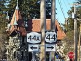
| New York State Route 44 | No current route | 1920s–1930; 1930 – ca. 1935 | |
| New York State Route 44A | No current route | 1980–2008 | |
| New York State Route 45 New York State Route 45 New York State Route 45 is a north–south state highway in central Rockland County, New York, United States. It spans from the village of Chestnut Ridge at the New Jersey – New York border, where it becomes County Route 73 in Bergen County, New Jersey, to U.S. Route 202 in... |
New Jersey line at Chestnut Ridge; becomes Bergen CR 73 | US 202 in Haverstraw | 1920s–1930; 1930 – late 1940s |
| New York State Route 46 New York State Route 46 New York State Route 46 is a state highway in Central New York, United States. It extends from NY 12B in the Madison County town of Eaton to NY 12D in the Oneida County village of Boonville. NY 46 passes through the cities of Oneida and Rome.-Madison County:NY 46 begins at... |
NY 12B in Eaton | NY 12D in Boonville | |
| New York State Route 46A | No current route | 1930–1950s | |
| New York State Route 47 | No current route | 1920s–1930; 1930 – ca. 1936; ca. 1937 – 1980 New York State Route 47 New York State Route 47 was a long state highway around Rochester in New York, United States. It formed a semicircle through the inner suburbs of Rochester, following expressways west and east of the city and surface streets south of Rochester. The western terminus of the route was at an... |
|
| New York State Route 48 New York State Route 48 New York State Route 48 is a north–south state highway in Central New York in the United States. The southern terminus of the route is located at Interstate 690 exit 3 near the interchange between I-690 and the New York State Thruway in Van Buren, northwest of Syracuse... |
I-690 in Van Buren | NY 104 in Oswego | 1920s–1930 |
| New York State Route 48A | No current route | ca. 1931 – ca. 1940 | |
| New York State Route 49 New York State Route 49 New York State Route 49 is an east–west state highway in New York in the United States. It runs from NY 3 in Volney to Interstate 790 , NY 5, NY 8 and NY 12 in Utica... |
NY 3 in Volney | I-790 / NY 5 / NY 8 / NY 12 in Utica | |
| New York State Route 50 New York State Route 50 New York State Route 50 is a state highway in the Capital District of New York in the United States. The southern terminus of the route is at an intersection with NY 5 in Scotia... |
NY 5 in Scotia | NY 32 in Northumberland | mid-1920s–1927 |
| New York State Route 51 New York State Route 51 New York State Route 51 is a state highway in the central part of New York state. The highway runs generally in a southwest to northeast direction from the hamlet of Mount Upton to the village of Ilion... |
NY 8 in Guilford | NY 5 in Herkimer | 1920s–1930 |
| New York State Route 52 New York State Route 52 New York State Route 52 is a long state highway in the southeastern part of New York in the United States. It generally runs from west to east, beginning at the Pennsylvania state line in the Delaware River near Narrowsburg, crossing the Hudson River on the Newburgh-Beacon Bridge, and ending... |
Pennsylvania line at Tusten; becomes PA 652 | US 6 in Carmel | 1920s–1930 |
| New York State Route 52A | NY 17B in Delaware | NY 52 in Delaware | |
| New York State Route 53 | NY 415 in Bath | NY 21 in Naples | 1920s–1930 |
| New York State Route 54 New York State Route 54 New York State Route 54 is a state highway in the Finger Lakes region of New York, United States. The southern terminus of the route is at an interchange with the Southern Tier Expressway in the village of Bath in Steuben County... |
I-86 / NY 15 / NY 17 New York State Route 17 New York State Route 17 is a state highway that extends for through the Southern Tier and Downstate regions of New York in the United States... in Bath |
NY 14 in Dresden | 1920s–1930 |
| New York State Route 54A New York State Route 54A New York State Route 54A is a state highway in the western part of New York, United States. It runs in a northeast to southwest direction through part of the Finger Lakes district of New York. The southern terminus of NY 54A is at NY 54 south of Hammondsport. The northern terminus... |
NY 54 near Hammondsport | NY 14A / NY 54 in Penn Yan | |
| New York State Route 55 New York State Route 55 New York State Route 55 is a state highway in southern New York, running from the Pennsylvania state line at the Delaware River in Barryville to the Connecticut state line at Wingdale... |
NY 97 / PA 434 in Highland | Connecticut line at Dover; becomes CT 55 | 1920s–1930 |
| New York State Route 55A New York State Route 55A New York State Route 55A is a state highway located in Sullivan and Ulster counties. It is a loop route connected to NY 55 at both ends, near Grahamsville in the west and Napanoch in the east... |
NY 55 in Neversink | NY 55 in Wawarsing | |
| New York State Route 56 New York State Route 56 New York State Route 56 is a north–south state highway in eastern St. Lawrence County, New York, United States. The southern terminus of the route is at an intersection with NY 3 in the town of Colton. Its northern terminus is at a junction with NY 37 southwest of Massena in the... |
NY 3 in Colton | NY 37 near Massena | 1920s–1930 |
| New York State Route 56A | No current route | 1930–1980 | |
| New York State Route 57 | No current route | 1927–1982 New York State Route 57 New York State Route 57 was a major north–south state highway in Central New York, connecting downtown Syracuse to the Lake Ontario shoreline in Oswego. The southern terminus of the route was at U.S. Route 11 in Syracuse just north of downtown and a short distance east of Lake... |
|
| New York State Route 58 New York State Route 58 New York State Route 58 is a north–south state highway located in St. Lawrence County, New York, United States. The highway runs in a northwest to southeast direction as it traverses the county. The southern terminus of the route is at a junction with NY 3 in the hamlet of Fine within... |
NY 3 in Fine | NY 37 in Morristown | 1920s–1930 |
| New York State Route 59 New York State Route 59 New York State Route 59 is an east–west state highway in southern Rockland County, New York, in the United States. The route extends for from NY 17 in Hillburn to U.S. Route 9W in Nyack. In Suffern, it has a concurrency with US 202 for . NY 59 runs parallel to the New... |
NY 17 in Hillburn | US 9W in Nyack | |
| New York State Route 59A | No current route | ca. 1955 – late 1950s | |
| New York State Route 60 New York State Route 60 New York State Route 60 is a north–south state highway in Chautauqua County, New York, United States. The southern terminus of the route is at an intersection with U.S. Route 62 south of the city of Jamestown in the town of Kiantone. Its northern terminus is at a junction with NY 5... |
US 62 in Kiantone | NY 5 in Dunkirk | |
| New York State Route 61 New York State Route 61 New York State Route 61 is a state highway located almost entirely in the city of Niagara Falls in Niagara County, New York in the United States. The road runs across the city in a northwest–southeast direction, terminating at NY 384 at its southern extent and NY 104 at its northern... |
NY 384 in Niagara Falls | NY 104 in Lewiston | 1920s–1934 |
| New York State Route 62 | No current route | 1920s–1930; 1930 – ca. 1932 | |
| New York State Route 62A | No current route | 1970s–2006 New York State Route 62A U.S. Route 62 Business is a business route of US 62 located within the city of Niagara Falls, New York, in the United States. It follows Pine Avenue through downtown Niagara Falls, spanning between New York State Route 104 at its western terminus and US 62 at its eastern extent... |
|
| New York State Route 63 New York State Route 63 New York State Route 63 is a state highway in the western part of New York in the United States. The southern terminus of the route is at an intersection with NY 15 and NY 21 in the village of Wayland in Steuben County. Its northern end is at a junction with NY 18 in the town... |
NY 15 / NY 21 in Wayland | NY 18 in Yates | |
| New York State Route 63A | No current route | 1930–1940s | |
| New York State Route 64 New York State Route 64 New York State Route 64 is a north–south state highway in the Finger Lakes region of New York in the United States. Its southern terminus is at an intersection with NY 21 in the hamlet of Bristol Springs within the town of South Bristol, Ontario County... |
NY 21 in South Bristol | NY 96 / NY 252 in Pittsford | 1920s–1930 |
| New York State Route 65 New York State Route 65 New York State Route 65 is a north–south state highway located in the western portion of New York in the United States. It extends for from an intersection with U.S. Route 20 and NY 5 in the Ontario County town of West Bloomfield to a junction with NY 96 in the Monroe County... |
US 20 / NY 5 in West Bloomfield | NY 96 in Brighton | |
| New York State Route 66 New York State Route 66 New York State Route 66 is a state highway in the Capital District of New York in the United States. The route begins at an intersection with NY 23B in the Columbia County city of Hudson and ends at a junction with NY 2 in the Rensselaer County city of Troy... |
NY 23B in Hudson | NY 2 in Troy | |
| New York State Route 67 New York State Route 67 New York State Route 67 is an east–west state highway in eastern New York in the United States. The western terminus of the route is at an intersection with NY 5 in the town of St. Johnsville... |
NY 5 in St. Johnsville | Vermont line at Hoosick; becomes VT 67 | |
| New York State Route 68 New York State Route 68 New York State Route 68 is an east–west state highway located entirely within St. Lawrence County in the North Country of New York in the United States. The western terminus is at an intersection with NY 37 in Oswegatchie, just west of the Ogdensburg city limits... |
NY 37 in Ogdensburg | NY 56 in Colton | |
| New York State Route 69 New York State Route 69 New York State Route 69 is a state highway extending for across the central portion of the U.S. state of New York. The western terminus of the route is at NY 104 in the Oswego County village of Mexico. The eastern terminus is at NY 5A in the Oneida County village of Yorkville, just... |
NY 104 in Mexico | NY 5A in Yorkville | |
| New York State Route 69A | US 11 in Hastings | NY 69 in Parish | |
| New York State Route 70 New York State Route 70 New York State Route 70 is a short state highway in the western portion of New York in the United States. It travels through three different counties in just and is the primary road to and from the village of Canaseraga. The northern terminus of the route is at an intersection with... |
NY 36 near Canaseraga | NY 436 in Portage | 1920s–1930 |
| New York State Route 70A | No current route | ca. 1931 – 1970s | |
| New York State Route 71 | NY 22 in Hillsdale | Massachusetts line at Hillsdale; becomes MA 71 | |
| New York State Route 72 New York State Route 72 New York State Route 72 is a state highway in the North Country of New York in the United States. The road is an east–west highway located entirely within the eastern part of St. Lawrence County. The western terminus of NY 72 is at an intersection with NY 56 in the town of... |
NY 56 near Potsdam village | NY 11B in Hopkinton | 1920s–1930 |
| New York State Route 72A | No current route | 1930–1940s | |
| New York State Route 73 New York State Route 73 New York State Route 73 is a state highway located entirely within Essex County, New York, United States. The highway begins at an intersection with NY 86 in the village of Lake Placid and ends at a junction with U.S. Route 9 north of the hamlet of Underwood in the extreme... |
NY 86 in Lake Placid | US 9 in Underwood | |
| New York State Route 74 New York State Route 74 New York State Route 74 and Vermont Route 74 are adjoining state highways in the northeastern United States, connected by one of the last remaining cable ferries in North America. Together they extend for through Essex County, New York, and Addison County, Vermont... |
I-87 in Schroon | Ticonderoga – Larrabees Point ferry at Ticonderoga | 1920s–1930; 1930 – ca. 1973 |
| New York State Route 75 New York State Route 75 New York State Route 75 is a north–south state highway in Erie County, New York, in the United States. It extends for from an intersection with NY 39 in the Collins hamlet of Collins Center to an interchange with NY 5 in the town of Hamburg... |
NY 39 in Collins | NY 5 in Hamburg | 1930 – ca. 1932 |
| New York State Route 76 New York State Route 76 New York State Route 76 is located entirely within Chautauqua County, New York, United States. It runs north–south from NY 474 in the hamlet of North Clymer in the town of Clymer at its southern end to NY 5 along the Lake Erie shoreline in the town of Ripley... |
NY 474 in Clymer | NY 5 in Ripley | 1927–1930 |
| New York State Route 77 New York State Route 77 New York State Route 77 is a north–south state highway in the western part of New York in the United States. The highway runs for across mostly rural areas from an intersection with NY 78 and NY 98 in the Wyoming County town of Java to a junction with NY 31 near the city of... |
NY 78 / NY 98 in Java | NY 31 in Lockport | |
| New York State Route 77A | No current route | 1930s | |
| New York State Route 78 New York State Route 78 New York State Route 78 , most commonly known as Transit Road, is a state highway in Western New York, USA. While it is signed north–south, the lower portion runs in an east–west direction across Wyoming County, from its beginning north of the Village of Gainesville.NY 78 is... |
NY 19 near Gainesville village | NY 18 in Olcott | 1920s–1930 |
| New York State Route 78A | No current route | ca. 1932 – ca. 1938 | |
| New York State Route 79 New York State Route 79 New York State Route 79 is an east–west state highway in the Southern Tier of New York, United States. The western terminus of the route is at the intersection with NY 414 near the southern end of Seneca Lake east of Watkins Glen... |
NY 414 in Hector | Pennsylvania line at Windsor; becomes PA 92 | |
| New York State Route 80 New York State Route 80 New York State Route 80 is a west–east New York State Route located within Onondaga, Madison, Chenango, Otsego, Herkimer, and Montgomery Counties in New York. Its western terminus is located at a junction with NY 175 in the city of Syracuse in Onondaga County, from which it... |
NY 175 in Syracuse | NY 5 in Nelliston | |
| New York State Route 81 New York State Route 81 New York State Route 81 is an east–west state highway in the Capital District of New York, United States. The western terminus of the route is at NY 145 in the hamlet of Cooksburg within the town of Rensselaerville. The eastern terminus is at U.S. Route 9W in the town of Coxsackie... |
NY 145 in Rensselaerville | US 9W / NY 385 in Coxsackie | |
| New York State Route 82 New York State Route 82 New York State Route 82 is a state highway in the eastern Hudson Valley of New York, United States. It begins at an intersection with NY 52 northeast of the village of Fishkill, bends eastward towards Millbrook, and then returns westward to end at a junction with U.S. Route 9,... |
NY 52 near Fishkill village | US 9 / NY 9H / NY 23 in Livingston | |
| New York State Route 82A | No current route | 1930–1980 | |
| New York State Route 83 New York State Route 83 New York State Route 83 is a state route located entirely in Chautauqua County, New York in the United States. It extends from an intersection with U.S. Route 62 in the hamlet of Conewango Valley to NY 60 in the hamlet of Laona, near Fredonia... |
US 62 in Ellington | NY 60 in Pomfret | |
| New York State Route 84 | No current route | 1930–1960s | |
| New York State Route 85 New York State Route 85 New York State Route 85 is a state highway in Albany County, New York, in the United States. It is long and runs from County Route 351 and CR 353 in Rensselaerville to Interstate 90 exit 4 in Albany. It also has a loop route, NY 85A, which connects NY 85 to... |
Albany CR 353 in Rensselaerville | I-90 in Albany | |
| New York State Route 85A New York State Route 85A New York State Route 85A is an east–west state highway in Albany County, New York, in the United States. It serves as a , two-lane alternate route of NY 85 through the town of New Scotland, running from the hamlet of New Salem to the hamlet of New Scotland... |
NY 85 in New Scotland | NY 85 in New Scotland | |
| New York State Route 86 New York State Route 86 New York State Route 86 is a long state highway located within Adirondack Park in northern New York, United States, linking Franklin County to Essex County. The western terminus of the route is at NY 30 in the hamlet of Paul Smiths. The eastern terminus is at NY 9N in Jay... |
NY 30 in Brighton | NY 9N in Jay | |
| New York State Route 86A | No current route | 1930–1950s | |
| New York State Route 87 | No current route | 1930–1970s | |
| New York State Route 88 New York State Route 88 New York State Route 88 is a north–south state highway in the Finger Lakes region of New York in the United States. It extends for from an intersection with NY 96 in the Ontario County village of Phelps to a junction with NY 104 in the Wayne County town of Sodus... |
NY 96 in Phelps | NY 104 in Sodus | |
| New York State Route 89 New York State Route 89 New York State Route 89 is a north–south state highway in central New York in the United States. It extends for from an intersection with NY 13, NY 34, and NY 96 in the Tompkins County city of Ithaca to an interchange with NY 104 in the Wayne County town of town of Wolcott... |
NY 13 / NY 34 / NY 96 in Ithaca | NY 104 near Wolcott village | |
| New York State Route 89A | No current route | 1950s | |
| New York State Route 90 New York State Route 90 New York State Route 90 is a north–south state highway in the Finger Lakes region of New York, United States. All but five of the route's are located in Cayuga County, with the remaining situated in Cortland County. The southern terminus of the route is at an intersection with U.S.... |
US 11 / NY 41 in Homer | NY 31 in Montezuma | |
| New York State Route 91 New York State Route 91 New York State Route 91 is a north–south state highway in Central New York in the United States. The southern terminus of the route is located at an intersection with NY 13 in the Cortland County town of Truxton. Its northern terminus is located at a junction with NY 173 in... |
NY 13 in Truxton | NY 173 in Jamesville | |
| New York State Route 92 New York State Route 92 New York State Route 92 is a state highway located in central New York in the United States. The western terminus of the route is at an intersection with U.S. Route 11 in downtown Syracuse. Its eastern terminus is at a junction with US 20 west of the village of Cazenovia... |
US 11 in Syracuse | US 20 in Cazenovia | |
| New York State Route 93 New York State Route 93 New York State Route 93 is a state highway in western New York in the United States. It runs in a northwest–southeast direction between NY 18F near the Niagara River in the village of Youngstown and NY 5 just south of the village of Akron... |
NY 18F in Youngstown | NY 5 in Akron | |
| New York State Route 94 New York State Route 94 New York State Route 94 is a state highway entirely within Orange County in southern New York. The western terminus is at the New York-New Jersey state line, where it continues as NJ 94 for another to Columbia, New Jersey. Its eastern terminus is located at U.S. Route 9W in New Windsor.... |
New Jersey line at Warwick; becomes NJ 94 | US 9W in New Windsor | 1930 – early 1940s; early 1940s – late 1940s |
| New York State Route 95 New York State Route 95 New York State Route 95 is a short state highway in northern New York, USA. NY 95 is a north–south route, connecting two towns in Franklin County. The southern terminus is at U.S. Route 11 in the hamlet of Moira in the town of Moira. The northern terminus is at NY 37... |
US 11 in Moira | NY 37 in Bombay | |
| New York State Route 96 New York State Route 96 New York State Route 96 is a northwest–southeast state highway in the Finger Lakes region of New York in the United States. The southern terminus of the route is at an interchange with NY 17 in the Southern Tier village of Owego, Tioga County. Its northern terminus is at a junction with... |
NY 17 in Owego | East Main Street in Rochester | 1930 – early 1940s |
| New York State Route 96A New York State Route 96A New York State Route 96A is a state highway in Seneca County, New York, in the United States. It is a north–south road between Seneca Lake and Cayuga Lake, two of the Finger Lakes. NY 96A is two lanes wide for most of its length, with the exception of the long four-lane divided highway... |
NY 96 in Interlaken | US 20 / NY 5 in Waterloo | |
| New York State Route 96B New York State Route 96B New York State Route 96B is a north–south state highway in the Southern Tier of New York, United States. It connects NY 96 in the village of Candor in Tioga County to NY 13, NY 34, and NY 96 in the city of Ithaca in Tompkins County... |
NY 96 in Candor | NY 13 / NY 34 / NY 96 in Ithaca | |
| New York State Route 97 New York State Route 97 New York State Route 97 is a north–south scenic route in southern New York, United States. It runs from U.S. Route 6 and US 209 in Port Jervis to NY 17 in Hancock. Its most famous feature is the Hawk's Nest, a tightly winding section of the road along the Delaware River,... |
US 6 / US 209 / NY 42 in Port Jervis | NY 17 in Hancock | |
| New York State Route 98 New York State Route 98 New York State Route 98 is a state highway in the western part of New York in the United States. The southern terminus of the route is at an intersection with U.S. Route 219 in the town of Great Valley in Cattaraugus County... |
US 219 in Great Valley | Lake Ontario State Parkway Lake Ontario State Parkway The Lake Ontario State Parkway is a parkway along the southern shore of Lake Ontario in western New York in the United States. The western end of the highway is at a partial interchange within Lakeside Beach State Park in Carlton, Orleans County. Its eastern terminus is at an intersection with... in Carlton |
|
| New York State Route 99 | No current route | 1930–1994 New York State Route 99 New York State Route 99 was a state highway in Franklin County, New York, in the United States. The western terminus of the route was at an intersection with NY 30 in Duane. Its eastern terminus was at a junction with NY 3 near the Franklin community of Merrillsville... |
|
Routes 100–199
| Route | Southern or western terminus | Northern or eastern terminus | Former routes |
|---|---|---|---|
| New York State Route 100 New York State Route 100 New York State Route 100 is a major north–south state highway in Westchester County, New York, in the United States. It begins parallel to Interstate 87 at a junction with the Cross County Parkway in the city of Yonkers and runs through most of the length of the county via the city of... |
Cross County Parkway Cross County Parkway The Cross County Parkway is a long parkway in Westchester County, New York. The parkway is a critical east–west connection throughout Westchester, having full interchanges with every major north–south parkway in southern Westchester, in addition to the New York State Thruway mainline.... in Yonkers |
US 202 in Somers | |
| New York State Route 100A New York State Route 100A New York State Route 100A is a long loop route of NY 100 in the town of Greenburgh . It starts in the hamlet of Hartsdale and ends in the community of Grasslands at the boundary between the towns Greenburgh and Mount Pleasant.-Route description:NY 100A splits from NY 100 along... |
NY 100 in Greenburgh | NY 100 / NY 100C on Greenburgh – Mount Pleasant town line | |
| New York State Route 100B New York State Route 100B New York State Route 100B is a spur route of NY 100 in Westchester County, New York, in the United States. The route crosses the southern part of the town of Greenburgh, connecting NY 9A to NY 119. It does not directly connect to NY 100; however, it intersects... |
NY 9A in Greenburgh | NY 100 / NY 119 in Greenburgh | |
| New York State Route 100C New York State Route 100C New York State Route 100C is an east–west spur route of NY 100 in Westchester County, New York, in the United States. It extends for along the Greenburgh – Mount Pleasant town line from an intersection with NY 9A to a junction with NY 100 and NY 100A... |
NY 9A in Greenburgh | NY 100 / NY 100A on Greenburgh – Mount Pleasant town line | |
| New York State Route 101 New York State Route 101 New York State Route 101 is a long state highway in northwestern Nassau County, New York, United States. It runs north–south as Port Washington Boulevard from NY 25A in Flower Hill, west of Roslyn and north of Manhasset, to Astor Lane in Sands Point... |
NY 25A in Flower Hill | Astor Lane in Sands Point | |
| New York State Route 102 New York State Route 102 New York State Route 102 is an east–west state highway in Nassau County, New York, United States. It is little more than an alternate route of NY 24 through the town of Hempstead. NY 102 leaves NY 24 in West Hempstead and follows Front Street through the village of Hempstead... |
NY 24 in West Hempstead | NY 24 in East Meadow | |
| New York State Route 103 New York State Route 103 New York State Route 103 is a state highway in Schenectady County, New York, in the United States. It runs from the hamlet of Rotterdam Junction across the Mohawk River/Erie Canal at Lock 9 to the town of Rotterdam. The route is officially only in length and runs from NY 5S to NY 5... |
NY 5S in Rotterdam | NY 5 in Glenville | |
| New York State Route 104 New York State Route 104 New York State Route 104 is a long east–west state highway in Upstate New York, United States. It spans six counties and enters the vicinity of four cities—Niagara Falls, Lockport, Rochester, and Oswego—as it follows a routing largely parallel to that of the southern shoreline of Lake... |
NY 384 in Niagara Falls | NY 13 in Williamstown | early 1930s; ca. 1932 – ca. 1936 |
| New York State Route 104A New York State Route 104A New York State Route 104A is an east–west state highway in the central portion of New York in the United States. It serves as a northerly alternate route of NY 104, to which it connects at each end... |
NY 104 / NY 370 near Red Creek | NY 104 in Oswego | |
| New York State Route 104B New York State Route 104B New York State Route 104B is a east–west state highway located in central Oswego County, New York, in the United States. This highway provides a connection between NY 104, the principal highway along the southern shore of Lake Ontario, in New Haven and NY 3, the principal highway... |
NY 104 in New Haven | NY 3 in Mexico | |
| New York State Route 105 New York State Route 105 New York State Route 105 is a state highway in New York. It runs from NY 106 in North Bellmore to NY 107 in Massapequa. It runs through North Bellmore, Wantagh, and Seaford in the Town of Hempstead and at its eastern extreme into Massapequa in the Town of Oyster Bay... |
NY 106 in North Bellmore | NY 107 in Massapequa | |
| New York State Route 106 New York State Route 106 New York State Route 106 is a state highway in New York, running from NY 105 in North Bellmore to Oyster Bay. It runs through the Towns of Hempstead and Oyster Bay, including the hamlets of East Meadow, Levittown, Hicksville, Jericho, and East Norwich and the Villages of Brookville and... |
NY 105 in North Bellmore | Bay Avenue in Oyster Bay | |
| New York State Route 107 New York State Route 107 New York State Route 107 is a state highway located entirely within Nassau County, New York, in the United States. It runs from Merrick Road in Massapequa to Mill Street and Brewster Avenue in the city of Glen Cove near City Hall... |
Merrick Road in Massapequa | Mill Street in Glen Cove | |
| New York State Route 108 New York State Route 108 New York State Route 108 is a long north–south state highway located on the Suffolk County side of the Suffolk-Nassau county line on Long Island, New York, United States. It is a spur route connecting NY 25A in Cold Spring Harbor to the Cold Spring Harbor station on the Long Island Rail... |
Suffolk CR 11 County Route 11 (Suffolk County, New York) Suffolk County Road 11, mostly known as Pulaski Road is a county road in northwestern Suffolk County, New York. It runs east and west between Cold Spring Harbor and Kings Park, New York... in Cold Spring Harbor |
NY 25A in Cold Spring Harbor | |
| New York State Route 109 New York State Route 109 New York State Route 109 , also known as the Babylon–Farmingdale Turnpike, is a four-lane state highway on Long Island in New York in the United States. It runs from Farmingdale in the Nassau County town of Oyster Bay to the village of Babylon in Suffolk County... |
NY 24 in Farmingdale | NY 27A in Babylon | |
| New York State Route 110 New York State Route 110 New York State Route 110 is a major north–south state highway along the western border of Suffolk County, New York. It runs between the Village of Amityville in the Town of Babylon and Halesite in the Town of Huntington... |
NY 27A in Amityville | Youngs Hill Road in Halesite | |
| New York State Route 111 New York State Route 111 New York State Route 111 is a state highway located in Suffolk County, New York, in the United States. It runs north and south through the towns of Islip and Smithtown between NY 27A in the town seat of Islip and the east end of the NY 25 and NY 25A concurrency in Smithtown's... |
NY 27A in Islip | NY 25 / NY 25A in Village of the Branch | |
| New York State Route 112 New York State Route 112 New York State Route 112 is a New York state highway, entirely within the Town of Brookhaven in Suffolk County. It runs from Montauk Highway, formerly part of NY 27A, in the village of Patchogue to NY 25A in Port Jefferson Station. It is known locally as Medford Ave in Patchogue... |
Suffolk CR 80 in Patchogue | NY 25A in Port Jefferson Station | |
| New York State Route 113 New York State Route 113 New York State Route 113 is an east–west state highway located southeast of the city of Poughkeepsie in Dutchess County, New York, United States. The western terminus of the route is at U.S. Route 9 in the town of Poughkeepsie. Its eastern terminus is at NY 376 in the Poughkeepsie... |
US 9 in Poughkeepsie | NY 376 in Poughkeepsie | 1930–1972 |
| New York State Route 114 New York State Route 114 New York State Route 114 is a state highway on the far eastern sections of Long Island in New York, United States. It serves as a connector between the two "forks" of Long Island, crossing Shelter Island in the process. This is the only connection between the North and South Forks east of... |
NY 27 in East Hampton | NY 25 in Greenport | |
| New York State Route 115 New York State Route 115 New York State Route 115 is a long state highway located entirely within Dutchess County, New York. The route runs from the U.S. Route 44/NY 55 in the city of Poughkeepsie along the former Salt Point Turnpike to an interchange with the Taconic State Parkway in Clinton... |
US 44 / NY 55 in Poughkeepsie | Taconic State Parkway Taconic State Parkway The Taconic State Parkway , is a divided highway between Kensico Dam and Chatham, the longest parkway in the U.S. state of New York. It follows a generally northward route midway between the Hudson River and the Connecticut and Massachusetts state lines... in Clinton |
1930s–1970s |
| New York State Route 116 New York State Route 116 New York State Route 116 is an east–west state highway in Westchester County, New York, in the United States. It extends for from an intersection with U.S. Route 202 in the hamlet of Somers to the Connecticut state line, where it becomes that state's Route 116... |
US 202 in Somers | Connecticut line at North Salem; becomes CT 116 | |
| New York State Route 117 New York State Route 117 New York State Route 117 is a 15.57 mile long state highway in Westchester County, New York, United States. The southern terminus of the route is at U.S. Route 9 north of the village of Sleepy Hollow. The northern terminus is at the Saw Mill River Parkway south of Katonah, a hamlet... |
US 9 in Mount Pleasant | Saw Mill River Parkway Saw Mill River Parkway The Saw Mill River Parkway is a north–south parkway that extends for through Westchester County, New York, in the United States. It begins at the border between Westchester County and the Bronx, where it continues into New York City as the Henry Hudson Parkway, and heads generally... in Bedford |
|
| New York State Route 118 New York State Route 118 New York State Route 118 is a north–south state highway that extends for in Downstate New York in the United States. Much of the highway is located within Westchester County; however, a small portion of the route near the northern terminus is situated in Putnam County... |
NY 100 in Yorktown | US 6 in Carmel | |
| New York State Route 119 New York State Route 119 New York State Route 119 is an east–west state highway in Westchester County, New York, in the United States. The road starts in Tarrytown at an intersection with U.S. Route 9 and comes to an end at a junction with NY 22 in White Plains... |
US 9 in Tarrytown | NY 22 in White Plains | |
| New York State Route 119A | No current route | ca. 1939 – ca. 1961 | |
| New York State Route 120 New York State Route 120 New York State Route 120 is a state highway in southern Westchester County, New York, United States. It begins in the city of Rye at an intersection with U.S. Route 1 and runs for about north to the hamlet of Millwood, where it ends at a junction with NY 100... |
US 1 in Rye | NY 100 in New Castle | |
| New York State Route 120A New York State Route 120A New York State Route 120A is a state highway in southern Westchester County, New York, in the United States. It serves as an alternate route to the southern half of NY 120 running along the New York–Connecticut state line. The southern terminus of route is at NY 120 in Harrison. Its... |
I-287 / NY 120 in Harrison | NY 120 in North Castle | |
| New York State Route 120B | No current route | early 1930s – ca. 1939 | |
| New York State Route 121 New York State Route 121 New York State Route 121 is a north–south state highway in New York, going from northern Westchester County to the village of Brewster in Putnam County.-Route description:... |
NY 22 in Bedford | US 6 / US 202 in Southeast | |
| New York State Route 122 New York State Route 122 New York State Route 122 is an east–west state highway in northern Franklin County, New York, United States. The western terminus of the route is at an intersection with NY 37 in the town of Westville. Its eastern terminus is at a junction with U.S. Route 11 in the town of Burke... |
NY 37 in Westville | US 11 in Burke | |
| New York State Route 123 New York State Route 123 New York State Route 123 is a north–south state highway in the northern part of Westchester County, New York, in the United States... |
Connecticut line at Lewisboro; becomes CT 123 | NY 35 in Lewisboro | |
| New York State Route 124 New York State Route 124 New York State Route 124 is a long north–south state highway in the northern part of Westchester County, New York, in the United States. The route connects NY 137 in the hamlet of Pound Ridge to NY 35 near the hamlet of South Salem.-Route description:NY 124 begins at... |
NY 137 in Pound Ridge | NY 35 in Lewisboro | |
| New York State Route 125 New York State Route 125 New York State Route 125 is a long north–south state highway in Westchester County, New York. The route begins in The Town of Mamaroneck at U.S... |
US 1 in Mamaroneck | NY 22 in White Plains | |
| New York State Route 126 New York State Route 126 New York State Route 126 is a state highway in the North Country of New York in the United States. It proceeds in a roughly northwest to southeast direction between NY 12 at the eastern city line of Watertown in central Jefferson County and NY 812 in the village of Croghan in... |
NY 12 in Watertown | NY 812 in Croghan | 1930 – ca. 1936; ca. 1940 – ca. 1972 |
| New York State Route 127 New York State Route 127 New York State Route 127 is a long north–south state highway in Westchester County, New York, from the village of Mamaroneck to the city of White Plains, New York.-Route description:... |
US 1 in Mamaroneck | I-287 in White Plains | |
| New York State Route 128 New York State Route 128 New York State Route 128 is a long north–south state highway in northern Westchester County, New York. The route connects the hamlet of Armonk to the village of Mount Kisco. The road passes by the municipal offices of the Town of North Castle.-Route description:NY 128 begins in the... |
NY 22 in Armonk | NY 117 in Mount Kisco | |
| New York State Route 129 New York State Route 129 New York State Route 129 is a long state highway in the western part of Westchester County, New York. The route begins at NY 9A in the village of Croton on Hudson. NY 129 then travels through the towns of Cortlandt and Yorktown, running along the northern edge of the New Croton... |
NY 9A in Croton-on-Hudson | NY 118 in Yorktown | |
| New York State Route 130 New York State Route 130 New York State Route 130 is a state highway entirely within Erie County, New York, United States. It runs east–west from U.S. Route 62 in Buffalo to the village of Depew, where it terminates at NY 78... |
US 62 in Buffalo | US 20 / NY 78 in Depew | 1930 – ca. 1938 |
| New York State Route 131 New York State Route 131 New York State Route 131 is a long state highway in St. Lawrence County, New York, United States. It serves as a coastal alternate route to NY 37, going around the village of Massena instead of through it. NY 131 leaves NY 37 in the town of Louisville and rejoins it in the... |
NY 37 in Louisville | NY 37 in Massena | 1930–1940s |
| New York State Route 132 New York State Route 132 New York State Route 132 is a long state highway located entirely within the Town of Yorktown in Westchester County, New York. The route acts as a connector between U.S. Route 202 and NY 35 in the south and U.S. Route 6 in the north... |
US 202 / NY 35 in Yorktown | US 6 in Yorktown | |
| New York State Route 132A | No current route | 1930–1970s | |
| New York State Route 133 New York State Route 133 New York State Route 133 is a state highway in Westchester County, New York. It begins at US 9 in the village of Ossining, goes through several hamlets in the town of New Castle , and ends at NY 117 in the village of Mount Kisco.-Route description:NY 133 begins in downtown... |
US 9 in Ossining | NY 117 in Mount Kisco | |
| New York State Route 134 New York State Route 134 New York State Route 134 is a long state highway in the western part of Westchester County, New York. It connects the village of Ossining with the hamlet of Kitchawan-Route description:... |
NY 133 in Ossining | NY 100 in Yorktown | |
| New York State Route 135 New York State Route 135 New York State Route 135 is a state highway in eastern Nassau County, New York, United States. The route is a limited-access highway that connects Seaford with Syosset. The highway runs from Merrick Road in Seaford to NY 25 in Syosset... |
Merrick Road in Seaford | NY 25 in Syosset | 1930 – ca. 1935; ca. 1937 – ca. 1939 |
| New York State Route 136 New York State Route 136 New York State Route 136 is a state highway within the town of North Greenbush in Rensselaer County, New York, in the United States. It begins at an intersection with U.S. Route 4 just south of Troy and ends at a junction with NY 150 in the hamlet of Wynantskill... |
US 4 in North Greenbush | NY 150 in North Greenbush | |
| New York State Route 137 New York State Route 137 New York State Route 137 is a long state highway in Westchester County, New York, United States. The route is a continuation of Connecticut's Route 137, which links NY 137 to Stamford, Connecticut... |
Connecticut line at Pound Ridge; becomes CT 137 | NY 121 in Bedford | |
| New York State Route 137A | No current route | 1930 – ca. 1932 | |
| New York State Route 138 New York State Route 138 New York State Route 138 is a long state highway in Westchester County, New York. It begins in the town of Somers at NY 100 and ends at NY 121 west of the hamlet of Waccabuc. The road passes by the shopping center at Golden's Bridge.-Route description:NY 138 begins at... |
NY 100 in Somers | NY 121 in Lewisboro | |
| New York State Route 139 New York State Route 139 New York State Route 139 is a long state highway in the town of Somers in Westchester County, New York, in the United States. It connects the hamlet of Whitehall Corners at NY 100 with the hamlet of Lincolndale at U.S. Route 202. The entirety of NY 139, known as Primrose... |
NY 100 in Somers | US 202 in Somers | |
| New York State Route 140 New York State Route 140 New York State Route 140 is an east–west state highway located entirely within Albany County, New York, in the United States. The highway runs for from NY 85 near the hamlet of Slingerlands to NY 443 in the hamlet of Delmar... |
NY 85 in Bethlehem | NY 443 in Bethlehem | |
| New York State Route 141 New York State Route 141 New York State Route 141 is a north–south state highway in Westchester County, New York, in the United States. It extends for from an interchange with NY 9A in the hamlet of Hawthorne to an intersection with NY 117 in the village of Pleasantville... |
NY 9A in Mount Pleasant | NY 117 in Pleasantville | |
| New York State Route 142 New York State Route 142 New York State Route 142 is a north–south state highway in Rensselaer County, New York, in the United States. The southern terminus is at an intersection with NY 7 in the hamlet of Brunswick Center within the town of Brunswick. Its northern terminus is at U.S. Route 4 in the... |
NY 7 in Brunswick | US 4 in Troy | ca. 1931 – ca. 1938 |
| New York State Route 143 New York State Route 143 New York State Route 143 is a state highway in New York. The highway runs from the town of Westerlo to the hamlet of Coeymans. Located entirely in Albany County, NY 143 is a two-lane highway its entire length.-Route description:... |
NY 85 in Westerlo | NY 144 in Coeymans | |
| New York State Route 144 New York State Route 144 New York State Route 144 is a state highway in the Capital District of New York in the United States. The highway runs from the Greene County hamlet of Hannacroix to just south of the city of Albany. NY 144 is a two-lane highway its entire length. Significant sections are narrow and... |
US 9W in New Baltimore | NY 32 near Albany | |
| New York State Route 145 New York State Route 145 New York State Route 145 is a state highway in eastern New York in the United States. The highway extends for from NY 23 in the Greene County town of Cairo to U.S. Route 20 in the Schoharie County town of Sharon. Along the way, NY 145 intersects NY 30 in Middleburgh and... |
NY 23 in Cairo | US 20 in Sharon | |
| New York State Route 146 New York State Route 146 New York State Route 146 is a state highway in the Capital District of New York in the United States. It extends for from Gallupville at NY 443 to near Mechanicville at U.S. Route 4 and NY 32. NY 146 is a major thoroughfare in the city of Schenectady, just outside of... |
NY 443 in Wright | US 4 / NY 32 in Halfmoon | |
| New York State Route 146A New York State Route 146A New York State Route 146A is a state highway in New York State. It begins at NY 146 in Clifton Park and ends at NY 50 in Ballston Lake. It is located entirely within Saratoga County... |
NY 146 in Clifton Park | NY 50 in Ballston | |
| New York State Route 146B | No current route | ca. 1932 – ca. 1965 New York State Route 146B New York State Route 146B was a state highway in southern Saratoga County, New York, United States. It was long and located entirely within the town of Clifton Park. The western terminus of the route was at an intersection with NY 146, its parent route, in the hamlet of Rexford... |
|
| New York State Route 146C | No current route | 1930s – ca. 1962 | |
| New York State Route 147 New York State Route 147 New York State Route 147 is a north–south state highway in the Capital District of New York, United States. The southern terminus of the route is at an intersection with NY 5 west of Schenectady in the village of Scotia. Its northern terminus is at a junction with NY 29 in the town... |
NY 5 in Scotia | NY 29 in Galway | |
| New York State Route 148 New York State Route 148 New York State Route 148 is a state highway in Niagara County, New York, United States. It runs north–south between a junction with NY 104 in the town of Hartland and NY 18 north of the village of Barker. The entire length of NY 148 is maintained by Niagara County as County... |
NY 104 in Hartland | NY 18 in Somerset | 1930–1950s |
| New York State Route 149 New York State Route 149 New York State Route 149 is an east–west state highway that runs for through the Capital District of New York in the United States. It begins at exit 20 on the Adirondack Northway in the Warren County town of Queensbury and intersects U.S... |
I-87 in Queensbury | Vermont line at Granville; becomes VT 149 | |
| New York State Route 150 New York State Route 150 New York State Route 150 is a north–south state highway in Rensselaer County, New York, United States. The southern terminus of the route is at NY 9J in Castleton-on-Hudson... |
NY 9J in Castleton-on-Hudson | NY 66 in North Greenbush | |
| New York State Route 151 New York State Route 151 New York State Route 151 is an state highway located in Rensselaer County, New York, in the United States. Its western terminus is at an interchange with U.S. Route 9 and US 20 in Rensselaer, and its eastern terminus is at a junction with NY 150 in Shivers Corners, a hamlet... |
US 9 / US 20 in Rensselaer | NY 150 in Schodack | |
| New York State Route 152 | No current route | 1930–1980 New York State Route 152 New York State Route 152 was an east–west state highway in Rensselaer County, New York, in the United States. The western terminus of the route was at an intersection with U.S. Route 4 and NY 43 in the town of North Greenbush. Its eastern terminus was at a junction with... |
|
| New York State Route 153 New York State Route 153 New York State Route 153 is a long north–south state highway located in the eastern suburbs of Rochester, New York, United States. The southern terminus of the route is at NY 96 in the village of Pittsford. Its northern terminus is at an interchange with NY 441 in the town of... |
NY 96 in Pittsford | NY 441 in Penfield | ca. 1932 – 1940s; ca. 1962 – 1980s |
| New York State Route 154 | No current route | ca. 1932 – 1980 New York State Route 154 New York State Route 154 was a state highway in Rensselaer County, New York, in the United States. It began at an intersection with U.S. Route 4 in Troy and ended at then-County Route 77 in Poestenkill. Along the way, it intersected NY 66 and NY 355... |
|
| New York State Route 155 New York State Route 155 New York State Route 155 is a 17-mile long state highway located entirely within Albany County in the Capital District of New York. The western terminus of the route is at NY 85A in Voorheesville... |
NY 85A in Voorheesville | NY 32 in Watervliet | |
| New York State Route 156 New York State Route 156 New York State Route 156 is a state highway in New York. The highway runs from the hamlet of Berne to the village of Voorheesville. A two-lane highway its entire length, NY 156 is entirely located within Albany County.... |
NY 443 in Berne | NY 85A in Voorheesville | |
| New York State Route 157 New York State Route 157 New York State Route 157 is a state highway in Albany County, New York, in the United States. It runs from an intersection with NY 156 near the hamlet of Berne to a junction with NY 85 in the hamlet of New Salem. NY 157 is a two-lane, narrow, winding route that runs along an... |
NY 156 in Berne | NY 85 in New Scotland | |
| New York State Route 157A New York State Route 157A New York State Route 157A is an east–west state highway located in Albany County, New York, in the United States. It serves as a loop route of NY 157 through the towns of Knox and Berne, veering a considerable distance to the south to serve the hamlet of East Berne and indirectly... |
NY 157 in Berne | NY 157 in Berne | |
| New York State Route 158 New York State Route 158 New York State Route 158 is a state highway in New York, running from near the Albany County village of Altamont to the Schenectady County town of Rotterdam, just outside Schenectady... |
NY 146 in Altamont | NY 7 in Rotterdam | |
| New York State Route 159 New York State Route 159 New York State Route 159 is a state highway in New York, running from the town of Duanesburg through Mariaville Lake to the hamlet of Rotterdam, just outside the city of Schenectady... |
NY 30 in Duanesburg | NY 7 in Rotterdam | |
| New York State Route 160 New York State Route 160 New York State Route 160 is a north–south state highway mostly located within Schenectady County, New York, in the United States. The southern terminus of the route is at an intersection with NY 159 in the Duanesburg hamlet of Mariaville Lake. Its northern terminus is at a junction with... |
NY 159 in Duanesburg | NY 5S in Rotterdam | |
| New York State Route 161 New York State Route 161 New York State Route 161 is an east–west state highway located in eastern Montgomery County, New York, in the United States. It extends for just over from an intersection with NY 30A in the town of Glen to a junction with NY 30 in the town of Florida... |
NY 30A in Glen | NY 30 in Florida | |
| New York State Route 161A | No current route | ca. 1931 – ca. 1938 | |
| New York State Route 162 New York State Route 162 New York State Route 162 is a state highway in eastern New York, United States. It runs from the hamlet of Sloansville within the town of Esperance, Schoharie County to the hamlet of Sprakers within the town of Root, Montgomery County, west of the village of Canajoharie... |
US 20 / NY 30A in Esperance | NY 5S in Root | |
| New York State Route 163 New York State Route 163 New York State Route 163 is an east–west state highway in Montgomery County, New York, United States. It runs from the village of Fort Plain to the town of Canajoharie in southern Montgomery County. With the exception of its eastern terminus, NY 163 is not signed with directions... |
NY 5S / NY 80 in Fort Plain | NY 10 in Canajoharie | |
| New York State Route 164 New York State Route 164 New York State Route 164 is a short state highway located entirely in the town of Patterson in northeastern Putnam County, New York, United States. It is a short, two-lane back road that does not pass through any major populated areas and serves primarily as a connector between NY 311... |
NY 311 in Patterson | NY 22 in Patterson | 1930 – ca. 1940; ca. 1940 – 1960s |
| New York State Route 165 New York State Route 165 New York State Route 165 is an east–west state highway in eastern New York, United States. It serves as a connector between NY 166 in the Otsego County town of Roseboom and NY 10 in the Schoharie County town of Seward... |
NY 166 in Roseboom | NY 10 in Seward | |
| New York State Route 166 New York State Route 166 New York State Route 166 is a north–south state highway in Otsego County, New York, United States. It extends for from NY 28 in the village of Milford to U.S. Route 20 north of the village of Cherry Valley. Much of NY 166's southern portion is near Cooperstown, and various... |
NY 28 in Milford | US 20 near Cherry Valley village | |
| New York State Route 167 New York State Route 167 New York State Route 167 is a north–south state highway located mostly within Herkimer County in eastern New York, United States. The southern terminus of the route is at an intersection with U.S. Route 20 in Richfield Springs, Otsego County. Its northern terminus is at a junction with... |
US 20 in Richfield Springs | NY 29 in Dolgeville | |
| New York State Route 168 New York State Route 168 New York State Route 168 is an east–west state highway in southern Herkimer County, New York, in the United States. The highway runs for through a largely rural area of Upstate New York, from an intersection with NY 28 in the village of Mohawk to a junction with NY 80 in Stark.... |
NY 28 in Mohawk | NY 80 in Stark | |
| New York State Route 169 New York State Route 169 New York State Route 169 is a north–south state highway located within Herkimer County, New York, in the United States. It extends for from an intersection with NY 5S in the town of Danube to a junction with NY 28 and NY 29 in the village of Middleville... |
NY 5S in Danube | NY 28 / NY 29 in Middleville | |
| New York State Route 170 New York State Route 170 New York State Route 170 is a north–south state highway in Herkimer County, New York, United States. It runs from NY 169 in the city of Little Falls to NY 29 in the town of Fairfield. It has only one other junction with a signed state highway, that being NY 170A, its spur route... |
NY 169 in Little Falls | NY 29 in Fairfield | |
| New York State Route 170A | NY 170 in Fairfield | NY 29 in Fairfield | |
| New York State Route 171 New York State Route 171 New York State Route 171 is an east–west state highway in Herkimer County, New York, in the United States. The route connects the hamlet of Gulph in the town of Frankfort to the village of Frankfort by way of the Frankfort Gorge. Its western terminus is at the junction of County... |
Ball Road / Gulph Road in Frankfort town | Main Street in Frankfort village | |
| New York State Route 172 New York State Route 172 New York State Route 172 is an state highway in Westchester County, New York, in the United States. The route begins at NY 117 in the village of Mount Kisco and ends in the hamlet of Pound Ridge at NY 137.... |
NY 117 in Mount Kisco | NY 137 in Pound Ridge | |
| New York State Route 173 New York State Route 173 New York State Route 173 is a state highway located in the Syracuse area of central New York, United States. It takes a slightly bow-shaped route from NY 31 in the town of Van Buren to NY 5 in Chittenango, gently curving to the south of Downtown Syracuse in the center of its routing... |
NY 31 in Van Buren | NY 5 in Chittenango | |
| New York State Route 174 New York State Route 174 New York State Route 174 is a state highway in Onondaga County, located in Central New York, United States. The highway is long and passes through mostly rural regions. Route 174 begins at an intersection with NY 41 in Borodino, a hamlet of Spafford... |
NY 41 in Spafford | NY 5 in Camillus | |
| New York State Route 175 New York State Route 175 New York State Route 175 is a west–east state highway located in Onondaga County, New York, in the United States. The route begins at an intersection with U.S. Route 20 east of the village of Skaneateles and passes through the village of Marcellus before ending at a junction with... |
US 20 in Skaneateles | US 11 in Syracuse | |
| New York State Route 176 New York State Route 176 New York State Route 176 is a north–south state highway located in the central part of New York, United States, that connects Cayuga County with Oswego County. The southern terminus of the route is at an intersection with NY 370 in the northeast part of the town of Cato, east of... |
NY 370 in Cato | NY 48 in Fulton | |
| New York State Route 177 New York State Route 177 New York State Route 177 is an east–west state highway in the North Country of New York, United States. It extends from Interstate 81 exit 42 in the town of Adams, Jefferson County, to NY 12 west of the village of Lowville, Lewis County. NY 177 intersects U.S... |
I-81 in Adams | NY 12 near Lowville village | |
| New York State Route 178 New York State Route 178 New York State Route 178 is an east–west state highway in Jefferson County, New York, in the United States. The western terminus of the route is at an intersection with NY 3 by Aspinwell Corners in the town of Henderson. Its eastern terminus is at a junction with U.S. Route 11 in... |
NY 3 in Henderson | US 11 in Adams | |
| New York State Route 179 New York State Route 179 New York State Route 179 is a short state highway located south of Buffalo in Erie County, New York, in the United States. It is a four-lane divided road for most of its length. It is known as Mile Strip Road. A small section between U.S... |
NY 5 in Hamburg | US 20 in Orchard Park | 1930 – ca. 1963 |
| New York State Route 180 New York State Route 180 New York State Route 180 is a north–south state highway in the northwestern part of Jefferson County in the U.S. state of New York. The southern terminus of the route is at NY 3 in the Hounsfield hamlet of Baggs Corner, located west of downtown Watertown. The northern terminus is... |
NY 3 in Hounsfield | NY 12 in Orleans | |
| New York State Route 181 | No current route | 1930 – ca. 1939; 1960 – ca. 1963 | |
| New York State Route 182 New York State Route 182 New York State Route 182 is a state highway in Niagara County, New York, United States. It serves as a signed connection between the Whirlpool Rapids Bridge over the Niagara River and the Niagara Falls International Airport east of the city of Niagara Falls... |
Whirlpool Rapids Bridge Whirlpool Rapids Bridge The Whirlpool Rapids Bridge, commonly called the Whirlpool Bridge, and until 1937, known as the Lower Steel Arch Bridge, is a spandrel braced, riveted, two-hinged arch bridge. It crosses the international border between Canada and the United States, connecting the commercial downtown districts of... in Niagara Falls |
US 62 in Wheatland | |
| New York State Route 183 New York State Route 183 New York State Route 183 is a state highway located within Oswego County, New York, United States. The southern terminus is at an intersection with NY 69 in the hamlet of Amboy Center within the town of Amboy... |
NY 69 in Amboy | NY 13 in Williamstown | |
| New York State Route 184 New York State Route 184 New York State Route 184 is a state highway in St. Lawrence County, New York, United States. The route is signed as east–west; however, it runs more in a northeast–southwest direction. The western terminus of NY 184 is at an intersection with NY 58 in the community of Pope Mills... |
NY 58 in Macomb | NY 812 in Heuvelton | |
| New York State Route 185 New York State Route 185 New York State Route 185 was a state highway located within St. Lawrence County in the North Country of New York in the United States. Although the route followed a mostly north–south alignment, it was considered an east–west highway by the New York State Department of Transportation... |
NY 9N / NY 22 in Crown Point | Vermont line at Crown Point; becomes VT 17 | 1930s–1980 |
| New York State Route 186 New York State Route 186 New York State Route 186 is a short east–west state highway in northern New York, United States. The highway is located entirely within the town of Harrietstown in the southwest part of Franklin County. The western terminus is at NY 30 and the eastern terminus is at NY 86. ... |
NY 30 in Harrietstown | NY 86 in Harrietstown | 1930s–1982 |
| New York State Route 187 New York State Route 187 New York State Route 187 is a short state highway located entirely in Erie County, New York, United States. It serves as the southern end of the busy Transit Road in the town of Elma. Its southern terminus is at Quaker Road and its northern terminus at US 20 where that highway becomes... |
US 20A in Orchard Park | US 20 in Elma | 1930 – ca. 1938 |
| New York State Route 188 | No current route | 1930 – ca. 1939; 1969–1970 | |
| New York State Route 189 New York State Route 189 New York State Route 189 is a north–south state highway located near the northern border of New York in the United States. It extends for through the Clinton County town of Clinton from a junction with U.S. Route 11 to the Canadian border, where it continues into Quebec as... |
US 11 in Clinton | Canadian border at Clinton; becomes QC 209 | |
| New York State Route 190 New York State Route 190 New York State Route 190 is an east–west state highway in the North Country of New York in the United States. The western terminus of the route is at an intersection with NY 374 in the community of Brainardsville within the town of Bellmont. Its eastern terminus is at a junction with... |
NY 374 in Bellmont | NY 3 in Plattsburgh | |
| New York State Route 191 New York State Route 191 New York State Route 191 is a short county-maintained state highway located north of Adirondack Park in Clinton County, New York, United States. The route is co-designated by the county highway department as County Route 23 and heads from an intersection with NY 22 in the hamlet of... |
NY 22 in Chazy | US 9 in Chazy | |
| New York State Route 192 | No current route | 1930–1989 New York State Route 192 New York State Route 192 was a long east–west state highway in Franklin County, New York, United States. The western terminus of the route was at an intersection with NY 30 in the hamlet of Paul Smiths within the town of Brighton. Its eastern terminus was at a junction with NY 86... |
|
| New York State Route 192A | No current route | 1950s–1980 | |
| New York State Route 193 New York State Route 193 New York State Route 193 is a short state highway located entirely within the Town of Ellisburg in the southwest part of Jefferson County in northern New York, USA. The western terminus of NY 193 is at NY 3 at Southwick Beach State Park, just east of Lake Ontario. The eastern... |
NY 3 in Ellisburg | US 11 near Mannsville | |
| New York State Route 194 | No current route | 1930–1980 New York State Route 194 New York State Route 194 was a state highway that was located in Lewis County, New York. It began at an intersection with NY 177 in Barnes Corners, a hamlet within the town of Pinckney, and progressed northeast to its northern terminus at a junction with NY 12 in Copenhagen.When... |
|
| New York State Route 195 | No current route | 1930 – ca. 1936; ca. 1938 – 1980 New York State Route 195 New York State Route 195 was a north–south state highway located within the town of Lawrence in St. Lawrence County, New York, United States. The southern terminus of the route was at NY 11B in the hamlet of Nicholville. Its northern terminus was at U.S. Route 11 in the community of... |
|
| New York State Route 196 New York State Route 196 New York State Route 196 is a state route in New York, running from the village of Hudson Falls east to the hamlet of South Hartford in Hartford, Washington County.... |
US 4 in Hudson Falls | NY 40 in Hartford | |
| New York State Route 197 New York State Route 197 New York State Route 197 is an east–west state highway in eastern New York, United States. It runs from U.S. Route 9 in the Saratoga County town of Moreau east to NY 40 in Argyle. NY 197 has a short overlap with U.S... |
US 9 in Moreau | NY 40 in Argyle | |
| New York State Route 198 New York State Route 198 New York State Route 198 is a state highway located entirely within the city of Buffalo, New York, in the United States. It is named the Scajaquada Expressway for Scajaquada Creek, which it parallels as it heads across northern Buffalo... |
I-190 in Buffalo | NY 33 in Buffalo | ca. 1932 – 1940s |
| New York State Route 199 New York State Route 199 New York State Route 199 is a state highway located in the Hudson Valley of New York in the United States. It extends for from an interchange with U.S. Route 9W and US 209 north of Kingston to an intersection with US 44 and NY 22 southwest of Millerton... |
US 9W / US 209 in Ulster | US 44 / NY 22 in North East | |
Routes 200–299
| Route | Southern or western terminus | Northern or eastern terminus | Former routes |
|---|---|---|---|
| New York State Route 200 | NY 38 in Harford | NY 221 in Harford | 1930 – early 1940s |
| New York State Route 201 New York State Route 201 New York State Route 201 is a north–south state highway located west of the city of Binghamton in Broome County, New York... |
NY 434 in Vestal | NY 17 in Johnson City | 1930–1950s |
| New York State Route 202 | No current route | 1930–1934 | |
| New York State Route 203 New York State Route 203 New York State Route 203 is a state highway in the Capital District of New York in the United States. It begins at an intersection with NY 22 in the Columbia County hamlet of Austerlitz and ends at a junction with US 20 in the Rensselaer County village of Nassau. NY 203 was... |
NY 22 in Austerlitz | US 20 in Nassau | |
| New York State Route 204 New York State Route 204 New York State Route 204 is an east–west state highway located just southeast of Rochester in Monroe County, New York, in the United States. The western terminus of the route is at exit 6 on Interstate 490 in Gates. Its eastern terminus is at the Rochester city line just east of... |
I-490 in Gates | Rochester city line at Gates | 1930–1940s |
| New York State Route 205 New York State Route 205 New York State Route 205 is a state highway in New York, running from near the city of Oneonta to the town of Otsego in Otsego County. NY 205 is a two-lane highway its entire length and passes through Hartwick.... |
I-88 in Oneonta | NY 28 / NY 80 in Otsego | |
| New York State Route 206 New York State Route 206 New York State Route 206 is a state highway in the Southern Tier of New York, United States. It runs through some lightly populated regions along the state's southern border, from Central New York to the Catskills. It begins near a busy intersection with Interstate 81 at Whitney Point... |
NY 26 / NY 79 in Whitney Point | NY 17 in Rockland | |
| New York State Route 207 New York State Route 207 New York State Route 207 is a state highway located entirely within Orange County, New York, in the United States. It serves as a connector between the village of Goshen and the city of Newburgh. It has for a long time provided the main access to Stewart International Airport... |
US 6 / NY 17 / NY 17A / NY 17M in Goshen | NY 17K in Newburgh | |
| New York State Route 208 New York State Route 208 New York State Route 208 is a state highway located in southern New York in the United States. The southern terminus is at an intersection with NY 17M in the Orange County village of Monroe... |
NY 17M in Monroe | NY 32 / NY 299 in New Paltz | |
| New York State Route 209 | No current route | 1930 – ca. 1935 | |
| New York State Route 210 New York State Route 210 New York State Route 210 is a state highway in Orange County, New York, in the United States. It runs north from the New Jersey state line—where it continues south as Passaic County Route 511 —along the west shore of Greenwood Lake to the eponymous village of Greenwood Lake, where it... |
New Jersey line at Warwick; becomes Passaic CR 511 County Route 511 (New Jersey) County Route 511 is a county highway in the U.S. state of New Jersey. The highway extends 37.44 miles from Columbia Avenue in Morris Township to the New York state line in West Milford.... |
NY 17A in Greenwood Lake | |
| New York State Route 211 New York State Route 211 New York State Route 211 is a state highway located entirely within Orange County, New York, in the United States. The western terminus is at the intersection with US 209 located in Cuddebackville, and the eastern terminus is located at Montgomery at NY 17K, where it becomes the... |
US 209 in Deerpark | NY 17K in Montgomery | |
| New York State Route 212 New York State Route 212 New York State Route 212 is a state highway located entirely within Ulster County. It runs from the interior of the Catskill Park to the west bank of the Hudson River, providing a key interchange with the New York State Thruway along the way.It visits the picturesque and historic villages of... |
NY 28 in Shandaken | US 9W / NY 32 in Saugerties | |
| New York State Route 213 New York State Route 213 New York State Route 213 is a state highway located entirely in Ulster County. It runs from the eastern Catskills to downtown Kingston.... |
NY 28A in Olive | NY 32 in Kingston | |
| New York State Route 214 New York State Route 214 New York State Route 214 is a short but scenic state highway in the heart of the Catskill Park. It runs north–south from near the hamlet of Phoenicia up near an old railroad route into the narrow pass known as Stony Clove Notch, then down into the upper Schoharie Creek valley to end... |
NY 28 in Shandaken | NY 23A near Tannersville | |
| New York State Route 215 New York State Route 215 New York State Route 215 is a north–south state highway located entirely within Cortland County, New York, in the United States. It extends for just over from an intersection with NY 392 in the town of Virgil to a junction with NY 13 in the city of Cortland... |
NY 392 in Virgil | NY 13 in Cortland | 1930 – ca. 1939; 1940s–1970s New York State Route 215 (1940s–1970s) New York State Route 215 was a north–south state highway located within the town of Hamlin in Monroe County, New York, in the United States. It served as the primary highway to and from Hamlin Beach State Park prior to the construction of the Lake Ontario State Parkway... |
| New York State Route 216 New York State Route 216 New York State Route 216 is a short state highway located entirely in Dutchess County, New York, United States. At in length, it connects NY 52 and NY 55 between the hamlets of Stormville at the east end and Poughquag at the west... |
NY 52 in East Fishkill | NY 55 in Beekman | |
| New York State Route 217 New York State Route 217 New York State Route 217 is a long state highway in Columbia County, New York, United States. It connects NY 23 in Claverack to the Taconic State Parkway in Ghent by way of the village of Philmont... |
NY 23 in Claverack | Columbia CR 21C in Ghent | |
| New York State Route 218 New York State Route 218 New York State Route 218 is a state highway located within Orange County, New York, in the United States. It loops off U.S. Route 9W to run closer to the Hudson River between Highland Falls and Cornwall-on-Hudson. North of Highland Falls, it is briefly concurrent with... |
US 9W in Highland Falls | US 9W near Cornwall-on-Hudson | 1930 – early 1940s |
| New York State Route 219 | No current route | 1930 – ca. 1935 | |
| New York State Route 220 New York State Route 220 New York State Route 220 is a state highway located in Chenango County, New York, United States. It is signed as an east–west highway, but its actual routing wanders considerably from north to south as it proceeds across the county. The western terminus of NY 220 is at an intersection... |
NY 41 in Smithville | Chenango CR 32 in Oxford | |
| New York State Route 221 New York State Route 221 New York State Route 221 is a state highway in Cortland County, New York, United States. Its western terminus is at NY 38 in the town of Harford. The eastern terminus is at NY 26 and NY 41 in the town of Willet. Near its western end, NY 221 intersects New York State... |
NY 38 in Harford | NY 26 / NY 41 in Willet | |
| New York State Route 222 New York State Route 222 New York State Route 222 is an east–west state highway in central New York, United States. It runs from NY 38 in the village of Groton in northeastern Tompkins County to the conjoined routes of U.S. Route 11, NY 13, and NY 41 in the city of Cortland in western Cortland... |
NY 38 in Groton | US 11 / NY 13 / NY 41 in Cortland | |
| New York State Route 223 New York State Route 223 New York State Route 223 is an east–west state highway in Chemung County, New York, United States. The western terminus of the route is at NY 13 in the town of Horseheads, northeast of the city of Elmira. Its eastern terminus is at NY 224 in the town of Van Etten... |
NY 13 in Horseheads | NY 224 in Van Etten | |
| New York State Route 224 New York State Route 224 New York State Route 224 is a state highway in the Southern Tier of New York, United States. The route is signed as north–south; however, in actuality the highway follows more of an east–west routing across southeastern Schuyler County and northeastern Chemung County... |
NY 14 in Montour Falls | NY 34 in Van Etten | |
| New York State Route 225 New York State Route 225 New York State Route 225 is a state highway in the Southern Tier of New York, United States. It is a loop route off NY 352 that connects the town of Big Flats and the city of Corning to the hamlet of Caton within the town of the same name... |
NY 352 in Big Flats | NY 352 in Corning | 1930–1940s |
| New York State Route 226 New York State Route 226 New York State Route 226 is a north–south state highway in the Finger Lakes region of New York, United States. The southern terminus of the route is at an interchange with the Southern Tier Expressway just west of the Savona village line in the town of Bath... |
I-86 / NY 15 / NY 17 near Savona | NY 14A in Reading | |
| New York State Route 227 New York State Route 227 New York State Route 227 is a north–south state highway in the Finger Lakes region of New York, United States. The southern terminus of the route is at NY 79 south of the hamlet of Reynoldsville in the town of Hector. Its northern terminus is at NY 96 in Trumansburg... |
NY 79 in Hector | NY 96 in Trumansburg | |
| New York State Route 228 New York State Route 228 New York State Route 228 is a state highway in Schuyler County, New York, United States. It runs in a northeast to southwest direction from an intersection with NY 224 in the village of Odessa to a junction with NY 227 in the hamlet of Perry City within the town of Hector... |
NY 224 in Odessa | NY 227 in Hector | |
| New York State Route 229 | No current route | 1930 – ca. 1939 | |
| New York State Route 230 New York State Route 230 New York State Route 230 is a state highway in the Finger Lakes District of New York, USA. NY 230 is an east–west highway between the eastern edge of Steuben County to the interior of adjacent Yates County.... |
NY 54 in Wayne | NY 14A in Dundee | |
| New York State Route 231 New York State Route 231 New York State Route 231 is a north–south state highway located in Suffolk County, New York, in the United States. The route extends for from a partial interchange with NY 27A in Babylon to an interchange with the Northern State Parkway in Dix Hills... |
NY 27A in Babylon | Northern State Parkway Northern State Parkway The Northern State Parkway is a long limited-access state parkway on Long Island in the U.S. state of New York. The western terminus is at the Queens-Nassau County line, where the parkway continues westward into New York City as the Grand Central Parkway... in Dix Hills |
|
| New York State Route 232 New York State Route 232 New York State Route 232 is a short state highway in northern New York, USA. This highway is entirely within the southwest part of the Town of Watertown in Jefferson County... |
US 11 in Watertown | I-81 in Watertown | |
| New York State Route 233 New York State Route 233 New York State Route 233 is a state highway in Oneida County, New York, United States. The southern terminus of the route is at an intersection with NY 12B southwest of the Clinton. Its northern terminus is at an interchange with the Utica–Rome Expressway within the Rome city limits but... |
NY 12B near Clinton | NY 49 / NY 69 / NY 365 in Rome | |
| New York State Route 234 | No current route | ca. 1932 – 1981 | |
| New York State Route 235 New York State Route 235 New York State Route 235 is a north–south state highway in the Southern Tier of New York in the United States. Most of the route is in Chenango County; however, the southernmost is in Broome County... |
NY 7 in Colesville | NY 41 / NY 206 in Coventry | |
| New York State Route 236 New York State Route 236 New York State Route 236 is a north–south state highway located within the town of Halfmoon in Saratoga County, New York, United States. The highway is little more than a connector linking U.S. Route 9 to NY 146 while bypassing the intersection of the two routes to the south and east... |
US 9 in Halfmoon | NY 146 in Halfmoon | ca. 1931 – ca. 1939 |
| New York State Route 237 New York State Route 237 New York State Route 237 is a north–south state highway located in the western part of New York in the United States. The southern terminus of the route is at an intersection with NY 5 in Stafford. Its northern terminus is at an interchange with the Lake Ontario State Parkway... |
NY 5 in Stafford | Lake Ontario State Parkway Lake Ontario State Parkway The Lake Ontario State Parkway is a parkway along the southern shore of Lake Ontario in western New York in the United States. The western end of the highway is at a partial interchange within Lakeside Beach State Park in Carlton, Orleans County. Its eastern terminus is at an intersection with... in Kendall |
|
| New York State Route 238 New York State Route 238 New York State Route 238 is a state highway located in Western New York in the United States. It runs in a northwest–southeast direction roughly centered on the village of Attica. In the former direction, it connects to U.S. Route 20 in Darien and serves as a more direct route into... |
US 20A in Orangeville | US 20 in Darien | |
| New York State Route 239 | No current route | 1930–1981 New York State Route 239 New York State Route 239 was a state highway in eastern Erie County, New York, United States. The southern terminus of the route was at an intersection with NY 354 in Marilla. Its northern terminus was at a junction with U.S. Route 20 in the village of Alden... |
|
| New York State Route 240 New York State Route 240 New York State Route 240 is a state highway in western New York in the United States. The southern terminus of the route is at an intersection with NY 242 in the Ellicottville community of Ashford in northern Cattaraugus County. Its northern terminus is at a junction with NY 324... |
NY 242 in Ashford | I-290 / NY 324 in Amherst | |
| New York State Route 241 New York State Route 241 New York State Route 241 is a north–south state highway in Cattaraugus County, New York, United States. The southern terminus of the route is at an intersection with NY 394 in the village of Randolph and its northern terminus is at a junction with U.S. Route 62 in the town of... |
NY 394 in Randolph | US 62 in Conewango | |
| New York State Route 242 New York State Route 242 New York State Route 242 is a state highway that runs across Cattaraugus County, New York, in the United States. Although signed as an east–west route, it takes a more northeast–southwest course across the county from NY 394 near the village of Randolph to NY 16 in Machias... |
NY 394 in Randolph | NY 16 in Machias | |
| New York State Route 243 New York State Route 243 New York State Route 243 is a short east–west state highway in the Southern Tier of Western New York. Despite its minimal length, it is an important route as it provides access to Rushford Lake.-Route description:... |
NY 98 in Farmersville | NY 19 in Caneadea | |
| New York State Route 244 New York State Route 244 New York State Route 244 is a state highway in Allegany County, New York, United States. It runs parallel to and south of the Southern Tier Expressway between the village of Belmont and the town of Alfred and it passes through more rugged and scenic countryside than the superhighway... |
NY 19 in Belmont | NY 21 in Alfred | |
| New York State Route 245 New York State Route 245 New York State Route 245 is a state highway in the Finger Lakes region of New York in the United States. The southern terminus of the route is at NY 21 in Naples. The northern terminus is at NY 5, U.S. Route 20 and NY 14A west of Geneva... |
NY 21 in Naples | US 20 / NY 5 / NY 14A in Geneva | |
| New York State Route 246 New York State Route 246 New York State Route 246 is a north–south state highway located in western New York in the United States. All but of the route are located in Wyoming County; the northernmost intersection on the highway is in Genesee County instead... |
NY 39 in Perry | NY 63 in Pavilion | |
| New York State Route 247 New York State Route 247 New York State Route 247 is a north–south state highway located in the Finger Lakes region of New York in the United States. It extends for from an intersection with NY 364 in the Yates County town of Potter to a junction with U.S. Route 20 and NY 5 in the Ontario... |
NY 364 in Potter | US 20 / NY 5 in Hopewell | |
| New York State Route 248 New York State Route 248 New York State Route 248 is a state highway in a remote part of the Southern Tier region of New York in the United States. The route, located close to the Pennsylvania state line, passes through Allegany and Steuben Counties... |
NY 19 in Willing | NY 36 in Canisteo | |
| New York State Route 248A | Pennsylvania line at Willing; becomes PA 244 Pennsylvania Route 244 Pennsylvania Route 244 is an long state highway located in Potter county in Pennsylvania. The western terminus is at PA 44 in Coneville... |
NY 248 in Independence | |
| New York State Route 249 New York State Route 249 New York State Route 249 is a state highway located within Erie County, New York, in the United States. It runs east–west across southwestern Erie County from the shores of Lake Erie in the town of Farnham to the hamlet of Langford in the town of North Collins.-Route... |
NY 5 in Farnham | NY 75 in Langford | |
| New York State Route 250 New York State Route 250 New York State Route 250 is a north–south state highway in the eastern portion of Monroe County, New York, in the United States. It extends for just over from an intersection with NY 96 in the town of Perinton to a junction with Lake Road near the Lake Ontario shoreline in the... |
NY 96 in Perinton | Lake Road in Webster | |
| New York State Route 251 New York State Route 251 New York State Route 251 is an east–west state highway in western New York in the United States. It extends for from NY 383 in Scottsville, Monroe County, to NY 96 in the town of Victor, Ontario County... |
NY 383 in Scottsville | NY 96 in Victor | |
| New York State Route 252 New York State Route 252 New York State Route 252 is an east–west state highway south of Rochester in Monroe County, New York, in the United States. The western terminus of the route is at an intersection with NY 33A in Chili and the eastern terminus is at a junction with NY 64 and NY 96 in the village... |
NY 33A in Chili | NY 64 / NY 96 in Pittsford | |
| New York State Route 252A New York State Route 252A New York State Route 252A is an east–west state highway located within the town of Chili in Monroe County, New York, in the United States. The western terminus of the route is at an intersection with NY 33A and NY 386 in the hamlet of Chili Center. Its eastern terminus is at a... |
NY 33A / NY 386 in Chili | NY 383 in Chili | |
| New York State Route 253 New York State Route 253 New York State Route 253 is a long east–west state highway in Monroe County, New York, United States. The western terminus of the route is at NY 383 in the village of Scottsville. Its eastern terminus is at NY 65 in the town of Pittsford... |
NY 383 in Scottsville | NY 65 in Pittsford | |
| New York State Route 254 New York State Route 254 New York State Route 254 is a state highway that extends for through Warren and Washington Counties in the Capital District of New York, United States... |
I-87 in Queensbury | US 4 in Hudson Falls | 1930 – ca. 1940 |
| New York State Route 255 | No current route | 1930–1995 New York State Route 255 New York State Route 255 was a state highway located in Livingston County, New York, in the United States. The southern terminus of the route was at an intersection with NY 256 south of the community of Scottsburg in Sparta. Its northern terminus was at a junction with NY 15 in... |
|
| New York State Route 256 New York State Route 256 New York State Route 256 is a north–south state highway located within Livingston County, New York, in the United States. It extends for across mostly rural terrain from an intersection with NY 63 in the village of Dansville to a junction with NY 15 on the Geneseo–Livonia town line... |
NY 63 in Dansville | NY 15 on Geneseo–Livonia town line | |
| New York State Route 257 New York State Route 257 New York State Route 257 is a state highway in eastern Onondaga County, New York, in the United States. It runs from a junction with NY 92 near the village of Manlius through downtown Fayetteville to an intersection with NY 290 at Manlius Center... |
NY 92 in Manlius village | NY 290 in Manlius town | |
| New York State Route 258 New York State Route 258 New York State Route 258 is a state highway located entirely within the town of Groveland in Livingston County, New York, United States. It connects NY 36 in the hamlet of Ross Corners to NY 63 in the hamlet of Groveland. NY 258 is named Flats Road and passes through the flat... |
NY 36 on Groveland – West Sparta town line | NY 63 in Groveland | |
| New York State Route 259 New York State Route 259 New York State Route 259 is a north–south state highway located west of Rochester in Monroe County, New York, United States. The southern terminus of the route is at NY 33A in the hamlet of West Chili within the town of Chili. Its northern terminus is at the Lake Ontario State Parkway in... |
NY 33A in Chili | Lake Ontario State Parkway Lake Ontario State Parkway The Lake Ontario State Parkway is a parkway along the southern shore of Lake Ontario in western New York in the United States. The western end of the highway is at a partial interchange within Lakeside Beach State Park in Carlton, Orleans County. Its eastern terminus is at an intersection with... in Parma |
|
| New York State Route 260 New York State Route 260 New York State Route 260 is a north–south state highway in Monroe County, New York, in the United States. The southern terminus of the route is at an intersection with NY 31 in the town of Sweden. Its northern terminus is at a junction with the Lake Ontario State Parkway in the town of... |
NY 31 in Sweden | Lake Ontario State Parkway Lake Ontario State Parkway The Lake Ontario State Parkway is a parkway along the southern shore of Lake Ontario in western New York in the United States. The western end of the highway is at a partial interchange within Lakeside Beach State Park in Carlton, Orleans County. Its eastern terminus is at an intersection with... in Hamlin |
|
| New York State Route 261 New York State Route 261 New York State Route 261 is a north–south state highway located west of the city of Rochester in Monroe County, New York, in the United States. It extends for through mostly rural areas from an intersection with NY 104 on the Greece–Parma town line to a dead end at the Lake Ontario... |
NY 104 on Greece–Parma town line | Lake Ontario Lake Ontario Lake Ontario is one of the five Great Lakes of North America. It is bounded on the north and southwest by the Canadian province of Ontario, and on the south by the American state of New York. Ontario, Canada's most populous province, was named for the lake. In the Wyandot language, ontarío means... shoreline in Greece |
|
| New York State Route 262 New York State Route 262 New York State Route 262 is an east–west state highway in Genesee County, New York, in the United States. It extends for across mostly rural areas dominated by cultivated fields, connecting NY 63 in the village of Oakfield to NY 19 in the village of Bergen... |
NY 63 in Oakfield | NY 19 in Bergen | |
| New York State Route 263 New York State Route 263 New York State Route 263 is a state highway located entirely within the town of Amherst in Erie County, New York, in the United States. It extends from just north of the northeast corner of the city of Buffalo in a roughly northeast direction almost straight to just south of the north county... |
US 62 in Amherst | NY 78 on Amherst–Clarence town line | |
| New York State Route 264 New York State Route 264 New York State Route 264 is a north–south state highway in Oswego County, New York, United States. It runs from an intersection with County Route 57 in the village of Phoenix north to a junction with NY 3 in the town of Palermo... |
Oswego CR 57 in Phoenix | NY 3 in Palermo | |
| New York State Route 265 New York State Route 265 New York State Route 265 is a state highway located in the western part of New York in the United States. NY 265 is a north–south route that roughly parallels the western parts of the Niagara River in Erie County and Niagara County... |
I-190 / Thruway New York State Thruway The New York State Thruway is a system of limited-access highways located within the state of New York in the United States. The system, known officially as the Governor Thomas E. Dewey Thruway for former New York Governor Thomas E. Dewey, is operated by the New York State Thruway Authority and... / NY 198 / NY 266 in Buffalo |
NY 104 in Lewiston | |
| New York State Route 266 New York State Route 266 New York State Route 266 is a state highway in Erie County, New York, in the United States. It runs along the Niagara River from the city of Buffalo to the city of North Tonawanda. The southern terminus of the route is at the ramps leading to Interstate 190 exit 8 in Buffalo... |
I-190 / Thruway New York State Thruway The New York State Thruway is a system of limited-access highways located within the state of New York in the United States. The system, known officially as the Governor Thomas E. Dewey Thruway for former New York Governor Thomas E. Dewey, is operated by the New York State Thruway Authority and... in Buffalo |
NY 265 in Tonawanda | |
| New York State Route 267 | No current route | ca. 1931 – ca. 1935; ca. 1935 – 1980 New York State Route 267 New York State Route 267 was an east–west state highway in the western portion of New York in the United States. It extended for from an intersection with NY 93 in the Erie County village of Akron to a junction with NY 77 in the Genesee County hamlet of Basom. Part of NY 267... |
|
| New York State Route 268 New York State Route 268 New York State Route 268 is a state highway located in southwestern Delaware County, New York in the United States. It runs from NY 97 in Hancock north over to a bridge over Cannonsville Reservoir near the former site of the hamlet of Rock Rift in Tompkins. There, it ends at a junction... |
NY 97 in Hancock | NY 10 in Tompkins | ca. 1934 – ca. 1974 |
| New York State Route 269 New York State Route 269 New York State Route 269 is a north–south state highway in located in western New York in the United States. The highway runs for along the Niagara–Orleans county line and is named County Line Road. The southern terminus of NY 269 is at an intersection with NY 104 in the hamlet of... |
NY 104 on Hartland–Ridgeway town line | NY 18 on Somerset–Yates town line | |
| New York State Route 270 New York State Route 270 New York State Route 270 is a north–south state highway in western New York in the United States. It runs through rural and wooded areas of the town of Amherst in Erie County and the town of Pendleton in Niagara County. The southern terminus of the route is at an intersection with NY 263... |
NY 263 in Amherst | NY 31 / NY 93 in Lockport | |
| New York State Route 271 New York State Route 271 New York State Route 271 is a north–south state highway in eastern Niagara County, New York, in the United States. It primarily serves as Middleport's Main Street, connecting NY 31 in the south to NY 104 in the north. The southernmost portion of NY 271 is concurrent with... |
NY 31 / NY 31E in Middleport | NY 104 in Ridgeway | |
| New York State Route 272 New York State Route 272 New York State Route 272 is a north–south state highway in the western portion of New York in the United States. It extends for just over along the Orleans–Monroe county line from an intersection with NY 104 in Clarkson to the Lake Ontario shoreline just north of an interchange with the... |
NY 104 on Murray–Clarkson town line | Lake Ontario Lake Ontario Lake Ontario is one of the five Great Lakes of North America. It is bounded on the north and southwest by the Canadian province of Ontario, and on the south by the American state of New York. Ontario, Canada's most populous province, was named for the lake. In the Wyandot language, ontarío means... shoreline on Kendall–Hamlin town line |
|
| New York State Route 273 | No current route | ca. 1948 – 1980 New York State Route 273 New York State Route 273 was a state highway in northern Washington County, New York, United States. It began at an intersection with U.S. Route 4 east of the village of Whitehall and ended at a junction with NY 22A in the town of Hampton, just west of the Vermont state line... |
|
| New York State Route 274 New York State Route 274 New York State Route 274 is a state highway located entirely in Oneida County, New York, in the United States. The route begins at an intersection with NY 365 in the village of Holland Patent and heads north and west for in each direction to a junction with NY 46 at the hamlet of... |
NY 365 in Holland Patent | NY 46 in Western | 1930s |
| New York State Route 275 New York State Route 275 New York State Route 275 is a north–south state highway in Allegany County, New York, United States. It connects the village of Bolivar and NY 417 at its southern end with the hamlet of Friendship to the north, where it intersects the Southern Tier Expressway... |
NY 417 in Bolivar | I-86 / NY 17 in Friendship | |
| New York State Route 276 New York State Route 276 New York State Route 276 is a state highway located entirely within Clinton County, New York, in the United States. It connects the town of Champlain to the village of Rouses Point, with both termini situated at intersections with U.S. Route 11 about apart... |
US 11 in Champlain | US 11 in Rouses Point | |
| New York State Route 277 New York State Route 277 New York State Route 277 is a state highway in New York, USA. This highway is also called Union Road, along with other names. NY 277 is a major north–south road east of Buffalo, New York, through the middle of Erie County... |
NY 391 in Boston | NY 324 in Amherst | |
| New York State Route 278 New York State Route 278 New York State Route 278 is a state highway in Rensselaer County, New York, United States. The route, in length, is located entirely in the town of Brunswick... |
NY 2 in Brunswick | NY 7 in Brunswick | ca. 1935 – ca. 1938 |
| New York State Route 279 New York State Route 279 New York State Route 279 is a north–south state highway in Orleans County, New York, in the United States. The southern terminus of the route is at an intersection with NY 98 north of the village of Albion in the town of Gaines... |
NY 98 in Gaines | NY 18 in Carlton | 1933 – ca. 1935 |
| New York State Route 280 New York State Route 280 New York State Route 280 is a long north–south state highway in rural Cattaraugus County, New York, United States. The southern terminus of the route is at the Pennsylvania state line in South Valley, where it becomes Pennsylvania Route 346... |
Pennsylvania line at South Valley; becomes PA 346 Pennsylvania Route 346 Pennsylvania Route 346 is a state highway located in Warren and McKean counties in Pennsylvania, United States The western terminus is at the New York state line in the Allegheny National Forest, where it becomes New York State Route 280... |
I-86 / NY 17 in Coldspring | |
| New York State Route 281 New York State Route 281 New York State Route 281 is a north–south state highway in central New York, United States. It extends for across Cortland and Onondaga Counties. The southern terminus of the route is at an intersection with NY 13 in the town of Cortlandville. Its northern terminus is at a junction with... |
NY 13 in Cortlandville | US 11 / NY 80 in Tully | |
| New York State Route 282 New York State Route 282 New York State Route 282 is a state highway in the Southern Tier of New York in the United States. This highway is a north–south roadway connecting NY 17C to the Pennsylvania state line, where it becomes Pennsylvania Route 187.NY 282 is located entirely within Tioga... |
Pennsylvania line at Nichols; becomes PA 187 Pennsylvania Route 187 Pennsylvania Route 187 is an long state highway located in Wyoming and Bradford counties in Pennsylvania. The southern terminus is at PA 87 in Lovelton. The northern terminus is at the New York State Line, north of Windham Center. The route continues as NY 282 for a few miles north to its terminus... |
NY 17C in Smithboro | |
| New York State Route 283 New York State Route 283 New York State Route 283 is a east–west state highway in Jefferson County, New York, in the United States. The western terminus of the route is at an intersection with U.S. Route 11 , NY 3, and NY 12 in downtown Watertown. Its eastern terminus is at a junction with... |
US 11 / NY 12 in Watertown | NY 342 in Calcium | 1930–1970; 1970s – by 1981 |
| New York State Route 284 New York State Route 284 New York State Route 284 is a short state highway located entirely in Orange County in New York, United States. It is the continuation of New Jersey Route 284 northbound from the state line at Minisink to U.S. Route 6 in Wawayanda... |
New Jersey line at Minisink; becomes NJ 284 | US 6 in Wawayanda | ca. 1931 – ca. 1939 |
| New York State Route 285 | No current route | 1930–1988 New York State Route 285 New York State Route 285 was a state highway in Oneida County, New York, in the United States. The southern terminus of the route was at an intersection with NY 69 west of the hamlet of Taberg in the town of Annsville... |
|
| New York State Route 286 New York State Route 286 New York State Route 286 is an east–west state highway in the vicinity of the city of Rochester in New York, United States. It links Rochester to its eastern suburbs and to western Wayne County. The western terminus of the route is at exit 7 on NY 590 just inside the Rochester city... |
NY 590 in Rochester | NY 350 in Walworth | 1930 – early 1940s |
| New York State Route 286A | No current route | ca. 1938 – ca. 1939; 1940s–1970s | |
| New York State Route 287 | No current route | 1930–1970; 1970s – by 1981 New York State Route 287 (1970s) New York State Route 287 was a state highway within the town of Alexandria in Jefferson County, New York, United States. The route served as a connector between NY 283 southeast of Alexandria Bay in the hamlet of Browns Corners and NY 37 in the hamlet of Redwood. It was long and... |
|
| New York State Route 288 | No current route | 1940s–1981 New York State Route 288 New York State Route 288 was a north–south state highway in Montgomery County, New York, in the United States. It extended for as Noeltner Road through a rural portion of the town of Glen, serving as a connector between NY 161 east of the hamlet of Glen and NY 5S east of the hamlet... |
|
| New York State Route 289 New York State Route 289 New York State Route 289 is a north–south state highway in Jefferson County, New York, United States. The southern terminus of the route is at NY 193 in the village of Ellisburg near the center of the town of Ellisburg... |
NY 193 in Ellisburg | NY 178 in Adams | |
| New York State Route 290 New York State Route 290 New York State Route 290 is a state highway located entirely within Onondaga County, New York, extending from downtown Syracuse to the east side of the county... |
US 11 in Syracuse | NY 5 in Manlius | |
| New York State Route 291 New York State Route 291 New York State Route 291 is a state highway in Oneida County, New York, in the United States. The route extends from an intersection with NY 69 in the town of Whitestown to a junction with NY 365 in the extreme northern tip of the town of Marcy, near the hamlet of Stittville. It is... |
NY 69 in Whitestown | NY 365 in Marcy | 1930–1940s |
| New York State Route 292 New York State Route 292 New York State Route 292 is a short state highway in the Hudson Valley of New York, United States, bridging Putnam and Dutchess Counties. The southern terminus of the route is at an intersection with NY 311 in the town of Patterson, and the northern terminus is at a junction with... |
NY 311 in Patterson | NY 55 in Pawling | |
| New York State Route 293 New York State Route 293 New York State Route 293 is a state highway located entirely within eastern Orange County, New York, in the United States. The highway starts at U.S. Route 6 in Woodbury, and heads to the northeast, ending at an intersection with US 9W and NY 218 in the community of Highlands... |
US 6 in Woodbury | US 9W / NY 218 in Highlands | 1930 – ca. 1933 |
| New York State Route 294 New York State Route 294 New York State Route 294 is a state highway in northern New York state. This highway is an east–west route between the Town of Lewis in Lewis County and the Village of Boonville in Oneida County.... |
NY 26 in Lewis | NY 46 in Boonville | |
| New York State Route 295 New York State Route 295 New York State Route 295 is a state highway in Columbia County, New York, in the United States. It begins at an intersection with NY 66 in the village of Chatham and heads generally easterly to the Massachusetts border in the town of Canaan, where the road becomes that state's... |
NY 66 in Chatham | Massachusetts line at Canaan; becomes MA 295 | |
| New York State Route 296 New York State Route 296 New York State Route 296 is a short state highway located entirely within both the Catskill Park and Greene County. It connects NY 23A in the village of Hunter with NY 23 near the Windham hamlet of Hensonville.... |
NY 23A in Hunter | NY 23 in Windham | |
| New York State Route 297 New York State Route 297 New York State Route 297 is a state highway in the western suburbs of Syracuse, New York, in the United States. It is signed as north–south; however, it follows more of a southwest–northeast alignment for through the towns of Camillus and Geddes. The southern terminus of the route is at an... |
NY 173 in Camillus | I-690 in Geddes | |
| New York State Route 298 New York State Route 298 New York State Route 298 is an east–west state highway located entirely within Onondaga County, New York, in the United States. It runs in a generally northeast direction for from an interchange with Interstate 690 in the city of Syracuse to an intersection with NY 31 near the... |
I-690 in Syracuse | NY 31 in Cicero | |
| New York State Route 299 New York State Route 299 New York State Route 299 is a short but important state route entirely within Ulster County, New York, United States. Centered around its interchange with the New York State Thruway outside New Paltz, it provides access from that road to the popular recreational attractions of the Shawangunk... |
US 44 / NY 55 in Gardiner | US 9W in Highland | |
Routes 300–399
| Route | Southern or western terminus | Northern or eastern terminus | Former routes |
|---|---|---|---|
| New York State Route 300 New York State Route 300 New York State Route 300 is a state highway located west of the city of Newburgh in the Hudson Valley of New York in the United States. The southern terminus of the route is at a five-way intersection with NY 32 and NY 94 in the hamlet of Vails Gate... |
NY 32 / NY 94 in New Windsor | NY 208 in Shawangunk | |
| New York State Route 301 New York State Route 301 New York State Route 301 is an intra-county state highway stretching across three-quarters of Putnam County, New York, in the United States. The western terminus of NY 301 is at an intersection with NY 9D in Cold Spring. Its eastern terminus is at a junction with NY 52 in... |
NY 9D in Cold Spring | NY 52 in Carmel | |
| New York State Route 302 New York State Route 302 New York State Route 302 is a state highway in northern Orange County, New York, United States. The southern terminus of the route is at an intersection with NY 17M north of the city of Middletown... |
NY 17M near Middletown | NY 52 in Crawford | |
| New York State Route 303 New York State Route 303 New York State Route 303 is a north–south state highway in eastern Rockland County, New York, in the United States. It begins at the New Jersey state line in the hamlet of Tappan and ends later at an intersection with U.S. Route 9W in Clarkstown... |
New Jersey line at Orangetown; becomes Bergen CR 505 County Route 505 (New Jersey) County Route 505 is a county highway in the U.S. state of New Jersey. The highway extends 20.64 miles from John F. Kennedy Boulevard in Union City to the New York state line in Northvale.-Route description:... |
US 9W in Clarkstown | |
| New York State Route 304 New York State Route 304 New York State Route 304 is a New York State Route that is entirely located in Central Rockland County. NY 304 begins at the New Jersey-New York border in Pearl River, New York, and ends at US 9W. Though it crosses both the New York State Thruway and the Palisades Interstate... |
New Jersey line at Orangetown; becomes Bergen CR 503 County Route 503 (New Jersey) County Route 503 is a county highway in the U.S. state of New Jersey. The highway extends 17.95 miles from Paterson Plank Road in Carlstadt to the New York state line at the Montvale NJ/Pearl River NY border, where it continues as New York State Route 304... |
US 9W in Haverstraw | |
| New York State Route 305 New York State Route 305 New York State Route 305 is a north–south route in the Southern Tier that runs from the Pennsylvania state line in Cattaraugus County to the hamlet of Belfast in Allegany County, where it ends at NY 19... |
Pennsylvania line at Portville; becomes PA 446 | NY 19 in Belfast | 1930 – early 1940s |
| New York State Route 306 New York State Route 306 New York State Route 306 is a north–south state highway in western Rockland County, New York in the United States. NY 306 runs from NY 59 in the hamlet of Monsey to U.S. Route 202 in Ladentown, on the western boundary of the village of Pomona... |
NY 59 in Ramapo | US 202 in Pomona | |
| New York State Route 307 | No current route | 1930s–1980 | |
| New York State Route 308 New York State Route 308 New York State Route 308 is a short state highway, in length, located entirely in northern Dutchess County, in the U.S. state of New York. It is a major collector road through mostly rural areas that serves primarily as a shortcut for traffic from the two main north–south routes in the area,... |
US 9 in Rhinebeck | NY 199 in Milan | |
| New York State Route 309 New York State Route 309 New York State Route 309 is a state highway located entirely in Fulton County, New York, in the United States. The southern terminus of the route is at an intersection with NY 29A in Gloversville... |
NY 29A in Gloversville | Fulton CR 112 in Bleecker | |
| New York State Route 310 New York State Route 310 New York State Route 310 is a north–south state highway located entirely within St. Lawrence County in the North Country of the U.S. state of New York. The southern terminus is at NY 68 and U.S. Route 11 in the town of Canton, just east of the village of Canton... |
US 11 / NY 68 in Canton | NY 56 in Norfolk | 1930s–1960s |
| New York State Route 311 New York State Route 311 New York State Route 311 is a state highway located entirely within Putnam County, New York, United States. The highway begins at NY 52 in Lake Carmel, and intersects Interstate 84 shortly thereafter... |
NY 52 in Kent | NY 22 in Patterson | |
| New York State Route 312 New York State Route 312 New York State Route 312 is a short but important state highway located entirely within the town of Southeast in Putnam County, New York in the United States... |
US 6 in Southeast | NY 22 in Southeast | 1930 – ca. 1937 |
| New York State Route 313 New York State Route 313 New York State Route 313 is a state highway in New York State. It begins at NY 22 in Cambridge, and intersects with two county routes on its journey from Cambridge to the state line in Salem. Once in Salem, the route crosses the Vermont border, entering the town of Arlington... |
NY 22 in Cambridge | Vermont line at Salem; becomes VT 313 | |
| New York State Route 314 New York State Route 314 New York State Route 314 and Vermont Route 314 are a pair of like-numbered state highways in New York and Vermont, United States, that are connected by way of the Plattsburgh – Grand Isle Ferry across Lake Champlain... |
I-87 in Plattsburgh | Plattsburgh – Grand Isle Ferry in Plattsburgh | |
| New York State Route 315 New York State Route 315 New York State Route 315 is a state highway in Oneida County, New York, in the United States. It begins at an intersection with NY 12 in the village of Waterville and ends at a junction NY 12B in the hamlet of Deansboro, located in the town of Marshall... |
NY 12 in Waterville | NY 12B in Marshall | |
| New York State Route 316 New York State Route 316 New York State Route 316 is a state highway in Madison County, New York, in the United States. It begins at an intersection with NY 46 in the city of Oneida and ends at a junction with NY 31 in the hamlet of Oneida Valley, located in the town of Lenox... |
NY 46 in Oneida | NY 31 in Lenox | |
| New York State Route 317 New York State Route 317 New York State Route 317 is a long state highway within the town of Elbridge in Onondaga County, New York, United States. It begins at an intersection with NY 5 in the village of Elbridge and ends at a junction with NY 31 in the village of Jordan... |
NY 5 in Elbridge | NY 31 in Jordan | early 1940s – ca. 1974 |
| New York State Route 318 New York State Route 318 New York State Route 318 is an east–west state highway in the Finger Lakes region of New York, United States. The western terminus of the route is at an intersection with NY 14 at New York State Thruway exit 42 in the town of Phelps. The eastern terminus is at an intersection that... |
I-90 / Thruway New York State Thruway The New York State Thruway is a system of limited-access highways located within the state of New York in the United States. The system, known officially as the Governor Thomas E. Dewey Thruway for former New York Governor Thomas E. Dewey, is operated by the New York State Thruway Authority and... / NY 14 in Phelps |
US 20 / NY 5 on Tyre – Seneca Falls town line | |
| New York State Route 319 | No current route | 1930–1984 New York State Route 319 New York State Route 319 was a state highway in Chenango County, New York, in the United States. It was long and connected the hamlet of Preston to the nearby city of Norwich... |
|
| New York State Route 320 New York State Route 320 New York State Route 320 is an east–west state highway located within Chenango County in the central part of New York, United States. The western terminus of the route is at an intersection with NY 12 immediately north of the city of Norwich in the surrounding town of Norwich... |
NY 12 in Norwich | Chenango CR 29 in North Norwich | |
| New York State Route 321 New York State Route 321 New York State Route 321 is a state highway in Onondaga County, New York, United States. The southern terminus of the route is at an intersection with U.S. Route 20 in the village of Skaneateles. Its northern terminus is at an intersection with NY 5 in Bennetts Corners, a hamlet... |
US 20 in Skaneateles | NY 5 in Camillus | |
| New York State Route 322 New York State Route 322 New York State Route 322 is a state highway in the Southern Tier of New York, United States. The western terminus of the route is at an intersection with NY 83 in Balcom Corners, a hamlet within the Chautauqua County town of Villenova. Its eastern terminus is at a junction with U.S.... |
NY 83 in Villenova | US 62 in Dayton | |
| New York State Route 323 | No current route | 1930–1980 New York State Route 323 New York State Route 323 was a state highway in Erie County, New York, United States. The route was long and stretched from the town of Brant to the hamlet of Evans Center within the town of Evans. NY 323 began at an intersection with NY 249 and County Route 9 in Brant and... |
|
| New York State Route 324 New York State Route 324 New York State Route 324 is an east–west state highway located in the western portion of New York in the United States... |
I-190 / Thruway New York State Thruway The New York State Thruway is a system of limited-access highways located within the state of New York in the United States. The system, known officially as the Governor Thomas E. Dewey Thruway for former New York Governor Thomas E. Dewey, is operated by the New York State Thruway Authority and... / NY 384 in Niagara Falls |
NY 5 in Clarence | |
| New York State Route 325 | I-190 / Thruway New York State Thruway The New York State Thruway is a system of limited-access highways located within the state of New York in the United States. The system, known officially as the Governor Thomas E. Dewey Thruway for former New York Governor Thomas E. Dewey, is operated by the New York State Thruway Authority and... / NY 266 in Tonawanda |
NY 324 in Tonawanda | ca. 1932 – ca. 1933 |
| New York State Route 326 New York State Route 326 New York State Route 326 is a state highway in Cayuga County, New York, United States. NY 326 runs in a southwest to northeast direction from the village of Union Springs to the city of Auburn. The western terminus of the route is at an intersection with NY 90 near the northern... |
NY 90 in Union Springs | US 20 / NY 5 near Auburn | |
| New York State Route 327 New York State Route 327 New York State Route 327 is a state highway in New York State. It begins at the NY 13/NY 34/NY 96 concurrency in the Town of Ithaca and ends at NY 79 in the Town of Enfield. It is located entirely within Tompkins County.-Route description:Route 327 begins at an... |
NY 13 / NY 34 / NY 96 in Ithaca | NY 79 in Enfield | |
| New York State Route 328 New York State Route 328 New York State Route 328 is a northeast–southwest state highway located entirely within the town of Southport in Chemung County, New York, in the United States... |
Pennsylvania line at Southport; becomes PA 328 | NY 14 in Southport | |
| New York State Route 328A | No current route | 1930 – ca. 1935 | |
| New York State Route 329 New York State Route 329 New York State Route 329 is a long state highway near Watkins Glen, New York, in the United States. The western terminus is at an intersection with Meads Hill Road in Dix. The eastern terminus is at a junction with NY 14 and NY 414 in Watkins Glen... |
Meads Hill Road in Dix | NY 14 / NY 414 in Watkins Glen | |
| New York State Route 330 | No current route | ca. 1931 – 1980 | |
| New York State Route 331 New York State Route 331 New York State Route 331 is a short state highway in the U.S. state of New York. The route begins at a junction with County Route 57 south of Crum Creek in the Montgomery County town of St. Johnsville and ends at NY 29 in the Oppenheim hamlet of the same name. It is a two-lane... |
Montgomery CR 57 in St. Johnsville | NY 29 in Oppenheim | |
| New York State Route 332 New York State Route 332 New York State Route 332 is a north–south state highway that extends for through Ontario County in the Finger Lakes region of New York in the United States. The southern terminus of the route is at an intersection with U.S. Route 20, NY 5, and NY 21 just south of... |
US 20 / NY 5 / NY 21 in Canandaigua | I-90 / Thruway New York State Thruway The New York State Thruway is a system of limited-access highways located within the state of New York in the United States. The system, known officially as the Governor Thomas E. Dewey Thruway for former New York Governor Thomas E. Dewey, is operated by the New York State Thruway Authority and... in Farmington |
|
| New York State Route 333 | No current route | 1930–1997 New York State Route 333 New York State Route 333 was an east–west state highway located in southeastern Steuben County, New York, United States. The western terminus of the route was at an intersection with County Route 11 and CR 24 in Risingville, a hamlet within the town of Thurston. Its eastern... |
|
| New York State Route 334 New York State Route 334 New York State Route 334 is a state highway in New York, running from the village of Fonda to the town of Johnstown. NY 334 is a two-lane highway its entire length, with the exception of a long climbing lane northbound leaving Sammonsville... |
NY 5 in Fonda | NY 67 in Johnstown | |
| New York State Route 335 New York State Route 335 New York State Route 335 is a long state highway located in the town of Bethlehem, New York, in the United States. Its southern terminus is at an intersection with Feura Bush Road near the hamlet of Delmar, and its northern terminus is at a junction with NY 443 in the hamlet of Elsmere... |
Feura Bush Road in Bethlehem | NY 443 in Bethlehem | |
| New York State Route 336 New York State Route 336 New York State Route 336 is a short state highway in the Finger Lakes District of New York, USA. The highway is entirely within the Town of Fayette in Seneca County.... |
NY 96A in Fayette | NY 414 in Fayette | |
| New York State Route 337 New York State Route 337 New York State Route 337 is a short state highway located entirely within the Town of Rotterdam in Schenectady County, New York... |
NY 7 in Rotterdam | I-890 in Rotterdam | 1930 – ca. 1933; ca. 1935 – ca. 1972 |
| New York State Route 338 | No current route | 1940s–1980 New York State Route 338 (1940s–1980) New York State Route 338 was a state highway in Saratoga County, New York, United States. It served as a bypass of the village of Schuylerville, linking NY 29 west of the village to U.S. Route 4 and NY 32 in the southern portion of Schuylerville... ; 1980–1996 New York State Route 338 (1980–1996) New York State Route 338 was a state highway in Washington County, New York, in the United States. The western terminus of the route was at NY 40 in South Argyle, a hamlet in the town of Argyle. Its eastern terminus was at NY 29 in Greenwich... |
|
| New York State Route 339 | No current route | ca. 1932 – ca. 1937; by 1946 – 1970s New York State Route 339 New York State Route 339 was a state highway located within the town of Ballston in Saratoga County, New York, United States. The road's western terminus was at an intersection with NY 50 and County Route 58 in the hamlet of Burnt Hills... |
|
| New York State Route 340 New York State Route 340 New York State Route 340 is a state highway in southeastern Rockland County, New York, in the United States. Though it is signed as an east–west route, it actually follows a north–south alignment. The southern terminus of the route is at the New Jersey state line in Palisades,... |
New Jersey line at Orangetown; becomes Bergen CR 501 County Route 501 (New Jersey) County Route 501 is a county highway in New Jersey in two sections spanning Middlesex, Hudson and Bergen Counties. The southern section runs from South Plainfield to Perth Amboy, the northern section runs from Bayonne to Rockleigh, and the two sections are connected by New York State Route 440... |
South Greenbush Road in Orangetown | |
| New York State Route 341 | No current route | early 1930s – ca. 1934; ca. 1934 – 1940s | |
| New York State Route 342 New York State Route 342 New York State Route 342 is a short east–west state highway in Jefferson County, New York, United States. The western terminus of NY 342 is at an intersection with NY 12 near the hamlet of Scoville Corners in the town of Pamelia. The eastern terminus is at a junction with... |
NY 12 in Pamelia | NY 3 in Le Ray | 1930–1940s |
| New York State Route 343 New York State Route 343 New York State Route 343 is a state highway located entirely within central Dutchess County, in the Hudson Valley region of the U.S. state of New York. It runs east–west from the intersection of NY 82 in the village of Millbrook to the Connecticut state line in the town of Amenia, where... |
US 44 / NY 82 in Millbrook | Connecticut line at Amenia; becomes CT 343 | |
| New York State Route 344 New York State Route 344 New York State Route 344 is a state highway located in Columbia County, New York, United States. The route is in length and serves primarily as an access road to the Bash Bish Falls state parks on both sides of the New York – Massachusetts border. The western terminus of NY 344 is... |
NY 22 in Copake | Massachusetts line at Copake | |
| New York State Route 345 New York State Route 345 New York State Route 345 is a state highway located entirely within St. Lawrence County in the North Country of New York in the United States. It is a north–south route connecting the towns of Waddington and Potsdam by way of the town of Madrid. The southern terminus of NY 345 is at an... |
US 11 in Potsdam | NY 37 in Waddington | |
| New York State Route 346 New York State Route 346 New York State Route 346 and Vermont Route 346 are short, adjoining state highways in the northeastern United States. Together, they extend for a combined through the towns of Petersburgh in Rensselaer County, New York, and Pownal in Bennington County, Vermont... |
NY 22 in Petersburgh | Vermont line at Petersburgh; becomes VT 346 | |
| New York State Route 347 New York State Route 347 New York State Route 347 is an east–west state highway located in Suffolk County, New York, in the United States. It connects the Northern State Parkway in Hauppauge to NY 25A in Mount Sinai. The route serves as a southern bypass of Smithtown and as a direct link between Nesconset and... |
NY 454 / Northern State Parkway Northern State Parkway The Northern State Parkway is a long limited-access state parkway on Long Island in the U.S. state of New York. The western terminus is at the Queens-Nassau County line, where the parkway continues westward into New York City as the Grand Central Parkway... in Hauppauge |
NY 25A in Mount Sinai | 1930 – ca. 1934; ca. 1934 – 1950s |
| New York State Route 348 | No current route | 1930–1980 New York State Route 348 New York State Route 348 was a state highway located within the town of Chazy in Clinton County, New York, United States. It stretched for 6.2 miles from NY 22 in the hamlet of West Chazy to U.S. Route 9 in the hamlet of Chazy and passed under the Adirondack Northway... |
|
| New York State Route 349 New York State Route 349 New York State Route 349 is an east–west state highway in Fulton County, New York, in the United States. The highway extends for across largely rural terrain from an intersection with NY 30A in the town of Johnstown to a junction with NY 30 in the town of Mayfield. The westernmost... |
NY 30A in Johnstown | NY 30 in Mayfield | |
| New York State Route 350 New York State Route 350 New York State Route 350 is a north–south state highway in western Wayne County, New York, in the United States. It extends for from an intersection with NY 31 and NY 31F in the village of Macedon to a junction with NY 104 in the town of Ontario... |
NY 31 / NY 31F in Macedon | NY 104 in Ontario | |
| New York State Route 351 New York State Route 351 New York State Route 351 is a north–south state highway in central Rensselaer County, New York, in the United States. It extends for from an intersection with NY 43 in the Sand Lake hamlet of West Sand Lake to a junction with NY 2 in the Brunswick hamlet of Cropseyville... |
NY 43 in Sand Lake | NY 2 in Brunswick | ca. 1931 – 1970s |
| New York State Route 352 New York State Route 352 New York State Route 352 is a state highway in the Southern Tier of New York, United States. It generally parallels the Southern Tier Expressway from the village of Riverside east through the city of Corning to the city of Elmira... |
NY 415 in Riverside | NY 17 in Elmira | |
| New York State Route 353 New York State Route 353 New York State Route 353 is a north–south state highway located within Cattaraugus County, New York, in the United States. It extends for from an intersection with NY 417 in the city of Salamanca to a junction with U.S. Route 62 in the hamlet of Dayton... |
NY 417 in Salamanca | US 62 in Dayton | |
| New York State Route 354 New York State Route 354 New York State Route 354 is a state highway in New York, USA. NY 354 is one of several highways radiating eastward from its western terminus in downtown Buffalo, New York. The east terminus of NY 354 is in the Village of Attica, where it ends at NY 98 and NY 238 as West... |
US 62 in Buffalo | NY 98 in Attica | |
| New York State Route 355 New York State Route 355 New York State Route 355 is an east–west state highway in Rensselaer County, New York, United States. The western terminus of the route is at an intersection with NY 66 in the town of North Greenbush. Its eastern terminus is at a junction with NY 351 in the hamlet of Poestenkill... |
NY 66 in North Greenbush | NY 351 in Poestenkill | 1930 – ca. 1937 |
| New York State Route 356 | No current route | 1930–1988 New York State Route 356 New York State Route 356 was an east–west state highway in Erie County, New York, United States. The final western terminus of the route was at an intersection with U.S. Route 62 on the Tonawanda–Amherst town line. Its eastern terminus was at a junction with NY 270 in the Amherst... |
|
| New York State Route 357 New York State Route 357 New York State Route 357 is a state highway in New York, running from the Otsego County village of Unadilla to the Delaware County town of Franklin.... |
NY 7 in Unadilla | NY 28 in Franklin | |
| New York State Route 358 | No current route | 1930–1982 New York State Route 358 New York State Route 358 was a north–south state highway in Erie County, New York, United States. The southern terminus of the route was at U.S. Route 20A in the hamlet of Wales Center within the town of Wales. Its northern terminus was at U.S. Route 20 in the town of Alden... |
|
| New York State Route 359 New York State Route 359 New York State Route 359 is a state highway located entirely within the town of Skaneateles in Onondaga County, New York in the United States. At in length, it is one of the shortest signed state highways in all of New York... |
NY 38A in Skaneateles | NY 41A in Skaneateles | 1930 – early 1940s |
| New York State Route 360 New York State Route 360 New York State Route 360 is an east–west state highway located in northwestern Monroe County, New York, in the United States. It extends for through the town of Hamlin from an intersection with NY 272 at the Monroe–Orleans county line to a junction with NY 19 north of the hamlet of... |
NY 272 in Hamlin | NY 19 in Hamlin | |
| New York State Route 361 | No current route | ca. 1936 – 1980 | |
| New York State Route 362 New York State Route 362 New York State Route 362 is a short state highway located entirely in Wyoming County. It runs north–south between NY 39 just south of Bliss to NY 78 two miles to the north. Route 362 was assigned in 1930.-Route description:Route 362 begins at an intersection with... |
NY 39 in Eagle | NY 78 in Wethersfield | |
| New York State Route 363 | NY 434 in Binghamton | NY 7 in Binghamton | ca. 1932 – 1950s |
| New York State Route 364 New York State Route 364 New York State Route 364 is a state highway located in the Finger Lakes region of New York in the United States. It extends for from an intersection with NY 14A in Penn Yan to a junction with the concurrent routes of U.S. Route 20 and NY 5 just east of the Canandaigua city... |
NY 14A in Penn Yan | US 20 / NY 5 in Canandaigua | |
| New York State Route 365 New York State Route 365 New York State Route 365 is an east–west state highway in the central portion of New York in the United States. It extends for from an intersection with NY 5 east of the Oneida County city of Oneida to a junction with NY 8 in the Herkimer County town of Ohio... |
NY 5 in Oneida | NY 8 in Ohio | |
| New York State Route 365A | NY 5 in Oneida | NY 365 in Verona | |
| New York State Route 366 New York State Route 366 New York State Route 366 is an east–west state highway located entirely within Tompkins County in the Finger Lakes region of New York in the United States. It runs for from State Street just east of downtown Ithaca to NY 38 in Freeville... |
NY 79 in Ithaca | NY 38 in Freeville | |
| New York State Route 367 New York State Route 367 New York State Route 367 is one of New York's shortest state highways, located entirely within the Chemung County village of Wellsburg... |
Pennsylvania line at Wellsburg | NY 427 in Wellsburg | |
| New York State Route 368 | No current route | 1930s–1980 New York State Route 368 New York State Route 368 was a state highway in Onondaga County, New York, United States. It was one of the shortest routes in the county, extending for only between NY 321 and NY 5 in the town of Elbridge. NY 368 was known as Halfway Road for the hamlet it served near its... |
|
| New York State Route 369 New York State Route 369 New York State Route 369 is a state highway located entirely within the town of Fenton in Broome County, New York. It begins at NY 7B south of the concurrency of Interstate 88 and NY 7 in the hamlet of Port Crane and ends at NY 79 in the hamlet of North Fenton.-Route... |
NY 7B in Fenton | NY 79 in Fenton | |
| New York State Route 370 New York State Route 370 New York State Route 370 is an east–west state highway in central New York in the United States. It extends for from an intersection with NY 104 and NY 104A south of the Wayne County village of Red Creek to a junction with U.S. Route 11 in the Onondaga County city of Syracuse... |
NY 104 / NY 104A near Red Creek | US 11 in Syracuse | |
| New York State Route 371 New York State Route 371 New York State Route 371 is a north–south state highway in Steuben County, New York, in the United States. It runs for from an intersection with NY 415 in the village of Cohocton to a junction with NY 21 in the town of Cohocton. NY 371 follows the Cohocton River and the main... |
NY 415 in Cohocton village | NY 21 in Cohocton town | |
| New York State Route 372 New York State Route 372 New York State Route 372 is an east–west state highway in southern Washington County, New York, in the United States. It extends for just under from an intersection with NY 22 in the village of Cambridge to a junction with NY 29 in the village of Greenwich... |
NY 29 in Greenwich | NY 22 in Cambridge | |
| New York State Route 373 New York State Route 373 New York State Route 373 is a short state highway in Essex County, New York, within Adirondack State Park. It begins at U.S. Route 9 and proceeds eastward, ending at a ferry landing on Lake Champlain. It intersects two county routes, several local roads, and a reference... |
US 9 in Chesterfield | Port Kent – Burlington Ferry in Chesterfield | |
| New York State Route 374 New York State Route 374 New York State Route 374 is a state highway in the North Country of New York in the United States. The route follows a generally northwest to southeast progression; however, the portion of the route within Franklin County runs north–south and is signed in the same manner... |
Canadian border at Chateaugay; becomes QC 202 | NY 22 in Plattsburgh | |
| New York State Route 375 New York State Route 375 New York State Route 375 , locally known as West Hurley Road for its entire length, is a short highway in the Catskill Park located entirely within Ulster County, New York, United States. It primarily allows for more direct access from nearby Kingston to Woodstock... |
NY 28 in Hurley | NY 212 in Woodstock | |
| New York State Route 376 New York State Route 376 New York State Route 376 is a state highway located entirely within Dutchess County in the Hudson Valley region of New York, United States. The route begins at an intersection with NY 52 in East Fishkill and passes north through Hopewell Junction and Red Oaks Mill on its way to the city... |
NY 52 in East Fishkill | US 44 / NY 55 in Poughkeepsie | 1930 – ca. 1933 |
| New York State Route 377 New York State Route 377 New York State Route 377 is a state highway in Albany County, New York, United States. Its southern terminus is at U.S. Route 9 in the city of Albany. After a journey of , it reaches its northern end at an intersection with NY 378 in the suburb of Menands.-Route description:At its... |
US 9 in Albany | NY 378 in Menands | |
| New York State Route 378 New York State Route 378 New York State Route 378 is a state highway in the Capital District of New York in the United States. It runs from Loudonville to Troy and traverses the Hudson River via the Menands Bridge. NY 378 once connected to Menands Road in the village of Menands; however, Menands Road has since... |
US 9 in Colonie | US 4 in Troy | |
| New York State Route 379 | No current route | ca. 1931 – 1978 | |
| New York State Route 380 | No current route | 1930–1980 | |
| New York State Route 381 | No current route | ca. 1938 – 1960s | |
| New York State Route 382 | No current route | ca. 1932 – 1970s New York State Route 382 New York State Route 382 was a state highway in the town of Red House in Cattaraugus County, New York, United States. The highway was long and served as a connector between NY 17 and the Red House entrance of Allegany State Park, where it connected to Allegany State Park Route 2... |
|
| New York State Route 383 New York State Route 383 New York State Route 383 is an north–south state highway in Monroe County, New York, in the United States. The southern terminus of the route is at an intersection with NY 36 in the hamlet of Mumford within the town of Wheatland. Its northern terminus is at a junction with NY 31 in... |
NY 36 in Wheatland | NY 31 in Rochester | ca. 1935 – early 1940s |
| New York State Route 383B | No current route | 1940s | |
| New York State Route 384 New York State Route 384 New York State Route 384 is a state highway in Western New York in the United States. It is a north–south route extending from the city of Buffalo, Erie County to the city of Niagara Falls, Niagara County, and is one of several routes directly connecting the two cities. The southern terminus... |
NY 5 in Buffalo | NY 104 in Niagara Falls | |
| New York State Route 385 New York State Route 385 New York State Route 385 is a state highway in Greene County, New York, United States. It runs from the village of Catskill to the village of Coxsackie, serving as an alternate route of U.S. Route 9W between the two locations. While US 9W follows a more inland routing, NY 385... |
US 9W in Catskill | US 9W / NY 81 in Coxsackie | 1930 – ca. 1932 |
| New York State Route 386 New York State Route 386 New York State Route 386 is a north–south state highway located in the western suburbs of the city of Rochester in Monroe County, New York, in the United States. Its southern terminus is at an intersection with NY 383 in the village of Scottsville. The northern end of the highway is... |
NY 383 in Scottsville | NY 104 in Greece | |
| New York State Route 387 New York State Route 387 New York State Route 387 is a state highway located within the town of Murray in Orleans County, New York, in the United States. It serves as a north–south connector between NY 31 in the hamlet of Fancher and NY 104 midway between the hamlets of East Gaines and Murray... |
NY 31 in Murray | NY 104 in Murray | |
| New York State Route 388 | No current route | by 1931 – by 1938 | |
| New York State Route 390 New York State Route 390 New York State Route 390 is a north–south state highway located along the western edge of the city of Rochester, New York, in the United States. The route, a limited-access northward continuation of Interstate 390 , extends for from I-490 in Gates to the Lake Ontario State Parkway in... |
I-390 / I-490 in Gates | Lake Ontario State Parkway Lake Ontario State Parkway The Lake Ontario State Parkway is a parkway along the southern shore of Lake Ontario in western New York in the United States. The western end of the highway is at a partial interchange within Lakeside Beach State Park in Carlton, Orleans County. Its eastern terminus is at an intersection with... in Greece |
1930–1960s |
| New York State Route 390A | No current route | 1930s–1950s | |
| New York State Route 391 New York State Route 391 New York State Route 391 is a short state highway in Erie County, New York, United States. The route is signed as north–south; however, it follows more of a southeast–northwest alignment between NY 277 in the hamlet of North Boston and U.S. Route 62 in the village of Hamburg... |
NY 277 in Boston | US 62 in Hamburg | |
| New York State Route 392 New York State Route 392 New York State Route 392 is an east–west state highway in south-central New York, United States. The western terminus of the route is at an intersection with the concurrency of NY 13 and NY 38 in the village of Dryden in Tompkins County. Its eastern terminus is at a junction with U.S... |
NY 13 / NY 38 in Dryden | US 11 in Virgil | ca. 1936 – 1970s |
| New York State Route 393 | No current route | ca. 1933 – 1960s New York State Route 393 New York State Route 393 was an east–west state highway in Tompkins County, New York, United States. It was a spur route that connected the downtown district of the city of Ithaca to the Ithaca–Dryden town line. The western terminus of the route was at an intersection with NY 13 in East... |
|
| New York State Route 394 New York State Route 394 New York State Route 394 is a state highway located within Cattaraugus and Chautauqua Counties in southwestern New York, United States. Its western terminus is located on the shore of Lake Erie at an intersection with NY 5 in the Westfield hamlet of Barcelona... |
NY 5 in Westfield | I-86 / NY 17 in Coldspring | ca. 1936 – 1967 |
| New York State Route 395 New York State Route 395 New York State Route 395 is a state highway located within in the town of Duanesburg in Schenectady County, New York, in the United States. It connects NY 7 to U.S. Route 20 by way of the village of Delanson... |
NY 7 in Duanesburg | US 20 in Duanesburg | |
| New York State Route 396 New York State Route 396 New York State Route 396 is an east–west state highway in Albany County, New York, United States. The route is functionally a spur route as it connects to another signed state highway at only one end... |
Albany CR 301 in Coeymans | NY 144 in Bethlehem | |
| New York State Route 397 New York State Route 397 New York State Route 397 is a short state highway in New York, running from the village of Altamont to the hamlet of Dunnsville within the town of Guilderland, in Albany County. NY 397 is a two-lane highway its entire length.... |
NY 146 in Altamont | US 20 in Guilderland | |
| New York State Route 398 | No current route | ca. 1932 – 1980 New York State Route 398 New York State Route 398 was an east–west state highway located within the town of Stuyvesant in Columbia County, New York, United States. It served as a short connector between NY 9J in the hamlet of Stuyvesant and U.S. Route 9 in the hamlet of Sunnyside southwest of the village... |
|
| New York State Route 399 | No current route | ca. 1933 – by 1961 New York State Route 399 New York State Route 399 was a state highway located within the town of Johnstown in Fulton County, New York, United States. It served as a connector between NY 29 in the hamlet of Cork and NY 29A in the hamlet of Meco. The route was assigned in the early 1930s and removed by the... ; proposed routing |
|
Routes 400–499
| Route | Southern or western terminus | Northern or eastern terminus | Former routes |
|---|---|---|---|
| New York State Route 400 New York State Route 400 New York State Route 400 is a state highway located within Erie County, New York, in the United States. The northwest end is connected to the New York State Thruway and the southeast end terminates at NY 16 in the town of Aurora. NY 400, a limited-access highway, roughly parallels... |
NY 16 in Aurora | I-90 / Thruway New York State Thruway The New York State Thruway is a system of limited-access highways located within the state of New York in the United States. The system, known officially as the Governor Thomas E. Dewey Thruway for former New York Governor Thomas E. Dewey, is operated by the New York State Thruway Authority and... in West Seneca |
|
| New York State Route 401 | No current route | 1930s–1950s; 1970 – ca. 1973 | |
| New York State Route 402 | No current route | 1930s–1980 New York State Route 402 New York State Route 402 was a state highway located within the village of Tivoli in Dutchess County, New York, United States. It was assigned in the early 1930s and served as a connector between NY 9G and what was once a ferry landing on the Hudson River west of the village... |
|
| New York State Route 403 New York State Route 403 New York State Route 403 is a short state highway located entirely within Putnam County. It connects NY 9D in Philipstown at its northern/western end to US 9 in Graymoor, where the Appalachian Trail crosses both highways... |
US 9 in Philipstown | NY 9D in Philipstown | |
| New York State Route 404 New York State Route 404 New York State Route 404 is an east–west state highway located in eastern Monroe County, New York, in the United States. It extends for just over from an interchange with NY 590 in Irondequoit to an intersection with NY 104 on the Monroe–Wayne County line in the town of Webster... |
NY 590 in Irondequoit | NY 104 in Webster | 1933–1940s |
| New York State Route 405 | No current route | 1970s–1980 New York State Route 405 New York State Route 405 was a state highway in Rensselaer County, New York, United States. It ran for between an intersection with U.S. Route 4 in North Greenbush and a junction with NY 66 just inside the Troy city limits. In between, NY 405 intersected NY 136. The... |
|
| New York State Route 406 New York State Route 406 New York State Route 406 is a state highway in Schenectady County, New York, United States. The western terminus of the route is at U.S. Route 20 in the town of Princetown. Its eastern terminus is at NY 158 in the town of Rotterdam. NY 406 is a two-lane highway and known as... |
US 20 in Princetown | NY 158 in Rotterdam | |
| New York State Route 407 | No current route | ca. 1931 – 1981 | |
| New York State Route 408 New York State Route 408 New York State Route 408 is a state highway located entirely within Livingston County, New York, in the United States. It runs north–south from an intersection with NY 70 near the hamlet of Dalton in the town of Nunda to a junction with NY 63 in the town of Groveland near... |
NY 70 in Nunda | NY 63 in Groveland | 1930 – ca. 1938 |
| New York State Route 408A | No current route | early 1940s – ca. 1948 | |
| New York State Route 409 New York State Route 409 New York State Route 409 is a state highway in Schuyler County, New York, in the United States. It is more of a spur route as it is connected to the state highway system at only one end. It begins at a grade crossing with the Norfolk Southern Railway in the town of Dix and ends in downtown... |
Norfolk Southern grade crossing in Dix | NY 14 / NY 414 in Watkins Glen | 1930 – ca. 1938 |
| New York State Route 410 New York State Route 410 New York State Route 410 is a state highway in Lewis County, New York, United States, that serves as a connector between NY 26, NY 126, and the village of Castorland.-Route description:... |
NY 26 in Denmark | NY 126 in Croghan | |
| New York State Route 411 New York State Route 411 New York State Route 411 is an east–west state highway in Jefferson County, New York, United States. The western terminus of the route is at an intersection with NY 180 in the community of La Fargeville in the town of Orleans... |
NY 180 in Orleans | NY 26 / NY 37 in Theresa | |
| New York State Route 412 New York State Route 412 New York State Route 412 is a state highway in Oneida County, New York, United States. It serves as a connector between NY 233, which bypasses the village of Clinton to the west, and NY 12B, which passes through the village. NY 412 is a two-lane highway its entire length... |
NY 233 in Kirkland | NY 12B in Clinton | |
| New York State Route 413 | No current route | ca. 1931 – 1950s | |
| New York State Route 414 New York State Route 414 New York State Route 414 is a north–south state highway in the Southern Tier and Finger Lakes regions of New York in the United States. It extends for from an intersection with NY 352 in the Steuben County city of Corning to a junction with NY 104 in the Wayne County town of Huron... |
NY 352 in Corning | NY 104 in Huron | |
| New York State Route 415 New York State Route 415 New York State Route 415 is a state highway located in Steuben County, New York, United States. It is a north–south trunk road that parallels in part, the Cohocton River, Interstate 86 and Interstate 390. The southern terminus of the route is at an intersection with NY 414 in... |
NY 414 in Corning | NY 15 / NY 21 in Wayland | |
| New York State Route 416 New York State Route 416 New York State Route 416 is a state highway located entirely within the towns of Hamptonburgh and Montgomery in Orange County, New York, in the United States. It does not intersect any other state routes besides those at its termini, nor pass through any settlements... |
NY 207 in Hamptonburgh | NY 211 in Montgomery | |
| New York State Route 417 New York State Route 417 New York State Route 417 is an east–west state highway located in the Southern Tier of New York in the United States. It begins at exit 20 of the Southern Tier Expressway in the city of Salamanca and ends at a junction with NY 415 in Painted Post, west of the city of Corning... |
I-86 / NY 17 in Salamanca | US 15 in Erwin | |
| New York State Route 418 New York State Route 418 New York State Route 418 is a state highway located entirely within the Adirondack Park in Warren County, New York, United States. The route begins just west of the hamlet of Thurman Station, where Athol Road changes designations from County Route 4 to NY 418... |
Warren CR 4 in Thurman | US 9 in Warrensburg | |
| New York State Route 419 | Watkins Glen State Park south entrance | NY 329 New York State Route 329 New York State Route 329 is a long state highway near Watkins Glen, New York, in the United States. The western terminus is at an intersection with Meads Hill Road in Dix. The eastern terminus is at a junction with NY 14 and NY 414 in Watkins Glen... in Watkins Glen |
|
| New York State Route 420 New York State Route 420 New York State Route 420 is a north–south state highway in St. Lawrence County, New York, United States. The southern terminus of the route is at an intersection with U.S. Route 11 in the town of Stockholm. Its northern terminus is at a junction with NY 37 in the village of... |
US 11 in Stockholm | NY 37 in Massena | |
| New York State Route 421 New York State Route 421 New York State Route 421 is a short state highway located within Adirondack Park in the southeastern corner of St. Lawrence County, New York, United States. It is a narrow, two-lane spur route connecting NY 30 to Horseshoe Lake by way of Tupper Lake. A dead end sign is posted immediately... |
Veteran's Mountain Camp in Piercefield | NY 30 in Piercefield | |
| New York State Route 422 | No current route | ca. 1931 – 1980 | |
| New York State Route 423 New York State Route 423 New York State Route 423 is a state highway in Saratoga County, New York, United States that serves as a connector between Saratoga Lake and the Saratoga National Historical Park.-Route description:... |
NY 9P in Stillwater | NY 32 in Stillwater | |
| New York State Route 424 | No current route | 1930–1980 New York State Route 424 New York State Route 424 was an east–west state highway in northern Chautauqua County, New York, United States. The route began at an intersection with NY 380 in the town of Stockton and ended at a junction with NY 60 in the village of Cassadaga... |
|
| New York State Route 425 New York State Route 425 New York State Route 425 is a New York state highway that runs from NY 18 in Wilson, New York on the shore of Lake Ontario to a connection with Interstate 290 in the Town of Tonawanda... |
I-290 in Tonawanda | NY 18 in Wilson | |
| New York State Route 426 New York State Route 426 New York State Route 426 is a state highway located entirely within Chautauqua County, New York, United States. It runs just over from one section of the Pennsylvania state line to another, passing through two small hamlets and providing the Southern Tier Expressway with its westernmost... |
Pennsylvania line at French Creek; becomes PA 426 | Pennsylvania line at Mina; becomes PA 426 | |
| New York State Route 427 New York State Route 427 New York State Route 427 is an east–west state highway in Chemung County, New York, United States. It extends for from its western terminus at an intersection with NY 14 in the town of Southport, south of the city of Elmira, to its eastern terminus at an interchange with NY 17 in... |
NY 14 in Southport | NY 17 in Chemung | ca. 1931 – ca. 1938 |
| New York State Route 428 | No current route | ca. 1932 – 1980 New York State Route 428 New York State Route 428 was a north–south state highway located within Chautauqua County, New York, United States. The southern terminus of the route was at an intersection with NY 39 in Forestville. Its northern terminus was at a junction with U.S. Route 20 in Silver Creek... |
|
| New York State Route 429 New York State Route 429 New York State Route 429 is a north–south state highway located entirely within Niagara County, New York, in the United States. It extends for from an intersection with NY 265 and NY 384 in North Tonawanda to a junction with NY 104 on the border between the towns of Cambria... |
NY 265 / NY 384 in North Tonawanda | NY 104 on Lewiston–Cambria town line | |
| New York State Route 430 New York State Route 430 New York State Route 430 is a state highway located entirely within Chautauqua County, New York, in the United States. Its western terminus is located at the Pennsylvania state line near the hamlet of Findley Lake in the town of Mina. The eastern terminus is located in the city of Jamestown... |
Pennsylvania line at Mina; becomes PA 430 | NY 60 in Jamestown | |
| New York State Route 431 New York State Route 431 New York State Route 431 is a state highway in Essex County, New York, United States. The highway, also known as the Whiteface Mountain Veterans Memorial Highway, begins at an intersection with NY 86 in Wilmington and climbs Whiteface Mountain in the Adirondacks... |
Whiteface Mountain in Wilmington | NY 86 in Wilmington | |
| New York State Route 432 | No current route | ca. 1935 – 1940; 1940s–1998 | |
| New York State Route 433 New York State Route 433 New York State Route 433 is a short state highway located entirely in the town of North Castle in Westchester County, New York, in the United States. It runs for from the Connecticut state line, where it continues south into Greenwich as a local highway known as Riversville Road, to an... |
Connecticut line at North Castle | NY 22 in North Castle | ca. 1937 – ca. 1940; 1950s–1960s |
| New York State Route 434 New York State Route 434 New York State Route 434 is a state highway located in the Southern Tier of the U.S. state of New York. The route extends for from an intersection with NY 96 in the village of Owego to an intersection with US 11 in the city of Binghamton. In between, NY 434 passes through the... |
NY 96 in Owego | US 11 in Binghamton | |
| New York State Route 436 New York State Route 436 New York State Route 436 is an east–west state highway located in the western portion of New York in the United States. It extends for from an intersection with NY 39 in the Pike hamlet of Lamont to a junction with NY 36 in the village of Dansville... |
NY 39 in Lamont | NY 36 in Dansville | 1950s–1960s |
| New York State Route 437 New York State Route 437 New York State Route 437 is a state highway located south of Auburn in Cayuga County, New York, in the United States. At in length, it is the shortest signed state route in New York. It is a brief connector route between NY 38 and NY 38A known locally as White Bridge Road... |
NY 38A in Fleming | NY 38 in Owasco | |
| New York State Route 438 New York State Route 438 New York State Route 438 is a north–south state highway located entirely in Erie County, New York, in the United States. Though signed as north–south, the route runs in an almost east–west direction for between Gowanda and Irving through the Cattaraugus Indian Reservation. The... |
US 62 / NY 39 in Gowanda | US 20 / NY 5 in Brant | |
| New York State Route 439 | No current route | 1949 – ca. 1968 New York State Route 439 New York State Route 439 was an east–west state highway on Staten Island in New York, United States. The western terminus of the route was at the Goethals Bridge, where it continued into New Jersey as its Route 439. Its eastern terminus was at the Staten Island Ferry terminal in the St.... |
|
| New York State Route 439A | No current route | 1940s – ca. 1968 | |
| New York State Route 440 New York State Route 440 New York State Route 440 is a state highway located entirely on Staten Island in New York City. The route acts as a connector between the two segments of New Jersey Route 440, running from the Staten Island community of Richmond Valley to the south to Port Richmond to the north... |
New Jersey line at Staten Island; becomes NJ 440 | New Jersey line at Staten Island; becomes NJ 440 | |
| New York State Route 441 New York State Route 441 New York State Route 441 is an east–west state highway in the eastern suburbs of Rochester, New York, United States. Its western terminus is at NY 96 in Brighton, and its eastern terminus is at NY 350 in Walworth. The portion of NY 441 in Brighton and western Penfield is a... |
NY 96 in Brighton | NY 350 in Walworth | |
| New York State Route 442 New York State Route 442 New York State Route 442 is a state highway located within the town of Peru in Clinton County, New York, in the United States. It is an east–west highway that connects the hamlet of Peru with the Adirondack Northway . The western terminus of the route is at an intersection with... |
NY 22 in Peru | US 9 in Peru | |
| New York State Route 443 New York State Route 443 New York State Route 443 is an east–west state highway in the Capital District of New York in the United States. The route begins at an intersection with NY 30 in the town of Schoharie and ends later at a junction with U.S. Route 9W and US 20 in the city of Albany... |
NY 30 in Schoharie | US 20 in Albany | |
| New York State Route 444 New York State Route 444 New York State Route 444 is a north–south state highway in Ontario County, New York, in the United States. It serves as a connector between the overlapping routes of U.S. Route 20, NY 5, and NY 64 south of the village of Bloomfield and NY 96 in the village of Victor... |
US 20 / NY 5 / NY 64 in East Bloomfield | NY 96 in Victor | |
| New York State Route 446 New York State Route 446 New York State Route 446 is a state highway in the Southern Tier of New York in the United States. It parallels the Southern Tier Expressway very closely between Hinsdale and Cuba. The western terminus of the route is at an intersection with NY 16 north of the hamlet of Hinsdale... |
NY 16 in Hinsdale | NY 305 in Cuba | |
| New York State Route 448 New York State Route 448 New York State Route 448 is a long state highway in western Westchester County, New York in the United States. The route begins in the village of Sleepy Hollow at U.S. Route 9 and goes in a northeast direction through the Pocantico Hills community in Mount Pleasant... |
US 9 in Sleepy Hollow | NY 117 in Mount Pleasant | |
| New York State Route 454 New York State Route 454 New York State Route 454 , also known as the Suffolk County Veterans' Memorial Highway, is a east–west divided highway in western and central Suffolk County on Long Island in New York. It spans from NY 25 in Commack to NY 27 north of Patchogue... |
NY 25 in Commack | NY 27 in Islip | |
| New York State Route 456 New York State Route 456 New York State Route 456 is a short state highway located entirely within the town of Beekmantown in Clinton County, New York, in the United States... |
NY 22 in Beekmantown | US 9 near Point au Roche State Park | |
| New York State Route 458 New York State Route 458 New York State Route 458 is a state highway in the North Country of New York, United States. This highway runs northwest to southeast from St. Lawrence County into adjacent Franklin County. The western terminus is at NY 11B in the Hopkinton near the Lawrence hamlet of Nicholville... |
NY 11B in Hopkinton | NY 30 in Brighton | |
| New York State Route 470 New York State Route 470 New York State Route 470 is a state highway in the Capital District of New York in the United States. The western terminus of the route is at an intersection with NY 9R just west of the Cohoes city limits in Colonie. The eastern terminus is at a junction with U.S. Route 4 in Troy... |
NY 9R in Colonie | US 4 in Troy | |
| New York State Route 474 New York State Route 474 New York State Route 474 is a state highway located entirely in Chautauqua County, in the westernmost corner of New York in the United States... |
Pennsylvania line at French Creek; becomes PA 474 | NY 394 in Busti | |
| New York State Route 481 New York State Route 481 New York State Route 481 is a state highway in Central New York in the United States. The southern terminus of the route is at an interchange with Interstate 81 in North Syracuse, where the highway continues southeastward as I-481. Its northern terminus is located at an intersection... |
I-81 / I-481 in North Syracuse | NY 104 in Oswego | |
| New York State Route 488 New York State Route 488 New York State Route 488 is a state highway in Ontario County, New York, in the United States. It extends for from an intersection with NY 21 in the town of Hopewell, near the city of Canandaigua, to a junction with NY 96 midway between the villages of Phelps and Clifton Springs... |
NY 21 in Hopewell | NY 96 in Phelps | |
| New York State Route 495 | New Jersey line at Manhattan; becomes NJ 495 | 34th Street 34th Street (Manhattan) 34th Street is a major cross-town street in the New York City borough of Manhattan, connecting the Lincoln Tunnel and Queens-Midtown Tunnel. Like many of New York City's major crosstown streets, it has its own bus routes and four subway stops serving the trains at Eighth Avenue, the trains at... in New York |
|
Routes 500–899
| Route | Southern or western terminus | Northern or eastern terminus | Former routes |
|---|---|---|---|
| New York State Route 531 New York State Route 531 New York State Route 531 is a limited-access, east–west state highway located in Monroe County, New York, in the United States. The route extends for from the far northwestern suburbs of Rochester to the town of Gates located just west of the city... |
NY 31 / NY 36 in Ogden | I-490 in Gates | |
| New York State Route 546 | NY 5 in Schenectady | NY 146 in Schenectady | Proposed designation |
| New York State Route 590 New York State Route 590 New York State Route 590 is a north–south state highway located in the eastern suburbs of Rochester, New York, in the United States... |
I-490 / I-590 in Rochester | Culver Road in Irondequoit | |
| New York State Route 598 New York State Route 598 New York State Route 598 is a north–south state highway located within Onondaga County, New York, in the United States. It extends for from an intersection with NY 5 in the city of Syracuse to a junction with NY 298 in the adjacent town of Salina... |
NY 5 in Syracuse | NY 298 in Salina | |
| New York State Route 631 New York State Route 631 New York State Route 631 is a state highway in Onondaga County, New York. The southern terminus is at NY 370 in Baldwinsville. The northern terminus is at NY 48 and NY 690 just north of Baldwinsville.-Route description:... |
NY 370 in Baldwinsville | NY 48 / NY 690 in Lysander | |
| New York State Route 635 New York State Route 635 New York State Route 635 is a state highway located in the vicinity of Syracuse in Onondaga County, New York. The southern terminus of the route is at Erie Boulevard in Syracuse. The northern terminus is at Carrier Circle in DeWitt, where NY 635 connects to both the New York State... |
NY 5 in East Syracuse | NY 298 in DeWitt | |
| New York State Route 646 | NY 156 in Schenectady | NY 146 in Schenectady | Proposed designation |
| New York State Route 656 | NY 32 in Queensbury | NY 254 in Queensbury | Proposed designation |
| New York State Route 690 New York State Route 690 New York State Route 690 is a state highway in Central New York. NY 690's southern terminus is at an interchange with the New York State Thruway and Interstate 690 in Van Buren. The northern terminus is at an intersection with NY 48 and NY 631 in Lysander... |
I-90 / I-690 in Van Buren | NY 48 / NY 631 in Lysander | |
| New York State Route 695 New York State Route 695 New York State Route 695 is a short state highway located west of Syracuse in the towns of Camillus and Geddes in Onondaga County, New York. The number of the highway was derived from the two highways that NY 695 links, Interstate 690 and NY 5... |
NY 5 in Camillus | I-690 in Geddes | |
| New York State Route 747 New York State Route 747 New York State Route 747 is a state highway in northeast Orange County, New York, in the United States. The route extends for about from NY 207 in the town of New Windsor to NY 17K in the town of Montgomery. It officially came into existence when exit 5A on Interstate 84... |
NY 207 in New Windsor | NY 17K in Montgomery | |
| New York State Route 781 | I-81 in Pamelia | CSX Transportation railroad bridge in Le Ray | Original planning designation for Interstate 781 Interstate 781 Interstate 781 is a future auxiliary Interstate Highway that is under construction north of Watertown in Jefferson County, New York, in the United States. When complete, the route will extend for from I-81 in Pamelia to the main entrance of Fort Drum in Le Ray. It will also have one... |
| New York State Route 787 New York State Route 787 New York State Route 787 is a state highway in Albany County, New York, in the United States. It is a superhighway extension of I-787, continuing northward from the underpass at exit 9 for NY 7 near Green Island to downtown Cohoes at NY 32... |
I-787 / NY 7 in Colonie | NY 32 in Cohoes | |
| New York State Route 812 New York State Route 812 New York State Route 812 is a state highway in the North Country of New York in the United States. The southern terminus of the route is at an intersection with NY 12 and NY 26 in the Lewis County village of Lowville... |
NY 12 in Lowville | Canadian border at Ogdensburg; becomes ON 16 Highway 16 (Ontario) King's Highway 16, commonly known as Highway 16 and historically as the Prescott Highway, is a provincially maintained highway in the Canadian province of Ontario. The highway once travelled from near Prescott to Ottawa. However, its length was truncated significantly when most of the route was... |
|
| New York State Route 825 New York State Route 825 New York State Route 825 is a state highway in Oneida County, New York, in the United States. It connects the former Griffiss Air Force Base to the Utica–Rome Expressway and downtown Rome. The southern terminus is at an interchange with NY 49 east of downtown Rome... |
NY 49 in Rome | NY 46 in Rome | |
| New York State Route 840 New York State Route 840 New York State Route 840 is an east–west state highway in Oneida County, New York, United States. It is a superhighway extension of Judd Road , which ended at Halsey Road in Whitestown prior to the construction of NY 840... |
Halsey Road in Whitestown | NY 5 / NY 8 / NY 12 in Utica | |
| New York State Route 878 New York State Route 878 New York State Route 878 is a state highway in the U.S. state of New York, forming the Nassau Expressway. The route exists in two sections connected by Rockaway Boulevard and Rockaway Turnpike, maintained in part by New York City, the New York State Department of Transportation , and Nassau... |
Belt Parkway Belt Parkway The Belt System is a series of connected limited-access highways that form a belt-like circle around the New York City boroughs of Brooklyn and Queens. The system comprises four officially separate parkways; however, three of the four are signed as the Belt Parkway... / NY 27 in Queens |
Boundary Road in Queens | |
| Burnside Avenue in Inwood | Atlantic Beach Bridge in Lawrence | ||
| New York State Route 890 New York State Route 890 New York State Route 890 is a long state highway located northwest of downtown Schenectady in the Capital District of New York. Although the route runs north–south, it is signed as east–west to match the posted direction of Interstate 890, of which NY 890 is an... |
NY 5 in Glenville | I-890 in Rotterdam |
Routes 900–999
The 900 through 999 designations are reserved for reference routes, which are unsigned state-maintained highways of varying length. Four of these routes have been erroneously signed as touring routes and are listed below.| Route | Southern or western terminus | Northern or eastern terminus | Former routes |
|---|---|---|---|
| New York State Route 961F New York State Route 961F New York State Route 961F is a reference route in the Southern Tier of New York in the United States. It extends for from an intersection with NY 70 east of the Steuben County village of Canaseraga to a junction with NY 36 in the Allegany County village of Arkport... |
NY 70 in Burns | NY 36 in Arkport | |
| New York State Route 962J New York State Route 962J New York State Route 962J is a northeast–southwest reference route that has been erroneously signed as a touring route in Southern Tier town of Owego in Tioga County, New York... |
NY 434 in Owego | NY 17C in Owego | |
| New York State Route 990L New York State Route 990L New York State Route 990L is a reference route in Chenango County, New York, United States. The western terminus of the route is at an intersection with NY 12 in the city of Norwich. Its eastern terminus is at a junction with NY 23 in the town of Norwich... |
NY 12 in Norwich city | NY 23 in Norwich town | |
| New York State Route 990V New York State Route 990V New York State Route 990V is a long east–west reference route in Schoharie County, New York, United States. The western terminus of the route is at an intersection with NY 30 in Gilboa. Its eastern terminus is at County Route 18 in Conesville, where the road continues east as... |
NY 30 in Gilboa | Schoharie CR 3 in Conesville |