

New York State Route 182
Encyclopedia
New York State Route 182 (NY 182) is a state highway
in Niagara County, New York
, United States
. It serves as a signed connection between the Whirlpool Rapids Bridge
over the Niagara River
and the Niagara Falls International Airport
east of the city of Niagara Falls
. The western terminus of the route is at the roadway leading to the Whirlpool Rapids Bridge in Niagara Falls and its eastern terminus is at U.S. Route 62 in Wheatfield
. In between, NY 182 runs across the city of Niagara Falls, following several local streets as it makes its way from the Niagara River gorge to the suburbs of Niagara Falls.
 From the eastbound customs station on the Whirlpool Rapids Bridge, NY 182 turns south onto Whirlpool Street, an at-grade road that parallels the Robert Moses State Parkway
for most of its routing through Niagara Falls
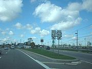
. Two intersections to the south, NY 182 turns east onto Cleveland Avenue. The route follows the street east to Lockport Avenue, where NY 182 follows the northeast alignment of the road to Ontario Avenue. At this intersection, NY 182 resumes an eastward progression as it travels through the northern portion of Niagara Falls.
At Hyde Park Blvd., NY 61
, NY 182 forms a short concurrency with the route south to Porter Road, making an eastward turn at the intersection and passing through the center of Hyde Park before connecting to Interstate 190
at exit 23. Just east of the exit, Porter Road comes to an end, forcing NY 182 onto Packard Road as it intersects NY 265
, Military Road. A short distance from this point, Porter Road resumes, allowing NY 182 to return to the road.
Porter Road, and likewise NY 182, continues to the southeast, forming the southern edge of the Niagara Falls International Airport
, before turning due east and terminating at an angled intersection with US 62 south of the center of the airport.
was truncated to NY 104
in Lewiston
ca. 1962.
State highway
State highway, state road or state route can refer to one of three related concepts, two of them related to a state or provincial government in a country that is divided into states or provinces :#A...
in Niagara County, New York
Niagara County, New York
Niagara County is a county located in the U.S. state of New York. As of the 2010 census, the population was 216,469. The county seat is Lockport. The county name is from the Iroquois word Onguiaahra; meaning the strait or thunder of waters. It is the location of Niagara Falls and Fort Niagara, and...
, United States
United States
The United States of America is a federal constitutional republic comprising fifty states and a federal district...
. It serves as a signed connection between the Whirlpool Rapids Bridge
Whirlpool Rapids Bridge
The Whirlpool Rapids Bridge, commonly called the Whirlpool Bridge, and until 1937, known as the Lower Steel Arch Bridge, is a spandrel braced, riveted, two-hinged arch bridge. It crosses the international border between Canada and the United States, connecting the commercial downtown districts of...
over the Niagara River
Niagara River
The Niagara River flows north from Lake Erie to Lake Ontario. It forms part of the border between the Province of Ontario in Canada and New York State in the United States. There are differing theories as to the origin of the name of the river...
and the Niagara Falls International Airport
Niagara Falls International Airport
-Traffic figures:Niagara Falls International received 56,943 passengers in 2008. As per Federal Aviation Administration records, the airport had 660 passenger boardings in calendar year 2005 and 1,409 unscheduled enplanements in 2006....
east of the city of Niagara Falls
Niagara Falls, New York
Niagara Falls is a city in Niagara County, New York, United States. As of the 2010 census, the city had a total population of 50,193, down from the 55,593 recorded in the 2000 census. It is across the Niagara River from Niagara Falls, Ontario , both named after the famed Niagara Falls which they...
. The western terminus of the route is at the roadway leading to the Whirlpool Rapids Bridge in Niagara Falls and its eastern terminus is at U.S. Route 62 in Wheatfield
Wheatfield, New York
Wheatfield is a town in Niagara County, New York, United States. The population was 18,117 at the 2010 census. The name stems from the agricultural use of the town lands: Growing Wheat....
. In between, NY 182 runs across the city of Niagara Falls, following several local streets as it makes its way from the Niagara River gorge to the suburbs of Niagara Falls.
Route description
Robert Moses State Parkway
The Robert Moses State Parkway is an long north–south highway in western Niagara County, New York, United States. Its southern terminus is at the LaSalle Expressway on the east bank of the Niagara River in Niagara Falls. The northern terminus is at NY 18 at Four Mile Creek State Park in...
for most of its routing through Niagara Falls
Niagara Falls, New York
Niagara Falls is a city in Niagara County, New York, United States. As of the 2010 census, the city had a total population of 50,193, down from the 55,593 recorded in the 2000 census. It is across the Niagara River from Niagara Falls, Ontario , both named after the famed Niagara Falls which they...
. Two intersections to the south, NY 182 turns east onto Cleveland Avenue. The route follows the street east to Lockport Avenue, where NY 182 follows the northeast alignment of the road to Ontario Avenue. At this intersection, NY 182 resumes an eastward progression as it travels through the northern portion of Niagara Falls.
At Hyde Park Blvd., NY 61
New York State Route 61
New York State Route 61 is a state highway located almost entirely in the city of Niagara Falls in Niagara County, New York in the United States. The road runs across the city in a northwest–southeast direction, terminating at NY 384 at its southern extent and NY 104 at its northern...
, NY 182 forms a short concurrency with the route south to Porter Road, making an eastward turn at the intersection and passing through the center of Hyde Park before connecting to Interstate 190
Interstate 190 (New York)
Interstate 190 runs 28.34 miles from Interstate 90 near Buffalo, New York to Lewiston, New York via Niagara Falls. Parts of this highway were built on the former rights-of-way of the Lehigh Valley Railroad and the Erie Canal. It is referred to by locals as The One-Ninety...
at exit 23. Just east of the exit, Porter Road comes to an end, forcing NY 182 onto Packard Road as it intersects NY 265
New York State Route 265
New York State Route 265 is a state highway located in the western part of New York in the United States. NY 265 is a north–south route that roughly parallels the western parts of the Niagara River in Erie County and Niagara County...
, Military Road. A short distance from this point, Porter Road resumes, allowing NY 182 to return to the road.
Porter Road, and likewise NY 182, continues to the southeast, forming the southern edge of the Niagara Falls International Airport
Niagara Falls International Airport
-Traffic figures:Niagara Falls International received 56,943 passengers in 2008. As per Federal Aviation Administration records, the airport had 660 passenger boardings in calendar year 2005 and 1,409 unscheduled enplanements in 2006....
, before turning due east and terminating at an angled intersection with US 62 south of the center of the airport.
History
The length of NY 182 was originally designated as NY 18D ca. 1932. The designation of the route was changed to NY 182 when NY 18New York State Route 18
New York State Route 18 is an east–west state highway in western New York in the United States. It runs parallel to the south shore of Lake Ontario for most of its length between Niagara County and Monroe County...
was truncated to NY 104
New York State Route 104
New York State Route 104 is a long east–west state highway in Upstate New York, United States. It spans six counties and enters the vicinity of four cities—Niagara Falls, Lockport, Rochester, and Oswego—as it follows a routing largely parallel to that of the southern shoreline of Lake...
in Lewiston
Lewiston (town), New York
Lewiston is a town in Niagara County, New York United States. The population was 16,262 at the 2010 census. The town and its contained village are named after Morgan Lewis, a governor of New York....
ca. 1962.