
New York State Route 344
Encyclopedia
New York State Route 344 (NY 344) is a state highway
located in Columbia County, New York
, United States
. The route is 1.9 miles (3.06 km) in length and serves primarily as an access road to the Bash Bish Falls
state parks on both sides of the New York
– Massachusetts
border. The western terminus of NY 344 is at NY 22
in Copake
. Its eastern terminus is at the Massachusetts state line, where it continues into Bash Bish Falls State Park
as Falls Road, a locally-maintained highway. NY 344 was assigned ca. 1932 and extended to its current length by 1953 after NY 22 was rerouted to bypass Copake Falls.
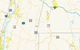
 NY 344 begins at an intersection with NY 22
in the hamlet
of Copake Falls. The road heads to the southeast, turning eastward into Taconic State Park
. NY 344 intersects with a few local roads at the border of the park, where it runs along the base of Sunset Rock, an 1800 feet (548.6 m) high, dual state mountain. The route continues eastward, along the base of Cedar Mountain before beginning to ascend up the mountain. While climbing Cedar Mountain, NY 344 crosses into Massachusetts
and becomes the unnumbered Falls Road, a local roadway providing access to Bash Bish Falls State Park
.
state line in the east. At the time, NY 22
served Copake Falls directly instead of bypassing it. NY 22 was rerouted to bypass Copake Falls on a new roadway to the west of the hamlet between 1947 and 1953. NY 344 was then extended northward on NY 22's former alignment to meet the new bypass north of Copake Falls. The southern half of NY 22's old routing into the hamlet remained state-maintained as well and is now NY 980F, an unsigned reference route.
State highway
State highway, state road or state route can refer to one of three related concepts, two of them related to a state or provincial government in a country that is divided into states or provinces :#A...
located in Columbia County, New York
Columbia County, New York
Columbia County is a county located in the U.S. state of New York. As of the 2010 census, the population was 63,096. The county seat is Hudson. The name comes from the Latin feminine form of the name of Christopher Columbus, which was at the time of the formation of the county a popular proposal...
, United States
United States
The United States of America is a federal constitutional republic comprising fifty states and a federal district...
. The route is 1.9 miles (3.06 km) in length and serves primarily as an access road to the Bash Bish Falls
Bash Bish Falls
Bash Bish Falls, a waterfall in Bash Bish Falls State Park in the Taconic Mountains of southwestern Massachusetts , is the highest waterfall in the state...
state parks on both sides of the New York
New York
New York is a state in the Northeastern region of the United States. It is the nation's third most populous state. New York is bordered by New Jersey and Pennsylvania to the south, and by Connecticut, Massachusetts and Vermont to the east...
– Massachusetts
Massachusetts
The Commonwealth of Massachusetts is a state in the New England region of the northeastern United States of America. It is bordered by Rhode Island and Connecticut to the south, New York to the west, and Vermont and New Hampshire to the north; at its east lies the Atlantic Ocean. As of the 2010...
border. The western terminus of NY 344 is at NY 22
New York State Route 22
New York State Route 22 is a north–south state highway in eastern New York in the United States. It runs parallel to the state's eastern edge from the outskirts of New York City to a short distance south of the Canadian border. At , it is the state's longest north–south route and...
in Copake
Copake, New York
Copake is a town in Columbia County, United States. New York, United States. The population was 3,278 at the 2000 census. The town derives its name from a lake, which was known to the natives as Cook-pake, or Ack-kook-peek, meaning "Snake Pond." The town borders Taconic State Park.The Town of...
. Its eastern terminus is at the Massachusetts state line, where it continues into Bash Bish Falls State Park
Bash Bish Falls State Park
Bash Bish Falls State Park is a Massachusetts state park located in Mount Washington which is named after Bash Bish Falls, Massachusetts' highest single-drop waterfall , which lies within its borders...
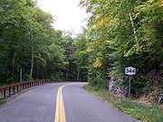
as Falls Road, a locally-maintained highway. NY 344 was assigned ca. 1932 and extended to its current length by 1953 after NY 22 was rerouted to bypass Copake Falls.
Route description
New York State Route 22
New York State Route 22 is a north–south state highway in eastern New York in the United States. It runs parallel to the state's eastern edge from the outskirts of New York City to a short distance south of the Canadian border. At , it is the state's longest north–south route and...
in the hamlet
Hamlet (place)
A hamlet is usually a rural settlement which is too small to be considered a village, though sometimes the word is used for a different sort of community. Historically, when a hamlet became large enough to justify building a church, it was then classified as a village...
of Copake Falls. The road heads to the southeast, turning eastward into Taconic State Park
Taconic State Park
Taconic State Park is located in Columbia and Dutchess County, New York abutting Massachusetts and Connecticut within the Taconic Mountains. The state park is located off New York State Route 344 south of Interstate 90 and north of New York City...
. NY 344 intersects with a few local roads at the border of the park, where it runs along the base of Sunset Rock, an 1800 feet (548.6 m) high, dual state mountain. The route continues eastward, along the base of Cedar Mountain before beginning to ascend up the mountain. While climbing Cedar Mountain, NY 344 crosses into Massachusetts
Massachusetts
The Commonwealth of Massachusetts is a state in the New England region of the northeastern United States of America. It is bordered by Rhode Island and Connecticut to the south, New York to the west, and Vermont and New Hampshire to the north; at its east lies the Atlantic Ocean. As of the 2010...
and becomes the unnumbered Falls Road, a local roadway providing access to Bash Bish Falls State Park
Bash Bish Falls State Park
Bash Bish Falls State Park is a Massachusetts state park located in Mount Washington which is named after Bash Bish Falls, Massachusetts' highest single-drop waterfall , which lies within its borders...
.
History
NY 344 was assigned ca. 1932 to a 1.52 miles (2.45 km) long highway extending from Copake Falls in the west to the MassachusettsMassachusetts
The Commonwealth of Massachusetts is a state in the New England region of the northeastern United States of America. It is bordered by Rhode Island and Connecticut to the south, New York to the west, and Vermont and New Hampshire to the north; at its east lies the Atlantic Ocean. As of the 2010...
state line in the east. At the time, NY 22
New York State Route 22
New York State Route 22 is a north–south state highway in eastern New York in the United States. It runs parallel to the state's eastern edge from the outskirts of New York City to a short distance south of the Canadian border. At , it is the state's longest north–south route and...
served Copake Falls directly instead of bypassing it. NY 22 was rerouted to bypass Copake Falls on a new roadway to the west of the hamlet between 1947 and 1953. NY 344 was then extended northward on NY 22's former alignment to meet the new bypass north of Copake Falls. The southern half of NY 22's old routing into the hamlet remained state-maintained as well and is now NY 980F, an unsigned reference route.