

New York State Route 101
Encyclopedia
New York State Route 101 (NY 101) is a 3.58 miles (5.76 km) long state highway
in northwestern Nassau County, New York
, United States
. It runs north–south as Port Washington Boulevard from NY 25A
in Flower Hill
, west of Roslyn
and north of Manhasset
, to Astor Lane in Sands Point
. It continues south along Searingtown Road to Shelter Rock Road (County Route 8 or CR 8) and north on Middle Neck Road to a dead end at Long Island Sound
as the unsigned County Route 101.
NY 101 was assigned ca. 1931 while the county route continuations were assigned in 1958. CR 101 was initially signed; however, signage for the route was removed in 1973. In the 1950s and 1960s, a proposal was made to construct a freeway in western Nassau County. The Western Nassau Expressway, as it was known, would have extended from NY 27
to NY 101 and utilized the NY 101 corridor north of NY 25A. The proposal was shelved in the 1970s.
. The route heads eastward as Searingtown Road, passing to the south of the high school and to the north of a small pond. One block east of Herricks Road, CR 101 intersects with Old Searingtown Road, a former alignment of the current CR 101 alignment. At this point, the highway curves to the northeast and passes through a small area of trees nestled amongst a large, residential area bordering Williston Park
. Old Searingtown Road rejoins CR 101 at the northern edge of the forested area.
The route continues north, serving as the boundary between Searingtown
and Albertson
as it proceeds past side streets lined by homes. At I.U. Willets Road, CR 101 serves Henry Wiscardi School and enters Searingtown. Just inside of the community, CR 101 intersects Hilldale Drive and Dogwood Road, two local streets connecting to Herricks Middle School
. The route continues on through Searingtown into the village of North Hills
, where the homes give way to trees as it turns to the northeast and passes under the Northern State Parkway
. A short distance after the Northern Parkway overpass, CR 101 meets the Long Island Expressway (Interstate 495
) by way of Nassau Boulevard—the southern service road—and North Service Road.
North of the Long Island Expressway, CR 101 passes by the Christopher Morley Park and Golf Course to the east and residential neighborhoods to the west. Past the park, CR 101 enters an area with more residential development as it begins to run along the western boundary of Roslyn Estates
and the eastern edge of Manhasset
. The homes give way to commercial developments as the highway approaches Flower Hill
and NY 25A
(Northern Boulevard). Searingtown Road becomes Port Washington Boulevard and CR 101 becomes NY 101 upon intersecting NY 25A.
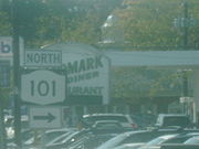 NY 101 continues north from NY 25A as a four-lane, undivided highway, passing homes, businesses and small patches of trees situated near the junction with NY 25A. At an intersection with Park Avenue North, NY 101 becomes a divided highway
with two lanes in each direction. The highway continues north through Flower Hill to St. Francis Hospital, where it curves to the northwest to serve the center of Flower Hill. Here, NY 101 passes east of Flower Hill Park and west of North Hempstead Country Club before curving back to the north and entering Port Washington
.
In Port Washington, NY 101 passes Nassau Knolls Cemetery and narrows to become a four-lane undivided highway as it enters the center of the hamlet. It proceeds north–south through downtown, passing several blocks of commercial buildings and Paul D. Schreiber Senior High School ahead of a junction with Main Street. North of this point, the surroundings of NY 101 become more residential as the route narrows to two lanes and passes into the village of Sands Point
. NY 101 ends shortly afterward at an intersection with Astor Lane, at which point Port Washington Blvd is continued by Middle Neck Road and designated as CR 101.
From this point west to the highway's end on Long Island Sound
, CR 101 follows a mostly east–west alignment through Sands Point. Along this last stretch, the route passes to the south of Sands Point County Park and north past Sands Point Golf Club as the surroundings around the route become increasingly forested and undeveloped. At Tibbits Lane, the route turns to the northwest and continues to the road's end at a dead end on the southern shore of Long Island Sound.
(Northern Boulevard) in Flower Hill
to Astor Lane in Sands Point
, which was designated as NY 101 by the following year. In 1959, the Nassau County
Department of Public Works created a numbered highway system as part of their "Master Plan" for the county highway system. This plan marked CR 101 along its current alignment. At the time, CR 101 was signed with blue-on-orange pentagonal shields, as were all county routes in Nassau County. In 1973, the state of New York
adopted the national Manual on Uniform Traffic Control Devices
, which specified that county route shields must be yellow-on-blue. Instead of changing all of its signage to meet the new standards, the Department of Public Works elected to remove all of the county route signage along its highways.
Since 2005, the traffic counts contained within the annual New York State Department of Transportation
(NYSDOT) Traffic Data Report have indicated that the northern terminus of NY 101 is at an intersection with Beacon Hill Road. However, other documents produced by NYSDOT, such as their official description of routes in New York, give the highway's northern terminus as Astors Lane.
laid out plans for a six-lane expressway in western Nassau County. The proposed highway would begin at Atlantic Avenue
in Freeport
and head north to an intersection with NY 25A (Northern Boulevard) in Roslyn
. Local residents opposed the plan, stating that the area was being developed too quickly. The proposed expressway was cancelled, and the $45 million that would have been used for the 11.5 miles (18.5 km) expressway went to extending the Meadowbrook State Parkway
northward instead.
Although the original plan was shelved, the need for a highway in western Nassau County still existed. In 1963, the Department of Public Works revived the project; however, the routing was altered to extend from the Sunrise Highway (NY 27
) north to an intersection with CR 101 (Middle Neck Road) in Sands Point. Part of the route would use modern NY 101 and the right-of-way of an abandoned Long Island Rail Road
line. In 1971, several proposed crossings of the Long Island Sound
were studied. One crossing, a bridge connecting Sands Point to New Rochelle
to Westchester County
, may have become a northward extension of the highway if it was constructed. By 1971, though, hopes had begun to fade on the highway's prospects of becoming reality. Even if construction had begun in that year, the highway would not be open to traffic until 1975. The project was eventually shelved.
and NY 101. The highway was a spur of CR 101 in name only as it never connected to CR 101.
State highway
State highway, state road or state route can refer to one of three related concepts, two of them related to a state or provincial government in a country that is divided into states or provinces :#A...
in northwestern Nassau County, New York
Nassau County, New York
Nassau County is a suburban county on Long Island, east of New York City in the U.S. state of New York, within the New York Metropolitan Area. As of the 2010 census, the population was 1,339,532...
, United States
United States
The United States of America is a federal constitutional republic comprising fifty states and a federal district...
. It runs north–south as Port Washington Boulevard from NY 25A
New York State Route 25A
New York State Route 25A is a state highway on Long Island in New York in the United States. It serves as the main east–west route for most of the North Shore of Long Island, running from the Queens Midtown Tunnel in the New York City borough of Queens at its western terminus to...
in Flower Hill
Flower Hill, New York
Flower Hill is a village in Nassau County, New York in the United States. The eastern half is considered part of the Greater Roslyn area, which is anchored by the Village of Roslyn. Western and northern parts are in Manhasset and Port Washington. The population was 4,665 at the 2010 census.The...
, west of Roslyn
Roslyn, New York
Roslyn is a village in Nassau County, New York, on the North Shore of Long Island. As of the United States 2010 Census, the village population was 2,770...
and north of Manhasset
Manhasset, New York
Manhasset is a hamlet and neighborhood in Nassau County, New York, on the North Shore of Long Island. As of the United States 2010 Census, the population was 8,080....
, to Astor Lane in Sands Point
Sands Point, New York
Sands Point is a village located at the northernmost tip of the Cow Neck Peninsula on the North Shore of Long Island in Nassau County, New York. As of the United States 2010 Census, the village population was 2,675. The Incorporated Village of Sands Point is in the Town of North...
. It continues south along Searingtown Road to Shelter Rock Road (County Route 8 or CR 8) and north on Middle Neck Road to a dead end at Long Island Sound
Long Island Sound
Long Island Sound is an estuary of the Atlantic Ocean, located in the United States between Connecticut to the north and Long Island, New York to the south. The mouth of the Connecticut River at Old Saybrook, Connecticut, empties into the sound. On its western end the sound is bounded by the Bronx...
as the unsigned County Route 101.
NY 101 was assigned ca. 1931 while the county route continuations were assigned in 1958. CR 101 was initially signed; however, signage for the route was removed in 1973. In the 1950s and 1960s, a proposal was made to construct a freeway in western Nassau County. The Western Nassau Expressway, as it was known, would have extended from NY 27
New York State Route 27
New York State Route 27 is an east–west long state highway extending from Interstate 278 in the New York City borough of Brooklyn to Montauk Point State Park on Long Island, New York, United States...
to NY 101 and utilized the NY 101 corridor north of NY 25A. The proposal was shelved in the 1970s.
Southern segment of CR 101
CR 101's southern segment begins at an intersection with Shelter Rock Road (CR 8) and Herricks Road near Herricks High SchoolHerricks High School
Herricks High School is a four-year comprehensive public high school with 1450 students, accredited by the New York State Board of Regents and the Middle States Association. The school is located in New Hyde Park, New York, 20 miles east of Manhattan. Dr. Jack Bierwirth, son of an ambassador in the...
. The route heads eastward as Searingtown Road, passing to the south of the high school and to the north of a small pond. One block east of Herricks Road, CR 101 intersects with Old Searingtown Road, a former alignment of the current CR 101 alignment. At this point, the highway curves to the northeast and passes through a small area of trees nestled amongst a large, residential area bordering Williston Park
Williston Park, New York
Williston Park is an incorporated village in Nassau County, New York in the United States. The population was 7,287 at the 2010 census.The Village of Williston Park is in the Town of North Hempstead.-Geography:...
. Old Searingtown Road rejoins CR 101 at the northern edge of the forested area.
The route continues north, serving as the boundary between Searingtown
Searingtown, New York
Searingtown is a census-designated place in Nassau County, New York, United States. It is considered part of the Greater Roslyn area, which is anchored by the Village of Roslyn...
and Albertson
Albertson, New York
Albertson is a hamlet in Nassau County, New York, United States. The population was 5,182 at the 2010 census.-Geography:...
as it proceeds past side streets lined by homes. At I.U. Willets Road, CR 101 serves Henry Wiscardi School and enters Searingtown. Just inside of the community, CR 101 intersects Hilldale Drive and Dogwood Road, two local streets connecting to Herricks Middle School
Herricks Middle School
Herricks Middle School is an intermediate school in Albertson, New York. In 1997, the U.S. Department of Education named Herricks Middle School a recipient of the Blue Ribbon Award, the department's most prestigious honor....
. The route continues on through Searingtown into the village of North Hills
North Hills, New York
North Hills is a village in Nassau County, New York in the United States. The population was 5,075 at the 2010 census.The Village of North Hills is located in the Town of North Hempstead.-Geography:North Hills is located at ....
, where the homes give way to trees as it turns to the northeast and passes under the Northern State Parkway
Northern State Parkway
The Northern State Parkway is a long limited-access state parkway on Long Island in the U.S. state of New York. The western terminus is at the Queens-Nassau County line, where the parkway continues westward into New York City as the Grand Central Parkway...
. A short distance after the Northern Parkway overpass, CR 101 meets the Long Island Expressway (Interstate 495
Interstate 495 (New York)
Interstate 495 is an auxiliary Interstate Highway on Long Island in New York in the United States. The route extends for from the western portal of the Queens-Midtown Tunnel in the New York City borough of Manhattan to County Route 58 in Riverhead, Suffolk County...
) by way of Nassau Boulevard—the southern service road—and North Service Road.
North of the Long Island Expressway, CR 101 passes by the Christopher Morley Park and Golf Course to the east and residential neighborhoods to the west. Past the park, CR 101 enters an area with more residential development as it begins to run along the western boundary of Roslyn Estates
Roslyn Estates, New York
Roslyn Estates is a village in Nassau County, New York, in the United States. It is considered part of the Greater Roslyn area, which is anchored by the village of Roslyn...
and the eastern edge of Manhasset
Manhasset, New York
Manhasset is a hamlet and neighborhood in Nassau County, New York, on the North Shore of Long Island. As of the United States 2010 Census, the population was 8,080....
. The homes give way to commercial developments as the highway approaches Flower Hill
Flower Hill, New York
Flower Hill is a village in Nassau County, New York in the United States. The eastern half is considered part of the Greater Roslyn area, which is anchored by the Village of Roslyn. Western and northern parts are in Manhasset and Port Washington. The population was 4,665 at the 2010 census.The...
and NY 25A
New York State Route 25A
New York State Route 25A is a state highway on Long Island in New York in the United States. It serves as the main east–west route for most of the North Shore of Long Island, running from the Queens Midtown Tunnel in the New York City borough of Queens at its western terminus to...
(Northern Boulevard). Searingtown Road becomes Port Washington Boulevard and CR 101 becomes NY 101 upon intersecting NY 25A.
NY 101
Divided Highway
Divided Highway is a compilation album by American rock band The Doobie Brothers, released in 2003. . All tracks are taken from the albums Cycles and Brotherhood .-Track listing:...
with two lanes in each direction. The highway continues north through Flower Hill to St. Francis Hospital, where it curves to the northwest to serve the center of Flower Hill. Here, NY 101 passes east of Flower Hill Park and west of North Hempstead Country Club before curving back to the north and entering Port Washington
Port Washington, New York
Port Washington is a hamlet and census-designated place in Nassau County, New York on the North Shore of Long Island. As of the United States 2010 Census, the community population was 15,846....
.
In Port Washington, NY 101 passes Nassau Knolls Cemetery and narrows to become a four-lane undivided highway as it enters the center of the hamlet. It proceeds north–south through downtown, passing several blocks of commercial buildings and Paul D. Schreiber Senior High School ahead of a junction with Main Street. North of this point, the surroundings of NY 101 become more residential as the route narrows to two lanes and passes into the village of Sands Point
Sands Point, New York
Sands Point is a village located at the northernmost tip of the Cow Neck Peninsula on the North Shore of Long Island in Nassau County, New York. As of the United States 2010 Census, the village population was 2,675. The Incorporated Village of Sands Point is in the Town of North...
. NY 101 ends shortly afterward at an intersection with Astor Lane, at which point Port Washington Blvd is continued by Middle Neck Road and designated as CR 101.
Northern segment of CR 101
The northern segment of CR 101 heads northward along Middle Neck Road, passing local residences and local commercial buildings to the east and the Village Club of Sands Point to the west. North of the club, the highway curves to the northwest and becomes surrounded by several blocks of residential homes to the southwest and patches of trees to the northeast as it heads deeper into the village.From this point west to the highway's end on Long Island Sound
Long Island Sound
Long Island Sound is an estuary of the Atlantic Ocean, located in the United States between Connecticut to the north and Long Island, New York to the south. The mouth of the Connecticut River at Old Saybrook, Connecticut, empties into the sound. On its western end the sound is bounded by the Bronx...
, CR 101 follows a mostly east–west alignment through Sands Point. Along this last stretch, the route passes to the south of Sands Point County Park and north past Sands Point Golf Club as the surroundings around the route become increasingly forested and undeveloped. At Tibbits Lane, the route turns to the northwest and continues to the road's end at a dead end on the southern shore of Long Island Sound.
Designation
In the 1930 renumbering of state highways in New York, several of the routes assigned during the 1920s were renumbered or modified. At the same time, hundreds of state-maintained highways that did not yet have a route number were assigned one. One of these highways was Port Washington Boulevard, a roadway connecting NY 25ANew York State Route 25A
New York State Route 25A is a state highway on Long Island in New York in the United States. It serves as the main east–west route for most of the North Shore of Long Island, running from the Queens Midtown Tunnel in the New York City borough of Queens at its western terminus to...
(Northern Boulevard) in Flower Hill
Flower Hill, New York
Flower Hill is a village in Nassau County, New York in the United States. The eastern half is considered part of the Greater Roslyn area, which is anchored by the Village of Roslyn. Western and northern parts are in Manhasset and Port Washington. The population was 4,665 at the 2010 census.The...
to Astor Lane in Sands Point
Sands Point, New York
Sands Point is a village located at the northernmost tip of the Cow Neck Peninsula on the North Shore of Long Island in Nassau County, New York. As of the United States 2010 Census, the village population was 2,675. The Incorporated Village of Sands Point is in the Town of North...
, which was designated as NY 101 by the following year. In 1959, the Nassau County
Nassau County, New York
Nassau County is a suburban county on Long Island, east of New York City in the U.S. state of New York, within the New York Metropolitan Area. As of the 2010 census, the population was 1,339,532...
Department of Public Works created a numbered highway system as part of their "Master Plan" for the county highway system. This plan marked CR 101 along its current alignment. At the time, CR 101 was signed with blue-on-orange pentagonal shields, as were all county routes in Nassau County. In 1973, the state of New York
New York
New York is a state in the Northeastern region of the United States. It is the nation's third most populous state. New York is bordered by New Jersey and Pennsylvania to the south, and by Connecticut, Massachusetts and Vermont to the east...
adopted the national Manual on Uniform Traffic Control Devices
Manual on Uniform Traffic Control Devices
The Manual on Uniform Traffic Control Devices is a document issued by the Federal Highway Administration of the United States Department of Transportation to specify the standards by which traffic signs, road surface markings, and signals are designed, installed, and used...
, which specified that county route shields must be yellow-on-blue. Instead of changing all of its signage to meet the new standards, the Department of Public Works elected to remove all of the county route signage along its highways.
Since 2005, the traffic counts contained within the annual New York State Department of Transportation
New York State Department of Transportation
The New York State Department of Transportation is responsible for the development and operation of highways, railroads, mass transit systems, ports, waterways and aviation facilities in the U.S...
(NYSDOT) Traffic Data Report have indicated that the northern terminus of NY 101 is at an intersection with Beacon Hill Road. However, other documents produced by NYSDOT, such as their official description of routes in New York, give the highway's northern terminus as Astors Lane.
Western Nassau Expressway
In 1952, the New York State Department of Public WorksNew York State Department of Public Works
The office of Superintendent of Public Works was created by an 1876 amendment to the New York State Constitution. It abolished the canal commissioners and established that the Department of Public Works execute all laws relating to canal maintenance and navigation except for those functions...
laid out plans for a six-lane expressway in western Nassau County. The proposed highway would begin at Atlantic Avenue
Atlantic Avenue (New York City)
Atlantic Avenue is an important street in the New York City boroughs of Brooklyn and Queens. It stretches from the Brooklyn waterfront on the East River all the way to Jamaica, Queens...
in Freeport
Freeport, New York
Freeport is a village in the town of Hempstead, Nassau County, New York, USA, on the South Shore of Long Island. The population was 42,860 at the 2010 census. A settlement since the 1640s, it was once an oystering community and later a resort popular with the New York City theater community...
and head north to an intersection with NY 25A (Northern Boulevard) in Roslyn
Roslyn, New York
Roslyn is a village in Nassau County, New York, on the North Shore of Long Island. As of the United States 2010 Census, the village population was 2,770...
. Local residents opposed the plan, stating that the area was being developed too quickly. The proposed expressway was cancelled, and the $45 million that would have been used for the 11.5 miles (18.5 km) expressway went to extending the Meadowbrook State Parkway
Meadowbrook State Parkway
The Meadowbrook State Parkway is a long parkway in Nassau County, New York. The southern terminus is at the Bay Parkway in Jones Beach State Park, where the parkway becomes the Ocean Parkway. The northern terminus is at the Northern State Parkway in Carle Place...
northward instead.
Although the original plan was shelved, the need for a highway in western Nassau County still existed. In 1963, the Department of Public Works revived the project; however, the routing was altered to extend from the Sunrise Highway (NY 27
New York State Route 27
New York State Route 27 is an east–west long state highway extending from Interstate 278 in the New York City borough of Brooklyn to Montauk Point State Park on Long Island, New York, United States...
) north to an intersection with CR 101 (Middle Neck Road) in Sands Point. Part of the route would use modern NY 101 and the right-of-way of an abandoned Long Island Rail Road
Long Island Rail Road
The Long Island Rail Road or LIRR is a commuter rail system serving the length of Long Island, New York. It is the busiest commuter railroad in North America, serving about 81.5 million passengers each year. Established in 1834 and having operated continuously since then, it is the oldest US...
line. In 1971, several proposed crossings of the Long Island Sound
Long Island Sound
Long Island Sound is an estuary of the Atlantic Ocean, located in the United States between Connecticut to the north and Long Island, New York to the south. The mouth of the Connecticut River at Old Saybrook, Connecticut, empties into the sound. On its western end the sound is bounded by the Bronx...
were studied. One crossing, a bridge connecting Sands Point to New Rochelle
New Rochelle, New York
New Rochelle is a city in Westchester County, New York, United States, in the southeastern portion of the state.The town was settled by refugee Huguenots in 1688 who were fleeing persecution in France...
to Westchester County
Westchester County, New York
Westchester County is a county located in the U.S. state of New York. Westchester covers an area of and has a population of 949,113 according to the 2010 Census, residing in 45 municipalities...
, may have become a northward extension of the highway if it was constructed. By 1971, though, hopes had begun to fade on the highway's prospects of becoming reality. Even if construction had begun in that year, the highway would not be open to traffic until 1975. The project was eventually shelved.
CR 101A
CR 101A was a designation for the 0.5 mile (0.80467 km) portion of Middle Neck Road between NY 25ANew York State Route 25A
New York State Route 25A is a state highway on Long Island in New York in the United States. It serves as the main east–west route for most of the North Shore of Long Island, running from the Queens Midtown Tunnel in the New York City borough of Queens at its western terminus to...
and NY 101. The highway was a spur of CR 101 in name only as it never connected to CR 101.