

New York State Route 9R
Encyclopedia
New York State Route 9R (NY 9R) is a north–south state highway
in northeastern Albany County, New York
, in the United States. The route is a 3.22 miles (5.18 km) eastern loop of U.S. Route 9 (US 9), connecting that route to the city of Cohoes
1.5 miles (2.4 km) to the east. It leaves US 9 in the hamlet of Latham
and rejoins its parent in the hamlet of Boght Corners
, both located in the town of Colonie
. Most of NY 9R is a two-lane highway that passes through residential areas; however, the southwesternmost portion of the route is four lanes wide and serves a commercial district. The route was assigned ca. 1939 and has remained largely unchanged since that time, save for a brief period during the 1970s where NY 9R was partially replaced by NY 470
.
 NY 9R begins opposite the entrance to the on-ramp for Interstate 87 (I-87) exit 7 at an intersection with US 9 (Loudon Road) in the Colonie
hamlet of Latham
, located north of the city of Albany
. The junction is also the termination of the off-ramp from the limited-access NY 7
west onto US 9. NY 9R heads east as the four-lane Columbia Street Extension, initially passing through a commercialized area centered around the route's intersections with US 9 and the nearby Old Loudon Road. The commercial strip ends at Johnson Road, where the route turns northeastward and narrows to two lanes as it heads into a lightly populated area of Colonie. This section of Columbia Street Extension passes by some commercial buildings; however, most of the development along the highway is residential, with most of the homes located in cul-de-sac
s leading away from NY 9R.
Roughly 0.5 mile (0.80467 km) west of an intersection with NY 470
on the western edge of the city of Cohoes
, the area surrounding the highway changes drastically as the route becomes lined with residential dwellings. The string of homes continue to the junction with NY 470 on the Cohoes city line, where NY 9R turns north onto Baker Avenue, a two-lane street that runs along the border between the town of Colonie and the city of Cohoes. Columbia Street, meanwhile, continues east into downtown Cohoes
as NY 470, which begins at NY 9R. Heading north, NY 9R passes through both residential neighborhoods and lightly populated areas. The homes along the Colonie (west) side of the route give way to woods after just 0.3 mile (0.482802 km); however, the Cohoes (east) side remains lined with fully populated and developed neighborhoods for another 0.7 miles (1.1 km).
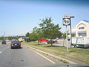
The 1 miles (1.6 km) north–south stretch ends at a junction with Boght Road, known as Manor Avenue within Cohoes. Both highways sit on the northern boundary of what was once the Manor of Rensselaerswyck. NY 9R turns left at this intersection, leaving the city boundary and proceeding westward along Boght Road. The complexion of the roadway is similar to that of the first 0.3 miles of Baker Avenue, as the two-lane road is lined with a steady stream of houses. After 0.75 miles (1.21 km), NY 9R enters a lightly populated hamlet named Boght Corners
, where it ends at an intersection with US 9. While the state route ends here, Boght Road continues westward as a town road to Dunsbach Ferry Road, a north–south town highway paralleling I-87 through northern Colonie.
; however, it was realigned in the early 1940s to follow an extension of Columbia Street between US 9 and the Cohoes
city line. In the mid-1970s, NY 9R was removed and partially replaced with the new NY 470
, an east–west route extending from the current southern terminus of NY 9R east through Cohoes
to Troy
. The NY 9R designation was reinstated in the late 1970s, resulting in the truncation of NY 470 to its present length.
State highway
State highway, state road or state route can refer to one of three related concepts, two of them related to a state or provincial government in a country that is divided into states or provinces :#A...
in northeastern Albany County, New York
Albany County, New York
Albany County is a county located in the U.S. state of New York, and is part of the Albany-Schenectady-Troy Metropolitan Statistical Area. The name is from the title of the Duke of York and Albany, who became James II of England . As of the 2010 census, the population was 304,204...
, in the United States. The route is a 3.22 miles (5.18 km) eastern loop of U.S. Route 9 (US 9), connecting that route to the city of Cohoes
Cohoes, New York
Cohoes is an incorporated city located at the northeast corner of Albany County in the US state of New York. It is called the "Spindle City" because of the importance of textile production to its growth. As of the 2010 census, the city population was 16,168...
1.5 miles (2.4 km) to the east. It leaves US 9 in the hamlet of Latham
Latham, New York
Latham is a hamlet in Albany County, New York, United States. It is located along U.S. Route 9 in the town of Colonie, a dense suburb north of Albany.-History:...
and rejoins its parent in the hamlet of Boght Corners
Boght Corners, New York
Boght Corners is a hamlet in the town of Colonie in northern Albany County, New York that straddles U.S. Route 9 . The corners that give the hamlet its name are found at the intersection of Route 9 and Boght Road , near the Boght Community Fire District’s station...
, both located in the town of Colonie
Colonie (town), New York
Colonie is a town in Albany County, New York, United States. It is the most populous suburb of Albany, New York, and is the third largest town in area in Albany County, occupying about 11% of the county. Several hamlets exist within the town. As of the 2010 census, the town had a total population...
. Most of NY 9R is a two-lane highway that passes through residential areas; however, the southwesternmost portion of the route is four lanes wide and serves a commercial district. The route was assigned ca. 1939 and has remained largely unchanged since that time, save for a brief period during the 1970s where NY 9R was partially replaced by NY 470
New York State Route 470
New York State Route 470 is a state highway in the Capital District of New York in the United States. The western terminus of the route is at an intersection with NY 9R just west of the Cohoes city limits in Colonie. The eastern terminus is at a junction with U.S. Route 4 in Troy...
.
Route description
Colonie (town), New York
Colonie is a town in Albany County, New York, United States. It is the most populous suburb of Albany, New York, and is the third largest town in area in Albany County, occupying about 11% of the county. Several hamlets exist within the town. As of the 2010 census, the town had a total population...
hamlet of Latham
Latham, New York
Latham is a hamlet in Albany County, New York, United States. It is located along U.S. Route 9 in the town of Colonie, a dense suburb north of Albany.-History:...
, located north of the city of Albany
Albany, New York
Albany is the capital city of the U.S. state of New York, the seat of Albany County, and the central city of New York's Capital District. Roughly north of New York City, Albany sits on the west bank of the Hudson River, about south of its confluence with the Mohawk River...
. The junction is also the termination of the off-ramp from the limited-access NY 7
New York State Route 7
New York State Route 7 is a 180-mile long New York State Highway that runs from the New York/Pennsylvania border south of Binghamton, New York to the New York/Vermont border east of Hoosick. Most of the road runs along the Susquehanna Valley, closely paralleling Interstate 88 throughout...
west onto US 9. NY 9R heads east as the four-lane Columbia Street Extension, initially passing through a commercialized area centered around the route's intersections with US 9 and the nearby Old Loudon Road. The commercial strip ends at Johnson Road, where the route turns northeastward and narrows to two lanes as it heads into a lightly populated area of Colonie. This section of Columbia Street Extension passes by some commercial buildings; however, most of the development along the highway is residential, with most of the homes located in cul-de-sac
Cul-de-sac
A cul-de-sac is a word of French origin referring to a dead end, close, no through road or court meaning dead-end street with only one inlet/outlet...
s leading away from NY 9R.
Roughly 0.5 mile (0.80467 km) west of an intersection with NY 470
New York State Route 470
New York State Route 470 is a state highway in the Capital District of New York in the United States. The western terminus of the route is at an intersection with NY 9R just west of the Cohoes city limits in Colonie. The eastern terminus is at a junction with U.S. Route 4 in Troy...
on the western edge of the city of Cohoes
Cohoes, New York
Cohoes is an incorporated city located at the northeast corner of Albany County in the US state of New York. It is called the "Spindle City" because of the importance of textile production to its growth. As of the 2010 census, the city population was 16,168...
, the area surrounding the highway changes drastically as the route becomes lined with residential dwellings. The string of homes continue to the junction with NY 470 on the Cohoes city line, where NY 9R turns north onto Baker Avenue, a two-lane street that runs along the border between the town of Colonie and the city of Cohoes. Columbia Street, meanwhile, continues east into downtown Cohoes
Downtown Cohoes Historic District
The Downtown Cohoes Historic District takes up of the city of Cohoes, New York, United States. Many of the 165 contributing properties date from the 1820-1930 period when the Erie Canal and Harmony Mills were the mainstay of the city's economy. It was recognized as a historic district and added to...
as NY 470, which begins at NY 9R. Heading north, NY 9R passes through both residential neighborhoods and lightly populated areas. The homes along the Colonie (west) side of the route give way to woods after just 0.3 mile (0.482802 km); however, the Cohoes (east) side remains lined with fully populated and developed neighborhoods for another 0.7 miles (1.1 km).
The 1 miles (1.6 km) north–south stretch ends at a junction with Boght Road, known as Manor Avenue within Cohoes. Both highways sit on the northern boundary of what was once the Manor of Rensselaerswyck. NY 9R turns left at this intersection, leaving the city boundary and proceeding westward along Boght Road. The complexion of the roadway is similar to that of the first 0.3 miles of Baker Avenue, as the two-lane road is lined with a steady stream of houses. After 0.75 miles (1.21 km), NY 9R enters a lightly populated hamlet named Boght Corners
Boght Corners, New York
Boght Corners is a hamlet in the town of Colonie in northern Albany County, New York that straddles U.S. Route 9 . The corners that give the hamlet its name are found at the intersection of Route 9 and Boght Road , near the Boght Community Fire District’s station...
, where it ends at an intersection with US 9. While the state route ends here, Boght Road continues westward as a town road to Dunsbach Ferry Road, a north–south town highway paralleling I-87 through northern Colonie.
History
NY 9R was assigned ca. 1939 to most of its current alignment. Originally, the southern half of the route followed Johnson Road and St. Agnes Highway through ColonieColonie (town), New York
Colonie is a town in Albany County, New York, United States. It is the most populous suburb of Albany, New York, and is the third largest town in area in Albany County, occupying about 11% of the county. Several hamlets exist within the town. As of the 2010 census, the town had a total population...
; however, it was realigned in the early 1940s to follow an extension of Columbia Street between US 9 and the Cohoes
Cohoes, New York
Cohoes is an incorporated city located at the northeast corner of Albany County in the US state of New York. It is called the "Spindle City" because of the importance of textile production to its growth. As of the 2010 census, the city population was 16,168...
city line. In the mid-1970s, NY 9R was removed and partially replaced with the new NY 470
New York State Route 470
New York State Route 470 is a state highway in the Capital District of New York in the United States. The western terminus of the route is at an intersection with NY 9R just west of the Cohoes city limits in Colonie. The eastern terminus is at a junction with U.S. Route 4 in Troy...
, an east–west route extending from the current southern terminus of NY 9R east through Cohoes
Cohoes, New York
Cohoes is an incorporated city located at the northeast corner of Albany County in the US state of New York. It is called the "Spindle City" because of the importance of textile production to its growth. As of the 2010 census, the city population was 16,168...
to Troy
Troy, New York
Troy is a city in the US State of New York and the seat of Rensselaer County. Troy is located on the western edge of Rensselaer County and on the eastern bank of the Hudson River. Troy has close ties to the nearby cities of Albany and Schenectady, forming a region popularly called the Capital...
. The NY 9R designation was reinstated in the late 1970s, resulting in the truncation of NY 470 to its present length.