

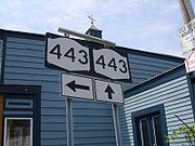
New York State Route 443
Encyclopedia
New York State Route 443 (NY 443) is an east–west state highway
in the Capital District
of New York
in the United States. The route begins at an intersection with NY 30
in the town of Schoharie
and ends 33.44 miles (53.82 km) later at a junction with U.S. Route 9W (US 9W) and US 20
in the city of Albany
. It passes through the Helderberg Mountains in the towns of Berne
and New Scotland
. Within the town of Bethlehem
and the city of Albany
, NY 443 is known as Delaware Avenue.
NY 443 was originally designated as the Albany County
portion of NY 43
in the 1920s, but the NY 43 designation was truncated to Rensselaer
in the early 1970s. The portion of NY 43 west of Madison Avenue in Albany was then redesignated as NY 443. Many of the reference marker
s along NY 443 bear the number "43" instead.
in the Schoharie County
town of Schoharie
. The highway heads eastward, passing residential homes, fields, and forests. After making several turns in direction, Route 443 enters the town of Wright
and the small hamlet of Shutters Corners. The highway leaves the hamlet uneventfully and heads to the southeast. NY 443 then enters the hamlet of Gallupville, where NY 146
begins. The highway makes a drastic turn to the south, entering the unofficial center of Gallupville.
In Gallupville, Route 443 turns eastward, passing homes and businesses. At the intersection with Knox Road (County Route 24 or CR 24), the highway turns to the southeast, with both roads paralleling for a short time. After Gallupville, the surroundings around Route 443 become rural again, with the highway changing directions several times. It follows Fox Creek southeast into Albany County
.
.
 Berne is well-developed, with Route 443 passing through the center of town. Outside the community, Route 443 continues through rural regions similar to those it has followed for most of its length. Just outside of Berne, the highway intersects with NY 156
, a highway that heads north to Knox
then east to Altamont. Route 443 makes several turns in direction before heading steadily to the southeast. The surroundings around the highway have not changed, entering East Berne shortly after. Most of the intersections in this area are with county roads, entering the hamlet of Wolf Hill.
In Wolf Hill, NY 85
merges, and the two roads overlap along the Delaware Turnpike. The two highways pass Helderberg Lake and leave Wolf Hill soon after. The surroundings are still rural, with Route 85 turning off to the east along New Scotland Road soon after. Route 443 continues to the south as the Delaware Turnpike. The highway is still rural, with local roads becoming the only intersections. After intersecting with Tarrytown Road (CR 301), Route 443 heads through a small, residential downtown. NY 443 heads to the northeast and into Unionville.
-owned Selkirk Subdivision
prior to passing through Unionville. Route 443 passes various businesses, homes, and forests as it continues through Albany County. The highway enters Bethlehem
, where the road name becomes Delaware Avenue and the surroundings become more residential in nature. Here, NY 443 intersects with the southern terminus of NY 140
. A junction with NY 335
comes soon after. Route 443 crosses over Normans Kill, a tributary of the Hudson River
as it enters the city of Albany
.
In Normansville
, a hamlet just inside of the city limits, ownership and maintenance of the route shifts from the New York State Department of Transportation
(NYSDOT) to the city of Albany. Continuing on, the highway passes over the New York State Thruway
(Interstate 87) as it enters the inner core of the city. Here, NY 443 passes densely populated city blocks and intersects with US 9W
(Southern Boulevard). US 9W joins NY 443 northeastward along Delaware Avenue to a junction with Lark Street and Madison Avenue (the latter designated as US 20
) in Albany. Here, NY 443 and Delaware Avenue both come to an end while US 9W continues to the north along Lark Street.
In the mid-1920s, the entirety of modern NY 443 was designated as part of NY 43
, a highway extending from NY 9 (now NY 7
) in the hamlet of Central Bridge north of Schoharie
to Albany
. The 1930 renumbering of state highways in New York brought about a pair of changes in NY 43's alignment. On its western end, it was truncated to a junction with the newly-created NY 30
just north of Schoharie. To the east, NY 43 was extended east through Albany and across the Hudson River
to the Massachusetts
state line. NY 43 was truncated on its western end in the early 1970s to Rensselaer
, a city bordering Albany on the eastern bank of the Hudson River. Its former routing from Schoharie to Madison Avenue in Albany was redesignated as NY 443. Many of the reference marker
s along NY 443 still bear the number "43".
State highway
State highway, state road or state route can refer to one of three related concepts, two of them related to a state or provincial government in a country that is divided into states or provinces :#A...
in the Capital District
Capital District
New York's Capital District, also known as the Capital Region, is a region in upstate New York that generally refers to the four counties surrounding Albany, the capital of the state: Albany County, Schenectady County, Rensselaer County, and Saratoga County...
of New York
New York
New York is a state in the Northeastern region of the United States. It is the nation's third most populous state. New York is bordered by New Jersey and Pennsylvania to the south, and by Connecticut, Massachusetts and Vermont to the east...
in the United States. The route begins at an intersection with NY 30
New York State Route 30
New York State Route 30 is a state highway in the central part of New York in the United States. It extends for from an interchange with NY 17 in the Southern Tier to the Canadian border in the state's North Country, where it continues into Quebec as Route 138. On a regional level,...
in the town of Schoharie
Schoharie (town), New York
Schoharie is a town in Schoharie County, New York. The population was 3,299 at the 2000 census. The village is named after a native word for driftwood.The Town of Schoharie has a village, also called Schoharie...
and ends 33.44 miles (53.82 km) later at a junction with U.S. Route 9W (US 9W) and US 20
U.S. Route 20 in New York
U.S. Route 20 is a part of the U.S. Highway System that runs from Newport, Oregon, to Boston, Massachusetts. In the U.S. state of New York, US 20 extends from the Pennsylvania state line at Ripley to the Massachusetts state line in the Berkshire Mountains. US 20 is the longest...
in the city of Albany
Albany, New York
Albany is the capital city of the U.S. state of New York, the seat of Albany County, and the central city of New York's Capital District. Roughly north of New York City, Albany sits on the west bank of the Hudson River, about south of its confluence with the Mohawk River...
. It passes through the Helderberg Mountains in the towns of Berne
Berne, New York
Berne is a town in Albany County, New York, United States. The population was 2,794 at the 2010 census. The town is at the west border of Albany County.- History :...
and New Scotland
New Scotland, New York
New Scotland is a town in Albany County, New York, United States. The population was 8,648 at the 2010 census.The town is southwest of Albany, New York, the state capital. New Scotland is centrally located in the county.-History:...
. Within the town of Bethlehem
Bethlehem, New York
Bethlehem is a town in Albany County, New York, USA. The population was 33,656 at the 2010 census. The town is south of Albany. Bethlehem includes the following hamlets: Delmar, Elsmere, Slingerlands, Glenmont, Selkirk, South and North Bethlehem. U.S. Route 9W passes through the town...
and the city of Albany
Albany, New York
Albany is the capital city of the U.S. state of New York, the seat of Albany County, and the central city of New York's Capital District. Roughly north of New York City, Albany sits on the west bank of the Hudson River, about south of its confluence with the Mohawk River...
, NY 443 is known as Delaware Avenue.
NY 443 was originally designated as the Albany County
Albany County, New York
Albany County is a county located in the U.S. state of New York, and is part of the Albany-Schenectady-Troy Metropolitan Statistical Area. The name is from the title of the Duke of York and Albany, who became James II of England . As of the 2010 census, the population was 304,204...
portion of NY 43
New York State Route 43
New York State Route 43 is a state highway in Rensselaer County, New York, United States. It extends for from Interstate 90 exit 8 in North Greenbush to the Massachusetts state line, where it continues into Williamstown as Massachusetts Route 43...
in the 1920s, but the NY 43 designation was truncated to Rensselaer
Rensselaer, New York
Rensselaer is a city in Rensselaer County, New York, United States, and is located on the Hudson River directly opposite Albany. As of the 2010 census, the city population was 9,392; in 1920, it was 10,832. The name is from Kiliaen van Rensselaer, the original landowner of the region in New...
in the early 1970s. The portion of NY 43 west of Madison Avenue in Albany was then redesignated as NY 443. Many of the reference marker
Reference marker (New York)
In New York, a reference marker is a small green sign mounted approximately every one-tenth mile on highways maintained by the New York State Department of Transportation. This was initiated in response to the Highway Safety Act of 1966 enacted by Congress, in an effort to monitor traffic and...
s along NY 443 bear the number "43" instead.
Schoharie County
Route 443 begins at an intersection with NY 30New York State Route 30
New York State Route 30 is a state highway in the central part of New York in the United States. It extends for from an interchange with NY 17 in the Southern Tier to the Canadian border in the state's North Country, where it continues into Quebec as Route 138. On a regional level,...
in the Schoharie County
Schoharie County, New York
As of the census of 2000, there were 31,582 people, 11,991 households and 8,177 families residing in the county. The population density was 51 people per square mile . There were 15,915 housing units at an average density of 26 per square mile...
town of Schoharie
Schoharie (town), New York
Schoharie is a town in Schoharie County, New York. The population was 3,299 at the 2000 census. The village is named after a native word for driftwood.The Town of Schoharie has a village, also called Schoharie...
. The highway heads eastward, passing residential homes, fields, and forests. After making several turns in direction, Route 443 enters the town of Wright
Wright, New York
Wright is a town in Schoharie County, New York, United States. The population was 1,547 at the 2000 census. The town was named after governor Silas Wright.The Town of Wright is on the county's northeastern corner and is west of Albany.- History :...
and the small hamlet of Shutters Corners. The highway leaves the hamlet uneventfully and heads to the southeast. NY 443 then enters the hamlet of Gallupville, where NY 146
New York State Route 146
New York State Route 146 is a state highway in the Capital District of New York in the United States. It extends for from Gallupville at NY 443 to near Mechanicville at U.S. Route 4 and NY 32. NY 146 is a major thoroughfare in the city of Schenectady, just outside of...
begins. The highway makes a drastic turn to the south, entering the unofficial center of Gallupville.
In Gallupville, Route 443 turns eastward, passing homes and businesses. At the intersection with Knox Road (County Route 24 or CR 24), the highway turns to the southeast, with both roads paralleling for a short time. After Gallupville, the surroundings around Route 443 become rural again, with the highway changing directions several times. It follows Fox Creek southeast into Albany County
Albany County, New York
Albany County is a county located in the U.S. state of New York, and is part of the Albany-Schenectady-Troy Metropolitan Statistical Area. The name is from the title of the Duke of York and Albany, who became James II of England . As of the 2010 census, the population was 304,204...
.
Albany County
When Route 443 enters Albany County, it becomes known as the Helderberg Trail. The highway heads southward, still paralleling Fox Creek. Soon after, the highway enters the hamlet of West Berne. Route 443 and the Helderberg Trail leave West Berne uneventfully. Just outside of West Berne, the surroundings are again rural, with the highway turning to the southeast at an intersection with CR 254. Route 443 passes Berne Park before entering the hamlet of BerneBerne, New York
Berne is a town in Albany County, New York, United States. The population was 2,794 at the 2010 census. The town is at the west border of Albany County.- History :...
.
New York State Route 156
New York State Route 156 is a state highway in New York. The highway runs from the hamlet of Berne to the village of Voorheesville. A two-lane highway its entire length, NY 156 is entirely located within Albany County....
, a highway that heads north to Knox
Knox, New York
Knox is a town in Albany County, New York, United States. The population was 2,692 at the 2010 census.The Town is in the northwest part of Albany County and is west of Albany, the state capital.- History :...
then east to Altamont. Route 443 makes several turns in direction before heading steadily to the southeast. The surroundings around the highway have not changed, entering East Berne shortly after. Most of the intersections in this area are with county roads, entering the hamlet of Wolf Hill.
In Wolf Hill, NY 85
New York State Route 85
New York State Route 85 is a state highway in Albany County, New York, in the United States. It is long and runs from County Route 351 and CR 353 in Rensselaerville to Interstate 90 exit 4 in Albany. It also has a loop route, NY 85A, which connects NY 85 to...
merges, and the two roads overlap along the Delaware Turnpike. The two highways pass Helderberg Lake and leave Wolf Hill soon after. The surroundings are still rural, with Route 85 turning off to the east along New Scotland Road soon after. Route 443 continues to the south as the Delaware Turnpike. The highway is still rural, with local roads becoming the only intersections. After intersecting with Tarrytown Road (CR 301), Route 443 heads through a small, residential downtown. NY 443 heads to the northeast and into Unionville.
City of Albany
In Unionville, Route 443 becomes concurrent with CR 308 at New Scotland South Road. CR 308 quickly turns off onto Feura Bush – Unionville Road, with the main highway (NY 443) heading eastward. The highway passes under the CSX TransportationCSX Transportation
CSX Transportation operates a Class I railroad in the United States known as the CSX Railroad. It is the main subsidiary of the CSX Corporation. The company is headquartered in Jacksonville, Florida, and owns approximately 21,000 route miles...
-owned Selkirk Subdivision
Selkirk Subdivision
The Selkirk Subdivision is a railroad line owned by CSX Transportation in the U.S. State of New York. The line runs from Selkirk northwest to Amsterdam along a former New York Central Railroad line. At its southeast end, at Selkirk Yard, the Selkirk Subdivision becomes the Castleton Subdivision...
prior to passing through Unionville. Route 443 passes various businesses, homes, and forests as it continues through Albany County. The highway enters Bethlehem
Bethlehem, New York
Bethlehem is a town in Albany County, New York, USA. The population was 33,656 at the 2010 census. The town is south of Albany. Bethlehem includes the following hamlets: Delmar, Elsmere, Slingerlands, Glenmont, Selkirk, South and North Bethlehem. U.S. Route 9W passes through the town...
, where the road name becomes Delaware Avenue and the surroundings become more residential in nature. Here, NY 443 intersects with the southern terminus of NY 140
New York State Route 140
New York State Route 140 is an east–west state highway located entirely within Albany County, New York, in the United States. The highway runs for from NY 85 near the hamlet of Slingerlands to NY 443 in the hamlet of Delmar...
. A junction with NY 335
New York State Route 335
New York State Route 335 is a long state highway located in the town of Bethlehem, New York, in the United States. Its southern terminus is at an intersection with Feura Bush Road near the hamlet of Delmar, and its northern terminus is at a junction with NY 443 in the hamlet of Elsmere...
comes soon after. Route 443 crosses over Normans Kill, a tributary of the Hudson River
Hudson River
The Hudson is a river that flows from north to south through eastern New York. The highest official source is at Lake Tear of the Clouds, on the slopes of Mount Marcy in the Adirondack Mountains. The river itself officially begins in Henderson Lake in Newcomb, New York...
as it enters the city of Albany
Albany, New York
Albany is the capital city of the U.S. state of New York, the seat of Albany County, and the central city of New York's Capital District. Roughly north of New York City, Albany sits on the west bank of the Hudson River, about south of its confluence with the Mohawk River...
.
In Normansville
Normansville, New York
Normansville is a hamlet in the town of Bethlehem and a neighborhood in the city of Albany, Albany County, New York. The entire area was one hamlet in Bethlehem until the portion north of the Normans Kill was annexed by Albany in 1916...
, a hamlet just inside of the city limits, ownership and maintenance of the route shifts from the New York State Department of Transportation
New York State Department of Transportation
The New York State Department of Transportation is responsible for the development and operation of highways, railroads, mass transit systems, ports, waterways and aviation facilities in the U.S...
(NYSDOT) to the city of Albany. Continuing on, the highway passes over the New York State Thruway
New York State Thruway
The New York State Thruway is a system of limited-access highways located within the state of New York in the United States. The system, known officially as the Governor Thomas E. Dewey Thruway for former New York Governor Thomas E. Dewey, is operated by the New York State Thruway Authority and...
(Interstate 87) as it enters the inner core of the city. Here, NY 443 passes densely populated city blocks and intersects with US 9W
U.S. Route 9W
U.S. Route 9W is a north–south U.S. Highway in the states of New Jersey and New York. It begins on Fletcher Avenue in Fort Lee, New Jersey as it crosses the US 1 & 9, US 46, and the Interstate 95 approaches to the George Washington Bridge, where it heads north up the west...
(Southern Boulevard). US 9W joins NY 443 northeastward along Delaware Avenue to a junction with Lark Street and Madison Avenue (the latter designated as US 20
U.S. Route 20 in New York
U.S. Route 20 is a part of the U.S. Highway System that runs from Newport, Oregon, to Boston, Massachusetts. In the U.S. state of New York, US 20 extends from the Pennsylvania state line at Ripley to the Massachusetts state line in the Berkshire Mountains. US 20 is the longest...
) in Albany. Here, NY 443 and Delaware Avenue both come to an end while US 9W continues to the north along Lark Street.
History
Route 443 roughly follows an 18th century trail of the Mohawk Indians from the Hudson River to Schoharie Valley. It was probably a few years before 1787 when Stephen Van Rensselaer III had it upgraded and straightened slightly to make it accessible by wagons. Before that the settlers in the Beaver Dam as the Town of Berne is now known, had to go by way of the wagon road from Altamont, through what is now Knox, to the Schoharie Valley.In the mid-1920s, the entirety of modern NY 443 was designated as part of NY 43
New York State Route 43
New York State Route 43 is a state highway in Rensselaer County, New York, United States. It extends for from Interstate 90 exit 8 in North Greenbush to the Massachusetts state line, where it continues into Williamstown as Massachusetts Route 43...
, a highway extending from NY 9 (now NY 7
New York State Route 7
New York State Route 7 is a 180-mile long New York State Highway that runs from the New York/Pennsylvania border south of Binghamton, New York to the New York/Vermont border east of Hoosick. Most of the road runs along the Susquehanna Valley, closely paralleling Interstate 88 throughout...
) in the hamlet of Central Bridge north of Schoharie
Schoharie (village), New York
Schoharie is a village in Schoharie County, New York, USA. The population was 1,030 at the 2000 census. It is the county seat of Schoharie County...
to Albany
Albany, New York
Albany is the capital city of the U.S. state of New York, the seat of Albany County, and the central city of New York's Capital District. Roughly north of New York City, Albany sits on the west bank of the Hudson River, about south of its confluence with the Mohawk River...
. The 1930 renumbering of state highways in New York brought about a pair of changes in NY 43's alignment. On its western end, it was truncated to a junction with the newly-created NY 30
New York State Route 30
New York State Route 30 is a state highway in the central part of New York in the United States. It extends for from an interchange with NY 17 in the Southern Tier to the Canadian border in the state's North Country, where it continues into Quebec as Route 138. On a regional level,...
just north of Schoharie. To the east, NY 43 was extended east through Albany and across the Hudson River
Hudson River
The Hudson is a river that flows from north to south through eastern New York. The highest official source is at Lake Tear of the Clouds, on the slopes of Mount Marcy in the Adirondack Mountains. The river itself officially begins in Henderson Lake in Newcomb, New York...
to the Massachusetts
Massachusetts
The Commonwealth of Massachusetts is a state in the New England region of the northeastern United States of America. It is bordered by Rhode Island and Connecticut to the south, New York to the west, and Vermont and New Hampshire to the north; at its east lies the Atlantic Ocean. As of the 2010...
state line. NY 43 was truncated on its western end in the early 1970s to Rensselaer
Rensselaer, New York
Rensselaer is a city in Rensselaer County, New York, United States, and is located on the Hudson River directly opposite Albany. As of the 2010 census, the city population was 9,392; in 1920, it was 10,832. The name is from Kiliaen van Rensselaer, the original landowner of the region in New...
, a city bordering Albany on the eastern bank of the Hudson River. Its former routing from Schoharie to Madison Avenue in Albany was redesignated as NY 443. Many of the reference marker
Reference marker (New York)
In New York, a reference marker is a small green sign mounted approximately every one-tenth mile on highways maintained by the New York State Department of Transportation. This was initiated in response to the Highway Safety Act of 1966 enacted by Congress, in an effort to monitor traffic and...
s along NY 443 still bear the number "43".