

New York State Route 290
Encyclopedia
New York State Route 290 (NY 290) is a state highway
located entirely within Onondaga County, New York
, extending from downtown Syracuse
to the east side of the county. It provides access to Green Lakes State Park
from the north.
NY 290 is one of several state highways linking Syracuse and its eastern suburbs.
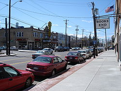
. All of NY 290 within the city of Syracuse is maintained by the city. It follows James Street towards the Eastwood
section of Syracuse. At Eastwood, it intersects NY 598
(Midler Avenue). NY 290 continues east and has a junction with NY 635
(Thompson Road).
 Shortly after its junction with NY 635, NY 290 enters the village of East Syracuse
as West Manlius Street. In the village of East Syracuse, NY 290 approaches a fork in the road, and veers to the right on Bridge Street. After a bridge over the CSX Transportation
-owned Mohawk Subdivision railroad line, NY 290 approaches an intersection with Manlius Center Road to the left, Bridge Street to the right and Chevy Drive straight ahead. NY 930P (an unsigned reference route) continues to the right as Bridge Street, towards Interstate 690, and NY 5
. NY 290 continues to the left on Manlius Center Drive, towards the town of Manlius
.
Shortly after passing under the Interstate 481 bridge, NY 290 enters the town of Manlius
. NY 290 passes through a residential section of Manlius, called Fremont Heights. NY 290 passes Fremont Road, North Burdick Street, and Minoa Road. It then stops at a T-shaped intersection, at the northern terminus of NY 257
, which leads to Fayetteville
. NY 290 continues to the left as Green Lakes Road.
NY 290 eventually passes Green Lakes State Park
in Manlius
, and then reaches its eastern terminus at NY 5
in the hamlet of Mycenae
.
State highway
State highway, state road or state route can refer to one of three related concepts, two of them related to a state or provincial government in a country that is divided into states or provinces :#A...
located entirely within Onondaga County, New York
Onondaga County, New York
Onondaga County is a county located in the U.S. state of New York. As of the 2010 census, the population was 467,026. The county seat is Syracuse.Onondaga County is part of the Syracuse, NY Metropolitan Statistical Area....
, extending from downtown Syracuse
Syracuse, New York
Syracuse is a city in and the county seat of Onondaga County, New York, United States, the largest U.S. city with the name "Syracuse", and the fifth most populous city in the state. At the 2010 census, the city population was 145,170, and its metropolitan area had a population of 742,603...
to the east side of the county. It provides access to Green Lakes State Park
Green Lakes State Park
Green Lakes State Park is a New York State Park located east of Syracuse in the Town of Manlius. The park is strikingly scenic, and has a "masterpiece" golf course designed by Robert Trent Jones very early in his career. Green Lake itself is perhaps the most studied meromictic lake – one in...
from the north.
NY 290 is one of several state highways linking Syracuse and its eastern suburbs.
Route description
NY 290 begins at US 11 in downtown SyracuseSyracuse, New York
Syracuse is a city in and the county seat of Onondaga County, New York, United States, the largest U.S. city with the name "Syracuse", and the fifth most populous city in the state. At the 2010 census, the city population was 145,170, and its metropolitan area had a population of 742,603...
. All of NY 290 within the city of Syracuse is maintained by the city. It follows James Street towards the Eastwood
Eastwood, Syracuse
Eastwood is a neighborhood in the east of Syracuse, New York, USA. The neighborhood was part of the last round of annexations by the City of Syracuse, in 1928...
section of Syracuse. At Eastwood, it intersects NY 598
New York State Route 598
New York State Route 598 is a north–south state highway located within Onondaga County, New York, in the United States. It extends for from an intersection with NY 5 in the city of Syracuse to a junction with NY 298 in the adjacent town of Salina...
(Midler Avenue). NY 290 continues east and has a junction with NY 635
New York State Route 635
New York State Route 635 is a state highway located in the vicinity of Syracuse in Onondaga County, New York. The southern terminus of the route is at Erie Boulevard in Syracuse. The northern terminus is at Carrier Circle in DeWitt, where NY 635 connects to both the New York State...
(Thompson Road).
East Syracuse, New York
East Syracuse is an incorporated village and a suburb of the City of Syracuse in eastern Onondaga County, New York. United States. As of the 2000 U.S. Census, the village had a population of 3,178....
as West Manlius Street. In the village of East Syracuse, NY 290 approaches a fork in the road, and veers to the right on Bridge Street. After a bridge over the CSX Transportation
CSX Transportation
CSX Transportation operates a Class I railroad in the United States known as the CSX Railroad. It is the main subsidiary of the CSX Corporation. The company is headquartered in Jacksonville, Florida, and owns approximately 21,000 route miles...
-owned Mohawk Subdivision railroad line, NY 290 approaches an intersection with Manlius Center Road to the left, Bridge Street to the right and Chevy Drive straight ahead. NY 930P (an unsigned reference route) continues to the right as Bridge Street, towards Interstate 690, and NY 5
New York State Route 5
New York State Route 5 is a state highway that extends for across the state of New York in the United States. It begins at the Pennsylvania state line in the Chautauqua County town of Ripley and passes through Buffalo, Syracuse, Utica, Schenectady, and several other smaller cities and...
. NY 290 continues to the left on Manlius Center Drive, towards the town of Manlius
Manlius (town), New York
Manlius is a town in Onondaga County, east of the city of Syracuse, New York, United States. The population was 32,370 at the 2010 census, making it the third largest suburb in metropolitan Syracuse...
.
Shortly after passing under the Interstate 481 bridge, NY 290 enters the town of Manlius
Manlius (town), New York
Manlius is a town in Onondaga County, east of the city of Syracuse, New York, United States. The population was 32,370 at the 2010 census, making it the third largest suburb in metropolitan Syracuse...
. NY 290 passes through a residential section of Manlius, called Fremont Heights. NY 290 passes Fremont Road, North Burdick Street, and Minoa Road. It then stops at a T-shaped intersection, at the northern terminus of NY 257
New York State Route 257
New York State Route 257 is a state highway in eastern Onondaga County, New York, in the United States. It runs from a junction with NY 92 near the village of Manlius through downtown Fayetteville to an intersection with NY 290 at Manlius Center...
, which leads to Fayetteville
Fayetteville, New York
Fayetteville is a village located in Onondaga County, New York, United States. As of the 2000 U.S. Census, the village had a population of 4,190. The village is named after Lafayette, a national hero of both France and the United States...
. NY 290 continues to the left as Green Lakes Road.
NY 290 eventually passes Green Lakes State Park
Green Lakes State Park
Green Lakes State Park is a New York State Park located east of Syracuse in the Town of Manlius. The park is strikingly scenic, and has a "masterpiece" golf course designed by Robert Trent Jones very early in his career. Green Lake itself is perhaps the most studied meromictic lake – one in...
in Manlius
Manlius (town), New York
Manlius is a town in Onondaga County, east of the city of Syracuse, New York, United States. The population was 32,370 at the 2010 census, making it the third largest suburb in metropolitan Syracuse...
, and then reaches its eastern terminus at NY 5
New York State Route 5
New York State Route 5 is a state highway that extends for across the state of New York in the United States. It begins at the Pennsylvania state line in the Chautauqua County town of Ripley and passes through Buffalo, Syracuse, Utica, Schenectady, and several other smaller cities and...
in the hamlet of Mycenae
Mycenae, New York
Mycenae is a hamlet in the Town of Manlius, within Onondaga County, USA. It lies at the meeting point of New York Route 5 and Route 290. Mycenae is located at 43°02'56" North, 75°55'50" West...
.