

New York State Route 66
Encyclopedia
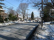
New York State Route 66 (NY 66) is a state highway
in the Capital District
of New York
in the United States
. The route begins at an intersection with NY 23B
in the Columbia County
city of Hudson
and ends at a junction with NY 2
in the Rensselaer County
city of Troy
. While both Hudson and Troy are located on the Hudson River
, NY 66 follows a more inland routing between the two locations to serve several rural villages and hamlets, including Chatham
and Sand Lake
. NY 66 overlaps with U.S. Route 20 and NY 43
, two regionally important east–west highways, in Nassau
and Sand Lake, respectively.
The route was assigned in the mid-1920s to an alignment extending from Claverack
to Nassau via Ghent
. It was extended north to Troy as part of the 1930 renumbering of state highways in New York and rerouted south of Ghent to serve Hudson ca. 1933. Originally, NY 66 directly served Averill Park
via modern County Route 45 and part of NY 43; however, it was realigned in 1980 to bypass the hamlet to the northeast. The segment of NY 66 between Sand Lake and US 20 was part of Route 21, an unsigned legislative route
, in the early 1920s.
 NY 66 is not a direct link between Hudson and Troy, heading instead northeasterly to reach Chatham and Sand Lake. NY 66 is a two-lane highway its entire length.
as Union Turnpike, passes through Ghent
, then enters Chatham
as Hudson Avenue, then Main Street. A tight left turn around a village roundabout
leads to its northern egress from Chatham. From there, NY 66 follows the Kinderhook Creek, taking a winding, serpentine path around abandoned aqueducts and the creek itself. This is a heavily-wooded area.
 NY 66 continues to follow the Kinderhook Creek until well above its concurrency
with US 20 in the town of Nassau
. After the split, the route passes by several lakes and hamlets in the southeast part of the county, including several along a concurrency with NY 43
through the town of Sand Lake
. After that split, the highway straightens out a bit as it heads through the town of Poestenkill
toward the hamlet of Wynantskill
as Main Avenue. In Troy
, it becomes Pawling Avenue, ending at a Y intersection at Congress St., NY 2
.
, in 1908, it followed modern County Routes 15 and 51 between Averill Park
and the village of Nassau
. The route was realigned on March 1, 1921, to use what is now NY 66 between Averill Park and current U.S. Route 20 instead. This leg of Route 21 was included in NY 66 when it was assigned in the mid-1920s. At the time, NY 66 began at NY 23
in Claverack
and followed modern NY 217
to Mellenville (west of Philmont
). Here, NY 66 turned onto what is now County Route 9 and proceeded north to Ghent
, where it joined its modern alignment. On its north end, NY 66 originally ended at NY 45 (now NY 43
) just south of the Sand Lake
town line. The remainder of modern NY 66 north to Troy
was part of NY 45, which was assigned around the same time as NY 66 and utilized modern County Route 45 in the vicinity of Averill Park.
In the 1930 renumbering of state highways in New York, the NY 45 designation was reassigned elsewhere in the state while its former routing was split up into several routes. One of these was NY 66, which was extended northward over former NY 45 to Troy. NY 66 was altered ca. 1933 to follow Union Turnpike southwest from Ghent to Hudson
, bypassing Claverack and Philmont to the west. On April 1, 1980, ownership and maintenance of NY 66 between NY 43 in Averill Park and then-County Route 48 (CR 48, named Miller Hill Road) north of the hamlet was transferred from the state of New York
to Rensselaer County
as part of a highway maintenance swap between the two levels of government. One of the highways the state received in exchange was CR 48, a northerly bypass of Averill Park that began at NY 43 and NY 66 in the hamlet of Sand Lake and went northwest around Averill Park to NY 66 north of the latter hamlet. The new state highway became part of a realigned NY 66 while the route's old alignment into Averill Park became CR 45.
State highway
State highway, state road or state route can refer to one of three related concepts, two of them related to a state or provincial government in a country that is divided into states or provinces :#A...
in the Capital District
Capital District
New York's Capital District, also known as the Capital Region, is a region in upstate New York that generally refers to the four counties surrounding Albany, the capital of the state: Albany County, Schenectady County, Rensselaer County, and Saratoga County...
of New York
New York
New York is a state in the Northeastern region of the United States. It is the nation's third most populous state. New York is bordered by New Jersey and Pennsylvania to the south, and by Connecticut, Massachusetts and Vermont to the east...
in the United States
United States
The United States of America is a federal constitutional republic comprising fifty states and a federal district...
. The route begins at an intersection with NY 23B
New York State Route 23B
New York State Route 23B is an east–west state highway located in western Columbia County, New York, in the United States. The route is a former section of NY 23 that runs for from NY 9G southwest of Hudson to NY 9H in Claverack...
in the Columbia County
Columbia County, New York
Columbia County is a county located in the U.S. state of New York. As of the 2010 census, the population was 63,096. The county seat is Hudson. The name comes from the Latin feminine form of the name of Christopher Columbus, which was at the time of the formation of the county a popular proposal...
city of Hudson
Hudson, New York
Hudson is a city located along the west border of Columbia County, New York, United States. The city is named after the adjacent Hudson River and ultimately after the explorer Henry Hudson.Hudson is the county seat of Columbia County...
and ends at a junction with NY 2
New York State Route 2
New York State Route 2 is a state highway in the Capital District of New York, United States. It extends from an interchange with Interstate 87 and NY 7 in the hamlet of Latham within the town of Colonie to the Massachusetts state line, where it continues to Boston as Route 2....
in the Rensselaer County
Rensselaer County, New York
Rensselaer County is a county in the U.S. state of New York. As of the 2010 census, the population was 159,429. Its name is in honor of the family of Kiliaen van Rensselaer, the original Dutch owner of the land in the area. Its county seat is Troy...
city of Troy
Troy, New York
Troy is a city in the US State of New York and the seat of Rensselaer County. Troy is located on the western edge of Rensselaer County and on the eastern bank of the Hudson River. Troy has close ties to the nearby cities of Albany and Schenectady, forming a region popularly called the Capital...
. While both Hudson and Troy are located on the Hudson River
Hudson River
The Hudson is a river that flows from north to south through eastern New York. The highest official source is at Lake Tear of the Clouds, on the slopes of Mount Marcy in the Adirondack Mountains. The river itself officially begins in Henderson Lake in Newcomb, New York...
, NY 66 follows a more inland routing between the two locations to serve several rural villages and hamlets, including Chatham
Chatham (village), New York
Chatham is a village in Columbia County, New York, USA. The population was 1,770 at the 2010 census.The Village of Chatham is in the Town of Chatham and the Town of Ghent. The village is at the junction of Routes 66 and 203.-History:...
and Sand Lake
Sand Lake, New York
Sand Lake is a town in Rensselaer County, New York, United States. As of the 2000 census, the town had a population of 7,987. The Capital District Regional Planning Commission indicates it to be 8,336 as of September 2010. The town is in the south-central part of the county...
. NY 66 overlaps with U.S. Route 20 and NY 43
New York State Route 43
New York State Route 43 is a state highway in Rensselaer County, New York, United States. It extends for from Interstate 90 exit 8 in North Greenbush to the Massachusetts state line, where it continues into Williamstown as Massachusetts Route 43...
, two regionally important east–west highways, in Nassau
Nassau (town), New York
Nassau is a town in Rensselaer County, New York, USA. The population was 4,818 at the 2000 census.The Town of Nassau is at the southern border of the county.- History :The region was first settled around 1760....
and Sand Lake, respectively.
The route was assigned in the mid-1920s to an alignment extending from Claverack
Claverack, New York
Claverack is a town in Columbia County, New York, United States. The population was 6,401 at the 2000 census. The town name is a corruption for the Dutch word for "Clover Fields" or "Clover Reach"....
to Nassau via Ghent
Ghent, New York
Ghent is a town in Columbia County, New York, United States, with a ZIP code of 12075. The population was 5,276 at the 2000 census. 2004 estimates put the population at 5,316.The Town of Ghent is centrally located in the county...
. It was extended north to Troy as part of the 1930 renumbering of state highways in New York and rerouted south of Ghent to serve Hudson ca. 1933. Originally, NY 66 directly served Averill Park
Averill Park, New York
Averill Park is a hamlet in Rensselaer County, New York, United States. The population was 1,517 at the 2000 census....
via modern County Route 45 and part of NY 43; however, it was realigned in 1980 to bypass the hamlet to the northeast. The segment of NY 66 between Sand Lake and US 20 was part of Route 21, an unsigned legislative route
Legislative route
In United States, a legislative route or legislative highway is a highway defined by laws passed in a state legislature. The numbering of such highways may or may not correspond to the numbers familiar to the public as part of the state, U.S. highway, and Interstate highway systems...
, in the early 1920s.
Route description
Columbia County
NY 66 leaves HudsonHudson, New York
Hudson is a city located along the west border of Columbia County, New York, United States. The city is named after the adjacent Hudson River and ultimately after the explorer Henry Hudson.Hudson is the county seat of Columbia County...
as Union Turnpike, passes through Ghent
Ghent, New York
Ghent is a town in Columbia County, New York, United States, with a ZIP code of 12075. The population was 5,276 at the 2000 census. 2004 estimates put the population at 5,316.The Town of Ghent is centrally located in the county...
, then enters Chatham
Chatham (village), New York
Chatham is a village in Columbia County, New York, USA. The population was 1,770 at the 2010 census.The Village of Chatham is in the Town of Chatham and the Town of Ghent. The village is at the junction of Routes 66 and 203.-History:...
as Hudson Avenue, then Main Street. A tight left turn around a village roundabout
Roundabout
A roundabout is the name for a road junction in which traffic moves in one direction around a central island. The word dates from the early 20th century. Roundabouts are common in many countries around the world...
leads to its northern egress from Chatham. From there, NY 66 follows the Kinderhook Creek, taking a winding, serpentine path around abandoned aqueducts and the creek itself. This is a heavily-wooded area.
Rensselaer County
Concurrency (road)
A concurrency, overlap, or coincidence in a road network is an instance of one physical road bearing two or more different highway, motorway, or other route numbers...
with US 20 in the town of Nassau
Nassau (town), New York
Nassau is a town in Rensselaer County, New York, USA. The population was 4,818 at the 2000 census.The Town of Nassau is at the southern border of the county.- History :The region was first settled around 1760....
. After the split, the route passes by several lakes and hamlets in the southeast part of the county, including several along a concurrency with NY 43
New York State Route 43
New York State Route 43 is a state highway in Rensselaer County, New York, United States. It extends for from Interstate 90 exit 8 in North Greenbush to the Massachusetts state line, where it continues into Williamstown as Massachusetts Route 43...
through the town of Sand Lake
Sand Lake, New York
Sand Lake is a town in Rensselaer County, New York, United States. As of the 2000 census, the town had a population of 7,987. The Capital District Regional Planning Commission indicates it to be 8,336 as of September 2010. The town is in the south-central part of the county...
. After that split, the highway straightens out a bit as it heads through the town of Poestenkill
Poestenkill (town), New York
Poestenkill is a town in Rensselaer County, New York, United States. The population was 4,054 at the 2000 census. The town is named after the Poesten Kill, an important stream in the area. The words "poesten kil" are traditionally supposed to signify "foaming water" or "foaming creek" in Dutch...
toward the hamlet of Wynantskill
Wynantskill, New York
-Demographics:As of the census of 2000, there were 3,018 people, 1,246 households, and 857 families residing in the CDP. The population density was 1,245.1 per square mile . There were 1,284 housing units at an average density of 529.7/sq mi...
as Main Avenue. In Troy
Troy, New York
Troy is a city in the US State of New York and the seat of Rensselaer County. Troy is located on the western edge of Rensselaer County and on the eastern bank of the Hudson River. Troy has close ties to the nearby cities of Albany and Schenectady, forming a region popularly called the Capital...
, it becomes Pawling Avenue, ending at a Y intersection at Congress St., NY 2
New York State Route 2
New York State Route 2 is a state highway in the Capital District of New York, United States. It extends from an interchange with Interstate 87 and NY 7 in the hamlet of Latham within the town of Colonie to the Massachusetts state line, where it continues to Boston as Route 2....
.
History
When the New York State Legislature assigned Route 21, an unsigned legislative routeLegislative route
In United States, a legislative route or legislative highway is a highway defined by laws passed in a state legislature. The numbering of such highways may or may not correspond to the numbers familiar to the public as part of the state, U.S. highway, and Interstate highway systems...
, in 1908, it followed modern County Routes 15 and 51 between Averill Park
Averill Park, New York
Averill Park is a hamlet in Rensselaer County, New York, United States. The population was 1,517 at the 2000 census....
and the village of Nassau
Nassau (village), New York
Nassau is a village located in the Town of Nassau in Rensselaer County, New York, USA. The population was 1,161 at the 2000 census.The Village of Nassau is in the south part of the county in the Town of Nassau...
. The route was realigned on March 1, 1921, to use what is now NY 66 between Averill Park and current U.S. Route 20 instead. This leg of Route 21 was included in NY 66 when it was assigned in the mid-1920s. At the time, NY 66 began at NY 23
New York State Route 23
New York State Route 23 is an east–west state highway in the eastern portion New York in the United States. It extends for from an intersection with NY 26 in the Central New York town of Cincinnatus to the Massachusetts state line in the Berkshire Mountains, where it continues east as...
in Claverack
Claverack, New York
Claverack is a town in Columbia County, New York, United States. The population was 6,401 at the 2000 census. The town name is a corruption for the Dutch word for "Clover Fields" or "Clover Reach"....
and followed modern NY 217
New York State Route 217
New York State Route 217 is a long state highway in Columbia County, New York, United States. It connects NY 23 in Claverack to the Taconic State Parkway in Ghent by way of the village of Philmont...
to Mellenville (west of Philmont
Philmont, New York
Philmont is a village in Columbia County, New York, USA. The population was 1,379 at the 2010 census.The Village of Philmont is located in the northeast corner of the Town of Claverack on Route 217.-History:...
). Here, NY 66 turned onto what is now County Route 9 and proceeded north to Ghent
Ghent, New York
Ghent is a town in Columbia County, New York, United States, with a ZIP code of 12075. The population was 5,276 at the 2000 census. 2004 estimates put the population at 5,316.The Town of Ghent is centrally located in the county...
, where it joined its modern alignment. On its north end, NY 66 originally ended at NY 45 (now NY 43
New York State Route 43
New York State Route 43 is a state highway in Rensselaer County, New York, United States. It extends for from Interstate 90 exit 8 in North Greenbush to the Massachusetts state line, where it continues into Williamstown as Massachusetts Route 43...
) just south of the Sand Lake
Sand Lake, New York
Sand Lake is a town in Rensselaer County, New York, United States. As of the 2000 census, the town had a population of 7,987. The Capital District Regional Planning Commission indicates it to be 8,336 as of September 2010. The town is in the south-central part of the county...
town line. The remainder of modern NY 66 north to Troy
Troy, New York
Troy is a city in the US State of New York and the seat of Rensselaer County. Troy is located on the western edge of Rensselaer County and on the eastern bank of the Hudson River. Troy has close ties to the nearby cities of Albany and Schenectady, forming a region popularly called the Capital...
was part of NY 45, which was assigned around the same time as NY 66 and utilized modern County Route 45 in the vicinity of Averill Park.
In the 1930 renumbering of state highways in New York, the NY 45 designation was reassigned elsewhere in the state while its former routing was split up into several routes. One of these was NY 66, which was extended northward over former NY 45 to Troy. NY 66 was altered ca. 1933 to follow Union Turnpike southwest from Ghent to Hudson
Hudson, New York
Hudson is a city located along the west border of Columbia County, New York, United States. The city is named after the adjacent Hudson River and ultimately after the explorer Henry Hudson.Hudson is the county seat of Columbia County...
, bypassing Claverack and Philmont to the west. On April 1, 1980, ownership and maintenance of NY 66 between NY 43 in Averill Park and then-County Route 48 (CR 48, named Miller Hill Road) north of the hamlet was transferred from the state of New York
New York
New York is a state in the Northeastern region of the United States. It is the nation's third most populous state. New York is bordered by New Jersey and Pennsylvania to the south, and by Connecticut, Massachusetts and Vermont to the east...
to Rensselaer County
Rensselaer County, New York
Rensselaer County is a county in the U.S. state of New York. As of the 2010 census, the population was 159,429. Its name is in honor of the family of Kiliaen van Rensselaer, the original Dutch owner of the land in the area. Its county seat is Troy...
as part of a highway maintenance swap between the two levels of government. One of the highways the state received in exchange was CR 48, a northerly bypass of Averill Park that began at NY 43 and NY 66 in the hamlet of Sand Lake and went northwest around Averill Park to NY 66 north of the latter hamlet. The new state highway became part of a realigned NY 66 while the route's old alignment into Averill Park became CR 45.