

New York State Route 74
Encyclopedia
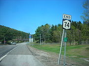
New York State Route 74 (NY 74) and Vermont Route 74 (VT 74) are adjoining state highways in the northeastern United States, connected by one of the last remaining cable ferries
in North America. Together they extend for 35 miles (56 km) through Essex County, New York
, and Addison County, Vermont
. NY 74 begins at exit 28 off Interstate 87 (I-87) in the hamlet of Severance
in the Adirondack Mountains
region of the northern part of New York State. It extends 20.44 miles (32.89 km) to the western shore of Lake Champlain
in Ticonderoga
. There, the seasonal Fort Ticonderoga – Larrabees Point Ferry carries cars across the state border into Vermont
, where VT 74 starts at the lake's eastern shore and terminates 13.26 miles (21.34 km) later at a junction with VT 30
in the town of Cornwall
.
NY 74 is a descendant of the historic Ticonderoga and Schroon Turnpike, which was a privately owned highway chartered in 1832, and segments of NY 74 follow the alignment of the original 19th century turnpike. The connecting ferry route predates both NY 74 and VT 74 and began operation in 1759 on an informal basis. The ferry operation formalized at the close of the 18th century and upgraded to a cable system in 1946.
Due to extensive changes in designations in both states during the 20th century, the entire length of the present highway consists of renamed segments from other highways. The New York portion of the cross-state Route 74 west of Ticonderoga was designated as part of NY 73
in the 1930 renumbering of state highways in New York, while the Vermont section carried several different designations from the 1920s to the late 1930s, when it became solely part of Vermont Route F-9. NY 73 was extended east to Lake Champlain in the 1950s—replacing New York State Route 347—and VT F-9 was split into VT 73
and VT 74 shortly afterward. The Schroon–Ticonderoga highway was redesignated as NY 74 ca. 1973 after NY 73 was cut back to its current eastern terminus in Elizabethtown
.
. The highway meets a few local road intersections just south of Goosebury Hill before encountering Paradox Lake. NY 74 runs mostly parallel to the lake and intersects with a local campground entrance road as it continues eastward from Schroon.
 Cotters Pond is a small landmark located beyond a few mountains and hills on the southern side of Route 74 near the end of Paradox Lake. Cotters Pond, by state law, is a water body that cannot be used for baitfishing. This was designated by the New York State Department of Environmental Conservation
. Shortly afterward, NY 74 passes Bumbo Pond and enters the hamlet of Paradox. After leaving Paradox, Route 74 turns to the southeast along the base of Skiff Mountain. The highway then approaches a creek that flows into Eagle Lake. Route 74 crosses over Eagle Lake
and runs along the base of Eagle Cliff and the shores of the lake. After leaving Eagle Lake, the highway intersects with County Route 2 (CR 2), the first numbered highway that NY 74 encounters after US 9.
This stretch of NY 74 skirts the base of Keeney Mountain, which peaks at 1400 feet (426.7 m). Route 74 then intersects with CR 56, which parallels the main route to the south. Route 56 merges back with Route 74, which leaves the mountainous region for the hamlet of Ticonderoga. NY 74 intersects with NY 9N
and NY 22 in the hamlet; the latter of the two highways becomes concurrent with NY 74. Routes 74 and 22 continue to the east, heading around the outskirts of Ticonderoga. NY 74 intersects with CR 49 before Route 74 turns to the southeast. Route 74 and Route 22 head southward toward the center of Ticonderoga. At the intersection with Montcalm Street, Route 74 turns eastward off Route 22, which heads southward for Washington County
.
Route 74 crosses local roads as it continues eastward toward Lake Champlain. The highway passes the entrance to Fort Ticonderoga and the Ticonderoga Amtrak station
. The New York portion of Route 74 terminates at a ferry landing by Lake Champlain at the state border.
before encountering Barnum Hill Road. Near the Barnum Hill intersection Route 74 passes developed areas and bends more toward the north. VT 74 then turns to the northeast at Smith Street and enters a patch of forest. Afterward Route 74 climbs a hill and intersects with Harrington Hill Road where it turns northward once again.
Fields and forests surround this thinly populated stretch of highway. At the intersection with Blue Harbor Road Route 74 turns to the east and heads toward downtown Shoreham. Within central Shoreham, VT 74 is known as Main Street and has a short concurrency with Route 22A. As VT 74 leaves the densely populated portion of Shoreham, the concurrency ends and Route 74 takes a eastward turn toward Cornwall.
As Route 74 returns to the rural countryside it bends toward the northeast for most of the distance to Cornwall. Through this stretch the highway winds through forests and occasional farmland. VT 74 straightens at an intersection with Bates Road. A connector road called North Palmer Road merges with Route 74 shortly afterward. VT 74 winds again for a stretch and straightens a second time near the intersection with Elmendorf Road as it continues toward Cornwall, intersecting with several township highways and approaching increasingly residential areas. At Clark Road in Cornwall, Route 74 turns to the northeast once again, passing through more forests before terminating at VT 30
in Cornwall.
, which originally included considerable portions of thinly populated land that later developed into separate townships. The first of these divisions occurred on March 20, 1804 with the establishment of the town of Schroon. Minerva split from Crown Point in March 1817, before another municipal reorganization in 1840 implemented further reductions to the land area of Crown Point. During this period two thoroughfares served the area that correspond to parts of modern NY 74 and US 9. One of these old state roads traversed the route covered by the current alignment of NY 74 from Schroon to Ticonderoga.
. It ran for 17.06 miles (27.46 km) from Route 22 (now US 9) in Schroon
to the western edge of the then-village of Ticonderoga. On March 1, 1921, Route 22-b became part of Route 48, a new route created as part of a partial renumbering of New York's legislative route system. In 1924, when state highways were first publicly signed with route numbers, the highway from Schroon to Ticonderoga remained unnumbered. During the 1930 renumbering of state highways in New York, the segment of modern NY 74 between US 9 in Schroon
and NY 22 in Ticonderoga was designated as part of NY 73
, a route extending from NY 28N
in Tahawus
to Ticonderoga. NY 73 followed the Blue Ridge Road
from Tahawus to North Hudson
and had an overlap with US 9 from North Hudson to Schroon.
The portion of NY 73 between Tahawus and North Hudson
was removed from the state highway system ca. 1936. As a result, NY 73 was truncated to a new western terminus at US 9 in Schroon, eliminating the concurrency with US 9. The Blue Ridge Road is now designated as CR 84 from NY 28N in Tawahus to the Adirondack Northway in North Hudson, and as NY 910K, a short unsigned reference route, from the Northway to US 9.
On the Vermont side, the road connecting Larrabees Point to the main north–south highways in the area was designated as VT F-9 by 1926. Route F-9 began at the ferry landing at Larrabees Point and continued northeast to Shoreham Center, where it briefly overlapped with then-VT 30A (modern VT 22A
). Past VT 30A, Route F-9 continued east along what are now town highways through Whiting
to Leicester
, where it ended at a junction with US 7. At the time, modern VT 74 between Shoreham and Cornwall centers was known as VT F-9A while what is now VT 73
from Larrabees Point to Brown Lane north of the town center of Orwell
was part of VT F-10A.
. Ca. 1934, NY 8 was realigned to follow NY 22
north from Ticonderoga to Crown Point
, where it left NY 22 to follow NY 347 (modern NY 185
) to the Champlain Bridge
. The NY 347 designation was reassigned to NY 8's former routing between NY 22 and the ferry landing east of Ticonderoga.
VT F-9, meanwhile, was extended southward to Orwell over VT F-10A by 1938. Like VT F-10A, it initially bypassed Orwell to the north on Brown Lane; however, it was realigned in the late 1930s to follow modern VT 73 into Orwell. Around the same time, VT F-9 was realigned east of Shoreham to follow VT F-9A northeast to Cornwall. The VT F-9A designation was eliminated while the former routing of Route F-9 between Shoreham and Leicester became unnumbered. In the early 1950s, New York extended NY 73 east to the ferry landing by way of NY 347 and Wicker and Montcalm Streets. Vermont renumbered the Larrabees Point – Orwell section of VT F-9 to VT 73 in the mid-1950s in order to match the New York route number. At the same time, the Larrabees Point – Cornwall section of VT F-9 was renumbered by Vermont to VT 74.
Ca. 1973, NY 73 was truncated to its current eastern terminus in Underwood, eliminating a lengthy overlap with US 9, while its former routing from Schroon to Lake Champlain was renumbered to NY 74, matching the other Vermont route number that ends in Larrabees Point. The already existing Route 74 in Chautauqua County (in the Jamestown
area) was renumbered to NY 474
as a result. The opening of the Adirondack Northway in 1967 also resulted in a slight shift of the western terminus of NY 74 from US 9 to I-87. By 1981, NY 74 was rerouted to follow its current alignment around the northeastern edge of Ticonderoga, on a concurrency with NY 22. The highway has remained the same since that date.
The New York State Department of Transportation has announced a project to repave Route 74 from Chilson to Paradox. The project is in preliminary development, with construction is expected to begin in early 2013 and reach completion about a year later. Funding will come from state sources and run an estimated cost of $8.6 million.
s; "a double-ended sailing scow was in service by 1800. This vessel was about 30 feet (9.1 m) long, with a mainsail that would swing completely around the mast to provide a simple means of reversing course."
Ferry size continued to increase with traffic until the system upgraded to a cable guidance system in 1946. John S. Larrabee of Vermont established the first regular ferry at the location in the late 18th century. The Vermont State Legislature approved a franchise for a ferry from Larrabees Point to Ticonderoga in 1907, to the Shoreham and Ticonderoga Ferry Company. The New York State Legislature granted the ferry a franchise in 1918.
|colspan=5 align="center"|New York – Vermont state line; ferry leads to VT 74 eastbound and NY 74 westbound
|-
Cable ferry
A cable ferry is guided and in many cases propelled across a river or other larger body of water by cables connected to both shores. They are also called chain ferries, floating bridges, or punts....
in North America. Together they extend for 35 miles (56 km) through Essex County, New York
Essex County, New York
Essex County is a county located in the U.S. state of New York. As of the 2010 census, the population was 39,370. Its name is from the English county of Essex. Its county seat is Elizabethtown...
, and Addison County, Vermont
Addison County, Vermont
Addison County is a county located in the U.S. state of Vermont. In 2010, the population was 36,821. Its shire town is Middlebury.-Geography:...
. NY 74 begins at exit 28 off Interstate 87 (I-87) in the hamlet of Severance
Schroon, New York
Schroon is a town in the Adirondack Park, in Essex County, New York, United States. The population was 1,759 at the 2000 census. The town is also known as Schroon Lake, which is actually a centrally located lake, and the name of a hamlet on the lake....
in the Adirondack Mountains
Adirondack Mountains
The Adirondack Mountains are a mountain range located in the northeastern part of New York, that runs through Clinton, Essex, Franklin, Fulton, Hamilton, Herkimer, Lewis, Saint Lawrence, Saratoga, Warren, and Washington counties....
region of the northern part of New York State. It extends 20.44 miles (32.89 km) to the western shore of Lake Champlain
Lake Champlain
Lake Champlain is a natural, freshwater lake in North America, located mainly within the borders of the United States but partially situated across the Canada—United States border in the Canadian province of Quebec.The New York portion of the Champlain Valley includes the eastern portions of...
in Ticonderoga
Ticonderoga, New York
Ticonderoga is a town in Essex County, New York, USA. The population was 5,167 at the 2000 census. The name comes from the Mohawk tekontaró:ken, meaning "it is at the junction of two waterways"....
. There, the seasonal Fort Ticonderoga – Larrabees Point Ferry carries cars across the state border into Vermont
Vermont
Vermont is a state in the New England region of the northeastern United States of America. The state ranks 43rd in land area, , and 45th in total area. Its population according to the 2010 census, 630,337, is the second smallest in the country, larger only than Wyoming. It is the only New England...
, where VT 74 starts at the lake's eastern shore and terminates 13.26 miles (21.34 km) later at a junction with VT 30
Vermont Route 30
Vermont Route 30 is a north–south state highway in Vermont, United States. Considered one of Vermont's most scenic roadways, it runs from Brattleboro, Vermont in the south to Middlebury, Vermont in the north...
in the town of Cornwall
Cornwall, Vermont
Cornwall is a town in Addison County, Vermont, United States. It was founded November 3, 1761. The population was 1,136 at the 2000 census.-Geography:...
.
NY 74 is a descendant of the historic Ticonderoga and Schroon Turnpike, which was a privately owned highway chartered in 1832, and segments of NY 74 follow the alignment of the original 19th century turnpike. The connecting ferry route predates both NY 74 and VT 74 and began operation in 1759 on an informal basis. The ferry operation formalized at the close of the 18th century and upgraded to a cable system in 1946.
Due to extensive changes in designations in both states during the 20th century, the entire length of the present highway consists of renamed segments from other highways. The New York portion of the cross-state Route 74 west of Ticonderoga was designated as part of NY 73
New York State Route 73
New York State Route 73 is a state highway located entirely within Essex County, New York, United States. The highway begins at an intersection with NY 86 in the village of Lake Placid and ends at a junction with U.S. Route 9 north of the hamlet of Underwood in the extreme...
in the 1930 renumbering of state highways in New York, while the Vermont section carried several different designations from the 1920s to the late 1930s, when it became solely part of Vermont Route F-9. NY 73 was extended east to Lake Champlain in the 1950s—replacing New York State Route 347—and VT F-9 was split into VT 73
Vermont Route 73
Vermont Route 73 is an east–west state highway in central Vermont, United States. It extends from VT 74 in Shoreham in the west to VT 100 in Rochester in the east. The route runs through parts of Addison, Rutland, and Windsor counties...
and VT 74 shortly afterward. The Schroon–Ticonderoga highway was redesignated as NY 74 ca. 1973 after NY 73 was cut back to its current eastern terminus in Elizabethtown
Elizabethtown, New York
Elizabethtown is a town in Essex County, New York, United States. The population was 1,315 at the 2000 census. The county seat of Essex County is a hamlet also called Elizabethtown. The name is derived from Elizabeth Gilliland, the wife of an early settler....
.
NY 74
NY 74 originates at exit 28 of the Adirondack Northway (I-87) in the town of Schroon. The starting interchange is located near local landmark Severance Hill, which reaches an altitude of 1600 feet (487.7 m). Route 74 intersects with the north–south U.S. Route 9 (US 9) shortly after the northbound ramps of the Adirondack Northway. It then meets Stowell Road just before crossing the Schroon RiverSchroon River
The Schroon River is a tributary of the Hudson River in the southern Adirondack Mountains of New York, beginning at the confluence of Crowfoot Brook and New Pond Brook near Underwood, and terminating at the Hudson in Warrensburg. Its watershed is entirely within the Adirondack Park...
. The highway meets a few local road intersections just south of Goosebury Hill before encountering Paradox Lake. NY 74 runs mostly parallel to the lake and intersects with a local campground entrance road as it continues eastward from Schroon.
New York State Department of Environmental Conservation
The New York State Department of Environmental Conservation is responsible for the conservation, improvement, and protection of natural resources within the U.S. state of New York. It was founded in 1970, replacing the previous Conservation Department...
. Shortly afterward, NY 74 passes Bumbo Pond and enters the hamlet of Paradox. After leaving Paradox, Route 74 turns to the southeast along the base of Skiff Mountain. The highway then approaches a creek that flows into Eagle Lake. Route 74 crosses over Eagle Lake
Ticonderoga, New York
Ticonderoga is a town in Essex County, New York, USA. The population was 5,167 at the 2000 census. The name comes from the Mohawk tekontaró:ken, meaning "it is at the junction of two waterways"....
and runs along the base of Eagle Cliff and the shores of the lake. After leaving Eagle Lake, the highway intersects with County Route 2 (CR 2), the first numbered highway that NY 74 encounters after US 9.
This stretch of NY 74 skirts the base of Keeney Mountain, which peaks at 1400 feet (426.7 m). Route 74 then intersects with CR 56, which parallels the main route to the south. Route 56 merges back with Route 74, which leaves the mountainous region for the hamlet of Ticonderoga. NY 74 intersects with NY 9N
New York State Route 9N
New York State Route 9N is a north–south state highway in northeastern New York, United States. It extends from an intersection with U.S. Route 9 , NY 29, and NY 50 in the city of Saratoga Springs to a junction with US 9 and NY 22 in the Clinton County village of...
and NY 22 in the hamlet; the latter of the two highways becomes concurrent with NY 74. Routes 74 and 22 continue to the east, heading around the outskirts of Ticonderoga. NY 74 intersects with CR 49 before Route 74 turns to the southeast. Route 74 and Route 22 head southward toward the center of Ticonderoga. At the intersection with Montcalm Street, Route 74 turns eastward off Route 22, which heads southward for Washington County
Washington County, New York
Washington County is a county located in the U.S. state of New York. It is part of the Glens Falls, New York, Metropolitan Statistical Area. As of the 2010 census, the population was 63,216. It was named for the Revolutionary War general George Washington...
.
Route 74 crosses local roads as it continues eastward toward Lake Champlain. The highway passes the entrance to Fort Ticonderoga and the Ticonderoga Amtrak station
Ticonderoga (Amtrak station)
The Ticonderoga Station, often referred to as the Fort Ticonderoga Amtrak Station is a train station in Ticonderoga, New York. It is served by the Adirondack, and is 400 yards from the ferry to Shoreham, Vermont...
. The New York portion of Route 74 terminates at a ferry landing by Lake Champlain at the state border.
Fort Ticonderoga – Larrabees Point Ferry
The Fort Ticonderoga – Larrabees Point Ferry is the oldest and southernmost ferry on Lake Champlain. Its cable system consists of two 1.1 inches (2.8 cm) steel cables in parallel alignment. The current ferry barge, in operation since 1959, is powered by a sixteen-ton tugboat built in 1979 that can hold up to 18 cars. The seasonal ferry is half a mile long and operates from May through October. The seven-minute passage operates during daylight hours.VT 74
After crossing the state line via the Fort Ticonderoga – Larrabees Point Ferry, Route 74 begins its track into Vermont. The highway heads a short distance to the north, passing a thinly populated area in Shoreham, as intermittent forest yields to fields and farmlands. After 0.49 mile (0.7885766 km) from the border, Route 74 intersects with Route 73Vermont Route 73
Vermont Route 73 is an east–west state highway in central Vermont, United States. It extends from VT 74 in Shoreham in the west to VT 100 in Rochester in the east. The route runs through parts of Addison, Rutland, and Windsor counties...
before encountering Barnum Hill Road. Near the Barnum Hill intersection Route 74 passes developed areas and bends more toward the north. VT 74 then turns to the northeast at Smith Street and enters a patch of forest. Afterward Route 74 climbs a hill and intersects with Harrington Hill Road where it turns northward once again.
Fields and forests surround this thinly populated stretch of highway. At the intersection with Blue Harbor Road Route 74 turns to the east and heads toward downtown Shoreham. Within central Shoreham, VT 74 is known as Main Street and has a short concurrency with Route 22A. As VT 74 leaves the densely populated portion of Shoreham, the concurrency ends and Route 74 takes a eastward turn toward Cornwall.
As Route 74 returns to the rural countryside it bends toward the northeast for most of the distance to Cornwall. Through this stretch the highway winds through forests and occasional farmland. VT 74 straightens at an intersection with Bates Road. A connector road called North Palmer Road merges with Route 74 shortly afterward. VT 74 winds again for a stretch and straightens a second time near the intersection with Elmendorf Road as it continues toward Cornwall, intersecting with several township highways and approaching increasingly residential areas. At Clark Road in Cornwall, Route 74 turns to the northeast once again, passing through more forests before terminating at VT 30
Vermont Route 30
Vermont Route 30 is a north–south state highway in Vermont, United States. Considered one of Vermont's most scenic roadways, it runs from Brattleboro, Vermont in the south to Middlebury, Vermont in the north...
in Cornwall.
Early history
Schroon and its early highways
Settlers of European descent began to populate the region near modern Schroon around 1797. The area's first municipality was the town of Crown PointCrown Point, New York
Crown Point is a town in Essex County, New York, USA. The population was 2,119 at the 2000 census. The name of the town is a direct translation of the original French name, "Point au Chevalure."...
, which originally included considerable portions of thinly populated land that later developed into separate townships. The first of these divisions occurred on March 20, 1804 with the establishment of the town of Schroon. Minerva split from Crown Point in March 1817, before another municipal reorganization in 1840 implemented further reductions to the land area of Crown Point. During this period two thoroughfares served the area that correspond to parts of modern NY 74 and US 9. One of these old state roads traversed the route covered by the current alignment of NY 74 from Schroon to Ticonderoga.
Ticonderoga and Schroon Turnpike
The entire length of NY 74 from Ticonderoga to Schroon covers the same route as the 19th century Ticonderoga and Schroon Turnpike. The turnpike, chartered in April 1832, was built to a stretch of highway from the two towns. Two toll gates were erected specifically for use on the highway, and the charter allowed for additional toll gates at a spacing of approximately one for every ten miles of completed highway. The turnpike management raised funds by selling 600 shares valued at $25 each. $20,000 (1832 USD) was also set aside for properties along the highway.Designations from 1913 to the 1930s
In 1913, the New York State Legislature designated most of modern NY 74 as Route 22-b, an unsigned legislative routeLegislative route
In United States, a legislative route or legislative highway is a highway defined by laws passed in a state legislature. The numbering of such highways may or may not correspond to the numbers familiar to the public as part of the state, U.S. highway, and Interstate highway systems...
. It ran for 17.06 miles (27.46 km) from Route 22 (now US 9) in Schroon
Schroon, New York
Schroon is a town in the Adirondack Park, in Essex County, New York, United States. The population was 1,759 at the 2000 census. The town is also known as Schroon Lake, which is actually a centrally located lake, and the name of a hamlet on the lake....
to the western edge of the then-village of Ticonderoga. On March 1, 1921, Route 22-b became part of Route 48, a new route created as part of a partial renumbering of New York's legislative route system. In 1924, when state highways were first publicly signed with route numbers, the highway from Schroon to Ticonderoga remained unnumbered. During the 1930 renumbering of state highways in New York, the segment of modern NY 74 between US 9 in Schroon
Schroon, New York
Schroon is a town in the Adirondack Park, in Essex County, New York, United States. The population was 1,759 at the 2000 census. The town is also known as Schroon Lake, which is actually a centrally located lake, and the name of a hamlet on the lake....
and NY 22 in Ticonderoga was designated as part of NY 73
New York State Route 73
New York State Route 73 is a state highway located entirely within Essex County, New York, United States. The highway begins at an intersection with NY 86 in the village of Lake Placid and ends at a junction with U.S. Route 9 north of the hamlet of Underwood in the extreme...
, a route extending from NY 28N
New York State Route 28N
New York State Route 28N is a state highway in the Adirondacks in New York that extends from Blue Mountain Lake to North Creek. The route, in length, is a northerly alternate route to NY 28 between both locations. The highway passes through several communities before terminating at...
in Tahawus
Tahawus, New York
Tahawus was a village in the Town of Newcomb, Essex County, New York, USA. It is now a ghost town situated in Adirondack Park. Tahawus is located in Essex County within the unpopulated northern area designated to the town of Newcomb. Tahawus was the site of major mining and iron smelting...
to Ticonderoga. NY 73 followed the Blue Ridge Road
Blue Ridge Road
Blue Ridge Road is a long roadway in Essex County, New York, in the United States. The road is designated as County Route 84 from NY 28N in Newcomb to Interstate 87 in North Hudson, and as New York State Route 910K between I-87 and U.S. Route 9 in North Hudson...
from Tahawus to North Hudson
North Hudson, New York
North Hudson is a town in Essex County, New York, United States. The population was 266 at the 2000 census. The town derives its name by being by the north end of the Hudson River....
and had an overlap with US 9 from North Hudson to Schroon.
The portion of NY 73 between Tahawus and North Hudson
North Hudson, New York
North Hudson is a town in Essex County, New York, United States. The population was 266 at the 2000 census. The town derives its name by being by the north end of the Hudson River....
was removed from the state highway system ca. 1936. As a result, NY 73 was truncated to a new western terminus at US 9 in Schroon, eliminating the concurrency with US 9. The Blue Ridge Road is now designated as CR 84 from NY 28N in Tawahus to the Adirondack Northway in North Hudson, and as NY 910K, a short unsigned reference route, from the Northway to US 9.
On the Vermont side, the road connecting Larrabees Point to the main north–south highways in the area was designated as VT F-9 by 1926. Route F-9 began at the ferry landing at Larrabees Point and continued northeast to Shoreham Center, where it briefly overlapped with then-VT 30A (modern VT 22A
Vermont Route 22A
Vermont Route 22A is a state highway in western Vermont, United States. It is the northward continuation of New York State Route 22A. Its southern end is at the New York state line in Fair Haven and its northern end is in Ferrisburgh at U.S. Route 7...
). Past VT 30A, Route F-9 continued east along what are now town highways through Whiting
Whiting, Vermont
Whiting is a town in Addison County, Vermont, United States. The town was named for John Whiting, a landholder. The population was 380 at the 2000 census.-Geography:...
to Leicester
Leicester, Vermont
Leicester is a town in Addison County, Vermont, United States. The population was 974 at the 2000 census.Satans Kingdom is an unincorporated community located in Leicester.-Geography:...
, where it ended at a junction with US 7. At the time, modern VT 74 between Shoreham and Cornwall centers was known as VT F-9A while what is now VT 73
Vermont Route 73
Vermont Route 73 is an east–west state highway in central Vermont, United States. It extends from VT 74 in Shoreham in the west to VT 100 in Rochester in the east. The route runs through parts of Addison, Rutland, and Windsor counties...
from Larrabees Point to Brown Lane north of the town center of Orwell
Orwell, Vermont
Orwell is a town in Addison County, Vermont, United States. The population was 1,185 at the 2000 census. Mount Independence was the largest fortification constructed by the American colonial forces...
was part of VT F-10A.
Changes from 1933 onward
By 1933, the highway linking NY 22 in Ticonderoga to the ferry for Larrabees Point became part of NY 8New York State Route 8
New York State Route 8 is a state highway in the central part of New York in the United States. It runs in a southwest-to-northeast direction from the Southern Tier to the northern part of Lake George. The southern terminus of the route is at an interchange with NY 17 in the town of...
. Ca. 1934, NY 8 was realigned to follow NY 22
New York State Route 22
New York State Route 22 is a north–south state highway in eastern New York in the United States. It runs parallel to the state's eastern edge from the outskirts of New York City to a short distance south of the Canadian border. At , it is the state's longest north–south route and...
north from Ticonderoga to Crown Point
Crown Point, New York
Crown Point is a town in Essex County, New York, USA. The population was 2,119 at the 2000 census. The name of the town is a direct translation of the original French name, "Point au Chevalure."...
, where it left NY 22 to follow NY 347 (modern NY 185
New York State Route 185
New York State Route 185 was a state highway located within St. Lawrence County in the North Country of New York in the United States. Although the route followed a mostly north–south alignment, it was considered an east–west highway by the New York State Department of Transportation...
) to the Champlain Bridge
Champlain Bridge (United States)
The Champlain Bridge was a long vehicular bridge in the United States that traversed Lake Champlain between Crown Point, New York and Chimney Point, Vermont. It was opened to traffic in 1929 as a toll bridge; the tolls were removed in 1987...
. The NY 347 designation was reassigned to NY 8's former routing between NY 22 and the ferry landing east of Ticonderoga.
VT F-9, meanwhile, was extended southward to Orwell over VT F-10A by 1938. Like VT F-10A, it initially bypassed Orwell to the north on Brown Lane; however, it was realigned in the late 1930s to follow modern VT 73 into Orwell. Around the same time, VT F-9 was realigned east of Shoreham to follow VT F-9A northeast to Cornwall. The VT F-9A designation was eliminated while the former routing of Route F-9 between Shoreham and Leicester became unnumbered. In the early 1950s, New York extended NY 73 east to the ferry landing by way of NY 347 and Wicker and Montcalm Streets. Vermont renumbered the Larrabees Point – Orwell section of VT F-9 to VT 73 in the mid-1950s in order to match the New York route number. At the same time, the Larrabees Point – Cornwall section of VT F-9 was renumbered by Vermont to VT 74.
Ca. 1973, NY 73 was truncated to its current eastern terminus in Underwood, eliminating a lengthy overlap with US 9, while its former routing from Schroon to Lake Champlain was renumbered to NY 74, matching the other Vermont route number that ends in Larrabees Point. The already existing Route 74 in Chautauqua County (in the Jamestown
Jamestown, New York
Jamestown is a city in Chautauqua County, New York in the United States. The population was 31,146 at the 2010 census.The City of Jamestown is adjacent to Town of Ellicott and is at the southern tip of Chautauqua Lake...
area) was renumbered to NY 474
New York State Route 474
New York State Route 474 is a state highway located entirely in Chautauqua County, in the westernmost corner of New York in the United States...
as a result. The opening of the Adirondack Northway in 1967 also resulted in a slight shift of the western terminus of NY 74 from US 9 to I-87. By 1981, NY 74 was rerouted to follow its current alignment around the northeastern edge of Ticonderoga, on a concurrency with NY 22. The highway has remained the same since that date.
The New York State Department of Transportation has announced a project to repave Route 74 from Chilson to Paradox. The project is in preliminary development, with construction is expected to begin in early 2013 and reach completion about a year later. Funding will come from state sources and run an estimated cost of $8.6 million.
Ferry history
According to its website, the ferry operated informally from 1759 and in an organized way from 1799. The earliest ferries are believed to have been rowboats or canoeCanoe
A canoe or Canadian canoe is a small narrow boat, typically human-powered, though it may also be powered by sails or small electric or gas motors. Canoes are usually pointed at both bow and stern and are normally open on top, but can be decked over A canoe (North American English) or Canadian...
s; "a double-ended sailing scow was in service by 1800. This vessel was about 30 feet (9.1 m) long, with a mainsail that would swing completely around the mast to provide a simple means of reversing course."
Ferry size continued to increase with traffic until the system upgraded to a cable guidance system in 1946. John S. Larrabee of Vermont established the first regular ferry at the location in the late 18th century. The Vermont State Legislature approved a franchise for a ferry from Larrabees Point to Ticonderoga in 1907, to the Shoreham and Ticonderoga Ferry Company. The New York State Legislature granted the ferry a franchise in 1918.
Major intersections
|-|colspan=5 align="center"|New York – Vermont state line; ferry leads to VT 74 eastbound and NY 74 westbound
|-