
New York State Route 404
Encyclopedia
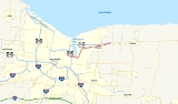
New York State Route 404 (NY 404) is an east–west state highway
located in eastern Monroe County, New York
, in the United States. It extends for just over 10 miles (16 km) from an interchange with NY 590
in Irondequoit
to an intersection with NY 104
on the Monroe–Wayne County
line in the town of Webster
. The route traverses the southern tip of Irondequoit Bay
and passes through the village of Webster
, where NY 404 intersects NY 250
. Most of NY 404 passes through commercial areas; however, the western and eastern extents of the highway serve areas more residential in nature. The westernmost 3 miles (5 km) of the route is part of the Seaway Trail
, a National Scenic Byway
.
NY 404 largely follows the path of the Theodore Roosevelt International Highway
, an early 20th century auto trail
, through the towns of Irondequoit, Penfield
, and Webster. Most of modern NY 404 was designated as NY 3
in 1924 and redesignated as U.S. Route 104 (US 104) ca. 1935. In the early 1970s, US 104 was realigned to follow a new freeway between Irondequoit and Five Mile Line Road in Webster while NY 404 was assigned to US 104's former surface routing along the southern and eastern extents of Irondequoit Bay. NY 404 was gradually extended eastward to the Wayne County line over the course of the next decade as more sections of the freeway opened to traffic.
 NY 404 begins at NY 590
exit 8 in Irondequoit
as Empire Boulevard, although the 0.71 miles (1.14 km) portion of Empire Boulevard between NY 590 and the Rochester
city line is also state maintained as NY 941B, an unsigned reference route. Irondequoit Bay
is northeast of this intersection, and Empire Boulevard serves as the northernmost non-bridge route from one side of the bay to the other; that is, between the inner-ring suburbs of Irondequoit
and Brighton
and the outer-ring suburbs of Webster
and Penfield
. The four-lane Empire Boulevard heads east from NY 590, intersecting North Winton Road (former NY 47
) in a residential neighborhood before descending into a valley surrounding the bay. NY 404 continues east across the base of the valley, crossing the southern tip of the bay at the Irondequoit–Penfield
town line.
At the eastern edge of the bay valley, the route begins to turn to the northeast, slowly ascending in elevation as it heads away from Irondequoit Bay. The terrain levels off at the top of the valley, where NY 404 enters a major commercial strip that follows the route for 2 miles (3.2 km) into the adjacent town of Webster
. This strip is largely based around NY 404's junction with Bay Road, a north–south highway connecting NY 404 to Lake Road
. The segment of Empire Boulevard between Culver Road (located just west of the Rochester city line) and Bay Road is part of the Seaway Trail
, a National Scenic Byway
. NY 404 continues into Webster, where it narrows to two lanes ahead of an intersection with Ridge Road
in the Webster hamlet of West Webster. The route merges with Ridge Road, taking on that name as it heads east toward the village of Webster
.
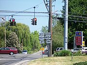
From West Webster to the village of Webster, a distance of 2.5 miles (4 km), NY 404 runs along the edge of a small ridge as it passes through a commercial corridor anchored by a series of shopping plazas at the base of the hill. The commercial surroundings continue into the village, where NY 404 becomes West Main Street. It changes names to East Main Street upon intersecting NY 250
in Webster's central business district, but the Ridge Road name returns east of the Webster village limits. NY 404 continues on, passing through a residential area of the town as it approaches the Monroe–Wayne County
line. Roughly a half-mile (0.8 km) before the county line, NY 404 turns north onto Ridge Road Junction, a road that heads northeast down the edge of the ridge that gives Ridge Road its name. Upon reaching the base of the hill, NY 404 merges with County Line Road for a short distance to reach an intersection with NY 104, where NY 404 terminates.
extending from Niagara Falls
to Rouses Point
via Rochester
and Maple View. Route 30 exited Rochester on Empire Boulevard and followed it northeastward around Irondequoit Bay
to where it merged with Ridge Road
west of Webster
. The route continued eastward on Ridge Road through Webster and into Wayne County
. When the first set of posted routes in New York
were assigned in 1924, most of legislative Route 30 in northeastern Monroe County
became part of NY 3
, a cross-state highway that extended from the Niagara Frontier
to the North Country
and passed through downtown Rochester. In eastern Monroe County, NY 3 originally followed the path of legislative Route 30 from Rochester to the county line. This section of NY 3 was also part of the Theodore Roosevelt International Highway
, an international auto trail
.
By 1930, NY 3 was realigned through Rochester to exit the city on North Winton Road. It rejoined its previous alignment at the junction of North Winton Road and Empire Boulevard. The designation remained in place until ca. 1935 when NY 3 was supplanted east of Rochester by US 104, a new highway assigned to the length of Ridge Road between Lewiston
and Oswego
. In the eastern suburbs of Rochester, US 104 initially followed what had been NY 3—namely Winton Road, Empire Boulevard, and Ridge Road. US 104 was realigned ca. 1937 to follow Ridge and Culver Roads through Irondequoit, bypassing downtown entirely. US 104 turned east at the junction of Culver Road and Empire Boulevard, following the latter to Winton Road.
The current super two
highway paralleling Ridge Road between the Wayne County line and Sodus
was built in the mid-1940s. Also constructed at this time was a short connector named Ridge Road Junction, which carried US 104 between the west end of the super two and Ridge Road just west of the Wayne County line. US 104 was realigned in the late 1950s to follow a new section of the Sea Breeze Expressway between Ridge Road and Empire Boulevard. The route was altered again ca. 1971 to follow a newly-built expressway between NY 47
(now NY 590
) in Irondequoit and Five Mile Line Road in Webster. The former alignment of US 104 from NY 47 around the southern tip of Irondequoit Bay to Five Mile Line Road was redesignated as NY 404.
In the mid-1970s, NY 404 was extended eastward to NY 250 in the village of Webster, replacing then-NY 104
, which had been moved onto a pair of highways between Five Mile Line Road and NY 250 that eventually became the freeway's frontage road
s. The section from NY 250 to the existing expressway at the Wayne County line was built in the late 1970s while the main carriageway of NY 104 between Five Mile Line Road and NY 250 was completed in the early 1980s. NY 404 was extended east along the former alignment of NY 104 to the county line upon the total completion of the Five Mile Line Road – NY 250 segment.
State highway
State highway, state road or state route can refer to one of three related concepts, two of them related to a state or provincial government in a country that is divided into states or provinces :#A...
located in eastern Monroe County, New York
Monroe County, New York
Monroe County is a county located in the U.S. state of New York. As of the 2010 census, the population was 744,344. It is named after James Monroe, fifth President of the United States of America. Its county seat is the city of Rochester....
, in the United States. It extends for just over 10 miles (16 km) from an interchange with NY 590
New York State Route 590
New York State Route 590 is a north–south state highway located in the eastern suburbs of Rochester, New York, in the United States...
in Irondequoit
Irondequoit, New York
Irondequoit is a town in Monroe County, New York, USA. As of the 2010 census, the coterminous town-CDP had a total population of 51,692...
to an intersection with NY 104
New York State Route 104
New York State Route 104 is a long east–west state highway in Upstate New York, United States. It spans six counties and enters the vicinity of four cities—Niagara Falls, Lockport, Rochester, and Oswego—as it follows a routing largely parallel to that of the southern shoreline of Lake...
on the Monroe–Wayne County
Wayne County, New York
Wayne County is a county located in the US state of New York. It is part of the Rochester, New York Metropolitan Statistical Area and lies on the south shore of Lake Ontario, forming part of the northern border of the United States with Canada. The name honors General Anthony Wayne, an American...
line in the town of Webster
Webster (town), New York
Webster is a town in the northeast corner of Monroe County, New York, United States. The town is named after orator and statesman Daniel Webster. The population was 42,641 at the 2010 census....
. The route traverses the southern tip of Irondequoit Bay
Irondequoit Bay
Irondequoit Bay is a large body of water located in northeastern Monroe County, New York. The bay, roughly wide and in length, is fed by Irondequoit Creek to the south and flows into Lake Ontario at its northern end...
and passes through the village of Webster
Webster (village), New York
Webster is a village in Monroe County, New York, United States. The population was 5,216 at the 2000 census. The village and town are named after orator and statesman Daniel Webster....
, where NY 404 intersects NY 250
New York State Route 250
New York State Route 250 is a north–south state highway in the eastern portion of Monroe County, New York, in the United States. It extends for just over from an intersection with NY 96 in the town of Perinton to a junction with Lake Road near the Lake Ontario shoreline in the...
. Most of NY 404 passes through commercial areas; however, the western and eastern extents of the highway serve areas more residential in nature. The westernmost 3 miles (5 km) of the route is part of the Seaway Trail
Seaway Trail
The Great Lakes Seaway Trail, formerly named and commonly known as the Seaway Trail, is a National Scenic Byway in the northeastern United States, mostly contained in New York but with a small segment in Pennsylvania...
, a National Scenic Byway
National Scenic Byway
A National Scenic Byway is a road recognized by the United States Department of Transportation for its archeological, cultural, historic, natural, recreational, and/or scenic qualities. The program was established by Congress in 1991 to preserve and protect the nation's scenic but often...
.
NY 404 largely follows the path of the Theodore Roosevelt International Highway
Theodore Roosevelt International Highway
The Theodore Roosevelt International Highway was a transcontinental North American highway through the United States and Canada that ran from Portland, Maine, to Portland, Oregon. Its length was about .-Route description:...
, an early 20th century auto trail
Auto trail
The system of auto trails was an informal network of marked routes that existed in the United States and Canada in the early part of the 20th century. Marked with colored bands on telephone poles, the trails were intended to help travellers in the early days of the automobile.Auto trails were...
, through the towns of Irondequoit, Penfield
Penfield, New York
Penfield is a town in Monroe County, New York, United States. The population was 36,242 at the 2010 census.The town was incorporated in 1810 by the proprietor, Daniel Penfield, who purchased the town lands in 1795 and moved to the area in 1809. Penfield is a suburb of Rochester, New York...
, and Webster. Most of modern NY 404 was designated as NY 3
New York State Route 3
New York State Route 3 is a major east–west state highway in New York, United States, that connects central New York to the North Country region near the Canadian border via Adirondack Park. The route extends for between its western terminus at an intersection with NY 104A in the Cayuga...
in 1924 and redesignated as U.S. Route 104 (US 104) ca. 1935. In the early 1970s, US 104 was realigned to follow a new freeway between Irondequoit and Five Mile Line Road in Webster while NY 404 was assigned to US 104's former surface routing along the southern and eastern extents of Irondequoit Bay. NY 404 was gradually extended eastward to the Wayne County line over the course of the next decade as more sections of the freeway opened to traffic.
Route description
New York State Route 590
New York State Route 590 is a north–south state highway located in the eastern suburbs of Rochester, New York, in the United States...
exit 8 in Irondequoit
Irondequoit, New York
Irondequoit is a town in Monroe County, New York, USA. As of the 2010 census, the coterminous town-CDP had a total population of 51,692...
as Empire Boulevard, although the 0.71 miles (1.14 km) portion of Empire Boulevard between NY 590 and the Rochester
Rochester, New York
Rochester is a city in Monroe County, New York, south of Lake Ontario in the United States. Known as The World's Image Centre, it was also once known as The Flour City, and more recently as The Flower City...
city line is also state maintained as NY 941B, an unsigned reference route. Irondequoit Bay
Irondequoit Bay
Irondequoit Bay is a large body of water located in northeastern Monroe County, New York. The bay, roughly wide and in length, is fed by Irondequoit Creek to the south and flows into Lake Ontario at its northern end...
is northeast of this intersection, and Empire Boulevard serves as the northernmost non-bridge route from one side of the bay to the other; that is, between the inner-ring suburbs of Irondequoit
Irondequoit, New York
Irondequoit is a town in Monroe County, New York, USA. As of the 2010 census, the coterminous town-CDP had a total population of 51,692...
and Brighton
Brighton, Monroe County, New York
Brighton is a town in Monroe County, New York, USA. The population was 36,609 at the 2010 census.-History:The Town of Brighton, located on the southeast border of the city of Rochester, was originally settled approximately 1790, and formally established in 1814—earning it recognition as one...
and the outer-ring suburbs of Webster
Webster (town), New York
Webster is a town in the northeast corner of Monroe County, New York, United States. The town is named after orator and statesman Daniel Webster. The population was 42,641 at the 2010 census....
and Penfield
Penfield, New York
Penfield is a town in Monroe County, New York, United States. The population was 36,242 at the 2010 census.The town was incorporated in 1810 by the proprietor, Daniel Penfield, who purchased the town lands in 1795 and moved to the area in 1809. Penfield is a suburb of Rochester, New York...
. The four-lane Empire Boulevard heads east from NY 590, intersecting North Winton Road (former NY 47
New York State Route 47
New York State Route 47 was a long state highway around Rochester in New York, United States. It formed a semicircle through the inner suburbs of Rochester, following expressways west and east of the city and surface streets south of Rochester. The western terminus of the route was at an...
) in a residential neighborhood before descending into a valley surrounding the bay. NY 404 continues east across the base of the valley, crossing the southern tip of the bay at the Irondequoit–Penfield
Penfield, New York
Penfield is a town in Monroe County, New York, United States. The population was 36,242 at the 2010 census.The town was incorporated in 1810 by the proprietor, Daniel Penfield, who purchased the town lands in 1795 and moved to the area in 1809. Penfield is a suburb of Rochester, New York...
town line.
At the eastern edge of the bay valley, the route begins to turn to the northeast, slowly ascending in elevation as it heads away from Irondequoit Bay. The terrain levels off at the top of the valley, where NY 404 enters a major commercial strip that follows the route for 2 miles (3.2 km) into the adjacent town of Webster
Webster (town), New York
Webster is a town in the northeast corner of Monroe County, New York, United States. The town is named after orator and statesman Daniel Webster. The population was 42,641 at the 2010 census....
. This strip is largely based around NY 404's junction with Bay Road, a north–south highway connecting NY 404 to Lake Road
Lake Road (Western New York)
Lake Road is an east–west roadway in western New York, United States. It extends for from the Irondequoit Bay Outlet Bridge in the Monroe County town of Webster to NY 14 in the Wayne County village of Sodus Point. As its name implies, it follows the southern shore of Lake Ontario for its...
. The segment of Empire Boulevard between Culver Road (located just west of the Rochester city line) and Bay Road is part of the Seaway Trail
Seaway Trail
The Great Lakes Seaway Trail, formerly named and commonly known as the Seaway Trail, is a National Scenic Byway in the northeastern United States, mostly contained in New York but with a small segment in Pennsylvania...
, a National Scenic Byway
National Scenic Byway
A National Scenic Byway is a road recognized by the United States Department of Transportation for its archeological, cultural, historic, natural, recreational, and/or scenic qualities. The program was established by Congress in 1991 to preserve and protect the nation's scenic but often...
. NY 404 continues into Webster, where it narrows to two lanes ahead of an intersection with Ridge Road
Ridge Road (Western New York)
Ridge Road is a east–west road that traverses four counties in Upstate New York in the United States. It is named for the rise atop which the road was built, a mound of sand and gravel that was formed when it was the shoreline of ancient Glacial Lake Iroquois...
in the Webster hamlet of West Webster. The route merges with Ridge Road, taking on that name as it heads east toward the village of Webster
Webster (village), New York
Webster is a village in Monroe County, New York, United States. The population was 5,216 at the 2000 census. The village and town are named after orator and statesman Daniel Webster....
.
From West Webster to the village of Webster, a distance of 2.5 miles (4 km), NY 404 runs along the edge of a small ridge as it passes through a commercial corridor anchored by a series of shopping plazas at the base of the hill. The commercial surroundings continue into the village, where NY 404 becomes West Main Street. It changes names to East Main Street upon intersecting NY 250
New York State Route 250
New York State Route 250 is a north–south state highway in the eastern portion of Monroe County, New York, in the United States. It extends for just over from an intersection with NY 96 in the town of Perinton to a junction with Lake Road near the Lake Ontario shoreline in the...
in Webster's central business district, but the Ridge Road name returns east of the Webster village limits. NY 404 continues on, passing through a residential area of the town as it approaches the Monroe–Wayne County
Wayne County, New York
Wayne County is a county located in the US state of New York. It is part of the Rochester, New York Metropolitan Statistical Area and lies on the south shore of Lake Ontario, forming part of the northern border of the United States with Canada. The name honors General Anthony Wayne, an American...
line. Roughly a half-mile (0.8 km) before the county line, NY 404 turns north onto Ridge Road Junction, a road that heads northeast down the edge of the ridge that gives Ridge Road its name. Upon reaching the base of the hill, NY 404 merges with County Line Road for a short distance to reach an intersection with NY 104, where NY 404 terminates.
History
In 1908, the New York State Legislature created Route 30, an unsigned legislative routeLegislative route
In United States, a legislative route or legislative highway is a highway defined by laws passed in a state legislature. The numbering of such highways may or may not correspond to the numbers familiar to the public as part of the state, U.S. highway, and Interstate highway systems...
extending from Niagara Falls
Niagara Falls, New York
Niagara Falls is a city in Niagara County, New York, United States. As of the 2010 census, the city had a total population of 50,193, down from the 55,593 recorded in the 2000 census. It is across the Niagara River from Niagara Falls, Ontario , both named after the famed Niagara Falls which they...
to Rouses Point
Rouses Point, New York
Rouses Point is a village in Clinton County, New York, United States, along the 45th parallel. The population was 2,209 at the 2010 census. The village is named after Jacques Rouse, an early settler....
via Rochester
Rochester, New York
Rochester is a city in Monroe County, New York, south of Lake Ontario in the United States. Known as The World's Image Centre, it was also once known as The Flour City, and more recently as The Flower City...
and Maple View. Route 30 exited Rochester on Empire Boulevard and followed it northeastward around Irondequoit Bay
Irondequoit Bay
Irondequoit Bay is a large body of water located in northeastern Monroe County, New York. The bay, roughly wide and in length, is fed by Irondequoit Creek to the south and flows into Lake Ontario at its northern end...
to where it merged with Ridge Road
Ridge Road (Western New York)
Ridge Road is a east–west road that traverses four counties in Upstate New York in the United States. It is named for the rise atop which the road was built, a mound of sand and gravel that was formed when it was the shoreline of ancient Glacial Lake Iroquois...
west of Webster
Webster (village), New York
Webster is a village in Monroe County, New York, United States. The population was 5,216 at the 2000 census. The village and town are named after orator and statesman Daniel Webster....
. The route continued eastward on Ridge Road through Webster and into Wayne County
Wayne County, New York
Wayne County is a county located in the US state of New York. It is part of the Rochester, New York Metropolitan Statistical Area and lies on the south shore of Lake Ontario, forming part of the northern border of the United States with Canada. The name honors General Anthony Wayne, an American...
. When the first set of posted routes in New York
New York
New York is a state in the Northeastern region of the United States. It is the nation's third most populous state. New York is bordered by New Jersey and Pennsylvania to the south, and by Connecticut, Massachusetts and Vermont to the east...
were assigned in 1924, most of legislative Route 30 in northeastern Monroe County
Monroe County, New York
Monroe County is a county located in the U.S. state of New York. As of the 2010 census, the population was 744,344. It is named after James Monroe, fifth President of the United States of America. Its county seat is the city of Rochester....
became part of NY 3
New York State Route 3
New York State Route 3 is a major east–west state highway in New York, United States, that connects central New York to the North Country region near the Canadian border via Adirondack Park. The route extends for between its western terminus at an intersection with NY 104A in the Cayuga...
, a cross-state highway that extended from the Niagara Frontier
Niagara Frontier
The Niagara Frontier refers to the stretch of land south of Lake Ontario and Lake Erie and extending westward to Cleveland, Ohio. The term dates to the War of 1812. This only includes the land east of the Niagara River and south of Lake Erie within the United States...
to the North Country
North Country, New York
The North Country is a region of the U.S. state of New York that encompasses the state's extreme northern frontier, bordering Lake Ontario on the west, the Saint Lawrence River and the Canadian provinces of Ontario and Quebec on the north and northwest, and Lake Champlain and Vermont on the east...
and passed through downtown Rochester. In eastern Monroe County, NY 3 originally followed the path of legislative Route 30 from Rochester to the county line. This section of NY 3 was also part of the Theodore Roosevelt International Highway
Theodore Roosevelt International Highway
The Theodore Roosevelt International Highway was a transcontinental North American highway through the United States and Canada that ran from Portland, Maine, to Portland, Oregon. Its length was about .-Route description:...
, an international auto trail
Auto trail
The system of auto trails was an informal network of marked routes that existed in the United States and Canada in the early part of the 20th century. Marked with colored bands on telephone poles, the trails were intended to help travellers in the early days of the automobile.Auto trails were...
.
By 1930, NY 3 was realigned through Rochester to exit the city on North Winton Road. It rejoined its previous alignment at the junction of North Winton Road and Empire Boulevard. The designation remained in place until ca. 1935 when NY 3 was supplanted east of Rochester by US 104, a new highway assigned to the length of Ridge Road between Lewiston
Lewiston, New York
Lewiston is a village in Niagara County, New York, United States. The population was 2,781 at the 2000 census. The village is named after Morgan Lewis, an early 19th-century governor of New York. It is part of the Buffalo–Niagara Falls Metropolitan Statistical Area.The Village of Lewiston,...
and Oswego
Oswego, New York
Oswego is a city in Oswego County, New York, United States. The population was 18,142 at the 2010 census. Oswego is located on Lake Ontario in north-central New York and promotes itself as "The Port City of Central New York"...
. In the eastern suburbs of Rochester, US 104 initially followed what had been NY 3—namely Winton Road, Empire Boulevard, and Ridge Road. US 104 was realigned ca. 1937 to follow Ridge and Culver Roads through Irondequoit, bypassing downtown entirely. US 104 turned east at the junction of Culver Road and Empire Boulevard, following the latter to Winton Road.
The current super two
Super two
A super two, super two-lane highway or wide two lane is a two-lane surface road built to high standards, typically including partial control of access, occasional passing lanes and hard shoulders...
highway paralleling Ridge Road between the Wayne County line and Sodus
Sodus (village), New York
Sodus is a village in Wayne County, New York, USA. The population was 1,735 at the 2000 census.The Village of Sodus is near the center of the Town of Sodus and lies between Rochester and Syracuse. The village contains the government center for the Town of Sodus.- History :The village area was part...
was built in the mid-1940s. Also constructed at this time was a short connector named Ridge Road Junction, which carried US 104 between the west end of the super two and Ridge Road just west of the Wayne County line. US 104 was realigned in the late 1950s to follow a new section of the Sea Breeze Expressway between Ridge Road and Empire Boulevard. The route was altered again ca. 1971 to follow a newly-built expressway between NY 47
New York State Route 47
New York State Route 47 was a long state highway around Rochester in New York, United States. It formed a semicircle through the inner suburbs of Rochester, following expressways west and east of the city and surface streets south of Rochester. The western terminus of the route was at an...
(now NY 590
New York State Route 590
New York State Route 590 is a north–south state highway located in the eastern suburbs of Rochester, New York, in the United States...
) in Irondequoit and Five Mile Line Road in Webster. The former alignment of US 104 from NY 47 around the southern tip of Irondequoit Bay to Five Mile Line Road was redesignated as NY 404.
In the mid-1970s, NY 404 was extended eastward to NY 250 in the village of Webster, replacing then-NY 104
New York State Route 104
New York State Route 104 is a long east–west state highway in Upstate New York, United States. It spans six counties and enters the vicinity of four cities—Niagara Falls, Lockport, Rochester, and Oswego—as it follows a routing largely parallel to that of the southern shoreline of Lake...
, which had been moved onto a pair of highways between Five Mile Line Road and NY 250 that eventually became the freeway's frontage road
Frontage road
A frontage road is a non-limited access road running parallel to a higher-speed road, usually a freeway, and feeding it at appropriate points of access...
s. The section from NY 250 to the existing expressway at the Wayne County line was built in the late 1970s while the main carriageway of NY 104 between Five Mile Line Road and NY 250 was completed in the early 1980s. NY 404 was extended east along the former alignment of NY 104 to the county line upon the total completion of the Five Mile Line Road – NY 250 segment.