
New York State Route 151
Encyclopedia
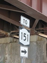
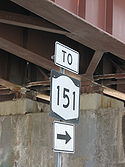
New York State Route 151 (NY 151) is an 8.23 miles (13.24 km) state highway
located in Rensselaer County, New York
, in the United States. Its western terminus is at an interchange with U.S. Route 9 (US 9) and US 20
in Rensselaer
, and its eastern terminus is at a junction with NY 150
in Shivers Corners, a hamlet in the town of Schodack
. It also has an intersection with US 4
in East Greenbush
. NY 151 was assigned to most of its current alignment as part of the 1930 renumbering of state highways in New York. In Rensselaer, NY 151 has been altered several times, with the most recent change coming in the late 1990s. The current western terminus of NY 151 was once the western terminus of NY 43
.
 NY 151 begins as a city-maintained highway at a junction with US 9 and US 20
in Rensselaer
, near the Hudson River
. Known as 3rd Avenue, the two-lane route heads towards the southeast in a largely developed area. Upon assuming an eastward route, the highway crosses over a series of Amtrak
tracks, passing south of the Albany-Rensselaer rail station
and entering a more residential area. NY 151 turns slightly towards the northeast as it leaves the city of Rensselaer and becomes maintained by the New York State Department of Transportation
(NYSDOT) as it passes into the town of East Greenbush
.
Just east of the city line, NY 151 veers to the south at an intersection with Barrack Road. While 3rd Avenue continues eastward as the unsigned NY 915E
, NY 151 follows Barrack Road through a less-developed—and at times forested—landscape as it passes through the town. After 0.5 mile (0.80467 km), the highway curves to the southeast, intersecting County Route 63 (CR 63) and changing street names to Red Mill Road in the process. It continues on a southeasterly alignment across Mill Creek to a junction with US 4
. At this point, it becomes known as Luther Road as it turns northeastward towards Interstate 90
(I-90). NY 151 subsequently passes under the freeway and crosses Mill Creek a second time. After resuming a southeastern path, the route loses its street name and terminates at NY 150
in Shivers Corners, a hamlet
in the town of Schodack
.
) and High Street in Rensselaer
and followed the length of High Street and Red Mill Road to where it merged with its current alignment southeast of the city. West of High Street, what is now NY 151 was the westernmost portion of NY 152. NY 152 was truncated to Defreestville on its western end ca. 1937. Its former routing along Third Avenue from Rensselaer to Defreestville was redesignated as NY 381. NY 381 was supplanted by a rerouted NY 43
in the late 1960s.
In the late 1970s, NY 151 was rerouted off High Street and onto a new roadway, Barracks Road, in the vicinity of Rensselaer. As a result, the roadway no longer entered the Rensselaer city limits. It was re-extended into the city by way of Third Avenue in the late 1990s when NY 43 was rerouted to meet I-90
at the new exit 8 west of Defreestville. Like NY 43 before it, NY 151 terminated at an interchange linking Third Avenue to US 9 and US 20
.
State highway
State highway, state road or state route can refer to one of three related concepts, two of them related to a state or provincial government in a country that is divided into states or provinces :#A...
located in Rensselaer County, New York
Rensselaer County, New York
Rensselaer County is a county in the U.S. state of New York. As of the 2010 census, the population was 159,429. Its name is in honor of the family of Kiliaen van Rensselaer, the original Dutch owner of the land in the area. Its county seat is Troy...
, in the United States. Its western terminus is at an interchange with U.S. Route 9 (US 9) and US 20
U.S. Route 20 in New York
U.S. Route 20 is a part of the U.S. Highway System that runs from Newport, Oregon, to Boston, Massachusetts. In the U.S. state of New York, US 20 extends from the Pennsylvania state line at Ripley to the Massachusetts state line in the Berkshire Mountains. US 20 is the longest...
in Rensselaer
Rensselaer, New York
Rensselaer is a city in Rensselaer County, New York, United States, and is located on the Hudson River directly opposite Albany. As of the 2010 census, the city population was 9,392; in 1920, it was 10,832. The name is from Kiliaen van Rensselaer, the original landowner of the region in New...
, and its eastern terminus is at a junction with NY 150
New York State Route 150
New York State Route 150 is a north–south state highway in Rensselaer County, New York, United States. The southern terminus of the route is at NY 9J in Castleton-on-Hudson...
in Shivers Corners, a hamlet in the town of Schodack
Schodack, New York
Schodack is a town in Rensselaer County, New York, United States. The population was 12,536 at the 2000 census. The town name is derived from the native word, Escotak. The town is in the southwestern part of the county. Schodack is southeast of Albany, New York.- History :Prior to the advent of...
. It also has an intersection with US 4
U.S. Route 4 in New York
U.S. Route 4 is a part of the U.S. Highway System that runs from East Greenbush, New York, to Portsmouth, New Hampshire. In the U.S. state of New York, US 4 extends from an intersection with US 9 and US 20 in East Greenbush to the Vermont state line northeast of Whitehall...
in East Greenbush
East Greenbush (town), New York
East Greenbush is a town in Rensselaer County, New York, USA. The population was 15,560 at the 2000 census. The word Greenbush is derived from the Dutch "Greenen Bosch," referring to the pine woods that originally covered the land. The first settlement of the land now known as East Greenbush was...
. NY 151 was assigned to most of its current alignment as part of the 1930 renumbering of state highways in New York. In Rensselaer, NY 151 has been altered several times, with the most recent change coming in the late 1990s. The current western terminus of NY 151 was once the western terminus of NY 43
New York State Route 43
New York State Route 43 is a state highway in Rensselaer County, New York, United States. It extends for from Interstate 90 exit 8 in North Greenbush to the Massachusetts state line, where it continues into Williamstown as Massachusetts Route 43...
.
Route description
U.S. Route 20 in New York
U.S. Route 20 is a part of the U.S. Highway System that runs from Newport, Oregon, to Boston, Massachusetts. In the U.S. state of New York, US 20 extends from the Pennsylvania state line at Ripley to the Massachusetts state line in the Berkshire Mountains. US 20 is the longest...
in Rensselaer
Rensselaer, New York
Rensselaer is a city in Rensselaer County, New York, United States, and is located on the Hudson River directly opposite Albany. As of the 2010 census, the city population was 9,392; in 1920, it was 10,832. The name is from Kiliaen van Rensselaer, the original landowner of the region in New...
, near the Hudson River
Hudson River
The Hudson is a river that flows from north to south through eastern New York. The highest official source is at Lake Tear of the Clouds, on the slopes of Mount Marcy in the Adirondack Mountains. The river itself officially begins in Henderson Lake in Newcomb, New York...
. Known as 3rd Avenue, the two-lane route heads towards the southeast in a largely developed area. Upon assuming an eastward route, the highway crosses over a series of Amtrak
Amtrak
The National Railroad Passenger Corporation, doing business as Amtrak , is a government-owned corporation that was organized on May 1, 1971, to provide intercity passenger train service in the United States. "Amtrak" is a portmanteau of the words "America" and "track". It is headquartered at Union...
tracks, passing south of the Albany-Rensselaer rail station
Albany-Rensselaer (Amtrak station)
The Albany – Rensselaer Rail Station is a long-distance rail terminal in Rensselaer, New York, located 1.5 miles from downtown Albany across the Hudson River. , the station was Amtrak's tenth-busiest station and by 2010 it had become the ninth-busiest...
and entering a more residential area. NY 151 turns slightly towards the northeast as it leaves the city of Rensselaer and becomes maintained by the New York State Department of Transportation
New York State Department of Transportation
The New York State Department of Transportation is responsible for the development and operation of highways, railroads, mass transit systems, ports, waterways and aviation facilities in the U.S...
(NYSDOT) as it passes into the town of East Greenbush
East Greenbush (town), New York
East Greenbush is a town in Rensselaer County, New York, USA. The population was 15,560 at the 2000 census. The word Greenbush is derived from the Dutch "Greenen Bosch," referring to the pine woods that originally covered the land. The first settlement of the land now known as East Greenbush was...
.
Just east of the city line, NY 151 veers to the south at an intersection with Barrack Road. While 3rd Avenue continues eastward as the unsigned NY 915E
New York State Route 915E
New York State Route 915E is an unsigned reference route designation for Third Avenue Extension in East Greenbush, located in Rensselaer County, New York, in the United States. The east–west highway extends for from an intersection with NY 151 east of the Rensselaer city limits to a...
, NY 151 follows Barrack Road through a less-developed—and at times forested—landscape as it passes through the town. After 0.5 mile (0.80467 km), the highway curves to the southeast, intersecting County Route 63 (CR 63) and changing street names to Red Mill Road in the process. It continues on a southeasterly alignment across Mill Creek to a junction with US 4
U.S. Route 4 in New York
U.S. Route 4 is a part of the U.S. Highway System that runs from East Greenbush, New York, to Portsmouth, New Hampshire. In the U.S. state of New York, US 4 extends from an intersection with US 9 and US 20 in East Greenbush to the Vermont state line northeast of Whitehall...
. At this point, it becomes known as Luther Road as it turns northeastward towards Interstate 90
Interstate 90 in New York
Interstate 90 is a part of the Interstate Highway System that runs from Seattle, Washington, to Boston, Massachusetts. In the U.S. state of New York, I-90 extends from the Pennsylvania state line at Ripley to the Massachusetts state line at Canaan...
(I-90). NY 151 subsequently passes under the freeway and crosses Mill Creek a second time. After resuming a southeastern path, the route loses its street name and terminates at NY 150
New York State Route 150
New York State Route 150 is a north–south state highway in Rensselaer County, New York, United States. The southern terminus of the route is at NY 9J in Castleton-on-Hudson...
in Shivers Corners, a hamlet
Hamlet (place)
A hamlet is usually a rural settlement which is too small to be considered a village, though sometimes the word is used for a different sort of community. Historically, when a hamlet became large enough to justify building a church, it was then classified as a village...
in the town of Schodack
Schodack, New York
Schodack is a town in Rensselaer County, New York, United States. The population was 12,536 at the 2000 census. The town name is derived from the native word, Escotak. The town is in the southwestern part of the county. Schodack is southeast of Albany, New York.- History :Prior to the advent of...
.
History
NY 151 was assigned as part of the 1930 renumbering of state highways in New York to a routing similar to its current alignment. At the time, NY 151 began at the intersection of Third Avenue (then-NY 152New York State Route 152
New York State Route 152 was an east–west state highway in Rensselaer County, New York, in the United States. The western terminus of the route was at an intersection with U.S. Route 4 and NY 43 in the town of North Greenbush. Its eastern terminus was at a junction with...
) and High Street in Rensselaer
Rensselaer, New York
Rensselaer is a city in Rensselaer County, New York, United States, and is located on the Hudson River directly opposite Albany. As of the 2010 census, the city population was 9,392; in 1920, it was 10,832. The name is from Kiliaen van Rensselaer, the original landowner of the region in New...
and followed the length of High Street and Red Mill Road to where it merged with its current alignment southeast of the city. West of High Street, what is now NY 151 was the westernmost portion of NY 152. NY 152 was truncated to Defreestville on its western end ca. 1937. Its former routing along Third Avenue from Rensselaer to Defreestville was redesignated as NY 381. NY 381 was supplanted by a rerouted NY 43
New York State Route 43
New York State Route 43 is a state highway in Rensselaer County, New York, United States. It extends for from Interstate 90 exit 8 in North Greenbush to the Massachusetts state line, where it continues into Williamstown as Massachusetts Route 43...
in the late 1960s.
In the late 1970s, NY 151 was rerouted off High Street and onto a new roadway, Barracks Road, in the vicinity of Rensselaer. As a result, the roadway no longer entered the Rensselaer city limits. It was re-extended into the city by way of Third Avenue in the late 1990s when NY 43 was rerouted to meet I-90
Interstate 90 in New York
Interstate 90 is a part of the Interstate Highway System that runs from Seattle, Washington, to Boston, Massachusetts. In the U.S. state of New York, I-90 extends from the Pennsylvania state line at Ripley to the Massachusetts state line at Canaan...
at the new exit 8 west of Defreestville. Like NY 43 before it, NY 151 terminated at an interchange linking Third Avenue to US 9 and US 20
U.S. Route 20 in New York
U.S. Route 20 is a part of the U.S. Highway System that runs from Newport, Oregon, to Boston, Massachusetts. In the U.S. state of New York, US 20 extends from the Pennsylvania state line at Ripley to the Massachusetts state line in the Berkshire Mountains. US 20 is the longest...
.