

New York State Route 23A
Encyclopedia
New York State Route 23A (NY 23A) is an east–west state highway
in Greene County, New York
, in the United States. It serves as a 34.56 miles (55.62 km) alternate route of NY 23
through the northern Catskill Mountains
. The route passes several of the Catskill High Peaks
, including Hunter Mountain
, before dropping into the Hudson Valley
via Kaaterskill Clove
and ending at an intersection with U.S. Route 9W (US 9W) in the village of Catskill
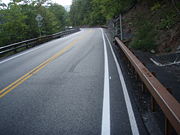
. NY 23A was assigned in the mid-1920s and has not been changed since. A portion of the route through Kaaterskill Clove was closed for several months in 2006 after landslide
s triggered by heavy rains damaged the route.
 NY 23A begins 1 miles (1.6 km) southeast of the hamlet of Prattsville at a three-way junction with NY 23
in the town of Prattsville
. NY 23 enters the intersection from the northwest and turns left (east) to continue toward Windham while traffic proceeding straight through the junction is directed on NY 23A. It heads generally southward along the eastern banks of Schoharie Creek
, continuing the course set by its parent route through northwestern Greene County
. Along the way, the route serves numerous state-maintained parking areas providing direct access to the creek, a popular trout
stream among fly fishermen
. At one of these stops, it begins to run southwestward along the Blue Line
delimiting the boundaries of Catskill Park. After 1 miles (1.6 km), the creek and the route turn to the east, crossing into the park limits.
Inside the park, NY 23A deviates from the creek at various points, occasionally losing sight of the waterway, but it consistently follows the creek valley of the upper Schoharie to within a few miles of its source
. At the first bend taking the stream away from the road, NY 42
comes up from the hamlet of Lexington
to the immediate south, the first of four state routes to terminate at NY 23A. The road, previously level, begins to climb gently and steadily as it heads away from NY 42 and into the center of Greene County. Around the crossing of the East Kill 2.5 miles (4 km) east of Lexington, Rusk Mountain
, the first major peak, comes into view to the south. The route continues to wind its way through the town of Jewett
to the western fringe of the village of Hunter
, where it connects to the south end of NY 296
, a connector route that leads to NY 23 north of Hensonville.
The highway continues east into Hunter, one of only a handful of communities along NY 23A, becoming the village's main street. Here, the ski trails striping the Colonel's Chair, a corner of Hunter Mountain
that hosts the eponymous ski area
, come into view. Traffic, usually low here, becomes heavy on weekends during ski season as commuters from outside the region head to the adjacent resort. Once past the village, the fire tower
on Hunter Mountain's 4040 feet (1,231 m) summit becomes visible to the south as the highway continues to climb in elevation. Roughly 1 miles (1.6 km) from the village limits, NY 23A connects to NY 214
at the north end of Stony Clove Notch
, a narrow cleft separating Hunter Mountain from neighboring Plateau Mountain.
NY 23A's junction with NY 214 heralds the beginning of a stretch of several miles in which the creek valley provides drivers with an unobstructed view of the Devil's Path
, one of the Catskills' best-known ranges. Past Plateau Mountain, the remainder of the range—Sugarloaf, Twin and Indian Head mountains—rise to the south as the road continues east. Schoharie Creek and the Devil's Path recede to the south as the highway enters the village of Tannersville
. The road crests at 2300 feet (701 m) in elevation just before exiting the village and entering the adjacent hamlet of Haines Falls
. From there, a road runs north to the state campground complex near the former Catskill Mountain House
site at North–South Lake.
The distinctive ridgeline of Kaaterskill High Peak
and its shorter neighbor, Round Top Mountain, appear just east of the hamlet along with the dramatic drop into Kaaterskill Clove
, a view that inspired many Hudson River School
paintings. In the next two miles (3.2 km), NY 23A drops 2000 feet (610 m) in elevation through this gap in the Catskill Escarpment
. It passes the trailhead
for Kaaterskill Falls
, from where pedestrians must use the narrow shoulder of NY 23A for a considerable distance to reach the falls themselves. Below the falls are many swimming hole
s and the steep, rugged cliffs that line Kaaterskill Creek
. The road levels off just west of Palenville
, where it crosses the Long Path
hiking trail and leaves the Catskill Park.
Palenville, a small hamlet at the eastern edge of the Catskill Escarpment, is marked by a traffic light at the northern end of NY 32A
, a connector that shortens the trip to the Hunter–Tannersville area for those coming south on the New York State Thruway
(Interstate 87). Just past the junction is Rowena Memorial School
, a local landmark. Going further east, NY 23A crosses much gentler but still largely undeveloped terrain as it traverses the town of Catskill
. It reaches NY 32
itself at an undeveloped intersection prior to crossing Kaaterskill Creek and the Thruway near the grades of an abandoned interchange
. From the Thruway, it heads generally northeastward through a small valley to the western edge of the village of Catskill
, where it ends at a junction with US 9W
. Southbound US 9W is accessed by a right-hand turn, while northbound US 9W is straight ahead.
extending through Kaaterskill Clove
from Palenville
to Haines Falls
. The route did not connect to any other route in the legislative route system, and was removed on March 1, 1921, as part of a partial renumbering of the system. When the first set of posted routes in New York
were assigned in 1924, NY 23
was assigned to an alignment extending from Oneonta to the Massachusetts
state line west of Great Barrington
by way of Catskill Park. The new route bypassed Kaaterskill Clove to the north, however, in favor of an alignment serving the hamlets of Windham
and Cairo
. Within two years, the Kaaterskill Clove road was designated as part of NY 23A, an alternate route of NY 23 between Prattsville
and Catskill
through Hunter
. The routing of NY 23A has remained the same since.
In 2006, the segment of NY 23A from Palenville
to Haines Falls through Kaaterskill Clove
was closed to traffic for several months by the New York State Department of Transportation
(NYSDOT) due to landslide
s caused by heavy rains in downstate New York. The road, closed in mid-June, was repaired at a cost of roughly $5 million and reopened in late November in time for the Thanksgiving
holiday period.
State highway
State highway, state road or state route can refer to one of three related concepts, two of them related to a state or provincial government in a country that is divided into states or provinces :#A...
in Greene County, New York
Greene County, New York
Greene County is a county located in the U.S. state of New York. Its name is in honor of the American Revolutionary War general Nathanael Greene. Its county seat is Catskill...
, in the United States. It serves as a 34.56 miles (55.62 km) alternate route of NY 23
New York State Route 23
New York State Route 23 is an east–west state highway in the eastern portion New York in the United States. It extends for from an intersection with NY 26 in the Central New York town of Cincinnatus to the Massachusetts state line in the Berkshire Mountains, where it continues east as...
through the northern Catskill Mountains
Catskill Mountains
The Catskill Mountains, an area in New York State northwest of New York City and southwest of Albany, are a mature dissected plateau, an uplifted region that was subsequently eroded into sharp relief. They are an eastward continuation, and the highest representation, of the Allegheny Plateau...
. The route passes several of the Catskill High Peaks
Catskill High Peaks
The Catskill High Peaks are all of the mountains in New York's Catskill Mountains above 3,500 ft in elevation whose summits are separated either by one-half mile or a vertical drop of at least 250 ft between it and the next nearest separate summit...
, including Hunter Mountain
Hunter Mountain (New York)
Hunter Mountain is in the towns of Hunter and Lexington, just south of the village of Hunter, in Greene County, New York, USA. At approximately 4,040 feet in elevation, it is the highest peak in the county and the second-highest peak in the Catskill Mountains.While the mountain is closely...
, before dropping into the Hudson Valley
Hudson Valley
The Hudson Valley comprises the valley of the Hudson River and its adjacent communities in New York State, United States, from northern Westchester County northward to the cities of Albany and Troy.-History:...
via Kaaterskill Clove
Kaaterskill Clove
Kaaterskill Clove is a deep gorge, or valley, in New York's eastern Catskill Mountains, lying just west of the village of Palenville. The clove was formed by Kaaterskill Creek, a tributary of Catskill Creek rising west of North Mountain, and is estimated by geologists to be as much as 1 million...
and ending at an intersection with U.S. Route 9W (US 9W) in the village of Catskill
Catskill (village), New York
Catskill is a village in Greene County, New York, USA. The population was 4,081 at the 2010 census.The Village of Catskill is in the northeast part of the Town of Catskill. Catskill is the county seat of Greene County.-History:...
. NY 23A was assigned in the mid-1920s and has not been changed since. A portion of the route through Kaaterskill Clove was closed for several months in 2006 after landslide
Landslide
A landslide or landslip is a geological phenomenon which includes a wide range of ground movement, such as rockfalls, deep failure of slopes and shallow debris flows, which can occur in offshore, coastal and onshore environments...
s triggered by heavy rains damaged the route.
Route description
New York State Route 23
New York State Route 23 is an east–west state highway in the eastern portion New York in the United States. It extends for from an intersection with NY 26 in the Central New York town of Cincinnatus to the Massachusetts state line in the Berkshire Mountains, where it continues east as...
in the town of Prattsville
Prattsville, New York
Prattsville is a town in Greene County, New York, United States. The Town of Prattsville is in the northwest part of the county. As of the 2010 census, the city population was 700.- History :...
. NY 23 enters the intersection from the northwest and turns left (east) to continue toward Windham while traffic proceeding straight through the junction is directed on NY 23A. It heads generally southward along the eastern banks of Schoharie Creek
Schoharie Creek
Schoharie Creek in New York, USA flows north from the foot of Indian Head Mountain in the Catskill Mountains through the Schoharie Valley to the Mohawk River. It is twice impounded north of Prattsville to create New York City's Schoharie Reservoir and the Blenheim-Gilboa Power Project.Two notable...
, continuing the course set by its parent route through northwestern Greene County
Greene County, New York
Greene County is a county located in the U.S. state of New York. Its name is in honor of the American Revolutionary War general Nathanael Greene. Its county seat is Catskill...
. Along the way, the route serves numerous state-maintained parking areas providing direct access to the creek, a popular trout
Trout
Trout is the name for a number of species of freshwater and saltwater fish belonging to the Salmoninae subfamily of the family Salmonidae. Salmon belong to the same family as trout. Most salmon species spend almost all their lives in salt water...
stream among fly fishermen
Fly fishing
Fly fishing is an angling method in which an artificial 'fly' is used to catch fish. The fly is cast using a fly rod, reel, and specialized weighted line. Casting a nearly weightless fly or 'lure' requires casting techniques significantly different from other forms of casting...
. At one of these stops, it begins to run southwestward along the Blue Line
Blue Line (New York State)
The Blue Line is the term used in New York state for the boundaries of the Adirondack and Catskill parks, within which can be found the state's Forest Preserve...
delimiting the boundaries of Catskill Park. After 1 miles (1.6 km), the creek and the route turn to the east, crossing into the park limits.
Inside the park, NY 23A deviates from the creek at various points, occasionally losing sight of the waterway, but it consistently follows the creek valley of the upper Schoharie to within a few miles of its source
Source (river or stream)
The source or headwaters of a river or stream is the place from which the water in the river or stream originates.-Definition:There is no universally agreed upon definition for determining a stream's source...
. At the first bend taking the stream away from the road, NY 42
New York State Route 42
New York State Route 42 is a north–south, discontinuous state highway in the Catskill Mountains region of New York in the United States. The southernmost of the highway's two segments begins at an intersection with U.S. Route 6 and US 209 in Port Jervis and ends at a junction with...
comes up from the hamlet of Lexington
Lexington, New York
Lexington is a town in Greene County, New York, United States. The population was 805 at the 2010 census.The Town of Lexington is in the southwest part of Greene County.- History :The town was first settled around 1788....
to the immediate south, the first of four state routes to terminate at NY 23A. The road, previously level, begins to climb gently and steadily as it heads away from NY 42 and into the center of Greene County. Around the crossing of the East Kill 2.5 miles (4 km) east of Lexington, Rusk Mountain
Rusk Mountain
Rusk Mountain is a peak located in the towns of Jewett and Lexington in Greene County, New York, USA. At 3,680 feet in elevation, it is the 20th-highest peak in the Catskill Mountains and considered a member of the Catskill High Peaks...
, the first major peak, comes into view to the south. The route continues to wind its way through the town of Jewett
Jewett, New York
Jewett is a town centrally located in Greene County, New York, United States. The population was 953 at the 2010 census. The town is named after Judge Freeborn Jewett.- History :The town was first settled around 1784....
to the western fringe of the village of Hunter
Hunter (village), New York
Hunter is a village in Greene County, New York, USA. The population was 502 at the 2010 census.The Village of Hunter is in the northwest part of the Town of Hunter on Route 23A.- History :...
, where it connects to the south end of NY 296
New York State Route 296
New York State Route 296 is a short state highway located entirely within both the Catskill Park and Greene County. It connects NY 23A in the village of Hunter with NY 23 near the Windham hamlet of Hensonville....
, a connector route that leads to NY 23 north of Hensonville.
The highway continues east into Hunter, one of only a handful of communities along NY 23A, becoming the village's main street. Here, the ski trails striping the Colonel's Chair, a corner of Hunter Mountain
Hunter Mountain (New York)
Hunter Mountain is in the towns of Hunter and Lexington, just south of the village of Hunter, in Greene County, New York, USA. At approximately 4,040 feet in elevation, it is the highest peak in the county and the second-highest peak in the Catskill Mountains.While the mountain is closely...
that hosts the eponymous ski area
Hunter Mountain (ski area)
Hunter Mountain is a ski resort located about three hours up the New York State Thruway north-northwest of New York City. It features a vertical drop....
, come into view. Traffic, usually low here, becomes heavy on weekends during ski season as commuters from outside the region head to the adjacent resort. Once past the village, the fire tower
Fire lookout tower
A fire lookout tower, fire tower or lookout tower, provides housing and protection for a person known as a "fire lookout" whose duty it is to search for wildfires in the wilderness...
on Hunter Mountain's 4040 feet (1,231 m) summit becomes visible to the south as the highway continues to climb in elevation. Roughly 1 miles (1.6 km) from the village limits, NY 23A connects to NY 214
New York State Route 214
New York State Route 214 is a short but scenic state highway in the heart of the Catskill Park. It runs north–south from near the hamlet of Phoenicia up near an old railroad route into the narrow pass known as Stony Clove Notch, then down into the upper Schoharie Creek valley to end...
at the north end of Stony Clove Notch
Stony Clove Notch
Stony Clove Notch is a narrow pass, roughly 2,220 feet in elevation located in the Town of Hunter in Greene County, New York, deep in the Catskill Mountains. It is traversed by New York State Route 214, although in the past the Ulster and Delaware Railroad went through it as well.The notch divides...
, a narrow cleft separating Hunter Mountain from neighboring Plateau Mountain.
NY 23A's junction with NY 214 heralds the beginning of a stretch of several miles in which the creek valley provides drivers with an unobstructed view of the Devil's Path
Devil's Path (Catskills)
The Devil's Path is the name of a mountain range and hiking trail in the Greene County portion of New York's Catskill Mountains. The mountains commonly considered to be part of the Devil's Path are, from west to east, West Kill, Hunter, Plateau, Sugarloaf, Twin, and Indian Head.The name comes from...
, one of the Catskills' best-known ranges. Past Plateau Mountain, the remainder of the range—Sugarloaf, Twin and Indian Head mountains—rise to the south as the road continues east. Schoharie Creek and the Devil's Path recede to the south as the highway enters the village of Tannersville
Tannersville, New York
Tannersville is a village in Greene County, New York, USA. The village is in the east-central part of the town of Hunter on Route 23A. The population was 539 at the 2010 census.- History :...
. The road crests at 2300 feet (701 m) in elevation just before exiting the village and entering the adjacent hamlet of Haines Falls
Haines Falls, New York
Haines Falls is a hamlet located east of Tannersville, New York in the Town of Hunter, in Greene County, New York. Haines Falls is located at .-Transportation:...
. From there, a road runs north to the state campground complex near the former Catskill Mountain House
Catskill Mountain House
The Catskill Mountain House was a famous hotel near Palenville, New York in the Catskill Mountains overlooking the Hudson River Valley, built in 1824. In its prime, from the 1850s to the turn of the century, it was visited by three U.S. presidents The Catskill Mountain House was a famous hotel...
site at North–South Lake.
The distinctive ridgeline of Kaaterskill High Peak
Kaaterskill High Peak
Kaaterskill High Peak is one of the Catskill Mountains, located in the Town of Hunter in Greene County, New York, USA. It was once believed to be the highest peak in the entire range, but its summit, at 3,655 feet in elevation, places it only 23rd among the Catskill High Peaks. It is, however,...
and its shorter neighbor, Round Top Mountain, appear just east of the hamlet along with the dramatic drop into Kaaterskill Clove
Kaaterskill Clove
Kaaterskill Clove is a deep gorge, or valley, in New York's eastern Catskill Mountains, lying just west of the village of Palenville. The clove was formed by Kaaterskill Creek, a tributary of Catskill Creek rising west of North Mountain, and is estimated by geologists to be as much as 1 million...
, a view that inspired many Hudson River School
Hudson River school
The Hudson River School was a mid-19th century American art movement embodied by a group of landscape painters whose aesthetic vision was influenced by romanticism...
paintings. In the next two miles (3.2 km), NY 23A drops 2000 feet (610 m) in elevation through this gap in the Catskill Escarpment
Catskill Escarpment
The Catskill Escarpment, often referred to locally as just the Escarpment or the Great Wall of Manitou, and known as the Catskill Front to geologists, is the range forming the northeastern corner of the Catskill Mountains in Greene and Ulster counties in the U.S. state of New York...
. It passes the trailhead
Trailhead
A trailhead is the point at which a trail begins, where the trail is often intended for hiking, biking, horseback riding, or off-road vehicles...
for Kaaterskill Falls
Kaaterskill Falls
Kaaterskill Falls is a two-drop waterfall located near in the eastern Catskill Mountains of New York, on the north side of Kaaterskill Clove, between the hamlets of Haines Falls and Palenville in Greene County's Town of Hunter...
, from where pedestrians must use the narrow shoulder of NY 23A for a considerable distance to reach the falls themselves. Below the falls are many swimming hole
Swimming hole
A swimming hole is a place in a river, stream, creek, spring, or similar natural body of water, which is large enough and deep enough for a person to swim in...
s and the steep, rugged cliffs that line Kaaterskill Creek
Kaaterskill Creek
Kaaterskill Creek is a tributary of Catskill Creek in Greene and Ulster counties in New York. Via Catskill Creek, it is part of the Hudson River watershed....
. The road levels off just west of Palenville
Palenville, New York
Palenville is a hamlet in Greene County, New York, United States. The population was 1,037 at the 2010 census.Palenville is in the southwest part of the Town of Catskill, located at the junction of Routes 23A and 32A. It lies at the foot of Kaaterskill Clove, nestled against the base of the...
, where it crosses the Long Path
Long Path
The Long Path is a long-distance hiking trail beginning at the George Washington Bridge in Fort Lee, New Jersey and currently ending at Altamont, New York, in the Albany area...
hiking trail and leaves the Catskill Park.
Palenville, a small hamlet at the eastern edge of the Catskill Escarpment, is marked by a traffic light at the northern end of NY 32A
New York State Route 32A
New York State Route 32A is a state highway in the Hudson Valley region of New York in the United States. It serves as a connector between NY 32 in the town of Saugerties and NY 23A in the town of Catskill...
, a connector that shortens the trip to the Hunter–Tannersville area for those coming south on the New York State Thruway
New York State Thruway
The New York State Thruway is a system of limited-access highways located within the state of New York in the United States. The system, known officially as the Governor Thomas E. Dewey Thruway for former New York Governor Thomas E. Dewey, is operated by the New York State Thruway Authority and...
(Interstate 87). Just past the junction is Rowena Memorial School
Rowena Memorial School
The former Rowena Memorial School is located on NY 23A, at the junction with NY 32A, in Palenville, New York, United States. It is a stone Romanesque style building that educated local students for 70 years...
, a local landmark. Going further east, NY 23A crosses much gentler but still largely undeveloped terrain as it traverses the town of Catskill
Catskill (town), New York
Catskill is a town in the southeast part of Greene County, New York, United States. The population was 11,775 at the 2010 census. The western part of the town is in the Catskill Park....
. It reaches NY 32
New York State Route 32
New York State Route 32 is a north–south state highway that extends for through the Hudson Valley and Capital District regions of the U.S. state of New York. It is a two-lane surface road for nearly its entire length, with few divided and no limited-access sections. From Harriman to Albany,...
itself at an undeveloped intersection prior to crossing Kaaterskill Creek and the Thruway near the grades of an abandoned interchange
Interchange (road)
In the field of road transport, an interchange is a road junction that typically uses grade separation, and one or more ramps, to permit traffic on at least one highway to pass through the junction without directly crossing any other traffic stream. It differs from a standard intersection, at which...
. From the Thruway, it heads generally northeastward through a small valley to the western edge of the village of Catskill
Catskill (village), New York
Catskill is a village in Greene County, New York, USA. The population was 4,081 at the 2010 census.The Village of Catskill is in the northeast part of the Town of Catskill. Catskill is the county seat of Greene County.-History:...
, where it ends at a junction with US 9W
U.S. Route 9W
U.S. Route 9W is a north–south U.S. Highway in the states of New Jersey and New York. It begins on Fletcher Avenue in Fort Lee, New Jersey as it crosses the US 1 & 9, US 46, and the Interstate 95 approaches to the George Washington Bridge, where it heads north up the west...
. Southbound US 9W is accessed by a right-hand turn, while northbound US 9W is straight ahead.
History
In 1913, the New York State Legislature created Route 5-c, an unsigned legislative routeLegislative route
In United States, a legislative route or legislative highway is a highway defined by laws passed in a state legislature. The numbering of such highways may or may not correspond to the numbers familiar to the public as part of the state, U.S. highway, and Interstate highway systems...
extending through Kaaterskill Clove
Kaaterskill Clove
Kaaterskill Clove is a deep gorge, or valley, in New York's eastern Catskill Mountains, lying just west of the village of Palenville. The clove was formed by Kaaterskill Creek, a tributary of Catskill Creek rising west of North Mountain, and is estimated by geologists to be as much as 1 million...
from Palenville
Palenville, New York
Palenville is a hamlet in Greene County, New York, United States. The population was 1,037 at the 2010 census.Palenville is in the southwest part of the Town of Catskill, located at the junction of Routes 23A and 32A. It lies at the foot of Kaaterskill Clove, nestled against the base of the...
to Haines Falls
Haines Falls, New York
Haines Falls is a hamlet located east of Tannersville, New York in the Town of Hunter, in Greene County, New York. Haines Falls is located at .-Transportation:...
. The route did not connect to any other route in the legislative route system, and was removed on March 1, 1921, as part of a partial renumbering of the system. When the first set of posted routes in New York
New York
New York is a state in the Northeastern region of the United States. It is the nation's third most populous state. New York is bordered by New Jersey and Pennsylvania to the south, and by Connecticut, Massachusetts and Vermont to the east...
were assigned in 1924, NY 23
New York State Route 23
New York State Route 23 is an east–west state highway in the eastern portion New York in the United States. It extends for from an intersection with NY 26 in the Central New York town of Cincinnatus to the Massachusetts state line in the Berkshire Mountains, where it continues east as...
was assigned to an alignment extending from Oneonta to the Massachusetts
Massachusetts
The Commonwealth of Massachusetts is a state in the New England region of the northeastern United States of America. It is bordered by Rhode Island and Connecticut to the south, New York to the west, and Vermont and New Hampshire to the north; at its east lies the Atlantic Ocean. As of the 2010...
state line west of Great Barrington
Great Barrington, Massachusetts
Great Barrington is a town in Berkshire County, Massachusetts, United States. It is part of the Pittsfield, Massachusetts Metropolitan Statistical Area. The population was 7,104 at the 2010 census. Both a summer resort and home to Ski Butternut, Great Barrington includes the villages of Van...
by way of Catskill Park. The new route bypassed Kaaterskill Clove to the north, however, in favor of an alignment serving the hamlets of Windham
Windham (CDP), New York
Windham is a census-designated place in Greene County, New York, United States. The population was 359 at the 2000 census.The community of Windham is in the town of Windham, located on Route 23...
and Cairo
Cairo (CDP), New York
Cairo is a census-designated place in the town of Cairo in Greene County, New York, United States. The population was 1,390 at the 2000 census.-Geography:Cairo is located at ....
. Within two years, the Kaaterskill Clove road was designated as part of NY 23A, an alternate route of NY 23 between Prattsville
Prattsville, New York
Prattsville is a town in Greene County, New York, United States. The Town of Prattsville is in the northwest part of the county. As of the 2010 census, the city population was 700.- History :...
and Catskill
Catskill (town), New York
Catskill is a town in the southeast part of Greene County, New York, United States. The population was 11,775 at the 2010 census. The western part of the town is in the Catskill Park....
through Hunter
Hunter (village), New York
Hunter is a village in Greene County, New York, USA. The population was 502 at the 2010 census.The Village of Hunter is in the northwest part of the Town of Hunter on Route 23A.- History :...
. The routing of NY 23A has remained the same since.
In 2006, the segment of NY 23A from Palenville
Palenville, New York
Palenville is a hamlet in Greene County, New York, United States. The population was 1,037 at the 2010 census.Palenville is in the southwest part of the Town of Catskill, located at the junction of Routes 23A and 32A. It lies at the foot of Kaaterskill Clove, nestled against the base of the...
to Haines Falls through Kaaterskill Clove
Kaaterskill Clove
Kaaterskill Clove is a deep gorge, or valley, in New York's eastern Catskill Mountains, lying just west of the village of Palenville. The clove was formed by Kaaterskill Creek, a tributary of Catskill Creek rising west of North Mountain, and is estimated by geologists to be as much as 1 million...
was closed to traffic for several months by the New York State Department of Transportation
New York State Department of Transportation
The New York State Department of Transportation is responsible for the development and operation of highways, railroads, mass transit systems, ports, waterways and aviation facilities in the U.S...
(NYSDOT) due to landslide
Landslide
A landslide or landslip is a geological phenomenon which includes a wide range of ground movement, such as rockfalls, deep failure of slopes and shallow debris flows, which can occur in offshore, coastal and onshore environments...
s caused by heavy rains in downstate New York. The road, closed in mid-June, was repaired at a cost of roughly $5 million and reopened in late November in time for the Thanksgiving
Thanksgiving
Thanksgiving Day is a holiday celebrated primarily in the United States and Canada. Thanksgiving is celebrated each year on the second Monday of October in Canada and on the fourth Thursday of November in the United States. In Canada, Thanksgiving falls on the same day as Columbus Day in the...
holiday period.