

New York State Route 23B
Encyclopedia
New York State Route 23B (NY 23B) is an east–west state highway
located in western Columbia County, New York
, in the United States. The route is a former section of NY 23
that runs for 6.71 miles (10.8 km) from NY 9G
southwest of Hudson
to NY 9H
in Claverack
. It provides direct access to the city of Hudson from the Rip Van Winkle Bridge
whereas NY 23 bypasses it to the south. NY 23B was assigned in the late 1950s after NY 23 was moved onto its current alignment south of Hudson.
, 3 miles (5 km) south of the city of Hudson
and a half-mile (0.8 km) east of the Rip Van Winkle Bridge
in Greenport
, Columbia County
. The intersection borders the grounds of the Olana State Historic Site
and is 300 yards (274.3 m) west of the Columbia-Greene Community College
campus. NY 9G
, concurrent with NY 23 west of this point, leaves NY 23 to follow NY 23B toward Hudson. The route is the westernmost through route along the Hudson River
between the Rip Van Winkle Bridge and Hudson; however, it is separated from the river by Mount Merino, a peak situated 546 feet (166.4 m) above sea level.
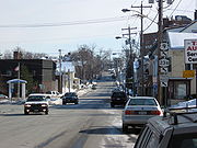 Upon entering the Hudson city limits, NY 9G and NY 23B change from a state-maintained highway to a locally maintained street as it traverses the marshy South Bay. The routes continue into the downtown district
, where they follow Third Street for several blocks to Columbia Street. Here, NY 9G and NY 23B veer east, following Columbia Street through the city to a junction with US 9 at Park Place. NY 9G terminates here; however, NY 23B continues east on Columbia Street, now joined by US 9. Both routes curve onto Green Street one block later. At Fairview Avenue, US 9 splits from NY 23B and heads north while NY 23B heads eastward as an independent route for the first time. NY 23B passes out of Hudson and back into Greenport after intersecting the southern terminus of NY 66
at Columbia Street.
In Greenport, maintenance of NY 23B reverts back to the New York State Department of Transportation
(NYSDOT). The route remains in Greenport for only 1 miles (1.6 km) before crossing into the town of Claverack
upon traversing Claverack Creek
. The route terminates 1.5 miles (2.4 km) to the southeast in the hamlet of Claverack, where it intersects NY 9H
and NY 23. Here, NY 23 leaves NY 9H and continues east on the right-of-way of NY 23B.
were assigned in 1924, the portion of NY 23B from Third Street in Hudson
to Claverack
was designated as part of NY 23
. West of Hudson, NY 23 continued across the Hudson River
to Athens
by way of a ferry
. The Rip Van Winkle Bridge
over the Hudson River between Catskill and Greenport
was opened to traffic on July 2, 1935; however, NY 23 was not realigned to use the structure until the Athens–Hudson ferry was shut down in the late 1940s. NY 23 utilized modern NY 23B between the bridge and Hudson. In the late 1950s, NY 23 was realigned between the east end of the bridge and Claverack to follow a new, more southerly alignment via Bell Pond. Its former routing via Hudson was redesignated as NY 23B.
State highway
State highway, state road or state route can refer to one of three related concepts, two of them related to a state or provincial government in a country that is divided into states or provinces :#A...
located in western Columbia County, New York
Columbia County, New York
Columbia County is a county located in the U.S. state of New York. As of the 2010 census, the population was 63,096. The county seat is Hudson. The name comes from the Latin feminine form of the name of Christopher Columbus, which was at the time of the formation of the county a popular proposal...
, in the United States. The route is a former section of NY 23
New York State Route 23
New York State Route 23 is an east–west state highway in the eastern portion New York in the United States. It extends for from an intersection with NY 26 in the Central New York town of Cincinnatus to the Massachusetts state line in the Berkshire Mountains, where it continues east as...
that runs for 6.71 miles (10.8 km) from NY 9G
New York State Route 9G
New York State Route 9G is a state highway in the Hudson Valley of New York in the United States. It runs north from U.S. Route 9 at Poughkeepsie, starting out as Violet Avenue, then follows the Hudson River mostly along the eastern side of the US 9 to Rhinebeck, where the two...
southwest of Hudson
Hudson, New York
Hudson is a city located along the west border of Columbia County, New York, United States. The city is named after the adjacent Hudson River and ultimately after the explorer Henry Hudson.Hudson is the county seat of Columbia County...
to NY 9H
New York State Route 9H
New York State Route 9H is a state highway located within Columbia County, New York, United States. It runs from US 9, NY 82, and NY 23 at its southern end in Bell Pond to its northern end in Valatie, also at US 9....
in Claverack
Claverack, New York
Claverack is a town in Columbia County, New York, United States. The population was 6,401 at the 2000 census. The town name is a corruption for the Dutch word for "Clover Fields" or "Clover Reach"....
. It provides direct access to the city of Hudson from the Rip Van Winkle Bridge
Rip Van Winkle Bridge
The Rip Van Winkle Bridge is a cantilever bridge spanning the Hudson River between Hudson, NY and Catskill, New York. The structure carries NY 23 across the river, connecting on the west side, US 9W and NY 385 with NY 9G on the east side. The bridge was built by the newly created New York State...
whereas NY 23 bypasses it to the south. NY 23B was assigned in the late 1950s after NY 23 was moved onto its current alignment south of Hudson.
Route description
NY 23B forks from its parent, NY 23New York State Route 23
New York State Route 23 is an east–west state highway in the eastern portion New York in the United States. It extends for from an intersection with NY 26 in the Central New York town of Cincinnatus to the Massachusetts state line in the Berkshire Mountains, where it continues east as...
, 3 miles (5 km) south of the city of Hudson
Hudson, New York
Hudson is a city located along the west border of Columbia County, New York, United States. The city is named after the adjacent Hudson River and ultimately after the explorer Henry Hudson.Hudson is the county seat of Columbia County...
and a half-mile (0.8 km) east of the Rip Van Winkle Bridge
Rip Van Winkle Bridge
The Rip Van Winkle Bridge is a cantilever bridge spanning the Hudson River between Hudson, NY and Catskill, New York. The structure carries NY 23 across the river, connecting on the west side, US 9W and NY 385 with NY 9G on the east side. The bridge was built by the newly created New York State...
in Greenport
Greenport, Columbia County, New York
Greenport is a town in Columbia County, New York, United States. The population was 4,180 at the 2000 census.The Town of Greenport is on the west border of the county and surrounds the City of Hudson on three sides. US 9 passes through the town....
, Columbia County
Columbia County, New York
Columbia County is a county located in the U.S. state of New York. As of the 2010 census, the population was 63,096. The county seat is Hudson. The name comes from the Latin feminine form of the name of Christopher Columbus, which was at the time of the formation of the county a popular proposal...
. The intersection borders the grounds of the Olana State Historic Site
Olana State Historic Site
Olana State Historic Site was the home of Frederic Edwin Church , one of the major figures in the Hudson River School of landscape painting. The centerpiece of Olana is an eclectic villa composed of many styles, difficult to categorize, which overlooks parkland and a working farm designed by the...
and is 300 yards (274.3 m) west of the Columbia-Greene Community College
Columbia-Greene Community College
Columbia–Greene Community College is a two-year community college located in the city of Hudson, New York. The college takes its name from the two counties it serves, Columbia County, New York and Greene County, New York.-Clubs and organizations:...
campus. NY 9G
New York State Route 9G
New York State Route 9G is a state highway in the Hudson Valley of New York in the United States. It runs north from U.S. Route 9 at Poughkeepsie, starting out as Violet Avenue, then follows the Hudson River mostly along the eastern side of the US 9 to Rhinebeck, where the two...
, concurrent with NY 23 west of this point, leaves NY 23 to follow NY 23B toward Hudson. The route is the westernmost through route along the Hudson River
Hudson River
The Hudson is a river that flows from north to south through eastern New York. The highest official source is at Lake Tear of the Clouds, on the slopes of Mount Marcy in the Adirondack Mountains. The river itself officially begins in Henderson Lake in Newcomb, New York...
between the Rip Van Winkle Bridge and Hudson; however, it is separated from the river by Mount Merino, a peak situated 546 feet (166.4 m) above sea level.
Hudson Historic District (New York)
The Hudson Historic District includes most of downtown Hudson, New York, United States, once called "one of the richest dictionaries of architectural history in New York State". It is a area stretching from the city's waterfront on the east bank of the Hudson River to almost its eastern boundary,...
, where they follow Third Street for several blocks to Columbia Street. Here, NY 9G and NY 23B veer east, following Columbia Street through the city to a junction with US 9 at Park Place. NY 9G terminates here; however, NY 23B continues east on Columbia Street, now joined by US 9. Both routes curve onto Green Street one block later. At Fairview Avenue, US 9 splits from NY 23B and heads north while NY 23B heads eastward as an independent route for the first time. NY 23B passes out of Hudson and back into Greenport after intersecting the southern terminus of NY 66
New York State Route 66
New York State Route 66 is a state highway in the Capital District of New York in the United States. The route begins at an intersection with NY 23B in the Columbia County city of Hudson and ends at a junction with NY 2 in the Rensselaer County city of Troy...
at Columbia Street.
In Greenport, maintenance of NY 23B reverts back to the New York State Department of Transportation
New York State Department of Transportation
The New York State Department of Transportation is responsible for the development and operation of highways, railroads, mass transit systems, ports, waterways and aviation facilities in the U.S...
(NYSDOT). The route remains in Greenport for only 1 miles (1.6 km) before crossing into the town of Claverack
Claverack, New York
Claverack is a town in Columbia County, New York, United States. The population was 6,401 at the 2000 census. The town name is a corruption for the Dutch word for "Clover Fields" or "Clover Reach"....
upon traversing Claverack Creek
Claverack Creek
Claverack Creek is a tributary to Stockport Creek in Columbia County, New York, in the United States. Its source is in the town of Claverack at the hamlet of Mellenville, and its mouth is at its confluence with Kinderhook Creek to form Stockport Creek, in the town of Stockport.-History:The lower...
. The route terminates 1.5 miles (2.4 km) to the southeast in the hamlet of Claverack, where it intersects NY 9H
New York State Route 9H
New York State Route 9H is a state highway located within Columbia County, New York, United States. It runs from US 9, NY 82, and NY 23 at its southern end in Bell Pond to its northern end in Valatie, also at US 9....
and NY 23. Here, NY 23 leaves NY 9H and continues east on the right-of-way of NY 23B.
History
When the first set of posted routes in New YorkNew York
New York is a state in the Northeastern region of the United States. It is the nation's third most populous state. New York is bordered by New Jersey and Pennsylvania to the south, and by Connecticut, Massachusetts and Vermont to the east...
were assigned in 1924, the portion of NY 23B from Third Street in Hudson
Hudson, New York
Hudson is a city located along the west border of Columbia County, New York, United States. The city is named after the adjacent Hudson River and ultimately after the explorer Henry Hudson.Hudson is the county seat of Columbia County...
to Claverack
Claverack, New York
Claverack is a town in Columbia County, New York, United States. The population was 6,401 at the 2000 census. The town name is a corruption for the Dutch word for "Clover Fields" or "Clover Reach"....
was designated as part of NY 23
New York State Route 23
New York State Route 23 is an east–west state highway in the eastern portion New York in the United States. It extends for from an intersection with NY 26 in the Central New York town of Cincinnatus to the Massachusetts state line in the Berkshire Mountains, where it continues east as...
. West of Hudson, NY 23 continued across the Hudson River
Hudson River
The Hudson is a river that flows from north to south through eastern New York. The highest official source is at Lake Tear of the Clouds, on the slopes of Mount Marcy in the Adirondack Mountains. The river itself officially begins in Henderson Lake in Newcomb, New York...
to Athens
Athens (village), New York
Athens is a village in Greene County, New York, USA. The population was 1,668 at the 2010 census. The village is named after the classical city of Athens.The Village of Athens is in the eastern part of the Town of Athens, opposite the City of Hudson....
by way of a ferry
Ferry
A ferry is a form of transportation, usually a boat, but sometimes a ship, used to carry primarily passengers, and sometimes vehicles and cargo as well, across a body of water. Most ferries operate on regular, frequent, return services...
. The Rip Van Winkle Bridge
Rip Van Winkle Bridge
The Rip Van Winkle Bridge is a cantilever bridge spanning the Hudson River between Hudson, NY and Catskill, New York. The structure carries NY 23 across the river, connecting on the west side, US 9W and NY 385 with NY 9G on the east side. The bridge was built by the newly created New York State...
over the Hudson River between Catskill and Greenport
Greenport, Columbia County, New York
Greenport is a town in Columbia County, New York, United States. The population was 4,180 at the 2000 census.The Town of Greenport is on the west border of the county and surrounds the City of Hudson on three sides. US 9 passes through the town....
was opened to traffic on July 2, 1935; however, NY 23 was not realigned to use the structure until the Athens–Hudson ferry was shut down in the late 1940s. NY 23 utilized modern NY 23B between the bridge and Hudson. In the late 1950s, NY 23 was realigned between the east end of the bridge and Claverack to follow a new, more southerly alignment via Bell Pond. Its former routing via Hudson was redesignated as NY 23B.