
New York State Route 812
Encyclopedia
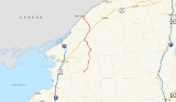
New York State Route 812 (NY 812) is a state highway
in the North Country
of New York
in the United States
. The southern terminus of the route is at an intersection with NY 12
and NY 26
in the Lewis County
village of Lowville
. Its northern terminus is at the Canada – United States border in Ogdensburg
, where it crosses the Ogdensburg–Prescott International Bridge and connects to Highway 16 in Ontario
. While most of NY 812 passes through rural areas of the North Country
, the route also serves several villages and small communities.
The origins of NY 812 date back to the 1930 renumbering of state highways in New York, when the portion of modern NY 812 from Lowville to Croghan
became part of NY 26A and the segment of modern NY 812 between De Kalb
and Ogdensburg was designated as the northernmost portion of New York State Route 87. NY 87 originally extended as far south as Harrisville
; however, it was truncated north to Edwards
in the 1940s and farther north to De Kalb in the 1970s.
In the late 1970s, all of NY 87 and the Lowville–Croghan leg of NY 26A were replaced with NY 812, a new route that began in Lowville and passed through Croghan, Harrisville, Gouverneur
, and De Kalb before ending near Ogdensburg. At the time, two sections of the route—from the Croghan village line to a point west of Harrisville and from Harrisville to Fowler
—were maintained by the counties that they passed through, and a piece between NY 126
and the Croghan village line was maintained by the village itself. The state of New York assumed maintenance of the Croghan–Harrisville segment in 1980 and took over the Harrisville–Fowler section in 1982.
and NY 26
in the center of Lowville
. NY 26, concurrent
with NY 12 south of this point, leaves NY 12 and follows NY 812 for several blocks along North State Street before NY 812 turns northeast onto Bostwick Street. Just before Bostwick ends at East State Street, NY 812 turns off and begins its progression northward through a largely rural area of the North Country
. As it exits the village of Lowville (and enters the town of the same name
), it begins to parallel the western bank of the Black River
. The two entities remain close for roughly 1 miles (1.6 km) before NY 812 crosses over the river and enters New Bremen
.
In the hamlet of New Bremen, NY 812 intersects County Route 33 (CR 33), a riverside roadway bypassing both Croghan
and Beaver Falls along the east bank of the Black River, southwest of Duflo Airport. NY 812 continues onward, crossing the Black Creek as it enters Croghan, a village situated on the New Bremen – Croghan
town line. At the center of the community, NY 812 meets the eastern terminus of NY 126
.
Outside of Croghan, NY 812 traverses the Beaver River
just north of the village line. The route and the river continue northward along parallel routings for a brief distance before the two separate near the hamlet of High Falls. While the river curves east toward the hamlet, NY 812 presses northward through the rural hamlets of Indian River and Dutton Corners into the town of Diana
, where NY 812 starts to parallel the west branch of the Oswegatchie River
as both continue north through the town. At Tylers Corners, NY 812 intersects NY 3
and joins the route eastward into Harrisville
, where the conjoined routes cross over the Oswegatchie. Northeast of Harrisville in extreme southwestern St. Lawrence County
, NY 812 breaks from NY 3 and heads northwest through Pitcairn
(crossing over the Oswegatchie once more in the process).
. This area contains numerous small lakes and rivers and is predominantly rural in nature. Within Fowler, the route serves the hamlet of Balmat (located on the eastern edge of Sylvia Lake) before intersecting NY 58
in the hamlet of Fowler. Here, NY 812 joins NY 58 northeast along the southern bank of the now-unified Oswegatchie River to the village of Gouverneur
, where NY 812 leaves NY 58 but joins U.S. Route 11 (US 11) at the heart of the community.
Outside of the village in the town of the same name
, US 11 and NY 812 head northeast, roughly paralleling the Oswegatchie once more into the De Kalb
village of Richville
. The routes quickly exit the village and separate shortly thereafter south of the hamlet of De Kalb, with the Oswegatchie leaving the path of US 11 and following NY 812. NY 812 heads north, serving De Kalb and crossing over the Oswegatchie south of an intersection with CR 14, a connector leading to Rensselaer Falls
that was once NY 186. Here, NY 812 begins to the northwest as it approaches the village of Heuvelton
.
Within the village, NY 812, here known as State Street, intersects NY 184
just before traversing the Oswegatchie one final time. The name remains for three blocks before NY 812 departs the village and reemerges into the town of Oswegatchie
. Farther north, NY 812 passes by the Ogdensburg International Airport
before meeting NY 37
at an interchange just south of the Ogdensburg
city limits. NY 812 joins NY 37 here, following the route through the southern reaches of the city. The conjoined routes intersect NY 68
before separating near the northeastern city limits. Past NY 37, NY 812 continues onto the Ogdensburg–Prescott International Bridge over the St. Lawrence River, where it becomes Highway 16 upon crossing the Canada – United States border into Ontario
.
and Croghan
became the southern leg of NY 26A, an alternate route of NY 26
between Lowville and Carthage
. Farther north, the portion of modern NY 812 between De Kalb
and Ogdensburg
became part of NY 87, a route extending from Harrisville
to Ogdensburg via Edwards
, Russell
and De Kalb. From Harrisville to Fowler
, NY 87 followed a parallel alignment to modern NY 812 along Hands Flats, Stone, and Pitcairn Roads, and CR 135. Between Fowler and De Kalb, NY 87 used what is now NY 58
, CR 24, and CR 17 before following current NY 812 north to Ogdensburg. The portion of NY 87 between De Kalb Junction and De Kalb was concurrent with US 11. Both US 11 and NY 87 were shifted south onto a new highway ca. 1936, at which time the former routing of US 11 between the new road and De Kalb became part of NY 87.
NY 87 was gradually truncated northward over time. The first change to the route's southern end came in the early 1940s when it was moved northeastward to the eastern terminus of its former overlap with NY 58 in Edwards. It was moved once more, this time to what was the west end of its overlap with US 11 in De Kalb, in the early 1970s. NY 87 was eliminated entirely in the late 1970s when it became part of NY 812, a new route extending from Lowville to Ogdensburg via Croghan, Harrisville, Gouverneur
, and De Kalb that also supplanted NY 26A south of Croghan.
When NY 812 was first assigned, it was locally maintained from NY 126
in Croghan to NY 3
in Diana
and from NY 3 in Pitcairn
to NY 58
in Fowler
. The section of the route between NY 126 and the Croghan village line was maintained by the village of Croghan; however, the rest of the two locally-maintained sections were maintained by Lewis
and St. Lawrence
Counties. Most of the Lewis County-owned section was co-designated as CR 11; however, the short piece between the Croghan village line and Belfort Road was part of CR 10. In St. Lawrence County, NY 812 was overlaid on the existing CR 73 from NY 3 to Stone Road, CR 99 between Stone Road and Balmat, and CR 56 from Balmat to Fowler. The state of New York
assumed ownership and maintenance of NY 812 between Croghan and Diana on April 1, 1980, as part of a highway maintenance swap between the state and Lewis County that transferred NY 194
to the county. Ownership of NY 812 from Pitcairn to Fowler was transferred to the state on September 1, 1982, as part of a highway maintenance swap between the state and St. Lawrence County.
State highway
State highway, state road or state route can refer to one of three related concepts, two of them related to a state or provincial government in a country that is divided into states or provinces :#A...
in the North Country
North Country, New York
The North Country is a region of the U.S. state of New York that encompasses the state's extreme northern frontier, bordering Lake Ontario on the west, the Saint Lawrence River and the Canadian provinces of Ontario and Quebec on the north and northwest, and Lake Champlain and Vermont on the east...
of New York
New York
New York is a state in the Northeastern region of the United States. It is the nation's third most populous state. New York is bordered by New Jersey and Pennsylvania to the south, and by Connecticut, Massachusetts and Vermont to the east...
in the United States
United States
The United States of America is a federal constitutional republic comprising fifty states and a federal district...
. The southern terminus of the route is at an intersection with NY 12
New York State Route 12
New York State Route 12 is a state highway extending for through central and northern New York in the United States. The southern terminus of the route is at U.S. Route 11 in the town of Chenango in the Southern Tier. The northern terminus is at NY 37 near the village of...
and NY 26
New York State Route 26
New York State Route 26 is a north–south state highway that runs for through Central New York in the United States. Its southern terminus is located at the Pennsylvania state line south of the town of Vestal in Broome County, where it becomes Pennsylvania Route 267...
in the Lewis County
Lewis County, New York
As of the census of 2000, there were 26,944 people, 10,040 households, and 7,309 families residing in the county. The population density was 21 people per square mile . There were 15,134 housing units at an average density of 12 per square mile...
village of Lowville
Lowville (village), New York
Lowville is a village in Lewis County, New York, United States. The Village is nestled in the Black River Valley, between the foothills of the Adirondack Mountains and the Tug Hill Plateau, and is located in the eastern part of the Town of Lowville....
. Its northern terminus is at the Canada – United States border in Ogdensburg
Ogdensburg, New York
Ogdensburg is a city in St. Lawrence County, New York, United States. The population was 11,128 at the 2010 census. In the late 18th century, European-American settlers named the community after American land owner and developer Samuel Ogden....
, where it crosses the Ogdensburg–Prescott International Bridge and connects to Highway 16 in Ontario
Ontario
Ontario is a province of Canada, located in east-central Canada. It is Canada's most populous province and second largest in total area. It is home to the nation's most populous city, Toronto, and the nation's capital, Ottawa....
. While most of NY 812 passes through rural areas of the North Country
North Country, New York
The North Country is a region of the U.S. state of New York that encompasses the state's extreme northern frontier, bordering Lake Ontario on the west, the Saint Lawrence River and the Canadian provinces of Ontario and Quebec on the north and northwest, and Lake Champlain and Vermont on the east...
, the route also serves several villages and small communities.
The origins of NY 812 date back to the 1930 renumbering of state highways in New York, when the portion of modern NY 812 from Lowville to Croghan
Croghan (village), New York
Croghan is a village in Lewis County, New York, USA. Its population was 665 at the 2000 census.The village is situated mainly in the south part of the town of Croghan, with a small part in New Bremen...
became part of NY 26A and the segment of modern NY 812 between De Kalb
De Kalb, New York
De Kalb is a town in St. Lawrence County, New York, USA. The population was 2,213 at the 2000 census. The town is named after American general Baron de Kalb, a German officer serving under George Washington....
and Ogdensburg was designated as the northernmost portion of New York State Route 87. NY 87 originally extended as far south as Harrisville
Harrisville, New York
Harrisville is a village in Lewis County, New York, United States. The population was 653 at the 2000 census.The Village of Harrisville is in the northeast part of the Town of Diana and is south of Ogdensburg, New York.-Geography:...
; however, it was truncated north to Edwards
Edwards (village), New York
Edwards is a village in St. Lawrence County, New York, United States. The population was 465 at the 2000 census.The Village of Edwards is in the northeast corner of the Town of Edwards...
in the 1940s and farther north to De Kalb in the 1970s.
In the late 1970s, all of NY 87 and the Lowville–Croghan leg of NY 26A were replaced with NY 812, a new route that began in Lowville and passed through Croghan, Harrisville, Gouverneur
Gouverneur (village), New York
Gouverneur is a village in St. Lawrence County, New York, United States. The population was 4,263 at the 2000 census. The village is named after Gouverneur Morris, one of the authors of the Constitution of the United States, as well as a prominent landowner and part-time resident of the area.The...
, and De Kalb before ending near Ogdensburg. At the time, two sections of the route—from the Croghan village line to a point west of Harrisville and from Harrisville to Fowler
Fowler, New York
Fowler is a town in St. Lawrence County, New York, United States. The population was 2,180 at the 2000 census.The Town of Fowler is located on the southwest border of the county and is southwest of Canton and southeast of Gouverneur.- History :...
—were maintained by the counties that they passed through, and a piece between NY 126
New York State Route 126
New York State Route 126 is a state highway in the North Country of New York in the United States. It proceeds in a roughly northwest to southeast direction between NY 12 at the eastern city line of Watertown in central Jefferson County and NY 812 in the village of Croghan in...
and the Croghan village line was maintained by the village itself. The state of New York assumed maintenance of the Croghan–Harrisville segment in 1980 and took over the Harrisville–Fowler section in 1982.
Lewis County
NY 812 begins at an intersection with NY 12New York State Route 12
New York State Route 12 is a state highway extending for through central and northern New York in the United States. The southern terminus of the route is at U.S. Route 11 in the town of Chenango in the Southern Tier. The northern terminus is at NY 37 near the village of...
and NY 26
New York State Route 26
New York State Route 26 is a north–south state highway that runs for through Central New York in the United States. Its southern terminus is located at the Pennsylvania state line south of the town of Vestal in Broome County, where it becomes Pennsylvania Route 267...
in the center of Lowville
Lowville (village), New York
Lowville is a village in Lewis County, New York, United States. The Village is nestled in the Black River Valley, between the foothills of the Adirondack Mountains and the Tug Hill Plateau, and is located in the eastern part of the Town of Lowville....
. NY 26, concurrent
Concurrency (road)
A concurrency, overlap, or coincidence in a road network is an instance of one physical road bearing two or more different highway, motorway, or other route numbers...
with NY 12 south of this point, leaves NY 12 and follows NY 812 for several blocks along North State Street before NY 812 turns northeast onto Bostwick Street. Just before Bostwick ends at East State Street, NY 812 turns off and begins its progression northward through a largely rural area of the North Country
North Country, New York
The North Country is a region of the U.S. state of New York that encompasses the state's extreme northern frontier, bordering Lake Ontario on the west, the Saint Lawrence River and the Canadian provinces of Ontario and Quebec on the north and northwest, and Lake Champlain and Vermont on the east...
. As it exits the village of Lowville (and enters the town of the same name
Lowville (town), New York
Lowville is a town in Lewis County, New York, United States. The population was 4,548 at the 2000 census. The town is near the center of the county and is southeast of the city of Watertown. Lowville contains a village also named Lowville, which is the county seat. The town of is named after...
), it begins to parallel the western bank of the Black River
Black River (New York)
The Black River is a blackwater river that empties into the eastern end of Lake Ontario on the shore of Jefferson County, New York in the United States of America...
. The two entities remain close for roughly 1 miles (1.6 km) before NY 812 crosses over the river and enters New Bremen
New Bremen, New York
New Bremen is a town in Lewis County, New York, United States. The population was 2,722 at the 2000 census. The town is named after the German city Bremen....
.
In the hamlet of New Bremen, NY 812 intersects County Route 33 (CR 33), a riverside roadway bypassing both Croghan
Croghan (village), New York
Croghan is a village in Lewis County, New York, USA. Its population was 665 at the 2000 census.The village is situated mainly in the south part of the town of Croghan, with a small part in New Bremen...
and Beaver Falls along the east bank of the Black River, southwest of Duflo Airport. NY 812 continues onward, crossing the Black Creek as it enters Croghan, a village situated on the New Bremen – Croghan
Croghan (town), New York
Croghan is a town in Lewis County, New York, USA. The population was 3,161 at the 2000 census. The town is named after George Croghan, a military officer....
town line. At the center of the community, NY 812 meets the eastern terminus of NY 126
New York State Route 126
New York State Route 126 is a state highway in the North Country of New York in the United States. It proceeds in a roughly northwest to southeast direction between NY 12 at the eastern city line of Watertown in central Jefferson County and NY 812 in the village of Croghan in...
.
Outside of Croghan, NY 812 traverses the Beaver River
Beaver River (New York)
The Beaver River is a small mountain stream which flows from the Adirondack Mountains to the Black River at Naumberg, north of Lowville in northwestern New York. The Beaver flows through parts of Hamilton, Herkimer, and Lewis counties...
just north of the village line. The route and the river continue northward along parallel routings for a brief distance before the two separate near the hamlet of High Falls. While the river curves east toward the hamlet, NY 812 presses northward through the rural hamlets of Indian River and Dutton Corners into the town of Diana
Diana, New York
Diana is a town in Lewis County, New York, United States. The population was 1,661 at the 2000 census.The Town of Diana is on the northeast border of the county and is northeast of Watertown. The northwest part of Diana is in the Fort Drum military reservation.- History :The Town of Diana was...
, where NY 812 starts to parallel the west branch of the Oswegatchie River
Oswegatchie River
The Oswegatchie River is a river in northern New York that flows north from the Adirondack Mountains to the Saint Lawrence River at the city of Ogdensburg. The river mouth was the site of a Jesuit mission, Fort de La Présentation, founded in 1749. Also a fur trading post, the village had 3,000...
as both continue north through the town. At Tylers Corners, NY 812 intersects NY 3
New York State Route 3
New York State Route 3 is a major east–west state highway in New York, United States, that connects central New York to the North Country region near the Canadian border via Adirondack Park. The route extends for between its western terminus at an intersection with NY 104A in the Cayuga...
and joins the route eastward into Harrisville
Harrisville, New York
Harrisville is a village in Lewis County, New York, United States. The population was 653 at the 2000 census.The Village of Harrisville is in the northeast part of the Town of Diana and is south of Ogdensburg, New York.-Geography:...
, where the conjoined routes cross over the Oswegatchie. Northeast of Harrisville in extreme southwestern St. Lawrence County
St. Lawrence County, New York
St. Lawrence County is a county located in the U.S. state of New York. As of the 2010 census, the population was 111,944. The county seat is Canton. The county is named for the Saint Lawrence River, which in turn was named for the Catholic saint on whose Feast day the river was discovered by...
, NY 812 breaks from NY 3 and heads northwest through Pitcairn
Pitcairn, New York
Pitcairn is a town in St. Lawrence County, New York, United States. The population was 783 at the 2000 census. The name is from that of Joseph Pitcairn, an early landowner and diplomat....
(crossing over the Oswegatchie once more in the process).
St. Lawrence County
From Harrisville, NY 812 travels north through an area of Pitcairn and FowlerFowler, New York
Fowler is a town in St. Lawrence County, New York, United States. The population was 2,180 at the 2000 census.The Town of Fowler is located on the southwest border of the county and is southwest of Canton and southeast of Gouverneur.- History :...
. This area contains numerous small lakes and rivers and is predominantly rural in nature. Within Fowler, the route serves the hamlet of Balmat (located on the eastern edge of Sylvia Lake) before intersecting NY 58
New York State Route 58
New York State Route 58 is a north–south state highway located in St. Lawrence County, New York, United States. The highway runs in a northwest to southeast direction as it traverses the county. The southern terminus of the route is at a junction with NY 3 in the hamlet of Fine within...
in the hamlet of Fowler. Here, NY 812 joins NY 58 northeast along the southern bank of the now-unified Oswegatchie River to the village of Gouverneur
Gouverneur (village), New York
Gouverneur is a village in St. Lawrence County, New York, United States. The population was 4,263 at the 2000 census. The village is named after Gouverneur Morris, one of the authors of the Constitution of the United States, as well as a prominent landowner and part-time resident of the area.The...
, where NY 812 leaves NY 58 but joins U.S. Route 11 (US 11) at the heart of the community.
Outside of the village in the town of the same name
Gouverneur (town), New York
Gouverneur is a town in St. Lawrence County, New York, United States. The population was 7,418 at the 2000 census. The town is named after statesman and landowner Gouverneur Morris....
, US 11 and NY 812 head northeast, roughly paralleling the Oswegatchie once more into the De Kalb
De Kalb, New York
De Kalb is a town in St. Lawrence County, New York, USA. The population was 2,213 at the 2000 census. The town is named after American general Baron de Kalb, a German officer serving under George Washington....
village of Richville
Richville, New York
Richville is a village in St. Lawrence County, New York, United States. The population was 274 at the 2000 census. The name is from an early settler....
. The routes quickly exit the village and separate shortly thereafter south of the hamlet of De Kalb, with the Oswegatchie leaving the path of US 11 and following NY 812. NY 812 heads north, serving De Kalb and crossing over the Oswegatchie south of an intersection with CR 14, a connector leading to Rensselaer Falls
Rensselaer Falls, New York
Rensselaer Falls is a village located in St. Lawrence County, New York, United States. As of the 2000 census, the village had a total population of 337...
that was once NY 186. Here, NY 812 begins to the northwest as it approaches the village of Heuvelton
Heuvelton, New York
Heuvelton is a small rural, incorporated, village located in St. Lawrence County in the state of New York in the United States of America. It is situated about six miles southeast of the city of Ogdensburg, in the Town of Oswegatchie. It is the only village in the town. Route 812 bisects the...
.
Within the village, NY 812, here known as State Street, intersects NY 184
New York State Route 184
New York State Route 184 is a state highway in St. Lawrence County, New York, United States. The route is signed as east–west; however, it runs more in a northeast–southwest direction. The western terminus of NY 184 is at an intersection with NY 58 in the community of Pope Mills...
just before traversing the Oswegatchie one final time. The name remains for three blocks before NY 812 departs the village and reemerges into the town of Oswegatchie
Oswegatchie, New York
Oswegatchie is a town in St. Lawrence County, New York, United States. The population was 4,370 at the 2000 census. The name reportedly means "Black water" in the aboriginal language. It is on the northern border of the county and is adjacent to the city of Ogdensburg.- History :The area was first...
. Farther north, NY 812 passes by the Ogdensburg International Airport
Ogdensburg International Airport
Ogdensburg International Airport is a public airport located two miles southeast of the central business district of Ogdensburg, a city in St. Lawrence County, New York, United States. It is owned by the Ogdensburg Bridge & Port Authority. and is situated just outside the city limits on NYS Route...
before meeting NY 37
New York State Route 37
New York State Route 37 is a state highway in the North Country of New York in the United States, extending for on a west–east axis. The western terminus of the route is at an intersection with U.S. Route 11 in Watertown, Jefferson County...
at an interchange just south of the Ogdensburg
Ogdensburg, New York
Ogdensburg is a city in St. Lawrence County, New York, United States. The population was 11,128 at the 2010 census. In the late 18th century, European-American settlers named the community after American land owner and developer Samuel Ogden....
city limits. NY 812 joins NY 37 here, following the route through the southern reaches of the city. The conjoined routes intersect NY 68
New York State Route 68
New York State Route 68 is an east–west state highway located entirely within St. Lawrence County in the North Country of New York in the United States. The western terminus is at an intersection with NY 37 in Oswegatchie, just west of the Ogdensburg city limits...
before separating near the northeastern city limits. Past NY 37, NY 812 continues onto the Ogdensburg–Prescott International Bridge over the St. Lawrence River, where it becomes Highway 16 upon crossing the Canada – United States border into Ontario
Ontario
Ontario is a province of Canada, located in east-central Canada. It is Canada's most populous province and second largest in total area. It is home to the nation's most populous city, Toronto, and the nation's capital, Ottawa....
.
History
In the 1930 renumbering of state highways in New York, what is now NY 812 between LowvilleLowville (village), New York
Lowville is a village in Lewis County, New York, United States. The Village is nestled in the Black River Valley, between the foothills of the Adirondack Mountains and the Tug Hill Plateau, and is located in the eastern part of the Town of Lowville....
and Croghan
Croghan (village), New York
Croghan is a village in Lewis County, New York, USA. Its population was 665 at the 2000 census.The village is situated mainly in the south part of the town of Croghan, with a small part in New Bremen...
became the southern leg of NY 26A, an alternate route of NY 26
New York State Route 26
New York State Route 26 is a north–south state highway that runs for through Central New York in the United States. Its southern terminus is located at the Pennsylvania state line south of the town of Vestal in Broome County, where it becomes Pennsylvania Route 267...
between Lowville and Carthage
Carthage, New York
Carthage is a village located in the Town of Wilna in Jefferson County, New York. The population was 3,721 at the 2000 census. The village is named after the historic Carthage in North Africa....
. Farther north, the portion of modern NY 812 between De Kalb
De Kalb, New York
De Kalb is a town in St. Lawrence County, New York, USA. The population was 2,213 at the 2000 census. The town is named after American general Baron de Kalb, a German officer serving under George Washington....
and Ogdensburg
Ogdensburg, New York
Ogdensburg is a city in St. Lawrence County, New York, United States. The population was 11,128 at the 2010 census. In the late 18th century, European-American settlers named the community after American land owner and developer Samuel Ogden....
became part of NY 87, a route extending from Harrisville
Harrisville, New York
Harrisville is a village in Lewis County, New York, United States. The population was 653 at the 2000 census.The Village of Harrisville is in the northeast part of the Town of Diana and is south of Ogdensburg, New York.-Geography:...
to Ogdensburg via Edwards
Edwards (village), New York
Edwards is a village in St. Lawrence County, New York, United States. The population was 465 at the 2000 census.The Village of Edwards is in the northeast corner of the Town of Edwards...
, Russell
Russell, New York
Russell is a town in St. Lawrence County, New York, United States. The population was 1,801 at the 2000 census. The town is named after Russell Attwater, the pioneer land owner....
and De Kalb. From Harrisville to Fowler
Fowler, New York
Fowler is a town in St. Lawrence County, New York, United States. The population was 2,180 at the 2000 census.The Town of Fowler is located on the southwest border of the county and is southwest of Canton and southeast of Gouverneur.- History :...
, NY 87 followed a parallel alignment to modern NY 812 along Hands Flats, Stone, and Pitcairn Roads, and CR 135. Between Fowler and De Kalb, NY 87 used what is now NY 58
New York State Route 58
New York State Route 58 is a north–south state highway located in St. Lawrence County, New York, United States. The highway runs in a northwest to southeast direction as it traverses the county. The southern terminus of the route is at a junction with NY 3 in the hamlet of Fine within...
, CR 24, and CR 17 before following current NY 812 north to Ogdensburg. The portion of NY 87 between De Kalb Junction and De Kalb was concurrent with US 11. Both US 11 and NY 87 were shifted south onto a new highway ca. 1936, at which time the former routing of US 11 between the new road and De Kalb became part of NY 87.
NY 87 was gradually truncated northward over time. The first change to the route's southern end came in the early 1940s when it was moved northeastward to the eastern terminus of its former overlap with NY 58 in Edwards. It was moved once more, this time to what was the west end of its overlap with US 11 in De Kalb, in the early 1970s. NY 87 was eliminated entirely in the late 1970s when it became part of NY 812, a new route extending from Lowville to Ogdensburg via Croghan, Harrisville, Gouverneur
Gouverneur (village), New York
Gouverneur is a village in St. Lawrence County, New York, United States. The population was 4,263 at the 2000 census. The village is named after Gouverneur Morris, one of the authors of the Constitution of the United States, as well as a prominent landowner and part-time resident of the area.The...
, and De Kalb that also supplanted NY 26A south of Croghan.
When NY 812 was first assigned, it was locally maintained from NY 126
New York State Route 126
New York State Route 126 is a state highway in the North Country of New York in the United States. It proceeds in a roughly northwest to southeast direction between NY 12 at the eastern city line of Watertown in central Jefferson County and NY 812 in the village of Croghan in...
in Croghan to NY 3
New York State Route 3
New York State Route 3 is a major east–west state highway in New York, United States, that connects central New York to the North Country region near the Canadian border via Adirondack Park. The route extends for between its western terminus at an intersection with NY 104A in the Cayuga...
in Diana
Diana, New York
Diana is a town in Lewis County, New York, United States. The population was 1,661 at the 2000 census.The Town of Diana is on the northeast border of the county and is northeast of Watertown. The northwest part of Diana is in the Fort Drum military reservation.- History :The Town of Diana was...
and from NY 3 in Pitcairn
Pitcairn, New York
Pitcairn is a town in St. Lawrence County, New York, United States. The population was 783 at the 2000 census. The name is from that of Joseph Pitcairn, an early landowner and diplomat....
to NY 58
New York State Route 58
New York State Route 58 is a north–south state highway located in St. Lawrence County, New York, United States. The highway runs in a northwest to southeast direction as it traverses the county. The southern terminus of the route is at a junction with NY 3 in the hamlet of Fine within...
in Fowler
Fowler, New York
Fowler is a town in St. Lawrence County, New York, United States. The population was 2,180 at the 2000 census.The Town of Fowler is located on the southwest border of the county and is southwest of Canton and southeast of Gouverneur.- History :...
. The section of the route between NY 126 and the Croghan village line was maintained by the village of Croghan; however, the rest of the two locally-maintained sections were maintained by Lewis
Lewis County, New York
As of the census of 2000, there were 26,944 people, 10,040 households, and 7,309 families residing in the county. The population density was 21 people per square mile . There were 15,134 housing units at an average density of 12 per square mile...
and St. Lawrence
St. Lawrence County, New York
St. Lawrence County is a county located in the U.S. state of New York. As of the 2010 census, the population was 111,944. The county seat is Canton. The county is named for the Saint Lawrence River, which in turn was named for the Catholic saint on whose Feast day the river was discovered by...
Counties. Most of the Lewis County-owned section was co-designated as CR 11; however, the short piece between the Croghan village line and Belfort Road was part of CR 10. In St. Lawrence County, NY 812 was overlaid on the existing CR 73 from NY 3 to Stone Road, CR 99 between Stone Road and Balmat, and CR 56 from Balmat to Fowler. The state of New York
New York
New York is a state in the Northeastern region of the United States. It is the nation's third most populous state. New York is bordered by New Jersey and Pennsylvania to the south, and by Connecticut, Massachusetts and Vermont to the east...
assumed ownership and maintenance of NY 812 between Croghan and Diana on April 1, 1980, as part of a highway maintenance swap between the state and Lewis County that transferred NY 194
New York State Route 194
New York State Route 194 was a state highway that was located in Lewis County, New York. It began at an intersection with NY 177 in Barnes Corners, a hamlet within the town of Pinckney, and progressed northeast to its northern terminus at a junction with NY 12 in Copenhagen.When...
to the county. Ownership of NY 812 from Pitcairn to Fowler was transferred to the state on September 1, 1982, as part of a highway maintenance swap between the state and St. Lawrence County.