

New York State Route 168
Encyclopedia
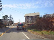
New York State Route 168 (NY 168) is an east–west state highway
in southern Herkimer County, New York
, in the United States
. The highway runs for 14.32 miles (23.05 km) through a largely rural area of Upstate New York
, from an intersection with NY 28
in the village of Mohawk
to a junction with NY 80
in Stark
. Along the way, it intersects one state highway and crosses multiple creeks. The route was originally designated as part of Route 5, an unsigned legislative route
, in 1908 and as part of the signed NY 28
in 1924. In the 1930 renumbering of state highways in New York, NY 28 was realigned to follow a new alignment to the west while its former routing between Mohawk and Paines Hollow became NY 168. The route was extended eastward to its current terminus at NY 80 ca. 1932.
in the village of Mohawk
. The highway heads southeastward out of the village and parallels Fulmer Creek. Now in a more rural area, NY 168 crosses Fulmer Creep and its tributaries multiple times as it takes on a more easterly course. Approximately halfway along its route, the highway intersects with NY 167
in the community of Paines Hollow. It passes through the populated place
of Smith Corners and crosses over several more creeks before briefly bordering the Ohisa State Forest. The highway passes south of the Hawn Cemetery and continues southeastward towards its eastern terminus. NY 168 ends at a junction with NY 80
in Starkville, a hamlet within the town of Stark
.
to Paines Hollow was originally designated as part of Route 5, an unsigned legislative route
, by the New York State Legislature in 1908. It was improved to state highway standards by way of two separate projects assigned and completed during the 1910s. The first contract, awarded on September 30, 1915, covered the 6.55 miles (10.54 km) portion of the road from the Mohawk village line to the current intersection with NY 167 in Paines Hollow. The second contract, let on December 14, 1916, called for the improvement of the section of modern NY 168 within the village of Mohawk and what is now NY 28
between NY 168 and West Main Street (old NY 5S
), a total distance of 0.71 miles (1.14 km).
 Construction on the Mohawk – Paines Hollow segment cost about $127,000 (equivalent to $ in ), and required 62000 square yards (51,840 m²) of pavement while the latter project cost $38,000 (equivalent to $ in ) to complete. The highway improved by the second project was added to the state highway system as State Highway 5631 (SH 5631) on May 3, 1918, and the Mohawk – Paines Hollow road was added as SH 5579 on May 31, 1919. When the first set of posted routes in New York
were assigned in 1924, the section of legislative Route 5 between Mohawk and Paines Hollow became part of NY 28
. In the 1930 renumbering of state highways in New York, NY 28 was realigned to use its modern alignment between Cooperstown
and Mohawk while its former routing from Mohawk to Paines Hollow was redesignated as NY 168. The route was extended eastward to NY 80
in Starkville ca. 1932.
State highway
State highway, state road or state route can refer to one of three related concepts, two of them related to a state or provincial government in a country that is divided into states or provinces :#A...
in southern Herkimer County, New York
Herkimer County, New York
Herkimer County is a county located in the U.S. state of New York. It was created in 1791 north of the Mohawk River out of part of Montgomery County. As of the 2010 census, the population was 64,519. It is named after General Nicholas Herkimer, who died from battle wounds in 1777 after taking part...
, in the United States
United States
The United States of America is a federal constitutional republic comprising fifty states and a federal district...
. The highway runs for 14.32 miles (23.05 km) through a largely rural area of Upstate New York
Upstate New York
Upstate New York is the region of the U.S. state of New York that is located north of the core of the New York metropolitan area.-Definition:There is no clear or official boundary between Upstate New York and Downstate New York...
, from an intersection with NY 28
New York State Route 28
New York State Route 28 is a state highway extending for in the shape of a "C" between the Hudson Valley city of Kingston and southern Warren County in the U.S. state of New York. Along the way, it intersects several major routes, including Interstate 88 , U.S. Route 20 , and the...
in the village of Mohawk
Mohawk, Herkimer County, New York
----Mohawk is a village in Herkimer County, New York, United States. The population was 2,660 at the 2000 census. The village was named after the adjacent river....
to a junction with NY 80
New York State Route 80
New York State Route 80 is a west–east New York State Route located within Onondaga, Madison, Chenango, Otsego, Herkimer, and Montgomery Counties in New York. Its western terminus is located at a junction with NY 175 in the city of Syracuse in Onondaga County, from which it...
in Stark
Stark, New York
Stark is a town in Herkimer County, New York, United States. The population was 767 at the 2000 census. The town was named after a Revolutionary War General named John Stark.The Town of Stark is in the eastern part of Herkimer County.- History :...
. Along the way, it intersects one state highway and crosses multiple creeks. The route was originally designated as part of Route 5, an unsigned legislative route
Legislative route
In United States, a legislative route or legislative highway is a highway defined by laws passed in a state legislature. The numbering of such highways may or may not correspond to the numbers familiar to the public as part of the state, U.S. highway, and Interstate highway systems...
, in 1908 and as part of the signed NY 28
New York State Route 28
New York State Route 28 is a state highway extending for in the shape of a "C" between the Hudson Valley city of Kingston and southern Warren County in the U.S. state of New York. Along the way, it intersects several major routes, including Interstate 88 , U.S. Route 20 , and the...
in 1924. In the 1930 renumbering of state highways in New York, NY 28 was realigned to follow a new alignment to the west while its former routing between Mohawk and Paines Hollow became NY 168. The route was extended eastward to its current terminus at NY 80 ca. 1932.
Route description
NY 168's western terminus is at an intersection with NY 28New York State Route 28
New York State Route 28 is a state highway extending for in the shape of a "C" between the Hudson Valley city of Kingston and southern Warren County in the U.S. state of New York. Along the way, it intersects several major routes, including Interstate 88 , U.S. Route 20 , and the...
in the village of Mohawk
Mohawk, Herkimer County, New York
----Mohawk is a village in Herkimer County, New York, United States. The population was 2,660 at the 2000 census. The village was named after the adjacent river....
. The highway heads southeastward out of the village and parallels Fulmer Creek. Now in a more rural area, NY 168 crosses Fulmer Creep and its tributaries multiple times as it takes on a more easterly course. Approximately halfway along its route, the highway intersects with NY 167
New York State Route 167
New York State Route 167 is a north–south state highway located mostly within Herkimer County in eastern New York, United States. The southern terminus of the route is at an intersection with U.S. Route 20 in Richfield Springs, Otsego County. Its northern terminus is at a junction with...
in the community of Paines Hollow. It passes through the populated place
Populated place
A populated place is a place or area with clustered or scattered buildings and a permanent human population referenced with geographic coordinates...
of Smith Corners and crosses over several more creeks before briefly bordering the Ohisa State Forest. The highway passes south of the Hawn Cemetery and continues southeastward towards its eastern terminus. NY 168 ends at a junction with NY 80
New York State Route 80
New York State Route 80 is a west–east New York State Route located within Onondaga, Madison, Chenango, Otsego, Herkimer, and Montgomery Counties in New York. Its western terminus is located at a junction with NY 175 in the city of Syracuse in Onondaga County, from which it...
in Starkville, a hamlet within the town of Stark
Stark, New York
Stark is a town in Herkimer County, New York, United States. The population was 767 at the 2000 census. The town was named after a Revolutionary War General named John Stark.The Town of Stark is in the eastern part of Herkimer County.- History :...
.
History
The highway connecting MohawkMohawk, Herkimer County, New York
----Mohawk is a village in Herkimer County, New York, United States. The population was 2,660 at the 2000 census. The village was named after the adjacent river....
to Paines Hollow was originally designated as part of Route 5, an unsigned legislative route
Legislative route
In United States, a legislative route or legislative highway is a highway defined by laws passed in a state legislature. The numbering of such highways may or may not correspond to the numbers familiar to the public as part of the state, U.S. highway, and Interstate highway systems...
, by the New York State Legislature in 1908. It was improved to state highway standards by way of two separate projects assigned and completed during the 1910s. The first contract, awarded on September 30, 1915, covered the 6.55 miles (10.54 km) portion of the road from the Mohawk village line to the current intersection with NY 167 in Paines Hollow. The second contract, let on December 14, 1916, called for the improvement of the section of modern NY 168 within the village of Mohawk and what is now NY 28
New York State Route 28
New York State Route 28 is a state highway extending for in the shape of a "C" between the Hudson Valley city of Kingston and southern Warren County in the U.S. state of New York. Along the way, it intersects several major routes, including Interstate 88 , U.S. Route 20 , and the...
between NY 168 and West Main Street (old NY 5S
New York State Route 5S
New York State Route 5S is an east–west state highway located in the Mohawk Valley of New York in the United States. It extends for from an interchange with NY 5, NY 5A, NY 8, and NY 12 in Utica to a smaller interchange with NY 890 in Rotterdam...
), a total distance of 0.71 miles (1.14 km).
New York
New York is a state in the Northeastern region of the United States. It is the nation's third most populous state. New York is bordered by New Jersey and Pennsylvania to the south, and by Connecticut, Massachusetts and Vermont to the east...
were assigned in 1924, the section of legislative Route 5 between Mohawk and Paines Hollow became part of NY 28
New York State Route 28
New York State Route 28 is a state highway extending for in the shape of a "C" between the Hudson Valley city of Kingston and southern Warren County in the U.S. state of New York. Along the way, it intersects several major routes, including Interstate 88 , U.S. Route 20 , and the...
. In the 1930 renumbering of state highways in New York, NY 28 was realigned to use its modern alignment between Cooperstown
Cooperstown, New York
Cooperstown is a village in Otsego County, New York, USA. It is located in the Town of Otsego. The population was estimated to be 1,852 at the 2010 census.The Village of Cooperstown is the county seat of Otsego County, New York...
and Mohawk while its former routing from Mohawk to Paines Hollow was redesignated as NY 168. The route was extended eastward to NY 80
New York State Route 80
New York State Route 80 is a west–east New York State Route located within Onondaga, Madison, Chenango, Otsego, Herkimer, and Montgomery Counties in New York. Its western terminus is located at a junction with NY 175 in the city of Syracuse in Onondaga County, from which it...
in Starkville ca. 1932.