
New York State Route 163
Encyclopedia
New York State Route 163 (NY 163) is an east–west state highway
in Montgomery County, New York
, United States
. It runs from the village of Fort Plain
to the town of Canajoharie
in southern Montgomery County
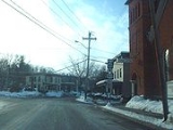
. With the exception of its eastern terminus, NY 163 is not signed with directions. Reference markers indicate its terminus in Fort Plain to be its western, although the route heads nearly due southward until Sprout Brook. Approaching that hamlet, it is named "Cherry Valley Road", and when NY 163 turns left to head eastward, CR 82 continues that road name directly to Cherry Valley
. In Fort Plain, NY 163 follows Kellogg and Douglas Streets. NY 163 is a two-lane highway its entire length.
 NY 163 begins concurrent
to NY 80
at an intersection with NY 5S
in the village of Fort Plain
. NY 80 and NY 163 head southwest for two blocks before splitting. NY 163 heads southwest from here, crossing over Otsquago Creek as it exits the village limits and passes through the rural town of Minden
. After passing through the hamlet of Hessville, the route turns to the south to enter the town of Canajoharie
. The southward alignment continues to Sprout Brook, a community located on Canajoharie Creek, at which point the route curves back to the northeast. It loosely follows the creek to an intersection with NY 10
, where NY 163 terminates.
State highway
State highway, state road or state route can refer to one of three related concepts, two of them related to a state or provincial government in a country that is divided into states or provinces :#A...
in Montgomery County, New York
Montgomery County, New York
As of the census of 2000, there were 49,708 people, 20,038 households, and 13,104 families residing in the county. The population density was 123 people per square mile . There were 22,522 housing units at an average density of 56 per square mile...
, United States
United States
The United States of America is a federal constitutional republic comprising fifty states and a federal district...
. It runs from the village of Fort Plain
Fort Plain, New York
Fort Plain is a village in Montgomery County, New York, United States. As of the 2000 census, the village population was 2,288. The village is named after a fort built during the American Revolution....
to the town of Canajoharie
Canajoharie (town), New York
Canajoharie is a town in Montgomery County, New York, United States. The population was 3,730 at the 2010 census. Canajoharie is located south of the Mohawk River on the south border of the county. The Erie Canal passes along the north town line. There is a village of Canajoharie in the town...
in southern Montgomery County
Montgomery County, New York
As of the census of 2000, there were 49,708 people, 20,038 households, and 13,104 families residing in the county. The population density was 123 people per square mile . There were 22,522 housing units at an average density of 56 per square mile...
. With the exception of its eastern terminus, NY 163 is not signed with directions. Reference markers indicate its terminus in Fort Plain to be its western, although the route heads nearly due southward until Sprout Brook. Approaching that hamlet, it is named "Cherry Valley Road", and when NY 163 turns left to head eastward, CR 82 continues that road name directly to Cherry Valley
Cherry Valley (village), New York
Cherry Valley is a village in Otsego County, New York, United States. The population was 592 at the 2000 census.The Village of Cherry Valley is in the Town of Cherry Valley...
. In Fort Plain, NY 163 follows Kellogg and Douglas Streets. NY 163 is a two-lane highway its entire length.
Route description
Concurrency (road)
A concurrency, overlap, or coincidence in a road network is an instance of one physical road bearing two or more different highway, motorway, or other route numbers...
to NY 80
New York State Route 80
New York State Route 80 is a west–east New York State Route located within Onondaga, Madison, Chenango, Otsego, Herkimer, and Montgomery Counties in New York. Its western terminus is located at a junction with NY 175 in the city of Syracuse in Onondaga County, from which it...
at an intersection with NY 5S
New York State Route 5S
New York State Route 5S is an east–west state highway located in the Mohawk Valley of New York in the United States. It extends for from an interchange with NY 5, NY 5A, NY 8, and NY 12 in Utica to a smaller interchange with NY 890 in Rotterdam...
in the village of Fort Plain
Fort Plain, New York
Fort Plain is a village in Montgomery County, New York, United States. As of the 2000 census, the village population was 2,288. The village is named after a fort built during the American Revolution....
. NY 80 and NY 163 head southwest for two blocks before splitting. NY 163 heads southwest from here, crossing over Otsquago Creek as it exits the village limits and passes through the rural town of Minden
Minden, New York
Minden is a town in Montgomery County, New York, United States. The population was 4,297 at the 2010 census. The town is located at the western edge of the county. It has possessed a post office from 1802 to 1903.- History :...
. After passing through the hamlet of Hessville, the route turns to the south to enter the town of Canajoharie
Canajoharie (town), New York
Canajoharie is a town in Montgomery County, New York, United States. The population was 3,730 at the 2010 census. Canajoharie is located south of the Mohawk River on the south border of the county. The Erie Canal passes along the north town line. There is a village of Canajoharie in the town...
. The southward alignment continues to Sprout Brook, a community located on Canajoharie Creek, at which point the route curves back to the northeast. It loosely follows the creek to an intersection with NY 10
New York State Route 10
New York State Route 10 is a north–south state highway in the Central New York and North Country regions of New York in the United States. It extends for from the Quickway in Deposit, Delaware County to NY 8 at Higgins Bay, a hamlet in the Hamilton County town of Arietta...
, where NY 163 terminates.