
New York State Route 39
Encyclopedia
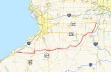
New York State Route 39 (NY 39) is an east–west state highway
in the western portion
of New York
in the United States. It begins and ends at intersections with U.S. Route 20
(US 20) 98.89 miles (159.15 km) apart. The western terminus of NY 39 is east of Fredonia
in the Chautauqua County
town of Sheridan
, while the eastern terminus is in the Livingston County
village of Avon
. At its east end, NY 39 also ends at NY 5
, which is concurrent
to US 20 at this point. NY 39 serves several villages, including Gowanda
and Geneseo, and intersects a handful of major north–south highways, such as US 219
in Springville
and NY 19
near Pike. Most of the route is a two-lane highway that passes through rural, undeveloped areas.
NY 39 was assigned as part of the 1930 renumbering of state highways in New York to an alignment extending from Dunkirk in the west to Geneva in the east via Pike, Dansville
, and Naples
. From Pike eastward, NY 39 used large parts of modern NY 436
and NY 245
. At the time, what is now NY 39 northeast of Pike was part of then-NY 245 from Pike to Perry
and US 20 from outside of Leicester
to Avon. Ca. 1931, US 20 was realigned between Geneseo and East Avon to follow a more easterly alignment via Lakeville, at which time the Geneseo–Avon highway became New York State Route 20D. Over the next decade, the Pike–Perry–Avon highway underwent several designation changes, culminating with the realignment of NY 39 onto it ca. 1940. The route was cut back to its current western terminus in the mid-1960s.
(NYSDOT). The lone non-state-maintained segment lies within the village of Geneseo, where the route is maintained by the village from the east end of the overlap with US 20A
to North Street, a local east–west street four blocks to the north of US 20A.
at the southern extent of the town of Sheridan
, located northeast of the village of Fredonia
and southeast of the city of Dunkirk. Heading east, NY 39 passes farmland and other undeveloped areas as it intersects a number of Chautauqua County
routes. The most notable of these is County Route 85 (CR 85), which was once NY 428
north of where it meets NY 39 in the village of Forestville
. Although NY 39 crosses many county routes as it makes its way across the towns of Sheridan and Hanover
, it does not intersect another state-maintained route until it crosses into Cattaraugus County
. Across the county line, NY 39 enters the village of Perrysburg
, centered around the route's junction with CR 58, locally known as North Road. South of this point, CR 58 was once part of NY 353
.
To the east, NY 39 briefly turns northward before following West Main Street eastward into the creekside village of Gowanda
. It continues east to the village's business district, located adjacent to Cattaraugus Creek
, where the route intersects US 62
. The two routes form a northward concurrency
, jointly occupying West Main Street to the bridge traversing Cattaraugus Creek a mere 60 yards (54.9 m) to the northeast, where the road name becomes East Main Street and the county becomes Erie County
on the other side of the waterway. US 62 and NY 39 break from East Main Street 90 yards (82.3 m) later, following Buffalo Street northward through a mostly residential neighborhood. At the northern edge of the village, the two routes change direction again, turning east onto Sandhill Road. Buffalo Street continues to be a touring route, however, as NY 438
continues north on Buffalo Street toward the Cattaraugus Indian Reservation.
, where the two routes split in the town center. US 62 continues northward towards Buffalo
on Gowanda–Buffalo Road while NY 39 takes Main Street east out of town. In Collins Center to the east, NY 39 intersects the southern terminus of the Sisson Highway, NY 75
. Past the hamlet, NY 39 heads generally northeastward across 8 miles (13 km) of open areas to the village of Springville
. West of the village, NY 39 meets the Southern Expressway (US 219
) at an interchange. Not far to the east is a junction with the heavily commercialized Cascade Drive, the newer of US 219's two former routings through Springville.
NY 39 continues east past Cascade Drive and into the village, where it becomes Main Street. In the village's central business district, NY 39 crosses Buffalo Street, US 219's original alignment through Springville. The route continues on, meeting NY 240
at the eastern village line before proceeding into another rural area dominated by farmlands. From Springville to Yorkshire, NY 39 closely parallels the northern bank of Cattaraugus Creek as it heads to the northeast. The route crosses the creek 9 miles (14 km) later in the town of Sardinia
, where it intersects NY 16
east of the town center. NY 16 and NY 39 come together for a brief overlap that leads NY 39 south across the creek and back into Cattaraugus County. They split just south of the creek in the village of Yorkville, at which point NY 39 heads east for 0.8 miles (1.3 km) to enter Wyoming County
.
, NY 39 remains Main Street, acting as the primary east–west road through town. It crosses two railroad lines, the Buffalo Line
of the Norfolk Southern Railway
and the Arcade and Attica Railroad (ARA), by way of two grade crossings immediately after entering the village. The route continues on through the lightly developed western half of Arcade, crossing the ARA a second time before both reach the more populated village center. Here, the railroad crosses NY 39 a third and final time before connecting to NY 98
at Liberty Street. That route overlaps with NY 39 for a mere 300 yards (274.3 m) east to Water Street, where NY 98 resumes its northward trek toward Batavia
. After another 0.5 mile (0.80467 km), Arcade abruptly ends, giving way to more fields of farmland, a common sight along NY 39 from here eastward.
About 9 miles (14 km) northeast of Arcade in the hamlet of Bliss, NY 39 intersects the southern terminus of NY 362
, a short–north south connector linking NY 39 to NY 78
. After another 5 miles (8 km), NY 39 connects to the north–south NY 19
outside of the hamlet of Pike. At this point, NY 39 turns to the northeast, a direction that it proceeds in for most of the remainder of its routing. The first 1 miles (1.6 km) of this stretch overlaps with NY 19, which eventually splits from NY 39 to proceed north to Lake Ontario
. NY 39 continues on, connecting to the western terminus of NY 436
in the hamlet of Lamont before intersecting NY 19A
southwest of the village of Castile
.
NY 19A, an easterly alternate route of NY 19, merges with NY 39, following the latter for 0.25 mile (0.402335 km) to an unorthodox intersection southwest of the village. Heading west on NY 39, traffic is diverted onto a ramp leading to NY 19A, where commuters must turn left onto NY 19A to continue west on NY 39. Eastbound NY 39, however, has no such configuration, allowing eastbound traffic to remain on NY 39 through the intersection. Between Castile and the village of Perry
, NY 39 assumes a slightly more northerly alignment, paralleling the edges of Silver Lake
a half-mile to the northwest and Letchworth State Park
2 miles (3.2 km) to the southeast. Upon entering Perry, NY 39 shifts to a northeasterly alignment once again as it intersects NY 246
in the village center. East of the village, NY 39 switches counties for the final time as the road crosses into Livingston County
.
, NY 39 intersects US 20A
in an area known as Pine Tavern. The two routes fuse together and head northeast to Leicester, where they descend into a valley surrounding the Genesee River
and form a short concurrency with NY 36
in the village center. NY 36 enters from the north and travels east along US 20A and NY 39 for 250 yards (228.6 m) prior to continuing south to Pennsylvania, leaving US 20A and NY 39 to continue east. They serve Cuylerville
, a small hamlet on the outskirts of Leicester, before crossing over the Genesee River and climbing the eastern face of the valley to reach a junction with NY 63
. Like NY 19A near Castile, NY 63 overlaps NY 39 for just 0.25 mile (0.402335 km) before it forks from the route at the southernmost point of the SUNY Geneseo campus.
While NY 63 runs along the western edge of the college, US 20A and NY 39 follow the eastern edge of SUNY Geneseo northward to the village center. Here, the two routes meet Mary Jemison
Drive, an east–west street that serves that the only connection between NY 39 west and NY 63 north. At the same intersection, NY 39 and US 20A turn east onto South Street; however, the concurrency terminates just one block later at Main Street. Here, NY 39 turns north, leaving US 20A to proceed east toward the Finger Lakes
.
Outside of Geneseo, NY 39 becomes Avon Road, a name it retains to the outskirts of the village of Avon
. As it enters Avon, the farmlands give way to more developed, mostly residential areas. Now named Wadsworth Avenue, NY 39 passes west of a large Kraft Foods
plant that occupies a large portion of southwestern Avon. North of the plant, the route heads past residential neighborhoods to the west and commercial establishments situated on the Livonia, Avon and Lakeville Railroad
(LAL) to the east. NY 39 ends about 0.5 mile (0.80467 km) from the plant at a junction with US 20 and NY 5
west of the center of Avon and just west of where those two routes cross the LAL at-grade.
and Avon
was originally designated as part of NY 36
in the mid-1920s. Around the same time, the piece between Pine Tavern and Geneseo became part of NY 35. In 1927, the portion of NY 35 between East Aurora
and Geneseo and the segment of NY 36 from Geneseo to Avon were incorporated into US 20
, a new cross-state U.S. Highway that continued east from Avon toward Albany
and west from Pine Tavern toward Buffalo
. As a result, NY 36 was truncated to its junction with US 20 in Leicester. In Avon, US 20 was routed on Wadsworth Avenue, Spring Street, and Genesee Street.
NY 39 was assigned as part of the 1930 renumbering of state highways in New York and originally extended from NY 20A (now NY 5
) in Dunkirk to US 20 and NY 5 west of the city of Geneva. In between, NY 39 passed through the villages of Pike
, Dansville
, Naples
, and Rushville
. The portion of the route from Dansville to Geneva had previously been designated as NY 52. At the same time, a highway connecting Pike to Perry Center via Castile
and Perry village
was designated as NY 245
. Ca. 1931, US 20 was realigned between Geneseo and East Avon to use NY 254 (current US 20A
) and NY 2 (now NY 15
) instead. The former routing of US 20 between Geneseo and Avon was redesignated as NY 20D. NY 245 was realigned north of Perry to follow a new highway (modern NY 39) to an intersection with US 20 southwest of Leicester ca. 1934.
US 20 was realigned ca. 1938 to follow its modern routing between Hamburg and Avon. Its former alignment between Hamburg and Geneseo became part of NY 20A, which continued north from Geneseo to Avon over NY 20D. By the following year, the Hamburg–Geneseo segment of NY 20A was included in the new US 20A while the Geneseo–Avon portion became part of a realigned NY 254. The routings of NY 39 and NY 245 east of Pike were swapped ca. 1940, placing NY 245 on a routing extending from Pike to Geneva and NY 39 on its modern alignment to Leicester. NY 39 was also extended northeast to Avon as part of the change, supplanting NY 254. The portion of NY 39 within Avon was rerouted to follow Wadsworth Avenue to West Main Street (US 20 and NY 5) in the early 1950s.
In Dunkirk, NY 39 originally began at the intersection of East Lake Shore Drive (NY 5) and Main Street. From there, it followed Main Street, Franklin Avenue, and Roberts Road to US 20. NY 39 was truncated to its current western terminus east of the city in the mid-1960s; however, the portion of its former routing outside of the Dunkirk city limits remained state maintained as an unsigned reference route. On April 1, 1980, ownership and maintenance of it was transferred from the state of New York
to Chautauqua County
as part of a highway maintenance swap between the two levels of government. The Roberts Road segment of NY 39's former alignment is now part of CR 81 while the Main Street portion is now the northernmost part of NY 60
.
State highway
State highway, state road or state route can refer to one of three related concepts, two of them related to a state or provincial government in a country that is divided into states or provinces :#A...
in the western portion
Western New York
Western New York is the westernmost region of the state of New York. It includes the cities of Buffalo, Rochester, Niagara Falls, the surrounding suburbs, as well as the outlying rural areas of the Great Lakes lowlands, the Genesee Valley, and the Southern Tier. Some historians, scholars and others...
of New York
New York
New York is a state in the Northeastern region of the United States. It is the nation's third most populous state. New York is bordered by New Jersey and Pennsylvania to the south, and by Connecticut, Massachusetts and Vermont to the east...
in the United States. It begins and ends at intersections with U.S. Route 20
U.S. Route 20 in New York
U.S. Route 20 is a part of the U.S. Highway System that runs from Newport, Oregon, to Boston, Massachusetts. In the U.S. state of New York, US 20 extends from the Pennsylvania state line at Ripley to the Massachusetts state line in the Berkshire Mountains. US 20 is the longest...
(US 20) 98.89 miles (159.15 km) apart. The western terminus of NY 39 is east of Fredonia
Fredonia, New York
Fredonia is a village in Chautauqua County, New York, United States. The population was 11,068 as of 2009.The Village of Fredonia is in the Town of Pomfret south of Lake Erie...
in the Chautauqua County
Chautauqua County, New York
-Major highways:* Interstate 86/New York State Route 17 * Interstate 90 * U.S. Route 20* U.S. Route 62* New York State Route 5* New York State Route 39* New York State Route 60* New York State Route 394...
town of Sheridan
Sheridan, New York
Sheridan is a town in Chautauqua County, New York, United States. The population was 2,838 at the 2000 census.The Town of Sheridan is on the county's northern border, east of the City of Dunkirk.- History :The town was first settled around 1804....
, while the eastern terminus is in the Livingston County
Livingston County, New York
As of the census of 2000, there were 64,328 people, 22,150 households, and 15,349 families residing in the county. The population density was 102 people per square mile . There were 24,023 housing units at an average density of 38 per square mile...
village of Avon
Avon (village), New York
Avon is a village in Livingston County, New York, USA. The population was 2,977 at the 2000 census. The village is named after the River Avon. ....
. At its east end, NY 39 also ends at NY 5
New York State Route 5
New York State Route 5 is a state highway that extends for across the state of New York in the United States. It begins at the Pennsylvania state line in the Chautauqua County town of Ripley and passes through Buffalo, Syracuse, Utica, Schenectady, and several other smaller cities and...
, which is concurrent
Concurrency (road)
A concurrency, overlap, or coincidence in a road network is an instance of one physical road bearing two or more different highway, motorway, or other route numbers...
to US 20 at this point. NY 39 serves several villages, including Gowanda
Gowanda, New York
Gowanda is a village in New York in the United States and lies partly in Erie County and partly in Cattaraugus County. The population was 2,842 at the 2000 census. The name is a local native term meaning "almost surrounded by hills" or "beautiful place among the hills...
and Geneseo, and intersects a handful of major north–south highways, such as US 219
U.S. Route 219 in New York
U.S. Route 219 is a part of the U.S. Highway System that runs from Rich Creek, Virginia, to West Seneca, New York. In the U.S. state of New York, US 219 extends from the Pennsylvania state line at Carrollton to an interchange with the New York State Thruway at exit 55 in West...
in Springville
Springville, New York
Springville is a village in the southeast part of the town of Concord in Erie County, New York, United States. Springville is the principal community in the town and a major business location in south Erie County. The population was 4,252 at the 2000 census. It is part of the Buffalo–Niagara...
and NY 19
New York State Route 19
New York State Route 19 is a north–south state highway in Western New York in the United States. It is the longest state highway in that region, and the only other one besides NY 14 to completely transect the state from the Pennsylvania state line to the shore of Lake Ontario...
near Pike. Most of the route is a two-lane highway that passes through rural, undeveloped areas.
NY 39 was assigned as part of the 1930 renumbering of state highways in New York to an alignment extending from Dunkirk in the west to Geneva in the east via Pike, Dansville
Dansville, Livingston County, New York
Dansville is a village in the town of North Dansville in the eastern part of Livingston County, New York, United States. As of the census, the village population was 4,832. The village is named after Daniel Faulkner, an early settler. Interstate 390 passes next to the west side of the village.-...
, and Naples
Naples (village), New York
Naples is a village in Ontario County, New York, USA. The population was 1,072 at the 2000 census.The Village of Naples is in the Town of Naples. Naples is in the center of an important grape-growing region.- History :...
. From Pike eastward, NY 39 used large parts of modern NY 436
New York State Route 436
New York State Route 436 is an east–west state highway located in the western portion of New York in the United States. It extends for from an intersection with NY 39 in the Pike hamlet of Lamont to a junction with NY 36 in the village of Dansville...
and NY 245
New York State Route 245
New York State Route 245 is a state highway in the Finger Lakes region of New York in the United States. The southern terminus of the route is at NY 21 in Naples. The northern terminus is at NY 5, U.S. Route 20 and NY 14A west of Geneva...
. At the time, what is now NY 39 northeast of Pike was part of then-NY 245 from Pike to Perry
Perry (village), New York
Perry is a village located mostly inside the Town of Perry in Wyoming County, New York, USA. The population was 3,945 at the 2000 census.The Village of Perry is at the junction of New York State Route 39 and New York State Route 246. A small south section of the village is within the Town of...
and US 20 from outside of Leicester
Leicester (village), New York
Leicester is a village in Livingston County, New York, USA. The population was 469 at the 2000 census. The village is named after Leicester Phelps, an early inhabitant.The Village of Leicester is located inside the Town of Leicester.- History :...
to Avon. Ca. 1931, US 20 was realigned between Geneseo and East Avon to follow a more easterly alignment via Lakeville, at which time the Geneseo–Avon highway became New York State Route 20D. Over the next decade, the Pike–Perry–Avon highway underwent several designation changes, culminating with the realignment of NY 39 onto it ca. 1940. The route was cut back to its current western terminus in the mid-1960s.
Route description
All but 0.46 mile (0.7402964 km) of NY 39 is maintained by the New York State Department of TransportationNew York State Department of Transportation
The New York State Department of Transportation is responsible for the development and operation of highways, railroads, mass transit systems, ports, waterways and aviation facilities in the U.S...
(NYSDOT). The lone non-state-maintained segment lies within the village of Geneseo, where the route is maintained by the village from the east end of the overlap with US 20A
U.S. Route 20A (New York)
U.S. Route 20A is an east–west alternate route of US 20 that extends for across the western portion of New York in the United States. It leaves US 20 in Hamburg, a suburb of Buffalo, and rejoins it in East Bloomfield about five miles west of Canandaigua, the county seat of...
to North Street, a local east–west street four blocks to the north of US 20A.
Sheridan to Gowanda
NY 39 begins at an intersection with US 20U.S. Route 20 in New York
U.S. Route 20 is a part of the U.S. Highway System that runs from Newport, Oregon, to Boston, Massachusetts. In the U.S. state of New York, US 20 extends from the Pennsylvania state line at Ripley to the Massachusetts state line in the Berkshire Mountains. US 20 is the longest...
at the southern extent of the town of Sheridan
Sheridan, New York
Sheridan is a town in Chautauqua County, New York, United States. The population was 2,838 at the 2000 census.The Town of Sheridan is on the county's northern border, east of the City of Dunkirk.- History :The town was first settled around 1804....
, located northeast of the village of Fredonia
Fredonia, New York
Fredonia is a village in Chautauqua County, New York, United States. The population was 11,068 as of 2009.The Village of Fredonia is in the Town of Pomfret south of Lake Erie...
and southeast of the city of Dunkirk. Heading east, NY 39 passes farmland and other undeveloped areas as it intersects a number of Chautauqua County
Chautauqua County, New York
-Major highways:* Interstate 86/New York State Route 17 * Interstate 90 * U.S. Route 20* U.S. Route 62* New York State Route 5* New York State Route 39* New York State Route 60* New York State Route 394...
routes. The most notable of these is County Route 85 (CR 85), which was once NY 428
New York State Route 428
New York State Route 428 was a north–south state highway located within Chautauqua County, New York, United States. The southern terminus of the route was at an intersection with NY 39 in Forestville. Its northern terminus was at a junction with U.S. Route 20 in Silver Creek...
north of where it meets NY 39 in the village of Forestville
Forestville, New York
Forestville is a village in Chautauqua County, New York, United States. The population was 770 at the 2000 census.The Village of Forestville is within the Town of Hanover and in the northeast part of the county....
. Although NY 39 crosses many county routes as it makes its way across the towns of Sheridan and Hanover
Hanover, New York
Hanover is a town in Chautauqua County, New York, United States. The population was 7,638 at the 2000 census.The Town of Hanover lies in the northeast corner of Chautauqua County.- History :The first settler arrived in 1796....
, it does not intersect another state-maintained route until it crosses into Cattaraugus County
Cattaraugus County, New York
Cattaraugus County is a county located in the U.S. state of New York. As of the 2010 census, the population was 80,317. The county seat is Little Valley.-History:...
. Across the county line, NY 39 enters the village of Perrysburg
Perrysburg (village), New York
Perrysburg is a village in Cattaraugus County, New York, United States. The population was 408 at the 2000 census. It is named after Commodore Oliver Hazard Perry.The Village of Perrysburg is in the south-central part of the Town of Perrysburg...
, centered around the route's junction with CR 58, locally known as North Road. South of this point, CR 58 was once part of NY 353
New York State Route 353
New York State Route 353 is a north–south state highway located within Cattaraugus County, New York, in the United States. It extends for from an intersection with NY 417 in the city of Salamanca to a junction with U.S. Route 62 in the hamlet of Dayton...
.
To the east, NY 39 briefly turns northward before following West Main Street eastward into the creekside village of Gowanda
Gowanda, New York
Gowanda is a village in New York in the United States and lies partly in Erie County and partly in Cattaraugus County. The population was 2,842 at the 2000 census. The name is a local native term meaning "almost surrounded by hills" or "beautiful place among the hills...
. It continues east to the village's business district, located adjacent to Cattaraugus Creek
Cattaraugus Creek
Cattaraugus Creek is a stream, approximately 68 miles long, in western New York in the United States. The creek drains a wooded rural portion of western New York southwest of Buffalo into Lake Erie. In its lower course it flows primarily through the Cattaraugus Reservation of the Seneca tribe...
, where the route intersects US 62
U.S. Route 62 in New York
U.S. Route 62 is a part of the U.S. Highway System that runs from the United States – Mexico border at El Paso, Texas, to Niagara Falls, New York. In the U.S. state of New York, US 62 extends from the New York – Pennsylvania border south of Jamestown to an intersection with...
. The two routes form a northward concurrency
Concurrency (road)
A concurrency, overlap, or coincidence in a road network is an instance of one physical road bearing two or more different highway, motorway, or other route numbers...
, jointly occupying West Main Street to the bridge traversing Cattaraugus Creek a mere 60 yards (54.9 m) to the northeast, where the road name becomes East Main Street and the county becomes Erie County
Erie County, New York
Erie County is a county located in the U.S. state of New York. As of the 2010 census, the population was 919,040. The county seat is Buffalo. The county's name comes from Lake Erie, which in turn comes from the Erie tribe of American Indians who lived south and east of the lake before 1654.Erie...
on the other side of the waterway. US 62 and NY 39 break from East Main Street 90 yards (82.3 m) later, following Buffalo Street northward through a mostly residential neighborhood. At the northern edge of the village, the two routes change direction again, turning east onto Sandhill Road. Buffalo Street continues to be a touring route, however, as NY 438
New York State Route 438
New York State Route 438 is a north–south state highway located entirely in Erie County, New York, in the United States. Though signed as north–south, the route runs in an almost east–west direction for between Gowanda and Irving through the Cattaraugus Indian Reservation. The...
continues north on Buffalo Street toward the Cattaraugus Indian Reservation.
Erie County and vicinity
Outside of Gowanda, US 62 and NY 39 take on a more northerly routing to the town of CollinsCollins, New York
Collins is a town in Erie County, New York, United States. The town is on the south border of the county and is considered to be one of the "Southtowns" of Erie County. The population indicated by the 2000 census was 8,307. The population for 2007 is estimated at 7,092, a loss of 1,215...
, where the two routes split in the town center. US 62 continues northward towards Buffalo
Buffalo, New York
Buffalo is the second most populous city in the state of New York, after New York City. Located in Western New York on the eastern shores of Lake Erie and at the head of the Niagara River across from Fort Erie, Ontario, Buffalo is the seat of Erie County and the principal city of the...
on Gowanda–Buffalo Road while NY 39 takes Main Street east out of town. In Collins Center to the east, NY 39 intersects the southern terminus of the Sisson Highway, NY 75
New York State Route 75
New York State Route 75 is a north–south state highway in Erie County, New York, in the United States. It extends for from an intersection with NY 39 in the Collins hamlet of Collins Center to an interchange with NY 5 in the town of Hamburg...
. Past the hamlet, NY 39 heads generally northeastward across 8 miles (13 km) of open areas to the village of Springville
Springville, New York
Springville is a village in the southeast part of the town of Concord in Erie County, New York, United States. Springville is the principal community in the town and a major business location in south Erie County. The population was 4,252 at the 2000 census. It is part of the Buffalo–Niagara...
. West of the village, NY 39 meets the Southern Expressway (US 219
U.S. Route 219 in New York
U.S. Route 219 is a part of the U.S. Highway System that runs from Rich Creek, Virginia, to West Seneca, New York. In the U.S. state of New York, US 219 extends from the Pennsylvania state line at Carrollton to an interchange with the New York State Thruway at exit 55 in West...
) at an interchange. Not far to the east is a junction with the heavily commercialized Cascade Drive, the newer of US 219's two former routings through Springville.
NY 39 continues east past Cascade Drive and into the village, where it becomes Main Street. In the village's central business district, NY 39 crosses Buffalo Street, US 219's original alignment through Springville. The route continues on, meeting NY 240
New York State Route 240
New York State Route 240 is a state highway in western New York in the United States. The southern terminus of the route is at an intersection with NY 242 in the Ellicottville community of Ashford in northern Cattaraugus County. Its northern terminus is at a junction with NY 324...
at the eastern village line before proceeding into another rural area dominated by farmlands. From Springville to Yorkshire, NY 39 closely parallels the northern bank of Cattaraugus Creek as it heads to the northeast. The route crosses the creek 9 miles (14 km) later in the town of Sardinia
Sardinia, New York
Sardinia, New York is a town in Erie County, New York, United States. The town lies in the southeast corner of Erie County and is considered one of the county's "Southtowns." The town is southeast of Buffalo. The population was 2,692 at the 2000 census...
, where it intersects NY 16
New York State Route 16
New York State Route 16 is a state highway in western New York, United States. It runs from the Pennsylvania state line, where it is one of the highest highways in the state in elevation, to downtown Buffalo. NY 16 is a major route through Erie County, despite the construction of the...
east of the town center. NY 16 and NY 39 come together for a brief overlap that leads NY 39 south across the creek and back into Cattaraugus County. They split just south of the creek in the village of Yorkville, at which point NY 39 heads east for 0.8 miles (1.3 km) to enter Wyoming County
Wyoming County, New York
Wyoming County is a county located in the U.S. state of New York. At the 2010 census, the population was 42,155. The county seat is Warsaw. The name is from a modified Delaware Indian word meaning "broad bottom lands"...
.
Wyoming County
In the neighboring village of ArcadeArcade (village), New York
Arcade is a village in Wyoming County, New York, in the United States. The population was 2,026 at the 2000 census.The Village of Arcade in located in the southwest part of the Town of Arcade...
, NY 39 remains Main Street, acting as the primary east–west road through town. It crosses two railroad lines, the Buffalo Line
Buffalo Line
The Buffalo Line is a railroad line owned and operated by the Norfolk Southern Railway in the U.S. states of New York and Pennsylvania. The line runs from Buffalo, New York southeast to Harrisburg, Pennsylvania along a former Pennsylvania Railroad line...
of the Norfolk Southern Railway
Norfolk Southern Railway
The Norfolk Southern Railway is a Class I railroad in the United States, owned by the Norfolk Southern Corporation. With headquarters in Norfolk, Virginia, the company operates 21,500 route miles in 22 eastern states, the District of Columbia and the province of Ontario, Canada...
and the Arcade and Attica Railroad (ARA), by way of two grade crossings immediately after entering the village. The route continues on through the lightly developed western half of Arcade, crossing the ARA a second time before both reach the more populated village center. Here, the railroad crosses NY 39 a third and final time before connecting to NY 98
New York State Route 98
New York State Route 98 is a state highway in the western part of New York in the United States. The southern terminus of the route is at an intersection with U.S. Route 219 in the town of Great Valley in Cattaraugus County...
at Liberty Street. That route overlaps with NY 39 for a mere 300 yards (274.3 m) east to Water Street, where NY 98 resumes its northward trek toward Batavia
Batavia (city), New York
Batavia is a city in Genesee County, Western New York, USA, located near the middle of Genesee County, entirely within the Town of Batavia. Its population as of the 2000 census was 16,256...
. After another 0.5 mile (0.80467 km), Arcade abruptly ends, giving way to more fields of farmland, a common sight along NY 39 from here eastward.
About 9 miles (14 km) northeast of Arcade in the hamlet of Bliss, NY 39 intersects the southern terminus of NY 362
New York State Route 362
New York State Route 362 is a short state highway located entirely in Wyoming County. It runs north–south between NY 39 just south of Bliss to NY 78 two miles to the north. Route 362 was assigned in 1930.-Route description:Route 362 begins at an intersection with...
, a short–north south connector linking NY 39 to NY 78
New York State Route 78
New York State Route 78 , most commonly known as Transit Road, is a state highway in Western New York, USA. While it is signed north–south, the lower portion runs in an east–west direction across Wyoming County, from its beginning north of the Village of Gainesville.NY 78 is...
. After another 5 miles (8 km), NY 39 connects to the north–south NY 19
New York State Route 19
New York State Route 19 is a north–south state highway in Western New York in the United States. It is the longest state highway in that region, and the only other one besides NY 14 to completely transect the state from the Pennsylvania state line to the shore of Lake Ontario...
outside of the hamlet of Pike. At this point, NY 39 turns to the northeast, a direction that it proceeds in for most of the remainder of its routing. The first 1 miles (1.6 km) of this stretch overlaps with NY 19, which eventually splits from NY 39 to proceed north to Lake Ontario
Lake Ontario
Lake Ontario is one of the five Great Lakes of North America. It is bounded on the north and southwest by the Canadian province of Ontario, and on the south by the American state of New York. Ontario, Canada's most populous province, was named for the lake. In the Wyandot language, ontarío means...
. NY 39 continues on, connecting to the western terminus of NY 436
New York State Route 436
New York State Route 436 is an east–west state highway located in the western portion of New York in the United States. It extends for from an intersection with NY 39 in the Pike hamlet of Lamont to a junction with NY 36 in the village of Dansville...
in the hamlet of Lamont before intersecting NY 19A
New York State Route 19A
New York State Route 19A is a north–south state highway in western New York in the United States. It is an alternate route of NY 19 between the town of Hume and the vicinity of the village of Silver Springs. NY 19A also serves the community of Portageville and the village of Castile...
southwest of the village of Castile
Castile (village), New York
Castile is a village in Wyoming County, New York, USA. The population was 1,051 at the 2000 census.The Village of Castile lies within the boundaries of the Town of Castile.-Geography:Castile is located at ....
.
NY 19A, an easterly alternate route of NY 19, merges with NY 39, following the latter for 0.25 mile (0.402335 km) to an unorthodox intersection southwest of the village. Heading west on NY 39, traffic is diverted onto a ramp leading to NY 19A, where commuters must turn left onto NY 19A to continue west on NY 39. Eastbound NY 39, however, has no such configuration, allowing eastbound traffic to remain on NY 39 through the intersection. Between Castile and the village of Perry
Perry (village), New York
Perry is a village located mostly inside the Town of Perry in Wyoming County, New York, USA. The population was 3,945 at the 2000 census.The Village of Perry is at the junction of New York State Route 39 and New York State Route 246. A small south section of the village is within the Town of...
, NY 39 assumes a slightly more northerly alignment, paralleling the edges of Silver Lake
Silver Lake, Wyoming County, New York
Silver Lake is a community in Wyoming County, New York, United States. It is located on New York State Route 39 south of the village of Perry in the Town of Castile. It is named for the nearby lake to the west, which extends from the village of Perry south to Silver Lake State Park near Silver...
a half-mile to the northwest and Letchworth State Park
Letchworth State Park
Letchworth State Park is a New York state park located 35 miles southwest of Rochester and 60 miles southeast of Buffalo in Livingston and Wyoming counties. The park is roughly 17 miles long, covering of land along the Genesee River...
2 miles (3.2 km) to the southeast. Upon entering Perry, NY 39 shifts to a northeasterly alignment once again as it intersects NY 246
New York State Route 246
New York State Route 246 is a north–south state highway located in western New York in the United States. All but of the route are located in Wyoming County; the northernmost intersection on the highway is in Genesee County instead...
in the village center. East of the village, NY 39 switches counties for the final time as the road crosses into Livingston County
Livingston County, New York
As of the census of 2000, there were 64,328 people, 22,150 households, and 15,349 families residing in the county. The population density was 102 people per square mile . There were 24,023 housing units at an average density of 38 per square mile...
.
Livingston County
Northeast of where NY 39 enters the county but southwest of the village of LeicesterLeicester (village), New York
Leicester is a village in Livingston County, New York, USA. The population was 469 at the 2000 census. The village is named after Leicester Phelps, an early inhabitant.The Village of Leicester is located inside the Town of Leicester.- History :...
, NY 39 intersects US 20A
U.S. Route 20A (New York)
U.S. Route 20A is an east–west alternate route of US 20 that extends for across the western portion of New York in the United States. It leaves US 20 in Hamburg, a suburb of Buffalo, and rejoins it in East Bloomfield about five miles west of Canandaigua, the county seat of...
in an area known as Pine Tavern. The two routes fuse together and head northeast to Leicester, where they descend into a valley surrounding the Genesee River
Genesee River
The Genesee River is a North American river flowing northward through the Twin Tiers of Pennsylvania and New York. The river provided the original power for the Rochester area's 19th century mills and still provides hydroelectric power for downtown Rochester....
and form a short concurrency with NY 36
New York State Route 36
New York State Route 36 is a north–south state highway in the western part of New York in the United States. The highway extends for from the Pennsylvania state line at Troupsburg, Steuben County northward to Ogden, Monroe County, where it ends at an intersection with NY 31...
in the village center. NY 36 enters from the north and travels east along US 20A and NY 39 for 250 yards (228.6 m) prior to continuing south to Pennsylvania, leaving US 20A and NY 39 to continue east. They serve Cuylerville
Cuylerville, New York
Cuylerville is a hamlet in Livingston County, New York.The latitude of Cuylerville is 42.776N. The longitude is -77.871W.The community was named for William Cuyler....
, a small hamlet on the outskirts of Leicester, before crossing over the Genesee River and climbing the eastern face of the valley to reach a junction with NY 63
New York State Route 63
New York State Route 63 is a state highway in the western part of New York in the United States. The southern terminus of the route is at an intersection with NY 15 and NY 21 in the village of Wayland in Steuben County. Its northern end is at a junction with NY 18 in the town...
. Like NY 19A near Castile, NY 63 overlaps NY 39 for just 0.25 mile (0.402335 km) before it forks from the route at the southernmost point of the SUNY Geneseo campus.
While NY 63 runs along the western edge of the college, US 20A and NY 39 follow the eastern edge of SUNY Geneseo northward to the village center. Here, the two routes meet Mary Jemison
Mary Jemison
Mary Jemison was an American frontierswoman and an adopted Seneca. When she was in her teens, she was captured in what is now Adams County, Pennsylvania, from her home along Marsh Creek, and later chose to remain a Seneca....
Drive, an east–west street that serves that the only connection between NY 39 west and NY 63 north. At the same intersection, NY 39 and US 20A turn east onto South Street; however, the concurrency terminates just one block later at Main Street. Here, NY 39 turns north, leaving US 20A to proceed east toward the Finger Lakes
Finger Lakes
The Finger Lakes are a pattern of lakes in the west-central section of Upstate New York in the United States. They are a popular tourist destination. The lakes are long and thin , each oriented roughly on a north-south axis. The two longest, Cayuga Lake and Seneca Lake, are among the deepest in...
.
Outside of Geneseo, NY 39 becomes Avon Road, a name it retains to the outskirts of the village of Avon
Avon (village), New York
Avon is a village in Livingston County, New York, USA. The population was 2,977 at the 2000 census. The village is named after the River Avon. ....
. As it enters Avon, the farmlands give way to more developed, mostly residential areas. Now named Wadsworth Avenue, NY 39 passes west of a large Kraft Foods
Kraft Foods
Kraft Foods Inc. is an American confectionery, food and beverage conglomerate. It markets many brands in more than 170 countries. 12 of its brands annually earn more than $1 billion worldwide: Cadbury, Jacobs, Kraft, LU, Maxwell House, Milka, Nabisco, Oscar Mayer, Philadelphia, Trident, Tang...
plant that occupies a large portion of southwestern Avon. North of the plant, the route heads past residential neighborhoods to the west and commercial establishments situated on the Livonia, Avon and Lakeville Railroad
Livonia, Avon and Lakeville Railroad
The Livonia, Avon and Lakeville Railroad is a short line railroad that operates in Livingston County and Monroe County in New York, United States...
(LAL) to the east. NY 39 ends about 0.5 mile (0.80467 km) from the plant at a junction with US 20 and NY 5
New York State Route 5
New York State Route 5 is a state highway that extends for across the state of New York in the United States. It begins at the Pennsylvania state line in the Chautauqua County town of Ripley and passes through Buffalo, Syracuse, Utica, Schenectady, and several other smaller cities and...
west of the center of Avon and just west of where those two routes cross the LAL at-grade.
History
The modern routing of NY 39 between GeneseoGeneseo, New York
Geneseo is the name of a town and its village in Livingston County in the Finger Lakes region of New York, USA, outside of Rochester, New York. The town's population is approximately 9,600, of which about 7,600 live in the village...
and Avon
Avon (village), New York
Avon is a village in Livingston County, New York, USA. The population was 2,977 at the 2000 census. The village is named after the River Avon. ....
was originally designated as part of NY 36
New York State Route 36
New York State Route 36 is a north–south state highway in the western part of New York in the United States. The highway extends for from the Pennsylvania state line at Troupsburg, Steuben County northward to Ogden, Monroe County, where it ends at an intersection with NY 31...
in the mid-1920s. Around the same time, the piece between Pine Tavern and Geneseo became part of NY 35. In 1927, the portion of NY 35 between East Aurora
East Aurora, New York
East Aurora is a village in Erie County, New York, United States, southeast of Buffalo. The Village of East Aurora lies in the eastern half of the Town of Aurora.The population was 6,673 at the 2000 census...
and Geneseo and the segment of NY 36 from Geneseo to Avon were incorporated into US 20
U.S. Route 20 in New York
U.S. Route 20 is a part of the U.S. Highway System that runs from Newport, Oregon, to Boston, Massachusetts. In the U.S. state of New York, US 20 extends from the Pennsylvania state line at Ripley to the Massachusetts state line in the Berkshire Mountains. US 20 is the longest...
, a new cross-state U.S. Highway that continued east from Avon toward Albany
Albany, New York
Albany is the capital city of the U.S. state of New York, the seat of Albany County, and the central city of New York's Capital District. Roughly north of New York City, Albany sits on the west bank of the Hudson River, about south of its confluence with the Mohawk River...
and west from Pine Tavern toward Buffalo
Buffalo, New York
Buffalo is the second most populous city in the state of New York, after New York City. Located in Western New York on the eastern shores of Lake Erie and at the head of the Niagara River across from Fort Erie, Ontario, Buffalo is the seat of Erie County and the principal city of the...
. As a result, NY 36 was truncated to its junction with US 20 in Leicester. In Avon, US 20 was routed on Wadsworth Avenue, Spring Street, and Genesee Street.
NY 39 was assigned as part of the 1930 renumbering of state highways in New York and originally extended from NY 20A (now NY 5
New York State Route 5
New York State Route 5 is a state highway that extends for across the state of New York in the United States. It begins at the Pennsylvania state line in the Chautauqua County town of Ripley and passes through Buffalo, Syracuse, Utica, Schenectady, and several other smaller cities and...
) in Dunkirk to US 20 and NY 5 west of the city of Geneva. In between, NY 39 passed through the villages of Pike
Pike (village), New York
Pike is a hamlet within the Town of Pike in Wyoming County, New York. The population was 382 at the 2000 census. Pike, located near the center of the town at the junction of NY 19 and NY 39, was a village from 1848 to 2009...
, Dansville
Dansville, Livingston County, New York
Dansville is a village in the town of North Dansville in the eastern part of Livingston County, New York, United States. As of the census, the village population was 4,832. The village is named after Daniel Faulkner, an early settler. Interstate 390 passes next to the west side of the village.-...
, Naples
Naples (village), New York
Naples is a village in Ontario County, New York, USA. The population was 1,072 at the 2000 census.The Village of Naples is in the Town of Naples. Naples is in the center of an important grape-growing region.- History :...
, and Rushville
Rushville, New York
Rushville is a village in Ontario and Yates Counties in the U.S. state of New York. The population was 621 at the 2000 census.Most of the Village of Rushville is within the Town of Potter in Yates County and a small part is in the Town of Gorham in Ontario County.- History :Elisha Gilbert was the...
. The portion of the route from Dansville to Geneva had previously been designated as NY 52. At the same time, a highway connecting Pike to Perry Center via Castile
Castile (village), New York
Castile is a village in Wyoming County, New York, USA. The population was 1,051 at the 2000 census.The Village of Castile lies within the boundaries of the Town of Castile.-Geography:Castile is located at ....
and Perry village
Perry (village), New York
Perry is a village located mostly inside the Town of Perry in Wyoming County, New York, USA. The population was 3,945 at the 2000 census.The Village of Perry is at the junction of New York State Route 39 and New York State Route 246. A small south section of the village is within the Town of...
was designated as NY 245
New York State Route 245
New York State Route 245 is a state highway in the Finger Lakes region of New York in the United States. The southern terminus of the route is at NY 21 in Naples. The northern terminus is at NY 5, U.S. Route 20 and NY 14A west of Geneva...
. Ca. 1931, US 20 was realigned between Geneseo and East Avon to use NY 254 (current US 20A
U.S. Route 20A (New York)
U.S. Route 20A is an east–west alternate route of US 20 that extends for across the western portion of New York in the United States. It leaves US 20 in Hamburg, a suburb of Buffalo, and rejoins it in East Bloomfield about five miles west of Canandaigua, the county seat of...
) and NY 2 (now NY 15
New York State Route 15
New York State Route 15 is a north–south state highway located in western New York in the United States. The southern terminus of the route is officially at Interstate 390 exit 3 south of the village of Wayland, although some signage indicating that NY 15 continues south to...
) instead. The former routing of US 20 between Geneseo and Avon was redesignated as NY 20D. NY 245 was realigned north of Perry to follow a new highway (modern NY 39) to an intersection with US 20 southwest of Leicester ca. 1934.
US 20 was realigned ca. 1938 to follow its modern routing between Hamburg and Avon. Its former alignment between Hamburg and Geneseo became part of NY 20A, which continued north from Geneseo to Avon over NY 20D. By the following year, the Hamburg–Geneseo segment of NY 20A was included in the new US 20A while the Geneseo–Avon portion became part of a realigned NY 254. The routings of NY 39 and NY 245 east of Pike were swapped ca. 1940, placing NY 245 on a routing extending from Pike to Geneva and NY 39 on its modern alignment to Leicester. NY 39 was also extended northeast to Avon as part of the change, supplanting NY 254. The portion of NY 39 within Avon was rerouted to follow Wadsworth Avenue to West Main Street (US 20 and NY 5) in the early 1950s.
In Dunkirk, NY 39 originally began at the intersection of East Lake Shore Drive (NY 5) and Main Street. From there, it followed Main Street, Franklin Avenue, and Roberts Road to US 20. NY 39 was truncated to its current western terminus east of the city in the mid-1960s; however, the portion of its former routing outside of the Dunkirk city limits remained state maintained as an unsigned reference route. On April 1, 1980, ownership and maintenance of it was transferred from the state of New York
New York
New York is a state in the Northeastern region of the United States. It is the nation's third most populous state. New York is bordered by New Jersey and Pennsylvania to the south, and by Connecticut, Massachusetts and Vermont to the east...
to Chautauqua County
Chautauqua County, New York
-Major highways:* Interstate 86/New York State Route 17 * Interstate 90 * U.S. Route 20* U.S. Route 62* New York State Route 5* New York State Route 39* New York State Route 60* New York State Route 394...
as part of a highway maintenance swap between the two levels of government. The Roberts Road segment of NY 39's former alignment is now part of CR 81 while the Main Street portion is now the northernmost part of NY 60
New York State Route 60
New York State Route 60 is a north–south state highway in Chautauqua County, New York, United States. The southern terminus of the route is at an intersection with U.S. Route 62 south of the city of Jamestown in the town of Kiantone. Its northern terminus is at a junction with NY 5...
.