

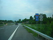
New York State Route 314
Encyclopedia
New York State Route 314 (NY 314) and Vermont Route 314 (VT 314) are a pair of like-numbered state highway
s in New York
and Vermont
, United States
, that are connected by way of the Plattsburgh – Grand Isle Ferry across Lake Champlain
. NY 314 extends for 4.73 miles (7.61 km) through the Clinton County
town of Plattsburgh
from Interstate 87 (I-87) exit 39 to the ferry landing on Cumberland Head. Its Vermont counterpart is a 5.493 miles (8.84 km) loop route off of U.S. Route 2 (US 2) through the Grand Isle County
towns of South Hero
and Grand Isle
that connects to the ferry near its midpoint.
VT 314 was originally designated as Vermont Route F-3 in the 1920s. The roadway on the New York side was unnumbered until ca. 1962, when Cumberland Head Road was designated as NY 314. VT F-3 was redesignated as VT 314 by 1964 to match the designation present at the New York ferry approach. In 2005, a new highway connecting US 9 to the ferry landing by way of the interior of Cumberland Head was completed and opened to traffic as the Commodore Thomas MacDonough Highway. NY 314 was realigned to follow the new highway while ownership and maintenance of its old alignment was transferred to the town of Plattsburgh.
) exit 39 in the town of Plattsburgh
. The route heads southeast as a four-lane divided highway
known as Moffitt Road to an intersection with US 9 (the Lakes to Locks Passage
) just 0.1 mile (0.160934 km) from the I-87 interchange. At this point, maintenance of NY 314 shifts from the New York State Department of Transportation
to Clinton County
, which maintains the highway as the unsigned County Route 57 (CR 57). Past US 9, NY 314 becomes known as Cumberland Head Road as it curves to the east and runs along the southern edge of Cumberland Bay State Park
. At the eastern edge of the park, the median ends and NY 314 narrows to become a two-lane undivided highway.
 Just east of the park, Cumberland Head Road forks off of NY 314 to follow the perimeter of Cumberland Head. NY 314, meanwhile, continues east on Commodore Thomas MacDonough Highway, a super two
bypassing the perimeter of Cumberland Head and the hamlets of Rocky Point and Champlain Park on the western shore of the peninsula. Roughly 0.25 mile (0.402335 km) to the east of the fork, NY 314 intersects Cumberland Head Road again as the latter highway makes its way around Cumberland Head. NY 314 continues on, passing through a dense forest as it bypasses Rocky Point to the northeast. Upon exiting the forest, the highway curves slightly to the southeast and passes through a small area of open fields before heading through another dense forest just east of Champlain Park.
The route continues southward for another 1.5 miles (2.4 km) through the vast forests and fields that make up the interior of Cumberland Head to the southern tip of the peninsula, where it meets Cumberland Head Road one final time. NY 314 continues south for about 400 feet (121.9 m) before curving to the northeast toward Lake Champlain
. The highway and the route both come to an end at a ferry landing for the Plattsburgh – Grand Isle Ferry, which connects to VT 314 on Grand Isle
.
in the town of South Hero
. The route heads northwestward as Ferry Road, passing by a small number of homes situated amongst open fields. At the western edge of Grand Isle, VT 314 intersects West Shore Road, a local highway that runs along the western shoreline of the island. The route turns north onto West Shore Road, following the roadway along Lake Champlain and into the town of Grand Isle
. Here, the route's surroundings are mainly the same as it proceeds toward Gordon Landing.
In Gordon Landing, VT 314 connects to a ferry landing for the Plattsburgh – Grand Isle Ferry (which leads to NY 314) by way of an unnamed extension of Bell Hill Road. VT 314 continues northward along West Shore Road to Allen Road, where the route turns to follow Allen Road eastward across the island. While on Allen Road, the route passes through an area of open fields and forests that contains only a couple dozen homes. VT 314 continues eastward to another junction with US 2, where the route comes to an end.
by way of a ferry across Lake Champlain
. The primary highway leading from the New York ferry landing to US 9 near Plattsburgh
, then Cumberland Head Road, was initially unnumbered. VT F-3 was maintained by the towns of South Hero
and Grand Isle
until June 20, 1957, when the state of Vermont
assumed ownership and maintenance of the highway.
Ca. 1961, the portion of the Adirondack Northway (I-87
) between exits 36 and 39 was completed and opened to traffic. The portion of Moffitt Road between the new freeway and US 9 was upgraded as part of the Northway's construction. By the following year, the upgraded piece of Moffitt Road and the piece of Cumberland Head Road between US 9 and the ferry landing was designated as NY 314. From I-87 to US 9, NY 314 was maintained by the New York State Department of Transportation
; the remainder of the route was maintained by Clinton County
and co-designated as CR 42. VT F-3 was renumbered to VT 314 between 1962 and 1964 to match the designation now present at the New York ferry approach.
The Cumberland Head connector began at the east end of the divided highway
portion of NY 314 and would pass through the rural interior of the peninsula on its way to the ferry landing. Part of the road would utilize the preexisting Lighthouse Road. It was built as a super two
highway with a 45 mi/h speed limit, 10 mi/h higher than that of the perimeter road. The project was initially expected to be completed around November 2006; however, it was completed nearly a year ahead of schedule. On December 1, 2005, the new highway was named the Commodore Thomas MacDonough Highway in honor of Thomas MacDonough
, an American naval officer who defeated the British in the Battle of Plattsburgh
during the War of 1812
. The road opened to traffic about a week later, co-designated as NY 314 (which was realigned to follow the length of the highway) and CR 57. Following the completion of the project, ownership and maintenance of Cumberland Head Road (NY 314's former routing) was to be transferred from Clinton County to the town of Plattsburgh
. The transfer was officially approved on September 13, 2006.
The new highway has only two intersections, both with Cumberland Head Road. This was by design as no access roads were built off of the route in an effort to improve safety along the highway. One part of the finished highway that drew controversy was a one-way ramp built between the eastbound MacDonough Highway and the west end of Cumberland Head Road. Some residents criticized the layout, stating that it made it difficult to travel to and from MacDonough Highway and Cumberland Head Road. Ironically, the ramp was added as a result of public input; the initial project designs did not call for a ramp. Instead, all traffic to and from Cumberland Head Road would have had to utilize the junction with MacDonough Highway 0.25 mile (0.402335 km) to the east.
State highway
State highway, state road or state route can refer to one of three related concepts, two of them related to a state or provincial government in a country that is divided into states or provinces :#A...
s in New York
New York
New York is a state in the Northeastern region of the United States. It is the nation's third most populous state. New York is bordered by New Jersey and Pennsylvania to the south, and by Connecticut, Massachusetts and Vermont to the east...
and Vermont
Vermont
Vermont is a state in the New England region of the northeastern United States of America. The state ranks 43rd in land area, , and 45th in total area. Its population according to the 2010 census, 630,337, is the second smallest in the country, larger only than Wyoming. It is the only New England...
, United States
United States
The United States of America is a federal constitutional republic comprising fifty states and a federal district...
, that are connected by way of the Plattsburgh – Grand Isle Ferry across Lake Champlain
Lake Champlain
Lake Champlain is a natural, freshwater lake in North America, located mainly within the borders of the United States but partially situated across the Canada—United States border in the Canadian province of Quebec.The New York portion of the Champlain Valley includes the eastern portions of...
. NY 314 extends for 4.73 miles (7.61 km) through the Clinton County
Clinton County, New York
Clinton County is a county located in the U.S. state of New York. As of the 2010 census, the population was 82,128. Its name is in honor of the first Governor of New York as a state, George Clinton. Its county seat is Plattsburgh.-History:...
town of Plattsburgh
Plattsburgh (town), New York
Plattsburgh is a town in Clinton County, New York, United States. The population was 11,870 at the 2010 census. The town is named after Zephaniah Platt, an early land owner.The Town of Plattsburgh borders the City of Plattsburgh...
from Interstate 87 (I-87) exit 39 to the ferry landing on Cumberland Head. Its Vermont counterpart is a 5.493 miles (8.84 km) loop route off of U.S. Route 2 (US 2) through the Grand Isle County
Grand Isle County, Vermont
Grand Isle County is a county located in the U.S. state of Vermont. As of 2010, the population was 6,970. Its shire town is North Hero.Grand Isle County is part of the Burlington-South Burlington, VT Metropolitan Statistical Area.-Geography:...
towns of South Hero
South Hero, Vermont
South Hero is a town in Grand Isle County, Vermont, United States. The population was 1,696 at the 2000 census.-Geography:According to the United States Census Bureau, the town has a total area of 47.5 square miles , of which 15.1 square miles is land and 32.4 square miles is...
and Grand Isle
Grand Isle, Vermont
Grand Isle is a town in Grand Isle County, Vermont, United States. The population was 1,955 at the 2000 census.A landing for the Lake Champlain Transportation Company's ferry to Plattsburgh, New York at Cumberland Head is located on the western shore of Grand Isle at Gordon's...
that connects to the ferry near its midpoint.
VT 314 was originally designated as Vermont Route F-3 in the 1920s. The roadway on the New York side was unnumbered until ca. 1962, when Cumberland Head Road was designated as NY 314. VT F-3 was redesignated as VT 314 by 1964 to match the designation present at the New York ferry approach. In 2005, a new highway connecting US 9 to the ferry landing by way of the interior of Cumberland Head was completed and opened to traffic as the Commodore Thomas MacDonough Highway. NY 314 was realigned to follow the new highway while ownership and maintenance of its old alignment was transferred to the town of Plattsburgh.
NY 314
NY 314 begins at Adirondack Northway (I-87Interstate 87
Interstate 87 is a Interstate Highway located entirely within New York State in the United States of America. I-87 is the longest intrastate Interstate highway in the Interstate Highway System. Its southern end is at the Bronx approaches of the Robert F. Kennedy Bridge in New York City...
) exit 39 in the town of Plattsburgh
Plattsburgh (town), New York
Plattsburgh is a town in Clinton County, New York, United States. The population was 11,870 at the 2010 census. The town is named after Zephaniah Platt, an early land owner.The Town of Plattsburgh borders the City of Plattsburgh...
. The route heads southeast as a four-lane divided highway
Divided Highway
Divided Highway is a compilation album by American rock band The Doobie Brothers, released in 2003. . All tracks are taken from the albums Cycles and Brotherhood .-Track listing:...
known as Moffitt Road to an intersection with US 9 (the Lakes to Locks Passage
Lakes to Locks Passage
The New York State byway known as Lakes to Locks Passage unifies the interconnected waterway of the upper Hudson River, Champlain Canal, Lake George, and Lake Champlain; this waterway is the core of North America’s first “super-highway” between upstate New York, USA and the Province of Quebec, Canada...
) just 0.1 mile (0.160934 km) from the I-87 interchange. At this point, maintenance of NY 314 shifts from the New York State Department of Transportation
New York State Department of Transportation
The New York State Department of Transportation is responsible for the development and operation of highways, railroads, mass transit systems, ports, waterways and aviation facilities in the U.S...
to Clinton County
Clinton County, New York
Clinton County is a county located in the U.S. state of New York. As of the 2010 census, the population was 82,128. Its name is in honor of the first Governor of New York as a state, George Clinton. Its county seat is Plattsburgh.-History:...
, which maintains the highway as the unsigned County Route 57 (CR 57). Past US 9, NY 314 becomes known as Cumberland Head Road as it curves to the east and runs along the southern edge of Cumberland Bay State Park
Cumberland Bay State Park
Cumberland Bay State Park is located in the Town of Plattsburgh in Clinton County, New York, on the Cumberland Head peninsula. The park is adjacent to Lake Champlain....
. At the eastern edge of the park, the median ends and NY 314 narrows to become a two-lane undivided highway.
Super two
A super two, super two-lane highway or wide two lane is a two-lane surface road built to high standards, typically including partial control of access, occasional passing lanes and hard shoulders...
bypassing the perimeter of Cumberland Head and the hamlets of Rocky Point and Champlain Park on the western shore of the peninsula. Roughly 0.25 mile (0.402335 km) to the east of the fork, NY 314 intersects Cumberland Head Road again as the latter highway makes its way around Cumberland Head. NY 314 continues on, passing through a dense forest as it bypasses Rocky Point to the northeast. Upon exiting the forest, the highway curves slightly to the southeast and passes through a small area of open fields before heading through another dense forest just east of Champlain Park.
The route continues southward for another 1.5 miles (2.4 km) through the vast forests and fields that make up the interior of Cumberland Head to the southern tip of the peninsula, where it meets Cumberland Head Road one final time. NY 314 continues south for about 400 feet (121.9 m) before curving to the northeast toward Lake Champlain
Lake Champlain
Lake Champlain is a natural, freshwater lake in North America, located mainly within the borders of the United States but partially situated across the Canada—United States border in the Canadian province of Quebec.The New York portion of the Champlain Valley includes the eastern portions of...
. The highway and the route both come to an end at a ferry landing for the Plattsburgh – Grand Isle Ferry, which connects to VT 314 on Grand Isle
Grand Isle (island)
Grand Isle is the largest island in Lake Champlain, Vermont, USA. It has a land area of 81.86 km² . The island comprises the two towns of Grand Isle and South Hero, Vermont. The total population as of the 2000 census was 3,651....
.
VT 314
VT 314 begins at an intersection with US 2 just north of Keeler Bay, a villageVillage (Vermont)
In the U.S. state of Vermont, villages are named communities located within the boundaries of an incorporated town. Villages may be incorporated or unincorporated....
in the town of South Hero
South Hero, Vermont
South Hero is a town in Grand Isle County, Vermont, United States. The population was 1,696 at the 2000 census.-Geography:According to the United States Census Bureau, the town has a total area of 47.5 square miles , of which 15.1 square miles is land and 32.4 square miles is...
. The route heads northwestward as Ferry Road, passing by a small number of homes situated amongst open fields. At the western edge of Grand Isle, VT 314 intersects West Shore Road, a local highway that runs along the western shoreline of the island. The route turns north onto West Shore Road, following the roadway along Lake Champlain and into the town of Grand Isle
Grand Isle, Vermont
Grand Isle is a town in Grand Isle County, Vermont, United States. The population was 1,955 at the 2000 census.A landing for the Lake Champlain Transportation Company's ferry to Plattsburgh, New York at Cumberland Head is located on the western shore of Grand Isle at Gordon's...
. Here, the route's surroundings are mainly the same as it proceeds toward Gordon Landing.
In Gordon Landing, VT 314 connects to a ferry landing for the Plattsburgh – Grand Isle Ferry (which leads to NY 314) by way of an unnamed extension of Bell Hill Road. VT 314 continues northward along West Shore Road to Allen Road, where the route turns to follow Allen Road eastward across the island. While on Allen Road, the route passes through an area of open fields and forests that contains only a couple dozen homes. VT 314 continues eastward to another junction with US 2, where the route comes to an end.
Designations
All of modern VT 314 was originally designated as VT F-3 in 1924. At Gordon Landing, VT F-3 connected to Cumberland Head in New YorkNew York
New York is a state in the Northeastern region of the United States. It is the nation's third most populous state. New York is bordered by New Jersey and Pennsylvania to the south, and by Connecticut, Massachusetts and Vermont to the east...
by way of a ferry across Lake Champlain
Lake Champlain
Lake Champlain is a natural, freshwater lake in North America, located mainly within the borders of the United States but partially situated across the Canada—United States border in the Canadian province of Quebec.The New York portion of the Champlain Valley includes the eastern portions of...
. The primary highway leading from the New York ferry landing to US 9 near Plattsburgh
Plattsburgh (city), New York
Plattsburgh is a city in and county seat of Clinton County, New York, United States. The population was 19,989 at the 2010 census. The population of the unincorporated areas within the Town of Plattsburgh was 11,870 as of the 2010 census; making the population for the immediate, urban Plattsburgh,...
, then Cumberland Head Road, was initially unnumbered. VT F-3 was maintained by the towns of South Hero
South Hero, Vermont
South Hero is a town in Grand Isle County, Vermont, United States. The population was 1,696 at the 2000 census.-Geography:According to the United States Census Bureau, the town has a total area of 47.5 square miles , of which 15.1 square miles is land and 32.4 square miles is...
and Grand Isle
Grand Isle, Vermont
Grand Isle is a town in Grand Isle County, Vermont, United States. The population was 1,955 at the 2000 census.A landing for the Lake Champlain Transportation Company's ferry to Plattsburgh, New York at Cumberland Head is located on the western shore of Grand Isle at Gordon's...
until June 20, 1957, when the state of Vermont
Vermont
Vermont is a state in the New England region of the northeastern United States of America. The state ranks 43rd in land area, , and 45th in total area. Its population according to the 2010 census, 630,337, is the second smallest in the country, larger only than Wyoming. It is the only New England...
assumed ownership and maintenance of the highway.
Ca. 1961, the portion of the Adirondack Northway (I-87
Interstate 87
Interstate 87 is a Interstate Highway located entirely within New York State in the United States of America. I-87 is the longest intrastate Interstate highway in the Interstate Highway System. Its southern end is at the Bronx approaches of the Robert F. Kennedy Bridge in New York City...
) between exits 36 and 39 was completed and opened to traffic. The portion of Moffitt Road between the new freeway and US 9 was upgraded as part of the Northway's construction. By the following year, the upgraded piece of Moffitt Road and the piece of Cumberland Head Road between US 9 and the ferry landing was designated as NY 314. From I-87 to US 9, NY 314 was maintained by the New York State Department of Transportation
New York State Department of Transportation
The New York State Department of Transportation is responsible for the development and operation of highways, railroads, mass transit systems, ports, waterways and aviation facilities in the U.S...
; the remainder of the route was maintained by Clinton County
Clinton County, New York
Clinton County is a county located in the U.S. state of New York. As of the 2010 census, the population was 82,128. Its name is in honor of the first Governor of New York as a state, George Clinton. Its county seat is Plattsburgh.-History:...
and co-designated as CR 42. VT F-3 was renumbered to VT 314 between 1962 and 1964 to match the designation now present at the New York ferry approach.
Cumberland Head connector
The idea of a building a new highway that would lead directly from US 9 to the ferry landing at the southern tip of Cumberland Head was first proposed in 1964. At that time, a group of Cumberland Head residents stated that the existing narrow and winding perimeter road (NY 314) jeopardized the safety of residents and motorists alike. As time went on, the problem grew worse as the amount of traffic traveling to and from the ferry increased. The proposal finally gained traction in 2002 when New York State Senator Ronald B. Stafford was able to procure most of the $7.3 million required to build the highway. Construction on the new route began in March 2005 following three years of studies and planning.The Cumberland Head connector began at the east end of the divided highway
Divided Highway
Divided Highway is a compilation album by American rock band The Doobie Brothers, released in 2003. . All tracks are taken from the albums Cycles and Brotherhood .-Track listing:...
portion of NY 314 and would pass through the rural interior of the peninsula on its way to the ferry landing. Part of the road would utilize the preexisting Lighthouse Road. It was built as a super two
Super two
A super two, super two-lane highway or wide two lane is a two-lane surface road built to high standards, typically including partial control of access, occasional passing lanes and hard shoulders...
highway with a 45 mi/h speed limit, 10 mi/h higher than that of the perimeter road. The project was initially expected to be completed around November 2006; however, it was completed nearly a year ahead of schedule. On December 1, 2005, the new highway was named the Commodore Thomas MacDonough Highway in honor of Thomas MacDonough
Thomas MacDonough
Thomas Macdonough was an early-19th-century American naval officer noted for his roles in the first Barbary War, and the War of 1812. He was the son of a revolutionary officer, Thomas Sr. who lived close to Middleton, Delaware. Being the sixth child born, he came from a large family of ten...
, an American naval officer who defeated the British in the Battle of Plattsburgh
Battle of Plattsburgh
The Battle of Plattsburgh, also known as the Battle of Lake Champlain, ended the final invasion of the northern states during the War of 1812...
during the War of 1812
War of 1812
The War of 1812 was a military conflict fought between the forces of the United States of America and those of the British Empire. The Americans declared war in 1812 for several reasons, including trade restrictions because of Britain's ongoing war with France, impressment of American merchant...
. The road opened to traffic about a week later, co-designated as NY 314 (which was realigned to follow the length of the highway) and CR 57. Following the completion of the project, ownership and maintenance of Cumberland Head Road (NY 314's former routing) was to be transferred from Clinton County to the town of Plattsburgh
Plattsburgh (town), New York
Plattsburgh is a town in Clinton County, New York, United States. The population was 11,870 at the 2010 census. The town is named after Zephaniah Platt, an early land owner.The Town of Plattsburgh borders the City of Plattsburgh...
. The transfer was officially approved on September 13, 2006.
The new highway has only two intersections, both with Cumberland Head Road. This was by design as no access roads were built off of the route in an effort to improve safety along the highway. One part of the finished highway that drew controversy was a one-way ramp built between the eastbound MacDonough Highway and the west end of Cumberland Head Road. Some residents criticized the layout, stating that it made it difficult to travel to and from MacDonough Highway and Cumberland Head Road. Ironically, the ramp was added as a result of public input; the initial project designs did not call for a ramp. Instead, all traffic to and from Cumberland Head Road would have had to utilize the junction with MacDonough Highway 0.25 mile (0.402335 km) to the east.
NY 314
VT 314
See also
- State Route 74 (New York – Vermont)
- State Route 346 (New York – Vermont)