

New York State Route 33A
Encyclopedia
New York State Route 33A (NY 33A) is an east–west state highway
mostly located in Monroe County, New York
, in the United States. The route is just over 17 miles (27 km) long and serves as an alternate route
of NY 33
between the town of Bergen
in Genesee County
and the city of Rochester
in Monroe County
. While NY 33 heads to Rochester by way of Churchville
and northern Gates
, NY 33A dips south to pass through Chili
and southern Gates. NY 33A was assigned as part of the 1930 renumbering of state highways in New York, but only from Riga
to Rochester. It was extended westward to its current terminus in Bergen ca. 1932.
just east of the village of Bergen
in the town of the same name
. From this point, NY 33 travels to the west and to the northeast while NY 33A heads east. Less than a quarter of a mile (0.4 km) from its western terminus, NY 33A meets Interstate 490
(I-490) at exit 2. In this area, I-490 straddles the border between Genesee County
and Monroe County
; thus, the westbound portion of the interchange is in Genesee County while the eastbound half is in Monroe County.
 Now in the town of Riga
, NY 33A becomes Chili – Riga Center Road as it traverses a largely rural portion of southwestern Monroe County. In the small hamlet of Riga, the route intersects and briefly overlaps with NY 36
. East of Riga hamlet, NY 33A heads generally northeastward, passing by Black Creek Park as it enters the town of Chili
. Just west of the hamlet of West Chili, the route crosses over Black Creek and intersects Chili Avenue Extension. At this junction, NY 33A becomes Chili Avenue, the name it retains into the city of Rochester. Locally, the Chili Avenue name is used more in common parlance than the NY 33A designation.
In West Chili, the route meets the southern terminus of NY 259
. The route continues on, heading northeastward into more densely populated areas of the town of Chili. About 1.5 miles (2.4 km) east of West Chili, NY 33A intersects the western terminus of NY 252
. Not far to the northeast, the highway meets NY 386
, which joins NY 33A for one mile (1.6 km) to Chili Center, Chili's main commercial hub. Here, NY 386 splits off to the north at a junction that also serves as the western terminus of NY 252A
. Past Chili Center, NY 33A heads northeast through a residential neighborhood and into the town of Gates
.
). At this point, NY 204 leaves the highway and turns to follow NY 33A eastward. While most of NY 33A west of Gates is a two-lane highway, the portion of Chili Avenue that carries both NY 33A and NY 204 is a four-lane roadway. The two routes soon enter Tressmar, a hamlet that has been transformed into a major commercial destination. The development is mostly centered around Westgate Plaza, a large shopping plaza anchored by a Wal-Mart
. As NY 33A passes south of the plaza, it connects to Howard Road (unsigned NY 940L and formerly part of NY 47
) and Brooks Avenue. NY 204 leaves NY 33A at Brooks Avenue to follow the road eastward toward the Greater Rochester International Airport
.
 East of Brooks Avenue, NY 33A passes through a small residential area before entering a more industrial neighborhood surrounding the Erie Canal
and the Rochester
city line. In the western portion of this area, the route meets I-390
at exit 19 and intersects Buell Road, a county-maintained highway that directly links NY 33A to the airport a half-mile (0.8 km) to the south. East of I-390, NY 33A crosses the Erie Canal and enters the city of Rochester, at which point maintenance of NY 33A shifts from the New York State Department of Transportation
(NYSDOT) to the city of Rochester. On the northern bank of the waterway, the route passes under the Rochester and Southern Railroad
. The surroundings become significantly more residential east of the railroad as the route heads northeastward toward downtown Rochester. However, NY 33A ends roughly one mile (1.6 km) west of downtown at a junction with NY 33 (West Avenue). Here, Chili and West Avenues converge and NY 33 continues toward downtown as West Main Street.
extending from the Southern Tier
village of Cuba
to the city of Rochester
just south of Lake Ontario
. Route 16 entered the Rochester area on what is now NY 386
and followed modern NY 386, Old Scottsville–Chili Road, and Chili Avenue northeastward to the Rochester city line. From there, the route continued for an additional 1 miles (1.6 km) to the original city limits, where it ended near the intersection of Chili Avenue and Post Street. On March 1, 1921, Route 16 was truncated to end in Le Roy
while the portion of its former alignment north of Caledonia
became part of an extended Route 15.
When the first set of posted routes in New York
were assigned in 1924, the segment of legislative Route 15 north of Caledonia was not assigned a designation. Within two years, a highway extending from Batavia
to Rochester by way of Bergen
and Gates
was designated as NY 33
. However, NY 33 followed a more northerly routing through Gates than old Route 15 did as it used Buffalo Road instead of Chili Avenue. In the 1930 renumbering of state highways in New York, the Chili Avenue portion of legislative Route 15 became part of the new NY 33A, a then-spur route of NY 33 that began at NY 36
in Riga
and ended at NY 33 in southwestern Rochester. Ca. 1932, NY 33A was extended westward to the town of Bergen
, where it reconnected to NY 33 southeast of the village of Bergen
.
State highway
State highway, state road or state route can refer to one of three related concepts, two of them related to a state or provincial government in a country that is divided into states or provinces :#A...
mostly located in Monroe County, New York
Monroe County, New York
Monroe County is a county located in the U.S. state of New York. As of the 2010 census, the population was 744,344. It is named after James Monroe, fifth President of the United States of America. Its county seat is the city of Rochester....
, in the United States. The route is just over 17 miles (27 km) long and serves as an alternate route
Alternate route
An official alternate route is a special route in the United States that provides an alternate alignment for a highway. They are loop roads and found in many road systems in the United States including the U.S. Route system and various state route systems...
of NY 33
New York State Route 33
New York State Route 33 is an east–west state highway in western New York in the United States. The route extends for just under from NY 5 in Buffalo in the west to NY 31 in Rochester in the east. It is, in fact, the only state highway that directly connects both cities, although...
between the town of Bergen
Bergen (town), New York
Bergen is a town in Genesee County, New York, United States. The town is in the northeast corner of the county. There is also a village of Bergen in the town...
in Genesee County
Genesee County, New York
Genesee County is a county located in Western New York, United States. As of the 2010 census, the population was 60,079. Its name is from the Seneca Indian word Gen-nis'-hee-yo meaning "The Beautiful Valley." Its county seat is Batavia.- History :...
and the city of Rochester
Rochester, New York
Rochester is a city in Monroe County, New York, south of Lake Ontario in the United States. Known as The World's Image Centre, it was also once known as The Flour City, and more recently as The Flower City...
in Monroe County
Monroe County, New York
Monroe County is a county located in the U.S. state of New York. As of the 2010 census, the population was 744,344. It is named after James Monroe, fifth President of the United States of America. Its county seat is the city of Rochester....
. While NY 33 heads to Rochester by way of Churchville
Churchville, New York
Churchville is a village in Monroe County, New York, United States. According to the 2000 census, the population is 1,887. The village is named after Samuel Church, an early settler....
and northern Gates
Gates, New York
Gates is a town in Monroe County, New York. The town is named after General Horatio Gates. The population was 28,400 at the 2010 census. Gates-North Gates census-designated place is located within the town's boundaries....
, NY 33A dips south to pass through Chili
Chili, New York
Chili is a town in Monroe County, New York, USA. The population was 28,625 at the 2010 census. It is a suburb of the city of Rochester.The Town of Chili was established in 1822 from part of the Town of Riga....
and southern Gates. NY 33A was assigned as part of the 1930 renumbering of state highways in New York, but only from Riga
Riga, New York
Riga is a town in Monroe County, New York, United States. The population was 5,590 at the 2010 census.The Town of Riga is southwest of the City of Rochester on the western border of the county...
to Rochester. It was extended westward to its current terminus in Bergen ca. 1932.
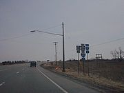
West of Gates
NY 33A begins at an intersection with NY 33New York State Route 33
New York State Route 33 is an east–west state highway in western New York in the United States. The route extends for just under from NY 5 in Buffalo in the west to NY 31 in Rochester in the east. It is, in fact, the only state highway that directly connects both cities, although...
just east of the village of Bergen
Bergen (village), New York
Bergen is a village in Genesee County, New York, United States. The population was 1,240 at the 2000 census.The village lies on the eastern edge of the Town of Bergen. The village is north of the junction of Routes 19 and 33.-History:...
in the town of the same name
Bergen (town), New York
Bergen is a town in Genesee County, New York, United States. The town is in the northeast corner of the county. There is also a village of Bergen in the town...
. From this point, NY 33 travels to the west and to the northeast while NY 33A heads east. Less than a quarter of a mile (0.4 km) from its western terminus, NY 33A meets Interstate 490
Interstate 490 (New York)
Interstate 490 is an auxiliary Interstate Highway that serves the city of Rochester, New York, in the United States. It acts as a northerly alternate route to the New York State Thruway , leaving it at exit 47 in the town of Le Roy and rejoining the highway at exit 45 in the town of...
(I-490) at exit 2. In this area, I-490 straddles the border between Genesee County
Genesee County, New York
Genesee County is a county located in Western New York, United States. As of the 2010 census, the population was 60,079. Its name is from the Seneca Indian word Gen-nis'-hee-yo meaning "The Beautiful Valley." Its county seat is Batavia.- History :...
and Monroe County
Monroe County, New York
Monroe County is a county located in the U.S. state of New York. As of the 2010 census, the population was 744,344. It is named after James Monroe, fifth President of the United States of America. Its county seat is the city of Rochester....
; thus, the westbound portion of the interchange is in Genesee County while the eastbound half is in Monroe County.
Riga, New York
Riga is a town in Monroe County, New York, United States. The population was 5,590 at the 2010 census.The Town of Riga is southwest of the City of Rochester on the western border of the county...
, NY 33A becomes Chili – Riga Center Road as it traverses a largely rural portion of southwestern Monroe County. In the small hamlet of Riga, the route intersects and briefly overlaps with NY 36
New York State Route 36
New York State Route 36 is a north–south state highway in the western part of New York in the United States. The highway extends for from the Pennsylvania state line at Troupsburg, Steuben County northward to Ogden, Monroe County, where it ends at an intersection with NY 31...
. East of Riga hamlet, NY 33A heads generally northeastward, passing by Black Creek Park as it enters the town of Chili
Chili, New York
Chili is a town in Monroe County, New York, USA. The population was 28,625 at the 2010 census. It is a suburb of the city of Rochester.The Town of Chili was established in 1822 from part of the Town of Riga....
. Just west of the hamlet of West Chili, the route crosses over Black Creek and intersects Chili Avenue Extension. At this junction, NY 33A becomes Chili Avenue, the name it retains into the city of Rochester. Locally, the Chili Avenue name is used more in common parlance than the NY 33A designation.
In West Chili, the route meets the southern terminus of NY 259
New York State Route 259
New York State Route 259 is a north–south state highway located west of Rochester in Monroe County, New York, United States. The southern terminus of the route is at NY 33A in the hamlet of West Chili within the town of Chili. Its northern terminus is at the Lake Ontario State Parkway in...
. The route continues on, heading northeastward into more densely populated areas of the town of Chili. About 1.5 miles (2.4 km) east of West Chili, NY 33A intersects the western terminus of NY 252
New York State Route 252
New York State Route 252 is an east–west state highway south of Rochester in Monroe County, New York, in the United States. The western terminus of the route is at an intersection with NY 33A in Chili and the eastern terminus is at a junction with NY 64 and NY 96 in the village...
. Not far to the northeast, the highway meets NY 386
New York State Route 386
New York State Route 386 is a north–south state highway located in the western suburbs of the city of Rochester in Monroe County, New York, in the United States. Its southern terminus is at an intersection with NY 383 in the village of Scottsville. The northern end of the highway is...
, which joins NY 33A for one mile (1.6 km) to Chili Center, Chili's main commercial hub. Here, NY 386 splits off to the north at a junction that also serves as the western terminus of NY 252A
New York State Route 252A
New York State Route 252A is an east–west state highway located within the town of Chili in Monroe County, New York, in the United States. The western terminus of the route is at an intersection with NY 33A and NY 386 in the hamlet of Chili Center. Its eastern terminus is at a...
. Past Chili Center, NY 33A heads northeast through a residential neighborhood and into the town of Gates
Gates, New York
Gates is a town in Monroe County, New York. The town is named after General Horatio Gates. The population was 28,400 at the 2010 census. Gates-North Gates census-designated place is located within the town's boundaries....
.
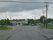
Gates and Rochester
Just across the town line, NY 33A intersects the east end of the Airport Expressway (NY 204New York State Route 204
New York State Route 204 is an east–west state highway located just southeast of Rochester in Monroe County, New York, in the United States. The western terminus of the route is at exit 6 on Interstate 490 in Gates. Its eastern terminus is at the Rochester city line just east of...
). At this point, NY 204 leaves the highway and turns to follow NY 33A eastward. While most of NY 33A west of Gates is a two-lane highway, the portion of Chili Avenue that carries both NY 33A and NY 204 is a four-lane roadway. The two routes soon enter Tressmar, a hamlet that has been transformed into a major commercial destination. The development is mostly centered around Westgate Plaza, a large shopping plaza anchored by a Wal-Mart
Wal-Mart
Wal-Mart Stores, Inc. , branded as Walmart since 2008 and Wal-Mart before then, is an American public multinational corporation that runs chains of large discount department stores and warehouse stores. The company is the world's 18th largest public corporation, according to the Forbes Global 2000...
. As NY 33A passes south of the plaza, it connects to Howard Road (unsigned NY 940L and formerly part of NY 47
New York State Route 47
New York State Route 47 was a long state highway around Rochester in New York, United States. It formed a semicircle through the inner suburbs of Rochester, following expressways west and east of the city and surface streets south of Rochester. The western terminus of the route was at an...
) and Brooks Avenue. NY 204 leaves NY 33A at Brooks Avenue to follow the road eastward toward the Greater Rochester International Airport
Greater Rochester International Airport
Greater Rochester International Airport is a county-owned public-use airport located three nautical miles southwest of the central business district of Rochester, a city in Monroe County, New York, United States...
.
Erie Canal
The Erie Canal is a waterway in New York that runs about from Albany, New York, on the Hudson River to Buffalo, New York, at Lake Erie, completing a navigable water route from the Atlantic Ocean to the Great Lakes. The canal contains 36 locks and encompasses a total elevation differential of...
and the Rochester
Rochester, New York
Rochester is a city in Monroe County, New York, south of Lake Ontario in the United States. Known as The World's Image Centre, it was also once known as The Flour City, and more recently as The Flower City...
city line. In the western portion of this area, the route meets I-390
Interstate 390
Interstate 390 is a north–south auxiliary Interstate Highway located entirely within New York in the United States. The southern terminus of the route is at the Southern Tier Expressway in the town of Avoca. Its northern terminus is at I-490 in Rochester...
at exit 19 and intersects Buell Road, a county-maintained highway that directly links NY 33A to the airport a half-mile (0.8 km) to the south. East of I-390, NY 33A crosses the Erie Canal and enters the city of Rochester, at which point maintenance of NY 33A shifts from the New York State Department of Transportation
New York State Department of Transportation
The New York State Department of Transportation is responsible for the development and operation of highways, railroads, mass transit systems, ports, waterways and aviation facilities in the U.S...
(NYSDOT) to the city of Rochester. On the northern bank of the waterway, the route passes under the Rochester and Southern Railroad
Rochester and Southern Railroad
The Rochester and Southern Railroad , a subsidiary of Genesee & Wyoming Inc., is a class III shortline that runs from the city of Rochester in Monroe County to Silver Springs, NY. The RSR started in 1986, when the B&O sold off its Buffalo and Rochester branches...
. The surroundings become significantly more residential east of the railroad as the route heads northeastward toward downtown Rochester. However, NY 33A ends roughly one mile (1.6 km) west of downtown at a junction with NY 33 (West Avenue). Here, Chili and West Avenues converge and NY 33 continues toward downtown as West Main Street.
History
In 1908, the New York State Legislature created Route 16, an unsigned legislative routeLegislative route
In United States, a legislative route or legislative highway is a highway defined by laws passed in a state legislature. The numbering of such highways may or may not correspond to the numbers familiar to the public as part of the state, U.S. highway, and Interstate highway systems...
extending from the Southern Tier
Southern Tier
The Southern Tier is a geographical term that refers to the counties of New York State west of the Catskill Mountains along the northern border of Pennsylvania. It is a loosely defined term that generally includes the counties that border Pennsylvania west of Delaware County inclusive...
village of Cuba
Cuba (village), New York
Cuba is a village in Allegany County, New York, United States. The population was 1,633 at the 2000 census.The Village of Cuba is in the western part of the Town of Cuba at the junction of Routes 305 and 446 on Oil Creek.- History :...
to the city of Rochester
Rochester, New York
Rochester is a city in Monroe County, New York, south of Lake Ontario in the United States. Known as The World's Image Centre, it was also once known as The Flour City, and more recently as The Flower City...
just south of Lake Ontario
Lake Ontario
Lake Ontario is one of the five Great Lakes of North America. It is bounded on the north and southwest by the Canadian province of Ontario, and on the south by the American state of New York. Ontario, Canada's most populous province, was named for the lake. In the Wyandot language, ontarío means...
. Route 16 entered the Rochester area on what is now NY 386
New York State Route 386
New York State Route 386 is a north–south state highway located in the western suburbs of the city of Rochester in Monroe County, New York, in the United States. Its southern terminus is at an intersection with NY 383 in the village of Scottsville. The northern end of the highway is...
and followed modern NY 386, Old Scottsville–Chili Road, and Chili Avenue northeastward to the Rochester city line. From there, the route continued for an additional 1 miles (1.6 km) to the original city limits, where it ended near the intersection of Chili Avenue and Post Street. On March 1, 1921, Route 16 was truncated to end in Le Roy
Le Roy (village), New York
Le Roy is a village in Genesee County, New York, United States. The population was 4,462 at the 2000 census.The Village of Le Roy lies in the center of the Town of Le Roy at the intersection of Routes 5 and 19.- History :...
while the portion of its former alignment north of Caledonia
Caledonia (village), New York
Caledonia is a village in Livingston County, New York, USA. The population was 2,327 at the 2000 census. The name refers to Scotland.The Village of Caledonia is located inside the Town of Caledonia and is southwest of Rochester, Monroe County....
became part of an extended Route 15.
When the first set of posted routes in New York
New York
New York is a state in the Northeastern region of the United States. It is the nation's third most populous state. New York is bordered by New Jersey and Pennsylvania to the south, and by Connecticut, Massachusetts and Vermont to the east...
were assigned in 1924, the segment of legislative Route 15 north of Caledonia was not assigned a designation. Within two years, a highway extending from Batavia
Batavia (city), New York
Batavia is a city in Genesee County, Western New York, USA, located near the middle of Genesee County, entirely within the Town of Batavia. Its population as of the 2000 census was 16,256...
to Rochester by way of Bergen
Bergen (village), New York
Bergen is a village in Genesee County, New York, United States. The population was 1,240 at the 2000 census.The village lies on the eastern edge of the Town of Bergen. The village is north of the junction of Routes 19 and 33.-History:...
and Gates
Gates, New York
Gates is a town in Monroe County, New York. The town is named after General Horatio Gates. The population was 28,400 at the 2010 census. Gates-North Gates census-designated place is located within the town's boundaries....
was designated as NY 33
New York State Route 33
New York State Route 33 is an east–west state highway in western New York in the United States. The route extends for just under from NY 5 in Buffalo in the west to NY 31 in Rochester in the east. It is, in fact, the only state highway that directly connects both cities, although...
. However, NY 33 followed a more northerly routing through Gates than old Route 15 did as it used Buffalo Road instead of Chili Avenue. In the 1930 renumbering of state highways in New York, the Chili Avenue portion of legislative Route 15 became part of the new NY 33A, a then-spur route of NY 33 that began at NY 36
New York State Route 36
New York State Route 36 is a north–south state highway in the western part of New York in the United States. The highway extends for from the Pennsylvania state line at Troupsburg, Steuben County northward to Ogden, Monroe County, where it ends at an intersection with NY 31...
in Riga
Riga, New York
Riga is a town in Monroe County, New York, United States. The population was 5,590 at the 2010 census.The Town of Riga is southwest of the City of Rochester on the western border of the county...
and ended at NY 33 in southwestern Rochester. Ca. 1932, NY 33A was extended westward to the town of Bergen
Bergen (town), New York
Bergen is a town in Genesee County, New York, United States. The town is in the northeast corner of the county. There is also a village of Bergen in the town...
, where it reconnected to NY 33 southeast of the village of Bergen
Bergen (village), New York
Bergen is a village in Genesee County, New York, United States. The population was 1,240 at the 2000 census.The village lies on the eastern edge of the Town of Bergen. The village is north of the junction of Routes 19 and 33.-History:...
.