

New York State Route 825
Encyclopedia
New York State Route 825 (NY 825) is a state highway
in Oneida County, New York
, in the United States
. It connects the former Griffiss Air Force Base
to the Utica–Rome Expressway (NY 49
) and downtown Rome
. The southern terminus is at an interchange with NY 49 east of downtown Rome. Its northern terminus is at an intersection with NY 46
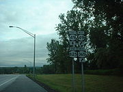
just north of downtown. NY 825 was assigned in 2002 and is ceremoniously named the Griffiss Veterans' Memorial Parkway.
) east of downtown Rome
. The route heads northward, crossing over NY 365
about 150 yards (137 m) from NY 49. No direct connection exists between NY 365 and NY 825; however, Shady Grove Trail, a local street located just south of the Griffiss Business and Technology Park limits, provides access between the two roads. The highway continues north into the park, where it serves as the primary north–south roadway through the area. Roughly 1 miles (1.6 km) north of NY 49, NY 825 meets Geiger and Ellsworth Roads at a roundabout
. At this point, NY 825 narrows from four to two lanes as it proceeds northward toward Griffiss International Airport.
 At Hangar Road, a local street providing direct access to the airport, NY 825 turns to the northwest, following Mohawk Drive toward the western extent of the former Griffiss Air Force Base
grounds. The road reverts to a four-lane highway ahead of a junction with Bell Road, the last street that NY 825 meets within the business park. Past Bell Road, the route curves the northwest and exits the park as it crosses over the Mohawk River
and enters a more densely developed area of Rome. NY 825, now named East Chestnut Street, continues onward for three blocks into a commercialized area north of downtown Rome, where it ends at a junction with Black River Boulevard (NY 46
). All of NY 825 is maintained by the city of Rome.
north of downtown Rome
. Long-term plans for the route called for the two-lane segments of NY 825 to be widened to four lanes. The section of NY 825 from Bell Road to NY 46 was widened by February 2009, leaving just the 1 miles (1.6 km) of the route from the roundabout
with Geiger and Ellsworth Roads northwest to Bell Road to be expanded.
On July 3, 2007, all of NY 825 was officially designated the Griffiss Veterans' Memorial Parkway after legislation proposing the name was signed into law by Governor Eliot Spitzer
. Signage displaying the ceremonial name was unveiled as part of a dedication ceremony held on November 14, 2007.
In February 2009, the Griffiss Local Development Corporation (GLDC) looked into the possibility of hiring an engineering firm to complete the design work needed to begin work on widening the final two-lane section of NY 825 to four lanes. The company hoped that completing the project's design would make the project eligible for federal stimulus funding. The New York State Department of Transportation
had completed 40% of the necessary design work; however, it lacked the funds needed to complete the plans and build the highway. As a result, GLDC saw hiring an outside firm to finish the project layout and receive federal stimulus funding as the most feasible way to make the project a reality. The remaining design work was estimated to cost between $400,000 and $500,000 while the actual construction cost was set at approximately $7 million.
State highway
State highway, state road or state route can refer to one of three related concepts, two of them related to a state or provincial government in a country that is divided into states or provinces :#A...
in Oneida County, New York
Oneida County, New York
Oneida County is a county located in the U.S. state of New York. As of the 2010 census, the population was 234,878. The county seat is Utica. The name is in honor of the Oneida, an Iroquoian tribe that formerly occupied the region....
, in the United States
United States
The United States of America is a federal constitutional republic comprising fifty states and a federal district...
. It connects the former Griffiss Air Force Base
Griffiss Air Force Base
Griffiss Air Force Base, is a former United States Air Force base, located in Rome, New York, about NW of Utica. Missions at Griffiss AFB included fighter interceptors, electronic research, installation, and support activities, aerial refueling, and bombers...
to the Utica–Rome Expressway (NY 49
New York State Route 49
New York State Route 49 is an east–west state highway in New York in the United States. It runs from NY 3 in Volney to Interstate 790 , NY 5, NY 8 and NY 12 in Utica...
) and downtown Rome
Rome, New York
Rome is a city in Oneida County, New York, United States. It is located in north-central or "upstate" New York. The population was 44,797 at the 2010 census. It is in New York's 24th congressional district. In 1758, British forces began construction of Fort Stanwix at this strategic location, but...
. The southern terminus is at an interchange with NY 49 east of downtown Rome. Its northern terminus is at an intersection with NY 46
New York State Route 46
New York State Route 46 is a state highway in Central New York, United States. It extends from NY 12B in the Madison County town of Eaton to NY 12D in the Oneida County village of Boonville. NY 46 passes through the cities of Oneida and Rome.-Madison County:NY 46 begins at...
just north of downtown. NY 825 was assigned in 2002 and is ceremoniously named the Griffiss Veterans' Memorial Parkway.
Route description
NY 825 begins at a trumpet interchange with the Utica–Rome Expressway (NY 49New York State Route 49
New York State Route 49 is an east–west state highway in New York in the United States. It runs from NY 3 in Volney to Interstate 790 , NY 5, NY 8 and NY 12 in Utica...
) east of downtown Rome
Rome, New York
Rome is a city in Oneida County, New York, United States. It is located in north-central or "upstate" New York. The population was 44,797 at the 2010 census. It is in New York's 24th congressional district. In 1758, British forces began construction of Fort Stanwix at this strategic location, but...
. The route heads northward, crossing over NY 365
New York State Route 365
New York State Route 365 is an east–west state highway in the central portion of New York in the United States. It extends for from an intersection with NY 5 east of the Oneida County city of Oneida to a junction with NY 8 in the Herkimer County town of Ohio...
about 150 yards (137 m) from NY 49. No direct connection exists between NY 365 and NY 825; however, Shady Grove Trail, a local street located just south of the Griffiss Business and Technology Park limits, provides access between the two roads. The highway continues north into the park, where it serves as the primary north–south roadway through the area. Roughly 1 miles (1.6 km) north of NY 49, NY 825 meets Geiger and Ellsworth Roads at a roundabout
Roundabout
A roundabout is the name for a road junction in which traffic moves in one direction around a central island. The word dates from the early 20th century. Roundabouts are common in many countries around the world...
. At this point, NY 825 narrows from four to two lanes as it proceeds northward toward Griffiss International Airport.
Griffiss Air Force Base
Griffiss Air Force Base, is a former United States Air Force base, located in Rome, New York, about NW of Utica. Missions at Griffiss AFB included fighter interceptors, electronic research, installation, and support activities, aerial refueling, and bombers...
grounds. The road reverts to a four-lane highway ahead of a junction with Bell Road, the last street that NY 825 meets within the business park. Past Bell Road, the route curves the northwest and exits the park as it crosses over the Mohawk River
Mohawk River
The Mohawk River is a river in the U.S. state of New York. It is the largest tributary of the Hudson River. The Mohawk flows into the Hudson in the Capital District, a few miles north of the city of Albany. The river is named for the Mohawk Nation of the Iroquois Confederacy...
and enters a more densely developed area of Rome. NY 825, now named East Chestnut Street, continues onward for three blocks into a commercialized area north of downtown Rome, where it ends at a junction with Black River Boulevard (NY 46
New York State Route 46
New York State Route 46 is a state highway in Central New York, United States. It extends from NY 12B in the Madison County town of Eaton to NY 12D in the Oneida County village of Boonville. NY 46 passes through the cities of Oneida and Rome.-Madison County:NY 46 begins at...
). All of NY 825 is maintained by the city of Rome.
History
Construction on the four-lane roadway that became NY 825 began on November 20, 2001, with a groundbreaking ceremony. The southernmost 1 miles (1.6 km) of the $8.5 million highway was completed by the following October, at which time the roadway was signed as NY 825. By 2004, the route was extended northward along two-lane surface streets to intersect NY 46New York State Route 46
New York State Route 46 is a state highway in Central New York, United States. It extends from NY 12B in the Madison County town of Eaton to NY 12D in the Oneida County village of Boonville. NY 46 passes through the cities of Oneida and Rome.-Madison County:NY 46 begins at...
north of downtown Rome
Rome, New York
Rome is a city in Oneida County, New York, United States. It is located in north-central or "upstate" New York. The population was 44,797 at the 2010 census. It is in New York's 24th congressional district. In 1758, British forces began construction of Fort Stanwix at this strategic location, but...
. Long-term plans for the route called for the two-lane segments of NY 825 to be widened to four lanes. The section of NY 825 from Bell Road to NY 46 was widened by February 2009, leaving just the 1 miles (1.6 km) of the route from the roundabout
Roundabout
A roundabout is the name for a road junction in which traffic moves in one direction around a central island. The word dates from the early 20th century. Roundabouts are common in many countries around the world...
with Geiger and Ellsworth Roads northwest to Bell Road to be expanded.
On July 3, 2007, all of NY 825 was officially designated the Griffiss Veterans' Memorial Parkway after legislation proposing the name was signed into law by Governor Eliot Spitzer
Eliot Spitzer
Eliot Laurence Spitzer is an American lawyer, former Democratic Party politician, and political commentator. He was the co-host of In the Arena, a talk-show and punditry forum broadcast on CNN until CNN cancelled his show in July of 2011...
. Signage displaying the ceremonial name was unveiled as part of a dedication ceremony held on November 14, 2007.
In February 2009, the Griffiss Local Development Corporation (GLDC) looked into the possibility of hiring an engineering firm to complete the design work needed to begin work on widening the final two-lane section of NY 825 to four lanes. The company hoped that completing the project's design would make the project eligible for federal stimulus funding. The New York State Department of Transportation
New York State Department of Transportation
The New York State Department of Transportation is responsible for the development and operation of highways, railroads, mass transit systems, ports, waterways and aviation facilities in the U.S...
had completed 40% of the necessary design work; however, it lacked the funds needed to complete the plans and build the highway. As a result, GLDC saw hiring an outside firm to finish the project layout and receive federal stimulus funding as the most feasible way to make the project a reality. The remaining design work was estimated to cost between $400,000 and $500,000 while the actual construction cost was set at approximately $7 million.