

New York State Route 91
Encyclopedia
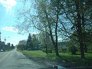
New York State Route 91 (NY 91) is a north–south state highway
in Central New York
in the United States. The southern terminus of the route is located at an intersection with NY 13
in the Cortland County
town of Truxton
. Its northern terminus is located at a junction with NY 173
in the Onondaga County
hamlet of Jamesville
. In between, NY 91 serves the village of Fabius
and the hamlet of Pompey
, where it meets NY 80
and U.S. Route 20
(US 20), respectively.
NY 91 originally extended as far south as Cincinnatus
and as far north as Bridgeport
when it was assigned as part of the 1930 renumbering of state highways in New York. The route was truncated to its current northern terminus at Jamesville in the late 1930s and cut back to its modern southern terminus at Truxton in 1981. Most of NY 91's former routing northeast of Syracuse
became NY 298
while the highway that NY 91 followed from Cincinnatus to Truxton is now maintained by Cortland County as County Route 600 (CR 600) and County Route 600A.
at an intersection with NY 13
in Truxton
. It proceeds north alongside Labrador Creek into Onondaga County
, where it passes by Labrador Pond at the county line. While the creek ends at the pond, NY 91 continues north through the town of Fabius
to an intersection with NY 80
in the hamlet of Apulia. Here, NY 91 turns east and joins NY 80 for roughly 3 miles (5 km) to the village of Fabius
before splitting from NY 80 and continuing northward. Shortly after entering Pompey
, NY 91 breaks from its north–south routing and makes a sharp turn to the west onto an extension of Chase Road. At Jerome Corners, the route curves back to the north and proceeds to the community of Pompey, where it intersects US 20
.
 As NY 91 exits Pompey, it passes near both the Pompey Golf Club the Jamesville Beach and Country Club before passing alongside the eastern edge of the Jamesville Reservoir in the northeastern corner of LaFayette
. Past the reservoir, NY 91 enters DeWitt and parallels the Butternut Creek to the hamlet of Jamesville
, where the route ends at an intersection with NY 173
.
in Cincinnatus
and followed Taylor Valley Road and Cheningo Road through the Truxton
hamlet of Cheningo to the hamlet of Truxton, where it joined its modern alignment and proceeded north to Jamesville
. From there, the route continued north past Jamesville to NY 31
in Bridgeport
by way of overlaps with NY 173
and US 11
through downtown Syracuse
and what is now NY 298
from Syracuse to Bridgeport. NY 91 was truncated southward to the intersection of US 11 and NY 173 west of Jamesville ca. 1934 and eastward to its current northern terminus at Jamesville at some point between 1935 and 1938.
In the late 1930s, the route was truncated northward to begin in Cheningo. The former route to Cincinnatus on Taylor Valley Road was designated as CR 600 by 1974. NY 91 was truncated again on April 1, 1981, when ownership and maintenance of the portion of the route south of NY 13
in the hamlet of Truxton was transferred to Cortland County as part of a highway maintenance swap between the county and the state of New York
. While NY 91 was cut back to the eastern terminus of its then-overlap with NY 13, the former routing of NY 91 south of Truxton to Cheningo on Cheningo Road was redesignated as CR 600A.
State highway
State highway, state road or state route can refer to one of three related concepts, two of them related to a state or provincial government in a country that is divided into states or provinces :#A...
in Central New York
Central New York
Central New York is a term used to broadly describe the central region of New York State, roughly including the following counties and cities:...
in the United States. The southern terminus of the route is located at an intersection with NY 13
New York State Route 13
New York State Route 13 is a state highway that runs mainly north–south for between NY 14 in Horseheads and NY 3 west of Pulaski in Central New York in the United States. In between, NY 13 intersects with Interstate 81 in Cortland and Pulaski and meets the New York...
in the Cortland County
Cortland County, New York
Cortland County is a county located in the U.S. state of New York, named after Federico Van Cortlandt, president of the convention at Kingston that wrote the first New York State Constitution in 1777, and first lieutenant governor of the state. The county seat is Cortland...
town of Truxton
Truxton, New York
Truxton is a town in Cortland County, New York, United States. The population was 1,225 at the 2000 census. The town was named for Commodore Thomas Truxton, a naval officer of the American Revolution....
. Its northern terminus is located at a junction with NY 173
New York State Route 173
New York State Route 173 is a state highway located in the Syracuse area of central New York, United States. It takes a slightly bow-shaped route from NY 31 in the town of Van Buren to NY 5 in Chittenango, gently curving to the south of Downtown Syracuse in the center of its routing...
in the Onondaga County
Onondaga County, New York
Onondaga County is a county located in the U.S. state of New York. As of the 2010 census, the population was 467,026. The county seat is Syracuse.Onondaga County is part of the Syracuse, NY Metropolitan Statistical Area....
hamlet of Jamesville
Jamesville, New York
Jamesville is a hamlet in De Witt, Onondaga County, New York, United States, part of the greater Syracuse area.The history of the community is documented in the book Water, Wheels and Stone: Heritage of the Little Village by the Creek, Jamesville, New York, written by Jean Schutz Keough, and...
. In between, NY 91 serves the village of Fabius
Fabius (village), New York
Fabius is a village in Onondaga County, New York, United States. The population was 344 at the 2005 census. It is part of the Syracuse Metropolitan Statistical Area.The Village of Fabius is near the center of the Town of Fabius and is south of Syracuse....
and the hamlet of Pompey
Pompey, New York
Pompey is a town in the southeast part of Onondaga County, New York, United States. The population was 6,159 at the 2000 census. The town was named after the Roman general and political leader Pompey by a late 18th-century clerk interested in the Classics in the new federal republic.- History :The...
, where it meets NY 80
New York State Route 80
New York State Route 80 is a west–east New York State Route located within Onondaga, Madison, Chenango, Otsego, Herkimer, and Montgomery Counties in New York. Its western terminus is located at a junction with NY 175 in the city of Syracuse in Onondaga County, from which it...
and U.S. Route 20
U.S. Route 20 in New York
U.S. Route 20 is a part of the U.S. Highway System that runs from Newport, Oregon, to Boston, Massachusetts. In the U.S. state of New York, US 20 extends from the Pennsylvania state line at Ripley to the Massachusetts state line in the Berkshire Mountains. US 20 is the longest...
(US 20), respectively.
NY 91 originally extended as far south as Cincinnatus
Cincinnatus, New York
Cincinnatus is a town in Cortland County, New York, U.S. The population was 1,051 at the 2000 census. The town is named after an important Roman general, Cincinnatus....
and as far north as Bridgeport
Bridgeport, New York
Bridgeport is a hamlet located partly in the Town of Sullivan in Madison County, New York and partly in the Town of Cicero in Onondaga County, New York...
when it was assigned as part of the 1930 renumbering of state highways in New York. The route was truncated to its current northern terminus at Jamesville in the late 1930s and cut back to its modern southern terminus at Truxton in 1981. Most of NY 91's former routing northeast of Syracuse
Syracuse, New York
Syracuse is a city in and the county seat of Onondaga County, New York, United States, the largest U.S. city with the name "Syracuse", and the fifth most populous city in the state. At the 2010 census, the city population was 145,170, and its metropolitan area had a population of 742,603...
became NY 298
New York State Route 298
New York State Route 298 is an east–west state highway located entirely within Onondaga County, New York, in the United States. It runs in a generally northeast direction for from an interchange with Interstate 690 in the city of Syracuse to an intersection with NY 31 near the...
while the highway that NY 91 followed from Cincinnatus to Truxton is now maintained by Cortland County as County Route 600 (CR 600) and County Route 600A.
Route description
NY 91 begins in northeast Cortland CountyCortland County, New York
Cortland County is a county located in the U.S. state of New York, named after Federico Van Cortlandt, president of the convention at Kingston that wrote the first New York State Constitution in 1777, and first lieutenant governor of the state. The county seat is Cortland...
at an intersection with NY 13
New York State Route 13
New York State Route 13 is a state highway that runs mainly north–south for between NY 14 in Horseheads and NY 3 west of Pulaski in Central New York in the United States. In between, NY 13 intersects with Interstate 81 in Cortland and Pulaski and meets the New York...
in Truxton
Truxton, New York
Truxton is a town in Cortland County, New York, United States. The population was 1,225 at the 2000 census. The town was named for Commodore Thomas Truxton, a naval officer of the American Revolution....
. It proceeds north alongside Labrador Creek into Onondaga County
Onondaga County, New York
Onondaga County is a county located in the U.S. state of New York. As of the 2010 census, the population was 467,026. The county seat is Syracuse.Onondaga County is part of the Syracuse, NY Metropolitan Statistical Area....
, where it passes by Labrador Pond at the county line. While the creek ends at the pond, NY 91 continues north through the town of Fabius
Fabius (town), New York
Fabius is a town in Onondaga County, New York, United States. The population was 1,974 at the 2000 census. The classical name of the town was assigned by a clerk interested in the classics.The Town of Fabius contains a village of Fabius...
to an intersection with NY 80
New York State Route 80
New York State Route 80 is a west–east New York State Route located within Onondaga, Madison, Chenango, Otsego, Herkimer, and Montgomery Counties in New York. Its western terminus is located at a junction with NY 175 in the city of Syracuse in Onondaga County, from which it...
in the hamlet of Apulia. Here, NY 91 turns east and joins NY 80 for roughly 3 miles (5 km) to the village of Fabius
Fabius (village), New York
Fabius is a village in Onondaga County, New York, United States. The population was 344 at the 2005 census. It is part of the Syracuse Metropolitan Statistical Area.The Village of Fabius is near the center of the Town of Fabius and is south of Syracuse....
before splitting from NY 80 and continuing northward. Shortly after entering Pompey
Pompey, New York
Pompey is a town in the southeast part of Onondaga County, New York, United States. The population was 6,159 at the 2000 census. The town was named after the Roman general and political leader Pompey by a late 18th-century clerk interested in the Classics in the new federal republic.- History :The...
, NY 91 breaks from its north–south routing and makes a sharp turn to the west onto an extension of Chase Road. At Jerome Corners, the route curves back to the north and proceeds to the community of Pompey, where it intersects US 20
U.S. Route 20 in New York
U.S. Route 20 is a part of the U.S. Highway System that runs from Newport, Oregon, to Boston, Massachusetts. In the U.S. state of New York, US 20 extends from the Pennsylvania state line at Ripley to the Massachusetts state line in the Berkshire Mountains. US 20 is the longest...
.
LaFayette, New York
LaFayette is a town in Onondaga County, New York, United States. The population was 4,833 at the 2000 census. The town is named after LaFayette, a national hero of both France and the United States....
. Past the reservoir, NY 91 enters DeWitt and parallels the Butternut Creek to the hamlet of Jamesville
Jamesville, New York
Jamesville is a hamlet in De Witt, Onondaga County, New York, United States, part of the greater Syracuse area.The history of the community is documented in the book Water, Wheels and Stone: Heritage of the Little Village by the Creek, Jamesville, New York, written by Jean Schutz Keough, and...
, where the route ends at an intersection with NY 173
New York State Route 173
New York State Route 173 is a state highway located in the Syracuse area of central New York, United States. It takes a slightly bow-shaped route from NY 31 in the town of Van Buren to NY 5 in Chittenango, gently curving to the south of Downtown Syracuse in the center of its routing...
.
History
When NY 91 was assigned as part of the 1930 renumbering of state highways in New York, it was substantially longer than it is today. NY 91 originally began at NY 26New York State Route 26
New York State Route 26 is a north–south state highway that runs for through Central New York in the United States. Its southern terminus is located at the Pennsylvania state line south of the town of Vestal in Broome County, where it becomes Pennsylvania Route 267...
in Cincinnatus
Cincinnatus, New York
Cincinnatus is a town in Cortland County, New York, U.S. The population was 1,051 at the 2000 census. The town is named after an important Roman general, Cincinnatus....
and followed Taylor Valley Road and Cheningo Road through the Truxton
Truxton, New York
Truxton is a town in Cortland County, New York, United States. The population was 1,225 at the 2000 census. The town was named for Commodore Thomas Truxton, a naval officer of the American Revolution....
hamlet of Cheningo to the hamlet of Truxton, where it joined its modern alignment and proceeded north to Jamesville
Jamesville, New York
Jamesville is a hamlet in De Witt, Onondaga County, New York, United States, part of the greater Syracuse area.The history of the community is documented in the book Water, Wheels and Stone: Heritage of the Little Village by the Creek, Jamesville, New York, written by Jean Schutz Keough, and...
. From there, the route continued north past Jamesville to NY 31
New York State Route 31
New York State Route 31 is a state highway that extends for across western and central New York in the United States. The western terminus of the route is at an intersection with NY 104 in the city of Niagara Falls. Its eastern terminus is at a traffic circle with NY 26 in Vernon...
in Bridgeport
Bridgeport, New York
Bridgeport is a hamlet located partly in the Town of Sullivan in Madison County, New York and partly in the Town of Cicero in Onondaga County, New York...
by way of overlaps with NY 173
New York State Route 173
New York State Route 173 is a state highway located in the Syracuse area of central New York, United States. It takes a slightly bow-shaped route from NY 31 in the town of Van Buren to NY 5 in Chittenango, gently curving to the south of Downtown Syracuse in the center of its routing...
and US 11
U.S. Route 11 in New York
U.S. Route 11 is a part of the U.S. Highway System that runs from New Orleans, Louisiana, to the Canadian border at Rouses Point, New York...
through downtown Syracuse
Syracuse, New York
Syracuse is a city in and the county seat of Onondaga County, New York, United States, the largest U.S. city with the name "Syracuse", and the fifth most populous city in the state. At the 2010 census, the city population was 145,170, and its metropolitan area had a population of 742,603...
and what is now NY 298
New York State Route 298
New York State Route 298 is an east–west state highway located entirely within Onondaga County, New York, in the United States. It runs in a generally northeast direction for from an interchange with Interstate 690 in the city of Syracuse to an intersection with NY 31 near the...
from Syracuse to Bridgeport. NY 91 was truncated southward to the intersection of US 11 and NY 173 west of Jamesville ca. 1934 and eastward to its current northern terminus at Jamesville at some point between 1935 and 1938.
In the late 1930s, the route was truncated northward to begin in Cheningo. The former route to Cincinnatus on Taylor Valley Road was designated as CR 600 by 1974. NY 91 was truncated again on April 1, 1981, when ownership and maintenance of the portion of the route south of NY 13
New York State Route 13
New York State Route 13 is a state highway that runs mainly north–south for between NY 14 in Horseheads and NY 3 west of Pulaski in Central New York in the United States. In between, NY 13 intersects with Interstate 81 in Cortland and Pulaski and meets the New York...
in the hamlet of Truxton was transferred to Cortland County as part of a highway maintenance swap between the county and the state of New York
New York
New York is a state in the Northeastern region of the United States. It is the nation's third most populous state. New York is bordered by New Jersey and Pennsylvania to the south, and by Connecticut, Massachusetts and Vermont to the east...
. While NY 91 was cut back to the eastern terminus of its then-overlap with NY 13, the former routing of NY 91 south of Truxton to Cheningo on Cheningo Road was redesignated as CR 600A.