
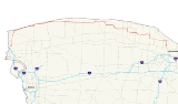
New York State Route 18
Encyclopedia
New York State Route 18 (NY 18) is an east–west state highway
in western New York
in the United States. It runs parallel to the south shore of Lake Ontario
for most of its length between Niagara County
and Monroe County
. NY 18, which also passes through Orleans County
, acts as a northerly alternate to NY 104
, another east–west route that parallels NY 18 to the south on Ridge Road
. The western terminus of NY 18 is at an intersection NY 104 outside the village of Lewiston. Its eastern terminus is at a junction NY 104 in an area of Rochester
known as Kodak Park
.
NY 18 was assigned in 1924 and originally extended from the Pennsylvania state line near Salamanca
to downtown Buffalo
via Dayton
and Hamburg
. It was extended northeast to Rochester via Niagara Falls
as part of the 1930 renumbering of state highways in New York and east to NY 250
in the town of Webster
by the following year. NY 18 was truncated on its west end to the town of Lewiston
in the early 1960s and on its east end to Rochester in the early 1970s.
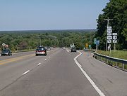
Although NY 18 is signed as east–west, it runs primarily north–south through the western portion of Niagara County. After leaving Niagara County, NY 18 shifts farther south, gradually moving away from the shore of Lake Ontario. In central Orleans County, NY 18 meets the Lake Ontario State Parkway
at the Lakeside Beach State Park
. The parkway then becomes the lakeside road, and NY 18 veers south to follow a more inland routing.
south of a complex grade-separated interchange that includes NY 18F
, NY 104, and the Robert Moses State Parkway
on the eastern edge of the village of Lewiston. From NY 104 east, a right-turn ramp allows access to Creek Road Extension, the first street that modern-day NY 18 occupies. NY 104 continues north from the ramp, passing over NY 18 westbound (which terminates at the merge ramp with NY 104 west) on its way to the village while NY 18 proceeds to the northeast on Creek Road Extension, bypassing Lewiston to the southeast. After 0.5 mile (0.80467 km), the highway curves to the north and meets NY 104 at an unconventional grade-separated interchange that has a pair of two-way ramps connecting the two state routes. NY 18 continues on, passing under NY 104 and paralleling the Robert Moses State Parkway as it proceeds north.
 At a wye in the Youngstown
hamlet of Blairville, NY 18 breaks from its north–south alignment and turns to the northeast before curving northward once more, returning to a perfect north–south alignment at an intersection with NY 93
in the hamlet of Towers Corners. Southwest of the Four Mile Creek State Park
, NY 18 turns a full 90 degrees to the east and begins to parallel the southern shore of Lake Ontario
. Here, NY 18 meets the northern terminus of NY 18F, changes names from Creek Road to Lake Road, and becomes part of the Seaway Trail
, a National Scenic Byway
. The route proceeds northeast to Four Mile Creek State Park, where it intersects the intersects the northern end of the Robert Moses State Parkway. East of the park, NY 18 gradually moves to the north, decreasing the area between the route and the lakeshore as it proceeds east.
Now in Wilson
and less than 100 yards (91.4 m) from the lakeshore, NY 18 meets the northern terminus of NY 425
. Farther east, in Olcott
, NY 18 intersects the northern extent of NY 78
. On the eastern edge of town, the route intersects Transit Road, which runs along the transit
line first surveyed by the Holland Land Company
. This portion of Transit Road does not meet the NY 78-occupied portion in Lockport
, however. After meeting the northern end of NY 148
in Somerset
, NY 18 intersects the northern terminus of NY 269
at the Niagara–Orleans County
line.
in Yates Center, north of Lyndonville
. While NY 63 ends here, Lyndonville Road continues north to the lake as County Route 63-1 (CR 63-1). This portion of Lyndonville Road was once part of NY 63. In Carlton
, NY 18 intersects the northern terminus of NY 279
, the last in a series of north–south routes that terminate at NY 18. Not far to the east, the route serves Lakeside Beach State Park
and indirectly connects to the western terminus of the Lake Ontario State Parkway
. At this point, the Seaway Trail leaves NY 18 to follow the parkway along the lakeshore.
East of the park, NY 18 breaks from the Lake Ontario shore and begins to make its way southward, curving to the southeast as it meets NY 98
north of the hamlet of Baldwin Corner. The routes converge to form a concurrency south to the hamlet, where NY 18 continues east. At the Carlton–Kendall
town line, NY 18 curves southeastward once again before reverting back to an easterly alignment in Kendall. After passing NY 237
south of the hamlet of Kendall, NY 18 intersects NY 272
at the Orleans–Monroe County
line. NY 18 merges onto the county line road, overlapping NY 272 along the county line for just under 1 miles (1.6 km) to the continuation of Roosevelt Highway, where NY 18 continues east into Monroe County.
, it meets NY 19
. NY 18 passes NY 260
before swerving northward onto West Avenue at the Hamlin–Parma
town line and proceeding eastward toward the village of Hilton
. In Hilton, NY 18 meets NY 259
(Lake Avenue) in the center of the village. The two routes overlap for a short distance east along Main Street before turning south to exit the village on South Avenue.
NY 18 and NY 259, now named Hilton – Parma Corners Road, remain concurrent until Parma Center, where NY 18 turns east to follow Parma Center Road for roughly 2 miles (3.2 km) through a rural portion of Parma. Parma Center Road ends upon intersecting NY 261
(Manitou Road) at the Parma–Greece
town line; as a result, NY 18 joins NY 261 for one block southward before returning east on Latta Road and entering the Rochester
suburb of Greece. NY 18 passes through the rural northwestern part of the town and the more developed, densely populated northeastern section, meeting NY 390
at exit 26 in the latter. The junction is the northernmost exit on NY 390 prior to its merging with the Lake Ontario State Parkway to the north.
A small distance east of NY 390, NY 18 passes Greece Arcadia High School and intersects Mount Read Boulevard in the hamlet of Mount Read before intersecting Dewey Avenue a half-mile to the east. NY 18 turns south onto Dewey Avenue; however, state maintenance continues to follow Latta Road east to where it crosses into the Rochester
city limits at Charlotte
. This section of Latta Road is designated as NY 941A, an unsigned reference route. NY 18, meanwhile, becomes maintained by Monroe County as part of the unsigned
CR 132, which follows Dewey Avenue north to its end at the Lake Ontario shoreline. The route continues south on Dewey Avenue to the Rochester city line, where CR 132 ends and maintenance of the route shifts to the city of Rochester. NY 18 ends about 1 miles (1.6 km) later at a junction with NY 104 in an industrialized area known as Kodak Park
.
that ran from the Pennsylvania state line at Ripley
to the mouth of the Niagara River
north of Youngstown
with a gap through the city of Buffalo
. North of Buffalo, Route 18 followed Niagara Falls Boulevard (modern NY 950K and U.S. Route 62
or US 62) to Niagara Falls
and current NY 104
and NY 18F
between Niagara Falls and Lake Ontario
. When the first set of posted routes in New York
were assigned in 1924, the portion of legislative Route 18 north of Buffalo became the basis for NY 34, which began at Main Street (NY 5
) in Buffalo and followed the path of legislative Route 18 through Niagara Falls and along the Niagara River
to Lake Ontario. NY 18 was assigned at the same time; however, it initially went from the Pennsylvania state line at Limestone
north to Buffalo along what is now US 219
, NY 417
, NY 353
and US 62. In Cattaraugus County
, NY 18 initially followed Leon and New Albion Roads between Cattaraugus
and Little Valley
.
NY 18 was extended northeastward to Rochester
as part of the 1930 renumbering of state highways in New York, effectively doubling the route's length. Instead of ending at the junction of Ohio and Main Streets (the latter then part of NY 5) in downtown Buffalo, NY 18 now overlapped with NY 5 along Main Street north to Niagara Falls Boulevard, where it turned north and proceeded to Lake Ontario over NY 34. At Youngstown, the route turned east, following a previously unnumbered alignment along the lakeshore to Rochester, where it ended at NY 31
(now NY 104
) in Kodak Park
. The route was extended further eastward to NY 250
in Webster
by the following year by way of East Ridge Road
, Culver Road, and Lake Road
. NY 18 was never extended eastward past its junction with NY 250.
While the general routing of NY 18 between Youngstown and Rochester was the same in 1930 as it is now, it initially followed a slightly different alignment through eastern Orleans County
and western Monroe County
. NY 18 broke from its current alignment at Carr Road and followed Carr, Kenmore and Kendall Roads through the town of Kendall
to the hamlet of Morton, from where it continued to Hamlin
via modern NY 360
and NY 19
. Additionally, NY 18 utilized Hamlin Center Road and what is now NY 260
between Hamlin and Clarkson–Hamlin Town Line Road.
 The majority of NY 18's routing south of the village of Lewiston was incorporated into the U.S. Highway System in the early 1930s after US 62 and US 219 were extended into New York and US 104 was assigned. NY 18 now began concurrent
to US 219 at the state line and overlapped the route northward to the city of Salamanca
. US 219 left NY 18 here, and the latter continued independently to the town of Dayton
, where it intersected US 62. From there, US 62 followed NY 18 north to a junction with US 104 (Main Street) in Niagara Falls. US 62 ended here, and NY 18 became concurrent to US 104 upon turning onto Main Street. The overlap ended in the village of Lewiston, where US 104 turned east to follow Ridge Road instead.
town line while the modern routing of NY 18 between the Orleans County line and Hamlin was designated as NY 360. The alignments of NY 360 and NY 18 between NY 272
and Hamlin were flipped ca. 1933, placing both routes on their modern routings through Hamlin. NY 18 was moved onto its present routing through Kendall ca. 1938, bypassing the hamlets of Kendall and Morton to the south. In the Buffalo area, NY 18 was realigned twice in the 1930s: first by 1935 to bypass downtown to the east on Bailey Avenue between Abbott Road and Main Street and again in the late 1930s to use Bailey Avenue and Eggert Road between Main Street and Niagara Falls Boulevard. The Cattaraugus – Little Valley segment of the route was realigned ca. 1934 to travel directly between the two locations. Its former routing via New Albion
became NY 18F; however, that designation was eliminated ca. 1938.
 In the late 1940s, NY 18 was rerouted between Lewiston and Youngstown to follow a more inland highway through western Niagara County
. The former routing of NY 18 alongside the Niagara River
was redesignated as NY 18F
. To the east in Rochester
, NY 18 was realigned in the early 1950s to follow East Ridge Road east to the then-southern terminus of the Sea Breeze Expressway. The route turned north, following the highway to its end at Culver Road, where it rejoined its pre-expressway alignment. Ca. 1962, the western terminus of NY 18 was moved north to its present location in Lewiston, eliminating the three lengthy overlaps that existed between Pennsylvania and Lewiston. The lone independent portion of NY 18 south of Lewiston became an extension of NY 353.
On January 1, 1970, NY 47
was extended northward to encompass the entirety of the now-complete Sea Breeze Expressway, creating an overlap with NY 18 between Ridge and Culver Roads. Prior to the extension, NY 47 had ended at Empire Boulevard (US 104, now NY 404
). The overlap proved to be temporary as NY 18 was truncated westward ca. 1973 to its current eastern terminus in Kodak Park. The former routing of NY 18 between NY 590 and NY 250 was redesignated as NY 941L, an unsigned reference route. East Ridge Road, meanwhile, was now devoid of any designations as US 104 had been shifted onto the Keeler Street Expressway several years before. As a result, ownership and maintenance of the Irondequoit
section of East Ridge Road was transferred to Monroe County
, which designated it as the unsigned CR 241. Culver Road, meanwhile, is now CR 120.
ca. 1962.
State highway
State highway, state road or state route can refer to one of three related concepts, two of them related to a state or provincial government in a country that is divided into states or provinces :#A...
in western New York
Western New York
Western New York is the westernmost region of the state of New York. It includes the cities of Buffalo, Rochester, Niagara Falls, the surrounding suburbs, as well as the outlying rural areas of the Great Lakes lowlands, the Genesee Valley, and the Southern Tier. Some historians, scholars and others...
in the United States. It runs parallel to the south shore of Lake Ontario
Lake Ontario
Lake Ontario is one of the five Great Lakes of North America. It is bounded on the north and southwest by the Canadian province of Ontario, and on the south by the American state of New York. Ontario, Canada's most populous province, was named for the lake. In the Wyandot language, ontarío means...
for most of its length between Niagara County
Niagara County, New York
Niagara County is a county located in the U.S. state of New York. As of the 2010 census, the population was 216,469. The county seat is Lockport. The county name is from the Iroquois word Onguiaahra; meaning the strait or thunder of waters. It is the location of Niagara Falls and Fort Niagara, and...
and Monroe County
Monroe County, New York
Monroe County is a county located in the U.S. state of New York. As of the 2010 census, the population was 744,344. It is named after James Monroe, fifth President of the United States of America. Its county seat is the city of Rochester....
. NY 18, which also passes through Orleans County
Orleans County, New York
As of the census of 2000, there were 44,171 people, 15,363 households, and 10,846 families residing in the county. The population density was 113 people per square mile . There were 17,347 housing units at an average density of 44 per square mile...
, acts as a northerly alternate to NY 104
New York State Route 104
New York State Route 104 is a long east–west state highway in Upstate New York, United States. It spans six counties and enters the vicinity of four cities—Niagara Falls, Lockport, Rochester, and Oswego—as it follows a routing largely parallel to that of the southern shoreline of Lake...
, another east–west route that parallels NY 18 to the south on Ridge Road
Ridge Road (Western New York)
Ridge Road is a east–west road that traverses four counties in Upstate New York in the United States. It is named for the rise atop which the road was built, a mound of sand and gravel that was formed when it was the shoreline of ancient Glacial Lake Iroquois...
. The western terminus of NY 18 is at an intersection NY 104 outside the village of Lewiston. Its eastern terminus is at a junction NY 104 in an area of Rochester
Rochester, New York
Rochester is a city in Monroe County, New York, south of Lake Ontario in the United States. Known as The World's Image Centre, it was also once known as The Flour City, and more recently as The Flower City...
known as Kodak Park
Kodak Park
Eastman Business Park, formerly Kodak Park, is a large manufacturing and industrial complex in the city of Rochester, New York, in the United States. The complex is run by Eastman Kodak and is located north of downtown Rochester and south of Lake Ontario...
.
NY 18 was assigned in 1924 and originally extended from the Pennsylvania state line near Salamanca
Salamanca (city), New York
Salamanca is a city in Cattaraugus County, New York, United States, located inside the Allegany Indian Reservation. The population was 6,097 at the 2000 census.-Geography:...
to downtown Buffalo
Buffalo, New York
Buffalo is the second most populous city in the state of New York, after New York City. Located in Western New York on the eastern shores of Lake Erie and at the head of the Niagara River across from Fort Erie, Ontario, Buffalo is the seat of Erie County and the principal city of the...
via Dayton
Dayton, New York
Dayton is a town in Cattaraugus County, New York, United States. The population was 1,945 at the 2000 census.The Town of Dayton is on the western border of Cattaraugus County.- History :...
and Hamburg
Hamburg (village), New York
Hamburg is a village in Erie County, New York, United States. The population was 10,116 at the 2000 census. The village is reportedly named after Hamburg, a city in Germany...
. It was extended northeast to Rochester via Niagara Falls
Niagara Falls, New York
Niagara Falls is a city in Niagara County, New York, United States. As of the 2010 census, the city had a total population of 50,193, down from the 55,593 recorded in the 2000 census. It is across the Niagara River from Niagara Falls, Ontario , both named after the famed Niagara Falls which they...
as part of the 1930 renumbering of state highways in New York and east to NY 250
New York State Route 250
New York State Route 250 is a north–south state highway in the eastern portion of Monroe County, New York, in the United States. It extends for just over from an intersection with NY 96 in the town of Perinton to a junction with Lake Road near the Lake Ontario shoreline in the...
in the town of Webster
Webster (town), New York
Webster is a town in the northeast corner of Monroe County, New York, United States. The town is named after orator and statesman Daniel Webster. The population was 42,641 at the 2010 census....
by the following year. NY 18 was truncated on its west end to the town of Lewiston
Lewiston (town), New York
Lewiston is a town in Niagara County, New York United States. The population was 16,262 at the 2010 census. The town and its contained village are named after Morgan Lewis, a governor of New York....
in the early 1960s and on its east end to Rochester in the early 1970s.
Although NY 18 is signed as east–west, it runs primarily north–south through the western portion of Niagara County. After leaving Niagara County, NY 18 shifts farther south, gradually moving away from the shore of Lake Ontario. In central Orleans County, NY 18 meets the Lake Ontario State Parkway
Lake Ontario State Parkway
The Lake Ontario State Parkway is a parkway along the southern shore of Lake Ontario in western New York in the United States. The western end of the highway is at a partial interchange within Lakeside Beach State Park in Carlton, Orleans County. Its eastern terminus is at an intersection with...
at the Lakeside Beach State Park
Lakeside Beach State Park
Lakeside Beach State Park is a New York state park, located in western New York in the Town of Carlton in Orleans County on the shore of Lake Ontario. The park may be accessed from Route 18. The park includes over one hundred campsites with electrical hook-ups, as well as a campground store...
. The parkway then becomes the lakeside road, and NY 18 veers south to follow a more inland routing.
Niagara County
NY 18 begins at a junction with NY 104New York State Route 104
New York State Route 104 is a long east–west state highway in Upstate New York, United States. It spans six counties and enters the vicinity of four cities—Niagara Falls, Lockport, Rochester, and Oswego—as it follows a routing largely parallel to that of the southern shoreline of Lake...
south of a complex grade-separated interchange that includes NY 18F
New York State Route 18F
New York State Route 18F is a long state highway in northwestern Niagara County, New York, United States. The southern terminus of the route is at an interchange with NY 104 and the Robert Moses State Parkway just east of the village of Lewiston. The northern terminus is at an...
, NY 104, and the Robert Moses State Parkway
Robert Moses State Parkway
The Robert Moses State Parkway is an long north–south highway in western Niagara County, New York, United States. Its southern terminus is at the LaSalle Expressway on the east bank of the Niagara River in Niagara Falls. The northern terminus is at NY 18 at Four Mile Creek State Park in...
on the eastern edge of the village of Lewiston. From NY 104 east, a right-turn ramp allows access to Creek Road Extension, the first street that modern-day NY 18 occupies. NY 104 continues north from the ramp, passing over NY 18 westbound (which terminates at the merge ramp with NY 104 west) on its way to the village while NY 18 proceeds to the northeast on Creek Road Extension, bypassing Lewiston to the southeast. After 0.5 mile (0.80467 km), the highway curves to the north and meets NY 104 at an unconventional grade-separated interchange that has a pair of two-way ramps connecting the two state routes. NY 18 continues on, passing under NY 104 and paralleling the Robert Moses State Parkway as it proceeds north.
Youngstown, New York
Youngstown is a village in Niagara County, New York, USA. The population was 1,957 at the 2000 census. It is part of the Buffalo–Niagara Falls Metropolitan Statistical Area....
hamlet of Blairville, NY 18 breaks from its north–south alignment and turns to the northeast before curving northward once more, returning to a perfect north–south alignment at an intersection with NY 93
New York State Route 93
New York State Route 93 is a state highway in western New York in the United States. It runs in a northwest–southeast direction between NY 18F near the Niagara River in the village of Youngstown and NY 5 just south of the village of Akron...
in the hamlet of Towers Corners. Southwest of the Four Mile Creek State Park
Four Mile Creek State Park
Four Mile Creek State Park is located in the Town of Porter in Niagara County, New York. The park is at the mouth of Four Mile Creek on the shore of Lake Ontario....
, NY 18 turns a full 90 degrees to the east and begins to parallel the southern shore of Lake Ontario
Lake Ontario
Lake Ontario is one of the five Great Lakes of North America. It is bounded on the north and southwest by the Canadian province of Ontario, and on the south by the American state of New York. Ontario, Canada's most populous province, was named for the lake. In the Wyandot language, ontarío means...
. Here, NY 18 meets the northern terminus of NY 18F, changes names from Creek Road to Lake Road, and becomes part of the Seaway Trail
Seaway Trail
The Great Lakes Seaway Trail, formerly named and commonly known as the Seaway Trail, is a National Scenic Byway in the northeastern United States, mostly contained in New York but with a small segment in Pennsylvania...
, a National Scenic Byway
National Scenic Byway
A National Scenic Byway is a road recognized by the United States Department of Transportation for its archeological, cultural, historic, natural, recreational, and/or scenic qualities. The program was established by Congress in 1991 to preserve and protect the nation's scenic but often...
. The route proceeds northeast to Four Mile Creek State Park, where it intersects the intersects the northern end of the Robert Moses State Parkway. East of the park, NY 18 gradually moves to the north, decreasing the area between the route and the lakeshore as it proceeds east.
Now in Wilson
Wilson, New York
Wilson is a village in Niagara County, New York, United States. The population was 1,213 at the 2000 census. The village is said to be named after Luther Wilson. It is part of the Buffalo–Niagara Falls Metropolitan Statistical Area....
and less than 100 yards (91.4 m) from the lakeshore, NY 18 meets the northern terminus of NY 425
New York State Route 425
New York State Route 425 is a New York state highway that runs from NY 18 in Wilson, New York on the shore of Lake Ontario to a connection with Interstate 290 in the Town of Tonawanda...
. Farther east, in Olcott
Olcott, New York
Olcott is a hamlet located in the Town of Newfane in Niagara County, New York, United States 14126. As of the 2000 census, this community population was 1,156. Most locals refer to it as Olcott Beach...
, NY 18 intersects the northern extent of NY 78
New York State Route 78
New York State Route 78 , most commonly known as Transit Road, is a state highway in Western New York, USA. While it is signed north–south, the lower portion runs in an east–west direction across Wyoming County, from its beginning north of the Village of Gainesville.NY 78 is...
. On the eastern edge of town, the route intersects Transit Road, which runs along the transit
Theodolite
A theodolite is a precision instrument for measuring angles in the horizontal and vertical planes. Theodolites are mainly used for surveying applications, and have been adapted for specialized purposes in fields like metrology and rocket launch technology...
line first surveyed by the Holland Land Company
Holland Land Company
The Holland Land Company was a purchaser of the western two-thirds of the western New York land tract known as the Phelps and Gorham Purchase. This tract was known thereafter as The Holland Purchase...
. This portion of Transit Road does not meet the NY 78-occupied portion in Lockport
Lockport (city), New York
Lockport is a city in Niagara County, New York, United States. The population was 21,165 at the 2010 census. The name is derived from a set of Erie canal locks within the city. Lockport is the county seat of Niagara County and is surrounded by the town of Lockport...
, however. After meeting the northern end of NY 148
New York State Route 148
New York State Route 148 is a state highway in Niagara County, New York, United States. It runs north–south between a junction with NY 104 in the town of Hartland and NY 18 north of the village of Barker. The entire length of NY 148 is maintained by Niagara County as County...
in Somerset
Somerset, New York
Somerset is a town in Niagara County, New York, United States. The population was 2,662 at the 2010 census. The town is believed to be named after Somerset, New Jersey, the source of some early settlers....
, NY 18 intersects the northern terminus of NY 269
New York State Route 269
New York State Route 269 is a north–south state highway in located in western New York in the United States. The highway runs for along the Niagara–Orleans county line and is named County Line Road. The southern terminus of NY 269 is at an intersection with NY 104 in the hamlet of...
at the Niagara–Orleans County
Orleans County, New York
As of the census of 2000, there were 44,171 people, 15,363 households, and 10,846 families residing in the county. The population density was 113 people per square mile . There were 17,347 housing units at an average density of 44 per square mile...
line.
Orleans County
Across the county line, NY 18 becomes the Roosevelt Highway. It continues across the northern edge of the county and the southern fringe of Lake Ontario, meeting the northern terminus of NY 63New York State Route 63
New York State Route 63 is a state highway in the western part of New York in the United States. The southern terminus of the route is at an intersection with NY 15 and NY 21 in the village of Wayland in Steuben County. Its northern end is at a junction with NY 18 in the town...
in Yates Center, north of Lyndonville
Lyndonville, New York
Lyndonville is a village in Orleans County, New York, United States. The population was 862 at the 2000 census. The name was selected because some of the early settlers were from Lyndon, Vermont...
. While NY 63 ends here, Lyndonville Road continues north to the lake as County Route 63-1 (CR 63-1). This portion of Lyndonville Road was once part of NY 63. In Carlton
Carlton, New York
Carlton is a town in Orleans County, New York, United States. The population was 2,960 at the 2000 census. The name is derived from Carleton, a shipbuilding district near Ottawa, Ontario, Canada....
, NY 18 intersects the northern terminus of NY 279
New York State Route 279
New York State Route 279 is a north–south state highway in Orleans County, New York, in the United States. The southern terminus of the route is at an intersection with NY 98 north of the village of Albion in the town of Gaines...
, the last in a series of north–south routes that terminate at NY 18. Not far to the east, the route serves Lakeside Beach State Park
Lakeside Beach State Park
Lakeside Beach State Park is a New York state park, located in western New York in the Town of Carlton in Orleans County on the shore of Lake Ontario. The park may be accessed from Route 18. The park includes over one hundred campsites with electrical hook-ups, as well as a campground store...
and indirectly connects to the western terminus of the Lake Ontario State Parkway
Lake Ontario State Parkway
The Lake Ontario State Parkway is a parkway along the southern shore of Lake Ontario in western New York in the United States. The western end of the highway is at a partial interchange within Lakeside Beach State Park in Carlton, Orleans County. Its eastern terminus is at an intersection with...
. At this point, the Seaway Trail leaves NY 18 to follow the parkway along the lakeshore.
East of the park, NY 18 breaks from the Lake Ontario shore and begins to make its way southward, curving to the southeast as it meets NY 98
New York State Route 98
New York State Route 98 is a state highway in the western part of New York in the United States. The southern terminus of the route is at an intersection with U.S. Route 219 in the town of Great Valley in Cattaraugus County...
north of the hamlet of Baldwin Corner. The routes converge to form a concurrency south to the hamlet, where NY 18 continues east. At the Carlton–Kendall
Kendall, New York
Kendall is a town in Orleans County, New York, United States. The population was 2,838 at the 2000 census. The Town of Kendall is in the northeast corner of the county and is northwest of Rochester.- History :...
town line, NY 18 curves southeastward once again before reverting back to an easterly alignment in Kendall. After passing NY 237
New York State Route 237
New York State Route 237 is a north–south state highway located in the western part of New York in the United States. The southern terminus of the route is at an intersection with NY 5 in Stafford. Its northern terminus is at an interchange with the Lake Ontario State Parkway...
south of the hamlet of Kendall, NY 18 intersects NY 272
New York State Route 272
New York State Route 272 is a north–south state highway in the western portion of New York in the United States. It extends for just over along the Orleans–Monroe county line from an intersection with NY 104 in Clarkson to the Lake Ontario shoreline just north of an interchange with the...
at the Orleans–Monroe County
Monroe County, New York
Monroe County is a county located in the U.S. state of New York. As of the 2010 census, the population was 744,344. It is named after James Monroe, fifth President of the United States of America. Its county seat is the city of Rochester....
line. NY 18 merges onto the county line road, overlapping NY 272 along the county line for just under 1 miles (1.6 km) to the continuation of Roosevelt Highway, where NY 18 continues east into Monroe County.
Monroe County
NY 18 remains Roosevelt Highway until Hamlin-Parma Town Line Road, where is becomes West Avenue. In the hamlet of HamlinHamlin, New York
Hamlin is a town in Monroe County, New York, United States. The population was 9,045 at the 2010 census.The Town of Hamlin is in the northwest part of the county and is the second largest town in area in the county.- History :...
, it meets NY 19
New York State Route 19
New York State Route 19 is a north–south state highway in Western New York in the United States. It is the longest state highway in that region, and the only other one besides NY 14 to completely transect the state from the Pennsylvania state line to the shore of Lake Ontario...
. NY 18 passes NY 260
New York State Route 260
New York State Route 260 is a north–south state highway in Monroe County, New York, in the United States. The southern terminus of the route is at an intersection with NY 31 in the town of Sweden. Its northern terminus is at a junction with the Lake Ontario State Parkway in the town of...
before swerving northward onto West Avenue at the Hamlin–Parma
Parma, New York
Parma is a town in Monroe County, New York, United States. The population was 15,633 at the 2010 census.The Town of Parma, then in Genesee County, was organized in 1808, named after Parma in Italy.-Geography:...
town line and proceeding eastward toward the village of Hilton
Hilton, New York
Hilton is a village in Monroe County, New York, United States. The population was 5,856 at the 2000 census. The community was named for the Rev. Charles A. Hilton.The Village of Hilton is within the Town of Parma.-History:...
. In Hilton, NY 18 meets NY 259
New York State Route 259
New York State Route 259 is a north–south state highway located west of Rochester in Monroe County, New York, United States. The southern terminus of the route is at NY 33A in the hamlet of West Chili within the town of Chili. Its northern terminus is at the Lake Ontario State Parkway in...
(Lake Avenue) in the center of the village. The two routes overlap for a short distance east along Main Street before turning south to exit the village on South Avenue.
NY 18 and NY 259, now named Hilton – Parma Corners Road, remain concurrent until Parma Center, where NY 18 turns east to follow Parma Center Road for roughly 2 miles (3.2 km) through a rural portion of Parma. Parma Center Road ends upon intersecting NY 261
New York State Route 261
New York State Route 261 is a north–south state highway located west of the city of Rochester in Monroe County, New York, in the United States. It extends for through mostly rural areas from an intersection with NY 104 on the Greece–Parma town line to a dead end at the Lake Ontario...
(Manitou Road) at the Parma–Greece
Greece (town), New York
Greece is a town in Monroe County, New York, United States. As of the 2010 United States census, the town had a total population of 96,095. The town motto is "Discover the Promise."...
town line; as a result, NY 18 joins NY 261 for one block southward before returning east on Latta Road and entering the Rochester
Rochester, New York
Rochester is a city in Monroe County, New York, south of Lake Ontario in the United States. Known as The World's Image Centre, it was also once known as The Flour City, and more recently as The Flower City...
suburb of Greece. NY 18 passes through the rural northwestern part of the town and the more developed, densely populated northeastern section, meeting NY 390
New York State Route 390
New York State Route 390 is a north–south state highway located along the western edge of the city of Rochester, New York, in the United States. The route, a limited-access northward continuation of Interstate 390 , extends for from I-490 in Gates to the Lake Ontario State Parkway in...
at exit 26 in the latter. The junction is the northernmost exit on NY 390 prior to its merging with the Lake Ontario State Parkway to the north.
A small distance east of NY 390, NY 18 passes Greece Arcadia High School and intersects Mount Read Boulevard in the hamlet of Mount Read before intersecting Dewey Avenue a half-mile to the east. NY 18 turns south onto Dewey Avenue; however, state maintenance continues to follow Latta Road east to where it crosses into the Rochester
Rochester, New York
Rochester is a city in Monroe County, New York, south of Lake Ontario in the United States. Known as The World's Image Centre, it was also once known as The Flour City, and more recently as The Flower City...
city limits at Charlotte
Charlotte, Rochester, New York
Charlotte is a neighborhood in Rochester, New York located at the mouth of the Genesee River along Lake Ontario. It is the home of the Port of Rochester and Charlotte High School.-Early Settlers:...
. This section of Latta Road is designated as NY 941A, an unsigned reference route. NY 18, meanwhile, becomes maintained by Monroe County as part of the unsigned
Unsigned highway
An unsigned highway is a highway that has been assigned a route number, but does not bear conventional road markings that would normally be used to identify the route with that number...
CR 132, which follows Dewey Avenue north to its end at the Lake Ontario shoreline. The route continues south on Dewey Avenue to the Rochester city line, where CR 132 ends and maintenance of the route shifts to the city of Rochester. NY 18 ends about 1 miles (1.6 km) later at a junction with NY 104 in an industrialized area known as Kodak Park
Kodak Park
Eastman Business Park, formerly Kodak Park, is a large manufacturing and industrial complex in the city of Rochester, New York, in the United States. The complex is run by Eastman Kodak and is located north of downtown Rochester and south of Lake Ontario...
.
Origins and early changes
In 1908, the New York State Legislature created Route 18, an unsigned legislative routeLegislative route
In United States, a legislative route or legislative highway is a highway defined by laws passed in a state legislature. The numbering of such highways may or may not correspond to the numbers familiar to the public as part of the state, U.S. highway, and Interstate highway systems...
that ran from the Pennsylvania state line at Ripley
Ripley, New York
Ripley is a town on Lake Erie in the westernmost part of Chautauqua County, New York, USA. The population was 2,636 at the 2000 census. The town was named after General Eleazer Wheelock Ripley. There are no incorporated villages in the town, but there is one CDP: Ripley.- History :Ripley was...
to the mouth of the Niagara River
Niagara River
The Niagara River flows north from Lake Erie to Lake Ontario. It forms part of the border between the Province of Ontario in Canada and New York State in the United States. There are differing theories as to the origin of the name of the river...
north of Youngstown
Youngstown, New York
Youngstown is a village in Niagara County, New York, USA. The population was 1,957 at the 2000 census. It is part of the Buffalo–Niagara Falls Metropolitan Statistical Area....
with a gap through the city of Buffalo
Buffalo, New York
Buffalo is the second most populous city in the state of New York, after New York City. Located in Western New York on the eastern shores of Lake Erie and at the head of the Niagara River across from Fort Erie, Ontario, Buffalo is the seat of Erie County and the principal city of the...
. North of Buffalo, Route 18 followed Niagara Falls Boulevard (modern NY 950K and U.S. Route 62
U.S. Route 62 in New York
U.S. Route 62 is a part of the U.S. Highway System that runs from the United States – Mexico border at El Paso, Texas, to Niagara Falls, New York. In the U.S. state of New York, US 62 extends from the New York – Pennsylvania border south of Jamestown to an intersection with...
or US 62) to Niagara Falls
Niagara Falls, New York
Niagara Falls is a city in Niagara County, New York, United States. As of the 2010 census, the city had a total population of 50,193, down from the 55,593 recorded in the 2000 census. It is across the Niagara River from Niagara Falls, Ontario , both named after the famed Niagara Falls which they...
and current NY 104
New York State Route 104
New York State Route 104 is a long east–west state highway in Upstate New York, United States. It spans six counties and enters the vicinity of four cities—Niagara Falls, Lockport, Rochester, and Oswego—as it follows a routing largely parallel to that of the southern shoreline of Lake...
and NY 18F
New York State Route 18F
New York State Route 18F is a long state highway in northwestern Niagara County, New York, United States. The southern terminus of the route is at an interchange with NY 104 and the Robert Moses State Parkway just east of the village of Lewiston. The northern terminus is at an...
between Niagara Falls and Lake Ontario
Lake Ontario
Lake Ontario is one of the five Great Lakes of North America. It is bounded on the north and southwest by the Canadian province of Ontario, and on the south by the American state of New York. Ontario, Canada's most populous province, was named for the lake. In the Wyandot language, ontarío means...
. When the first set of posted routes in New York
New York
New York is a state in the Northeastern region of the United States. It is the nation's third most populous state. New York is bordered by New Jersey and Pennsylvania to the south, and by Connecticut, Massachusetts and Vermont to the east...
were assigned in 1924, the portion of legislative Route 18 north of Buffalo became the basis for NY 34, which began at Main Street (NY 5
New York State Route 5
New York State Route 5 is a state highway that extends for across the state of New York in the United States. It begins at the Pennsylvania state line in the Chautauqua County town of Ripley and passes through Buffalo, Syracuse, Utica, Schenectady, and several other smaller cities and...
) in Buffalo and followed the path of legislative Route 18 through Niagara Falls and along the Niagara River
Niagara River
The Niagara River flows north from Lake Erie to Lake Ontario. It forms part of the border between the Province of Ontario in Canada and New York State in the United States. There are differing theories as to the origin of the name of the river...
to Lake Ontario. NY 18 was assigned at the same time; however, it initially went from the Pennsylvania state line at Limestone
Limestone, New York
Limestone is a hamlet in Cattaraugus County, New York, United States. The population was 411 at the 2000 census....
north to Buffalo along what is now US 219
U.S. Route 219 in New York
U.S. Route 219 is a part of the U.S. Highway System that runs from Rich Creek, Virginia, to West Seneca, New York. In the U.S. state of New York, US 219 extends from the Pennsylvania state line at Carrollton to an interchange with the New York State Thruway at exit 55 in West...
, NY 417
New York State Route 417
New York State Route 417 is an east–west state highway located in the Southern Tier of New York in the United States. It begins at exit 20 of the Southern Tier Expressway in the city of Salamanca and ends at a junction with NY 415 in Painted Post, west of the city of Corning...
, NY 353
New York State Route 353
New York State Route 353 is a north–south state highway located within Cattaraugus County, New York, in the United States. It extends for from an intersection with NY 417 in the city of Salamanca to a junction with U.S. Route 62 in the hamlet of Dayton...
and US 62. In Cattaraugus County
Cattaraugus County, New York
Cattaraugus County is a county located in the U.S. state of New York. As of the 2010 census, the population was 80,317. The county seat is Little Valley.-History:...
, NY 18 initially followed Leon and New Albion Roads between Cattaraugus
Cattaraugus, New York
Cattaraugus is a village in Cattaraugus County, New York, United States. The population was 1,075 at the 2000 census.The Village of Cattaraugus lies in the northeast part of the Town of New Albion, north of Salamanca, New York.- History :...
and Little Valley
Little Valley (village), New York
Little Valley is a village in Cattaraugus County, New York, USA. The population was 1,130 at the 2000 census.The Village of Little Valley is in the northwest corner of the Town of Little Valley....
.
NY 18 was extended northeastward to Rochester
Rochester, New York
Rochester is a city in Monroe County, New York, south of Lake Ontario in the United States. Known as The World's Image Centre, it was also once known as The Flour City, and more recently as The Flower City...
as part of the 1930 renumbering of state highways in New York, effectively doubling the route's length. Instead of ending at the junction of Ohio and Main Streets (the latter then part of NY 5) in downtown Buffalo, NY 18 now overlapped with NY 5 along Main Street north to Niagara Falls Boulevard, where it turned north and proceeded to Lake Ontario over NY 34. At Youngstown, the route turned east, following a previously unnumbered alignment along the lakeshore to Rochester, where it ended at NY 31
New York State Route 31
New York State Route 31 is a state highway that extends for across western and central New York in the United States. The western terminus of the route is at an intersection with NY 104 in the city of Niagara Falls. Its eastern terminus is at a traffic circle with NY 26 in Vernon...
(now NY 104
New York State Route 104
New York State Route 104 is a long east–west state highway in Upstate New York, United States. It spans six counties and enters the vicinity of four cities—Niagara Falls, Lockport, Rochester, and Oswego—as it follows a routing largely parallel to that of the southern shoreline of Lake...
) in Kodak Park
Kodak Park
Eastman Business Park, formerly Kodak Park, is a large manufacturing and industrial complex in the city of Rochester, New York, in the United States. The complex is run by Eastman Kodak and is located north of downtown Rochester and south of Lake Ontario...
. The route was extended further eastward to NY 250
New York State Route 250
New York State Route 250 is a north–south state highway in the eastern portion of Monroe County, New York, in the United States. It extends for just over from an intersection with NY 96 in the town of Perinton to a junction with Lake Road near the Lake Ontario shoreline in the...
in Webster
Webster (town), New York
Webster is a town in the northeast corner of Monroe County, New York, United States. The town is named after orator and statesman Daniel Webster. The population was 42,641 at the 2010 census....
by the following year by way of East Ridge Road
Ridge Road (Western New York)
Ridge Road is a east–west road that traverses four counties in Upstate New York in the United States. It is named for the rise atop which the road was built, a mound of sand and gravel that was formed when it was the shoreline of ancient Glacial Lake Iroquois...
, Culver Road, and Lake Road
Lake Road (Western New York)
Lake Road is an east–west roadway in western New York, United States. It extends for from the Irondequoit Bay Outlet Bridge in the Monroe County town of Webster to NY 14 in the Wayne County village of Sodus Point. As its name implies, it follows the southern shore of Lake Ontario for its...
. NY 18 was never extended eastward past its junction with NY 250.
While the general routing of NY 18 between Youngstown and Rochester was the same in 1930 as it is now, it initially followed a slightly different alignment through eastern Orleans County
Orleans County, New York
As of the census of 2000, there were 44,171 people, 15,363 households, and 10,846 families residing in the county. The population density was 113 people per square mile . There were 17,347 housing units at an average density of 44 per square mile...
and western Monroe County
Monroe County, New York
Monroe County is a county located in the U.S. state of New York. As of the 2010 census, the population was 744,344. It is named after James Monroe, fifth President of the United States of America. Its county seat is the city of Rochester....
. NY 18 broke from its current alignment at Carr Road and followed Carr, Kenmore and Kendall Roads through the town of Kendall
Kendall, New York
Kendall is a town in Orleans County, New York, United States. The population was 2,838 at the 2000 census. The Town of Kendall is in the northeast corner of the county and is northwest of Rochester.- History :...
to the hamlet of Morton, from where it continued to Hamlin
Hamlin, New York
Hamlin is a town in Monroe County, New York, United States. The population was 9,045 at the 2010 census.The Town of Hamlin is in the northwest part of the county and is the second largest town in area in the county.- History :...
via modern NY 360
New York State Route 360
New York State Route 360 is an east–west state highway located in northwestern Monroe County, New York, in the United States. It extends for through the town of Hamlin from an intersection with NY 272 at the Monroe–Orleans county line to a junction with NY 19 north of the hamlet of...
and NY 19
New York State Route 19
New York State Route 19 is a north–south state highway in Western New York in the United States. It is the longest state highway in that region, and the only other one besides NY 14 to completely transect the state from the Pennsylvania state line to the shore of Lake Ontario...
. Additionally, NY 18 utilized Hamlin Center Road and what is now NY 260
New York State Route 260
New York State Route 260 is a north–south state highway in Monroe County, New York, in the United States. The southern terminus of the route is at an intersection with NY 31 in the town of Sweden. Its northern terminus is at a junction with the Lake Ontario State Parkway in the town of...
between Hamlin and Clarkson–Hamlin Town Line Road.
Concurrency (road)
A concurrency, overlap, or coincidence in a road network is an instance of one physical road bearing two or more different highway, motorway, or other route numbers...
to US 219 at the state line and overlapped the route northward to the city of Salamanca
Salamanca (city), New York
Salamanca is a city in Cattaraugus County, New York, United States, located inside the Allegany Indian Reservation. The population was 6,097 at the 2000 census.-Geography:...
. US 219 left NY 18 here, and the latter continued independently to the town of Dayton
Dayton, New York
Dayton is a town in Cattaraugus County, New York, United States. The population was 1,945 at the 2000 census.The Town of Dayton is on the western border of Cattaraugus County.- History :...
, where it intersected US 62. From there, US 62 followed NY 18 north to a junction with US 104 (Main Street) in Niagara Falls. US 62 ended here, and NY 18 became concurrent to US 104 upon turning onto Main Street. The overlap ended in the village of Lewiston, where US 104 turned east to follow Ridge Road instead.
Realignments and truncation
By 1931, NY 18 was realigned to follow its current alignment between Hamlin and the ParmaParma, New York
Parma is a town in Monroe County, New York, United States. The population was 15,633 at the 2010 census.The Town of Parma, then in Genesee County, was organized in 1808, named after Parma in Italy.-Geography:...
town line while the modern routing of NY 18 between the Orleans County line and Hamlin was designated as NY 360. The alignments of NY 360 and NY 18 between NY 272
New York State Route 272
New York State Route 272 is a north–south state highway in the western portion of New York in the United States. It extends for just over along the Orleans–Monroe county line from an intersection with NY 104 in Clarkson to the Lake Ontario shoreline just north of an interchange with the...
and Hamlin were flipped ca. 1933, placing both routes on their modern routings through Hamlin. NY 18 was moved onto its present routing through Kendall ca. 1938, bypassing the hamlets of Kendall and Morton to the south. In the Buffalo area, NY 18 was realigned twice in the 1930s: first by 1935 to bypass downtown to the east on Bailey Avenue between Abbott Road and Main Street and again in the late 1930s to use Bailey Avenue and Eggert Road between Main Street and Niagara Falls Boulevard. The Cattaraugus – Little Valley segment of the route was realigned ca. 1934 to travel directly between the two locations. Its former routing via New Albion
New Albion, New York
New Albion is a town in Cattaraugus County, New York, United States. The population was 2,068 at the 2000 census. The town is named after Albion in Orleans County, New York, the source of some early settlers....
became NY 18F; however, that designation was eliminated ca. 1938.
Niagara County, New York
Niagara County is a county located in the U.S. state of New York. As of the 2010 census, the population was 216,469. The county seat is Lockport. The county name is from the Iroquois word Onguiaahra; meaning the strait or thunder of waters. It is the location of Niagara Falls and Fort Niagara, and...
. The former routing of NY 18 alongside the Niagara River
Niagara River
The Niagara River flows north from Lake Erie to Lake Ontario. It forms part of the border between the Province of Ontario in Canada and New York State in the United States. There are differing theories as to the origin of the name of the river...
was redesignated as NY 18F
New York State Route 18F
New York State Route 18F is a long state highway in northwestern Niagara County, New York, United States. The southern terminus of the route is at an interchange with NY 104 and the Robert Moses State Parkway just east of the village of Lewiston. The northern terminus is at an...
. To the east in Rochester
Rochester, New York
Rochester is a city in Monroe County, New York, south of Lake Ontario in the United States. Known as The World's Image Centre, it was also once known as The Flour City, and more recently as The Flower City...
, NY 18 was realigned in the early 1950s to follow East Ridge Road east to the then-southern terminus of the Sea Breeze Expressway. The route turned north, following the highway to its end at Culver Road, where it rejoined its pre-expressway alignment. Ca. 1962, the western terminus of NY 18 was moved north to its present location in Lewiston, eliminating the three lengthy overlaps that existed between Pennsylvania and Lewiston. The lone independent portion of NY 18 south of Lewiston became an extension of NY 353.
On January 1, 1970, NY 47
New York State Route 47
New York State Route 47 was a long state highway around Rochester in New York, United States. It formed a semicircle through the inner suburbs of Rochester, following expressways west and east of the city and surface streets south of Rochester. The western terminus of the route was at an...
was extended northward to encompass the entirety of the now-complete Sea Breeze Expressway, creating an overlap with NY 18 between Ridge and Culver Roads. Prior to the extension, NY 47 had ended at Empire Boulevard (US 104, now NY 404
New York State Route 404
New York State Route 404 is an east–west state highway located in eastern Monroe County, New York, in the United States. It extends for just over from an interchange with NY 590 in Irondequoit to an intersection with NY 104 on the Monroe–Wayne County line in the town of Webster...
). The overlap proved to be temporary as NY 18 was truncated westward ca. 1973 to its current eastern terminus in Kodak Park. The former routing of NY 18 between NY 590 and NY 250 was redesignated as NY 941L, an unsigned reference route. East Ridge Road, meanwhile, was now devoid of any designations as US 104 had been shifted onto the Keeler Street Expressway several years before. As a result, ownership and maintenance of the Irondequoit
Irondequoit, New York
Irondequoit is a town in Monroe County, New York, USA. As of the 2010 census, the coterminous town-CDP had a total population of 51,692...
section of East Ridge Road was transferred to Monroe County
Monroe County, New York
Monroe County is a county located in the U.S. state of New York. As of the 2010 census, the population was 744,344. It is named after James Monroe, fifth President of the United States of America. Its county seat is the city of Rochester....
, which designated it as the unsigned CR 241. Culver Road, meanwhile, is now CR 120.
Suffixed routes
NY 18 has had seven suffixed routes using six designations; only one, NY 18F, still exists. Most of the routes were renumbered when NY 18 was truncated to LewistonLewiston (town), New York
Lewiston is a town in Niagara County, New York United States. The population was 16,262 at the 2010 census. The town and its contained village are named after Morgan Lewis, a governor of New York....
ca. 1962.
- NY 18A was an alternate route of NY 18 between CollinsCollins, New YorkCollins is a town in Erie County, New York, United States. The town is on the south border of the county and is considered to be one of the "Southtowns" of Erie County. The population indicated by the 2000 census was 8,307. The population for 2007 is estimated at 7,092, a loss of 1,215...
and HamburgHamburg (village), New YorkHamburg is a village in Erie County, New York, United States. The population was 10,116 at the 2000 census. The village is reportedly named after Hamburg, a city in Germany...
. It was assigned ca. 1931 and mostly replaced with an extended NY 75New York State Route 75New York State Route 75 is a north–south state highway in Erie County, New York, in the United States. It extends for from an intersection with NY 39 in the Collins hamlet of Collins Center to an interchange with NY 5 in the town of Hamburg...
ca. 1962. - NY 18B was an alternate route of NY 18 through the eastern suburbs of BuffaloBuffalo, New YorkBuffalo is the second most populous city in the state of New York, after New York City. Located in Western New York on the eastern shores of Lake Erie and at the head of the Niagara River across from Fort Erie, Ontario, Buffalo is the seat of Erie County and the principal city of the...
. It was assigned ca. 1935 and mostly replaced with an extended NY 277New York State Route 277New York State Route 277 is a state highway in New York, USA. This highway is also called Union Road, along with other names. NY 277 is a major north–south road east of Buffalo, New York, through the middle of Erie County...
ca. 1962. - NY 18C was a short-lived alternate route of NY 18 through the eastern Buffalo suburbs. It was assigned ca. 1932 and began at NY 18 (now US 62) at Big Tree in HamburgHamburg (town), New YorkHamburg is a town in Erie County, New York, United States. As of the 2000 census, the town had a total population of 56,259.The Town of Hamburg is on the western border of the county and is south of Buffalo, New York. Hamburg is one of the "Southtowns" in Erie County...
and followed Big Tree Road and modern US 20U.S. Route 20 in New YorkU.S. Route 20 is a part of the U.S. Highway System that runs from Newport, Oregon, to Boston, Massachusetts. In the U.S. state of New York, US 20 extends from the Pennsylvania state line at Ripley to the Massachusetts state line in the Berkshire Mountains. US 20 is the longest...
to NY 35New York State Route 35 (1927 – early 1940s)New York State Route 35 was a state highway in the Finger Lakes region of New York, United States. The western terminus of the route was at NY 36 in the hamlet of Mumford within the town of Wheatland. Its eastern terminus was at U.S. Route 104 in the hamlet of Ontario Center within...
(now US 20 and NY 130New York State Route 130New York State Route 130 is a state highway entirely within Erie County, New York, United States. It runs east–west from U.S. Route 62 in Buffalo to the village of Depew, where it terminates at NY 78...
) in DepewDepew, New YorkDepew is a village in Erie County, New York, United States. The population was 16,629 at the 2000 census. It is part of the Buffalo–Niagara Falls Metropolitan Statistical Area...
. The Transit Road portion of the route overlapped with NY 78New York State Route 78New York State Route 78 , most commonly known as Transit Road, is a state highway in Western New York, USA. While it is signed north–south, the lower portion runs in an east–west direction across Wyoming County, from its beginning north of the Village of Gainesville.NY 78 is...
. NY 18C was truncated to consist only of the Transit Road portion ca. 1935 and removed entirely ca. 1938 as part of US 20's realignment through western New YorkWestern New YorkWestern New York is the westernmost region of the state of New York. It includes the cities of Buffalo, Rochester, Niagara Falls, the surrounding suburbs, as well as the outlying rural areas of the Great Lakes lowlands, the Genesee Valley, and the Southern Tier. Some historians, scholars and others...
. - NY 18D was a spur route linking NY 18 to the Whirlpool Rapids BridgeWhirlpool Rapids BridgeThe Whirlpool Rapids Bridge, commonly called the Whirlpool Bridge, and until 1937, known as the Lower Steel Arch Bridge, is a spandrel braced, riveted, two-hinged arch bridge. It crosses the international border between Canada and the United States, connecting the commercial downtown districts of...
north of downtown Niagara FallsNiagara Falls, New YorkNiagara Falls is a city in Niagara County, New York, United States. As of the 2010 census, the city had a total population of 50,193, down from the 55,593 recorded in the 2000 census. It is across the Niagara River from Niagara Falls, Ontario , both named after the famed Niagara Falls which they...
. It was assigned ca. 1932 and renumbered to NY 182New York State Route 182New York State Route 182 is a state highway in Niagara County, New York, United States. It serves as a signed connection between the Whirlpool Rapids Bridge over the Niagara River and the Niagara Falls International Airport east of the city of Niagara Falls...
ca. 1962. - NY 18E was a short spur assigned in the early 1930s to a connector between then-NY 18 (now NY 18FNew York State Route 18FNew York State Route 18F is a long state highway in northwestern Niagara County, New York, United States. The southern terminus of the route is at an interchange with NY 104 and the Robert Moses State Parkway just east of the village of Lewiston. The northern terminus is at an...
) and the original Queenston-Lewiston Bridge in Lewiston. It was removed in the early 1960s when the original bridge to QueenstonQueenston, OntarioQueenston is located 5 km north of Niagara Falls, Ontario in the Town of Niagara-on-the-Lake. The community is bordered by Highway 405 and the Niagara River; its location on the Niagara Escarpment led to the establishment of the now-defunct Queenston Quarry in the area...
was replaced with the modern Lewiston-Queenston BridgeLewiston-Queenston BridgeThe Lewiston–Queenston Bridge is an arch bridge that crosses the Niagara River gorge just south of the Niagara Escarpment. The bridge was officially opened on November 1, 1962. It is an international bridge between the United States and Canada. It connects Interstate 190 in the town of Lewiston,...
a short distance upstream. - The NY 18F designation has been used for two distinct highways:
- The first NY 18F was assigned ca. 1934 to NY 18's original routing between CattaraugusCattaraugus, New YorkCattaraugus is a village in Cattaraugus County, New York, United States. The population was 1,075 at the 2000 census.The Village of Cattaraugus lies in the northeast part of the Town of New Albion, north of Salamanca, New York.- History :...
and Little ValleyLittle Valley (village), New YorkLittle Valley is a village in Cattaraugus County, New York, USA. The population was 1,130 at the 2000 census.The Village of Little Valley is in the northwest corner of the Town of Little Valley....
. The designation was removed ca. 1938. - The current NY 18FNew York State Route 18FNew York State Route 18F is a long state highway in northwestern Niagara County, New York, United States. The southern terminus of the route is at an interchange with NY 104 and the Robert Moses State Parkway just east of the village of Lewiston. The northern terminus is at an...
(9.8 miles or 15.77 km) is an alternate route of NY 18 in western Niagara CountyNiagara County, New YorkNiagara County is a county located in the U.S. state of New York. As of the 2010 census, the population was 216,469. The county seat is Lockport. The county name is from the Iroquois word Onguiaahra; meaning the strait or thunder of waters. It is the location of Niagara Falls and Fort Niagara, and...
that serves the riverside villages of Lewiston and YoungstownYoungstown, New YorkYoungstown is a village in Niagara County, New York, USA. The population was 1,957 at the 2000 census. It is part of the Buffalo–Niagara Falls Metropolitan Statistical Area....
. It was assigned in the late 1940s.
- The first NY 18F was assigned ca. 1934 to NY 18's original routing between Cattaraugus