
New York State Route 90
Encyclopedia
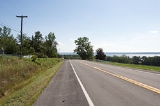
New York State Route 90 (NY 90) is a north–south state highway
in the Finger Lakes
region of New York
, United States
. All but five of the route's 53 miles (85 km) are located in Cayuga County
, with the remaining 5 miles (8 km) situated in Cortland County
. The southern terminus of the route is at an intersection with U.S. Route 11 and NY 41
in the village of Homer
. Its northern terminus is at a junction with NY 31
in the town of Montezuma
. Although the route is signed as north–south, the portion of NY 90 from King Ferry to Homer follows an east–west alignment.
It is not to be confused with Interstate 90, which also passes through Montezuma. The two 90s in fact cross, the only time when two same numbered highways intersect in the state, but there is no access between them.
 NY 90 begins at an intersection with U.S. Route 11 and NY 41
in the village of Homer
. It heads westward from the village and passes through rural portions of Cortland County
on its way into Cayuga County
. In Cayuga County, the route traverses the rural towns of Summerhill
and Locke
to the hamlet of Locke, where it intersects NY 38
. NY 90 continues west into Genoa
, intersecting with NY 34
and NY 34B
in the hamlets of Genoa and King Ferry, respectively, before turning northward as it approaches Cayuga Lake
.
The route heads northward along the eastern lakeshore, passing Long Point State Park
in the town of Ledyard
and Wells College
in the village of Aurora
. NY 90 continues north through Ledyard and southern Springport
to the village of Union Springs
, where NY 90 intersects NY 326
. Past this point, NY 90 runs through the remainder of Springport into the town of Aurelius
. Here, the route serves the village of Cayuga
before entering the town of Montezuma
and meeting U.S. Route 20 and NY 5
just north of the tip of Cayuga Lake and east of the Montezuma National Wildlife Refuge
.
North of Routes 5 and 20, NY 90 follows the Cayuga and Seneca Canal northward for a short distance before turning to the east as it enters the vicinity of the New York State Thruway
(Interstate 90). NY 90 parallels the Thruway for just under 1 miles (1.6 km) before turning back to the north and passing over the toll road as it enters the hamlet of Montezuma. NY 90 ends at an intersection with NY 31
north of the hamlet.
, Cortland
to King Ferry, where it ran along the eastern edge of Cayuga Lake
to its terminus at NY 31
in Montezuma
. In Cortland, NY 90 had an overlap with NY 13
along Tompkins Street from Owego Street to Main Street. At Main Street, NY 90 turned north to follow US 11 and NY 41
to Homer
, where NY 90 split from the two routes and headed west toward Cayuga County
.
In the early 1980s, the state of New York
assumed maintenance of an east–west highway connecting NY 90 in Virgil to the village of Dryden
. Around the same time, NY 90 was truncated on its southern end to its junction with US 11 and NY 41 in Homer. The Dryden–Virgil highway and NY 90's former routing from Virgil to Messengerville became NY 392
; from Virgil to Cortland, old NY 90 was redesignated as NY 215
. Today, at least two signs showing NY 90 signed concurrently with US 11 and NY 41 still exist in the village of Homer as remnants of its former southward extension.
State highway
State highway, state road or state route can refer to one of three related concepts, two of them related to a state or provincial government in a country that is divided into states or provinces :#A...
in the Finger Lakes
Finger Lakes
The Finger Lakes are a pattern of lakes in the west-central section of Upstate New York in the United States. They are a popular tourist destination. The lakes are long and thin , each oriented roughly on a north-south axis. The two longest, Cayuga Lake and Seneca Lake, are among the deepest in...
region of New York
New York
New York is a state in the Northeastern region of the United States. It is the nation's third most populous state. New York is bordered by New Jersey and Pennsylvania to the south, and by Connecticut, Massachusetts and Vermont to the east...
, United States
United States
The United States of America is a federal constitutional republic comprising fifty states and a federal district...
. All but five of the route's 53 miles (85 km) are located in Cayuga County
Cayuga County, New York
Cayuga County is a county located in the U.S. state of New York. It was named for one of the tribes of Indians in the Iroquois Confederation. Its county seat is Auburn.- History :...
, with the remaining 5 miles (8 km) situated in Cortland County
Cortland County, New York
Cortland County is a county located in the U.S. state of New York, named after Federico Van Cortlandt, president of the convention at Kingston that wrote the first New York State Constitution in 1777, and first lieutenant governor of the state. The county seat is Cortland...
. The southern terminus of the route is at an intersection with U.S. Route 11 and NY 41
New York State Route 41
New York State Route 41 is a north–south state highway in Central New York, United States. The southern terminus of the route is at an interchange with NY 17 in the town of Sanford. Its northern terminus is at an intersection with U.S. Route 20 in the village of Skaneateles...
in the village of Homer
Homer (village), New York
Homer is a village in Cortland County, New York, USA . The population was 3,368 at the 2000 census. The village name is derived from the surrounding town, which was named after the poet Homer....
. Its northern terminus is at a junction with NY 31
New York State Route 31
New York State Route 31 is a state highway that extends for across western and central New York in the United States. The western terminus of the route is at an intersection with NY 104 in the city of Niagara Falls. Its eastern terminus is at a traffic circle with NY 26 in Vernon...
in the town of Montezuma
Montezuma, New York
Montezuma is a town in Cayuga County, New York, United States. The population was 1,277 at the 2010 census.The Town of Montezuma is at the west border of Cayuga County and is northwest of Auburn, New York.- History :...
. Although the route is signed as north–south, the portion of NY 90 from King Ferry to Homer follows an east–west alignment.
It is not to be confused with Interstate 90, which also passes through Montezuma. The two 90s in fact cross, the only time when two same numbered highways intersect in the state, but there is no access between them.
Route description
New York State Route 41
New York State Route 41 is a north–south state highway in Central New York, United States. The southern terminus of the route is at an interchange with NY 17 in the town of Sanford. Its northern terminus is at an intersection with U.S. Route 20 in the village of Skaneateles...
in the village of Homer
Homer (village), New York
Homer is a village in Cortland County, New York, USA . The population was 3,368 at the 2000 census. The village name is derived from the surrounding town, which was named after the poet Homer....
. It heads westward from the village and passes through rural portions of Cortland County
Cortland County, New York
Cortland County is a county located in the U.S. state of New York, named after Federico Van Cortlandt, president of the convention at Kingston that wrote the first New York State Constitution in 1777, and first lieutenant governor of the state. The county seat is Cortland...
on its way into Cayuga County
Cayuga County, New York
Cayuga County is a county located in the U.S. state of New York. It was named for one of the tribes of Indians in the Iroquois Confederation. Its county seat is Auburn.- History :...
. In Cayuga County, the route traverses the rural towns of Summerhill
Summerhill, New York
Summerhill is a town in Cayuga County, New York, United States. The population was 1,217 at the 2010 census. The current town name is that of a location in Ireland....
and Locke
Locke, New York
Locke is a town in Cayuga County, New York, United States. The population was 1,951 at the 2010 census. The town was named after John Locke, an English philosopher and is the birthplace of Millard Fillmore, 13th President of the United States....
to the hamlet of Locke, where it intersects NY 38
New York State Route 38
New York State Route 38 is a north–south state highway in the Finger Lakes region of New York in the United States. Its southern terminus is at an intersection with NY 96 in the town of Owego in Tioga County. The northern terminus is at a junction with NY 104A in the town of...
. NY 90 continues west into Genoa
Genoa, New York
Genoa is a town in Cayuga County, New York, United States. The population was 1,935 at the 2010 census.The Town of Genoa is located in the southwest corner of the county and is north of Ithaca, New York...
, intersecting with NY 34
New York State Route 34
New York State Route 34 is a north–south New York state route located in Central New York. Its southern terminus is at the Pennsylvania state line in the village of Waverly, where it connects to Pennsylvania Route 199 and meets NY 17...
and NY 34B
New York State Route 34B
New York State Route 34B is a north–south state highway located within Tompkins and Cayuga Counties in Central New York. Its northern terminus is located at a junction with NY 34 by the hamlet of Fleming within the town of the same name in Cayuga County...
in the hamlets of Genoa and King Ferry, respectively, before turning northward as it approaches Cayuga Lake
Cayuga Lake
Cayuga Lake is the longest of central New York's glacial Finger Lakes, and is the second largest in surface area and second largest in volume. It is just under 40 miles long. Its average width is 1.7 miles , and it is at its widest point near Aurora...
.
The route heads northward along the eastern lakeshore, passing Long Point State Park
Long Point State Park - Finger Lakes
Long Point State Park is located on Cayuga Lake. This park is in the Town of Ledyard in Cayuga County, New York .The park offers a playground, picnic tables, hunting, fishing, and a boat launch.-External links:*...
in the town of Ledyard
Ledyard, New York
Ledyard is a town in Cayuga County, New York, United States. The population was 1,886 at the 2010 census. The name of the town is from General Benjamin Ledyard, an early settler....
and Wells College
Wells College
Wells College is a private coeducational liberal arts college located in Aurora, Cayuga County, New York, on the eastern shore of Cayuga Lake. Initially an all-women's institution, Wells became a co-ed college in Fall 2005....
in the village of Aurora
Aurora, Cayuga County, New York
Aurora is a village and college town in Cayuga County, in the Town of Ledyard, north of Ithaca, New York, United States. The village had a population of 720 at the 2000 census, of which more than 400 were college students....
. NY 90 continues north through Ledyard and southern Springport
Springport, New York
Springport is a town in Cayuga County, New York, United States. The population was 2,367 at the 2010 census. The name is derived from the local springs and lakeports....
to the village of Union Springs
Union Springs, New York
Union Springs is a village in Cayuga County, New York, United States. The population was at 1,074 people at the 2000 census. The name is derived from the mineral springs near the village....
, where NY 90 intersects NY 326
New York State Route 326
New York State Route 326 is a state highway in Cayuga County, New York, United States. NY 326 runs in a southwest to northeast direction from the village of Union Springs to the city of Auburn. The western terminus of the route is at an intersection with NY 90 near the northern...
. Past this point, NY 90 runs through the remainder of Springport into the town of Aurelius
Aurelius, New York
Aurelius is a town in Cayuga County, New York, USA. The population was 2,792 at the 2010 census. The town was named after the Roman Emperor Marcus Aurelius.The Town of Aurelius is at the western edge of the county and borders the City of Auburn....
. Here, the route serves the village of Cayuga
Cayuga, New York
Cayuga is a village in Cayuga County, New York, United States. The population was 509 at the 2000 census. The village derives its name from the local Cayuga tribe and the lake named after them....
before entering the town of Montezuma
Montezuma, New York
Montezuma is a town in Cayuga County, New York, United States. The population was 1,277 at the 2010 census.The Town of Montezuma is at the west border of Cayuga County and is northwest of Auburn, New York.- History :...
and meeting U.S. Route 20 and NY 5
New York State Route 5
New York State Route 5 is a state highway that extends for across the state of New York in the United States. It begins at the Pennsylvania state line in the Chautauqua County town of Ripley and passes through Buffalo, Syracuse, Utica, Schenectady, and several other smaller cities and...
just north of the tip of Cayuga Lake and east of the Montezuma National Wildlife Refuge
Montezuma National Wildlife Refuge
Montezuma National Wildlife Refuge is a wildlife preserve operated by the United States Fish and Wildlife Service, encompassing part of the Montezuma Swamp at the north end of Cayuga Lake...
.
North of Routes 5 and 20, NY 90 follows the Cayuga and Seneca Canal northward for a short distance before turning to the east as it enters the vicinity of the New York State Thruway
New York State Thruway
The New York State Thruway is a system of limited-access highways located within the state of New York in the United States. The system, known officially as the Governor Thomas E. Dewey Thruway for former New York Governor Thomas E. Dewey, is operated by the New York State Thruway Authority and...
(Interstate 90). NY 90 parallels the Thruway for just under 1 miles (1.6 km) before turning back to the north and passing over the toll road as it enters the hamlet of Montezuma. NY 90 ends at an intersection with NY 31
New York State Route 31
New York State Route 31 is a state highway that extends for across western and central New York in the United States. The western terminus of the route is at an intersection with NY 104 in the city of Niagara Falls. Its eastern terminus is at a traffic circle with NY 26 in Vernon...
north of the hamlet.
History
NY 90 was assigned as part of the 1930 renumbering of state highways in New York. It originally began at U.S. Route 11 in the hamlet of Messengerville and passed through VirgilVirgil, New York
Virgil is a town in Cortland County, New York, United States. The population was 2,287 at the 2000 census. The name is from the Roman poet Virgil...
, Cortland
Cortland, New York
Cortland is a city in Cortland County, New York, USA. As of the 2000 census, the city had a population of 18,740. It is the county seat of Cortland County.The City of Cortland, near the west border of the county, is surrounded by the Town of Cortlandville....
to King Ferry, where it ran along the eastern edge of Cayuga Lake
Cayuga Lake
Cayuga Lake is the longest of central New York's glacial Finger Lakes, and is the second largest in surface area and second largest in volume. It is just under 40 miles long. Its average width is 1.7 miles , and it is at its widest point near Aurora...
to its terminus at NY 31
New York State Route 31
New York State Route 31 is a state highway that extends for across western and central New York in the United States. The western terminus of the route is at an intersection with NY 104 in the city of Niagara Falls. Its eastern terminus is at a traffic circle with NY 26 in Vernon...
in Montezuma
Montezuma, New York
Montezuma is a town in Cayuga County, New York, United States. The population was 1,277 at the 2010 census.The Town of Montezuma is at the west border of Cayuga County and is northwest of Auburn, New York.- History :...
. In Cortland, NY 90 had an overlap with NY 13
New York State Route 13
New York State Route 13 is a state highway that runs mainly north–south for between NY 14 in Horseheads and NY 3 west of Pulaski in Central New York in the United States. In between, NY 13 intersects with Interstate 81 in Cortland and Pulaski and meets the New York...
along Tompkins Street from Owego Street to Main Street. At Main Street, NY 90 turned north to follow US 11 and NY 41
New York State Route 41
New York State Route 41 is a north–south state highway in Central New York, United States. The southern terminus of the route is at an interchange with NY 17 in the town of Sanford. Its northern terminus is at an intersection with U.S. Route 20 in the village of Skaneateles...
to Homer
Homer (village), New York
Homer is a village in Cortland County, New York, USA . The population was 3,368 at the 2000 census. The village name is derived from the surrounding town, which was named after the poet Homer....
, where NY 90 split from the two routes and headed west toward Cayuga County
Cayuga County, New York
Cayuga County is a county located in the U.S. state of New York. It was named for one of the tribes of Indians in the Iroquois Confederation. Its county seat is Auburn.- History :...
.
In the early 1980s, the state of New York
New York
New York is a state in the Northeastern region of the United States. It is the nation's third most populous state. New York is bordered by New Jersey and Pennsylvania to the south, and by Connecticut, Massachusetts and Vermont to the east...
assumed maintenance of an east–west highway connecting NY 90 in Virgil to the village of Dryden
Dryden (village), New York
Dryden is a village in Tompkins County, New York, United States. The population was 1,832 at the 2000 census. The name was assigned by a clerk interested in the classics to honor John Dryden, poet and playwright....
. Around the same time, NY 90 was truncated on its southern end to its junction with US 11 and NY 41 in Homer. The Dryden–Virgil highway and NY 90's former routing from Virgil to Messengerville became NY 392
New York State Route 392
New York State Route 392 is an east–west state highway in south-central New York, United States. The western terminus of the route is at an intersection with the concurrency of NY 13 and NY 38 in the village of Dryden in Tompkins County. Its eastern terminus is at a junction with U.S...
; from Virgil to Cortland, old NY 90 was redesignated as NY 215
New York State Route 215
New York State Route 215 is a north–south state highway located entirely within Cortland County, New York, in the United States. It extends for just over from an intersection with NY 392 in the town of Virgil to a junction with NY 13 in the city of Cortland...
. Today, at least two signs showing NY 90 signed concurrently with US 11 and NY 41 still exist in the village of Homer as remnants of its former southward extension.