
New York State Route 150
Encyclopedia
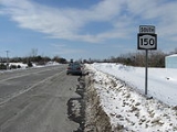
New York State Route 150 (NY 150) is a north–south state highway
in Rensselaer County, New York
, United States
. The southern terminus of the route is at NY 9J
in Castleton-on-Hudson
. Its northern terminus is at a junction with NY 66
in the hamlet of Wynantskill
, located within the town of North Greenbush
.
 NY 150 begins at an intersection with NY 9J
in the village of Castleton-on-Hudson
. It heads eastward through the village into the town of Schodack
, where it turns to follow a more northeasterly alignment along Moordener Kill. It passes through the hamlet of Brookview
and travels under Interstate 90 on its way to Schodack Center, where it meets U.S. Route 9 and U.S. Route 20. The route continues on, following the river to East Schodack
before turning to the north toward Shivers Corners, where it has a junction with NY 151
just before entering the town of Sand Lake
. The highway progresses northward, meeting NY 43
in the hamlet of West Sand Lake
on its way into the town of North Greenbush
. Here, it serves the hamlet of Snyders Corner before ending at an intersection with NY 66
in Wynantskill
.
northeastward to Schodack Center. The route was extended northeastward to NY 66
in Wynantskill
by the following year.
State highway
State highway, state road or state route can refer to one of three related concepts, two of them related to a state or provincial government in a country that is divided into states or provinces :#A...
in Rensselaer County, New York
Rensselaer County, New York
Rensselaer County is a county in the U.S. state of New York. As of the 2010 census, the population was 159,429. Its name is in honor of the family of Kiliaen van Rensselaer, the original Dutch owner of the land in the area. Its county seat is Troy...
, United States
United States
The United States of America is a federal constitutional republic comprising fifty states and a federal district...
. The southern terminus of the route is at NY 9J
New York State Route 9J
New York State Route 9J is a state highway in the Hudson Valley region of New York, United States, located in Columbia and Rensselaer counties...
in Castleton-on-Hudson
Castleton-on-Hudson, New York
Castleton-on-Hudson is a village located in the southwestern part of the town of Schodack in Rensselaer County, New York. The population was 1,619 at the 2000 census. The village is southeast of Albany, New York.- History :...
. Its northern terminus is at a junction with NY 66
New York State Route 66
New York State Route 66 is a state highway in the Capital District of New York in the United States. The route begins at an intersection with NY 23B in the Columbia County city of Hudson and ends at a junction with NY 2 in the Rensselaer County city of Troy...
in the hamlet of Wynantskill
Wynantskill, New York
-Demographics:As of the census of 2000, there were 3,018 people, 1,246 households, and 857 families residing in the CDP. The population density was 1,245.1 per square mile . There were 1,284 housing units at an average density of 529.7/sq mi...
, located within the town of North Greenbush
North Greenbush, New York
North Greenbush is a town in Rensselaer County, New York, United States. North Greenbush is located in the western part of the county. The population was 10,805 at the 2000 census....
.
Route description
New York State Route 9J
New York State Route 9J is a state highway in the Hudson Valley region of New York, United States, located in Columbia and Rensselaer counties...
in the village of Castleton-on-Hudson
Castleton-on-Hudson, New York
Castleton-on-Hudson is a village located in the southwestern part of the town of Schodack in Rensselaer County, New York. The population was 1,619 at the 2000 census. The village is southeast of Albany, New York.- History :...
. It heads eastward through the village into the town of Schodack
Schodack, New York
Schodack is a town in Rensselaer County, New York, United States. The population was 12,536 at the 2000 census. The town name is derived from the native word, Escotak. The town is in the southwestern part of the county. Schodack is southeast of Albany, New York.- History :Prior to the advent of...
, where it turns to follow a more northeasterly alignment along Moordener Kill. It passes through the hamlet of Brookview
Brookview, New York
Brookview, New York is a small hamlet located in Schodack, New York and just outside of Castleton, New York.Brookview is named for the Moordener Kill that runs through the hamlet. Brookview Road runs from East Greenbush through Brookview and then to Castleton-on-Hudson, New York. The hamlet of...
and travels under Interstate 90 on its way to Schodack Center, where it meets U.S. Route 9 and U.S. Route 20. The route continues on, following the river to East Schodack
East Schodack, New York
East Schodack, New York is a hamlet in Rensselaer County. It comprises the ZIP code of 12063.It is located southeast of Albany and Troy, New York, in the town of Schodack, New York...
before turning to the north toward Shivers Corners, where it has a junction with NY 151
New York State Route 151
New York State Route 151 is an state highway located in Rensselaer County, New York, in the United States. Its western terminus is at an interchange with U.S. Route 9 and US 20 in Rensselaer, and its eastern terminus is at a junction with NY 150 in Shivers Corners, a hamlet...
just before entering the town of Sand Lake
Sand Lake, New York
Sand Lake is a town in Rensselaer County, New York, United States. As of the 2000 census, the town had a population of 7,987. The Capital District Regional Planning Commission indicates it to be 8,336 as of September 2010. The town is in the south-central part of the county...
. The highway progresses northward, meeting NY 43
New York State Route 43
New York State Route 43 is a state highway in Rensselaer County, New York, United States. It extends for from Interstate 90 exit 8 in North Greenbush to the Massachusetts state line, where it continues into Williamstown as Massachusetts Route 43...
in the hamlet of West Sand Lake
West Sand Lake, New York
West Sand Lake is a hamlet in Rensselaer County, New York, United States. The population was 2,439 at the 2000 census. The community is located in the northwest corner of the town of Sand Lake.- Past residents of note :...
on its way into the town of North Greenbush
North Greenbush, New York
North Greenbush is a town in Rensselaer County, New York, United States. North Greenbush is located in the western part of the county. The population was 10,805 at the 2000 census....
. Here, it serves the hamlet of Snyders Corner before ending at an intersection with NY 66
New York State Route 66
New York State Route 66 is a state highway in the Capital District of New York in the United States. The route begins at an intersection with NY 23B in the Columbia County city of Hudson and ends at a junction with NY 2 in the Rensselaer County city of Troy...
in Wynantskill
Wynantskill, New York
-Demographics:As of the census of 2000, there were 3,018 people, 1,246 households, and 857 families residing in the CDP. The population density was 1,245.1 per square mile . There were 1,284 housing units at an average density of 529.7/sq mi...
.
History
NY 150 was assigned as part of the 1930 renumbering of state highways in New York to an alignment extending from Castleton-on-HudsonCastleton-on-Hudson, New York
Castleton-on-Hudson is a village located in the southwestern part of the town of Schodack in Rensselaer County, New York. The population was 1,619 at the 2000 census. The village is southeast of Albany, New York.- History :...
northeastward to Schodack Center. The route was extended northeastward to NY 66
New York State Route 66
New York State Route 66 is a state highway in the Capital District of New York in the United States. The route begins at an intersection with NY 23B in the Columbia County city of Hudson and ends at a junction with NY 2 in the Rensselaer County city of Troy...
in Wynantskill
Wynantskill, New York
-Demographics:As of the census of 2000, there were 3,018 people, 1,246 households, and 857 families residing in the CDP. The population density was 1,245.1 per square mile . There were 1,284 housing units at an average density of 529.7/sq mi...
by the following year.