
New York State Route 414
Encyclopedia
New York State Route 414 (NY 414) is a north–south state highway
in the Southern Tier
and Finger Lakes
regions of New York
in the United States. It extends for 83.2 miles (133.9 km) from an intersection with NY 352
in the Steuben County
city of Corning
to a junction with NY 104
in the Wayne County
town of Huron
. NY 414 spans five counties and roughly parallels NY 14
between Watkins Glen
and Huron. It intersects every major east–west arterial in western New York
, including Interstate 86
(I-86), U.S. Route 20
(US 20), and the New York State Thruway
(I-90
). The route passes through mostly rural areas as it travels between the several villages and cities along its routing.
In the 1930 renumbering of state highways in New York, the portion of modern NY 414 south of Seneca Falls
was designated as part of New York State Route 44, a route extending from Caton
to Wolcott
, while most of what is now NY 414 north of Seneca Falls became part of NY 89
. NY 44 was renumbered to NY 414 ca. 1935 to eliminate numerical duplication with US 44
. NY 414 was shifted onto its current alignment between Seneca Falls and Huron in the late 1950s, placing it on what had been NY 89 north of the hamlet of Magee and New York State Route 89A between Magee and the overlapped routes of US 20 and NY 5
.
(Denison Parkway) in the Steuben County
city of Corning
. It initially heads north on Cedar Street, following it past two largely commercial blocks that make up part of the Market Street Historic District
. Past the district, the route changes names to Centerway and crosses over the Chemung River
, which flows east–west through the center of Corning. Across the river, the route traverses more commercial neighborhoods to reach Pulteney Street, designated as NY 415
west of this point. Along this stretch, NY 414 passes the former Corning Armory
and the Corning Museum of Glass
, the latter located on the southwest corner of the junction with NY 415.
The route continues on, meeting the Southern Tier Expressway (STE) at exit 46. The composition of the exit's ramps is unorthodox in that the westbound on-ramp for I-86
and NY 17
is about 0.25 mile (0.402335 km) north of the remainder of the interchange. This layout is caused by several factors, including a nearby wye
connecting two Norfolk Southern Railway
lines—the east–west Southern Tier Line
and the north–south Corning Secondary. Another is the alignment of the STE itself, which runs in close proximity to NY 414 for a short distance as it bypasses northern Corning while avoiding the hilly terrain north of the city. North of the STE, the amount of development along the highway significantly decreases as it follows the Corning Secondary northeastward into the mountains that surround the city of Corning.
Over the next 7 miles (11 km), NY 414 and the rail line head due northeast through a valley surrounding Post Creek, traversing rural, isolated areas as both cross into Chemung County
. Past the county line, the valley turns to the north, reflecting a similar curve in the creek's routing. NY 414 and the Corning Secondary turn to match, and the route passes over the rail line via a bridge just east of the county line. As the highway heads north, it runs parallel to the county line for 4 miles (6 km) and passes through the hamlet of Chambers, the only developed location along an otherwise nondescript and undeveloped stretch that leads to Schuyler County
and the town of Dix
.
; however, NY 414 and the rail line continue northeast to the outskirts of Watkins Glen
, a village located inside of a wide valley holding Seneca Lake. At the western edge of the gully, the Corning Secondary breaks from NY 414 to follow the ridge north through Watkins Glen State Park
. The route, meanwhile, descends the side of the valley to enter Watkins Glen, where it merges with NY 14
at the foot of the hill.
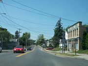
As one road, NY 14 and NY 414 travel down Franklin Street, the main thoroughfare of Watkins Glen. The routes pass by several blocks of homes as they follow the western base of the ravine and meet the east end of NY 329
, which ascends the side of the valley to serve Watkins Glen State Park. NY 414 continues to follow NY 14 to Watkins Glen's central business district, where NY 414 splits from the overlap to travel east at an intersection that also acts as the eastern terminus of NY 409
. From this point north, NY 14 and NY 414 follow opposite sides of Seneca Lake, with NY 414 running along the east lake shore.
The route initially heads east from Watkins Glen to skirt the southern edge of the lake, but turns north upon exiting the village and passing the southeastern tip of the waterbody. Just outside of Watkins Glen, NY 414 comes to a fork. The left fork carries NY 414 to the foot of the valley, bringing it very close to Seneca Lake. The right fork holds NY 79
, which travels up the side of the valley toward the village of Burdett
. NY 414 continues to parallel Seneca Lake, but gradually ascends the side of the lake valley as it heads north through the town of Hector
and enters Seneca County
.
, where it intersects and forms an overlap with NY 96A
. The two routes head due north from Lodi, crossing relatively flat farmland to reach the neighboring village of Ovid. At the northern edge of the community, NY 96A splits from the concurrency at a junction that also features NY 96
. While NY 96A travels to the west, NY 96—which enters Ovid from the east—forms a concurrency with NY 414 and follows the latter north out of the village. The overlap continues for 2.5 miles (4 km) across more farmland to a junction east of the Seneca Army Depot
. NY 96 heads northwest to straddle the eastern border of the depot while NY 414 progresses northward through the sparsely populated towns of Romulus
and Varick
.
 At the Varick–Fayette
town line 6.5 miles (10.5 km) north of NY 96, NY 414 intersects the eastern terminus of NY 336
. The route continues into Fayette, serving the town center and several large farms on its way into the town of Seneca Falls
. Just past the town line, the highway connects to Finger Lakes Regional Airport and passes by a large field that hosts the annual Empire Farm Days exhibition every August. North of here is the village of Seneca Falls
, where the farmlands are replaced by densely populated residential blocks. The highway follows Ovid Street across the Cayuga-Seneca Canal
to the village center, where it intersects US 20
and NY 5
at Fall Street. NY 414 turns west here, following both routes through the northwestern portion of Seneca Falls. Here, the route passes the National Women's Hall of Fame
and the Women's Rights National Historical Park
.
West of the village, US 20, NY 5, and NY 414 become a major commercial strip as it heads through an area situated between the villages of Seneca Falls and Waterloo
. Roughly midway between the two communities, NY 414 splits from US 20 and NY 5, becoming a commercial strip itself as it heads north through the northern portion of the town of Seneca Falls as Mound Road. Near the northern end of the strip, the route crosses the main line
of the Finger Lakes Railway
at a grade crossing. Past the crossing, the businesses give way to mostly undeveloped areas that persist into the neighboring town of Tyre
, where it intersects NY 318
in the small hamlet of Magee as Ridge Road. Just north of this intersection, NY 414 intersects the New York State Thruway
(I-90
) at exit 41. North of the Thruway, NY 414 maintains a constant north-northwest alignment across rolling farmland into Wayne County
.
, located on the Erie Canal
and the CSX Transportation
-owned Rochester Subdivision
. The route traverses the lightly populated southern half of the village prior to crossing the canal and the railroad to enter the village's center. As it proceeds through Clyde's business district, NY 414 intersects NY 31
, overlapping the route for just 150 feet (46 m) as NY 31 moves from Park to Genesee Streets. NY 414, meanwhile, continues north through the community on Glasgow Street, passing several blocks of homes and the village's high school
before exiting Clyde for more rural regions of Wayne County.
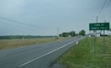
North of Clyde, NY 414 intersects a number of roads of local importance as it heads north-northwest across gentle terrain in the mostly open towns of Galen
and Rose
as Main Street. Aside from Rose and North Rose, the two communities of note along NY 414 between Clyde and the route's end, NY 414 traverses little more than nondescript cultivated fields. In the latter hamlet, NY 414 crosses the Ontario Midland Railroad
at a grade crossing in the center of the community. The route ends about 1.5 miles (2.4 km) north of North Rose at an intersection with NY 104
in the town of Huron
, located at the southern tip of Sodus Bay
. While NY 414 ends here, the right-of-way of the highway continues north along the eastern edge of the bay to the Lake Ontario
shoreline as the county-maintained Lake Bluff Road.
extending from Owego
to Seneca Falls
via Ovid
. From Ovid north to Seneca Falls, Route 36 followed what is now NY 414 (via NY 96
and County Route 148 or CR 148 in Romulus
). The portion of modern NY 414 between Watkins Glen
and Ovid became Route 45 on June 16, 1911; however, the route was realigned one year later to use what is now NY 96A
from Lodi
to Interlaken
instead. When the first set of posted routes in New York were assigned in 1924, the Owego–Interlaken and Ovid–Romulus segments of legislative Route 36 became part of NY 15, which continued northwest from Romulus to Rochester
. From Interlaken to Ovid, NY 15 initially followed the post-1912 alignment of legislative Route 45 to Lodi and the pre-1912 routing of Route 45 to Ovid.
The portion of legislative Route 45 south of Lodi remained unnumbered until ca. 1927 when it was designated as NY 78. By 1929, the route was extended northward over a new highway that followed the eastern edge of Seneca Lake between Ovid and Geneva. Also altered by this time was NY 15, which was realigned to follow what had been legislative Route 36 from Interlaken to Ovid. The former routing of NY 15 between Lodi and Ovid became part of the extended NY 78. The remainder of what is now NY 414 south of Watkins Glen and north of Romulus remained unnumbered until the 1930 renumbering of state highways in New York, even though parts of the highway were state-maintained as early as 1926. Among these state-maintained but unnumbered segments was the Romulus – Seneca Falls section of the old Route 36. Another significant section of continuous state maintenance existed from Clyde
to Huron
.
in Caton
to Ridge Road
(then NY 3
and later US 104) in Wolcott
. From Caton to Watkins Glen, NY 44 was assigned to what is now NY 225
and NY 414. North of Romulus, the route utilized the alignment of legislative Route 36 from Romulus to Seneca Falls and modern NY 89
from a junction east of Seneca Falls to Wolcott. In the vicinity of Seneca Falls, NY 44 overlapped with US 20
and NY 5
. US 44
was assigned ca. 1935; as a result, NY 44 was renumbered to NY 414 to eliminate numerical duplication with the new U.S. Highway.
Also assigned as part of the 1930 renumbering was NY 89, which utilized modern NY 414 north of the hamlet of Magee and the portion of Lake Bluff Road between the current NY 104
super two and Ridge Road. Between Magee and its current alignment east of the village of Seneca Falls, NY 89 used what is now NY 318
. In the early 1950s, a north–south connector between NY 89 in Magee and a junction with US 20 and NY 5 midway between Waterloo
and Seneca Falls was designated NY 89A. This route became part of a larger realignment of NY 414 in the late 1950s. In the rerouting, NY 414 was altered to overlap US 20 and NY 5 west out of Seneca Falls before following what had been NY 89A and NY 89 north to US 104 (Ridge Road) near the Huron hamlet of Resort. NY 89, meanwhile, was realigned to follow the former alignment of NY 414 to Wolcott.
NY 414 has been truncated twice over the years. The first of these occurred in the late 1940s when it was cut back on its southern end to Corning
. NY 414 was truncated to its current northern terminus in the mid-1960s following the construction of the super two
highway for US 104 between Sodus
and NY 414. US 104 continued to use the former alignment of NY 414 along Lake Bluff Road to connect to Ridge Road until the remainder of the super two east to Red Creek
was completed in the early 1970s. This portion of Lake Bluff Road is now maintained by Wayne County
as CR 254. In Seneca County
, NY 414 was realigned slightly in the early 1950s to bypass the hamlet of Romulus to the east, moving it off CR 148 and NY 96 and onto a new road leading directly to Ovid.
at Pulteney Street. The two routes then overlapped along Pulteney Street to Centerway, where they crossed the Chemung River
via Centerway and Pine Street. At Market Street, NY 17 and NY 44 turned east and remained concurrent to Conhocton Street, where NY 44 headed south to Caton while NY 17 continued east on Market to the hamlet of Gibson. When the overlap through Corning was eliminated in the late 1940s, NY 414 was truncated to the western end of the overlap at the intersection of Baker and Pulteney Streets.
NY 414 was re-extended across the Chemung River in the mid-1960s after NY 17 was moved onto Denison Parkway, a new divided highway
through Corning that bypassed Pulteney Street. NY 414 followed its original routing across the river to Market Street, then continued south on Pine Street for an additional block to intersect NY 17. The portion of NY 414 south of Pulteney Street was realigned slightly ca. 1979 following the completion of the Briscoe Bridge across the Chemung River. Instead of entering downtown Corning on Pine Street, NY 414 used Cedar Street instead. When the Corning Bypass (part of the Southern Tier Expressway) was built in the mid-1990s, Baker Street was split into two segments. NY 414 was subsequently rerouted onto its current alignment through the city.
State highway
State highway, state road or state route can refer to one of three related concepts, two of them related to a state or provincial government in a country that is divided into states or provinces :#A...
in the Southern Tier
Southern Tier
The Southern Tier is a geographical term that refers to the counties of New York State west of the Catskill Mountains along the northern border of Pennsylvania. It is a loosely defined term that generally includes the counties that border Pennsylvania west of Delaware County inclusive...
and Finger Lakes
Finger Lakes
The Finger Lakes are a pattern of lakes in the west-central section of Upstate New York in the United States. They are a popular tourist destination. The lakes are long and thin , each oriented roughly on a north-south axis. The two longest, Cayuga Lake and Seneca Lake, are among the deepest in...
regions of New York
New York
New York is a state in the Northeastern region of the United States. It is the nation's third most populous state. New York is bordered by New Jersey and Pennsylvania to the south, and by Connecticut, Massachusetts and Vermont to the east...
in the United States. It extends for 83.2 miles (133.9 km) from an intersection with NY 352
New York State Route 352
New York State Route 352 is a state highway in the Southern Tier of New York, United States. It generally parallels the Southern Tier Expressway from the village of Riverside east through the city of Corning to the city of Elmira...
in the Steuben County
Steuben County, New York
Steuben County is a county located in the U.S. state of New York. As of the 2010 census, the population was 98,990. Its name is in honor of Baron von Steuben, a German general who fought on the American side in the American Revolutionary War, though it is not pronounced the same...
city of Corning
Corning (city), New York
Corning is a city in Steuben County, New York, United States, on the Chemung River. The population was 10,842 at the 2000 census. It is named for Erastus Corning, an Albany financier and railroad executive who was an investor in the company that developed the community.- Overview :The city of...
to a junction with NY 104
New York State Route 104
New York State Route 104 is a long east–west state highway in Upstate New York, United States. It spans six counties and enters the vicinity of four cities—Niagara Falls, Lockport, Rochester, and Oswego—as it follows a routing largely parallel to that of the southern shoreline of Lake...
in the Wayne County
Wayne County, New York
Wayne County is a county located in the US state of New York. It is part of the Rochester, New York Metropolitan Statistical Area and lies on the south shore of Lake Ontario, forming part of the northern border of the United States with Canada. The name honors General Anthony Wayne, an American...
town of Huron
Huron, New York
Huron is a town in Wayne County, New York, United States. The population was 2,117 at the 2000 census. The town is named after the Huron Indians.The Town of Huron is in the northeastern part of the county and is east of Rochester, NY.- History :...
. NY 414 spans five counties and roughly parallels NY 14
New York State Route 14
New York State Route 14 is a state highway located in western New York in the United States. Along with NY 19, it is one of two routes to transect the state in a north–south fashion between the Pennsylvania border and Lake Ontario...
between Watkins Glen
Watkins Glen, New York
Watkins Glen is a village in Schuyler County, New York, United States. The population was 2,149 at the 2000 census. It is the county seat of Schuyler County.The Village of Watkins Glen lies on the border of the towns of Dix and Montour....
and Huron. It intersects every major east–west arterial in western New York
Western New York
Western New York is the westernmost region of the state of New York. It includes the cities of Buffalo, Rochester, Niagara Falls, the surrounding suburbs, as well as the outlying rural areas of the Great Lakes lowlands, the Genesee Valley, and the Southern Tier. Some historians, scholars and others...
, including Interstate 86
Interstate 86 (east)
Interstate 86 is an Interstate Highway that extends for through northwestern Pennsylvania and southern New York in the United States...
(I-86), U.S. Route 20
U.S. Route 20 in New York
U.S. Route 20 is a part of the U.S. Highway System that runs from Newport, Oregon, to Boston, Massachusetts. In the U.S. state of New York, US 20 extends from the Pennsylvania state line at Ripley to the Massachusetts state line in the Berkshire Mountains. US 20 is the longest...
(US 20), and the New York State Thruway
New York State Thruway
The New York State Thruway is a system of limited-access highways located within the state of New York in the United States. The system, known officially as the Governor Thomas E. Dewey Thruway for former New York Governor Thomas E. Dewey, is operated by the New York State Thruway Authority and...
(I-90
Interstate 90 in New York
Interstate 90 is a part of the Interstate Highway System that runs from Seattle, Washington, to Boston, Massachusetts. In the U.S. state of New York, I-90 extends from the Pennsylvania state line at Ripley to the Massachusetts state line at Canaan...
). The route passes through mostly rural areas as it travels between the several villages and cities along its routing.
In the 1930 renumbering of state highways in New York, the portion of modern NY 414 south of Seneca Falls
Seneca Falls (village), New York
Seneca Falls is a village in Seneca County, New York, United States. The population was 6,861 at the 2000 census. The village is in the Town of Seneca Falls, east of Geneva, New York. On March 16, 2010, village residents voted to dissolve the village, a move that would take effect at the end of 2011...
was designated as part of New York State Route 44, a route extending from Caton
Caton, New York
Caton is a town in Steuben County, New York, United States. The population was 2,097 at the 2000 census. The town is named after Richard Caton.The Town of Caton is in the southeast part of the county, south of Corning, New York.- History :...
to Wolcott
Wolcott (village), New York
Wolcott is a village in Wayne County, New York, United States. The population was 1,712 at the 2000 census. The name is from a former governor of Connecticut....
, while most of what is now NY 414 north of Seneca Falls became part of NY 89
New York State Route 89
New York State Route 89 is a north–south state highway in central New York in the United States. It extends for from an intersection with NY 13, NY 34, and NY 96 in the Tompkins County city of Ithaca to an interchange with NY 104 in the Wayne County town of town of Wolcott...
. NY 44 was renumbered to NY 414 ca. 1935 to eliminate numerical duplication with US 44
U.S. Route 44 in New York
U.S. Route 44 in the state of New York is a major east–west thoroughfare in the Hudson Valley region of the state. Its entire length is maintained by the New York State Department of Transportation, with the exception of the Mid-Hudson Bridge, which is maintained by the New York State Bridge...
. NY 414 was shifted onto its current alignment between Seneca Falls and Huron in the late 1950s, placing it on what had been NY 89 north of the hamlet of Magee and New York State Route 89A between Magee and the overlapped routes of US 20 and NY 5
New York State Route 5
New York State Route 5 is a state highway that extends for across the state of New York in the United States. It begins at the Pennsylvania state line in the Chautauqua County town of Ripley and passes through Buffalo, Syracuse, Utica, Schenectady, and several other smaller cities and...
.
Steuben and Chemung Counties
NY 414 begins at an intersection with NY 352New York State Route 352
New York State Route 352 is a state highway in the Southern Tier of New York, United States. It generally parallels the Southern Tier Expressway from the village of Riverside east through the city of Corning to the city of Elmira...
(Denison Parkway) in the Steuben County
Steuben County, New York
Steuben County is a county located in the U.S. state of New York. As of the 2010 census, the population was 98,990. Its name is in honor of Baron von Steuben, a German general who fought on the American side in the American Revolutionary War, though it is not pronounced the same...
city of Corning
Corning (city), New York
Corning is a city in Steuben County, New York, United States, on the Chemung River. The population was 10,842 at the 2000 census. It is named for Erastus Corning, an Albany financier and railroad executive who was an investor in the company that developed the community.- Overview :The city of...
. It initially heads north on Cedar Street, following it past two largely commercial blocks that make up part of the Market Street Historic District
Market Street Historic District (Corning, New York)
Market Street Historic Districtis a historic district located at Corning in Steuben County, New York.It was originally listed on the National Register of Historic Places in 1974 and its boundaries were increased in 2000....
. Past the district, the route changes names to Centerway and crosses over the Chemung River
Chemung River
The Chemung River is a tributary of the Susquehanna River, approximately long, in south central New York and northern Pennsylvania in the United States. It drains a mountainous region of the northern Allegheny Plateau in the Southern Tier of New York...
, which flows east–west through the center of Corning. Across the river, the route traverses more commercial neighborhoods to reach Pulteney Street, designated as NY 415
New York State Route 415
New York State Route 415 is a state highway located in Steuben County, New York, United States. It is a north–south trunk road that parallels in part, the Cohocton River, Interstate 86 and Interstate 390. The southern terminus of the route is at an intersection with NY 414 in...
west of this point. Along this stretch, NY 414 passes the former Corning Armory
Corning Armory
Corning Armory, since 1977 home to the Corning YMCA, is a historic National Guard armory building located at Corning in Steuben County, New York. It was designed by architect William Haugaard. The historic, main block of the armory is a T-shaped Gothic Revival edifice with terra cotta trim...
and the Corning Museum of Glass
Corning Museum of Glass
The Corning Museum of Glass, in Corning, New York, explores every facet of glass, including art, history, culture, science and technology, craft, and design....
, the latter located on the southwest corner of the junction with NY 415.
The route continues on, meeting the Southern Tier Expressway (STE) at exit 46. The composition of the exit's ramps is unorthodox in that the westbound on-ramp for I-86
Interstate 86 (east)
Interstate 86 is an Interstate Highway that extends for through northwestern Pennsylvania and southern New York in the United States...
and NY 17
New York State Route 17
New York State Route 17 is a state highway that extends for through the Southern Tier and Downstate regions of New York in the United States...
is about 0.25 mile (0.402335 km) north of the remainder of the interchange. This layout is caused by several factors, including a nearby wye
Wye (railroad)
A wye or triangular junction, in rail terminology, is a triangular shaped arrangement of rail tracks with a switch or set of points at each corner. In mainline railroads, this can be used at a rail junction, where three rail lines join, in order to allow trains to pass from any line to any other...
connecting two Norfolk Southern Railway
Norfolk Southern Railway
The Norfolk Southern Railway is a Class I railroad in the United States, owned by the Norfolk Southern Corporation. With headquarters in Norfolk, Virginia, the company operates 21,500 route miles in 22 eastern states, the District of Columbia and the province of Ontario, Canada...
lines—the east–west Southern Tier Line
Southern Tier Line
The Southern Tier Line is a railroad line owned and operated by the Norfolk Southern Railway in the U.S. states of New York and Pennsylvania. The line runs from Suffern, New York northwest to Buffalo, New York mostly along a former Erie Railroad line. From Suffern to Sparrowbush along which...
and the north–south Corning Secondary. Another is the alignment of the STE itself, which runs in close proximity to NY 414 for a short distance as it bypasses northern Corning while avoiding the hilly terrain north of the city. North of the STE, the amount of development along the highway significantly decreases as it follows the Corning Secondary northeastward into the mountains that surround the city of Corning.
Over the next 7 miles (11 km), NY 414 and the rail line head due northeast through a valley surrounding Post Creek, traversing rural, isolated areas as both cross into Chemung County
Chemung County, New York
Chemung County is a county located in the U.S. state of New York. It is part of the 'Elmira, New York Metropolitan Statistical Area' which encompasses all of Chemung County. As of the 2010 census, the population was 88,830. Its name is derived from the name of a Delaware Indian village . Its...
. Past the county line, the valley turns to the north, reflecting a similar curve in the creek's routing. NY 414 and the Corning Secondary turn to match, and the route passes over the rail line via a bridge just east of the county line. As the highway heads north, it runs parallel to the county line for 4 miles (6 km) and passes through the hamlet of Chambers, the only developed location along an otherwise nondescript and undeveloped stretch that leads to Schuyler County
Schuyler County, New York
As of the census of 2000, there were 19,224 people, 7,374 households, and 5,191 families residing in the county. The population density was 58 people per square mile . There were 9,181 housing units at an average density of 28 per square mile...
and the town of Dix
Dix, New York
Dix is a town in Schuyler County, New York, United States. The population was 4,197 at the 2000 census.The Town of Dix is located on the south border of the county and is north of Elmira, New York.- History :...
.
Schuyler County
In Dix, NY 414 makes a large reverse S-curve, turning to the east and northeast as it follows the Corning Secondary through another creek valley, this one surrounding Shequaga Creek. The creek eventually heads east toward Montour FallsMontour Falls, New York
Montour Falls is a village in Schuyler County, New York, United States. The population was 1,797 at the 2000 census. A waterfall in the village gives the village its name...
; however, NY 414 and the rail line continue northeast to the outskirts of Watkins Glen
Watkins Glen, New York
Watkins Glen is a village in Schuyler County, New York, United States. The population was 2,149 at the 2000 census. It is the county seat of Schuyler County.The Village of Watkins Glen lies on the border of the towns of Dix and Montour....
, a village located inside of a wide valley holding Seneca Lake. At the western edge of the gully, the Corning Secondary breaks from NY 414 to follow the ridge north through Watkins Glen State Park
Watkins Glen State Park
Watkins Glen State Park is located on the edge of the village of Watkins Glen, New York, south of Seneca Lake in Schuyler County. The main feature of the park is the hiking trail that climbs up through the gorge, passing over and under waterfalls...
. The route, meanwhile, descends the side of the valley to enter Watkins Glen, where it merges with NY 14
New York State Route 14
New York State Route 14 is a state highway located in western New York in the United States. Along with NY 19, it is one of two routes to transect the state in a north–south fashion between the Pennsylvania border and Lake Ontario...
at the foot of the hill.
As one road, NY 14 and NY 414 travel down Franklin Street, the main thoroughfare of Watkins Glen. The routes pass by several blocks of homes as they follow the western base of the ravine and meet the east end of NY 329
New York State Route 329
New York State Route 329 is a long state highway near Watkins Glen, New York, in the United States. The western terminus is at an intersection with Meads Hill Road in Dix. The eastern terminus is at a junction with NY 14 and NY 414 in Watkins Glen...
, which ascends the side of the valley to serve Watkins Glen State Park. NY 414 continues to follow NY 14 to Watkins Glen's central business district, where NY 414 splits from the overlap to travel east at an intersection that also acts as the eastern terminus of NY 409
New York State Route 409
New York State Route 409 is a state highway in Schuyler County, New York, in the United States. It is more of a spur route as it is connected to the state highway system at only one end. It begins at a grade crossing with the Norfolk Southern Railway in the town of Dix and ends in downtown...
. From this point north, NY 14 and NY 414 follow opposite sides of Seneca Lake, with NY 414 running along the east lake shore.
The route initially heads east from Watkins Glen to skirt the southern edge of the lake, but turns north upon exiting the village and passing the southeastern tip of the waterbody. Just outside of Watkins Glen, NY 414 comes to a fork. The left fork carries NY 414 to the foot of the valley, bringing it very close to Seneca Lake. The right fork holds NY 79
New York State Route 79
New York State Route 79 is an east–west state highway in the Southern Tier of New York, United States. The western terminus of the route is at the intersection with NY 414 near the southern end of Seneca Lake east of Watkins Glen...
, which travels up the side of the valley toward the village of Burdett
Burdett, New York
Burdett is a village in Schuyler County, New York, United States. The population was 357 at the 2000 census.The Village of Burdett in within the Town of Hector, east of Seneca Lake and northeast of Watkins Glen, New York.-Geography:...
. NY 414 continues to parallel Seneca Lake, but gradually ascends the side of the lake valley as it heads north through the town of Hector
Hector, New York
Hector is a town in the northeastern corner of Schuyler County, New York, United States. The population was 4,854 at the 2000 census. The town is named after Hector Ely, who at the time was the firstborn son of the town founders...
and enters Seneca County
Seneca County, New York
As of the census of 2000, there were 33,342 people, 12,630 households, and 8,626 families residing in the county. The population density was 103 people per square mile . There were 14,794 housing units at an average density of 46 per square mile...
.
Seneca County
Soon after entering Seneca County, NY 414 turns to the northeast, traveling away from Seneca Lake. It continues on a northeast alignment across more level terrain to the village of LodiLodi (village), New York
Lodi is a village in Seneca County, New York, USA. The population was 338 at the 2000 census.The Village of Lodi is in the north part of the Town of Lodi and is northwest of Ithaca, New York...
, where it intersects and forms an overlap with NY 96A
New York State Route 96A
New York State Route 96A is a state highway in Seneca County, New York, in the United States. It is a north–south road between Seneca Lake and Cayuga Lake, two of the Finger Lakes. NY 96A is two lanes wide for most of its length, with the exception of the long four-lane divided highway...
. The two routes head due north from Lodi, crossing relatively flat farmland to reach the neighboring village of Ovid. At the northern edge of the community, NY 96A splits from the concurrency at a junction that also features NY 96
New York State Route 96
New York State Route 96 is a northwest–southeast state highway in the Finger Lakes region of New York in the United States. The southern terminus of the route is at an interchange with NY 17 in the Southern Tier village of Owego, Tioga County. Its northern terminus is at a junction with...
. While NY 96A travels to the west, NY 96—which enters Ovid from the east—forms a concurrency with NY 414 and follows the latter north out of the village. The overlap continues for 2.5 miles (4 km) across more farmland to a junction east of the Seneca Army Depot
Seneca Army Depot
The former Seneca Army Depot occupied 10,587 acres between Seneca Lake and Cayuga Lake in Seneca County, New York. It was used as a munitions storage and disposal facility by the United States Army from 1941 until the 1990s. The Depot was listed in the 1995 Base Realignment and Closure Commission...
. NY 96 heads northwest to straddle the eastern border of the depot while NY 414 progresses northward through the sparsely populated towns of Romulus
Romulus, New York
Romulus is a town in Seneca County, New York, United States. The population was 2,036 at the 2000 census. The town is named after the mythical founder of Rome, Romulus, a name assigned by a clerk with an interest in the classics...
and Varick
Varick, New York
Varick is a town in Seneca County, New York, United States. The population was 1,729 at the 2000 census. The town is named after Richard Varick, an officer in the American Revolution, mayor of New York City, and uncle of the first Town Supervisor, Anthony Dey.The Town of Varick is located in the...
.
Fayette, New York
Fayette is a town in Seneca County, New York, United States. The population was 3,643 at the 2000 census.The Town of Fayette is on the western border of the county and is southeast of Geneva, New York.- History :...
town line 6.5 miles (10.5 km) north of NY 96, NY 414 intersects the eastern terminus of NY 336
New York State Route 336
New York State Route 336 is a short state highway in the Finger Lakes District of New York, USA. The highway is entirely within the Town of Fayette in Seneca County....
. The route continues into Fayette, serving the town center and several large farms on its way into the town of Seneca Falls
Seneca Falls (town), New York
Seneca Falls is a town in Seneca County, New York, United States. The population was 9,347 at the 2000 census.The Town of Seneca Falls contains a village also called Seneca Falls...
. Just past the town line, the highway connects to Finger Lakes Regional Airport and passes by a large field that hosts the annual Empire Farm Days exhibition every August. North of here is the village of Seneca Falls
Seneca Falls (village), New York
Seneca Falls is a village in Seneca County, New York, United States. The population was 6,861 at the 2000 census. The village is in the Town of Seneca Falls, east of Geneva, New York. On March 16, 2010, village residents voted to dissolve the village, a move that would take effect at the end of 2011...
, where the farmlands are replaced by densely populated residential blocks. The highway follows Ovid Street across the Cayuga-Seneca Canal
Cayuga-Seneca Canal
The Cayuga–Seneca Canal is a canal in New York, USA. It is now part of the New York State Canal System.The Cayuga–Seneca Canal connects the Erie Canal to Cayuga Lake and Seneca Lake. It is approximately long.-History:...
to the village center, where it intersects US 20
U.S. Route 20 in New York
U.S. Route 20 is a part of the U.S. Highway System that runs from Newport, Oregon, to Boston, Massachusetts. In the U.S. state of New York, US 20 extends from the Pennsylvania state line at Ripley to the Massachusetts state line in the Berkshire Mountains. US 20 is the longest...
and NY 5
New York State Route 5
New York State Route 5 is a state highway that extends for across the state of New York in the United States. It begins at the Pennsylvania state line in the Chautauqua County town of Ripley and passes through Buffalo, Syracuse, Utica, Schenectady, and several other smaller cities and...
at Fall Street. NY 414 turns west here, following both routes through the northwestern portion of Seneca Falls. Here, the route passes the National Women's Hall of Fame
National Women's Hall of Fame
The National Women's Hall of Fame is an American institution. It was created in 1969 by a group of people in Seneca Falls, New York, the location of the 1848 Women's Rights Convention...
and the Women's Rights National Historical Park
Women's Rights National Historical Park
Women's Rights National Historical Park was established in 1980, and covers a total of 6.83 acres of land in Seneca Falls and nearby Waterloo, New York....
.
West of the village, US 20, NY 5, and NY 414 become a major commercial strip as it heads through an area situated between the villages of Seneca Falls and Waterloo
Waterloo (village), New York
Waterloo is a village in and the county seat of Seneca County, New York, United States. The population was 5,111 at the 2000 census. The village is named after the Waterloo in Belgium, where Napoleon was defeated...
. Roughly midway between the two communities, NY 414 splits from US 20 and NY 5, becoming a commercial strip itself as it heads north through the northern portion of the town of Seneca Falls as Mound Road. Near the northern end of the strip, the route crosses the main line
Main line (railway)
The Mainline or Main line of a railway is a track that is used for through trains or is the principal artery of the system from which branch lines, yards, sidings and spurs are connected....
of the Finger Lakes Railway
Finger Lakes Railway
The Finger Lakes Railway is a class III railroad in the Finger Lakes region of New York.The Finger Lakes Railway began operation on July 23, 1995 and operates in Onondaga, Cayuga, Seneca, Ontario, Schuyler and Yates counties....
at a grade crossing. Past the crossing, the businesses give way to mostly undeveloped areas that persist into the neighboring town of Tyre
Tyre, New York
Tyre is a town in Seneca County, New York, United States. The population was 899 at the 2000 census. The town is named after the Lebanese city of Tyre.The Town of Tyre is located in the northeastern part of the county, northeast of Geneva, New York....
, where it intersects NY 318
New York State Route 318
New York State Route 318 is an east–west state highway in the Finger Lakes region of New York, United States. The western terminus of the route is at an intersection with NY 14 at New York State Thruway exit 42 in the town of Phelps. The eastern terminus is at an intersection that...
in the small hamlet of Magee as Ridge Road. Just north of this intersection, NY 414 intersects the New York State Thruway
New York State Thruway
The New York State Thruway is a system of limited-access highways located within the state of New York in the United States. The system, known officially as the Governor Thomas E. Dewey Thruway for former New York Governor Thomas E. Dewey, is operated by the New York State Thruway Authority and...
(I-90
Interstate 90 in New York
Interstate 90 is a part of the Interstate Highway System that runs from Seattle, Washington, to Boston, Massachusetts. In the U.S. state of New York, I-90 extends from the Pennsylvania state line at Ripley to the Massachusetts state line at Canaan...
) at exit 41. North of the Thruway, NY 414 maintains a constant north-northwest alignment across rolling farmland into Wayne County
Wayne County, New York
Wayne County is a county located in the US state of New York. It is part of the Rochester, New York Metropolitan Statistical Area and lies on the south shore of Lake Ontario, forming part of the northern border of the United States with Canada. The name honors General Anthony Wayne, an American...
.
Wayne County
Across the county line, NY 414 veers slightly to the west and east as it heads north across rural terrain to the village of ClydeClyde, New York
Clyde is a village in Wayne County, New York, United States. The population was 2,269 at the 2000 census.The Village of Clyde is in the Town of Galen and is northeast of Geneva, NY...
, located on the Erie Canal
Erie Canal
The Erie Canal is a waterway in New York that runs about from Albany, New York, on the Hudson River to Buffalo, New York, at Lake Erie, completing a navigable water route from the Atlantic Ocean to the Great Lakes. The canal contains 36 locks and encompasses a total elevation differential of...
and the CSX Transportation
CSX Transportation
CSX Transportation operates a Class I railroad in the United States known as the CSX Railroad. It is the main subsidiary of the CSX Corporation. The company is headquartered in Jacksonville, Florida, and owns approximately 21,000 route miles...
-owned Rochester Subdivision
Rochester Subdivision
The Rochester Subdivision is a railroad line owned by CSX Transportation in the U.S. state of New York. The line runs from Syracuse west to Buffalo along the former New York Central Railroad main line. At its east end, west of downtown Syracuse, the line becomes the Mohawk Subdivision...
. The route traverses the lightly populated southern half of the village prior to crossing the canal and the railroad to enter the village's center. As it proceeds through Clyde's business district, NY 414 intersects NY 31
New York State Route 31
New York State Route 31 is a state highway that extends for across western and central New York in the United States. The western terminus of the route is at an intersection with NY 104 in the city of Niagara Falls. Its eastern terminus is at a traffic circle with NY 26 in Vernon...
, overlapping the route for just 150 feet (46 m) as NY 31 moves from Park to Genesee Streets. NY 414, meanwhile, continues north through the community on Glasgow Street, passing several blocks of homes and the village's high school
Clyde-Savannah Central School District
The Clyde-Savannah Central School District is a public school district in New York State, USA that serves approximately 1100 students in the villages of Clyde and Savannah in Wayne County.The average class size is 17 students.Dr...
before exiting Clyde for more rural regions of Wayne County.
North of Clyde, NY 414 intersects a number of roads of local importance as it heads north-northwest across gentle terrain in the mostly open towns of Galen
Galen, New York
Galen is a town in Wayne County, New York, United States. The population was 4,439 at the 2000 census. The town is named after the classical physician Galen.The Town of Galen is on the south border of the county and west of Syracuse, New York....
and Rose
Rose, New York
Rose is a town in Wayne County, New York, United States. The population was 2,442 at the 2000 census. The town was named after Robert S. Rose, an early landowner of the town....
as Main Street. Aside from Rose and North Rose, the two communities of note along NY 414 between Clyde and the route's end, NY 414 traverses little more than nondescript cultivated fields. In the latter hamlet, NY 414 crosses the Ontario Midland Railroad
Ontario Midland Railroad
The Ontario Midland Railroad is an American railroad company operating in western New York.It was founded on 5 October 1979 and was created to save the entire Rome, Watertown and Ogdensburg Railroad line from Oswego's West Yard to Suspension Bridge in Niagara Falls. However, the railroad managed...
at a grade crossing in the center of the community. The route ends about 1.5 miles (2.4 km) north of North Rose at an intersection with NY 104
New York State Route 104
New York State Route 104 is a long east–west state highway in Upstate New York, United States. It spans six counties and enters the vicinity of four cities—Niagara Falls, Lockport, Rochester, and Oswego—as it follows a routing largely parallel to that of the southern shoreline of Lake...
in the town of Huron
Huron, New York
Huron is a town in Wayne County, New York, United States. The population was 2,117 at the 2000 census. The town is named after the Huron Indians.The Town of Huron is in the northeastern part of the county and is east of Rochester, NY.- History :...
, located at the southern tip of Sodus Bay
Sodus Bay
Sodus Bay is a bay on the south shore of Lake Ontario, one of the Great Lakes. Sodus Bay is located in Wayne County, New York, USA. Most of the bay is in the Town of Huron, but the western part is in the Town of Sodus....
. While NY 414 ends here, the right-of-way of the highway continues north along the eastern edge of the bay to the Lake Ontario
Lake Ontario
Lake Ontario is one of the five Great Lakes of North America. It is bounded on the north and southwest by the Canadian province of Ontario, and on the south by the American state of New York. Ontario, Canada's most populous province, was named for the lake. In the Wyandot language, ontarío means...
shoreline as the county-maintained Lake Bluff Road.
Origins
In 1908, the New York State Legislature created Route 36, an unsigned legislative routeLegislative route
In United States, a legislative route or legislative highway is a highway defined by laws passed in a state legislature. The numbering of such highways may or may not correspond to the numbers familiar to the public as part of the state, U.S. highway, and Interstate highway systems...
extending from Owego
Owego (village), New York
Owego is a village in and the county seat of Tioga County, New York, USA. The population was 3,911 at the 2000 census. It is part of the Binghamton Metropolitan Statistical Area...
to Seneca Falls
Seneca Falls (village), New York
Seneca Falls is a village in Seneca County, New York, United States. The population was 6,861 at the 2000 census. The village is in the Town of Seneca Falls, east of Geneva, New York. On March 16, 2010, village residents voted to dissolve the village, a move that would take effect at the end of 2011...
via Ovid
Ovid (village), New York
Ovid is a village in and one of the two county seats of Seneca County, New York, United States. The population was 612 at the 2000 census. The town was named by a clerk interested in the classics ....
. From Ovid north to Seneca Falls, Route 36 followed what is now NY 414 (via NY 96
New York State Route 96
New York State Route 96 is a northwest–southeast state highway in the Finger Lakes region of New York in the United States. The southern terminus of the route is at an interchange with NY 17 in the Southern Tier village of Owego, Tioga County. Its northern terminus is at a junction with...
and County Route 148 or CR 148 in Romulus
Romulus, New York
Romulus is a town in Seneca County, New York, United States. The population was 2,036 at the 2000 census. The town is named after the mythical founder of Rome, Romulus, a name assigned by a clerk with an interest in the classics...
). The portion of modern NY 414 between Watkins Glen
Watkins Glen, New York
Watkins Glen is a village in Schuyler County, New York, United States. The population was 2,149 at the 2000 census. It is the county seat of Schuyler County.The Village of Watkins Glen lies on the border of the towns of Dix and Montour....
and Ovid became Route 45 on June 16, 1911; however, the route was realigned one year later to use what is now NY 96A
New York State Route 96A
New York State Route 96A is a state highway in Seneca County, New York, in the United States. It is a north–south road between Seneca Lake and Cayuga Lake, two of the Finger Lakes. NY 96A is two lanes wide for most of its length, with the exception of the long four-lane divided highway...
from Lodi
Lodi (village), New York
Lodi is a village in Seneca County, New York, USA. The population was 338 at the 2000 census.The Village of Lodi is in the north part of the Town of Lodi and is northwest of Ithaca, New York...
to Interlaken
Interlaken, New York
Interlaken is a village in Seneca County, New York, United States. The population was 674 at the 2000 census. The name is related to the village's position between two lakes....
instead. When the first set of posted routes in New York were assigned in 1924, the Owego–Interlaken and Ovid–Romulus segments of legislative Route 36 became part of NY 15, which continued northwest from Romulus to Rochester
Rochester, New York
Rochester is a city in Monroe County, New York, south of Lake Ontario in the United States. Known as The World's Image Centre, it was also once known as The Flour City, and more recently as The Flower City...
. From Interlaken to Ovid, NY 15 initially followed the post-1912 alignment of legislative Route 45 to Lodi and the pre-1912 routing of Route 45 to Ovid.
The portion of legislative Route 45 south of Lodi remained unnumbered until ca. 1927 when it was designated as NY 78. By 1929, the route was extended northward over a new highway that followed the eastern edge of Seneca Lake between Ovid and Geneva. Also altered by this time was NY 15, which was realigned to follow what had been legislative Route 36 from Interlaken to Ovid. The former routing of NY 15 between Lodi and Ovid became part of the extended NY 78. The remainder of what is now NY 414 south of Watkins Glen and north of Romulus remained unnumbered until the 1930 renumbering of state highways in New York, even though parts of the highway were state-maintained as early as 1926. Among these state-maintained but unnumbered segments was the Romulus – Seneca Falls section of the old Route 36. Another significant section of continuous state maintenance existed from Clyde
Clyde, New York
Clyde is a village in Wayne County, New York, United States. The population was 2,269 at the 2000 census.The Village of Clyde is in the Town of Galen and is northeast of Geneva, NY...
to Huron
Huron, New York
Huron is a town in Wayne County, New York, United States. The population was 2,117 at the 2000 census. The town is named after the Huron Indians.The Town of Huron is in the northeastern part of the county and is east of Rochester, NY.- History :...
.
Designation
In the 1930 renumbering, NY 78 was split into two new routes. North of Ovid, it served as the basis for NY 15A, which continued southeast to Interlaken over the original alignment of NY 15. The remainder of NY 78 became part of NY 44, a lengthy north–south route extending from NY 13New York State Route 13
New York State Route 13 is a state highway that runs mainly north–south for between NY 14 in Horseheads and NY 3 west of Pulaski in Central New York in the United States. In between, NY 13 intersects with Interstate 81 in Cortland and Pulaski and meets the New York...
in Caton
Caton, New York
Caton is a town in Steuben County, New York, United States. The population was 2,097 at the 2000 census. The town is named after Richard Caton.The Town of Caton is in the southeast part of the county, south of Corning, New York.- History :...
to Ridge Road
Ridge Road (Western New York)
Ridge Road is a east–west road that traverses four counties in Upstate New York in the United States. It is named for the rise atop which the road was built, a mound of sand and gravel that was formed when it was the shoreline of ancient Glacial Lake Iroquois...
(then NY 3
New York State Route 3
New York State Route 3 is a major east–west state highway in New York, United States, that connects central New York to the North Country region near the Canadian border via Adirondack Park. The route extends for between its western terminus at an intersection with NY 104A in the Cayuga...
and later US 104) in Wolcott
Wolcott (village), New York
Wolcott is a village in Wayne County, New York, United States. The population was 1,712 at the 2000 census. The name is from a former governor of Connecticut....
. From Caton to Watkins Glen, NY 44 was assigned to what is now NY 225
New York State Route 225
New York State Route 225 is a state highway in the Southern Tier of New York, United States. It is a loop route off NY 352 that connects the town of Big Flats and the city of Corning to the hamlet of Caton within the town of the same name...
and NY 414. North of Romulus, the route utilized the alignment of legislative Route 36 from Romulus to Seneca Falls and modern NY 89
New York State Route 89
New York State Route 89 is a north–south state highway in central New York in the United States. It extends for from an intersection with NY 13, NY 34, and NY 96 in the Tompkins County city of Ithaca to an interchange with NY 104 in the Wayne County town of town of Wolcott...
from a junction east of Seneca Falls to Wolcott. In the vicinity of Seneca Falls, NY 44 overlapped with US 20
U.S. Route 20 in New York
U.S. Route 20 is a part of the U.S. Highway System that runs from Newport, Oregon, to Boston, Massachusetts. In the U.S. state of New York, US 20 extends from the Pennsylvania state line at Ripley to the Massachusetts state line in the Berkshire Mountains. US 20 is the longest...
and NY 5
New York State Route 5
New York State Route 5 is a state highway that extends for across the state of New York in the United States. It begins at the Pennsylvania state line in the Chautauqua County town of Ripley and passes through Buffalo, Syracuse, Utica, Schenectady, and several other smaller cities and...
. US 44
U.S. Route 44 in New York
U.S. Route 44 in the state of New York is a major east–west thoroughfare in the Hudson Valley region of the state. Its entire length is maintained by the New York State Department of Transportation, with the exception of the Mid-Hudson Bridge, which is maintained by the New York State Bridge...
was assigned ca. 1935; as a result, NY 44 was renumbered to NY 414 to eliminate numerical duplication with the new U.S. Highway.
Also assigned as part of the 1930 renumbering was NY 89, which utilized modern NY 414 north of the hamlet of Magee and the portion of Lake Bluff Road between the current NY 104
New York State Route 104
New York State Route 104 is a long east–west state highway in Upstate New York, United States. It spans six counties and enters the vicinity of four cities—Niagara Falls, Lockport, Rochester, and Oswego—as it follows a routing largely parallel to that of the southern shoreline of Lake...
super two and Ridge Road. Between Magee and its current alignment east of the village of Seneca Falls, NY 89 used what is now NY 318
New York State Route 318
New York State Route 318 is an east–west state highway in the Finger Lakes region of New York, United States. The western terminus of the route is at an intersection with NY 14 at New York State Thruway exit 42 in the town of Phelps. The eastern terminus is at an intersection that...
. In the early 1950s, a north–south connector between NY 89 in Magee and a junction with US 20 and NY 5 midway between Waterloo
Waterloo (village), New York
Waterloo is a village in and the county seat of Seneca County, New York, United States. The population was 5,111 at the 2000 census. The village is named after the Waterloo in Belgium, where Napoleon was defeated...
and Seneca Falls was designated NY 89A. This route became part of a larger realignment of NY 414 in the late 1950s. In the rerouting, NY 414 was altered to overlap US 20 and NY 5 west out of Seneca Falls before following what had been NY 89A and NY 89 north to US 104 (Ridge Road) near the Huron hamlet of Resort. NY 89, meanwhile, was realigned to follow the former alignment of NY 414 to Wolcott.
NY 414 has been truncated twice over the years. The first of these occurred in the late 1940s when it was cut back on its southern end to Corning
Corning (city), New York
Corning is a city in Steuben County, New York, United States, on the Chemung River. The population was 10,842 at the 2000 census. It is named for Erastus Corning, an Albany financier and railroad executive who was an investor in the company that developed the community.- Overview :The city of...
. NY 414 was truncated to its current northern terminus in the mid-1960s following the construction of the super two
Super two
A super two, super two-lane highway or wide two lane is a two-lane surface road built to high standards, typically including partial control of access, occasional passing lanes and hard shoulders...
highway for US 104 between Sodus
Sodus (village), New York
Sodus is a village in Wayne County, New York, USA. The population was 1,735 at the 2000 census.The Village of Sodus is near the center of the Town of Sodus and lies between Rochester and Syracuse. The village contains the government center for the Town of Sodus.- History :The village area was part...
and NY 414. US 104 continued to use the former alignment of NY 414 along Lake Bluff Road to connect to Ridge Road until the remainder of the super two east to Red Creek
Red Creek, New York
Red Creek is a village in Wayne County, New York, United States. The population was 521 at the 2000 census.The Village of Red Creek is in the eastern part of the Town of Wolcott. The village is west of Syracuse, New York.- History :...
was completed in the early 1970s. This portion of Lake Bluff Road is now maintained by Wayne County
Wayne County, New York
Wayne County is a county located in the US state of New York. It is part of the Rochester, New York Metropolitan Statistical Area and lies on the south shore of Lake Ontario, forming part of the northern border of the United States with Canada. The name honors General Anthony Wayne, an American...
as CR 254. In Seneca County
Seneca County, New York
As of the census of 2000, there were 33,342 people, 12,630 households, and 8,626 families residing in the county. The population density was 103 people per square mile . There were 14,794 housing units at an average density of 46 per square mile...
, NY 414 was realigned slightly in the early 1950s to bypass the hamlet of Romulus to the east, moving it off CR 148 and NY 96 and onto a new road leading directly to Ovid.
Corning area
In the city of Corning, NY 44, and later NY 414, originally entered from the north on Baker Street and met NY 17New York State Route 17
New York State Route 17 is a state highway that extends for through the Southern Tier and Downstate regions of New York in the United States...
at Pulteney Street. The two routes then overlapped along Pulteney Street to Centerway, where they crossed the Chemung River
Chemung River
The Chemung River is a tributary of the Susquehanna River, approximately long, in south central New York and northern Pennsylvania in the United States. It drains a mountainous region of the northern Allegheny Plateau in the Southern Tier of New York...
via Centerway and Pine Street. At Market Street, NY 17 and NY 44 turned east and remained concurrent to Conhocton Street, where NY 44 headed south to Caton while NY 17 continued east on Market to the hamlet of Gibson. When the overlap through Corning was eliminated in the late 1940s, NY 414 was truncated to the western end of the overlap at the intersection of Baker and Pulteney Streets.
NY 414 was re-extended across the Chemung River in the mid-1960s after NY 17 was moved onto Denison Parkway, a new divided highway
Divided Highway
Divided Highway is a compilation album by American rock band The Doobie Brothers, released in 2003. . All tracks are taken from the albums Cycles and Brotherhood .-Track listing:...
through Corning that bypassed Pulteney Street. NY 414 followed its original routing across the river to Market Street, then continued south on Pine Street for an additional block to intersect NY 17. The portion of NY 414 south of Pulteney Street was realigned slightly ca. 1979 following the completion of the Briscoe Bridge across the Chemung River. Instead of entering downtown Corning on Pine Street, NY 414 used Cedar Street instead. When the Corning Bypass (part of the Southern Tier Expressway) was built in the mid-1990s, Baker Street was split into two segments. NY 414 was subsequently rerouted onto its current alignment through the city.