

New York State Route 470
Encyclopedia
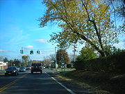
New York State Route 470 (NY 470) is a state highway
in the Capital District of New York
in the United States
. The western terminus of the route is at an intersection with NY 9R
just west of the Cohoes
city limits in Colonie. The eastern terminus is at a junction with U.S. Route 4
(US 4) in Troy
. Along the way, NY 470 intersects NY 787
in Cohoes and traverses the Hudson River
via the 112th Street Bridge
. NY 470 was assigned in the mid-1970s and is maintained by the cities of Cohoes and Troy.
 NY 470 begins at an intersection with NY 9R
just west of the Cohoes
city limits in the Albany County
town of Colonie. NY 9R, known as Columbia Street west of this point, turns north to follow Baker Avenue while NY 470 heads east on Columbia Street into Cohoes. As the route heads through suburban Cohoes, it passes within view of Cohoes High School and directly serves Cohoes Middle School before passing under an abandoned railroad line. At the first intersection east of the overpass, NY 470 turns north to parallel the old line along Bedford Street. Four blocks later, Bedford turns eastward, becoming Ontario Street at the midpoint of the curve as it descends. Here, the surroundings become more commercial as the route heads toward the city's historic
downtown.
 In downtown Cohoes
, NY 470 crosses the Delaware and Hudson Railway
and intersects NY 32
(Saratoga Street) in quick succession ahead of a junction with NY 787
on the banks of the First Branch
of the Mohawk River
. Past NY 787, NY 470 crosses a pair of bridges; first to reach Simmons Island, then to access the larger Van Schaick Island
. NY 470 heads east across both of the densely populated islands and over the Hudson River
via the 112th Street Bridge
into the Lansingburgh neighborhood of Troy
, in Rensselaer County
. Within Troy, the route continues for one block as 112th Street before terminating at US 4
(2nd Avenue).
east through Cohoes
to Troy
. NY 9R, which had been intact prior to the assignment of NY 470, was removed. The NY 9R designation was reinstated in the late 1970s, reducing NY 470 to its present length. Although NY 470 is signed as a state highway
, none of the route is maintained by the New York State Department of Transportation
. Instead, maintenance of NY 470 is handled by the cities of Cohoes
and Troy
.
State highway
State highway, state road or state route can refer to one of three related concepts, two of them related to a state or provincial government in a country that is divided into states or provinces :#A...
in the Capital District of New York
New York
New York is a state in the Northeastern region of the United States. It is the nation's third most populous state. New York is bordered by New Jersey and Pennsylvania to the south, and by Connecticut, Massachusetts and Vermont to the east...
in the United States
United States
The United States of America is a federal constitutional republic comprising fifty states and a federal district...
. The western terminus of the route is at an intersection with NY 9R
New York State Route 9R
New York State Route 9R is a north–south state highway in northeastern Albany County, New York, in the United States. The route is a eastern loop of U.S. Route 9 , connecting that route to the city of Cohoes to the east...
just west of the Cohoes
Cohoes, New York
Cohoes is an incorporated city located at the northeast corner of Albany County in the US state of New York. It is called the "Spindle City" because of the importance of textile production to its growth. As of the 2010 census, the city population was 16,168...
city limits in Colonie. The eastern terminus is at a junction with U.S. Route 4
U.S. Route 4 in New York
U.S. Route 4 is a part of the U.S. Highway System that runs from East Greenbush, New York, to Portsmouth, New Hampshire. In the U.S. state of New York, US 4 extends from an intersection with US 9 and US 20 in East Greenbush to the Vermont state line northeast of Whitehall...
(US 4) in Troy
Troy, New York
Troy is a city in the US State of New York and the seat of Rensselaer County. Troy is located on the western edge of Rensselaer County and on the eastern bank of the Hudson River. Troy has close ties to the nearby cities of Albany and Schenectady, forming a region popularly called the Capital...
. Along the way, NY 470 intersects NY 787
New York State Route 787
New York State Route 787 is a state highway in Albany County, New York, in the United States. It is a superhighway extension of I-787, continuing northward from the underpass at exit 9 for NY 7 near Green Island to downtown Cohoes at NY 32...
in Cohoes and traverses the Hudson River
Hudson River
The Hudson is a river that flows from north to south through eastern New York. The highest official source is at Lake Tear of the Clouds, on the slopes of Mount Marcy in the Adirondack Mountains. The river itself officially begins in Henderson Lake in Newcomb, New York...
via the 112th Street Bridge
112th Street Bridge
The 112th Street Bridge is a bridge that carries New York State Route 470 across the Hudson River in New York. It connects Van Schaick Island in the city of Cohoes with the Lansingburgh neighborhood of Troy. The original bridge was built in 1922 and demolished in 1995. The newer version was...
. NY 470 was assigned in the mid-1970s and is maintained by the cities of Cohoes and Troy.
Route description
New York State Route 9R
New York State Route 9R is a north–south state highway in northeastern Albany County, New York, in the United States. The route is a eastern loop of U.S. Route 9 , connecting that route to the city of Cohoes to the east...
just west of the Cohoes
Cohoes, New York
Cohoes is an incorporated city located at the northeast corner of Albany County in the US state of New York. It is called the "Spindle City" because of the importance of textile production to its growth. As of the 2010 census, the city population was 16,168...
city limits in the Albany County
Albany County, New York
Albany County is a county located in the U.S. state of New York, and is part of the Albany-Schenectady-Troy Metropolitan Statistical Area. The name is from the title of the Duke of York and Albany, who became James II of England . As of the 2010 census, the population was 304,204...
town of Colonie. NY 9R, known as Columbia Street west of this point, turns north to follow Baker Avenue while NY 470 heads east on Columbia Street into Cohoes. As the route heads through suburban Cohoes, it passes within view of Cohoes High School and directly serves Cohoes Middle School before passing under an abandoned railroad line. At the first intersection east of the overpass, NY 470 turns north to parallel the old line along Bedford Street. Four blocks later, Bedford turns eastward, becoming Ontario Street at the midpoint of the curve as it descends. Here, the surroundings become more commercial as the route heads toward the city's historic
Historic district
A historic district or heritage district is a section of a city which contains older buildings considered valuable for historical or architectural reasons. In some countries, historic districts receive legal protection from development....
downtown.
Downtown Cohoes Historic District
The Downtown Cohoes Historic District takes up of the city of Cohoes, New York, United States. Many of the 165 contributing properties date from the 1820-1930 period when the Erie Canal and Harmony Mills were the mainstay of the city's economy. It was recognized as a historic district and added to...
, NY 470 crosses the Delaware and Hudson Railway
Delaware and Hudson Railway
The Delaware and Hudson Railway is a railroad that operates in the northeastern United States. Since 1991 it has been a subsidiary of the Canadian Pacific Railway, although CPR has assumed all operations and the D&H does not maintain any locomotives or rolling stock.It was formerly an important...
and intersects NY 32
New York State Route 32
New York State Route 32 is a north–south state highway that extends for through the Hudson Valley and Capital District regions of the U.S. state of New York. It is a two-lane surface road for nearly its entire length, with few divided and no limited-access sections. From Harriman to Albany,...
(Saratoga Street) in quick succession ahead of a junction with NY 787
New York State Route 787
New York State Route 787 is a state highway in Albany County, New York, in the United States. It is a superhighway extension of I-787, continuing northward from the underpass at exit 9 for NY 7 near Green Island to downtown Cohoes at NY 32...
on the banks of the First Branch
Sprouts of the Mohawk River
The Sprouts of the Mohawk River are the multiple channels of the Mohawk River as it flows into the Hudson River creating a delta in the US state of New York. Most of the sprouts lie within Albany County, with the northern ones in Saratoga County, and the sprouts enter the Hudson at the boundary...
of the Mohawk River
Mohawk River
The Mohawk River is a river in the U.S. state of New York. It is the largest tributary of the Hudson River. The Mohawk flows into the Hudson in the Capital District, a few miles north of the city of Albany. The river is named for the Mohawk Nation of the Iroquois Confederacy...
. Past NY 787, NY 470 crosses a pair of bridges; first to reach Simmons Island, then to access the larger Van Schaick Island
Van Schaick Island
Van Schaick Island is an island in the city of Cohoes, New York. Van Schaick is a part of the delta of the Mohawk River at its mouth with the Hudson River. The island has been referred to by numerous names including Quehemesicos, Long, Anthony's, Isle of Cohoes, and Cohoes Island...
. NY 470 heads east across both of the densely populated islands and over the Hudson River
Hudson River
The Hudson is a river that flows from north to south through eastern New York. The highest official source is at Lake Tear of the Clouds, on the slopes of Mount Marcy in the Adirondack Mountains. The river itself officially begins in Henderson Lake in Newcomb, New York...
via the 112th Street Bridge
112th Street Bridge
The 112th Street Bridge is a bridge that carries New York State Route 470 across the Hudson River in New York. It connects Van Schaick Island in the city of Cohoes with the Lansingburgh neighborhood of Troy. The original bridge was built in 1922 and demolished in 1995. The newer version was...
into the Lansingburgh neighborhood of Troy
Troy, New York
Troy is a city in the US State of New York and the seat of Rensselaer County. Troy is located on the western edge of Rensselaer County and on the eastern bank of the Hudson River. Troy has close ties to the nearby cities of Albany and Schenectady, forming a region popularly called the Capital...
, in Rensselaer County
Rensselaer County, New York
Rensselaer County is a county in the U.S. state of New York. As of the 2010 census, the population was 159,429. Its name is in honor of the family of Kiliaen van Rensselaer, the original Dutch owner of the land in the area. Its county seat is Troy...
. Within Troy, the route continues for one block as 112th Street before terminating at US 4
U.S. Route 4 in New York
U.S. Route 4 is a part of the U.S. Highway System that runs from East Greenbush, New York, to Portsmouth, New Hampshire. In the U.S. state of New York, US 4 extends from an intersection with US 9 and US 20 in East Greenbush to the Vermont state line northeast of Whitehall...
(2nd Avenue).
History
When NY 470 was originally assigned in the mid-1970s, it extended from the current southern terminus of NY 9RNew York State Route 9R
New York State Route 9R is a north–south state highway in northeastern Albany County, New York, in the United States. The route is a eastern loop of U.S. Route 9 , connecting that route to the city of Cohoes to the east...
east through Cohoes
Cohoes, New York
Cohoes is an incorporated city located at the northeast corner of Albany County in the US state of New York. It is called the "Spindle City" because of the importance of textile production to its growth. As of the 2010 census, the city population was 16,168...
to Troy
Troy, New York
Troy is a city in the US State of New York and the seat of Rensselaer County. Troy is located on the western edge of Rensselaer County and on the eastern bank of the Hudson River. Troy has close ties to the nearby cities of Albany and Schenectady, forming a region popularly called the Capital...
. NY 9R, which had been intact prior to the assignment of NY 470, was removed. The NY 9R designation was reinstated in the late 1970s, reducing NY 470 to its present length. Although NY 470 is signed as a state highway
State highway
State highway, state road or state route can refer to one of three related concepts, two of them related to a state or provincial government in a country that is divided into states or provinces :#A...
, none of the route is maintained by the New York State Department of Transportation
New York State Department of Transportation
The New York State Department of Transportation is responsible for the development and operation of highways, railroads, mass transit systems, ports, waterways and aviation facilities in the U.S...
. Instead, maintenance of NY 470 is handled by the cities of Cohoes
Cohoes, New York
Cohoes is an incorporated city located at the northeast corner of Albany County in the US state of New York. It is called the "Spindle City" because of the importance of textile production to its growth. As of the 2010 census, the city population was 16,168...
and Troy
Troy, New York
Troy is a city in the US State of New York and the seat of Rensselaer County. Troy is located on the western edge of Rensselaer County and on the eastern bank of the Hudson River. Troy has close ties to the nearby cities of Albany and Schenectady, forming a region popularly called the Capital...
.