
List of rivers of Europe
Encyclopedia
These are the main river
s of Europe
(ecologically, the extreme west of the Palearctic
ecozone
- which includes Russia
in the east). See each article for their tributaries, drainage areas, etc. For clarity, only rivers longer than 100 km (or very significant in another way) are shown in this list. Shorter rivers can be found in the lists by country.
| |}>
In the list below, the European rivers are grouped by the sea or ocean into which they flow. They are sorted along the coastline of the seas and oceans. Rivers that flow into other rivers are sorted in orographic order, i.e., by the proximity of their points of confluence to the sea.
Barents Sea
The rivers in this section are sorted east (Novaya Zemlya
) to west (North Cape, Norway
).
In Russia:
In Norway:
On Iceland

:
In Ireland
(including Celtic Sea
):
:
) to south (Tarifa
).
In France:
In Spain:
In Portugal:
In Spain:
Baltic Sea
The rivers in this section are sorted clockwise, starting from Helsingborg
(south Sweden).
In Estonia
In Latvia
In Lithuania
In Russia (Kaliningrad Oblast
.
In Bulgaria
In Romania
In Ukraine
) to east (Ramsgate
).
In Britain:
) to west (Brest
).
In France:
Irish Sea
The rivers in this section are sorted clockwise, starting from the (Mull of Kintyre
).
In Britain:
In Ireland:
and the Tyrrhenian Sea
. The rivers are sorted from west (Tarifa
) to east (Reggio Calabria
).
In Spain:
In France:
In Italy:
Adriatic Sea
The rivers in this section are sorted clockwise, from Otranto
, southern Italy, to Vlorë
in southern Albania.
In Italy:
In Croatia
:
In Montenegro
:
In Albania
:
Ionian Sea
West coast
The rivers in this section are sorted south-west to north-east from Reggio Calabria
to Otranto
.
In Italy:
East coast
The rivers in this section are sorted north-west to south-east from Vlorë
to Cape Malea
.
In Greece:
Aegean Sea
The rivers in this section are sorted west (Cape Malea
) to east (Istanbul
).
In Greece:
In Turkey
:
North Sea
The rivers in this section are given clockwise along the North Sea coast, starting from Bergen, Norway.

.jpg)
River
A river is a natural watercourse, usually freshwater, flowing towards an ocean, a lake, a sea, or another river. In a few cases, a river simply flows into the ground or dries up completely before reaching another body of water. Small rivers may also be called by several other names, including...
s of Europe
Europe
Europe is, by convention, one of the world's seven continents. Comprising the westernmost peninsula of Eurasia, Europe is generally 'divided' from Asia to its east by the watershed divides of the Ural and Caucasus Mountains, the Ural River, the Caspian and Black Seas, and the waterways connecting...
(ecologically, the extreme west of the Palearctic
Palearctic
The Palearctic or Palaearctic is one of the eight ecozones dividing the Earth's surface.Physically, the Palearctic is the largest ecozone...
ecozone
Ecozone
An ecozone is the broadest biogeographic division of the Earth's land surface, based on distributional patterns of terrestrial organisms.Ecozones delineate large areas of the Earth's surface within which organisms have been evolving in relative isolation over long periods of time, separated from...
- which includes Russia
Russia
Russia or , officially known as both Russia and the Russian Federation , is a country in northern Eurasia. It is a federal semi-presidential republic, comprising 83 federal subjects...
in the east). See each article for their tributaries, drainage areas, etc. For clarity, only rivers longer than 100 km (or very significant in another way) are shown in this list. Shorter rivers can be found in the lists by country.
Longest rivers
Rivers over 650 km:| River | Km | Mi | Draining into |
| Volga Volga River The Volga is the largest river in Europe in terms of length, discharge, and watershed. It flows through central Russia, and is widely viewed as the national river of Russia. Out of the twenty largest cities of Russia, eleven, including the capital Moscow, are situated in the Volga's drainage... |
3692 | 2294 | Caspian Sea Caspian Sea The Caspian Sea is the largest enclosed body of water on Earth by area, variously classed as the world's largest lake or a full-fledged sea. The sea has a surface area of and a volume of... |
| Danube Danube The Danube is a river in the Central Europe and the Europe's second longest river after the Volga. It is classified as an international waterway.... |
2860 | 1780 | Black Sea Black Sea The Black Sea is bounded by Europe, Anatolia and the Caucasus and is ultimately connected to the Atlantic Ocean via the Mediterranean and the Aegean seas and various straits. The Bosphorus strait connects it to the Sea of Marmara, and the strait of the Dardanelles connects that sea to the Aegean... |
| Ural Ural River The Ural or Jayıq/Zhayyq , known as Yaik before 1775, is a river flowing through Russia and Kazakhstan. It arises in the southern Ural Mountains and ends at the Caspian Sea. Its total length is 1,511 mi making it the third longest river in Europe after the Volga and the Danube... |
2428 | 1509 | Caspian Sea |
| Dnieper Dnieper River The Dnieper River is one of the major rivers of Europe that flows from Russia, through Belarus and Ukraine, to the Black Sea.The total length is and has a drainage basin of .The river is noted for its dams and hydroelectric stations... |
2290 | 1420 | Black Sea |
| Don Don River (Russia) The Don River is one of the major rivers of Russia. It rises in the town of Novomoskovsk 60 kilometres southeast from Tula, southeast of Moscow, and flows for a distance of about 1,950 kilometres to the Sea of Azov.... |
1950 | 1210 | Sea of Azov Sea of Azov The Sea of Azov , known in Classical Antiquity as Lake Maeotis, is a sea on the south of Eastern Europe. It is linked by the narrow Strait of Kerch to the Black Sea to the south and is bounded on the north by Ukraine mainland, on the east by Russia, and on the west by the Ukraine's Crimean... |
| Pechora Pechora River The Pechora River is a river in northwest Russia which flows north into the Arctic Ocean on the west side of the Ural Mountains. It lies mostly in the Komi Republic but the northernmost part crosses the Nenets Autonomous Okrug. It is 1,809 km long and its basin is 322,000 square kilometers... |
1809 | 1124 | Barents Sea Barents Sea The Barents Sea is a marginal sea of the Arctic Ocean, located north of Norway and Russia. Known in the Middle Ages as the Murman Sea, the sea takes its current name from the Dutch navigator Willem Barents... |
| Northern Dvina–Vychegda Vychegda River Vychegda is a river in the European part of Russia, tributary to the Northern Dvina. Its length is about . Its source is approximately west of the northern Ural Mountains. It flows roughly in western direction, through Komi Republic and Arkhangelsk Oblast. The largest city along the Vychegda is... |
1774 | 1102 | White Sea White Sea The White Sea is a southern inlet of the Barents Sea located on the northwest coast of Russia. It is surrounded by Karelia to the west, the Kola Peninsula to the north, and the Kanin Peninsula to the northeast. The whole of the White Sea is under Russian sovereignty and considered to be part of... |
| Dniester Dniester The Dniester is a river in Eastern Europe. It runs through Ukraine and Moldova and separates most of Moldova's territory from the breakaway de facto state of Transnistria.-Names:... |
1362 | 846 | Black Sea |
| Rhine | 1236 | 768 | North Sea North Sea In the southwest, beyond the Straits of Dover, the North Sea becomes the English Channel connecting to the Atlantic Ocean. In the east, it connects to the Baltic Sea via the Skagerrak and Kattegat, narrow straits that separate Denmark from Norway and Sweden respectively... |
| Elbe Elbe The Elbe is one of the major rivers of Central Europe. It rises in the Krkonoše Mountains of the northwestern Czech Republic before traversing much of Bohemia , then Germany and flowing into the North Sea at Cuxhaven, 110 km northwest of Hamburg... |
1091 | 678 | North Sea |
| Vistula | 1047 | 651 | Baltic Sea Baltic Sea The Baltic Sea is a brackish mediterranean sea located in Northern Europe, from 53°N to 66°N latitude and from 20°E to 26°E longitude. It is bounded by the Scandinavian Peninsula, the mainland of Europe, and the Danish islands. It drains into the Kattegat by way of the Øresund, the Great Belt and... |
| Tagus Tagus The Tagus is the longest river on the Iberian Peninsula. It is long, in Spain, along the border between Portugal and Spain and in Portugal, where it empties into the Atlantic Ocean at Lisbon. It drains an area of . The Tagus is highly utilized for most of its course... |
1038 | 645 | Atlantic Ocean Atlantic Ocean The Atlantic Ocean is the second-largest of the world's oceanic divisions. With a total area of about , it covers approximately 20% of the Earth's surface and about 26% of its water surface area... |
| Daugava | 1020 | 630 | Baltic Sea |
| Loire Loire (river) The Loire is the longest river in France. With a length of , it drains an area of , which represents more than a fifth of France's land area. It is the 170th longest river in the world... |
1013 | 629 | Atlantic Ocean |
| Tisza Tisza The Tisza or Tisa is one of the main rivers of Central Europe. It rises in Ukraine, and is formed near Rakhiv by the junction of headwaters White Tisa, whose source is in the Chornohora mountains and Black Tisa, which springs in the Gorgany range... |
965 | 600 | Black Sea (tributary of Danube) |
| Sava | 947 | 588 | Black Sea (tributary of Danube) |
| Neman Neman River Neman or Niemen or Nemunas, is a major Eastern European river rising in Belarus and flowing through Lithuania before draining into the Curonian Lagoon and then into the Baltic Sea at Klaipėda. It is the northern border between Lithuania and Russia's Kaliningrad Oblast in its lower reaches... |
937 | 582 | Baltic Sea |
| Meuse | 925 | 575 | North Sea |
| Ebro Ebro The Ebro or Ebre is one of the most important rivers in the Iberian Peninsula. It is the biggest river by discharge volume in Spain.The Ebro flows through the following cities:*Reinosa in Cantabria.*Miranda de Ebro in Castile and León.... |
910 | 570 | Mediterranean |
| Douro Douro The Douro or Duero is one of the major rivers of the Iberian Peninsula, flowing from its source near Duruelo de la Sierra in Soria Province across northern-central Spain and Portugal to its outlet at Porto... |
897 | 557 | Atlantic Ocean |
| Kuban Kuban River The Kuban River is a river in Russia, in the North Caucasus region. It flows mostly through Krasnodar Krai but also in the Karachay-Cherkess Republic, Stavropol Krai and the Republic of Adygea.... |
870 | 540 | Sea of Azov |
| Mezen Mezen River The Mezen is a river in Udorsky District of the Komi Republic and in Leshukonsky and Mezensky Districts of Arkhangelsk Oblast in Russia. Its mouth is located in the Mezen Bay of the White Sea. Mezen is one of the biggest rivers of European Russia. It is long, and the area of its basin... |
857 | 533 | Barents Sea |
| Oder Oder The Oder is a river in Central Europe. It rises in the Czech Republic and flows through western Poland, later forming of the border between Poland and Germany, part of the Oder-Neisse line... |
854 | 531 | Baltic Sea |
| Neva Neva River The Neva is a river in northwestern Russia flowing from Lake Ladoga through the western part of Leningrad Oblast to the Neva Bay of the Gulf of Finland. Despite its modest length , it is the third largest river in Europe in terms of average discharge .The Neva is the only river flowing from Lake... –Svir Svir River Svir is a river in the north-east of Leningrad Oblast, Russia. It flows from Lake Onega west to Lake Ladoga, thus connecting the two largest lakes of Europe. It is the largest river flowing into Lake Ladoga.... –Suna Suna River Suna is a river in Republic of Karelia, Russia. The length of the river is 280 km. The area of its basin is 7,670 km². The Suna originates in Lake Kivi-Yarvi and flows out into the Kondopoga Gulf of Lake Onega.... |
852 | 529 | Baltic Sea |
| Rhône Rhône Rhone can refer to:* Rhone, one of the major rivers of Europe, running through Switzerland and France* Rhône Glacier, the source of the Rhone River and one of the primary contributors to Lake Geneva in the far eastern end of the canton of Valais in Switzerland... |
813 | 505 | Mediterranean |
| Seine Seine The Seine is a -long river and an important commercial waterway within the Paris Basin in the north of France. It rises at Saint-Seine near Dijon in northeastern France in the Langres plateau, flowing through Paris and into the English Channel at Le Havre . It is navigable by ocean-going vessels... |
776 | 482 | Atlantic Ocean |
| Mureş Mures River The Mureș is an approximately 761 km long river in Eastern Europe. It originates in the Hășmașu Mare Range in the Eastern Carpathian Mountains, Romania, and joins the Tisza river at Szeged in southeastern Hungary.... |
761 | 473 | Black Sea (tributary of Danube) |
| Drava Drava Drava or Drave is a river in southern Central Europe, a tributary of the Danube. It sources in Toblach/Dobbiaco, Italy, and flows east through East Tirol and Carinthia in Austria, into Slovenia , and then southeast, passing through Croatia and forming most of the border between Croatia and... |
749 | 465 | Black Sea (tributary of Danube) |
| Guadiana Guadiana The Guadiana , or Odiana, is an international river located on the Portuguese–Spanish border, separating Extremadura and Andalucia from Alentejo and Algarve... |
742 | 461 | Atlantic Ocean |
| Prut | 742 | 461 | Black Sea (tributary of Danube) |
| Po | 682 | 424 | Adriatic Sea Adriatic Sea The Adriatic Sea is a body of water separating the Italian Peninsula from the Balkan peninsula, and the system of the Apennine Mountains from that of the Dinaric Alps and adjacent ranges... |
In the list below, the European rivers are grouped by the sea or ocean into which they flow. They are sorted along the coastline of the seas and oceans. Rivers that flow into other rivers are sorted in orographic order, i.e., by the proximity of their points of confluence to the sea.
- Note for additions: please remember to add the city where the river meets for each river.
Barents SeaBarents SeaThe Barents Sea is a marginal sea of the Arctic Ocean, located north of Norway and Russia. Known in the Middle Ages as the Murman Sea, the sea takes its current name from the Dutch navigator Willem Barents...
and White SeaWhite SeaThe White Sea is a southern inlet of the Barents Sea located on the northwest coast of Russia. It is surrounded by Karelia to the west, the Kola Peninsula to the north, and the Kanin Peninsula to the northeast. The whole of the White Sea is under Russian sovereignty and considered to be part of...
(Arctic OceanArctic OceanThe Arctic Ocean, located in the Northern Hemisphere and mostly in the Arctic north polar region, is the smallest and shallowest of the world's five major oceanic divisions...
)
The rivers in this section are sorted east (Novaya ZemlyaNovaya Zemlya
Novaya Zemlya , also known in Dutch as Nova Zembla and in Norwegian as , is an archipelago in the Arctic Ocean in the north of Russia and the extreme northeast of Europe, the easternmost point of Europe lying at Cape Flissingsky on the northern island...
) to west (North Cape, Norway
North Cape, Norway
North Cape is a cape on the island of Magerøya in Northern Norway, in the municipality of Nordkapp. Its 307 m high, steep cliff is often referred to as the northernmost point of Europe, located at , 2102.3 km from the North Pole. However, the neighbouring point Knivskjellodden is actually...
).
In Russia:
- PechoraPechora RiverThe Pechora River is a river in northwest Russia which flows north into the Arctic Ocean on the west side of the Ural Mountains. It lies mostly in the Komi Republic but the northernmost part crosses the Nenets Autonomous Okrug. It is 1,809 km long and its basin is 322,000 square kilometers...
(north-east of Naryan-MarNaryan-MarNaryan-Mar is a sea and river port town and the administrative center of Nenets Autonomous Okrug, Russia. The town is situated on the right bank of the Pechora River, upstream from the river's mouth, on the Barents Sea. Naryan-Mar lies north of the Arctic Circle, south of Andeg and east of...
)- UsaUsa River (Komi Republic)Usa is a river in the northeast corner of European Russia which drains the Polar Urals southwest into the Pechora River. The Polar Urals tend to the northeast and the Usa runs parallel to them. It is in the Komi Republic of Russia and the largest tributary of the Pechora River, which it joins from...
(west of UsinskUsinskUsinsk is a town in the Komi Republic, Russia, situated east of the republic's capital city of Syktyvkar and north of the town of Pechora, on the northern bank of the Usa River, before its confluence with the Pechora River. Population:...
)- KolvaKolva River (Usa)Kolva River is a river in Nenets Autonomous Okrug and the Komi Republic in Russia. It is a right tributary of the Usa River of the Pechora basin. The length of the river is . The area of its basin . The Kolva River freezes up in late November and stays under the ice until mid-May....
(near Usinsk)
- Kolva
- Usa
- Northern DvinaNorthern DvinaThe Northern Dvina is a river in Northern Russia flowing through the Vologda Oblast and Arkhangelsk Oblast into the Dvina Bay of the White Sea. Along with the Pechora River to the east, it drains most of Northwest Russia into the Arctic Ocean...
(in SeverodvinskSeverodvinskSeverodvinsk is a city in the north of Arkhangelsk Oblast, Russia, located in the delta of the Northern Dvina River, west of Arkhangelsk. Administratively, it is incorporated as a town of oblast significance . Municipally, it is incorporated as Severodvinsk Urban Okrug. The city was founded as...
)- PinegaPinega RiverThe Pinega is a river in Verkhnetoyemsky, Pinezhsky, and Kholmogorsky Districts of Arkhangelsk Oblast in Russia. It is a right tributary of the Northern Dvina River. It is long, and the area of its basin...
(in Ust-Pinega) - Yomtsa (near Bolshaya Gora)
- VagaVaga RiverThe Vaga is a river in Totemsky, Syamzhensky, and Verkhovazhsky Districts of Vologda Oblast and in Velsky, Shenkursky, and Vinogradovsky Districts of Arkhangelsk Oblast in Russia. It is a left and the biggest tributary of the Northern Dvina River. The length of the river is . The area of its basin...
(near BereznikBereznikBereznik , also known as Dvinskoy Bereznik is an urban type settlement and the administrative center of Vinogradovsky District, Arkhangelsk Oblast, Russia, located on the left bank of the Northern Dvina River, southeast of Kholmogorskaya railway station and away from Arkhangelsk...
) - UftyugaUftyuga River (Arkhangelsk Oblast)The Uftyuga is a river in Krasnoborsky District of Arkhangelsk Oblast in Russia. It is a right tributary of the Northern Dvina River. The river is long. The area of its basin is . The Uftyuga River freezes in mid-October to early November and stays under the ice until mid-April to early May...
(near KrasnoborskKrasnoborsk, Arkhangelsk OblastKrasnoborsk is a rural locality and the administrative center of Krasnoborsky District, Arkhangelsk Oblast, Russia, located on the left bank of the Northern Dvina River. It also serves as the administrative center of Alexeyevsky Selsoviet, one of the ten selsoviets into which the district is...
) - VychegdaVychegda RiverVychegda is a river in the European part of Russia, tributary to the Northern Dvina. Its length is about . Its source is approximately west of the northern Ural Mountains. It flows roughly in western direction, through Komi Republic and Arkhangelsk Oblast. The largest city along the Vychegda is...
(in KotlasKotlasKotlas is a town in the southeast of Arkhangelsk Oblast, Russia, situated at the confluence of the Northern Dvina and Vychegda Rivers. Administratively, it is incorporated as a town of oblast significance . It also serves as the administrative center of Kotlassky District, by which it is...
) - YugYug RiverThe Yug is a river in Kichmengsko-Gorodetsky, Nikolsky, and Velikoustyugsky Districts of Vologda Oblast and in Podosinovsky District of Kirov Oblast in Russia. It is long, and the area of its basin...
(in Veliki Ustyug) - SukhonaSukhona RiverThe Sukhona is a river in the European pert of Russia, a tributary of the Northern Dvina River. The course of the Sukhona lies in Ust-Kubinsky, Sokolsky, Mezhdurechensky, Totemsky, Tarnogsky, Nyuksensky, and Velikoustyugsky Districts of Vologda Oblast in Russia. It is long, and the area of its...
(in Veliki Ustyug)
- Pinega
- MezenMezen RiverThe Mezen is a river in Udorsky District of the Komi Republic and in Leshukonsky and Mezensky Districts of Arkhangelsk Oblast in Russia. Its mouth is located in the Mezen Bay of the White Sea. Mezen is one of the biggest rivers of European Russia. It is long, and the area of its basin...
(near MezenMezen-See also:*Administrative divisions of Arkhangelsk Oblast...
) - OnegaOnega RiverThe Onega is a river in Kargopolsky, Plesetsky, and Onezhsky Districts of Arkhangelsk Oblast in Russia. The Onega connects Lake Lacha with the Onega Bay in the White Sea southwest of Arkhangelsk, flowing in the northern direction. The discharge at the source is and at the mouth is . The river is ...
(in Onega)
In Norway:
- Pasvikelva (eastern FinnmarkFinnmarkor Finnmárku is a county in the extreme northeast of Norway. By land it borders Troms county to the west, Finland to the south and Russia to the east, and by water, the Norwegian Sea to the northwest, and the Barents Sea to the north and northeast.The county was formerly known as Finmarkens...
at the border with Russia) - Neidenelva (into Bøkfjorden near KirkenesKirkenesis a town in the municipality of Sør-Varanger in the county of Finnmark in the far northeast of Norway...
) - TanaTana River (Norway)Tana river , is a long river in Sápmi, in the Norwegian county of in Finnmark and the Lapland of Finland. The Sámi name means "Great River". The main tributaries of Tana are Anarjohka and Karasjohka....
river (into TanafjordTanafjordTanafjord or Tanafjorden is a fjord in Finnmark, Norway. Its orientation is mainly north-south, spanning approximately 66 kilometres from the Smalfjord settlement in the south to Barents Sea in the north. The fjord separates the Nordkinn Peninsula in the west from the Varanger Peninsula in the...
in northeastern FinnmarkFinnmarkor Finnmárku is a county in the extreme northeast of Norway. By land it borders Troms county to the west, Finland to the south and Russia to the east, and by water, the Norwegian Sea to the northwest, and the Barents Sea to the north and northeast.The county was formerly known as Finmarkens...
) - KarasjohkaKarasjohkaKarasjohka river joins Anarjohka downstream of Karigasniemi and forms the famous salmon fishing Tana river . Karasjok municipality in Finnmark, Norway is situated along the upper river basin of the Deatnu / Tana river, and its tributaries Anarjohka and Karasjohka, and includes large tracts of the...
(through FinnmarkFinnmarkor Finnmárku is a county in the extreme northeast of Norway. By land it borders Troms county to the west, Finland to the south and Russia to the east, and by water, the Norwegian Sea to the northwest, and the Barents Sea to the north and northeast.The county was formerly known as Finmarkens...
into Tana riverTana River (Norway)Tana river , is a long river in Sápmi, in the Norwegian county of in Finnmark and the Lapland of Finland. The Sámi name means "Great River". The main tributaries of Tana are Anarjohka and Karasjohka....
) - LakselvaLakselvaLakselva is a river that runs through Porsanger, Norway....
(in Lakselv in PorsangerPorsangerPorsanger or Porsáŋgu or Porsanki is a municipality in Finnmark county, Norway. The administrative centre of the municipality is the village of Lakselv...
)
On IcelandIcelandIceland , described as the Republic of Iceland, is a Nordic and European island country in the North Atlantic Ocean, on the Mid-Atlantic Ridge. Iceland also refers to the main island of the country, which contains almost all the population and almost all the land area. The country has a population...
- Jökulsá á FjöllumJökulsá á FjöllumJökulsá á Fjöllum is the second longest river of Iceland . Its source is the Vatnajökull glacier. It flows into the Arctic Sea. Jökulsá á Fjöllum streams over the waterfalls Selfoss and Dettifoss, the second of which is the most powerful waterfall in Europe, and through the canyon at...
(north coast) - ÞjórsáÞjórsáÞjórsá is Iceland's longest river at 230 kilometers. It is in the southern region of the island.Þjórsá is a glacier river has its source on the glacier Hofsjökull. It flows out through narrow gorges in the highlands of Iceland. Further downstream, another river, the Tungnaá, flows into it , before...
(south coast)
Norwegian coast
In Norway:- AltaelvaAltaelvaThe river Altaelva has carved out Sautso, one of the largest canyons in Europe on its way from the High Plateau of Finnmarksvidda down to the Altafjord. It lies in the municipality of Alta in Finnmark county, Norway...
(in AltaAlta, Norway-Birdlife:For those interested in bird watching, the river outlet, known locally as Altaosen is well worth a visit. This tidal area is used as a stopover for many wetland species.-Transportation:...
into AltafjordAltafjordAltafjord is a fjord in the municipality Alta in Finnmark county, Norway, and is about 38 kilometres long. In the inner southern part of the fjord, near the town of Alta, is the outlet of the 200 kilometre long river Altaelva...
in western FinnmarkFinnmarkor Finnmárku is a county in the extreme northeast of Norway. By land it borders Troms county to the west, Finland to the south and Russia to the east, and by water, the Norwegian Sea to the northwest, and the Barents Sea to the north and northeast.The county was formerly known as Finmarkens...
) - Reisaelva (in NordreisaNordreisaNordreisa is a municipality in Troms county, Norway. The administrative centre of the municipality is the village of Storslett.The municipality consists of the valley of Reisadalen, with the Reisa river and deep pine forests, surrounded by mountains and high plateaus. Most people live in...
, TromsTromsor Romsa is a county in North Norway, bordering Finnmark to the northeast and Nordland in the southwest. To the south is Norrbotten Län in Sweden and further southeast is a shorter border with Lapland Province in Finland. To the west is the Norwegian Sea...
) - MålselvaMålselvaThe Målselva river in Troms county, Norway has given name to Målselv municipality and the Målselvdalen valley. The river empties into the in Målselvfjorden, an arm of the Malangen fjord, north of Olsborg. The rivers Divielva, Tamokelva, and Rostaelva converge near the Lille Rostavatn lake to form...
(into MalangenMalangenMalangen is a fjord and a former municipality in Troms county in Norway. The fjord is located between the islands of Kvaløya and Senja and the area today is divided between the municipalities of Balsfjord, Lenvik, Tromsø, and Målselv...
in MålselvMålselvMålselv is a municipality in Troms county, Norway. The administrative centre of the municipality is the village of Moen. Some other villages include Andslimoen, Bardufoss, Alappmoen, Holmen, Fossmoen, and Heggelia...
, TromsTromsor Romsa is a county in North Norway, bordering Finnmark to the northeast and Nordland in the southwest. To the south is Norrbotten Län in Sweden and further southeast is a shorter border with Lapland Province in Finland. To the west is the Norwegian Sea...
) - Saltdalselva (in SaltdalSaltdal-Transportation:European route E6 passes through the entire length of Saltdal, with the Nordlandsbanen railway running alongside it. A road running east through the Junkerdalen valley leads to Sweden. The nearest main airport is in Bodø, a nearly two hour drive from Rognan.- Economy :Saltdal has a...
, NordlandNordlandis a county in Norway in the North Norway region, bordering Troms in the north, Nord-Trøndelag in the south, Norrbottens län in Sweden to the east, Västerbottens län to the southeast, and the Atlantic Ocean to the west. The county was formerly known as Nordlandene amt. The county administration is...
) - RanelvaRanelvaRanelva is a 130 km long river in the municipality of Rana, and is one of the longest rivers in the county of Nordland, Norway. The river begins on Saltfjellet, in the borders between Norway and Sweden, and flows northwestwards under the name Randalselv . Ranelva begins where Randalselva and the...
(in RanaRana, NorwayRana is the second largest municipality in Nordland county – and the third largest in North Norway – by population. By area, Rana is largest in Norway south of Finnmark , taking in large areas of mountains and forested valleys. It is part of the Helgeland traditional region...
, NordlandNordlandis a county in Norway in the North Norway region, bordering Troms in the north, Nord-Trøndelag in the south, Norrbottens län in Sweden to the east, Västerbottens län to the southeast, and the Atlantic Ocean to the west. The county was formerly known as Nordlandene amt. The county administration is...
) - VefsnaVefsnaThe river Vefsna is the largest river in Nordland county, Norway. It is long and drains a watershed of . Its headwaters lie in the mountains of Børgefjell National Park at the lake Simskardvatnet. The river runs through the municipalities of Hattfjelldal, Grane, and Vefsn. The southern parts of...
(in MosjøenMosjøen-History:Mosjøen was founded in the 17th century as local farmers met here to trade, and has been growing since then. Sawmills were built here in 1866 by a British company, and Mosjøen got township rights in 1875. It is the oldest town in the Helgeland region and the second oldest town in Nordland...
, NordlandNordlandis a county in Norway in the North Norway region, bordering Troms in the north, Nord-Trøndelag in the south, Norrbottens län in Sweden to the east, Västerbottens län to the southeast, and the Atlantic Ocean to the west. The county was formerly known as Nordlandene amt. The county administration is...
) - Namsen (in NamsosNamsosis a town and municipality in Nord-Trøndelag county, Norway. It is part of the Namdalen region. The administrative centre of the municipality is the town of Namsos. Other villages in the municipality include Bangsund, Klinga, Ramsvika, Skomsvoll, and Spillum....
in Nord-TrøndelagNord-Trøndelagis a county constituting the northern part of Trøndelag in Norway. As of 2010, the county had 131,555 inhabitants, making it the country's fourth-least populated county. The largest municipalities are Stjørdal, Steinkjer—the county seat, Levanger, Namsos and Verdal, all with between 21,000 and...
) - NidelvaNidelvaNidelva or Nidelven is a river in the county Sør-Trøndelag, Norway. Elva or Elven is Norwegian for river, so the name translates to "Nid River".-Location:...
(into TrondheimsfjordTrondheimsfjordThe Trondheimsfjord , an inlet of the Norwegian Sea, is Norway's third longest fjord at long. It is located in the west central part of the country, and it stretches from Ørland in west to Steinkjer in north, passing the city of Trondheim on its way...
at Trondheim, Sør-TrøndelagSør-Trøndelag- References :...
) - Gaula (in TrondheimTrondheimTrondheim , historically, Nidaros and Trondhjem, is a city and municipality in Sør-Trøndelag county, Norway. With a population of 173,486, it is the third most populous municipality and city in the country, although the fourth largest metropolitan area. It is the administrative centre of...
, Sør-TrøndelagSør-Trøndelag- References :...
) - Orkla RiverOrkla RiverThe Orkla River is the longest river in Sør-Trøndelag county, Norway. The long river follows the Orkdalen valley, discharging into the Orkdalsfjord, an arm of the Trondheimsfjord, at the village of Orkanger....
(into TrondheimsfjordTrondheimsfjordThe Trondheimsfjord , an inlet of the Norwegian Sea, is Norway's third longest fjord at long. It is located in the west central part of the country, and it stretches from Ørland in west to Steinkjer in north, passing the city of Trondheim on its way...
at OrkdalOrkdalOrkdal is a municipality in Sør-Trøndelag county, Norway. It is part of the Orkdalen region. The administrative centre of the municipality is the village of Orkanger. Other villages in the municipality include Kjøra, Geitastrand, Gjølme, Thamshavn, Fannrem, Vormstad, Svorkmo, and...
, Sør-TrøndelagSør-Trøndelag- References :...
) - Surna River (into Surnadalsfjord at SurnadalSurnadalis a municipality in Møre og Romsdal county, Norway. It is part of the Nordmøre region. The administrative centre is the village of Skei. Other villages include Todalsøra, Surnadalsøra, Sylte, Glærem, Stangvik, and Åsskard....
, Møre og RomsdalMøre og Romsdalis a county in the northernmost part of Western Norway. It borders the counties of Sør-Trøndelag, Oppland and Sogn og Fjordane. The county administration is located in Molde, while Ålesund is the largest city.-The name:...
) - DrivaDrivaThe Driva river runs through Sør-Trøndelag and Møre og Romsdal counties in Norway. The headwaters lie in the Dovrefjell mountains in the south, from where it flows northward, downward through the valley Drivdalen in the municipality of Oppdal. In Oppdal it turns westward down the Sunndalen valley...
(into SunndalsfjordSunndalsfjordSunndalsfjord is a fjord in the municipality of Sunndal in Møre og Romsdal county, Norway. The long Sunndalsfjord comprises the southern end of the Tingvollfjorden. It begins at Ballsneset, at the municipal boundary of Sunndal and extends south to the village of Sunndalsøra. Other villages along...
at SunndalsøraSunndalsørais a village and the administrative centre of the municipality of Sunndal in Møre og Romsdal county, Norway. It is located at the mouth of the river Driva at the beginning of the Sunndalsfjord. It is about west of Hoelsand, southeast of Øksendalsøra, and about west of Grøa. The village has a...
, Møre og RomsdalMøre og Romsdalis a county in the northernmost part of Western Norway. It borders the counties of Sør-Trøndelag, Oppland and Sogn og Fjordane. The county administration is located in Molde, while Ålesund is the largest city.-The name:...
) - Rauma (in ÅndalsnesÅndalsnesis a town in the municipality of Rauma in Møre og Romsdal county, Norway. Åndalsnes is the administrative center of Rauma. The town has a population of 2,207...
, Møre og RomsdalMøre og Romsdalis a county in the northernmost part of Western Norway. It borders the counties of Sør-Trøndelag, Oppland and Sogn og Fjordane. The county administration is located in Molde, while Ålesund is the largest city.-The name:...
) - Lærdalselvi (into SognefjordSognefjordThe Sognefjord is the largest fjord in Norway, and the second longest in the world. Located in Sogn og Fjordane county, it stretches inland to the small village of Skjolden...
at LærdalLærdalLærdal is a municipality in the southwestern part of Sogn og Fjordane county, Norway. It is part of the traditional district of Sogn. The administrative center of the municipality is the village of Lærdalsøyri...
, Sogn og FjordaneSogn og Fjordaneis a county in Norway, bordering Møre og Romsdal, Oppland, Buskerud, and Hordaland. The county administration is in the town of Hermansverk in Leikanger municipality while the largest town is Førde....
)
Irish coast
In Northern IrelandNorthern Ireland
Northern Ireland is one of the four countries of the United Kingdom. Situated in the north-east of the island of Ireland, it shares a border with the Republic of Ireland to the south and west...
:
- BannRiver BannThe River Bann is the longest river in Northern Ireland, the total length being 80 miles . The river winds its way from the south east corner of Northern Ireland to the north west coast, pausing in the middle to widen into the enormous Lough Neagh...
(in ColeraineColeraineColeraine is a large town near the mouth of the River Bann in County Londonderry, Northern Ireland. It is northwest of Belfast and east of Derry, both of which are linked by major roads and railway connections...
)
In Ireland
Republic of Ireland
Ireland , described as the Republic of Ireland , is a sovereign state in Europe occupying approximately five-sixths of the island of the same name. Its capital is Dublin. Ireland, which had a population of 4.58 million in 2011, is a constitutional republic governed as a parliamentary democracy,...
(including Celtic Sea
Celtic Sea
The Celtic Sea is the area of the Atlantic Ocean off the south coast of Ireland bounded to the east by Saint George's Channel; other limits include the Bristol Channel, the English Channel, and the Bay of Biscay, as well as adjacent portions of Wales, Cornwall, Devon, and Brittany...
):
- ShannonRiver ShannonThe River Shannon is the longest river in Ireland at . It divides the west of Ireland from the east and south . County Clare, being west of the Shannon but part of the province of Munster, is the major exception...
(near LimerickLimerickLimerick is the third largest city in the Republic of Ireland, and the principal city of County Limerick and Ireland's Mid-West Region. It is the fifth most populous city in all of Ireland. When taking the extra-municipal suburbs into account, Limerick is the third largest conurbation in the...
)
- SwillyRiver SwillyThe River Swilly is a river in the Republic of Ireland, which flows in an eastern direction through Letterkenny, County Donegal. Letterkenny, the largest town in County Donegal, is built on the river and became the first crossing point on the river in the 17th century.-History:The river takes its...
(LetterkennyLetterkennyLetterkenny , with a population of 17,568, is the largest town in County Donegal, part of the Province of Ulster in Ireland. The town is located on the River Swilly...
) - SuckRiver SuckThe River Suck is a river in Ireland, approx. in length.It is the main tributary of the River Shannon. It meets the River Swilly a few kilometres north of the village of Shannonbridge to form the Suck-Swilly, which becomes the River Shannon....
(near Ballinasloe) - BrosnaRiver BrosnaThe River Brosna is a river in Ireland, flowing through County Westmeath and County Offaly.The river rises in Lough Owel north of Mullingar and is a tributary of the River Shannon. It meets the Shannon at Shannon Harbour.-Course:...
- Swilly
- BarrowRiver BarrowThe Barrow is a river in Ireland. It is one of The Three Sisters; the other two being the River Suir and the River Nore. The Barrow is the longest and most prominent of the three rivers...
(near Waterford) - Ireland- SuirRiver SuirThe River Suir is a river in Ireland that flows into the Atlantic Ocean near Waterford after a distance of .Popular with anglers, it holds plentiful reserves of brown trout...
(near Waterford) - NoreRiver NoreThe River Nore is a long river located in south-east of Ireland. Along with the River Suir and River Barrow, it is one of the constituent rivers of the group known as the Three Sisters. The river drains approximately of Leinster. The river rises in the Devil's Bit Mountain, North Tipperary...
(in New RossNew RossNew Ross is a town located in southwest County Wexford, in the southeast of Ireland. In 2006 it had a population of 7,709 people, making it the third largest town in the county after Wexford and Enniscorthy.-History:...
)
- Suir
British coast
The Bristol ChannelBristol Channel
The Bristol Channel is a major inlet in the island of Great Britain, separating South Wales from Devon and Somerset in South West England. It extends from the lower estuary of the River Severn to the North Atlantic Ocean...
:
- SevernRiver SevernThe River Severn is the longest river in Great Britain, at about , but the second longest on the British Isles, behind the River Shannon. It rises at an altitude of on Plynlimon, Ceredigion near Llanidloes, Powys, in the Cambrian Mountains of mid Wales...
(near CardiffCardiffCardiff is the capital, largest city and most populous county of Wales and the 10th largest city in the United Kingdom. The city is Wales' chief commercial centre, the base for most national cultural and sporting institutions, the Welsh national media, and the seat of the National Assembly for...
and Weston-Super-MareWeston-super-MareWeston-super-Mare is a seaside resort, town and civil parish in the unitary authority of North Somerset, which is within the ceremonial county of Somerset, England. It is located on the Bristol Channel coast, south west of Bristol, spanning the coast between the bounding high ground of Worlebury...
)- TemeRiver TemeThe River Teme rises in Mid Wales, south of Newtown in Powys, and flows through Knighton where it crosses the border into England down to Ludlow in Shropshire, then to the north of Tenbury Wells on the Shropshire/Worcestershire border there, on its way to join the River Severn south of Worcester...
(near WorcesterWorcesterThe City of Worcester, commonly known as Worcester, , is a city and county town of Worcestershire in the West Midlands of England. Worcester is situated some southwest of Birmingham and north of Gloucester, and has an approximate population of 94,000 people. The River Severn runs through the...
) - Avon (Upper)River Avon, WarwickshireThe River Avon or Avon is a river in or adjoining the counties of Leicestershire, Northamptonshire, Warwickshire, Worcestershire and Gloucestershire in the Midlands of England...
(in TewkesburyTewkesburyTewkesbury is a town in Gloucestershire, England. It stands at the confluence of the River Severn and the River Avon, and also minor tributaries the Swilgate and Carrant Brook...
) - WyeRiver WyeThe River Wye is the fifth-longest river in the UK and for parts of its length forms part of the border between England and Wales. It is important for nature conservation and recreation.-Description:...
(near ChepstowChepstowChepstow is a town in Monmouthshire, Wales, adjoining the border with Gloucestershire, England. It is located on the River Wye, close to its confluence with the River Severn, and close to the western end of the Severn Bridge on the M48 motorway...
) - Avon (Lower) (near BristolBristolBristol is a city, unitary authority area and ceremonial county in South West England, with an estimated population of 433,100 for the unitary authority in 2009, and a surrounding Larger Urban Zone with an estimated 1,070,000 residents in 2007...
) - UskRiver UskThe River Usk rises on the northern slopes of the Black Mountain of mid-Wales, in the easternmost part of the Brecon Beacons National Park. Initially it flows north into Usk Reservoir, then east by Sennybridge to Brecon before turning southeast to flow by Talybont-on-Usk, Crickhowell and...
(in NewportNewportNewport is a city and unitary authority area in Wales. Standing on the banks of the River Usk, it is located about east of Cardiff and is the largest urban area within the historic county boundaries of Monmouthshire and the preserved county of Gwent...
) - TaffRiver TaffThe River Taff is a large river in Wales. It rises as two rivers in the Brecon Beacons — the Taf Fechan and the Taf Fawr — before joining to form the Taff north of Merthyr Tydfil...
(in CardiffCardiffCardiff is the capital, largest city and most populous county of Wales and the 10th largest city in the United Kingdom. The city is Wales' chief commercial centre, the base for most national cultural and sporting institutions, the Welsh national media, and the seat of the National Assembly for...
)
- Teme
French, Spanish, and Portuguese coast
The rivers in this section are sorted north (BrestBrest, France
Brest is a city in the Finistère department in Brittany in northwestern France. Located in a sheltered position not far from the western tip of the Breton peninsula, and the western extremity of metropolitan France, Brest is an important harbour and the second French military port after Toulon...
) to south (Tarifa
Tarifa
Tarifa is a small town in the province of Cádiz, Andalusia, on the southernmost coast of Spain. The town is located on the Costa de la Luz and across the Straits of Gibraltar facing Morocco. The municipality includes Punta de Tarifa, the southernmost point in continental Europe. There are five...
).
In France:
- AulneAulneThe Aulne is a 140 km long river of Brittany in north-western France, flowing down the hills and emptying into the roadstead of Brest, one of the many fjord-like bays just south of Brest. The river is part of the Canal de Nantes à Brest, the navigation canal that once connected the city of Nantes...
(near BrestBrest, FranceBrest is a city in the Finistère department in Brittany in northwestern France. Located in a sheltered position not far from the western tip of the Breton peninsula, and the western extremity of metropolitan France, Brest is an important harbour and the second French military port after Toulon...
) - OdetOdetThe Odet is a river in western France , which runs from Saint-Goazec into the Atlantic Ocean at Bénodet. Bénodet is being given its name from the river The Odet is a river in western France (Finistère department), which runs from Saint-Goazec (near Leuhan, in the Montagnes Noires of Brittany) into...
(near Quimper) - BlavetBlavetThe Blavet river flows from central Brittany and enters the Atlantic Ocean on the south coast near Lorient. The river is canalized for most of its length and is navigable for smaller craft. It is part of Brittany's canal system and became more important when the western half of that system got cut...
(in LorientLorientLorient, or L'Orient, is a commune and a seaport in the Morbihan department in Brittany in north-western France.-History:At the beginning of the 17th century, merchants who were trading with India had established warehouses in Port-Louis...
) - VilaineVilaineThe Vilaine is a river in Brittany, in the west of France. The river's source is in the Mayenne département , and flows out in the Atlantic Ocean at Pénestin in the Morbihan département . It is 218 km long...
(in PénestinPénestinPénestin is a commune in the Morbihan department of Brittany in north-western France.-Beaches:As Penestin lies on the coast, it boasts several beaches, the most popular of which are La Mine d'Or and Loscolo.-References:* * -External links:*...
)- Oust (in RedonRedon, Ille-et-Vilaine-Breton language:The municipality launched a linguistic plan through Ya d'ar brezhoneg on 10 October 2008.In 2008, 14.31% of the children attended bilingual schools in primary education.-Economy:* Cargill Texturising Systems - A pectin factory...
)
- Oust (in Redon
- LoireLoire (river)The Loire is the longest river in France. With a length of , it drains an area of , which represents more than a fifth of France's land area. It is the 170th longest river in the world...
(in Saint-NazaireSaint-NazaireSaint-Nazaire , is a commune in the Loire-Atlantique department in western France.The town has a major harbour, on the right bank of the Loire River estuary, near the Atlantic Ocean. The town is at the south of the second-largest swamp in France, called "la Brière"...
)- Sèvre NantaiseSèvre NantaiseThe Sèvre Nantaise is a river in western France, left tributary to the river Loire. Its source is in the Deux-Sèvres département, near Secondigny.It flows through the following départements and towns:*Deux-Sèvres: Moncoutant, La Forêt-sur-Sèvre...
(in NantesNantesNantes is a city in western France, located on the Loire River, from the Atlantic coast. The city is the 6th largest in France, while its metropolitan area ranks 8th with over 800,000 inhabitants....
) - ErdreErdreThe Erdre is a river in western France, right tributary to the river Loire. Its source is in the Maine-et-Loire département, near La Pouëze. It flows through the départements Maine-et-Loire and Loire-Atlantique. It flows into the river Loire in the city Nantes...
(in NantesNantesNantes is a city in western France, located on the Loire River, from the Atlantic coast. The city is the 6th largest in France, while its metropolitan area ranks 8th with over 800,000 inhabitants....
) - Maine (near AngersAngersAngers is the main city in the Maine-et-Loire department in western France about south-west of Paris. Angers is located in the French region known by its pre-revolutionary, provincial name, Anjou, and its inhabitants are called Angevins....
)- Mayenne (near AngersAngersAngers is the main city in the Maine-et-Loire department in western France about south-west of Paris. Angers is located in the French region known by its pre-revolutionary, provincial name, Anjou, and its inhabitants are called Angevins....
) - Sarthe (near AngersAngersAngers is the main city in the Maine-et-Loire department in western France about south-west of Paris. Angers is located in the French region known by its pre-revolutionary, provincial name, Anjou, and its inhabitants are called Angevins....
)- LoirLoirThe Loir is a river in western France. It is a left tributary of the Sarthe River. Its source is in the Eure-et-Loir département, north of Illiers-Combray...
(north of AngersAngersAngers is the main city in the Maine-et-Loire department in western France about south-west of Paris. Angers is located in the French region known by its pre-revolutionary, provincial name, Anjou, and its inhabitants are called Angevins....
)- Braye (in Pont-de-Braye)
- HuisneHuisneThe Huisne is a river is located in France. It is a left tributary of the river Sarthe, which it meets in Le Mans. Its source is near the town Pervenchères, in the Orne department.The Huisne flows through the following départements and towns:...
(in Le MansLe MansLe Mans is a city in France, located on the Sarthe River. Traditionally the capital of the province of Maine, it is now the capital of the Sarthe department and the seat of the Roman Catholic diocese of Le Mans. Le Mans is a part of the Pays de la Loire region.Its inhabitants are called Manceaux...
)
- Loir
- Mayenne (near Angers
- Vienne (in Candes-Saint-MartinCandes-Saint-MartinCandes-Saint-Martin is a commune in the Indre-et-Loire department in central France. It overlooks the confluence of the Vienne and Loire rivers from a steep hill on the left bank of the Loire, and marks the boundary between the modern departments of Indre-et-Loire to the east, and Maine-et-Loire...
)- Creuse (north of ChâtelleraultChâtelleraultChâtellerault is a commune in the Vienne department in the Poitou-Charentes region in France.It is located to the north of Poitou, and the residents are called Châtelleraudais.-Geography:...
)- GartempeGartempeThe Gartempe is a French river, 205 kilometres long. It is a left tributary of the Creuse River, which it joins in La Roche-Posay. Its source is in the municipality of Peyrabout.Among its tributaries are the Anglin, the Brame and the Semme....
(in La Roche-PosayLa Roche-PosayLa Roche-Posay is a commune in the Vienne department in the Poitou-Charentes region in western France.-Demographics:-References:*...
)
- Gartempe
- ClainClainThe Clain is a 144 km long river in western France, left tributary of the river Vienne. Its source is near Hiesse, in the Charente department.The Clain flows generally north through the following departments and towns:*Charente...
(in ChâtelleraultChâtelleraultChâtellerault is a commune in the Vienne department in the Poitou-Charentes region in France.It is located to the north of Poitou, and the residents are called Châtelleraudais.-Geography:...
)
- Creuse (north of Châtellerault
- Indre (east of Candes-Saint-MartinCandes-Saint-MartinCandes-Saint-Martin is a commune in the Indre-et-Loire department in central France. It overlooks the confluence of the Vienne and Loire rivers from a steep hill on the left bank of the Loire, and marks the boundary between the modern departments of Indre-et-Loire to the east, and Maine-et-Loire...
) - Cher (in VillandryVillandryVillandry is a commune in the Indre-et-Loire department in central France. The Château de Villandry is located there....
)- SauldreSauldreThe Sauldre is a river in central France, right tributary of the river Cher. Its source is near the village Montigny, southwest of Sancerre. The Sauldre flows generally northwest through the following départements and towns:...
(in Selles-sur-CherSelles-sur-CherSelles-sur-Cher is a commune in the Loir-et-Cher department of central France.The name of the commune is known internationally for the goat's cheese, Selles-sur-Cher, that was first made in the village in the 19th century.-Demography:-References:...
) - ArnonArnon (France)The Arnon is a river in central France, left tributary of the river Cher. Its source is near the village Préveranges, west of Montluçon. The Arnon flows generally north through the following départements and towns:* Allier...
(near VierzonVierzonVierzon is a commune in the Cher department in the Centre region of France.-Geography:A medium-sized town by the banks of the Cher River with some light industry and an area of forestry and farming to the north...
)
- Sauldre
- BeuvronBeuvron (Loire)The Beuvron is a river in central France, left tributary of the river Loire. Its source is near the village Coullons, southwest of Gien. The Beuvron flows generally west through the following départements and towns:* Loiret: Cerdon...
(in Chaumont-sur-LoireChaumont-sur-LoireChaumont-sur-Loire is a commune in the Loir-et-Cher département in central France.-See also:* Château de Chaumont* Communes of the Loir-et-Cher department...
) - Loiret (in OrléansOrléans-Prehistory and Roman:Cenabum was a Gallic stronghold, one of the principal towns of the Carnutes tribe where the Druids held their annual assembly. It was conquered and destroyed by Julius Caesar in 52 BC, then rebuilt under the Roman Empire...
) - Allier (near NeversNeversNevers is a commune in – and the administrative capital of – the Nièvre department in the Bourgogne region in central France...
)- SiouleSiouleThe Sioule is a long river in central France, left tributary of the river Allier. Its source is near the village Orcival, north of Mont-Dore, in the Massif Central. The Sioule has cut a deep gorge, especially in its upper course...
(near Saint-Pourçain-sur-SiouleSaint-Pourçain-sur-SiouleSaint-Pourçain-sur-Sioule is a commune in the Allier department in central France.-Geography:The commune is located north of Vichy and south of Moulins on the Route nationale 9....
) - DoreDore (France)The Dore is a 141 km long river in central France , right tributary of the river Allier. Its source is near the town Saint-Germain-l'Herm, in the Massif Central. The Dore flows generally north through the following towns: Arlanc, Ambert, Courpière, Puy-Guillaume...
(near Puy-GuillaumePuy-GuillaumePuy-Guillaume is a commune in the Puy-de-Dôme department in Auvergne in central France.-References:*...
)
- Sioule
- BesbreBesbreThe Besbre is a river in central France, left tributary of the river Loire. Its source is on the mountain Puy de Montoncel, northeast of Thiers, in the Massif Central...
(near Dompierre-sur-BesbreDompierre-sur-BesbreDompierre-sur-Besbre is a commune in the Allier department in central France.-Population:-References:*...
) - ArrouxArrouxThe Arroux is a river in central France, right tributary of the river Loire. Its source is east of Arnay-le-Duc, in Côte-d'Or. The Arroux flows generally south through the following départements and towns:* Côte-d'Or: Arnay-le-Duc...
(in DigoinDigoinDigoin is a commune in the Saône-et-Loire department in the region of Bourgogne in eastern France.The junction of the Canal du Centre and the Canal latéral à la Loire is near Digoin.-Geography:...
)
- Sèvre Nantaise
- Sèvre NiortaiseSèvre NiortaiseThe Sèvre Niortaise is a river in western France, flowing into the Atlantic Ocean. Its source is in the Deux-Sèvres département, near Sepvret, north of Melle.It flows through the following départements and towns:...
(north of La RochelleLa RochelleLa Rochelle is a city in western France and a seaport on the Bay of Biscay, a part of the Atlantic Ocean. It is the capital of the Charente-Maritime department.The city is connected to the Île de Ré by a bridge completed on 19 May 1988...
)- Vendée (in MaransMaransThe Marans is a breed of chicken originating in France. It is a medium breed compared to others, popular for poultry shows and is a dual purpose fowl known both for its extremely dark eggs as well as for its very fine meat qualities.-Appearance:...
)
- Vendée (in Marans
- Charente (near RochefortRochefort, Charente-MaritimeRochefort is a commune in southwestern France, a port on the Charente estuary. It is a sub-prefecture of the Charente-Maritime department.-History:...
)
- GaronneGaronneThe Garonne is a river in southwest France and northern Spain, with a length of .-Source:The Garonne's headwaters are to be found in the Aran Valley in the Pyrenees, though three different locations have been proposed as the true source: the Uelh deth Garona at Plan de Beret , the Ratera-Saboredo...
(into Gironde estuaryGironde estuaryThe Gironde is a navigable estuary , in southwest France and is formed from the meeting of the rivers Dordogne and Garonne just below the centre of Bordeaux...
near BordeauxBordeauxBordeaux is a port city on the Garonne River in the Gironde department in southwestern France.The Bordeaux-Arcachon-Libourne metropolitan area, has a population of 1,010,000 and constitutes the sixth-largest urban area in France. It is the capital of the Aquitaine region, as well as the prefecture...
)- Dordogne (near BordeauxBordeauxBordeaux is a port city on the Garonne River in the Gironde department in southwestern France.The Bordeaux-Arcachon-Libourne metropolitan area, has a population of 1,010,000 and constitutes the sixth-largest urban area in France. It is the capital of the Aquitaine region, as well as the prefecture...
)- Isle (in LibourneLibourneLibourne is a commune in the Gironde department in Aquitaine in southwestern France. It is a sub-prefecture of the department.It is the wine-making capital of northern Gironde and lies near Saint-Émilion and Pomerol.-Geography:...
)- DronneDronneThe Dronne is a 201 km long river in southwestern France, right tributary of the Isle River. Its source is in the north-western Massif Central, east of the town of Châlus at an elevation of 510 m...
(near Libourne)
- Dronne
- VézèreVézèreThe Vézère is a 211 km long river in south-western France, right tributary of the Dordogne River. Its source is in the north-western Massif Central...
(near Le BugueLe BugueLe Bugue is a commune in the Dordogne department in southwestern France.-Geography:Le Bugue is located on the banks of the Vézère River a few kilometres before the confluence of the Vézère with the Dordogne River at Limeuil. Le Bugue is also on two national routes .-History:Le Bugue has been...
)- Corrèze (in Brive-la-GaillardeBrive-la-GaillardeBrive-la-Gaillarde is a commune of France. It is a sub-prefecture of the Corrèze department. The population of the urban area was 89,260 as of 1999. Although it is by far the biggest commune in Corrèze, the capital is Tulle.-History:...
)
- Corrèze (in Brive-la-Gaillarde
- CèreCèreThe Cère is a long river in south-western France, left tributary of the Dordogne River. Its source is in the south-western Massif Central, near the mountain Plomb du Cantal...
(near BretenouxBretenouxBretenoux is a commune in the Lot department in south-western France....
)
- Isle (in Libourne
- Lot (near Aiguillon)
- TruyèreTruyèreThe Truyère is a 167 km long river in south-western France, right tributary of the Lot River. Its source is in the south-western Massif Central, north of Mende. It flows generally west through the following départements and towns:...
(in Entraygues-sur-TruyèreEntraygues-sur-TruyèreEntraygues-sur-Truyère is a commune in the Aveyron department in southern France.-Geography:The village is located from Paris and from Toulouse.-Population:-Transportation:...
)
- Truyère
- BaïseBaïseThe Baïse is a 188 km long river in south-western France, left tributary of the Garonne. Its source is in the foothills of the Pyrenees, near Lannemezan...
(near Aiguillon) - Gers (near AgenAgenAgen is a commune in the Lot-et-Garonne department in Aquitaine in south-western France. It lies on the river Garonne southeast of Bordeaux. It is the capital of the department.-Economy:The town has a higher level of unemployment than the national average...
) - Tarn (near CastelsarrasinCastelsarrasinCastelsarrasin is a commune in the Tarn-et-Garonne department in Midi-Pyrénées region of France. The inhabitants are called Castelsarrasinois.-History:The first signs of life in the town is from 961...
)- Aveyron (near MontaubanMontaubanMontauban is a commune in the Tarn-et-Garonne department in the Midi-Pyrénées region in southern France. It is the capital of the department and lies north of Toulouse....
)- ViaurViaurThe Viaur is a 168 km long river in south-western France, left tributary of the Aveyron River. Its source is in the southern Massif Central, north of Millau...
(in LaguépieLaguépieLaguépie is a commune in the Tarn-et-Garonne department in the Midi-Pyrénées region in southern France.Situated in the Midi Quercy at the confluence of the rivers Aveyron and Viaur and at the corner of 3 different departments, Laguepie is a typical village of La France Profonde. It is in reality...
)
- Viaur
- AgoutAgoutThe Agout is a 195 km long river in south-western France, left tributary of the Tarn River. Its source is in the southern Massif Central, in the Parc naturel régional du Haut-Languedoc...
(in Saint-SulpiceSaint-Sulpice, TarnSaint-Sulpice is a commune in the Tarn department in southern France.-References:*...
)
- Aveyron (near Montauban
- GimoneGimoneThe Gimone is a 136 km long river in south-western France, left tributary of the Garonne. Its source is in the foothills of the Pyrenees, near Lannemezan...
(near CastelsarrasinCastelsarrasinCastelsarrasin is a commune in the Tarn-et-Garonne department in Midi-Pyrénées region of France. The inhabitants are called Castelsarrasinois.-History:The first signs of life in the town is from 961...
) - SaveSave (Garonne)The Save is a 143 km long river in southern France, left tributary of the Garonne. Its source is in the northern foothills of the Pyrenees, south of Lannemezan...
(in GrenadeGrenade, Haute-GaronneGrenade, also referred to as Grenade-sur-Garonne, is a commune in the Haute-Garonne department in southwestern France.-Population:-References:*...
) - Ariège (in ToulouseToulouseToulouse is a city in the Haute-Garonne department in southwestern FranceIt lies on the banks of the River Garonne, 590 km away from Paris and half-way between the Atlantic Ocean and the Mediterranean Sea...
)- Hers-Vif (in CintegabelleCintegabelleCintegabelle is a commune in the Haute-Garonne department in southwestern France.-Population:-References:*...
)
- Hers-Vif (in Cintegabelle
- Dordogne (near Bordeaux
- AdourAdourThe Adour is a river in southwestern France. It rises in High-Bigorre , at the Col du Tourmalet, and flows into the Atlantic Ocean near Bayonne. It is long, of which the uppermost as the Adour du Tourmalet. At its final stretch, i.e...
(in BayonneBayonneBayonne is a city and commune in south-western France at the confluence of the Nive and Adour rivers, in the Pyrénées-Atlantiques department, of which it is a sub-prefecture...
)- Gave de PauGave de PauThe Gave de Pau is a river of south-western France and a left tributary of the Adour. It takes its name from the city Pau, through which it flows. The river is in length, and its source is at the Cirque de Gavarnie in the Pyrenees mountains....
(near PeyrehoradePeyrehoradePeyrehorade is a commune in the Landes department in Aquitaine in south-western France.-See also:*Communes of the Landes department...
) - Gave d'OloronGave d'OloronThe Gave d'Oloron is a river of south-western France near the border with Spain. It takes its name from the city Oloron-Sainte-Marie, where it is formed from the rivers Gave d'Aspe and Gave d'Ossau.It joins the Gave de Pau in Peyrehorade...
(in PeyrehoradePeyrehoradePeyrehorade is a commune in the Landes department in Aquitaine in south-western France.-See also:*Communes of the Landes department...
)
- Gave de Pau
In Spain:
- NerviónNerviónThe river Nervión runs through the city of Bilbao, Spain into the Cantabrian Sea .It is also known as Estuary of Bilbao on its final tract, from the joining with Ibaizabal river to the sea.-Geography:...
(near BilbaoBilbaoBilbao ) is a Spanish municipality, capital of the province of Biscay, in the autonomous community of the Basque Country. With a population of 353,187 , it is the largest city of its autonomous community and the tenth largest in Spain...
) - Pas (near SantanderSantander, CantabriaThe port city of Santander is the capital of the autonomous community and historical region of Cantabria situated on the north coast of Spain. Located east of Gijón and west of Bilbao, the city has a population of 183,446 .-History:...
) - Nalón (in Muros de NalónMuros de NalónMuros de Nalón is a small coastal municipality in the Spanish province of Asturias, with an area of 8.09 square kilometers. It is bounded to the north by the Bay of Biscay, to the east by the river Nalón, to the south by Pravia and the west by Cudillero...
) - Minho/Miño (near CaminhaCaminhaCaminha is a municipality in the north-west of Portugal, 21 km north from Viana do Castelo, located in the Viana do Castelo District.The municipality has a total area of 137.4 km² and 16,839 inhabitants ....
) - Portugal, Spain- Sil (near OurenseOurenseOurense is a city in northwestern Spain, the capital of the province of the same name in Galicia. Its population of 108,674 accounts for 30% of the population of the province and makes it the third largest city of Galicia.-Population:...
)
- Sil (near Ourense
In Portugal:
- DouroDouroThe Douro or Duero is one of the major rivers of the Iberian Peninsula, flowing from its source near Duruelo de la Sierra in Soria Province across northern-central Spain and Portugal to its outlet at Porto...
/Duero (in PortoPortoPorto , also known as Oporto in English, is the second largest city in Portugal and one of the major urban areas in the Iberian Peninsula. Its administrative limits include a population of 237,559 inhabitants distributed within 15 civil parishes...
) - Portugal, Spain- Tâmega (near Penafiel, PortugalPenafiel, PortugalThe city of Penafiel had, as of 2001, a population of 9,343. It is located in Penafiel Municipality, that has 71,801 inhabitants....
) - Pisuerga (near ValladolidValladolidValladolid is a historic city and municipality in north-central Spain, situated at the confluence of the Pisuerga and Esgueva rivers, and located within three wine-making regions: Ribera del Duero, Rueda and Cigales...
, Spain)
- Tâmega (near Penafiel, Portugal
- Mondego (in Figueira da FozFigueira da FozFigueira da Foz , also known as Figueira for short, is a municipality in the Coimbra District, in Portugal. It is located at the mouth of the Mondego River, 40 km west of Coimbra, and sheltered by hills ....
, Portugal) - TagusTagusThe Tagus is the longest river on the Iberian Peninsula. It is long, in Spain, along the border between Portugal and Spain and in Portugal, where it empties into the Atlantic Ocean at Lisbon. It drains an area of . The Tagus is highly utilized for most of its course...
/Tejo/Tajo (near LisbonLisbonLisbon is the capital city and largest city of Portugal with a population of 545,245 within its administrative limits on a land area of . The urban area of Lisbon extends beyond the administrative city limits with a population of 3 million on an area of , making it the 9th most populous urban...
) - Portugal, Spain
- Zêzere (in ConstânciaConstânciaConstância is a municipality in Portugal with a total area of 80.4 km² and a total population of 3796 inhabitants.The municipality is composed of 3 parishes, and is located in Santarém District....
, Portugal) - Alagón (near AlcántaraAlcántaraAlcántara is a municipality in the province of Cáceres, Extremadura, Spain, on the Tagus, near Portugal. The toponym is from the Arabic word al-QanTarah meaning "the bridge".-History:...
, Spain) - JaramaJaramaJarama is a river in central Spain. It flows north to south, and passes east of Madrid when El Atazar Dam is built on a tributary, the Lozoya River. It flows into the river Tagus in Aranjuez...
(in AranjuezAranjuezAranjuez is a town lying 48 km south of Madrid, in the southern part of the Community of Madrid. It is located at the confluence of the Tagus and Jarama rivers, 48 km from Toledo. As of 2009, it has a population of 54,055.-History:...
, Spain)- Manzanares (crosses MadridMadridMadrid is the capital and largest city of Spain. The population of the city is roughly 3.3 million and the entire population of the Madrid metropolitan area is calculated to be 6.271 million. It is the third largest city in the European Union, after London and Berlin, and its metropolitan...
, Spain) - Tajuña (near MadridMadridMadrid is the capital and largest city of Spain. The population of the city is roughly 3.3 million and the entire population of the Madrid metropolitan area is calculated to be 6.271 million. It is the third largest city in the European Union, after London and Berlin, and its metropolitan...
, Spain)
- Manzanares (crosses Madrid
- Zêzere (in Constância
- Sado (in SetúbalSetúbalSetúbal is the main city in Setúbal Municipality in Portugal with a total area of 172.0 km² and a total population of 118,696 inhabitants in the municipality. The city proper has 89,303 inhabitants....
, Portugal)
In Spain:
- GuadianaGuadianaThe Guadiana , or Odiana, is an international river located on the Portuguese–Spanish border, separating Extremadura and Andalucia from Alentejo and Algarve...
(near AyamonteAyamonteAyamonte is a town and municipality located in the province of Huelva, Spain. According to the 2005 census, the city has a population of 18,001 inhabitants.-Location and history:...
) - Spain, Portugal- ZáncaraZáncaraThe Záncara is a 168 km long river in Castile-La Mancha, Spain. It is a tributary to the Cigüela, a tributary of the Guadiana. Its source is near the village Abia de la Obispalía, west of Cuenca, in the Iberian System. The Záncara flows southwest, along the town of Socuéllamos...
(near Alcázar de San JuanAlcázar de San JuanAlcázar de San Juan is a town and municipality in the province of Ciudad Real, part of the autonomous community of Castile-La Mancha, Spain...
)
- Záncara
- Rio Tinto (in HuelvaHuelvaHuelva is a city in southwestern Spain, the capital of the province of Huelva in the autonomous region of Andalusia. It is located along the Gulf of Cadiz coast, at the confluence of the Odiel and Tinto rivers. According to the 2010 census, the city has a population of 149,410 inhabitants. The...
) - GuadalquivirGuadalquivirThe Guadalquivir is the fifth longest river in the Iberian peninsula and the second longest river to be its whole length in Spain. The Guadalquivir is 657 kilometers long and drains an area of about 58,000 square kilometers...
(in Sanlúcar de BarramedaSanlúcar de BarramedaSanlúcar de Barrameda is a city in the northwest of Cádiz province, part of the autonomous community of Andalucía in southern Spain. Sanlúcar is located on the left bank at the mouth of the Guadalquivir River opposite the Doñana National Park, 52 km from the provincial capital Cádiz and...
) - Spain- GenilGenilThe Genil River is the main tributary of the river Guadalquivir in Andalusia, Spain. The Roman Singilis, its modern name derives from the Moorish rendering of the Roman name: Sinyil, Sannil, and Sinnil. The source of the Genil is in the Sierra Nevada mountains, north of its highest peak Mulhacén....
(in Palma del RíoPalma del RíoPalma del Río is a city located in the province of Córdoba, Spain. According to the 2006 census , the city has a population of 20640 inhabitants. Spanish singer Antonio José and matador El Cordobes is from there.-External links:...
)
- Genil
Baltic SeaBaltic SeaThe Baltic Sea is a brackish mediterranean sea located in Northern Europe, from 53°N to 66°N latitude and from 20°E to 26°E longitude. It is bounded by the Scandinavian Peninsula, the mainland of Europe, and the Danish islands. It drains into the Kattegat by way of the Øresund, the Great Belt and...
The rivers in this section are sorted clockwise, starting from HelsingborgHelsingborg
Helsingborg is a city and the seat of Helsingborg Municipality, Skåne County, Sweden with 97,122 inhabitants in 2010. Helsingborg is the centre of an area in the Øresund region of about 320,000 inhabitants in north-west Scania, and is Sweden's closest point to Denmark, with the Danish city...
(south Sweden).
In Sweden
- Motala strömMotala strömMotala ström is the river system that drains lake Vättern, the second largest lake in Sweden, into the Baltic Sea in Norrköping. It is named from the city Motala where it begins. In the early 19th century, the Göta Canal was constructed in parallel with Motala ström....
(in NorrköpingNorrköpingNorrköping is a city in the province of Östergötland in eastern Sweden and the seat of Norrköping Municipality, Östergötland County. The city has a population of 87,247 inhabitants in 2010, out of a municipal total of 130,050, making it Sweden's tenth largest city and eighth largest...
) - Dal RiverDal RiverThe Dal River is a river in central Sweden that flows from the north of Dalarna and runs into the sea in northern Uppland; it is commonly considered to be the southern border of Norrland. The northern part is split into two rivers: Österdalälven and Västerdalälven. The two connect in Djurås...
(near GävleGävleGävle is a city in Sweden, the seat of Gävle Municipality and the capital of Gävleborg County. It had 71,033 inhabitants in 12/31 2010. It is the oldest city in the historical Norrland , having received its charter in 1446 from Christopher of Bavaria.-History:It is believed that the name Gävle...
)- Västerdalälven (in DjuråsDjuråsDjurås is a locality and the seat of Gagnef Municipality in Dalarna County, Sweden, with 1,862 inhabitants in 2009.- References :...
) - Österdalälven (in DjuråsDjuråsDjurås is a locality and the seat of Gagnef Municipality in Dalarna County, Sweden, with 1,862 inhabitants in 2009.- References :...
)
- Västerdalälven (in Djurås
- Ljusnan (in SöderhamnSöderhamnSöderhamn is a locality and the seat of Söderhamn Municipality, Gävleborg County, Sweden with 12,056 inhabitants in 2005.The most popular tourist attraction is Oskarsborg, a tower built in 1895 on the top of a hill close to the town centre. The tower is built as a memorial over a visit of king...
) - LjunganLjunganLjungan is a 322 kilometer long river in Sweden. It originates near Trondheim and the Norwegian border. The river runs through the Swedish counties of Jämtland and Västernorrland...
(near SundsvallSundsvall-External links:* - Official site from Nordisk Familjebok - Sundsvalls tourist information bureau. - The alternative guide to Sundsvall. - Blog with photos from Sundsvall....
) - Indal River (near SundsvallSundsvall-External links:* - Official site from Nordisk Familjebok - Sundsvalls tourist information bureau. - The alternative guide to Sundsvall. - Blog with photos from Sundsvall....
) - Ångerman RiverÅngerman RiverThe Ångerman River is one of Sweden's longest rivers with a total length of 460 kilometers. It also has the largest amount of water running through it....
(near KramforsKramforsKramfors is a locality and the seat of Kramfors Municipality in Västernorrland County, Sweden with 6,235 inhabitants in 2005.Geographically the town is situated on the western shore of the Ångerman River. This river was the reason that Kramfors was founded, because in the 19th century it was a...
) - Ume RiverUme RiverThe Ume River is one of the main rivers in northern Sweden. It is around long, and flows in a south-eastern direction from its source, the lake Överuman by the Norwegian border within the Scandinavian mountain range. For large parts, the European route E12, also known as Blå Vägen , follows its...
(in UmeåUmeå- Transport :The road infrastructure in Umeå is well-developed, with two European highways passing through the city. About 4 km from the city centre is the Umeå City Airport...
) - Skellefte RiverSkellefte RiverThe Skellefte River is a river in northern Sweden; one of the major Norrland rivers..Geographically, it starts in the Norrbotten County, also known as the Swedish Lappland province where it drains the lakes Hornavan, Uddjaur and Storavan near Arjeplog; then goes south-east into Västerbotten...
(in SkellefteåSkellefteå-Industry:*Boliden AB, a big mining and smelting company*Alimak*Natural User Interface Technologies AB - NUITEQ, a promising emerging technology start-up company-Sports:*Skellefteå AIK, an ice hockey team in the highest Swedish league, Elitserien....
) - Pite RiverPite RiverThe Pite River is a river in northern Sweden, flowing through the Norrbotten County. It is one of the four major rivers in Norrland that have been left mostly untouched by water power plants, the river has a single dam at Sikfors approximately 15 km upstream from the sea.It starts in the large...
(in PiteåPiteåPiteå is a locality and the seat of Piteå Municipality in Norrbotten County, Sweden. The town has 22,650 inhabitants out of a municipal total of 41,000 in 2008.- Geography :...
) - Lule RiverLule RiverLule River is a major river in Sweden, rising in northern Sweden and flowing southeast for before reaching the Gulf of Bothnia at Luleå. It is the second longest river by watershed area or length in Norrbotten County , but is the largest by average discharge.It has a watershed of 25,240.5 km² of...
(in LuleåLuleå- Transportation :Local buses are run by .A passenger train service is available from Luleå Centralstation on Sweden's national SJ railway service northbound to Narvik on the Norwegian coast, or southbound to Stockholm. See Rail transport in Sweden....
) - Kalix RiverKalix RiverThe Kalix River is one of the four major rivers of Norrland, northern Sweden, that are untouched by water power...
(in KalixKalixKalix is a locality and the seat of the Kalix Municipality in Norrbotten County, Sweden. The name Kalix is believed to have come from nomadic tribes, possibly of Sapmí origin, and is derived from the word "Kalasätno", meaning "The cold river"...
) - Torne RiverTorne RiverThe Torne River , is a river in northern Sweden and Finland. Approximately half of the river's length is a part of the border between these two countries. It rises at Lake Torne near the border with Norway and flows generally southeast for a distance of into the Gulf of Bothnia...
/Torne älv/Tornionjoki (in TornioTornioTornio is a town and municipality in Lapland, Finland. The municipality covers an area of of which is water. The population density is , with a total population of . It borders to the Swedish municipality of Haparanda...
) - Sweden, Finland- TengeliönjokiTengeliönjokiTengeliönjoki is a river of Finland. It is 51 kilometres in length. It is a tributary of Torne River in finnish Lapland.-See also:*List of rivers in Finland...
(in AavasaksaAavasaksaAavasaksa is a sharp-edged hill in Ylitornio municipality in Finnish Lapland. It has an elevation of . Aavasaksa is famous for its sights both towards Finland and Sweden and it is included to the list of the National Views of Finland. The emperor Alexander II of Russia visited the site in 1876...
) - Finland - Muonionjoki (near PajalaPajalaPajala is a locality and the seat of Pajala Municipality in Norrbotten County, Sweden with 1,985 inhabitants in 2005.-History:Lars Levi Læstadius lived and worked in Pajala Municipality in the middle of the 19th century...
) - Finland, Sweden- KönkämäenoKönkämäenoKönkämäeno is a river in Finland and Sweden in Finnish and Swedish Lapland. It forms the upper course of the Muonionjoki river, which begins where the Könkämäeno river meets the Lätäseno river. The river begins from Lake Kilpisjärvi and forms together with Muonionjoki and the lower course of Torne...
(near Kaaresuvanto) - Finland, Sweden - LätäsenoLätäsenoLätäseno is a river of Finland in Finnish Lapland. It is a tributary of Muonio River, which itself is a tributary of Torne River.-See also:*List of rivers in Finland...
(near Kaaresuvanto) - Finland
- Könkämäeno
- Lainioälven (near JunosuandoJunosuandoJunosuando is a locality situated in Pajala Municipality, Norrbotten County, Sweden with 345 inhabitants in 2005. It was founded in 1637....
) - Sweden
- Tengeliönjoki
In Finland
- KemijokiKemijokiKemijoki , with its length, is the longest river in Finland. It runs through Kemijärvi and Rovaniemi before reaching the Gulf of Bothnia at Kemi.At Rovaniemi the Ounasjoki river merges with Kemijoki....
(in KemiKemiKemi is a town and municipality of Finland. It is located very near the city of Tornio. It was founded in 1869 by royal decree, because of its proximity to a deep water harbour....
)- OunasjokiOunasjokiThe Ounasjoki River is the Kemijoki River's largest tributary, as well as, Finland's longest single river tributary. It is also the largest river entirely within its borders. Ounasjoki is approximately in length, and the catchment area is , 27 percent of the Kemi catchment area.-Course:The...
(in RovaniemiRovaniemiRovaniemi is a city and municipality of Finland. It is the administrative capital and commercial centre of Finland's northernmost province, Lapland. It is situated close to the Arctic Circle and is between the hills of Ounasvaara and Korkalovaara, at the confluence of the Kemijoki River and its...
)- KäkkälöjokiKäkkälöjokiKäkkälöjoki is a river in Finland. It rises near the Norwegian border and flows first southeast, then south and southwest/west until it flows to the Ounasjoki River. The confluence is located about 15 kilometres from the village Hetta....
(near HettaHettaHetta is a village in the municipality of Enontekiö in Lapland in north-western Finland....
)
- Käkkälöjoki
- KitinenKitinenKitinen is a river of Finland. It flows for 278 kilometres. It is a tributary of Kemijoki. The river flows trough the municipalities of Kittilä, Pelkosenniemi and Sodankylä in finnish Lapland. The reservoir of Porttipahta is located in the upper course of the river. The biggest tributary of Kitinen...
(near PelkosenniemiPelkosenniemiPelkosenniemi is a municipality of Finland.It is located in the province of Lapland. The municipality has a population of and covers an area of ofwhich is water. The population density is....
)- LuiroLuiroLuiro is a river of Finland. It is a tributary of Kitinen, that itself is a tributary of Kemijoki. The river flows trough the municipalities of Sodankylä, Savukoski and Pelkosenniemi in Finnish Lapland. The Lokka Reservoir is located in the middle course of the river.-See also:*List of rivers in...
(near PelkosenniemiPelkosenniemiPelkosenniemi is a municipality of Finland.It is located in the province of Lapland. The municipality has a population of and covers an area of ofwhich is water. The population density is....
)
- Luiro
- Ounasjoki
- IijokiIijokiIijoki is a river of Finland in the region of Northern Ostrobothnia. It flows for 370 kilometres into the Gulf of Bothnia. Some of its many tributaries are Siuruanjoki and Livojoki....
(in IiIi, FinlandIi is a municipality of Finland.It is situated by the Bothnian Bay, at the mouth of river Iijoki, and it is part of the Northern Ostrobothnia region. The municipality has a population of and covers an area of of which is water. The population density is .The municipality is unilingually...
) - OulujokiOulujokiOulujoki is a river in Oulu province, Finland.Its origin is Oulujärvi and, its watershed area covers a significant part of Kainuu region....
(in OuluOuluOulu is a city and municipality of inhabitants in the region of Northern Ostrobothnia, in Finland. It is the most populous city in Northern Finland and the sixth most populous city in the country. It is one of the northernmost larger cities in the world....
) - KalajokiKalajokiKalajoki is a town and municipality of Finland.It is located in the province of Oulu and is part of the Northern Ostrobothnia region. The town has a population of and covers an area of of which is water...
(in Kalajoki) - KyrönjokiKyrönjokiKyrönjoki is a river of Finland. It is located in Southern Ostrobothnia region and flows into the Gulf of Bothnia.-See also:*List of rivers of Finland...
(near VaasaVaasaVaasa is a city on the west coast of Finland. It received its charter in 1606, during the reign of Charles IX of Sweden and is named after the Royal House of Vasa...
) - KokemäenjokiKokemäenjokiThe Kokemäenjoki is a river and its drainage basin in southwestern Finland.-Geography:The river originates at Lake Liekovesi in the Pirkanmaa region, and flows to the Gulf of Bothnia at Pori in the Satakunta region...
(in PoriPoriPori is a city and municipality on the west coast of Finland. The city is located some from the Gulf of Bothnia, on the estuary of the Kokemäenjoki river, which is the largest in Finland. Pori is the most important town in the Satakunta region....
) - Aurajoki (in TurkuTurkuTurku is a city situated on the southwest coast of Finland at the mouth of the Aura River. It is located in the region of Finland Proper. It is believed that Turku came into existence during the end of the 13th century which makes it the oldest city in Finland...
) - Kymijoki (in KotkaKotkaKotka is a town and municipality of Finland. Its former name is Rochensalm.Kotka is located on the coast of the Gulf of Finland at the mouth of Kymi River and it is part of the Kymenlaakso region in southern Finland. The municipality has a population of and covers an area of of which is water....
and near RuotsinpyhtääRuotsinpyhtääRuotsinpyhtää is a former municipality of Finland. Ruotsinpyhtää, Pernå and Liljendal were consolidated to Loviisa on January 1, 2010.It is located in the province of Southern Finland and was part of the Eastern Uusimaa region. The municipality had a population of 2,893 and covered an area of of...
)
In Russia
- Neva (in Saint PetersburgSaint PetersburgSaint Petersburg is a city and a federal subject of Russia located on the Neva River at the head of the Gulf of Finland on the Baltic Sea...
)- OkhtaOkhta River, Neva basinOkhta River is a river in Leningrad Oblast and the eastern part of the city of Saint Petersburg, Russia. It is the largest right tributary of the Neva river. It joins the Neva 12 km upstream of the Neva's mouth, within the city limits of Saint Petersburg. Rzhevsky reservoir has been built on...
(in Saint Petersburg) - IzhoraIzhora RiverThe Izhora , also known as Inger River, is a left tributary of the Neva River on its run through Ingria in northwestern Russia from Lake Ladoga to Gulf of Finland. A settlement of Ust-Izhora is situated at the confluence of Izhora and Neva, halfway between Saint Petersburg and Schlisselburg. The...
(in Ust-IzhoraUst-IzhoraUst-Izhora is a municipal settlement in Kolpinsky District of the federal city of St. Petersburg, Russia, situated at the confluence of the Izhora and Neva Rivers, and is roughly equidistant to Saint Petersburg and Schlisselburg, Russia, from both the Gulf of Finland in the west and Lake...
) - TosnaTosna RiverTosna River is a river in Leningrad Oblast, Russia, a left tributary of Neva River. The towns of Tosno, Nikolskoye, and Otradnoye are located along the Tosna .Sablinskiye Caves are located by the Tosna River....
(in Otradnoye) - Lake LadogaLake LadogaLake Ladoga is a freshwater lake located in the Republic of Karelia and Leningrad Oblast in northwestern Russia, not far from Saint Petersburg. It is the largest lake in Europe, and the 14th largest lake by area in the world.-Geography:...
(in ShlisselburgShlisselburgShlisselburg is a town in Leningrad Oblast, Russia, situated at the head of the Neva River on Lake Ladoga, east of St. Petersburg. From 1944 to 1992, it was known as Petrokrepost...
)- VolkhovVolkhov RiverVolkhov is a river in Novgorod Oblast and Leningrad Oblast in northwestern Russia.-Geography:The Volkhov flows out of Lake Ilmen north into Lake Ladoga, the largest lake of Europe. It is the second largest tributary of Lake Ladoga. It is navigable over its whole length. Discharge is highly...
(near VolkhovVolkhovVolkhov is an industrial town in Leningrad Oblast, Russia, situated east of St. Petersburg, on the Volkhov River. Population: -History:...
)- Tigoda (near KirishiKirishiKirishi is a town in Leningrad Oblast, Russia, situated on the right bank of the Volkhov River, southeast of St. Petersburg. Population: -History:...
)- RavanRavan (river)Ravan is a river in Leningrad Oblast in Russia, a right tributary of the Tigoda River. It starts from the Otlizino lake. Its length is 76 km....
- ChagodaChagoda RiverChagoda is a river in Leningrad Oblast, Russia, a left tributary of the Tigoda River. It starts at the level of 40 meters, and joins Tigoda at the level of 18 meters. Its length is 45 km....
- Ravan
- VisheraVishera River, Novgorod OblastVishera is a river in Novgorod Oblast, Russia, a right tributary of the Maly Volkhovets River.It is formed by a confluence of the Malaya Vishera and the Bolshaya Vishera. It joins the Maly Volkhovets River, an eastern armlet of the Volkhov, some 10 km east of Velikiy Novgorod, at . Length:...
(near Velikiy Novgorod) - Lake IlmenLake IlmenIlmen is a historically important lake in the Novgorod Oblast of Russia, formerly a vital part of the Trade route from the Varangians to the Greeks. The city of Novgorod lies six kilometers below the lake's outflow....
(in Velikiy Novgorod)- MstaMSTAThe 2S19 "MSTA-S" is a self-propelled 152 mm howitzer designed by Russia/Soviet Union, which entered service in 1989 as the successor to the SO-152...
(near Velikiy Novgorod)- UverUver RiverUver is a river in Novgorod Oblast of Russia, a right tributary of the Msta River. Uver starts from the Korobozha Lake at , north-east of Borovichi, then flows south, and joins the Msta at , between the settlements of Berezovsky Ryadok and Opechensky Posad. The village of Moshenskoye is located...
(near Berezovsky Ryadok) - Berezayka (in Berezovsky Ryadok)
- ValdaykaValdayka RiverValdayka is a river in Novgorod Oblast and Tver Oblast of Russia, in the Valdai Hills. It belongs to Msta River basin. Valdayka starts from Uzhin Lake near the town of Valday and flows north-east into Piros Lake. It flows through a number of lakes 3–4 km long and 300–400 m wide, in...
- Valdayka
- Mstino Lake (near Vyshny VolochyokVyshny VolochyokVyshny Volochyok , also known as Vyshny Volochok , is a town in Tver Oblast, Russia. Population: The town is located northwest of Tver, in the Valdai Hills, between the Tveritsa and Tsna Rivers, on the watershed between the basins of the Volga and the Baltic Sea. Hence the town's name is...
)- TsnaTsna River (Mstino Lake basin)Tsna is a river in Tver Oblast, Russia. It belongs to Baltic Sea basin. Its source is situated in the Valdai Hills close to the drainage divide between Neva and Volga basins, thus the river was once an important trade route. The town of Vyshny Volochyok is situated upon Tsna....
(near Vyshny Volochyok)
- Tsna
- Uver
- PolaPola RiverPola River is a river in Novgorod Oblast of Russia. It begins in the north-west of Valdai Hills, and flows into the Lake Ilmen, joining the Lovat River downstream....
(near Staraya RussaStaraya RussaStaraya Russa is a town in Novgorod Oblast, Russia, located south of Veliky Novgorod. It is a wharf on the Polist River in the Lake Ilmen basin. It serves as the administrative center of Starorussky District, although administratively it is not a part of it...
) - LovatLovat RiverThe Lovat River is a river in Belarus and Russia. It flows out of Lovatets Lake in northwestern Belarus, and flows north through Pskov and Novgorod Oblasts of Russia into Lake Ilmen. Its main tributaries are the Kunya, Polist, Redya, and Robya Rivers....
(near Staraya Russa)- PolistPolist RiverThe Polist River is a river in Novgorod Oblast, Russia, and a tributary of the Lovat River. It starts from Polisto Lake, flows northeast, and joins the Lovat at its delta. The historic town of Staraya Russa is situated upon the Polist. The river is navigable downstream of Staraya Russa....
(near Staraya Russa) - KunyaKunya RiverThe Kunya River is a river in Pskov Oblast, Tver Oblast and Novgorod Oblast of Russia, and a tributary of the Lovat River. It flows north out of Vsteselovo Lake in the southern portion of Pskov Oblast, near the town of Velikie Luki, and joins the Lovat in the town of Kholm....
(in KholmKholmKholm is a town and the administrative center of Kholmsky District of Novgorod Oblast, Russia, situated at the confluence of the Lovat and Kunya Rivers, north of Toropets, southwest of Staraya Russa, and south of Veliky Novgorod. Population:...
)
- Polist
- ShelonShelon RiverShelon River is a river in the northwest part of European Russia, one of the main tributaries of Lake Ilmen. It has a length of 248 km and drains a basin of 9710 km².The river flows through the Novgorod Oblast and the Pskov Oblast.- History :...
(near ShimskShimskShimsk is an urban locality and the administrative center of Shimsky District of Novgorod Oblast, Russia, located on a highway connecting Veliky Novgorod and Pskov, southwest of Veliky Novgorod. Another road connects the settlement with Staraya Russa. Shimsk lies on Shelon River, approximately ...
)
- Msta
- Tigoda (near Kirishi
- SyasSyas RiverSyas River is a river in the Novgorod and Leningrad Oblasts of Russia. The Syas River flows from Valdai Hills north into Lake Ladoga. A town of Syasstroy is located at its mouth. The largest tributary is Tikhvinka River...
(in SyasstroySyasstroySyasstroy is a town in Volkhovsky District of Leningrad Oblast, Russia, located near the mouth of the Syas River, at the confluence of the Valdonka and the Syas Rivers, close to Lake Ladoga, east of St. Petersburg. Population:...
) - Vuoksi (in Taipale and PriozerskPriozerskPriozersk is a town in Leningrad Oblast, Russia, centered on an island at the southwestern shore of Lake Ladoga, at the estuary of the northern armlet of River Vuoksi on the Karelian Isthmus. It is served by a station of the Saint Petersburg-Kuznechnoye railroad with the same name...
) - Svir (near Lodeynoye PoleLodeynoye PoleLodeynoye Pole is a town in Leningrad Oblast, Russia, located on the left bank of the Svir River northeast of St. Petersburg. Population: 21,400 ....
)- PashaPasha RiverPashá is a river in the eastern part of Leningrad Oblast of Russia, a left tributary of the Svir River . It is the largest and the most downstream of Svir's tributaries. It joins the Svir just 8 km away from Svir's mouth. Its largest tributary is the Kapsha River....
(near Lodeynoye Pole) - OyatOyat RiverOyat is a river in Vologda Oblast and Leningrad Oblast of Russia, a left tributary of the Svir River ....
(near Lodeynoye Pole) - Lake OnegaLake OnegaLake Onega is a lake in the north-west European part of Russia, located on the territory of Republic of Karelia, Leningrad Oblast and Vologda Oblast. It belongs to the basin of Baltic Sea, Atlantic Ocean, and is the second largest lake in Europe after Lake Ladoga...
- VodlaVodla RiverVodla is a river in the south-east of Republic of Karelia, Russia. The town of Pudozh is located along Vodla....
(near PudozhPudozhPudozh is a town and the administrative center of Pudozhsky District of the Republic of Karelia, Russia, located on the Vodla River east of Petrozavodsk. Population: 8,000 ....
) - VytegraVytegra RiverThe Vytegra is a river in Vytegorsky District of Vologda Oblast in Russia. It nominally flows out of Lake Matkozero and is a tributary of Lake Onega. It is long, and the area of its basin . The principal tributary if the Tagazhma River ....
(near VytegraVytegraVytegra may refer to:*Vytegra, a town in Vologda Oblast, Russia*Vytegra River, a river in Vologda Oblast, Russia...
)
- Vodla
- Pasha
- Volkhov
- Okhta
- LugaLuga RiverThe Luga River -See also:* Shum Gora, an archaeological site near the banks of the river...
(in Ust-LugaUst-LugaUst-Luga is a settlement and railway station in Kingiseppsky District of Leningrad Oblast, Russia, situated on the Luga River near its entry into the Luga Bay of the Gulf of Finland, about west of St. Petersburg....
)- OredezhOredezh RiverOredezh River is a river in the south-western part of Leningrad Oblast, Russia, a right tributary of Luga River. A cascade of hydroelectric plants was constructed on the upper course of the river in 1948....
(near Luga)
- Oredezh
In EstoniaEstoniaEstonia , officially the Republic of Estonia , is a state in the Baltic region of Northern Europe. It is bordered to the north by the Gulf of Finland, to the west by the Baltic Sea, to the south by Latvia , and to the east by Lake Peipsi and the Russian Federation . Across the Baltic Sea lies...
- NarvaNarva RiverThe Narva is a river flowing into the Baltic Sea, the largest river in Estonia. Draining Lake Peipsi, the river forms the border of Estonia and Russia and flows through the towns of Narva/Ivangorod and Narva-Jõesuu into Narva Bay. Though the river is only 77 km long, in terms of volume...
(near NarvaNarvaNarva is the third largest city in Estonia. It is located at the eastern extreme point of Estonia, by the Russian border, on the Narva River which drains Lake Peipus.-Early history:...
) - EstoniaEstoniaEstonia , officially the Republic of Estonia , is a state in the Baltic region of Northern Europe. It is bordered to the north by the Gulf of Finland, to the west by the Baltic Sea, to the south by Latvia , and to the east by Lake Peipsi and the Russian Federation . Across the Baltic Sea lies...
, Russia- EmajõgiEmajõgiThe Emajõgi is a river in Estonia which flows from Lake Võrtsjärv through Tartu County into Lake Peipus, crossing the city of Tartu for 10 km. It has a length of 100 km...
- PedjaPedja RiverPedja is the fourth longest river in Estonia. Its source is near Simuna on the southern slope of Pandivere Upland. The river flows for 122 km through Lääne-Viru, Jõgeva and Tartu counties before joining with Emajõgi northeast of Lake Võrtsjärv. The last 4 km section of the river after confluence...
- Põltsamaa
- Väike EmajõgiVäike EmajõgiThe Väike Emajõgi, is a river in southern Estonia that drains into Lake Võrtsjärv....
- AhjaAhja RiverAhja River is river in Estonia. The river is long. The river begins from Lake Erastvere and ends in river Emajõgi.- External links :...
- Pedja
- Võhandu
- PiusaPiusa RiverPiusa is a river in Southeastern Estonia and, for the last 14 km before draining into Lake Pihkva, in Pskov Oblast, Russia. For a 17-km-long section near Pechory Piusa is the border river between Estonia and the Russian Federation....
- Estonia, Russia - VelikayaVelikaya RiverFor the Velikaya river in Far East Siberia, see Velikaya River .Velikaya River is located in western Russia . It starts in highlands in the south of Pskov Oblast, flows north through the cities of Opochka, Ostrov, and Pskov into Lake Peipus, which is drained by the Narva River....
(near PskovPskovPskov is an ancient city and the administrative center of Pskov Oblast, Russia, located in the northwest of Russia about east from the Estonian border, on the Velikaya River. Population: -Early history:...
) - Russia - PlyussaPlyussa RiverThe Plyussa , is a river in Pskov Oblast and Leningrad Oblast of Russia, a right tributary of the Narva. It joins the Narva at the southern bay of the Narva Reservoir...
- Russia
- Emajõgi
- ValgejõgiValgejõgiValgejõgi is a river in Northern Estonia. Its source is in Lake Porkuni in Pandivere and it drains into Hara Bay at Loksa .-Geography:...
- Jägala (at Jõesuu)
- PiritaPirita RiverThe Pirita River is a long river in northern Estonia that drains into the Gulf of Finland in Pirita, Tallinn. The basin area of Pirita is 799 km²....
(at TallinnTallinnTallinn is the capital and largest city of Estonia. It occupies an area of with a population of 414,940. It is situated on the northern coast of the country, on the banks of the Gulf of Finland, south of Helsinki, east of Stockholm and west of Saint Petersburg. Tallinn's Old Town is in the list...
) - KeilaKeila River-External links:...
(at Keila-Joa) - KasariKasari RiverThe Kasari, is a river in Western Estonia that drains into the Matsalu Bay which is part of Väinameri.- External links :...
(at MatsaluMatsalu National ParkMatsalu National Park is a nature reserve and national park situated in Lääne County, Estonia...
) - PärnuPärnu RiverThe Pärnu is a river in Estonia that drains into the Gulf of Riga at Pärnu. It is a one of the longest rivers in Estonia - 144 km long. It has the basin area of 6,920 km² and average discharge is 64.4 m³/s.- References :...
(in PärnuPärnuPärnu is a city in southwestern Estonia on the coast of Pärnu Bay, an inlet of the Gulf of Riga in the Baltic Sea. It is a popular summer vacation resort with many hotels, restaurants, and large beaches. The Pärnu River flows through the city and drains into the Gulf of Riga...
)- NavestiNavesti RiverThe Navesti is a long river in Estonia. Its source is near Imavere , Järva County. It flows generally west. It is a left tributary of the Pärnu into which it flows near Tori in Jõesuu. The basin area of Navesti is 3,000 km² and average discharge 27.9 m³/s....
- HallisteHalliste RiverThe Halliste is a long river in Viljandi County, Estonia, left tributary to the river Navesti. Its source is on the Sakala uplands. The basin area of Halliste is 1,900 km² and average discharge 17.3 m³/s.- References :...
- Raudna
- Halliste
- Reiu - Estonia, LatviaLatviaLatvia , officially the Republic of Latvia , is a country in the Baltic region of Northern Europe. It is bordered to the north by Estonia , to the south by Lithuania , to the east by the Russian Federation , to the southeast by Belarus and shares maritime borders to the west with Sweden...
- Ura
- Sauga
- Navesti
In LatviaLatviaLatvia , officially the Republic of Latvia , is a country in the Baltic region of Northern Europe. It is bordered to the north by Estonia , to the south by Lithuania , to the east by the Russian Federation , to the southeast by Belarus and shares maritime borders to the west with Sweden...
- SalacaSalacaThe Salaca is a river in northern Latvia. It flows from Lake Burtnieks in Vidzeme, 90 km, to the Gulf of Riga. The river flows through three towns, Mazsalaca, Staicele and Salacgrīva. The riverbanks feature Devonian red sandstone cliffs, and many caves and rapids as well. The Salaca is one of...
(near border of EstoniaEstoniaEstonia , officially the Republic of Estonia , is a state in the Baltic region of Northern Europe. It is bordered to the north by the Gulf of Finland, to the west by the Baltic Sea, to the south by Latvia , and to the east by Lake Peipsi and the Russian Federation . Across the Baltic Sea lies...
) - LatviaLatviaLatvia , officially the Republic of Latvia , is a country in the Baltic region of Northern Europe. It is bordered to the north by Estonia , to the south by Lithuania , to the east by the Russian Federation , to the southeast by Belarus and shares maritime borders to the west with Sweden... - GaujaGaujaThe Gauja is one of the longest rivers in Latvia, with a length of and a catchment area of . Its source is in the hills southeast of Cēsis. It first flows east and north and forms the border with Estonia for about . South of Valga and Valka, it turns west towards Valmiera, continuing southwest...
(near RigaRigaRiga is the capital and largest city of Latvia. With 702,891 inhabitants Riga is the largest city of the Baltic states, one of the largest cities in Northern Europe and home to more than one third of Latvia's population. The city is an important seaport and a major industrial, commercial,...
) - Latvia (on border of Estonia) - Daugava/Zahodniaja Dzvina/Zapadnaya Dvina/Western Dvina (near RigaRigaRiga is the capital and largest city of Latvia. With 702,891 inhabitants Riga is the largest city of the Baltic states, one of the largest cities in Northern Europe and home to more than one third of Latvia's population. The city is an important seaport and a major industrial, commercial,...
) - Latvia, BelarusBelarusBelarus , officially the Republic of Belarus, is a landlocked country in Eastern Europe, bordered clockwise by Russia to the northeast, Ukraine to the south, Poland to the west, and Lithuania and Latvia to the northwest. Its capital is Minsk; other major cities include Brest, Grodno , Gomel ,...
, Russia- Aiviekste
- Polota (in PolatskPolatskPolotsk , is a historical city in Belarus, situated on the Dvina river. It is the center of Polotsk district in Vitsebsk Voblast. Its population is more than 80,000 people...
)
- LielupeLielupeThe Lielupe is a river in central Latvia. Its length is 119 km . The surface area of its basin is 17,600 km²...
(near JūrmalaJurmalaJūrmala is a city in Latvia, about 25 kilometers west of Riga. Jūrmala is a resort town stretching and sandwiched between the Gulf of Riga and the Lielupe River...
) - Latvia - Venta RiverVenta RiverVenta River is a river in north-western Lithuania and western Latvia. Its source is near Kuršėnai in the Lithuanian Šiauliai County. It flows into the Baltic Sea at Ventspils in Latvia....
(in VentspilsVentspilsVentspils is a city in northwestern Latvia in the Courland historical region of Latvia, the sixth largest city in the country. As of 2006, Ventspils had a population of 43,806. Ventspils is situated on the Venta River and the Baltic Sea, and has an ice-free port...
) - Latvia, LithuaniaLithuaniaLithuania , officially the Republic of Lithuania is a country in Northern Europe, the biggest of the three Baltic states. It is situated along the southeastern shore of the Baltic Sea, whereby to the west lie Sweden and Denmark...
- AbavaAbavaAbava is a river of Latvia, the largest tributary of the Venta River.Its valley was submitted for inclusion in the UNESCO World Heritage List....
- Abava
In LithuaniaLithuaniaLithuania , officially the Republic of Lithuania is a country in Northern Europe, the biggest of the three Baltic states. It is situated along the southeastern shore of the Baltic Sea, whereby to the west lie Sweden and Denmark...
- ŠventojiŠventoji River (Baltic)The Šventoji or Latvian Sventāja River is a river in the northwest of Lithuania and southwest of Latvia. It begins in Skuodas district and for 30 km flows on the international border between Latvia and Lithuania. Šventoji River flows into the Baltic Sea near Šventoji settlement north of Palanga....
(in ŠventojiŠventoji, LithuaniaŠventoji is a small resort town on the coast of the Baltic Sea in Lithuania. Administratively it is part of Palanga city. The town is located about 10 km north of Palanga and close to the border with Latvia. Further north of the town is Būtingė and its oil terminal...
) - Dangė (in KlaipėdaKlaipedaKlaipėda is a city in Lithuania situated at the mouth of the Nemunas River where it flows into the Baltic Sea. It is the third largest city in Lithuania and the capital of Klaipėda County....
) - Nemunas River/Neman/Niemen/Nioman/Memel (near ŠilutėŠiluteŠilutė is a city in the south of the Klaipėda County, Lithuania. The city was part of the Klaipėda Region and ethnographic Lithuania Minor. Šilutė was the interwar capital of Šilutė County and is currently the capital of Šilutė district municipality.-Name:...
) - BelarusBelarusBelarus , officially the Republic of Belarus, is a landlocked country in Eastern Europe, bordered clockwise by Russia to the northeast, Ukraine to the south, Poland to the west, and Lithuania and Latvia to the northwest. Its capital is Minsk; other major cities include Brest, Grodno , Gomel ,...
, LithuaniaLithuaniaLithuania , officially the Republic of Lithuania is a country in Northern Europe, the biggest of the three Baltic states. It is situated along the southeastern shore of the Baltic Sea, whereby to the west lie Sweden and Denmark...
, Russia- MinijaMinijaMinija is a river in western Lithuania and a tributary to Nemunas. It begins from small Lake Didovas, and hidrografically from lake Sydeklis, 14 km south of Telšiai...
(near Cape Ventė) - JūraJura RiverThe Jura River may refer to:*Jūra, river in Lithuania*Jura River , river near Agaun, Papua New Guinea*Jura River , now dry river in California, United States, formerly contained gold...
(near NemanNeman (town)Neman is a town and the administrative center of Nemansky District of Kaliningrad Oblast, Russia. It is located in the historic Prussia region, east of the town of Sovetsk, on the steep southern bank of the Neman River, where it currently forms the border with the Klaipėda Region in...
)- ŠešuvisŠešuvisThe Šešuvis is a river in western Lithuania and the main tributary of the Jūra River. Šešuvis begins northwest of Raseiniai and flows mostly in the southwest direction. Its main tributaries are the Ančia, Šaltuona, Agluona, Žalpė, and Įkojis rivers. There are almost no lakes in Šešuvis' basin...
(near TauragėTaurageTauragė is an industrial city in Lithuania, and the capital of Tauragė County. In 2011, its population was 26,444. Tauragė is situated on the Jūra River, close to the border with the Kaliningrad Oblast, and not far from the Baltic Sea coast....
)
- Šešuvis
- Šešupė (near NemanNeman (town)Neman is a town and the administrative center of Nemansky District of Kaliningrad Oblast, Russia. It is located in the historic Prussia region, east of the town of Sovetsk, on the steep southern bank of the Neman River, where it currently forms the border with the Klaipėda Region in...
) - MituvaMituvaMituva is a river in the western part of Lithuania . It is a tributary of the Nemunas River. The Mituva originates 8 km to the northwest of Ariogala and just 1 km from the Dubysa river. It flows to the west and after confluence with the Vidauja river turns to the southeast...
(near JurbarkasJurbarkasJurbarkas is a city in Tauragė County, Lithuania. It is on the right-hand shore of the Neman River at its confluence with the tributaries Mituva and Imsre...
) - DubysaDubysaDubysa, at 131 km, is the 15th longest river in Lithuania. It originates just a few kilometers from Lake Rėkyva near Šiauliai city. At first it flows south, but at Lyduvėnai turns southeast and near Ariogala - southwest. Dubysa is a Samogitian river...
(near SeredžiusSeredžiusSeredžius is a town in Lithuania, situated on the right bank of the Neman River near its confluence with Dubysa River. According to the 2001 census, it had population of 749.-Name:...
) - NevėžisNevežis RiverNevėžis River is the sixth longest river in Lithuania and one of the main tributaries of the Neman River. Its length is , and it flows only within the geographical confines of Lithuania. It is the second longest river in Lithuania, after the Šventoji River, that flows exclusively within its borders...
(near RaudondvarisRaudondvarisRaudondvaris is a village on the Neman River in Kaunas district, Lithuania, west of Kaunas.-History:The town was first mentioned in Teutonic chronicles in 1392. The old castle was rebuilt after the Battle of Grunwald and became Grand Duke's property. In 1549 Grand Duke Sigismund II Augustus...
)- ŠušvėŠušveŠušvė is a river in central Lithuania. It begins in Kelmė district municipality, 6 km southeast from Tytuvėnai. The river passes through Tytuvėnai and Sulinkiai Marshes and flows south through Radviliškis district municipality. Finally, Šušvė passes through Kėdainiai district municipality and...
(near Josvainiai)
- Šušvė
- NerisNerisNeris is a river rising in Belarus, flowing through Vilnius and becoming a tributary of the Neman River at Kaunas...
(in KaunasKaunasKaunas is the second-largest city in Lithuania and has historically been a leading centre of Lithuanian economic, academic, and cultural life. Kaunas was the biggest city and the center of a powiat in Trakai Voivodeship of the Grand Duchy of Lithuania since 1413. During Russian Empire occupation...
)- ŠventojiŠventoji RiverThe Šventoji River is the longest river that flows entirely within Lithuania and the largest tributary of the Neris River. It originates from the Lake Samanis in the Gražutė Regional Park and flows into Neris near Jonava. The longest tributary of the Šventoji is the Širvinta River.The Šventoji...
(in JonavaJonavaJonava is the ninth largest city in Lithuania with a population of ca 35,000.It is located in Kaunas County in central Lithuania, north east of Kaunas, the second-largest city in Lithuania. It is served by Kaunas International Airport. The largest fertilizer factory in the Baltic states is...
)- Širvinta (between UpninkaiUpninkaiUpninkai is the largest village in Jonava district, Lithuania. It is situated 8 km southwest of Vepriai on the left bank of the Šventoji River. According to the 2001 census, it had population of 1019.-History:...
and VepriaiVepriaiVepriai is the largest town in Ukmergė district, Lithuania, situated south-west of Ukmergė with population of about 1,000 . The capital of Vepriai elderate.-History:Vepriai was founded on a hill near Vepriai Lake and south of Šventoji River...
)
- Širvinta (between Upninkai
- VilniaVilnia RiverVilnia is a river in Lithuania. Its source is near the village of Vindžiūnai, 5 km south of Šumskas, at the Lithuanian-Belarusian border. The Vilnia is 79.6 km long and its basin covers 624 sq. km...
(in VilniusVilniusVilnius is the capital of Lithuania, and its largest city, with a population of 560,190 as of 2010. It is the seat of the Vilnius city municipality and of the Vilnius district municipality. It is also the capital of Vilnius County...
) - ŽeimenaŽeimenaThe Žeimena River is a river in Aukštaitija, eastern Lithuania, and right tributary of Neris River. Žeimena begins in Labanoras Forest and at Lake Žeimenys. Žeimena flows to the south passing Kaltanėnai town, Švenčionėliai city, and Pabradė city. Its confluence with Neris is located near the border...
(12 km from PabradėPabradePabradė is a city in Lithuania, in Švenčionys district municipality, on Žeimena river, 38 km south-west of Švenčionys.Pabradė is a busy place as the Vilnius–Daugavpils railway is close to the city. It was quite a small settlement until the 19th century, when the Warsaw – Saint Petersburg...
)
- Šventoji
- MerkysMerkys RiverThe Merkys is a river in southern Lithuania and northern Belarus. It flows for through Belarus, along the Belarusian–Lithuanian border, and through Lithuania before joining the Neman River near Merkinė....
(near MerkinėMerkineMerkinė is a town in Dzūkija National Park in Lithuania, located at the confluence of the Merkys and Neman Rivers.First mentioned in 1359, Merkinė is one of the oldest Lithuanian settlements. It received the Magdeburg rights in 1569. The town is the location of The Mount of Queen Bona, a mound...
)- ŪlaUla RiverŪla is a river in Dzūkija National Park in southern Lithuania.The total length of the river is 84 km. Ūla flows into Merkys....
(near Perloja) - ŠalčiaSalciaSalcia may refer to several places.In Romania:* Salcia, Mehedinţi, a commune in Mehedinţi County* Salcia, Prahova, a commune in Prahova County* Salcia, Teleorman, a commune in Teleorman County* Salcia, a village in Frecăţei Commune, Brăila County...
(near Valkininkai)
- Ūla
- KotraKotra RiverKotra River is a long river in Belarus and Lithuania. The river is known due to a rare phenomenon of river bifurcation.At first Kotra and Ūla Rivers form one river, known as Pelesa River. Pelesa originates in Belarus and flows in northwestern direction...
- Minija
In Russia (Kaliningrad OblastKaliningrad OblastKaliningrad Oblast is a federal subject of Russia situated on the Baltic coast. It has a population of The oblast forms the westernmost part of the Russian Federation, but it has no land connection to the rest of Russia. Since its creation it has been an exclave of the Russian SFSR and then the...
)
- PregolyaPregolyaThe Pregolya or Pregola is a river in the Russian Kaliningrad Oblast exclave.It starts as a confluence of the Instruch and the Angrapa and drains into the Baltic Sea through Vistula Lagoon. Its length under the name of Pregolya is 123 km, 292 km including the Angrapa. The basin has an...
/Pregel (near KaliningradKaliningradKaliningrad is a seaport and the administrative center of Kaliningrad Oblast, the Russian exclave between Poland and Lithuania on the Baltic Sea...
)- Łyna/Lava (in ZnamenskZnamensk, Kaliningrad OblastZnamensk is a settlement in Kaliningrad Oblast, Russia. It is located on the right bank of the Pregolya River at its confluence with the Lava River some 50 km east of Kaliningrad...
) - Instruch/Inster (in ChernyakhovskChernyakhovskChernyakhovsk is a town and the administrative center of Chernyakhovsky District of Kaliningrad Oblast, Russia, located at the confluence of the Instruch and the Angrapa Rivers, forming the Pregolya...
) - AngrapaAngrapaAngrapa is a river in northeastern Poland and Russia . It originates in Masuria and flows into the Pregolya, of which it is a main tributary.The Angrapa has a length of 172 km and a basin area of 3,639 km²...
(in ChernyakhovskChernyakhovskChernyakhovsk is a town and the administrative center of Chernyakhovsky District of Kaliningrad Oblast, Russia, located at the confluence of the Instruch and the Angrapa Rivers, forming the Pregolya...
)- Pissa (near ChernyakhovskChernyakhovskChernyakhovsk is a town and the administrative center of Chernyakhovsky District of Kaliningrad Oblast, Russia, located at the confluence of the Instruch and the Angrapa Rivers, forming the Pregolya...
) - Krasnaya RiverKrasnaya RiverThe Krasnaya is a river in Russia's Kaliningrad Oblast and Poland's Warmian-Masurian Voivodeship.The Krasnaya flows through Romincka Forest and ends at the Pissa River at Gusev. Krasnolesye, Russia is one of the many villages and towns located on the river....
(in GusevGusevGusev is a town and the administrative center of Gusevsky District of Kaliningrad Oblast, Russia, located at the confluence of the Pissa and Krasnaya Rivers, near the border with Poland and Lithuania, east of Chernyakhovsk. Population: -History:...
)
- Pissa (near Chernyakhovsk
- Łyna/Lava (in Znamensk
In Poland
- Pasłęka (near BraniewoBraniewoBraniewo is a town in northeastern Poland, in the Warmian-Masurian Voivodeship, with a population of 18,068 . It is the capital of Braniewo County...
) - NogatNogat-----------------The Nogat is a 62km long delta branch of the Vistula River and does not empty at Gdańsk Bay as the main river does.The Nogat has its origin near the city of Biała Góra as an anabranch of the Vistula River. Shortly after the river Liwa flows into the Nogat. Than the river passes...
(near ElblągElblagElbląg is a city in northern Poland with 127,892 inhabitants . It is the capital of Elbląg County and has been assigned to the Warmian-Masurian Voivodeship since 1999. Before then it was the capital of Elbląg Voivodeship and a county seat in Gdańsk Voivodeship...
)- branch of river VistulaVistulaThe Vistula is the longest and the most important river in Poland, at 1,047 km in length. The watershed area of the Vistula is , of which lies within Poland ....
(near MalborkMalborkMalbork is a town in northern Poland in the Żuławy region , with 38,478 inhabitants . Situated in the Pomeranian Voivodeship since 1999, it was previously assigned to Elbląg Voivodeship...
)
- branch of river Vistula
.
- Wisła/VistulaVistulaThe Vistula is the longest and the most important river in Poland, at 1,047 km in length. The watershed area of the Vistula is , of which lies within Poland ....
(near GdańskGdanskGdańsk is a Polish city on the Baltic coast, at the centre of the country's fourth-largest metropolitan area.The city lies on the southern edge of Gdańsk Bay , in a conurbation with the city of Gdynia, spa town of Sopot, and suburban communities, which together form a metropolitan area called the...
)- WdaWdaThe Wda is a river in northern Poland, a tributary of the Vistula river , with a length of 198 kilometres and a basin area of 2,325 km²...
(in Chełmno) - Brda (in Bydgoszcz)
- DrwęcaDrwecaThe Drwęca is a river in northern Poland and a tributary of the Vistula river near Toruń, forming a part of the city's administrative boundary. It has a length of 207 km and a basin area of 5,344 km², all in Poland.Towns:...
(near ToruńTorunToruń is an ancient city in northern Poland, on the Vistula River. Its population is more than 205,934 as of June 2009. Toruń is one of the oldest cities in Poland. The medieval old town of Toruń is the birthplace of the astronomer Nicolaus Copernicus....
) - BzuraBzuraBzura is a river in central Poland, a tributary of the Vistula river , with a length of 166 kilometres and the basin area of 7,788 km2.-Towns and townships:*Zgierz*Aleksandrów Łódzki*Ozorków*Łęczyca*Łowicz*Sochaczew...
(in WyszogródWyszogródWyszogród is a town in Poland, in Masovian Voivodship, in Płock County, by the Vistula River. The population of Wyszogród was 2,793 in 2004.-History:...
) - NarewNarewThe Narew River , in western Belarus and north-eastern Poland, is a left tributary of the Vistula river...
(in Nowy Dwór MazowieckiNowy Dwór MazowieckiNowy Dwór Mazowiecki is a town in central Poland with ca. 42500 inhabitants . It is situated in the Masovian Voivodeship ; previously, it was in Warszawa Voivodeship...
)- WkraWkraWkra is a river in north-eastern Poland, a tributary of the Narew river, with a length of 249 kilometres and the basin area of 5,322 km². .Towns and townships:* Bieżuń* Radzanów* Strzegowo* Glinojeck* Sochocin...
(near Nowy Dwór MazowieckiNowy Dwór MazowieckiNowy Dwór Mazowiecki is a town in central Poland with ca. 42500 inhabitants . It is situated in the Masovian Voivodeship ; previously, it was in Warszawa Voivodeship...
) - BugBug RiverThe Bug River is a left tributary of the Narew river flows from central Ukraine to the west, passing along the Ukraine-Polish and Polish-Belarusian border and into Poland, where it empties into the Narew river near Serock. The part between the lake and the Vistula River is sometimes referred to as...
(near SerockSerockSerock is a town at the north bank of the Zegrze lake in the Legionowo County, Masovian Voivodeship, Poland, with 3,616 inhabitants ....
)- MukhavetsMukhavets RiverMukhavets , ; ) is a river in western Belarus, a tributary to the Bug River.The river rises in Pruzhany, Belarus where the Mukha river and the Viets canal are converging, flows in the south-western Belarus and empties into the Bug River in Brest....
/Muchawiec (in BrestBrest, BelarusBrest , formerly also Brest-on-the-Bug and Brest-Litovsk , is a city in Belarus at the border with Poland opposite the city of Terespol, where the Bug River and Mukhavets rivers meet...
)
- Mukhavets
- BiebrzaBiebrzaBiebrza is a river in north-eastern Poland, a tributary of the Narew river , with a length of 155 kilometres and the basin area of 7,057 km2...
(near WiznaWiznaWizna is a village in Łomża County of Podlaskie Voivodeship, in north-eastern Poland. The Biebrza River flows through town. Wizna is also known for the battle of Wizna which took place in its vicinity during the 1939 Invasion of Poland. At present, farming and food production are the primary...
)
- Wkra
- Pilica (near WarkaWarkaWarka is a town in central Poland, located on the left bank of the Pilica river , with 11,035 inhabitants . It has been situated in Grójec County, in the Masovian Voivodeship, since 1999; previously it was in the Radom Voivodeship from 1975 to 1998.Warka obtained its city charter in 1321...
) - Kurówka (near Puławy)
- Wieprz (in DęblinDeblinDęblin is a town, population 19,500 , at the confluence of Vistula and Wieprz rivers, in Lublin Voivodeship, Poland. Dęblin is the part of the agglomeration with adjacent towns of Ryki and Puławy, which altogether has over 100 000 inhabitants....
) - San (near SandomierzSandomierzSandomierz is a city in south-eastern Poland with 25,714 inhabitants . Situated in the Świętokrzyskie Voivodeship , previously in Tarnobrzeg Voivodeship . It is the capital of Sandomierz County . Sandomierz is known for its Old Town, a major tourist attraction...
)- Wisłok (in TryńczaTrynczaTryńcza is a village in Przeworsk County, Subcarpathian Voivodeship, in south-eastern Poland. It is the seat of the gmina called Gmina Tryńcza. It lies approximately north-east of Przeworsk and east of the regional capital Rzeszów....
)
- Wisłok (in Tryńcza
- Wisłoka (in Gawłuszowice)
- Nida (in Nowy KorczynNowy KorczynNowy Korczyn is a village in Busko County, Świętokrzyskie Voivodeship, in south-central Poland. It is the seat of the gmina called Gmina Nowy Korczyn. It lies approximately south of Busko-Zdrój and south of the regional capital Kielce. It is located close to the confluence of the Nida and...
) - Dunajec (in OpatowiecOpatowiecOpatowiec is a village in Kazimierza County, Świętokrzyskie Voivodeship, in south-central Poland. It is the seat of the gmina called Gmina Opatowiec. It lies on the Vistula, approximately east of Kazimierza Wielka and south of the regional capital Kielce...
)- Poprad (near Nowy SączNowy SaczNowy Sącz is a town in the Lesser Poland Voivodeship in southern Poland. It is the district capital of Nowy Sącz County, but is not included within the powiat.-Names:...
)
- Poprad (near Nowy Sącz
- Wda
- Łeba (near Łeba)
- Słupia (in UstkaUstkaUstka is a town in the Middle Pomerania region of northwestern Poland with 17,100 inhabitants . It is also part of Słupsk County in Pomeranian Voivodeship since 1999, and was previously in Słupsk Voivodeship .- History :...
) - WieprzaWieprzaWieprza , a river in north-western Poland, is a tributary of the Baltic Sea, with a length of 112 kilometers and a basin area of 2,170km². Its German name is Wipper .Towns:* Sławno * Darłowo See also: rivers of Poland, list of...
(in Darłowo) - ParsętaParsetaParsęta is a river in the West Pomeranian Voivodeship of north-western Poland, a tributary of the Baltic Sea, with a length of and a basin area of .Towns:* Białogard* Kołobrzeg* Karlino-See also:* Rivers of Poland...
(in Kołobrzeg) - RegaRegaThe Rega is a river in north-western Poland, flowing into the Baltic Sea. It is the country's 24th longest river, with a total length of 168 km and a catchment area of 2,725 km².Towns on the Rega:* Świdwin* Łobez* Resko* Płoty* Gryfice...
(near TrzebiatówTrzebiatówTrzebiatów is a town in the West Pomeranian Voivodeship, Poland. As of June 2007, it has 10,196 inhabitants.It was in Pomerania, Germany until 1945.Trzebiatów's Day of the Cereal is a celebration during the first week of August...
) - DziwnaDziwnaThe Dziwna is an eastern strait, river or a branch of the Oder River out of three straits connecting the Oder Lagoon with the Bay of Pomerania of the Baltic Sea, between the island of Wolin and the Polish mainland.Major towns on the Dziwna include:* Wolin...
(in DziwnowDziwnówDziwnów is a town in north-western Poland situated on the Baltic Sea at the mouth of the river Dziwna. Previously in the Szczecin Voivodeship , Dziwnów has been in Kamień Pomorski County in the West Pomeranian Voivodeship since 1999. The population is 3,031 .-Twin towns — Sister cities:Dziwnów is...
)- branch of river OderOderThe Oder is a river in Central Europe. It rises in the Czech Republic and flows through western Poland, later forming of the border between Poland and Germany, part of the Oder-Neisse line...
via Oder Lagoon
- branch of river Oder
- Odra/OderOderThe Oder is a river in Central Europe. It rises in the Czech Republic and flows through western Poland, later forming of the border between Poland and Germany, part of the Oder-Neisse line...
(main branch ŚwinaSwinaThe Świna is a river in Poland flowing from the Oder Lagoon to the Baltic Sea, between the islands of Usedom and Wolin. It is a part of the Oder River estuary, and carries about 75% of that river's waterflow . It has a length of about 16 km...
, in ŚwinoujścieSwinoujscieŚwinoujście is a city and seaport on the Baltic Sea and Szczecin Lagoon, located in the extreme north-west of Poland. It is situated mainly on the islands of Uznam and Wolin, but also occupies smaller islands, of which the largest is Karsibór island, once part of Usedom, now separated by a Piast...
) - Germany, Poland, Czech RepublicCzech RepublicThe Czech Republic is a landlocked country in Central Europe. The country is bordered by Poland to the northeast, Slovakia to the east, Austria to the south, and Germany to the west and northwest....
- Ina/Ihna (near SzczecinSzczecinSzczecin , is the capital city of the West Pomeranian Voivodeship in Poland. It is the country's seventh-largest city and the largest seaport in Poland on the Baltic Sea. As of June 2009 the population was 406,427....
) - Warta/Warthe (in Kostrzyn nad OdrąKostrzyn nad OdraKostrzyn nad Odrą is a town in western Poland, at the confluence of the Oder and Warta rivers, on the border with Germany. Located in the Lubusz Voivodeship, in Gorzów County, it had 19,952 inhabitants as of 2007.- History :...
)- NotećNotecNoteć is a river in central Poland with a length of 388 km and a basin area of 17,330 km². It is a tributary of the Warta river and lies completely within Poland....
(in SantokSantokSantok is a village in Gorzów County, Lubusz Voivodeship, in western Poland. It is the seat of the gmina called Gmina Santok. It is located at the confluence of the Noteć and Warta rivers, approximately east of Gorzów Wielkopolski...
)- DrawaDrawaDrawa is a river in north-western Poland, a tributary of the Notec river , with a length of 186 kilometres and the basin area of 3,296 km2.Towns:*Drawsko Pomorskie*Drawno*Krzyz Wielkopolski-See also:...
(in Krzyż WielkopolskiKrzyz WielkopolskiKrzyż Wielkopolski is a town in Poland, with 6,317 inhabitants in Czarnków-Trzcianka County, Greater Poland Voivodship. It is an important railroad junction, with two major lines crossing there - the Berlin - Bydgoszcz and Poznań - Szczecin connections...
)
- Drawa
- Obra (in SkwierzynaSkwierzynaSkwierzyna is a town of 10,339 inhabitants in Lubusz Voivodeship in western Poland, the administrative seat of the Gmina Skwierzyna. It is located at the confluence of the Obra and Warta rivers, about north of Międzyrzecz and south-east of the regional capital Gorzów Wielkopolski. The town is...
) - ProsnaProsnaThe Prosna is a river in central Poland, a tributary of the Warta river , with a length of 217 kilometres and the basin area of 4,925 km2 .-Towns:*Gorzów Śląski*Praszka*Wieruszów*Grabów nad Prosną*Kalisz...
(near PyzdryPyzdryPyzdry is a town in Września County, Greater Poland Voivodeship, Poland, with 3,163 inhabitants .- History :In 1390 the treaty of Pyzdry was signed there. In 1815 the town was the western most point of the Russian Empire. There was a narrow-gauge railway in Pyzdry....
)
- Noteć
- Lusatian NeisseLusatian NeisseThe Lusatian Neisse is a long river in Central Europe. The river has its source in the Jizera Mountains near Nová Ves nad Nisou, Czech Republic, reaching the tripoint with Poland and Germany at Zittau after , and later forms the Polish-German border on a length of...
/Nysa Łużycka (in Kosarzyn) - BóbrBóbrBóbr is a river which runs through the north of the Czech Republic and the southwest of Poland, a left tributary of the Oder River, with a length of and a basin area of .The Bóbr originates in the Rýchory mountains in the southeast of the Karkonosze range, where the source is...
(in Krosno OdrzańskieKrosno OdrzanskieKrosno Odrzańskie is a city on the east bank of Oder River, at the confluence with the Bóbr. The town in Western Poland with 12,500 inhabitants is the capital of Krosno County...
) - BaryczBaryczThe Barycz is a river in Greater Poland and Lower Silesian Voivodeships in western Poland. It is a right tributary of the Oder River. The river course roughly marked the northern border of the historic region of Lower Silesia with Greater Poland....
(near Głogów) - Nysa Kłodzka (near BrzegBrzegBrzeg is a town in southwestern Poland with 38,496 inhabitants , situated in Silesia in the Opole Voivodeship on the left bank of the Oder...
) - Mała PanewMała PanewThe Mała Panew is a river in south-western Poland, Silesian and Opole Voivodeships. It is a right tributary of the Oder, merging with the Oder near the village of Czarnowąsy near Opole....
(near OpoleOpoleOpole is a city in southern Poland on the Oder River . It has a population of 125,992 and is the capital of the Upper Silesia, Opole Voivodeship and, also the seat of Opole County...
) - Opava (in OstravaOstravaOstrava is the third largest city in the Czech Republic and the second largest urban agglomeration after Prague. Located close to the Polish border, it is also the administrative center of the Moravian-Silesian Region and of the Municipality with Extended Competence. Ostrava was candidate for the...
)
- Ina/Ihna (near Szczecin
In Germany
- PeenestromPeenestromThe Peenestrom is a strait or river in Mecklenburg-Vorpommern, Germany. It is 20 Kilometers long and is the westernmost connection of the Szczecin Lagoon with the Baltic Sea. It is therefore also one of the three distributaries of the Oder....
(in PeenemündePeenemündeThe Peenemünde Army Research Center was founded in 1937 as one of five military proving grounds under the Army Weapons Office ....
)- PeenePeeneThe Peene is a river in Germany. The Westpeene, Kleine Peene and Ostpeene flow into the Kummerower See, and from there as Peene proper to Anklam and into the Oder Lagoon....
(near AnklamAnklamAnklam is a town in the Western Pomerania region of Mecklenburg-Vorpommern, Germany. It is situated on the banks of the Peene river, just 8 km from its mouth in the Kleines Haff, the western part of the Stettin Lagoon. Anklam has a population of 14,603 and was the capital of the former...
)- TollenseTollenseThe Tollense is a river in Mecklenburg-Vorpommern in northeastern Germany, right tributary of the Peene. The river starts as the outflow of the lake Tollensesee in Neubrandenburg...
(in DemminDemminDemmin is a town in the Mecklenburgische Seenplatte district, Mecklenburg-Western Pomerania, Germany. It was the capital of the former district Demmin.- Name :...
)
- Tollense
- branch of river OderOderThe Oder is a river in Central Europe. It rises in the Czech Republic and flows through western Poland, later forming of the border between Poland and Germany, part of the Oder-Neisse line...
via Oder Lagoon
- Peene
- RecknitzRecknitzThe Recknitz is a river in Mecklenburg-Vorpommern in northeastern Germany. The Recknitz's glacial valley stretches as far south as the heights at Glasewitz near Güstrow. The river has no definite source, but rather builds up from streams and drainage ditches...
(in Ribnitz-DamgartenRibnitz-DamgartenRibnitz-Damgarten is a town in Mecklenburg-Vorpommern, Germany. It is situated at the Ribnitzer See . Ribnitz-Damgarten is the largest town of the district Vorpommern-Rügen, but not its capital.-Geography:...
) - WarnowWarnowThe Warnow is a river in the state of Mecklenburg-Vorpommern in Germany. It flows into the Baltic Sea near the town of Rostock, in its borough Warnemünde....
(in WarnemündeWarnemündeWarnemünde is a sea resort and northmost district of Rostock in Mecklenburg-Vorpommern, situated on the Baltic Sea in the northeast of Germany at the estuary of the river Warnow.- History :...
) - TraveTraveThe Trave is a river in Schleswig-Holstein, Germany. It is approximately 124 kilometres long, running from its source near the village of Gießelrade in Ostholstein to Travemünde where it flows into the Baltic Sea. It passes through Bad Segeberg, Bad Oldesloe, and Lübeck, where it is linked to the...
(in LübeckLübeckThe Hanseatic City of Lübeck is the second-largest city in Schleswig-Holstein, in northern Germany, and one of the major ports of Germany. It was for several centuries the "capital" of the Hanseatic League and, because of its Brick Gothic architectural heritage, is listed by UNESCO as a World...
–TravemündeTravemündeTravemünde is a borough of Lübeck, Germany, located at the mouth of the river Trave in Lübeck Bay. It began life as a fortress built by Henry the Lion, Duke of Saxony, in the 12th century to guard the mouth of the Trave, and the Danes subsequently strengthened it. It became a town in 1317 and in...
)
In BulgariaBulgariaBulgaria , officially the Republic of Bulgaria , is a parliamentary democracy within a unitary constitutional republic in Southeast Europe. The country borders Romania to the north, Serbia and Macedonia to the west, Greece and Turkey to the south, as well as the Black Sea to the east...
- VelekaVelekaThe Veleka is a river in the very southeast of Bulgaria , as well as the very northeast of European Turkey. It is 147 km long, of which 123 km in Bulgaria and 25 km in Turkey, and takes it sources from a number of Karst springs in the Turkish part of the Strandzha mountain to flow...
- BulgariaBulgariaBulgaria , officially the Republic of Bulgaria , is a parliamentary democracy within a unitary constitutional republic in Southeast Europe. The country borders Romania to the north, Serbia and Macedonia to the west, Greece and Turkey to the south, as well as the Black Sea to the east...
, TurkeyTurkeyTurkey , known officially as the Republic of Turkey , is a Eurasian country located in Western Asia and in East Thrace in Southeastern Europe...
(at SinemoretsSinemoretsSinemorets is a village and seaside resort on the Black Sea coast of Bulgaria, located in the very southeast of the country close to the border with Turkey, where the river Veleka flows into the sea. Sinemorets is part of Tsarevo municipality, Burgas Province, and has a population of 216...
) - KamchiyaKamchiyaThe Kamchiya is a 244.5 km long river in eastern Bulgaria, the longest river on the Balkan Peninsula to flow directly into the Black Sea...
(near VarnaVarnaVarna is the largest city and seaside resort on the Bulgarian Black Sea Coast and third-largest in Bulgaria after Sofia and Plovdiv, with a population of 334,870 inhabitants according to Census 2011...
)- Luda KamchiyaLuda KamchiyaLuda Kamchiya is a river in eastern Bulgaria, the main tributary of the Kamchiya river. The river has a total length of 201 km and a drainage basin of 1612 km², with an average slope of 5.3%....
(near DalgopolDalgopolDalgopol is a town in northeastern Bulgaria, part of Varna Province. It is the administrative centre of Dalgopol Municipality, which lies in the southwestern part of the Province...
)
- Luda Kamchiya
In RomaniaRomaniaRomania is a country located at the crossroads of Central and Southeastern Europe, on the Lower Danube, within and outside the Carpathian arch, bordering on the Black Sea...
- DanubeDanubeThe Danube is a river in the Central Europe and the Europe's second longest river after the Volga. It is classified as an international waterway....
(in SulinaSulinaSulina is a town and free port in Tulcea County, Romania, at the mouth of the Sulina branch of the Danube. It is the easternmost point of Romania and of the continental European Union.-History:...
)- Germany, Austria, SlovakiaSlovakiaThe Slovak Republic is a landlocked state in Central Europe. It has a population of over five million and an area of about . Slovakia is bordered by the Czech Republic and Austria to the west, Poland to the north, Ukraine to the east and Hungary to the south...
, Hungary, CroatiaCroatiaCroatia , officially the Republic of Croatia , is a unitary democratic parliamentary republic in Europe at the crossroads of the Mitteleuropa, the Balkans, and the Mediterranean. Its capital and largest city is Zagreb. The country is divided into 20 counties and the city of Zagreb. Croatia covers ...
, SerbiaSerbiaSerbia , officially the Republic of Serbia , is a landlocked country located at the crossroads of Central and Southeast Europe, covering the southern part of the Carpathian basin and the central part of the Balkans...
, RomaniaRomaniaRomania is a country located at the crossroads of Central and Southeastern Europe, on the Lower Danube, within and outside the Carpathian arch, bordering on the Black Sea...
, BulgariaBulgariaBulgaria , officially the Republic of Bulgaria , is a parliamentary democracy within a unitary constitutional republic in Southeast Europe. The country borders Romania to the north, Serbia and Macedonia to the west, Greece and Turkey to the south, as well as the Black Sea to the east...
, UkraineUkraineUkraine is a country in Eastern Europe. It has an area of 603,628 km², making it the second largest contiguous country on the European continent, after Russia...
,
- Prut (near ReniReni, UkraineReni is a small town in the Odessa Oblast of western Ukraine. It is the administrative center of the Reniysky Raion , and is located in the Bessarabian historic district of Budjak. The settlement was founded around 1548, acquiring city status in 1821.The current estimated population is around...
)- Jijia (near HuşiHusiHuși is a city in Vaslui County, Romania, former capital of the disbanded Fălciu County in the historical region of Moldavia, Romanian Orthodox episcopal see, and home of some of the best vineyards of Romania. The city is located on a branch of the Iaşi-Galaţi railway, nine miles west of the Prut...
)- Bahlui (in IaşiIasiIași is the second most populous city and a municipality in Romania. Located in the historical Moldavia region, Iași has traditionally been one of the leading centres of Romanian social, cultural, academic and artistic life...
)
- Bahlui (in Iaşi
- CheremoshCheremosh RiverThe Cheremosh River is a river in western Ukraine, tributary of the Prut River.It flows along the borderline of the historic regions of Bukovina and Galicia. In the Middle Ages and the early modern era, it was part of the borderline between the Principality of Moldavia and Kingdom of Poland...
(near SniatynSniatynSniatyn is a city located in the Ivano-Frankivsk Oblast, in western Ukraine along the Prut river. It is the administrative center of the Sniatynsky Raion , and is located at around . The current estimated population is around 10,500 ....
)
- Jijia (near Huşi
- SiretSiret RiverThe Siret or Sireth is a river that rises from the Carpathians in the Northern Bukovina region of Ukraine, and flows southward into Romania for 470 km before it joins the Danube...
(in GalaţiGalatiGalați is a city and municipality in Romania, the capital of Galați County. Located in the historical region of Moldavia, in the close vicinity of Brăila, Galați is the largest port and sea port on the Danube River and the second largest Romanian port....
)- BuzăuBuzau RiverBuzău is a river in eastern Romania, tributary of the Siret River. Its total length is 302 km. Its source is in the south-eastern Carpathian Mountains, east of Braşov. The Buzău flows through the Romanian counties Braşov, Covasna, Buzău and Brăila...
(near GalaţiGalatiGalați is a city and municipality in Romania, the capital of Galați County. Located in the historical region of Moldavia, in the close vicinity of Brăila, Galați is the largest port and sea port on the Danube River and the second largest Romanian port....
) - Râmnicul SăratRâmnicul Sarat RiverThe Râmnicul Sărat River or Râmnicu Sărat River is a tributary of the Siret River in Romania.-Towns and villages:The following towns and villages are situated along the river Râmnicul Sărat, from source to mouth: Jitia, Vintileasca, Ciorăşti, Dumitreşti, Podgoria, Râmnicu Sărat,...
(in FundeniFundeni, GalatiFundeni is a commune in Galaţi County, Romania with a population of 3,923 people. It is composed of four villages: Fundeni, Fundenii Noi, Hanu Conachi and Lungoci....
) - Putna (in VulturuVulturu, VranceaVulturu is a commune located in the southeastern part of Vrancea County, Romania. It is composed of five villages: Boţârlău, Hânguleşti, Maluri, Vadu-Roşca and Vulturu.-References:...
) - BârladBârlad RiverThe Bârlad is a river in eastern Romania, a tributary of the Siret River. Its total length is 207 km. Its source is in the low hills between the Siret and Prut rivers, southwest of Iaşi. It flows generally south, through the cities of Negreşti, Vaslui, Bârlad and Tecuci. The Bârlad river flows...
(in LieştiLiestiLiești is a commune in eastern Romania, the third largest commune of Galați County, on the confluence of the Siret and Bârlad rivers, very close to Tecuci and Galați . It is composed of two villages, Liești and Șerbănești...
) - TrotuşTrotus RiverThe Trotuş River in eastern Romania emerges from the Ciuc Mountains in the Eastern Carpathians and joins the Siret River after passing through Comăneşti and Oneşti in Bacău County...
(near AdjudAdjudAdjud is a city in Vrancea County, Moldavia, Romania. It has a population of 17,585 inhabitants . It lies at a railway junction which has a classification yard and a passenger station...
) - BistriţaBistriţa River (Siret)Bistrița is a river in the Romanian region of Moldavia. Near Bacău it flows into the Siret River. It flows through the counties Suceava, Neamț and Bacău...
(near BacăuBacauBacău is the main city in Bacău County, Romania. It covers a land surface of 43 km², and, as of January 1, 2009, has an estimated population of 177,087. The city is situated in the historical region of Moldavia, at the foothills of the Carpathian Mountains, and on the Bistriţa River...
) - MoldovaMoldova RiverThe Moldova River is a river in Romania, in the historical region of Moldavia. The river rises from the Obcina Feredeu Mountains of Bukovina in Suceava County and joins the Siret River near the city of Roman in Neamţ County....
(near RomanRoman, RomaniaRoman is a mid-sized city, having the title of municipality, located in the central part of Moldavia, a traditional region of Romania. It is located 46 km east of Piatra Neamţ, in the Neamţ County at the confluence of Siret and Moldova rivers....
) - SuceavaSuceava RiverThe Suceava River is a river located in the north-east of Romania, in Suceava County. It rises from the Obcina Mestecăniş in Bukovina, near the border with Ukraine...
(in LiteniLiteniLiteni is a town located in Suceava County, Romania. Five villages are administered by the town: Corni, Roşcani, Rotunda, Siliştea and Vercicani.-References:...
)
- Buzău
- CălmăţuiCalmatui River (Braila)The Călmăţui River is a tributary of the Danube in Romania. Its source is a few km southwest of Buzău. It flows generally eastwards and flows into the Danube at Berteştii de Jos.-References:...
(near Berteştii de JosBertestii de JosBerteştii de Jos is a commune located in Brăila County, Romania. It is composed of six villages: Berteştii de Jos, Berteştii de Sus, Gura Călmăţui, Gura Gârluţei, Nicoleşti and Spiru Haret....
) - IalomiţaIalomita RiverThe Ialomiţa is a river of Southern Romania that rises from the Bucegi Mountains in the Carpathians and flows into the Danube.The upper reach of the river is sometimes known as Valea Obârşiei or Obârşia Ialomiţei.-Localities:...
(near HârşovaHârsovaHârşova is a town located on the right bank of the Danube, in Constanţa County, Romania, with a population of 11,000.The village of Vadu Oii is administered by the town...
)- PrahovaPrahova RiverThe Prahova River is a river of Southern Romania, which rises from the Bucegi Mountains, in the Southern Carpathians and flows into the Ialomiţa...
(near AdâncataAdâncata, IalomitaAdâncata is a commune located in Ialomiţa County, Romania. It is composed of two villages, Adâncata and Patru Fraţi....
)- TeleajenTeleajen RiverThe Teleajen River in southern Romania is a tributary of the Prahova River. Its source is located in the Ciucaş Mountains in the locality of Cheia, at the junction of headwaters Cheiţa and Tâmpa River...
(near DumbravaDumbrava, PrahovaDumbrava is a commune in Prahova County, Romania. It is composed of six villages: Ciupelniţa, Cornu de Sus, Dumbrava, Trestienii de Jos, Trestienii de Sus and Zănoaga....
)
- Teleajen
- Prahova
- MostişteaMostistea RiverThe Mostiştea River is a tributary of the Danube in Romania. It flows through the artificial Lake Mostiştea. Its source is near the village Dascălu, northeast of Bucharest...
(near MânăstireaManastireaMănăstirea may refer to several villages in Romania:* Mănăstirea, a village in Pătârlagele town, Buzău County* Mănăstirea, a village in Mica Commune, Cluj County* Mănăstirea, a village in Cobia Commune, Dâmboviţa County...
) - ArgeşArges RiverArgeș is a river of Southern Romania. It starts at the junction of headwaters Buda and Capra in the Făgăraș Mountains, in the Southern Carpathians and flows into the Danube at Oltenița.The main city on the Argeş is Piteşti...
(in OlteniţaOltenitaOlteniţa is a city in Romania in the Călăraşi County on the left bank of the Argeş River where its waters reach the Danube through a network of streams and marshes.Oltenita stands just across the Danube from the Bulgarian city of Tutrakan.-History:...
)- DâmboviţaDâmbovita RiverDâmbovița is a river in Romania. It has its sources in the Făgăraş Mountains, on the Curmătura Oticu. The upper reach of the rivers, upstream of the confluence with the Boarcăşu River is also known as Izvorul Oticului River or Oticu River....
(in BudeştiBudestiBudeşti is a small provincial town in Călăraşi County, approximately 30 km south-east of Bucharest, the capital of Romania. Three villages are administered by the town: Aprozi, Buciumeni and Gruiu. Budeşti was the birthplace of famous Romanian violin player Ion Voicu. It has a population of...
)- ColentinaColentina RiverThe Colentina River is a tributary of the Dâmboviţa River in Romania.The following lakes are built on the river:* Lake Moarta* Lake Ciocăneşti I* Lake Ciocăneşti I* Lake Crevedia VI* Lake Buftea* Lake Mogoşoaia* Lake Chitila...
(in CernicaCernicaCernica is a commune in the southeast part of Ilfov County, Romania, with a population of 9,425 as of 2002. It is composed of five villages: Bălăceanca, Căldăraru, Cernica, Poşta and Tânganu, several villages on the bank of lake Cernica...
)
- Colentina
- SabarSabar RiverThe Sabar River or Răstoaca River is a tributary of the Argeş River in Romania. Its source is near the village Ludeşti, northwest of Târgovişte...
(near Valea DraguluiValea DraguluiValea Dragului is a commune located in Giurgiu County, Romania. It is composed of two villages, Ciocoveni and Valea Dragului....
) - NeajlovNeajlov RiverThe Neajlov is a river in Romania. It is a tributary of the Argeş River, which it meets near Comana, Giurgiu County. It rises from the Getic plateau and runs for .- Location :...
(near ComanaComana, GiurgiuComana is a commune in Giurgiu County, Romania. It is composed of five villages: Comana, Vlad Ţepeş, Budeni, Falaştoaca and Grădiştea.Comana monastery was founded by Vlad III "Ţepeş" in 1461, and is possibly the site of his tomb....
)
- Dâmboviţa
- VedeaVedea RiverThe Vedea River in southern Romania flows from the Cotmeana Plateau and runs into the Danube, having a total length of 224 km, of which 33 km is regulated.It flows in Argeş, Olt and Teleorman counties...
(near GiurgiuGiurgiuGiurgiu is the capital city of Giurgiu County, Romania, in the Greater Wallachia. It is situated amid mud-flats and marshes on the left bank of the Danube facing the Bulgarian city of Rousse on the opposite bank. Three small islands face the city, and a larger one shelters its port, Smarda...
) - Yantra (near SvishtovSvishtovSvishtov is a town in northern Bulgaria, located in Veliko Tarnovo Province on the right bank of the Danube river opposite the Romanian town of Zimnicea. It is the administrative centre of the homonymous Svishtov Municipality...
) - OltOlt RiverThe Olt River is a river in Romania. It is the longest river flowing exclusively through Romania. Its source is in the Hăşmaş Mountains of the eastern Carpathian Mountains, near the village Bălan. It flows through the Romanian counties Harghita, Covasna, Braşov, Sibiu, Vâlcea and Olt...
(near Turnu MăgureleTurnu MagureleTurnu Măgurele is a city in Teleorman County, Romania . Developed nearby the site once occupied by the medieval port of Turnu, it is situated north-east of the confluence between the Olt River and the Danube....
)- OlteţOltet River (Olt)The Olteț River is a tributary of the Olt River in Romania.-Towns and villages:The following towns and villages are situated along the river Olteţ, from source to mouth: Polovragi, Alunu, Sineşti, Livezi, Zătreni, Bălceşti, Laloşu, Morunglav, Balş, Bârza, Pârşcoveni, Osica de Sus,...
(in FălcoiuFalcoiuFălcoiu is a commune in Olt County, Romania. It is composed of three villages: Cioroiaşu, Cioroiu and Fălcoiu....
) - Cibin (in TălmaciuTalmaciuTălmaciu is a town in Sibiu County, in central Romania, 20 km south of the county capital Sibiu. It lies on the east end of the Mărginimea Sibiului area.-Geography:...
)
- Olteţ
- OsamOsamThe Osam is a river in northern Bulgaria. Its drainage basin is in between that of the river Vit to the west and the Yantra system to the east. The river has two main tributaries in its upper course: the Black Osam takes its source from the foot of Levski Peak in the Balkan Mountains, at an...
(near NikopolNikopol, BulgariaNikopol is a town in northern Bulgaria, the administrative center of Nikopol municipality, part of Pleven Province, on the right bank of the Danube river, 4 km downstream from the mouth of the Osam river. It spreads at the foot of steep chalk cliffs along the Danube and up a narrow valley...
) - VitVitThe Vit also Vid is a river in central northern Bulgaria with a length of 18 km. It is a tributary of Danube. The source of the Vit is in Stara Planina, below Vezhen Peak at an altitude of 2,030 m, and it empties into the Danube close to Somovit...
(near GulyantsiGulyantsiGulyantsi is a town in central northern Bulgaria, part of Pleven Province. It is the administrative centre of Gulyantsi municipality and lies in the central north of the province, near the town of Nikopol, very close to the Danube River...
) - Iskar (near GigenGigenGigen is a village in northern Bulgaria, part of Gulyantsi Municipality, Pleven Province. It is located near to the Danube River, close to the place where the Iskar River empties into it, opposite the Romanian town of Corabia....
) - OgostaOgostaThe Ogosta , is a river in Northern Bulgaria, a right tributary of the Danube. It takes it source from Vrazha Glava Peak on the border with Serbia. The towns of Chiprovtsi, Montana and Miziya are situated on the river's banks....
(near KozloduyKozloduyKozloduy is a town of 13,871 inhabitants in northwest Bulgaria, located in Vratsa Province, on the river Danube. The city was liberated from Ottoman rule on 23 November 1877 by the Romanian Army under the command of the Imperial Russian Army...
) - JiuJiu RiverJiu is a river of southern Romania. It is formed near Petroşani by the junction of headwaters Jiul de Vest and Jiul de Est.It flows southward through the Romanian counties Hunedoara, Gorj and Dolj before flowing into the Danube a few kilometers upstream from the Bulgarian city of Oryahovo, 331...
(near BechetBechetBechet is a city in Dolj County, Oltenia, Romania, on the river Danube, opposite the Bulgarian city of Oryahovo.- External links :*...
)- MotruMotru RiverThe Motru River is a tributary of the Jiu River in the Southwest of Romania. The hydrological basin of the Motru has an area of 1874 km²...
(near FiliaşiFiliasiFiliaşi is a town in Dolj County, Romania, on the Jiu River. In 2002, it had a population of 18,848. The town administers six villages: Almăjel, Bâlta, Branişte, Fratoştiţa, Răcarii de Sus and Uscăci....
)
- Motru
- Timok (near BregovoBregovoBregovo is a town in the very northwest of Bulgaria, situated on the east bank of the Timok River close to its mouth. It is the administrative centre of the homonymous Bregovo Municipality, Vidin Province. The town is located close to the city of Vidin near the national border crossings with...
) - NeraNera River (Danube)The Nera is a 124 km long river in Romania and Serbia, left tributary of the Danube.- Romania :The Nera rises in the Semenic mountains, the easternmost part of the Banat region, south of the city of Reşiţa, in the Caraş-Severin County of Romania...
(near Bela CrkvaBela Crkva (Vojvodina)Bela Crkva is a town and municipality in the South Banat District of Vojvodina, Serbia. The town has a population of 10,638, while the Bela Crkva municipality has 20,275 inhabitants....
) - CaraşCaras RiverThe Karaš or Caraș is a 110 km long river in the Banat region of Serbia and Romania, left tributary of the Danube.-Name:...
(near Bela Crkva) - TimişTimis RiverThe Timiş or Tamiš is a 359 km long river originating from Țarcu Mountains , southern Carpathian Mountains, Caraş-Severin County, Romania. It flows through the Banat region and flows into the Danube near Pančevo, in northern Serbia....
/Temes/Tamiš (in PančevoPancevoPančevo is a city and municipality located in the southern part of Serbian province of Vojvodina, 15 km northeast from Belgrade. In 2002, the city had a total population of 77,087, while municipality of Pančevo had 127,162 inhabitants. It is the administrative center of the South Banat...
)- Bârzava (in BotošBotošBotoš is a village located in the Zrenjanin municipality, in the Central Banat District of Serbia. It is situated in the Autonomous Province of Vojvodina...
)
- Bârzava (in Botoš
- Velika Morava (near SmederevoSmederevoSmederevo is a city and municipality in Serbia, on the right bank of the Danube, about 40 km downstream of the capital Belgrade. According to official results of the 2011 census, the city has a population of 107,528...
)- Južna Morava (near KruševacKruševacKruševac is a city and municipality, and the administrative center of the Rasina District, in central Serbia. According to the 2011 census, the municipality has a population of 127,429, while the town has 57,627....
) - Zapadna Morava (near Kruševac)
- Ibar (in KraljevoKraljevoKraljevo is a city and municipality in central Serbia, built beside the river Ibar, 7 km west of its confluence with the Western Morava. It is located in the midst of an upland valley, between the mountains of Kotlenik in the north, and Stolovi in the south.In 2011 the city has population of...
)
- Ibar (in Kraljevo
- Južna Morava (near Kruševac
- Sava (in BelgradeBelgradeBelgrade is the capital and largest city of Serbia. It is located at the confluence of the Sava and Danube rivers, where the Pannonian Plain meets the Balkans. According to official results of Census 2011, the city has a population of 1,639,121. It is one of the 15 largest cities in Europe...
)- Kolubara (near ObrenovacObrenovacObrenovac is a town and municipality located in Serbia at 44°40′ North, 20°13′ East. Its name stems from last name "Obrenović" which in turn stems from name "Obren" in Serbian language. In 2003 the municipality has total population of 75,949...
) - Bosut (near RavnjeRavnjeRavnje is a village in Serbia. It is located in the Sremska Mitrovica municipality, in the Srem District, Vojvodina province. The village has a Serb ethnic majority and its population numbering 1,413,463 people...
) - DrinaDrinaThe Drina is a 346 kilometer long river, which forms most of the border between Bosnia and Herzegovina and Serbia. It is the longest tributary of the Sava River and the longest karst river in the Dinaric Alps which belongs to the Danube river watershed...
(near BijeljinaBijeljinaBijeljina is a city and municipality in northeastern Bosnia and Herzegovina. The city is the second largest in the Republika Srpska entity after Banja Luka and fifth largest city in Bosnia and Herzegovina, and is situated on the flat rich plains of Semberija...
)- Lim (near VišegradVišegradVišegrad is a town and municipality in Bosnia and Herzegovina. It is part of the Republika Srpska entity. It is on the river Drina, located on the road from Goražde and Ustiprača towards Užice, Serbia.-History:...
) - Tara (near FočaFocaFoča is a town and municipality in southeastern Bosnia and Herzegovina on the Drina river, in the Foča Region of the Republika Srpska entity.-Early history:...
)
- Lim (near Višegrad
- Bosna (in Bosanski Šamac)
- Vrbas (in SrbacSrbacSrbac , is a town and municipality on the northern border of Bosnia and Herzegovina with Croatia. Srbac is located in the Republika Srpska entity at the entry of river Vrbas into river Sava.-Name:...
) - Una (in JasenovacJasenovacJasenovac is a village and a municipality in Croatian Slavonia, in the southern part of the Sisak-Moslavina county at the confluence of the river Una into Sava.The name means "ash tree" or "ash forest" in Croatian, the area being ringed by such a forest....
)- Sana (in Bosanski Novi)
- LonjaLonjaLonja is a river in central Croatia, a left tributary of Sava. It is long and its basin covers an area of .Lonja rises in the Kalnik mountain in northern Croatia, southeast of Novi Marof, at . It flows westward until turning south near Breznički Hum, passing east of Sveti Ivan Zelina, and turning...
/Trebež (near LipovljaniLipovljaniLipovljani is a municipality in Croatian Slavonia in the Sisak-Moslavina county. It has a population of 4,101 , 85.7% which are Croats. Other notable minorities are Ukrainians , Slovaks , and Czechs...
)- ČesmaČesmaČesma is a river in central Croatia, the left tributary of the river Lonja-Trebež.It is long, and its catchment area is .Created by merging streams Grđevica and Barna at near the village of Pavlovac in the municipality of Veliki Grđevac....
(near PopovačaPopovacaPopovača is a municipality in Croatia in the Sisak-Moslavina County. It is part of Moslavina. The municipality has a population of 12,701 , 95% of which are Croats.-External links:**...
)
- Česma
- KupaKupa (river)The Kupa or Kolpa river forms a natural border between north-west Croatia and southeast Slovenia.The Kupa originates in Croatia in the mountainous region of Gorski kotar, northeast of Rijeka, in the area of Risnjak National Park...
(in SisakSisakSisak is a city in central Croatia. The city's population in 2011 was 33,049, with a total of 49,699 in the administrative region and it is also the administrative centre of the Sisak-Moslavina county...
)- GlinaGlina (river)Glina is a river in central Croatia and Bosnia and Herzegovina, a right tributary of Kupa. It is long and its basin covers an area of .Glina rises in the mountainous forested areas of Kordun, northeast of Slunj, near the village of Glinsko Vrelo . It flows north before turning east near the...
(near GlinaGlina, CroatiaGlina is a small town in central Croatia, located southwest of Petrinja and Sisak in the Sisak-Moslavina county. It lies on the eponymous river of Glina.-History:...
) - KoranaKoranaThe Korana is a river in central Croatia and west Bosnia and Herzegovina. The river has a total length of and watershed area of .It rises in the eastern parts of Lika, creates the world-famous Plitvice Lakes, a UNESCO World Heritage Site. Downstream from Plitvice Lakes the Korana river forms a 25...
(in KarlovacKarlovacKarlovac is a city and municipality in central Croatia. The city proper has a population of 49,082, while the municipality has a population of 59,395 inhabitants .Karlovac is the administrative centre of Karlovac County...
) - Dobra (near Karlovac)
- Glina
- KrkaKrka (Slovenia)The Krka is a river in the historic Lower Carniola region of Slovenia, a right tributary of the Sava.It sources at Gradiček near the village of Krka, about southwest of Ivančna Gorica and around southeast of Ljubljana, before flowing southeast...
(in BrežiceBrežiceBrežice is a city and municipality in eastern Slovenia in the Lower Sava Valley, near the Croatian border. The area was traditionally divided between Lower Styria and Lower Carniola...
)
- Kolubara (near Obrenovac
- TiszaTiszaThe Tisza or Tisa is one of the main rivers of Central Europe. It rises in Ukraine, and is formed near Rakhiv by the junction of headwaters White Tisa, whose source is in the Chornohora mountains and Black Tisa, which springs in the Gorgany range...
/Tisa/Theiß (near TitelTitelTitel is a town and municipality in the South Bačka District of the Vojvodina, Serbia. The town of Titel has a population of 5,831, while the population of the municipality of Titel is 16,936...
)- MureşMures RiverThe Mureș is an approximately 761 km long river in Eastern Europe. It originates in the Hășmașu Mare Range in the Eastern Carpathian Mountains, Romania, and joins the Tisza river at Szeged in southeastern Hungary....
/Maros (in SzegedSzeged' is the third largest city of Hungary, the largest city and regional centre of the Southern Great Plain and the county town of Csongrád county. The University of Szeged is one of the most distinguished universities in Hungary....
)- TârnavaTârnava RiverThe Târnava is a river in Romania. It is formed by the confluence of the Târnava Mare and Târnava Mică in the town of Blaj. The Târnava flows into the Mureş River after 28 km, near the town of Teiuş.- Etymology :...
/Küküllő (near TeiuşTeiusTeius is a genus of lizards that belong to the family Teiidae.-Classification:Genus Teius*Teius oculatus*Teius suquiensis*Teius teyou...
)- Târnava MareTârnava Mare RiverThe Târnava Mare River is a river in Romania. Its source is in the Eastern Carpathian Mountains, near the sources of the Mureş and Olt in Harghita County. It flows through the Romanian counties of Harghita, Mureş, Sibiu, and Alba. The cities of Odorheiu Secuiesc, Sighişoara, and Mediaş lie on the...
/Nagy-Küküllő (in BlajBlajBlaj is a city in Alba County, Transylvania, Romania. It has a population of 20,758 inhabitants.The landmark of the city is the fact that it was the principal religious and cultural center of the Romanian Greek-Catholic Church in Transylvania....
) - Târnava MicăTârnava Mica RiverThe Târnava Mică River is a river in Romania. Its source is in the Eastern Carpathian Mountains, in Harghita County. It flows through the Romanian counties Harghita, Mureş, and Alba, more or less parallel to and north from the Târnava Mare River. The cities of Sovata and Târnăveni lie on the...
/Kis-Küküllő (in BlajBlajBlaj is a city in Alba County, Transylvania, Romania. It has a population of 20,758 inhabitants.The landmark of the city is the fact that it was the principal religious and cultural center of the Romanian Greek-Catholic Church in Transylvania....
)
- Târnava Mare
- ArieşArieș River (Mureș)The Arieș is a tributary of Mureș River in Transylvania, Romania.Most probably "Arieș" means "Gold River" in Dalmatian which is thought to be very similar to the Dacian language. It is concluded that the Romanian name most probably derives from the Dacian name of the river...
/Aranyos (near LuduşLudusLuduș is a town in central Romania in Mureș County, 44 km south-west from the county's capital Târgu Mureș.Six villages are administered by the town: Avrămeşti , Cioarga , Ciurgău , Fundătura , Gheja and Roșiori .-History:* 1330 - First mentioned as Plehanus de...
)
- Târnava
- KörösKörös RiverKörös is the name of a 195 km long river in eastern Hungary. It is formed at the confluence of the rivers Fehér-Körös and Fekete-Körös near Gyula. The Sebes-Körös flows into the Körös near Gyomaendrőd...
/Criş (near CsongrádCsongrádCsongrád is a town in Csongrád County in southern Hungary. Formerly, the city also had the alternate Slavic name of Černigrad, which, like the Hungarian version, means "Black Castle" or "Black Town".-History:...
)- Crişul Repede/Sebes-Körös (near Gyoma)
- BarcăuBarcau River (Cris)The Barcău River or Bereteu River is a river which has its origin in Sălaj County, Romania. It has a length of 134 kilometers and a watershed area of 2,025 km²...
/Berettyó (in SzeghalomSzeghalomSzeghalom is a town in Békés county, in southeastern Hungary. It is located at around .Szeghalom's football club is in the regional 1 league.It has a stadium with capicities over 500 people.-External links:*...
)
- Barcău
- Crişul Alb/Fehér-Körös (near GyulaGyula, HungaryGyula is a city in Békés county in south-eastern Hungary. It lies close to the border with Romania, on the river Fehér-Körös.-History:The first recorded reference to Gyula was in a document dated 1313 which mentions a monastery called Gyulamonostor . By 1332 the settlement around the monastery was...
) - Crişul Negru/Fekete-Körös (near Gyula)
- Crişul Repede/Sebes-Körös (near Gyoma)
- ZagyvaZagyvaThe Zagyva is a river in Hungary. Its length is 160 km, and drains an area of about 5,677 km². The source is near Salgótarján in Nógrád county. It flows through the towns of Bátonyterenye, Pásztó, Hatvan and Jászberény and flows into the Tisza River at Szolnok. Average discharge at Szolnok is 9 m³/s....
(in SzolnokSzolnokSzolnok is the county seat of Jász-Nagykun-Szolnok county in central Hungary. Its location on the banks of the Tisza river, at the heart of the Great Hungarian Plain, has made it an important cultural and economic crossroads for centuries....
) - SajóSajóThe Sajó is a river in Slovakia and Hungary.Its length is 229 km, of which 110 km is in Slovakia. Its source is in the Stolica Mountains range of the Slovak Ore Mountains. It flows through the Slovak town Rožňava and the Hungarian city Miskolc. In Hungary it flows through the county of...
/Slaná (in TiszaújvárosTiszaújvárosTiszaújváros is an industrial town in Borsod-Abaúj-Zemplén county, Northern Hungary, south-east of Miskolc, near the river Tisza.Tiszaújváros owes its existence to the industrialization wave that took over the then-socialist Hungary after World War II...
)- HornádHornádHornád or Hernád is a river in eastern Slovakia and north-eastern Hungary.It is a tributary to the river Sajó, which is itself a tributary to the river Tisza. The source of the Hornád is in the Low Tatra mountains under the Kráľova hoľa hill, southwest of Poprad...
/Hernád (near MiskolcMiskolcMiskolc is a city in northeastern Hungary, mainly with heavy industrial background. With a population close to 170,000 Miskolc is the fourth largest city of Hungary It is also the county capital of Borsod-Abaúj-Zemplén and the regional centre of Northern Hungary.- Geography :Miskolc is located...
)
- Hornád
- BodrogBodrogThe Bodrog is a river in eastern Slovakia and north-eastern Hungary. It is a tributary to the river Tisza. The Bodrog is formed by the confluence of the rivers Ondava and Latorica near Zemplin in eastern Slovakia...
(in TokajTokajTokaj , is a historical town in Borsod-Abaúj-Zemplén county, Northern Hungary, 54 kilometers from county capital Miskolc. It is the centre of the famous Tokaj-Hegyalja wine district where the world famous Tokaji wine is produced.- History :...
)- OndavaOndavaThe Ondava is a 146.5 km long river in Slovakia, the northern source river of the Bodrog. Its source is in the Low Beskids , near the village Nižná Polianka, close to the border with Poland...
(near CejkovCejkovCejkov is a village and municipality in the Trebišov District in the Košice Region of eastern Slovakia.-Geography:The village lies at an altitude of 172 metres and covers an area of 20.845 km².It has a population of about 1210 people.-Facilities:...
) - Latorica/Liatorytsia (near CejkovCejkovCejkov is a village and municipality in the Trebišov District in the Košice Region of eastern Slovakia.-Geography:The village lies at an altitude of 172 metres and covers an area of 20.845 km².It has a population of about 1210 people.-Facilities:...
)- Laborec/Laborets (near OborinOborínOborín is a village and large municipality in Michalovce District in the Kosice Region of eastern Slovakia.-Geography:The village lies at an altitude of 104 metres and covers an area of 43.782 km². The municipality has a population of about 700 people....
)- UzhUzh RiverThe Uzh is a river in Ukraine and Slovakia. Its name comes from the ancient west slavic dialect word už, meaning "Snake", ....
/Uh (near Pavlovce nad UhomPavlovce nad UhomPavlovce nad Uhom is a village and municipality in Michalovce District in the Kosice Region of eastern Slovakia.-Geography:The village lies at an altitude of 108 metres and covers an area of 33.420 km²....
) - CirochaCirochaCirocha is a 56.6 km long river and tributary of Laborec in eastern Slovakia. It raises in the Bukovské vrchy mountains under the Ruské sedlo saddle at the Slovak-Polish border, flowing south and west after first few kilometres into the Starina reservoir, flowing further to the municipalities of...
(in HumennéHumennéHumenné is a town in the Prešov Region in eastern Slovakia and the second largest town of the historic Zemplín region. It lies at the volcanic Vihorlat mountains and at the confluence of the Laborec and Cirocha Rivers.-Characteristics:...
)
- Uzh
- Stara
- Vicha
- Kerepets
- Laborec/Laborets (near Oborin
- Ondava
- CrasnaCrasna River (Tisza)The Crasna or Kraszna is the name of a river in northwestern Romania and northeastern Hungary.The Crasna is a tributary of the Tisza River. Its source is in Transylvania, Romania, near the village of Crasna. It flows through the Romanian counties Sălaj and Satu Mare and the Hungarian county...
/Kraszna (in VásárosnaményVásárosnaményVásárosnamény is a small town in Szabolcs-Szatmár-Bereg county, in the Northern Great Plain region of eastern Hungary.It is located at around ....
) - SomeşSomeş RiverThe river Someş flows through Romania and Hungary.It rises from two headstreams, the Someşul Mare, in the Rodna Mountains in Bistriţa-Năsăud County and the Someşul Mic in the Apuseni Mountains of Cluj County...
/Szamos (near Vásárosnamény)- Someşul MicSomesul Mic RiverThe Someșul Mic River is a river in north-western Romania . It is formed at the confluence of two rivers, Someșul Cald and Someșul Rece, that come from the Apuseni Mountains...
(in DejDejDej is a city in northwestern Romania, 60 km north of Cluj-Napoca, in Cluj County. It lies where the Someşul Mic River meets the river Someşul Mare River...
) - Someşul MareSomeşul Mare RiverThe Someșul Mare is a river in north-western Romania, originating in the Bistriţa-Năsăud County in the Rodna Mountains at the junction of two headwaters — the Preluci River/Pârâul Mariei) and the Zmeu River. The Someşul Mare flows west through Rodna, Năsăud and Beclean, until it meets the Someșul...
(in Dej)- ŞieuSieu River (Somes)The Şieu River is a tributary of the Someşul Mare River in Romania.-Towns and villages:The following towns and villages are situated along the river Şieu, from source to mouth: Şieu, Mărişelu, Şieu-Măgheruş, Şieu-Odorhei, Şintereag-Tributaries:...
(in BecleanBecleanBeclean is a town in Bistriţa-Năsăud County, in north-eastern Transylvania, Romania. It has an estimated population in 2006 of 10,889 and administers three villages: Coldău, Figa and Rusu de Jos....
)- Bistriţa (near BistriţaBistritaBistrița is the capital city of Bistriţa-Năsăud County, Transylvania, Romania. It is situated on the Bistriţa River. The city has a population of approximately 80,000 inhabitants, and it administers six villages: Ghinda, Sărata, Sigmir, Slătiniţa, Unirea and Viişoara.-History:The earliest sign of...
)
- Bistriţa (near Bistriţa
- Şieu
- Someşul Mic
- Mureş
- Drave (near OsijekOsijekOsijek is the fourth largest city in Croatia with a population of 83,496 in 2011. It is the largest city and the economic and cultural centre of the eastern Croatian region of Slavonia, as well as the administrative centre of Osijek-Baranja county...
)- Mur (near LegradLegradLegrad is a municipality in northern Croatia, located north of Koprivnica and east of Ludbreg in the Koprivnica–Križevci County. There are 2,764 inhabitants in the municipality, absolute majority of which are Croats, besides whom there is also a Hungarian minority...
)- MürzMürzThe Mürz is a river in Austria.It begins north of the Schneealpe in Lower Austria, flows into Styria, and meets the Mur River after 98 km in Bruck an der Mur. Its headwaters end at Mürzzuschlag. Along its course are the tracks of the Southern Railway as well as the Semmering Highway....
(in Bruck an der MurBruck an der MurBruck an der Mur is a city of some 13,500 people located in the Austrian state of Styria. It is located at the confluence of the Mur and Mürz Rivers. Its manufactures include metal products and paper; Bruck is an important rail junction in the region located on the Graz to Vienna main...
)
- Mürz
- BednjaBednjaBednja is a village and municipality in Croatia in the Varaždin county , and also a river in northern Croatia. According to the 2001 census, there are 4,765 inhabitants, the majority of Croat descent....
(near Mali BukovecMali BukovecMali Bukovec is a village and municipality in Croatia in the Varaždin county. According to the 2001 census, there are 2,507 inhabitants, absolute majority which are Croats....
) - Gurk (near VölkermarktVölkermarktVölkermarkt is a city of about 11,000 inhabitants in Carinthia, Austria.According to the 2001 census 2.6% of the population are Carinthian Slovenes....
) - Gail (in VillachVillachVillach is the second largest city in the Carinthia state in the southern Austria, at the Drava River and represents an important traffic junction for Austria and the whole Alpe-Adria region. , the population is 58,480.-History:...
)
- Mur (near Legrad
- SióSióSió is an artificial channel in central Hungary. It is the outlet of Lake Balaton. It flows out of the lake in the city Siófok. It flows along the city Szekszárd, and a few km east of this city it flows into the river Danube. The river Sió flows through the Hungarian counties Somogy, Fejér and Tolna....
(near SzekszárdSzekszárdSzekszárd is a city in Hungary and the capital of Tolna county. By population, Szekszárd is the smallest county capital in Hungary; by area, it is the second smallest -Location:...
)- Lake BalatonLake BalatonLake Balaton is a freshwater lake in the Transdanubian region of Hungary. It is the largest lake in Central Europe, and one of its foremost tourist destinations. As Hungary is landlocked , Lake Balaton is often affectionately called the "Hungarian Sea"...
(in SiófokSiófokSiófok is a city in Hungary on the southern bank of Lake Balaton in Somogy County. The city is one of Hungary's most popular holiday destinations, famous for its beaches and nightlife. Siófok is one of the richest municipalities of Hungary due to tourism...
)- Zala (near KeszthelyKeszthelyKeszthely is a Hungarian city of 21,100 inhabitants located on the western shore of Lake Balaton. It's the second largest city by the lake after Siófok....
)
- Zala (near Keszthely
- Lake Balaton
- IpeľIpelIpeľ or Ipoly is a 232 km long river in Slovakia and Hungary, tributary to the river Danube. Its source is in central Slovakia in the Slovenské rudohorie Mountains...
(in SzobSzobSzob is a town in Pest county, Hungary. It is just South and East of the Slovak border on the North Bank of the Danube. Szob is on a major electrified rail connection from Bratislava ands a major railway border crossing into Hungary. The border is located between Szob and Štúrovo...
) - HronHronHron is a 298 km long left tributary of the Danube and the second longest river in Slovakia. It flows from its source located in the Low Tatra mountains through central and southern Slovakia, pouring into the Danube near Štúrovo and Esztergom...
(near EsztergomEsztergomEsztergom , is a city in northern Hungary, 46 km north-west of the capital Budapest. It lies in Komárom-Esztergom county, on the right bank of the river Danube, which forms the border with Slovakia there....
) - VáhVáhThe Váh is the longest river in entire Slovakia. A left tributary of the Danube river, the Váh is 406 km long, including its Čierny Váh branch...
(in KomárnoKomárnoKomárno is a town in Slovakia at the confluence of the Danube and the Váh rivers. Komárno was formed from part of a historical town in Hungary situated on both banks of the Danube. Following World War I, the border of the newly created Czechoslovakia cut the historical, unified town in half,...
)- Nitra (near KomárnoKomárnoKomárno is a town in Slovakia at the confluence of the Danube and the Váh rivers. Komárno was formed from part of a historical town in Hungary situated on both banks of the Danube. Following World War I, the border of the newly created Czechoslovakia cut the historical, unified town in half,...
) - Little DanubeLittle DanubeThe Little Danube is a branch of the river Danube in Slovakia.It splits from the main river near Bratislava, and flows more or less parallel to the Danube until it flows into the river Váh in Kolárovo...
(in KolárovoKolárovoKolárovo is a town in the south of Slovakia near the town of Komárno. It is an agricultural center with 11,000 inhabitants.- Basic information :...
)- branch of Danube (in BratislavaBratislavaBratislava is the capital of Slovakia and, with a population of about 431,000, also the country's largest city. Bratislava is in southwestern Slovakia on both banks of the Danube River. Bordering Austria and Hungary, it is the only national capital that borders two independent countries.Bratislava...
)
- branch of Danube (in Bratislava
- Orava (in KraľovanyKralovanyKraľovany is a village and municipality in Dolný Kubín District in the Žilina Region of northern Slovakia. It lies at the confluence of the Orava and Váh rivers....
)
- Nitra (near Komárno
- RábaRábaThe Rába is a river in southeastern Austria and western Hungary and a right tributary of the Danube. Its source is in Austria, some kilometres east of Bruck an der Mur below Heubodenhöhe Hill. It flows through the Austrian states of Styria and Burgenland, and the Hungarian counties of Vas and...
/Raab (near GyőrGyor-Climate:-Main sights:The ancient core of the city is Káptalan Hill at the confluence of three rivers: the Danube, Rába and Rábca. Püspökvár, the residence of Győr’s bishops can be easily recognised by its incomplete tower. Győr’s oldest buildings are the 13th-century dwelling tower and the...
) - Leitha (near MosonmagyaróvárMosonmagyaróvárMosonmagyaróvár is a city in Győr-Moson-Sopron county in northwestern Hungary. It lies close to both the Austrian and Slovakian borders and has a population of 30,200 ....
) - Morava/March (in BratislavaBratislavaBratislava is the capital of Slovakia and, with a population of about 431,000, also the country's largest city. Bratislava is in southwestern Slovakia on both banks of the Danube River. Bordering Austria and Hungary, it is the only national capital that borders two independent countries.Bratislava...
-Devin)- ThayaThayaThe Thaya is a river in Central Europe, tributary to the Morava River. It is about 235 km long and meanders from west to east in the border area between Lower Austria and South Moravia , but does not exactly follow the border in most parts...
/Dyje (near HohenauHohenauHohenau is a municipality in the district of Freyung-Grafenau in Bavaria in Germany....
) - BečvaBecvaThe Bečva is a river in the Czech Republic. It is a left tributary of the river Morava. The Bečva is created by two source streams, the Northern Rožnovská Bečva and the Southern Vsetínská Bečva The Bečva is a river in the Czech Republic. It is a left tributary of the river Morava. The Bečva is...
(near PřerovPrerovPřerov is a town in the Olomouc Region of the Czech Republic where the Bečva river flows through. Přerov is a statute town . It has population of about 47,373 to January 2, 2008. Přerov is about 22 km south west of Olomouc. In the past it was a major crossroad in the heart of Moravia in the...
)
- Thaya
- Wien (in ViennaViennaVienna is the capital and largest city of the Republic of Austria and one of the nine states of Austria. Vienna is Austria's primary city, with a population of about 1.723 million , and is by far the largest city in Austria, as well as its cultural, economic, and political centre...
) - KampKampThe Kamp is a 153 km long river in northern Austria, left tributary of the Danube. The source of the Kamp is on the border of Lower Austria and Upper Austria, near the town Liebenau, in the Mühlviertel. It flows generally east through Rapottenstein , Zwettl, Krumau am Kamp and Gars am Kamp...
(in GrafenwörthGrafenwörthGrafenwörth is a municipality in the district of Tulln in Lower Austria, Austria....
) - YbbsYbbsYbbs is a river in Lower Austria, and in Austria also the common short form to designate the little town Ybbs an der Donau.Its source is located on the Zellerrain Pass near Mariazell...
(in Ybbs an der DonauYbbs an der DonauYbbs an der Donau is a city in Austria. It was established in 1317. Throughout the town, from the intersection of the important trade routes and along the Danube the town has preserved a site that already had great economic importance during the Middle Ages...
) - Enns (in EnnsEnns (city)Enns is a city in the Austrian state of Upper Austria, located 281 m above sea level on the river Enns, which forms the border with the state of Lower Austria....
) - Traun (in LinzLinzLinz is the third-largest city of Austria and capital of the state of Upper Austria . It is located in the north centre of Austria, approximately south of the Czech border, on both sides of the river Danube. The population of the city is , and that of the Greater Linz conurbation is about...
) - Inn (in PassauPassauPassau is a town in Lower Bavaria, Germany. It is also known as the Dreiflüssestadt or "City of Three Rivers," because the Danube is joined at Passau by the Inn from the south and the Ilz from the north....
)- Rott (in SchärdingSchärdingSchärding is a town in northern Upper Austria, Austria, capital of the district of the same name, and a major port on the Inn River. As of 2001, it has a population of 5,052. Historically it was owned by the Wittelsbach family, which reflects on the town's architecture...
) - SalzachSalzachThe Salzach is a river in Austria and Germany. It is a right tributary of the Inn and is 225 kilometres in length.The river's name is derived from the German word Salz, meaning "salt". Until the 19th century shipping of salt down the river was an important part of the local economy...
(in Haiming)- SaalachSaalachThe Saalach is a long river in Austria and Germany, and a left tributary of the Salzach.- Course :The river begins, as the Saalbach stream, in the Austrian state of Tyrol in the Kitzbühel Alps at the Torsee lake below the 2,178 m high Gamshag...
(in FreilassingFreilassingFreilassing is a municipality of some 16,000 inhabitants situated in the southeastern corner of Bavaria, Germany. It belongs to the "Regierungsbezirk" Oberbayern and the "Landkreis" of Berchtesgadener Land...
)
- Saalach
- ZillerZillerThe Ziller is an approximately 47 km long right-side tributary to the Inn River, in the Zillertal in Tyrol, Austria. It springs from the ridge of the Zillertal Alps, and feeds the Zillergründl Dam. In Mayrhofen it receives the Zemmbach...
(in Münster)
- Rott (in Schärding
- VilsVils (Danube)The Vils is a river in Bavaria, Germany, right tributary of the Danube. It is formed by the confluence of its two source rivers, the Kleine Vils and the Große Vils, in Gerzen. It is 68.62 km long . It flows east through a rural area with small towns, including Aham, Frontenhausen, Marklkofen,...
(in Vilshofen) - IsarIsarThe Isar is a river in Tyrol, Austria and Bavaria, Germany. Its source is in the Karwendel range of the Alps in Tyrol; it enters Germany near Mittenwald, and flows through Bad Tölz, Munich, and Landshut before reaching the Danube near Deggendorf. At 295 km in length, it is the fourth largest river...
(near DeggendorfDeggendorfDeggendorf is a town in Bavaria, capital of the district Deggendorf.The earliest traces of settlement in the area are found near the Danube, about 8,000 years ago. Both Bronze Age and Celtic era archeological finds indicate continuous habitation through the years...
)- AmmerAmperThe Amper is a river located in southern Bavaria, Germany and is the largest tributary to the Isar river. The Amper flows into the Isar in Moosburg, 185 km from the headwater of the river and at a speed of 45 m³/s. It runs out of the Ammersee and its upper course, upstream from the...
/AmperAmperThe Amper is a river located in southern Bavaria, Germany and is the largest tributary to the Isar river. The Amper flows into the Isar in Moosburg, 185 km from the headwater of the river and at a speed of 45 m³/s. It runs out of the Ammersee and its upper course, upstream from the...
(near MoosburgMoosburgMoosburg an der Isar is a town in the Landkreis Freising of Bavaria, Germany.The oldest town between Regensburg and Italy, it lies on the river Isar at an altitude of 421 m . It has 17,275 inhabitants and covers an area of 44 km². It is easily reached by the A 92 autobahn and regional trains on...
) - LoisachLoisachThe Loisach is a river that flows through Tyrol, Austria and Bavaria, Germany. Its name is Celtic in origin, from Proto-Celtic *lawo and *iskā, both of which mean "water."...
- Ammer
- Große Laaber (near StraubingStraubingStraubing is an independent city in Lower Bavaria, southern Germany. It is seat of the district of Straubing-Bogen. Annually in August the Gäubodenvolksfest, the second largest fair in Bavaria, is held....
) - Regen (in RegensburgRegensburgRegensburg is a city in Bavaria, Germany, located at the confluence of the Danube and Regen rivers, at the northernmost bend in the Danube. To the east lies the Bavarian Forest. Regensburg is the capital of the Bavarian administrative region Upper Palatinate...
) - NaabNaabThe Naab is a river in Bavaria, Germany, and is a left tributary of the Danube. It is approx. long, including its main source river Waldnaab....
(near RegensburgRegensburgRegensburg is a city in Bavaria, Germany, located at the confluence of the Danube and Regen rivers, at the northernmost bend in the Danube. To the east lies the Bavarian Forest. Regensburg is the capital of the Bavarian administrative region Upper Palatinate...
)- VilsVils (Naab)The Vils is a river in Bavaria, Germany, right tributary of the Naab. Its source is near Freihung. It is approx. 87 km long. It flows generally south through the towns Vilseck, Amberg and Schmidmühlen. It flows into the Naab in Kallmünz....
(in KallmünzKallmünzKallmünz is a municipality in the district of Regensburg in Bavaria, Germany.Situated at the river Naab about 25 km north of Regensburg Kallmünz has conserved a beautiful medieval center. The main attractions are the ruins of the Kallmünz Castle above the town on a cliff and the old stone...
)
- Vils
- AltmühlAltmühlThe Altmühl is a river in Bavaria, Germany. It is a left tributary of the Danube and is approximately 230 km in length.The source of the Altmühl is located close to the city of Ansbach. From here the river runs southeastwards as a narrow brook to enter the Altmühlsee north of Gunzenhausen...
(in KelheimKelheimKelheim is a municipality in Bavaria, capital of the district Kelheim. It is situated at the confluence of Altmühl and Danube. As of June 30, 2005, the town had a population of 15,667....
) - AbensAbensThe Abens is a river in Bavaria, Germany, right tributary of the Danube. Its source is near Au in der Hallertau. It is approx. 76 km long. It flows generally north through the small towns Au in der Hallertau, Rudelzhausen, Mainburg, Siegenburg and Abensberg. It flows into the Danube in Eining, part...
(near Neustadt (Donau)) - PaarPaarThe Paar is a river in Germany and a right tributary of the Danube. For several tens of kilometers it flows parallel to the Lech, at only a few km distance. Near Augsburg, the Paar leaves the Lech valley and turns north-east towards Ingolstadt. It flows into the Danube near Vohburg...
(near VohburgVohburgVohburg is a town in the district of Pfaffenhofen, in Bavaria, Germany. It is situated on the right bank of the Danube, 14 km east of Ingolstadt....
) - Lech (near DonauwörthDonauwörthDonauwörth is a city in the German State of Bavaria , in the region of Swabia . It is said to have been founded by two fisherman where the Danube and Wörnitz rivers meet...
)- Wertach (in AugsburgAugsburgAugsburg is a city in the south-west of Bavaria, Germany. It is a university town and home of the Regierungsbezirk Schwaben and the Bezirk Schwaben. Augsburg is an urban district and home to the institutions of the Landkreis Augsburg. It is, as of 2008, the third-largest city in Bavaria with a...
)
- Wertach (in Augsburg
- Wörnitz (in DonauwörthDonauwörthDonauwörth is a city in the German State of Bavaria , in the region of Swabia . It is said to have been founded by two fisherman where the Danube and Wörnitz rivers meet...
) - Brenz (in LauingenLauingenLauingen is a town in the district of Dillingen in Bavaria, Germany. It is located on the left bank of the Danube, 5 km west of Dillingen, and 37 km northeast of Ulm.St. Albert the Great was born in Lauingen, c. 1200....
) - BlauBlau (Danube)The Blau is a 15 km long river in Baden-Württemberg, southern Germany, and a left tributary of the Danube. The source of the Blau is the karst spring of Blautopf, in the town Blaubeuren, in the Swabian Jura. It flows east through Blaustein to the city of Ulm, where it empties into the...
(in UlmUlmUlm is a city in the federal German state of Baden-Württemberg, situated on the River Danube. The city, whose population is estimated at 120,000 , forms an urban district of its own and is the administrative seat of the Alb-Donau district. Ulm, founded around 850, is rich in history and...
) - IllerIllerThe Iller is a river in Bavaria, Germany. It is a right tributary of the Danube, 147 km in length.The source is located near Oberstdorf in the Allgäu region of the Alps, close to the Austrian border. From there it runs northwards, passing the towns of Sonthofen, Immenstadt, and Kempten...
(in UlmUlmUlm is a city in the federal German state of Baden-Württemberg, situated on the River Danube. The city, whose population is estimated at 120,000 , forms an urban district of its own and is the administrative seat of the Alb-Donau district. Ulm, founded around 850, is rich in history and...
) - RißRißThe Riss is a small river in Baden-Württemberg, south-western Germany, right tributary of the Danube. Its source is in Upper Swabia, between Bad Waldsee and Bad Schussenried. It flows north, through the town of Biberach an der Riss. It then flows into the Danube between Ehingen and Erbach,...
(near Erbach an der DonauErbach an der DonauErbach an der Donau is a town on the Danube River in Baden-Württemberg, Germany. Located in the Alb-Donau District, Erbach lies between Ulm and Ehingen an der Donau on the southern edge of the Swabian Alb.-History:...
)
- Prut (near Reni
In UkraineUkraineUkraine is a country in Eastern Europe. It has an area of 603,628 km², making it the second largest contiguous country on the European continent, after Russia...
- DniesterDniesterThe Dniester is a river in Eastern Europe. It runs through Ukraine and Moldova and separates most of Moldova's territory from the breakaway de facto state of Transnistria.-Names:...
/Dnister/Nistru (near Bilhorod-DnistrovskyiBilhorod-DnistrovskyiBilhorod-Dnistrovskyi is a city situated on the right bank of the Dniester Liman in the Odessa Oblast of southwestern Ukraine, in the historical region of Bessarabia...
) - UkraineUkraineUkraine is a country in Eastern Europe. It has an area of 603,628 km², making it the second largest contiguous country on the European continent, after Russia...
, MoldovaMoldovaMoldova , officially the Republic of Moldova is a landlocked state in Eastern Europe, located between Romania to the West and Ukraine to the North, East and South. It declared itself an independent state with the same boundaries as the preceding Moldavian Soviet Socialist Republic in 1991, as part...
, TransnistriaTransnistriaTransnistria is a breakaway territory located mostly on a strip of land between the Dniester River and the eastern Moldovan border to Ukraine...
- StryiStryi RiverThe Stryi River starts in the Carpathian mountains in western Ukraine. It snakes through the mountains running for 144 miles . After 120 miles it passes Stryi...
(through StryiStryiStryi is a city located on the left bank of the river Stryi in the Lviv Oblast of western Ukraine . Serving as the administrative center of the Stryi Raion , the city itself is also designated as a separate raion within the oblast. Thus, the city has two administrations - the city and the raion...
and LvivLvivLviv is a city in western Ukraine. The city is regarded as one of the main cultural centres of today's Ukraine and historically has also been a major Polish and Jewish cultural center, as Poles and Jews were the two main ethnicities of the city until the outbreak of World War II and the following...
) - ZbruchZbruch RiverZbruch River is a river in Western Ukraine, a left tributary of the Dniester.It flows within the Podolia Upland starting from the Avratinian Upland. Zbruch is the namesake of the Zbruch idol, a sculpture of a Slavic deity in the form of a column with a head with four faces, discovered in 1848 by...
(near KhotynKhotynKhotyn is a city in Chernivtsi Oblast of western Ukraine, and is the administrative center of Khotyn Raion within the oblast, and is located south-west of Kamianets-Podilskyi. According to the 2001 Ukrainian census, it has a population of 11,124...
) - Tysmenytsia
- SeretSeret RiverThe Seret is a minor river in Ukraine, a tributary of the Tysmenytsia River. The Seret flows through the center of Drohobych, a city located in Lviv Oblast in the west of Ukraine....
(near ZalischykyZalischykyZalischyky is a small city located on the Dniester River in the southern part of the Ternopil Oblast , in western Ukraine. It is the administrative center of the Zalishchytskyi Raion ....
) - BystrytsiaBystrytsia RiverThe Bystrytsia is a river, a right tributary of the Dniester which flows through Ukraine. The upper half of the Bystrytsia river is divided into two parts: Bystrytsia-Solotvynska and Bystrytsia-Nadvirnyanska...
(near Ivano-FrankivskIvano-FrankivskIvano-Frankivsk is a historic city located in the western Ukraine. It is the administrative centre of the Ivano-Frankivsk Oblast , and is designated as its own separate raion within the oblast, municipality....
)
- Stryi
- Southern BugSouthern BugThe Southern Bug, also called Southern Buh), is a river located in Ukraine. The source of the river is in the west of Ukraine, in the Volyn-Podillia Upland, about 145 km from the Polish border, and flows southeasterly into the Bug Estuary through the southern steppes...
(near MykolaivMykolaivMykolaiv , also known as Nikolayev , is a city in southern Ukraine, administrative center of the Mykolaiv Oblast. Mykolaiv is the main ship building center of the Black Sea, and, arguably, the whole Eastern Europe.-Name of city:...
)- InhulInhulInhul is a left tributary of the Southern Bug river of Ukraine. It rises North of Kirovohrad, flowing South into the Southern Bug at Mykolayiv, at the place where the Southern Bug empties into the Black Sea. It is about 300 km long....
(in Mykolayiv)
- Inhul
- DnieperDnieper RiverThe Dnieper River is one of the major rivers of Europe that flows from Russia, through Belarus and Ukraine, to the Black Sea.The total length is and has a drainage basin of .The river is noted for its dams and hydroelectric stations...
(near KhersonKhersonKherson is a city in southern Ukraine. It is the administrative center of the Kherson Oblast , and is designated as its own separate raion within the oblast. Kherson is an important port on the Black Sea and Dnieper River, and the home of a major ship-building industry...
) - Russia, BelarusBelarusBelarus , officially the Republic of Belarus, is a landlocked country in Eastern Europe, bordered clockwise by Russia to the northeast, Ukraine to the south, Poland to the west, and Lithuania and Latvia to the northwest. Its capital is Minsk; other major cities include Brest, Grodno , Gomel ,...
, UkraineUkraineUkraine is a country in Eastern Europe. It has an area of 603,628 km², making it the second largest contiguous country on the European continent, after Russia...
- InhuletsInhulets RiverThe Inhulets or Ingulets is a river, a right tributary of the Dnieper River, which flows through Ukraine. It has a length of 549 km and a drainage basin of 14,870 km²....
(near KirovohradKirovohradKirovohrad , formerly Yelisavetgrad, is a city in central Ukraine. It is located on the Inhul River. It is a motorway junction. Pop. 239,400 ....
) - BazavlukBazavluk RiverBazavluk is a river in Ukraine and a right tributary of the Dnieper River. It is long and its basin area is . It is shallow and dries up frequently....
(near OrdzhonikidzeOrdzhonikidze, UkraineOrdzhonikidze is a city of oblast subordinance in Dnipropetrovsk Oblast of central Ukraine. It is located at around . The city is named afterSergo Ordzhonikidze....
) - Bilozerka (near Nikopol)
- KonkaKonka RiverKonka is a tributary of Dnieper River, flowing through the Kherson Oblast. The city of Hola Prystan, a small town founded by Catherine II of Russia, is located on the river....
(near Zaporizhzhia) - SamaraSamara River (Dnieper)The Samara is a river in Ukraine, a left tributary of the river Dnieper. The city of Dnipropetrovsk is located near the confluence of Dnieper and Samara....
(near DnipropetrovskDnipropetrovskDnipropetrovsk or Dnepropetrovsk formerly Yekaterinoslav is Ukraine's third largest city with one million inhabitants. It is located southeast of Ukraine's capital Kiev on the Dnieper River, in the south-central region of the country...
) - VorsklaVorskla RiverThe Vorskla River , located in Russia and northeastern Ukraine, is a south-flowing tributary of the Dnieper River.An ancient fort, thought to be Gelonos, is on the Vorskla south of Okhtyrka. In 1399, the Battle of the Vorskla River was fought in the area...
(near Verkhn'odniprovs'k) - PselPsel RiverThe Psel is a river, a left tributary of the Dnipro River, which flows through Russia and Ukraine.The Psel has a length of 717 km and a drainage basin of 22,800 km². The river's right bank is high and steep, unlike the low, left bank...
(in KremenchukKremenchukKremenchuk is an important industrial city in the Poltava Oblast of central Ukraine. Serving as the administrative center of the Kremenchutskyi Raion , the city itself is also designated as a separate raion within the oblast, and is located on the banks of Dnieper River.-History:Kremenchuk was...
) - SulaSula RiverThe Sula River is a left tributary of the Dnipró or Dnieper River with a total length of 365 km and a drainage basin of 19,600 km²....
(near Kremenchuk) - Supiy (near CherkasyCherkasyCherkasy or Cherkassy , is a city in central Ukraine. It is the capital of the Cherkasy Oblast , as well as the administrative center of the surrounding Cherkasky Raion within the oblast...
) - TiasmynTiasmyn RiverThe Tiasmyn river is a right tributary of the Dnieper River in Ukraine. The Tiasmyn originates in the north central part of the Dnieper hills in the central Ukrainian province of Kirovohrad. From there it flows through the Cherkasy Oblast, where it finally flows into the Kremenchuk Reservoir. The...
(near ChyhyrynChyhyrynChyhyryn is a city located in Cherkasy Oblast of central Ukraine. In 1648 to 1669 the city was the capital of Ukraine .- Location :...
) - RosRos' RiverRos is a river in Ukraine, 346 km in length, a right tributary of the Dnieper river. The Ros river finds its source in the village of Ordyntsi in Pohrebyschenskyi Raion, Vinnytsia Oblast....
(near KanivKanivKaniv is a city located in the Cherkasy Oblast in central Ukraine. The city rests on the Dnieper River, and is also one of the main inland river ports on the Dnieper...
) - TrubizhTrubizh RiverTrubizh is a river entirely located in Ukraine, a left tributary of Dnieper. It falls into the Dnieper's Kaniv Reservoir .It is not to be confused with the Russian Trubezh River ....
(in Pereiaslav-KhmelnytskyiPereiaslav-KhmelnytskyiPereiaslav-Khmelnytskyi is a town located where Alta River flows into Trubizh River in the Kiev Oblast in central Ukraine. Serving as the administrative center of the Pereiaslav-Khmelnytskyi Raion , the town itself is also designated as a separate raion within the oblast...
) - StuhnaStuhna RiverStuhna is a minor river in Ukraine, a right tributary of Dnieper River. Its length is 68 km.The river was mentioned in the Tale of Igor's Campaign and was a place of the Battle of the Stugna River.Towns located on the river: Vasylkiv...
(near KievKievKiev or Kyiv is the capital and the largest city of Ukraine, located in the north central part of the country on the Dnieper River. The population as of the 2001 census was 2,611,300. However, higher numbers have been cited in the press....
) - Desna (in KievKievKiev or Kyiv is the capital and the largest city of Ukraine, located in the north central part of the country on the Dnieper River. The population as of the 2001 census was 2,611,300. However, higher numbers have been cited in the press....
)- OsterOster RiverThe Oster River is a river in the northern Ukrainian oblast of Chernihiv. The river is the left branch of the Desna River. It is approximately 199 km long and its basin area is 2,950 km². It is connected by canals and streams with the Trubizh River, which flows southwest from Kiev into...
(near OsterOsterOster is a city located where the Oster River flows into the Desna in Chernihiv Oblast of Ukraine. As of January 1, 2005, its population is 7,100....
) - SeimSeym RiverSeym is a river in Russia and Ukraine. Its length is 748 km and its basin area about 27,500 km². It is the largest tributary of the Desna....
(in SosnytsiaSosnytsiaSosnytsia is a townlet and administrative center of the Sosnytsky Raion of the Chernihiv Oblast in north-central Ukraine. The townlet is located on the west bank of the Ubid' river, a tributary of the Desna river, some from Chernihiv, the province center.Sosnytsia was the birthplace of...
) - SudostSudost RiverThe Sudost River is a river in Bryansk Oblast in Russia and Chernihiv Oblast in Ukraine. It is a right tributary of the Desna River.The length of the Sudost River is . The area of its basin is approximately . The river freezes up in November and December, and stays icebound until late March–early...
(north of Novhorod-SiverskyiNovhorod-SiverskyiNovhorod-Siversky is a historic city in the Chernihiv Oblast of Ukraine. It is the administrative center of the Novhorod-Siversky Raion, and is situated on the bank of the Desna River, 330 km from the capital, Kiev, and 45 km south of the Russian border. Current estimated population:...
)
- Oster
- IrpinIrpin RiverIrpin’ , often called Irpen’ as its name is pronounced in Russian, is a river in Ukraine, a right tributary of the Dnieper.It is 162 km in length and flows through the city of Irpin'. The location where Irpin' enters the Dnieper river falls into the Kiev Reservoir which the Dnieper forms...
(near Kiev) - TeterivTeteriv RiverThe Teteriv River is a right tributary of the Dnieper River in Ukraine. It has a length of 365 km and a drainage basin of 15,100 km²....
(near ChernobylChernobylChernobyl or Chornobyl is an abandoned city in northern Ukraine, in Kiev Oblast, near the border with Belarus. The city had been the administrative centre of the Chernobyl Raion since 1932....
) - PrypiatPripyat RiverThe Pripyat River or Prypiat River is a river in Eastern Europe, approximately long. It flows east through Ukraine, Belarus, and Ukraine again, draining into the Dnieper....
(near Chernobyl)- Horyn RiverHoryn RiverThe Horyn or Haryn is a river, a tributary of the Pripyat River, which flows through Ukraine and Belarus. It has a length of 659 km, a drainage basin of 22,700 km², a maximum width of 80 m, and a maximum depth of 16 meters...
(Ukraine)- Sluch (near Novohrad-VolynskyiNovohrad-VolynskyiNovohrad-Volynskyi is a city in the Zhytomyr Oblast of northern Ukraine...
)
- Sluch (near Novohrad-Volynskyi
- Horyn River
- SozhSozhSozh is an international river flowing in Belarus, Russia and Ukraine. It is a left bank tributary of the Dnieper River. Sozh passes through Gomel, the second largest city in Belarus....
(in Loev/Loeu, BelarusBelarusBelarus , officially the Republic of Belarus, is a landlocked country in Eastern Europe, bordered clockwise by Russia to the northeast, Ukraine to the south, Poland to the west, and Lithuania and Latvia to the northwest. Its capital is Minsk; other major cities include Brest, Grodno , Gomel ,...
) - BerezinaBerezina RiverThe Berezina is a river in Belarus and a tributary of the Dnieper River.The Berezina Preserve by the river is in the UNESCO list of Biosphere Preserves.-Historical significance:...
(near RechytsaRechytsaRechytsa is a town in the Homiel Province of Belarus. It is center of Rechytsa Raion. The city is situated at the mouth of Rechitsa river, flowing into Dnieper. The population is 65,532 as of 2005.-History:...
, Belarus)- Śvisłač (near AsipovichyAsipovichyAsipovichy or Osipovichi is a town in Mahilyow Voblast, Belarus, located 136 km southwest of Mogilev, 3 km north of the Minsk-Homyel expressway. It is located at the junction of railway lines between Minsk, Homel, Mahilyow , and Baranavichy...
, Belarus)
- Śvisłač (near Asipovichy
- Druć (in Rahachou/Rogachev, Belarus)
- Inhulets
- SalhirSalhir RiverThe Salhir River is the longest river in the Autonomous Republic of Crimea, Ukraine. Its length is 204 km, and its drainage basin is 3,750 km². The average discharge of the water is 2 m³/s....
(into Lake SyvashSyvashSyvash or Sivash also known as the Rotten Sea , is a large system of shallow lagoons on the west coast of the Sea of Azov . Sıvaş in the Crimean Tatar language means dirt. The total water area: 2 560 km², length: 200 km, width: up to 35 km...
, northeastern CrimeaCrimeaCrimea , or the Autonomous Republic of Crimea , is a sub-national unit, an autonomous republic, of Ukraine. It is located on the northern coast of the Black Sea, occupying a peninsula of the same name...
)
In Russia
- MiusMius RiverMius is a river in Eastern Europe that flows through Ukraine and Russia. It starts in the Donets Range of Donetsk Oblast and flows through Luhansk Oblast, Ukraine and Rostov Oblast, Russia into the Mius Firth of the Sea of Azov, west of Taganrog...
(into Sea of AzovSea of AzovThe Sea of Azov , known in Classical Antiquity as Lake Maeotis, is a sea on the south of Eastern Europe. It is linked by the narrow Strait of Kerch to the Black Sea to the south and is bounded on the north by Ukraine mainland, on the east by Russia, and on the west by the Ukraine's Crimean...
near TaganrogTaganrogTaganrog is a seaport city in Rostov Oblast, Russia, located on the north shore of Taganrog Bay , several kilometers west of the mouth of the Don River. Population: -History of Taganrog:...
) - Russia, UkraineUkraineUkraine is a country in Eastern Europe. It has an area of 603,628 km², making it the second largest contiguous country on the European continent, after Russia... - Don (into Sea of Azov near AzovAzov-External links:** *...
)- Manych (east of Rostov-on-DonRostov-on-Don-History:The mouth of the Don River has been of great commercial and cultural importance since the ancient times. It was the site of the Greek colony Tanais, of the Genoese fort Tana, and of the Turkish fortress Azak...
) - Sal (in SemikarakorskSemikarakorskSemikarakorsk is a town and the administrative center of Semikarakorsky District of Rostov Oblast, Russia, located on the left bank of the Don River, northeast of Rostov-on-Don. Population:...
) - Donets (near SemikarakorskSemikarakorskSemikarakorsk is a town and the administrative center of Semikarakorsky District of Rostov Oblast, Russia, located on the left bank of the Don River, northeast of Rostov-on-Don. Population:...
) - Russia, Ukraine - VoronezhVoronezh RiverVoronezh is a river in Tambov, Lipetsk, and Voronezh Oblasts in Russia, a left tributary of the Don. The Voronezh River is 342 km in length. The area of its drainage basin is 21,600 km². It freezes up in the first half of December and stays under the ice until late March. The lower...
(near VoronezhVoronezhVoronezh is a city in southwestern Russia, the administrative center of Voronezh Oblast. It is located on both sides of the Voronezh River, away from where it flows into the Don. It is an operating center of the Southeastern Railway , as well as the center of the Don Highway...
)
- Manych (east of Rostov-on-Don
- KubanKuban RiverThe Kuban River is a river in Russia, in the North Caucasus region. It flows mostly through Krasnodar Krai but also in the Karachay-Cherkess Republic, Stavropol Krai and the Republic of Adygea....
(into Sea of Azov near TemryukTemryukTemryuk is the largest town and the administrative center of Temryuksky District of Krasnodar Krai, Russia, located on the Taman peninsula on the right bank of the Kuban River not far from its entry into the Temryuk Bay, amid a field of mud volcanoes. The seaport of Temryuk is situated from the...
)- Laba (in Ust-LabinskUst-LabinskUst-Labinsk is a town and the administrative center of Ust-Labinsky District of Krasnodar Krai, Russia. Population: -History:It was established as the stanitsa of Ust-Labinskaya in 1794...
)
- Laba (in Ust-Labinsk
In Russia
- Terek (near KizlyarKizlyarKizlyar is a town in the Republic of Dagestan, Russia, located in the delta of the Terek River northwest of Makhachkala. Population: 30,000 ....
)
- VolgaVolga RiverThe Volga is the largest river in Europe in terms of length, discharge, and watershed. It flows through central Russia, and is widely viewed as the national river of Russia. Out of the twenty largest cities of Russia, eleven, including the capital Moscow, are situated in the Volga's drainage...
(near AstrakhanAstrakhanAstrakhan is a major city in southern European Russia and the administrative center of Astrakhan Oblast. The city lies on the left bank of the Volga River, close to where it discharges into the Caspian Sea at an altitude of below the sea level. Population:...
)- SamaraSamara RiverThe Samara is a river in Russia, left tributary of Volga. The city of Samara is located at the confluence of Volga and Samara. It rises southwest of the southern end of the Ural Mountains close to the middle Ural River near the town of Orenburg. It then flows west or west northwest to meet the...
(in SamaraSamara, RussiaSamara , is the sixth largest city in Russia. It is situated in the southeastern part of European Russia at the confluence of the Volga and Samara Rivers. Samara is the administrative center of Samara Oblast. Population: . The metropolitan area of Samara-Tolyatti-Syzran within Samara Oblast...
) - KamaKama RiverKama is a major river in Russia, the longest left tributary of the Volga and the largest one in discharge; in fact, it is larger than the Volga before junction....
(south of KazanKazanKazan is the capital and largest city of the Republic of Tatarstan, Russia. With a population of 1,143,546 , it is the eighth most populous city in Russia. Kazan lies at the confluence of the Volga and Kazanka Rivers in European Russia. In April 2009, the Russian Patent Office granted Kazan the...
)- VyatkaVyatka RiverThe Vyatka River is a river in Kirov Oblast and the Republic of Tatarstan in Russia, right tributary of the Kama River. It is 1,314 km in length. The area of its basin is 129,000 km²....
(near NizhnekamskNizhnekamskNizhnekamsk is a city in the Republic of Tatarstan, Russia, located to the south of the Kama River between the cities of Naberezhnye Chelny and Chistopol.Population: -History:...
) - BelayaBelaya (Aghidhel) RiverBelaya River is a river in the Bashkortostan and Tatarstan, Russian Federation. Its source lies in the south-western Ural Mountains. Its length is 1,430 km...
(near NeftekamskNeftekamskNeftekamsk is a city in the Republic of Bashkortostan, Russia, located on the Kama River, from the republic's capital Ufa. Population: The city's territory borders with Krasnokamsky and Yanaulsky Districts of the republic. A road network connects the town to Ufa, Birsk, Yanaul, Agidel,...
)- UfaUfa RiverUfa River is a river in the Urals, Chelyabinsk Oblast, Sverdlovsk Oblast, and the Republic of Bashkortostan; a tributary of the Belaya River. It is 918 km in length. The area of the basin is 53,100 km². It freezes up between late October and early December and stays under the ice until...
(in UfaUfa-Demographics:Nationally, dominated by Russian , Bashkirs and Tatars . In addition, numerous are Ukrainians , Chuvash , Mari , Belarusians , Mordovians , Armenian , Germans , Jews , Azeris .-Government and administration:Local...
)
- Ufa
- Chusovaya (near PermPermPerm is a city and the administrative center of Perm Krai, Russia, located on the banks of the Kama River, in the European part of Russia near the Ural Mountains. From 1940 to 1957 it was named Molotov ....
)- SylvaSylva RiverSylva River is a river in Sverdlovsk Oblast and Perm Krai in Russia. It is in length. The area of the basin is . The Sylva River flows into the Chusovoy Cove of the Kama Reservoir. It freezes up in November and stays under the ice until April. Principal tributaries: Iren, Barda, Shakva...
(near PermPermPerm is a city and the administrative center of Perm Krai, Russia, located on the banks of the Kama River, in the European part of Russia near the Ural Mountains. From 1940 to 1957 it was named Molotov ....
)
- Sylva
- Yegoshikha RiverYegoshikha RiverYegoshikha , formerly Yagoshikha , is a river in Perm Krai, Russia, the left tributary of the Kama. In spite of its relatively small size it is famous for its historical significance. It mainly flows in the borders of the Perm city. The origin of Yegoshikha is in the forest area close to Lipovaya...
(in PermPermPerm is a city and the administrative center of Perm Krai, Russia, located on the banks of the Kama River, in the European part of Russia near the Ural Mountains. From 1940 to 1957 it was named Molotov ....
) - Mulyanka RiverMulyanka RiverThe Mulyanka , also referred as Upper Mulyanka, is a small river in Perm Krai, Russia which flows in the city of Perm and nearby Permsky District and is a left tributary of the Kama River. The proximity of city's industry has a heavy influence on the river ecology.-Geography:The length of Mulyanka...
(in PermPermPerm is a city and the administrative center of Perm Krai, Russia, located on the banks of the Kama River, in the European part of Russia near the Ural Mountains. From 1940 to 1957 it was named Molotov ....
) - VisheraVishera River, Perm KraiThe Vishera River is a river in Perm Krai, Russia, left tributary of the Kama River. It is 415 km in length. The area of its basin is 31,200 km². The Vishera River freezes up in the late October–early November and stays under the ice until the end of April...
(near SolikamskSolikamskSolikamsk is a town in Perm Krai, Russia. It is the third-largest town in Perm Krai, with a population of It was founded in 1430. The name of the town is derived from the Russian words "" and "" .It is famous for its production of salt, in particular, potassium chloride, which is used as a...
)- KolvaKolva River, Perm KraiKolva River is a river in Perm Krai, Russia, right tributary of the Vishera River of the Kama basin. The length of the river is . The area of its basin . It starts on southeastern slope of mount Kolvinsky Kamen, in northeastern portion of Perm Krai, near the border with Komi Republic...
(near CherdynCherdynCherdyn is a town and the administrative center of Cherdynsky District of Perm Krai, Russia. Population: The Kolva River flows by the town....
)
- Kolva
- Vyatka
- KazankaKazanka RiverKazanka or Qazansu is a river in the Republic of Tatarstan, Russia, a left tributary of the Volga. Kazanka begins near the village of Bimeri in Arsk District and flows into the Samara Reservoir in Kazan, near the Kazan Kremlin. Another towns on the Kazanka are Arsk and historical Iske Kazan. The...
(in Kazan) - SviyagaSviyaga RiverThe Sviyaga is a river in the Ulyanovsk Oblast and Tatarstan, a right tributary of the Volga River. It has a length of 375 km. The area of the basin is 16,700 km². The Sviyaga River flows into the Sviyaga Cove of the Kuybyshev Reservoir, west of Kazan. It freezes up in November-December and stays...
(west of Kazan) - VetlugaVetluga RiverVetluga is a river in the Kirov Oblast, Kostroma Oblast, Mari El Republic and Nizhny Novgorod Oblast of Russia. It is a left tributary of Volga, confluence near Kozmodemyansk. The river is navigable....
(near KozmodemyanskKozmodemyanskKozmodemyansk is a town in the Mari El Republic, Russia, located at the confluence of the Vetluga and the Volga Rivers. It serves as the administrative center of Gornomariysky District, although it is not administratively a part of it...
) - SuraSura RiverSura is a river in Russia, a right tributary of the Volga River. It flows through Penza Oblast, Mordovia, Ulyanovsk Oblast, Chuvashia and Nizhny Novgorod Oblast. Its length is 841 km, it is navigable for 394 km from the mouth....
(in VasilsurskVasilsurskVasilsursk is an urban locality in Vorotynsky District of Nizhny Novgorod Oblast, Russia, located on the Sura River, not far from its fall into the Volga. Population:...
)- Penza(in PenzaPenza-Honors:A minor planet, 3189 Penza, discovered by Soviet astronomer Nikolai Stepanovich Chernykh in 1978, is named after the city.-Notable residents:...
)- Penzyatka (near Zagoskino)
- Penza(in Penza
- KerzhenetsKerzhenets RiverKerzhenets River is a river in the Nizhny Novgorod Oblast in Russia. It is a left tributary of the Volga, joining the Volga near Lyskovo, about 70 km east of Nizhny Novgorod.-History:...
(near LyskovoLyskovoLyskovo is a town and the administrative center of Lyskovsky District of Nizhny Novgorod Oblast, Russia, located on the southern side of the Volga River , opposite the mouth of the Kerzhenets River, southeast of Nizhny Novgorod.. Population: It was first mentioned in 1410...
) - OkaOka RiverOka is a river in central Russia, the largest right tributary of the Volga. It flows through the regions of Oryol, Tula, Kaluga, Moscow, Ryazan, Vladimir, and Nizhny Novgorod and is navigable over a large part of its total length, as far upstream as to the town of Kaluga. Its length exceeds...
(in Nizhny NovgorodNizhny NovgorodNizhny Novgorod , colloquially shortened to Nizhny, is, with the population of 1,250,615, the fifth largest city in Russia, ranking after Moscow, St. Petersburg, Novosibirsk, and Yekaterinburg...
)- KlyazmaKlyazma RiverThe Klyazma River is a river in the Moscow, Nizhny Novgorod, Ivanovo and Vladimir Oblasts in Russia, a left tributary of the Oka River. The length of the river is 686 kilometres. The area of its drainage basin is 42,500 km². The Klyazma River freezes up in November and stays under the ice...
(in Gorbatov) - MokshaMoksha RiverMoksha is a river in central Russia, a right tributary of the Oka River. It is 656 kilometres in length....
(near Yelatma)- TsnaTsna River (Moksha basin)Tsna is a river in Tambov Oblast and Ryazan Oblast of Russia, a left tributary of the Moksha River. 451 kilometers in length, it runs through the cities of Tambov and Morshansk....
(near SasovoSasovoSasovo is a town in Ryazan Oblast, Russia, located on the Tsna River southeast of Ryazan. Population: Sasovo was founded in 1642 and granted town status in 1926....
)
- Tsna
- PraPra River (Russia)Pra River is a river in the Ryazan and Moscow Oblasts in Russia, a left tributary of the Oka River. It is 167 km in length. The area of its basin is 5,520 km². The Pra River freezes up in late November and stays under the ice until April....
(near KasimovKasimovKasimov is a town in Ryazan Oblast, Russia, which serves as the administrative center of Kasimovsky District . The town is situated on the left bank of the Oka River...
) - MoskvaMoskva RiverThe Moskva River is a river that flows through the Moscow and Smolensk Oblasts in Russia, and is a tributary of the Oka River.-Etymology:...
(in KolomnaKolomnaKolomna is an ancient city and the administrative center of Kolomensky District of Moscow Oblast, Russia, situated at the confluence of the Moskva and Oka Rivers, southeast of Moscow. The area of the city is about . The city was founded in 1177...
)- PakhraPakhra RiverThe Pakhra River is a river in the Moscow Oblast in Russia, a right tributary of the Moskva River. It is 135 km in length. The area of its basin is 2580 km². The Pakhra River freezes up in November - December and stays under the ice until the late March - April. Main tributaries: Mocha,...
(near Moscow) - IstraIstra RiverIstra is a river in Moscow Oblast, Russia.It is the left tributary of the Moskva River....
(near Moscow)
- Pakhra
- UpaUpa RiverUpa is a river in Tula Oblast, Russia, one of the main tributaries of the Oka River.The river is 345 km long; the city of Tula is on its banks. The name of the river is of Baltic origin....
(near Suvorov)
- Klyazma
- UnzhaUnzha RiverUnzha River , a river in the Vologda Oblast and Kostroma Oblast in Russia, a tributary of the Volga River. Its length is 426 km. The area of the basin is 28,900 km². The Unzha River begins at the confluence of the Kema River and the Lundonga River. It flows into the Unzhensky Cove of the Gorkovsky...
(near YuryevetsYuryevets, Ivanovo OblastYuryevets is a town and the administrative center of Yuryevetsky District of Ivanovo Oblast, Russia, located at the confluence of the Unzha and the Volga Rivers. Population:...
) - KostromaKostroma RiverThe Kostroma is a river in the European part of Russia. It flows through the Kostroma and Yaroslavl Oblasts, and is a left tributary of the Volga, which it enters at the Gorky Reservoir, at the city of Kostroma, at ....
(in KostromaKostromaKostroma is a historic city and the administrative center of Kostroma Oblast, Russia. A part of the Golden Ring of Russian towns, it is located at the confluence of the Volga and Kostroma Rivers...
) - KotoroslKotoroslThe Kotorosl River is a right tributary of the Volga in the Yaroslavl Oblast of Russia. The river flows from Lake Nero near Rostov past Karabikha and enters the Volga in Yaroslavl. In the medieval ages, the river was highly important strategically, for it connected Rostov with major waterways of...
(in YaroslavlYaroslavlYaroslavl is a city and the administrative center of Yaroslavl Oblast, Russia, located northeast of Moscow. The historical part of the city, a World Heritage Site, is located at the confluence of the Volga and the Kotorosl Rivers. It is one of the Golden Ring cities, a group of historic cities...
) - SheksnaSheksna RiverThe Sheksna is a river in Belozersky, Kirillovsky, Sheksninsky, and Cherepovetsky Districts of Vologda Oblast in Russia. It is a left tributary of the Volga River. It is long, and the area of its basin...
(near RybinskRybinskRybinsk is the second largest city of Yaroslavl Oblast, Russia, which lies at the confluence of the Volga and Sheksna Rivers. Population: It is served by Rybinsk Staroselye airport.-Early history:...
) - MologaMologa RiverMologa River is a river in Tver, Novgorod and Vologda Oblasts of Russia. It is a left tributary of the Volga River, flowing into the Rybinsk Reservoir. The river freezes up in the late October - early December and stays under the ice until April - early May....
(near RybinskRybinskRybinsk is the second largest city of Yaroslavl Oblast, Russia, which lies at the confluence of the Volga and Sheksna Rivers. Population: It is served by Rybinsk Staroselye airport.-Early history:...
)
- Samara
North coast
The rivers in this section are sorted west (Lizard Point, CornwallLizard Point, Cornwall
Lizard Point in Cornwall is at the southern tip of the Lizard Peninsula. It is situated half-a-mile south of Lizard village in the civil parish of Landewednack and approximately 11 miles southeast of Helston....
) to east (Ramsgate
Ramsgate
Ramsgate is a seaside town in the district of Thanet in east Kent, England. It was one of the great English seaside towns of the 19th century and is a member of the ancient confederation of Cinque Ports. It has a population of around 40,000. Ramsgate's main attraction is its coastline and its main...
).
In Britain:
- FalRiver FalThe River Fal flows through Cornwall, United Kingdom, rising on the Goss Moor and reaching the English Channel at Falmouth. On or near the banks of the Fal are the castles of Pendennis and St Mawes as well as Trelissick Garden. The River Fal separates the Roseland peninsula from the rest of...
(in FalmouthFalmouth, CornwallFalmouth is a town, civil parish and port on the River Fal on the south coast of Cornwall, England, United Kingdom. It has a total resident population of 21,635.Falmouth is the terminus of the A39, which begins some 200 miles away in Bath, Somerset....
) - FoweyRiver FoweyThe River Fowey is a river in Cornwall, United Kingdom.It rises about north-west of Brown Willy on Bodmin Moor, passes Lanhydrock House, Restormel Castle and Lostwithiel, then broadens at Milltown before joining the English Channel at Fowey. It is only navigable by larger craft for the last ....
(in FoweyFoweyFowey is a small town, civil parish and cargo port at the mouth of the River Fowey in south Cornwall, United Kingdom. According to the 2001 census it had a population of 2,273.-Early history:...
) - TamarRiver TamarThe Tamar is a river in South West England, that forms most of the border between Devon and Cornwall . It is one of several British rivers whose ancient name is assumed to be derived from a prehistoric river word apparently meaning "dark flowing" and which it shares with the River Thames.The...
(near PlymouthPlymouthPlymouth is a city and unitary authority area on the coast of Devon, England, about south-west of London. It is built between the mouths of the rivers Plym to the east and Tamar to the west, where they join Plymouth Sound...
)- TavyRiver TavyThe Tavy is a river on Dartmoor, Devon, England. The name derives from the Brythonic root "Taff", the original meaning of which has now been lost...
(near Plymouth)
- Tavy
- DartRiver DartThe River Dart is a river in Devon, England which rises high on Dartmoor, and releases to the sea at Dartmouth. Its valley and surrounding area is a place of great natural beauty.-Watercourse:...
(in Dartmouth) - ExeRiver ExeThe River Exe in England rises near the village of Simonsbath, on Exmoor in Somerset, near the Bristol Channel coast, but flows more or less directly due south, so that most of its length lies in Devon. It reaches the sea at a substantial ria, the Exe Estuary, on the south coast of Devon...
(in ExmouthExmouth, DevonExmouth is a port town, civil parish and seaside resort in East Devon, England, sited on the east bank of the mouth of the River Exe. In 2001, it had a population of 32,972.-History:...
) - Stour (Dorset)River Stour, DorsetThe River Stour is a 60.5 mile long river which flows through Wiltshire and Dorset in southern England, and drains into the English Channel. It is sometimes called the Dorset Stour to distinguish it from rivers of the same name...
(in ChristchurchChristchurch, DorsetChristchurch is a borough and town in the county of Dorset on the south coast of England. The town adjoins Bournemouth in the west and the New Forest lies to the east. Historically in Hampshire, it joined Dorset with the reorganisation of local government in 1974 and is the most easterly borough in...
) - Avon (Hampshire)River Avon, HampshireThe River Avon is a river in the south of England. The river rises in the county of Wiltshire and flows through the city of Salisbury and the county of Hampshire before reaching the English Channel through Christchurch Harbour in the county of Dorset....
(in Christchurch)- BourneRiver Bourne, WiltshireThe River Bourne is a river in the English county of Wiltshire, and a tributary of the River Avon.The Bourne's source is at the eastern end of the Vale of Pewsey, near the village of Burbage. The river cuts through the chalk escarpment at Collingbourne Kingston, to flow south across Salisbury Plain...
(in Salisbury)
- Bourne
- AdurRiver AdurThe Adur is a river in Sussex, England; it gives its name to the Adur district of West Sussex. The river was formerly navigable for large vessels up as far as Steyning, where there was a large port, but over time the river valley became silted up and the port moved down to the deeper waters nearer...
(in Shoreham-by-SeaShoreham-by-SeaShoreham-by-Sea is a small town, port and seaside resort in West Sussex, England. Shoreham-by-Sea railway station is located less than a mile from the town centre and London Gatwick Airport is away...
) - Ouse (Sussex)River Ouse, SussexThe River Ouse is a river in the counties of West and East Sussex in England.-Course:The river rises near Lower Beeding and runs eastwards into East Sussex, meandering narrowly and turning slowly southward...
(in NewhavenNewhaven, East SussexNewhaven is a town in the Lewes District of East Sussex in England. It lies at the mouth of the River Ouse, on the English Channel coast, and is a ferry port for services to France.-Origins:...
) - Stour (Kent)River Stour, KentThe River Stour is the river in Kent, England that flows into the English Channel at Pegwell Bay. Above Plucks Gutter, where the Little Stour joins it, the river is normally known as the Great Stour. The upper section of the river, above its confluence with the East Stour at Ashford is sometimes...
(near RamsgateRamsgateRamsgate is a seaside town in the district of Thanet in east Kent, England. It was one of the great English seaside towns of the 19th century and is a member of the ancient confederation of Cinque Ports. It has a population of around 40,000. Ramsgate's main attraction is its coastline and its main...
)
South coast
The rivers in this section are sorted east (CalaisCalais
Calais is a town in Northern France in the department of Pas-de-Calais, of which it is a sub-prefecture. Although Calais is by far the largest city in Pas-de-Calais, the department's capital is its third-largest city of Arras....
) to west (Brest
Brest, France
Brest is a city in the Finistère department in Brittany in northwestern France. Located in a sheltered position not far from the western tip of the Breton peninsula, and the western extremity of metropolitan France, Brest is an important harbour and the second French military port after Toulon...
).
In France:
- CancheCancheThe river Canche is one of the rivers that flow from the plateau of the southern Boulonnais and Picardy, into the English Channel. The Somme is the largest example. The basin of the Canche extends to 1,274 square kilometres and lies in the southern end of the département of Pas-de-Calais...
(near Le Touquet) - Authie (near BerckBerckBerck, sometimes referred to as Berck-sur-Mer, is a commune in the Pas-de-Calais department in northern France and lies within the Marquenterre regional park, an ornithological nature reserve...
) - Somme (near AbbevilleAbbevilleAbbeville is a commune in the Somme department in Picardie in northern France.-Location:Abbeville is located on the Somme River, from its modern mouth in the English Channel, and northwest of Amiens...
) - SeineSeineThe Seine is a -long river and an important commercial waterway within the Paris Basin in the north of France. It rises at Saint-Seine near Dijon in northeastern France in the Langres plateau, flowing through Paris and into the English Channel at Le Havre . It is navigable by ocean-going vessels...
(in Le HavreLe HavreLe Havre is a city in the Seine-Maritime department of the Haute-Normandie region in France. It is situated in north-western France, on the right bank of the mouth of the river Seine on the English Channel. Le Havre is the most populous commune in the Haute-Normandie region, although the total...
)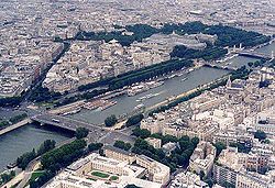
- RisleRisleThe Risle is a long river in Normandy, left tributary of the Seine.The river begins in Orne west of L'Aigle, crosses the western part of the department of Eure flowing from south to north and out into the estuary of the Seine on the left bank near Berville-sur-Mer...
(in Berville-sur-MerBerville-sur-MerBerville-sur-Mer is a commune in the Eure department in northern France.It was the crossing point of the River Seine before the Pont de Normandie opened. It is now a pretty village located on the banks of the river Seine. It is also notable for the longest barn in Normandy at 77 metres long...
) - Eure (in Pont-de-l'ArchePont-de-l'ArchePont-de-l'Arche is a commune of the Eure département in France.-Population:-External links:*...
)- ItonItonThe Iton is a river in Normandy, France, left tributary of the Eure River. Its source is near Moulins-la-Marche. For about 10 km between Orvaux and Glisolles, it disappears and pursues a subterranean course....
(near LouviersLouviersLouviers is a commune in the Eure department in Haute-Normandie in northern France.Louviers is from Paris and from Rouen.-Population:-Sights:Its church, Notre Dame, has parts which date from the thirteenth century...
)
- Iton
- EpteEpteThe Epte is a river in Seine-Maritime and Eure, in Normandy, France. It is a right tributary of the Seine.The river rises in Seine-Maritime in the Pays de Bray, near Forges-les-Eaux...
(near VernonVernon, EureVernon is a commune in the department of Eure in the Haute-Normandie region in northern France.It lies on the banks of the Seine River, about midway between Paris and Rouen...
) - Oise (in Conflans-Sainte-HonorineConflans-Sainte-HonorineConflans-Sainte-Honorine is a commune in the Yvelines department in the Île-de-France region in north-central France. It is located in the north-western suburbs of Paris from the center....
, west of Paris)- Aisne (in CompiègneCompiègneCompiègne is a city in northern France. It is designated municipally as a commune within the département of Oise.The city is located along the Oise River...
)- VesleVesleThe Vesle is the river on which the city of Reims stands. It is a fourth order river of France and a left-bank tributary of the Aisne River. It is 140 kilometres long, rises in the département of Marne through which it flows most of its course.-Geography:...
(in Condé-sur-AisneCondé-sur-AisneCondé-sur-Aisne is a commune in the Aisne department in Picardy in northern France.-References:*...
) - AireAire (Aisne)The Aire is a river in northern France, right tributary of the Aisne. Its source is near the village Saint-Aubin-sur-Aire. Its course crosses the départements of Meuse and Ardennes. It flows through the towns of Pierrefitte-sur-Aire, Clermont-en-Argonne, Varennes-en-Argonne and Grandpré, finally...
(near GrandpréGrandpré, ArdennesGrandpré is a commune in the Ardennes department in northern France.-References:*...
)
- Vesle
- Aisne (in Compiègne
- Marne (in Ivry-sur-SeineIvry-sur-SeineIvry-sur-Seine is a commune in the Val-de-Marne department in the southeastern suburbs of Paris, France. It is located from the center of Paris....
, south-east of Paris)- Grand MorinGrand MorinThe Grand Morin is a 118 km long river in France, left tributary of the Marne. Its source is near the village of Lachy. Its course crosses the departments of Marne and Seine-et-Marne...
(near MeauxMeauxMeaux is a commune in the Seine-et-Marne department in the Île-de-France region in the metropolitan area of Paris, France. It is located east-northeast from the center of Paris. Meaux is a sub-prefecture of the department and the seat of an arondissement...
) - Saulx (in Vitry-le-FrançoisVitry-le-FrançoisVitry-le-François is a commune in the Marne department in north-eastern France. It is located on the Marne River and is the western terminus of the Marne-Rhine Canal.- History :In 1142, Louis VII invaded Champagne and seized Vitry-le-François...
)- OrnainOrnainThe Ornain is a 116 km long river in northeastern France, right tributary of the Saulx . It is formed near the village Gondrecourt-le-Château by the confluence of the small rivers Ognon and Maldite. It flows generally northwest...
(in Pargny-sur-SaulxPargny-sur-SaulxPargny-sur-Saulx is a commune in the Marne department in north-eastern France.Pargny-sur-Saulx is known for its tiles, which are exported sometimes to Singapore, giving it the nickname "the city of the tiles"...
)
- Ornain
- Grand Morin
- LoingLoingThe Loing is a 142 km long river in central France, a left tributary of the Seine. Its source is in Sainte-Colombe-sur-Loing, in the south of the Yonne département.The Loing flows into the Seine in Saint-Mammès, near Moret-sur-Loing...
(near Moret-sur-LoingMoret-sur-LoingMoret-sur-Loing is a commune in the Seine-et-Marne department in the Île-de-France region in north-central France.The town was a source of inspiration for Monet, Renoir and Sisley.-Twin towns:...
) - Yonne (in Montereau-Fault-YonneMontereau-Fault-YonneMontereau-Fault-Yonne, or simply Montereau, is a commune in the Seine-et-Marne department in the Île-de-France region in north-central France.-Name:...
)- ArmançonArmançonThe River Armançon drains part of north-western Burgundy in France. It rises in the département of Côte-d'Or and flows into the River Yonne at Migennes...
(in MigennesMigennesMigennes is a commune in the Yonne department in Burgundy in north-central France....
) - Cure (near VermentonVermentonVermenton is a commune in the Yonne department in Burgundy in north-central France.The remains of the former Cistercian Reigny Abbey are situated here....
) - SereinSereinThe Serein is a river of eastern France. It is the main waterway of the Chablis wine district in Burgundy.-Origin of the name:Serein is the French word for "serene". This may reflect the placid nature of its course, or the strong monastic tradition in the area.-Geography:The Serein rises in the...
(in BassouBassouBassou is a commune in the Yonne department in Burgundy in north-central France....
)
- Armançon
- Aube (near Romilly-sur-SeineRomilly-sur-SeineRomilly-sur-Seine is a commune in the Aube department in north-central France.-Population:-Twin towns:Romilly-sur-Seine is twinned with: Milford Haven, United Kingdom Gotha, Germany Lüdenscheid, Germany Medicina, Italy Uman, Ukraine-References:*...
)
- Risle
- Touques (in DeauvilleDeauvilleDeauville is a commune in the Calvados département in the Basse-Normandie region in northwestern France.With its racecourse, harbour, international film festival, marinas, conference centre, villas, Grand Casino and sumptuous hotels, Deauville is regarded as the "queen of the Norman beaches" and...
) - Dives (in CabourgCabourgCabourg is a commune in the Calvados department in the Basse-Normandie region of France.Cabourg belongs to the Paris Basin. The commune is located next to the sea and the back country is a plain, favourable to the cereal culture...
) - Orne (in OuistrehamOuistrehamOuistreham is a commune in the Calvados department' in the Basse-Normandie region in northwestern France.Ouistreham is a small port with fishing boats, leisure craft and a ferry-harbour. It serves as the port of the city of Caen. The town is about the mouth of the Canal de Caen à la...
)- Odon (in CaenCaenCaen is a commune in northwestern France. It is the prefecture of the Calvados department and the capital of the Basse-Normandie region. It is located inland from the English Channel....
)
- Odon (in Caen
- Vire (in Isigny-sur-MerIsigny-sur-MerIsigny-sur-Mer is a commune in the Calvados department in the Basse-Normandie region in northwestern France.-Geography:Positioned at the bottom of the baie des Veys, Isigny is an important milk production area, known for its AOC butter and cream, as well as its cheeses made by the Isigny Sainte...
) - Rance (in Saint-MaloSaint-MaloSaint-Malo is a walled port city in Brittany in northwestern France on the English Channel. It is a sub-prefecture of the Ille-et-Vilaine.-Demographics:The population can increase to up to 200,000 in the summer tourist season...
)
Irish SeaIrish SeaThe Irish Sea separates the islands of Ireland and Great Britain. It is connected to the Celtic Sea in the south by St George's Channel, and to the Atlantic Ocean in the north by the North Channel. Anglesey is the largest island within the Irish Sea, followed by the Isle of Man...
The rivers in this section are sorted clockwise, starting from the (Mull of KintyreMull of Kintyre
The Mull of Kintyre is the southwesternmost tip of the Kintyre Peninsula in southwest Scotland. From here, the Antrim coast is visible and an historic lighthouse, the second commissioned in Scotland, guides shipping in the intervening North Channel...
).
In Britain:
- ClydeRiver ClydeThe River Clyde is a major river in Scotland. It is the ninth longest river in the United Kingdom, and the third longest in Scotland. Flowing through the major city of Glasgow, it was an important river for shipbuilding and trade in the British Empire....
(near GlasgowGlasgowGlasgow is the largest city in Scotland and third most populous in the United Kingdom. The city is situated on the River Clyde in the country's west central lowlands...
)
- Dee (Galloway)River Dee, GallowayThe River Dee, in south-west Scotland, flows from its source in Loch Dee amongst the Galloway Hills, firstly to Clatteringshaws Loch, then in to Loch Ken, where it joins the Water of Ken. From there, the Dee flows southwards to Kirkcudbright, and into Kirkcudbright Bay to reach the Solway. The...
(in KirkcudbrightKirkcudbrightKirkcudbright, is a town in Dumfries and Galloway, Scotland.The town lies south of Castle Douglas and Dalbeattie, in the part of Dumfries and Galloway known as the Stewartry, at the mouth of the River Dee, some six miles from the sea...
) - EdenRiver Eden, CumbriaThe River Eden is a river that flows through Cumbria, England on its way to the Solway Firth.-Course of river:The Eden rises in Black Fell Moss, Mallerstang, on the high ground between High Seat, Yorkshire Dales and Hugh Seat. Here it forms the boundary between the counties of Cumbria and North...
(near Carlisle) - RibbleRiver RibbleThe River Ribble is a river that runs through North Yorkshire and Lancashire, in northern England. The river's drainage basin also includes parts of Greater Manchester around Wigan.-Geography:...
(in Lytham St AnnesLytham St AnnesLytham St Annes is a conurbation in the Fylde district of Lancashire, England. The neighbouring towns of Lytham and St-Anne's-on-the-Sea have grown together and now form a seaside resort...
) - MerseyRiver MerseyThe River Mersey is a river in North West England. It is around long, stretching from Stockport, Greater Manchester, and ending at Liverpool Bay, Merseyside. For centuries, it formed part of the ancient county divide between Lancashire and Cheshire....
(near LiverpoolLiverpoolLiverpool is a city and metropolitan borough of Merseyside, England, along the eastern side of the Mersey Estuary. It was founded as a borough in 1207 and was granted city status in 1880...
) - IrwellRiver IrwellThe River Irwell is a long river which flows through the Irwell Valley in the counties of Lancashire and Greater Manchester in North West England. The river's source is at Irwell Springs on Deerplay Moor, approximately north of Bacup, in the parish of Cliviger, Lancashire...
(near IrlamIrlamIrlam is a suburban town and unparished area within the City of Salford in Greater Manchester, England. At the 2001 census it had a population of 18,504. The town lies on flat ground on the south side of the M62 motorway and the north bank of the Manchester Ship Canal, and is west-southwest of...
) - Dee (Wales)River Dee, WalesThe River Dee is a long river in the United Kingdom. It travels through Wales and England and also forms part of the border between the two countries....
(in FlintFlint, FlintshireFlint is a town in Flintshire, North Wales, lying on the estuary of the River Dee. It was the county town of the historic county of Flintshire and today is the third largest town in Flintshire. According to the 2001 Census the population of the community of Flint was 12,804...
)
In Ireland:
- Slaney (in WexfordWexfordWexford is the county town of County Wexford, Ireland. It is situated near the southeastern corner of Ireland, close to Rosslare Europort. The town is connected to Dublin via the M11/N11 National Primary Route, and the national rail network...
) - AvocaRiver AvocaThe Avoca is a river in County Wicklow, Ireland. It is contained completely within the county.The Avoca starts life as two rivers, the Avonmore and the Avonbeg...
(in ArklowArklowArklow , also known as Inbhear Dé from the Avonmore river's older name Abhainn Dé, is a historic town located in County Wicklow on the east coast of Ireland. Founded by the Vikings in the ninth century, Arklow was the site of one of the bloodiest battles of the 1798 rebellion...
) - LiffeyRiver LiffeyThe Liffey is a river in Ireland, which flows through the centre of Dublin. Its major tributaries include the River Dodder, the River Poddle and the River Camac. The river supplies much of Dublin's water, and a range of recreational opportunities.-Name:The river was previously named An Ruirthech,...
(in Dublin) - BoyneRiver BoyneThe River Boyne is a river in Leinster, Ireland, the course of which is about long. It rises at Trinity Well, Newbury Hall, near Carbury, County Kildare, and flows towards the Northeast through County Meath to reach the Irish Sea between Mornington, County Meath and Baltray, County Louth. Salmon...
(in DroghedaDroghedaDrogheda is an industrial and port town in County Louth on the east coast of Ireland, 56 km north of Dublin. It is the last bridging point on the River Boyne before it enters the Irish Sea....
)
Western Mediterranean
This section includes the Ligurian SeaLigurian Sea
The Ligurian Sea is an arm of the Mediterranean Sea, between the Italian Riviera and the island of Corsica. The sea is probably named after the ancient Ligures people.-Geography:...
and the Tyrrhenian Sea
Tyrrhenian Sea
The Tyrrhenian Sea is part of the Mediterranean Sea off the western coast of Italy.-Geography:The sea is bounded by Corsica and Sardinia , Tuscany, Lazio, Campania, Basilicata and Calabria and Sicily ....
. The rivers are sorted from west (Tarifa
Tarifa
Tarifa is a small town in the province of Cádiz, Andalusia, on the southernmost coast of Spain. The town is located on the Costa de la Luz and across the Straits of Gibraltar facing Morocco. The municipality includes Punta de Tarifa, the southernmost point in continental Europe. There are five...
) to east (Reggio Calabria
Reggio Calabria
Reggio di Calabria , commonly known as Reggio Calabria or Reggio, is the biggest city and the most populated comune of Calabria, southern Italy, and is the capital of the Province of Reggio Calabria and seat of the Council of Calabrian government.Reggio is located on the "toe" of the Italian...
).
In Spain:
- GuadalhorceGuadalhorceThe Guadalhorce River is the principal river of the Province of Málaga, southern Spain....
(in MálagaMálagaMálaga is a city and a municipality in the Autonomous Community of Andalusia, Spain. With a population of 568,507 in 2010, it is the second most populous city of Andalusia and the sixth largest in Spain. This is the southernmost large city in Europe...
) - SeguraSeguraSegura is a medium-sized river in southeastern Spain.It starts at Santiago Pontones , passes Calasparra, Cieza, Murcia, Beniaján, Orihuela, Rojales and ends in the Mediterranean Sea near Guardamar del Segura in the province of Alicante...
(in Guardamar del SeguraGuardamar del SeguraGuardamar del Segura or briefly Guardamar is a municipality of the province of Alicante located at the mouth of the river Segura in southern Valencia , Spain...
)- GuadalentinGuadalentínGuadalentín is a river of Spain. It is a tributary of Segura....
(near MurciaMurcia-History:It is widely believed that Murcia's name is derived from the Latin words of Myrtea or Murtea, meaning land of Myrtle , although it may also be a derivation of the word Murtia, which would mean Murtius Village...
) - Mundo (near HellínHellínHellín is a town and municipality located in the south of the province of Albacete, in Castile-La Mancha, Spain. , it has a population of 31,109....
)
- Guadalentin
- JúcarJúcarThe Júcar or Xúquer is a river on the Iberian Peninsula of Spain. The river runs for approximately 509 km from its source at Ojuelos de Valdeminguete, on the eastern flank of the Montes Universales, Sistema Ibérico...
/Xúquer (in CulleraCulleraCullera is a municipality in Valencia in the Valencian Community, Spain, situated in the Ribera Baixa comarca.-Geography:Cullera is situated at the mouth of the Júcar river, 40 kilometers from the capital of Valencia.-Neighborhoods and hamlets:...
)- Magre/Magro (in AlgemesíAlgemesíAlgemesí is a municipality in the comarca of Ribera Alta in the Valencian Community, Spain.The town of Algemesí is one of the major centres for the production of citruses in Spain, and several cooperatives are based there...
) - Cabriol/Cabriel (in CofrentesCofrentesCofrentes is a town in the province of Valencia.There is a nuclear power plant in Cofrentes....
)
- Magre/Magro (in Algemesí
- TuriaTuría (river)The Turia is a small river, 9 km in length and an altitude of 250 m above the sea, which rises in the town of Taramundi and drains into the Eo River in the town of Puente Nuevo ....
/Túria (in Valencia) - EbroEbroThe Ebro or Ebre is one of the most important rivers in the Iberian Peninsula. It is the biggest river by discharge volume in Spain.The Ebro flows through the following cities:*Reinosa in Cantabria.*Miranda de Ebro in Castile and León....
/Ebre (near TortosaTortosa-External links:* *** * * *...
)- Segre (in MequinenzaMequinenzaMequinenza or Mequinensa is a town and municipality of the province of Zaragoza, in the autonomous community of Aragon, Spain. It is located by the confluence of the rivers Segre and Ebro.-History & Features:...
)- CincaCinca (Spain)The Cinca is a river in Aragon, Spain. Its source is in the Circo de Pineta, in the Ordesa y Monte Perdido National Park, in the Aragonese Pyrenees. It is a tributary to the Segre River, with its confluence at La Granja d'Escarp, not far from the point where the Segre flows into the Ebro River...
(near Mequinenza) - Noguera Ribagorzana (near LleidaLleidaLleida is a city in the west of Catalonia, Spain. It is the capital city of the province of Lleida, as well as the largest city in the province and it had 137,387 inhabitants , including the contiguous municipalities of Raimat and Sucs. The metro area has about 250,000 inhabitants...
) - Noguera PallaresaNoguera PallaresaThe Noguera Pallaresa is a river in Catalonia, Spain. Its source is at Era Font d'era Noguereta in the municipality of Naut Aran at an elevation of about 2000 m and barely a hundred meters from those of the Garonne...
(near BalaguerBalaguerBalaguer is the capital of the comarca of Noguera, in the province of Lleida, Catalonia, Spain.It is located by the river Segre, a tributary to the Ebre....
) - Valira (in La Seu d'UrgellLa Seu d'UrgellLa Seu d'Urgell is a town located in the Catalan Pyrenees in Spain. La Seu d'Urgell is also the capital of the comarca Alt Urgell, head of the judicial district of la Seu d'Urgell and the seat of Bishop of Urgell, one of the Andorra co-princes...
)
- Cinca
- GállegoGállego (river)The Gállego is a river in Aragon, Spain, one of the main tributaries of the Ebro River. It has a watershed of over 4,000 km², with a total length of 193.2 km....
(in ZaragozaZaragozaZaragoza , also called Saragossa in English, is the capital city of the Zaragoza Province and of the autonomous community of Aragon, Spain...
) - Aragón (near TudelaTudela, NavarreTudela is a municipality in Spain, the second city of the autonomous community of Navarre. Its population is around 35,000. Tudela is sited in the Ebro valley. Fast trains running on two-track electrified railways serve the city and two freeways join close to it...
)
- Segre (in Mequinenza
- FrancolíFrancolíThe Francolí is a river in Catalonia . Its source is in the Prades Mountains and it flows into the Mediterranean Sea at Tarragona....
(near TarragonaTarragonaTarragona is a city located in the south of Catalonia on the north-east of Spain, by the Mediterranean. It is the capital of the Spanish province of the same name and the capital of the Catalan comarca Tarragonès. In the medieval and modern times it was the capital of the Vegueria of Tarragona...
) - GaiàGaiàGaià is a village in the province of Barcelona and autonomous community of Catalonia, Spain....
(near Tarragona) - Foix (near Vilanova i la GeltrúVilanova i la GeltrúVilanova i la Geltrú is a city in the province of Barcelona, Catalonia, Spain and the capital of the Garraf comarca. Originally a fishing port, the city has a growing population of approximately 66,000, and is situated 40 km south-west of Barcelona, with the more famous coastal resort of...
) - LlobregatLlobregatThe Llobregat is the second longest river in Catalonia, Spain. It originates in Castellar de n'Hug at an altitude of 1,259 meters in the Serra del Cadí, and ends in the Mediterranean Sea, in the municipality of El Prat de Llobregat, near Barcelona...
(between BarcelonaBarcelonaBarcelona is the second largest city in Spain after Madrid, and the capital of Catalonia, with a population of 1,621,537 within its administrative limits on a land area of...
and El Prat de LlobregatEl Prat de LlobregatEl Prat de Llobregat , commonly known as El Prat, is a municipality in the comarca of Baix Llobregat inCatalonia, Spain. It is situated in the delta of the Llobregat river on the right bank, bordering the coast of the Mediterranean Sea between Barcelona and Viladecans. More than a quarter of the...
) - Besòs (at Sant Adrià del Besòs)
- Ter (in l'EstartitL'EstartitL'Estartit is a small town and seaside resort on the Costa Brava, on the north-eastern coast of Spain.The town is situated between the foothills of the Montgrí Massif and the Mediterranean Sea, and is part of the borough of Torroella de Montgrí, in the Baix Empordà county, Girona province,...
) - FluviàFluviàThe Fluvià is a river in Catalonia. It rises in the Serralada Transversal, passes through Olot, and flows into the Mediterranean Sea near Sant Pere Pescador.- See also :* List of rivers of Spain...
(near Sant Pere PescadorSant Pere PescadorSant Pere Pescador is a municipality in the comarca of Alt Empordà, Girona, Catalonia, Spain, is a small town in the Bay of Roses on the river Fluvià....
)
In France:
- Têt (near PerpignanPerpignan-Sport:Perpignan is a rugby stronghold: their rugby union side, USA Perpignan, is a regular competitor in the Heineken Cup and seven times champion of the Top 14 , while their rugby league side plays in the engage Super League under the name Catalans Dragons.-Culture:Since 2004, every year in the...
) - Aude (near NarbonneNarbonneNarbonne is a commune in southern France in the Languedoc-Roussillon region. It lies from Paris in the Aude department, of which it is a sub-prefecture. Once a prosperous port, it is now located about from the shores of the Mediterranean Sea...
) - Orb (in Valras-PlageValras-PlageValras-Plage is a commune in the Hérault department in Languedoc-Roussillon southern France....
) - Hérault (near AgdeAgdeAgde is a commune in the Hérault department in southern France. It is the Mediterranean port of the Canal du Midi.-Location:Agde is located on the river Hérault, 4 km from the Mediterranean Sea, and 750 km from Paris...
)
- RhôneRhôneRhone can refer to:* Rhone, one of the major rivers of Europe, running through Switzerland and France* Rhône Glacier, the source of the Rhone River and one of the primary contributors to Lake Geneva in the far eastern end of the canton of Valais in Switzerland...
(in Port-Saint-Louis-du-RhônePort-Saint-Louis-du-RhônePort-Saint-Louis-du-Rhône is a commune in the Bouches-du-Rhône department in southern France.-History:The commune was created in 1904 from Arles and Fos-sur-Mer on which its history is dependent. The Saint-Louis channel was dug in 1871...
) - Switzerland, France
- GardonGardonThe Gardon or Gard is a river in southern France. It is the namesake of the Gard département. Several of its tributaries are also called Gardon....
(in Beaucaire) - DuranceDuranceThe Durance is a major river in south-eastern France.Its source is in the south-western Alps, in Montgenèvre ski resort near Briançon and it flows south-west through the following départements and cities:* Hautes-Alpes: Briançon, Embrun.* Alpes-de-Haute-Provence: Sisteron, Manosque.* Vaucluse:...
(in AvignonAvignonAvignon is a French commune in southeastern France in the départment of the Vaucluse bordered by the left bank of the Rhône river. Of the 94,787 inhabitants of the city on 1 January 2010, 12 000 live in the ancient town centre surrounded by its medieval ramparts.Often referred to as the...
)- Verdon (in Saint-Paul-lès-DuranceSaint-Paul-lès-DuranceSaint-Paul-lès-Durance is a commune in the Bouches-du-Rhône department in southern France.The Cadarache research center for nuclear energy is located in Saint-Paul-lès-Durance.-Population:-External links:* * * * * * * * *...
)
- Verdon (in Saint-Paul-lès-Durance
- Ardèche (in Pont-Saint-EspritPont-Saint-EspritPont-Saint-Esprit is a commune in the Gard département in southern France. It is situated on the Rhône River and is the site of a historical crossing, hence its name...
) - Drôme (in Loriol-sur-DrômeLoriol-sur-DrômeLoriol-sur-Drôme is a commune in the Drôme department in southeastern France.-Population:-References:*...
) - Isère (near ValenceValence, DrômeValence is a commune in southeastern France, the capital of the Drôme department, situated on the left bank of the Rhône, south of Lyon on the railway to Marseilles.Its inhabitants are called Valentinois...
)- Drac (in GrenobleGrenobleGrenoble is a city in southeastern France, at the foot of the French Alps where the river Drac joins the Isère. Located in the Rhône-Alpes region, Grenoble is the capital of the department of Isère...
) - ArcArc (Savoie)The Arc is a 128 km long river in the Savoie département of south-eastern France. It is a left tributary of the Isère River, which it joins at Chamousset, approximately 15 km downstream from Albertville. Its source is near the border with Italy, in the Graian Alps, northeast of Bonneval-sur-Arc...
(near AlbertvilleAlbertvilleAlbertville is a commune in the Savoie department in the Rhône-Alpes region in south-eastern France.The town is best known for hosting the 1992 Winter Olympics.-Geography:...
)
- Drac (in Grenoble
- SaôneSaôneThe Saône is a river of eastern France. It is a right tributary of the River Rhône. Rising at Vioménil in the Vosges department, it joins the Rhône in Lyon....
(in LyonLyonLyon , is a city in east-central France in the Rhône-Alpes region, situated between Paris and Marseille. Lyon is located at from Paris, from Marseille, from Geneva, from Turin, and from Barcelona. The residents of the city are called Lyonnais....
)- Doubs (in Verdun-sur-le-DoubsVerdun-sur-le-DoubsVerdun-sur-le-Doubs is a commune in the Saône-et-Loire department in the region of Bourgogne in eastern France.It is located in southern Burgundy at the confluence of the Doubs and the Saône in the Bresse plain, near Beaune and Chalon-sur-Saône....
)- LoueLoueThe Loue is a river of eastern France, a left tributary of the Doubs, which it joins downstream of Dole. Its source is a karstic spring in the Jura mountains near Ouhans, which at least partly receives its water from the Doubs...
(near DoleDole, JuraDole is a commune in the Jura department in the Franche-Comté region in eastern France, of which it is a subprefecture ....
)
- Loue
- OgnonOgnon (Franche-Comté)The Ognon is a river of eastern France. It is a left tributary of the Saône, which it joins in Pontailler-sur-Saône. Its source is in the Vosges mountains near the Ballon d'Alsace.The Ognon flows through the following départements and towns:...
(in Pontailler-sur-SaônePontailler-sur-SaônePontailler-sur-Saône is a commune in the Côte-d'Or department in eastern France.-Population:-References:*...
)
- Doubs (in Verdun-sur-le-Doubs
- Ain (near Pont-de-ChéruyPont-de-ChéruyPont-de-Chéruy is a commune in the Isère department in south-eastern France.-Geography:The Bourbre flows northward through the middle of the commune and crosses the town.-See also:*Communes of the Isère department...
) - ArveArveThe Arve river flows for approximately 100 km through France, in the département of Haute-Savoie, and in Switzerland...
(in GenevaGenevaGeneva In the national languages of Switzerland the city is known as Genf , Ginevra and Genevra is the second-most-populous city in Switzerland and is the most populous city of Romandie, the French-speaking part of Switzerland...
)
- Gardon
- ArgensArgensThe Argens is a 116 km long river of the French Riviera. Its basin is fully included in the Var department.The river goes through Vidauban, Le Muy, Roquebrune-sur-Argens, Fréjus, then it flows into the Mediterranean sea, near Fréjus....
(in FréjusFréjusFréjus is a commune in the Var department in the Provence-Alpes-Côte d'Azur region in southeastern France.It neighbours Saint-Raphaël, effectively forming one town...
) - Var (near NiceNiceNice is the fifth most populous city in France, after Paris, Marseille, Lyon and Toulouse, with a population of 348,721 within its administrative limits on a land area of . The urban area of Nice extends beyond the administrative city limits with a population of more than 955,000 on an area of...
)
In Italy:
- ArnoArnoThe Arno is a river in the Tuscany region of Italy. It is the most important river of central Italy after the Tiber.- Source and route :The river originates on Mount Falterona in the Casentino area of the Apennines, and initially takes a southward curve...
(near PisaPisaPisa is a city in Tuscany, Central Italy, on the right bank of the mouth of the River Arno on the Tyrrhenian Sea. It is the capital city of the Province of Pisa...
)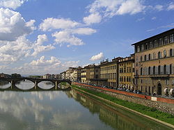
- OmbroneOmbroneThe Ombrone is a 160 km long river in Tuscany, central Italy.The Ombrone's source is located near Castelnuovo Berardenga, on the south-eastern side of the Monti del Chianti...
(near GrossetoGrossetoGrosseto is a city and comune in the central Italian region of Tuscany, the capital of the Province of Grosseto. The city lies 14 km from the Tyrrhenian Sea, in the Maremma, at the centre of an alluvial plain, on the Ombrone river....
) - TiberTiberThe Tiber is the third-longest river in Italy, rising in the Apennine Mountains in Emilia-Romagna and flowing through Umbria and Lazio to the Tyrrhenian Sea. It drains a basin estimated at...
/Tevere (in OstiaOstia Antica (district)thumb|300px|The Castle of Julius II in Ostia Antica.thumb|300px|The square of Ostia Antica, with the church of Santa Aurea on the right.Ostia Antica is a district in the commune of Rome, Italy, five kilometers away from the coast. It is distinct from Ostia.- History :Under the Romans, Ostia Antica...
)- AnieneAniene-External links:* http://www.humnet.ucla.edu/humnet/horaces-villa/glossary/Anio.gloss.html*...
(in Rome) - Nera (near OrteOrteOrte is a comune in the province of Viterbo, in the Italian region Latium Lazio, located about 60 km north of Rome and about 24 km east of Viterbo. As of 31 December 2006, Orte had a population of 8,364....
)
- Aniene
- VolturnoVolturnoThe Volturno is a river in south-central Italy.-Geography:It rises in the Abruzzese central Apennines of Samnium near Rocchetta a Volturno and flows southeast as far as its junction with the Calore River near Caiazzo and runs south as far as Venafro, and then turns southwest, past Capua, to...
(in Castel VolturnoCastel VolturnoCastel Volturno is a comune in the Province of Caserta in the Italian region Campania, located about 35 km northwest of Naples and about 35 km west of Caserta on the Volturno river.-History:...
)
Adriatic SeaAdriatic SeaThe Adriatic Sea is a body of water separating the Italian Peninsula from the Balkan peninsula, and the system of the Apennine Mountains from that of the Dinaric Alps and adjacent ranges...
The rivers in this section are sorted clockwise, from OtrantoOtranto
Otranto is a town and comune in the province of Lecce , in a fertile region once famous for its breed of horses.It is located on the east coast of the Salento peninsula. The Strait of Otranto, to which the city gives its name, connects the Adriatic Sea with the Ionian Sea and Italy with Albania...
, southern Italy, to Vlorë
Vlorë
Vlorë is one of the biggest towns and the second largest port city of Albania, after Durrës, with a population of about 94,000 . It is the city where the Albanian Declaration of Independence was proclaimed on November 28, 1912...
in southern Albania.
In Italy:
- OfantoOfantoThe Ofanto, known in ancient times as Aufidus, from the Greek Ophidus, Ωφιδους, meaning snake, is a 170 km river in southern Italy...
(near BarlettaBarlettaBarletta is a city and comune located in the north of Apulia in south eastern Italy. Its current population is 94,140.It is famous for the Colossus of Barletta, a bronze statue, representing a Roman Emperor...
) - TrignoTrignoThe Trigno is an 85 km Italian river. It originates in the Apennine Mountains, in the province of Isernia and flows into the Adriatic Sea near Vasto. It also forms the border between the regions Abruzzo and Molise.-See also:...
(near VastoVastoVasto is a town and comune on the Adriatic coast of the Province of Chieti in southern Abruzzo, Italy. The population is now just over 40,000.-History:According to tradition, the town was founded by Diomedes, the Greek hero...
) - Sangro (near OrtonaOrtonaOrtona is a coastal town and municipality of the Province of Chieti in the Italian region of Abruzzo, with some 23,000 inhabitants.Ortona was the site of fierce fighting between German and Canadian forces during the Italian campaign in World War II...
) - Aterno-Pescara (in PescaraPescaraPescara is the capital city of the Province of Pescara, in the Abruzzo region of Italy. As of January 1, 2007 it was the most populated city within Abruzzo at 123,059 residents, 400,000 with the surrounding metropolitan area...
) - TrontoTrontoThe Tronto is a 115 km-long Italian river that arises at Monte della Laghetta and ends in the Adriatic Sea at Porto d'Ascoli, San Benedetto del Tronto. Anciently the Truentus, it traverses the Lazio, Marche, and Abruzzo regions....
(near San Benedetto del TrontoSan Benedetto del TrontoSan Benedetto del Tronto is a city and comune in Marche, Italy, in the province of Ascoli Piceno. It lies on the Adriatic Sea. San Benedetto del Tronto is an important little town on the Marche coast, an active fishing port and one of the main seaside resorts on the central Adriatic coast.Located...
) - MetauroMetauroThe Metauro is a river of the Marche, central Italy. It rises in the Apennine Mountains and runs east for 110 km ....
(in FanoFanoFano is a town and comune of the province of Pesaro and Urbino in the Marche region of Italy. It is a beach resort 12 km southeast of Pesaro, located where the Via Flaminia reaches the Adriatic Sea...
) - MarecchiaMarecchiaThe Marecchia is a river in eastern Italy. In ancient times it was known as the Ariminus which was from the Greek Ariminos, Αριμινος . The source of the river is east of Pieve Santo Stefano and southwest of Badia Tedalda in the province of Arezzo in Tuscany...
(near RiminiRiminiRimini is a medium-sized city of 142,579 inhabitants in the Emilia-Romagna region of Italy, and capital city of the Province of Rimini. It is located on the Adriatic Sea, on the coast between the rivers Marecchia and Ausa...
) - RubiconRubiconThe Rubicon is a shallow river in northeastern Italy, about 80 kilometres long, running from the Apennine Mountains to the Adriatic Sea through the southern Emilia-Romagna region, between the towns of Rimini and Cesena. The Latin word rubico comes from the adjective "rubeus", meaning "red"...
(near CesenaticoCesenaticoCesenatico is a port town with about 20,000 inhabitants on the Adriatic coast of Italy. It is located in the province of Forlì-Cesena in the region of Emilia-Romagna, about 30 km south of Ravenna...
) - Savio (near CesenaCesenaCesena is a city and comune in the Emilia-Romagna region of northern Italy, south of Ravenna and west of Rimini, on the Savio River, co-chief of the Province of Forlì-Cesena. It is at the foot of the Apennines, and about 15 km from the Adriatic Sea.-History:Cesena was originally an Umbrian...
) - Montone (near ForlìForlìForlì is a comune and city in Emilia-Romagna, Italy, and is the capital of the province of Forlì-Cesena. The city is situated along the Via Emilia, to the right of the Montone river, and is an important agricultural centre...
) - Reno (near ComacchioComacchioComacchio is a town and comune of Emilia Romagna, Italy, in the province of Ferrara, 48 km from the provincial capital Ferrara.-Geography:...
)- SenioSenioThe Senio is a 92 km river of Romagna in Italy, the final right-sided tributary of the river Reno. The mean discharge at its mouth is about 10 m³/s; however this can vary from a minimum of 0.3 m³/s to a maximum of 500 m³/s....
(near FaenzaFaenzaFaenza is an Italian city and comune, in the province of Ravenna, Emilia-Romagna, situated 50 km southeast of Bologna.Faenza is noted for its manufacture of majolica ware glazed earthenware pottery, known from the name of the town as "faience"....
)
- Senio
- Po (several branches near Porto TollePorto TollePorto Tolle is a town in the province of Rovigo, Veneto, Italy.The municipality of Porto Tolle contains the frazioni :Boccasette, Ca' Mello, Ca' Tiepolo , Ca' Venier, Ca' Zuliani, Donzella, Pila, Polesine Camerini, Santa Giulia, Scardovari and Tolle....
)- PanaroPanaroThe Panaro is an Italian river and the final right-hand tributary to the Po, discounting the Cavo Napoleonico canal. It runs right across Emilia-Romagna in a north-easterly direction: from its source close to the Apennine watershed, where Emilia-Romagna meets Tuscany, to its outlet where the Po...
(near FerraraFerraraFerrara is a city and comune in Emilia-Romagna, northern Italy, capital city of the Province of Ferrara. It is situated 50 km north-northeast of Bologna, on the Po di Volano, a branch channel of the main stream of the Po River, located 5 km north...
) - Secchia (near MantuaMantuaMantua is a city and comune in Lombardy, Italy and capital of the province of the same name. Mantua's historic power and influence under the Gonzaga family, made it one of the main artistic, cultural and notably musical hubs of Northern Italy and the country as a whole...
) - MincioMincioMincio is a river in the Lombardy region of northern Italy.Called the Sarca River before entering Lake Garda, it flows from there about 65 km past Mantua into the Po River....
(near Mantua) - OglioOglioThe Oglio is a left-side tributary of the Po River in Lombardy, Italy. It is 280 km long....
(near Mantua)- ChieseChieseThe Chiese, also known in the Province of Brescia as the Clisi, is a 160 km Italian river which is the principal immisary and sole emissary of the sub-alpine lake Lago d’Idro, and is a left tributary of the Oglio....
(near Asola)
- Chiese
- Taro (north of ParmaParmaParma is a city in the Italian region of Emilia-Romagna famous for its ham, its cheese, its architecture and the fine countryside around it. This is the home of the University of Parma, one of the oldest universities in the world....
) - AddaAdda (river)The Adda is a river in North Italy, a tributary of the Po. It rises in the Alps near the border with Switzerland and flows through Lake Como. The Adda joins the Po a few kilometres upstream of Cremona. It is 313 kilometres long...
(in CremonaCremonaCremona is a city and comune in northern Italy, situated in Lombardy, on the left bank of the Po River in the middle of the Pianura Padana . It is the capital of the province of Cremona and the seat of the local City and Province governments...
) - TrebbiaTrebbiaThe Trebbia is a river predominantly of Liguria and Emilia Romagna in northern Italy. It is one of the four main right-bank tributaries of the river Po, the other three being the Tanaro, the Secchia and the Panaro...
(in PiacenzaPiacenzaPiacenza is a city and comune in the Emilia-Romagna region of northern Italy. It is the capital of the province of Piacenza...
) - Ticino (in PaviaPaviaPavia , the ancient Ticinum, is a town and comune of south-western Lombardy, northern Italy, 35 km south of Milan on the lower Ticino river near its confluence with the Po. It is the capital of the province of Pavia. It has a population of c. 71,000...
) - Tanaro (near AlessandriaAlessandria-Monuments:* The Citadel * The church of Santa Maria di Castello * The church of Santa Maria del Carmine * Palazzo Ghilini * Università del Piemonte Orientale-Museums:* The Marengo Battle Museum...
)- Stura di DemonteStura di DemonteStura di Demonte is a 111 km long river in northwestern Italy . It is a tributary to the river Tanaro, which is a tributary of the river Po. Its source is in the Alps, near the border with France. It flows through Demonte and Cuneo before joining the Tanaro just east of Cherasco....
(near Bra)
- Stura di Demonte
- SesiaSesiaSesia may refer to:* Sesia River, in northwest Italy* Sesia , a district during the First French Empire, named after the river* Sesia, a genus of moths* The Valsesia, the river’s valley...
(near Casale MonferratoCasale MonferratoCasale Monferrato, population 36,058, is a town and comune in the Piedmont region of north-west Italy, part of the province of Alessandria. It is situated about 60 km east of Turin on the right bank of the Po, where the river runs at the foot of the Montferrato hills. Beyond the river lies the...
) - Dora BalteaDora BalteaDora Baltea or Doire Baltée , is a river in northern Italy. It is a left-hand tributary of the Po River, and is about 160 km long...
(in CrescentinoCrescentinoCrescentino is a comune in the Province of Vercelli in the Italian region Piedmont, located about 35 km northeast of Turin and about 30 km southwest of Vercelli...
) - OrcoOrcoThe Orco is an Italian river. It originates in the glaciers of the Piedmontese slopes of Gran Paradiso, and after about 90 km reaches the Po River near Chivasso...
(in ChivassoChivassoChivasso is a comune in the Province of Turin in the Italian region Piedmont, located about 20 km northeast of Turin. Chivasso has a population of about 25,000...
) - Dora RipariaDora RipariaThe Dora Riparia is an Italian river, a left-hand tributary of the Po. It is 125 km long, with a 1,231 km² drainage basin. It originates in the Cottian Alps, close to the Col de Montgenèvre in France, where it is called the Piccola Dora...
(in TurinTurinTurin is a city and major business and cultural centre in northern Italy, capital of the Piedmont region, located mainly on the left bank of the Po River and surrounded by the Alpine arch. The population of the city proper is 909,193 while the population of the urban area is estimated by Eurostat...
)
- Panaro
- AdigeAdigeThe Adige is a river with its source in the Alpine province of South Tyrol near the Italian border with Austria and Switzerland. At in length, it is the second longest river in Italy, after the River Po with ....
(south of ChioggiaChioggiaChioggia is a coastal town and comune of the province of Venice in the Veneto region of northern Italy.-Geography:...
)- EisackEisackThe Eisack is a river in Northern Italy, the second largest river in South Tyrol. Its source is near the Brenner Pass, at an altitude of about 1990 m above sea level. The river draws water from an area of about 4,200 km². After about 96 km, it joins the Adige river south of Bolzano. At first the...
(near Bolzano)
- Eisack
- BacchiglioneBacchiglioneThe Bacchiglione is a river that flows through northern Italy. It rises in the Alps and empties into the Gulf of Venice, on the Adriatic Sea, near Chioggia...
(near Chioggia) - Brenta (near Chioggia)
- Piave (north-east of Venice)
- Soča/IsonzoSocaThe Soča or Isonzo is a 140 km long river that flows through western Slovenia and northeastern Italy. An Alpine river in character, its source lies in the Trenta Valley in the Julian Alps in Slovenia, at an elevation of around 1,100 metres...
(near MonfalconeMonfalconeMonfalcone is a town and comune of the province of Gorizia , located on the coast of the Gulf of Trieste. Monfalcone means "Mount of Falcon" in Italian....
) - SloveniaSloveniaSlovenia , officially the Republic of Slovenia , is a country in Central and Southeastern Europe touching the Alps and bordering the Mediterranean. Slovenia borders Italy to the west, Croatia to the south and east, Hungary to the northeast, and Austria to the north, and also has a small portion of...
, Italy
In Croatia
Croatia
Croatia , officially the Republic of Croatia , is a unitary democratic parliamentary republic in Europe at the crossroads of the Mitteleuropa, the Balkans, and the Mediterranean. Its capital and largest city is Zagreb. The country is divided into 20 counties and the city of Zagreb. Croatia covers ...
:
- KrkaKrka (Croatia)Krka is a river in Croatia's Dalmatia region, famous for its numerous waterfalls. It is long and its basin covers an area of .Possibly the river called Catarbates by the ancient Greeks, it was known to the ancient Romans as Titius, Corcoras, or Korkoras.The river has its source near the border...
(near ŠibenikŠibenikŠibenik is a historic town in Croatia, with population of 51,553 . It is located in central Dalmatia where the river Krka flows into the Adriatic Sea...
) - CetinaCetinaCetina is a river in southern Croatia. It has a length of and its basin covers an area of . Cetina descends from an altitude of 385 m at its source to the sea level when it flows into the Adriatic Sea. It is the most water-rich river in Dalmatia....
(in OmišOmišOmiš is a town and port in the Dalmatia region of Croatia, and is a municipality in the Split-Dalmatia County. The town is situated approximately south-east of Croatia's second largest city, Split. Its location is where the emerald-green Cetina River meets the Adriatic Sea...
) - NeretvaNeretvaNeretva is the largest river of the eastern part of the Adriatic basin. It has been harnessed and controlled to a large extent by four HE power-plants with large dams and their storage lakes, but it is still recognized for its natural beauty, diversity of its landscape and visual...
(near PločePlocePloče is a town and a notable seaport in the Dubrovnik-Neretva County of Croatia.The total population of Ploče is 10,102 , in the following settlements:* Baćina, population 564* Banja, population 176* Komin, population 1,222...
) - Bosnia and HerzegovinaBosnia and HerzegovinaBosnia and Herzegovina , sometimes called Bosnia-Herzegovina or simply Bosnia, is a country in Southern Europe, on the Balkan Peninsula. Bordered by Croatia to the north, west and south, Serbia to the east, and Montenegro to the southeast, Bosnia and Herzegovina is almost landlocked, except for the...
, CroatiaCroatiaCroatia , officially the Republic of Croatia , is a unitary democratic parliamentary republic in Europe at the crossroads of the Mitteleuropa, the Balkans, and the Mediterranean. Its capital and largest city is Zagreb. The country is divided into 20 counties and the city of Zagreb. Croatia covers ... - Trebišnjica (a sinking river, appears as Ombla near DubrovnikDubrovnikDubrovnik is a Croatian city on the Adriatic Sea coast, positioned at the terminal end of the Isthmus of Dubrovnik. It is one of the most prominent tourist destinations on the Adriatic, a seaport and the centre of Dubrovnik-Neretva county. Its total population is 42,641...
)
In Montenegro
Montenegro
Montenegro Montenegrin: Crna Gora Црна Гора , meaning "Black Mountain") is a country located in Southeastern Europe. It has a coast on the Adriatic Sea to the south-west and is bordered by Croatia to the west, Bosnia and Herzegovina to the northwest, Serbia to the northeast and Albania to the...
:
- Bojana/Bunë (near UlcinjUlcinjUlcinj is a coastal resort town and municipality in Montenegro. The town of Ulcinj has a population of 10,828 of which the majority are Albanians...
) - AlbaniaAlbaniaAlbania , officially known as the Republic of Albania , is a country in Southeastern Europe, in the Balkans region. It is bordered by Montenegro to the northwest, Kosovo to the northeast, the Republic of Macedonia to the east and Greece to the south and southeast. It has a coast on the Adriatic Sea...
, Montenegro- MoračaMoračaMorača is a river in Montenegro. It originates in northern Montenegro, under Rzača mountain. It generally flows southwards for some , before emptying into Lake Skadar....
(into Lake Scutari near Žabljak CrnojevićaŽabljak CrnojevicaŽabljak Crnojevića is an abandoned medieval fortified town in the Old Royal Capital Cetinje in Montenegro.-Location:...
)
- Morača
In Albania
Albania
Albania , officially known as the Republic of Albania , is a country in Southeastern Europe, in the Balkans region. It is bordered by Montenegro to the northwest, Kosovo to the northeast, the Republic of Macedonia to the east and Greece to the south and southeast. It has a coast on the Adriatic Sea...
:
- Drin (near LezhëLezhëLezhë is a city in northwest Albania, in the district and county with the same name. It is located at and has a population of about 27,500...
)- White Drin (in KukësKukësKukës is a town in Albania located at 42.09°N, 20.43°E in the district and county with the same name. It has a population of about 16,000 . The town is set among the mountains of northern Albania. It is famous for its role during the Kosovo conflict for taking in 450,000 refugees from Kosovo...
) - Black DrinBlack DrinThe Black Drin is a river in Albania and the Republic of Macedonia. It flows out of Lake Ohrid in Struga, Macedonia. After approximately it crosses the border to Albania, west of Debar. It merges with the White Drin in Kukës to form the Drin, which flows into the Adriatic Sea...
(in Kukës)
- White Drin (in Kukës
- Mat (near LaçLaçLaç or also Laçi is a city in northwestern Albania. It is the administrative center of the Kurbin District, which is part of Lezhë County. The official population is 23,400, however, the accuracy of official population statistics is questionable....
) - ErzenErzenThe Erzen is a river in western Albania. Its source is in the mountains east of Tirana, near the village Shëngjergj. It flows west through Bërzhitë, Petrelë, Vaqarr, Ndroq, Shijak and Sukth. It flows into the Adriatic Sea near Sukth, north of Durrës...
(near ShijakShijak-Overview:Shijak is a Town in the country of Albania. Shijak is located within the administration of Durrës, 11 km away from the city of Durrës, and 38 km from the city of Tirana. The communes of Xhafzotaj, Gjepalaj, and Maminas border Shijak. The municipality has a surface area of 3.4...
) - ShkumbinShkumbinShkumbin is a river in central Albania, flowing into the Adriatic Sea. It is considered the dividing line for the two dialects of the Albanian language: Tosk and Gheg ....
(near LushnjëLushnjëLushnjë or Lushnje is a city in Central-West Albania located at 40.95°N, 19.71°E. It is the center of the District of Lushnje in the County of Fier and has a population of about 54,813. The town was founded in late medieval times by a Turkish widow called Salushe. She built a rest stop on the...
) - SemanSemanThe Seman is a river in western Albania. It is formed at the confluence of the rivers Osum and Devoll, a few km northwest of Kuçovë. It flows west through Fier-Shegan and Mbrostar . It flows into the Adriatic Sea near Topojë....
(near FierFierFieri is a city in southwest Albania, in the district and county of the same name. It is located at , and has a population of 82,297 . Fier is from the ruins of the ancient Greek city of Apollonia.-History :...
)- Devoll (near KuçovëKuçovëKuçovë is an Albanian city, capital of the Kuçovë District, with many parks and museums.-Ancient :Archaeologists found in the village of Katundas near Kuçovë six phases of inhabitation dating to the Neolithic, Chalcolithic, Bronze Age, Iron Age, urban Illyrian and the Late Antiquity era.- Modern...
) - OsumOsumThe Osum is a river in southern Albania, one of the source rivers of the Seman. Its source is in the southern part of the Korçë District, near the village Vithkuq which rearches at an elevation of . It flows initially south to the Kolonjë District, then west to Çepan, and northwest through...
(near Kuçovë)
- Devoll (near Kuçovë
- VjosëVjosëVjosë or Aoös is a river in northwestern Greece and southwestern Albania.Its total length is about , of which the first are in Greece, and the remaining are in Albania. Vjosë is fed by two secondary branches, both in Albania, the Drino river and the Shushicë.Its source is in Greece, specifically...
/Aoos (near VlorëVlorëVlorë is one of the biggest towns and the second largest port city of Albania, after Durrës, with a population of about 94,000 . It is the city where the Albanian Declaration of Independence was proclaimed on November 28, 1912...
) - Greece, AlbaniaAlbaniaAlbania , officially known as the Republic of Albania , is a country in Southeastern Europe, in the Balkans region. It is bordered by Montenegro to the northwest, Kosovo to the northeast, the Republic of Macedonia to the east and Greece to the south and southeast. It has a coast on the Adriatic Sea...
Ionian SeaIonian SeaThe Ionian Sea , is an arm of the Mediterranean Sea, south of the Adriatic Sea. It is bounded by southern Italy including Calabria, Sicily and the Salento peninsula to the west, southern Albania to the north, and a large number of Greek islands, including Corfu, Zante, Kephalonia, Ithaka, and...
West coastThe rivers in this section are sorted south-west to north-east from Reggio Calabria
Reggio Calabria
Reggio di Calabria , commonly known as Reggio Calabria or Reggio, is the biggest city and the most populated comune of Calabria, southern Italy, and is the capital of the Province of Reggio Calabria and seat of the Council of Calabrian government.Reggio is located on the "toe" of the Italian...
to Otranto
Otranto
Otranto is a town and comune in the province of Lecce , in a fertile region once famous for its breed of horses.It is located on the east coast of the Salento peninsula. The Strait of Otranto, to which the city gives its name, connects the Adriatic Sea with the Ionian Sea and Italy with Albania...
.
In Italy:
- Sinni (near PolicoroPolicoroPolicoro is a town and comune in the province of Matera, in the Southern Italian region of Basilicata. It is bounded by the communes of Rotondella, Scanzano Jonico and Tursi. Policoro is a relatively small town of approximately 15,000 inhabitants...
) - Agri (in Policoro)
- BasentoBasentoThe Basento is a river in southern Italy. It rises in the southern Apennine Mountains, west of Potenza. It flows into the Gulf of Taranto, which is part of the Ionian Sea, in Metaponto. The main city on the Basento is Potenza, the capital of Basilicata....
(in MetapontoMetapontoMetaponto is a small town of about 1,000 people in the province of Matera, Basilicata, Italy. Administratively it is a frazione of Bernalda.-History:The town is best known for the ruins of the ancient Greek city of Metapontum...
)
East coast
The rivers in this section are sorted north-west to south-east from Vlorë
Vlorë
Vlorë is one of the biggest towns and the second largest port city of Albania, after Durrës, with a population of about 94,000 . It is the city where the Albanian Declaration of Independence was proclaimed on November 28, 1912...
to Cape Malea
Cape Malea
Cape Maleas is a peninsula and cape in the southeast of the Peloponnese in Greece. To distinguish it from the cape, the peninsula is sometimes referred to as "Epidavros Limira" peninsula, after the most prominent ancient city located on it. It separates the Laconian Gulf in the west from the...
.
In Greece:
- Thyamis (near IgoumenitsaIgoumenitsaIgoumenitsa , is a coastal city in northwestern Greece. It is the capital of the regional unit Thesprotia. Its original ancient name used to be Titani....
) - Arachthos (in KommenoKommenoKommeno is a village and a former community in the Arta peripheral unit, Epirus, Greece. Since the 2011 local government reform it is part of the municipality Nikolaos Skoufas, of which it is a municipal unit. Population 835 . During the Axis Occupation of Greece in World War II, the village was...
) - Acheloos (near AstakosAstakosAstakos is a town and a former municipality in Aetolia-Acarnania, West Greece, Greece. Since the 2011 local government reform it is part of the municipality Xiromero, of which it is a municipal unit. It is located on the eastern shore of the Ionian Sea but small hills to the west of the town block...
) - Evinos (near Missolonghi)
- Pineios (near GastouniGastouniGastouni is a town and a former municipality in Elis, West Greece, Greece. Since the 2011 local government reform it is part of the municipality Pineios, of which it is the seat and a municipal unit. Distance is south of Lechaina, from Kyllini Baths, from Pyrgos, NW of Amaliada and SW of...
) - Alfeios (near PyrgosPyrgos, ElisPyrgos is the capital of the Elis peripheral unit in Greece. It is named after a local tower. The city is located in the western part of the Peloponnese, in the middle of a plain near the Ionian Sea. It is 96 km away from Patras via Greek National Road 9, 320 km from Athens, and...
) - Neda (near KyparissiaKyparissiaKyparissia is a town and a former municipality in Messenia, Peloponnese, Greece. Since the 2011 local government reform it is part of the municipality Trifylia, of which it is the seat and a municipal unit. The town proper has around 5,708 inhabitants. The town is located on Greek National Road 9,...
)
Aegean SeaAegean SeaThe Aegean Sea[p] is an elongated embayment of the Mediterranean Sea located between the southern Balkan and Anatolian peninsulas, i.e., between the mainlands of Greece and Turkey. In the north, it is connected to the Marmara Sea and Black Sea by the Dardanelles and Bosporus...
The rivers in this section are sorted west (Cape MaleaCape Malea
Cape Maleas is a peninsula and cape in the southeast of the Peloponnese in Greece. To distinguish it from the cape, the peninsula is sometimes referred to as "Epidavros Limira" peninsula, after the most prominent ancient city located on it. It separates the Laconian Gulf in the west from the...
) to east (Istanbul
Istanbul
Istanbul , historically known as Byzantium and Constantinople , is the largest city of Turkey. Istanbul metropolitan province had 13.26 million people living in it as of December, 2010, which is 18% of Turkey's population and the 3rd largest metropolitan area in Europe after London and...
).
In Greece:
- Spercheios (near LamiaLamia (city)Lamia is a city in central Greece. The city has a continuous history since antiquity, and is today the capital of the regional unit of Phthiotis and of the Central Greece region .-Name:...
) - Pineios (near LarissaLarissaLarissa is the capital and biggest city of the Thessaly region of Greece and capital of the Larissa regional unit. It is a principal agricultural centre and a national transportation hub, linked by road and rail with the port of Volos, the city of Thessaloniki and Athens...
)- TitaresiosTitaresiosThe Titarisios , older form: Xerias is one of the major rivers in Thessaly and is also one of the major tributaries of the Pineios. The river begins at the western part of Mount Olympus and flows west, then southwest and merges with the Pineios...
(near Larissa)
- Titaresios
- AliakmonHaliacmonThe Haliacmon is the longest river in Greece, with a total length of . Haliacmon is the traditional English name for the river, but many sources cite the formerly official Katharevousa version of the name, Aliákmon...
(near ThessalonikiThessalonikiThessaloniki , historically also known as Thessalonica, Salonika or Salonica, is the second-largest city in Greece and the capital of the region of Central Macedonia as well as the capital of the Decentralized Administration of Macedonia and Thrace...
) - Vardar/AxiosVardarThe Vardar or Axios is the longest and major river in the Republic of Macedonia and also a major river of Greece. It is long, and drains an area of around . The maximum depth of river is ....
(near ThessalonikiThessalonikiThessaloniki , historically also known as Thessalonica, Salonika or Salonica, is the second-largest city in Greece and the capital of the region of Central Macedonia as well as the capital of the Decentralized Administration of Macedonia and Thrace...
) - Republic of MacedoniaRepublic of MacedoniaMacedonia , officially the Republic of Macedonia , is a country located in the central Balkan peninsula in Southeast Europe. It is one of the successor states of the former Yugoslavia, from which it declared independence in 1991...
, Greece- Crna (near GradskoGradsko, Republic of MacedoniaGradsko is a village located in central Republic of Macedonia. It is located at around and is very close to the main motorway which links Gevgelija on Macedonia's border with Greece, to Slovenia's crossing with Austria. It was constructed in Yugoslavia...
) - BregalnicaBregalnicaBregalnica is the second largest river in the Republic of Macedonia. It starts as a spring near the mountain city of Berovo and it passes near the cities of Makedonska Kamenica, Kočani, Vinica and Štip, before joining the river Vardar on its way to the Aegean Sea...
(near GradskoGradsko, Republic of MacedoniaGradsko is a village located in central Republic of Macedonia. It is located at around and is very close to the main motorway which links Gevgelija on Macedonia's border with Greece, to Slovenia's crossing with Austria. It was constructed in Yugoslavia...
)- LakavicaLakavicaLakavica, or Kriva Lakavica , is a river in the east-central part of the Republic of Macedonia, in Štip municipality. It is a tributary of the Bregalnica River, the second largest river in country. The Lakavica Valley is very fertile and dotted with villages and farms....
(near ŠtipŠtipŠtip is the largest urban agglomeration in the eastern part of the Republic of Macedonia, serving as the economic, industrial, entertainment and educational focal point for the surrounding municipalities. As of the 2002 census, the Štip municipality alone had a population of about 47,796...
)
- Lakavica
- Pčinja (near KatlanovoKatlanovoKatlanovo is a village in the Republic of Macedonia. It belongs to the Petrovec municipality and is situated between the cities of Skopje and Veles.-See also:* Petrovec municipality...
)- Kriva RekaKriva RekaThe Kriva Reka , is a 75 km long river in northeastern Macedonia, and the biggest left tributary of the Pcinja River.- Geography and Tributaries :...
(near KumanovoKumanovoKumanovo is a city in the Republic of Macedonia and is the seat of Kumanovo Municipality which is the largest municipality in the country. Municipal institutions include a city council, mayor and other administrative bodies.-Name:...
)
- Kriva Reka
- TreskaTreskaTreska is a river in the western part of the Republic of Macedonia, a right tributary to Vardar. It is long, and its basin is 2350 km².It rises in the Stogovo mountain at an altitude of around 2000 meters, and flows eastwards through the valley of Kičevo...
(near SkopjeSkopjeSkopje is the capital and largest city of the Republic of Macedonia with about a third of the total population. It is the country's political, cultural, economic, and academic centre...
)
- Crna (near Gradsko
- Struma/Strimonas (in AmphipolisAmphipolisAmphipolis was an ancient Greek city in the region once inhabited by the Edoni people in the present-day region of Central Macedonia. It was built on a raised plateau overlooking the east bank of the river Strymon where it emerged from Lake Cercinitis, about 3 m. from the Aegean Sea. Founded in...
, near SerresSerresSerres is a city in Greece, seat of the Serres prefecture.Serres may also refer to:Places:* Serres, Germany, a part of Wiernsheim in Baden-WürttembergIn France:* Serres, Aude in the Aude département...
) - Greece, Bulgaria- StrumicaStrumicaStrumica is the largest city in eastern Macedonia, near the Novo Selo-Petrich border crossing with Bulgaria. About 100,000 people live in the region surrounding the city. The city is named after the Strumica River which runs through it...
(near RupiteRupiteRupite is a village which includes a small mountainous protected area in the southeastern part Blagoevgrad Province, Bulgaria, 10-12 kilometres northeast of Petrich, on the right bank of the Struma River. It is best known as the place where the Bulgarian medium Baba Vanga lived and was buried...
)
- Strumica
- Mesta/NestosMesta RiverThe Nestos or Mesta , formerly the Mesta Karasu , is a river in Bulgaria and Greece. It rises in the Rila Mountains and flows into the Aegean Sea near the island of Thasos. It plunges down towering canyons toward the Aegean Sea through mostly metamorphic formations...
(near ThasosThasosThasos or Thassos is a Greek island in the northern Aegean Sea, close to the coast of Thrace and the plain of the river Nestos but geographically part of Macedonia. It is the northernmost Greek island, and 12th largest by area...
) - Greece, Bulgaria- Dospat/Despatis (near PotamoiPotamoiPotamoi are the gods of rivers in Greek mythology. They are the fathers of Naiads, and the brothers of the Oceanids, and as such, the sons of Oceanus and Tethys...
)
- Dospat/Despatis (near Potamoi
In Turkey
Turkey
Turkey , known officially as the Republic of Turkey , is a Eurasian country located in Western Asia and in East Thrace in Southeastern Europe...
:
- Maritsa/Evros/MeriçMaritsaThe Maritsa or Evros , ) is, with a length of 480 km, the longest river that runs solely in the interior of the Balkans. It has its origin in the Rila Mountains in Western Bulgaria, flowing southeast between the Balkan and Rhodope Mountains, past Plovdiv and Parvomay to Edirne, Turkey...
(near AlexandroupoliAlexandroupoliAlexandroupoli , is a city of Greece and the capital of the Evros peripheral unit in Thrace. Named after King Alexander, it is an important port and commercial center of northeastern Greece.-Name:...
) - BulgariaBulgariaBulgaria , officially the Republic of Bulgaria , is a parliamentary democracy within a unitary constitutional republic in Southeast Europe. The country borders Romania to the north, Serbia and Macedonia to the west, Greece and Turkey to the south, as well as the Black Sea to the east...
, TurkeyTurkeyTurkey , known officially as the Republic of Turkey , is a Eurasian country located in Western Asia and in East Thrace in Southeastern Europe...
, Greece- ErgeneErgeneErgene is a major left tributary of the Maritsa river, flowing entirely in the East Thrace region of Turkey.The river rises from the southern part of Strandzha mountain, not far from the Black Sea and flows for 281 km before entering the Maritsa near the Turkish city of İpsala, with part of its...
(near İpsalaIpsalaİpsala is a town and district of Edirne Province in northwestern Turkey. It is the location of one of the main border checkpoints between Greece and Turkey. The Greek town opposite İpsala is Kipoi. The population is 8,332 and 30,112 ....
) - TundzhaTundzhaThe Tundzha is a river in Bulgaria and Turkey and the most significant tributary of the Maritsa, emptying into it on Turkish territory near Edirne....
(in EdirneEdirneEdirne is a city in Eastern Thrace, the northwestern part of Turkey, close to the borders with Greece and Bulgaria. Edirne served as the capital city of the Ottoman Empire from 1365 to 1453, before Constantinople became the empire's new capital. At present, Edirne is the capital of the Edirne...
) - Arda/Ardas (near Edirne)
- StryamaStryamaThe Stryama is a river in southern Bulgaria, an important left tributary of the Maritsa. The river is 110.1 km long and has a drainage basin of 2,853 km²....
(near SadovoSadovoSadovo is a small town in the Plovdiv Province, central Bulgaria. The population is 2 551. Most of the people are employed in agriculture, which due to the fertile soils and the high levels of mechanisation is efficient and highly productive. Major crops are apples, tomatoes, peppers, wheat,... - Vacha (near PlovdivPlovdivPlovdiv is the second-largest city in Bulgaria after Sofia with a population of 338,153 inhabitants according to Census 2011. Plovdiv's history spans some 6,000 years, with traces of a Neolithic settlement dating to roughly 4000 BC; it is one of the oldest cities in Europe...
)
- Ergene
North SeaNorth SeaIn the southwest, beyond the Straits of Dover, the North Sea becomes the English Channel connecting to the Atlantic Ocean. In the east, it connects to the Baltic Sea via the Skagerrak and Kattegat, narrow straits that separate Denmark from Norway and Sweden respectively...
The rivers in this section are given clockwise along the North Sea coast, starting from Bergen, Norway.In Norway
- GlommaGlommaThe Glomma or Glåma is the longest and largest river in Norway. The long river has a drainage basin that covers a full 13% of Norway's area, all in the southern part of Norway.-Geography:...
(into OslofjordOslofjordThe Oslofjord is a bay in the south-east of Norway, stretching from an imaginary line between the Torbjørnskjær and Færder lighthouses and down to Langesund in the south to Oslo in the north....
at FredrikstadFredrikstadis a city and municipality in Østfold county, Norway. The administrative centre of the municipality is the city of Fredrikstad....
)- VormaVormaVorma is a river in Norway that brings water from lake Mjøsa into the Glomma river. The Vorma is 30 kilometers long and flows through the town of Eidsvoll. The Vorma goes from Lake Mjøsa via Minnesund to join with the Glomma at Årnes....
(out of Lake MjøsaMjøsaMjøsa is Norway's largest lake, as well as one of the deepest lakes in Norway and in Europe as a whole, after Hornindalsvatnet. It is located in the southern part of Norway, about 100 km north of Oslo...
into Glomma at ÅrnesÅrnesÅrnes is the administrative centre of Nes municipality, Akershus, Norway.Its population is 3,140. Årnes is located in the nort-east of Akershus along Glomma , and is the largest municipality in Nes Kommune...
)- GudbrandsdalslågenGudbrandsdalslågenThe Gudbrandsdalslågen river flows through the Gudbrandsdal of Norway.The Gudbrandsdalslågen begins in the lake Lesjaskogsvatnet , which lies in Lesja municipality in Oppland. Lesjavatn is the only lake in Norway which has two outlets; they flow into two of Norway’s more famous rivers...
(into Lake MjøsaMjøsaMjøsa is Norway's largest lake, as well as one of the deepest lakes in Norway and in Europe as a whole, after Hornindalsvatnet. It is located in the southern part of Norway, about 100 km north of Oslo...
in Oppland)- Otta (in OpplandOpplandis a county in Norway, bordering Sør-Trøndelag, Møre og Romsdal, Sogn og Fjordane, Buskerud, Akershus, Oslo and Hedmark. The county administration is in Lillehammer. Oppland is, together with Hedmark, one of the only two landlocked counties of Norway....
into Gudbrandsdalslågen at OttaOtta, Norwayis a town in the municipality of Sel in the county of Oppland in Norway. It has about 2,750 inhabitants. The Otta river joins the Gudbrandsdalslågen river at Otta. Next to Otta lies the massive Rondane, which became the first national park in Norway in 1962, and which has several mountains over...
)
- Otta (in Oppland
- Gudbrandsdalslågen
- RenaelvaRenaelvaThe Renaelva river flows into the Glomma in Åmot municipality in the county of Hedmark, Norway. One bridge that connect east and west side of the river, is Kjøllsæter Bridge...
(in HedmarkHedmarkis a county in Norway, bordering Sør-Trøndelag, Oppland and Akershus. The county administration is in Hamar.Hedmark makes up the northeastern part of Østlandet, the southeastern part of the country. It includes a long part of the borderline with Sweden, Dalarna County and Värmland County. The...
into Glomma at ÅmotÅmotÅmot is a municipality in Hedmark county, Norway. It is part of the traditional region of Østerdalen. The administrative centre of the municipality is the village of Rena...
)
- Vorma
- NumedalslågenNumedalslågen-Location:Numedalslågen stretches for over 250 kilometres through the counties of Vestfold and Buskerud, beginning at the Hardangervidda plateau and meeting the ocean at Larvik in Vestfold. Numedalslågen is one of Norway's longest rivers. The rivers runs through the municipalities Larvik, Lardal,...
(in LarvikLarvikis a city and municipality in Vestfold county, Norway. The administrative centre of the municipality is the city of Larvik. Larvik kommune - has about 41 364 inhabitants and covers 530 km2....
, VestfoldVestfoldis a county in Norway, bordering Buskerud and Telemark. The county administration is in Tønsberg.Vestfold is located west of the Oslofjord, as the name indicates. It includes many smaller, but well-known towns in Norway, such as Larvik, Sandefjord, Tønsberg and Horten. The river Numedalslågen runs...
) - HallingdalselvaHallingdalselvaHallingdalselva is a river which flows through the valley and traditional district of Hallingdal in Buskerud County, Norway....
(through HallingdalHallingdalHallingdal is a valley and traditional district in Buskerud county in Norway. It consists of the municipalities of Flå, Nes, Gol, Hemsedal, Ål and Hol.-History:Ancient routes went to Vestlandet through Valdres and Hallingdal and down Røldal to Odda...
into Lake KrøderenKrøderen (lake)Krøderen, sometimes called Krøderfjorden, is a lake in Buskerud, Norway.The lake stretches about north from the village of Krøderen in Krødsherad on it southern end and reaches north to the village of Gulsvik in Flå municipality in the valley of Hallingdal. The lake has a surface area of 42.88...
, BuskerudBuskerudis a county in Norway, bordering Akershus, Oslo, Oppland, Sogn og Fjordane, Hordaland, Telemark, and Vestfold. The county administration is located in Drammen.-Geography:...
) - Begna (in BuskerudBuskerudis a county in Norway, bordering Akershus, Oslo, Oppland, Sogn og Fjordane, Hordaland, Telemark, and Vestfold. The county administration is located in Drammen.-Geography:...
) - Dramselva (into OslofjordOslofjordThe Oslofjord is a bay in the south-east of Norway, stretching from an imaginary line between the Torbjørnskjær and Færder lighthouses and down to Langesund in the south to Oslo in the north....
in DrammenDrammenDrammen is a city in Buskerud County, Norway. The port and river city of Drammen is centrally located in the eastern and most populated part of Norway.-Location:...
, BuskerudBuskerudis a county in Norway, bordering Akershus, Oslo, Oppland, Sogn og Fjordane, Hordaland, Telemark, and Vestfold. The county administration is located in Drammen.-Geography:...
) - SkienSkien RiverThe Skien watershed is the third largest watershed of Norway after the watersheds of the Glomma and the Drammen rivers.The catchment area is 10,780 sq km, and maximum length is 252 km.The Skien watershed includes rivers which feed Lake Norsjø above Skien;...
(into MøsvatnMøsvatnMøsvatn is twelfth largest lake in Norway with a surface area of 78.31 km². It lies primarily in Vinje municipality in Telemark county. The lake lies in the watershed of the Skien river and discharges into the Måna river. Along the shores of the lake, many traces of stone age settlers can be...
, TelemarkTelemarkis a county in Norway, bordering Vestfold, Buskerud, Hordaland, Rogaland and Aust-Agder. The county administration is in Skien. Until 1919 the county was known as Bratsberg amt.-Location:...
) - TinnTinnTinn is a municipality in Telemark county, Norway. It is part of the traditional region of Øst-Telemark. The administrative centre of the municipality is the town of Rjukan....
(into MøsvatnMøsvatnMøsvatn is twelfth largest lake in Norway with a surface area of 78.31 km². It lies primarily in Vinje municipality in Telemark county. The lake lies in the watershed of the Skien river and discharges into the Måna river. Along the shores of the lake, many traces of stone age settlers can be...
, TelemarkTelemarkis a county in Norway, bordering Vestfold, Buskerud, Hordaland, Rogaland and Aust-Agder. The county administration is in Skien. Until 1919 the county was known as Bratsberg amt.-Location:...
) - NidelvaNidelva (Aust-Agder)Nidelva in Aust-Agder is the main river in the Arendal drainage basin. It is formed by the confluence of two rivers, Nisserelva and Fyreselv. The river flows into the Skagerak at Arendal. The total length of the system is , the watershed covers...
(in ArendalArendalis a town and municipality in the county of Aust-Agder, Norway. Arendal belongs to the traditional region of Sørlandet.The town of Arendal is the administrative center the municipality and also of Aust-Agder county...
, Aust-AgderAust-Agderis a county in Norway, bordering Telemark, Rogaland, and Vest-Agder. In 2002, there were 102,945 inhabitants, which is 2.2% of the total population in Norway. Its area is . The administrative center of the county is in Arendal....
) - OtraOtraThe Otra river is the largest river in the Sørlandet region of Norway. It flows from the Setesdalsheiene mountains in Bykle municipality in Aust-Agder county in the north, down to the municipality of Kristiansand in the south, where it flows into the Skagerrak.The Otra is long, making it Norway’s...
(in KristiansandKristiansand-History:As indicated by archeological findings in the city, the Kristiansand area has been settled at least since 400 AD. A royal farm is known to have been situated on Oddernes as early as 800, and the first church was built around 1040...
, Vest-AgderVest-AgderIn the 16th century, Dutch merchant vessels began to visit ports in southern Norway to purchase salmon and other goods. Soon thereafter the export of timber began, as oak from southern Norway was exceptionally well suited for shipbuilding...
)
In Sweden
- Göta älvGöta älvThe Göta is a river that drains lake Vänern into the Kattegat at the city of Gothenburg on the western coast of Sweden. It is located in Götaland, with the river itself being a site of early Geatish settlement. The length is 93 km. Often the combination of Göta älv and Klarälven is mentioned...
(into KattegatKattegatThe Kattegat , or Kattegatt is a sea area bounded by the Jutland peninsula and the Straits islands of Denmark on the west and south, and the provinces of Västergötland, Scania, Halland and Bohuslän in Sweden on the east. The Baltic Sea drains into the Kattegat through the Øresund and the Danish...
in GothenburgGothenburgGothenburg is the second-largest city in Sweden and the fifth-largest in the Nordic countries. Situated on the west coast of Sweden, the city proper has a population of 519,399, with 549,839 in the urban area and total of 937,015 inhabitants in the metropolitan area...
)- Lake VänernVänernVänern is the largest lake in Sweden, the largest lake in the EU and the third largest lake in Europe after Ladoga and Onega in Russia. It is located in the provinces of Västergötland, Dalsland, and Värmland in the southwest of the country.- History :...
- KlarälvenKlarälvenKlarälven is a river flowing through Norway and Sweden. Together with Göta älv, which it is called as the river has passed through the lake Vänern, thus regarded as an entity, Göta älv-Klarälven is the longest river in Scandinavia and in the Nordic countries and its Swedish part the longest river...
/Trysilelva (into Vänern near (KarlstadKarlstadKarlstad is a city, the seat of Karlstad Municipality, the capital of Värmland County, and the largest city in the province Värmland in Sweden. The city had 61,685 inhabitants in 2010 out of a municipal total that during the first quarter 2010 was 84,885 inhabitants...
))
- Klarälven
- Lake Vänern
- ViskanViskanViskan is a river in the south west of Sweden. It is about 140 kilometers long. It starts in the lake Tolken outside Ulricehamn and has its outlet in the Kattegatt. It runs through Borås. The name means Whisper River....
(into KattegatKattegatThe Kattegat , or Kattegatt is a sea area bounded by the Jutland peninsula and the Straits islands of Denmark on the west and south, and the provinces of Västergötland, Scania, Halland and Bohuslän in Sweden on the east. The Baltic Sea drains into the Kattegat through the Øresund and the Danish...
near VarbergVarbergVarberg is a locality and the seat of Varberg Municipality, Halland County, Sweden with 26,041 inhabitants in 2005.Varberg and all of Halland are well known for their 'typical west coast' sandy beaches. In Varberg the coast changes from wide sandy beaches to rocky terrain that continues north into...
) - Ätran (into KattegatKattegatThe Kattegat , or Kattegatt is a sea area bounded by the Jutland peninsula and the Straits islands of Denmark on the west and south, and the provinces of Västergötland, Scania, Halland and Bohuslän in Sweden on the east. The Baltic Sea drains into the Kattegat through the Øresund and the Danish...
in FalkenbergFalkenbergFalkenberg is a locality and the seat of Falkenberg Municipality, Halland County, Sweden, with 18,972 inhabitants in 2005.The town has a population of 19,000 and is located at the mouth of the river Ätran. The name consists of the Swedish words for falcon and mountain...
) - Nissan (into KattegatKattegatThe Kattegat , or Kattegatt is a sea area bounded by the Jutland peninsula and the Straits islands of Denmark on the west and south, and the provinces of Västergötland, Scania, Halland and Bohuslän in Sweden on the east. The Baltic Sea drains into the Kattegat through the Øresund and the Danish...
in HalmstadHalmstadHalmstad is a port, university, industrial and recreational city at the mouth of Nissan in the province of Halland on the Swedish west coast. Halmstad is the seat of Halmstad Municipality and the capital of Halland County...
) - Lagan (into KattegatKattegatThe Kattegat , or Kattegatt is a sea area bounded by the Jutland peninsula and the Straits islands of Denmark on the west and south, and the provinces of Västergötland, Scania, Halland and Bohuslän in Sweden on the east. The Baltic Sea drains into the Kattegat through the Øresund and the Danish...
near LaholmLaholmLaholm is a locality and the seat of Laholm Municipality, Halland County, Sweden, with 5,835 inhabitants in 2005.Laholm is, despite its small population, for historical reasons often still referred to as a city...
)
In Denmark
- GudenåGudenåThe River Guden , on the Jutland peninsula, is Denmark's longest river. It flows 176 kilometres from Tinnet Krat in Vejle County, between Nørre Snede and Tørring-Uldum, to Randers Fjord in Randers, on a course which takes it through central Jutland...
(into KattegatKattegatThe Kattegat , or Kattegatt is a sea area bounded by the Jutland peninsula and the Straits islands of Denmark on the west and south, and the provinces of Västergötland, Scania, Halland and Bohuslän in Sweden on the east. The Baltic Sea drains into the Kattegat through the Øresund and the Danish...
near RandersRandersRanders is a city in Randers municipality on the Jutland peninsula in central Denmark. It is Denmark's sixth-largest city, with a population of 60,656 . Randers city is the main town of the municipality and the site of its municipal council.-Overview:Randers municipality has 94,750 inhabitants...
) - Skjern Å (near SkjernSkjern, DenmarkSkjern is a railway town located in western Jutland, Denmark with a population of 7,665 . It was the main town in now abolished Skjern Municipality. From 2007 it is, with Ringkøbing, the co-administrative seat of Ringkøbing-Skjern Municipality....
)
In Germany
- Eider (in TönningTönningTönning is a town in the district of Nordfriesland in the German state of Schleswig-Holstein. During the Great Northern War, Tönning was besieged twice.-Geography:...
) - ElbeElbeThe Elbe is one of the major rivers of Central Europe. It rises in the Krkonoše Mountains of the northwestern Czech Republic before traversing much of Bohemia , then Germany and flowing into the North Sea at Cuxhaven, 110 km northwest of Hamburg...
/Labe (near Cuxhaven) - Czech RepublicCzech RepublicThe Czech Republic is a landlocked country in Central Europe. The country is bordered by Poland to the northeast, Slovakia to the east, Austria to the south, and Germany to the west and northwest....
, Germany
- OsteOsteThe Oste is a river in northern Lower Saxony, Germany with a length of 153 km, left tributary of the Elbe. It flows through the districts of Harburg, Rotenburg, Stade and Cuxhaven and empties into the Elbe river near Otterndorf. Its drainage area is 1.711 km² and the decline between the...
(near OtterndorfOtterndorfOtterndorf is a town on the coast of the North Sea in the region of Lower Saxony, Germany, and is part of the Samtgemeinde Land Hadeln . The town is at the mouth of the river Medem on part of the Elbe delta in the district Cuxhaven...
) - StörStörThe Stör is a river in Schleswig-Holstein, Germany, right tributary of the Elbe. Its total length is 87 km. The Stör rises east of Neumünster, and flows west through Neumünster, Kellinghusen, and Itzehoe. The Stör joins the Elbe near Glückstadt....
(near GlückstadtGlückstadtGlückstadt is a town in the Steinburg district of Schleswig-Holstein, Germany. It is located on the right bank of the Lower Elbe at the confluence of the small Rhin river, about northwest of Altona...
) - Ilmenau (near Winsen (Luhe)Winsen (Luhe)Winsen is the capital of the district of Harburg, in Lower Saxony, Germany. It is situated on the small river Luhe, near its confluence with the Elbe, approx. 25 km southeast of Hamburg, and 20 km northwest of Lüneburg....
) - Löcknitz (near DömitzDömitzDömitz is a municipality in the Ludwigslust-Parchim district, in Mecklenburg-Western Pomerania, Germany. It is situated on the right bank of the Elbe, 25 km southwest of Ludwigslust, and 37 km northwest of Wittenberge....
)- EldeEldeThe Elde is a river in northern Germany , a right tributary of the Löcknitz. Its total length is 220 km. The Elde originates near Altenhof, south of Malchow. It first flows southeast towards the southern end of Lake Müritz, which it enters at Vipperow. It flows out of the Müritz at its...
(near LenzenLenzenLenzen is a small town in the district of Prignitz, in Brandenburg, Germany. It is part of the Amt Lenzen-Elbtalaue.-Overview:Lenzen is situated near the Elbe, approx. 20 km northwest of Wittenberge. It was the scene of an early victory by the Germans over the Wends in 929...
)
- Elde
- Aland (in SchnackenburgSchnackenburgSchnackenburg is a town in the Lüchow-Dannenberg district, in Lower Saxony, Germany. It is situated on the left bank of the Elbe. It is part of the Samtgemeinde Gartow.-Etymology of the toponym:...
) - StepenitzStepenitz (Brandenburg)The Stepenitz is a river in Brandenburg, Germany. It is a right tributary of the Elbe and runs for approximately 84 kilometers. The Dömnitz is a left tributary of the Stepenitz....
(in WittenbergeWittenbergeWittenberge is a town of twenty thousand people on the lower Elbe in the district of Prignitz , Brandenburg, Germany.-History:...
) - HavelHavelThe Havel is a river in north-eastern Germany, flowing through the German states of Mecklenburg-Vorpommern, Brandenburg, Berlin and Saxony-Anhalt. It is a right tributary of the Elbe river and in length...
(near HavelbergHavelbergHavelberg is a town in the district of Stendal, in Saxony-Anhalt, Germany. It is situated on the Havel, and part of the town is built on an island in the centre of the river. The two parts were incorporated as a town in 1875...
)- DosseDosseThe Dosse is a river in the district of Ostprignitz-Ruppin in the northwestern part of Brandenburg, Germany. It is a right tributary of the Havel. The Dosse is 94 km long, with its source on the border between Mecklenburg-Vorpommern and Brandenburg, arising out of three small brooks that unite...
(near Kuhlhausen) - RhinRhinThe Rhin is a 125 km long river in Brandenburg, Germany, right tributary to the river Havel. It flows through the city Neuruppin and several lakes. A few km downstream from Rhinow it flows into the Havel, approx. 20 km upstream from where the Havel meets the Elbe....
(near WarnauWarnauWarnau is a municipality in the district of Plön, in Schleswig-Holstein, Germany....
) - SpreeSpreeThe Spree is a river that flows through the Saxony, Brandenburg and Berlin states of Germany, and in the Ústí nad Labem region of the Czech Republic...
(in Berlin-SpandauSpandauSpandau is the fifth of the twelve boroughs of Berlin. It is the fourth largest and westernmost borough, situated at the confluence of the Havel and Spree rivers and along the western bank of the Havel, but the least populated.-Overview:...
)- Dahme (in Berlin-KöpenickKöpenickKöpenick is a historic town and locality that is situated at the confluence of the rivers Dahme and Spree in the south-east of the German capital city of Berlin. It was formerly known as Copanic and then Cöpenick, only officially adopting the current spelling in 1931...
)
- Dahme (in Berlin-Köpenick
- Dosse
- OhreOhreThe Ohře is a 316 km long river in Germany and the Czech Republic , left tributary of the Elbe. The basin area of the river has a size of 6,255 km², of which 5,614 km² are in the Czech Republic and 641 km² in Germany...
(near Burg) - SaaleSaaleThe Saale, also known as the Saxon Saale and Thuringian Saale , is a river in Germany and a left-bank tributary of the Elbe. It is not to be confused with the smaller Franconian Saale, a right-bank tributary of the Main, or the Saale in Lower Saxony, a tributary of the Leine.-Course:The Saale...
(in BarbyBarby, GermanyBarby is a town in the Salzlandkreis district, in Saxony-Anhalt, Germany. It is situated on the left bank of the Elbe river, near the confluence with the Saale, approx. southeast of Magdeburg...
)- Bode (in Nienburg (Saale))
- Weiße ElsterWeiße ElsterThe White Elster or Weisse Elster is a long river in central Europe, right tributary of the Saale. Its source is in the westernmost part of the Czech Republic, near Aš. After a few kilometres, it flows into eastern Germany...
(near Halle (Saale))- PleißePleißeThe Pleiße is a right tributary of the Weiße Elster in Saxony, Germany. It has its source southwest of Zwickau at Ebersbrunn, then flows through Werdau, Crimmitschau, Altenburg, and other cities in Saxony and Thuringia, before meeting the Weiße Elster in Leipzig.The river naturally had a length of...
(in LeipzigLeipzigLeipzig Leipzig has always been a trade city, situated during the time of the Holy Roman Empire at the intersection of the Via Regia and Via Imperii, two important trade routes. At one time, Leipzig was one of the major European centres of learning and culture in fields such as music and publishing...
)
- Pleiße
- UnstrutUnstrutThe Unstrut is a river in Germany and a left tributary of the Saale. It originates in northern Thuringia near Dingelstädt and its catchment area is the whole of the Thuringian Basin...
(near NaumburgNaumburgNaumburg is a town in Germany, on the Saale River. It is in the district Burgenlandkreis in the Bundesland of Saxony-Anhalt. It is approximately southwest of Leipzig, south-southwest of Halle, and north-northeast of Jena....
) - IlmIlm (Thuringia)The Ilm is a long river in Thuringia, Germany. It is a left tributary of the Saale, into which it flows in Großheringen near Bad Kösen.Towns along the Ilm are Ilmenau, Stadtilm, Kranichfeld, Bad Berka, Weimar, Apolda and Bad Sulza....
(in GroßheringenGroßheringenGroßheringen is a municipality in the Weimarer Land district of Thuringia, Germany....
)
- MuldeMuldeThe Mulde is a river in Saxony and Saxony-Anhalt, Germany. It is a left tributary of the Elbe and 124 km in length.The river is formed by the confluence, near Colditz, of the Zwickauer Mulde and the Freiberger Mulde , both rising from the Ore Mountains...
(in DessauDessauDessau is a town in Germany on the junction of the rivers Mulde and Elbe, in the Bundesland of Saxony-Anhalt. Since 1 July 2007, it is part of the merged town Dessau-Roßlau. Population of Dessau proper: 77,973 .-Geography:...
)- Zwickauer MuldeZwickauer MuldeThe Zwickauer Mulde is a river in the Free State of Saxony, Germany. It is the left tributary of the Mulde and 166 km in length.The source of the river is in the Ore Mountains, near Schöneck, in the Vogtlandkreis. It runs northeast to Aue, then northwest to Zwickau , and further north through...
(near ColditzColditzColditz is a town in the Free State of Saxony, Germany, near Leipzig, located on the banks of the river Mulde. The town has a population of 5,188 ....
)- ChemnitzChemnitz (river)The Chemnitz is a river in Saxony, Germany, right tributary of the Zwickauer Mulde. It gave name to the city of Chemnitz, where it is formed by the smaller rivers Zwönitz and Würschnitz. It joins the Zwickauer Mulde near Wechselburg, south of Rochlitz and has a total length of 75 km....
(near WechselburgWechselburgWechselburg is a municipality in the district of Mittelsachsen, in Saxony, Germany. It is well known for its twelfth century Benedictine monastery, theWechselburg Priory.- References :...
)
- Chemnitz
- Freiberger MuldeFreiberger MuldeThe Freiberger Mulde is a river in Saxony, Germany. It is a right tributary of the Mulde and 124 km in length.The source of the river is in the Ore Mountains, near Moldava, in the Czech Republic. It runs northwest, crossing the border with Germany after a few km, to Freiberg , and further...
(near ColditzColditzColditz is a town in the Free State of Saxony, Germany, near Leipzig, located on the banks of the river Mulde. The town has a population of 5,188 ....
)- Zschopau (near DöbelnDöbelnDöbeln is a town in the Free State of Saxony, Germany, part of the Mittelsachsen district, located at both banks of the river Freiberger Mulde.-History:It was founded in the 10th century, the first written proof of its existence dates back to the year 981....
)
- Zschopau (near Döbeln
- Zwickauer Mulde
- Schwarze ElsterSchwarze ElsterThe Black Elster or Schwarze Elster is a 179 km long river in eastern Germany, in the states Saxony, Brandenburg and Saxony-Anhalt, right tributary of the Elbe. Its source is in the Upper Lusatia region, near Elstra....
(near WittenbergWittenbergWittenberg, officially Lutherstadt Wittenberg, is a city in Germany in the Bundesland Saxony-Anhalt, on the river Elbe. It has a population of about 50,000....
) - Bílina (in Ústí nad LabemÚstí nad LabemÚstí nad Labem is a city of the Czech Republic, in the Ústí nad Labem Region. The city is the 7th-most populous in the country.Ústí is situated in a mountainous district at the confluence of the Bílina and the Elbe Rivers, and, besides being an active river port, is an important railway junction...
) - OhřeOhreThe Ohře is a 316 km long river in Germany and the Czech Republic , left tributary of the Elbe. The basin area of the river has a size of 6,255 km², of which 5,614 km² are in the Czech Republic and 641 km² in Germany...
(in LitoměřiceLitomericeLitoměřice is a town at the junction of the rivers Elbe and Ohře in the north part of the Czech Republic, approximately 64 km northwest of Prague....
) - VltavaVltavaThe Vltava is the longest river in the Czech Republic, running north from its source in Šumava through Český Krumlov, České Budějovice, and Prague, merging with the Elbe at Mělník...
(in MělníkMelnik-Places:Bulgaria* Melnik, Bulgaria, a town in Bulgaria* Shiroka Melnishka Losa, a Bulgarian wine grape also known as MelnikCzech Republic* Mělník, a townUnited States* Melnik, Wisconsin, an unincorporated community...
)- BerounkaBerounkaThe Berounka is a river in the Czech Republic. It carries the name Mže from its source in Germany, next to the Czech border, until its confluence with the Radbuza in Pilsen...
(near PraguePraguePrague is the capital and largest city of the Czech Republic. Situated in the north-west of the country on the Vltava river, the city is home to about 1.3 million people, while its metropolitan area is estimated to have a population of over 2.3 million...
) - LužniceLužniceThe Lužnice is a river in the Czech Republic starting in Austria . It flows into the Vltava river in Týn nad Vltavou . The river drains 4,226 square kilometers....
(in Týn nad VltavouTýn nad VltavouTýn nad Vltavou is a town in the South Bohemian Region of the Czech Republic. It has approximately 8,200 inhabitants.- Main sights :* main square* St. Jacob's church* town hall* town museum, expositon of moldavite stones* ruins of Tyn's castle...
)
- Berounka
- JizeraJizera RiverThe Jizera is a river that begins on the border between Poland and the Czech Republic and ends in Central Bohemia. Like some other names in Bohemia, the name Jizera is of Celtic origin, as the Celts lived in the area during Roman times .-Geography:It develops from the confluence of the Great Jizera...
(near ČelákoviceCelákoviceČelákovice is a town in the Central Bohemian Region of the Czech Republic. It is located on the Labe river, 25 kilometers from Prague. The population is about 10,000. The town is part of the Prague metropolitan area....
) - Cidlina (near PoděbradyPodebradyPoděbrady is a historical spa town in the Central Bohemian Region, Czech Republic. It lies on the river Labe 50 km east of Prague on the D11 highway. A historic milestone in the life of the town was the year 1905, when it was visited by the German estate owner Prince von Bülow...
)
- Oste
- Weser (near BremerhavenBremerhavenBremerhaven is a city at the seaport of the free city-state of Bremen, a state of the Federal Republic of Germany. It forms an enclave in the state of Lower Saxony and is located at the mouth of the River Weser on its eastern bank, opposite the town of Nordenham...
)- HunteHunteThe Hunte is a 189 km long river in north-western Germany , left tributary of the Weser. It rises in the Wiehengebirge hills. In the Northern German Plain it flows through lake Dümmer. It flows generally northwards through the towns Bad Essen, Diepholz, Wildeshausen and Oldenburg. It flows...
(in ElsflethElsflethElsfleth is a town in the district of Wesermarsch, Lower Saxony, Germany. It is situated at the confluence of the Hunte with the Weser, on the left bank of the Weser, on the railway Hude-Nordenham. It has an Evangelical church, a school of navigation , a harbour and docks.Elsfleth offers many...
) - LesumLesumThe Lesum is a 10 km long river in northern Germany, right tributary of the Weser. It is formed at the confluence of the rivers Wümme and Hamme, near Ritterhude, northwest of Bremen. It flows west and flows into the Weser in Bremen-Vegesack....
(in Bremen-Vegesack)- Hamme (in RitterhudeRitterhudeRitterhude is a municipality in the district of Osterholz, in Lower Saxony, Germany. It is situated on the Hamme River, approx. 6 km southwest of Osterholz-Scharmbeck, and 13 km northwest of Bremen.- Geographical location :...
) - Wümme (in RitterhudeRitterhudeRitterhude is a municipality in the district of Osterholz, in Lower Saxony, Germany. It is situated on the Hamme River, approx. 6 km southwest of Osterholz-Scharmbeck, and 13 km northwest of Bremen.- Geographical location :...
)
- Hamme (in Ritterhude
- AllerAllerThe Aller is a river, long, in the states of Saxony-Anhalt and Lower Saxony in Germany. It is a right-hand, and hence eastern, tributary of the River Weser and is also its largest tributary. Its last form the Lower Aller federal waterway...
(near Verden (Aller)Verden, GermanyVerden an der Aller, also called Verden or simply Verden , is a town in Lower Saxony, Germany, on the river Aller. It is the administrative centre of the district of Verden...
)- LeineLeineThe Leine is a river in Thuringia and Lower Saxony, Germany. It is a left tributary of the Aller river and 281 km in length.The river's source is located close to the town of Leinefelde in Thuringia...
(near SchwarmstedtSchwarmstedtSchwarmstedt is a municipality in the Heidekreis in Lower Saxony, Germany. It is situated near the confluence of the rivers Aller and Leine, approx. 20 km south of Bad Fallingbostel, and 30 km east of Nienburg...
)- InnersteInnersteThe Innerste is a river in Lower Saxony, Germany. It is a right tributary of the Leine river and 95 km in length.- Origin of the name :...
(near SarstedtSarstedtSarstedt is a town in the district of Hildesheim, Lower Saxony, Germany. It has around 17,800 inhabitants. Sarstedt is close to Hanover.The GEO 600 gravitational wave detector is located nearby....
)
- Innerste
- FuhseFuhseThe Fuhse is a stream of Lower Saxony, Germany, a left tributary of the Aller. Spelled Fuse in maps of the 19th century and earlier, the name is thought to derive from the ancient Fosa flumen, after which the Germanic tribe of the Fosi took their name .The Fuhse originates on the west slope of the...
(in CelleCelleCelle is a town and capital of the district of Celle, in Lower Saxony, Germany. The town is situated on the banks of the River Aller, a tributary of the Weser and has a population of about 71,000...
) - OkerOkerThe Oker is a river in Lower Saxony, Germany, that has historically formed an important political boundary. It is a left tributary of the River Aller, in length and runs in a generally northerly direction.- Course :...
in MüdenMüden (Aller)Müden is a municipality in the district of Gifhorn, in Lower Saxony, Germany....
- SchunterSchunterThe Schunter is a river in Lower Saxony, Germany, with a length of 58 km, right tributary of the Oker. It originates in the Elm hills near Räbke west of Helmstedt, flows northward to Süpplingenburg, then turns westward and joins the Oker at Schwülper, downstream of Braunschweig...
(near BraunschweigBraunschweigBraunschweig , is a city of 247,400 people, located in the federal-state of Lower Saxony, Germany. It is located north of the Harz mountains at the farthest navigable point of the Oker river, which connects to the North Sea via the rivers Aller and Weser....
)
- Schunter
- Leine
- WerreWerreThe Werre is a river in the Detmold region of North Rhine-Westphalia, Germany, left tributary of the Weser. Its source is near Horn-Bad Meinberg. The Werre flows generally north through the towns Detmold, Lage, Bad Salzuflen, Herford and Löhne. It flows into the Weser close to Bad Oeynhausen. The...
(in Bad OeynhausenBad OeynhausenBad Oeynhausen is a spa town in the Minden-Lübbecke district, in North Rhine-Westphalia, Germany.- Geography :Bad Oeynhausen is located on the banks of the Weser river, which runs along the eastern edges of the town. Bad Oeynhausen has the world's highest carbonated, thermal saltwater fountain,...
) - DiemelDiemelThe Diemel is a river in Hesse and North Rhine-Westphalia, Germany, left tributary of the Weser. Its source is near Willingen, in Sauerland. The Diemel flows generally northeast through the towns Marsberg, Warburg and Trendelburg. It flows into the Weser in Bad Karlshafen. The total length of the...
(in Bad KarlshafenBad KarlshafenBad Karlshafen is a baroque, thermal salt spa town in the district of Kassel, in Hesse, Germany. It has 2300 inhabitants in the main ward of Bad Karlshafen, and a further 1900 in the medieval ward of Helmarshausen...
) - Fulda (in Hannoversch Münden)
- EderEderThe Eder is a 177 km long river in Germany, and a tributary of the Fulda River. It was first mentioned by the Roman historian Tacitus as the Adrana in the territory of the Chatti....
(in EdermündeEdermündeEdermünde is a community in northern Hesse, Germany.-Location:Edermünde lies in the north of the Schwalm-Eder district not far southwest of Kassel. This is where the river Eder empties into the river Fulda...
)- Schwalm (near EdermündeEdermündeEdermünde is a community in northern Hesse, Germany.-Location:Edermünde lies in the north of the Schwalm-Eder district not far southwest of Kassel. This is where the river Eder empties into the river Fulda...
)
- Schwalm (near Edermünde
- Eder
- WerraWerraThe Werra is a river in central Germany, the right-source river of the Weser. The Werra has its source near Eisfeld in southern Thuringia. After 293 km the Werra joins the river Fulda in the town of Hann. Münden, forming the Weser....
(in Hannoversch Münden)
- Hunte
- Ems (near DelfzijlDelfzijlDelfzijl is a municipality and city in the northeast of the Netherlands. It is situated on the left bank of the river Ems estuary, which forms the border with Germany.-Population centres:...
) - Germany, Netherlands- HaseHaseThe Hase is a 193 km long river in Lower Saxony, Germany. It is a right tributary of the Ems, but part of its flow goes to the Else, that is part of the Weser basin. Its source is in the Teutoburg Forest, south-east of Osnabrück, on the north slope of the 307 m high Hankenüll hill.- Weser-Ems...
(in Meppen)
- Hase
In the Netherlands
- Zwarte WaterZwarte WaterThe Zwarte Water is a river in the Dutch province of Overijssel. It is formed just south of the city of Zwolle when two streams, the Soestwetering and the Nieuwe Wetering, merge...
(into IJsselmeerIJsselmeerIJsselmeer is a shallow artificial lake of 1100 km² in the central Netherlands bordering the provinces of Flevoland, North Holland and Friesland, with an average depth of 5 to 6 m. The IJsselmeer is the largest lake in Western Europe....
near GenemuidenGenemuidenGenemuiden is a city located in the north western part of the Province of Overijssel. It received city rights in 1275 which is also the first time Genemuiden gets mentioned in history....
) - Netherlands- Vecht (Overijssel)/Vechte (near ZwolleZwolleZwolle is a municipality and the capital city of the province of Overijssel, Netherlands, 120 kilometers northeast of Amsterdam. Zwolle has about 120,000 citizens.-History:...
)- Regge (near OmmenOmmenOmmen is a municipality and a Hanseatic city in the Vecht valley of the Salland region, which is at the heart of the province of Overijssel in the eastern Netherlands. Historical records first name Ommen in the early 12th century and it was officially founded as a city in 1248...
) - DinkelDinkelThe Dinkel is a river in Germany and the Netherlands, left tributary of the Vecht. Its total length is 93 km, of which 47 km in Germany. The Dinkel originates in North Rhine-Westphalia, Germany, between Ahaus and Coesfeld. It flows north to Gronau, crosses the border with the Netherlands , flows...
(in NeuenhausNeuenhausNeuenhaus is a town in the district of Grafschaft Bentheim in Lower Saxony, and is the seat of a like-named Joint Community . Neuenhaus lies on the river Vechte near the border with the Kingdom of the Netherlands and is roughly 10 km northwest of Nordhorn, and 30 km north of...
)
- Regge (near Ommen
- Vecht (Overijssel)/Vechte (near Zwolle
- IJsselIJsselRiver IJssel , sometimes called Gelderse IJssel to avoid confusion with its Hollandse IJssel namesake in the west of the Netherlands, is a branch of the Rhine in the Dutch provinces of Gelderland and Overijssel...
(into IJsselmeerIJsselmeerIJsselmeer is a shallow artificial lake of 1100 km² in the central Netherlands bordering the provinces of Flevoland, North Holland and Friesland, with an average depth of 5 to 6 m. The IJsselmeer is the largest lake in Western Europe....
near Kampen) - Netherlands- BerkelBerkelThe Berkel is a river in the Netherlands and Germany. It is a right tributary of the River IJssel.The river rises in Billerbeck, near the German city of Münster in North Rhine-Westphalia, and crosses the border with the Netherlands near Vreden and Rekken...
(in Zutphen) - Oude IJsselOude IJsselOude IJssel or Issel is a river in Germany and the Netherlands approximately 80 km long. It is a right tributary of the river IJssel....
(in DoesburgDoesburgDoesburg Doesburg Doesburg (Dutch is a municipality and a city in the eastern Netherlands in the province of Gelderland. Doesburg received city rights in 1237 and currently has 11,602 inhabitants (1 January 2007, source: CBS). The city is situated on the right bank of river IJssel, at the...
) - branch of the river Rhine (near PannerdenPannerdenPannerden is a village in the Dutch province of Gelderland. It is located in the municipality of Rijnwaarden.Pannerden was a separate municipality from 1818 to 1985, when it became a part of the new municipality of Rijnwaarden.-External links:*...
)
- Berkel
- Rhine/Rhein (main branch at Hoek van HollandHoek van HollandThe Hook of Holland , also known in English as the Hook, is a town in South Holland in the Netherlands. It is situated on the North Sea coast, on the north bank of the Nieuwe Waterweg ship canal. The town is administered by the municipality of Rotterdam as a district of that city...
) - Switzerland, LiechtensteinLiechtensteinThe Principality of Liechtenstein is a doubly landlocked alpine country in Central Europe, bordered by Switzerland to the west and south and by Austria to the east. Its area is just over , and it has an estimated population of 35,000. Its capital is Vaduz. The biggest town is Schaan...
, Austria, Germany, France, Belgium, Netherlands- LingeLingeLinge is a river in the Betuwe that is over 100 km long, which makes it one of the longest rivers that flow entirely within the Netherlands.It starts near the village Doornenburg near the German border. A legend tells us that if there will be no more pigs grazing at the castle of Doornenburg, the...
(in GorinchemGorinchemGorinchem , also called Gorkum , is a city and municipality in the western Netherlands, in the province of South Holland. The municipality covers an area of 21.99 km² of which 3.03 km² is water...
) - Lippe (in WeselWeselWesel is a city in North Rhine-Westphalia, Germany. It is the capital of the Wesel district.-Division of the town:Suburbs of Wesel include Lackhausen, Obrighoven, Ginderich, Feldmark,Fusternberg, Büderich, Flüren and Blumenkamp.-History:...
) - EmscherEmscherThe Emscher is a relatively small river and tributary of the Rhine, flowing through the Ruhr area in North Rhine-Westphalia in western Germany. Its total length is 84km with an average discharge near the mouth into the lower Rhine of 16 m³/s .The Emscher has its source in Holzwickede, east of the...
(near DinslakenDinslakenDinslaken is a city in the district of Wesel, in North Rhine-Westphalia, Germany. It is known for its harness horse race track, its now closed coal mine in Lohberg and its wealthy neighborhoods Hiesfeld and Eppinghoven.- Geography :...
) - Ruhr (in DuisburgDuisburg- History :A legend recorded by Johannes Aventinus holds that Duisburg, was built by the eponymous Tuisto, mythical progenitor of Germans, ca. 2395 BC...
)- LenneLenneThe Lenne is a river in the Sauerland area in North Rhine-Westphalia, western Germany, a left tributary of the Ruhr.Having its source on top of the Kahler Asten near Winterberg in an intermittent spring at an elevation of 2,687 feet, the Lenne ends after a course of 128 km flowing into the...
(near HagenHagenHagen is the 39th-largest city in Germany, located in the federal state of North Rhine-Westphalia. It is located on the eastern edge of the Ruhr area, 15 km south of Dortmund, where the rivers Lenne, Volme and Ennepe meet the river Ruhr...
)
- Lenne
- DüsselDüsselThe Düssel is a small right tributary of the River Rhine in North Rhine Westphalia, Germany. Its source is between Wülfrath and Velbert. It flows westward through the Neander Valley where the fossils of the first Neanderthal man were found in 1856...
(in DüsseldorfDüsseldorfDüsseldorf is the capital city of the German state of North Rhine-Westphalia and centre of the Rhine-Ruhr metropolitan region.Düsseldorf is an important international business and financial centre and renowned for its fashion and trade fairs. Located centrally within the European Megalopolis, the...
) - ErftErftThe Erft is a river in North Rhine-Westphalia, Germany. It flows through the foothills of the Eifel, and joins the Lower Rhine . Its origin is near Nettersheim, and its mouth in Neuss-Grimlinghausen south of the Josef-Cardinal-Frings-bridge. The river is 103 km long, which is significantly...
(in NeussNeussNeuss is a city in North Rhine-Westphalia, Germany. It is located on the west bank of the Rhine opposite Düsseldorf. Neuss is the largest city within the Rhein-Kreis Neuss district and owes its prosperity to its location at the crossing of historic and modern trade routes. It is primarily known...
) - WupperWupperThe Wupper is a right tributary to the Rhine river in the state of North Rhine-Westphalia, Germany. Rising near Marienheide in western Sauerland it runs through the mountainous area of the Bergisches Land Berg County and enters the Rhine at Leverkussen, south of Düsseldorf...
(in LeverkusenLeverkusenLeverkusen is a city in North Rhine-Westphalia, Germany on the eastern bank of the Rhine. To the South, Leverkusen borders the city of Cologne and to the North is the state capital Düsseldorf....
) - SiegSiegThe Sieg is a river in North Rhine-Westphalia and Rhineland-Palatinate, Germany named after the Sigambrer. It is a right tributary of the Rhine and 153 kilometres in length....
(in BonnBonnBonn is the 19th largest city in Germany. Located in the Cologne/Bonn Region, about 25 kilometres south of Cologne on the river Rhine in the State of North Rhine-Westphalia, it was the capital of West Germany from 1949 to 1990 and the official seat of government of united Germany from 1990 to 1999....
) - AhrAhrAhr is a river in Germany, a left tributary of the Rhine. Its source is at an elevation of approximately 470 metres above sea level in Blankenheim in the Eifel, in the cellar of a timber-frame house near the castle of Blankenheim...
(near SinzigSinzigSinzig is a town in the district of Ahrweiler, in Rhineland-Palatinate, Germany. It is situated on the river Rhine, approx. 5 km south-east of Remagen and 25 km south-east of Bonn, and it has approximately 20,000 inhabitants .-History:...
) - Wied (in NeuwiedNeuwiedNeuwied is a town in the north of the German state of Rhineland-Palatinate, capital of the District of Neuwied. Neuwied lies on the right bank of the Rhine, 12 km northwest of Koblenz, on the railway from Frankfurt am Main to Cologne...
) - Moselle (in KoblenzKoblenzKoblenz is a German city situated on both banks of the Rhine at its confluence with the Moselle, where the Deutsches Eck and its monument are situated.As Koblenz was one of the military posts established by Drusus about 8 BC, the...
)- KyllKyllThe Kyll , noted by the Roman poet Ausonius as Celbis, is a 142km long river in western Germany , left tributary of the Moselle. It rises in the Eifel mountains, near the border with Belgium and flows generally south through the towns Stadtkyll, Gerolstein, Kyllburg and east of Bitburg...
(near Trier-EhrangTrierTrier, historically called in English Treves is a city in Germany on the banks of the Moselle. It is the oldest city in Germany, founded in or before 16 BC....
) - Ruwer (near Trier-RuwerTrierTrier, historically called in English Treves is a city in Germany on the banks of the Moselle. It is the oldest city in Germany, founded in or before 16 BC....
) - Saar (near KonzKonzKonz is a town in the Trier-Saarburg district, in Rhineland-Palatinate, Germany. It is situated at the confluence of the rivers Saar and Moselle, approx. 8 km southwest of Trier....
)- NiedNiedThe Nied is a river in Lorraine, France, and Saarland, Germany, left tributary of the Saar River. It has two headstreams, the Nied allemande and the Nied française , that join in Condé-Northen....
(near Rehlingen-SiersburgRehlingen-SiersburgRehlingen-Siersburg is a municipality in the district of Saarlouis, in Saarland, Germany. It is situated on the river Saar, approx. 8 km northwest of Saarlouis, and 30 km northwest of Saarbrücken....
)
- Nied
- SauerSauerThe Sauer or Sûre is a river in Belgium, Luxembourg and Germany. A left tributary of the river Moselle, its total length is 173 km....
(in WasserbilligWasserbilligWasserbillig is a town in the commune of Mertert, in eastern Luxembourg. , Wasserbillig has 2,186 inhabitants, which makes it the largest town in Mertert. It lies at the confluence of the rivers Moselle and Sauer, which form the border with Germany at the town...
)- Prüm (near EchternachEchternachEchternach is a commune with city status in the canton of Echternach, which is part of the district of Grevenmacher, in eastern Luxembourg. Echternach lies near the border with Germany, and is the oldest town in Luxembourg....
) - Our (in WallendorfWallendorfWallendorf is a municipality in the German state of Rhineland-Palatinate, on the Sauer river. It was first mentioned in an old document from 1136 as "Vualcheresdorf". Wallendorf has 388 inhabitants. It is located on the German side of a bridge connecting it to the Luxembourgish town of...
) - AlzetteAlzetteThe Alzette is a river with a length of 73 kilometers in France and Luxembourg. It is a right tributary of the Sauer.It rises in Thil near the town Villerupt in the Meurthe-et-Moselle département, France. It crosses the border with Luxembourg after a few kilometres. In Lameschmillen it is joined...
(in EttelbrückEttelbruckEttelbruck is a commune with city status in central Luxembourg, with a population of approximately 7,500. As of 2005, the town of Ettelbruck itself, which lies in the east of the commune, has a population of 6,191. The town of Warken and Grentzingen are also within the commune...
)
- Prüm (near Echternach
- Seille (in MetzMetzMetz is a city in the northeast of France located at the confluence of the Moselle and the Seille rivers.Metz is the capital of the Lorraine region and prefecture of the Moselle department. Located near the tripoint along the junction of France, Germany, and Luxembourg, Metz forms a central place...
) - Meurthe (in FrouardFrouardFrouard is a commune in the Meurthe-et-Moselle department in the region of Lorraine, north-eastern France. It is located 10 km north of Nancy near the confluence of the Moselle and Meurthe. It is noted for its Medieval mill; and was latterly a steel industry centre...
) - MadonMadonThe Madon is a long river in the Vosges and Meurthe-et-Moselle départements, northeastern France. Its source is near Vioménil. It flows generally north...
(in Neuves-MaisonsNeuves-MaisonsNeuves-Maisons is a commune in the Meurthe-et-Moselle department in north-eastern France....
) - VologneVologneThe Vologne is a river of the Vosges department in France. It is tributary of the Moselle River. Its source is in the Vosges Mountains, on the northwestern slope of the Hohneck...
(near ÉloyesÉloyesÉloyes is a commune in the Vosges department in Lorraine in northeastern France.-References:*...
) - MoselotteMoselotteThe Moselotte is a river in Lorraine, in the French department of Vosges. It is a direct right tributary of the Moselle, and thus a sub-tributary of the Rhine.-Geography:...
(in RemiremontRemiremontRemiremont is a commune in the Vosges department in Lorraine in northeastern France.Inhabitants are called Romarimontains.-Geography:Remiremont is located on the Moselle, close to its confluence with the Moselotte, southeast of Épinal...
)
- Kyll
- LahnLahnThe Lahn River is a -long, right tributary of the Rhine River in Germany. Its course passes through the federal states of North Rhine-Westphalia , Hesse , and Rhineland-Palatinate ....
(in LahnsteinLahnsteinLahnstein is a verband-free town of Rhein-Lahn-Kreis in Rhineland-Palatinate, Germany. It is situated at the confluence of the Lahn River with the Rhine, approximately south of Koblenz...
)- Ohm (in CölbeCölbeCölbe is a community in Marburg-Biedenkopf district in Hesse, Germany.- Location :Cölbe's municipal area lies on the southern edge of the Burgwald, a low mountain range and part of the Hessisches Bergland , and borders directly on the university city of Marburg to the south...
)
- Ohm (in Cölbe
- Nahe (in BingenBingen am RheinBingen am Rhein is a town in the Mainz-Bingen district in Rhineland-Palatinate, Germany.The settlement’s original name was Bingium, a Celtic word that may have meant “hole in the rock”, a description of the shoal behind the Mäuseturm, known as the Binger Loch. Bingen was the starting point for the...
) - Main (in MainzMainzMainz under the Holy Roman Empire, and previously was a Roman fort city which commanded the west bank of the Rhine and formed part of the northernmost frontier of the Roman Empire...
)- Nidda (in Frankfurt-HöchstHöchst (Frankfurt am Main)Höchst is a district of Frankfurt am Main, Germany. It is part of the Ortsbezirk West, and is subdivided into 4 Stadtbezirke.Höchst am Main became part of Frankfurt am Main in 1928 together with its boroughs Sindlingen, Unterliederbach and Zeilsheim. It is situated 10 km west of downtown...
) - KinzigKinzig (Main)The Kinzig is a river in southern Hesse, Germany. It is a right tributary of the Main. It is 82 km long. Its source is in the Spessart hills, near Schlüchtern. The Kinzig flows into the Main in Hanau. The Main-Kinzig-Kreis was named after the river...
(in HanauHanauHanau is a town in the Main-Kinzig-Kreis, in Hesse, Germany. It is located 25 km east of Frankfurt am Main. Its station is a major railway junction.- Geography :...
) - TauberTauberFor the singer, see Richard Tauber.For the mathematician, see Alfred Tauber.The Tauber is a river in Franconia, Germany. It is a left tributary of the Main and is 122 km in length...
(in Wertheim am MainWertheim am MainWertheim is a town in southwestern Germany, in the state of Baden-Württemberg with a population of 24,202. It is located on the confluence of the rivers Tauber and Main.It is known for its wine, castle and medieval town centre.-Geography:...
) - Franconian Saale (in GemündenGemünden am MainGemünden am Main is a town in the Main-Spessart district in the Regierungsbezirk of Lower Franconia in Bavaria, Germany and lies roughly 40 km down the Main from Würzburg.- Location :...
) - RegnitzRegnitzThe Regnitz is a river in Bavaria, Germany. It is a left tributary of the Main and is in length.The river is formed by the confluence of the rivers Rednitz and Pegnitz, which meet in the city of Fürth. From there the Regnitz runs northwards through the cities of Erlangen and Forchheim...
(in BambergBambergBamberg is a city in Bavaria, Germany. It is located in Upper Franconia on the river Regnitz, close to its confluence with the river Main. Bamberg is one of the few cities in Germany that was not destroyed by World War II bombings because of a nearby Artillery Factory that prevented planes from...
)- Pegnitz (in FürthFürthThe city of Fürth is located in northern Bavaria, Germany in the administrative region of Middle Franconia. It is now contiguous with the larger city of Nuremberg, the centres of the two cities being only 7 km apart....
) - RednitzRednitzThe Rednitz is a river in Franconia, Germany, tributary of the Regnitz . The Rednitz is formed by the confluence of the rivers Fränkische Rezat and Schwäbische Rezat, in Georgensgmünd . The Rednitz flows north through Roth bei Nürnberg, Schwabach and the southwestern quarters of Nuremberg...
(in FürthFürthThe city of Fürth is located in northern Bavaria, Germany in the administrative region of Middle Franconia. It is now contiguous with the larger city of Nuremberg, the centres of the two cities being only 7 km apart....
)
- Pegnitz (in Fürth
- Nidda (in Frankfurt-Höchst
- NeckarNeckarThe Neckar is a long river, mainly flowing through the southwestern state of Baden-Württemberg, but also a short section through Hesse, in Germany. The Neckar is a major right tributary of the River Rhine...
(in MannheimMannheimMannheim is a city in southwestern Germany. With about 315,000 inhabitants, Mannheim is the second-largest city in the Bundesland of Baden-Württemberg, following the capital city of Stuttgart....
)- JagstJagstThe Jagst is a right tributary of the Neckar in northern Baden-Württemberg. It is 189 km long. Its source is in the hills east of Ellwangen, close to the Bavarian border. It winds through the towns Ellwangen, Crailsheim, Kirchberg an der Jagst, Langenburg, Krautheim, Möckmühl and Neudenau...
(near Bad FriedrichshallBad FriedrichshallBad Friedrichshall is a town in the district of Heilbronn in Baden-Württemberg in southern Germany. It is situated at the confluence of the Jagst and the Kocher into the Neckar, 10 km north of Heilbronn...
) - KocherKocherThe Kocher is a 168 km long right tributary of the Neckar in the north-eastern part of Baden-Württemberg, Germany. The name "Kocher" originates from its Celtic name "cochan" and probably means winding, meandering river. The Kocher rises in the eastern foothills of the Swabian Alb from two karst...
(in Bad FriedrichshallBad FriedrichshallBad Friedrichshall is a town in the district of Heilbronn in Baden-Württemberg in southern Germany. It is situated at the confluence of the Jagst and the Kocher into the Neckar, 10 km north of Heilbronn...
) - EnzEnzThe Enz is a left tributary of the Neckar in Baden-Württemberg.It is 112 km long.Its headstreams – the Little Enz and the Big Enz – rise in the northern Black Forest, the latter at Enzklösterle. In Calmbach , the Little Enz and the Big Enz join to form the Enz. The river passes through...
(in BesigheimBesigheimBesigheim is a municipality in the district of Ludwigsburg in Baden-Württemberg in southern Germany.It is situated 13 km north of Ludwigsburg at the confluence of the Neckar and Enz rivers. The town has many old buildings and a town hall that dates back to 1459...
) - Fils (in Plochingen)
- Jagst
- LauterLauter (Rhine)The Lauter is a river in Germany and France, left tributary of the Rhine. Its length is 55 km. It is formed by the confluence of two headstreams north of Hinterweidenthal in the Pfälzerwald, Rhineland-Palatinate, Germany...
(in LauterbourgLauterbourgLauterbourg is a commune and Bas-Rhin department in Alsace in north-eastern France. Situated on the German border and not far from the German city of Karlsruhe, it is the easternmost commune in Metropolitan France...
) - MurgMurgThe Murg is a river and right tributary of the Rhine in Baden-Württemberg, Germany.-Source:The river has numerous tributaries and is known as the Murg only from the point of confluence of the rivers Rechtmurg and Rotmurg in the community of Obertal, a part of Baiersbronn...
(near RastattRastattRastatt is a city and baroque residence in the District of Rastatt, Baden-Württemberg, Germany. It is located on the Murg river, above its junction with the Rhine and has a population of around 50'000...
) - Ill (near StrasbourgStrasbourgStrasbourg is the capital and principal city of the Alsace region in eastern France and is the official seat of the European Parliament. Located close to the border with Germany, it is the capital of the Bas-Rhin département. The city and the region of Alsace are historically German-speaking,...
) - KinzigKinzig (Rhine)The Kinzig is a river in southwestern Germany, a right tributary of the Rhine.It runs for 95 km from the Black Forest through the Upper Rhine River Plains. The Kinzig valley and secondary valleys constitute the largest system of valleys in the Black Forest...
(near KehlKehlKehl is a town in southwestern Germany in the Ortenaukreis, Baden-Württemberg. It is located on the river Rhine, directly opposite the French city of Strasbourg.-History:...
) - ElzElz (Rhine)The Elz is a river in Baden-Württemberg, Germany, a right tributary of the Rhine. It rises in the Black Forest, near the source of the Breg. The Elz flows through Elzach, Waldkirch and Emmendingen before reaching the Rhine near Lahr. Its length is approx. ....
(near LahrLahrLahr is a city in western Baden-Württemberg, Germany, approximately 38 km north of Freiburg in Breisgau and 100 km south of Karlsruhe...
) - WieseWieseThe Wiese is a river in Baden-Württemberg, Germany, and Basel-City, Switzerland, a right tributary of the Rhine. It rises in the Black Forest, on the Feldberg. The Wiese flows through Todtnau, Schönau im Schwarzwald, Schopfheim and Lörrach...
(in BaselBaselBasel or Basle In the national languages of Switzerland the city is also known as Bâle , Basilea and Basilea is Switzerland's third most populous city with about 166,000 inhabitants. Located where the Swiss, French and German borders meet, Basel also has suburbs in France and Germany...
) - Aare (in KoblenzKoblenz, SwitzerlandKoblenz is a municipality in the district of Zurzach in the canton of Aargau in Switzerland.-History:Koblenz is first mentioned in 10th or 11th Century as Confluentia, for the confluence of the Aare and Rhine rivers. In 1265 it was mentioned as Cobilz. In the Roman era a goods yard and...
)- LimmatLimmatThe Limmat is a river in Switzerland. It is the continuation of the Linth river, known as Limmat from the point of effluence from Lake Zurich, in the city of Zurich. From Zurich it flows in a northwesterly direction, after 35 km reaching the river Aare...
(in BruggBrugg, SwitzerlandBrugg is a municipality in the Swiss canton of Aargau and is the seat of the district of the same name. The city is located at the confluence of the Reuss, Aare, and Limmat Rivers, with the Aare flowing through the city’s old town...
) - Reuss (in BruggBrugg, SwitzerlandBrugg is a municipality in the Swiss canton of Aargau and is the seat of the district of the same name. The city is located at the confluence of the Reuss, Aare, and Limmat Rivers, with the Aare flowing through the city’s old town...
) - Emme (near SolothurnSolothurnThe city of Solothurn is the capital of the Canton of Solothurn in Switzerland. The city also comprises the only municipality of the district of the same name.-Pre-roman settlement:...
) - SaaneSaâneThe Saâne is a river of Normandy, France, in length, flowing through the department of Seine-Maritime.- Geography :The Saâne has its source in the Pays de Caux in the territory of the hamlet of Varvannes, in the commune of Val-de-Saâne...
/Sarine (near Bern)
- Limmat
- Thur (near SchaffhausenSchaffhausenSchaffhausen is a city in northern Switzerland and the capital of the canton of the same name; it has an estimated population of 34,587 ....
) - IllIll (Austria)The Ill is a 72 km long tributary of the Rhine river in the western Austrian province of Vorarlberg.It flows from the northern slopes of the Silvretta mountain range and then runs north-west through Vorarlberg. The Ill passes through the Montafon and Walgau valleys and the town Feldkirch...
(near FeldkirchFeldkirch, Vorarlberg- Schools :* Bundesgymnasium und Bundesrealgymnasium Feldkirch * Bundeshandelsakademie und Bundeshandelsschule Feldkirch* Bundesoberstufenrealgymnasium und Bundesrealgymnasium Schillerstrasse...
) - VorderrheinVorderrheinThe Vorderrhein is one of the two sources of the Rhine. Its catchment area of is located predominantly in the Canton of Graubünden . The Vorderrhein is about long, thus more than 5% longer than the Hinterrhein...
(near ChurChurChur or Coire is the capital of the Swiss canton of Graubünden and lies in the northern part of the canton.-History:The name "chur" derives perhaps from the Celtic kora or koria, meaning "tribe", or from the Latin curia....
) - HinterrheinHinterrhein (river)The Hinterrhein is one of the initial tributaries of the Rhine in the Canton of Graubünden in Switzerland, flowing from the village Hinterrhein near the San Bernardino pass through the Rheinwald valley into a gorge called Roflaschlucht...
(near ChurChurChur or Coire is the capital of the Swiss canton of Graubünden and lies in the northern part of the canton.-History:The name "chur" derives perhaps from the Celtic kora or koria, meaning "tribe", or from the Latin curia....
)
- Linge
- Meuse/Maas (main branch near HellevoetsluisHellevoetsluisHellevoetsluis is a small city and municipality on Voorne-Putten Island in the western Netherlands, in the province of South Holland...
) - France, Belgium, Netherlands- DiezeDiezeThe Dieze is a short river in North Brabant, The Netherlands, tributary of the Meuse. It is formed by the confluence of the rivers Aa and Dommel in 's-Hertogenbosch. The part of the Dieze in the centre of 's-Hertogenbosch is called "Binnendieze": a partly covered network of canals...
(near 's-Hertogenbosch)- Aa (in 's-Hertogenbosch)
- DommelDommelThe Dommel is a creek in Belgium and the Netherlands, left tributary of the Dieze. It rises in north-eastern Belgium near Peer and flows into the southern part of the Netherlands. The Dommel takes in water from the Keersop, Tongelreep, Run, Gender and Kleine Dommel streams and merges at...
(in 's-Hertogenbosch)
- NiersNiersThe Niers is a river in Germany and the Netherlands, right tributary to the river Meuse. Its source is near Erkelenz, south of Mönchengladbach, in North Rhine-Westphalia . The Niers flows through Mönchengladbach, Viersen, Wachtendonk, Geldern and Goch before flowing into the Meuse just across the...
(in GennepGennepGennep is a municipality and a city in the southeastern Netherlands.- Population centres :Aaldonk, Dam, De Looi, Diekendaal, Gennep, Heijen, Hekkens, Milsbeek, Ottersum, Smele, Ven-Zelderheide and Zelder.- The city of Gennep :...
) - SwalmSwalmThe Swalm is a small river in Germany and the Netherlands, tributary to the river Meuse. Its source is near Wegberg, in the district Heinsberg, south-west of Mönchengladbach, in North Rhine-Westphalia . The Swalm flows through Wegberg and Brüggen before flowing into the Meuse just across the...
(in SwalmenSwalmenSwalmen is a town in the south-eastern Netherlands. The town is situated between the German border and the Meuse river .Until 1 January 2007, Swalmen was a separate municipality, covering the villages Swalmen, Asselt and Boukoul...
) - RurRurThe Rur , — not to be confused with the Ruhr — is a river which flows through portions of Belgium, Germany and the Netherlands. It is a right tributary to the river Meuse...
/Roer (in RoermondRoermondRoermond is a city, a municipality, and a diocese in the southeastern part of the Netherlands.The city of Roermond is a historically important town, on the lower Roer at the east bank of the Meuse river. It received city rights in 1231...
)- WurmWurmThe Wurm is a river in Germany , a left tributary of the Rur. The source of the Wurm are several brooks in the forests southwest of Aachen, which form the Wurm after the Diepenbenden reservoir. From there the Wurm nowadays flows through canals through the city of Aachen, until it resurfaces at the...
(near HeinsbergHeinsbergHeinsberg is the capital of the district Heinsberg in North Rhine-Westphalia, Germany. It is situated near the border with the Netherlands, on the river Wurm, approx...
) - IndeIndeThe Inde is a small river in Belgium and Germany, left tributary of the Rur. It has its source near Raeren in Eastern Belgium, runs through Aachen-Kornelimünster, Eschweiler and Inden, and flows into the river Rur near Jülich...
(in JülichJülichJülich is a town in the district of Düren, in the federal state of North Rhine-Westphalia, Germany. Jülich is well known as location of a world-famous research centre, the Forschungszentrum Jülich and as shortwave transmission site of Deutsche Welle...
)
- Wurm
- GeulGeulThe Geul is a river in Belgium and the Netherlands. It is a right tributary to the river Meuse. The source of the Geul is near the German-Belgian border south of Aachen at approx. altitude. After approx. it flows into the Netherlands, and after a further it flows into the river Meuse, north of...
(near MeerssenMeerssenMeerssen is a place and a municipality in southeastern Netherlands.-History:The Treaty of Meerssen was signed in Meerssen in 870. The Treaty of Meerssen was an agreement of the division of the Carolingian Empire by the surviving sons of Louis I, Charles II of the West Franks and Louis the German...
) - JekerJekerThe Jeker is a river in Belgium and the Netherlands. It is a left tributary to the river Meuse. The source of the Jeker is near the village Geer in the Belgian province Liège. Most of its course is in Belgium , except the final approx. 5 km in the Netherlands...
/Geer (in MaastrichtMaastrichtMaastricht is situated on both sides of the Meuse river in the south-eastern part of the Netherlands, on the Belgian border and near the German border...
) - OurtheOurtheThe Ourthe is a 165 km long river in the Ardennes in Wallonia . It is a right tributary to the river Meuse. The Ourthe is formed at the confluence of the Ourthe Occidentale and the Ourthe Orientale , west of Houffalize.The source of the Ourthe Occidentale is near Libramont-Chevigny, in the...
(in Liège)- VesdreVesdrethumb|right|250px|The course of the VesdreThe Weser or Vesdre is a river in eastern Belgium, in the province of Liège, and is a right tributary to the river Ourthe. Its source lies in the High Fens , close to the border with Germany near Monschau...
(near Liège) - AmblèveAmblève (river)The Amblève or Amel is a 93 km long river in eastern Belgium in the province of Liège. It is a right tributary of the river Ourthe. It rises near Büllingen in the High Fens , close to the border with Germany.Tributaries of the Amblève are the rivers Warche, Eau Rouge, Salm and Lienne...
(in Comblain-au-PontComblain-au-PontComblain-au-Pont is a Walloon municipality located in the Belgian province of Liège. On January 1, 2006 Comblain-au-Pont had a total population of 5,372. The total area is 22.68 km² which gives a population density of 237 inhabitants per km². It is situated at the confluence of the rivers...
)- Salm (in Trois-PontsTrois-PontsTrois-Ponts is a municipality of Belgium. It lies in the country's Walloon Region and Province of Liege. On January 1, 2006 Trois-Ponts had a total population of 2,445. The total area is 68.90 km² which gives a population density of 35 inhabitants per km². It is situated at the confluence of the...
)
- Salm (in Trois-Ponts
- Vesdre
- SambreSambreThe Sambre is a river in northern France and Wallonia, southern Belgium, left tributary of the Meuse River. The ancient Romans called the river Sabis.-Course:...
(in NamurNamur (city)Namur is a city and municipality in Wallonia, in southern Belgium. It is both the capital of the province of Namur and of Wallonia....
) - LesseLesseThe Lesse is a river in the Ardennes, in the Walloon region of Belgium. It is a right tributary to the river Meuse.The source of the Lesse is near Libramont-Chevigny, in the Belgian province of Luxembourg. The Lesse flows roughly in north-western direction. Near Han-sur-Lesse the entire river goes...
(in DinantDinantDinant is a Walloon city and municipality located on the River Meuse in the Belgian province of Namur, Belgium. The Dinant municipality includes the old communes of Anseremme, Bouvignes-sur-Meuse, Dréhance, Falmagne, Falmignoul, Foy-Notre-Dame, Furfooz, Lisogne, Sorinnes, and Thynes.-Origins to...
-Anseremme) - Viroin (in Vireux-MolhainVireux-MolhainVireux-Molhain is a commune in the Ardennes department in northern France.-Population:-References:*...
) - SemoisSemoisThe Semois is a river flowing from the Ardennes uplands of Belgium and France towards the River Meuse, of which it is a right tributary....
/Semoy (in MontherméMontherméMonthermé is a commune in the Ardennes department in northern France.-Population:-References:*...
) - Bar (near Dom-le-MesnilDom-le-MesnilDom-le-Mesnil is a commune in the Ardennes department in northern France.-Population:-References:*...
) - ChiersChiersThe Chiers is a river in Luxembourg, Belgium and France. It is a right tributary to the river Meuse. Its total length is about 130 km.The source of the Chiers is near Differdange, in Luxembourg...
(in BazeillesBazeillesBazeilles is a commune in the Ardennes department in northern France.It lies near Sedan.-History:During the 1870 Franco-Prussian war, Bazeilles was the site of the Battle of Bazeilles, one of the first occasions of modern urban warfare.-Population:...
)
- Dieze
- ScheldtScheldtThe Scheldt is a 350 km long river in northern France, western Belgium and the southwestern part of the Netherlands...
/Schelde/Escaut (near Flushing, NetherlandsFlushing, NetherlandsVlissingen is a municipality and a city in the southwestern Netherlands on the former island of Walcheren. With its strategic location between the Scheldt river and the North Sea, Vlissingen has been an important harbour for centuries. It was granted city rights in 1315. In the 17th century...
) - France, Belgium, Netherlands- RupelRupelThe Rupel is a tidal river in northern Belgium, right tributary of the Scheldt. It is about 12 km long. It flows through the Belgian province Antwerp. It is formed by the confluence of the rivers Dijle and Nete, in Rumst. It flows into the Scheldt at Rupelmonde. Towns along the Rupel are...
(in RupelmondeRupelmondeRupelmonde is a town in the municipality of Kruibeke, in the Belgian province of East Flanders. It stands on the bank of the river Schelde opposite the confluence of the eponymous Rupel, and is famed for its sundials as well as having what is probably Belgium's only tidemill...
)- Nete (in RumstRumstRumst is a municipality located in the Belgian province of Antwerp. Since 1976 the municipality not only comprises Rumst proper but also the towns of Reet and Terhagen, which were independent municipalities before that year.Industry in Rumst, like Boom, was heavily focused around the production...
) - DijleDijleDyle or Dijle or historically the River Dyle in English, is a river in central Belgium, left tributary of the Rupel. It is long. It flows through the Belgian provinces of Walloon Brabant, Flemish Brabant and Antwerp...
(in Rumst)- ZenneZenneThe Zenne or Senne is a small river that flows through Brussels, left tributary of the Dijle/Dyle. Its source is in the municipality of Soignies. It is an indirect tributary of the Scheldt, through the Dijle and the Rupel...
(in MechelenMechelenMechelen Footnote: Mechelen became known in English as 'Mechlin' from which the adjective 'Mechlinian' is derived...
) - DemerDemerThe Demer is an 85 km long river in eastern Belgium, right tributary of the Dijle. It flows through the Belgian provinces Limburg and Flemish Brabant. Its source is near Tongeren. It flows into the river Dijle in Werchter, Rotselaar municipality....
(in RotselaarRotselaarRotselaar is a municipality located in the Belgian province of Flemish-Brabant, near the convergence of the Demer and the Dijle. Since January 1, 1977 the municipality comprises the towns of Rotselaar proper, Werchter and Wezemaal. On January 1, 2006 Rotselaar had a total population of 15,068...
)
- Zenne
- Nete (in Rumst
- Durme (in TemseTemseTemse is a municipality located in Flanders, one of the three regions of Belgium, and in the Flemish province of East Flanders. The municipality comprises the towns of Elversele, Steendorp, Temse proper and Tielrode. On January 1, 2006 Temse had a total population of 26,287...
) - DenderDenderThe Dendre or Dender is a 65 km long river in Belgium, right tributary of the river Scheldt. The confluence of both rivers is in the Belgian town Dendermonde....
(in DendermondeDendermondeDendermonde is a Belgian city and municipality located in the Flemish province of East Flanders in the Denderstreek. The municipality comprises the city of Dendermonde proper and the towns of Appels, Baasrode, Grembergen, Mespelare, Oudegem, Schoonaarde, and Sint-Gillis-bij-Dendermonde...
)- MarkMark (Dender)The Mark or Marcq is a river in Belgium, right tributary of the Dender. It rises south-west of Enghien, Hainaut. It passes through the homonymous village Marcq, Enghien and Galmaarden. The Mark flows into the Dender between Lessines and Geraardsbergen. The Dender is a tributary of the Scheldt....
(near LessinesLessinesLessines is a Walloon municipality located in the Belgian province of Hainaut. On January 1, 2006 Lessines had a total population of 17,848. The total area is 72.29 km² which gives a population density of 247 inhabitants per km²...
)
- Mark
- Leie (in GhentGhentGhent is a city and a municipality located in the Flemish region of Belgium. It is the capital and biggest city of the East Flanders province. The city started as a settlement at the confluence of the Rivers Scheldt and Lys and in the Middle Ages became one of the largest and richest cities of...
) - Scarpe (Mortagne-du-NordMortagne-du-Nord-References:*...
) - HaineHaineThe Haine is a river in southern Belgium and northern France , right tributary of the river Scheldt. The Haine gave its name to the County of Hainaut, and the present province of Hainaut. Its source is in Anderlues, Belgium...
(in Condé-sur-l'EscautCondé-sur-l'Escaut-Administration:Condé-sur-l'Escaut is the eastern member of the agglomerated Valenciennes metropolitan area, which together administers 35 communes.-References:...
)
- Rupel
In Britain
- MedwayRiver MedwayThe River Medway, which is almost entirely in Kent, England, flows for from just inside the West Sussex border to the point where it enters the Thames Estuary....
(near SheernessSheernessSheerness is a town located beside the mouth of the River Medway on the northwest corner of the Isle of Sheppey in north Kent, England. With a population of 12,000 it is the largest town on the island....
) - ThamesRiver ThamesThe River Thames flows through southern England. It is the longest river entirely in England and the second longest in the United Kingdom. While it is best known because its lower reaches flow through central London, the river flows alongside several other towns and cities, including Oxford,...
(near Southend-on-SeaSouthend-on-SeaSouthend-on-Sea is a unitary authority area, town, and seaside resort in Essex, England. The district has Borough status, and comprises the towns of Chalkwell, Eastwood, Leigh-on-Sea, North Shoebury, Prittlewell, Shoeburyness, Southchurch, Thorpe Bay, and Westcliff-on-Sea. The district is situated...
) - CrouchRiver CrouchThe River Crouch is a river that flows entirely through the English county of Essex.The distance of the Navigation between Holliwell Point which is north of Foulness Island and Battlesbridge is 17.5 Miles, i.e. 15.21 Nautical Miles.-Route:...
(at Burnham-on-CrouchBurnham-on-CrouchBurnham-on-Crouch is a town in the Maldon district of Essex in the East of England. It lies on the north bank of the River Crouch.-History:Historically, it has benefited from its location on the coast - first as a ferry port, later as a fishing port known for its oyster beds, and most recently as a...
) - ColneRiver Colne, EssexThe River Colne is a small river that runs through Colchester, England. It is not a tributary of any other river, instead having an estuary that joins the sea near Brightlingsea.-Source:...
(estuary that joins the sea near BrightlingseaBrightlingseaBrightlingsea is a coastal town in the Tendring district of Essex, England, located between Colchester and Clacton-on-Sea, situated at the mouth of the River Colne, on Brightlingsea Creek. It has an estimated population of 8500....
.) - BlackwaterRiver Blackwater, EssexThe River Blackwater is a river in England. It rises in the northwest of Essex as the River Pant and flows to Bocking, near Braintree, from where its name changes to the Blackwater. Its course takes it near Stisted, and then via Bradwell Juxta Coggeshall and Coggeshall and near Witham where it is...
(tidal estuary at West MerseaWest MerseaWest Mersea is a small town in the Colchester borough of Essex, England. It is the larger of two settlements on Mersea Island, located south east of Colchester. The smaller settlement on the island is the village of East Mersea....
.) - StourRiver Stour, SuffolkThe River Stour is a river in East Anglia, England. It is 76 km long and forms most of the county boundary between Suffolk to the north, and Essex to the south. It rises in eastern Cambridgeshire, passes to the east of Haverhill, through Cavendish, Sudbury and the Dedham Vale, and joins the...
( at HarwichHarwichHarwich is a town in Essex, England and one of the Haven ports, located on the coast with the North Sea to the east. It is in the Tendring district. Nearby places include Felixstowe to the northeast, Ipswich to the northwest, Colchester to the southwest and Clacton-on-Sea to the south...
, SuffolkSuffolkSuffolk is a non-metropolitan county of historic origin in East Anglia, England. It has borders with Norfolk to the north, Cambridgeshire to the west and Essex to the south. The North Sea lies to the east...
) - DebenRiver DebenThe River Deben is a river in Suffolk rising in Debenham -to be precise it has two main sources but the others are mostly fields runoff then , passes through Woodbridge, turning into a tidal estuary before entering the North Sea at Felixstowe Ferry...
(estuary at FelixstoweFelixstoweFelixstowe is a seaside town on the North Sea coast of Suffolk, England. The town gives its name to the nearby Port of Felixstowe, which is the largest container port in the United Kingdom and is owned by Hutchinson Ports UK...
) - AldeRiver AldeThe River Alde is a river in Suffolk, England, with a source near Laxfield in the same area as the River Blyth. Initially a stream, it becomes tidal and widens considerably when it reaches Snape. It meanders east past Aldeburgh, after which this part of the river was named...
(at SnapeSnape, SuffolkSnape is a small village in the English county of Suffolk, on the River Alde close to Aldeburgh. It has about 600 inhabitants. Snape is now best known for Snape Maltings, no longer in commercial use, but converted into a tourist centre together with a concert hall that hosts the major part of the...
, Suffolk) - WaveneyRiver WaveneyThe Waveney is a river which forms the border between Suffolk and Norfolk, England, for much of its length within The Broads.-Course:The source of the River Waveney is a ditch on the east side of the B1113 road between the villages of Redgrave, Suffolk and South Lopham, Norfolk...
(in Great YarmouthGreat YarmouthGreat Yarmouth, often known to locals as Yarmouth, is a coastal town in Norfolk, England. It is at the mouth of the River Yare, east of Norwich.It has been a seaside resort since 1760, and is the gateway from the Norfolk Broads to the sea...
) - YareRiver YareThe River Yare is a river in the English county of Norfolk. In its lower reaches the river connects with the navigable waterways of The Broads....
(in Great YarmouthGreat YarmouthGreat Yarmouth, often known to locals as Yarmouth, is a coastal town in Norfolk, England. It is at the mouth of the River Yare, east of Norwich.It has been a seaside resort since 1760, and is the gateway from the Norfolk Broads to the sea...
) - MunRiver MunThe River Mun or Mundesley Beck is a river in the north of the county of Norfolk, England. The source of the river can be found in the Parish of Northrepps. The river finally runs into the North Sea in the village of Mundesley.-The source:...
(in MundesleyMundesleyMundesley is a coastal village and a civil parish in the English county of Norfolk. The village is 20.3 miles north-north east of Norwich, 7.3 miles south east of Cromer and 136 miles north east of London. The village lies 5.6 miles north-north east of the town of North Walsham. The nearest...
Norfolk) - Great OuseRiver Great OuseThe Great Ouse is a river in the east of England. At long, it is the fourth-longest river in the United Kingdom. The river has been important for navigation, and for draining the low-lying region through which it flows. Its course has been modified several times, with the first recorded being in...
(in King's LynnKing's LynnKing's Lynn is a sea port and market town in the ceremonial county of Norfolk in the East of England. It is situated north of London and west of Norwich. The population of the town is 42,800....
) - NeneRiver NeneThe River Nene is a river in the east of England that rises from three sources in the county of Northamptonshire. The tidal river forms the border between Cambridgeshire and Norfolk for about . It is the tenth longest river in the United Kingdom, and is navigable for from Northampton to The...
(Sutton BridgeSutton BridgeSutton Bridge is a village and civil parish in southeastern Lincolnshire, England on the west bank of the River Nene in the district of South Holland.-Geography:...
in Lincolnshire) - WithamRiver WithamThe River Witham is a river, almost entirely in the county of Lincolnshire, in the east of England. It rises south of Grantham close to South Witham, at SK8818, passes Lincoln at SK9771 and at Boston, TF3244, flows into The Haven, a tidal arm of The Wash, near RSPB Frampton Marsh...
(The Wash) - HumberHumberThe Humber is a large tidal estuary on the east coast of Northern England. It is formed at Trent Falls, Faxfleet, by the confluence of the tidal River Ouse and the tidal River Trent. From here to the North Sea, it forms part of the boundary between the East Riding of Yorkshire on the north bank...
(near CleethorpesCleethorpesCleethorpes is a town and unparished area in North East Lincolnshire, England, situated on the estuary of the Humber. It has a population of 31,853 and is a seaside resort.- History :...
)- TrentRiver TrentThe River Trent is one of the major rivers of England. Its source is in Staffordshire on the southern edge of Biddulph Moor. It flows through the Midlands until it joins the River Ouse at Trent Falls to form the Humber Estuary, which empties into the North Sea below Hull and Immingham.The Trent...
(near ScunthorpeScunthorpeScunthorpe is a town within North Lincolnshire, England. It is the administrative centre of the North Lincolnshire unitary authority, and had an estimated total resident population of 72,514 in 2010. A predominantly industrial town, Scunthorpe, the United Kingdom's largest steel processing centre,...
)- MeaseRiver MeaseThe River Mease is a lowland clay river in the Midlands area of England. It flows through the counties of Leicestershire, Derbyshire and Staffordshire and forms the administrative border between these counties for parts of its length....
, near AlrewasAlrewasAlrewas is a large village and civil parish within Lichfield District, in Staffordshire, England. It lies on the A38 road, approximately 5 miles north of Lichfield... - TameRiver Tame, West MidlandsThe River Tame is the main river of the West Midlands, and the most important tributary of the River Trent. The Tame is about 40 km from source at Oldbury to its confluence with the Trent near Alrewas, but the main river length of the entire catchment, i.e...
, near AlrewasAlrewasAlrewas is a large village and civil parish within Lichfield District, in Staffordshire, England. It lies on the A38 road, approximately 5 miles north of Lichfield... - PenkRiver PenkThe River Penk is a small river flowing though Staffordshire, England. Its course is mainly within South Staffordshire, and it drains most of the northern part of that district, together with some adjoining areas of Cannock Chase, Stafford, Wolverhampton, and Shropshire...
, near StaffordStaffordStafford is the county town of Staffordshire, in the West Midlands region of England. It lies approximately north of Wolverhampton and south of Stoke-on-Trent, adjacent to the M6 motorway Junction 13 to Junction 14...
- Mease
- OuseRiver Ouse, YorkshireThe River Ouse is a river in North Yorkshire, England. The river is formed from the River Ure at Cuddy Shaw Reach near Linton-on-Ouse, about 6 miles downstream of the confluence of the River Swale with the River Ure...
(near ScunthorpeScunthorpeScunthorpe is a town within North Lincolnshire, England. It is the administrative centre of the North Lincolnshire unitary authority, and had an estimated total resident population of 72,514 in 2010. A predominantly industrial town, Scunthorpe, the United Kingdom's largest steel processing centre,...
) - AireRiver AireThe River Aire is a major river in Yorkshire, England of length . Part of the river is canalised, and is known as the Aire and Calder Navigation....
(in GooleGooleGoole is a town, civil parish and port located approximately inland on the confluence of the rivers Don and Ouse in the East Riding of Yorkshire, England...
)
- Trent
- TeesRiver TeesThe River Tees is in Northern England. It rises on the eastern slope of Cross Fell in the North Pennines, and flows eastwards for 85 miles to reach the North Sea between Hartlepool and Redcar.-Geography:...
(near MiddlesbroughMiddlesbroughMiddlesbrough is a large town situated on the south bank of the River Tees in north east England, that sits within the ceremonial county of North Yorkshire...
) - WearRiver WearThe River Wear is located in North East England, rising in the Pennines and flowing eastwards, mostly through County Durham, to the North Sea at Sunderland.-Geology and history:...
(In Sunderland) - Tyne (at South ShieldsSouth ShieldsSouth Shields is a coastal town in Tyne and Wear, England, located at the mouth of the River Tyne to Tyne Dock, and about downstream from Newcastle upon Tyne...
)- North Tyne (in AcombAcomb, NorthumberlandAcomb is a village in the south of Northumberland, England. It is situated to the north of Hexham, not far from the junction of the A69 road and A6079 road...
) - South Tyne (in AcombAcomb, NorthumberlandAcomb is a village in the south of Northumberland, England. It is situated to the north of Hexham, not far from the junction of the A69 road and A6079 road...
)
- North Tyne (in Acomb
- TweedRiver TweedThe River Tweed, or Tweed Water, is long and flows primarily through the Borders region of Great Britain. It rises on Tweedsmuir at Tweed's Well near where the Clyde, draining northwest, and the Annan draining south also rise. "Annan, Tweed and Clyde rise oot the ae hillside" as the Border saying...
(in Berwick-upon-TweedBerwick-upon-TweedBerwick-upon-Tweed or simply Berwick is a town in the county of Northumberland and is the northernmost town in England, on the east coast at the mouth of the River Tweed. It is situated 2.5 miles south of the Scottish border....
)
- TayRiver TayThe River Tay is the longest river in Scotland and the seventh-longest in the United Kingdom. The Tay originates in western Scotland on the slopes of Ben Lui , then flows easterly across the Highlands, through Loch Dochhart, Loch Lubhair and Loch Tay, then continues east through Strathtay , in...
(near DundeeDundeeDundee is the fourth-largest city in Scotland and the 39th most populous settlement in the United Kingdom. It lies within the eastern central Lowlands on the north bank of the Firth of Tay, which feeds into the North Sea...
) - DeeRiver Dee, AberdeenshireThe River Dee is a river in Aberdeenshire, Scotland. It rises in the Cairngorms and flows through Strathdee to reach the North Sea at Aberdeen...
(in AberdeenAberdeenAberdeen is Scotland's third most populous city, one of Scotland's 32 local government council areas and the United Kingdom's 25th most populous city, with an official population estimate of ....
) - DonRiver Don, AberdeenshireThe River Don is a river in north-east Scotland. It rises in the Grampians and flows eastwards, through Aberdeenshire, to the North Sea at Aberdeen. The Don passes through Alford, Kemnay, Inverurie, Kintore, and Dyce...
(in AberdeenAberdeenAberdeen is Scotland's third most populous city, one of Scotland's 32 local government council areas and the United Kingdom's 25th most populous city, with an official population estimate of ....
) - Ythan (in Newburgh, AberdeenshireNewburgh, AberdeenshireNewburgh is a coastal village in Aberdeenshire, Scotland. The village dates to 1261 AD, when Lord Sinclair wanted to establish a chapel in the area. Originally built as a school, somewhat later the chapel of Holy Rood was established.-Geography:...
) - SpeyRiver SpeyThe River Spey is a river in the northeast of Scotland, the second longest and the fastest-flowing river in Scotland...
(near ElginElgin, MorayElgin is a former cathedral city and Royal Burgh in Moray, Scotland. It is the administrative and commercial centre for Moray. The town originated to the south of the River Lossie on the higher ground above the flood plain. Elgin is first documented in the Cartulary of Moray in 1190...
)
See also
- Geography of EuropeGeography of EuropeEurope is traditionally reckoned as one of seven continents. Physiographically, however, it is the northwestern peninsula of the larger landmass known as Eurasia : Asia occupies the eastern bulk of this continuous landmass and all share a common continental shelf...
- List of European rivers with alternative names
- Latin names of European rivers
- European river zonationEuropean river zonationThe classification of European rivers comes from the fish fauna found in them. Changes in taxonomic composition relate to physical and chemical changes that occur longitudinally.- Trout zone :...
- List of rivers by discharge
Other continents
- Rivers of Asia
- Rivers of Africa
- Rivers of the Americas
- Rivers of Oceania