

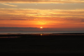
Bristol Channel
Encyclopedia

Great Britain
Great Britain or Britain is an island situated to the northwest of Continental Europe. It is the ninth largest island in the world, and the largest European island, as well as the largest of the British Isles...
, separating South Wales
South Wales
South Wales is an area of Wales bordered by England and the Bristol Channel to the east and south, and Mid Wales and West Wales to the north and west. The most densely populated region in the south-west of the United Kingdom, it is home to around 2.1 million people and includes the capital city of...
from Devon
Devon
Devon is a large county in southwestern England. The county is sometimes referred to as Devonshire, although the term is rarely used inside the county itself as the county has never been officially "shired", it often indicates a traditional or historical context.The county shares borders with...
and Somerset
Somerset
The ceremonial and non-metropolitan county of Somerset in South West England borders Bristol and Gloucestershire to the north, Wiltshire to the east, Dorset to the south-east, and Devon to the south-west. It is partly bounded to the north and west by the Bristol Channel and the estuary of the...
in South West England
South West England
South West England is one of the regions of England defined by the Government of the United Kingdom for statistical and other purposes. It is the largest such region in area, covering and comprising Bristol, Gloucestershire, Somerset, Dorset, Wiltshire, Devon, Cornwall and the Isles of Scilly. ...
. It extends from the lower estuary
Severn Estuary
The Severn Estuary is the estuary of the River Severn, the longest river in Great Britain. Its high tidal range means it has been at the centre of discussions in the UK regarding renewable energy.-Geography:...
of the River Severn
River Severn
The River Severn is the longest river in Great Britain, at about , but the second longest on the British Isles, behind the River Shannon. It rises at an altitude of on Plynlimon, Ceredigion near Llanidloes, Powys, in the Cambrian Mountains of mid Wales...
to the North Atlantic Ocean. It takes its name from the English
England
England is a country that is part of the United Kingdom. It shares land borders with Scotland to the north and Wales to the west; the Irish Sea is to the north west, the Celtic Sea to the south west, with the North Sea to the east and the English Channel to the south separating it from continental...
city of Bristol
Bristol
Bristol is a city, unitary authority area and ceremonial county in South West England, with an estimated population of 433,100 for the unitary authority in 2009, and a surrounding Larger Urban Zone with an estimated 1,070,000 residents in 2007...
, and is over 30 miles (50 km) across at its widest point.
Long stretches of the coastline of the Bristol Channel, on both the South Wales and West Country
West Country
The West Country is an informal term for the area of south western England roughly corresponding to the modern South West England government region. It is often defined to encompass the historic counties of Cornwall, Devon, Dorset and Somerset and the City of Bristol, while the counties of...
sides, are designated as Heritage Coast
Heritage Coast
A Heritage Coast is a strip of UK coastline designated by the Countryside Agency in England and the Countryside Council for Wales as having notable natural beauty or scientific significance.- Designated coastline :...
, including Exmoor
Exmoor
Exmoor is an area of hilly open moorland in west Somerset and north Devon in South West England, named after the main river that flows out of the district, the River Exe. The moor has given its name to a National Park, which includes the Brendon Hills, the East Lyn Valley, the Vale of Porlock and ...
, Bideford
Bideford
Bideford is a small port town on the estuary of the River Torridge in north Devon, south-west England. It is also the main town of the Torridge local government district.-History:...
Bay
Bay
A bay is an area of water mostly surrounded by land. Bays generally have calmer waters than the surrounding sea, due to the surrounding land blocking some waves and often reducing winds. Bays also exist as an inlet in a lake or pond. A large bay may be called a gulf, a sea, a sound, or a bight...
, the Hartland Point
Hartland Point
Hartland Point is a high rocky outcrop of land on the northwestern tip of the Devon coast in England. It is three miles north-west of the village of Hartland. The point marks the western limit of the Bristol Channel with the Atlantic Ocean continuing to the west...
peninsula, Lundy Island, Glamorgan
Glamorgan
Glamorgan or Glamorganshire is one of the thirteen historic counties and a former administrative county of Wales. It was originally an early medieval kingdom of varying boundaries known as Glywysing until taken over by the Normans as a lordship. Glamorgan is latterly represented by the three...
, Gower Peninsula
Gower Peninsula
Gower or the Gower Peninsula is a peninsula in south Wales, jutting from the coast into the Bristol Channel, and administratively part of the City and County of Swansea. Locally it is known as "Gower"...
, South Pembrokeshire
South Pembrokeshire
South Pembrokeshire was one of six local government districts of Dyfed, Wales from 1974 to 1996.It was formed on April 1, 1974 under the Local Government Act 1972, from the following parts of the administrative county of Pembrokeshire:...
and Caldey Island
Caldey Island
Caldey Island lies south of Tenby in Pembrokeshire, Wales.The island is home to a small village, but is best known for its monastery. Caldey Island is separated from the mainland by the Caldey Sound which is 1 km to 2 km wide between Caldey Island and the coast of Pembrokeshire...
.
Extent
The International Hydrographic OrganizationInternational Hydrographic Organization
The International Hydrographic Organization is the inter-governmental organisation representing the hydrographic community. It enjoys observer status at the UN and is the recognised competent authority on hydrographic surveying and nautical charting...
defines the limits of the Bristol Channel as "a line joining Hartland Point
Hartland Point
Hartland Point is a high rocky outcrop of land on the northwestern tip of the Devon coast in England. It is three miles north-west of the village of Hartland. The point marks the western limit of the Bristol Channel with the Atlantic Ocean continuing to the west...
[in Devon] (51°01′N 4°32′W) to St. Govan's Head [in Pembrokeshire] (51°36′N 4°55′W)".
The upper limit of the Channel is between Sand Point, Somerset
Sand Point, Somerset
Sand Point in Somerset is the peninsula stretching out from Middle Hope, which lies to the north of the village of Kewstoke, and the stretch of coastline called Sand Bay. It is owned by the National Trust and is a popular place for walking...
and Lavernock Point in South Wales. East of this line is the Severn Estuary
Severn Estuary
The Severn Estuary is the estuary of the River Severn, the longest river in Great Britain. Its high tidal range means it has been at the centre of discussions in the UK regarding renewable energy.-Geography:...
. Western and northern Pembrokeshire
Pembrokeshire
Pembrokeshire is a county in the south west of Wales. It borders Carmarthenshire to the east and Ceredigion to the north east. The county town is Haverfordwest where Pembrokeshire County Council is headquartered....
, and north Cornwall
Cornwall
Cornwall is a unitary authority and ceremonial county of England, within the United Kingdom. It is bordered to the north and west by the Celtic Sea, to the south by the English Channel, and to the east by the county of Devon, over the River Tamar. Cornwall has a population of , and covers an area of...
are outside the defined limits of the Bristol Channel, and are considered part of the seaboard of the Atlantic Ocean
Atlantic Ocean
The Atlantic Ocean is the second-largest of the world's oceanic divisions. With a total area of about , it covers approximately 20% of the Earth's surface and about 26% of its water surface area...
, more specifically the Celtic Sea
Celtic Sea
The Celtic Sea is the area of the Atlantic Ocean off the south coast of Ireland bounded to the east by Saint George's Channel; other limits include the Bristol Channel, the English Channel, and the Bay of Biscay, as well as adjacent portions of Wales, Cornwall, Devon, and Brittany...
.
Ecology

Wader
Waders, called shorebirds in North America , are members of the order Charadriiformes, excluding the more marine web-footed seabird groups. The latter are the skuas , gulls , terns , skimmers , and auks...
s, and has protected areas, including National Nature Reserve
National Nature Reserve
For details of National nature reserves in the United Kingdom see:*National Nature Reserves in England*National Nature Reserves in Northern Ireland*National Nature Reserves in Scotland*National Nature Reserves in Wales...
s such as Bridgwater Bay
Bridgwater Bay
Bridgwater Bay is on the Bristol Channel, north of Bridgwater in Somerset, England at the mouth of the River Parrett and the end of the River Parrett Trail. It consists of large areas of mud flats, saltmarsh, sandflats and shingle ridges, some of which are vegetated...
at the mouth of the River Parrett
River Parrett
The River Parrett flows through the counties of Dorset and Somerset in South West England, from its source in the Thorney Mills springs in the hills around Chedington in Dorset...
. At low tide
Tide
Tides are the rise and fall of sea levels caused by the combined effects of the gravitational forces exerted by the moon and the sun and the rotation of the Earth....
large parts of the channel become mud flats due to the tidal range
Tidal range
The tidal range is the vertical difference between the high tide and the succeeding low tide. Tides are the rise and fall of sea levels caused by the combined effects of the gravitational forces exerted by the Moon and the Sun and the rotation of the Earth...
of 15 metres (49.2 ft), second only to Bay of Fundy
Bay of Fundy
The Bay of Fundy is a bay on the Atlantic coast of North America, on the northeast end of the Gulf of Maine between the Canadian provinces of New Brunswick and Nova Scotia, with a small portion touching the U.S. state of Maine...
in Eastern Canada
Eastern Canada
Eastern Canada is generally considered to be the region of Canada east of Manitoba, consisting of the following provinces:* New Brunswick* Newfoundland and Labrador* Nova Scotia* Ontario* Prince Edward Island* Quebec...
. Development schemes have been proposed along the channel, including an airport and a tidal barrier for electricity generation, but conservation issues have so far managed to block such schemes.
The largest islands in the Bristol Channel are Lundy
Lundy
Lundy is the largest island in the Bristol Channel, lying off the coast of Devon, England, approximately one third of the distance across the channel between England and Wales. It measures about at its widest. Lundy gives its name to a British sea area and is one of the islands of England.As of...
, Steep Holm
Steep Holm
Steep Holm is an English island lying in the Bristol Channel. The island covers at high tide, expanding to at mean low water. At its highest point it is above mean sea level. It lies within the historic boundaries of Somerset and administratively, it forms part of North Somerset...
and Flat Holm
Flat Holm
Flat Holm is a limestone island lying in the Bristol Channel approximately from Lavernock Point in the Vale of Glamorgan, but in the City and County of Cardiff. It includes the most southerly point of Wales....
. The islands and headlands provide some shelter for the upper reaches of the channel from storms. These islands are mostly uninhabited and protected as nature reserves, and are home to some unique wild flower species. In 1971 a proposal was made by the Lundy Field Society to establish a marine reserve. Provision for the establishment of statutory Marine Nature Reserves was included in the Wildlife and Countryside Act 1981
Wildlife and Countryside Act 1981
The Wildlife and Countryside Act 1981 is an Act of Parliament in the United Kingdom and was implemented to comply with the Directive 2009/147/EC on the conservation of wild birds...
, and on 21 November 1986 the Secretary of State for the Environment
Secretary of State for the Environment
The Secretary of State for the Environment was a UK cabinet position, responsible for the Department of the Environment . This was created by Edward Heath as a combination of the Ministry of Housing and Local Government, the Ministry of Transport and the Ministry of Public Building and Works on 15...
announced the designation of a statutory reserve at Lundy. There is an outstanding variety of marine habitats and wildlife, and a large number of rare and unusual species in the waters around Lundy, including some species of seaweed
Seaweed
Seaweed is a loose, colloquial term encompassing macroscopic, multicellular, benthic marine algae. The term includes some members of the red, brown and green algae...
, branching sponges, sea fan
Sea fan
A gorgonian, also known as sea whip or sea fan, is an order of sessile colonial cnidarian found throughout the oceans of the world, especially in the tropics and subtropics. Gorgonians are similar to the sea pen, another soft coral. Individual tiny polyps form colonies that are normally erect,...
s and cup corals
Coral
Corals are marine animals in class Anthozoa of phylum Cnidaria typically living in compact colonies of many identical individual "polyps". The group includes the important reef builders that inhabit tropical oceans and secrete calcium carbonate to form a hard skeleton.A coral "head" is a colony of...
.
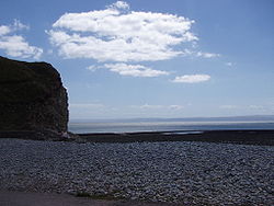
The Bristol Channel has some extensive and popular beaches and spectacular scenery, particularly on the coasts of Exmoor
Exmoor
Exmoor is an area of hilly open moorland in west Somerset and north Devon in South West England, named after the main river that flows out of the district, the River Exe. The moor has given its name to a National Park, which includes the Brendon Hills, the East Lyn Valley, the Vale of Porlock and ...
and Bideford Bay
Bideford Bay
Bideford Bay, also known as Barnstaple Bay and often shown on maps as Barnstaple or Bideford Bay, is a large area of water on the northwest coast of Devon in south west England, at the southwestern end of the Bristol Channel where it joins the Celtic Sea...
in North Devon
North Devon
North Devon is the northern part of the English county of Devon. It is also the name of a local government district in Devon. Its council is based in Barnstaple. Other towns and villages in the North Devon District include Braunton, Fremington, Ilfracombe, Instow, South Molton, Lynton and Lynmouth...
and the Vale of Glamorgan
Vale of Glamorgan
The Vale of Glamorgan is a county borough in Wales; an exceptionally rich agricultural area, it lies in the southern part of Glamorgan, South Wales...
and Gower Peninsula
Gower Peninsula
Gower or the Gower Peninsula is a peninsula in south Wales, jutting from the coast into the Bristol Channel, and administratively part of the City and County of Swansea. Locally it is known as "Gower"...
on the Glamorgan coast. The western stretch of Exmoor boasts Hangman cliffs
Hangman cliffs
Hangman cliffs are near Combe Martin on Devon's Exmoor coast.Great Hangman is high with a cliff face of . It is the highest sea cliff in England and the highest point on the South West Coast Path....
, the highest cliffs in mainland Britain, culminating near Combe Martin
Combe Martin
Combe Martin is a village and civil parish on the North Devon coast about east of Ilfracombe. It is a small seaside resort with a sheltered cove on the edge of the Exmoor National Park...
in the "Great Hangman", a 1,043 ft (318 m) 'hog-backed' hill with a cliff-face of 820 ft (250 m); its sister cliff "The Little Hangman" has a cliff-face of 716 ft (218 m). On the Gower Peninsula
Gower Peninsula
Gower or the Gower Peninsula is a peninsula in south Wales, jutting from the coast into the Bristol Channel, and administratively part of the City and County of Swansea. Locally it is known as "Gower"...
, at its western extremity is the Worms Head, a headland of carboniferous
Carboniferous
The Carboniferous is a geologic period and system that extends from the end of the Devonian Period, about 359.2 ± 2.5 Mya , to the beginning of the Permian Period, about 299.0 ± 0.8 Mya . The name is derived from the Latin word for coal, carbo. Carboniferous means "coal-bearing"...
limestone
Limestone
Limestone is a sedimentary rock composed largely of the minerals calcite and aragonite, which are different crystal forms of calcium carbonate . Many limestones are composed from skeletal fragments of marine organisms such as coral or foraminifera....
which is approachable on foot at low tide only. The beaches of Gower (at Rhossili
Rhossili
Rhossili is a small village and community on the southwestern tip of the Gower Peninsula near Swansea in Wales. Since the 1970s it has fallen within the boundaries of Swansea. It is within an area designated as the first Area of Outstanding Natural Beauty in the United Kingdom...
, for example) and North Devon, such as Croyde
Croyde
Croyde is a village on the west-facing coastline of North Devon, England. The village lies on the South West Coast Path near to Baggy Point, which is owned by the National Trust. It lies within the North Devon Coast Area of Outstanding Natural Beauty...
and Woolacombe
Woolacombe
Woolacombe is a seaside resort on the coast of North Devon, England, which lies at the mouth of a valley . The beach, which has Blue Flag and Premier Seaside Beach awards for its cleanliness, water quality and facilities, is long, sandy, gently sloping and faces the Atlantic Ocean near the...
, win awards for their water quality and setting, as well as being renowned for surfing
Surfing
Surfing' is a surface water sport in which the surfer rides a surfboard on the crest and face of a wave which is carrying the surfer towards the shore...
. In 2004, The Times
The Times
The Times is a British daily national newspaper, first published in London in 1785 under the title The Daily Universal Register . The Times and its sister paper The Sunday Times are published by Times Newspapers Limited, a subsidiary since 1981 of News International...
"Travel" magazine selected Barafundle Bay in Pembrokeshire
Pembrokeshire
Pembrokeshire is a county in the south west of Wales. It borders Carmarthenshire to the east and Ceredigion to the north east. The county town is Haverfordwest where Pembrokeshire County Council is headquartered....
as one of the twelve best beaches in the world. In 2007, Oxwich Bay
Oxwich Bay
thumb|Oxwich Bay on the Gower Peninsula of South WalesOxwich Bay is a bay on the south of the Gower Peninsula, Wales.Its landscape features sand dunes, salt marshes and woodland. Oxwich Bay includes a 2.5-mile long sandy beach, accessible from the village of Oxwich. It is a popular spot for...
made the same magazine's Top 12 best beaches in the world list, and was also selected as Britain's best beach for 2007.
Coastal cities and towns
Swansea
Swansea is a coastal city and county in Wales. Swansea is in the historic county boundaries of Glamorgan. Situated on the sandy South West Wales coast, the county area includes the Gower Peninsula and the Lliw uplands...
is the largest settlement on the Welsh coast of the Bristol Channel. Other major built-up areas include Barry (including Barry Island
Barry Island
Barry Island may refer to:*Barry Island , Wales*Barry Island , Antarctica...
), Port Talbot
Port Talbot
Port Talbot is a town in Neath Port Talbot, Wales. It had a population of 35,633 in 2001.-History:Port Talbot grew out of the original small port and market town of Aberafan , which belonged to the medieval Lords of Afan. The area of the parish of Margam lying on the west bank of the lower Afan...
and Llanelli
Llanelli
Llanelli , the largest town in both the county of Carmarthenshire and the preserved county of Dyfed , Wales, sits on the Loughor estuary on the West Wales coast, approximately west-north-west of Swansea and south-east of the county town, Carmarthen. The town is famous for its proud rugby...
. Smaller resort towns include Porthcawl
Porthcawl
Porthcawl is a town on the south coast of Wales in the county borough of Bridgend, 25 miles west of the capital city, Cardiff and 19 miles southeast of Swansea...
, Mumbles
Mumbles
Mumbles or The Mumbles is an area and community in Swansea, Wales which takes its name from the adjacent headland stretching into Swansea Bay...
, Saundersfoot
Saundersfoot
Saundersfoot is a community in Pembrokeshire, west Wales. It is known as a seaside resort, and along with nearby Tenby is one of the most visited Welsh holiday destinations.-Harbour:...
and Tenby
Tenby
Tenby is a walled seaside town in Pembrokeshire, South West Wales, lying on Carmarthen Bay.Notable features of Tenby include of sandy beaches; the 13th century medieval town walls, including the Five Arches barbican gatehouse ; 15th century St...
.
There are no cities on the English coast but the resorts of Burnham-on-Sea
Burnham-on-Sea
Burnham-on-Sea is a town in Somerset, England, at the mouth of the River Parrett and Bridgwater Bay. Burnham was a small village until the late 18th century, when it began to grow because of its popularity as a seaside resort. It forms part of the parish of Burnham-on-Sea and Highbridge...
, Watchet
Watchet
Watchet is a harbour town and civil parish in the English county of Somerset, with an approximate population of 4,400. It is situated west of Bridgwater, north-west of Taunton, and east of Minehead. The parish includes the hamlet of Beggearn Huish...
, Minehead
Minehead
Minehead is a coastal town and civil parish in Somerset, England. It lies on the south bank of the Bristol Channel, north-west of the county town of Taunton, from the border with the county of Devon and in proximity of the Exmoor National Park...
and Ilfracombe
Ilfracombe
Ilfracombe is a seaside resort and civil parish on the North Devon coast, England with a small harbour, surrounded by cliffs.The parish stretches along the coast from 'The Coastguard Cottages' in Hele Bay toward the east and 4 miles along The Torrs to Lee Bay toward the west...
face directly onto the Bristol Channel, whilst Barnstaple
Barnstaple
Barnstaple is a town and civil parish in the local government district of North Devon in the county of Devon, England, UK. It lies west southwest of Bristol, north of Plymouth and northwest of the county town of Exeter. The old spelling Barnstable is now obsolete.It is the main town of the...
and Bideford
Bideford
Bideford is a small port town on the estuary of the River Torridge in north Devon, south-west England. It is also the main town of the Torridge local government district.-History:...
are sited on estuaries opening onto Bideford Bay at the westernmost end of the Bristol Channel. The city of Bristol
Bristol
Bristol is a city, unitary authority area and ceremonial county in South West England, with an estimated population of 433,100 for the unitary authority in 2009, and a surrounding Larger Urban Zone with an estimated 1,070,000 residents in 2007...
, originally established on the River Avon
River Avon, Bristol
The River Avon is an English river in the south west of the country. To distinguish it from a number of other River Avons in Britain, this river is often also known as the Lower Avon or Bristol Avon...
but now with docks
Avonmouth Docks
The Avonmouth Docks are part of the Port of Bristol, in England. They are situated on the northern side of the mouth of the River Avon, opposite the Royal Portbury Dock on the southern side, where the river joins the Severn estuary, within Avonmouth....
on the Severn estuary, is one of the most important ports
Port of Bristol
The Port of Bristol comprises the commercial, and former commercial, docks situated in and near the city of Bristol in England. The Port of Bristol Authority was the commercial title of the Bristol City, Avonmouth, Portishead and Royal Portbury Docks when they were operated by Bristol City Council,...
in Britain and gives its name to the Channel which forms its seaward approach.
Navigation
There are no road or rail crossings of the Bristol Channel so direct crossings are necessarily made by sea or air, or less directly by the road and rail crossings of the Severn estuary. The Channel can be a hazardous area of water because of its strong tides and the rarity of havens on the north Devon and Somerset coasts that can be entered in all states of the tide. Because of the treacherous waters, pilotage is an essential service for shipping. A specialised style of sailing boat, the Bristol Channel Pilot Cutter, developed in the area.Paddle steamers
P and A CampbellP and A Campbell
P & A Campbell Ltd of Bristol with its White Funnel Fleet became the dominant excursion-steamer operator in the Bristol Channel by the 1890s; and along the South Coast of England in the first half of the twentieth century.-The White Funnel fleet:...
of Bristol
Bristol
Bristol is a city, unitary authority area and ceremonial county in South West England, with an estimated population of 433,100 for the unitary authority in 2009, and a surrounding Larger Urban Zone with an estimated 1,070,000 residents in 2007...
were the main operators of pleasure craft, particularly paddle steamer
Paddle steamer
A paddle steamer is a steamship or riverboat, powered by a steam engine, using paddle wheels to propel it through the water. In antiquity, Paddle wheelers followed the development of poles, oars and sails, where the first uses were wheelers driven by animals or humans...
s, from the mid-19th century to the late 1970s, together with the Barry Railway Company
Barry Railway Company
The Barry Railway Company was a coal pit owner developed and owned railway company, formed to provide an alternate route for the sea export of coal mined in the South Wales valleys to the existing monopoly of the Taff Vale Railway and Cardiff Docks...
. These served harbours along both coasts, such as Ilfracombe
Ilfracombe
Ilfracombe is a seaside resort and civil parish on the North Devon coast, England with a small harbour, surrounded by cliffs.The parish stretches along the coast from 'The Coastguard Cottages' in Hele Bay toward the east and 4 miles along The Torrs to Lee Bay toward the west...
and Weston-super-Mare
Weston-super-Mare
Weston-super-Mare is a seaside resort, town and civil parish in the unitary authority of North Somerset, which is within the ceremonial county of Somerset, England. It is located on the Bristol Channel coast, south west of Bristol, spanning the coast between the bounding high ground of Worlebury...
.
This tradition is continued each summer by the PS Waverley
PS Waverley
PS Waverley is the last seagoing passenger carrying paddle steamer in the world. Built in 1946, she sailed from Craigendoran on the Firth of Clyde to Arrochar on Loch Long until 1973...
, the last seagoing paddle steamer in the world, built in 1947. The steamer provides pleasure trips between the Welsh and English coasts and to the islands of the channel. Trips are also offered on the MV Balmoral, also owned by Waverley Excursions.
Marine rescue services
The Burnham-on-SeaBurnham-on-Sea
Burnham-on-Sea is a town in Somerset, England, at the mouth of the River Parrett and Bridgwater Bay. Burnham was a small village until the late 18th century, when it began to grow because of its popularity as a seaside resort. It forms part of the parish of Burnham-on-Sea and Highbridge...
Area Rescue Boat (BARB)http://www.burnham-on-sea.com/barb/index.html uses a hovercraft to rescue people from the treacherous mud flats on that part of the coast. A hovercraft was recently tested to determine the feasibility of setting up a similar rescue service in Weston-super-Mare
Weston-super-Mare
Weston-super-Mare is a seaside resort, town and civil parish in the unitary authority of North Somerset, which is within the ceremonial county of Somerset, England. It is located on the Bristol Channel coast, south west of Bristol, spanning the coast between the bounding high ground of Worlebury...
. There are also RNLI
Royal National Lifeboat Institution
The Royal National Lifeboat Institution is a charity that saves lives at sea around the coasts of Great Britain, Ireland, the Channel Islands and the Isle of Man, as well as on selected inland waterways....
lifeboats stationed along both sides of the Channel. In the Severn Estuary
Severn Estuary
The Severn Estuary is the estuary of the River Severn, the longest river in Great Britain. Its high tidal range means it has been at the centre of discussions in the UK regarding renewable energy.-Geography:...
, in-shore rescue is provided by two independent lifeboat trusts, the Severn Area Rescue Association
Severn Area Rescue Association
The Severn Area Rescue Association aka SARA or Severn Rescue is an Inshore Rescue boat and Land Search organisation covering the Severn Estuary and upper reaches of the River Severn. SARA is the largest independent lifeboat service in the UK, second only to the RNLI, with 12 operational boats and...
(SARA) and the Portishead and Bristol Lifeboat Trust.
Renewable energy
The Bristol Channel and Severn Estuary have the potential to generate more renewable electricity than all other UK estuaries. It has been stated that, if harnessed, it could create up to 5% of the UK’s electricity, contributing significantly to UK climate change goals and European Union renewable energy targets. The Severn Tidal Power Feasibility StudySevern Tidal Power Feasibility Study
Severn Tidal Power Feasibility Study is the name of a UK Government feasibility study into a tidal power project looking at the possibility of using the huge tidal range in the Severn Estuary and Bristol Channel to generate electricity....
was launched in 2008 by the UK Government to assess all tidal range
Tidal range
The tidal range is the vertical difference between the high tide and the succeeding low tide. Tides are the rise and fall of sea levels caused by the combined effects of the gravitational forces exerted by the Moon and the Sun and the rotation of the Earth...
technologies, including barrages, lagoons and others. The study will look at the costs, benefits and impacts of a Severn tidal power scheme and will help Government decide whether it could or could not support such a scheme. Some of the options being looked at may include a road crossing downstream of the existing crossings of the estuary.
1607 flood
On 30 January 1607 (New style) thousands of people were drowned, houses and villages swept away, farmland inundated and flocks destroyed when a floodFlood
A flood is an overflow of an expanse of water that submerges land. The EU Floods directive defines a flood as a temporary covering by water of land not normally covered by water...
hit the shores of the Channel. The devastation was particularly bad on the Welsh
Wales
Wales is a country that is part of the United Kingdom and the island of Great Britain, bordered by England to its east and the Atlantic Ocean and Irish Sea to its west. It has a population of three million, and a total area of 20,779 km²...
side, from Laugharne in Carmarthenshire
Carmarthenshire
Carmarthenshire is a unitary authority in the south west of Wales and one of thirteen historic counties. It is the 3rd largest in Wales. Its three largest towns are Llanelli, Carmarthen and Ammanford...
to above Chepstow
Chepstow
Chepstow is a town in Monmouthshire, Wales, adjoining the border with Gloucestershire, England. It is located on the River Wye, close to its confluence with the River Severn, and close to the western end of the Severn Bridge on the M48 motorway...
on the English border. Cardiff
Cardiff
Cardiff is the capital, largest city and most populous county of Wales and the 10th largest city in the United Kingdom. The city is Wales' chief commercial centre, the base for most national cultural and sporting institutions, the Welsh national media, and the seat of the National Assembly for...
was the most badly affected town. There remain plaques up to 8 ft (2.4 m) above sea level to show how high the waters rose on the sides of the surviving churches. It was commemorated in a contemporary pamphlet "God's warning to the people of England by the great overflowing of the waters or floods."
The cause of the flood is uncertain and disputed. It had long been believed that the floods were caused by a combination of meteorological extremes
Meteorology
Meteorology is the interdisciplinary scientific study of the atmosphere. Studies in the field stretch back millennia, though significant progress in meteorology did not occur until the 18th century. The 19th century saw breakthroughs occur after observing networks developed across several countries...
and tidal peaks
Tide
Tides are the rise and fall of sea levels caused by the combined effects of the gravitational forces exerted by the moon and the sun and the rotation of the Earth....
, but research published in 2002 showed some evidence of a tsunami
Tsunami
A tsunami is a series of water waves caused by the displacement of a large volume of a body of water, typically an ocean or a large lake...
in the Channel. Although some evidence from the time describes events similar to a tsunami, there are also similarities to descriptions of the 1953 floods in East Anglia
North Sea flood of 1953
The 1953 North Sea flood was a major flood caused by a heavy storm, that occurred on the night of Saturday 31 January 1953 and morning of 1 February 1953. The floods struck the Netherlands, Belgium, England and Scotland.A combination of a high spring tide and a severe European windstorm caused a...
, which were caused by a storm surge. It has been shown that the tide and weather at the time were capable of generating such a surge.
Religion
In 1835 John AshleyJohn Ashley (clergyman)
The Reverend Doctor John Ashley was an Anglican priest.In 1835 he was on the shore at Clevedon with his son who asked him how the people on Flat Holm could go to church. For the next three months Ashley voluntarily ministered to the population of the island...
was on the shore at Clevedon
Clevedon
Clevedon is a town and civil parish in the unitary authority of North Somerset, which covers part of the ceremonial county of Somerset, England...
with his son who asked him how the people on Flat Holm
Flat Holm
Flat Holm is a limestone island lying in the Bristol Channel approximately from Lavernock Point in the Vale of Glamorgan, but in the City and County of Cardiff. It includes the most southerly point of Wales....
could go to church. For the next three months Ashley voluntarily ministered to the population of the island. From there he recognised the needs of the seafarers on the four hundred sailing vessels in the Bristol Channel and created the Bristol Channel Mission. He raised funds and in 1839 a specially designed mission cutter was built with a main cabin which could be converted into a chapel for 100 people, this later became first initiative of the Mission to Seafarers
Mission to Seafarers
The Mission to Seafarers is an international not-for-profit charity serving sailor sailors in over 230 ports around the world. It is supported entirely by donations from the public, whose generosity has funded its work for more than a century and a half...
.
Surfing
Much of the coastline at the western end of the Bristol Channel faces west towards the Atlantic Ocean meaning that a combination of an off-shore (east) wind and a generous Atlantic swell produces excellent surf along the beaches. The heritage coasts of the Vale of Glamorgan, Bideford Bay and Gower are, along with the Atlantic coasts of Pembrokeshire and Cornwall, the key areas for surfing in the whole of Britain. Although slightly overshadowed by the Atlantic coasts of North Cornwall and West Pembrokeshire, both Gower and Bideford Bay nevertheless have several superb breaks—notably CroydeCroyde
Croyde is a village on the west-facing coastline of North Devon, England. The village lies on the South West Coast Path near to Baggy Point, which is owned by the National Trust. It lies within the North Devon Coast Area of Outstanding Natural Beauty...
in Bideford Bay and Langland Bay
Langland Bay
Langland Bay is a popular coastal holiday resort in Gower, near Swansea in south Wales. In the right conditions, it is one of the best surf beaches in Britain...
on Gower—and surfing in Gower and Bideford Bay is enhanced by the golden beaches, clean blue waters, excellent water quality and good facilities close by to the main surf breaks.
Walking
The high quality of the landscape of much of both coasts of the Bristol Channel means that they are popular destinations for walkers. Sections of two national trailsNational Trails
National Trails are long distance footpaths and bridleways in England and Wales. They are administered by Natural England and the Countryside Council for Wales, statutory agencies of the UK government....
; the South West Coast Path
South West Coast Path
The South West Coast Path is Britain's longest waymarked long-distance footpath and a National Trail. It stretches for , running from Minehead in Somerset, along the coasts of Devon and Cornwall, to Poole Harbour in Dorset. Since it rises and falls with every river mouth, it is also one of the more...
and the Pembrokeshire Coast Path
Pembrokeshire Coast Path
The Pembrokeshire Coast Path is a National Trail in southwest Wales. It was established in 1970, and is 186 miles long, mostly at cliff-top level, with 35,000 feet of ascent and descent. The northern end is at Poppit Sands, near St...
follow these shores along with various other shorter waymarked recreational routes. A continuous coastal path is being developed along the entire Welsh shore under the auspices of the Countryside Council for Wales
Countryside Council for Wales
The Countryside Council for Wales is an Assembly Government Sponsored Body. It is the Welsh Assembly Government's wildlife conservation authority for Wales...
.
Ilfracombe to Swansea
The first person to swim the 30.5 nautical miles (56.5 km) from IlfracombeIlfracombe
Ilfracombe is a seaside resort and civil parish on the North Devon coast, England with a small harbour, surrounded by cliffs.The parish stretches along the coast from 'The Coastguard Cottages' in Hele Bay toward the east and 4 miles along The Torrs to Lee Bay toward the west...
to Swansea
Swansea
Swansea is a coastal city and county in Wales. Swansea is in the historic county boundaries of Glamorgan. Situated on the sandy South West Wales coast, the county area includes the Gower Peninsula and the Lliw uplands...
was Gethin Jones, who achieved the record on 13 September 2009, taking nearly 22 hours.
Penarth to Clevedon
The youngest person to swim the Bristol Channel from PenarthPenarth
Penarth is a town and seaside resort in the Vale of Glamorgan , Wales, 5.2 miles south west from the city centre of the Welsh capital city of Cardiff and lying on the north shore of the Severn Estuary at the southern end of Cardiff Bay...
to Clevedon
Clevedon
Clevedon is a town and civil parish in the unitary authority of North Somerset, which covers part of the ceremonial county of Somerset, England...
is Gary Carpenter who at age 17 on August Bank Holiday 2007, swam the channel in 5 hours 35 minutes making him the youngest and fastest swimmer of the Bristol Channel. Gary Carpenter's coach Steve Price was the first ever person to swim from Penarth to Clevedon back in 1990.