

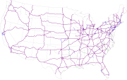
List of Interstate Highways
Encyclopedia
United States
The United States of America is a federal constitutional republic comprising fifty states and a federal district...
and are assigned a one or two-digit route number. Even route numbers are assigned to east/west routes, with the lower numbered routes being further south (I-10
Interstate 10
Interstate 10 is the fourth-longest Interstate Highway in the United States, after I-90, I-80, and I-40. It is the southernmost east–west, coast-to-coast Interstate Highway, although I-4 and I-8 are further south. It stretches from the Pacific Ocean at State Route 1 in Santa Monica,...
) and higher numbered routes in the north (I-90
Interstate 90
Interstate 90 is the longest Interstate Highway in the United States at . It is the northernmost coast-to-coast interstate, and parallels US 20 for the most part. Its western terminus is in Seattle, at Edgar Martinez Drive S. near Safeco Field and CenturyLink Field, and its eastern terminus is in...
). Similarly, odd route numbers are assigned to north/south routes, with the lower numbered routes being further west (I-5
Interstate 5
Interstate 5 is the main Interstate Highway on the West Coast of the United States, running largely parallel to the Pacific Ocean coastline from Canada to Mexico . It serves some of the largest cities on the U.S...
) and the higher numbered routes being further east (I-95
Interstate 95
Interstate 95 is the main highway on the East Coast of the United States, running parallel to the Atlantic Ocean from Maine to Florida and serving some of the most populated urban areas in the country, including Boston, Providence, New Haven, New York City, Newark, Philadelphia, Baltimore,...
).
There are five pairs of numbers that are duplicated throughout the system; the corresponding highways are separated by large distances to prevent confusion. Below, these are differentiated from each other by West and East.
Three-digit Interstates are spur or loop Interstates that usually service large cities and suburbs. The last two digits of a three-digit Interstate are always the number of the parent route, the primary Interstate where it originated. If the first digit is odd, the Interstate is typically a spur route
Spur route
A spur route is a short road forming a branch from a longer, more important route . A bypass or beltway is never considered a true spur route as it typically reconnects with the major road...
while if the first digit is even, the Interstate is typically a loop route
Loop route
A loop route is a highway or other major road that extends out from a typically longer, more important parents road to enter and circle a large city. A loop can function as a bypass for through traffic and also to service outlying suburbs....
. Three-digit Interstates are covered in their parent route's article, and those that have their own articles are linked below.
Primary Interstates
There are 66 primary Interstates listed in the table below, with 43 of them having auxiliary routes. Listed lengths are as of October 31, 2002.Routes ending in 0 or 5 are highlighted in green.
| Interstate |
Route, States Served & Associated routes (* not signposted as interstates) (sort by number of states served) |
Length (mi.) |
|---|---|---|
Interstate 4
Interstate 4 is a intrastate Highway located entirely within the state of Florida, United States. It goes from Interstate 275 in Tampa, Florida to Interstate 95 at Daytona Beach, Florida . It also has the Florida Department of Transportation designation of State Road 400, but only a small...
|Tampa, Florida
Tampa, Florida
Tampa is a city in the U.S. state of Florida. It serves as the county seat for Hillsborough County. Tampa is located on the west coast of Florida. The population of Tampa in 2010 was 335,709....
(I-275
Interstate 275 (Florida)
Interstate 275 in Florida serves the Tampa Bay metropolitan area, measuring 60.696 miles in length. The southern terminus is I-75 near Palmetto, just five miles east of the Sunshine Skyway Bridge, a toll bridge crossing Tampa Bay. The highway passes through St...
) to Daytona Beach, Florida
Daytona Beach, Florida
Daytona Beach is a city in Volusia County, Florida, USA. According to 2008 U.S. Census Bureau estimates, the city has a population of 64,211. Daytona Beach is a principal city of the Deltona – Daytona Beach – Ormond Beach, Florida Metropolitan Statistical Area, which the census bureau estimated had...
(I-95
Interstate 95
Interstate 95 is the main highway on the East Coast of the United States, running parallel to the Atlantic Ocean from Maine to Florida and serving some of the most populated urban areas in the country, including Boston, Providence, New Haven, New York City, Newark, Philadelphia, Baltimore,...
)
Florida Intrastate Interstate
Associated routes: none
|align=right|132.30
|- style="background:lightgreen"
|
 I-5
I-5Interstate 5
Interstate 5 is the main Interstate Highway on the West Coast of the United States, running largely parallel to the Pacific Ocean coastline from Canada to Mexico . It serves some of the largest cities on the U.S...
| San Ysidro, California (Mexico and MX-1
Mexican Federal Highway 1
Mexican Federal Highway No. 1 follows the length of the Baja California Peninsula from Cabo San Lucas , at the southern end to Tijuana in the north...
) to Blaine, Washington
Blaine, Washington
Blaine is a city in Whatcom County, Washington, United States. The city's northern boundary is the Canadian border. Blaine is the shared home of the Peace Arch international monument...
(Canada and BC 99)
3 States Served: CA
Interstate 5 in California
Interstate 5 is a major north–south route of the Interstate Highway System in the U.S. state of California. It begins at the Mexico – United States border at the San Ysidro crossing, goes north across the length of California and crosses into Oregon south of the Medford-Ashland metropolitan...
, OR
Interstate 5 in Oregon
In the U.S. state of Oregon, Interstate 5 traverses the state from north to south, passing through the major cities of Portland, Salem, Eugene, and Medford.-Route description:...
, WA
Interstate 5 in Washington
Interstate 5 in Washington is a highway in the U.S. state of Washington that extends from its border with Oregon to its border with Canada...
Associated routes: I-105, I-205, I-305*, I-405, I-505
Interstate 505
Interstate 505 is an Interstate Highway in California between Interstate 80 in Vacaville and Interstate 5 near Dunnigan. I-505 is primarily a rural interstate, but travels through Vacaville and the city of Winters. The interstate is the primary route connecting the San Francisco Bay Area and the...
, I-605
Interstate 605
Interstate 605 is a major north–south Interstate Highway in the Greater Los Angeles Area of Southern California...
, I-705
Interstate 705
Interstate 705 is a short Interstate Highway spur route of Interstate 5 located entirely within Tacoma, Pierce, Washington, United States. I-705 serves as the connector between Interstate 5, Downtown Tacoma, Tacoma's waterfront, North Tacoma, and the Tacoma Dome...
, I-805
Interstate 805
Interstate 805 is a major north–south Interstate Highway in Southern California. It is a bypass of Interstate 5, running along the eastern areas of the Greater San Diego area from San Ysidro near the Mexico–U.S...
| align=right|1,381.29
|-
|
 I-8
I-8Interstate 8
Interstate 8 is an Interstate Highway in the southwestern United States. It runs from the southern edge of Mission Bay at Sunset Cliffs Blvd, in San Diego, California, almost at the Pacific Ocean, to the junction with Interstate 10, just southeast of Casa Grande, Arizona...
|San Diego, California
California
California is a state located on the West Coast of the United States. It is by far the most populous U.S. state, and the third-largest by land area...
(Sunset Cliffs Blvd.) to Casa Grande, Arizona
Casa Grande, Arizona
Casa Grande is a city in Pinal County, approximately halfway between Phoenix and Tucson in the U.S. state of Arizona. According to 2010 Census, the population of the city is 48,571...
(I-10
Interstate 10
Interstate 10 is the fourth-longest Interstate Highway in the United States, after I-90, I-80, and I-40. It is the southernmost east–west, coast-to-coast Interstate Highway, although I-4 and I-8 are further south. It stretches from the Pacific Ocean at State Route 1 in Santa Monica,...
)
2 States Served: CA, AZ
Associated routes: none
|align=right|348.25
|- style="background:lightgreen"
|
 I-10
I-10Interstate 10
Interstate 10 is the fourth-longest Interstate Highway in the United States, after I-90, I-80, and I-40. It is the southernmost east–west, coast-to-coast Interstate Highway, although I-4 and I-8 are further south. It stretches from the Pacific Ocean at State Route 1 in Santa Monica,...
| Santa Monica, California
Santa Monica, California
Santa Monica is a beachfront city in western Los Angeles County, California, US. Situated on Santa Monica Bay, it is surrounded on three sides by the city of Los Angeles — Pacific Palisades on the northwest, Brentwood on the north, West Los Angeles on the northeast, Mar Vista on the east, and...
(CA-1) to Jacksonville, Florida
Jacksonville, Florida
Jacksonville is the largest city in the U.S. state of Florida in terms of both population and land area, and the largest city by area in the contiguous United States. It is the county seat of Duval County, with which the city government consolidated in 1968...
(I-95
Interstate 95
Interstate 95 is the main highway on the East Coast of the United States, running parallel to the Atlantic Ocean from Maine to Florida and serving some of the most populated urban areas in the country, including Boston, Providence, New Haven, New York City, Newark, Philadelphia, Baltimore,...
)
8 States Served: CA
Interstate 10 in California
Interstate 10 , the major east–west Interstate Highway in the Southern United States, runs in the U.S. state of California east from Santa Monica, on the Pacific Ocean, through Los Angeles and San Bernardino to the border with Arizona...
, AZ
Interstate 10 in Arizona
In the U.S. state of Arizona, Interstate 10, the major east–west Interstate Highway in the southern United States, runs east from California, enters Arizona and continues through Phoenix and Tucson and exits at the border with New Mexico.-Route description:...
, NM
Interstate 10 in New Mexico
Interstate 10 in the U.S. state of New Mexico is long main route of the Interstate Highway System. I-10 traverses Southern New Mexico through Hidalgo, Grant, Luna, and Doña Ana counties. The Interstate travels west–east between the Arizona state line and the interchange with I-25 in Las...
, TX
Interstate 10 in Texas
Interstate 10 is the major east–west Interstate Highway in the Southern United States. In the U.S. state of Texas, it runs east from El Paso, near the border with New Mexico, through San Antonio and Houston to the border with Louisiana in Orange, Texas....
, LA
Interstate 10 in Louisiana
Interstate 10, a major transcontinental Interstate Highway in the Southern U.S., runs across the southern part of the U.S. state of Louisiana. It passes through Lake Charles, Lafayette and Baton Rouge before dipping south of Lake Pontchartrain to serve the New Orleans area and then passing through...
, MS
Interstate 10 in Mississippi
Interstate 10 is a major east–west Interstate Highway in the southern areas of the United States. It runs nearly coast to coast from Santa Monica, California to Jacksonville, Florida.-Route description:...
, AL, FL
Interstate 10 in Florida
The of Interstate 10 in Florida is the eastern most section of the east–west Interstate 10 in the Southern United States. It is also the eastern end of the Interstate Highway known as the Christopher Columbus Transcontinental Highway, one of three coast to coast interstates, along with I-80...
Associated routes: I-110, I-210, I-310
Interstate 310
Interstate 310 is a short spur route of Interstate 10 near New Orleans, Louisiana, United States. It runs south from Interstate 10 near the New Orleans International Airport, intersects with U.S. Highway 61 and ends at the junction with U.S...
, I-410
Interstate 410
Interstate 410 is a loop route of Interstate 10 around San Antonio, Texas. It is identified as Connally Loop in honor of former Texas governor John Connally...
, I-510
Interstate 510
Interstate 510 is a short spur route of Interstate 10 within in eastern New Orleans, Louisiana, United States. It runs south from Interstate 10, intersects with U.S. Highway 90, and ends at the Almonaster Boulevard interchange, near the NASA Michoud Assembly Facility...
, I-610, I-710
Interstate 710
Interstate 710 is a major north–south interstate freeway running for 23 miles through Los Angeles County, California...
, I-910*
| align=right|2,460.34
|-
|
 I-12
I-12Interstate 12
Interstate 12 is an intrastate Interstate Highway located entirely within the state of Louisiana. I-12 starts in Baton Rouge at Interstate 10, and travels along the North Shore of Lake Pontchartrain before ending at the intersection of Interstate 10 and Interstate 59 near Slidell...
|Baton Rouge, Louisiana
Baton Rouge, Louisiana
Baton Rouge is the capital of the U.S. state of Louisiana. It is located in East Baton Rouge Parish and is the second-largest city in the state.Baton Rouge is a major industrial, petrochemical, medical, and research center of the American South...
(I-10
Interstate 10
Interstate 10 is the fourth-longest Interstate Highway in the United States, after I-90, I-80, and I-40. It is the southernmost east–west, coast-to-coast Interstate Highway, although I-4 and I-8 are further south. It stretches from the Pacific Ocean at State Route 1 in Santa Monica,...
) to Slidell, Louisiana
Slidell, Louisiana
Slidell is a city situated on the northeast shore of Lake Pontchartrain in St. Tammany Parish, Louisiana, United States. The population was 25,695 at the 2000 census. The Greater Slidell Community has a population of about 90,000...
(I-10
Interstate 10
Interstate 10 is the fourth-longest Interstate Highway in the United States, after I-90, I-80, and I-40. It is the southernmost east–west, coast-to-coast Interstate Highway, although I-4 and I-8 are further south. It stretches from the Pacific Ocean at State Route 1 in Santa Monica,...
/ I-59
Interstate 59
Interstate 59 is an Interstate Highway in the southern United States. Its southern terminus is near Slidell, Louisiana, a suburb of New Orleans, at an intersection with Interstate 10 and Interstate 12, its northern terminus is at Wildwood, Georgia, at an intersection with Interstate 24.The road's...
)
Louisiana Intrastate Interstate
Associated routes: none
|align=right|85.59
|- style="background:lightgreen"
|
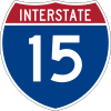 I-15
I-15Interstate 15
Interstate 15 is the fourth-longest north–south Interstate Highway in the United States, traveling through the states of California, Nevada, Arizona, Utah, Idaho, and Montana from San Diego to the Canadian border...
| San Diego, California
California
California is a state located on the West Coast of the United States. It is by far the most populous U.S. state, and the third-largest by land area...
(I-8
Interstate 8
Interstate 8 is an Interstate Highway in the southwestern United States. It runs from the southern edge of Mission Bay at Sunset Cliffs Blvd, in San Diego, California, almost at the Pacific Ocean, to the junction with Interstate 10, just southeast of Casa Grande, Arizona...
/CA-15) to Sweetgrass, Montana
Sweetgrass, Montana
Sweet Grass is an unincorporated community in Toole County, Montana, United States, on the Canada-US border. It is the northern terminus of Interstate 15, an important route connecting western Canada, the western United States, and Mexico.In 2004, a joint border facility opened at the Sweetgrass...
(Canada and Hwy 4)
6 States Served: CA
Interstate 15 in California
In the U.S. state of California, Interstate 15 is a major north–south route through the San Bernardino, Riverside, and San Diego Counties, and it has a length of in the state. It is a major thoroughfare for traffic between Southern California and Las Vegas, Nevada, as well as points beyond...
, NV
Interstate 15 in Nevada
In the U.S. State of Nevada, Interstate 15 begins in Primm, continues through Las Vegas and it crosses the border with Arizona in Mesquite. The freeway runs entirely in Clark County. Many motorists use Interstate 15 to visit Las Vegas, as it is the only primary Interstate Highway in the city. The...
, AZ
Interstate 15 in Arizona
Interstate 15 is an Interstate Highway, running from San Diego, California, United States, to the Canadian border, through Mohave County in northwest Arizona. Despite being isolated from the rest of Arizona, in the remote Arizona Strip, and short in length at , it remains notable for its scenic...
, UT
Interstate 15 in Utah
In the U.S. state of Utah, Interstate 15 runs north–south through the southwestern and central portions of the state, passing through many of the population centers of that state, including St. George, Provo, Salt Lake City, and Ogden, the latter three being part of the urban area known as...
, ID, MT
Associated routes: I-115
Interstate 115
Interstate 115 is a interstate in Butte, Montana that connects Interstate 15 and Interstate 90 to Business 15/90 in downtown Butte. It is a short spur that directs motorists into downtown Butte and continues as Iron Street. Unlike Interstate 315 in Great Falls which is signed as Business Loop 15...
, I-215, I-315*
Interstate 315
Interstate 15 Business is a Business loop of Interstate 15 in Great Falls, Montana. The route links I-15, which bypasses downtown Great Falls to the west, to the center of Great Falls. As its Business Loop designation implies, I-15 Business terminates at I-15 at each end...
, I-515
Interstate 515
Interstate 515 is a spur of Interstate 15 that runs from the junction of I-15, US 93 and US 95 near Downtown Las Vegas, Nevada approximately southeast to Railroad Pass near the borders of Henderson and Boulder City....
| align=right|1,433.52
|-
|
 I-16
I-16Interstate 16
Interstate 16 , also known as Jim Gillis Historic Savannah Parkway or State Route 404 , is an intrastate Interstate Highway located entirely within the state of Georgia, United States...
|Macon, Georgia
Macon, Georgia
Macon is a city located in central Georgia, US. Founded at the fall line of the Ocmulgee River, it is part of the Macon metropolitan area, and the county seat of Bibb County. A small portion of the city extends into Jones County. Macon is the biggest city in central Georgia...
(I-75
Interstate 75
Interstate 75 is a major north–south Interstate Highway in the Great Lakes and Southeastern regions of the United States. It travels from State Road 826 and State Road 924 in Hialeah, Florida to Sault Ste. Marie, Michigan, at the Ontario, Canada, border...
) to Savannah, Georgia
Savannah, Georgia
Savannah is the largest city and the county seat of Chatham County, in the U.S. state of Georgia. Established in 1733, the city of Savannah was the colonial capital of the Province of Georgia and later the first state capital of Georgia. Today Savannah is an industrial center and an important...
(Montgomery St.)
Georgia Intrastate Interstate
Associated route: I-516
Interstate 516
Interstate 516 is a 6.49-mile long auxiliary Interstate Highway near the southeastern, coastal Georgia city of Savannah as a spur route of Interstate 16. I-516 was formerly signed State Route 21 and even early as State Route 26 Loop...
|align=right|166.81
|-
|
 I-17
I-17Interstate 17
Interstate 17 , also known as the Black Canyon Freeway, is an intrastate Interstate Highway located entirely within the state of Arizona, United States. I-17's southern terminus lies within Phoenix, at Interstate 10, and its northern terminus is in Flagstaff, at Interstate 40...
|Phoenix, Arizona
Phoenix, Arizona
Phoenix is the capital, and largest city, of the U.S. state of Arizona, as well as the sixth most populated city in the United States. Phoenix is home to 1,445,632 people according to the official 2010 U.S. Census Bureau data...
(I-10
Interstate 10
Interstate 10 is the fourth-longest Interstate Highway in the United States, after I-90, I-80, and I-40. It is the southernmost east–west, coast-to-coast Interstate Highway, although I-4 and I-8 are further south. It stretches from the Pacific Ocean at State Route 1 in Santa Monica,...
) to Flagstaff, Arizona
Flagstaff, Arizona
Flagstaff is a city located in northern Arizona, in the southwestern United States. In 2010, the city's population was 65,870. The population of the Metropolitan Statistical Area was at 134,421 in 2010. It is the county seat of Coconino County...
(AZ-89A)
Arizona Intrastate Interstate
Associated routes: none
|align=right|145.76
|-
|
 I-19
I-19Interstate 19
Interstate 19 is an intrastate Interstate Highway located entirely within the state of Arizona. I-19 runs from Nogales, roughly 1,500 feet from the Mexican border, to Tucson, at Interstate 10...
|Nogales, Arizona
Nogales, Arizona
Nogales is a city in Santa Cruz County, Arizona, United States. The population was 21,017 at the 2010 census. According to 2005 Census Bureau estimates, the population of the city is 20,833. The city is the county seat of Santa Cruz County....
(Mexico and MX-15
Mexican Federal Highway 15
Federal Highway 15 is a primary north-south highway in Mexico. The highway begins in the north at the United States-Mexico border at the Mariposa Port of Entry in Nogales, Sonora, and terminates to the south in Mexico City...
) to Tucson, Arizona
Tucson, Arizona
Tucson is a city in and the county seat of Pima County, Arizona, United States. The city is located 118 miles southeast of Phoenix and 60 miles north of the U.S.-Mexico border. The 2010 United States Census puts the city's population at 520,116 with a metropolitan area population at 1,020,200...
(I-10
Interstate 10
Interstate 10 is the fourth-longest Interstate Highway in the United States, after I-90, I-80, and I-40. It is the southernmost east–west, coast-to-coast Interstate Highway, although I-4 and I-8 are further south. It stretches from the Pacific Ocean at State Route 1 in Santa Monica,...
)
Arizona Intrastate Interstate
Associated routes: none
|align=right|63.35
|- style="background:lightgreen"
|
 I-20
I-20Interstate 20
Interstate 20 is a major east–west Interstate Highway in the Southern United States. I‑20 runs 1,535 miles from near Kent, Texas, at Interstate 10 to Florence, South Carolina, at Interstate 95...
| Kent, Texas
Kent, Texas
Kent is an unincorporated village in Culberson County, in West Texas, United States. It lies just north of Interstate 10 at Exit 176, ten miles west of the beginning of Interstate 20 and four miles west of the eastern Culberson County boundary. It is sandwiched between the railroad, immediately...
(I-10
Interstate 10
Interstate 10 is the fourth-longest Interstate Highway in the United States, after I-90, I-80, and I-40. It is the southernmost east–west, coast-to-coast Interstate Highway, although I-4 and I-8 are further south. It stretches from the Pacific Ocean at State Route 1 in Santa Monica,...
) to Florence, South Carolina
Florence, South Carolina
-Municipal government and politics:The City of Florence has a council-manager form of government. The mayor and city council are elected every four years, with no term limits...
(I-95
Interstate 95
Interstate 95 is the main highway on the East Coast of the United States, running parallel to the Atlantic Ocean from Maine to Florida and serving some of the most populated urban areas in the country, including Boston, Providence, New Haven, New York City, Newark, Philadelphia, Baltimore,...
)
6 States Served: TX
Interstate 20 in Texas
Interstate 20 in Texas is a major east–west Interstate Highway in the Southern United States, running east from a junction with Interstate 10 east of Kent, Texas, through the Dallas-Fort Worth Metroplex to the border with Louisiana near Waskom, Texas...
, LA
Interstate 20 in Louisiana
Interstate 420 was to be a bypass of Monroe, Louisiana. Initially proposed in the late 1950s, this route was to have been only two lanes wide at a cost $29 million with a projected 2,500 to 3,000 ADT in 1964. The project was effectively canceled on October 12, 1964, when then Louisiana...
, MS
Interstate 20 in Mississippi
Interstate 20 is a major thoroughfare through central Mississippi, connecting the area with major metropolitan areas, including Dallas, Texas, Atlanta, Georgia and Birmingham, Alabama.-Route description:...
, AL
Interstate 20 in Alabama
In Alabama, Interstate 20 travels 214.7 miles through the center of the state. It enters the state from Mississippi near York, and travels northeastward through Tuscaloosa and Birmingham...
, GA
Interstate 20 in Georgia
In Georgia, Interstate 20 runs from the Alabama border to the Savannah River, which the Georgia-South Carolina border straddles. It passes through the heavily congested Atlanta metropolitan area and exits the state at Augusta...
, SC
Interstate 20 in South Carolina
Interstate 20 is a major thoroughfare cutting across the state of South Carolina, linking the state with important transportation and business hubs to the north, west and south, including Atlanta, Georgia, Charlotte, North Carolina , Savannah, Georgia and Washington, D.C...
Associated routes: I-220, I-520
Interstate 520
Interstate 520 is a auxiliary Interstate Highway that encircles Augusta, Georgia and North Augusta, South Carolina as a three quarter beltway around the western, southern and eastern parts of the Augusta area. It begins at Interstate 20 in the northwest part of Augusta, and ends at Interstate 20...
, I-820
Interstate 820
Interstate 820 is a loop of Interstate 20 in Fort Worth, Texas of approximately around the city and some of its suburbs. Exit numbers begin at its intersection with I-20 in southwest Fort Worth, and continue in a clockwise direction around the city until it ends at its intersection with I-20 in...
| align=right|1,539.38
|-
|
 I-22
I-22Interstate 22
Interstate 22 , when it is completed, will follow the U.S. Highway 78 corridor along a 213-mile-long route from Memphis, Tennessee, to Birmingham, Alabama, as an Interstate Highway. Interstate 22 will connect Interstate 240 and Interstate 40 in the northwest with Interstate 65 and Interstate...
|Memphis, Tennessee
Memphis, Tennessee
Memphis is a city in the southwestern corner of the U.S. state of Tennessee, and the county seat of Shelby County. The city is located on the 4th Chickasaw Bluff, south of the confluence of the Wolf and Mississippi rivers....
(I-55
Interstate 55
Interstate 55 is an Interstate Highway in the central United States. Its odd number indicates that it is a north–south Interstate Highway. I-55 goes from LaPlace, Louisiana at Interstate 10 to Chicago at U.S. Route 41 , at McCormick Place. A common nickname for the highway is "double...
& I-40
Interstate 40
Interstate 40 is the third-longest major east–west Interstate Highway in the United States, after I-90 and I-80. Its western end is at Interstate 15 in Barstow, California; its eastern end is at a concurrency of U.S. Route 117 and North Carolina Highway 132 in Wilmington, North Carolina...
) to Birmingham, Alabama
Birmingham, Alabama
Birmingham is the largest city in Alabama. The city is the county seat of Jefferson County. According to the 2010 United States Census, Birmingham had a population of 212,237. The Birmingham-Hoover Metropolitan Area, in estimate by the U.S...
(I-65
Interstate 65
Interstate 65 is a major Interstate Highway in the United States. The southern terminus is located at an intersection with Interstate 10 in Mobile, Alabama, and its northern terminus is at an interchange with Interstate 90 , U.S. Route 12, and U.S...
/US 31)
2 States Served: Mississippi, Alabama. Planned: Tennessee
Planned associated route: I-422
|align=right|213.0
|-
|
 I-24
I-24Interstate 24
Interstate 24 is an Interstate Highway in the Midwestern and Southeastern United States. It runs diagonally from Interstate 57 to Chattanooga, Tennessee, at Interstate 75....
|Pulley's Mill, Illinois (I-57
Interstate 57
Interstate 57 is an Interstate Highway in Missouri and Illinois that parallels the old Illinois Central rail line for much of its route. It goes from Miner, Missouri, at Interstate 55 to Chicago, Illinois, at Interstate 94. I-57 essentially serves as a shortcut route for travelers headed between...
) to Chattanooga, Tennessee
Chattanooga, Tennessee
Chattanooga is the fourth-largest city in the US state of Tennessee , with a population of 169,887. It is the seat of Hamilton County...
(I-75
Interstate 75
Interstate 75 is a major north–south Interstate Highway in the Great Lakes and Southeastern regions of the United States. It travels from State Road 826 and State Road 924 in Hialeah, Florida to Sault Ste. Marie, Michigan, at the Ontario, Canada, border...
)
4 States Served: Illinois
Interstate 24 in Illinois
In the U.S. state of Illinois, Interstate 24 is a remote, four-lane freeway that travels through hilly rural southern Illinois and the Shawnee National Forest. I-24 is in length in Illinois. There are only five mainline exits; of those five, four have services...
, Kentucky, Tennessee
Interstate 24 in Tennessee
In the U.S. state of Tennessee, Interstate 24 runs from Clarksville to Chattanooga via Nashville. Just west of Chattanooga, I-24 drops into Georgia's Dade County for before reentering Tennessee....
, Georgia
Associated route: I-124
Interstate 124
Interstate 124 is an unsigned designation for a short segment of a four-lane limited access highway located in Chattanooga, Tennessee, USA. During periods where this two miles long segment of U.S. Route 27 has been signed as I-124, it has served as a spur route of Interstate 24 to downtown...
|align=right|316.36
|- style="background:lightgreen"
|
 I-25
I-25Interstate 25
Interstate 25 is an Interstate Highway in the western United States. It is primarily a north–south highway. I-25 stretches from Interstate 10 at Las Cruces, New Mexico, , to Interstate 90 in Buffalo, Wyoming, .Interstate 25 is the main north–south expressway through...
| Las Cruces, New Mexico
Las Cruces, New Mexico
Las Cruces, also known as "The City of the Crosses", is the county seat of Doña Ana County, New Mexico, United States. The population was 97,618 in 2010 according to the 2010 Census, making it the second largest city in the state....
(I-10
Interstate 10
Interstate 10 is the fourth-longest Interstate Highway in the United States, after I-90, I-80, and I-40. It is the southernmost east–west, coast-to-coast Interstate Highway, although I-4 and I-8 are further south. It stretches from the Pacific Ocean at State Route 1 in Santa Monica,...
) to Buffalo, Wyoming
Buffalo, Wyoming
Buffalo is a city in Johnson County, Wyoming, United States. The population was 3,900 at the 2000 census. It is the county seat of Johnson County...
(I-90
Interstate 90
Interstate 90 is the longest Interstate Highway in the United States at . It is the northernmost coast-to-coast interstate, and parallels US 20 for the most part. Its western terminus is in Seattle, at Edgar Martinez Drive S. near Safeco Field and CenturyLink Field, and its eastern terminus is in...
)
3 States Served: New Mexico
Interstate 25 in New Mexico
In the U.S. state of New Mexico, Interstate 25 follows the north–south corridor through Albuquerque and Santa Fe. It replaced U.S. Route 85, which is no longer signed, but still exists in route logs sharing the I-25 alignment. I-25 starts in New Mexico at an interchange with I-10 in Las Cruces and...
, Colorado
Interstate 25 in Colorado
In the U.S. state of Colorado, Interstate 25 follows the north–south corridor through Colorado Springs and Denver. It replaced U.S. Highway 87 and most of U.S. Highway 85 for through traffic....
, Wyoming
Associated route: I-225
Interstate 225
Interstate 225 is a spur route of Interstate 25 in Colorado. It is the only auxiliary route of Interstate 25, and one of two in Colorado. I-225 traverses Aurora and small portions of Denver and Greenwood Village. It runs north from Interstate 25 to Interstate 70. It intersects with Interstate...
| align=right|1,062.77
|-
|
 I-26
I-26Interstate 26
Interstate 26 is a nominally east–west main route of the Interstate Highway System in the Southeastern United States. I-26 runs from the junction of U.S. Route 11W and U.S. Route 23 in Kingsport, Tennessee, generally southeastward to U.S. Route 17 in Charleston, South Carolina...
|Kingsport, Tennessee
Kingsport, Tennessee
Kingsport is a city located mainly in Sullivan County with some western portions in Hawkins County in the US state of Tennessee. The majority of the city lies in Sullivan County...
(US-11W
U.S. Route 11W
U.S. Route 11W is a divided highway of US 11 in the U.S. states of Tennessee and Virginia. The U.S. Highway, which is complemented by US 11E to the south and east, runs from US 11, US 11E, and US 70 in Knoxville, Tennessee north and east to US 11, US 11E, US 19, and US 421 in Bristol, Virginia...
) to Charleston, South Carolina
Charleston, South Carolina
Charleston is the second largest city in the U.S. state of South Carolina. It was made the county seat of Charleston County in 1901 when Charleston County was founded. The city's original name was Charles Towne in 1670, and it moved to its present location from a location on the west bank of the...
(US-17)
3 States Served: Tennessee, North Carolina, South Carolina
Interstate 26 in South Carolina
Interstate 26 is a South Carolina Interstate highway running generally east–west to U.S. Route 17 in the Atlantic Coast at Charleston, South Carolina to Landrum in Spartanburg County.-Route description:...
Associated routes: I-126
Interstate 126
Interstate 126 is a spur route of Interstate 26, almost entirely within the city limits of Columbia, South Carolina in the United States. It runs 3.1 miles from I-26 just south of the junction with Interstate 20, eastward across the Broad River , and into downtown Columbia terminating at US 21/US...
, I-526
Interstate 526
Interstate 526 or the Mark Clark Expressway is a beltway, Interstate Highway of Interstate 26 in Berkeley and Charleston counties in South Carolina, USA.-Route description:...
|align=right|346
|-
|
 I-27
I-27Interstate 27
Interstate 27 is an intrastate Interstate Highway, located entirely in the U.S. state of Texas, running north from Lubbock to Interstate 40 in Amarillo. These two cities are the only control cities on I-27; other cities and towns served by I-27 include New Deal, Abernathy, Hale Center, Plainview,...
|Lubbock, Texas
Lubbock, Texas
Lubbock is a city in and the county seat of Lubbock County, Texas, United States. The city is located in the northwestern part of the state, a region known historically as the Llano Estacado, and the home of Texas Tech University and Lubbock Christian University...
(US-87
U.S. Route 87
U.S. Highway 87 is a north–south United States highway that runs for 1,998 miles from northern Montana to southern Texas. Most of the portion from Billings, Montana, to Raton, New Mexico, is co-signed along Interstates 90 and 25...
and Loop 289
Texas State Highway Loop 289
Loop 289 is a multi-lane beltway servicing Lubbock as a freeway. The highway serves as the southern end for I-27 on the south side of the city. Loop 289 as spur that splits off that connects to US 62/ US 82, called Spur 327, on the southwest side of the city...
) to Amarillo, Texas
Amarillo, Texas
Amarillo is the 14th-largest city, by population, in the state of Texas, the largest in the Texas Panhandle, and the seat of Potter County. A portion of the city extends into Randall County. The population was 190,695 at the 2010 census...
(I-40
Interstate 40
Interstate 40 is the third-longest major east–west Interstate Highway in the United States, after I-90 and I-80. Its western end is at Interstate 15 in Barstow, California; its eastern end is at a concurrency of U.S. Route 117 and North Carolina Highway 132 in Wilmington, North Carolina...
)
Texas Intrastate Interstate
Associated routes: none
|align=right|124.13
|-
|
 I-29
I-29Interstate 29
Interstate 29 is an Interstate Highway in the Midwestern United States. I-29 runs from Kansas City, Missouri, at a junction with Interstate 35 and Interstate 70 to the Canadian border near Pembina, North Dakota, where it connects with Manitoba Highway 75 via the short Manitoba Highway 29.-Route...
|Kansas City, Missouri
Kansas City, Missouri
Kansas City, Missouri is the largest city in the U.S. state of Missouri and is the anchor city of the Kansas City Metropolitan Area, the second largest metropolitan area in Missouri. It encompasses in parts of Jackson, Clay, Cass, and Platte counties...
(I-35
Interstate 35
Interstate 35 is a north–south Interstate Highway in the central United States. I-35 stretches from Laredo, Texas, on the U.S.-Mexico border to Duluth, Minnesota, at Minnesota Highway 61 and 26th Avenue East. Many interstates used to have splits or spurs indicated with suffixed letters , but I-35...
& I-70
Interstate 70
Interstate 70 is an Interstate Highway in the United States that runs from Interstate 15 near Cove Fort, Utah, to a Park and Ride near Baltimore, Maryland. It was the first Interstate Highway project in the United States. I-70 approximately traces the path of U.S. Route 40 east of the Rocky...
) to Pembina, North Dakota
Pembina, North Dakota
Pembina is a city in Pembina County, North Dakota in the United States. The population was 592 at the 2010 census.The area of Pembina was long inhabited by various indigenous peoples...
(Canada and US 81 and PTH 29)
4 States Served: Missouri
Interstate 29 in Missouri
Interstate 29, a major north–south Interstate Highway in the Midwestern United States, begins in Missouri. It travels through the Kansas City and St. Joseph metropolitan areas before exiting the state and entering Iowa...
, Iowa
Interstate 29 in Iowa
In the U.S. state of Iowa, Interstate 29 is a north–south Interstate Highway which closely parallels the Missouri River. I-29 enters Iowa from Missouri near Hamburg and heads to the north-northwest through the Omaha-Council Bluffs and the Sioux City areas. It exits the state by crossing...
, South Dakota
Interstate 29 in South Dakota
In the U.S. state of South Dakota, Interstate 29 traverses on the eastern side of the state, bypassing through Sioux Falls, the state's largest city.-Route description:...
, North Dakota
Associated routes: I-129
Interstate 129
Interstate 129 is an auxiliary Interstate Highway which connects South Sioux City to Interstate 29 in Sioux City, Iowa. Opened in 1976, I-129 is a long route, running in Nebraska. At , Interstate 129 is the shortest highway in the state of Iowa...
, I-229
|align=right|755.51
|- style="background:lightgreen"
|
 I-30
I-30Interstate 30
Interstate 30 is an Interstate Highway in the southern United States. I-30 runs from Interstate 20 west of Fort Worth, Texas, northeast via Dallas, Texas, and Texarkana, Texas, to Interstate 40 in North Little Rock, Arkansas. The route parallels U.S. Route 67 except for the portion west of...
| Fort Worth, Texas
Fort Worth, Texas
Fort Worth is the 16th-largest city in the United States of America and the fifth-largest city in the state of Texas. Located in North Central Texas, just southeast of the Texas Panhandle, the city is a cultural gateway into the American West and covers nearly in Tarrant, Parker, Denton, and...
(I-20
Interstate 20
Interstate 20 is a major east–west Interstate Highway in the Southern United States. I‑20 runs 1,535 miles from near Kent, Texas, at Interstate 10 to Florence, South Carolina, at Interstate 95...
) to North Little Rock, Arkansas
North Little Rock, Arkansas
the city was 62.55% White, 33.98% Black or African American, 0.41% Native American, 0.59% Asian, 0.03% Pacific Islander, 1.18% from other races, and 1.26% from two or more races...
(I-40
Interstate 40
Interstate 40 is the third-longest major east–west Interstate Highway in the United States, after I-90 and I-80. Its western end is at Interstate 15 in Barstow, California; its eastern end is at a concurrency of U.S. Route 117 and North Carolina Highway 132 in Wilmington, North Carolina...
)
2 States Served: Texas, Arkansas
Associated routes: I-430
Interstate 430
Interstate 430 is a long Interstate highway in Pulaski County, Arkansas that bypasses the cities of Little Rock and North Little Rock. I-430 begins at an interchange southwest of Downtown Little Rock with I-30, U.S. Route 67 and U.S. 70 and travels north to cross the Arkansas River and...
, I-530
Interstate 530
Interstate 530 in Arkansas is a spur route of the Interstate highway system, traveling from Little Rock at the junction of Interstate 30 and Interstate 440 in the northwest, to Pine Bluff in the southeast.-Route description:...
, I-630
Interstate 630
Interstate 630 in Arkansas is an east–west connector within Little Rock. It is also known as the Wilbur D. Mills Freeway and starts at Interstate 30/US Route 65/US Route 67/US Route 167 traveling west through downtown Little Rock to Interstate 430 and an at-grade intersection with...
| align=right|366.76
|- style="background:lightgreen"
|
 I-35
I-35Interstate 35
Interstate 35 is a north–south Interstate Highway in the central United States. I-35 stretches from Laredo, Texas, on the U.S.-Mexico border to Duluth, Minnesota, at Minnesota Highway 61 and 26th Avenue East. Many interstates used to have splits or spurs indicated with suffixed letters , but I-35...
| Laredo, Texas
Laredo, Texas
Laredo is the county seat of Webb County, Texas, United States, located on the north bank of the Rio Grande in South Texas, across from Nuevo Laredo, Tamaulipas, Mexico. According to the 2010 census, the city population was 236,091 making it the 3rd largest on the United States-Mexican border,...
(Mexico
Mexico
The United Mexican States , commonly known as Mexico , is a federal constitutional republic in North America. It is bordered on the north by the United States; on the south and west by the Pacific Ocean; on the southeast by Guatemala, Belize, and the Caribbean Sea; and on the east by the Gulf of...
) to Duluth, Minnesota
Duluth, Minnesota
Duluth is a port city in the U.S. state of Minnesota and is the county seat of Saint Louis County. The fourth largest city in Minnesota, Duluth had a total population of 86,265 in the 2010 census. Duluth is also the second largest city that is located on Lake Superior after Thunder Bay, Ontario,...
(MN-61
Minnesota State Highway 61
Minnesota State Highway 61 is a highway in northeast Minnesota, which runs from the junction of Interstate Highway 35 and Minnesota 61 in Duluth and continues northeast to its northern terminus at the U.S.-Canadian border near Grand Portage...
)
6 States Served: TX
Interstate 35 in Texas
Interstate 35 in Texas is a major north–south Interstate Highway running from Laredo near the United States-Mexico border to the Red River north of Gainesville where it crosses into Oklahoma. Along its route, it passes through the cities of San Antonio, Austin, and Waco before it splits into two...
, OK
Interstate 35 in Oklahoma
Oklahoma is the second state that Interstate 35 passes through from south to north. In Oklahoma, I-35 runs from the Red River at the Texas border to the Kansas line near Braman, for a length of 236 miles . I-35 has one spur route in the state, Interstate 235 in the inner city of Oklahoma...
, KS, MO, IA
Interstate 35 in Iowa
In the U.S. state of Iowa, Interstate 35 runs north–south through the Des Moines area, parallel to US 65 and US 69. Segments of the Interstate Highway overlap with Interstate 80 and Iowa Highway 27, Iowa's designation for the Avenue of the Saints....
, MN
Interstate 35 in Minnesota
In the U.S. state of Minnesota, Interstate 35 is a highway in southeast, east-central, and northeast Minnesota. The route runs north–south from the Iowa state line through the twin cities of Minneapolis and Saint Paul; where it splits into Interstates 35E and 35W; and ends in the city of...
Associated routes: I-35E, I-35W, I-135
Interstate 135
Interstate 135 is a 95.7-mile-long Interstate Highway in central and south-central Kansas, USA. I-135 runs between the cities of Salina and Wichita. The interstate's northern terminus is at the junction of Interstate 70 and its southern terminus is with Interstate 35 .Until 1976, I-135 was...
, I-235, I-335, I-435
Interstate 435
Interstate 435 is an Interstate Highway beltway that encircles much of the Kansas City, Missouri Metropolitan Area in the states of Kansas and Missouri, USA.- Route description :...
, I-535
Interstate 535
Interstate 535 is a long Interstate Highway spur route of Interstate 35 in Minnesota and Wisconsin, in the United States. It is paired with U.S...
, I-635
| align=right|1,568.38
|-
|
 I-37
I-37Interstate 37
Interstate 37 is a intrastate Interstate Highway located within the U.S. state of Texas. The highway was first designated in 1959 as a route between Corpus Christi and San Antonio. Construction in the urban areas of Corpus Christi and San Antonio began in the 1960s and the segments of the...
|Corpus Christi, Texas
Corpus Christi, Texas
Corpus Christi is a coastal city in the South Texas region of the U.S. state of Texas. The county seat of Nueces County, it also extends into Aransas, Kleberg, and San Patricio counties. The MSA population in 2008 was 416,376. The population was 305,215 at the 2010 census making it the...
(US-181) to San Antonio, Texas
Texas
Texas is the second largest U.S. state by both area and population, and the largest state by area in the contiguous United States.The name, based on the Caddo word "Tejas" meaning "friends" or "allies", was applied by the Spanish to the Caddo themselves and to the region of their settlement in...
(I-35
Interstate 35
Interstate 35 is a north–south Interstate Highway in the central United States. I-35 stretches from Laredo, Texas, on the U.S.-Mexico border to Duluth, Minnesota, at Minnesota Highway 61 and 26th Avenue East. Many interstates used to have splits or spurs indicated with suffixed letters , but I-35...
)
Texas Intrastate Interstate
Associated routes: none
|align=right|143.00
|-
|
 I-39
I-39Interstate 39
Interstate 39 is a highway in the midwestern United States. I-39 runs from Normal, Illinois at Interstate 55 to Highway 29 in Rothschild, Wisconsin, approximately six miles south of Wausau. I-39 was designed to replace US Highway 51, which in the early 1980s was one of the busiest two-lane...
|Normal, Illinois
Normal, Illinois
Normal is an incorporated town in McLean County, Illinois, United States. It had a population of 52,497 as of the 2010 census. Normal is the smaller of two principal municipalities of the Bloomington-Normal metropolitan area...
(I-55
Interstate 55
Interstate 55 is an Interstate Highway in the central United States. Its odd number indicates that it is a north–south Interstate Highway. I-55 goes from LaPlace, Louisiana at Interstate 10 to Chicago at U.S. Route 41 , at McCormick Place. A common nickname for the highway is "double...
) to Wausau, Wisconsin
Wausau, Wisconsin
Wausau is a city in and the county seat of Marathon County, Wisconsin, United States. The Wisconsin River divides the city. The city is adjacent to the town of Wausau.According to the 2000 census, Wausau had a population of 38,426 people...
(WIS 29
Highway 29 (Wisconsin)
State Trunk Highway 29 is a state highway running east–west across central Wisconsin. It is a major east–west corridor connecting the Twin Cities and the Chippewa Valley with Wausau and Green Bay. A multi-year project to upgrade the corridor to a four-lane freeway/expressway from Elk Mound to...
& US-51
U.S. Route 51
U.S. Route 51 is a north–south United States highway that runs for 1,286 miles from the western suburbs of New Orleans, Louisiana to within of the Wisconsin-Michigan border. Much of the highway in Illinois and southern Wisconsin runs parallel to or overlaps Interstate 39...
)
2 States Served: Illinois, Wisconsin
Associated routes: none
|align=right|306.14
|- style="background:lightgreen"
|
 I-40
I-40Interstate 40
Interstate 40 is the third-longest major east–west Interstate Highway in the United States, after I-90 and I-80. Its western end is at Interstate 15 in Barstow, California; its eastern end is at a concurrency of U.S. Route 117 and North Carolina Highway 132 in Wilmington, North Carolina...
| Barstow, California
Barstow, California
Barstow is a city in San Bernardino County, California, United States. The population was 22,639 at the 2010 census, up from 21,119 at the 2000 census. Barstow is located north of San Bernardino....
(I-15
Interstate 15 in California
In the U.S. state of California, Interstate 15 is a major north–south route through the San Bernardino, Riverside, and San Diego Counties, and it has a length of in the state. It is a major thoroughfare for traffic between Southern California and Las Vegas, Nevada, as well as points beyond...
) to Wilmington, North Carolina
Wilmington, North Carolina
Wilmington is a port city in and is the county seat of New Hanover County, North Carolina, United States. The population is 106,476 according to the 2010 Census, making it the eighth most populous city in the state of North Carolina...
(NC-132)
8 States Served: CA
Interstate 40 in California
In the U.S. state of California, Interstate 40 has its western terminus in Barstow. Known as the Needles Freeway, a major east–west route of the Interstate Highway System, it heads east from Barstow across the Mojave Desert in San Bernardino County past the Clipper Mountains to Needles,...
, AZ
Interstate 40 in Arizona
Interstate 40 is an east–west Interstate Highway that has a section in the U.S. state of Arizona connecting sections in California to New Mexico. It enters Arizona from the west at a crossing of the Colorado River southwest of Kingman...
, NM
Interstate 40 in New Mexico
Interstate 40, a major east–west route of the Interstate Highway System, runs east–west through Albuquerque in the U.S. state of New Mexico. It is the direct replacement for the historic U.S...
, TX
Interstate 40 in Texas
In the U.S. state of Texas, Interstate 40 runs east–west through the panhandle in the northwest part of the state. The only large city it passes through is Amarillo, where it meets the north end of Interstate 27.-History:...
, OK
Interstate 40 in Oklahoma
Interstate 40 is an Interstate Highway in Oklahoma that runs 331 miles across the state from Texas to Arkansas. West of Oklahoma City, it parallels and replaces Old US-66, and east of Oklahoma City, it parallels US-62, US-266 and US-64.Cities along the route include Erick, Sayre, Elk City,...
, AR
Interstate 40 in Arkansas
Interstate 40 is an east–west Interstate Highway that has a section in the U.S. state of Arkansas connecting sections in Oklahoma to Tennessee. The route enters Arkansas from the west just north of the Arkansas River near Dora...
, TN
Interstate 40 in Tennessee
In the state of Tennessee, Interstate 40 traverses the entirety of the state from west to east, running from the Mississippi River at the Arkansas border to the northern base of the Great Smoky Mountains at the North Carolina border...
, NC
Interstate 40 in North Carolina
Interstate 40 runs through the state of North Carolina from the Tennessee state line in the west to its eastern terminus in Wilmington.-Pigeon River Gorge:...
Associated routes: I-140
Interstate 140
Interstate 140 may refer to:*Interstate 140 , a partially built spur route near Wilmington, North Carolina*Interstate 140 , a spur route in Knoxville, Tennessee...
, I-240
Interstate 240
Interstate 240 may refer to:* Interstate 240 , a connection into Asheville, North Carolina* Interstate 240 , a freeway on the south side of Oklahoma City* Interstate 240 , a bypass of Memphis, Tennessee...
, I-440
Interstate 440
Interstate 440 may refer to:*Interstate 440 , a partial loop near Little Rock*Interstate 440 , a loop route in Raleigh*Interstate 440 , now part of I-44 in Oklahoma City*Interstate 440 , a loop in Nashville...
, I-540
Interstate 540
Interstate 540 may mean:*Interstate 540 , a spur to Fort Smith, Arkansas and Bentonville, Arkansas*Interstate 540 , an incomplete loop route in Raleigh, North Carolina...
, I-640
Interstate 640
Interstate 640 is a bypass of Interstate 40 running north of Knoxville, Tennessee. For many years only about a two-mile segment of it between State Route 33 and U.S. Highway 25W was open. Finally, the road was completed in anticipation of the traffic which was to be generated by the 1982...
, I-840
| align=right|2,554.10
|-
|
 I-43
I-43Interstate 43
Interstate 43 is a intrastate Interstate Highway located entirely within the U.S. state of Wisconsin, connecting Interstate 39 and Interstate 90 in Beloit with Milwaukee and U.S. Route 41 and U.S. Route 141 in Green Bay. I-43 is the 5th longest intrastate Interstate Highway of the Interstate...
|Beloit, Wisconsin
Beloit, Wisconsin
Beloit is a city in Rock County, Wisconsin, United States. As of the 2010 census, Beloit had a population of 36,966. The greater Beloit area is home to more than 91,000 residents.-Claim to fame:...
(I-39
Interstate 39
Interstate 39 is a highway in the midwestern United States. I-39 runs from Normal, Illinois at Interstate 55 to Highway 29 in Rothschild, Wisconsin, approximately six miles south of Wausau. I-39 was designed to replace US Highway 51, which in the early 1980s was one of the busiest two-lane...
and I-90
Interstate 90
Interstate 90 is the longest Interstate Highway in the United States at . It is the northernmost coast-to-coast interstate, and parallels US 20 for the most part. Its western terminus is in Seattle, at Edgar Martinez Drive S. near Safeco Field and CenturyLink Field, and its eastern terminus is in...
) to Howard, Wisconsin
Howard, Wisconsin
Howard is a village in Brown and Outagamie counties in the U.S. state of Wisconsin. The population was 17,399 at the 2010 census. It is part of the Green Bay Metropolitan Statistical Area....
(US-41 and US-141)
Wisconsin Intrastate Interstate
Associated routes: none
|align=right|191.55
|-
|
 I-44
I-44Interstate 44
Interstate 44 is a major highway in the central United States. Its western terminus is in Wichita Falls, Texas at a concurrency with US 277, US 281 and US 287; its eastern terminus is at the Illinois state line on the Poplar Street Bridge over the Mississippi River in St...
|Wichita Falls, Texas
Wichita Falls, Texas
Wichita Falls is a city in and the county seat of Wichita County, Texas, United States, United States. Wichita Falls is the principal city of the Wichita Falls Metropolitan Statistical Area, which encompasses all of Archer, Clay and Wichita counties. According to the U.S. Census estimate of 2010,...
(US-277, US-281, and US-287) to St. Louis, Missouri
St. Louis, Missouri
St. Louis is an independent city on the eastern border of Missouri, United States. With a population of 319,294, it was the 58th-largest U.S. city at the 2010 U.S. Census. The Greater St...
(I-55
Interstate 55
Interstate 55 is an Interstate Highway in the central United States. Its odd number indicates that it is a north–south Interstate Highway. I-55 goes from LaPlace, Louisiana at Interstate 10 to Chicago at U.S. Route 41 , at McCormick Place. A common nickname for the highway is "double...
)
3 States Served: Texas
Interstate 44 in Texas
In the U.S. state of Texas, Interstate 44 has a short but regionally important stretch, connecting Wichita Falls with Oklahoma. Its entire length is concurrent with U.S. Highway 277 and U.S. Highway 281. I-44 provides access to downtown Wichita Falls and Sheppard Air Force Base. The Interstate...
, Oklahoma
Interstate 44 in Oklahoma
Interstate 44 runs diagonally through the U.S. state of Oklahoma, spanning from the Texas state line near Wichita Falls to the Missouri border near Joplin. It connects three of Oklahoma's largest cities, Oklahoma City, Tulsa, and Lawton. Most of I-44 in Oklahoma is a toll road. In southwestern...
, Missouri
Interstate 44 in Missouri
In the U.S. state of Missouri, Interstate 44 runs northeast from the Oklahoma state line near Joplin to Interstate 55 in downtown St. Louis. It runs for a total of 290 miles in Missouri.-Route description:...
Associated routes: I-244
Interstate 244
Interstate 244 , also known as the Martin Luther King Jr. Memorial Expressway , the Crosstown Expressway, and the Red Fork Expressway, is a 15.8-mile-long east–west Interstate Highway bypass route of Interstate 44 in Tulsa, Oklahoma, USA.At both I-244's western and eastern terminus, the...
, I-444*
Interstate 444
Interstate 444 is an unsigned auxiliary route of the Interstate Highway System, with both ends at Interstate 244 in downtown Tulsa, Oklahoma. It makes up the eastern and southern sections on the square-shaped Inner Dispersal Loop....
|align=right|633.79
|- style="background:lightgreen"
|
 I-45
I-45Interstate 45
Interstate 45 is an intrastate Interstate Highway located entirely within the U.S. state of Texas. It connects the cities of Dallas and Houston, continuing southeast from Houston to Galveston over the Galveston Causeway to the Gulf of Mexico...
| Galveston, Texas
Galveston, Texas
Galveston is a coastal city located on Galveston Island in the U.S. state of Texas. , the city had a total population of 47,743 within an area of...
(TX-87
State Highway 87 (Texas)
State Highway 87 or SH 87 runs for between Galveston, Texas to U.S. Highway 59 and U.S. Highway 84 in Timpson, Texas....
) to Dallas, Texas
Texas
Texas is the second largest U.S. state by both area and population, and the largest state by area in the contiguous United States.The name, based on the Caddo word "Tejas" meaning "friends" or "allies", was applied by the Spanish to the Caddo themselves and to the region of their settlement in...
(I-30
Interstate 30
Interstate 30 is an Interstate Highway in the southern United States. I-30 runs from Interstate 20 west of Fort Worth, Texas, northeast via Dallas, Texas, and Texarkana, Texas, to Interstate 40 in North Little Rock, Arkansas. The route parallels U.S. Route 67 except for the portion west of...
)
Texas Intrastate Interstate
Associated route: I-345*
| align=right|284.91
|-
|
 I-49
I-49Interstate 49
Interstate 49 is currently an intrastate Interstate Highway located entirely within the state of Louisiana in the southern United States. Its southern terminus is in Lafayette, Louisiana, at Interstate 10 while its northern terminus is in Shreveport, Louisiana, at Interstate 20.-Route...
|Lafayette, Louisiana
Lafayette, Louisiana
Lafayette is a city in and the parish seat of Lafayette Parish, Louisiana, United States, on the Vermilion River. The population was 120,623 at the 2010 census...
(I-10
Interstate 10
Interstate 10 is the fourth-longest Interstate Highway in the United States, after I-90, I-80, and I-40. It is the southernmost east–west, coast-to-coast Interstate Highway, although I-4 and I-8 are further south. It stretches from the Pacific Ocean at State Route 1 in Santa Monica,...
) to Shreveport, Louisiana
Shreveport, Louisiana
Shreveport is the third largest city in Louisiana. It is the principal city of the fourth largest metropolitan area in the state of Louisiana and is the 109th-largest city in the United States....
(I-20
Interstate 20
Interstate 20 is a major east–west Interstate Highway in the Southern United States. I‑20 runs 1,535 miles from near Kent, Texas, at Interstate 10 to Florence, South Carolina, at Interstate 95...
)
Louisiana Intrastate Interstate
Associated routes: none
|align=right|208.25
|- style="background:lightgreen"
|
 I-55
I-55Interstate 55
Interstate 55 is an Interstate Highway in the central United States. Its odd number indicates that it is a north–south Interstate Highway. I-55 goes from LaPlace, Louisiana at Interstate 10 to Chicago at U.S. Route 41 , at McCormick Place. A common nickname for the highway is "double...
| Laplace, Louisiana
Laplace, Louisiana
LaPlace is a census-designated place in St. John the Baptist Parish, Louisiana, United States, along the east bank of the Mississippi River in the New Orleans metropolitan area. The population is 32,134 at the 2010 census....
(I-10
Interstate 10
Interstate 10 is the fourth-longest Interstate Highway in the United States, after I-90, I-80, and I-40. It is the southernmost east–west, coast-to-coast Interstate Highway, although I-4 and I-8 are further south. It stretches from the Pacific Ocean at State Route 1 in Santa Monica,...
) to Chicago
Chicago
Chicago is the largest city in the US state of Illinois. With nearly 2.7 million residents, it is the most populous city in the Midwestern United States and the third most populous in the US, after New York City and Los Angeles...
, Illinois
Illinois
Illinois is the fifth-most populous state of the United States of America, and is often noted for being a microcosm of the entire country. With Chicago in the northeast, small industrial cities and great agricultural productivity in central and northern Illinois, and natural resources like coal,...
(US-41, Lake Shore Drive
Lake Shore Drive
Lake Shore Drive is a mostly freeway-standard expressway running parallel with and alongside the shoreline of Lake Michigan through Chicago, Illinois, USA. Except for the portion north of Foster Avenue , Lake Shore Drive is designated as part of U.S...
)
6 States Served: LA
Interstate 55 in Louisiana
Interstate 55 is a major north–south Interstate Highway that serves the middle of the United States. It runs from Interstate 10 in Laplace, Louisiana - about west of New Orleans to U.S. 41 in Chicago, Illinois.-Route description:...
, MS
Interstate 55 in Mississippi
Interstate 55 is a major north–south Interstate Highway that serves the middle of the United States. It runs from Interstate 10 in Laplace, Louisiana - about west of New Orleans to U.S. 41 in Chicago, Illinois.-Route description:...
, TN
Interstate 55 in Tennessee
Interstate 55 in Tennessee lies entirely within the city of Memphis, located in Shelby County. The highway enters the city from Southaven in Desoto County, Mississippi and passes through the Whitehaven area of the city, bypassing Memphis International Airport to the west.-Route description:I–55...
, AR, MO
Interstate 55 in Missouri
In the U.S. state of Missouri, Interstate 55 runs from the Arkansas state line to the Poplar Street Bridge over the Mississippi River in St. Louis.-Route description:...
, IL
Interstate 55 in Illinois
In the U.S. state of Illinois, Interstate 55 is a major north–south Interstate Highway that connects the St. Louis, Missouri and Chicago metropolitan areas. It runs from the Poplar Street Bridge in East St. Louis to U.S. Route 41 near downtown Chicago...
Associated routes: I-155, I-255
Interstate 255
Interstate 255 is a bypass route of Interstate 55 near St. Louis, Missouri and with Interstate 270, it forms a loop around the city. Even though St. Louis is in Missouri, a majority of the route runs through Illinois. It shares its southern terminus with 270 at the junction with Interstate 55, 270...
, I-355
Interstate 355
Interstate 355 , also known as the Veterans Memorial Tollway, is an Interstate Highway and tollway in the western and southwest suburbs of Chicago, Illinois, U.S. Like most other toll roads in the northeastern portion of the state, I-355 is maintained by a State Highway Authority...
| align=right|964.25
|-
|
 I-57
I-57Interstate 57
Interstate 57 is an Interstate Highway in Missouri and Illinois that parallels the old Illinois Central rail line for much of its route. It goes from Miner, Missouri, at Interstate 55 to Chicago, Illinois, at Interstate 94. I-57 essentially serves as a shortcut route for travelers headed between...
|Miner, Missouri
Miner, Missouri
Miner is a city in Mississippi and Scott counties in the U.S. state of Missouri. It borders the city of Sikeston to the east. The population was 1,056 at the 2000 census.-Geography:Miner is located at ....
(I-55
Interstate 55
Interstate 55 is an Interstate Highway in the central United States. Its odd number indicates that it is a north–south Interstate Highway. I-55 goes from LaPlace, Louisiana at Interstate 10 to Chicago at U.S. Route 41 , at McCormick Place. A common nickname for the highway is "double...
) to Chicago
Chicago
Chicago is the largest city in the US state of Illinois. With nearly 2.7 million residents, it is the most populous city in the Midwestern United States and the third most populous in the US, after New York City and Los Angeles...
, Illinois
Illinois
Illinois is the fifth-most populous state of the United States of America, and is often noted for being a microcosm of the entire country. With Chicago in the northeast, small industrial cities and great agricultural productivity in central and northern Illinois, and natural resources like coal,...
(I-94
Interstate 94
Interstate 94 is the northernmost east–west Interstate Highway, connecting the Great Lakes and Intermountain regions of the United States. I-94's western terminus is in Billings, Montana at a junction with Interstate 90; its eastern terminus is the U.S...
)
2 States Served: Missouri, Illinois
Associated routes: none
|align=right|386.12
|-
|
 I-59
I-59Interstate 59
Interstate 59 is an Interstate Highway in the southern United States. Its southern terminus is near Slidell, Louisiana, a suburb of New Orleans, at an intersection with Interstate 10 and Interstate 12, its northern terminus is at Wildwood, Georgia, at an intersection with Interstate 24.The road's...
|Slidell, Louisiana
Slidell, Louisiana
Slidell is a city situated on the northeast shore of Lake Pontchartrain in St. Tammany Parish, Louisiana, United States. The population was 25,695 at the 2000 census. The Greater Slidell Community has a population of about 90,000...
(I-10
Interstate 10
Interstate 10 is the fourth-longest Interstate Highway in the United States, after I-90, I-80, and I-40. It is the southernmost east–west, coast-to-coast Interstate Highway, although I-4 and I-8 are further south. It stretches from the Pacific Ocean at State Route 1 in Santa Monica,...
& I-12
Interstate 12
Interstate 12 is an intrastate Interstate Highway located entirely within the state of Louisiana. I-12 starts in Baton Rouge at Interstate 10, and travels along the North Shore of Lake Pontchartrain before ending at the intersection of Interstate 10 and Interstate 59 near Slidell...
) to Lookout Mountain, Georgia
Lookout Mountain, Georgia
Lookout Mountain is a city in Walker County, Georgia, United States. The population was 1,617 at the 2000 census. The city is located on Lookout Mountain, home to such attractions as Rock City and Ruby Falls. The city is also home to Covenant College...
(I-24
Interstate 24
Interstate 24 is an Interstate Highway in the Midwestern and Southeastern United States. It runs diagonally from Interstate 57 to Chattanooga, Tennessee, at Interstate 75....
)
4 States Served: Louisiana, Mississippi, Alabama, Georgia
Associated routes: I-359
Interstate 359
Interstate 359 is a part of the Interstate Highway System in the US state of Alabama. It is a spur route that runs for entirely within the city limits of Tuscaloosa. Its termini are just south of I-20/I-59 interchange on the south side of town and U.S. Highway 43 in downtown Tuscaloosa. The...
, I-459
Interstate 459
Interstate 459 is a bypass highway of Interstate 59 that is an alternate Interstate Highway around the southern sides of Birmingham, Alabama, Bessemer, Alabama, and several other cities and towns in Jefferson County. Interstate 459 lies entirely within Jefferson County, without exception...
, I-759
Interstate 759
Interstate 759 is a part of the Interstate Highway System in the US state of Alabama. It is a spur route that runs for between the cities of Attalla and Gadsden in Etowah County. It begins at an Interstate 59 in Attalla and ends at U.S. Highway 411 in southern Gadsden adjacent to the Gadsden...
|align=right|445.23
|-
|
 I-64
I-64Interstate 64
Interstate 64 is an Interstate Highway in the Midwestern and Southeastern United States. Its western terminus is at I-70, U.S. 40, and U.S. 61 in Wentzville, Missouri. Its eastern terminus is at an interchange with I-264 and I-664 at Bowers Hill in Chesapeake, Virginia. As I-64 is concurrent with...
|Wentzville, Missouri
Wentzville, Missouri
Wentzville is a city located in western St. Charles County, Missouri, United States. As of the 2010 census, the city had a total population of 29,070. The city's major employer is General Motors which has a full size van assembly plant located there. As the site of the county fairgrounds,...
(I-70
Interstate 70
Interstate 70 is an Interstate Highway in the United States that runs from Interstate 15 near Cove Fort, Utah, to a Park and Ride near Baltimore, Maryland. It was the first Interstate Highway project in the United States. I-70 approximately traces the path of U.S. Route 40 east of the Rocky...
) to Chesapeake, Virginia
Chesapeake, Virginia
As of the census of 2000, there were 199,184 people, 69,900 households, and 54,172 families residing in the city. The population density was 584.6 people per square mile . There were 72,672 housing units at an average density of 213.3 per square mile...
(I-264
Interstate 264 (Virginia)
Interstate 264 is an Interstate Highway in the U.S. state of Virginia. It runs from a junction with Interstate 64 and Interstate 664 near Bowers Hill in Chesapeake east into Portsmouth and through the Downtown Tunnel under the South Branch of the Elizabeth River into Norfolk...
& I-664
Interstate 664
Interstate 664 is an Interstate Highway in the U.S. state of Virginia. The Interstate runs from I-64 and I-264 in Chesapeake north to I-64 in Hampton. I-664 forms the west side of the Hampton Roads Beltway, a circumferential highway serving the Hampton Roads metropolitan area...
)
6 States Served: MO
Interstate 64 in Missouri
In the U.S. state of Missouri, Interstate 64 passes through in the St. Louis area. The entire route overlaps U.S. Route 40. Because the road was a main thoroughfare in the St. Louis area before the development of the Interstate Highway System, it is not uncommon for locals to refer to the stretch...
, IL, IN, KY
Interstate 64 in Kentucky
In the U.S. state of Kentucky, Interstate 64 travels for passing by the major towns and cities of Louisville, Frankfort, Lexington and Ashland. It has several major junctions within the state: Interstate 65, Interstate 71, Interstate 264 and Interstate 265 in Louisville, and Interstate 75 in...
, WV
Interstate 64 in West Virginia
The alignment of Interstate 64 was to originally parallel US 60 from Charleston to the Virginia state line. This would go through environmentally sensitive areas such as Hawk's Nest and the New River Gorge area and might have disrupted the natural beauty and the isolation of the area.In 1969,...
, VA
Interstate 64 in Virginia
In the U.S. state of Virginia, Interstate 64 runs east–west through the middle of the state from West Virginia to the Hampton Roads region, a total of . It is notable for crossing the mouth of the harbor of Hampton Roads on the Hampton Roads Bridge-Tunnel, the first bridge-tunnel to...
Associated routes: I-164
Interstate 164
Interstate 164 is a spur highway of Interstate 64 in Evansville, Indiana. Interstate 164, also known as the Robert D. Orr Highway, has a total length of...
, I-264, I-464
Interstate 464
Interstate 464 is an Interstate Highway in the U.S. state of Virginia. The highway runs from U.S. Route 17 and Virginia State Route 168 in Chesapeake north to I-264 in Norfolk. I-464 connects two major highway junctions in the South Hampton Roads region...
, I-564
Interstate 564
Interstate 564 is an Interstate Highway in the U.S. state of Virginia. Known as Admiral Taussig Boulevard, the Interstate runs from Virginia State Route 337 east to I-64 within the city of Norfolk. I-564 is the primary access highway to Naval Station Norfolk, the world's largest naval base...
, I-664
Interstate 664
Interstate 664 is an Interstate Highway in the U.S. state of Virginia. The Interstate runs from I-64 and I-264 in Chesapeake north to I-64 in Hampton. I-664 forms the west side of the Hampton Roads Beltway, a circumferential highway serving the Hampton Roads metropolitan area...
|align=right|953.74
|- style="background:lightgreen"
|
 I-65
I-65Interstate 65
Interstate 65 is a major Interstate Highway in the United States. The southern terminus is located at an intersection with Interstate 10 in Mobile, Alabama, and its northern terminus is at an interchange with Interstate 90 , U.S. Route 12, and U.S...
| Mobile, Alabama
Mobile, Alabama
Mobile is the third most populous city in the Southern US state of Alabama and is the county seat of Mobile County. It is located on the Mobile River and the central Gulf Coast of the United States. The population within the city limits was 195,111 during the 2010 census. It is the largest...
(I-10
Interstate 10
Interstate 10 is the fourth-longest Interstate Highway in the United States, after I-90, I-80, and I-40. It is the southernmost east–west, coast-to-coast Interstate Highway, although I-4 and I-8 are further south. It stretches from the Pacific Ocean at State Route 1 in Santa Monica,...
) to Gary, Indiana
Gary, Indiana
Gary is a city in Lake County, Indiana, United States. The city is in the southeastern portion of the Chicago metropolitan area and is 25 miles from downtown Chicago. The population is 80,294 at the 2010 census, making it the seventh-largest city in the state. It borders Lake Michigan and is known...
(I-90
Interstate 90
Interstate 90 is the longest Interstate Highway in the United States at . It is the northernmost coast-to-coast interstate, and parallels US 20 for the most part. Its western terminus is in Seattle, at Edgar Martinez Drive S. near Safeco Field and CenturyLink Field, and its eastern terminus is in...
)
4 States Served: Alabama
Interstate 65 in Alabama
Interstate 65, beginning in Mobile at an interchange with Interstate 10, meanders across of the Alabama countryside linking six of the state's ten largest cities. The highway links together many important roadways that make commerce inside and outside of the state's boundaries possible...
, Tennessee
Interstate 65 in Tennessee
Interstate 65 in Tennessee runs from Ardmore, Tennessee north to just south of Franklin, Kentucky, forming part of the national Interstate 65, which goes from Mobile, Alabama to Gary, Indiana. In Tennessee the highway's official name is The Albert Arnold Gore Sr...
, Kentucky
Interstate 65 in Kentucky
In the U.S. state of Kentucky, Interstate 65 enters the state five miles south of Franklin. It passes by the major cities of Bowling Green, Elizabethtown, and Louisville before exiting the state.- Route description :...
, Indiana
Interstate 65 in Indiana
In the U.S. state of Indiana, Interstate 65 traverses the state from south to north. The Indiana portion begins near Louisville, Kentucky and travels north, passing through Columbus, Indianapolis, Lafayette. Interstate 65 terminates near Gary on the Indiana Toll Road. Interstate 65 covers 261.27...
Associated routes: I-165
Interstate 165
Interstate 165 is a spur from Interstate 65 that provides access to Mobile, Alabama. It runs for 4.9 miles from Beauregard Street in downtown Mobile north to Interstate 65 in Prichard. As it is, I-165 terminates into Water Street which itself terminates into an I-10 on-ramp less than two miles ...
, I-265
Interstate 265
Interstate 265 is an Interstate Highway ringing the Louisville, Kentucky metropolitan area, which includes southern Indiana, although the Indiana and Kentucky segments remain separate at the present time. In Kentucky it only runs through Jefferson County, from Interstate 71 in northeastern...
, I-465
Interstate 465
Interstate 465 , also known as the USS Indianapolis Memorial Highway, is the beltway circling Indianapolis, Indiana, United States. It is roughly rectangular in shape and has a perimeter of approximately 53 miles . It lies almost completely within the boundaries of Marion County, except for two...
, I-565
Interstate 565
-External links:***...
, I-865
Interstate 865
Interstate 865 is an east–west connector northwest of Indianapolis, Indiana. It was renamed to I-865 in 2002 to prevent I-465 from intersecting with itself...
| align=right|887.30
|-
|
 I-66
I-66Interstate 66
Interstate 66 is an Interstate Highway in the eastern United States. As indicated by its even route number, it runs in an east–west direction. Its western terminus is at Middletown, Virginia, at an intersection with Interstate 81; its eastern terminus is in Washington, D.C., at an...
|Middletown, Virginia
Middletown, Virginia
Middletown is a town in Frederick County, Virginia, United States. The population was 1,265 at the 2010 census.- History :Belle Grove Plantation, about a mile southwest of Middletown, was first settled in about 1750 and its historic Federal-style manor house was completed in 1797...
(I-81
Interstate 81
Interstate 81 is an Interstate Highway in the eastern part of the United States. Its southern terminus is at Interstate 40 in Dandridge, Tennessee; its northern terminus is on Wellesley Island at the Canadian border, where the Thousand Islands Bridge connects it to Highway 401, the main freeway...
) to Washington, D.C.
Washington, D.C.
Washington, D.C., formally the District of Columbia and commonly referred to as Washington, "the District", or simply D.C., is the capital of the United States. On July 16, 1790, the United States Congress approved the creation of a permanent national capital as permitted by the U.S. Constitution....
(US-29)
2 States Served: Virginia, District of Columbia
Associated routes: none
|align=right|76.28
|-
|
 I-68
I-68Interstate 68
Interstate 68 is a Interstate highway in the U.S. states of West Virginia and Maryland, connecting in Morgantown to in Hancock. is also Corridor E of the Appalachian Development Highway System. From 1965 until the freeway's construction was completed in 1991, it was designated as...
|Morgantown, West Virginia
Morgantown, West Virginia
Morgantown is a city in Monongalia County, West Virginia. It is the county seat of Monongalia County. Placed along the banks of the Monongahela River, Morgantown is the largest city in North-Central West Virginia, and the base of the Morgantown metropolitan area...
(I-79
Interstate 79
Interstate 79 is an Interstate Highway in the eastern United States, designated from Interstate 77 in Charleston, West Virginia to Pennsylvania Route 5 and Pennsylvania Route 290 in Erie, Pennsylvania...
) to Hancock, Maryland
Hancock, Maryland
Hancock is a town in Washington County, Maryland, United States. The population was 1,725 at the 2000 census. The Western Maryland community is notable for being located at the narrowest part of the state...
(I-70
Interstate 70
Interstate 70 is an Interstate Highway in the United States that runs from Interstate 15 near Cove Fort, Utah, to a Park and Ride near Baltimore, Maryland. It was the first Interstate Highway project in the United States. I-70 approximately traces the path of U.S. Route 40 east of the Rocky...
)
2 States Served: West Virginia, Maryland
Associated routes: none
|align=right|113.15
|-
|
 I-69
I-69Interstate 69
Interstate 69 is an Interstate Highway in the United States. It exists in two parts: a completed highway from Indianapolis, Indiana, northeast to the Canadian border in Port Huron, Michigan, and a mostly proposed extension southwest to the Mexican border in Texas...
|Indianapolis
Indianapolis
Indianapolis is the capital of the U.S. state of Indiana, and the county seat of Marion County, Indiana. As of the 2010 United States Census, the city's population is 839,489. It is by far Indiana's largest city and, as of the 2010 U.S...
, Indiana
Indiana
Indiana is a US state, admitted to the United States as the 19th on December 11, 1816. It is located in the Midwestern United States and Great Lakes Region. With 6,483,802 residents, the state is ranked 15th in population and 16th in population density. Indiana is ranked 38th in land area and is...
(I-465
Interstate 465
Interstate 465 , also known as the USS Indianapolis Memorial Highway, is the beltway circling Indianapolis, Indiana, United States. It is roughly rectangular in shape and has a perimeter of approximately 53 miles . It lies almost completely within the boundaries of Marion County, except for two...
) to Port Huron, Michigan
Port Huron, Michigan
Port Huron is a city in the U.S. state of Michigan and the county seat of St. Clair County. The population was 30,184 at the 2010 census. The city is adjacent to Port Huron Township but is administratively autonomous. It is joined by the Blue Water Bridge over the St. Clair River to Sarnia,...
(Canada and Hwy 402)
4 States Served: MS
Interstate 69 in Mississippi
The proposed Interstate 69 extension from Indianapolis southwest to Texas presently has a short piece completed in the U.S. state of Mississippi, south of Memphis, Tennessee. The south end is an at-grade intersection with the former route of MS 304 near Tunica Resorts, where Mississippi Highway 713...
, TN
Interstate 69 in Tennessee
The proposed Interstate 69 will pass through the western part of the U.S. state of Tennessee, serving the cities of Union City, Troy, Dyersburg, and Memphis. State officials are considering building parts of I-69 as a toll road...
, IN
Interstate 69 in Indiana
Interstate 69 presently exists in two discontinuous segments in Indiana. The original highway, completed in November 1971, runs northeast from the state capital of Indianapolis, to the city of Fort Wayne, and then proceeds north to the state of Michigan...
, MI
Interstate 69 in Michigan
Interstate 69 is a part of the Interstate Highway System that currently runs from Indianapolis, Indiana, to the US–Canadian border at Port Huron, Michigan. In Michigan, it is a state trunkline highway that enters the state south of Coldwater and passes through the cities of Lansing and Flint...
. 5 Planned: TX
Interstate 69 in Texas
Interstate 69 in the U.S. state of Texas is a proposed extension of that existing Interstate Highway that would pass through the eastern part of the state.-Route description:In Texas, I-69 will enter from Louisiana to the east and intersect with the U.S...
, LA, AR
Interstate 69 in Arkansas
The proposed Interstate 69 will pass through the southeastern part of the U.S. state of Arkansas.-SIU 12 :I-69 will enter Arkansas on the Charles W. Dean Bridge south of Arkansas City, then continue west to U.S. 65 near McGehee; U.S. 278 will also be rerouted there from its present crossing with...
, MS
Interstate 69 in Mississippi
The proposed Interstate 69 extension from Indianapolis southwest to Texas presently has a short piece completed in the U.S. state of Mississippi, south of Memphis, Tennessee. The south end is an at-grade intersection with the former route of MS 304 near Tunica Resorts, where Mississippi Highway 713...
, KY
Interstate 69 in Kentucky
Interstate 69 is a freeway that overlaps Interstate 24 from Calvert City to Eddyville, and the Western Kentucky Parkway from Eddyville to the Breathitt-Pennyrile Parkway at Madisonville. Eventually, I-69 will pass through the western part of the U.S. state of Kentucky...
Associated route: I-469
Interstate 469
Interstate 469 is an Interstate Highway in the northeastern portion of the mid-western U.S. state of Indiana. It is an auxiliary route of parent Interstate 69 that also carries portions of US 24, US 30 and US 33 around the urban parts of Fort Wayne, Indiana...
; Future: I-269
Interstate 269
Interstate 269 is a partially built outer beltline around the city of Memphis, Tennessee, and its adjacent suburban areas in northern Mississippi. The sections of the route which are currently open are designated as State Route 385 and Mississippi Highway 304...
; Planned: I-369
Audubon Parkway
The Audubon Parkway is a four-lane controlled-access freeway connecting the cities of Henderson and Owensboro, Kentucky....
|align=right|355.81
|- style="background:lightgreen"
|
 I-70
I-70Interstate 70
Interstate 70 is an Interstate Highway in the United States that runs from Interstate 15 near Cove Fort, Utah, to a Park and Ride near Baltimore, Maryland. It was the first Interstate Highway project in the United States. I-70 approximately traces the path of U.S. Route 40 east of the Rocky...
| Cove Fort, Utah
Cove Fort, Utah
Cove Fort is a fort and historical site located in Millard County, Utah. It was founded in 1867 by Ira Hinckley at the request of Brigham Young. One of its distinctive features is the use of volcanic rock in the construction of the walls, rather than the wood used in many mid-19th century...
(I-15
Interstate 15 in Utah
In the U.S. state of Utah, Interstate 15 runs north–south through the southwestern and central portions of the state, passing through many of the population centers of that state, including St. George, Provo, Salt Lake City, and Ogden, the latter three being part of the urban area known as...
) to Baltimore
Baltimore
Baltimore is the largest independent city in the United States and the largest city and cultural center of the US state of Maryland. The city is located in central Maryland along the tidal portion of the Patapsco River, an arm of the Chesapeake Bay. Baltimore is sometimes referred to as Baltimore...
, Maryland
Maryland
Maryland is a U.S. state located in the Mid Atlantic region of the United States, bordering Virginia, West Virginia, and the District of Columbia to its south and west; Pennsylvania to its north; and Delaware to its east...
(I-695
Interstate 695 (Maryland)
Interstate 695 is a -long full beltway Interstate Highway extending around Baltimore, Maryland, USA. I-695 is officially designated the McKeldin Beltway, but is colloquially referred to as either the Baltimore Beltway or 695...
)
10 States Served: UT
Interstate 70 in Utah
Interstate 70 is a mainline route of the Interstate Highway System in the United States connecting Utah and Maryland. The Utah section runs east–west for across the central part of the state. Richfield is the largest Utah city served by the freeway, which does not serve or connect any urban areas...
, CO
Interstate 70 in Colorado
Interstate 70 is a transcontinental Interstate Highway in the United States, stretching from Cove Fort, Utah to Baltimore, Maryland. In Colorado, the highway traverses an east–west route across the center of the state. In western Colorado, the highway connects the metropolitan areas of Grand...
, KS
Interstate 70 in Kansas
In the U.S. state of Kansas, Interstate 70 contains the first segment to start being paved and to be completed in the Interstate Highway System. It extends from the Western border to the Eastern border covering and passing through several of the state's principal cities in the process.-Route...
, MO
Interstate 70 in Missouri
In the U.S. state of Missouri, Interstate 70 is generally parallel to the Missouri River. This section of the transcontinental Interstate has its western terminus at the Kansas state line on the Lewis and Clark Viaduct, concurrent with U.S...
, IL
Interstate 70 in Illinois
Interstate 70 is a part of the Interstate Highway System that runs from Cove Fort, Utah to Baltimore, Maryland. In the U.S. state of Illinois, the Interstate highway runs from the Missouri state line at the Mississippi River in East St. Louis east to the Indiana state line near Marshall...
, IN
Interstate 70 in Indiana
In the U.S. state of Indiana, Interstate 70 travels east–west across the state passing through Indianapolis. Interstate 70 crosses into Indiana near Terre Haute and crosses into Ohio in Richmond. It covers 156.60 miles in Indiana. It parallels U.S...
, OH
Interstate 70 in Ohio
In the U.S. state of Ohio, Interstate 70 provides access between Indiana and West Virginia.-Route description:Along its path through Ohio, Interstate 70 passes through the following counties: Preble, Montgomery, Clark, Madison, Franklin, Fairfield, Licking, Muskingum, Guernsey and Belmont County...
, WV
Interstate 70 in West Virginia
Interstate 70 in the U.S. state of West Virginia crosses the Northern Panhandle region, through Ohio County and the city of Wheeling. The shortest segment of I-70 in any state it crosses is the segment in West Virginia, spanning across the panhandle...
, PA
Interstate 70 in Pennsylvania
In the U.S. state of Pennsylvania, Interstate 70 runs east–west across the southwest part of the state serving the southern half of the Pittsburgh metropolitan area. About half of the route is concurrent with Interstate 76 along the Pennsylvania Turnpike...
, MD
Interstate 70 in Maryland
Interstate 70 is a part of the Interstate Highway System that runs from Cove Fort, Utah to Baltimore, Maryland. In Maryland, the Interstate Highway runs from the Pennsylvania state line in Hancock east to the Interstate's eastern terminus near its junction with I-695 at a park and ride in...
Associated routes: I-170
Interstate 170
Interstate 170 is the designation for an interstate route in the St. Louis, Missouri metropolitan area. I-170, also known as the Inner Belt Expressway, is an highway traveling north–south through the St. Louis suburbs of Hazelwood, Berkeley, St...
, I-270, I-370
Interstate 370
Interstate 370 is a Interstate Highway spur route off I-270 in Gaithersburg, Maryland to the western end of toll road MD 200 at an interchange that provides access to the park and ride lot at the Shady Grove station on the Red Line of the Washington Metro. Despite the number, I-370 does not...
, I-470, I-670
| align=right|2,153.13
|-
|
 I-71
I-71Interstate 71
Interstate 71 is an Interstate Highway in the Great Lakes/Midwestern and Southeastern region of the United States. Its southern terminus is at an interchange with Interstate 64 and Interstate 65 in Louisville, Kentucky. Its northern terminus is at an interchange with Interstate 90 in Cleveland,...
|Louisville, Kentucky
Louisville, Kentucky
Louisville is the largest city in the U.S. state of Kentucky, and the county seat of Jefferson County. Since 2003, the city's borders have been coterminous with those of the county because of a city-county merger. The city's population at the 2010 census was 741,096...
(I-64
Interstate 64
Interstate 64 is an Interstate Highway in the Midwestern and Southeastern United States. Its western terminus is at I-70, U.S. 40, and U.S. 61 in Wentzville, Missouri. Its eastern terminus is at an interchange with I-264 and I-664 at Bowers Hill in Chesapeake, Virginia. As I-64 is concurrent with...
) to Cleveland, Ohio
Ohio
Ohio is a Midwestern state in the United States. The 34th largest state by area in the U.S.,it is the 7th‑most populous with over 11.5 million residents, containing several major American cities and seven metropolitan areas with populations of 500,000 or more.The state's capital is Columbus...
(I-90
Interstate 90
Interstate 90 is the longest Interstate Highway in the United States at . It is the northernmost coast-to-coast interstate, and parallels US 20 for the most part. Its western terminus is in Seattle, at Edgar Martinez Drive S. near Safeco Field and CenturyLink Field, and its eastern terminus is in...
)
2 States Served: Kentucky, Ohio
Associated routes: I-271
Interstate 271
Interstate 271 is an auxiliary interstate highway in the suburbs of Cleveland and Akron in the U.S. state of Ohio. The highway is officially designated the "Cleveland Outerbelt East", but rarely referred to by that name.-Route description:...
, I-471
Interstate 471
Interstate 471 is a long United States Interstate Highway, linking Interstate 71 in downtown Cincinnati, Ohio to Interstate 275 in Highland Heights, Kentucky. South of I-275, the expressway continues south to U.S...
|align=right|345.57
|-
|
 I-72
I-72Interstate 72
Interstate 72 is an Interstate Highway in the midwestern United States. Its western terminus is in Hannibal, Missouri, at an intersection with U.S. Route 61; its eastern terminus is at Country Fair Drive in Champaign, Illinois. In 2006, the Illinois General Assembly dedicated all of Interstate 72...
|Hannibal, Missouri
Hannibal, Missouri
Hannibal is a city in Marion and Ralls counties in the U.S. state of Missouri. Hannibal is located at the intersection of Interstate 72 and U.S. Routes 24, 36 and 61, approximately northwest of St. Louis. According to the 2010 U.S. Census the population was 17,606...
(US-61) to Champaign, Illinois
Champaign, Illinois
Champaign is a city in Champaign County, Illinois, in the United States. The city is located south of Chicago, west of Indianapolis, Indiana, and 178 miles northeast of St. Louis, Missouri. Though surrounded by farm communities, Champaign is notable for sharing the campus of the University of...
(I-57
Interstate 57
Interstate 57 is an Interstate Highway in Missouri and Illinois that parallels the old Illinois Central rail line for much of its route. It goes from Miner, Missouri, at Interstate 55 to Chicago, Illinois, at Interstate 94. I-57 essentially serves as a shortcut route for travelers headed between...
)
2 States Served: Missouri, Illinois
Associated route: I-172
Interstate 172
Interstate 172 is a spur route from Interstate 72. The highway runs north from its start outside of Hannibal, Missouri to just two miles west of Fowler, Illinois. At U.S. Highway 24, Interstate 172 becomes Illinois Route 336, which runs north to Carthage, Illinois...
|align=right|179.29
|-
|
 I-73
I-73Interstate 73
Interstate 73 is a main route of the Interstate Highway System, currently located entirely within the U.S. state of North Carolina. It is part of a longer planned corridor, defined by various Federal laws to run from Myrtle Beach, South Carolina, to Grayling, Michigan, but only the part south of...
|Candor, North Carolina
Candor, North Carolina
Candor is a town in Montgomery County, North Carolina, United States. The population was 825 at the 2000 census. Candor is the home of the North Carolina Peach Festival, which is held every year on the third Saturday of July. The town's welcome sign reads: Welcome to Candor...
(US-220) to Greensboro, North Carolina
Greensboro, North Carolina
Greensboro is a city in the U.S. state of North Carolina. It is the third-largest city by population in North Carolina and the largest city in Guilford County and the surrounding Piedmont Triad metropolitan region. According to the 2010 U.S...
(I-40
Interstate 40
Interstate 40 is the third-longest major east–west Interstate Highway in the United States, after I-90 and I-80. Its western end is at Interstate 15 in Barstow, California; its eastern end is at a concurrency of U.S. Route 117 and North Carolina Highway 132 in Wilmington, North Carolina...
& I-85
Interstate 85
Interstate 85 is a major interstate highway in the Southeastern United States. Its current southern terminus is at an interchange with Interstate 65 in Montgomery, Alabama; its northern terminus interchanges with Interstate 95 in Petersburg, Virginia, near Richmond...
)
North Carolina Intrastate Interstate
Associated routes: none
|align=right|12.27
|-
|
 I-74
I-74Interstate 74
Interstate 74 is an Interstate Highway in the Midwestern and Southeastern United States. Its western end is at an intersection with Interstate 80 in Davenport, Iowa; the eastern end of its Midwest segment is at an intersection with Interstate 75 in Cincinnati, Ohio...
|West Bettendorf, Iowa
Bettendorf, Iowa
Bettendorf is a city in Scott County, Iowa, United States. Bettendorf is the fifteenth largest city in the U.S. state of Iowa and the fourth largest city in the "Quad Cities". As of the 2010 United States Census the population grew to 33,217. Bettendorf is one of the Quad Cities, along with...
(I-80
Interstate 80
Interstate 80 is the second-longest Interstate Highway in the United States, following Interstate 90. It is a transcontinental artery running from downtown San Francisco, California to Teaneck, New Jersey in the New York City Metropolitan Area...
) to Cincinnati, Ohio
Ohio
Ohio is a Midwestern state in the United States. The 34th largest state by area in the U.S.,it is the 7th‑most populous with over 11.5 million residents, containing several major American cities and seven metropolitan areas with populations of 500,000 or more.The state's capital is Columbus...
(I-75
Interstate 75
Interstate 75 is a major north–south Interstate Highway in the Great Lakes and Southeastern regions of the United States. It travels from State Road 826 and State Road 924 in Hialeah, Florida to Sault Ste. Marie, Michigan, at the Ontario, Canada, border...
)
7 States Served: IA
Interstate 74 in Iowa
Interstate 74 is the central freeway through the Iowa Quad Cities. It roughly divides Davenport to the west and Bettendorf to the east. The Interstate Highway begins at an interchange with Interstate 80 at the northeastern edge of Davenport and continues into Illinois at the Mississippi River...
, IL
Interstate 74 in Illinois
In the U.S. state of Illinois, Interstate 74 is a major northwest-southeast Interstate Highway that runs across the northern portion of the state. It runs from the Iowa state line at the Mississippi River southeast to the Indiana state line east of Danville, Illinois. This is a distance of 220.34...
, IN
Interstate 74 in Indiana
In the U.S. state of Indiana, Interstate 74 traverses central parts of the state from west to east. It connects Champaign in Illinois with Indianapolis in the center of the state, and Indianapolis with Cincinnati in Ohio...
, OH, WV, VA, NC
Interstate 74 in North Carolina
In the U.S. state of North Carolina, Interstate 74 is an Interstate Highway that is partially completed. Currently in four distinct segments in the state; when completed, it will traverse in a southeasterly direction from Virginia to South Carolina, connecting the cities of Winston-Salem, High...
Associated route: I-474
Interstate 474
Interstate 474 is an Interstate Highway loop route that provides a southern bypass around the north central Illinois city of Peoria. I-474's parent interstate is I-74. As the first digit of the interstate's number is even, it follows the established convention of providing a loop around a city....
|align=right|416.71
|-
|
I-74Interstate 74
Interstate 74 is an Interstate Highway in the Midwestern and Southeastern United States. Its western end is at an intersection with Interstate 80 in Davenport, Iowa; the eastern end of its Midwest segment is at an intersection with Interstate 75 in Cincinnati, Ohio...
|East Cana, Virginia
Cana, Virginia
Cana is a census-designated place in Carroll County, Virginia, United States. The population was 1,228 at the 2000 census. It is the only CDP designated area in the county that is outside of the Appalachian Mountains in the Virginia Piedmont...
(I-77
Interstate 77
Interstate 77 is an Interstate Highway in the eastern United States. It traverses diverse terrain, from the mountainous state of West Virginia to the rolling farmlands of North Carolina and Ohio. It largely supplants the old U.S...
) to Mount Airy, North Carolina
Mount Airy, North Carolina
Mount Airy is a city in Surry County, North Carolina, United States. As of the 2010 census, the city population was 10,388.-History:Mount Airy was settled in the 1750s as a stagecoach stop on the road between Winston-Salem and Galax, Virginia. It was named for a nearby plantation...
(US-52
U.S. Route 52
U.S. Route 52 is a United States highway that runs across the northern, eastern and southeastern regions of the United States. Contrary to most other even-numbered U.S...
)
2 States Served: VA, NC
Interstate 74 in North Carolina
In the U.S. state of North Carolina, Interstate 74 is an Interstate Highway that is partially completed. Currently in four distinct segments in the state; when completed, it will traverse in a southeasterly direction from Virginia to South Carolina, connecting the cities of Winston-Salem, High...
. Planned: WV
Associated routes: none
|align=right|12.10
|- style="background:lightgreen"
|
 I-75
I-75Interstate 75
Interstate 75 is a major north–south Interstate Highway in the Great Lakes and Southeastern regions of the United States. It travels from State Road 826 and State Road 924 in Hialeah, Florida to Sault Ste. Marie, Michigan, at the Ontario, Canada, border...
| Hialeah, Florida
Hialeah, Florida
Hialeah is a city in Miami-Dade County, Florida, United States. As of the 2000 census, the city population was 226,419. As of 2009, the population estimate by the U. S...
(FL-826
State Road 826 (Florida)
State Road 826, also known as the Palmetto Expressway, is a bypass route around the greater Miami area, extending from U.S. Route 1 in Pinecrest, going through the inner Miami suburbs in a north-east semicircle to the Golden Glades Interchange, reverting to a surface street to its terminus at...
) to Sault Ste. Marie, Michigan
Sault Ste. Marie, Michigan
Sault Ste. Marie is a city in and the county seat of Chippewa County in the U.S. state of Michigan. It is in the north-eastern end of Michigan's Upper Peninsula, on the Canadian border, separated from its twin city of Sault Ste. Marie, Ontario, by the St. Marys River...
(Canada)
6 States Served: FL
Interstate 75 in Florida
Interstate 75 is a part of the Interstate Highway System and runs from Hialeah, Florida, a few miles northwest of Miami to Sault Ste. Marie in the Upper Peninsula of Michigan...
, GA
Interstate 75 in Georgia
In the U.S. state of Georgia, Interstate 75 runs north–south along the U.S. Route 41 corridor on the western side of the state, passing through the cities of Valdosta, Macon and Atlanta. It is also designated — but not signed — as State Route 401...
, TN
Interstate 75 in Tennessee
In the U.S. state of Tennessee, Interstate 75 runs from Chattanooga to Jellico by way of Knoxville. Interstate 75 enters the East Tennessee region following the Tennessee Valley from Georgia, all the way through Knoxville to near Lake City, then climbs into the Cumberland Mountains before crossing...
, KY, OH
Interstate 75 in Ohio
In the U.S. state of Ohio, Interstate 75 runs from Cincinnati to Toledo by way of Dayton. I-75 enters Ohio concurrent with I-71 from Kentucky on the Brent Spence Bridge over the Ohio River and into the Bluegrass region...
, MI
Interstate 75 in Michigan
Interstate 75 is a part of the Interstate Highway System and runs from Miami, Florida to Sault Ste. Marie in the Upper Peninsula of Michigan. I-75 enters the state from Ohio in the south, just to the north of Toledo. It runs generally north through Detroit, Pontiac and Bay City, crossing the...
Associated routes: I-175, I-275, I-375, I-475, I-575
Interstate 575
Interstate 575 is an Interstate Highway spur route in the United States, which branches off Interstate 75 in Kennesaw and connects the metro Atlanta area with the north Georgia mountains. I-575 is also the unsigned State Route 417 and is cosigned as SR 5...
, I-675
| align=right|1,786.47
|-
|
 I-76
I-76|West Denver, Colorado
Colorado
Colorado is a U.S. state that encompasses much of the Rocky Mountains as well as the northeastern portion of the Colorado Plateau and the western edge of the Great Plains...
(I-70
Interstate 70
Interstate 70 is an Interstate Highway in the United States that runs from Interstate 15 near Cove Fort, Utah, to a Park and Ride near Baltimore, Maryland. It was the first Interstate Highway project in the United States. I-70 approximately traces the path of U.S. Route 40 east of the Rocky...
) to Big Springs, Nebraska
Big Springs, Nebraska
Big Springs is a village in Deuel County, Nebraska, United States. The population was 418 at the 2000 census.-Geography:Big Springs is located at ....
(I-80
Interstate 80
Interstate 80 is the second-longest Interstate Highway in the United States, following Interstate 90. It is a transcontinental artery running from downtown San Francisco, California to Teaneck, New Jersey in the New York City Metropolitan Area...
)
2 States Served: Colorado, Nebraska
Associated routes: none
|align=right|187.34
|-
|
I-76|East Westfield Center, Ohio
Westfield Center, Ohio
Westfield Center is a village in Medina County, Ohio, United States. The population was 1,054 at the 2000 census. It was founded in 1826. When it was given a Post Office, the name "Le Roy" was assigned. The two names were used interchangeably until it was incorporated in 1914 as Le Roy, Ohio. In...
(I-71
Interstate 71
Interstate 71 is an Interstate Highway in the Great Lakes/Midwestern and Southeastern region of the United States. Its southern terminus is at an interchange with Interstate 64 and Interstate 65 in Louisville, Kentucky. Its northern terminus is at an interchange with Interstate 90 in Cleveland,...
) to Camden, New Jersey
Camden, New Jersey
The city of Camden is the county seat of Camden County, New Jersey. It is located across the Delaware River from Philadelphia, Pennsylvania. As of the 2010 United States Census, the city had a total population of 77,344...
(I-295
Interstate 295 (Delaware-New Jersey)
Interstate 295 in New Jersey and Delaware is an auxiliary Interstate Highway, designated as a bypass around Philadelphia, Pennsylvania. The route begins at a junction with Interstate 95 south of Wilmington, Delaware, and runs to another junction with I-95 north of Trenton, New Jersey...
)
3 States Served: Ohio
Interstate 76 in Ohio
In the U.S. state of Ohio, Interstate 76 runs for from Interstate 71 south of Cleveland to the Pennsylvania state line south of Youngstown. Once numbered Interstate 80S, Interstate 76 now comprises the easternmost leg of the Ohio Turnpike.-Route description:...
, Pennsylvania, New Jersey
Associated routes: I-176
Interstate 176
Interstate 176 is a spur route of eastern Interstate 76 in Pennsylvania. I-176, known locally as the "Morgantown Expressway", travels from Morgantown, Pennsylvania to Reading, Pennsylvania; the entire length of the highway is just over...
, I-276, I-376
Interstate 376
Interstate 376 is a major auxiliary route of the Interstate Highway System in the U.S. state of Pennsylvania, located entirely within the Allegheny Plateau. It runs from I-80 near Sharon south and east to a junction with the Pennsylvania Turnpike in Monroeville, after having crossed the Turnpike...
, I-476
Interstate 476
Interstate 476 is a auxiliary Interstate Highway in the U.S. state of Pennsylvania designated between Interstate 95 near Chester and Interstate 81 near Scranton, serving as the primary north–south Interstate corridor through eastern Pennsylvania....
, I-676
Interstate 676
Interstate 676 is an Interstate Highway that serves as a major thoroughfare through Philadelphia, Pennsylvania, where it is known as the Vine Street Expressway, and Camden, New Jersey, where it is known as the northern segment of the North–South Freeway, as well as the Martin Luther King Jr....
|align=right|434.36
|-
|
 I-77
I-77Interstate 77
Interstate 77 is an Interstate Highway in the eastern United States. It traverses diverse terrain, from the mountainous state of West Virginia to the rolling farmlands of North Carolina and Ohio. It largely supplants the old U.S...
|Columbia, South Carolina
Columbia, South Carolina
Columbia is the state capital and largest city in the U.S. state of South Carolina. The population was 129,272 according to the 2010 census. Columbia is the county seat of Richland County, but a portion of the city extends into neighboring Lexington County. The city is the center of a metropolitan...
(I-26
Interstate 26
Interstate 26 is a nominally east–west main route of the Interstate Highway System in the Southeastern United States. I-26 runs from the junction of U.S. Route 11W and U.S. Route 23 in Kingsport, Tennessee, generally southeastward to U.S. Route 17 in Charleston, South Carolina...
) to Cleveland, Ohio
Ohio
Ohio is a Midwestern state in the United States. The 34th largest state by area in the U.S.,it is the 7th‑most populous with over 11.5 million residents, containing several major American cities and seven metropolitan areas with populations of 500,000 or more.The state's capital is Columbus...
(I-90
Interstate 90
Interstate 90 is the longest Interstate Highway in the United States at . It is the northernmost coast-to-coast interstate, and parallels US 20 for the most part. Its western terminus is in Seattle, at Edgar Martinez Drive S. near Safeco Field and CenturyLink Field, and its eastern terminus is in...
)
5 States Served: South Carolina
Interstate 77 in South Carolina
Interstate 77 is a north - south interstate highway, extending in the state of South Carolina, extending from the national southern terminus at an interchange with Interstate 26 near Columbia, north to the North Carolina state line near Rock Hill and Charlotte, NC.-Route description:Interstate 77...
, North Carolina
Interstate 77 in North Carolina
In the U.S. state of North Carolina, Interstate 77 is a Interstate Highway, which serves the city of Charlotte and the Western Piedmont.-Route description:...
, Virginia
Interstate 77 in Virginia
In the U.S. state of Virginia, Interstate 77 is a north–south along the U.S. Route 52 corridor, serving Hillsville, Wytheville, and Bland...
, West Virginia
Interstate 77 in West Virginia
In the U.S. state of West Virginia, Interstate 77 is a major north–south Interstate highway. It extends for between Bluefield at the Virginia state line to Williamstown at the Ohio state line....
, Ohio
Interstate 77 in Ohio
Interstate 77 is an Interstate Highway in the eastern United States. It traverses diverse terrain, from the mountainous state of West Virginia to the rolling farmlands of North Carolina and Ohio. It largely supplants the old U.S. Route 21 between Cleveland, Ohio, and Columbia, South Carolina, as...
Associated routes: I-277
|align=right|610.10
|-
|
 I-78
I-78Interstate 78
Interstate 78 is an Interstate Highway in the Northeast United States, running 144 miles from Interstate 81 northeast of Harrisburg, Pennsylvania, through Allentown, Pennsylvania, and western and northern New Jersey to the Holland Tunnel and Lower Manhattan in New York City.I-78 is a major road...
|Union Twp., Pennsylvania
Union Township, Lebanon County, Pennsylvania
Union Township is a township in Lebanon County, Pennsylvania, United States. It is part of the Lebanon, PA Metropolitan Statistical Area. The population was 2,590 at the 2000 census.-Geography:...
(I-81
Interstate 81
Interstate 81 is an Interstate Highway in the eastern part of the United States. Its southern terminus is at Interstate 40 in Dandridge, Tennessee; its northern terminus is on Wellesley Island at the Canadian border, where the Thousand Islands Bridge connects it to Highway 401, the main freeway...
) to New York, New York
3 States Served: Pennsylvania
Interstate 78 in Pennsylvania
Interstate 78 is an east–west route stretching from Union Township, Lebanon County, Pennsylvania to New York City. In the U.S. state of Pennsylvania, I-78 runs for about 77 miles in Pennsylvania, from the western terminus at Interstate 81 to New Jersey state line; I-78 continues into New...
, New Jersey
Interstate 78 in New Jersey
Interstate 78 is an east–west route stretching from Union Township, Lebanon County, Pennsylvania to New York City. In New Jersey, I-78 is called the Phillipsburg–Newark Expressway and the Newark Bay Extension of the New Jersey Turnpike...
, New York
Interstate 78 in New York
Interstate 78 is a part of the Interstate Highway System that runs from Union Township, Lebanon County, Pennsylvania, to New York City. The portion of I-78 within the U.S. state of New York is just long as it crosses the Hudson River from New Jersey via the Holland Tunnel and ends at the...
Associated routes: I-278
Interstate 278
Interstate 278 is an auxiliary Interstate Highway in New Jersey and New York, United States. The road runs from U.S. Route 1/9 in Linden, New Jersey to the Bruckner Interchange in the New York City borough of the Bronx...
, I-478*, I-678
Interstate 678
Interstate 678 is a north–south auxiliary Interstate Highway that extends for through two boroughs of New York City. The route begins at John F. Kennedy International Airport on Jamaica Bay and travels north through Queens and across the East River to the Bronx, where it ends at...
, I-878*
|align=right|143.56
|-
|
 I-79
I-79Interstate 79
Interstate 79 is an Interstate Highway in the eastern United States, designated from Interstate 77 in Charleston, West Virginia to Pennsylvania Route 5 and Pennsylvania Route 290 in Erie, Pennsylvania...
|Charleston, West Virginia
Charleston, West Virginia
Charleston is the capital and largest city of the U.S. state of West Virginia. It is located at the confluence of the Elk and Kanawha Rivers in Kanawha County. As of the 2010 census, it has a population of 51,400, and its metropolitan area 304,214. It is the county seat of Kanawha County.Early...
(I-77
Interstate 77
Interstate 77 is an Interstate Highway in the eastern United States. It traverses diverse terrain, from the mountainous state of West Virginia to the rolling farmlands of North Carolina and Ohio. It largely supplants the old U.S...
) to Erie, Pennsylvania
Erie, Pennsylvania
Erie is a city located in northwestern Pennsylvania in the United States. Named for the lake and the Native American tribe that resided along its southern shore, Erie is the state's fourth-largest city , with a population of 102,000...
(PA-5)
2 States Served: West Virginia, Pennsylvania
Associated routes: I-279
Interstate 279
Interstate 279 is a north–south Interstate Highway spur that lies entirely within Allegheny County, Pennsylvania. Its southern end is at Interstate 376 at the Fort Pitt Bridge in Pittsburgh, and the north end is in Franklin Park at Interstate 79...
, I-579
Interstate 579
Interstate 579 is a north–south Interstate Highway entirely within Pittsburgh, Pennsylvania. At long, it is short but not the shortest signed Interstate, an honor which belongs to I-375 in Michigan...
|align=right|343.24
|- style="background:lightgreen"
|
 I-80
I-80Interstate 80
Interstate 80 is the second-longest Interstate Highway in the United States, following Interstate 90. It is a transcontinental artery running from downtown San Francisco, California to Teaneck, New Jersey in the New York City Metropolitan Area...
| San Francisco, California
California
California is a state located on the West Coast of the United States. It is by far the most populous U.S. state, and the third-largest by land area...
(U.S. Route 101
U.S. Route 101
U.S. Route 101, or U.S. Highway 101, is an important north–south U.S. highway that runs through the states of California, Oregon, and Washington, on the West Coast of the United States...
) to Fort Lee, New Jersey
Fort Lee, New Jersey
Fort Lee is a borough in Bergen County, New Jersey, United States. As of the 2010 United States Census, the borough population was 35,345. Located atop the Hudson Palisades, the borough is the western terminus of the George Washington Bridge...
(I-95
Interstate 95
Interstate 95 is the main highway on the East Coast of the United States, running parallel to the Atlantic Ocean from Maine to Florida and serving some of the most populated urban areas in the country, including Boston, Providence, New Haven, New York City, Newark, Philadelphia, Baltimore,...
)
11 States Served: CA
Interstate 80 in California
In the U.S. state of California, Interstate 80 , a major east–west route of the Interstate Highway System, has its western terminus in San Francisco, California, United States. From there it heads east across the Bay Bridge to Oakland, where it turns north and crosses the Carquinez Bridge...
, NV
Interstate 80 in Nevada
In the U.S. state of Nevada, Interstate 80 traverses the northern portion of the state. The freeway serves the Reno-Sparks metropolitan area, and also goes through the towns of Fernley, Lovelock, Winnemucca, Battle Mountain, Elko, Wells and West Wendover on its way through the state.I-80 follows...
, UT
Interstate 80 in Utah
In the U.S. state of Utah, Interstate 80 runs east–west through northern part of the state, passing through the Bonneville Salt Flats, the Salt Lake City metropolitan area, the Wasatch Mountains and Echo canyon. In western Utah the highway was built along the corridor of the Victory...
, WY, NE
Interstate 80 in Nebraska
In the U.S. state of Nebraska, Interstate 80 runs west from Omaha to the Wyoming state border, ultimately terminating in San Francisco, California. When it completed construction of the stretch of Interstate 80 spanning the state on October 19, 1974, Nebraska was the first state in the nation to...
, IA
Interstate 80 in Iowa
In the U.S. state of Iowa, Interstate 80 runs east–west between the Omaha-Council Bluffs area and the Quad Cities area, serving Des Moines and Iowa City. It was built along the U.S. Highway 6 corridor and as a result, three sections of Interstate 80 overlap US 6 in Iowa...
, IL
Interstate 80 in Illinois
In the U.S. state of Illinois, Interstate 80 is an Interstate Highway that runs from the Quad Cities east to south of Chicago. It is a main east–west route for trafficcoming and going through Illinois, especially for cross-country truckers....
, IN
Interstate 80 in Indiana
In the U.S. state of Indiana, Interstate 80 consists entirely of the following two routes:* The Borman Expressway, from the Illinois state line to Lake Station, Indiana, running concurrently with Interstate 94....
, OH, PA
Interstate 80 in Pennsylvania
The transcontinental Interstate 80 is designated across northern Pennsylvania as the Keystone Shortway, officially the Z.H. Confair Memorial Highway. This route was built mainly along a completely new alignment, not paralleling any earlier U.S. Routes, as a shortcut to the tolled Pennsylvania...
, NJ
Interstate 80 in New Jersey
Interstate 80 is a major Interstate Highway in the United States, running from the New York City Metropolitan Area westward to San Francisco, California...
Associated routes: I-180, I-280, I-380, I-480, I-580, I-680, I-780
Interstate 780
Interstate 780 is an Interstate Highway in the San Francisco Bay Area of the U.S. state of California. It serves to connect Interstate 80 in Vallejo with Interstate 680 just north of the Benicia-Martinez Bridge in Benicia. Originally, this segment was part of I-680 before that Interstate was...
, I-880
Interstate 880
Interstate 880 is an Interstate Highway in the San Francisco Bay Area connecting San Jose and Oakland, running parallel to the southeastern shore of San Francisco Bay...
, I-980
Interstate 980
Interstate 980 is a short Interstate Highway spur entirely within Oakland, California, connecting Interstate 580 and State Route 24 to Interstate 880 near Downtown Oakland. I-980 passes the Oakland Convention Center and near the famous Jack London Square. I-980 is commonly considered the dividing...
| align=right|2,899.54
|-
|
 I-81
I-81Interstate 81
Interstate 81 is an Interstate Highway in the eastern part of the United States. Its southern terminus is at Interstate 40 in Dandridge, Tennessee; its northern terminus is on Wellesley Island at the Canadian border, where the Thousand Islands Bridge connects it to Highway 401, the main freeway...
|Dandridge, Tennessee
Dandridge, Tennessee
Dandridge is a town in Jefferson County, Tennessee, United States. It is the county seat of Jefferson County. It is part of the Morristown, Tennessee Metropolitan Statistical Area....
(I-40
Interstate 40
Interstate 40 is the third-longest major east–west Interstate Highway in the United States, after I-90 and I-80. Its western end is at Interstate 15 in Barstow, California; its eastern end is at a concurrency of U.S. Route 117 and North Carolina Highway 132 in Wilmington, North Carolina...
) to Fisher's Landing, New York (Canada)
6 States Served: TN
Interstate 81 in Tennessee
Interstate 81 is an long expressway stretching from Dandridge, Tennessee northward to the Thousand Islands Bridge at the United States-Canada border near Fishers Landing, New York...
, VA
Interstate 81 in Virginia
Interstate 81 is an long highway. In the U.S. state of Virginia, I-81 runs for , making it longer in Virginia than in any other state. It stretches from the Tennessee state line near Bristol to the West Virginia state line near Winchester. U.S...
, WV
Interstate 81 in West Virginia
In the U.S. state of West Virginia, Interstate 81 crosses the Eastern Panhandle region, linking Virginia to Maryland. The Interstate Highway, completed in 1966, spans through Berkeley County, paralleling U.S. Route 11 for its entire length...
, MD
Interstate 81 in Maryland
Interstate 81 is a part of the Interstate Highway System that runs from Dandridge, Tennessee to Fishers Landing, New York. In Maryland, the Interstate highway runs from the West Virginia state line at the Potomac River in Williamsport north to the Pennsylvania state line near Maugansville...
, PA
Interstate 81 in Pennsylvania
Interstate 81 is an long north–south Interstate Highway, stretching from Dandridge, Tennessee to Fisher's Landing, New York at the US/Canadian border...
, NY
Interstate 81 in New York
Interstate 81 is a part of the Interstate Highway System that runs from Dandridge, Tennessee, to the Canada – United States border at Wellesley Island in New York. In the U.S. state of New York, I-81 extends from the Pennsylvania state line southeast of Binghamton to the Canadian border...
Associated routes: I-181, I-381
Interstate 381
Interstate 381 is a spur from Interstate 81 that provides access to Bristol, Virginia, United States. It runs for from the intersection of Commonwealth Avenue and Keys Street in Bristol north to Interstate 81 at exit 0...
, I-481
Interstate 481
Interstate 481 is an auxiliary Interstate Highway that serves as an eastern bypass of Syracuse, New York, in the United States. It begins at its parent, I-81, in the city's southern end and travels through the eastern Syracuse suburbs of Jamesville, DeWitt, and Cicero before rejoining I-81 in...
, I-581
Interstate 581
Interstate 581 is a spur off Interstate 81 into Roanoke, Virginia, United States, completely overlapping U.S. Route 220.-Route description:...
|align=right|854.89
|-
|
 I-82
I-82Interstate 82
Interstate 82 is a Interstate Highway that extends from I-90 in Ellensburg, Washington to I-84 near Umatilla, Oregon in the United States. In the state of Washington, it serves the cities of Ellensburg, Yakima, and the Tri Cities , and in Oregon, it serves Umatilla and Hermiston...
|Ellensburg, Washington
Ellensburg, Washington
Ellensburg is a city in, and the county seat of, Kittitas County, Washington, United States. The population was 18,174 at the 2010 census. The population was 18,250 at 2011 Estimate from Office of Financial Management. Ellensburg is located just east of the Cascade Range on I-90 and is known as the...
(I-90
Interstate 90
Interstate 90 is the longest Interstate Highway in the United States at . It is the northernmost coast-to-coast interstate, and parallels US 20 for the most part. Its western terminus is in Seattle, at Edgar Martinez Drive S. near Safeco Field and CenturyLink Field, and its eastern terminus is in...
) to Hermiston, Oregon
Hermiston, Oregon
As of the census of 2010, there were 16,745 people, 4,964 households, and 3,360 families residing in the city. The population density was 2,035.4 people per square mile . There were 5,383 housing units at an average density of 832.9 per square mile...
(I-84
Interstate 84 (west)
Interstate 84 is an Interstate Highway in the Western United States that runs from Portland, Oregon, to a junction with Interstate 80 near Echo, Utah. The highway originally served as a fork of I-80 to serve the Pacific Northwest, and was originally numbered Interstate 80N.The highway serves and...
)
2 States Served: Washington, Oregon
Associated route: I-182
Interstate 182
Interstate 182 is a Interstate Highway that extends from I-82 west of Richland to US 12 in Pasco. It serves the Tri-Cities. The whole length of I-182 is concurrent with US 12, which extends westwards to Yakima, Naches, and Aberdeen and extends eastwards to Walla Walla, Lewiston, Idaho,...
|align=right|143.58
|-
|
 I-83
I-83Interstate 83
Interstate 83 is an Interstate Highway in the eastern United States. Its southern terminus is in Baltimore, Maryland at the Fayette Street exit; its northern terminus is in Harrisburg, Pennsylvania at Interstate 81....
|Baltimore
Baltimore
Baltimore is the largest independent city in the United States and the largest city and cultural center of the US state of Maryland. The city is located in central Maryland along the tidal portion of the Patapsco River, an arm of the Chesapeake Bay. Baltimore is sometimes referred to as Baltimore...
, Maryland
Maryland
Maryland is a U.S. state located in the Mid Atlantic region of the United States, bordering Virginia, West Virginia, and the District of Columbia to its south and west; Pennsylvania to its north; and Delaware to its east...
to Harrisburg, Pennsylvania
Harrisburg, Pennsylvania
Harrisburg is the capital of Pennsylvania. As of the 2010 census, the city had a population of 49,528, making it the ninth largest city in Pennsylvania...
(I-81
Interstate 81
Interstate 81 is an Interstate Highway in the eastern part of the United States. Its southern terminus is at Interstate 40 in Dandridge, Tennessee; its northern terminus is on Wellesley Island at the Canadian border, where the Thousand Islands Bridge connects it to Highway 401, the main freeway...
)
2 States Served: Maryland, Pennsylvania
Associated route: I-283
Interstate 283
Interstate 283 , considered State Route 283 by PennDOT, is an auxiliary route of the Interstate Highway System located just east of Harrisburg, Pennsylvania, United States. It runs from the Harrisburg East interchange of Interstate 76 north to Interstate 83 and U.S...
|align=right|85.3
|-
|
 I-84
I-84Interstate 84 (west)
Interstate 84 is an Interstate Highway in the Western United States that runs from Portland, Oregon, to a junction with Interstate 80 near Echo, Utah. The highway originally served as a fork of I-80 to serve the Pacific Northwest, and was originally numbered Interstate 80N.The highway serves and...
|West Portland, Oregon
Portland, Oregon
Portland is a city located in the Pacific Northwest, near the confluence of the Willamette and Columbia rivers in the U.S. state of Oregon. As of the 2010 Census, it had a population of 583,776, making it the 29th most populous city in the United States...
(I-5
Interstate 5
Interstate 5 is the main Interstate Highway on the West Coast of the United States, running largely parallel to the Pacific Ocean coastline from Canada to Mexico . It serves some of the largest cities on the U.S...
) to Echo, Utah
Echo, Utah
Echo is a census-designated place located in Summit County, Utah, United States. The population was 56 at the 2010 census. Although Echo has never had a sizable population, the town is historically significant.-History:...
(I-80
Interstate 80
Interstate 80 is the second-longest Interstate Highway in the United States, following Interstate 90. It is a transcontinental artery running from downtown San Francisco, California to Teaneck, New Jersey in the New York City Metropolitan Area...
)
3 States Served: Oregon
Interstate 84 in Oregon
In the U.S. state of Oregon, Interstate 84 travels east–west, following the Columbia River and the rough path of the old Oregon Trail from Portland east to Idaho. For this reason, it is also known as most of the Columbia River Highway No. 2 and all of the Old Oregon Trail Highway No. 6 . It...
, Idaho
Interstate 84 in Idaho
In the U.S. state of Idaho, Interstate 84 heads southeast from the Oregon state line, it spurs to Interstate 184 in Boise. Eventually I-84 spurs Interstate 86 and mainline I-84 heads southeast towards Utah and I-86 is continues due east and heads to Pocatello, meeting with Interstate 15.-Future:...
, Utah
Interstate 84 in Utah
In the U.S. state of Utah, Interstate 84 heads southeast from the Idaho state line, overlapping Interstate 15 between Tremonton and Ogden and ending at Interstate 80 at Echo.-Western segment:...
Associated route: I-184
Interstate 184
Interstate 184 is a short Interstate Highway spur route of Interstate 84 located in Idaho. I-184 connects I-84 travelers to downtown Boise. The western terminus of I-184 is with I-84; the eastern terminus 13th Street in downtown Boise, where I-184 empties eastbound traffic onto Myrtle Street and...
|align=right|769.62
|-
|
I-84Interstate 84 (east)
Interstate 84 is an Interstate Highway extending from Dunmore, Pennsylvania at an interchange with Interstate 81 to Sturbridge, Massachusetts, at an interchange with the Massachusetts Turnpike . I-84 has mile-log junction numbering in Pennsylvania; otherwise, exit numbers are roughly sequential...
|East Scranton, Pennsylvania
Scranton, Pennsylvania
Scranton is a city in the northeastern part of Pennsylvania, United States. It is the county seat of Lackawanna County and the largest principal city in the Scranton/Wilkes-Barre metropolitan area. Scranton had a population of 76,089 in 2010, according to the U.S...
(I-81
Interstate 81
Interstate 81 is an Interstate Highway in the eastern part of the United States. Its southern terminus is at Interstate 40 in Dandridge, Tennessee; its northern terminus is on Wellesley Island at the Canadian border, where the Thousand Islands Bridge connects it to Highway 401, the main freeway...
) to Sturbridge, Massachusetts
Sturbridge, Massachusetts
Sturbridge is a town in Worcester County, Massachusetts, United States. It is home to Old Sturbridge Village living history museum and other sites of historical interest such as Tantiusques.The population was 9,268 at the 2010 census...
(I-90
Interstate 90
Interstate 90 is the longest Interstate Highway in the United States at . It is the northernmost coast-to-coast interstate, and parallels US 20 for the most part. Its western terminus is in Seattle, at Edgar Martinez Drive S. near Safeco Field and CenturyLink Field, and its eastern terminus is in...
)
4 States Served: Pennsylvania, New York
Interstate 84 in New York
Interstate 84 is a part of the Interstate Highway System that runs from Dunmore, Pennsylvania, to Sturbridge, Massachusetts, in the Eastern United States. In New York, I-84 extends from the Pennsylvania state line at Port Jervis to the Connecticut state line east of Brewster...
, Connecticut
Interstate 84 in Connecticut
Interstate 84 is an East–West Interstate highway across the state of Connecticut into Danbury, Waterbury, Hartford and Union.-Route description:...
, Massachusetts
Associated routes: I-384
Interstate 384
Interstate 384 is an Interstate Highway located entirely within the state of Connecticut. It runs east to west, going from Interstate 84 in East Hartford to U.S. Route 6/U.S...
, I-684
Interstate 684
Interstate 684 is a 28.4 mile-long north–south Interstate Highway in the states of New York and Connecticut. The highway connects I-84 with I-287 and the Hutchinson River Parkway, primarily serving commuter traffic to and from the northern suburbs of the New York metropolitan area...
|align=right|232.4
|- style="background:lightgreen"
|
 I-85
I-85Interstate 85
Interstate 85 is a major interstate highway in the Southeastern United States. Its current southern terminus is at an interchange with Interstate 65 in Montgomery, Alabama; its northern terminus interchanges with Interstate 95 in Petersburg, Virginia, near Richmond...
| Montgomery, Alabama
Montgomery, Alabama
Montgomery is the capital of the U.S. state of Alabama, and is the county seat of Montgomery County. It is located on the Alabama River southeast of the center of the state, in the Gulf Coastal Plain. As of the 2010 census, Montgomery had a population of 205,764 making it the second-largest city...
(I-65
Interstate 65
Interstate 65 is a major Interstate Highway in the United States. The southern terminus is located at an intersection with Interstate 10 in Mobile, Alabama, and its northern terminus is at an interchange with Interstate 90 , U.S. Route 12, and U.S...
) to Petersburg, Virginia
Petersburg, Virginia
Petersburg is an independent city in Virginia, United States located on the Appomattox River and south of the state capital city of Richmond. The city's population was 32,420 as of 2010, predominantly of African-American ethnicity...
(I-95
Interstate 95
Interstate 95 is the main highway on the East Coast of the United States, running parallel to the Atlantic Ocean from Maine to Florida and serving some of the most populated urban areas in the country, including Boston, Providence, New Haven, New York City, Newark, Philadelphia, Baltimore,...
)
5 States Served: Alabama
Interstate 85 in Alabama
In the U.S. state of Alabama, Interstate 85 scales the state for from Montgomery to the Georgia border.-Exit list:In the U.S. state of Alabama, Interstate 85 scales the state for from Montgomery to the Georgia border.-Exit list:...
, Georgia
Interstate 85 in Georgia
In the U.S. state of Georgia, the major Interstate Highway, Interstate 85, runs northeast-southwest from the Alabama border near West Point, and Lanett, Ala., running through Metropolitan Atlanta, and traveling to the border with South Carolina, where it crosses the Savannah River near Lake Hartwell...
, South Carolina
Interstate 85 in South Carolina
In the U.S. state of South Carolina, Interstate 85 runs northeast-southwest through Greenville and Spartanburg. It follows the general corridor of U.S. Route 29...
, North Carolina
Interstate 85 in North Carolina
In the U.S. state of North Carolina, Interstate 85 scales the state for from the South Carolina border to the Virginia border. As the second-longest interstate in the state , it provides an important link between the cities of Atlanta, Georgia, Charlotte, Greensboro, Richmond, Virginia and...
, Virginia
Interstate 85 in Virginia
Interstate 85 is a part of the Interstate Highway System that runs from Montgomery, Alabama to Petersburg, Virginia. In Virginia, the Interstate Highway runs from the North Carolina state line near Bracey north to I-95 in Petersburg. I-85 passes through the eastern part of Southside Virginia,...
Associated routes: I-185, I-285
Interstate 285
Interstate 285 is an Interstate Highway loop encircling Atlanta, Georgia, for . I-285 is also known as unsigned State Route 407 and is colloquially referred to as the Perimeter. Suburban sprawl has made it one of the most heavily traveled roadways in the United States, and portions of the highway...
, I-385
Interstate 385
Interstate 385 starts where it meets the Interstate 26, near Clinton and heads in a northwest direction where it ends with exit 42, near downtown Greenville. After exit 42, I-385 turns into Business Spur 385 that then promptly ends at U.S. 29 near the Bi-Lo Center in downtown Greenville. It is one...
, I-485
Interstate 485
Interstate 485 is an Interstate Highway and a nearly completed beltway around Charlotte, North Carolina.-Route description:The western, southern and eastern segments of the beltway are complete and open to traffic...
, I-585
Interstate 585
Interstate 585 stretches from Interstate 85 to Spartanburg, South Carolina. I-585 is co-signed the entire length with U.S. Highway 176 and it uses US 176's exit number system instead of its own. Between exits 23 and 25B the road is a freeway but has substandard or no shoulders. To the south of...
, I-785
Interstate 785
In the U.S. state of North Carolina, Interstate 785 is the designation for a future spur interstate route. When completed, it will connect Greensboro to Danville, Virginia.-Route description:...
, I-985
Interstate 985
Interstate 985 is a long auxiliary Interstate Highway in Georgia. It begins at Interstate 85 near Suwanee and continues northward to the north Georgia city of Gainesville...
| align=right|668.75
|-
|
 I-86
I-86|West Heyburn, Idaho
Heyburn, Idaho
Heyburn is a city in Minidoka County, Idaho, United States. The population was 2,899 at the 2000 census. It is part of the Burley, Idaho Micropolitan Statistical Area.The city was named after Weldon Heyburn, a U.S. Senator from Idaho from 1903-12....
(I-84
Interstate 84 (west)
Interstate 84 is an Interstate Highway in the Western United States that runs from Portland, Oregon, to a junction with Interstate 80 near Echo, Utah. The highway originally served as a fork of I-80 to serve the Pacific Northwest, and was originally numbered Interstate 80N.The highway serves and...
) to Pocatello, Idaho
Pocatello, Idaho
Pocatello is the county seat and largest city of Bannock County, with a small portion on the Fort Hall Indian Reservation in neighboring Power County, in the southeastern part of the U.S. state of Idaho. It is the principal city of the Pocatello metropolitan area, which encompasses all of Bannock...
(I-15)
Idaho Intrastate Interstate
Associated routes: none
|align=right|62.85
|-
|
I-86|East Erie, Pennsylvania
Erie, Pennsylvania
Erie is a city located in northwestern Pennsylvania in the United States. Named for the lake and the Native American tribe that resided along its southern shore, Erie is the state's fourth-largest city , with a population of 102,000...
(I-90
Interstate 90
Interstate 90 is the longest Interstate Highway in the United States at . It is the northernmost coast-to-coast interstate, and parallels US 20 for the most part. Its western terminus is in Seattle, at Edgar Martinez Drive S. near Safeco Field and CenturyLink Field, and its eastern terminus is in...
) to Elmira, New York
Elmira, New York
Elmira is a city in Chemung County, New York, USA. It is the principal city of the 'Elmira, New York Metropolitan Statistical Area' which encompasses Chemung County, New York. The population was 29,200 at the 2010 census. It is the county seat of Chemung County.The City of Elmira is located in...
(NY-17)
2 States Served: Pennsylvania, New York
Associated routes: none
|align=right|183.56
|-
|
 I-87
I-87Interstate 87
Interstate 87 is a Interstate Highway located entirely within New York State in the United States of America. I-87 is the longest intrastate Interstate highway in the Interstate Highway System. Its southern end is at the Bronx approaches of the Robert F. Kennedy Bridge in New York City...
|New York, New York (I-278
Interstate 278
Interstate 278 is an auxiliary Interstate Highway in New Jersey and New York, United States. The road runs from U.S. Route 1/9 in Linden, New Jersey to the Bruckner Interchange in the New York City borough of the Bronx...
) to Champlain, New York
Champlain (village), New York
Champlain is a village in Clinton County, New York, USA. The population was 1,101 at the 2010 census. The village is named after nearby Lake Champlain.The Village of Champlain in located in the Town of Champlain and is north of Plattsburgh.-History:...
(Canada)
New York Intrastate Interstate
Associated routes: I-287
Interstate 287
Interstate 287 is an auxiliary Interstate Highway in the U.S. states of New Jersey and New York. It is a partial beltway around New York City, serving the northern half of New Jersey and the counties of Rockland and Westchester in New York...
, I-587, I-787
Interstate 787
Interstate 787 is an auxiliary Interstate Highway in the U.S. state of New York. I-787 is the main highway for those traveling into and out of downtown Albany. The southern terminus is at the Interstate 87/New York State Thruway exit 23 toll plaza southwest of downtown Albany...
|align=right|333.49
|-
|
 I-88
I-88|West Barstow, Illinois (I-80
Interstate 80
Interstate 80 is the second-longest Interstate Highway in the United States, following Interstate 90. It is a transcontinental artery running from downtown San Francisco, California to Teaneck, New Jersey in the New York City Metropolitan Area...
) to Chicago
Chicago
Chicago is the largest city in the US state of Illinois. With nearly 2.7 million residents, it is the most populous city in the Midwestern United States and the third most populous in the US, after New York City and Los Angeles...
, Illinois
Illinois
Illinois is the fifth-most populous state of the United States of America, and is often noted for being a microcosm of the entire country. With Chicago in the northeast, small industrial cities and great agricultural productivity in central and northern Illinois, and natural resources like coal,...
(I-290
Interstate 290 (Illinois)
Interstate 290 is a main Interstate freeway that runs westwards from the Chicago Loop. A portion of I-290 is officially called the Dwight D. Eisenhower Expressway. In short form, it is known as "the Ike" or the Eisenhower...
)
Illinois Intrastate Interstate
Associated routes: none
|align=right|140.6
|-
|
I-88|East Binghamton, New York
Binghamton, New York
Binghamton is a city in the Southern Tier of New York in the United States. It is near the Pennsylvania border, in a bowl-shaped valley at the confluence of the Susquehanna and Chenango Rivers...
(I-81
Interstate 81
Interstate 81 is an Interstate Highway in the eastern part of the United States. Its southern terminus is at Interstate 40 in Dandridge, Tennessee; its northern terminus is on Wellesley Island at the Canadian border, where the Thousand Islands Bridge connects it to Highway 401, the main freeway...
) to Schenectady, New York
Schenectady, New York
Schenectady is a city in Schenectady County, New York, United States, of which it is the county seat. As of the 2010 census, the city had a population of 66,135...
(I-90
Interstate 90
Interstate 90 is the longest Interstate Highway in the United States at . It is the northernmost coast-to-coast interstate, and parallels US 20 for the most part. Its western terminus is in Seattle, at Edgar Martinez Drive S. near Safeco Field and CenturyLink Field, and its eastern terminus is in...
)
New York Intrastate Interstate
Associated routes: none
|align=right|117.75
|-
|
 I-89
I-89Interstate 89
Interstate 89 is an interstate highway in the New England region of the United States travelling between Bow, New Hampshire and Highgate Springs, Vermont. As with all odd-numbered primary interstates, I-89 is signed as a north–south highway...
|Bow, New Hampshire
Bow, New Hampshire
Bow is a town in Merrimack County, New Hampshire, United States. The population was 7,519 at the 2010 census.- History :Incorporated in 1727, the town was one of several formed to ease population pressures on the Seacoast. The town's name comes from its establishment along a bend, or "bow", in the...
(I-93
Interstate 93
Interstate 93 is an Interstate Highway in the New England section of the United States. Its southern terminus is in Canton, Massachusetts, in the Boston metropolitan area, at Interstate 95; its northern terminus is near St. Johnsbury, Vermont, at Interstate 91...
) to Highgate Springs, Vermont (Canada)
2 States Served: New Hampshire, Vermont
Associated route: I-189
Interstate 189
Interstate 189 is an auxiliary Interstate Highway in Chittenden County, Vermont, United States. The highway extends for from Interstate 89 exit 13 in South Burlington to U.S. Route 7 just inside the Burlington city limits...
|align=right|191.12
|- style="background:lightgreen"
|
 I-90
I-90Interstate 90
Interstate 90 is the longest Interstate Highway in the United States at . It is the northernmost coast-to-coast interstate, and parallels US 20 for the most part. Its western terminus is in Seattle, at Edgar Martinez Drive S. near Safeco Field and CenturyLink Field, and its eastern terminus is in...
| Seattle, Washington (WA-519) to Boston
Boston
Boston is the capital of and largest city in Massachusetts, and is one of the oldest cities in the United States. The largest city in New England, Boston is regarded as the unofficial "Capital of New England" for its economic and cultural impact on the entire New England region. The city proper had...
, Massachusetts
Massachusetts
The Commonwealth of Massachusetts is a state in the New England region of the northeastern United States of America. It is bordered by Rhode Island and Connecticut to the south, New York to the west, and Vermont and New Hampshire to the north; at its east lies the Atlantic Ocean. As of the 2010...
(MA-1A
Route 1A (Massachusetts)
Route 1A is a south–north state highway in Massachusetts. It is an alternate route to U.S. 1 with three signed sections and two unsigned sections where the highway is concurrent with its parent...
)
13 States Served: WA
Interstate 90 in Washington
Interstate 90 , a transcontinental Interstate Highway from Seattle, Washington, to Boston, Massachusetts, crosses the state of Washington before crossing the Idaho state line between Spokane and Post Falls...
, ID
Interstate 90 in Idaho
In the U.S. state of Idaho, Interstate 90 has a small routing in the panhandle, just under 74 miles . Traveling east from Spokane, Washington, I-90 passes through Post Falls and Coeur d'Alene, over Fourth of July Summit, and through the Silver Valley before entering Montana at Lookout Pass.I-90 is...
, MT
Interstate 90 in Montana
Interstate 90 in Montana is a portion of the east–west transcontinental Interstate 90, which links Seattle, Washington to Boston, Massachusetts. The portion in the U.S...
, WY, SD
Interstate 90 in South Dakota
In the U.S. state of South Dakota, Interstate 90 traverses east–west through the southern half of the state.-Route description:Interstate 90 enters South Dakota in Lawrence County as a four lane divided highway. It enters concurrently with U.S. Route 14, and passes through the town of...
, MN
Interstate 90 in Minnesota
In the U.S. state of Minnesota, Interstate 90 traverses the southern side of the state, parallel to the Minnesota-Iowa state line. The route connects the cities of Worthington, Albert Lea, and Austin. The cities of Rochester and Winona are also in close proximity to I-90, with Winona about 10...
, WI
Interstate 90 in Wisconsin
In the U.S. state of Wisconsin, Interstate 90 runs east–west through the western, central and southern portions of the state. A total of of Interstate 90 lie in Wisconsin.-Route description:...
, IL
Interstate 90 in Illinois
In the U.S. state of Illinois, Interstate 90 runs roughly northwest through the northern end of the state, from the Indiana border to Wisconsin. I-90 traverses a variety of settings, from farmland west of the Fox River Valley to medium-density suburban west of O'Hare International Airport, to the...
, IN, OH
Interstate 90 in Ohio
In the U.S. state of Ohio, Interstate 90 runs east–west across the northern tier. Much of it is along the Ohio Turnpike, but sections outside the turnpike pass through Cleveland and northeast into Pennsylvania.-Route description:...
, PA, NY
Interstate 90 in New York
Interstate 90 is a part of the Interstate Highway System that runs from Seattle, Washington, to Boston, Massachusetts. In the U.S. state of New York, I-90 extends from the Pennsylvania state line at Ripley to the Massachusetts state line at Canaan...
, MA
Associated routes: I-190, I-290, I-390
Interstate 390
Interstate 390 is a north–south auxiliary Interstate Highway located entirely within New York in the United States. The southern terminus of the route is at the Southern Tier Expressway in the town of Avoca. Its northern terminus is at I-490 in Rochester...
, I-490, I-590
Interstate 590
Interstate 590 is a north–south auxiliary Interstate Highway that serves the immediate southeastern suburbs of the city of Rochester, New York, in the United States. It extends for from an interchange with I-390 in Brighton to the Can of Worms, a complex interchange connecting I-590 to I-490...
, I-690
Interstate 690
Interstate 690 is an auxiliary Interstate Highway that extends for through the vicinity of Syracuse, New York, in the United States. It is a spur of I-90 that travels southeast from Thruway exit 39 in Van Buren to I-481 in DeWitt...
, I-790
Interstate 790
Interstate 790 is an auxiliary Interstate Highway in the city of Utica, New York, in the United States. It runs for from an interchange with NY 5A and NY 5S in downtown Utica to exit 31 of the New York State Thruway east of the city...
, I-890
Interstate 890
Interstate 890 is a long auxiliary Interstate Highway in the vicinity of Schenectady, New York, United States. The highway runs southeast–northwest from an interchange with the New York State Thruway northwest of Schenectady to another junction with the Thruway south of the city and passes...
, I-990
Interstate 990
Interstate 990 is an auxiliary Interstate Highway located entirely within the town of Amherst in Erie County, New York, in the United States. It runs in a roughly north–south direction for through the southwestern and central parts of Amherst from Interstate 290 north of Buffalo to...
| align=right|3,020.54
|-
|
 I-91
I-91Interstate 91
Interstate 91 is an Interstate Highway in the New England region of the United States. It provides the primary north–south thoroughfare in the western part of New England...
|New Haven, Connecticut
New Haven, Connecticut
New Haven is the second-largest city in Connecticut and the sixth-largest in New England. According to the 2010 Census, New Haven's population increased by 5.0% between 2000 and 2010, a rate higher than that of the State of Connecticut, and higher than that of the state's five largest cities, and...
/North Haven, Connecticut
North Haven, Connecticut
North Haven is a town in New Haven County, Connecticut on the outskirts of New Haven, Connecticut.North Haven is less than ten miles from downtown New Haven and Yale University. It is near Sleeping Giant State Park and home the Quinnipiac University School of Health Sciences, the School of Nursing,...
(I-95
Interstate 95
Interstate 95 is the main highway on the East Coast of the United States, running parallel to the Atlantic Ocean from Maine to Florida and serving some of the most populated urban areas in the country, including Boston, Providence, New Haven, New York City, Newark, Philadelphia, Baltimore,...
) to Derby Line, Vermont
Derby Line, Vermont
Derby Line is an incorporated village in the town of Derby in Orleans County, Vermont, United States, slightly north of the 45th parallel, the normal U.S.-Canadian boundary...
(Canada)
3 States Served: Connecticut
Interstate 91 in Connecticut
Interstate 91 is a north–south Interstate Highway in the state of Connecticut. The interstate's southern end is in New Haven, Connecticut at Interstate 95.-Route description:...
, Massachusetts, Vermont
Associated routes: I-291, I-391
Interstate 391
Interstate 391 is an Auxiliary Interstate Highway located entirely within the U.S. State of Massachusetts. It runs from the I-91/I-391 interchange in Chicopee to the center of Holyoke, a distance of about . It runs near the Connecticut River throughout its journey in Chicopee, and crosses into...
, I-691
Interstate 691
Interstate 691 is a portion of the Interstate Highway System in Connecticut beginning at Interstate 91 in Meriden and ending at Interstate 84 near the Cheshire-Southington town line. It is in length, including of the exit ramp to the merge with westbound I-84.I-691 is also known as the Henry D...
|align=right|290.37
|-
|
 I-93
I-93Interstate 93
Interstate 93 is an Interstate Highway in the New England section of the United States. Its southern terminus is in Canton, Massachusetts, in the Boston metropolitan area, at Interstate 95; its northern terminus is near St. Johnsbury, Vermont, at Interstate 91...
|Canton, Massachusetts
Canton, Massachusetts
Canton is a town in Norfolk County, Massachusetts, United States. The population was 21,561 at the 2010 census. Canton is part of Greater Boston, about 15 miles southwest of downtown Boston.- History :...
(I-95
Interstate 95
Interstate 95 is the main highway on the East Coast of the United States, running parallel to the Atlantic Ocean from Maine to Florida and serving some of the most populated urban areas in the country, including Boston, Providence, New Haven, New York City, Newark, Philadelphia, Baltimore,...
) to St. Johnsbury, Vermont
St. Johnsbury, Vermont
St. Johnsbury is the shire town of Caledonia County, Vermont, United States. The population was 7,571 at the 2000 census. St. Johnsbury is located approximately northwest of the Connecticut River and south of the Canadian border.St...
(I-91
Interstate 91
Interstate 91 is an Interstate Highway in the New England region of the United States. It provides the primary north–south thoroughfare in the western part of New England...
)
3 States Served: Massachusetts, New Hampshire, Vermont
Associated routes: I-293
Interstate 293
Interstate 293 is an long loop surrounding Manchester, New Hampshire, USA roughly shaped like two sides of a triangle. Completing the loop in the northeast is Interstate 93. The southern portion of the loop shares the road with NH 101 and passes near Manchester-Boston Regional Airport and the...
, I-393
Interstate 393
Interstate 393 is a spur extending east from Interstate 93 at Concord, New Hampshire, USA. The primary purpose of the road is to bypass a densely-built commercial strip on Route 9 in the eastern part of Concord. Several times a year, I-393 also serves traffic to events at New Hampshire Motor...
|align=right|189.95
|-
|
 I-94
I-94Interstate 94
Interstate 94 is the northernmost east–west Interstate Highway, connecting the Great Lakes and Intermountain regions of the United States. I-94's western terminus is in Billings, Montana at a junction with Interstate 90; its eastern terminus is the U.S...
|Billings, Montana
Billings, Montana
Billings is the largest city in the U.S. state of Montana, and is the principal city of the Billings Metropolitan Area, the largest metropolitan area in over...
(I-90
Interstate 90
Interstate 90 is the longest Interstate Highway in the United States at . It is the northernmost coast-to-coast interstate, and parallels US 20 for the most part. Its western terminus is in Seattle, at Edgar Martinez Drive S. near Safeco Field and CenturyLink Field, and its eastern terminus is in...
) to Port Huron, Michigan
Port Huron, Michigan
Port Huron is a city in the U.S. state of Michigan and the county seat of St. Clair County. The population was 30,184 at the 2010 census. The city is adjacent to Port Huron Township but is administratively autonomous. It is joined by the Blue Water Bridge over the St. Clair River to Sarnia,...
(Canada)
7 States Served: MT
Interstate 94 in Montana
Interstate 94 in Montana is a portion of the east–west transcontinental Interstate 90, which links Billings, Montana to Detroit. The portion in the U.S...
, ND
Interstate 94 in North Dakota
In the U.S. state of North Dakota, Interstate 94 runs east–west through the central portion of the state.-Route description:The route enters from North Dakota at Beach and immediately heads east, passing Dickinson, Bismarck and Jamestown before entering Fargo and finally exiting the state.The...
, MN
Interstate 94 in Minnesota
In the U.S. state of Minnesota, Interstate 94 runs east–west through the central portion of the state. The route connects the cities of Moorhead, Fergus Falls, Alexandria, St...
, WI
Interstate 94 in Wisconsin
In the U.S. state of Wisconsin, Interstate 94 runs east–west through the western, central and southeastern portions of the state.-Route description:A total of of Interstate 94 lie in Wisconsin....
, IL
Interstate 94 in Illinois
In the U.S. state of Illinois, Interstate 94 generally runs north–south through the northeastern portion of the state, in Lake and Cook Counties. It is marked east–west in Illinois in accordance with its general alignment across the country, although some entrances on the Tri-State...
, IN
Interstate 94 in Indiana
In the U.S. state of Indiana, Interstate 94 runs east–west through the northwest portion of the state.-Route description:The route between the Illinois border and Lake Station at its junction with the Indiana Toll Road is known as the Borman Expressway and is a heavily traveled route...
, MI
Interstate 94 in Michigan
Interstate 94 is a part of the Interstate Highway System that runs from Billings, Montana, to the Lower Peninsula of the US state of Michigan. In Michigan, it is a state trunkline highway that enters the state south of New Buffalo...
Associated routes: I-194, I-294
Interstate 294
Interstate 294 is a tolled Interstate Highway in northeastern Illinois, U.S.A.. It forms the southern portion of the Tri-State Tollway in Illinois. I-294 runs from South Holland at Interstates 80 and 94, and Illinois Route 394 to Northbrook at I-94. Interstate 294 is long; are shared with I-80....
, I-394
Interstate 394
Interstate 394 is an east–west Interstate Highway spur route in Hennepin County in the U.S. state of Minnesota. It runs for 9.8 miles from its eastern terminus in downtown Minneapolis to its western terminus at its junction with Interstate 494 in the Minneapolis suburb of Minnetonka...
, I-494
Interstate 494
Interstate 494 is a loop route making up part of a beltway of Interstate 94, circling through the southern and western portions of the Minneapolis – Saint Paul metropolitan area in Minnesota...
, I-694
Interstate 694
Interstate 694 is an east–west auxiliary Interstate Highway located in the Minneapolis – Saint Paul metropolitan area in the U.S. state of Minnesota. The western terminus of the route is at its junction with Interstate 94 and Interstate 494 in Maple Grove...
, I-794
Interstate 794
Interstate 794 is Interstate Highway spur route in Milwaukee County in the U.S. state of Wisconsin. It is one of two auxiliary Interstates in the Milwaukee metropolitan area and serves the lakefront, the Port of Milwaukee and connects downtown with the southeastern suburbs of St...
, I-894
Interstate 894
Interstate 894 is a auxiliary Interstate Highway in Milwaukee County in the US state of Wisconsin. The route serves as a bypass of downtown Milwaukee, connecting with I-94 at the Zoo Interchange west of downtown and the Mitchell Interchange south of downtown...
|align=right|1,585.20
|- style="background:lightgreen"
|
 I-95
I-95Interstate 95
Interstate 95 is the main highway on the East Coast of the United States, running parallel to the Atlantic Ocean from Maine to Florida and serving some of the most populated urban areas in the country, including Boston, Providence, New Haven, New York City, Newark, Philadelphia, Baltimore,...
| Miami, Florida
Florida
Florida is a state in the southeastern United States, located on the nation's Atlantic and Gulf coasts. It is bordered to the west by the Gulf of Mexico, to the north by Alabama and Georgia and to the east by the Atlantic Ocean. With a population of 18,801,310 as measured by the 2010 census, it...
(US-1
U.S. Route 1
U.S. Route 1 is a major north–south U.S. Highway that serves the East Coast of the United States. It runs 2,377 miles from Fort Kent, Maine at the Canadian border south to Key West, Florida. U.S. 1 generally parallels Interstate 95, though it is significantly farther west between...
) to Houlton, Maine
Houlton, Maine
Houlton is a town in Aroostook County, Maine, on the United States – Canada border, located at . As of the 2010 census, the town population was 6,123. It is perhaps best known as being at the northern terminus of Interstate 95 and for being the birthplace of Samantha Smith...
(Canada)
15 States Served: FL
Interstate 95 in Florida
Interstate 95 is the main Interstate Highway on the east coast of the United States; it serves the Atlantic coast of Florida. It begins at a partial interchange with U.S. Highway 1 just south of downtown Miami, and heads north past Daytona Beach and Jacksonville to the Georgia state line at the St...
, GA
Interstate 95 in Georgia
Interstate 95, the main Interstate Highway on the east coast of the United States, serves the Atlantic coast of Georgia. It begins at the St. Marys River at the Florida state line north of Jacksonville and heads north past the border of South Carolina at the Savannah River...
, SC
Interstate 95 in South Carolina
Interstate 95 is a major Interstate Highway, running along the East Coast of the United States from Florida to Maine. In South Carolina, I-95 runs approximately parallel to the Atlantic Ocean shore although about inland, from Hardeeville in the south to Dillon in the northeast.-Route...
, NC
Interstate 95 in North Carolina
Interstate 95 is a major Interstate Highway, running along the East Coast of the United States from Florida to Maine. In North Carolina, I-95 runs diagonally across the eastern third of the state, from Rowland in the southwest to Roanoke Rapids in the northeast of the Inner Banks.-Route...
, VA
Interstate 95 in Virginia
In the Commonwealth of Virginia, Interstate 95 runs through the state. It runs concurrently for with Interstate 64 in Richmond, and meets the northern terminus of Interstate 85 in Petersburg. Though Interstate 95 was originally planned to go straight through Washington, D.C., it was instead...
, MD
Interstate 95 in Maryland
Interstate 95 in Maryland is a major highway that runs diagonally from northeast to southwest, from Maryland's border with Delaware, to the Woodrow Wilson Bridge, briefly entering the District of Columbia before reaching Virginia...
, DE
Interstate 95 in Delaware
In Delaware, Interstate 95 runs diagonally from the border with Maryland northeast to the border with Pennsylvania. Between the Maryland state line and exit 5, I-95 is also designated as the Delaware Turnpike and the John F. Kennedy Memorial Highway. Along with its auxiliaries, I-95 is the only...
, PA
Interstate 95 in Pennsylvania
Interstate 95 is an Interstate highway running from Miami, Florida north to Houlton, Maine. In the U.S. state of Pennsylvania, the route is known by many as the Delaware Expressway, but is officially named The Vietnam Veterans Memorial Highway. and locally known as "95"...
, NJ
Interstate 95 in New Jersey
Interstate 95 is a major Interstate Highway that traverses the full extent of the East Coast of the United States, from Florida to Maine...
, NY
Interstate 95 in New York
Interstate 95 is a part of the Interstate Highway System that runs from Miami, Florida, to the Canada – United States border near Houlton, Maine. In the U.S. state of New York, I-95 extends from the George Washington Bridge in New York City to the Connecticut state line at Port Chester...
, CT
Interstate 95 in Connecticut
Interstate 95, the main north–south Interstate Highway on the East Coast of the United States, runs in a general east–west compass direction for 111.57 miles in Connecticut from the Rhode Island state line to the New York State line. I-95 Southbound from East Lyme to the New York State...
, RI
Interstate 95 in Rhode Island
Interstate 95, the main north–south Interstate Highway on the east coast of the United States, runs generally southwest-northeast through the U.S. state of Rhode Island. It runs from the border with Connecticut near Westerly through Warwick and Providence and to the Massachusetts state line...
, MA
Interstate 95 in Massachusetts
Interstate 95 is the main highway on the East Coast of the United States, paralleling the Atlantic Ocean from Florida to Maine. The Massachusetts portion of the highway enters from the state of Rhode Island in Attleboro and travels in a northeasterly direction to the junction with Route 128 in...
, NH
Interstate 95 in New Hampshire
Interstate 95, the main Interstate Highway on the east coast of the United States, cuts through the Seacoast Region of New Hampshire. The majority of it, from the Massachusetts border to the Portsmouth Circle in Portsmouth, is the 14.29-mile Blue Star Turnpike or New Hampshire Turnpike, a toll...
, ME
Interstate 95 in Maine
In the U.S. state of Maine, Interstate 95 is a long highway running from the New Hampshire border near Kittery, to the Canadian border near Houlton. It is the only two-digit Interstate Highway in Maine...
Associated routes: I-195
Interstate 195
Interstate 195 may refer to:*Interstate 195 , a spur in Miami, Florida*Interstate 195 , a spur in Saco, Maine*Interstate 195 , a spur to BWI Airport*Interstate 195 , a spur to the Jersey Shore...
, I-295
Interstate 295
Interstate 295 may mean:*Interstate 295 , a bypass of Jacksonville, Florida*Interstate 295 , a planned bypass of Fayetteville, North Carolina*Interstate 295 , a bypass of Richmond & Petersburg, Virginia...
, I-395
Interstate 395
Interstate 395 may refer to:*Interstate 395 , a spur from I-95 to Washington, D.C.*Interstate 395 , a spur from I-95 to Auburn, Massachusetts*Interstate 395 , a spur in Miami, Florida...
, I-495
Interstate 495
Interstate 495 is the designation for several Interstate Highways in the United States, all of which are related to Interstate 95:*Interstate 495 , a beltway around Washington, D.C., commonly known as the Capital Beltway...
, I-595
Interstate 595
Interstate 595 may refer to:*Interstate 595 , a spur from I-75 across I-95 to Fort Lauderdale, Florida*Interstate 595 , an unsigned spur to Annapolis, Maryland...
, I-695
Interstate 695
Interstate 695 may refer to:*Interstate 695 , a partially built connector in Washington, D.C.*Interstate 695 , a beltway around Baltimore, Maryland*Interstate 695 , a short connector in Bronx County, New York...
, I-795
Interstate 795
Interstate 795 is the designation for several Interstate Highways in the United States, all of which are related to Interstate 95:*Interstate 795 , a planned connector southeast of Jacksonville*Interstate 795 , a spur to Goldsboro...
, I-895
Interstate 895
Interstate 895 may refer to:*Interstate 895 , a bypass through Baltimore, Maryland*Interstate 895 , a short connector in Bronx, New York*Interstate 895 , a never-built bypass of Providence, Rhode Island...
| align=right|1,925.74
|-
|
 I-96
I-96Interstate 96
Interstate 96 is an intrastate Interstate Highway that is entirely within the US state of Michigan. Its western terminus is at an interchange with US Highway 31 and Business US Highway 31 , on the western boundary of Norton Shores southeast of Muskegon. Its eastern terminus is at I-75 near the...
|Muskegon, Michigan
Muskegon, Michigan
Muskegon is a city in the U.S. state of Michigan. As of the 2010 census, the city population was 38,401. The city is the county seat of Muskegon County...
(US-31) to Detroit, Michigan
Michigan
Michigan is a U.S. state located in the Great Lakes Region of the United States of America. The name Michigan is the French form of the Ojibwa word mishigamaa, meaning "large water" or "large lake"....
(I-75
Interstate 75
Interstate 75 is a major north–south Interstate Highway in the Great Lakes and Southeastern regions of the United States. It travels from State Road 826 and State Road 924 in Hialeah, Florida to Sault Ste. Marie, Michigan, at the Ontario, Canada, border...
)
Michigan Intrastate Interstate
Associated routes: I-196
Interstate 196
Interstate 196 is a long freeway spur route in the US state of Michigan linking Grand Rapids, Holland, South Haven, and Benton Harbor. I-196 is known as the Gerald R. Ford Freeway, or simply the Ford Freeway, in Kent, Ottawa, and Allegan Counties, after the 38th President of the United States,...
, I-296*
Interstate 296
Interstate 296 is a part of the Interstate Highway System in the US state of Michigan. It is a state trunkline highway that runs for entirely within the Grand Rapids area. Its termini are I-96 on the north side of Grand Rapids in Walker and I-196 near downtown Grand Rapids. The entire length is...
, I-496
Interstate 496
Interstate 496 is an Interstate Highway that passes through downtown Lansing, Michigan and is a "child" of Interstate 96. It is ceremonially designated the R.E. Olds Freeway along the portion that cuts through the city of Lansing...
, I-696
Interstate 696
Interstate 696 is an intrastate Interstate Highway entirely within the US state of Michigan. I-696 is also known as the Walter P. Reuther Freeway, named for a prominent figure in early automobile factory labor union activity. I-696 is a spur route, partially circling the city of Detroit, but...
|align=right|192.06
|-
|
 I-97
I-97Interstate 97
Interstate 97 is an intrastate Interstate Highway located entirely within Anne Arundel County, Maryland, United States. It runs from Annapolis at the overlapped section of US 50, US 301, and the unsigned I-595 to Baltimore at the city's beltway...
|Annapolis, Maryland
Annapolis, Maryland
Annapolis is the capital of the U.S. state of Maryland, as well as the county seat of Anne Arundel County. It had a population of 38,394 at the 2010 census and is situated on the Chesapeake Bay at the mouth of the Severn River, south of Baltimore and about east of Washington, D.C. Annapolis is...
(US-50) to Baltimore
Baltimore
Baltimore is the largest independent city in the United States and the largest city and cultural center of the US state of Maryland. The city is located in central Maryland along the tidal portion of the Patapsco River, an arm of the Chesapeake Bay. Baltimore is sometimes referred to as Baltimore...
, Maryland
Maryland
Maryland is a U.S. state located in the Mid Atlantic region of the United States, bordering Virginia, West Virginia, and the District of Columbia to its south and west; Pennsylvania to its north; and Delaware to its east...
(I-695
Interstate 65
Interstate 65 is a major Interstate Highway in the United States. The southern terminus is located at an intersection with Interstate 10 in Mobile, Alabama, and its northern terminus is at an interchange with Interstate 90 , U.S. Route 12, and U.S...
)
Maryland Intrastate Interstate
Associated routes: none
|align=right|17.62
|-
|
 I-99
I-99Interstate 99
Interstate 99 is an intrastate Interstate Highway located in central Pennsylvania in the United States. The southern terminus of the route is at exit 146 of the Pennsylvania Turnpike north of Bedford, where the road continues south as U.S. Route 220 . The northern terminus is at...
|Bedford, Pennsylvania
Bedford, Pennsylvania
Bedford is a borough in Bedford County, Pennsylvania, west of the State Capital, Harrisburg. It is the county seat of Bedford County. Bedford was established in the mid-18th century. Population counts follow: 1890, 2,242; 1900, 2,167; 1910, 2,385. The population was 3,141 at the 2000...
(I-76
Interstate 76 (east)
Interstate 76 is an Interstate Highway in the United States, running 435 miles from an interchange with Interstate 71 west of Akron, Ohio, east to Interstate 295 near Camden, New Jersey....
) to Bellefonte, Pennsylvania
Bellefonte, Pennsylvania
Bellefonte is a borough in Centre County, Pennsylvania, United States. It lies about twelve miles northeast of State College and is part of the State College, Pennsylvania Metropolitan Statistical Area...
(I-80
Interstate 80
Interstate 80 is the second-longest Interstate Highway in the United States, following Interstate 90. It is a transcontinental artery running from downtown San Francisco, California to Teaneck, New Jersey in the New York City Metropolitan Area...
)
Pennsylvania Intrastate Interstate
Associated routes: none
|align=right| 85.0
|}
Interstates outside of the mainland
Interstate Highways not only reside in the contiguous 48 states of the United States, but there are also Interstates in Hawaii, Alaska, and Puerto Rico.Hawaiian Interstates
The Interstate Highways in the island of OahuOahu
Oahu or Oahu , known as "The Gathering Place", is the third largest of the Hawaiian Islands and most populous of the islands in the U.S. state of Hawaii. The state capital Honolulu is located on the southeast coast...
, Hawaii
Hawaii
Hawaii is the newest of the 50 U.S. states , and is the only U.S. state made up entirely of islands. It is the northernmost island group in Polynesia, occupying most of an archipelago in the central Pacific Ocean, southwest of the continental United States, southeast of Japan, and northeast of...
are signed with the standard Interstate shield, with the letter "H-" prefixed before the number. They are fully controlled-access routes built to the same standards as the mainland Interstate routes.
| Interstate | Route | Length (miles) |
|---|---|---|
 H-1 H-1Interstate H-1 Interstate H-1 is the busiest Interstate Highway in Hawaii, United States, located on the island of O‘ahu. Despite the number, this is an east–west highway—the 'H'-series numbering reflects the order in which routes were funded and built. H-1 goes from Route 93 in Kapolei to Route 72 in... |
Kapolei, Hawaii Kapolei, Hawaii Kapolei is an unincorporated community in Honolulu County, Hawaii, United States on the island of Oahu and is colloquially known as the "second city". Second to Honolulu in size, it is not a legal municipal corporation and thus not properly a city.... (HI-93 Hawaii Route 93 Route 93 is a major east–west highway on the island of Oahu which begins as Interstate H-1 terminates in Kapolei and ends at Kaena Point on the extreme northwest end of Oahu, just past Makaha.-Route description:... ) to Honolulu, Hawaii Hawaii Hawaii is the newest of the 50 U.S. states , and is the only U.S. state made up entirely of islands. It is the northernmost island group in Polynesia, occupying most of an archipelago in the central Pacific Ocean, southwest of the continental United States, southeast of Japan, and northeast of... (HI-72) Associated route: H-201 Interstate H-201 Interstate H-201 is an auxiliary Interstate Highway located on the island of O‘ahu in the U.S. state of Hawaii. The H-201 is also known as the Moanalua Freeway... |
27.16 |
 H-2 H-2Interstate H-2 Interstate H-2 is an intrastate Interstate Highway located on the island of O‘ahu in Hawai‘i, USA. H-2 is also known as the Veterans Memorial Freeway. Despite the number, this is a north–south interstate—the 'H'-series numbering reflects the order in which routes were funded and built... |
Pearl City, Hawaii Pearl City, Hawaii Pearl City is a census-designated place located in the Ewa District and City & County of Honolulu on the Island of Oahu. As of the 2010 Census, the CDP had a total population of 47,698. Pearl City is located along the north shore of Pearl Harbor. ʻAiea borders Pearl City to the east, while Waipahu... (H-1 Interstate H-1 Interstate H-1 is the busiest Interstate Highway in Hawaii, United States, located on the island of O‘ahu. Despite the number, this is an east–west highway—the 'H'-series numbering reflects the order in which routes were funded and built. H-1 goes from Route 93 in Kapolei to Route 72 in... ) to Wahiawa, Hawaii (HI-99) |
8.33 |
 H-3 H-3Interstate H-3 Interstate H-3 is an intrastate Interstate Highway located on the island of O'ahu in the state of Hawai'i in the United States. H-3 is also known as the John A. Burns Freeway... |
Halawa, Hawaii Halawa, Hawaii Halawa is a census-designated place in the ‘Ewa District of Honolulu County, Hawaii, United States. Halawa Stream branches into two valleys: North and South Halawa; North Halawa is the larger stream and fluvial feature. Their confluence is within the H-3/H-201 highways exchange. Most of Halawa... (H-1 Interstate H-1 Interstate H-1 is the busiest Interstate Highway in Hawaii, United States, located on the island of O‘ahu. Despite the number, this is an east–west highway—the 'H'-series numbering reflects the order in which routes were funded and built. H-1 goes from Route 93 in Kapolei to Route 72 in... & H-201 Interstate H-201 Interstate H-201 is an auxiliary Interstate Highway located on the island of O‘ahu in the U.S. state of Hawaii. The H-201 is also known as the Moanalua Freeway... ) to Marine Corps Base Hawaii Marine Corps Base Hawaii Marine Corps Base Hawaii , formerly Marine Corps Air Station, Kaneohe Bay and originally Naval Air Station Kaneohe Bay, is a U.S. Marine Corps base facility and air station located on the Mokapu Peninsula of windward O'ahu in the City & County of Honolulu. As of the 2000 Census, the base had a... |
15.32 |
Alaska and Puerto Rico
The Federal Highway AdministrationFederal Highway Administration
The Federal Highway Administration is a division of the United States Department of Transportation that specializes in highway transportation. The agency's major activities are grouped into two "programs," the Federal-aid Highway Program and the Federal Lands Highway Program...
funds four routes in Alaska
Alaska
Alaska is the largest state in the United States by area. It is situated in the northwest extremity of the North American continent, with Canada to the east, the Arctic Ocean to the north, and the Pacific Ocean to the west and south, with Russia further west across the Bering Strait...
and three routes in Puerto Rico
Puerto Rico
Puerto Rico , officially the Commonwealth of Puerto Rico , is an unincorporated territory of the United States, located in the northeastern Caribbean, east of the Dominican Republic and west of both the United States Virgin Islands and the British Virgin Islands.Puerto Rico comprises an...
under the same program as the rest of the Interstate Highway System. However, these routes are not required to meet the same standards as the mainland routes:
Alaska
Alaska
Alaska is the largest state in the United States by area. It is situated in the northwest extremity of the North American continent, with Canada to the east, the Arctic Ocean to the north, and the Pacific Ocean to the west and south, with Russia further west across the Bering Strait...
's Interstates are unsigned, although they all have state highway numbers that do not match the Interstate numbers.
 Interstate A-1
 Interstate A-2
 Interstate A-3
 Interstate A-4
Puerto Rico
Puerto Rico
Puerto Rico , officially the Commonwealth of Puerto Rico , is an unincorporated territory of the United States, located in the northeastern Caribbean, east of the Dominican Republic and west of both the United States Virgin Islands and the British Virgin Islands.Puerto Rico comprises an...
signs its Interstates as territorial routes, and the numbers do not match their official Interstate designations. Many of the territory's routes are freeway-standard toll road
Toll road
A toll road is a privately or publicly built road for which a driver pays a toll for use. Structures for which tolls are charged include toll bridges and toll tunnels. Non-toll roads are financed using other sources of revenue, most typically fuel tax or general tax funds...
s.
 Interstate PR-1
 Interstate PR-2
 Interstate PR-3