

U.S. Route 52
Encyclopedia
U.S. Route 52 is a United States highway that runs across the northern, eastern and southeastern regions of the United States
. Contrary to most other even-numbered U.S. Highways, US 52 primarily follows a northwest-southeast route, and is signed north–south or east–west depending on the local orientation of the route.
The highway's northwestern terminus is at Portal, North Dakota
, on the Canadian
border, where it continues as Saskatchewan Highway 39
. The southeastern terminus of US 52 is in Charleston, South Carolina
, at Number 2 Meeting Street and White Point Gardens along the Charleston Harbor.
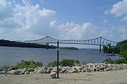
US 52 is one of five U.S. highways to cross the Mississippi River
more than once. It crosses the river three times: at Minneapolis
via the Dartmouth Bridge
, at St. Paul
by the Lafayette Bridge
, and between Iowa and Illinois by the Savanna–Sabula Bridge. The others are U.S. Route 61
, which crosses the Mississippi four times, U.S. Route 169
, which crosses three times, and U.S. Route 2
and U.S. Route 67
, which each cross twice.
|SC
|161
|259
|-
|NC
|153
|169.5
|-
|VA
|85
|137
|-
|KY
|
|
|-
|WV
|186
|299
|-
|OH
|190
|
|-
|IN
|
|
|-
|IL
|
|
|-
|IA
|164
|264
|-
|MN
|377
|607
|-
|ND
|361
|581
|-
|Total
|2,072
|3,335
|}
, US 52 continues from Highway 39
from the Canada-United States border
at North Portal, Saskatchewan
and Portal, North Dakota
to the Red River
in Fargo
, a distance of 361 miles (581 km). US 52 passes through Burke
, Ward
, McHenry
, Pierce
, Sheridan
, Wells
, Foster
, Stutsman
, Barnes
, and Cass
counties.
US 52 is a two-lane highway in most areas, except for four lane segments between Burlington
and Minot
, Jamestown
and Buchanan
, and Jamestown
and Fargo
. Some segments in Fargo are six lanes.
US 52 is co-signed
with US 2
near Minot
, where it also intersects with US 83
. US 52 is also co-signed with US 281
for 44 miles (71 km) between Jamestown
and Carrington
. US 52/US 281 in Jamestown
is on sign different streets. Include 5th Street NW to 1st Ave, and to west bus loop. The former US 52 route was assign to 10th street SE, 12th Ave SE, and 14th Street SE cosigned with Business Loop 94. The 93.5 miles (150 km) between Jamestown
and Fargo
are co-signed with Interstate 94
.
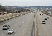 In the state of Minnesota
, U.S. 52 enters the state with Interstate 94
at Moorhead
and follows Interstate 94 southeast all the way to the Twin Cities. The portion of the highway which overlaps Interstate 94 is unsigned. From downtown St. Paul, U.S. 52 continues on its own southeast to Rochester
and the Iowa border. South of the Twin Cities and through Rochester to Interstate 90
, the road is being gradually improved to a freeway. It is currently a freeway from I-90, through Rochester, and into Oronoco. It is also a freeway from Interstate 94 in St. Paul to just south of Concord Blvd in Inver Grove Heights. The rest of the highway between Oronoco and Inver Grove Heights in built to expressway
standards.
north of the unincorporated community of Burr Oak
. It passes by Luther College
on the west side of Decorah
. At Calmar
the road turns to a southwest-northeast orientation. It joins with U.S. Route 18
just to the west of Postville
. The two highways overlap until a point east of the unincorporated community of Froelich. U.S. 52 roughly parallels the Mississippi River
for the rest of its path through Iowa. At Luxemburg
it joins with Iowa Highway 3 and turns east. The two highways run together to downtown Dubuque
, where it intersects U.S. Highway 61 and U.S. Highway 151.
South of Dubuque, U.S. 52, U.S. 61, and U.S. 151 share a freeway routing until 52 departs in Key West
to remain close to the Mississippi River. Just west of Sabula
the highway turns to an east–west orientation at the junction of Iowa Highway 64 and the northern terminus of U.S. Route 67
. In Sabula, the highway becomes a 'wrong way' road. Northbound traffic travels south, and vice versa, from Sabula to the Savanna–Sabula Bridge, where U.S. 52 crosses into Illinois.
North of Dubuque, Iowa
, US 52 is routed on to a narrow and often winding road. While scenic, the road has been the scene of numerous accidents over the years owing to this nature. Between 1964 and 1967, this segment of the route was called Alternate US 52 and US 52 was rerouted south from Luxemburg, Iowa
to Dyersville, Iowa
along Iowa Highway 136, and east from Dyersville to Dubuque along U.S. Route 20
.
The entire length of U.S. 52 in Iowa is located within the unglaciated Driftless Area.
 In Illinois
, U.S. 52 runs from the Savanna-Sabula Bridge
with Iowa Highway 64 and Illinois Route 64
at Savanna
southeast passing through the cities of Dixon
, Amboy
and Mendota
. U.S. 52 then passes through the southern portion of Joliet
, where it is a major thoroughfare in the city of Joliet (Jefferson Street), avoiding the city of Chicago proper. It joins with U.S. Route 45
through Kankakee
, and then runs concurrently with U.S. Route 24
east of Watseka
to the Indiana state line.
 In Indiana
, U.S. 52 runs in a northwest-southeast direction. It passes through Lafayette
and Indianapolis
. Northwest of Indianapolis, U.S. 52 runs along the same general area as, and is considered an alternative route to, Interstate 65
. In the Indianapolis area, it is overlapped with Interstate 865
and Interstate 465
. East of Indianapolis, it is considered an alternative to Interstate 74
before joining it before entering Ohio.
concurrently with Interstate 74
in northwestern Hamilton County
. U.S. 52 then parallels Interstate 75
from Interstate 74's terminus into and through downtown Cincinnati
. It skirts the Cincinnati riverfront along Pete Rose Way in the vicinity of Paul Brown Stadium
and Great American Ball Park
. From this point eastward, U.S. 52 generally follows the Ohio River
. There is a brief concurrency with Interstate 275
near California, a suburb of Cincinnati. Towns along its path include New Richmond
, Aberdeen
, Ripley
and Manchester
. The section between Interstate 275 and New Richmond was modernized in the 1960s. Parts of the old route run parallel to the newer highway. Around Portsmouth
and Ironton
U.S. 52 has several freeway or expressway
sections. In Portsmouth, U.S. 52 intersects with U.S. 23. At Chesapeake
, U.S. 52 crosses the Ohio River into Huntington, West Virginia
.
The sections of U.S. 52 that follow the Ohio River are known as the Ohio River Scenic Byway, which is part of the National Scenic Byway
Project. The section between SR 125
and SR 73
(near Portsmouth) is also designated as Scenic Scioto Heritage Trail
. This portion of U.S. 52, along the Ohio between Cincinnati and Huntington, is the only part where it falls in geographical sequence, south of U.S. 50 and north of U.S. 60.
to Bluefield
. The highway is undergoing a major expansion project as of 2007.
During its run in West Virginia, U.S. 52 enters Kentucky briefly, as described in the next paragraph. (Eventually, however, U.S. 52 leaves West Virginia and enters Virginia.)
twice along the Williamson, West Virginia
bypass, in order to prevent the blasting of several hillsides in West Virginia
. These stretches were completed in 1996 as part of the Corridor G (U.S. Route 119
) project. The speed limit in West Virginia is 65 mi/h, but drops to 55 mi/h along the Kentucky portions.
. It enters southwestern Virginia near Bluefield
and passes through Wytheville
and Hillsville
before leaving the state south of Cana
.
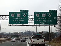 US 52 enters North Carolina
just north west of Mount Airy
. It goes by Pilot Mountain
, one of the most distinctive natural features in North Carolina. Through the Piedmont Triad
region, US 52 is mostly a limited-access freeway. The route joins Interstate 85 Business
into Lexington, North Carolina
and shares Interstate 85
around Salisbury, North Carolina
. The segment of US 52 from Interstate 40
in Winston-Salem, North Carolina
to Lexington is currently being upgraded to Interstate highway standards for the future Interstate 285
corridor. The segment from northern Winston-Salem to just south of Mount Airy is expected to form part of the Interstate 74
corridor through North Carolina.
South of the Triad area, after splitting from Interstate 85
in Salisbury, US 52 is typically a two-lane route linking some of the state's smaller cities and towns. Albemarle
is the largest municipality along this segment of US 52 to the South Carolina state line.
northeast of Cheraw
. From Darlington
southward it is a multilane highway and Freeway, passing through Florence
, Lake City
, Kingstree
, Moncks Corner
and North Charleston
before U.S. 52's terminus at number 2 Meeting Street and White Point Gardens in Charleston
.
between Minneapolis
and St. Paul. In the 1980s and 1990s, the highway was gradually shifted onto its present route along Interstate 94
. However, there was a gap in the definition of the highway for a few years until 1995. Since then, it has been routed along the interstate between the Twin Cities, although as of 2007, there was still a sign on University Avenue entering Hennepin County
telling motorists to follow County Highways 36 and 37 to reach US 52—which kept them on University, then on 4th St. for historic westbound US 52. Historic westbound US 52 then crossed the Central Avenue bridge (current Minnesota State Highway 65
) and turned onto the current routing of County Highway 81 northwest to Osseo
. It then followed the current route of U.S. Highway 169 north to Anoka
.
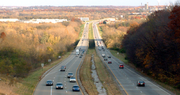
In Rochester, Minnesota
, US 52 was recently expanded to six lanes. Long term plans have US 52 from St. Paul to Interstate 90
becoming a freeway, and some have suggested that when the conversion is complete, the freeway should become a spur route for Interstate 90
(I-X90). Currently, Interstate 90
has no spur routes in Minnesota. Also, US 52's route through Rochester has exit numbers, presently the only non-Interstate in Minnesota to have them.
to Max Meadows, Virginia
, estimated to be 107 miles (172.2 km). In North Carolina
it overlapped with NC 66
; in Virginia
it was overlapped with SR 15. In 1934, US 52 was extended southeast into Virginia
and North Carolina
, and replaced all of US 121.
 Along U.S. 52's route, there are many places where the route crosses an Interstate (intersection), and many places where U.S. 52 shares its route with an Interstate (concurrency
).
United States
The United States of America is a federal constitutional republic comprising fifty states and a federal district...
. Contrary to most other even-numbered U.S. Highways, US 52 primarily follows a northwest-southeast route, and is signed north–south or east–west depending on the local orientation of the route.
The highway's northwestern terminus is at Portal, North Dakota
Portal, North Dakota
As of the census of 2000, there were 131 people, 63 households, and 43 families residing in the city. The population density was 232.8 people per square mile . There were 98 housing units at an average density of 174.1 per square mile...
, on the Canadian
Canada
Canada is a North American country consisting of ten provinces and three territories. Located in the northern part of the continent, it extends from the Atlantic Ocean in the east to the Pacific Ocean in the west, and northward into the Arctic Ocean...
border, where it continues as Saskatchewan Highway 39
Saskatchewan Highway 39
Highway 39 is a provincial paved undivided highway located in the southern portion of the Canadian province of Saskatchewan connecting North Portal and Moose Jaw in the north. This is a primary Saskatchewan highway maintained by the provincial and national governments providing a major trucking...
. The southeastern terminus of US 52 is in Charleston, South Carolina
Charleston, South Carolina
Charleston is the second largest city in the U.S. state of South Carolina. It was made the county seat of Charleston County in 1901 when Charleston County was founded. The city's original name was Charles Towne in 1670, and it moved to its present location from a location on the west bank of the...
, at Number 2 Meeting Street and White Point Gardens along the Charleston Harbor.
US 52 is one of five U.S. highways to cross the Mississippi River
Mississippi River
The Mississippi River is the largest river system in North America. Flowing entirely in the United States, this river rises in western Minnesota and meanders slowly southwards for to the Mississippi River Delta at the Gulf of Mexico. With its many tributaries, the Mississippi's watershed drains...
more than once. It crosses the river three times: at Minneapolis
Minneapolis, Minnesota
Minneapolis , nicknamed "City of Lakes" and the "Mill City," is the county seat of Hennepin County, the largest city in the U.S. state of Minnesota, and the 48th largest in the United States...
via the Dartmouth Bridge
Dartmouth Bridge
The Dartmouth Bridge is a steel girder bridge that spans the Mississippi River in Minneapolis, Minnesota, between the Cedar-Riverside area and the University of Minnesota campus area. It was built in 1964 and was designed by Parsons Brinckerhoff, Quade and Douglas.The original span was an...
, at St. Paul
Saint Paul, Minnesota
Saint Paul is the capital and second-most populous city of the U.S. state of Minnesota. The city lies mostly on the east bank of the Mississippi River in the area surrounding its point of confluence with the Minnesota River, and adjoins Minneapolis, the state's largest city...
by the Lafayette Bridge
Lafayette Bridge
The Lafayette Bridge is a bridge carrying U.S. Route 52 across the Mississippi River in downtown St. Paul. At this point, US 52 is on the Lafayette Freeway. The bridge spans across railroad yards north of the Mississippi, the river itself, and industrial areas south of the Mississippi...
, and between Iowa and Illinois by the Savanna–Sabula Bridge. The others are U.S. Route 61
U.S. Route 61
U.S. Route 61 is the official designation for a United States highway that runs from New Orleans, Louisiana, to the city of Wyoming, Minnesota. The highway generally follows the course of the Mississippi River, and is designated the Great River Road for much of its route. As of 2004, the highway's...
, which crosses the Mississippi four times, U.S. Route 169
U.S. Route 169
U.S. Route 169 currently runs for 966 miles from the city of Virginia, Minnesota to Tulsa, Oklahoma at U.S. Route 64.-Oklahoma:U.S. Highway 169 is a major south–north highway spanning in Oklahoma. The southern terminus for US-169 is Memorial Drive...
, which crosses three times, and U.S. Route 2
U.S. Route 2
U.S. Route 2 is an east–west U.S. Highway spanning across the northern continental United States. US 2 consists of two segments connected by various roadways in southern Canada...
and U.S. Route 67
U.S. Route 67
U.S. Route 67 is a 1,560 mile long north–south U.S. highway in the Central United States. The southern terminus of the route is at the United States-Mexico border in Presidio, Texas, where it continues south as Mexican Federal Highway 16 upon crossing the Rio Grande. The northern...
, which each cross twice.
Route description
|-|SC
U.S. Route 52 in South Carolina
U.S. Route 52 is a North–South U.S. Highway that runs from Charleston to the North Carolina state line near Cheraw. It serves as a strategic highway through the central South Carolina.-Route description:U.S. 52 enters South Carolina northeast of Cheraw...
|161
|259
|-
|NC
U.S. Route 52 in North Carolina
U.S. Route 52 is an north–south United States highway that runs for from the South Carolina state line, near McFarlan, to the Virginia state line, near Mount Airy. It serves as a strategic highway through the central North Carolina Piedmont....
|153
|169.5
|-
|VA
|85
|137
|-
|KY
|
|
|-
|WV
U.S. Route 52 in West Virginia
U.S. Route 52 skirts the western fringes of the U.S. state of West Virginia. It runs from the Virginia state line near Bluefield, where it is concurrent with Interstate 77, in a general northwest and north direction to Interstate 64 at Kenova...
|186
|299
|-
|OH
|190
|
|-
|IN
|
|
|-
|IL
|
|
|-
|IA
U.S. Route 52 in Iowa
U.S. Route 52 is a long United States highway in northeast Iowa. The route begins at the Savanna–Sabula Bridge over the Mississippi River between Sabula and Savanna, Illinois. From Sabula, it heads north along the Mississippi towards Bellevue and Dubuque. At Dubuque, US 52 briefly...
|164
|264
|-
|MN
U.S. Route 52 in Minnesota
U.S. Highway 52 enters the state of Minnesota at the unincorporated community of Prosper, north of the town of Burr Oak, Iowa. The route is marked north–south in Minnesota along its independent segment from the Iowa state line to downtown St. Paul...
|377
|607
|-
|ND
|361
|581
|-
|Total
|2,072
|3,335
|}
North Dakota
In North DakotaNorth Dakota
North Dakota is a state located in the Midwestern region of the United States of America, along the Canadian border. The state is bordered by Canada to the north, Minnesota to the east, South Dakota to the south and Montana to the west. North Dakota is the 19th-largest state by area in the U.S....
, US 52 continues from Highway 39
Saskatchewan Highway 39
Highway 39 is a provincial paved undivided highway located in the southern portion of the Canadian province of Saskatchewan connecting North Portal and Moose Jaw in the north. This is a primary Saskatchewan highway maintained by the provincial and national governments providing a major trucking...
from the Canada-United States border
Canada-United States border
The Canada–United States border, officially known as the International Boundary, is the longest border in the world. The terrestrial boundary is 8,891 kilometers long, including 2,475 kilometres shared with Alaska...
at North Portal, Saskatchewan
North Portal, Saskatchewan
-External links:********-Footnotes:...
and Portal, North Dakota
Portal, North Dakota
As of the census of 2000, there were 131 people, 63 households, and 43 families residing in the city. The population density was 232.8 people per square mile . There were 98 housing units at an average density of 174.1 per square mile...
to the Red River
Red River of the North
The Red River is a North American river. Originating at the confluence of the Bois de Sioux and Otter Tail rivers in the United States, it flows northward through the Red River Valley and forms the border between the U.S. states of Minnesota and North Dakota before continuing into Manitoba, Canada...
in Fargo
Fargo, North Dakota
Fargo is the largest city in the U.S. state of North Dakota and the county seat of Cass County. In 2010, its population was 105,549, and it had an estimated metropolitan population of 208,777...
, a distance of 361 miles (581 km). US 52 passes through Burke
Burke County, North Dakota
-National protected areas:*Des Lacs National Wildlife Refuge *Lostwood National Wildlife Refuge -Demographics:As of the 2000 United States Census, there were 2,242 people, 1,013 households, and 680 families residing in the county. The population density was 2.0 people per square mile...
, Ward
Ward County, North Dakota
-National protected areas:*Des Lacs National Wildlife Refuge *Hiddenwood National Wildlife Refuge *Upper Souris National Wildlife Refuge -Demographics:...
, McHenry
McHenry County, North Dakota
-National protected areas:*Cottonwood Lake National Wildlife Refuge*J. Clark Salyer National Wildlife Refuge *Wintering River National Wildlife Refuge-Demographics:...
, Pierce
Pierce County, North Dakota
-National protected area:*Buffalo Lake National Wildlife Refuge-Demographics:As of the census of 2000, there were 4,675 people, 1,964 households, and 1,276 families residing in the county. The population density was 5 people per square mile . There were 2,269 housing units at an average density...
, Sheridan
Sheridan County, North Dakota
-Demographics:As of the census of 2000, there were 1,710 people, 731 households, and 515 families residing in the county. The population density was 2 people per square mile . There were 924 housing units at an average density of 1 per square mile...
, Wells
Wells County, North Dakota
-Demographics:As of the census of 2000, there were 5,102 people, 2,215 households, and 1,453 families residing in the county. The population density was 4 people per square mile . There were 2,643 housing units at an average density of 2 per square mile...
, Foster
Foster County, North Dakota
-Demographics:As of the census of 2000, there were 3,759 people, 1,540 households, and 1,031 families residing in the county. The population density was 2/km² . There were 1,793 housing units at an average density of 1/km²...
, Stutsman
Stutsman County, North Dakota
-National protected areas:*Arrowwood National Wildlife Refuge *Chase Lake National Wildlife Refuge*Halfway Lake National Wildlife Refuge-Demographics:...
, Barnes
Barnes County, North Dakota
-National protected areas:*Hobart Lake National Wildlife Refuge*Stoney Slough National Wildlife Refuge*Tomahawk National Wildlife Refuge-Demographics:...
, and Cass
Cass County, North Dakota
-Demographics:As of the census of 2000, there were 123,138 people, 51,315 households, and 29,814 families residing in the county. The population density was 70 people per square mile . There were 53,790 housing units at an average density of 30 per square mile...
counties.
US 52 is a two-lane highway in most areas, except for four lane segments between Burlington
Burlington, North Dakota
Burlington is a city in Ward County, North Dakota in the United States. Burlington was founded in 1883, having been third in a series that included two earlier settlements. Despite this, Burlington is still the oldest city in Ward County, as well as north-western and north central North Dakota...
and Minot
Minot, North Dakota
Minot is a city located in north central North Dakota in the United States. It is most widely known for the Air Force base located approximately 15 miles north of the city. With a population of 40,888 at the 2010 census, Minot is the fourth largest city in the state...
, Jamestown
Jamestown, North Dakota
As of the census of 2000, there were 15,527 people, 6,505 households, and 3,798 families residing in the city. The population density was 1,246.7 per square mile . There were 6,970 housing units at an average density of 559.6 per square mile...
and Buchanan
Buchanan, North Dakota
As of the census of 2000, there were 77 people, 27 households, and 19 families residing in the city. The population density was 980.9 people per square mile . There were 29 housing units at an average density of 369.4 per square mile...
, and Jamestown
Jamestown, North Dakota
As of the census of 2000, there were 15,527 people, 6,505 households, and 3,798 families residing in the city. The population density was 1,246.7 per square mile . There were 6,970 housing units at an average density of 559.6 per square mile...
and Fargo
Fargo, North Dakota
Fargo is the largest city in the U.S. state of North Dakota and the county seat of Cass County. In 2010, its population was 105,549, and it had an estimated metropolitan population of 208,777...
. Some segments in Fargo are six lanes.
US 52 is co-signed
Concurrency (road)
A concurrency, overlap, or coincidence in a road network is an instance of one physical road bearing two or more different highway, motorway, or other route numbers...
with US 2
U.S. Route 2
U.S. Route 2 is an east–west U.S. Highway spanning across the northern continental United States. US 2 consists of two segments connected by various roadways in southern Canada...
near Minot
Minot, North Dakota
Minot is a city located in north central North Dakota in the United States. It is most widely known for the Air Force base located approximately 15 miles north of the city. With a population of 40,888 at the 2010 census, Minot is the fourth largest city in the state...
, where it also intersects with US 83
U.S. Route 83
U.S. Route 83 is one of the longest north–south U.S. Highways in the United States, at . Only four other north–south routes are longer: U.S. Routes 1, 41, 59 and 87. The highway's northern terminus is north of Westhope, North Dakota, at the Canadian border, where it continues as...
. US 52 is also co-signed with US 281
U.S. Route 281
U.S. Route 281 is a north–south United States highway. At 1,872 miles long it is the longest continuous three-digit U.S. Route....
for 44 miles (71 km) between Jamestown
Jamestown, North Dakota
As of the census of 2000, there were 15,527 people, 6,505 households, and 3,798 families residing in the city. The population density was 1,246.7 per square mile . There were 6,970 housing units at an average density of 559.6 per square mile...
and Carrington
Carrington, North Dakota
As of the census of 2000, there were 2,268 people, 961 households, and 594 families residing in the city. The population density was 1,531.9 people per square mile . There were 1,057 housing units at an average density of 713.9 per square mile...
. US 52/US 281 in Jamestown
Jamestown, North Dakota
As of the census of 2000, there were 15,527 people, 6,505 households, and 3,798 families residing in the city. The population density was 1,246.7 per square mile . There were 6,970 housing units at an average density of 559.6 per square mile...
is on sign different streets. Include 5th Street NW to 1st Ave, and to west bus loop. The former US 52 route was assign to 10th street SE, 12th Ave SE, and 14th Street SE cosigned with Business Loop 94. The 93.5 miles (150 km) between Jamestown
Jamestown, North Dakota
As of the census of 2000, there were 15,527 people, 6,505 households, and 3,798 families residing in the city. The population density was 1,246.7 per square mile . There were 6,970 housing units at an average density of 559.6 per square mile...
and Fargo
Fargo, North Dakota
Fargo is the largest city in the U.S. state of North Dakota and the county seat of Cass County. In 2010, its population was 105,549, and it had an estimated metropolitan population of 208,777...
are co-signed with Interstate 94
Interstate 94
Interstate 94 is the northernmost east–west Interstate Highway, connecting the Great Lakes and Intermountain regions of the United States. I-94's western terminus is in Billings, Montana at a junction with Interstate 90; its eastern terminus is the U.S...
.
Minnesota
Minnesota
Minnesota is a U.S. state located in the Midwestern United States. The twelfth largest state of the U.S., it is the twenty-first most populous, with 5.3 million residents. Minnesota was carved out of the eastern half of the Minnesota Territory and admitted to the Union as the thirty-second state...
, U.S. 52 enters the state with Interstate 94
Interstate 94
Interstate 94 is the northernmost east–west Interstate Highway, connecting the Great Lakes and Intermountain regions of the United States. I-94's western terminus is in Billings, Montana at a junction with Interstate 90; its eastern terminus is the U.S...
at Moorhead
Moorhead, Minnesota
Moorhead is a city in Clay County, Minnesota, United States, and the largest city in northwest Minnesota. The population was 38,065 at the 2010 Census. It is the county seat of Clay County....
and follows Interstate 94 southeast all the way to the Twin Cities. The portion of the highway which overlaps Interstate 94 is unsigned. From downtown St. Paul, U.S. 52 continues on its own southeast to Rochester
Rochester, Minnesota
Rochester is a city in the U.S. state of Minnesota and is the county seat of Olmsted County. Located on both banks of the Zumbro River, The city has a population of 106,769 according to the 2010 United States Census, making it Minnesota's third-largest city and the largest outside of the...
and the Iowa border. South of the Twin Cities and through Rochester to Interstate 90
Interstate 90
Interstate 90 is the longest Interstate Highway in the United States at . It is the northernmost coast-to-coast interstate, and parallels US 20 for the most part. Its western terminus is in Seattle, at Edgar Martinez Drive S. near Safeco Field and CenturyLink Field, and its eastern terminus is in...
, the road is being gradually improved to a freeway. It is currently a freeway from I-90, through Rochester, and into Oronoco. It is also a freeway from Interstate 94 in St. Paul to just south of Concord Blvd in Inver Grove Heights. The rest of the highway between Oronoco and Inver Grove Heights in built to expressway
Limited-access road
A limited-access road known by various terms worldwide, including limited-access highway, dual-carriageway and expressway, is a highway or arterial road for high-speed traffic which has many or most characteristics of a controlled-access highway , including limited or no access to adjacent...
standards.
Iowa
U.S. 52 enters IowaIowa
Iowa is a state located in the Midwestern United States, an area often referred to as the "American Heartland". It derives its name from the Ioway people, one of the many American Indian tribes that occupied the state at the time of European exploration. Iowa was a part of the French colony of New...
north of the unincorporated community of Burr Oak
Burr Oak, Iowa
Burr Oak is a small unincorporated community in Winneshiek County, Iowa, United States, very close to the Minnesota state line. Burr Oak is a census-designated place and the population was 166 in the 2010 census -History:...
. It passes by Luther College
Luther College (Iowa)
Luther College is a four-year, residential liberal arts institution of the Evangelical Lutheran Church in America, located in Decorah, Iowa, USA...
on the west side of Decorah
Decorah, Iowa
Decorah is a city in and the county seat of Winneshiek County, Iowa, United States. The population was 8,172 at the 2000 census. Decorah is located at the intersection of State Highway 9 and U.S...
. At Calmar
Calmar, Iowa
Calmar is a city in Winneshiek County, Iowa, United States. The population was 1,058 at the 2000 census. It is located at the junction of U.S. Highway 52 and State highways 150 and 24...
the road turns to a southwest-northeast orientation. It joins with U.S. Route 18
U.S. Route 18
U.S. Route 18 is an east–west U.S. highway in the Midwestern United States. The western terminus is in Orin, Wyoming at an interchange with Interstate 25. Its eastern terminus of US 18 is in downtown Milwaukee, Wisconsin. However, US 18 runs concurrent with other U.S...
just to the west of Postville
Postville, Iowa
Postville is a city in Allamakee and Clayton Counties in the U.S. state of Iowa. It lies near the junction of four counties and at the intersection of U.S. Routes 18 and 52 and Iowa Highway 51, with airport facilities in the neighboring communities of Waukon, Decorah, Monona, and Prairie du Chien....
. The two highways overlap until a point east of the unincorporated community of Froelich. U.S. 52 roughly parallels the Mississippi River
Mississippi River
The Mississippi River is the largest river system in North America. Flowing entirely in the United States, this river rises in western Minnesota and meanders slowly southwards for to the Mississippi River Delta at the Gulf of Mexico. With its many tributaries, the Mississippi's watershed drains...
for the rest of its path through Iowa. At Luxemburg
Luxemburg, Iowa
Luxemburg is a city in Dubuque County, Iowa, United States. It is part of the 'Dubuque, Iowa Metropolitan Statistical Area'. The population was 246 at the 2000 census...
it joins with Iowa Highway 3 and turns east. The two highways run together to downtown Dubuque
Dubuque, Iowa
Dubuque is a city in and the county seat of Dubuque County, Iowa, United States, located along the Mississippi River. In 2010 its population was 57,637, making it the ninth-largest city in the state and the county's population was 93,653....
, where it intersects U.S. Highway 61 and U.S. Highway 151.
South of Dubuque, U.S. 52, U.S. 61, and U.S. 151 share a freeway routing until 52 departs in Key West
Key West, Iowa
Key West is an unincorporated community in Dubuque County, Iowa, United States, near the extreme southern end of the city of Dubuque. Parts of the community are now within the city of Dubuque, while others are unincorporated. Owing to the presence of U.S. Highways 151, 61, and 52, and the nearby...
to remain close to the Mississippi River. Just west of Sabula
Sabula, Iowa
Sabula is a city in Jackson County, Iowa, United States. The population was 670 at the 2000 census. Sabula is the site of Iowa's only island city. The island has a beach and a campground. It also has a harbor with boat docks and storage sheds to store some boats during the winter...
the highway turns to an east–west orientation at the junction of Iowa Highway 64 and the northern terminus of U.S. Route 67
U.S. Route 67
U.S. Route 67 is a 1,560 mile long north–south U.S. highway in the Central United States. The southern terminus of the route is at the United States-Mexico border in Presidio, Texas, where it continues south as Mexican Federal Highway 16 upon crossing the Rio Grande. The northern...
. In Sabula, the highway becomes a 'wrong way' road. Northbound traffic travels south, and vice versa, from Sabula to the Savanna–Sabula Bridge, where U.S. 52 crosses into Illinois.
North of Dubuque, Iowa
Dubuque, Iowa
Dubuque is a city in and the county seat of Dubuque County, Iowa, United States, located along the Mississippi River. In 2010 its population was 57,637, making it the ninth-largest city in the state and the county's population was 93,653....
, US 52 is routed on to a narrow and often winding road. While scenic, the road has been the scene of numerous accidents over the years owing to this nature. Between 1964 and 1967, this segment of the route was called Alternate US 52 and US 52 was rerouted south from Luxemburg, Iowa
Luxemburg, Iowa
Luxemburg is a city in Dubuque County, Iowa, United States. It is part of the 'Dubuque, Iowa Metropolitan Statistical Area'. The population was 246 at the 2000 census...
to Dyersville, Iowa
Dyersville, Iowa
Dyersville is a city in eastern Delaware and western Dubuque Counties in the U.S. state of Iowa. It is part of the Dubuque, Iowa, Metropolitan Statistical Area. The population was 4,035 at the 2000 census and was estimated to be 4,167 in 2006....
along Iowa Highway 136, and east from Dyersville to Dubuque along U.S. Route 20
U.S. Route 20
U.S. Route 20 is an east–west United States highway. As the "0" in its route number implies, US 20 is a coast-to-coast route. Spanning , it is the longest road in the United States, and the route sparsely parallels Interstate 90...
.
The entire length of U.S. 52 in Iowa is located within the unglaciated Driftless Area.
Illinois
Illinois
Illinois is the fifth-most populous state of the United States of America, and is often noted for being a microcosm of the entire country. With Chicago in the northeast, small industrial cities and great agricultural productivity in central and northern Illinois, and natural resources like coal,...
, U.S. 52 runs from the Savanna-Sabula Bridge
Savanna-Sabula Bridge
The Savanna–Sabula Bridge is a truss bridge and causeway crossing the Mississippi River and connecting the city of Savanna, Illinois with the island city of Sabula, Iowa. The bridge carries U.S. Highway 52 over the river. It is also the terminus of both Iowa Highway 64 and Illinois Route 64...
with Iowa Highway 64 and Illinois Route 64
Illinois Route 64
Illinois Route 64 is an east–west road in north-central Illinois. Its western terminus is at the Iowa state line, connecting with U.S. Route 52 and Iowa Highway 64 via the Savanna-Sabula Bridge at the Mississippi River west of Savanna...
at Savanna
Savanna, Illinois
Savanna is a city in Carroll County, Illinois, United States. The population was 3,062 at the 2010 census, down from 3,542 at the 2000 census. Savanna is located along the Mississippi River at the mouth of the Plum River. Going from north to south, the second automobile bridge between Iowa and...
southeast passing through the cities of Dixon
Dixon, Illinois
Dixon is a city in Lee County, Illinois, United States. The population was 15,733 as of the 2010 census, down from 15,941 at the 2000 census. Named for its founder, John Dixon , it is the county seat of Lee County. Located on the Rock River, Dixon was the boyhood home of former U.S...
, Amboy
Amboy, Illinois
Amboy is a city in Lee County, Illinois, along the Green River. The population was 2,561 at the 2000 census. The chain of Carson Pirie Scott & Co. began in Amboy when Samuel Carson opened his first dry goods store there in 1854...
and Mendota
Mendota, Illinois
Mendota is a city located in north-central Illinois in LaSalle County, Illinois, United States. The city has 7,272 residents, and is the fifth largest city in LaSalle County, though recent estimates have shown that the population has decreased to 6,995 residents. It is part of the...
. U.S. 52 then passes through the southern portion of Joliet
Joliet, Illinois
Joliet is a city in Will and Kendall Counties in the U.S. state of Illinois, located southwest of Chicago. It is the county seat of Will County. As of the 2010 census, the city was the fourth-most populated in Illinois, with a population of 147,433. It continues to be Illinois' fastest growing...
, where it is a major thoroughfare in the city of Joliet (Jefferson Street), avoiding the city of Chicago proper. It joins with U.S. Route 45
U.S. Route 45
U.S. Route 45 is a north–south United States highway. US 45 is a border-to-border route, from Lake Superior to the Gulf of Mexico. A sign at the highway's northern terminus notes the total distance as ....
through Kankakee
Kankakee, Illinois
Kankakee is a city in Kankakee County, Illinois, USA. As of the 2000 census, the city population was 25,561, and 26,840 as of a 2009 estimate. It is the county seat of Kankakee County...
, and then runs concurrently with U.S. Route 24
U.S. Route 24
U.S. Route 24 is one of the original United States highways of 1926. It originally ran from Pontiac, Michigan, in the east to Kansas City, Missouri, in the west. Today, the highway's eastern terminus is west of Clarkston, Michigan, at an intersection with I-75 and its western terminus is near...
east of Watseka
Watseka, Illinois
Watseka is a city in and the county seat of Iroquois County, Illinois, United States. It is located approximately west of the Illinois-Indiana state line on U.S...
to the Indiana state line.
Indiana
Indiana
Indiana is a US state, admitted to the United States as the 19th on December 11, 1816. It is located in the Midwestern United States and Great Lakes Region. With 6,483,802 residents, the state is ranked 15th in population and 16th in population density. Indiana is ranked 38th in land area and is...
, U.S. 52 runs in a northwest-southeast direction. It passes through Lafayette
Lafayette, Indiana
Lafayette is a city in and the county seat of Tippecanoe County, Indiana, United States, northwest of Indianapolis. As of the 2010 census, the city had a total population of 67,140. West Lafayette, on the other side of the Wabash River, is home to Purdue University, which has a large impact on...
and Indianapolis
Indianapolis, Indiana
Indianapolis is the capital of the U.S. state of Indiana, and the county seat of Marion County, Indiana. As of the 2010 United States Census, the city's population is 839,489. It is by far Indiana's largest city and, as of the 2010 U.S...
. Northwest of Indianapolis, U.S. 52 runs along the same general area as, and is considered an alternative route to, Interstate 65
Interstate 65
Interstate 65 is a major Interstate Highway in the United States. The southern terminus is located at an intersection with Interstate 10 in Mobile, Alabama, and its northern terminus is at an interchange with Interstate 90 , U.S. Route 12, and U.S...
. In the Indianapolis area, it is overlapped with Interstate 865
Interstate 865
Interstate 865 is an east–west connector northwest of Indianapolis, Indiana. It was renamed to I-865 in 2002 to prevent I-465 from intersecting with itself...
and Interstate 465
Interstate 465
Interstate 465 , also known as the USS Indianapolis Memorial Highway, is the beltway circling Indianapolis, Indiana, United States. It is roughly rectangular in shape and has a perimeter of approximately 53 miles . It lies almost completely within the boundaries of Marion County, except for two...
. East of Indianapolis, it is considered an alternative to Interstate 74
Interstate 74
Interstate 74 is an Interstate Highway in the Midwestern and Southeastern United States. Its western end is at an intersection with Interstate 80 in Davenport, Iowa; the eastern end of its Midwest segment is at an intersection with Interstate 75 in Cincinnati, Ohio...
before joining it before entering Ohio.
Ohio
U.S. 52 enters OhioOhio
Ohio is a Midwestern state in the United States. The 34th largest state by area in the U.S.,it is the 7th‑most populous with over 11.5 million residents, containing several major American cities and seven metropolitan areas with populations of 500,000 or more.The state's capital is Columbus...
concurrently with Interstate 74
Interstate 74
Interstate 74 is an Interstate Highway in the Midwestern and Southeastern United States. Its western end is at an intersection with Interstate 80 in Davenport, Iowa; the eastern end of its Midwest segment is at an intersection with Interstate 75 in Cincinnati, Ohio...
in northwestern Hamilton County
Hamilton County, Ohio
As of 2000, there were 845,303 people, 346,790 households, and 212,582 families residing in the county. The population density was 2,075 people per square mile . There were 373,393 housing units at an average density of 917 per square mile...
. U.S. 52 then parallels Interstate 75
Interstate 75
Interstate 75 is a major north–south Interstate Highway in the Great Lakes and Southeastern regions of the United States. It travels from State Road 826 and State Road 924 in Hialeah, Florida to Sault Ste. Marie, Michigan, at the Ontario, Canada, border...
from Interstate 74's terminus into and through downtown Cincinnati
Cincinnati, Ohio
Cincinnati is a city in the U.S. state of Ohio. Cincinnati is the county seat of Hamilton County. Settled in 1788, the city is located to north of the Ohio River at the Ohio-Kentucky border, near Indiana. The population within city limits is 296,943 according to the 2010 census, making it Ohio's...
. It skirts the Cincinnati riverfront along Pete Rose Way in the vicinity of Paul Brown Stadium
Paul Brown Stadium
Paul Brown Stadium is an American sports stadium located in Cincinnati, Ohio. It is the home venue of the Cincinnati Bengals of the National Football League. It opened on August 19, 2000. The stadium was named after Bengals' founder Paul Brown. The stadium is located on approximately of land and...
and Great American Ball Park
Great American Ball Park
The Great American Ball Park is a Major League Baseball park in Cincinnati, Ohio. It is the home of the National League's Cincinnati Reds. It opened in 2003, replacing the Reds' former home, Cinergy Field, which was known as Riverfront Stadium from its opening in June 1970 until the 1996...
. From this point eastward, U.S. 52 generally follows the Ohio River
Ohio River
The Ohio River is the largest tributary, by volume, of the Mississippi River. At the confluence, the Ohio is even bigger than the Mississippi and, thus, is hydrologically the main stream of the whole river system, including the Allegheny River further upstream...
. There is a brief concurrency with Interstate 275
Interstate 275 (Ohio)
Interstate 275 is an loop in Ohio, Indiana, and Kentucky that forms a complete beltway around the Cincinnati, Ohio area. It is the only auxiliary interstate that enters three states, including one state that the parent route does not enter . It is the longest loop interstate highway in the United...
near California, a suburb of Cincinnati. Towns along its path include New Richmond
New Richmond, Ohio
New Richmond is a village in Clermont County, Ohio, United States, founded 1814, along the Ohio River. The population was 2,219 at the 2000 census.-Geography:New Richmond is located at ....
, Aberdeen
Aberdeen, Ohio
Aberdeen is a village in Brown County, Ohio, United States, along the Ohio River. The population was 1,603 at the 2000 census.Aberdeen is connected to Maysville, Kentucky by the Simon Kenton Memorial Bridge to downtown Maysville and the William H. Harsha Bridge, a cable-stayed bridge completed in...
, Ripley
Ripley, Ohio
Ripley is a village in Brown County, Ohio, United States, along the Ohio River 50 miles southeast of Cincinnati. The population was 1,745 at the 2000 census.-History:...
and Manchester
Manchester, Ohio
Manchester is a village in Adams County, Ohio, United States, along the Ohio River. As of the 2000 census, the village had a total population of 2,043....
. The section between Interstate 275 and New Richmond was modernized in the 1960s. Parts of the old route run parallel to the newer highway. Around Portsmouth
Portsmouth, Ohio
Portsmouth is a city in the U.S. state of Ohio and the county seat of Scioto County. The municipality is located on the northern banks of the Ohio River and east of the Scioto River in Southern Ohio. The population was 20,226 at the 2010 census.-Foundation:...
and Ironton
Ironton, Ohio
Ironton is a city in the U.S. state of Ohio and the county seat of Lawrence County. The municipality is located in southern Ohio along the Ohio River. The population was 11,211 at the 2000 census. Ironton is a part of the Huntington-Ashland, WV-KY-OH, Metropolitan Statistical Area . As of the...
U.S. 52 has several freeway or expressway
Limited-access road
A limited-access road known by various terms worldwide, including limited-access highway, dual-carriageway and expressway, is a highway or arterial road for high-speed traffic which has many or most characteristics of a controlled-access highway , including limited or no access to adjacent...
sections. In Portsmouth, U.S. 52 intersects with U.S. 23. At Chesapeake
Chesapeake, Ohio
Chesapeake is a village in Lawrence County, Ohio, United States. The population was listed as 842 in the 2000 census. It lies across the Ohio River from Huntington, West Virginia, at the mouth of Symmes Creek....
, U.S. 52 crosses the Ohio River into Huntington, West Virginia
Huntington, West Virginia
Huntington is a city in Cabell and Wayne counties in the U.S. state of West Virginia, along the Ohio River. Most of the city is in Cabell County, for which it is the county seat. A small portion of the city, mainly the neighborhood of Westmoreland, is in Wayne County. Its population was 49,138 at...
.
The sections of U.S. 52 that follow the Ohio River are known as the Ohio River Scenic Byway, which is part of the National Scenic Byway
National Scenic Byway
A National Scenic Byway is a road recognized by the United States Department of Transportation for its archeological, cultural, historic, natural, recreational, and/or scenic qualities. The program was established by Congress in 1991 to preserve and protect the nation's scenic but often...
Project. The section between SR 125
Ohio State Route 125
State Route 125 is an east–west state highway in the southwestern portion of the U.S. state of Ohio. Its western terminus is within the Cincinnati city limits, about east of downtown, at U.S. Route 50 – this is also the western terminus of State Route 32 and the southern terminus of State...
and SR 73
Ohio State Route 73
State Route 73 is an east–west state highway in the southern portion of the U.S. state of Ohio. Its western terminus is on U.S. Route 27 in Oxford. State Route 73’s eastern terminus is in Portsmouth at U.S. Route 23; this is also the southern terminus of State Route 104, and the two state...
(near Portsmouth) is also designated as Scenic Scioto Heritage Trail
Scenic Scioto Heritage Trail
Scenic Scioto Heritage Trail is a scenic byway located in Scioto County, Ohio that has been recognized by the Ohio Department of Transportation Scenic Byway Program as one of the state’s scenic byways having met the required criteria of having outstanding scenic, natural, historic, archeological,...
. This portion of U.S. 52, along the Ohio between Cincinnati and Huntington, is the only part where it falls in geographical sequence, south of U.S. 50 and north of U.S. 60.
West Virginia
US 52 serves western and southern portions of West Virginia, running from HuntingtonHuntington, West Virginia
Huntington is a city in Cabell and Wayne counties in the U.S. state of West Virginia, along the Ohio River. Most of the city is in Cabell County, for which it is the county seat. A small portion of the city, mainly the neighborhood of Westmoreland, is in Wayne County. Its population was 49,138 at...
to Bluefield
Bluefield, West Virginia
Bluefield is a city in Mercer County, West Virginia, United States. The population was 10,447 at the 2010 census. It is also the core city of the Bluefield WV-VA micropolitan area which has a population of 107,342.-Geography & Climate:...
. The highway is undergoing a major expansion project as of 2007.
During its run in West Virginia, U.S. 52 enters Kentucky briefly, as described in the next paragraph. (Eventually, however, U.S. 52 leaves West Virginia and enters Virginia.)
Kentucky
U.S. 52 enters KentuckyKentucky
The Commonwealth of Kentucky is a state located in the East Central United States of America. As classified by the United States Census Bureau, Kentucky is a Southern state, more specifically in the East South Central region. Kentucky is one of four U.S. states constituted as a commonwealth...
twice along the Williamson, West Virginia
Williamson, West Virginia
Williamson is a city in Mingo County, West Virginia, USA, along the Tug Fork River. The population was 3,414 at the 2000 census. It is the county seat of Mingo County, and is the county's largest and most populous city. Williamson is home to Southern West Virginia Community and Technical College...
bypass, in order to prevent the blasting of several hillsides in West Virginia
West Virginia
West Virginia is a state in the Appalachian and Southeastern regions of the United States, bordered by Virginia to the southeast, Kentucky to the southwest, Ohio to the northwest, Pennsylvania to the northeast and Maryland to the east...
. These stretches were completed in 1996 as part of the Corridor G (U.S. Route 119
U.S. Route 119
U.S. Route 119, commonly abbreviated as US 119, is a spur of US 19. It is a north–south route that was an original United States highway of 1926. It is often referred to as Corridor G east of US 23 and KY 80 in Kentucky to Interstate 64 at Charleston, West Virginia.- Kentucky :US 119 is a two...
) project. The speed limit in West Virginia is 65 mi/h, but drops to 55 mi/h along the Kentucky portions.
Virginia
U.S. 52 enters Virginia from West Virginia, and in Virginia closely follows Interstate 77Interstate 77
Interstate 77 is an Interstate Highway in the eastern United States. It traverses diverse terrain, from the mountainous state of West Virginia to the rolling farmlands of North Carolina and Ohio. It largely supplants the old U.S...
. It enters southwestern Virginia near Bluefield
Bluefield, Virginia
Bluefield is a town in Tazewell County, Virginia, along the Bluestone River. The population was 5,078 at the 2000 census. It is part of the Bluefield WV-VA micropolitan area which has a population of 107,578...
and passes through Wytheville
Wytheville, Virginia
Wytheville is a town in Wythe County, Virginia, United States. The population was 8,211 at the 2010 census. It is the county seat of Wythe County. The town is home to a Chautauqua Festival, held the third weekend in June every year since 1985...
and Hillsville
Hillsville, Virginia
Hillsville is a town in Carroll County, Virginia, United States. The population was 2,607 at the 2000 census. It is the county seat of Carroll County.-Geography:Hillsville is located at ....
before leaving the state south of Cana
Cana, Virginia
Cana is a census-designated place in Carroll County, Virginia, United States. The population was 1,228 at the 2000 census. It is the only CDP designated area in the county that is outside of the Appalachian Mountains in the Virginia Piedmont...
.
North Carolina
North Carolina
North Carolina is a state located in the southeastern United States. The state borders South Carolina and Georgia to the south, Tennessee to the west and Virginia to the north. North Carolina contains 100 counties. Its capital is Raleigh, and its largest city is Charlotte...
just north west of Mount Airy
Mount Airy, North Carolina
Mount Airy is a city in Surry County, North Carolina, United States. As of the 2010 census, the city population was 10,388.-History:Mount Airy was settled in the 1750s as a stagecoach stop on the road between Winston-Salem and Galax, Virginia. It was named for a nearby plantation...
. It goes by Pilot Mountain
Pilot Mountain (North Carolina)
Pilot Mountain, a metamorphic quartzite monadnock rising to a peak above sea level, is one of the most distinctive natural features in the state of North Carolina. It is a remnant of the ancient chain of Sauratown Mountains. The Saura were the earliest known inhabitants of the region...
, one of the most distinctive natural features in North Carolina. Through the Piedmont Triad
Piedmont Triad
The Piedmont Triad, or Triad, is a north-central region of the U.S. state of North Carolina that consists of the area within and surrounding the three major cities of Greensboro, Winston-Salem, and High Point. This close group or "triad" of cities lies in the Piedmont geographical region of the...
region, US 52 is mostly a limited-access freeway. The route joins Interstate 85 Business
Interstate 85 Business
Interstate 85 Business or Business Interstate 85 may refer to:*Interstate 85 Business *Interstate 85 Business...
into Lexington, North Carolina
Lexington, North Carolina
Lexington is the county seat of Davidson County, North Carolina, United States. As of the 2000 census, the city had a total population of 19,953. It is located in central North Carolina, twenty miles south of Winston-Salem. Major highways include I-85, U.S. Route 29, U.S. Route 70, U.S. Route 52 ...
and shares Interstate 85
Interstate 85
Interstate 85 is a major interstate highway in the Southeastern United States. Its current southern terminus is at an interchange with Interstate 65 in Montgomery, Alabama; its northern terminus interchanges with Interstate 95 in Petersburg, Virginia, near Richmond...
around Salisbury, North Carolina
Salisbury, North Carolina
Salisbury is a city in Rowan County in North Carolina, a state of the United States of America. The population was 33,663 in the 2010 Census . It is the county seat of Rowan County...
. The segment of US 52 from Interstate 40
Interstate 40
Interstate 40 is the third-longest major east–west Interstate Highway in the United States, after I-90 and I-80. Its western end is at Interstate 15 in Barstow, California; its eastern end is at a concurrency of U.S. Route 117 and North Carolina Highway 132 in Wilmington, North Carolina...
in Winston-Salem, North Carolina
Winston-Salem, North Carolina
Winston-Salem is a city in the U.S. state of North Carolina, with a 2010 population of 229,617. Winston-Salem is the county seat and largest city of Forsyth County and the fourth-largest city in the state. Winston-Salem is the second largest municipality in the Piedmont Triad region and is home to...
to Lexington is currently being upgraded to Interstate highway standards for the future Interstate 285
Interstate 285 (North Carolina)
In the U.S. state of North Carolina, Interstate 285 is the designation for a future connector interstate route. When completed, it will connect Interstate 85 to Winston-Salem.-Route description:...
corridor. The segment from northern Winston-Salem to just south of Mount Airy is expected to form part of the Interstate 74
Interstate 74
Interstate 74 is an Interstate Highway in the Midwestern and Southeastern United States. Its western end is at an intersection with Interstate 80 in Davenport, Iowa; the eastern end of its Midwest segment is at an intersection with Interstate 75 in Cincinnati, Ohio...
corridor through North Carolina.
South of the Triad area, after splitting from Interstate 85
Interstate 85
Interstate 85 is a major interstate highway in the Southeastern United States. Its current southern terminus is at an interchange with Interstate 65 in Montgomery, Alabama; its northern terminus interchanges with Interstate 95 in Petersburg, Virginia, near Richmond...
in Salisbury, US 52 is typically a two-lane route linking some of the state's smaller cities and towns. Albemarle
Albemarle, North Carolina
Albemarle is the county seat of Stanly County, North Carolina. The population was 15,680 at the 2000 census. It is governed by Mayor Elbert L. "Whit" Whitley, Jr...
is the largest municipality along this segment of US 52 to the South Carolina state line.
South Carolina
U.S. 52 enters South CarolinaSouth Carolina
South Carolina is a state in the Deep South of the United States that borders Georgia to the south, North Carolina to the north, and the Atlantic Ocean to the east. Originally part of the Province of Carolina, the Province of South Carolina was one of the 13 colonies that declared independence...
northeast of Cheraw
Cheraw, South Carolina
Cheraw is a town on the Pee Dee River in Chesterfield County, South Carolina, United States. The population was 5,524 at the 2000 census and center of an urban cluster with a total population of 9,069. It has been nicknamed "The Prettiest Town in Dixie." The harbor tub USS Cheraw was named in the...
. From Darlington
Darlington, South Carolina
Darlington is a city in and the county seat of Darlington County, in the northeastern part of the U.S. state of South Carolina. It is a center for tobacco farming. The population was 6,720 at the 2000 census and is part of the Florence Metropolitan Statistical Area...
southward it is a multilane highway and Freeway, passing through Florence
Florence, South Carolina
-Municipal government and politics:The City of Florence has a council-manager form of government. The mayor and city council are elected every four years, with no term limits...
, Lake City
Lake City, South Carolina
Lake City is a city in Florence County, South Carolina, United States. The population was 6,478 at the 2000 census...
, Kingstree
Kingstree, South Carolina
Kingstree is a town in and the county seat of Williamsburg County, South Carolina, United States. The population was 3,328 at the 2010 census.-History:...
, Moncks Corner
Moncks Corner, South Carolina
Moncks Corner is a town in and the county seat of Berkeley County, South Carolina, United States. The population was 5,952 at the 2000 census....
and North Charleston
North Charleston, South Carolina
North Charleston is the 3rd largest city in the U.S. state of South Carolina with incorporated areas in Berkeley, Charleston, and Dorchester counties. On June 12, 1972 the city of North Charleston incorporated and was the 9th largest city in South Carolina. According to the 2010 Census, North...
before U.S. 52's terminus at number 2 Meeting Street and White Point Gardens in Charleston
Charleston, South Carolina
Charleston is the second largest city in the U.S. state of South Carolina. It was made the county seat of Charleston County in 1901 when Charleston County was founded. The city's original name was Charles Towne in 1670, and it moved to its present location from a location on the west bank of the...
.
History
Historically, US 52 was routed along University AvenueUniversity Avenue (Minneapolis-St. Paul)
University Avenue in the Minneapolis–St. Paul region of Minnesota begins near the Minnesota State Capitol in Saint Paul and extends westward into neighboring Minneapolis, where it passes the University of Minnesota, and then turns north to pass through several suburbs before ending in Blaine,...
between Minneapolis
Minneapolis, Minnesota
Minneapolis , nicknamed "City of Lakes" and the "Mill City," is the county seat of Hennepin County, the largest city in the U.S. state of Minnesota, and the 48th largest in the United States...
and St. Paul. In the 1980s and 1990s, the highway was gradually shifted onto its present route along Interstate 94
Interstate 94
Interstate 94 is the northernmost east–west Interstate Highway, connecting the Great Lakes and Intermountain regions of the United States. I-94's western terminus is in Billings, Montana at a junction with Interstate 90; its eastern terminus is the U.S...
. However, there was a gap in the definition of the highway for a few years until 1995. Since then, it has been routed along the interstate between the Twin Cities, although as of 2007, there was still a sign on University Avenue entering Hennepin County
Hennepin County, Minnesota
Hennepin County is a county located in the U.S. state of Minnesota, named in honor of the 17th-century explorer Father Louis Hennepin. As of 2010 the population was 1,152,425. Its county seat is Minneapolis. It is by far the most populous county in Minnesota; more than one in five Minnesotans live...
telling motorists to follow County Highways 36 and 37 to reach US 52—which kept them on University, then on 4th St. for historic westbound US 52. Historic westbound US 52 then crossed the Central Avenue bridge (current Minnesota State Highway 65
Minnesota State Highway 65
Minnesota State Highway 65 is a highway in east-central and northeast Minnesota, which runs from its intersection with Washington Avenue at the north end of downtown Minneapolis and continues north to its northern terminus at its intersection with U.S...
) and turned onto the current routing of County Highway 81 northwest to Osseo
Osseo, Minnesota
As of the census of 2000, there were 2,434 people, 1,035 households, and 606 families residing in the city. The population density was 3,179.7 people per square mile . There were 1,060 housing units at an average density of 1,384.7 per square mile...
. It then followed the current route of U.S. Highway 169 north to Anoka
Anoka, Minnesota
At the 2000 census, there were 18,076 people, 7,262 households and 4,408 families residing in the city. The population density was 2,709.0 per square mile . There were 7,398 housing units at an average density of 1,108.7 per square mile...
.
In Rochester, Minnesota
Rochester, Minnesota
Rochester is a city in the U.S. state of Minnesota and is the county seat of Olmsted County. Located on both banks of the Zumbro River, The city has a population of 106,769 according to the 2010 United States Census, making it Minnesota's third-largest city and the largest outside of the...
, US 52 was recently expanded to six lanes. Long term plans have US 52 from St. Paul to Interstate 90
Interstate 90
Interstate 90 is the longest Interstate Highway in the United States at . It is the northernmost coast-to-coast interstate, and parallels US 20 for the most part. Its western terminus is in Seattle, at Edgar Martinez Drive S. near Safeco Field and CenturyLink Field, and its eastern terminus is in...
becoming a freeway, and some have suggested that when the conversion is complete, the freeway should become a spur route for Interstate 90
Interstate 90
Interstate 90 is the longest Interstate Highway in the United States at . It is the northernmost coast-to-coast interstate, and parallels US 20 for the most part. Its western terminus is in Seattle, at Edgar Martinez Drive S. near Safeco Field and CenturyLink Field, and its eastern terminus is in...
(I-X90). Currently, Interstate 90
Interstate 90
Interstate 90 is the longest Interstate Highway in the United States at . It is the northernmost coast-to-coast interstate, and parallels US 20 for the most part. Its western terminus is in Seattle, at Edgar Martinez Drive S. near Safeco Field and CenturyLink Field, and its eastern terminus is in...
has no spur routes in Minnesota. Also, US 52's route through Rochester has exit numbers, presently the only non-Interstate in Minnesota to have them.
U.S. Route 121 (1926)
Established in 1926, US 121 traversed from Lexington, North CarolinaLexington, North Carolina
Lexington is the county seat of Davidson County, North Carolina, United States. As of the 2000 census, the city had a total population of 19,953. It is located in central North Carolina, twenty miles south of Winston-Salem. Major highways include I-85, U.S. Route 29, U.S. Route 70, U.S. Route 52 ...
to Max Meadows, Virginia
Max Meadows, Virginia
Max Meadows is a census-designated place in Wythe County, Virginia, United States. The population was 562 at the 2010 census.-Geography:Max Meadows is located at ....
, estimated to be 107 miles (172.2 km). In North Carolina
North Carolina
North Carolina is a state located in the southeastern United States. The state borders South Carolina and Georgia to the south, Tennessee to the west and Virginia to the north. North Carolina contains 100 counties. Its capital is Raleigh, and its largest city is Charlotte...
it overlapped with NC 66
North Carolina Highway 66
North Carolina Highway 66 is a highway running from Horneytown Road in Forsyth County to NC 89 in Johnstown.-Major intersections:...
; in Virginia
Virginia
The Commonwealth of Virginia , is a U.S. state on the Atlantic Coast of the Southern United States. Virginia is nicknamed the "Old Dominion" and sometimes the "Mother of Presidents" after the eight U.S. presidents born there...
it was overlapped with SR 15. In 1934, US 52 was extended southeast into Virginia
Virginia
The Commonwealth of Virginia , is a U.S. state on the Atlantic Coast of the Southern United States. Virginia is nicknamed the "Old Dominion" and sometimes the "Mother of Presidents" after the eight U.S. presidents born there...
and North Carolina
North Carolina
North Carolina is a state located in the southeastern United States. The state borders South Carolina and Georgia to the south, Tennessee to the west and Virginia to the north. North Carolina contains 100 counties. Its capital is Raleigh, and its largest city is Charlotte...
, and replaced all of US 121.
Major intersections
Concurrency (road)
A concurrency, overlap, or coincidence in a road network is an instance of one physical road bearing two or more different highway, motorway, or other route numbers...
).
- Interstate 94Interstate 94Interstate 94 is the northernmost east–west Interstate Highway, connecting the Great Lakes and Intermountain regions of the United States. I-94's western terminus is in Billings, Montana at a junction with Interstate 90; its eastern terminus is the U.S...
concurrency between Jamestown, North DakotaJamestown, North DakotaAs of the census of 2000, there were 15,527 people, 6,505 households, and 3,798 families residing in the city. The population density was 1,246.7 per square mile . There were 6,970 housing units at an average density of 559.6 per square mile...
and St. Paul, Minnesota (signed concurrently in North Dakota, unsigned in Minnesota) - Interstate 29Interstate 29Interstate 29 is an Interstate Highway in the Midwestern United States. I-29 runs from Kansas City, Missouri, at a junction with Interstate 35 and Interstate 70 to the Canadian border near Pembina, North Dakota, where it connects with Manitoba Highway 75 via the short Manitoba Highway 29.-Route...
in Fargo, North DakotaFargo, North DakotaFargo is the largest city in the U.S. state of North Dakota and the county seat of Cass County. In 2010, its population was 105,549, and it had an estimated metropolitan population of 208,777...
(while concurrent with I-94) - Interstate 694Interstate 694Interstate 694 is an east–west auxiliary Interstate Highway located in the Minneapolis – Saint Paul metropolitan area in the U.S. state of Minnesota. The western terminus of the route is at its junction with Interstate 94 and Interstate 494 in Maple Grove...
concurrency in Minneapolis, MinnesotaMinneapolis, MinnesotaMinneapolis , nicknamed "City of Lakes" and the "Mill City," is the county seat of Hennepin County, the largest city in the U.S. state of Minnesota, and the 48th largest in the United States...
(while concurrent with I-94) - Interstate 494Interstate 494Interstate 494 is a loop route making up part of a beltway of Interstate 94, circling through the southern and western portions of the Minneapolis – Saint Paul metropolitan area in Minnesota...
in Maple Grove, MinnesotaMaple Grove, MinnesotaAs of the census of 2000, there were 50,365 people , 17,532 households, and 13,955 families residing in the city. The population density was 1,532.3 people per square mile . There were 17,745 housing units at an average density of 539.9 per square mile...
(while concurrent with I-94) - Interstate 394Interstate 394Interstate 394 is an east–west Interstate Highway spur route in Hennepin County in the U.S. state of Minnesota. It runs for 9.8 miles from its eastern terminus in downtown Minneapolis to its western terminus at its junction with Interstate 494 in the Minneapolis suburb of Minnetonka...
in Minneapolis, MinnesotaMinneapolis, MinnesotaMinneapolis , nicknamed "City of Lakes" and the "Mill City," is the county seat of Hennepin County, the largest city in the U.S. state of Minnesota, and the 48th largest in the United States...
(while concurrent with I-94) - Interstate 35WInterstate 35W (Minnesota)Interstate 35W , is an Interstate Highway in the U.S. state of Minnesota, passing through downtown Minneapolis. It is one of two through routes for Interstate 35 through the Twin Cities of Minneapolis and Saint Paul, the other being Interstate 35E through downtown Saint Paul...
in Minneapolis, MinnesotaMinneapolis, MinnesotaMinneapolis , nicknamed "City of Lakes" and the "Mill City," is the county seat of Hennepin County, the largest city in the U.S. state of Minnesota, and the 48th largest in the United States...
(while concurrent with I-94) - Interstate 35EInterstate 35E (Minnesota)Interstate 35E is an Interstate Highway in the U.S. state of Minnesota, passing through downtown Saint Paul. It is one of two through routes for Interstate 35 through the Twin Cities of Minneapolis and Saint Paul, the other being Interstate 35W through Minneapolis. Thus, both ends of I-35E are...
concurrency in St. Paul, Minnesota (while concurrent with I-94) - Interstate 494Interstate 494Interstate 494 is a loop route making up part of a beltway of Interstate 94, circling through the southern and western portions of the Minneapolis – Saint Paul metropolitan area in Minnesota...
in Inver Grove Heights, MinnesotaInver Grove Heights, MinnesotaAs of the census of 2000, there were 29,751 people, 11,257 households, and 7,924 families residing in the city. The population density was 1,038.8 people per square mile . There were 11,457 housing units at an average density of 400.1 per square mile... - Interstate 90Interstate 90Interstate 90 is the longest Interstate Highway in the United States at . It is the northernmost coast-to-coast interstate, and parallels US 20 for the most part. Its western terminus is in Seattle, at Edgar Martinez Drive S. near Safeco Field and CenturyLink Field, and its eastern terminus is in...
near Rochester, MinnesotaRochester, MinnesotaRochester is a city in the U.S. state of Minnesota and is the county seat of Olmsted County. Located on both banks of the Zumbro River, The city has a population of 106,769 according to the 2010 United States Census, making it Minnesota's third-largest city and the largest outside of the... - Interstate 88Interstate 88 (west)Interstate 88 is an intrastate Interstate Highway in the state of Illinois. It runs from an interchange with Interstate 80 near Silvis and Moline to an interchange with Interstates 290 and 294 in Hillside, near Chicago...
in Dixon, IllinoisDixon, IllinoisDixon is a city in Lee County, Illinois, United States. The population was 15,733 as of the 2010 census, down from 15,941 at the 2000 census. Named for its founder, John Dixon , it is the county seat of Lee County. Located on the Rock River, Dixon was the boyhood home of former U.S... - Interstate 39Interstate 39Interstate 39 is a highway in the midwestern United States. I-39 runs from Normal, Illinois at Interstate 55 to Highway 29 in Rothschild, Wisconsin, approximately six miles south of Wausau. I-39 was designed to replace US Highway 51, which in the early 1980s was one of the busiest two-lane...
in Troy Grove, IllinoisTroy Grove, IllinoisTroy Grove is a village in LaSalle County, Illinois, United States. The population was 305 at the 2000 census. It is part of the Ottawa–Streator Micropolitan Statistical Area.Troy Grove is notable as the birthplace of Wild Bill Hickok... - Interstate 55Interstate 55Interstate 55 is an Interstate Highway in the central United States. Its odd number indicates that it is a north–south Interstate Highway. I-55 goes from LaPlace, Louisiana at Interstate 10 to Chicago at U.S. Route 41 , at McCormick Place. A common nickname for the highway is "double...
in Joliet, IllinoisJoliet, IllinoisJoliet is a city in Will and Kendall Counties in the U.S. state of Illinois, located southwest of Chicago. It is the county seat of Will County. As of the 2010 census, the city was the fourth-most populated in Illinois, with a population of 147,433. It continues to be Illinois' fastest growing... - Interstate 80Interstate 80Interstate 80 is the second-longest Interstate Highway in the United States, following Interstate 90. It is a transcontinental artery running from downtown San Francisco, California to Teaneck, New Jersey in the New York City Metropolitan Area...
in Joliet, IllinoisJoliet, IllinoisJoliet is a city in Will and Kendall Counties in the U.S. state of Illinois, located southwest of Chicago. It is the county seat of Will County. As of the 2010 census, the city was the fourth-most populated in Illinois, with a population of 147,433. It continues to be Illinois' fastest growing... - Interstate 57Interstate 57Interstate 57 is an Interstate Highway in Missouri and Illinois that parallels the old Illinois Central rail line for much of its route. It goes from Miner, Missouri, at Interstate 55 to Chicago, Illinois, at Interstate 94. I-57 essentially serves as a shortcut route for travelers headed between...
in Kankakee, IllinoisKankakee, IllinoisKankakee is a city in Kankakee County, Illinois, USA. As of the 2000 census, the city population was 25,561, and 26,840 as of a 2009 estimate. It is the county seat of Kankakee County... - Interstate 65Interstate 65Interstate 65 is a major Interstate Highway in the United States. The southern terminus is located at an intersection with Interstate 10 in Mobile, Alabama, and its northern terminus is at an interchange with Interstate 90 , U.S. Route 12, and U.S...
concurrency between Lebanon, IndianaLebanon, IndianaLebanon is a city in and the county seat of Boone County, Indiana, United States. The population was 15,792 at the 2010 census. The city was named Lebanon because a stand of hickory trees on the site reminded one of the town's commissioners of the Biblical cedars of Lebanon...
and Zionsville, IndianaZionsville, Indiana-Demographics:As of the census of 2000, there were 8,775 people, 3,063 households, and 2,407 families residing in the town. The population density was 1,512.9 people per square mile . There were 3,169 housing units at an average density of 546.4 per square mile... - Interstate 865Interstate 865Interstate 865 is an east–west connector northwest of Indianapolis, Indiana. It was renamed to I-865 in 2002 to prevent I-465 from intersecting with itself...
concurrency in Zionsville, IndianaZionsville, Indiana-Demographics:As of the census of 2000, there were 8,775 people, 3,063 households, and 2,407 families residing in the town. The population density was 1,512.9 people per square mile . There were 3,169 housing units at an average density of 546.4 per square mile... - Interstate 465Interstate 465Interstate 465 , also known as the USS Indianapolis Memorial Highway, is the beltway circling Indianapolis, Indiana, United States. It is roughly rectangular in shape and has a perimeter of approximately 53 miles . It lies almost completely within the boundaries of Marion County, except for two...
concurrency between Zionsville, IndianaZionsville, Indiana-Demographics:As of the census of 2000, there were 8,775 people, 3,063 households, and 2,407 families residing in the town. The population density was 1,512.9 people per square mile . There were 3,169 housing units at an average density of 546.4 per square mile...
and Warren Park, IndianaWarren Park, IndianaWarren Park is a town in Warren Township, Marion County, Indiana. The population was 1,656 at the 2000 census. It has existed as an "included town" since 1970, when it was incorporated into Indianapolis as part of Unigov... - Interstate 69Interstate 69Interstate 69 is an Interstate Highway in the United States. It exists in two parts: a completed highway from Indianapolis, Indiana, northeast to the Canadian border in Port Huron, Michigan, and a mostly proposed extension southwest to the Mexican border in Texas...
in Indianapolis, IndianaIndianapolis, IndianaIndianapolis is the capital of the U.S. state of Indiana, and the county seat of Marion County, Indiana. As of the 2010 United States Census, the city's population is 839,489. It is by far Indiana's largest city and, as of the 2010 U.S...
(while concurrent with I-465) - Interstate 70Interstate 70Interstate 70 is an Interstate Highway in the United States that runs from Interstate 15 near Cove Fort, Utah, to a Park and Ride near Baltimore, Maryland. It was the first Interstate Highway project in the United States. I-70 approximately traces the path of U.S. Route 40 east of the Rocky...
in Indianapolis, IndianaIndianapolis, IndianaIndianapolis is the capital of the U.S. state of Indiana, and the county seat of Marion County, Indiana. As of the 2010 United States Census, the city's population is 839,489. It is by far Indiana's largest city and, as of the 2010 U.S...
(while concurrent with I-465) - Interstate 74Interstate 74Interstate 74 is an Interstate Highway in the Midwestern and Southeastern United States. Its western end is at an intersection with Interstate 80 in Davenport, Iowa; the eastern end of its Midwest segment is at an intersection with Interstate 75 in Cincinnati, Ohio...
concurrency between the IndianaIndianaIndiana is a US state, admitted to the United States as the 19th on December 11, 1816. It is located in the Midwestern United States and Great Lakes Region. With 6,483,802 residents, the state is ranked 15th in population and 16th in population density. Indiana is ranked 38th in land area and is...
/OhioOhioOhio is a Midwestern state in the United States. The 34th largest state by area in the U.S.,it is the 7th‑most populous with over 11.5 million residents, containing several major American cities and seven metropolitan areas with populations of 500,000 or more.The state's capital is Columbus...
border and Cincinnati, OhioCincinnati, OhioCincinnati is a city in the U.S. state of Ohio. Cincinnati is the county seat of Hamilton County. Settled in 1788, the city is located to north of the Ohio River at the Ohio-Kentucky border, near Indiana. The population within city limits is 296,943 according to the 2010 census, making it Ohio's... - Interstate 275Interstate 275 (Ohio)Interstate 275 is an loop in Ohio, Indiana, and Kentucky that forms a complete beltway around the Cincinnati, Ohio area. It is the only auxiliary interstate that enters three states, including one state that the parent route does not enter . It is the longest loop interstate highway in the United...
concurrency in Miamitown, OhioMiamitown, OhioMiamitown is an unincorporated community in western Whitewater Township, Hamilton County, Ohio, United States. Although it is unincorporated, it has a post office, with the ZIP code of 45041.-References:...
(while concurrent with I-74) - Interstate 75Interstate 75Interstate 75 is a major north–south Interstate Highway in the Great Lakes and Southeastern regions of the United States. It travels from State Road 826 and State Road 924 in Hialeah, Florida to Sault Ste. Marie, Michigan, at the Ontario, Canada, border...
brief concurrency in Cincinnati, OhioCincinnati, OhioCincinnati is a city in the U.S. state of Ohio. Cincinnati is the county seat of Hamilton County. Settled in 1788, the city is located to north of the Ohio River at the Ohio-Kentucky border, near Indiana. The population within city limits is 296,943 according to the 2010 census, making it Ohio's... - Interstate 275Interstate 275 (Ohio)Interstate 275 is an loop in Ohio, Indiana, and Kentucky that forms a complete beltway around the Cincinnati, Ohio area. It is the only auxiliary interstate that enters three states, including one state that the parent route does not enter . It is the longest loop interstate highway in the United...
brief concurrency near California, Ohio - Interstate 64Interstate 64Interstate 64 is an Interstate Highway in the Midwestern and Southeastern United States. Its western terminus is at I-70, U.S. 40, and U.S. 61 in Wentzville, Missouri. Its eastern terminus is at an interchange with I-264 and I-664 at Bowers Hill in Chesapeake, Virginia. As I-64 is concurrent with...
concurrency between Huntington, West VirginiaHuntington, West VirginiaHuntington is a city in Cabell and Wayne counties in the U.S. state of West Virginia, along the Ohio River. Most of the city is in Cabell County, for which it is the county seat. A small portion of the city, mainly the neighborhood of Westmoreland, is in Wayne County. Its population was 49,138 at...
and Kenova, West VirginiaKenova, West VirginiaKenova is a city in Wayne County, West Virginia, at the confluence of the Ohio and Big Sandy Rivers. The name of the town comes from its unique position where the borders of Kentucky, Ohio, and Virginia meet. Founded in 1859 but not incorporated until 1894, the town's early history and... - Interstate 77Interstate 77Interstate 77 is an Interstate Highway in the eastern United States. It traverses diverse terrain, from the mountainous state of West Virginia to the rolling farmlands of North Carolina and Ohio. It largely supplants the old U.S...
concurrency between Bluefield, West VirginiaBluefield, West VirginiaBluefield is a city in Mercer County, West Virginia, United States. The population was 10,447 at the 2010 census. It is also the core city of the Bluefield WV-VA micropolitan area which has a population of 107,342.-Geography & Climate:...
and Rocky Gap, VirginiaRocky Gap, VirginiaRocky Gap is an unincorporated community that is located in Bland County in the U.S. state of Virginia. Rocky Gap's center sits at a high elevation of around 2,887 ft. In the year of 2009, there was an estimate that there were a total of 75 people living in Rocky Gap. Rocky Gap has one zip code... - Interstate 81Interstate 81Interstate 81 is an Interstate Highway in the eastern part of the United States. Its southern terminus is at Interstate 40 in Dandridge, Tennessee; its northern terminus is on Wellesley Island at the Canadian border, where the Thousand Islands Bridge connects it to Highway 401, the main freeway...
concurrency between Wytheville, VirginiaWytheville, VirginiaWytheville is a town in Wythe County, Virginia, United States. The population was 8,211 at the 2010 census. It is the county seat of Wythe County. The town is home to a Chautauqua Festival, held the third weekend in June every year since 1985...
and Fort Chiswell, VirginiaFort Chiswell, VirginiaFort Chiswell is a census-designated place in Wythe County, Virginia, United States. The population was 911 at the 2000 census.Fort Chiswell is unincorporated, but gains its importance from being used as a control city for Interstate 77 throughout North Carolina. Fort Chiswell is located at the...
(with Interstate 77Interstate 77Interstate 77 is an Interstate Highway in the eastern United States. It traverses diverse terrain, from the mountainous state of West Virginia to the rolling farmlands of North Carolina and Ohio. It largely supplants the old U.S...
) - Interstate 74Interstate 74Interstate 74 is an Interstate Highway in the Midwestern and Southeastern United States. Its western end is at an intersection with Interstate 80 in Davenport, Iowa; the eastern end of its Midwest segment is at an intersection with Interstate 75 in Cincinnati, Ohio...
in Mount Airy, North CarolinaMount Airy, North CarolinaMount Airy is a city in Surry County, North Carolina, United States. As of the 2010 census, the city population was 10,388.-History:Mount Airy was settled in the 1750s as a stagecoach stop on the road between Winston-Salem and Galax, Virginia. It was named for a nearby plantation... - Interstate 40Interstate 40Interstate 40 is the third-longest major east–west Interstate Highway in the United States, after I-90 and I-80. Its western end is at Interstate 15 in Barstow, California; its eastern end is at a concurrency of U.S. Route 117 and North Carolina Highway 132 in Wilmington, North Carolina...
in Winston-Salem, North CarolinaWinston-Salem, North CarolinaWinston-Salem is a city in the U.S. state of North Carolina, with a 2010 population of 229,617. Winston-Salem is the county seat and largest city of Forsyth County and the fourth-largest city in the state. Winston-Salem is the second largest municipality in the Piedmont Triad region and is home to... - Interstate 85Interstate 85Interstate 85 is a major interstate highway in the Southeastern United States. Its current southern terminus is at an interchange with Interstate 65 in Montgomery, Alabama; its northern terminus interchanges with Interstate 95 in Petersburg, Virginia, near Richmond...
concurrency between Lexington, North CarolinaLexington, North CarolinaLexington is the county seat of Davidson County, North Carolina, United States. As of the 2000 census, the city had a total population of 19,953. It is located in central North Carolina, twenty miles south of Winston-Salem. Major highways include I-85, U.S. Route 29, U.S. Route 70, U.S. Route 52 ...
and Salisbury, North CarolinaSalisbury, North CarolinaSalisbury is a city in Rowan County in North Carolina, a state of the United States of America. The population was 33,663 in the 2010 Census . It is the county seat of Rowan County... - Interstate 95Interstate 95 in South CarolinaInterstate 95 is a major Interstate Highway, running along the East Coast of the United States from Florida to Maine. In South Carolina, I-95 runs approximately parallel to the Atlantic Ocean shore although about inland, from Hardeeville in the south to Dillon in the northeast.-Route...
in Florence, South CarolinaFlorence, South Carolina-Municipal government and politics:The City of Florence has a council-manager form of government. The mayor and city council are elected every four years, with no term limits... - Interstate 526Interstate 526Interstate 526 or the Mark Clark Expressway is a beltway, Interstate Highway of Interstate 26 in Berkeley and Charleston counties in South Carolina, USA.-Route description:...
in North Charleston, South CarolinaNorth Charleston, South CarolinaNorth Charleston is the 3rd largest city in the U.S. state of South Carolina with incorporated areas in Berkeley, Charleston, and Dorchester counties. On June 12, 1972 the city of North Charleston incorporated and was the 9th largest city in South Carolina. According to the 2010 Census, North...
Bannered and suffixed routes
- U.S. Route 52 Spur in Charleston, South CarolinaCharleston, South CarolinaCharleston is the second largest city in the U.S. state of South Carolina. It was made the county seat of Charleston County in 1901 when Charleston County was founded. The city's original name was Charles Towne in 1670, and it moved to its present location from a location on the west bank of the...