
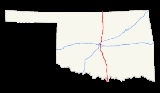
Interstate 35 in Oklahoma
Encyclopedia
Oklahoma is the second state that Interstate 35
(I-35) passes through from south to north. In Oklahoma
, I-35 runs from the Red River
at the Texas
border to the Kansas
line near Braman
, for a length of 236 miles (372 km). I-35 has one spur route in the state, Interstate 235
in the inner city of Oklahoma City
.
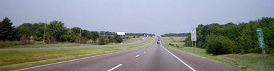
U.S. Highway 77 on a bridge over the Red River in Love County
, south of Thackerville
. US-77 splits off at Exit 1, but parallels the interstate for its entire length in Oklahoma. I-35 maintains a near-due north–south course through Love and Carter
Cos. I-35 provides four exits to Ardmore
. After leaving Ardmore, it has a brief concurrency with State Highway 53
and enters Murray County
and the Arbuckle Mountains
. I-35 then passes through Garvin County
and the county seat of Pauls Valley
. North of exit 79, I-35 enters McClain County
. There, it passes through Purcell
and Goldsby
.
State Highway 9
joins the interstate crossing over the South Canadian River into Cleveland County
, after which it splits off again. It then serves as a major urban interstate in Norman
and Moore
. Between Norman and Moore, US-77 joins the interstate again. It then enters Oklahoma City
and Oklahoma County
near milepost 120. Near downtown
, I-35 splits off the mainline (which becomes Interstate 235
/US-77) and runs concurrent with Interstate 40 for a mile before splitting off to the north again. Interstate 44 then joins I-35 between mileposts 133 and 137. In Edmond
US-77 joins the interstate yet again.
 At milepost 146, I-35 enters Logan County
. It serves Guthrie
at Exit 153, where US-77 splits off, and at Exit 157. The interstate then crosses the Cimarron River into Payne County
and enters Noble County
shortly thereafter. It provides two exits to Perry
and serves as the western terminus of the Cimarron Turnpike
. After providing access to Tonkawa
and Blackwell
in Kay County
, it crosses into Kansas, becoming the Kansas Turnpike
.
north to the Kansas border where it continued as the Kansas Turnpike
. This was followed by completion of the entire route from Oklahoma City northward to Braman by 1963 in several phases including Edmond
to Guthrie
in 1960, Guthrie to Perry
in 1961, Perry to Blackwell
in 1962 and Blackwell to Braman in early 1963.
To the south of Oklahoma City, I-35 was completed through Norman, Oklahoma
south to Purcell, Oklahoma
in June 1959. In Moore
, it opened in two parts: the northern half, connecting Moore to Oklahoma City, opened in January 1960. The southern half, linking it to Norman, was opened to traffic in June 1967. The Moore–Norman segment was originally a four-lane section of US-77 built in 1951 that did not meet full Interstate Highway standards
and included several at-grade intersections within the City of Moore including some with traffic signals and upgraded accordingly to include grade separations to bring up to full Interstate Highway standards and frontage roads to serve local traffic needs. Also not up to full Interstate Highway standards prior to 1967 was a section in the vicinity of Lindsey Street in the southern portion of Norman where another at-grade intersection still existed which dated back to the original highway's construction in the early 1950s—this was also brought up to full Interstate Highway standards in 1967 with the construction of interchanges on I-35 at Lindsey and a short distance to the south for the future SH-9 bypass that would be built around the south side of Norman in the early 1970s.
Further south, I-35 was completed from Marietta south to the Red River bridge in 1963, at which point a nearly 90 miles (144.8 km) gap of uncompleted interstate would exist between Purcell and Marietta until the late 1960s with traffic continuing to be routed over paralleling US-77. This was in large part due to efforts of the towns of Wynnewood
, Paoli
, and Wayne
, fighting to keep I-35 as close as possible to US-77. This was successful due to a threat from Governor Henry Bellmon
to build a toll road rather than I-35, and legislation preventing state funds for the interstate from being spent if it were more than 1 miles (1.6 km) from the U.S. route.
The uncompleted gap of I-35 in Southern Oklahoma was narrowed in 1967 and 1968 when two sections were completed from US-70/SH-199 in Ardmore south to SH-32 in Marietta. In 1969, the section of interstate bypassing Ardmore was completed north from US-70 two miles (3 km) to SH-142 and the following year, 1970, brought the completion of I-35 from SH-7 near Davis south to Ardmore, at long last bypassing the winding section of US-77 through the Arbuckle Mountains. This stretch through the Arbuckles was particularly expensive and difficult to construct, taking almost two years and requiring the blasting and removal of 4 million cubic yards of rock. A few months later in January, 1971, I-35 was finally completed across the state of Oklahoma, when the remaining portions of the interstate from Purcell to SH-7 near Davis were opened to traffic.
football games as grounds for opposing the closure of the interchange. A former OU economics professor estimated the interchange's closure would cost Norman $100 million over the course of fifteen years.
At the meeting, four proposals were displayed, only one of which displayed no access from Lindsey Street. A second proposal would preserve access to Lindsey Street but require the seizure of a newly-built Chevrolet
dealership near the interchange. The third proposal would instead send the ramps around the dealership, and the fourth, the highest-cost alternate, would use bridges to prevent Lindsey Street and SH-9 traffic from conflicting. ODOT said their design standards did not require consideration of OU football traffic, because they only considered the 30th highest traffic percentile. One ODOT engineer was quoted as saying, "Otherwise, we'd have to 10-lane everything in Norman."
Interstate 35
Interstate 35 is a north–south Interstate Highway in the central United States. I-35 stretches from Laredo, Texas, on the U.S.-Mexico border to Duluth, Minnesota, at Minnesota Highway 61 and 26th Avenue East. Many interstates used to have splits or spurs indicated with suffixed letters , but I-35...
(I-35) passes through from south to north. In Oklahoma
Oklahoma
Oklahoma is a state located in the South Central region of the United States of America. With an estimated 3,751,351 residents as of the 2010 census and a land area of 68,667 square miles , Oklahoma is the 28th most populous and 20th-largest state...
, I-35 runs from the Red River
Red River (Mississippi watershed)
The Red River, or sometimes the Red River of the South, is a major tributary of the Mississippi and Atchafalaya Rivers in the southern United States of America. The river gains its name from the red-bed country of its watershed. It is one of several rivers with that name...
at the Texas
Texas
Texas is the second largest U.S. state by both area and population, and the largest state by area in the contiguous United States.The name, based on the Caddo word "Tejas" meaning "friends" or "allies", was applied by the Spanish to the Caddo themselves and to the region of their settlement in...
border to the Kansas
Kansas
Kansas is a US state located in the Midwestern United States. It is named after the Kansas River which flows through it, which in turn was named after the Kansa Native American tribe, which inhabited the area. The tribe's name is often said to mean "people of the wind" or "people of the south...
line near Braman
Braman, Oklahoma
Braman is a town in Kay County, Oklahoma, United States. The population was 244 at the 2000 census.-Geography:According to the United States Census Bureau, Braman has a total area of , all of it land.-Demographics:...
, for a length of 236 miles (372 km). I-35 has one spur route in the state, Interstate 235
Interstate 235 (Oklahoma)
Interstate 235 in Oklahoma is also known as the Centennial Expressway. The spur route of Interstate 35 is a 5.4-mile-long north–south spur route in central and north-central Oklahoma City. It connects northbound to U.S. Highway 77 on to suburban Edmond and southbound at Interstate 44 on to...
in the inner city of Oklahoma City
Oklahoma City, Oklahoma
Oklahoma City is the capital and the largest city in the state of Oklahoma. The county seat of Oklahoma County, the city ranks 31st among United States cities in population. The city's population, from the 2010 census, was 579,999, with a metro-area population of 1,252,987 . In 2010, the Oklahoma...
.
Route description
Interstate 35 enters Oklahoma withConcurrency (road)
A concurrency, overlap, or coincidence in a road network is an instance of one physical road bearing two or more different highway, motorway, or other route numbers...
U.S. Highway 77 on a bridge over the Red River in Love County
Love County, Oklahoma
Love County is a county located in the U.S. state of Oklahoma. As of 2000, the population is 8,831. Its county seat is Marietta.Love County is part of the Ardmore, Oklahoma, Micropolitan Statistical Area.-Geography:According to the U.S...
, south of Thackerville
Thackerville, Oklahoma
Thackerville is a town in Love County, Oklahoma, United States. The population was 404 at the 2000 census. It is part of the Ardmore, Oklahoma Micropolitan Statistical Area.-Geography:...
. US-77 splits off at Exit 1, but parallels the interstate for its entire length in Oklahoma. I-35 maintains a near-due north–south course through Love and Carter
Carter County, Oklahoma
Carter County is a county located in the U.S. state of Oklahoma. As of 2010, the population was 47,557. Its county seat is Ardmore.Carter County is part of the Ardmore, Oklahoma, Micropolitan Statistical Area.-Geography:According to the U.S...
Cos. I-35 provides four exits to Ardmore
Ardmore, Oklahoma
Ardmore is a business, cultural and tourism city in and the county seat of Carter County, Oklahoma, United States. As of the 2010 Census, the city had a population of 24,283, while a 2007 estimate has the Ardmore micropolitan statistical area totaling 56,694 residents...
. After leaving Ardmore, it has a brief concurrency with State Highway 53
State Highway 53 (Oklahoma)
State Highway 53 is a 87 mile highway in southern Oklahoma. It connects Walters in Cotton Co. to Gene Autry in Carter Co.. It has one lettered spur route, SH-53A.-Route description:...
and enters Murray County
Murray County, Oklahoma
Murray County is a county located in the U.S. state of Oklahoma. As of 2000, the population was 12,623. Its county seat is Sulphur.-Geography:...
and the Arbuckle Mountains
Arbuckle Mountains
The Arbuckle Mountains are an ancient mountain range in south-central Oklahoma in the United States. The granite rocks of the Arbuckles date back to the Proterozoic Era some 1.4 billion years ago which were overlain by sediments during the Paleozoic Era. The range reaches a height of 1,412 feet...
. I-35 then passes through Garvin County
Garvin County, Oklahoma
Garvin County is a county located in the U.S. state of Oklahoma. As of 2000, the population was 27,210. Its county seat is Pauls Valley.-History:...
and the county seat of Pauls Valley
Pauls Valley, Oklahoma
Pauls Valley is a city in Garvin County, Oklahoma, United States. The population was 6,256 at the 2000 census. It is the county seat of Garvin County.-History:...
. North of exit 79, I-35 enters McClain County
McClain County, Oklahoma
McClain County is a county located in the U.S. state of Oklahoma. The population was 27,740 at the 2000 census. Its county seat is Purcell. McClain County is part of the Oklahoma City Metropolitan Statistical Area, and is in the top 3 fastest growing counties in Oklahoma with a growth rate of...
. There, it passes through Purcell
Purcell, Oklahoma
Purcell is located in the outer south suburban area of Oklahoma City. It is often called "Quarterhorse Capital of the World" and it is the county seat of McClain County , Oklahoma, United States; it also extends a short distance into Cleveland County. The population was 5,884 at the 2010 census...
and Goldsby
Goldsby, Oklahoma
Goldsby is a town in McClain County, Oklahoma, United States. The population was 1,204 at the 2000 census.-Geography:Goldsby is located at ....
.
State Highway 9
State Highway 9 (Oklahoma)
State Highway 9, abbreviated as SH-9, OK-9, or simply Highway 9, is a major east–west highway in the U.S. state of Oklahoma. Spanning across the central part of the state, SH-9 begins at the Texas state line near Madge, Oklahoma, and ends at the Arkansas state line near Fort Smith, Arkansas. State...
joins the interstate crossing over the South Canadian River into Cleveland County
Cleveland County, Oklahoma
Cleveland County is a county in the central part of the U.S. state of Oklahoma. The population was 255,755 at the 2010 census. Its county seat is Norman. Cleveland County is part of the Oklahoma City Metropolitan Statistical Area.-History:...
, after which it splits off again. It then serves as a major urban interstate in Norman
Norman, Oklahoma
Norman is a city in Cleveland County, Oklahoma, United States, and is located south of downtown Oklahoma City. It is part of the Oklahoma City metropolitan area. As of the 2010 census, Norman was to have 110,925 full-time residents, making it the third-largest city in Oklahoma and the...
and Moore
Moore, Oklahoma
Moore is a city in Cleveland County, Oklahoma and is part of the Oklahoma City Metropolitan Area. The population was 55,081 at the 2010 census, making it the seventh largest city in the state of Oklahoma....
. Between Norman and Moore, US-77 joins the interstate again. It then enters Oklahoma City
Oklahoma city
Oklahoma City is the capital and largest city of the U.S. state of Oklahoma.Oklahoma City may also refer to:*Oklahoma City metropolitan area*Downtown Oklahoma City*Uptown Oklahoma City*Oklahoma City bombing*Oklahoma City National Memorial...
and Oklahoma County
Oklahoma County, Oklahoma
Oklahoma County is a county located in the central partof the U.S. state of Oklahoma. The population was 718,633 at the 2010 census. The county seat and principal city is Oklahoma City...
near milepost 120. Near downtown
Downtown Oklahoma City
Downtown Oklahoma City is located at the geographic center of the Oklahoma City metropolitan area and is the principal business district of the city. With 115 city blocks and around of office space, downtown Oklahoma City also is the economic, financial, and entertainment center of the city...
, I-35 splits off the mainline (which becomes Interstate 235
Interstate 235 (Oklahoma)
Interstate 235 in Oklahoma is also known as the Centennial Expressway. The spur route of Interstate 35 is a 5.4-mile-long north–south spur route in central and north-central Oklahoma City. It connects northbound to U.S. Highway 77 on to suburban Edmond and southbound at Interstate 44 on to...
/US-77) and runs concurrent with Interstate 40 for a mile before splitting off to the north again. Interstate 44 then joins I-35 between mileposts 133 and 137. In Edmond
Edmond, Oklahoma
Edmond is a city in Oklahoma County, Oklahoma, United States, and a part of the Oklahoma City metropolitan area in the central part of the state. As of the 2010 census, the population was 81,405, making it the sixth largest city in the state of Oklahoma....
US-77 joins the interstate yet again.
Logan County, Oklahoma
Logan County is a county located in the U.S. state of Oklahoma. The population as of 2009 was 39,301. Its county seat is Guthrie. Logan County is part of the Oklahoma City Metropolitan Statistical Area.-Geography:...
. It serves Guthrie
Guthrie, Oklahoma
Guthrie is a city in and the county seat of Logan County, Oklahoma, United States, and a part of the Oklahoma City Metroplex. The population was 9,925 at the 2000 census.Guthrie was the territorial and later the first state capital for Oklahoma...
at Exit 153, where US-77 splits off, and at Exit 157. The interstate then crosses the Cimarron River into Payne County
Payne County, Oklahoma
Payne County is a county in the U.S. state of Oklahoma. The population as of 2010 was 77,350. Its county seat is Stillwater, and the county is named for Capt. David L. Payne...
and enters Noble County
Noble County, Oklahoma
Noble County is a county located in the U.S. state of Oklahoma. As of 2010, the population was 11,561. Its county seat is Perry.-21st century:In 2010, the Keystone-Cushing Pipeline was constructed north to south through Noble County....
shortly thereafter. It provides two exits to Perry
Perry, Oklahoma
Perry is a city in Noble County, Oklahoma, United States. As of the 2010 census, the city population was 5,126. It is the county seat of Noble County.-19th century:...
and serves as the western terminus of the Cimarron Turnpike
Cimarron Turnpike
The Cimarron Turnpike is a toll road in north-central Oklahoma. Opened to traffic in 1975, the route runs , from a junction with Interstate 35 north of Perry, to Westport, just west of Tulsa. The route also consists of a spur which runs from the mainline southwest to a junction with US-177 north...
. After providing access to Tonkawa
Tonkawa, Oklahoma
Tonkawa is a city in Kay County, Oklahoma, United States, along the Salt Fork Arkansas River. The population was 3,299 at the 2000 census.-History:...
and Blackwell
Blackwell, Oklahoma
Blackwell is a city in Kay County, Oklahoma, United States, located at the intersection of U.S. Highway 177 and State Highway 11 along Interstate 35. The population was 7,668 at the 2000 census. Blackwell was established following the September 16, 1893 Cherokee Outlet land run by A. J. Blackwell...
in Kay County
Kay County, Oklahoma
Kay County is a county located in the U.S. state of Oklahoma. As of 2000, the population was 48,080. Its county seat is Newkirk. The largest city in Kay County is Ponca City.-19th century:...
, it crosses into Kansas, becoming the Kansas Turnpike
Kansas Turnpike
The Kansas Turnpike is a freeway-standard toll road that lies entirely within the U.S. state of Kansas. It runs in a general southwest-northeast direction from the Oklahoma border, and passes through several major Kansas cities, including Wichita, Topeka, Lawrence and Kansas City...
.
History
Some sections of I-35 in Oklahoma City were already built in 1953, before the Interstate system was created. Following the passage of the Federal Highway Act of 1956 that created the Interstate Highway System, the Oklahoma Department of Transportation approved the location of the future interstate north of Oklahoma City to the Kansas state line on a route previously surveyed by the Oklahoma Turnpike Authority for a proposed toll road. As a free road, the first five miles (8 km) of that section of I-35 were opened to traffic in 1958 from US-177 near BramanBraman, Oklahoma
Braman is a town in Kay County, Oklahoma, United States. The population was 244 at the 2000 census.-Geography:According to the United States Census Bureau, Braman has a total area of , all of it land.-Demographics:...
north to the Kansas border where it continued as the Kansas Turnpike
Kansas Turnpike
The Kansas Turnpike is a freeway-standard toll road that lies entirely within the U.S. state of Kansas. It runs in a general southwest-northeast direction from the Oklahoma border, and passes through several major Kansas cities, including Wichita, Topeka, Lawrence and Kansas City...
. This was followed by completion of the entire route from Oklahoma City northward to Braman by 1963 in several phases including Edmond
Edmond, Oklahoma
Edmond is a city in Oklahoma County, Oklahoma, United States, and a part of the Oklahoma City metropolitan area in the central part of the state. As of the 2010 census, the population was 81,405, making it the sixth largest city in the state of Oklahoma....
to Guthrie
Guthrie, Oklahoma
Guthrie is a city in and the county seat of Logan County, Oklahoma, United States, and a part of the Oklahoma City Metroplex. The population was 9,925 at the 2000 census.Guthrie was the territorial and later the first state capital for Oklahoma...
in 1960, Guthrie to Perry
Perry, Oklahoma
Perry is a city in Noble County, Oklahoma, United States. As of the 2010 census, the city population was 5,126. It is the county seat of Noble County.-19th century:...
in 1961, Perry to Blackwell
Blackwell, Oklahoma
Blackwell is a city in Kay County, Oklahoma, United States, located at the intersection of U.S. Highway 177 and State Highway 11 along Interstate 35. The population was 7,668 at the 2000 census. Blackwell was established following the September 16, 1893 Cherokee Outlet land run by A. J. Blackwell...
in 1962 and Blackwell to Braman in early 1963.
To the south of Oklahoma City, I-35 was completed through Norman, Oklahoma
Norman, Oklahoma
Norman is a city in Cleveland County, Oklahoma, United States, and is located south of downtown Oklahoma City. It is part of the Oklahoma City metropolitan area. As of the 2010 census, Norman was to have 110,925 full-time residents, making it the third-largest city in Oklahoma and the...
south to Purcell, Oklahoma
Purcell, Oklahoma
Purcell is located in the outer south suburban area of Oklahoma City. It is often called "Quarterhorse Capital of the World" and it is the county seat of McClain County , Oklahoma, United States; it also extends a short distance into Cleveland County. The population was 5,884 at the 2010 census...
in June 1959. In Moore
Moore, Oklahoma
Moore is a city in Cleveland County, Oklahoma and is part of the Oklahoma City Metropolitan Area. The population was 55,081 at the 2010 census, making it the seventh largest city in the state of Oklahoma....
, it opened in two parts: the northern half, connecting Moore to Oklahoma City, opened in January 1960. The southern half, linking it to Norman, was opened to traffic in June 1967. The Moore–Norman segment was originally a four-lane section of US-77 built in 1951 that did not meet full Interstate Highway standards
Interstate Highway standards
Standards for Interstate Highways in the United States are defined by the American Association of State Highway and Transportation Officials in the publication A Policy on Design Standards - Interstate System...
and included several at-grade intersections within the City of Moore including some with traffic signals and upgraded accordingly to include grade separations to bring up to full Interstate Highway standards and frontage roads to serve local traffic needs. Also not up to full Interstate Highway standards prior to 1967 was a section in the vicinity of Lindsey Street in the southern portion of Norman where another at-grade intersection still existed which dated back to the original highway's construction in the early 1950s—this was also brought up to full Interstate Highway standards in 1967 with the construction of interchanges on I-35 at Lindsey and a short distance to the south for the future SH-9 bypass that would be built around the south side of Norman in the early 1970s.
Further south, I-35 was completed from Marietta south to the Red River bridge in 1963, at which point a nearly 90 miles (144.8 km) gap of uncompleted interstate would exist between Purcell and Marietta until the late 1960s with traffic continuing to be routed over paralleling US-77. This was in large part due to efforts of the towns of Wynnewood
Wynnewood, Oklahoma
Wynnewood is a city in Garvin County, Oklahoma, United States. The population was 2,367 at the 2000 census.- History :There is also a Wynnewood, Pennsylvania. The railroad workers were from Pennsylvania and named the existing townsites what they wanted. They also named Paoli and Ardmore, Oklahoma...
, Paoli
Paoli, Oklahoma
Paoli is a town in Garvin County, Oklahoma, United States. The population was 649 at the 2000 census. It was named after Paoli, an unincorporated community outside of Philadelphia, Pennsylvania, where most of the railroad workers that basically built the town were from.-Geography:Paoli is located...
, and Wayne
Wayne, Oklahoma
Wayne is a town in McClain County, Oklahoma, United States. Wayne and McClain County are part of the Oklahoma City Metropolitan Area The population was 519 according to the 2000 census and is part of the "Heart of Oklahoma" area. Wayne was so named by early railroad workers from Pennsylvania who...
, fighting to keep I-35 as close as possible to US-77. This was successful due to a threat from Governor Henry Bellmon
Henry Bellmon
Henry Louis "Harry" Bellmon was an American Republican politician from Oklahoma. He was a member of the Oklahoma Legislature, the 18th and 23rd Governor of Oklahoma , and a two-term United States Senator.-Service in World War II:Bellmon was born in Tonkawa, Oklahoma and graduated from Billings...
to build a toll road rather than I-35, and legislation preventing state funds for the interstate from being spent if it were more than 1 miles (1.6 km) from the U.S. route.
The uncompleted gap of I-35 in Southern Oklahoma was narrowed in 1967 and 1968 when two sections were completed from US-70/SH-199 in Ardmore south to SH-32 in Marietta. In 1969, the section of interstate bypassing Ardmore was completed north from US-70 two miles (3 km) to SH-142 and the following year, 1970, brought the completion of I-35 from SH-7 near Davis south to Ardmore, at long last bypassing the winding section of US-77 through the Arbuckle Mountains. This stretch through the Arbuckles was particularly expensive and difficult to construct, taking almost two years and requiring the blasting and removal of 4 million cubic yards of rock. A few months later in January, 1971, I-35 was finally completed across the state of Oklahoma, when the remaining portions of the interstate from Purcell to SH-7 near Davis were opened to traffic.
Future
ODOT has announced plans to widen 2 miles (3.2 km) of Interstate 35 through Norman, from the McCall Bridge over the Canadian River to the Main Street interchange (Exit 109). Controversy surrounding the project arose when early drafts eliminated the SH-74A/Lindsey Street interchange (Exit 108B), due to its proximity to the SH-9 interchange (Exit 108A). A public meeting held in Norman attracted 300 attendees, many bearing "Don't Close Lindsey" signs. Attendees cited the impact on local businesses and those attending University of OklahomaUniversity of Oklahoma
The University of Oklahoma is a coeducational public research university located in Norman, Oklahoma. Founded in 1890, it existed in Oklahoma Territory near Indian Territory for 17 years before the two became the state of Oklahoma. the university had 29,931 students enrolled, most located at its...
football games as grounds for opposing the closure of the interchange. A former OU economics professor estimated the interchange's closure would cost Norman $100 million over the course of fifteen years.
At the meeting, four proposals were displayed, only one of which displayed no access from Lindsey Street. A second proposal would preserve access to Lindsey Street but require the seizure of a newly-built Chevrolet
Chevrolet
Chevrolet , also known as Chevy , is a brand of vehicle produced by General Motors Company . Founded by Louis Chevrolet and ousted GM founder William C. Durant on November 3, 1911, General Motors acquired Chevrolet in 1918...
dealership near the interchange. The third proposal would instead send the ramps around the dealership, and the fourth, the highest-cost alternate, would use bridges to prevent Lindsey Street and SH-9 traffic from conflicting. ODOT said their design standards did not require consideration of OU football traffic, because they only considered the 30th highest traffic percentile. One ODOT engineer was quoted as saying, "Otherwise, we'd have to 10-lane everything in Norman."
Naming
- Through the Arbuckle Mountains, I-35 is designated as the Honey Creek Pass.
- The bridge over the South Canadian River is the S.K. McCall Memorial Bridge.
- In Moore, I-35 is the Helen Cole Memorial Highway.
- In Edmond, I-35 is the Shannon MillerShannon MillerShannon Lee Miller is a former artistic gymnast from Edmond, Oklahoma. She is the most decorated gymnast in U.S. History, and considered one of the greatest gymnasts the United States has ever produced...
Parkway.
Exit list
| County | Location | # Exit number An exit number is a number assigned to a road junction, usually an exit from a freeway. It is usually marked on the same sign as the destinations of the exit, as well as a sign in the gore.... |
Destinations | Notes | |
|---|---|---|---|---|---|
  I-35/US-77 enter Texas I-35/US-77 enter Texas |
|||||
| Love Love County, Oklahoma Love County is a county located in the U.S. state of Oklahoma. As of 2000, the population is 8,831. Its county seat is Marietta.Love County is part of the Ardmore, Oklahoma, Micropolitan Statistical Area.-Geography:According to the U.S... |
1 | North end of US-77 overlap | |||
| 5 | |||||
| 15 | |||||
| 21 | Oswalt Road | ||||
| Carter Carter County, Oklahoma Carter County is a county located in the U.S. state of Oklahoma. As of 2010, the population was 47,557. Its county seat is Ardmore.Carter County is part of the Ardmore, Oklahoma, Micropolitan Statistical Area.-Geography:According to the U.S... |
24 | SH-77S Oklahoma State Highway spurs from U.S. Highways The Oklahoma state highway system includes many state highways that actas short spur and connector routes off some of the U.S. highways that pass throughthe state. These highways generally bear the same number of the U.S. highway... – Lake Murray State Park |
|||
| Ardmore Ardmore, Oklahoma Ardmore is a business, cultural and tourism city in and the county seat of Carter County, Oklahoma, United States. As of the 2010 Census, the city had a population of 24,283, while a 2007 estimate has the Ardmore micropolitan statistical area totaling 56,694 residents... |
29 | South end of US-70 overlap | |||
| 31 | North end of US-70 overlap; signed as exits 31A (east) and 31B (west) | ||||
| 32 | 12th Street | ||||
| 33 | |||||
| 40 | South end of SH-53 overlap | ||||
| 42 | North end of SH-53 overlap | ||||
| Murray Murray County, Oklahoma Murray County is a county located in the U.S. state of Oklahoma. As of 2000, the population was 12,623. Its county seat is Sulphur.-Geography:... |
47 | Area | |||
| 51 | Area | ||||
| 55 | |||||
| Garvin Garvin County, Oklahoma Garvin County is a county located in the U.S. state of Oklahoma. As of 2000, the population was 27,210. Its county seat is Pauls Valley.-History:... |
60 | Ruppe Road | |||
| 64 | |||||
| 66 | |||||
| 70 | Airport Road | ||||
| Pauls Valley Pauls Valley, Oklahoma Pauls Valley is a city in Garvin County, Oklahoma, United States. The population was 6,256 at the 2000 census. It is the county seat of Garvin County.-History:... |
72 | ||||
| 74 | Kimberlin Road | ||||
| 79 | |||||
| McClain McClain County, Oklahoma McClain County is a county located in the U.S. state of Oklahoma. The population was 27,740 at the 2000 census. Its county seat is Purcell. McClain County is part of the Oklahoma City Metropolitan Statistical Area, and is in the top 3 fastest growing counties in Oklahoma with a growth rate of... |
86 | ||||
| Purcell Purcell, Oklahoma Purcell is located in the outer south suburban area of Oklahoma City. It is often called "Quarterhorse Capital of the World" and it is the county seat of McClain County , Oklahoma, United States; it also extends a short distance into Cleveland County. The population was 5,884 at the 2010 census... |
91 | ||||
| 95 | |||||
| 98 | Johnson Road | ||||
| Goldsby Goldsby, Oklahoma Goldsby is a town in McClain County, Oklahoma, United States. The population was 1,204 at the 2000 census.-Geography:Goldsby is located at .... |
101 | Ladd Road | |||
| 104 | |||||
| 106 | South end of SH-9 overlap | ||||
| Cleveland Cleveland County, Oklahoma Cleveland County is a county in the central part of the U.S. state of Oklahoma. The population was 255,755 at the 2010 census. Its county seat is Norman. Cleveland County is part of the Oklahoma City Metropolitan Statistical Area.-History:... |
Norman Norman, Oklahoma Norman is a city in Cleveland County, Oklahoma, United States, and is located south of downtown Oklahoma City. It is part of the Oklahoma City metropolitan area. As of the 2010 census, Norman was to have 110,925 full-time residents, making it the third-largest city in Oklahoma and the... |
108 | North end of SH-9 overlap; signed as exits 108A (SH-9) and 108B (Lindsey Street) southbound | ||
| 109 | Main Street | ||||
| 110 | Robinson Street | Signed as exits 110A (west) and 110B (east) southbound | |||
| 112 | Tecumseh Road | ||||
| 113 | Southbound exit and northbound entrance | ||||
| Moore Moore, Oklahoma Moore is a city in Cleveland County, Oklahoma and is part of the Oklahoma City Metropolitan Area. The population was 55,081 at the 2010 census, making it the seventh largest city in the state of Oklahoma.... |
114 | Indian Hill Road | |||
| 116 | Southwest 19th Street | ||||
| 117 | |||||
| 118 | Northwest 12th Street, Main Street, Northwest 5th Street | ||||
| 119A | Shields Boulevard | Northbound exit and southbound entrance | |||
| 119B | Northwest 27th Street | ||||
| Oklahoma City Oklahoma City, Oklahoma Oklahoma City is the capital and the largest city in the state of Oklahoma. The county seat of Oklahoma County, the city ranks 31st among United States cities in population. The city's population, from the 2010 census, was 579,999, with a metro-area population of 1,252,987 . In 2010, the Oklahoma... |
120 | Southeast 89th Street | |||
| Oklahoma Oklahoma County, Oklahoma Oklahoma County is a county located in the central partof the U.S. state of Oklahoma. The population was 718,633 at the 2010 census. The county seat and principal city is Oklahoma City... |
121A | Southeast 82nd Street | Southbound exit and northbound entrance | ||
| 121B | , Fort Smith Fort Smith, Arkansas Fort Smith is the second-largest city in Arkansas and one of the two county seats of Sebastian County. With a population of 86,209 in 2010, it is the principal city of the Fort Smith, Arkansas-Oklahoma Metropolitan Statistical Area, a region of 298,592 residents which encompasses the Arkansas... |
South end of US-62 overlap | |||
| 122A | Southeast 66th Street | No northbound entrance | |||
| 122B | Southeast 59th Street | ||||
| 123A | Southeast 51st Street | No northbound entrance | |||
| 123B | Southeast 44th Street | No southbound entrance | |||
| 124A | Southeast Grand Boulevard | ||||
| 124B | Southeast 29th Street, Southeast 25th Street | Signed as exit 125A southbound | |||
| 125B | Southeast 15th Street | Signed as exit 125D southbound | |||
| 126 | , State Capitol Oklahoma State Capitol The Oklahoma State Capitol is the house of government of the U.S. state of Oklahoma. It is the building that houses the Oklahoma Legislature, and the meeting place of the Oklahoma Supreme Court. It is located along Lincoln Boulevard in Oklahoma City. The present structure includes a dome that was... , Amarillo Amarillo, Texas Amarillo is the 14th-largest city, by population, in the state of Texas, the largest in the Texas Panhandle, and the seat of Potter County. A portion of the city extends into Randall County. The population was 190,695 at the 2010 census... , Oklahoma Health Center |
South end of I-40/US-270 overlap; north end of US-77 overlap | |||
| 127 | Eastern Avenue, M.L. King Avenue | Southbound exit is via exit 128 | |||
| 128 | - Ft. Smith Fort Smith, Arkansas Fort Smith is the second-largest city in Arkansas and one of the two county seats of Sebastian County. With a population of 86,209 in 2010, it is the principal city of the Fort Smith, Arkansas-Oklahoma Metropolitan Statistical Area, a region of 298,592 residents which encompasses the Arkansas... |
North end of I-40/US-270 overlap | |||
| 129 | Northeast 10th Street | ||||
| 130 | North end of US-62 overlap | ||||
| 131 | Northeast 36th Street | ||||
| 132A | Northeast 50th Street | ||||
| 132B | Northeast 63rd Street | Northbound exit and southbound entrance | |||
| 133 | , Amarillo Amarillo, Texas Amarillo is the 14th-largest city, by population, in the state of Texas, the largest in the Texas Panhandle, and the seat of Potter County. A portion of the city extends into Randall County. The population was 190,695 at the 2010 census... |
South end of I-44/SH-66 overlap | |||
| 134 | Wilshire Boulevard | ||||
| 135 | Britton Road | ||||
| 136 | Hefner Road | ||||
| 137 | Northeast 122nd Street | ||||
| 138A | North end of I-44 overlap | ||||
| 138B | Kilpatrick Turnpike west | ||||
| 138C | Sooner Road | Southbound exit and northbound entrance | |||
| Edmond Edmond, Oklahoma Edmond is a city in Oklahoma County, Oklahoma, United States, and a part of the Oklahoma City metropolitan area in the central part of the state. As of the 2010 census, the population was 81,405, making it the sixth largest city in the state of Oklahoma.... |
138D | Memorial Road | |||
| 139 | Southeast 33rd Street | ||||
| 140 | Southeast 15th Street | ||||
| 141 | North end of SH-66 overlap; south end of US-77 overlap | ||||
| 142 | Danforth Road | ||||
| 143 | Covell Road | ||||
| 146 | Waterloo Road | ||||
| Logan Logan County, Oklahoma Logan County is a county located in the U.S. state of Oklahoma. The population as of 2009 was 39,301. Its county seat is Guthrie. Logan County is part of the Oklahoma City Metropolitan Statistical Area.-Geography:... |
151 | Seward Road | |||
| 153 | North end of US-77 overlap | ||||
| 157 | |||||
| Payne Payne County, Oklahoma Payne County is a county in the U.S. state of Oklahoma. The population as of 2010 was 77,350. Its county seat is Stillwater, and the county is named for Capt. David L. Payne... |
170 | Mulhall Road | |||
| 174 | |||||
| Noble Noble County, Oklahoma Noble County is a county located in the U.S. state of Oklahoma. As of 2010, the population was 11,561. Its county seat is Perry.-21st century:In 2010, the Keystone-Cushing Pipeline was constructed north to south through Noble County.... |
180 | Orlando Road | |||
| Perry Perry, Oklahoma Perry is a city in Noble County, Oklahoma, United States. As of the 2010 census, the city population was 5,126. It is the county seat of Noble County.-19th century:... |
185 | ||||
| 186 | South end of US-64 overlap | ||||
| 193 | Airport Road | Northbound exit and southbound entrance | |||
| 194 | North end of US-64 overlap; signed as exits 194A (east) and 194B (west) | ||||
| 203 | |||||
| Kay Kay County, Oklahoma Kay County is a county located in the U.S. state of Oklahoma. As of 2000, the population was 48,080. Its county seat is Newkirk. The largest city in Kay County is Ponca City.-19th century:... |
211 | Fountain Road | |||
| 214 | |||||
| 218 | Hubbard Road | ||||
| 222 | |||||
| 230 | Braman Road | ||||
| 231 | |||||
 I-35 enters Kansas, Kansas Turnpike begins I-35 enters Kansas, Kansas Turnpike begins |
|||||