
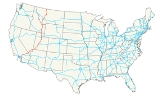
Interstate 15
Encyclopedia
Interstate 15 is the fourth-longest north–south Interstate Highway
in the United States
, traveling through the states of California
, Nevada
, Arizona
, Utah
, Idaho
, and Montana
from San Diego to the Canadian border. The Idaho, Utah and Arizona portions have been officially designated the "Veterans Memorial Highway".
Since I-15's inception, it has served as a long-haul route for North America
n commerce. It is now officially chartered for this purpose. From the junction of Interstate 515
in Las Vegas
to the Canadian border, I-15 forms part of the CANAMEX Corridor
, a High Priority Corridor, as a result of the North American Free Trade Agreement
.
Local portions were built to connect the Inland Empire
with San Diego in California, facilitate tourism access to Las Vegas, interconnect all of the Metropolitan Statistical Areas in Utah except Logan
, and provide freeway bypasses for Pocatello
, Idaho Falls
, and Great Falls
.
Since I-15's initial construction, California, Nevada, and Utah have consistently ranked in the fastest growing areas of the United States. As a result, the I-15 corridor has substantially increased in population and commuter traffic has increased the traffic burden on the freeway. Current population estimates are that more than 75 percent of Utah's population, 19 percent of California's population, and more than 70 percent of Nevada's population live in counties where Interstate 15 is the primary transportation corridor. Similarly, in California, I-15 is seeing more commuter traffic due to the growth of the Mojave Desert
communities of Hesperia
and Barstow, California
. In all of these states, I-15 has recently been or is currently in the process of being upgraded to increase capacity. The Arizona, Idaho and Montana portions have retained their rural, long-haul character. Although Arizona has also grown substantially since I-15's inception, I-15 only serves an isolated corner
of the state.
Due to this rapid area growth, the I-15 corridor is the focus of several mass transit projects. The Las Vegas Monorail
, FrontRunner
commuter rail system and TRAX
light rail
in Salt Lake City
are mass transit lines loosely parallel to I-15 that are now in operation. Between Los Angeles and Las Vegas has long been proposed as a maglev train route; in 2004 the California-Nevada Interstate Maglev
project held public meetings on the plan.
|CA
|287.26
|462.30
|-
|NV
|123.77
|199.19
|-
|AZ
|29.39
|47.30
|-
|UT
|401.07
|645.46
|-
|ID
|196.00
|315.43
|-
|MT
|396.03
|637.35
|-
|Total
|1,433.52
|2,307.03
|}
This highway's southern terminus is in San Diego, California
, at Interstate 8
, although via California State Route 15, a southern extension of the freeway, the route connects to Interstate 5
just north of the Mexican border. The northern terminus is in Sweet Grass, Montana, at the international border between the United States
and Canada
, where it becomes Alberta Highway 4. It is 1433 miles (2,306 km) long from San Diego to Sweet Grass.
, in the Inland Empire
near Corona
, the route roughly follows the former routes of U.S. Highway 91 and U.S. Highway 395. North of Devore
, the highway follows the approximate alignment of historic U.S. Highway 66 along with U.S. 91 and 395. U.S. 395 breaks away at Hesperia and the route continues the approximate route of co-signed 66 and 91 until about the Mojave River
, 35 miles (56 km) to the north. At that point, I-15 follows the old route of U.S. 91 exclusively. For many parts of the highway, high-voltage power line
s, like Path 46
and Path 27, almost all from the Hoover Dam
, follow the freeway. Many of these link distant power stations to the Los Angeles
metropolitan area.
 The southern starting point of Interstate 15 was in 1947 planned to be in San Bernardino
, at the interchange with the San Bernardino Freeway (then US 70/99), now I-10
). This was logical as I-15 was following the old alignment of the historic Route 66 which passed through San Bernardino. The segment was completed accordingly.
But in 1964, legislation was later passed to extend the interstate to San Diego
. But instead of extending the existing freeway from the I-10 interchange south, the California Department of Transportation
drew a new segment in Devore that 'branched' off of the original alignment and bypassed San Bernardino altogether. This segment's alignment is generally northeast to southwest for about 15 miles (24 km). Then, in Fontana
/Rancho Cucamonga
, its directional alignment shifts to north–south where it eventually junctions with Interstate 10 (about 15 miles (24.1 km) west of the original interchange in San Bernardino). The segment that had been built from Devore to San Bernardino was retained as an interstate, but was re-numbered as Interstate 215
. Note that during the construction of I-15's present alignment, and for some time afterwards, I-215 was numbered as I-15E, and its actual mileage would begin at Interstate 10. I-15 runs for a total of 287 miles (462 km) in California.

Interstate 15 begins in Primm
, continues through Las Vegas
along the Las Vegas Strip
corridor. Then the interstate crosses the border with Arizona
in Mesquite
. The whole interstate in Nevada
runs entirely in Clark County
, for a distance of 123.8 miles (199 km).
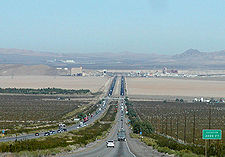
of Arizona
with a total length of 29.4 miles (47 km). The stretch is separated from the rest of the state and has one major exit, at Beaver Dam/Littlefield, Arizona
. It includes a spectacular section where the road twists between the narrow walls of the Virgin River Gorge
.

I-15 continues through Utah
for 401 miles (645 km). It is the main north–south connection for the state. The highway approximately follows the old alignment of U.S. Highway 91 from St. George
to Brigham City
. The highway passes through the fast-growing Dixie
region, which includes St. George
, Cedar City
, and eventually most of the major cities and suburbs along the Wasatch Front
, including Provo
, Orem
, Sandy
, West Jordan
, Salt Lake City
, Layton
, and Ogden
. Near Cove Fort
, Interstate 70
begins its journey eastward across the country. The interstate merges
with I-80
for about 3 miles (5 km) from South Salt Lake
to just west of Downtown Salt Lake City
and also merges with Interstate 84
from Ogden
to Tremonton
. Along nearly its entire length through the state, I-15 winds its way along the western edge of a nearly continuous range of mountains (the Wasatch Range
in the northern half of the state). The only exceptions are when it passes through the mountains south of Cedar City
and again north of Cove Fort
.
for 196 miles (315 km). Interstate 15 crosses the Utah
state line in Oneida County
. The highway runs through Pocatello
, Blackfoot
, and Idaho Falls
, intersecting with Interstate 86
. The last county in Idaho that Interstate 15 passes through is Clark County
. Finally, the interstate reaches the Montana
state line at Monida Pass
.
through the cities of Butte
, Helena
and Great Falls
, intersecting with Interstate 90
, Interstate 115
and Interstate 315
. At Sweet Grass, I-15 terminates upon crossing the Canadian border into the province of Alberta
; however, I-15 signage is present on Alberta Highway 4 southbound from Lethbridge
to the U.S.-Canada border.
. Once Interstate 15 was relatively intact U.S. 91 was decommissioned, except for one part in Northern Utah/Southern Idaho where Interstate 15 instead followed the route of former U.S. Route 191
.
Interstate 15 originally had two suffixed routes. In California, Interstate 15 had an eastern branch bypassing San Bernardino
, which was designated Interstate 15E. I-15E was renumbered and is now Interstate 215
. Present day routing of Interstate 15 in California was originally given "I-15W" as its title while it was under construction (the original asphalt portions from Temescal Canyon to Ontario Street were dubbed I-15W on maps until 1974 ) , but was never officially signed as such . In Idaho, I-15 had a western branch near Pocatello
that connected I-15 and I-84 (then I-80N). This highway was designated Interstate 15W. It is now the western I-86
.
with SR 94
is updated to Interstate standards. The interchange currently has left-exits and blind merges, and is due to be updated with a long-awaited widening of SR 94 in 2016. At that time SR 15 could be eliminated and re-signed as Interstate 15.
Interstate Highway System
The Dwight D. Eisenhower National System of Interstate and Defense Highways, , is a network of limited-access roads including freeways, highways, and expressways forming part of the National Highway System of the United States of America...
in the United States
United States
The United States of America is a federal constitutional republic comprising fifty states and a federal district...
, traveling through the states of California
California
California is a state located on the West Coast of the United States. It is by far the most populous U.S. state, and the third-largest by land area...
, Nevada
Nevada
Nevada is a state in the western, mountain west, and southwestern regions of the United States. With an area of and a population of about 2.7 million, it is the 7th-largest and 35th-most populous state. Over two-thirds of Nevada's people live in the Las Vegas metropolitan area, which contains its...
, Arizona
Arizona
Arizona ; is a state located in the southwestern region of the United States. It is also part of the western United States and the mountain west. The capital and largest city is Phoenix...
, Utah
Utah
Utah is a state in the Western United States. It was the 45th state to join the Union, on January 4, 1896. Approximately 80% of Utah's 2,763,885 people live along the Wasatch Front, centering on Salt Lake City. This leaves vast expanses of the state nearly uninhabited, making the population the...
, Idaho
Idaho
Idaho is a state in the Rocky Mountain area of the United States. The state's largest city and capital is Boise. Residents are called "Idahoans". Idaho was admitted to the Union on July 3, 1890, as the 43rd state....
, and Montana
Montana
Montana is a state in the Western United States. The western third of Montana contains numerous mountain ranges. Smaller, "island ranges" are found in the central third of the state, for a total of 77 named ranges of the Rocky Mountains. This geographical fact is reflected in the state's name,...
from San Diego to the Canadian border. The Idaho, Utah and Arizona portions have been officially designated the "Veterans Memorial Highway".
Since I-15's inception, it has served as a long-haul route for North America
North America
North America is a continent wholly within the Northern Hemisphere and almost wholly within the Western Hemisphere. It is also considered a northern subcontinent of the Americas...
n commerce. It is now officially chartered for this purpose. From the junction of Interstate 515
Interstate 515
Interstate 515 is a spur of Interstate 15 that runs from the junction of I-15, US 93 and US 95 near Downtown Las Vegas, Nevada approximately southeast to Railroad Pass near the borders of Henderson and Boulder City....
in Las Vegas
Las Vegas, Nevada
Las Vegas is the most populous city in the U.S. state of Nevada and is also the county seat of Clark County, Nevada. Las Vegas is an internationally renowned major resort city for gambling, shopping, and fine dining. The city bills itself as The Entertainment Capital of the World, and is famous...
to the Canadian border, I-15 forms part of the CANAMEX Corridor
CANAMEX Corridor
The CANAMEX corridor is a corridor linking Canada to Mexico through the United States. The corridor was established under the North American Free Trade Agreement.Currently the corridor is defined by a series of highways...
, a High Priority Corridor, as a result of the North American Free Trade Agreement
North American Free Trade Agreement
The North American Free Trade Agreement or NAFTA is an agreement signed by the governments of Canada, Mexico, and the United States, creating a trilateral trade bloc in North America. The agreement came into force on January 1, 1994. It superseded the Canada – United States Free Trade Agreement...
.
Local portions were built to connect the Inland Empire
Inland Empire (California)
The Inland Empire is a region in Southern California. The region sits directly east of the Los Angeles metropolitan area. The Inland Empire most commonly is used in reference to the U.S. Census Bureau's federally-defined Riverside-San Bernardino-Ontario metropolitan area, which covers more than...
with San Diego in California, facilitate tourism access to Las Vegas, interconnect all of the Metropolitan Statistical Areas in Utah except Logan
Logan, Utah
-Layout of the City:Logan's city grid originates from its Main and Center Street block, with Main Street running north and south, and Center east and west. Each block north, east, south, or west of the origin accumulates in additions of 100 , though some streets have non-numeric names...
, and provide freeway bypasses for Pocatello
Pocatello, Idaho
Pocatello is the county seat and largest city of Bannock County, with a small portion on the Fort Hall Indian Reservation in neighboring Power County, in the southeastern part of the U.S. state of Idaho. It is the principal city of the Pocatello metropolitan area, which encompasses all of Bannock...
, Idaho Falls
Idaho Falls, Idaho
Idaho Falls is a city in and the county seat of Bonneville County, Idaho, United States, and the largest city in Eastern Idaho. As of the 2010 census, the population of Idaho Falls was 56,813, with a metro population of 130,374....
, and Great Falls
Great Falls, Montana
Great Falls is a city in and the county seat of Cascade County, Montana, United States. The population was 58,505 at the 2010 census. It is the principal city of the Great Falls, Montana Metropolitan Statistical Area, which encompasses all of Cascade County...
.
Since I-15's initial construction, California, Nevada, and Utah have consistently ranked in the fastest growing areas of the United States. As a result, the I-15 corridor has substantially increased in population and commuter traffic has increased the traffic burden on the freeway. Current population estimates are that more than 75 percent of Utah's population, 19 percent of California's population, and more than 70 percent of Nevada's population live in counties where Interstate 15 is the primary transportation corridor. Similarly, in California, I-15 is seeing more commuter traffic due to the growth of the Mojave Desert
Mojave Desert
The Mojave Desert occupies a significant portion of southeastern California and smaller parts of central California, southern Nevada, southwestern Utah and northwestern Arizona, in the United States...
communities of Hesperia
Hesperia, California
Hesperia is a city in San Bernardino County, California, United States. It is located in the Mojave Desert north of San Bernardino. The locals refer to the surrounding area as the High Desert...
and Barstow, California
Barstow, California
Barstow is a city in San Bernardino County, California, United States. The population was 22,639 at the 2010 census, up from 21,119 at the 2000 census. Barstow is located north of San Bernardino....
. In all of these states, I-15 has recently been or is currently in the process of being upgraded to increase capacity. The Arizona, Idaho and Montana portions have retained their rural, long-haul character. Although Arizona has also grown substantially since I-15's inception, I-15 only serves an isolated corner
Arizona Strip
The Arizona Strip is the part of the U.S. state of Arizona lying north of the Colorado River. The difficulty of crossing the Grand Canyon causes this region to have more natural connections with southern Utah and Nevada than with the rest of Arizona....
of the state.
Due to this rapid area growth, the I-15 corridor is the focus of several mass transit projects. The Las Vegas Monorail
Las Vegas Monorail
The Las Vegas Monorail is a monorail mass transit system located on the Las Vegas Strip, in Clark County, Nevada, United States. It connects the unincorporated communities of Paradise and Winchester, and does not actually enter the City of Las Vegas. It is owned and operated by the Las Vegas...
, FrontRunner
FrontRunner
FrontRunner is a commuter rail system operated by the Utah Transit Authority , serving the northern portion of the Wasatch Front from Salt Lake Central Station to Ogden Union Station. The system opened 26 April 2008...
commuter rail system and TRAX
UTA TRAX
TRAX is a three-line light rail system in Utah's Salt Lake Valley, serving Salt Lake City and several of its suburbs throughout Salt Lake County. The system is operated by the Utah Transit Authority ....
light rail
Light rail
Light rail or light rail transit is a form of urban rail public transportation that generally has a lower capacity and lower speed than heavy rail and metro systems, but higher capacity and higher speed than traditional street-running tram systems...
in Salt Lake City
Salt Lake City, Utah
Salt Lake City is the capital and the most populous city of the U.S. state of Utah. The name of the city is often shortened to Salt Lake or SLC. With a population of 186,440 as of the 2010 Census, the city lies in the Salt Lake City metropolitan area, which has a total population of 1,124,197...
are mass transit lines loosely parallel to I-15 that are now in operation. Between Los Angeles and Las Vegas has long been proposed as a maglev train route; in 2004 the California-Nevada Interstate Maglev
California-Nevada Interstate Maglev
The California-Nevada Interstate Maglev project is proposing the construction of a Maglev train line from Las Vegas, Nevada to Anaheim, California. One segment would run from Las Vegas to Primm, Nevada, with proposed service to the Las Vegas area's forthcoming Ivanpah Valley Airport. The top speed...
project held public meetings on the plan.
Route description
|-|CA
Interstate 15 in California
In the U.S. state of California, Interstate 15 is a major north–south route through the San Bernardino, Riverside, and San Diego Counties, and it has a length of in the state. It is a major thoroughfare for traffic between Southern California and Las Vegas, Nevada, as well as points beyond...
|287.26
|462.30
|-
|NV
Interstate 15 in Nevada
In the U.S. State of Nevada, Interstate 15 begins in Primm, continues through Las Vegas and it crosses the border with Arizona in Mesquite. The freeway runs entirely in Clark County. Many motorists use Interstate 15 to visit Las Vegas, as it is the only primary Interstate Highway in the city. The...
|123.77
|199.19
|-
|AZ
Interstate 15 in Arizona
Interstate 15 is an Interstate Highway, running from San Diego, California, United States, to the Canadian border, through Mohave County in northwest Arizona. Despite being isolated from the rest of Arizona, in the remote Arizona Strip, and short in length at , it remains notable for its scenic...
|29.39
|47.30
|-
|UT
Interstate 15 in Utah
In the U.S. state of Utah, Interstate 15 runs north–south through the southwestern and central portions of the state, passing through many of the population centers of that state, including St. George, Provo, Salt Lake City, and Ogden, the latter three being part of the urban area known as...
|401.07
|645.46
|-
|ID
|196.00
|315.43
|-
|MT
|396.03
|637.35
|-
|Total
|1,433.52
|2,307.03
|}
This highway's southern terminus is in San Diego, California
San Diego, California
San Diego is the eighth-largest city in the United States and second-largest city in California. The city is located on the coast of the Pacific Ocean in Southern California, immediately adjacent to the Mexican border. The birthplace of California, San Diego is known for its mild year-round...
, at Interstate 8
Interstate 8
Interstate 8 is an Interstate Highway in the southwestern United States. It runs from the southern edge of Mission Bay at Sunset Cliffs Blvd, in San Diego, California, almost at the Pacific Ocean, to the junction with Interstate 10, just southeast of Casa Grande, Arizona...
, although via California State Route 15, a southern extension of the freeway, the route connects to Interstate 5
Interstate 5
Interstate 5 is the main Interstate Highway on the West Coast of the United States, running largely parallel to the Pacific Ocean coastline from Canada to Mexico . It serves some of the largest cities on the U.S...
just north of the Mexican border. The northern terminus is in Sweet Grass, Montana, at the international border between the United States
United States
The United States of America is a federal constitutional republic comprising fifty states and a federal district...
and Canada
Canada
Canada is a North American country consisting of ten provinces and three territories. Located in the northern part of the continent, it extends from the Atlantic Ocean in the east to the Pacific Ocean in the west, and northward into the Arctic Ocean...
, where it becomes Alberta Highway 4. It is 1433 miles (2,306 km) long from San Diego to Sweet Grass.
California
North of its junction with the Riverside Freeway, State Route 91California State Route 91
State Route 91 is a major east–west freeway located entirely within Southern California and serving several regions of the Greater Los Angeles metropolitan area...
, in the Inland Empire
Inland Empire (California)
The Inland Empire is a region in Southern California. The region sits directly east of the Los Angeles metropolitan area. The Inland Empire most commonly is used in reference to the U.S. Census Bureau's federally-defined Riverside-San Bernardino-Ontario metropolitan area, which covers more than...
near Corona
Corona, California
Corona is a city in Riverside County, California, United States. As of the 2010 census, the city had a population of 152,374, up from 124,966 at the 2000 census...
, the route roughly follows the former routes of U.S. Highway 91 and U.S. Highway 395. North of Devore
Devore, California
Devore is a neighborhood in the city of San Bernardino, California. It is located near the northern junction of Interstate 15 and Interstate 215. The area is just outside the boundaries of the San Bernardino National Forest; nearby cities/town centers include Universitytown, Fontana, and Rialto...
, the highway follows the approximate alignment of historic U.S. Highway 66 along with U.S. 91 and 395. U.S. 395 breaks away at Hesperia and the route continues the approximate route of co-signed 66 and 91 until about the Mojave River
Mojave River
The Mojave River is an intermittent river in the eastern San Bernardino Mountains and Mojave Desert in San Bernardino County, California. The river is notable as most of its flow is underground, while its surface channels remain dry most of the time, with the exception of the headwaters and several...
, 35 miles (56 km) to the north. At that point, I-15 follows the old route of U.S. 91 exclusively. For many parts of the highway, high-voltage power line
Electric power transmission
Electric-power transmission is the bulk transfer of electrical energy, from generating power plants to Electrical substations located near demand centers...
s, like Path 46
Path 46
Path 46, also called West of Colorado River, Arizona-California West-of-the-River Path , is a set of many alternating current high-voltage transmission lines that are located in southeast California and Nevada up to the Colorado River...
and Path 27, almost all from the Hoover Dam
Hoover Dam
Hoover Dam, once known as Boulder Dam, is a concrete arch-gravity dam in the Black Canyon of the Colorado River, on the border between the US states of Arizona and Nevada. It was constructed between 1931 and 1936 during the Great Depression and was dedicated on September 30, 1935, by President...
, follow the freeway. Many of these link distant power stations to the Los Angeles
Los Ángeles
Los Ángeles is the capital of the province of Biobío, in the commune of the same name, in Region VIII , in the center-south of Chile. It is located between the Laja and Biobío rivers. The population is 123,445 inhabitants...
metropolitan area.
San Bernardino, California
San Bernardino is a city located in the Riverside-San Bernardino metropolitan area , and serves as the county seat of San Bernardino County, California, United States...
, at the interchange with the San Bernardino Freeway (then US 70/99), now I-10
Interstate 10
Interstate 10 is the fourth-longest Interstate Highway in the United States, after I-90, I-80, and I-40. It is the southernmost east–west, coast-to-coast Interstate Highway, although I-4 and I-8 are further south. It stretches from the Pacific Ocean at State Route 1 in Santa Monica,...
). This was logical as I-15 was following the old alignment of the historic Route 66 which passed through San Bernardino. The segment was completed accordingly.
But in 1964, legislation was later passed to extend the interstate to San Diego
San Diego, California
San Diego is the eighth-largest city in the United States and second-largest city in California. The city is located on the coast of the Pacific Ocean in Southern California, immediately adjacent to the Mexican border. The birthplace of California, San Diego is known for its mild year-round...
. But instead of extending the existing freeway from the I-10 interchange south, the California Department of Transportation
California Department of Transportation
The California Department of Transportation is a government department in the U.S. state of California. Its mission is to improve mobility across the state. It manages the state highway system and is actively involved with public transportation systems throughout the state...
drew a new segment in Devore that 'branched' off of the original alignment and bypassed San Bernardino altogether. This segment's alignment is generally northeast to southwest for about 15 miles (24 km). Then, in Fontana
Fontana, California
Fontana is a city of 196,069 residents in San Bernardino County, California. Founded in 1913, it remained essentially rural until World War II, when entrepreneur Henry J. Kaiser built a large steel mill in the area...
/Rancho Cucamonga
Rancho Cucamonga, California
Rancho Cucamonga is a suburban city in San Bernardino County, California. As of the 2010 census, the city had a population of 165,269, up from 127,743 at the 2000 census. L. Dennis Michael was elected as Mayor on November 2, 2010. Jack Lam is the City Manager...
, its directional alignment shifts to north–south where it eventually junctions with Interstate 10 (about 15 miles (24.1 km) west of the original interchange in San Bernardino). The segment that had been built from Devore to San Bernardino was retained as an interstate, but was re-numbered as Interstate 215
Interstate 215 (California)
Interstate 215 is a long north–south Interstate highway in the Inland Empire region of Southern California. It is an auxiliary route of Interstate 15 , running from Murrieta to northern San Bernardino...
. Note that during the construction of I-15's present alignment, and for some time afterwards, I-215 was numbered as I-15E, and its actual mileage would begin at Interstate 10. I-15 runs for a total of 287 miles (462 km) in California.
Nevada
Interstate 15 begins in Primm
Primm, Nevada
Primm is a tiny community in Clark County, Nevada, United States, primarily notable for its position straddling Interstate 15 where it crosses the border between California and Nevada...
, continues through Las Vegas
Las Vegas, Nevada
Las Vegas is the most populous city in the U.S. state of Nevada and is also the county seat of Clark County, Nevada. Las Vegas is an internationally renowned major resort city for gambling, shopping, and fine dining. The city bills itself as The Entertainment Capital of the World, and is famous...
along the Las Vegas Strip
Las Vegas Strip
The Las Vegas Strip is an approximately stretch of Las Vegas Boulevard in Clark County, Nevada; adjacent to, but outside the city limits of Las Vegas proper. The Strip lies within the unincorporated townships of Paradise and Winchester...
corridor. Then the interstate crosses the border with Arizona
Arizona
Arizona ; is a state located in the southwestern region of the United States. It is also part of the western United States and the mountain west. The capital and largest city is Phoenix...
in Mesquite
Mesquite, Nevada
Mesquite is a city in Clark County, Nevada, United States, adjacent to the Arizona state line and northeast of Las Vegas. As of the 2010 United States Census, it had a population of 15,277. The city is located in the Virgin River Valley...
. The whole interstate in Nevada
Nevada
Nevada is a state in the western, mountain west, and southwestern regions of the United States. With an area of and a population of about 2.7 million, it is the 7th-largest and 35th-most populous state. Over two-thirds of Nevada's people live in the Las Vegas metropolitan area, which contains its...
runs entirely in Clark County
Clark County, Nevada
-Demographics:As of the census of 2000, there were 1,375,765 people, 512,253 households, and 339,693 families residing within the MSA. The racial makeup of the MSA was 71.6% White , 9.1% Black, 5.7% Asian, 0.8% American Indian and 12.8% of other or mixed race. 22.0% were Hispanic of any race...
, for a distance of 123.8 miles (199 km).
Arizona
I-15 just clips the northwestern cornerArizona Strip
The Arizona Strip is the part of the U.S. state of Arizona lying north of the Colorado River. The difficulty of crossing the Grand Canyon causes this region to have more natural connections with southern Utah and Nevada than with the rest of Arizona....
of Arizona
Arizona
Arizona ; is a state located in the southwestern region of the United States. It is also part of the western United States and the mountain west. The capital and largest city is Phoenix...
with a total length of 29.4 miles (47 km). The stretch is separated from the rest of the state and has one major exit, at Beaver Dam/Littlefield, Arizona
Littlefield, Arizona
Littlefield is an unincorporated community in Mohave County located in the Arizona Strip region of the U.S. state of Arizona. It is located along Interstate 15 approximately 10 miles northeast of Mesquite, Nevada...
. It includes a spectacular section where the road twists between the narrow walls of the Virgin River Gorge
Virgin River Gorge
The Virgin River Gorge, located between St. George, Utah, and Littlefield, Arizona, is a long canyon that has been carved out by the Virgin River in northwest Arizona. The Virgin River rises on the Colorado Plateau and created the topography of both Zion National Park and the Virgin River Gorge...
.
Utah
I-15 continues through Utah
Utah
Utah is a state in the Western United States. It was the 45th state to join the Union, on January 4, 1896. Approximately 80% of Utah's 2,763,885 people live along the Wasatch Front, centering on Salt Lake City. This leaves vast expanses of the state nearly uninhabited, making the population the...
for 401 miles (645 km). It is the main north–south connection for the state. The highway approximately follows the old alignment of U.S. Highway 91 from St. George
St. George, Utah
St. George is a city located in the southwestern part of the U.S. state of Utah, and the county seat of Washington County, Utah. It is the principal city of and is included in the St. George, Utah, Metropolitan Statistical Area. The city is 119 miles northeast of Las Vegas, Nevada, and 303 miles ...
to Brigham City
Brigham City, Utah
Brigham City is a city in Box Elder County, Utah, United States. The population was 17,899 at the 2010 census. It is the county seat of Box Elder County. It lies on the western slope of the Wellsville Mountains, a branch of the Wasatch Range at the western terminus of Box Elder Canyon...
. The highway passes through the fast-growing Dixie
Dixie (Utah)
Dixie is the nickname for southwestern Utah. It was first settled in the early 1860s, when farmers were sent south by Brigham Young to grow cotton, hoping to capitalize on the lack of availability of cotton due to the American Civil War. St. George, Grafton, Duncans Retreat, Adventure, and Northup...
region, which includes St. George
St. George, Utah
St. George is a city located in the southwestern part of the U.S. state of Utah, and the county seat of Washington County, Utah. It is the principal city of and is included in the St. George, Utah, Metropolitan Statistical Area. The city is 119 miles northeast of Las Vegas, Nevada, and 303 miles ...
, Cedar City
Cedar City, Utah
As of the census of 2000, there were 20,527 people, 6,486 households, and 4,682 families residing in the city. The population density was 1,021.8 people per square mile . There were 7,109 housing units at an average density of 353.9 per square mile...
, and eventually most of the major cities and suburbs along the Wasatch Front
Wasatch Front
The Wasatch Front is a metropolitan region in the north-central part of the U.S. state of Utah. It consists of a chain of cities and towns stretched along the Wasatch Range from approximately Santaquin in the south to Brigham City in the north...
, including Provo
Provo, Utah
Provo is the third largest city in the U.S. state of Utah, located about south of Salt Lake City along the Wasatch Front. Provo is the county seat of Utah County and lies between the cities of Orem to the north and Springville to the south...
, Orem
Orem, Utah
Orem is a city in Utah County, Utah, United States, in the north-central part of the state. It is adjacent to Provo, Lindon, and Vineyard and is about south of Salt Lake City. Orem is one of the principal cities of the Provo-Orem, Utah Metropolitan Statistical Area, which includes all of Utah and...
, Sandy
Sandy, Utah
Sandy is a city in Salt Lake County, Utah, United States. It is a suburb of Salt Lake City. The population was 87,461 at the 2010 census, making it the sixth-largest city in Utah....
, West Jordan
West Jordan, Utah
West Jordan is a city in Salt Lake County, Utah, United States. West Jordan is a rapidly growing suburb of Salt Lake City and has a mixed economy. According to the 2010 Census, the city had a population of 103,712, placing it as the fourth most populated in the state. The city occupies the...
, Salt Lake City
Salt Lake City, Utah
Salt Lake City is the capital and the most populous city of the U.S. state of Utah. The name of the city is often shortened to Salt Lake or SLC. With a population of 186,440 as of the 2010 Census, the city lies in the Salt Lake City metropolitan area, which has a total population of 1,124,197...
, Layton
Layton, Utah
-External links:*...
, and Ogden
Ogden, Utah
Ogden is a city in Weber County, Utah, United States. Ogden serves as the county seat of Weber County. The population was 82,825 according to the 2010 Census. The city served as a major railway hub through much of its history, and still handles a great deal of freight rail traffic which makes it a...
. Near Cove Fort
Cove Fort, Utah
Cove Fort is a fort and historical site located in Millard County, Utah. It was founded in 1867 by Ira Hinckley at the request of Brigham Young. One of its distinctive features is the use of volcanic rock in the construction of the walls, rather than the wood used in many mid-19th century...
, Interstate 70
Interstate 70
Interstate 70 is an Interstate Highway in the United States that runs from Interstate 15 near Cove Fort, Utah, to a Park and Ride near Baltimore, Maryland. It was the first Interstate Highway project in the United States. I-70 approximately traces the path of U.S. Route 40 east of the Rocky...
begins its journey eastward across the country. The interstate merges
Concurrency (road)
A concurrency, overlap, or coincidence in a road network is an instance of one physical road bearing two or more different highway, motorway, or other route numbers...
with I-80
Interstate 80
Interstate 80 is the second-longest Interstate Highway in the United States, following Interstate 90. It is a transcontinental artery running from downtown San Francisco, California to Teaneck, New Jersey in the New York City Metropolitan Area...
for about 3 miles (5 km) from South Salt Lake
South Salt Lake, Utah
South Salt Lake is a city in Salt Lake County, Utah, United States, part of the Salt Lake City, Utah Metropolitan Statistical Area. The population was 23,617 at the 2010 census.-History:...
to just west of Downtown Salt Lake City
Downtown Salt Lake City
Downtown is the oldest district in Salt Lake City. The grid from which the entire city is laid out originates at Temple Square, the location of the Salt Lake Temple.-Location:...
and also merges with Interstate 84
Interstate 84 in Utah
In the U.S. state of Utah, Interstate 84 heads southeast from the Idaho state line, overlapping Interstate 15 between Tremonton and Ogden and ending at Interstate 80 at Echo.-Western segment:...
from Ogden
Ogden, Utah
Ogden is a city in Weber County, Utah, United States. Ogden serves as the county seat of Weber County. The population was 82,825 according to the 2010 Census. The city served as a major railway hub through much of its history, and still handles a great deal of freight rail traffic which makes it a...
to Tremonton
Tremonton, Utah
Tremonton is a city in Box Elder County, Utah, United States. The population was 7,647 at the 2010 census.-Geography:Tremonton is located at ....
. Along nearly its entire length through the state, I-15 winds its way along the western edge of a nearly continuous range of mountains (the Wasatch Range
Wasatch Range
The Wasatch Range is a mountain range that stretches approximately from the Utah-Idaho border, south through central Utah in the western United States. It is generally considered the western edge of the greater Rocky Mountains, and the eastern edge of the Great Basin region...
in the northern half of the state). The only exceptions are when it passes through the mountains south of Cedar City
Cedar City, Utah
As of the census of 2000, there were 20,527 people, 6,486 households, and 4,682 families residing in the city. The population density was 1,021.8 people per square mile . There were 7,109 housing units at an average density of 353.9 per square mile...
and again north of Cove Fort
Cove Fort, Utah
Cove Fort is a fort and historical site located in Millard County, Utah. It was founded in 1867 by Ira Hinckley at the request of Brigham Young. One of its distinctive features is the use of volcanic rock in the construction of the walls, rather than the wood used in many mid-19th century...
.
Idaho
I-15 passes through IdahoIdaho
Idaho is a state in the Rocky Mountain area of the United States. The state's largest city and capital is Boise. Residents are called "Idahoans". Idaho was admitted to the Union on July 3, 1890, as the 43rd state....
for 196 miles (315 km). Interstate 15 crosses the Utah
Utah
Utah is a state in the Western United States. It was the 45th state to join the Union, on January 4, 1896. Approximately 80% of Utah's 2,763,885 people live along the Wasatch Front, centering on Salt Lake City. This leaves vast expanses of the state nearly uninhabited, making the population the...
state line in Oneida County
Oneida County, Idaho
Oneida County is a county located in the U.S. state of Idaho. As of the 2000 Census the county had a population of 4,125 . The county seat and largest city is Malad City. The Oneida County Courthouse is listed on the National Register of Historic Places.Most of the county's population lives in...
. The highway runs through Pocatello
Pocatello, Idaho
Pocatello is the county seat and largest city of Bannock County, with a small portion on the Fort Hall Indian Reservation in neighboring Power County, in the southeastern part of the U.S. state of Idaho. It is the principal city of the Pocatello metropolitan area, which encompasses all of Bannock...
, Blackfoot
Blackfoot, Idaho
Blackfoot is a city in Bingham County, Idaho, United States. The population was 10,419 at the 2000 census. The city is the county seat of Bingham County. Blackfoot is self-designated the "Potato Capital of the World", because it claims to have the largest potato industry in the world...
, and Idaho Falls
Idaho Falls, Idaho
Idaho Falls is a city in and the county seat of Bonneville County, Idaho, United States, and the largest city in Eastern Idaho. As of the 2010 census, the population of Idaho Falls was 56,813, with a metro population of 130,374....
, intersecting with Interstate 86
Interstate 86 (west)
Interstate 86 is an intrastate Interstate Highway, located entirely within the state of Idaho. It runs 63 miles from an intersection with Interstate 84 located approximately 7 miles east of Declo in rural Cassia County, to an intersection with Interstate 15 at Pocatello...
. The last county in Idaho that Interstate 15 passes through is Clark County
Clark County, Idaho
Clark County is a rural county located in the U.S. state of Idaho. As of the 2000 Census the county had a population of 1,022 . The county seat and largest city is Dubois...
. Finally, the interstate reaches the Montana
Montana
Montana is a state in the Western United States. The western third of Montana contains numerous mountain ranges. Smaller, "island ranges" are found in the central third of the state, for a total of 77 named ranges of the Rocky Mountains. This geographical fact is reflected in the state's name,...
state line at Monida Pass
Monida Pass
Monida Pass is a high mountain pass in the Rocky Mountains of the northwestern United States, at an elevation of 6870 feet above sea level on Interstate 15....
.
Montana
Interstate 15 continues onward through 396 miles (637 km) of MontanaMontana
Montana is a state in the Western United States. The western third of Montana contains numerous mountain ranges. Smaller, "island ranges" are found in the central third of the state, for a total of 77 named ranges of the Rocky Mountains. This geographical fact is reflected in the state's name,...
through the cities of Butte
Butte, Montana
Butte is a city in Montana and the county seat of Silver Bow County, United States. In 1977, the city and county governments consolidated to form the sole entity of Butte-Silver Bow. As of the 2010 census, Butte's population was 34,200...
, Helena
Helena, Montana
Helena is the capital city of the U.S. state of Montana and the county seat of Lewis and Clark County. The 2010 census put the population at 28,180. The local daily newspaper is the Independent Record. The Helena Brewers minor league baseball and Helena Bighorns minor league hockey team call the...
and Great Falls
Great Falls, Montana
Great Falls is a city in and the county seat of Cascade County, Montana, United States. The population was 58,505 at the 2010 census. It is the principal city of the Great Falls, Montana Metropolitan Statistical Area, which encompasses all of Cascade County...
, intersecting with Interstate 90
Interstate 90
Interstate 90 is the longest Interstate Highway in the United States at . It is the northernmost coast-to-coast interstate, and parallels US 20 for the most part. Its western terminus is in Seattle, at Edgar Martinez Drive S. near Safeco Field and CenturyLink Field, and its eastern terminus is in...
, Interstate 115
Interstate 115
Interstate 115 is a interstate in Butte, Montana that connects Interstate 15 and Interstate 90 to Business 15/90 in downtown Butte. It is a short spur that directs motorists into downtown Butte and continues as Iron Street. Unlike Interstate 315 in Great Falls which is signed as Business Loop 15...
and Interstate 315
Interstate 315
Interstate 15 Business is a Business loop of Interstate 15 in Great Falls, Montana. The route links I-15, which bypasses downtown Great Falls to the west, to the center of Great Falls. As its Business Loop designation implies, I-15 Business terminates at I-15 at each end...
. At Sweet Grass, I-15 terminates upon crossing the Canadian border into the province of Alberta
Alberta
Alberta is a province of Canada. It had an estimated population of 3.7 million in 2010 making it the most populous of Canada's three prairie provinces...
; however, I-15 signage is present on Alberta Highway 4 southbound from Lethbridge
Lethbridge
Lethbridge is a city in the province of Alberta, Canada, and the largest city in southern Alberta. It is Alberta's fourth-largest city by population after Calgary, Edmonton and Red Deer, and the third-largest by area after Calgary and Edmonton. The nearby Canadian Rockies contribute to the city's...
to the U.S.-Canada border.
History
Interstate 15 was constructed along the route of U.S. Route 91U.S. Route 91
U.S. Route 91 is a north–south United States highway. The highway currently serves as a connection between the Cache Valley area of Utah and Idaho to the Salt Lake and Idaho Falls population centers. Prior the mid-1970s, U.S. 91 was an international commerce route from Long Beach, California...
. Once Interstate 15 was relatively intact U.S. 91 was decommissioned, except for one part in Northern Utah/Southern Idaho where Interstate 15 instead followed the route of former U.S. Route 191
U.S. Route 191
U.S. Route 191 is a spur of U.S. Route 91 that has two branches. The southern branch runs for 1,465 miles from Douglas, Arizona on the Mexican border to the southern part of Yellowstone National Park. The northern branch runs for 440 miles from the northern part of Yellowstone National Park to...
.
Interstate 15 originally had two suffixed routes. In California, Interstate 15 had an eastern branch bypassing San Bernardino
San Bernardino, California
San Bernardino is a city located in the Riverside-San Bernardino metropolitan area , and serves as the county seat of San Bernardino County, California, United States...
, which was designated Interstate 15E. I-15E was renumbered and is now Interstate 215
Interstate 215 (California)
Interstate 215 is a long north–south Interstate highway in the Inland Empire region of Southern California. It is an auxiliary route of Interstate 15 , running from Murrieta to northern San Bernardino...
. Present day routing of Interstate 15 in California was originally given "I-15W" as its title while it was under construction (the original asphalt portions from Temescal Canyon to Ontario Street were dubbed I-15W on maps until 1974 ) , but was never officially signed as such . In Idaho, I-15 had a western branch near Pocatello
Pocatello, Idaho
Pocatello is the county seat and largest city of Bannock County, with a small portion on the Fort Hall Indian Reservation in neighboring Power County, in the southeastern part of the U.S. state of Idaho. It is the principal city of the Pocatello metropolitan area, which encompasses all of Bannock...
that connected I-15 and I-84 (then I-80N). This highway was designated Interstate 15W. It is now the western I-86
Interstate 86 (west)
Interstate 86 is an intrastate Interstate Highway, located entirely within the state of Idaho. It runs 63 miles from an intersection with Interstate 84 located approximately 7 miles east of Declo in rural Cassia County, to an intersection with Interstate 15 at Pocatello...
.
Future
Redesignation of SR 15 in San Diego as I-15 might eventually occur if the freeway's interchangeInterchange (road)
In the field of road transport, an interchange is a road junction that typically uses grade separation, and one or more ramps, to permit traffic on at least one highway to pass through the junction without directly crossing any other traffic stream. It differs from a standard intersection, at which...
with SR 94
California State Route 94
State Route 94 in the U.S. state of California is the Martin Luther King Jr. Freeway from Interstate 5 in Downtown San Diego to the end of the freeway portion past Route 125 in Spring Valley; the non-freeway segment of SR 94 is Campo Road....
is updated to Interstate standards. The interchange currently has left-exits and blind merges, and is due to be updated with a long-awaited widening of SR 94 in 2016. At that time SR 15 could be eliminated and re-signed as Interstate 15.
California
- Interstate 5 in San DiegoSan Diego, CaliforniaSan Diego is the eighth-largest city in the United States and second-largest city in California. The city is located on the coast of the Pacific Ocean in Southern California, immediately adjacent to the Mexican border. The birthplace of California, San Diego is known for its mild year-round...
- State Route 94California State Route 94State Route 94 in the U.S. state of California is the Martin Luther King Jr. Freeway from Interstate 5 in Downtown San Diego to the end of the freeway portion past Route 125 in Spring Valley; the non-freeway segment of SR 94 is Campo Road....
in San DiegoSan Diego, CaliforniaSan Diego is the eighth-largest city in the United States and second-largest city in California. The city is located on the coast of the Pacific Ocean in Southern California, immediately adjacent to the Mexican border. The birthplace of California, San Diego is known for its mild year-round... - Interstate 805 in San DiegoSan Diego, CaliforniaSan Diego is the eighth-largest city in the United States and second-largest city in California. The city is located on the coast of the Pacific Ocean in Southern California, immediately adjacent to the Mexican border. The birthplace of California, San Diego is known for its mild year-round...
- Interstate 8 in San DiegoSan Diego, CaliforniaSan Diego is the eighth-largest city in the United States and second-largest city in California. The city is located on the coast of the Pacific Ocean in Southern California, immediately adjacent to the Mexican border. The birthplace of California, San Diego is known for its mild year-round...
- State Route 52California State Route 52State Route 52 is a state highway in the U.S. state of California in San Diego County, that extends from La Jolla Parkway at Interstate 5 in La Jolla to Route 67 in Santee. Route 52 is a freeway for its entire length...
in San DiegoSan Diego, CaliforniaSan Diego is the eighth-largest city in the United States and second-largest city in California. The city is located on the coast of the Pacific Ocean in Southern California, immediately adjacent to the Mexican border. The birthplace of California, San Diego is known for its mild year-round... - State Route 163 in San DiegoSan Diego, CaliforniaSan Diego is the eighth-largest city in the United States and second-largest city in California. The city is located on the coast of the Pacific Ocean in Southern California, immediately adjacent to the Mexican border. The birthplace of California, San Diego is known for its mild year-round...
- State Route 78California State Route 78State Route 78 is a state highway in the U.S. state of California in the United States that runs from Oceanside east to Blythe, traversing nearly the entire width of the state. Its western terminus is at Interstate 5 in San Diego County and its eastern terminus is at I-10 in Riverside County...
in EscondidoEscondido, CaliforniaEscondido is a city occupying a shallow valley ringed by rocky hills, just north of the city of San Diego, California. Founded in 1888, it is one of the oldest cities in San Diego County. The city had a population of 143,911 at the 2010 census. Its municipal government set itself an operating... - Interstate 215Interstate 215 (California)Interstate 215 is a long north–south Interstate highway in the Inland Empire region of Southern California. It is an auxiliary route of Interstate 15 , running from Murrieta to northern San Bernardino...
in MurrietaMurrieta, CaliforniaMurrieta has a Mediterranean climate or Dry-Summer Subtropical . Murrieta has plenty of sunshine throughout the year, with an average of 263 sunshine days and 35 days with measurable precipitation annually.... - State Route 91California State Route 91State Route 91 is a major east–west freeway located entirely within Southern California and serving several regions of the Greater Los Angeles metropolitan area...
in CoronaCorona, CaliforniaCorona is a city in Riverside County, California, United States. As of the 2010 census, the city had a population of 152,374, up from 124,966 at the 2000 census... - State Route 60California State Route 60State Route 60 is a state highway in the U.S. state of California. It runs from Interstate 10 near the Los Angeles River in Los Angeles east to I-10 in Riverside County, with overlaps at State Route 57 and Interstate 215.-Route description:...
in OntarioOntario, CaliforniaOntario is a city located in San Bernardino County, California, United States, 35 miles east of downtown Los Angeles. Located in the western part of the Inland Empire region, it lies just east of the Los Angeles county line and is part of the Greater Los Angeles Area... - Interstate 10 in OntarioOntario, CaliforniaOntario is a city located in San Bernardino County, California, United States, 35 miles east of downtown Los Angeles. Located in the western part of the Inland Empire region, it lies just east of the Los Angeles county line and is part of the Greater Los Angeles Area...
- State Route 210 in FontanaFontana, CaliforniaFontana is a city of 196,069 residents in San Bernardino County, California. Founded in 1913, it remained essentially rural until World War II, when entrepreneur Henry J. Kaiser built a large steel mill in the area...
- Interstate 215Interstate 215 (California)Interstate 215 is a long north–south Interstate highway in the Inland Empire region of Southern California. It is an auxiliary route of Interstate 15 , running from Murrieta to northern San Bernardino...
in DevoreDevore, CaliforniaDevore is a neighborhood in the city of San Bernardino, California. It is located near the northern junction of Interstate 15 and Interstate 215. The area is just outside the boundaries of the San Bernardino National Forest; nearby cities/town centers include Universitytown, Fontana, and Rialto... - Interstate 40, State Route 58California State Route 58State Route 58 is an east-west highway across the California Coast Ranges, the southern San Joaquin Valley, the Tehachapi Mountains, which border the southern Sierra Nevada, and the Mojave Desert. It runs between its western terminus near Santa Margarita and its eastern terminus at Barstow...
in BarstowBarstow, CaliforniaBarstow is a city in San Bernardino County, California, United States. The population was 22,639 at the 2010 census, up from 21,119 at the 2000 census. Barstow is located north of San Bernardino....
Nevada
- Las Vegas Beltway ("I-215" to the east, "CC 215" to the west) in unincorporated Clark CountyClark County, Nevada-Demographics:As of the census of 2000, there were 1,375,765 people, 512,253 households, and 339,693 families residing within the MSA. The racial makeup of the MSA was 71.6% White , 9.1% Black, 5.7% Asian, 0.8% American Indian and 12.8% of other or mixed race. 22.0% were Hispanic of any race...
(ParadiseParadise, NevadaParadise is an unincorporated town in the Las Vegas metropolitan area in Clark County, Nevada, United States. The population was 223,167 at the 2010 census...
) near McCarran International AirportMcCarran International AirportMcCarran International Airport is the principal commercial airport serving Las Vegas and Clark County, Nevada, United States. The airport is located five miles south of the central business district of Las Vegas, in the unincorporated area of Paradise in Clark County. It covers an area of and... - U.S. Route 95U.S. Route 95 in NevadaIn the U.S. state of Nevada, U.S. Route 95 is a major U.S. highway traversing the state from north to south directly through Las Vegas and providing connections to both Carson City and Reno...
(also U.S. Route 93U.S. Route 93 in NevadaIn the U.S. state of Nevada, U.S. Route 93 is a major U.S. highway traversing the eastern edge of the state. The highway connects the Las Vegas area to the Great Basin National Park, and provides further connections to Ely and Wells...
and Interstate 515 to the east) in Las VegasLas Vegas, NevadaLas Vegas is the most populous city in the U.S. state of Nevada and is also the county seat of Clark County, Nevada. Las Vegas is an internationally renowned major resort city for gambling, shopping, and fine dining. The city bills itself as The Entertainment Capital of the World, and is famous...
, the "Spaghetti BowlSpaghetti BowlSpaghetti Bowl is a term used to describe a network of highway interconnects that looks like spaghetti in a bowl when viewed from overhead, also known as a Spaghetti Junction. The name is frequently only used by locals...
"
Utah
- Interstate 70 in Cove FortCove Fort, UtahCove Fort is a fort and historical site located in Millard County, Utah. It was founded in 1867 by Ira Hinckley at the request of Brigham Young. One of its distinctive features is the use of volcanic rock in the construction of the walls, rather than the wood used in many mid-19th century...
- Interstate 215Interstate 215 (Utah)Interstate 215 , also known locally as the belt route or two-fifteen, is an auxiliary interstate in the U.S. state of Utah that forms a 270-degree loop around Salt Lake City and many of its suburbs...
in MurrayMurray, UtahMurray is a city situated on the Wasatch Front in the core of Salt Lake Valley in the U.S. state of Utah. Named for territorial governor Eli Murray, it is the state's fourteenth largest city. According to the 2010 census, Murray has approximately 46,746 residents.Murray is close to Salt Lake City,... - Interstate 80 in South Salt LakeSouth Salt Lake, UtahSouth Salt Lake is a city in Salt Lake County, Utah, United States, part of the Salt Lake City, Utah Metropolitan Statistical Area. The population was 23,617 at the 2010 census.-History:...
; they merge for about 3 mi (5 km) into Salt Lake CitySalt Lake City, UtahSalt Lake City is the capital and the most populous city of the U.S. state of Utah. The name of the city is often shortened to Salt Lake or SLC. With a population of 186,440 as of the 2010 Census, the city lies in the Salt Lake City metropolitan area, which has a total population of 1,124,197... - Interstate 215Interstate 215 (Utah)Interstate 215 , also known locally as the belt route or two-fifteen, is an auxiliary interstate in the U.S. state of Utah that forms a 270-degree loop around Salt Lake City and many of its suburbs...
in North Salt LakeNorth Salt Lake, UtahNorth Salt Lake is a city in Davis County, Utah, United States. It is part of the Ogden–Clearfield, Utah Metropolitan Statistical Area. The population was 8,749 at the 2000 census.-Geography:North Salt Lake is located at .... - Interstate 84 in OgdenOgden, UtahOgden is a city in Weber County, Utah, United States. Ogden serves as the county seat of Weber County. The population was 82,825 according to the 2010 Census. The city served as a major railway hub through much of its history, and still handles a great deal of freight rail traffic which makes it a...
; they stay merged until TremontonTremonton, UtahTremonton is a city in Box Elder County, Utah, United States. The population was 7,647 at the 2010 census.-Geography:Tremonton is located at ....
Montana
- Interstate 90 in ButteButte, MontanaButte is a city in Montana and the county seat of Silver Bow County, United States. In 1977, the city and county governments consolidated to form the sole entity of Butte-Silver Bow. As of the 2010 census, Butte's population was 34,200...
; they are merged for 9 miles (14.5 km) - Interstate 115 in ButteButte, MontanaButte is a city in Montana and the county seat of Silver Bow County, United States. In 1977, the city and county governments consolidated to form the sole entity of Butte-Silver Bow. As of the 2010 census, Butte's population was 34,200...
. - Interstate 315 in Great FallsGreat Falls, MontanaGreat Falls is a city in and the county seat of Cascade County, Montana, United States. The population was 58,505 at the 2010 census. It is the principal city of the Great Falls, Montana Metropolitan Statistical Area, which encompasses all of Cascade County...
Auxiliary routes
- Inland Empire, CaliforniaInland Empire (California)The Inland Empire is a region in Southern California. The region sits directly east of the Los Angeles metropolitan area. The Inland Empire most commonly is used in reference to the U.S. Census Bureau's federally-defined Riverside-San Bernardino-Ontario metropolitan area, which covers more than...
– I-215Interstate 215 (California)Interstate 215 is a long north–south Interstate highway in the Inland Empire region of Southern California. It is an auxiliary route of Interstate 15 , running from Murrieta to northern San Bernardino... - Henderson, NevadaHenderson, Nevada-Demographics:According to the 2000 census, there were 175,381 people, 66,331 households, and 47,095 families residing in the city. The population density was 2,200.8 people per square mile . There were 71,149 housing units at an average density of 892.8 per square mile...
– I-515Interstate 515Interstate 515 is a spur of Interstate 15 that runs from the junction of I-15, US 93 and US 95 near Downtown Las Vegas, Nevada approximately southeast to Railroad Pass near the borders of Henderson and Boulder City.... - Las Vegas, NevadaLas Vegas, NevadaLas Vegas is the most populous city in the U.S. state of Nevada and is also the county seat of Clark County, Nevada. Las Vegas is an internationally renowned major resort city for gambling, shopping, and fine dining. The city bills itself as The Entertainment Capital of the World, and is famous...
– I-215Interstate 215 (Nevada)The Las Vegas Beltway is the name of the beltway route circling three-quarters of the Las Vegas Valley in southern Nevada. The Las Vegas Beltway carries two numerical designations. Approximately of the beltway, from its southern terminus at Interstate 515/U.S. Route 93/U.S... - Salt Lake City, UtahSalt Lake City, UtahSalt Lake City is the capital and the most populous city of the U.S. state of Utah. The name of the city is often shortened to Salt Lake or SLC. With a population of 186,440 as of the 2010 Census, the city lies in the Salt Lake City metropolitan area, which has a total population of 1,124,197...
– I-215Interstate 215 (Utah)Interstate 215 , also known locally as the belt route or two-fifteen, is an auxiliary interstate in the U.S. state of Utah that forms a 270-degree loop around Salt Lake City and many of its suburbs... - Butte, MontanaButte, MontanaButte is a city in Montana and the county seat of Silver Bow County, United States. In 1977, the city and county governments consolidated to form the sole entity of Butte-Silver Bow. As of the 2010 census, Butte's population was 34,200...
– I-115Interstate 115Interstate 115 is a interstate in Butte, Montana that connects Interstate 15 and Interstate 90 to Business 15/90 in downtown Butte. It is a short spur that directs motorists into downtown Butte and continues as Iron Street. Unlike Interstate 315 in Great Falls which is signed as Business Loop 15... - Great Falls, MontanaGreat Falls, MontanaGreat Falls is a city in and the county seat of Cascade County, Montana, United States. The population was 58,505 at the 2010 census. It is the principal city of the Great Falls, Montana Metropolitan Statistical Area, which encompasses all of Cascade County...
– I-315Interstate 315Interstate 15 Business is a Business loop of Interstate 15 in Great Falls, Montana. The route links I-15, which bypasses downtown Great Falls to the west, to the center of Great Falls. As its Business Loop designation implies, I-15 Business terminates at I-15 at each end...
External links
- http://www.dot.ca.gov/dist11/facts/I-15managed.pdf
- 2005 Rand McNally "The Road Atlas 2005" - newest feature- interstate mileage by state