
Interstate 78
Encyclopedia
Interstate 78 is an Interstate Highway in the Northeast United States, running 144 miles (231 km) from Interstate 81 northeast of Harrisburg, Pennsylvania
, through Allentown, Pennsylvania
, and western and northern New Jersey
to the Holland Tunnel
and Lower Manhattan
in New York City
.
I-78 is a major road linking ports in the New York City
and New Jersey
area to points west, and sees over 4 million trucks annually, with trucks representing 24% of all traffic. Truck traffic on the road is projected to rise once the widening of the Panama Canal
is completed in 2015, when more Asian ships are expected to use East Coast ports.
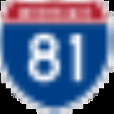
with Interstate 81
in Union Township, Lebanon County, Pennsylvania
, about 25 miles (40 km) northeast of Harrisburg
. Near the east end of the county, at exit 8, U.S. Route 22
merges with I-78, running concurrently for the next 43 miles (69.2 km).
At exit 51, in Upper Macungie Township
, US 22 leaves the highway. Passengers traveling on I-78 eastbound must use this exit to access I-476 (Northeast Extension of the Pennsylvania Turnpike
), and westbound travelers must use exit 53 (northbound PA 309) and then westbound US 22. From exits 53 to 60, I-78 runs concurrently with Pennsylvania Route 309
. The six lane overlap bypasses the City of Allentown
to the south and crosses South Mountain
.
At exit 60 (A-B going westbound), PA 309 south leaves for Quakertown
. Six miles later, there is an interchange between Pennsylvania Route 412
and I-78 in Hellertown
. Highway 412 also goes to Bethlehem
and Lehigh University
. At mile marker 71, Pennsylvania Route 33
intersects at Exit 71. Route 33 traverses the Pocono Mountains and goes to Bangor
and Interstate 80
. The final exit on Interstate 78 in Pennsylvania is for Morgan Hill Road, which goes to Pennsylvania Route 611
and Easton
. Interstate 78 then crosses the Interstate 78 Toll Bridge
and enters New Jersey
.
, I-78 enters New Jersey as the Phillipsburg-Newark Expressway
. The road begins by running parallel with County Route 642 in the town of Alpha
. At 3.94 miles (6.3 km), Exit 3, a partial cloverleaf interchange brings together U.S. Route 22
, New Jersey Route 122 and New Jersey Route 173 with Interstate 78 in Phillipsburg
. U.S. Route 22
now runs concurrently with I-78 for the next 15 miles (24.1 km). Going westbound, exit 4 leaves to the right for County Route 637 and Warren Glen. The next exit, Exit 6, is for County Route 632 in Bloomsbury. However the route number is not signed on Interstate 78. Exit 7 is the first of several eastbound exits for NJ 173. This one is located in Bloomsbury as 173 begins to parallel the interstate. Four miles later, Exit 11 leaves to the right as another Exit for NJ 173. Warren County 614 also is located off the exit. Exit 12, westbound is for NJ 173 again. However, Exit 12 eastbound is for a frontage road
parallelling Interstate 78.
 Exit 13 is only westbound and is another exit for NJ 173. Nearby the exit, going eastbound, the frontage road merges in. Exit 15 is for NJ 173 and County Route 513
in Franklin Township. Exit 17 is for NJ 31 in Clinton
. In the town of Annandale
, US 22 leaves Interstate 78 at exit 18. Route 22 continues towards Bound Brook and Union County. At exit 20, Hunterdon CR 639 intersects. Hunterdon 639 heads towards the Round Valley Recreational Area
. Exit 24 is for County Route 523
towards Oldwick
. At exit 29, Interstate 287
, U.S. Route 202
and U.S. Route 206
interchange with I-78 in Bedminster. At this point, in Somerset County, Exits 33, 36 and 40 are for county routes in Warren Township. At exit 41, I-78 enters Union County. At exit 45, County Route 527
intersects after parallelling for some time. West of exit 48, I-78 splits into express and local highways. Exit 48 is for New Jersey Route 24 in Springfield. Exit 49A is for one of Route 24's spur routes, New Jersey Route 124. Exit 52 is for the Garden State Parkway
in Union
. At Exits 57 and 58, New Jersey Route 21, U.S. Route 1
, U.S. Route 9
and U.S. Route 22
intersect Interstate 78. The exit provides access to Newark Liberty International Airport
.
 East of exit 58 at the eastern tip of Newark, I-78 becomes the Newark Bay Extension of the New Jersey Turnpike
. Past the first toll plaza, I-78 has an interchange with Interstate 95 (The New Jersey Turnpike) and crosses Newark Bay
via the Newark Bay Bridge
. The first exit, 14A, is for New Jersey Route 440 in Bayonne
. Liberty State Park
and the Liberty Science Center
can be reached by taking Exit 14B. Exit 14C is the final numbered exit, providing access to the New Jersey Turnpike
. New Jersey Route 139 runs concurrently with I-78 as it approaches the Holland Tunnel
and enters New York State.
is only 1/2 mile (1 km) - half of the Holland Tunnel and the egress-only roundabout immediately beyond the end of the tunnel. The route was planned to run east and north through New York City to end at Interstate 95
in the Bronx
, but sections of the planned route, including the Lower Manhattan Expressway
, were cancelled.
 In New York City, I-78 continues through the limited access egress-only roundabout known as the Saint John's Rotary. The five separate exits from the Rotary are assigned numbers — exits 1 to 5 - in counterclockwise order. The last one — and the logical continuation east — is Exit 5, Canal Street
. Under the original plans, I-78 was to continue across Manhattan
as the Lower Manhattan Expressway
onto the Williamsburg Bridge
, and then beyond I-278 on the never-built Bushwick Expressway through Brooklyn
into Queens
near the John F. Kennedy Airport. A section of I-78 at the airport was built as the Nassau Expressway, later Interstate 878 and now NY 878, though most of the westbound side was never built. East of the airport, I-78 would have turned north on the Clearview Expressway (built north of Hillside Avenue in Queens
and now I-295
), run across the Throgs Neck Bridge
, and forked into two spurs, ending at Interstate 95
via the Throgs Neck Expressway (now I-695) and the Bruckner Interchange
via the Cross Bronx Expressway (now part of I-295).
.
In eastern Pennsylvania, Route 378 into downtown Bethlehem
was once Interstate 378, but was redesignated as a state route after I-78 was rerouted to a new southerly alignment. An Interstate 178 was initially planned as an extension into downtown Allentown
, but was canceled due to local opposition.
Harrisburg, Pennsylvania
Harrisburg is the capital of Pennsylvania. As of the 2010 census, the city had a population of 49,528, making it the ninth largest city in Pennsylvania...
, through Allentown, Pennsylvania
Allentown, Pennsylvania
Allentown is a city located in Lehigh County, Pennsylvania, in the United States. It is Pennsylvania's third most populous city, after Philadelphia and Pittsburgh, and the 215th largest city in the United States. As of the 2010 census, the city had a total population of 118,032 and is currently...
, and western and northern New Jersey
New Jersey
New Jersey is a state in the Northeastern and Middle Atlantic regions of the United States. , its population was 8,791,894. It is bordered on the north and east by the state of New York, on the southeast and south by the Atlantic Ocean, on the west by Pennsylvania and on the southwest by Delaware...
to the Holland Tunnel
Holland Tunnel
The Holland Tunnel is a highway tunnel under the Hudson River connecting the island of Manhattan in New York City with Jersey City, New Jersey at Interstate 78 on the mainland. Unusual for an American public works project, it is not named for a government official, politician, or local hero or...
and Lower Manhattan
Lower Manhattan
Lower Manhattan is the southernmost part of the island of Manhattan, the main island and center of business and government of the City of New York...
in New York City
New York City
New York is the most populous city in the United States and the center of the New York Metropolitan Area, one of the most populous metropolitan areas in the world. New York exerts a significant impact upon global commerce, finance, media, art, fashion, research, technology, education, and...
.
I-78 is a major road linking ports in the New York City
New York City
New York is the most populous city in the United States and the center of the New York Metropolitan Area, one of the most populous metropolitan areas in the world. New York exerts a significant impact upon global commerce, finance, media, art, fashion, research, technology, education, and...
and New Jersey
New Jersey
New Jersey is a state in the Northeastern and Middle Atlantic regions of the United States. , its population was 8,791,894. It is bordered on the north and east by the state of New York, on the southeast and south by the Atlantic Ocean, on the west by Pennsylvania and on the southwest by Delaware...
area to points west, and sees over 4 million trucks annually, with trucks representing 24% of all traffic. Truck traffic on the road is projected to rise once the widening of the Panama Canal
Panama Canal
The Panama Canal is a ship canal in Panama that joins the Atlantic Ocean and the Pacific Ocean and is a key conduit for international maritime trade. Built from 1904 to 1914, the canal has seen annual traffic rise from about 1,000 ships early on to 14,702 vessels measuring a total of 309.6...
is completed in 2015, when more Asian ships are expected to use East Coast ports.
Pennsylvania
I-78 begins at a directional-T interchangeInterchange (road)
In the field of road transport, an interchange is a road junction that typically uses grade separation, and one or more ramps, to permit traffic on at least one highway to pass through the junction without directly crossing any other traffic stream. It differs from a standard intersection, at which...
with Interstate 81
Interstate 81
Interstate 81 is an Interstate Highway in the eastern part of the United States. Its southern terminus is at Interstate 40 in Dandridge, Tennessee; its northern terminus is on Wellesley Island at the Canadian border, where the Thousand Islands Bridge connects it to Highway 401, the main freeway...
in Union Township, Lebanon County, Pennsylvania
Union Township, Lebanon County, Pennsylvania
Union Township is a township in Lebanon County, Pennsylvania, United States. It is part of the Lebanon, PA Metropolitan Statistical Area. The population was 2,590 at the 2000 census.-Geography:...
, about 25 miles (40 km) northeast of Harrisburg
Harrisburg, Pennsylvania
Harrisburg is the capital of Pennsylvania. As of the 2010 census, the city had a population of 49,528, making it the ninth largest city in Pennsylvania...
. Near the east end of the county, at exit 8, U.S. Route 22
U.S. Route 22
U.S. Route 22 is a west–east route and is one of the original United States highways of 1926, running from Cincinnati, Ohio, at US 27, US 42, US 127, and US 52 to Newark, New Jersey, at U.S. Route 1/9 near the Newark Liberty International Airport.US 22 also carries the names of the William...
merges with I-78, running concurrently for the next 43 miles (69.2 km).
At exit 51, in Upper Macungie Township
Upper Macungie Township, Pennsylvania
Upper Macungie Township is a township in Lehigh County, Pennsylvania, in the United States. It is a suburb of Allentown, Pennsylvania, in the Lehigh Valley region of the state.The population of Upper Macungie Township was 20,063 as of the 2010 U.S...
, US 22 leaves the highway. Passengers traveling on I-78 eastbound must use this exit to access I-476 (Northeast Extension of the Pennsylvania Turnpike
Pennsylvania Turnpike
The Pennsylvania Turnpike is a toll highway system operated by the Pennsylvania Turnpike Commission in the Commonwealth of Pennsylvania, United States. The three sections of the turnpike system total . The main section extends from Ohio to New Jersey and is long...
), and westbound travelers must use exit 53 (northbound PA 309) and then westbound US 22. From exits 53 to 60, I-78 runs concurrently with Pennsylvania Route 309
Pennsylvania Route 309
Pennsylvania Route 309 is a major highway which runs for 134 miles through Pennsylvania in the United States. It connects Philadelphia and its northern suburbs to Allentown, Hazleton, and Wilkes-Barre. A limited-access highway portion of PA 309 in the Wilkes-Barre area is known as the North...
. The six lane overlap bypasses the City of Allentown
Allentown, Pennsylvania
Allentown is a city located in Lehigh County, Pennsylvania, in the United States. It is Pennsylvania's third most populous city, after Philadelphia and Pittsburgh, and the 215th largest city in the United States. As of the 2010 census, the city had a total population of 118,032 and is currently...
to the south and crosses South Mountain
South Mountain (eastern Pennsylvania)
South Mountain is a colloquial name applied to features in the mountain range extending south and south west from the Lehigh Valley to the Lebanon Valley regions of Pennsylvania. At times, it also been known as Durham Hills, Reading Hills, and the Lehigh Mountains...
.
At exit 60 (A-B going westbound), PA 309 south leaves for Quakertown
Quakertown, Pennsylvania
Quakertown is a borough in Bucks County, Pennsylvania, in the United States. As of the 2010 census, it had a population of 8,979. The borough is south of Bethlehem and north of Philadelphia, making Quakertown a border town of both the Delaware Valley and Lehigh Valley metropolitan areas...
. Six miles later, there is an interchange between Pennsylvania Route 412
Pennsylvania Route 412
Pennsylvania Route 412 is a long north–south state route located in Northampton and Bucks counties in southeastern Pennsylvania. Its southern terminus is at Pennsylvania Route 611 in the Nockamixon Township community of Harrow...
and I-78 in Hellertown
Hellertown, Pennsylvania
Hellertown is a borough in Northampton County, Pennsylvania, in the United States. Hellertown is located in the Lehigh Valley region of the state, and geographically in the Saucon Valley.The population of Hellertown was 5,606 at the 2000 census.-Geography:...
. Highway 412 also goes to Bethlehem
Bethlehem, Pennsylvania
Bethlehem is a city in Lehigh and Northampton Counties in the Lehigh Valley region of eastern Pennsylvania, in the United States. As of the 2010 census, the city had a total population of 74,982, making it the seventh largest city in Pennsylvania, after Philadelphia, Pittsburgh, Allentown, Erie,...
and Lehigh University
Lehigh University
Lehigh University is a private, co-educational university located in Bethlehem, Pennsylvania, in the Lehigh Valley region of the United States. It was established in 1865 by Asa Packer as a four-year technical school, but has grown to include studies in a wide variety of disciplines...
. At mile marker 71, Pennsylvania Route 33
Pennsylvania Route 33
Pennsylvania Route 33 is a -long limited-access state highway in eastern Pennsylvania, United States. South of the US 22 interchange, the route is called the Gen. Anthony Clement McAuliffe 101st Airborne Memorial Highway....
intersects at Exit 71. Route 33 traverses the Pocono Mountains and goes to Bangor
Bangor, Pennsylvania
Bangor is a borough located in Northampton County, Pennsylvania, west of New York City, in the Lehigh Valley region of Pennsylvania, United States. It is part of Pennsylvania's Slate Belt. It had a population of 5,273 at the 2010 census.-History:...
and Interstate 80
Interstate 80 in Pennsylvania
The transcontinental Interstate 80 is designated across northern Pennsylvania as the Keystone Shortway, officially the Z.H. Confair Memorial Highway. This route was built mainly along a completely new alignment, not paralleling any earlier U.S. Routes, as a shortcut to the tolled Pennsylvania...
. The final exit on Interstate 78 in Pennsylvania is for Morgan Hill Road, which goes to Pennsylvania Route 611
Pennsylvania Route 611
Pennsylvania Route 611 is a major state highway in Pennsylvania, United States, running from Interstate 95 south of downtown Philadelphia north to Interstate 380 in Coolbaugh Township, Pennsylvania in The Poconos....
and Easton
Easton, Pennsylvania
Easton is a city in Northampton County, Pennsylvania, United States. The population was 26,800 as of the 2010 census. It is the county seat of Northampton County....
. Interstate 78 then crosses the Interstate 78 Toll Bridge
Interstate 78 Toll Bridge
The Interstate 78 Toll Bridge carries Interstate 78 between Williams Township, Pennsylvania and Phillipsburg, New Jersey over the Delaware River. Opened on November 21, 1989, it is operated by the Delaware River Joint Toll Bridge Commission and is one of the newest bridges across the Delaware...
and enters New Jersey
New Jersey
New Jersey is a state in the Northeastern and Middle Atlantic regions of the United States. , its population was 8,791,894. It is bordered on the north and east by the state of New York, on the southeast and south by the Atlantic Ocean, on the west by Pennsylvania and on the southwest by Delaware...
.
New Jersey
After the Interstate 78 Toll BridgeInterstate 78 Toll Bridge
The Interstate 78 Toll Bridge carries Interstate 78 between Williams Township, Pennsylvania and Phillipsburg, New Jersey over the Delaware River. Opened on November 21, 1989, it is operated by the Delaware River Joint Toll Bridge Commission and is one of the newest bridges across the Delaware...
, I-78 enters New Jersey as the Phillipsburg-Newark Expressway
Interstate 78 in New Jersey
Interstate 78 is an east–west route stretching from Union Township, Lebanon County, Pennsylvania to New York City. In New Jersey, I-78 is called the Phillipsburg–Newark Expressway and the Newark Bay Extension of the New Jersey Turnpike...
. The road begins by running parallel with County Route 642 in the town of Alpha
Alpha, New Jersey
Alpha is a borough in Warren County, New Jersey, United States. As of the United States 2010 Census, the borough population was 2,369.Alpha was incorporated as a borough by an Act of the New Jersey Legislature and signed by Governor Woodrow Wilson on June 26, 1911, from portions of Pohatcong...
. At 3.94 miles (6.3 km), Exit 3, a partial cloverleaf interchange brings together U.S. Route 22
U.S. Route 22
U.S. Route 22 is a west–east route and is one of the original United States highways of 1926, running from Cincinnati, Ohio, at US 27, US 42, US 127, and US 52 to Newark, New Jersey, at U.S. Route 1/9 near the Newark Liberty International Airport.US 22 also carries the names of the William...
, New Jersey Route 122 and New Jersey Route 173 with Interstate 78 in Phillipsburg
Phillipsburg, New Jersey
Phillipsburg, known locally as P'burg, is a town in Warren County, New Jersey, in the United States. As of 2010 United States Census, the town's population was 14,950....
. U.S. Route 22
U.S. Route 22
U.S. Route 22 is a west–east route and is one of the original United States highways of 1926, running from Cincinnati, Ohio, at US 27, US 42, US 127, and US 52 to Newark, New Jersey, at U.S. Route 1/9 near the Newark Liberty International Airport.US 22 also carries the names of the William...
now runs concurrently with I-78 for the next 15 miles (24.1 km). Going westbound, exit 4 leaves to the right for County Route 637 and Warren Glen. The next exit, Exit 6, is for County Route 632 in Bloomsbury. However the route number is not signed on Interstate 78. Exit 7 is the first of several eastbound exits for NJ 173. This one is located in Bloomsbury as 173 begins to parallel the interstate. Four miles later, Exit 11 leaves to the right as another Exit for NJ 173. Warren County 614 also is located off the exit. Exit 12, westbound is for NJ 173 again. However, Exit 12 eastbound is for a frontage road
Frontage road
A frontage road is a non-limited access road running parallel to a higher-speed road, usually a freeway, and feeding it at appropriate points of access...
parallelling Interstate 78.
County Route 513 (New Jersey)
County Route 513 is a county highway in the U.S. state of New Jersey. The highway extends from Kingwood Avenue in Frenchtown to Lakeside Road in West Milford...
in Franklin Township. Exit 17 is for NJ 31 in Clinton
Clinton Township, New Jersey
Clinton Township is a Township in Hunterdon County, New Jersey, United States. As of the United States 2010 Census, the township population was 13,478....
. In the town of Annandale
Annandale, New Jersey
Annandale is a census-designated place and unincorporated area located within Clinton Township, in Hunterdon County, New Jersey. As of the United States 2000 Census, the CDP population was 1,276...
, US 22 leaves Interstate 78 at exit 18. Route 22 continues towards Bound Brook and Union County. At exit 20, Hunterdon CR 639 intersects. Hunterdon 639 heads towards the Round Valley Recreational Area
Round Valley Reservoir
The Round Valley Reservoir in Clinton Township of the U.S. state of New Jersey was formed in 1960 when the New Jersey Water Authority constructed two large dams and flooded a large valley in the state's Hunterdon County. The reservoir is named after the naturally formed circular valley surrounded...
. Exit 24 is for County Route 523
County Route 523 (New Jersey)
County Route 523 is a county highway in the U.S. state of New Jersey. The highway extends from Main Street in Stockton to Hillside Avenue in Bedminster Township.-Hunterdon County:...
towards Oldwick
Oldwick, New Jersey
Oldwick is an unincorporated area within Tewksbury Township in Hunterdon County, New Jersey, United States. The area is served as United States Postal Service ZIP Code 08858. As of the United States 2000 Census, the population for ZIP Code Tabulation Area 08858 was 177.Oldwick was formerly known as...
. At exit 29, Interstate 287
Interstate 287
Interstate 287 is an auxiliary Interstate Highway in the U.S. states of New Jersey and New York. It is a partial beltway around New York City, serving the northern half of New Jersey and the counties of Rockland and Westchester in New York...
, U.S. Route 202
U.S. Route 202
U.S. Route 202 is a highway stretching from Delaware to Maine, also passing through the states of Pennsylvania, New Jersey, New York, Connecticut, Massachusetts, and New Hampshire....
and U.S. Route 206
U.S. Route 206
U.S. Route 206 is a long north–south United States highway in New Jersey and Pennsylvania, United States. Only about a half a mile of its length is in Pennsylvania; the Milford-Montague Toll Bridge carries it over the Delaware River into New Jersey, where it is the remainder of the route...
interchange with I-78 in Bedminster. At this point, in Somerset County, Exits 33, 36 and 40 are for county routes in Warren Township. At exit 41, I-78 enters Union County. At exit 45, County Route 527
County Route 527 (New Jersey)
County Route 527 is a county highway in the U.S. state of New Jersey. The highway extends from Main Street in Toms River Township to Pompton Avenue in Cedar Grove. It is the second longest county highway in New Jersey after Route 519. It was first given the number 527 in 1954...
intersects after parallelling for some time. West of exit 48, I-78 splits into express and local highways. Exit 48 is for New Jersey Route 24 in Springfield. Exit 49A is for one of Route 24's spur routes, New Jersey Route 124. Exit 52 is for the Garden State Parkway
Garden State Parkway
The Garden State Parkway is a 172.4-mile limited-access toll parkway that stretches the length of New Jersey from the New York line at Montvale, New Jersey, to Cape May at New Jersey's southernmost tip. Its name refers to New Jersey's nickname, the "Garden State." Most New Jersey residents refer...
in Union
Union Township, Union County, New Jersey
Union is a Township in Union County, New Jersey, United States. In the 18th century, the area that is now Union was then called Connecticut Farms...
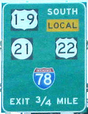
. At Exits 57 and 58, New Jersey Route 21, U.S. Route 1
U.S. Route 1
U.S. Route 1 is a major north–south U.S. Highway that serves the East Coast of the United States. It runs 2,377 miles from Fort Kent, Maine at the Canadian border south to Key West, Florida. U.S. 1 generally parallels Interstate 95, though it is significantly farther west between...
, U.S. Route 9
U.S. Route 9
U.S. Route 9 is a north–south United States highway in the states of Delaware, New Jersey, and New York in the United States. It is one of only two U.S. highways with a ferry connection ; the other being US 10. US 9 is signed east–west in Delaware and north–south on the rest of...
and U.S. Route 22
U.S. Route 22
U.S. Route 22 is a west–east route and is one of the original United States highways of 1926, running from Cincinnati, Ohio, at US 27, US 42, US 127, and US 52 to Newark, New Jersey, at U.S. Route 1/9 near the Newark Liberty International Airport.US 22 also carries the names of the William...
intersect Interstate 78. The exit provides access to Newark Liberty International Airport
Newark Liberty International Airport
Newark Liberty International Airport , first named Newark Metropolitan Airport and later Newark International Airport, is an international airport within the city limits of both Newark and Elizabeth, New Jersey, United States...
.
New Jersey Turnpike
The New Jersey Turnpike is a toll road in New Jersey, maintained by the New Jersey Turnpike Authority. According to the International Bridge, Tunnel and Turnpike Association, the Turnpike is the nation's sixth-busiest toll road and is among one of the most heavily traveled highways in the United...
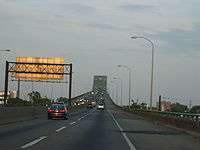
. Past the first toll plaza, I-78 has an interchange with Interstate 95 (The New Jersey Turnpike) and crosses Newark Bay
Newark Bay
Newark Bay is a tidal bay at the confluence of the Passaic and Hackensack Rivers in northeastern New Jersey. It is home to the Port Newark-Elizabeth Marine Terminal, the largest container shipping facility in Port of New York and New Jersey, 3rd largest and one of busiest in the United States...
via the Newark Bay Bridge
Newark Bay Bridge
The Newark Bay Bridge is a steel through arch bridge that is continuous across three spans. It crosses Newark Bay and connects the cities of Newark and Bayonne in New Jersey...
. The first exit, 14A, is for New Jersey Route 440 in Bayonne
Bayonne, New Jersey
Bayonne is a city in Hudson County, New Jersey, United States. Located in the Gateway Region, Bayonne is a peninsula that is situated between Newark Bay to the west, the Kill van Kull to the south, and New York Bay to the east...
. Liberty State Park
Liberty State Park
Liberty State Park is located on Upper New York Bay in Jersey City, New Jersey, opposite the Statue of Liberty and Ellis Island. The park opened in 1976 to coincide with bicentennial celebrations and is operated and maintained by the New Jersey Division of Parks and Forestry.-Geography and...
and the Liberty Science Center
Liberty Science Center
Liberty Science Center is an interactive science museum and learning center located in Liberty State Park in Jersey City, New Jersey.The center, which first opened in 1993 as New Jersey's first major state science museum, has science exhibits, the largest IMAX Dome theater in the United States,...
can be reached by taking Exit 14B. Exit 14C is the final numbered exit, providing access to the New Jersey Turnpike
New Jersey Turnpike
The New Jersey Turnpike is a toll road in New Jersey, maintained by the New Jersey Turnpike Authority. According to the International Bridge, Tunnel and Turnpike Association, the Turnpike is the nation's sixth-busiest toll road and is among one of the most heavily traveled highways in the United...
. New Jersey Route 139 runs concurrently with I-78 as it approaches the Holland Tunnel
Holland Tunnel
The Holland Tunnel is a highway tunnel under the Hudson River connecting the island of Manhattan in New York City with Jersey City, New Jersey at Interstate 78 on the mainland. Unusual for an American public works project, it is not named for a government official, politician, or local hero or...
and enters New York State.
New York City
I-78's length in New YorkNew York
New York is a state in the Northeastern region of the United States. It is the nation's third most populous state. New York is bordered by New Jersey and Pennsylvania to the south, and by Connecticut, Massachusetts and Vermont to the east...
is only 1/2 mile (1 km) - half of the Holland Tunnel and the egress-only roundabout immediately beyond the end of the tunnel. The route was planned to run east and north through New York City to end at Interstate 95
Interstate 95 in New York
Interstate 95 is a part of the Interstate Highway System that runs from Miami, Florida, to the Canada – United States border near Houlton, Maine. In the U.S. state of New York, I-95 extends from the George Washington Bridge in New York City to the Connecticut state line at Port Chester...
in the Bronx
The Bronx
The Bronx is the northernmost of the five boroughs of New York City. It is also known as Bronx County, the last of the 62 counties of New York State to be incorporated...
, but sections of the planned route, including the Lower Manhattan Expressway
Lower Manhattan Expressway
The Lower Manhattan Expressway was a controversial plan for an expressway through lower Manhattan originally conceived by Robert Moses in 1941, but delayed until the early 1960s...
, were cancelled.
Canal Street (Manhattan)
Canal Street is a major street in New York City, crossing lower Manhattan to join New Jersey in the west to Brooklyn in the east . It forms the main spine of Chinatown, and separates it from Little Italy...
. Under the original plans, I-78 was to continue across Manhattan
Manhattan
Manhattan is the oldest and the most densely populated of the five boroughs of New York City. Located primarily on the island of Manhattan at the mouth of the Hudson River, the boundaries of the borough are identical to those of New York County, an original county of the state of New York...
as the Lower Manhattan Expressway
Lower Manhattan Expressway
The Lower Manhattan Expressway was a controversial plan for an expressway through lower Manhattan originally conceived by Robert Moses in 1941, but delayed until the early 1960s...
onto the Williamsburg Bridge
Williamsburg Bridge
The Williamsburg Bridge is a suspension bridge in New York City across the East River connecting the Lower East Side of Manhattan at Delancey Street with the Williamsburg neighborhood of Brooklyn at Broadway near the Brooklyn-Queens Expressway...
, and then beyond I-278 on the never-built Bushwick Expressway through Brooklyn
Brooklyn
Brooklyn is the most populous of New York City's five boroughs, with nearly 2.6 million residents, and the second-largest in area. Since 1896, Brooklyn has had the same boundaries as Kings County, which is now the most populous county in New York State and the second-most densely populated...
into Queens
Queens
Queens is the easternmost of the five boroughs of New York City. The largest borough in area and the second-largest in population, it is coextensive with Queens County, an administrative division of New York state, in the United States....
near the John F. Kennedy Airport. A section of I-78 at the airport was built as the Nassau Expressway, later Interstate 878 and now NY 878, though most of the westbound side was never built. East of the airport, I-78 would have turned north on the Clearview Expressway (built north of Hillside Avenue in Queens
Queens
Queens is the easternmost of the five boroughs of New York City. The largest borough in area and the second-largest in population, it is coextensive with Queens County, an administrative division of New York state, in the United States....
and now I-295
Interstate 295 (New York)
Interstate 295 is a connector route within New York City. Measuring 9.10 miles in length, I-295 travels from the Bruckner Interchange, a junction with I-95/I-278/I-678 in The Bronx, across the toll Throgs Neck Bridge to the Grand Central Parkway in Queens...
), run across the Throgs Neck Bridge
Throgs Neck Bridge
The Throgs Neck Bridge is a suspension bridge opened on January 11, 1961, which carries Interstate 295 over the East River where it meets the Long Island Sound. The bridge connects the Throggs Neck section of the Bronx with the Bay Terrace section of Queens...
, and forked into two spurs, ending at Interstate 95
Interstate 95 in New York
Interstate 95 is a part of the Interstate Highway System that runs from Miami, Florida, to the Canada – United States border near Houlton, Maine. In the U.S. state of New York, I-95 extends from the George Washington Bridge in New York City to the Connecticut state line at Port Chester...
via the Throgs Neck Expressway (now I-695) and the Bruckner Interchange
Bruckner Interchange
The Bruckner Interchange is a complex interchange at the intersection of the Bruckner Expressway, Cross Bronx Expressway, Hutchinson River Expressway, and Hutchinson River Parkway in the New York City borough of the Bronx, United States...
via the Cross Bronx Expressway (now part of I-295).
Major intersections
- Interstate 81Interstate 81 in PennsylvaniaInterstate 81 is an long north–south Interstate Highway, stretching from Dandridge, Tennessee to Fisher's Landing, New York at the US/Canadian border...
in Union Township, PennsylvaniaUnion Township, Lebanon County, PennsylvaniaUnion Township is a township in Lebanon County, Pennsylvania, United States. It is part of the Lebanon, PA Metropolitan Statistical Area. The population was 2,590 at the 2000 census.-Geography:... - U.S. Route 22 in Union Township and Upper Macungie Township
- Interstate 476Interstate 476Interstate 476 is a auxiliary Interstate Highway in the U.S. state of Pennsylvania designated between Interstate 95 near Chester and Interstate 81 near Scranton, serving as the primary north–south Interstate corridor through eastern Pennsylvania....
via U.S. Route 22 near AllentownAllentown, PennsylvaniaAllentown is a city located in Lehigh County, Pennsylvania, in the United States. It is Pennsylvania's third most populous city, after Philadelphia and Pittsburgh, and the 215th largest city in the United States. As of the 2010 census, the city had a total population of 118,032 and is currently... - Interstate 287Interstate 287Interstate 287 is an auxiliary Interstate Highway in the U.S. states of New Jersey and New York. It is a partial beltway around New York City, serving the northern half of New Jersey and the counties of Rockland and Westchester in New York...
in Bedminster, New JerseyBedminster Township, New JerseyBedminster Township is a Township in Somerset County, New Jersey, United States. As of the 2010 United States Census, the township population was 8,165.... - U.S. Route 1-9 in NewarkNewark, New JerseyNewark is the largest city in the American state of New Jersey, and the seat of Essex County. As of the 2010 United States Census, Newark had a population of 277,140, maintaining its status as the largest municipality in New Jersey. It is the 68th largest city in the U.S...
- Interstate 95 (New Jersey TurnpikeNew Jersey TurnpikeThe New Jersey Turnpike is a toll road in New Jersey, maintained by the New Jersey Turnpike Authority. According to the International Bridge, Tunnel and Turnpike Association, the Turnpike is the nation's sixth-busiest toll road and is among one of the most heavily traveled highways in the United...
) in Newark
Auxiliary routes
All of I-78's auxiliary routes serve New York City; however, none of these routes actually intersects I-78, following the route's truncation at the eastern end of the Holland TunnelHolland Tunnel
The Holland Tunnel is a highway tunnel under the Hudson River connecting the island of Manhattan in New York City with Jersey City, New Jersey at Interstate 78 on the mainland. Unusual for an American public works project, it is not named for a government official, politician, or local hero or...
.
- Interstate 278Interstate 278Interstate 278 is an auxiliary Interstate Highway in New Jersey and New York, United States. The road runs from U.S. Route 1/9 in Linden, New Jersey to the Bruckner Interchange in the New York City borough of the Bronx...
runs from U.S. Route 1/9U.S. Route 1/9U.S. Route 9 is a U.S. highway in the northeast United States, running from Laurel, Delaware north to the Canadian border near Champlain, New York...
near Elizabeth, New JerseyElizabeth, New JerseyElizabeth is a city in Union County, New Jersey, United States. As of the 2010 United States Census, the city had a total population of 124,969, retaining its ranking as New Jersey's fourth largest city with an increase of 4,401 residents from its 2000 Census population of 120,568...
over the Goethals BridgeGoethals BridgeThe Goethals Bridge connects Elizabeth, New Jersey to Staten Island , near the Howland Hook Marine Terminal, Staten Island, New York over the Arthur Kill. Operated by the Port Authority of New York and New Jersey, the span was one of the first structures built by the authority...
, through Staten IslandStaten IslandStaten Island is a borough of New York City, New York, United States, located in the southwest part of the city. Staten Island is separated from New Jersey by the Arthur Kill and the Kill Van Kull, and from the rest of New York by New York Bay...
, over the Verrazano Narrows Bridge and through BrooklynBrooklynBrooklyn is the most populous of New York City's five boroughs, with nearly 2.6 million residents, and the second-largest in area. Since 1896, Brooklyn has had the same boundaries as Kings County, which is now the most populous county in New York State and the second-most densely populated...
and QueensQueensQueens is the easternmost of the five boroughs of New York City. The largest borough in area and the second-largest in population, it is coextensive with Queens County, an administrative division of New York state, in the United States....
, and across the Triborough Bridge into the BronxThe BronxThe Bronx is the northernmost of the five boroughs of New York City. It is also known as Bronx County, the last of the 62 counties of New York State to be incorporated...
to end at Interstate 95Interstate 95 in New YorkInterstate 95 is a part of the Interstate Highway System that runs from Miami, Florida, to the Canada – United States border near Houlton, Maine. In the U.S. state of New York, I-95 extends from the George Washington Bridge in New York City to the Connecticut state line at Port Chester...
at the Bruckner InterchangeBruckner InterchangeThe Bruckner Interchange is a complex interchange at the intersection of the Bruckner Expressway, Cross Bronx Expressway, Hutchinson River Expressway, and Hutchinson River Parkway in the New York City borough of the Bronx, United States...
. Interstate 278 was planned to extend west from Elizabeth to Interstate 78 in Springfield, Union County, New Jersey, and was to intersect I-78 at the east end of the Williamsburg BridgeWilliamsburg BridgeThe Williamsburg Bridge is a suspension bridge in New York City across the East River connecting the Lower East Side of Manhattan at Delancey Street with the Williamsburg neighborhood of Brooklyn at Broadway near the Brooklyn-Queens Expressway...
in Brooklyn. Until 1972, I-278 ran along Interstate 895Interstate 895 (New York)Interstate 895 , named the Arthur V. Sheridan Expressway, is a short freeway in the New York City borough of the Bronx, forming a short connecting link in the Interstate Highway System...
and a proposed extension to Interstate 95, while Interstate 278 east of I-895 was I-878. - Interstate 478 is an unsigned designation for the Brooklyn-Battery TunnelBrooklyn-Battery TunnelInterstate 478s entire length consists of the Brooklyn–Battery Tunnel and its approaches. Its south end is at Interstate 278, and its north end is at NY 9A ....
, a spur from Interstate 278 into lower ManhattanLower ManhattanLower Manhattan is the southernmost part of the island of Manhattan, the main island and center of business and government of the City of New York...
. Plans were made to continue it north along the West Side HighwayWest Side HighwayThe West Side Highway is a mostly surface section of New York State Route 9A that runs from West 72nd Street along the Hudson River to the southern tip of Manhattan. It replaced the West Side Elevated Highway, built between 1929 and 1951, which was shut down in 1973 due to neglect and lack of...
(Route 9A) to Interstate 78 at the Holland Tunnel, but have been canceled. Older plans would have given it the same purpose — connecting I-78 with I-278 - but along the Manhattan BridgeManhattan BridgeThe Manhattan Bridge is a suspension bridge that crosses the East River in New York City, connecting Lower Manhattan with Brooklyn . It was the last of the three suspension bridges built across the lower East River, following the Brooklyn and the Williamsburg bridges...
. - Interstate 678Interstate 678Interstate 678 is a north–south auxiliary Interstate Highway that extends for through two boroughs of New York City. The route begins at John F. Kennedy International Airport on Jamaica Bay and travels north through Queens and across the East River to the Bronx, where it ends at...
runs from I-278 at the Bruckner InterchangeBruckner InterchangeThe Bruckner Interchange is a complex interchange at the intersection of the Bruckner Expressway, Cross Bronx Expressway, Hutchinson River Expressway, and Hutchinson River Parkway in the New York City borough of the Bronx, United States...
south over the Bronx-Whitestone Bridge to John F. Kennedy International AirportJohn F. Kennedy International AirportJohn F. Kennedy International Airport is an international airport located in the borough of Queens in New York City, about southeast of Lower Manhattan. It is the busiest international air passenger gateway to the United States, handling more international traffic than any other airport in North...
. It was to intersect Interstate 78 at its south end. Original plans took I-678 west on the Grand Central ParkwayGrand Central ParkwayThe Grand Central Parkway is a parkway that stretches from the RFK-Triborough Bridge in New York City to Nassau County on Long Island. At the Queens-Nassau border, it becomes the Northern State Parkway, which runs across the northern part of Long Island through Nassau County and into Suffolk...
to I-278. - Interstate 878 is an unsigned designation for part of New York State Route 878New York State Route 878New York State Route 878 is a state highway in the U.S. state of New York, forming the Nassau Expressway. The route exists in two sections connected by Rockaway Boulevard and Rockaway Turnpike, maintained in part by New York City, the New York State Department of Transportation , and Nassau...
, a short east–west freeway on the north edge of Kennedy Airport. It was once planned as part of I-78, and now intersects I-678. The number was assigned in 1989. - A former Interstate 878 existed from 1959 to 1972 along present I-278 east of Interstate 895Interstate 895 (New York)Interstate 895 , named the Arthur V. Sheridan Expressway, is a short freeway in the New York City borough of the Bronx, forming a short connecting link in the Interstate Highway System...
. (I-895 was part of I-278.)
In eastern Pennsylvania, Route 378 into downtown Bethlehem
Bethlehem, Pennsylvania
Bethlehem is a city in Lehigh and Northampton Counties in the Lehigh Valley region of eastern Pennsylvania, in the United States. As of the 2010 census, the city had a total population of 74,982, making it the seventh largest city in Pennsylvania, after Philadelphia, Pittsburgh, Allentown, Erie,...
was once Interstate 378, but was redesignated as a state route after I-78 was rerouted to a new southerly alignment. An Interstate 178 was initially planned as an extension into downtown Allentown
Allentown, Pennsylvania
Allentown is a city located in Lehigh County, Pennsylvania, in the United States. It is Pennsylvania's third most populous city, after Philadelphia and Pittsburgh, and the 215th largest city in the United States. As of the 2010 census, the city had a total population of 118,032 and is currently...
, but was canceled due to local opposition.