
Interstate 430
Encyclopedia
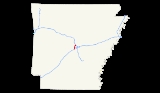
Interstate 430 is a 12.93 miles (20.81 km) long Interstate highway
in Pulaski County, Arkansas
that bypasses the cities of Little Rock
and North Little Rock
. I-430 begins at an interchange southwest of Downtown Little Rock with I-30, U.S. Route 67 (U.S. 67) and U.S. 70 and travels north to cross the Arkansas River
and end at I-40 and U.S. 65. The first plans for the freeway appeared in 1955.
with AR 5. The freeway goes north to pass Remington College
and intersect Colonel Glenn Road before curving eastward to intersect Shackleford Road and then turning back north. Immediately after going under Kanis Road, the highway has a cloverleaf interchange
with I-630, at its western terminus. After I-630, the roadway goes past Immanuel Baptist Church and Breckenridge Village to intersect Rodney Parham Road near the Colony West Shopping Center and later AR 10. The AR 10 interchange was the final I-430 interchange before the freeway crossed the Arkansas River
on the I-430 Bridge. After the bridge, the roadway passes Rosenbaum Lake and intersects with AR 100 before ending at a three-way interchange with I-40 and U.S. 65.
 Early plans for the Interstate Highway System
include a route along roughly the same alignment as the present Interstate 30 (I-30) through the Little Rock area, but are not detailed enough to show exactly how the cities would be served. Later, in 1955, a map of the Interstate Highway's plans shows a complete beltway around Little Rock, including present-day I-430, I-440
and Highway 440 (AR 440). When preliminary urban routes were laid out in 1955, the beltway was shortened to the current route of I-430.
Interstate Highway System
The Dwight D. Eisenhower National System of Interstate and Defense Highways, , is a network of limited-access roads including freeways, highways, and expressways forming part of the National Highway System of the United States of America...
in Pulaski County, Arkansas
Arkansas
Arkansas is a state located in the southern region of the United States. Its name is an Algonquian name of the Quapaw Indians. Arkansas shares borders with six states , and its eastern border is largely defined by the Mississippi River...
that bypasses the cities of Little Rock
Little Rock, Arkansas
Little Rock is the capital and the largest city of the U.S. state of Arkansas. The Metropolitan Statistical Area had a population of 699,757 people in the 2010 census...
and North Little Rock
North Little Rock, Arkansas
the city was 62.55% White, 33.98% Black or African American, 0.41% Native American, 0.59% Asian, 0.03% Pacific Islander, 1.18% from other races, and 1.26% from two or more races...
. I-430 begins at an interchange southwest of Downtown Little Rock with I-30, U.S. Route 67 (U.S. 67) and U.S. 70 and travels north to cross the Arkansas River
Arkansas River
The Arkansas River is a major tributary of the Mississippi River. The Arkansas generally flows to the east and southeast as it traverses the U.S. states of Colorado, Kansas, Oklahoma, and Arkansas. The river's initial basin starts in the Western United States in Colorado, specifically the Arkansas...
and end at I-40 and U.S. 65. The first plans for the freeway appeared in 1955.
Route description
Interstate 430 (I-430) starts its 12.93 miles (20.81 km) route at a trumpet interchange with I-30, U.S. Route 67 (U.S. 67) and U.S. 70. From the interchange, I-430 travels northwest and runs over Highway 338 (AR 338) before having a diamond interchangeDiamond interchange
A diamond interchange is a common type of road junction, used where a freeway crosses a minor road. The freeway itself is grade-separated from the minor road, one crossing the other over a bridge...
with AR 5. The freeway goes north to pass Remington College
Remington College
Remington College is an affiliated group of privately owned non-profit post-secondary educational institutions. Remington Colleges, Inc. operates 20 campuses in several US states. Some of the affiliated institutions have been in operation since the 1940s. It is a for-profit college...
and intersect Colonel Glenn Road before curving eastward to intersect Shackleford Road and then turning back north. Immediately after going under Kanis Road, the highway has a cloverleaf interchange
Cloverleaf interchange
A cloverleaf interchange is a two-level interchange in which left turns, reverse direction in left-driving regions, are handled by ramp roads...
with I-630, at its western terminus. After I-630, the roadway goes past Immanuel Baptist Church and Breckenridge Village to intersect Rodney Parham Road near the Colony West Shopping Center and later AR 10. The AR 10 interchange was the final I-430 interchange before the freeway crossed the Arkansas River
Arkansas River
The Arkansas River is a major tributary of the Mississippi River. The Arkansas generally flows to the east and southeast as it traverses the U.S. states of Colorado, Kansas, Oklahoma, and Arkansas. The river's initial basin starts in the Western United States in Colorado, specifically the Arkansas...
on the I-430 Bridge. After the bridge, the roadway passes Rosenbaum Lake and intersects with AR 100 before ending at a three-way interchange with I-40 and U.S. 65.
History
Interstate Highway System
The Dwight D. Eisenhower National System of Interstate and Defense Highways, , is a network of limited-access roads including freeways, highways, and expressways forming part of the National Highway System of the United States of America...
include a route along roughly the same alignment as the present Interstate 30 (I-30) through the Little Rock area, but are not detailed enough to show exactly how the cities would be served. Later, in 1955, a map of the Interstate Highway's plans shows a complete beltway around Little Rock, including present-day I-430, I-440
Interstate 440 (Arkansas)
Interstate 440 in Arkansas is a partial loop of connecting Interstate 40 with Interstate 30 and Interstate 530 near Little Rock...
and Highway 440 (AR 440). When preliminary urban routes were laid out in 1955, the beltway was shortened to the current route of I-430.
Exit list
The entire route is located in Pulaski County.| Location | # Exit number An exit number is a number assigned to a road junction, usually an exit from a freeway. It is usually marked on the same sign as the destinations of the exit, as well as a sign in the gore.... |
Destinations | Notes |
|---|---|---|---|
| Little Rock Little Rock, Arkansas Little Rock is the capital and the largest city of the U.S. state of Arkansas. The Metropolitan Statistical Area had a population of 699,757 people in the 2010 census... |
129 | Southbound exit and northbound entrance; signed as exits 129A (east) and 129B (west), exit no. corresponds to I-30 | |
| 1 | |||
| 4 | |||
| 5 | Shackleford Road, Kanis Road | ||
| 6 | |||
| 8 | Rodney Parham Road | ||
| 9 | |||
| North Little Rock North Little Rock, Arkansas the city was 62.55% White, 33.98% Black or African American, 0.41% Native American, 0.59% Asian, 0.03% Pacific Islander, 1.18% from other races, and 1.26% from two or more races... |
12 | ||
| 13 | , Memphis | Northbound exit and southbound entrance; signed as exits 13A (east) and 13B (west) |