
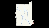
Interstate 95 in New Hampshire
Encyclopedia
Interstate 95, the main Interstate Highway on the east coast of the United States
, cuts through the Seacoast Region
of New Hampshire
. The majority of it, from the Massachusetts
border to the Portsmouth Circle
in Portsmouth
, is the 14.29-mile (23.00 km) Blue Star Turnpike or New Hampshire Turnpike, a toll road
maintained by the New Hampshire Department of Transportation
Bureau of Turnpikes
. The final piece in Portsmouth splits from the Turnpike south of the circle, running 2.42 miles (3.90 km) to the Piscataqua River Bridge
, a steel arch bridge
, towards Maine
and the Maine Turnpike.
.
There is a welcome center just north of the Massachusetts state line. The Seabrook Nuclear Power Plant is accessible via Exit 1. The highway then continues through the coast towns of Hampton Falls
and Hampton
, with state-run liquor store
s just prior to Exit 2. I-95 interchanges with New Hampshire Route 101
(Exit 2) in Hampton, then comes to the barrier toll booth
soon after. That interchange
also contains the only ramp toll used by all traffic passing between the Turnpike and Route 101. Traffic using the Turnpike south of exit 1 (NH Route 107
) or north of exit 3 (NH Route 33
) does not pay a toll.
I-95 then continues through the towns of North Hampton
and Greenland
before entering the city of Portsmouth
. Near the north end, a connection to the Portsmouth Circle
provides access to U.S. Route 1 Bypass and the Spaulding Turnpike
(U.S. Route 4
/NH Route 16
). I-95 crosses into Maine less than 2 miles (3 km) from the Portsmouth Circle.
, and was widened to eight lanes in 1976. The blue turnpike shield for the New Hampshire Turnpike is no longer in use, but was similar to the present-day signs for the Spaulding Turnpike
and Everett Turnpike
.
From its designation in 1957 until 1972, I-95 in Portsmouth did not connect to I-95 in Kittery, Maine. Instead, the expressway ended at the Portsmouth Circle. From there motorists had to use the US 1 Bypass and go over the Sarah Mildred Long Bridge
to the junction near the Kittery Circle with U.S. 1
. This bridge was what connected the New Hampshire and Maine Turnpikes. It is a drawbridge
over the Piscataqua
waterway, which would create an obvious problem. Not only would this be an obstacle to traffic, but the bridge was a narrow three-lane undivided roadway where the center lane could either be used in the direction of the greatest traffic flow or left closed for greater safety. Lane identification was accomplished via repeated banks of three traffic lights, one over each lane, and is the reason for the third (center) traffic light that is no longer used on the now two-lane bridge.
Furthermore, US 1 Bypass is not a controlled-access highway
, but an all-access divided highway (similar to US 1 between Saugus
and Boston
in Massachusetts). As far as most motorists were concerned, I-95 ended at the Portsmouth Circle and restarted in Kittery. The Piscataqua River Bridge was completed in the 1970s to correct this problem. Three construction workers fell to their deaths in the construction of the bridge.
East Coast of the United States
The East Coast of the United States, also known as the Eastern Seaboard, refers to the easternmost coastal states in the United States, which touch the Atlantic Ocean and stretch up to Canada. The term includes the U.S...
, cuts through the Seacoast Region
Seacoast Region (New Hampshire)
The Seacoast Region is the southeast area of the U.S. state of New Hampshire. The region stretches 18 miles along the Atlantic Ocean from New Hampshire's border with Salisbury, Massachusetts to the Piscataqua River and New Hampshire's border with Kittery, Maine. The shoreline is generally very...
of New Hampshire
New Hampshire
New Hampshire is a state in the New England region of the northeastern United States of America. The state was named after the southern English county of Hampshire. It is bordered by Massachusetts to the south, Vermont to the west, Maine and the Atlantic Ocean to the east, and the Canadian...
. The majority of it, from the Massachusetts
Massachusetts
The Commonwealth of Massachusetts is a state in the New England region of the northeastern United States of America. It is bordered by Rhode Island and Connecticut to the south, New York to the west, and Vermont and New Hampshire to the north; at its east lies the Atlantic Ocean. As of the 2010...
border to the Portsmouth Circle
Portsmouth Traffic Circle
The Portsmouth Traffic Circle is a four-point rotary in the city of Portsmouth, New Hampshire.-Description:The southern exit of the circle provides access to Interstate 95 north and south, although only northbound I-95 traffic enters here. The eastern and northern exits are part of the U.S. Route 1...
in Portsmouth
Portsmouth, New Hampshire
Portsmouth is a city in Rockingham County, New Hampshire in the United States. It is the largest city but only the fourth-largest community in the county, with a population of 21,233 at the 2010 census...
, is the 14.29-mile (23.00 km) Blue Star Turnpike or New Hampshire Turnpike, a toll road
Toll road
A toll road is a privately or publicly built road for which a driver pays a toll for use. Structures for which tolls are charged include toll bridges and toll tunnels. Non-toll roads are financed using other sources of revenue, most typically fuel tax or general tax funds...
maintained by the New Hampshire Department of Transportation
New Hampshire Department of Transportation
The State of New Hampshire Department of Transportation is a government agency of the U.S. state of New Hampshire. The NHDOT is under the executive direction of Commissioner of Transportation George Campbell. The main office of the NHDOT is located in the J.O...
Bureau of Turnpikes
New Hampshire Turnpike System
New Hampshire Turnpike System is a system of of limited access highway, of which are part of the National Highway System, within the U.S. state of New Hampshire...
. The final piece in Portsmouth splits from the Turnpike south of the circle, running 2.42 miles (3.90 km) to the Piscataqua River Bridge
Piscataqua River Bridge
The Piscataqua River Bridge is a cantilevered through arch bridge that crosses the Piscataqua River, connecting Portsmouth, New Hampshire with Kittery, Maine. Carrying six lanes of Interstate 95, the bridge is the third modern span and first fixed crossing of the Piscataqua between Portsmouth and...
, a steel arch bridge
Arch bridge
An arch bridge is a bridge with abutments at each end shaped as a curved arch. Arch bridges work by transferring the weight of the bridge and its loads partially into a horizontal thrust restrained by the abutments at either side...
, towards Maine
Maine
Maine is a state in the New England region of the northeastern United States, bordered by the Atlantic Ocean to the east and south, New Hampshire to the west, and the Canadian provinces of Quebec to the northwest and New Brunswick to the northeast. Maine is both the northernmost and easternmost...
and the Maine Turnpike.
Route description
I-95 crosses from Massachusetts into New Hampshire in the town of SeabrookSeabrook, New Hampshire
Seabrook is a town in Rockingham County, New Hampshire, United States. The population was 8,693 at the 2010 census. Located at the southern end of the coast of New Hampshire on the border with Massachusetts, Seabrook is noted as the location of the Seabrook Nuclear Power Station, the third-most...
.
There is a welcome center just north of the Massachusetts state line. The Seabrook Nuclear Power Plant is accessible via Exit 1. The highway then continues through the coast towns of Hampton Falls
Hampton Falls, New Hampshire
Hampton Falls is a New England town in Rockingham County, New Hampshire, United States. The population was 2,236 at the 2010 census.-History:...
and Hampton
Hampton, New Hampshire
Hampton is a town in Rockingham County, New Hampshire, United States. The population was 14,976 at the 2010 census. Located beside the Atlantic Ocean, Hampton is home to Hampton Beach, a summer tourist destination....
, with state-run liquor store
Liquor store
In the United States, Australia and Canada, a liquor store is a type of store that specializes in the sale of alcoholic beverages. In South Africa and Namibia these stores are generally called bottle stores....
s just prior to Exit 2. I-95 interchanges with New Hampshire Route 101
New Hampshire Route 101
New Hampshire Route 101 is a state-maintained highway in southern New Hampshire extending from Keene to Hampton Beach. It is the major east–west highway in the southern portion of the state....
(Exit 2) in Hampton, then comes to the barrier toll booth
Toll house
A tollhouse or toll house is a building with accommodation for a toll collector, beside a tollgate on a toll road or canal. Many tollhouses were built by turnpike trusts in England, Wales and Scotland during the 18th and early 19th centuries...
soon after. That interchange
Interchange (road)
In the field of road transport, an interchange is a road junction that typically uses grade separation, and one or more ramps, to permit traffic on at least one highway to pass through the junction without directly crossing any other traffic stream. It differs from a standard intersection, at which...
also contains the only ramp toll used by all traffic passing between the Turnpike and Route 101. Traffic using the Turnpike south of exit 1 (NH Route 107
New Hampshire Route 107
New Hampshire Route 107 is a long north–south state highway in New Hampshire. It connects Laconia in the Lakes Region with Seabrook on the Atlantic coast....
) or north of exit 3 (NH Route 33
New Hampshire Route 33
New Hampshire Route 33 is an long east–west highway in the Seacoast Region of the U.S. state of New Hampshire. It is the main road connecting Stratham with Portsmouth. The eastern terminus of NH 33 is in Portsmouth at U.S. Route 1...
) does not pay a toll.
I-95 then continues through the towns of North Hampton
North Hampton, New Hampshire
North Hampton is a town in Rockingham County, New Hampshire, United States. The population was 4,301 at the 2010 census. While the majority of the town is inland, North Hampton includes a part of New Hampshire's limited Atlantic seacoast.-History:...
and Greenland
Greenland, New Hampshire
Greenland is a town in Rockingham County, New Hampshire, United States. The population was 3,549 at the 2010 census. It is drained by the Winnicut River and bounded on the northwest by Great Bay.- History :...
before entering the city of Portsmouth
Portsmouth, New Hampshire
Portsmouth is a city in Rockingham County, New Hampshire in the United States. It is the largest city but only the fourth-largest community in the county, with a population of 21,233 at the 2010 census...
. Near the north end, a connection to the Portsmouth Circle
Portsmouth Traffic Circle
The Portsmouth Traffic Circle is a four-point rotary in the city of Portsmouth, New Hampshire.-Description:The southern exit of the circle provides access to Interstate 95 north and south, although only northbound I-95 traffic enters here. The eastern and northern exits are part of the U.S. Route 1...
provides access to U.S. Route 1 Bypass and the Spaulding Turnpike
Spaulding Turnpike
The Spaulding Turnpike is a toll road in New Hampshire, USA, running from Interstate 95 in Portsmouth northwest to Milton. The turnpike roughly parallels the Maine border, and in the mid-1990s New Hampshire Route 16 was re-signed onto the turnpike...
(U.S. Route 4
U.S. Route 4
U.S. Route 4 is a long United States highway that runs from East Greenbush, New York, in the west to Portsmouth, New Hampshire, in the east, traversing through Vermont.In New York, US 4 is signed north–south to reflect its alignment in the state...
/NH Route 16
New Hampshire Route 16
New Hampshire Route 16 is a long north–south highway in the U.S. state of New Hampshire. Much of its length is close to the border with Maine. NH 16 is the main route from the Seacoast region north to the Lakes Region and the White Mountains. The section from Portsmouth to Milton is a...
). I-95 crosses into Maine less than 2 miles (3 km) from the Portsmouth Circle.
History
The turnpike opened in 1950 as a four-lane highway parallel to U.S. 1U.S. Route 1 in New Hampshire
In the U.S. state of New Hampshire, U.S. Route 1 is a major north–south state highway through Hampton and Portsmouth. It lies between Interstate 95 and New Hampshire Route 1A.-History:...
, and was widened to eight lanes in 1976. The blue turnpike shield for the New Hampshire Turnpike is no longer in use, but was similar to the present-day signs for the Spaulding Turnpike
Spaulding Turnpike
The Spaulding Turnpike is a toll road in New Hampshire, USA, running from Interstate 95 in Portsmouth northwest to Milton. The turnpike roughly parallels the Maine border, and in the mid-1990s New Hampshire Route 16 was re-signed onto the turnpike...
and Everett Turnpike
Everett Turnpike
The Frederick E. Everett Turnpike, also called the Central New Hampshire Turnpike, is a toll road in New Hampshire, USA, running from the Massachusetts border at Nashua north to Concord...
.
From its designation in 1957 until 1972, I-95 in Portsmouth did not connect to I-95 in Kittery, Maine. Instead, the expressway ended at the Portsmouth Circle. From there motorists had to use the US 1 Bypass and go over the Sarah Mildred Long Bridge
Sarah Mildred Long Bridge
The Sarah Mildred Long Bridge is a lift bridge that carries the US 1 Bypass over the Piscataqua River between Portsmouth, New Hampshire and Kittery, Maine. The bridge is a double deck truss bridge, with the US 1 Bypass road deck above and a railroad bed below....
to the junction near the Kittery Circle with U.S. 1
U.S. Route 1 in New Hampshire
In the U.S. state of New Hampshire, U.S. Route 1 is a major north–south state highway through Hampton and Portsmouth. It lies between Interstate 95 and New Hampshire Route 1A.-History:...
. This bridge was what connected the New Hampshire and Maine Turnpikes. It is a drawbridge
Drawbridge
A drawbridge is a type of movable bridge typically associated with the entrance of a castle surrounded by a moat. The term is often used to describe all different types of movable bridges, like bascule bridges and lift bridges.-Castle drawbridges:...
over the Piscataqua
Piscataqua River
The Piscataqua River, in the northeastern United States, is a long tidal estuary formed by the confluence of the Salmon Falls and Cocheco rivers...
waterway, which would create an obvious problem. Not only would this be an obstacle to traffic, but the bridge was a narrow three-lane undivided roadway where the center lane could either be used in the direction of the greatest traffic flow or left closed for greater safety. Lane identification was accomplished via repeated banks of three traffic lights, one over each lane, and is the reason for the third (center) traffic light that is no longer used on the now two-lane bridge.
Furthermore, US 1 Bypass is not a controlled-access highway
Controlled-access highway
A controlled-access highway is a highway designed exclusively for high-speed vehicular traffic, with all traffic flow and ingress/egress regulated...
, but an all-access divided highway (similar to US 1 between Saugus
Saugus, Massachusetts
Saugus is a town in Essex County, Massachusetts, United States, in the Greater Boston area. The population was 26,628 at the 2010 census.-History:Saugus was first settled in 1629. Saugus is an Indian name believed to mean "great" or "extended"...
and Boston
Boston
Boston is the capital of and largest city in Massachusetts, and is one of the oldest cities in the United States. The largest city in New England, Boston is regarded as the unofficial "Capital of New England" for its economic and cultural impact on the entire New England region. The city proper had...
in Massachusetts). As far as most motorists were concerned, I-95 ended at the Portsmouth Circle and restarted in Kittery. The Piscataqua River Bridge was completed in the 1970s to correct this problem. Three construction workers fell to their deaths in the construction of the bridge.
Exit list
The entire route is in Rockingham County.| Location | Mile (km) |
Exit # Exit number An exit number is a number assigned to a road junction, usually an exit from a freeway. It is usually marked on the same sign as the destinations of the exit, as well as a sign in the gore.... |
Destinations | Notes | |
|---|---|---|---|---|---|
 continues into Massachusetts continues into MassachusettsInterstate 95 in Massachusetts Interstate 95 is the main highway on the East Coast of the United States, paralleling the Atlantic Ocean from Florida to Maine. The Massachusetts portion of the highway enters from the state of Rhode Island in Attleboro and travels in a northeasterly direction to the junction with Route 128 in... southbound |
|||||
| Seabrook Seabrook, New Hampshire Seabrook is a town in Rockingham County, New Hampshire, United States. The population was 8,693 at the 2010 census. Located at the southern end of the coast of New Hampshire on the border with Massachusetts, Seabrook is noted as the location of the Seabrook Nuclear Power Station, the third-most... |
0.93 (1.50) |
1 | Last free exit northbound | ||
| Hampton Hampton, New Hampshire Hampton is a town in Rockingham County, New Hampshire, United States. The population was 14,976 at the 2010 census. Located beside the Atlantic Ocean, Hampton is home to Hampton Beach, a summer tourist destination.... |
5.56 (8.95) |
2 | Exit and entrance toll: 75 cents | ||
| Hampton Toll Barrier | Auto toll $2.00 | ||||
| Portsmouth Portsmouth, New Hampshire Portsmouth is a city in Rockingham County, New Hampshire in the United States. It is the largest city but only the fourth-largest community in the county, with a population of 21,233 at the 2010 census... |
12.95 (20.84) |
3 | Signed as exit 3B southbound. | ||
| 12.95 (20.84) |
3A | Pease International Tradeport, Bus Terminal, Park & Ride | Southbound exit only. | ||
| 14.16 (22.79) |
4 |  , New Hampshire Lakes , New Hampshire LakesLakes Region (New Hampshire) The Lakes Region of New Hampshire is the mid-state region surrounding Lake Winnipesaukee, Winnisquam Lake, Squam Lake, and Newfound Lake.The area is a popular tourist destination in the summer time, with the activity peaking during the annual Motorcycle Week and races at Loudon's New Hampshire... , White Mountains White Mountains (New Hampshire) The White Mountains are a mountain range covering about a quarter of the state of New Hampshire and a small portion of western Maine in the United States. Part of the Appalachian Mountains, they are considered the most rugged mountains in New England... |
Left exit northbound; Northbound exit and southbound entrance only; Southbound exit is part of exit 5 | ||
| 14.16 (22.79) |
5 | ||||
| 14.58 (23.46) |
6 | Woodbury Avenue – Portsmouth Portsmouth, New Hampshire Portsmouth is a city in Rockingham County, New Hampshire in the United States. It is the largest city but only the fourth-largest community in the county, with a population of 21,233 at the 2010 census... |
Northbound exit only; Southbound exit is via exit 7 | ||
| 15.38 (24.75) |
7 | Market Street – Downtown Portsmouth | |||
| continues into Maine Interstate 95 in Maine In the U.S. state of Maine, Interstate 95 is a long highway running from the New Hampshire border near Kittery, to the Canadian border near Houlton. It is the only two-digit Interstate Highway in Maine... northbound |
|||||