
Interstate 376
Encyclopedia
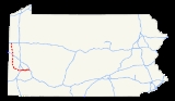
Interstate 376 is a major auxiliary route of the Interstate Highway System
in the U.S. state of Pennsylvania
, located entirely within the Allegheny Plateau
. It runs from I-80
near Sharon
south and east to a junction with the Pennsylvania Turnpike
(I-76
, its parent) in Monroeville
, after having crossed the Turnpike earlier in its route. The route serves Pittsburgh, Pennsylvania
and its surrounding areas, and is the main access road to Pittsburgh International Airport
(PIT). Within Allegheny County
, the route runs along the majority of the Penn-Lincoln Parkway, known locally as the Parkway West and the Parkway East. The route is also known by several other names in various jurisdictions. It is currently the fifth-longest auxiliary Interstate route in the system, and second only to I-476
within the Commonwealth of Pennsylvania.
I-376 is signed east–west despite running north–south for nearly three-quarters of its length; however, it does run east–west through the majority of Allegheny County. This is due to the fact that when the route was first conceived, it was an east–west highway that only connected I-279 in Downtown Pittsburgh to the Turnpike in Monroeville. Despite the route's direction, it serves as a major artery through Pittsburgh's West End
, with I-79
being the primary route through Pittsburgh's North Hills
. Since its 2009 extension, the route has also served as access to Youngstown, Ohio
(through both I-76 & I-80) and, ultimately, Akron, Ohio
via I-76, Columbus, Ohio
via I-76 & I-71
, and Cleveland
via I-80.
A 16 miles (25.7 km) stretch, from exit 15 where I-376 ends its brief concurrency
with U.S. Route 422
(US 422) to exit 31 where I-376 has its first intersection with Pennsylvania Route 51
(PA 51), is tolled
and is maintained by the Pennsylvania Turnpike Commission
, while the remainder of the highway is maintained by PennDOT
. Near the airport, I-376 also has a business loop route (BL-376).
 Since November 6, 2009, I-376 has had its western terminus at a cloverleaf interchange with I-80
located four miles east of Ohio
within the Glaciated Allegheny Plateau
. From there, it travels in a southern direction, following the former route of PA 60
along the Beaver Valley Expressway. Paralleling Pennsylvania Route 18
, I-376 has its first official interchange with that state highway in West Middlesex
, though as PA 760
it also meets that same route about a mile west-northwest of where the Interstate designation now begins (at I-80).
I-376 soon meets US 422 and forms an overlap with that highway along the west side of New Castle
. After an interchange with US 224
in Union Township
, I-376 eastbound widens to three (and eventually four) lanes in preparation of its split from US 422. Southwest of the city in Taylor Township
, I-376 finally exits the roadway to the south with two lanes, leaving US 422 to circle around the southern edge of the city with the other two lanes. At this point, I-376 becomes a tolled freeway
.
I-376 continues southward, still paralleled by PA 18, with both that road and the Beaver River
to the east. Shortly after entering Beaver County
near Koppel
, the route interchanges with its parent I-76
– the Mainline of the Pennsylvania Turnpike
– for the first time. It also has an indirect connection with Pennsylvania Route 351
at this interchange. Around this area, I-376 crosses into the Unglaciated Allegheny Plateau
, where it remains for the remainder of its length. I-376 then passes to the east of West Mayfield
and becomes a non-tolled highway again at its first interchange with Pennsylvania Route 51
in Chippewa Township, just west of Beaver Falls
. The freeway then weaves through mountainous terrain, interchanging with Pennsylvania Route 68
in Vanport just before crossing the Vanport Bridge
over the Ohio River
. It then has its second interchange with PA 18 near Kobuta
and continues south from there. I-376 passes to the west of Aliquippa
before leaving Beaver County
and entering Allegheny County
.
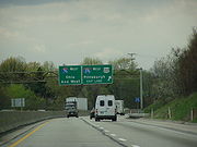
Approaching Pittsburgh International Airport
(PIT), the freeway diverges to the south onto the Southern Expressway, while Business Loop 376 (the former Business Route of PA 60) branches off to the east. I-376 circles around the southern edge of the airport, interchanging with the north edge of the Southern Beltway (Pennsylvania Route 576
) at the main entrance to PIT then recombining with BL-376 shortly thereafter. Now traveling east-southeastward, the route features a recently rebuilt cloverleaf interchange with the Penn-Lincoln Parkway (US 22
and US 30
) and Steubenville Pike (now the northern/western terminus of what remains of Pennsylvania Route 60
) in Robinson Township. The two U.S. Highways join I-376 here, continuing east-southeastward bearing the Penn-Lincoln Parkway name, and soon reach an interchange with I-79
. From that point eastward, along what was known for many years as I-279, the Parkway West freeway (now designated I-376) runs east-southeast through Rosslyn Farms
and Carnegie
before turning northeast and passing through Green Tree
.
Entering the city of Pittsburgh
along the former I-279, the Parkway West winds its way northeast to I-376's second interchange with PA 51 at Saw Mill Run Boulevard, which is also part of a spread-out and somewhat confusing series of ramps linking Banksville Road (US 19
) and US 19 Truck
. This junction, located just before the freeway passes under Mount Washington
in the Fort Pitt Tunnel
, features the infamous wrong-way concurrency of US 19 Truck. In addition to running concurrent with its parent route the wrong way, US 19 Truck is wrong-way concurrent onto itself, with both north and southbound traffic of US 19 Truck briefly running on I-376 eastbound.
At the northeastern portal of the tunnel, I-376 emerges onto the double-deck Fort Pitt Bridge
, crossing over the Monongahela River
. There are single-lane westbound exit and eastbound entrance ramps connecting Carson Street to the freeway between the tunnel's portal and the bridge. Once across the river, the route touches down in Downtown Pittsburgh at the famous Golden Triangle in Point State Park
. Here, the now-truncated I-279 begins, branching off to cross the twin Fort Duquesne Bridge
and heading out through the North Side to eventually meet up with its parent Interstate. From this same complex interchange, which also includes access ramps for Liberty Avenue, the I-376/US 22/US 30 freeway (named the Penn-Lincoln Parkway East from this point on) turns east to follow the left upstream bank of the Monongahela River
through the south side of the downtown area - as well that of as its adjacent neighborhoods, Soho and Oakland. The Parkway East eventually turns away from the river near the southwestern corner of Schenley Park
and runs along that park's southern border before passing through Squirrel Hill Tunnel
under Squirrel Hill
.
Exiting the city of Pittsburgh near the southeastern corner of Frick Park
, US 30 leaves the Parkway East freeway shortly thereafter at Pennsylvania Route 8
in the suburb of Wilkinsburg
. I-376 continues a general easterly stretch through Churchill
, Wilkins Township, Penn Hills, and finally Monroeville
, where it eventually meets the toll plaza of the Pittsburgh Interchange leading back onto the Pennsylvania Turnpike's mainline. Just before that plaza, US 22 exits the freeway as well, joining the William Penn Highway (its original routing prior to the construction of the Penn-Lincoln Parkway). I-376 then finally reaches its eastern terminus, at its parent I-76.
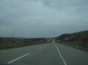
 The northern portion of the Beaver Valley Expressway opened in various stages between 1968 and 1977. The section of I-376 running concurrent with US 422
is officially known as the New Castle Bypass, which also bypasses the southern portion of New Castle after I-376 and US 422 split.
The first section that opened was in 1968 from the present-day exit 2 with PA 18
and where PA 18 intersects with the present-day PA 760
just north of I-80
and the western terminus of I-376. This section would actually receive the PA 18 designation while the former alignment would receive a business route
designation as PA 18 Business, since it served as a bypass of West Middlesex. PA 18 Business was decommissioned
in 1978 when PA 18 returned to the alignment (where it has remained to this day) when PA 60 was extended all the way to Hermitage. PA 60 was eventually extended to Sharon in 1997, ending at US 62 Business.
Until the James E. Ross Highway opened, the present-day exit 12A marked the southern terminus of the northern section of PA 60 as an "END 60" sign was located near the exit. The sign was removed when the first leg of the James E. Ross highway opened in 1991, and a "No re-entry this exit" sign has sat on the site since, due to exit 12A being an indirect connection to US 422 westbound without a direct re-entry ramp.
 One of the newest sections of I-376, it opened to PA 108
in 1991 and the remaining route in 1992 as the "missing link" between two sections of PA 60
, when that route's designation was on the highway. Previously, in order to continue on the highway, travelers had to use US 422
, PA 168
, PA 18
, PA 251
, and PA 51
before returning to the highway. Except for PA 251 (which passes over I-376 near the eastern toll plaza), I-376 has interchanges with all of the aforementioned routes.
This section of I-376 is signed as "Toll I-376", with a black-on-yellow "Toll" sign above the I-376 trailblazer. This makes I-376 one of the first tolled Interstates with such a marker, which was a new addition to the 2009 edition of the Manual on Uniform Traffic Control Devices
.
The Southern Expressway, which opened in 1992, is the newest portion of I-376, and also has the distinction of being the last freeway to open in the Pittsburgh area that was not a toll road. I-376 then merges with US 22
and US 30
at exit 60 south of Pittsburgh International Airport
, which also marks the northern terminus of PA 60
.
(Steubenville Pike, then US 22/US 30) near Pittsburgh International Airport
east to Saw Mill Run Boulevard (PA 51
and US 19). At Steubenville Pike, it connected to PA 60
—the Airport Parkway—which had been built ca. 1950 as a high-speed surface road to provide access to the airport. The Fort Pitt Bridge
opened June 19, 1959, and the Fort Pitt Tunnels completed the route on September 1, 1960. The final piece, from PA 60 west to the US 22/US 30 split at Imperial, opened in 1964. Early plans for that section would have instead taken it from PA 60 where it splits with PA Route 60 Business northwest to US 30 near Campmeeting Road at Clinton. The best-known landmark on I-376 is the Fort Pitt Tunnel
and Bridge
due to its "surprising" view of the Pittsburgh skyline.
The Parkway West has had the US 22 and US 30 designations for its entire history, using the West End Bypass (Pennsylvania Route 51
) and Carson Street (Pennsylvania Route 837
) as detours until the Fort Pitt Tunnel opened. From 1959 to 1964, I-70 also occupied this section east of PA 50
in Carnegie
. From 1963 to 1970, I-79
occupied the Parkway West, until it swapped positions with I-279
. I-76 replaced I-79 afterwards until 1972, when its move to the Turnpike prompted I-279 to take its place. When I-376 was extended onto the Parkway West in 2009, I-279 was truncated to its current southern terminus at the former western terminus of I-376.
 The Parkway East opened June 5, 1953, from PA 885
(Bates Street) near the Hot Metal Bridge east through the Squirrel Hill Tunnel
to US 22 Business (then US 22) at Churchill. In late 1956, it opened from the Boulevard of the Allies
(then US 22/US 30) near the Birmingham Bridge
east to Bates Street, with the eastbound lanes opening September 10 and westbound opening September 29. The other downtown sections opened in 1958 and 1959, and the extension east to the Pennsylvania Turnpike
in Monroeville opened October 27, 1962.
Like its western sister, the Parkway East has always had the US 22 and US 30 designations. Until 1961, it also carried the PA 80
designation until that route was decommissioned
due to Pennsylvania needing the designation for I-80
to the north. From 1959 to 1964, the route carried the I-70
designation. When I-70 moved to its current alignment (replacing I-70S) in 1964, the route received the Interstate 76
designation. Finally, in 1972, after I-76 west of Monroeville moved to the Pennsylvania Turnpike
and replaced I-80S, the highway received the I-376 designation.
in 2005, the U.S. Congress had designated an expansion of I-376 past I-79 and along present day US 22/US 30 and PA 60
through the Pittsburgh International Airport
and north to I-80
near Sharon, Pennsylvania
. This was done because the Airport held the dubious distinction of being the only major airport in the United States
without direct access to an Interstate highway.
This routing required some major infrastructure work on US 22
west of Downtown Pittsburgh (particularly at the US 22/US 30 cloverleaf
in Robinson Township) and safety improvements to PA 60; though both were limited access freeways before the extension, they were not up to Interstate Highway standards
in all areas. The improvements to both the US 22/US 30 cloverleaf in Robinson Township and the Lawrence County
leg of the route, as well as replacing all of the signs with the I-376 shield, were funded by the American Recovery and Reinvestment Act of 2009
.
The designation of I-279 from Downtown west through the Fort Pitt Tunnel to I-79 was officially dropped and replaced by that of I-376 on June 10, 2009. I-279 still exists between I-376 in the Golden Triangle and I-79 in Franklin Park. On November 6, 2009, officials announced the initial transition was complete.
On January 21, 2010, the remainder of the route except for the James E. Ross highway started receiving the I-376 signs. The stretch of PA 60 from I-80 in Shenango Township of Mercer County north past PA 18 (where the freeway terminates and the highway reverts to being a two lane arterial) to the former northern terminus of PA 60 in Sharon became PA 760
. On August 1, 2010, signage along Turnpike 60 was officially changed to Toll I-376, and unlike other tolled highways with Interstate designation it is not grandfathered
from Interstate standards
. Having been built in the early 1990s, this section was already up to Interstate standards.
Despite PennDOT giving motorists over four years of advance notice on the I-376 extension, some local drivers were confused after the transition was complete, thinking that the I-376 extension was going to be an all-new highway instead of a renaming of PA 60.
Business Loop in Moon Township
and Findlay Township
, Pennsylvania. Its western terminus is at I-376 and Flaugherty Run Road (Exits 50 and 51) north of Pittsburgh International Airport
(PIT). Its eastern terminus is at I-376's Exit 57, southeast of the PIT airport
.
Before November 6, 2009, and after the Southern Expressway was completed in 1992, this road was known as Pennsylvania Route 60
Business. Prior to that, this route had the regular PA 60 designation. Much of the road is up to freeway standards, but several signaled at-grade intersections remain, making this multi-lane divided road a true expressway
(unlike many of Pennsylvania's freeways, which are often misleadingly named using the suffix Expressway). Along with the business loop of Interstate 83
in York, Pennsylvania
, BL-376 is one of only two business Interstate routes found in the Commonwealth of Pennsylvania
.
Interstate Highway System
The Dwight D. Eisenhower National System of Interstate and Defense Highways, , is a network of limited-access roads including freeways, highways, and expressways forming part of the National Highway System of the United States of America...
in the U.S. state of Pennsylvania
Pennsylvania
The Commonwealth of Pennsylvania is a U.S. state that is located in the Northeastern and Mid-Atlantic regions of the United States. The state borders Delaware and Maryland to the south, West Virginia to the southwest, Ohio to the west, New York and Ontario, Canada, to the north, and New Jersey to...
, located entirely within the Allegheny Plateau
Allegheny Plateau
The Allegheny Plateau is a large dissected plateau area in western and central New York, northern and western Pennsylvania, northern and western West Virginia, and eastern Ohio...
. It runs from I-80
Interstate 80 in Pennsylvania
The transcontinental Interstate 80 is designated across northern Pennsylvania as the Keystone Shortway, officially the Z.H. Confair Memorial Highway. This route was built mainly along a completely new alignment, not paralleling any earlier U.S. Routes, as a shortcut to the tolled Pennsylvania...
near Sharon
Sharon, Pennsylvania
Sharon is a city in Mercer County, Pennsylvania, in the United States, northwest of Pittsburgh. It is part of the Youngstown–Warren–Boardman, OH-PA Metropolitan Statistical Area.- History :...
south and east to a junction with the Pennsylvania Turnpike
Pennsylvania Turnpike
The Pennsylvania Turnpike is a toll highway system operated by the Pennsylvania Turnpike Commission in the Commonwealth of Pennsylvania, United States. The three sections of the turnpike system total . The main section extends from Ohio to New Jersey and is long...
(I-76
Interstate 76 (east)
Interstate 76 is an Interstate Highway in the United States, running 435 miles from an interchange with Interstate 71 west of Akron, Ohio, east to Interstate 295 near Camden, New Jersey....
, its parent) in Monroeville
Monroeville, Pennsylvania
Monroeville is a home rule municipality in Allegheny County, Pennsylvania, United States. Located about east of the city of Pittsburgh, Monroeville is a bustling suburb with mixed residential and commercial developments...
, after having crossed the Turnpike earlier in its route. The route serves Pittsburgh, Pennsylvania
Pittsburgh, Pennsylvania
Pittsburgh is the second-largest city in the US Commonwealth of Pennsylvania and the county seat of Allegheny County. Regionally, it anchors the largest urban area of Appalachia and the Ohio River Valley, and nationally, it is the 22nd-largest urban area in the United States...
and its surrounding areas, and is the main access road to Pittsburgh International Airport
Pittsburgh International Airport
Pittsburgh International Airport , formerly Greater Pittsburgh Airport, Greater Pittsburgh International Airport and commonly referred to as Pittsburgh International, is a joint civil–military international airport located in the Pittsburgh suburb of Findlay Township, approximately west of...
(PIT). Within Allegheny County
Allegheny County, Pennsylvania
Allegheny County is a county in the southwestern part of the U.S. state of Pennsylvania. As of the 2010 census, the population was 1,223,348; making it the second most populous county in Pennsylvania, following Philadelphia County. The county seat is Pittsburgh...
, the route runs along the majority of the Penn-Lincoln Parkway, known locally as the Parkway West and the Parkway East. The route is also known by several other names in various jurisdictions. It is currently the fifth-longest auxiliary Interstate route in the system, and second only to I-476
Interstate 476
Interstate 476 is a auxiliary Interstate Highway in the U.S. state of Pennsylvania designated between Interstate 95 near Chester and Interstate 81 near Scranton, serving as the primary north–south Interstate corridor through eastern Pennsylvania....
within the Commonwealth of Pennsylvania.
I-376 is signed east–west despite running north–south for nearly three-quarters of its length; however, it does run east–west through the majority of Allegheny County. This is due to the fact that when the route was first conceived, it was an east–west highway that only connected I-279 in Downtown Pittsburgh to the Turnpike in Monroeville. Despite the route's direction, it serves as a major artery through Pittsburgh's West End
West End (Pittsburgh)
West End Village is a neighborhood in Pittsburgh, Pennsylvania's west city area. It has a zip code of 15220, and has representation on Pittsburgh City Council by the council member for District 2 ....
, with I-79
Interstate 79
Interstate 79 is an Interstate Highway in the eastern United States, designated from Interstate 77 in Charleston, West Virginia to Pennsylvania Route 5 and Pennsylvania Route 290 in Erie, Pennsylvania...
being the primary route through Pittsburgh's North Hills
North Hills (Pennsylvania)
The North Hills is a term generally used to collectively describe the northern suburbs of Pittsburgh, Pennsylvania. The independent suburban municipalities that are always included in the North Hills are Ross Township, Borough of West View, Shaler Township, West Deer Township, Frazer Township,...
. Since its 2009 extension, the route has also served as access to Youngstown, Ohio
Youngstown, Ohio
Youngstown is a city in the U.S. state of Ohio and the county seat of Mahoning County; it also extends into Trumbull County. The municipality is situated on the Mahoning River, approximately southeast of Cleveland and northwest of Pittsburgh, Pennsylvania...
(through both I-76 & I-80) and, ultimately, Akron, Ohio
Akron, Ohio
Akron , is the fifth largest city in the U.S. state of Ohio and the county seat of Summit County. It is located in the Great Lakes region approximately south of Lake Erie along the Little Cuyahoga River. As of the 2010 census, the city had a population of 199,110. The Akron Metropolitan...
via I-76, Columbus, Ohio
Columbus, Ohio
Columbus is the capital of and the largest city in the U.S. state of Ohio. The broader metropolitan area encompasses several counties and is the third largest in Ohio behind those of Cleveland and Cincinnati. Columbus is the third largest city in the American Midwest, and the fifteenth largest city...
via I-76 & I-71
Interstate 71
Interstate 71 is an Interstate Highway in the Great Lakes/Midwestern and Southeastern region of the United States. Its southern terminus is at an interchange with Interstate 64 and Interstate 65 in Louisville, Kentucky. Its northern terminus is at an interchange with Interstate 90 in Cleveland,...
, and Cleveland
Cleveland, Ohio
Cleveland is a city in the U.S. state of Ohio and is the county seat of Cuyahoga County, the most populous county in the state. The city is located in northeastern Ohio on the southern shore of Lake Erie, approximately west of the Pennsylvania border...
via I-80.
A 16 miles (25.7 km) stretch, from exit 15 where I-376 ends its brief concurrency
Concurrency (road)
A concurrency, overlap, or coincidence in a road network is an instance of one physical road bearing two or more different highway, motorway, or other route numbers...
with U.S. Route 422
U.S. Route 422
U.S. Route 422 is a long spur route of US 22 split into two segments in the U.S. states of Ohio and Pennsylvania. The western spur begins in downtown Cleveland, Ohio, and ends at Ebensburg, Pennsylvania...
(US 422) to exit 31 where I-376 has its first intersection with Pennsylvania Route 51
Pennsylvania Route 51
Pennsylvania Route 51 is a major state highway in Western Pennsylvania. It runs for from Uniontown to the Ohio state line near Darlington, where it connects with Ohio State Route 14. Route 51 is the termination point for Pennsylvania Route 43, Pennsylvania Route 48 and Pennsylvania Route 88. ...
(PA 51), is tolled
Toll road
A toll road is a privately or publicly built road for which a driver pays a toll for use. Structures for which tolls are charged include toll bridges and toll tunnels. Non-toll roads are financed using other sources of revenue, most typically fuel tax or general tax funds...
and is maintained by the Pennsylvania Turnpike Commission
Pennsylvania Turnpike Commission
The Pennsylvania Turnpike Commission was created in 1937 to construct, finance, operate and maintain the Pennsylvania Turnpike. The commission consists of five members. Four members are appointed by the Governor of Pennsylvania. The fifth member is the Pennsylvania Secretary of Transportation.In...
, while the remainder of the highway is maintained by PennDOT
Pennsylvania Department of Transportation
The Pennsylvania Department of Transportation oversees transportation issues in the Commonwealth of Pennsylvania. The administrator of PennDOT is the Pennsylvania Secretary of Transportation, currently Barry Schoch Presently, PennDOT supports over of state roads and highways, about 25,000...
. Near the airport, I-376 also has a business loop route (BL-376).
Route description
Interstate 80 in Pennsylvania
The transcontinental Interstate 80 is designated across northern Pennsylvania as the Keystone Shortway, officially the Z.H. Confair Memorial Highway. This route was built mainly along a completely new alignment, not paralleling any earlier U.S. Routes, as a shortcut to the tolled Pennsylvania...
located four miles east of Ohio
Ohio
Ohio is a Midwestern state in the United States. The 34th largest state by area in the U.S.,it is the 7th‑most populous with over 11.5 million residents, containing several major American cities and seven metropolitan areas with populations of 500,000 or more.The state's capital is Columbus...
within the Glaciated Allegheny Plateau
Glaciated Allegheny Plateau
The Glaciated Allegheny Plateau is that portion of the Allegheny Plateau that lies within the area covered by the last glaciation. As a result, this area of the Allegheny Plateau has lower relief and more gentle slopes than the relatively rugged Unglaciated Allegheny Plateau...
. From there, it travels in a southern direction, following the former route of PA 60
Pennsylvania Route 60
Pennsylvania Route 60 is a state highway located in the western suburbs of Pittsburgh, Pennsylvania, in the United States. Although the route follows a mostly east–west alignment, it is signed as a north–south highway. The southern terminus of the route is at a pseudo-interchange with U.S...
along the Beaver Valley Expressway. Paralleling Pennsylvania Route 18
Pennsylvania Route 18
Pennsylvania Route 18 is a major north–south highway in Western Pennsylvania whose southern terminus is at the West Virginia state line in Greene County, Pennsylvania near the village of Garrison, while the northern terminus is at PA Route 5 in Lake City, Pennsylvania...
, I-376 has its first official interchange with that state highway in West Middlesex
West Middlesex, Pennsylvania
West Middlesex is a borough in Mercer County, Pennsylvania, along the Shenango River. The population was 929 at the 2000 census. It is part of the Youngstown–Warren–Boardman, OH-PA Metropolitan Statistical Area.-Geography:...
, though as PA 760
Pennsylvania Route 760
Pennsylvania Route 760 is a state highway located in Mercer County, Pennsylvania. The route runs from an interchange with Interstate 80 and I-376 in Shenango Township to an intersection with U.S. Route 62 Business and PA 718 in Sharon...
it also meets that same route about a mile west-northwest of where the Interstate designation now begins (at I-80).
I-376 soon meets US 422 and forms an overlap with that highway along the west side of New Castle
New Castle, Pennsylvania
New Castle is a city in Lawrence County, Pennsylvania, United States, northwest of Pittsburgh and near the Pennsylvania-Ohio border just east of Youngstown, Ohio; in 1910, the total population was 36,280; in 1920, 44,938; and in 1940, 47,638. The population has fallen to 26,309 according to the...
. After an interchange with US 224
U.S. Route 224
U.S. Route 224 is a spur of U.S. Route 24. It currently runs for 289 miles from New Castle, Pennsylvania at Pennsylvania Route 18 to Huntington, Indiana at U.S. Route 24. It passes through the states of Pennsylvania, Ohio and Indiana...
in Union Township
Union Township, Lawrence County, Pennsylvania
Union Township is a township in Lawrence County, Pennsylvania, United States. The population was 5,103 at the 2000 census.-Geography:According to the United States Census Bureau, the township has a total area of 9.7 square miles , of which, 9.6 square miles of it is land and...
, I-376 eastbound widens to three (and eventually four) lanes in preparation of its split from US 422. Southwest of the city in Taylor Township
Taylor Township, Lawrence County, Pennsylvania
Taylor Township is a township in Lawrence County, Pennsylvania, United States. The population was 1,198 at the 2000 census.-Geography:According to the United States Census Bureau, the township has a total area of 5.3 square miles , of which, 5.1 square miles of it is land and...
, I-376 finally exits the roadway to the south with two lanes, leaving US 422 to circle around the southern edge of the city with the other two lanes. At this point, I-376 becomes a tolled freeway
Toll road
A toll road is a privately or publicly built road for which a driver pays a toll for use. Structures for which tolls are charged include toll bridges and toll tunnels. Non-toll roads are financed using other sources of revenue, most typically fuel tax or general tax funds...
.
I-376 continues southward, still paralleled by PA 18, with both that road and the Beaver River
Beaver River (Pennsylvania)
The Beaver River is a tributary of the Ohio River in Western Pennsylvania in the United States with a length of approximately 21 mi . It flows through a historically important coal-producing region north of Pittsburgh...
to the east. Shortly after entering Beaver County
Beaver County, Pennsylvania
-Demographics:As of the census of 2000, there were 181,412 people, 72,576 households, and 50,512 families residing in the county. The population density was 418 people per square mile . There were 77,765 housing units at an average density of 179 per square mile...
near Koppel
Koppel, Pennsylvania
Koppel is a borough in Beaver County, Pennsylvania, United States. The population was 856 at the 2000 census.-Geography:Koppel is located at ....
, the route interchanges with its parent I-76
Interstate 76 (east)
Interstate 76 is an Interstate Highway in the United States, running 435 miles from an interchange with Interstate 71 west of Akron, Ohio, east to Interstate 295 near Camden, New Jersey....
– the Mainline of the Pennsylvania Turnpike
Pennsylvania Turnpike
The Pennsylvania Turnpike is a toll highway system operated by the Pennsylvania Turnpike Commission in the Commonwealth of Pennsylvania, United States. The three sections of the turnpike system total . The main section extends from Ohio to New Jersey and is long...
– for the first time. It also has an indirect connection with Pennsylvania Route 351
Pennsylvania Route 351
Pennsylvania Route 351 is an long state highway located in Lawrence and Beaver counties in Pennsylvania. The western terminus is at the Ohio border near S.N.P.J. The eastern terminus is at PA 65/PA 288 in Ellwood City.-Route description:...
at this interchange. Around this area, I-376 crosses into the Unglaciated Allegheny Plateau
Unglaciated Allegheny Plateau
The Unglaciated Allegheny Plateau is located in an arc around southeastern Ohio into western Pennsylvania and West Virginia. This area is a dissected plateau, characterized by sandstone, shale, and many coal seams...
, where it remains for the remainder of its length. I-376 then passes to the east of West Mayfield
West Mayfield, Pennsylvania
West Mayfield is a borough in Beaver County, Pennsylvania, United States. The population was 1,187 at the 2000 census.-Geography:West Mayfield is located at ....
and becomes a non-tolled highway again at its first interchange with Pennsylvania Route 51
Pennsylvania Route 51
Pennsylvania Route 51 is a major state highway in Western Pennsylvania. It runs for from Uniontown to the Ohio state line near Darlington, where it connects with Ohio State Route 14. Route 51 is the termination point for Pennsylvania Route 43, Pennsylvania Route 48 and Pennsylvania Route 88. ...
in Chippewa Township, just west of Beaver Falls
Beaver Falls, Pennsylvania
Beaver Falls is a city in Beaver County, Pennsylvania, United States. The population was 8,987 at the 2010 census. It is located 31 miles northwest of Pittsburgh, and on the Beaver River, six miles from its confluence with the Ohio River...
. The freeway then weaves through mountainous terrain, interchanging with Pennsylvania Route 68
Pennsylvania Route 68
Pennsylvania Route 68 is a long east–west state highway located in western Pennsylvania in the United States. The western terminus of the route is at the Ohio state line west of Glasgow, where PA 68 continues into Ohio as State Route 39. The eastern terminus is at U.S...
in Vanport just before crossing the Vanport Bridge
Vanport Bridge
=The Vanport Bridge is a truss bridge that carries Interstate 376 across the Ohio River in Vanport Township, Pennsylvania.-See also:* List of crossings of the Ohio River...
over the Ohio River
Ohio River
The Ohio River is the largest tributary, by volume, of the Mississippi River. At the confluence, the Ohio is even bigger than the Mississippi and, thus, is hydrologically the main stream of the whole river system, including the Allegheny River further upstream...
. It then has its second interchange with PA 18 near Kobuta
Kobuta, Pennsylvania
Kobuta is an unincorporated community in Potter Township, Beaver County, Pennsylvania, United States. It is located along the Ohio River, due west of Monaca, southwest of Industry, and southeast of Beaver. The area was the site of a chemical plant during World War II, owned by the Koppers United...
and continues south from there. I-376 passes to the west of Aliquippa
Aliquippa, Pennsylvania
Aliquippa is a city in Beaver County, Pennsylvania, United States, within the Pittsburgh metropolitan area. The population was 9,438 at the 2010 census. Formerly a borough, it was formally named a city in 1987 by the Aliquippa Council.-History:...
before leaving Beaver County
Beaver County, Pennsylvania
-Demographics:As of the census of 2000, there were 181,412 people, 72,576 households, and 50,512 families residing in the county. The population density was 418 people per square mile . There were 77,765 housing units at an average density of 179 per square mile...
and entering Allegheny County
Allegheny County, Pennsylvania
Allegheny County is a county in the southwestern part of the U.S. state of Pennsylvania. As of the 2010 census, the population was 1,223,348; making it the second most populous county in Pennsylvania, following Philadelphia County. The county seat is Pittsburgh...
.
Approaching Pittsburgh International Airport
Pittsburgh International Airport
Pittsburgh International Airport , formerly Greater Pittsburgh Airport, Greater Pittsburgh International Airport and commonly referred to as Pittsburgh International, is a joint civil–military international airport located in the Pittsburgh suburb of Findlay Township, approximately west of...
(PIT), the freeway diverges to the south onto the Southern Expressway, while Business Loop 376 (the former Business Route of PA 60) branches off to the east. I-376 circles around the southern edge of the airport, interchanging with the north edge of the Southern Beltway (Pennsylvania Route 576
Pennsylvania Route 576
Pennsylvania Route 576, the Southern Beltway, is a partially completed highway in the southern suburbs of Pittsburgh, Pennsylvania, United States...
) at the main entrance to PIT then recombining with BL-376 shortly thereafter. Now traveling east-southeastward, the route features a recently rebuilt cloverleaf interchange with the Penn-Lincoln Parkway (US 22
U.S. Route 22 in Pennsylvania
U.S. Route 22 is an east–west route stretching from Cincinnati, Ohio in the west to Newark, New Jersey in the east. In Pennsylvania, the route runs for between the West Virginia state line at Washington County, where it is a limited-access expressway-grade route through the western suburbs...
and US 30
U.S. Route 30 in Pennsylvania
In the U.S. state of Pennsylvania, U.S. Route 30 runs east–west across the southern part of the state, passing through Pittsburgh and Philadelphia on its way from the West Virginia state line east to the Benjamin Franklin Bridge over the Delaware River into New Jersey...
) and Steubenville Pike (now the northern/western terminus of what remains of Pennsylvania Route 60
Pennsylvania Route 60
Pennsylvania Route 60 is a state highway located in the western suburbs of Pittsburgh, Pennsylvania, in the United States. Although the route follows a mostly east–west alignment, it is signed as a north–south highway. The southern terminus of the route is at a pseudo-interchange with U.S...
) in Robinson Township. The two U.S. Highways join I-376 here, continuing east-southeastward bearing the Penn-Lincoln Parkway name, and soon reach an interchange with I-79
Interstate 79
Interstate 79 is an Interstate Highway in the eastern United States, designated from Interstate 77 in Charleston, West Virginia to Pennsylvania Route 5 and Pennsylvania Route 290 in Erie, Pennsylvania...
. From that point eastward, along what was known for many years as I-279, the Parkway West freeway (now designated I-376) runs east-southeast through Rosslyn Farms
Rosslyn Farms, Pennsylvania
Rosslyn Farms is a suburban borough located west of Pittsburgh in Allegheny County, Pennsylvania in the United States. It is a small community, with an area of only...
and Carnegie
Carnegie, Pennsylvania
Carnegie is a borough in Allegheny County, Pennsylvania, United States and is part of the Pittsburgh Metro Area. The population was 7,972 at the 2010 census.-Geography:Carnegie is located at . It is approximately southwest of Pittsburgh...
before turning northeast and passing through Green Tree
Green Tree, Pennsylvania
Green Tree is a borough in Allegheny County, Pennsylvania, United States, and a suburb of Pittsburgh. The population was 4,432 at the 2010 census.The town is the birthplace of U.S...
.
Entering the city of Pittsburgh
Pittsburgh, Pennsylvania
Pittsburgh is the second-largest city in the US Commonwealth of Pennsylvania and the county seat of Allegheny County. Regionally, it anchors the largest urban area of Appalachia and the Ohio River Valley, and nationally, it is the 22nd-largest urban area in the United States...
along the former I-279, the Parkway West winds its way northeast to I-376's second interchange with PA 51 at Saw Mill Run Boulevard, which is also part of a spread-out and somewhat confusing series of ramps linking Banksville Road (US 19
U.S. Route 19
U.S. Route 19 is a north–south U.S. Highway. Despite encroaching Interstate Highways, the route has remained a long-haul route, connecting the Gulf of Mexico with Lake Erie....
) and US 19 Truck
U.S. Route 19 Truck (Pittsburgh, Pennsylvania)
U.S. Route 19 Truck is a truck route route of U.S. Route 19 located in Western Pennsylvania in the Pittsburgh Metro Area that has a length of . It is a loop off US 19; the southern terminus located in Mt. Lebanon and the northern terminus in McCandless Township, connecting to US 19 at both ends...
. This junction, located just before the freeway passes under Mount Washington
Mount Washington (Pittsburgh)
Mount Washington is a neighborhood in Pittsburgh, Pennsylvania's south city area. It has a zip code of 15211 and has representation on Pittsburgh City Council by both the council members for District 3 and District 2 .It is known for its steep hill overlooking the Pittsburgh skyline, which was...
in the Fort Pitt Tunnel
Fort Pitt Tunnel
The Fort Pitt Tunnel carries Interstate 376 , US 22, US 30, and US 19 Truck between Downtown Pittsburgh and its West End neighborhood in the U.S. state of Pennsylvania. It has two lanes both inbound and outbound. The tunnel travels beneath Mount Washington. Its northern ramps lead directly to...
, features the infamous wrong-way concurrency of US 19 Truck. In addition to running concurrent with its parent route the wrong way, US 19 Truck is wrong-way concurrent onto itself, with both north and southbound traffic of US 19 Truck briefly running on I-376 eastbound.
At the northeastern portal of the tunnel, I-376 emerges onto the double-deck Fort Pitt Bridge
Fort Pitt Bridge
The Fort Pitt Bridge is a steel, double decker bowstring arch bridge that spans the Monongahela River near its confluence with the Allegheny River in Pittsburgh, Pennsylvania. It carries Interstate 376 between the Fort Pitt Tunnel and Downtown Pittsburgh.-History:The Fort Pitt Bridge opened on...
, crossing over the Monongahela River
Monongahela River
The Monongahela River is a river on the Allegheny Plateau in north-central West Virginia and southwestern Pennsylvania in the United States...
. There are single-lane westbound exit and eastbound entrance ramps connecting Carson Street to the freeway between the tunnel's portal and the bridge. Once across the river, the route touches down in Downtown Pittsburgh at the famous Golden Triangle in Point State Park
Point State Park
Point State Park is a Pennsylvania state park on in Downtown Pittsburgh, Allegheny County, Pennsylvania, USA, at the confluence of the Allegheny and Monongahela rivers, forming the Ohio River....
. Here, the now-truncated I-279 begins, branching off to cross the twin Fort Duquesne Bridge
Fort Duquesne Bridge
The Fort Duquesne Bridge is a steel tied arch bridge that spans the Allegheny River in Pittsburgh, Pennsylvania. It was colloquially referred to as "The Bridge to Nowhere"...
and heading out through the North Side to eventually meet up with its parent Interstate. From this same complex interchange, which also includes access ramps for Liberty Avenue, the I-376/US 22/US 30 freeway (named the Penn-Lincoln Parkway East from this point on) turns east to follow the left upstream bank of the Monongahela River
Monongahela River
The Monongahela River is a river on the Allegheny Plateau in north-central West Virginia and southwestern Pennsylvania in the United States...
through the south side of the downtown area - as well that of as its adjacent neighborhoods, Soho and Oakland. The Parkway East eventually turns away from the river near the southwestern corner of Schenley Park
Schenley Park
Schenley Park is a large municipal park located in Pittsburgh, Pennsylvania, between the neighborhoods of Oakland, Greenfield, and Squirrel Hill. It is also listed on the National Register of Historic Places as a historic district...
and runs along that park's southern border before passing through Squirrel Hill Tunnel
Squirrel Hill Tunnel
The Squirrel Hill Tunnel is a tunnel in Pittsburgh, Pennsylvania, United States. It serves as an eastern gateway to the city for I-376 and was completed in 1953 after 8 years of construction and at a cost of US$18 million 1953 dollars. At the time of opening it was the single largest investment...
under Squirrel Hill
Squirrel Hill
Squirrel Hill is a residential neighborhood in the east end of Pittsburgh, Pennsylvania, United States. The city officially divides it into two neighborhoods, Squirrel Hill North and Squirrel Hill South, but it is almost universally treated as a single neighborhood...
.
Exiting the city of Pittsburgh near the southeastern corner of Frick Park
Frick Park
Frick Park is the largest municipal park in Pittsburgh, Pennsylvania, covering .The park began when Henry Clay Frick, upon his death in 1919, bequeathed south of Clayton, his Point Breeze mansion . He also arranged for a $2 million trust fund for long-term maintenance for the park, which opened on...
, US 30 leaves the Parkway East freeway shortly thereafter at Pennsylvania Route 8
Pennsylvania Route 8
Pennsylvania Route 8 is a major long route in western Pennsylvania. Officially, PA 8 is named the William Flinn Highway. Its southern terminus is at Interstate 376, U.S. Route 22, and U.S. Route 30 in Pittsburgh...
in the suburb of Wilkinsburg
Wilkinsburg, Pennsylvania
Wilkinsburg is a borough in Allegheny County, Pennsylvania, United States adjacent to the city of Pittsburgh. The population was 15,930 at the 2010 census, having lost more than 13,000 in the 70 years since 1940, when 29,853 people were enumerated...
. I-376 continues a general easterly stretch through Churchill
Churchill, Pennsylvania
Churchill is a borough in Allegheny County, Pennsylvania, United States. The population was 3,011 at the 2010 census.-Geography:Churchill is located at ....
, Wilkins Township, Penn Hills, and finally Monroeville
Monroeville, Pennsylvania
Monroeville is a home rule municipality in Allegheny County, Pennsylvania, United States. Located about east of the city of Pittsburgh, Monroeville is a bustling suburb with mixed residential and commercial developments...
, where it eventually meets the toll plaza of the Pittsburgh Interchange leading back onto the Pennsylvania Turnpike's mainline. Just before that plaza, US 22 exits the freeway as well, joining the William Penn Highway (its original routing prior to the construction of the Penn-Lincoln Parkway). I-376 then finally reaches its eastern terminus, at its parent I-76.
Northern portion of the Beaver Valley Expressway and the New Castle Bypass
U.S. Route 422
U.S. Route 422 is a long spur route of US 22 split into two segments in the U.S. states of Ohio and Pennsylvania. The western spur begins in downtown Cleveland, Ohio, and ends at Ebensburg, Pennsylvania...
is officially known as the New Castle Bypass, which also bypasses the southern portion of New Castle after I-376 and US 422 split.
The first section that opened was in 1968 from the present-day exit 2 with PA 18
Pennsylvania Route 18
Pennsylvania Route 18 is a major north–south highway in Western Pennsylvania whose southern terminus is at the West Virginia state line in Greene County, Pennsylvania near the village of Garrison, while the northern terminus is at PA Route 5 in Lake City, Pennsylvania...
and where PA 18 intersects with the present-day PA 760
Pennsylvania Route 760
Pennsylvania Route 760 is a state highway located in Mercer County, Pennsylvania. The route runs from an interchange with Interstate 80 and I-376 in Shenango Township to an intersection with U.S. Route 62 Business and PA 718 in Sharon...
just north of I-80
Interstate 80
Interstate 80 is the second-longest Interstate Highway in the United States, following Interstate 90. It is a transcontinental artery running from downtown San Francisco, California to Teaneck, New Jersey in the New York City Metropolitan Area...
and the western terminus of I-376. This section would actually receive the PA 18 designation while the former alignment would receive a business route
Business route
A business route in the United States and Canada is a short special route connected to a parent numbered highway at its beginning, then routed through the central business district of a nearby city or town, and finally reconnecting with the same parent numbered highway again at its...
designation as PA 18 Business, since it served as a bypass of West Middlesex. PA 18 Business was decommissioned
Decommissioned highway
A decommissioned highway is a highway that has been removed from service, shut down or has had its authorization as a federal or state highway removed. Decommissioning can include the complete or partial demolition or abandonment of an old highway structure because the old roadway has lost its...
in 1978 when PA 18 returned to the alignment (where it has remained to this day) when PA 60 was extended all the way to Hermitage. PA 60 was eventually extended to Sharon in 1997, ending at US 62 Business.
Until the James E. Ross Highway opened, the present-day exit 12A marked the southern terminus of the northern section of PA 60 as an "END 60" sign was located near the exit. The sign was removed when the first leg of the James E. Ross highway opened in 1991, and a "No re-entry this exit" sign has sat on the site since, due to exit 12A being an indirect connection to US 422 westbound without a direct re-entry ramp.
James E. Ross Highway
Pennsylvania Route 108
Pennsylvania Route 108 is a highway in Western Pennsylvania that runs for from the Ohio state line near SNPJ to Pennsylvania Route 8 in Adams Corner. PA 108 intersects US Route 422 in New Castle and US Route 19 near Harlansburg...
in 1991 and the remaining route in 1992 as the "missing link" between two sections of PA 60
Pennsylvania Route 60
Pennsylvania Route 60 is a state highway located in the western suburbs of Pittsburgh, Pennsylvania, in the United States. Although the route follows a mostly east–west alignment, it is signed as a north–south highway. The southern terminus of the route is at a pseudo-interchange with U.S...
, when that route's designation was on the highway. Previously, in order to continue on the highway, travelers had to use US 422
U.S. Route 422
U.S. Route 422 is a long spur route of US 22 split into two segments in the U.S. states of Ohio and Pennsylvania. The western spur begins in downtown Cleveland, Ohio, and ends at Ebensburg, Pennsylvania...
, PA 168
Pennsylvania Route 168
Pennsylvania Route 168 is a highway in Western Pennsylvania that runs for from Pennsylvania Route 18 in Frankfort Springs to Pennsylvania Route 208 in Volant...
, PA 18
Pennsylvania Route 18
Pennsylvania Route 18 is a major north–south highway in Western Pennsylvania whose southern terminus is at the West Virginia state line in Greene County, Pennsylvania near the village of Garrison, while the northern terminus is at PA Route 5 in Lake City, Pennsylvania...
, PA 251
Pennsylvania Route 251
Pennsylvania Route 251 is an long state highway located in Beaver county in Pennsylvania. The western terminus is at the Ohio state line in South Beaver Township. The eastern terminus is at PA 18 in Beaver Falls.-Route description:...
, and PA 51
Pennsylvania Route 51
Pennsylvania Route 51 is a major state highway in Western Pennsylvania. It runs for from Uniontown to the Ohio state line near Darlington, where it connects with Ohio State Route 14. Route 51 is the termination point for Pennsylvania Route 43, Pennsylvania Route 48 and Pennsylvania Route 88. ...
before returning to the highway. Except for PA 251 (which passes over I-376 near the eastern toll plaza), I-376 has interchanges with all of the aforementioned routes.
This section of I-376 is signed as "Toll I-376", with a black-on-yellow "Toll" sign above the I-376 trailblazer. This makes I-376 one of the first tolled Interstates with such a marker, which was a new addition to the 2009 edition of the Manual on Uniform Traffic Control Devices
Manual on Uniform Traffic Control Devices
The Manual on Uniform Traffic Control Devices is a document issued by the Federal Highway Administration of the United States Department of Transportation to specify the standards by which traffic signs, road surface markings, and signals are designed, installed, and used...
.
Southern portion of the Beaver Valley Expressway and the Southern Expressway
Much like the northern section of the Beaver Valley Expressway, the southern portion of the Beaver Valley Expressway opened in various stages between 1971 and 1976. The southern portion of the Beaver Valley Expressway and the Southern Expressway had the PA 60 designation for their entire lengths from their openings until the 2009 rebranding to I-376.The Southern Expressway, which opened in 1992, is the newest portion of I-376, and also has the distinction of being the last freeway to open in the Pittsburgh area that was not a toll road. I-376 then merges with US 22
U.S. Route 22 in Pennsylvania
U.S. Route 22 is an east–west route stretching from Cincinnati, Ohio in the west to Newark, New Jersey in the east. In Pennsylvania, the route runs for between the West Virginia state line at Washington County, where it is a limited-access expressway-grade route through the western suburbs...
and US 30
U.S. Route 30 in Pennsylvania
In the U.S. state of Pennsylvania, U.S. Route 30 runs east–west across the southern part of the state, passing through Pittsburgh and Philadelphia on its way from the West Virginia state line east to the Benjamin Franklin Bridge over the Delaware River into New Jersey...
at exit 60 south of Pittsburgh International Airport
Pittsburgh International Airport
Pittsburgh International Airport , formerly Greater Pittsburgh Airport, Greater Pittsburgh International Airport and commonly referred to as Pittsburgh International, is a joint civil–military international airport located in the Pittsburgh suburb of Findlay Township, approximately west of...
, which also marks the northern terminus of PA 60
Pennsylvania Route 60
Pennsylvania Route 60 is a state highway located in the western suburbs of Pittsburgh, Pennsylvania, in the United States. Although the route follows a mostly east–west alignment, it is signed as a north–south highway. The southern terminus of the route is at a pseudo-interchange with U.S...
.
Parkway West
The first section of the Parkway West opened October 15, 1953, running from PA 60Pennsylvania Route 60
Pennsylvania Route 60 is a state highway located in the western suburbs of Pittsburgh, Pennsylvania, in the United States. Although the route follows a mostly east–west alignment, it is signed as a north–south highway. The southern terminus of the route is at a pseudo-interchange with U.S...
(Steubenville Pike, then US 22/US 30) near Pittsburgh International Airport
Pittsburgh International Airport
Pittsburgh International Airport , formerly Greater Pittsburgh Airport, Greater Pittsburgh International Airport and commonly referred to as Pittsburgh International, is a joint civil–military international airport located in the Pittsburgh suburb of Findlay Township, approximately west of...
east to Saw Mill Run Boulevard (PA 51
Pennsylvania Route 51
Pennsylvania Route 51 is a major state highway in Western Pennsylvania. It runs for from Uniontown to the Ohio state line near Darlington, where it connects with Ohio State Route 14. Route 51 is the termination point for Pennsylvania Route 43, Pennsylvania Route 48 and Pennsylvania Route 88. ...
and US 19). At Steubenville Pike, it connected to PA 60
Pennsylvania Route 60
Pennsylvania Route 60 is a state highway located in the western suburbs of Pittsburgh, Pennsylvania, in the United States. Although the route follows a mostly east–west alignment, it is signed as a north–south highway. The southern terminus of the route is at a pseudo-interchange with U.S...
—the Airport Parkway—which had been built ca. 1950 as a high-speed surface road to provide access to the airport. The Fort Pitt Bridge
Fort Pitt Bridge
The Fort Pitt Bridge is a steel, double decker bowstring arch bridge that spans the Monongahela River near its confluence with the Allegheny River in Pittsburgh, Pennsylvania. It carries Interstate 376 between the Fort Pitt Tunnel and Downtown Pittsburgh.-History:The Fort Pitt Bridge opened on...
opened June 19, 1959, and the Fort Pitt Tunnels completed the route on September 1, 1960. The final piece, from PA 60 west to the US 22/US 30 split at Imperial, opened in 1964. Early plans for that section would have instead taken it from PA 60 where it splits with PA Route 60 Business northwest to US 30 near Campmeeting Road at Clinton. The best-known landmark on I-376 is the Fort Pitt Tunnel
Fort Pitt Tunnel
The Fort Pitt Tunnel carries Interstate 376 , US 22, US 30, and US 19 Truck between Downtown Pittsburgh and its West End neighborhood in the U.S. state of Pennsylvania. It has two lanes both inbound and outbound. The tunnel travels beneath Mount Washington. Its northern ramps lead directly to...
and Bridge
Fort Pitt Bridge
The Fort Pitt Bridge is a steel, double decker bowstring arch bridge that spans the Monongahela River near its confluence with the Allegheny River in Pittsburgh, Pennsylvania. It carries Interstate 376 between the Fort Pitt Tunnel and Downtown Pittsburgh.-History:The Fort Pitt Bridge opened on...
due to its "surprising" view of the Pittsburgh skyline.
The Parkway West has had the US 22 and US 30 designations for its entire history, using the West End Bypass (Pennsylvania Route 51
Pennsylvania Route 51
Pennsylvania Route 51 is a major state highway in Western Pennsylvania. It runs for from Uniontown to the Ohio state line near Darlington, where it connects with Ohio State Route 14. Route 51 is the termination point for Pennsylvania Route 43, Pennsylvania Route 48 and Pennsylvania Route 88. ...
) and Carson Street (Pennsylvania Route 837
Pennsylvania Route 837
Pennsylvania Route 837 is a state route located in western Pennsylvania. The southern terminus of the route is at Pennsylvania Route 88 in the Carroll Township hamlet of Wickerham Manor. The northern terminus is at U.S. Route 19 and Pennsylvania Route 51 in downtown Pittsburgh at the junction of...
) as detours until the Fort Pitt Tunnel opened. From 1959 to 1964, I-70 also occupied this section east of PA 50
Pennsylvania Route 50
Pennsylvania Route 50 is a long state highway located in western Pennsylvania. The western terminus of the route is at Pennsylvania Route 844 in the Independence Township community of Independence less than a mile from the West Virginia state line. The eastern terminus is at Pennsylvania Route 60...
in Carnegie
Carnegie, Pennsylvania
Carnegie is a borough in Allegheny County, Pennsylvania, United States and is part of the Pittsburgh Metro Area. The population was 7,972 at the 2010 census.-Geography:Carnegie is located at . It is approximately southwest of Pittsburgh...
. From 1963 to 1970, I-79
Interstate 79
Interstate 79 is an Interstate Highway in the eastern United States, designated from Interstate 77 in Charleston, West Virginia to Pennsylvania Route 5 and Pennsylvania Route 290 in Erie, Pennsylvania...
occupied the Parkway West, until it swapped positions with I-279
Interstate 279
Interstate 279 is a north–south Interstate Highway spur that lies entirely within Allegheny County, Pennsylvania. Its southern end is at Interstate 376 at the Fort Pitt Bridge in Pittsburgh, and the north end is in Franklin Park at Interstate 79...
. I-76 replaced I-79 afterwards until 1972, when its move to the Turnpike prompted I-279 to take its place. When I-376 was extended onto the Parkway West in 2009, I-279 was truncated to its current southern terminus at the former western terminus of I-376.
Parkway East
Pennsylvania Route 885
Pennsylvania Route 885 is a long north–south state highway in the U.S. State of Pennsylvania. It runs from Pennsylvania Route 837 in Clairton to Interstate 579 in Pittsburgh...
(Bates Street) near the Hot Metal Bridge east through the Squirrel Hill Tunnel
Squirrel Hill Tunnel
The Squirrel Hill Tunnel is a tunnel in Pittsburgh, Pennsylvania, United States. It serves as an eastern gateway to the city for I-376 and was completed in 1953 after 8 years of construction and at a cost of US$18 million 1953 dollars. At the time of opening it was the single largest investment...
to US 22 Business (then US 22) at Churchill. In late 1956, it opened from the Boulevard of the Allies
Boulevard of the Allies
The Boulevard of the Allies is a mostly four-lane road in the U.S. state of Pennsylvania, connecting Downtown Pittsburgh with the Oakland neighborhood of the city. Because of its lengthy name, locals often refer to it as simply "The Boulevard"....
(then US 22/US 30) near the Birmingham Bridge
Birmingham Bridge
The Birmingham Bridge is a tied arch bridge in Pittsburgh, Pennsylvania, which crosses over the Monongahela River. The bridge connects East Carson Street on the South Side with Fifth and Forbes Avenues going to Uptown, Oakland, and the Hill District.-History:The Birmingham Bridge was built in 1976...
east to Bates Street, with the eastbound lanes opening September 10 and westbound opening September 29. The other downtown sections opened in 1958 and 1959, and the extension east to the Pennsylvania Turnpike
Pennsylvania Turnpike
The Pennsylvania Turnpike is a toll highway system operated by the Pennsylvania Turnpike Commission in the Commonwealth of Pennsylvania, United States. The three sections of the turnpike system total . The main section extends from Ohio to New Jersey and is long...
in Monroeville opened October 27, 1962.
Like its western sister, the Parkway East has always had the US 22 and US 30 designations. Until 1961, it also carried the PA 80
Pennsylvania Route 80
Pennsylvania Route 80 was a long east–west state highway in western Pennsylvania. The western terminus of the route was at Interstate 70, U.S. Route 22, and U.S. Route 30 in Pittsburgh. The eastern terminus was at U.S...
designation until that route was decommissioned
Decommissioned highway
A decommissioned highway is a highway that has been removed from service, shut down or has had its authorization as a federal or state highway removed. Decommissioning can include the complete or partial demolition or abandonment of an old highway structure because the old roadway has lost its...
due to Pennsylvania needing the designation for I-80
Interstate 80 in Pennsylvania
The transcontinental Interstate 80 is designated across northern Pennsylvania as the Keystone Shortway, officially the Z.H. Confair Memorial Highway. This route was built mainly along a completely new alignment, not paralleling any earlier U.S. Routes, as a shortcut to the tolled Pennsylvania...
to the north. From 1959 to 1964, the route carried the I-70
Interstate 70 in Pennsylvania
In the U.S. state of Pennsylvania, Interstate 70 runs east–west across the southwest part of the state serving the southern half of the Pittsburgh metropolitan area. About half of the route is concurrent with Interstate 76 along the Pennsylvania Turnpike...
designation. When I-70 moved to its current alignment (replacing I-70S) in 1964, the route received the Interstate 76
Interstate 76 (east)
Interstate 76 is an Interstate Highway in the United States, running 435 miles from an interchange with Interstate 71 west of Akron, Ohio, east to Interstate 295 near Camden, New Jersey....
designation. Finally, in 1972, after I-76 west of Monroeville moved to the Pennsylvania Turnpike
Pennsylvania Turnpike
The Pennsylvania Turnpike is a toll highway system operated by the Pennsylvania Turnpike Commission in the Commonwealth of Pennsylvania, United States. The three sections of the turnpike system total . The main section extends from Ohio to New Jersey and is long...
and replaced I-80S, the highway received the I-376 designation.
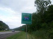
2009 extensions
As part of the Safe, Accountable, Flexible, Efficient Transportation Equity Act: A Legacy for UsersSafe, Accountable, Flexible, Efficient Transportation Equity Act: A Legacy for Users
The Safe, Accountable, Flexible, Efficient Transportation Equity Act: A Legacy for Users is a funding and authorization bill that governs United States federal surface transportation spending. It was signed into law by President George W. Bush on August 10, 2005, and expired as of September 30, 2009...
in 2005, the U.S. Congress had designated an expansion of I-376 past I-79 and along present day US 22/US 30 and PA 60
Pennsylvania Route 60
Pennsylvania Route 60 is a state highway located in the western suburbs of Pittsburgh, Pennsylvania, in the United States. Although the route follows a mostly east–west alignment, it is signed as a north–south highway. The southern terminus of the route is at a pseudo-interchange with U.S...
through the Pittsburgh International Airport
Pittsburgh International Airport
Pittsburgh International Airport , formerly Greater Pittsburgh Airport, Greater Pittsburgh International Airport and commonly referred to as Pittsburgh International, is a joint civil–military international airport located in the Pittsburgh suburb of Findlay Township, approximately west of...
and north to I-80
Interstate 80 in Pennsylvania
The transcontinental Interstate 80 is designated across northern Pennsylvania as the Keystone Shortway, officially the Z.H. Confair Memorial Highway. This route was built mainly along a completely new alignment, not paralleling any earlier U.S. Routes, as a shortcut to the tolled Pennsylvania...
near Sharon, Pennsylvania
Sharon, Pennsylvania
Sharon is a city in Mercer County, Pennsylvania, in the United States, northwest of Pittsburgh. It is part of the Youngstown–Warren–Boardman, OH-PA Metropolitan Statistical Area.- History :...
. This was done because the Airport held the dubious distinction of being the only major airport in the United States
United States
The United States of America is a federal constitutional republic comprising fifty states and a federal district...
without direct access to an Interstate highway.
This routing required some major infrastructure work on US 22
U.S. Route 22 in Pennsylvania
U.S. Route 22 is an east–west route stretching from Cincinnati, Ohio in the west to Newark, New Jersey in the east. In Pennsylvania, the route runs for between the West Virginia state line at Washington County, where it is a limited-access expressway-grade route through the western suburbs...
west of Downtown Pittsburgh (particularly at the US 22/US 30 cloverleaf
Cloverleaf interchange
A cloverleaf interchange is a two-level interchange in which left turns, reverse direction in left-driving regions, are handled by ramp roads...
in Robinson Township) and safety improvements to PA 60; though both were limited access freeways before the extension, they were not up to Interstate Highway standards
Interstate Highway standards
Standards for Interstate Highways in the United States are defined by the American Association of State Highway and Transportation Officials in the publication A Policy on Design Standards - Interstate System...
in all areas. The improvements to both the US 22/US 30 cloverleaf in Robinson Township and the Lawrence County
Lawrence County, Pennsylvania
Lawrence County is a county located in the U.S. state of Pennsylvania. In 2010, its population was 91,108. The county was added to the Pittsburgh Metropolitan Statistical Area in 2003. The county seat is New Castle....
leg of the route, as well as replacing all of the signs with the I-376 shield, were funded by the American Recovery and Reinvestment Act of 2009
American Recovery and Reinvestment Act of 2009
The American Recovery and Reinvestment Act of 2009, abbreviated ARRA and commonly referred to as the Stimulus or The Recovery Act, is an economic stimulus package enacted by the 111th United States Congress in February 2009 and signed into law on February 17, 2009, by President Barack Obama.To...
.
The designation of I-279 from Downtown west through the Fort Pitt Tunnel to I-79 was officially dropped and replaced by that of I-376 on June 10, 2009. I-279 still exists between I-376 in the Golden Triangle and I-79 in Franklin Park. On November 6, 2009, officials announced the initial transition was complete.
On January 21, 2010, the remainder of the route except for the James E. Ross highway started receiving the I-376 signs. The stretch of PA 60 from I-80 in Shenango Township of Mercer County north past PA 18 (where the freeway terminates and the highway reverts to being a two lane arterial) to the former northern terminus of PA 60 in Sharon became PA 760
Pennsylvania Route 760
Pennsylvania Route 760 is a state highway located in Mercer County, Pennsylvania. The route runs from an interchange with Interstate 80 and I-376 in Shenango Township to an intersection with U.S. Route 62 Business and PA 718 in Sharon...
. On August 1, 2010, signage along Turnpike 60 was officially changed to Toll I-376, and unlike other tolled highways with Interstate designation it is not grandfathered
Grandfather clause
Grandfather clause is a legal term used to describe a situation in which an old rule continues to apply to some existing situations, while a new rule will apply to all future situations. It is often used as a verb: to grandfather means to grant such an exemption...
from Interstate standards
Interstate Highway standards
Standards for Interstate Highways in the United States are defined by the American Association of State Highway and Transportation Officials in the publication A Policy on Design Standards - Interstate System...
. Having been built in the early 1990s, this section was already up to Interstate standards.
Despite PennDOT giving motorists over four years of advance notice on the I-376 extension, some local drivers were confused after the transition was complete, thinking that the I-376 extension was going to be an all-new highway instead of a renaming of PA 60.
Exit list
Business Loop 376
Business Loop 376 (BL-376), known locally as the Airport Parkway, is a 6-mile InterstateInterstate Highway System
The Dwight D. Eisenhower National System of Interstate and Defense Highways, , is a network of limited-access roads including freeways, highways, and expressways forming part of the National Highway System of the United States of America...
Business Loop in Moon Township
Moon Township, Pennsylvania
Moon Township is a township along the Ohio River in Allegheny County, Pennsylvania, United States. Moon is a part of the Pittsburgh Metro Area and is located northwest of Pittsburgh. The origin of its name is unknown for certain, although it has been suggested that it derives from a...
and Findlay Township
Findlay Township, Pennsylvania
Findlay Township is a township located west of Pittsburgh in Allegheny County, Pennsylvania, United States. The population was 5,060 at the 2010 census.The township is the home of Pittsburgh International Airport.-Geography:...
, Pennsylvania. Its western terminus is at I-376 and Flaugherty Run Road (Exits 50 and 51) north of Pittsburgh International Airport
Pittsburgh International Airport
Pittsburgh International Airport , formerly Greater Pittsburgh Airport, Greater Pittsburgh International Airport and commonly referred to as Pittsburgh International, is a joint civil–military international airport located in the Pittsburgh suburb of Findlay Township, approximately west of...
(PIT). Its eastern terminus is at I-376's Exit 57, southeast of the PIT airport
Pittsburgh International Airport
Pittsburgh International Airport , formerly Greater Pittsburgh Airport, Greater Pittsburgh International Airport and commonly referred to as Pittsburgh International, is a joint civil–military international airport located in the Pittsburgh suburb of Findlay Township, approximately west of...
.
Before November 6, 2009, and after the Southern Expressway was completed in 1992, this road was known as Pennsylvania Route 60
Pennsylvania Route 60
Pennsylvania Route 60 is a state highway located in the western suburbs of Pittsburgh, Pennsylvania, in the United States. Although the route follows a mostly east–west alignment, it is signed as a north–south highway. The southern terminus of the route is at a pseudo-interchange with U.S...
Business. Prior to that, this route had the regular PA 60 designation. Much of the road is up to freeway standards, but several signaled at-grade intersections remain, making this multi-lane divided road a true expressway
Limited-access road
A limited-access road known by various terms worldwide, including limited-access highway, dual-carriageway and expressway, is a highway or arterial road for high-speed traffic which has many or most characteristics of a controlled-access highway , including limited or no access to adjacent...
(unlike many of Pennsylvania's freeways, which are often misleadingly named using the suffix Expressway). Along with the business loop of Interstate 83
Interstate 83
Interstate 83 is an Interstate Highway in the eastern United States. Its southern terminus is in Baltimore, Maryland at the Fayette Street exit; its northern terminus is in Harrisburg, Pennsylvania at Interstate 81....
in York, Pennsylvania
York, Pennsylvania
York, known as the White Rose City , is a city located in York County, Pennsylvania, United States which is in the South Central region of the state. The population within the city limits was 43,718 at the 2010 census, which was a 7.0% increase from the 2000 count of 40,862...
, BL-376 is one of only two business Interstate routes found in the Commonwealth of Pennsylvania
Pennsylvania
The Commonwealth of Pennsylvania is a U.S. state that is located in the Northeastern and Mid-Atlantic regions of the United States. The state borders Delaware and Maryland to the south, West Virginia to the southwest, Ohio to the west, New York and Ontario, Canada, to the north, and New Jersey to...
.