
Interstate 65
Encyclopedia
Interstate 65 is a major Interstate Highway in the United States
. The southern terminus is located at an intersection with Interstate 10
in Mobile, Alabama
, and its northern terminus is at an interchange with Interstate 90 (the Indiana Toll Road), U.S. Route 12
, and U.S. Route 20
(the Dunes Highway) in Gary, Indiana
, just southeast of Chicago
.
| AL
| 367.00
| 590.63
|-
| TN
| 121.71
| 195.87
|-
| KY
| 137.32
| 221.00
|-
| IN
| 261.27
| 420.47
|-
| Total
| 887.30
| 1427.97
|}
at its junction with Interstate 10. From I-10, I-65 goes west of downtown Mobile and through its northern suburbs before turning northeast toward Montgomery
. From the state's capital, I-65 doglegs northwards, bypassing Prattville
and Clanton
before going through Metropolitan Birmingham, Alabama
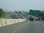
. From exit 246 to 290, this highway carries at least six lanes of traffic. A portion of the interstate running through Birmingham, has been nicknamed "Malfunction Junction
" for its numerous wrecks. These accidents include two separate occasions of the support beams melting after crashes by 18-wheelers, and the numerous collisions that happen every year, result from the junction with Interstate 20
and Interstate 59
.
In the case of an hurricane evacuation on Alabama's coast, I-65 can be converted to an evacuation route where all lanes flow in the northbound direction from Mobile to Montgomery. This process is known as contra-flow.
From Birmingham, I-65 continues north toward Cullman and Decatur. Just north of downtown Birmingham, two major Interstate Highway projects are in varying stages of work. Interstate 22
will connect with I - 65 at the new exit 265. Construction on this interchange was expected to begin in August 2009. Preliminary roadwork to widen I-65 on either side of the new interchange has been ongoing since 2007. Interstate 22
will provide a direct link between Birmingham and Memphis, Tennessee
. Currently no good Interstate Highway link exists between these two cities, making Memphis one of the few major Southeastern cities without a good interstate routing to Atlanta, a nexus of transportation in the Southeast.
Just a few miles north of I-22 will be the new interchange (exit 274), which will be the Corridor X-1
and has been designated as Interstate 422. This loop route will connect I-65 with I-59 northeast of Birmingham and I-20/I-59 southwest of Birmingham, and this will serve as an Interstate Highway bypass of Birmingham, augmenting the existing Interstate 459
, which already provides the southern loop of Birmingham. Construction of this interchange is still several years away, but right-of-way is in the process of being acquired to build I-422.
At Decatur, travelers can take Interstate 565
toward Huntsville.
From Decatur, I-65 bridges the Tennessee River
, and then it continues northward through Athens, Alabama
, to the State of Tennessee line.
In 2004, following the death of President
Ronald Reagan
, a lengthy segment of I-65 from Jefferson County to Limestone County was designated the Ronald Reagan Memorial Highway. The sign designating the north end of the segment includes a statement from Reagan's speech at Point Mallard Aquatic Center in nearby Decatur on July 4, 1984.
The Hyundai
Corporation's new automotive plant in Montgomery is located just off I-65. It can be accessed using the Pintlala-Hope Hull exit (number 164).
The Mercedes Benz plant in Tuscaloosa County can also be accessed by taking the I-59/I-20 southwest exit at the interchange in Birmingham.
The Kia Motors
Corporation is currently building a plant that will be less than an hour's drive away from the Interstate on the Alabama–Georgia border.
The entire Alabama portion of I-65 is dedicated as Heroes Highway, in honor of the C.I.A. Officer, Johnny "Mike" Spann and all of the people who died during the September 11 attacks.
Near the northern border of Alabama with Tennessee on southbound I-65 is located the Alabama Welcome Center and rest area. The unique feature of this rest area compared to others is the existence of a large Saturn IB
rocket erected on the site as a memorial to Alabama's—and in particular Huntsville's—contribution to NASA
's space exploration.
 I-65 enters Tennessee from the south near the town of Ardmore
, and passes through mostly rural territory for 65 miles (104.6 km). It then passes Lewisburg
. Then it reaches the outer parts of Columbia
and making its way to Saturn Parkway, which brings travellers to the city of Spring Hill, Tennessee
. I-65 then continues on to reach Tennessee State Route 840 and until it intersects Franklin
, which is in the Nashville Metropolitan Area
. Then the route travels through Brentwood, Tennessee
, Nashville
, Madison
, Goodlettsville
, White House
, and exits near Portland
into Kentucky
to the north.
 Interstate 65 enters the state five miles (8 km) south of Franklin
. It passes by the major cities of Bowling Green
, Elizabethtown
, and Louisville
before exiting the state.
Throughout its length, it passes near Mammoth Cave National Park
, Diamond Caverns, Bernheim Forest, the National Corvette Museum
, and the Fort Knox Military Reservation.
I-65 has intersections with four of the parkways. The first major junction is with the William H. Natcher Parkway
at Bowling Green
, followed by the Cumberland Parkway
north of the city between Smiths Grove
and Park City
. At Elizabethtown
, it has two more parkway interchanges with the Wendell H. Ford Western Kentucky Parkway and the Martha Layne Collins Bluegrass Parkway. Interstate 65 also has interchanges with I-265
, I-264
, I-64
, and I-71
.
The widest stretch of Interstate 65 in its entirety is in Louisville at the Kentucky Route 1065 (Outer Loop), where the main line is 14 lanes wide. The highway crosses the Ohio River
into Indiana on the John F. Kennedy Memorial Bridge
.
At one time, the stretch of I-65 from Louisville to Elizabethtown was a toll road bearing the Kentucky Turnpike name. The bonds that financed the road have been paid off, and tolls are no longer collected. All signs of the former turnpike have been removed.
On November 15, 2006, the stretch of I-65 from Bowling Green to Louisville was renamed the Abraham Lincoln
Memorial Highway.
On February 12, 2007, a bill passed the Kentucky Senate
to rename I-65 in Jefferson County, Kentucky
the Dr. Martin Luther King Jr. Expressway. Signs were posted July 25, 2007.
On July 15, 2007, Kentucky highway officials raised its speed limits on Interstate and State Parkway highways to 70 mi/h. Until that date, Kentucky was the only state along I-65's path that had a speed limit of 65 mi/h.
Both of the Ford Motor Company
truck plants in Louisville
are accessible—The Explorer SUV plant is directly accessible from I-65 while the Kentucky Truck Plant, makers of the F-350 and Excursion SUV, is accessed via I-265.
In Bowling Green
, I-65 comes within the proximity of a General Motors Corporation plant that makes the Chevrolet Corvette
sports car, as well as the Cadillac XLR
luxury roadster.
 Interstate 65 enters the Hoosier state at Jeffersonville
and Clarksville
.
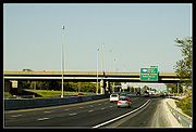
The section of Interstate 65 in downtown Indianapolis overlaps Interstate 70
. The junctions are often referred to as the "North Split" and the "South Split", forming a section of interstate locally known as the "Inner Loop" or "Spaghetti Junction" due to the visual complexity of the overlapping freeways.
In mid-March 2007, a six-mile (10 km) section of Interstate 70 from the North Split to Interstate 465
east of downtown was restricted to automobiles only for the "Super 70" project, a massive rebuild and expansion of that freeway. Trucks over 13 tons were forced to divert through Interstate 65 if coming from the north and use the circular Interstate 465 to the south to reconnect to Interstate 70 East. Westbound traffic from Interstate 70 was required to loop north or south along Interstate 465 to get to Interstates 65 or 70. The Super 70 project was completed in November 2007.
In the summer of 2003, the portion of Interstate 65 that runs concurrently with Interstate 70
was closed to all traffic due to the "HyperFix" project. During that time, a new concrete surface was installed and the overpasses were upgraded.
In 1999, the 25 mile (40 km) segment of Interstate 65 between the two Interstate 465
interchanges was renamed the Kenneth "Babyface" Edmonds Highway.
North of Lafayette
near Brookston
, the road passes through the Meadow Lake Wind Farm
for several miles, with the turbines and standards spaced out in order to avoid a collapse onto the highway. The Fowler Ridge Wind Farm
is also visible on both sides of the highway.
Upon crossing into Lake County
, Indiana
, over the Kankakee River, the highway is known as the Casimir Pulaski Memorial Highway. It is known as this from that point to its northern terminus.
The northern terminus of Interstate 65 was only 1/8 mile (0.2 km) north of Interstate 90 (Indiana Toll Road)
, prior to 2004. Until then, traffic going from Interstate 90 to Interstate 65 had to make a physical left turn onto Interstate 65 via a traffic signal. Traffic from Interstate 65 to Interstate 90 bypassed the traffic signal via an isolated right-turn lane. In 2004 it was fully grade-separated, so it is now considered to be a single interchange between I-65, I-90, US-12, and US-20, thereby eliminating a Connection gap in the Interstate system.
The future Interstate 22
near Birmingham will join and cross beneath I-65 before terminating at US 31 just a few blocks away. The target date for the completion of the final sections of the new route is 2013-2014. Construction is scheduled to begin August 1, 2010.
United States
The United States of America is a federal constitutional republic comprising fifty states and a federal district...
. The southern terminus is located at an intersection with Interstate 10
Interstate 10
Interstate 10 is the fourth-longest Interstate Highway in the United States, after I-90, I-80, and I-40. It is the southernmost east–west, coast-to-coast Interstate Highway, although I-4 and I-8 are further south. It stretches from the Pacific Ocean at State Route 1 in Santa Monica,...
in Mobile, Alabama
Mobile, Alabama
Mobile is the third most populous city in the Southern US state of Alabama and is the county seat of Mobile County. It is located on the Mobile River and the central Gulf Coast of the United States. The population within the city limits was 195,111 during the 2010 census. It is the largest...
, and its northern terminus is at an interchange with Interstate 90 (the Indiana Toll Road), U.S. Route 12
U.S. Route 12
U.S. Route 12 or US 12 is an east–west United States highway, running from Grays Harbor on the Pacific Ocean, in the state of Washington, to downtown Detroit, for almost . As a thoroughfare, it has mostly been supplanted by I-90 and I-94, but remains an important road for local travel.The...
, and U.S. Route 20
U.S. Route 20
U.S. Route 20 is an east–west United States highway. As the "0" in its route number implies, US 20 is a coast-to-coast route. Spanning , it is the longest road in the United States, and the route sparsely parallels Interstate 90...
(the Dunes Highway) in Gary, Indiana
Gary, Indiana
Gary is a city in Lake County, Indiana, United States. The city is in the southeastern portion of the Chicago metropolitan area and is 25 miles from downtown Chicago. The population is 80,294 at the 2010 census, making it the seventh-largest city in the state. It borders Lake Michigan and is known...
, just southeast of Chicago
Chicago
Chicago is the largest city in the US state of Illinois. With nearly 2.7 million residents, it is the most populous city in the Midwestern United States and the third most populous in the US, after New York City and Los Angeles...
.
Route description
|-| AL
Interstate 65 in Alabama
Interstate 65, beginning in Mobile at an interchange with Interstate 10, meanders across of the Alabama countryside linking six of the state's ten largest cities. The highway links together many important roadways that make commerce inside and outside of the state's boundaries possible...
| 367.00
| 590.63
|-
| TN
Interstate 65 in Tennessee
Interstate 65 in Tennessee runs from Ardmore, Tennessee north to just south of Franklin, Kentucky, forming part of the national Interstate 65, which goes from Mobile, Alabama to Gary, Indiana. In Tennessee the highway's official name is The Albert Arnold Gore Sr...
| 121.71
| 195.87
|-
| KY
Interstate 65 in Kentucky
In the U.S. state of Kentucky, Interstate 65 enters the state five miles south of Franklin. It passes by the major cities of Bowling Green, Elizabethtown, and Louisville before exiting the state.- Route description :...
| 137.32
| 221.00
|-
| IN
Interstate 65 in Indiana
In the U.S. state of Indiana, Interstate 65 traverses the state from south to north. The Indiana portion begins near Louisville, Kentucky and travels north, passing through Columbus, Indianapolis, Lafayette. Interstate 65 terminates near Gary on the Indiana Toll Road. Interstate 65 covers 261.27...
| 261.27
| 420.47
|-
| Total
| 887.30
| 1427.97
|}
Alabama
Interstate 65 begins its journey in MobileMobile, Alabama
Mobile is the third most populous city in the Southern US state of Alabama and is the county seat of Mobile County. It is located on the Mobile River and the central Gulf Coast of the United States. The population within the city limits was 195,111 during the 2010 census. It is the largest...
at its junction with Interstate 10. From I-10, I-65 goes west of downtown Mobile and through its northern suburbs before turning northeast toward Montgomery
Montgomery, Alabama
Montgomery is the capital of the U.S. state of Alabama, and is the county seat of Montgomery County. It is located on the Alabama River southeast of the center of the state, in the Gulf Coastal Plain. As of the 2010 census, Montgomery had a population of 205,764 making it the second-largest city...
. From the state's capital, I-65 doglegs northwards, bypassing Prattville
Prattville, Alabama
Prattville is a city in Autauga and Elmore counties in the U.S. state of Alabama. As of the 2010 Census, the population of the city is 33,960. Nicknamed "The Fountain City" due to the many artesian wells in the area, Prattville is part of the Montgomery metropolitan statistical area and serves as...
and Clanton
Clanton, Alabama
Clanton is a city in Chilton County, Alabama, United States. It is part of the Birmingham–Hoover–Cullman Combined Statistical Area. At the 2000 census the population was 7,800. The city is the county seat of Chilton County.-History:...
before going through Metropolitan Birmingham, Alabama
Birmingham, Alabama
Birmingham is the largest city in Alabama. The city is the county seat of Jefferson County. According to the 2010 United States Census, Birmingham had a population of 212,237. The Birmingham-Hoover Metropolitan Area, in estimate by the U.S...
. From exit 246 to 290, this highway carries at least six lanes of traffic. A portion of the interstate running through Birmingham, has been nicknamed "Malfunction Junction
Malfunction Junction
Malfunction Junction is a derisive nickname given by motorists to a confusing, dangerous, or otherwise problematic interchange.-Alabama:*Interstates in Birmingham. This interchange is the busiest in Alabama, and has been the site of many accidents, including roadway punctures and two fiery...
" for its numerous wrecks. These accidents include two separate occasions of the support beams melting after crashes by 18-wheelers, and the numerous collisions that happen every year, result from the junction with Interstate 20
Interstate 20
Interstate 20 is a major east–west Interstate Highway in the Southern United States. I‑20 runs 1,535 miles from near Kent, Texas, at Interstate 10 to Florence, South Carolina, at Interstate 95...
and Interstate 59
Interstate 59
Interstate 59 is an Interstate Highway in the southern United States. Its southern terminus is near Slidell, Louisiana, a suburb of New Orleans, at an intersection with Interstate 10 and Interstate 12, its northern terminus is at Wildwood, Georgia, at an intersection with Interstate 24.The road's...
.
In the case of an hurricane evacuation on Alabama's coast, I-65 can be converted to an evacuation route where all lanes flow in the northbound direction from Mobile to Montgomery. This process is known as contra-flow.
From Birmingham, I-65 continues north toward Cullman and Decatur. Just north of downtown Birmingham, two major Interstate Highway projects are in varying stages of work. Interstate 22
Interstate 22
Interstate 22 , when it is completed, will follow the U.S. Highway 78 corridor along a 213-mile-long route from Memphis, Tennessee, to Birmingham, Alabama, as an Interstate Highway. Interstate 22 will connect Interstate 240 and Interstate 40 in the northwest with Interstate 65 and Interstate...
will connect with I - 65 at the new exit 265. Construction on this interchange was expected to begin in August 2009. Preliminary roadwork to widen I-65 on either side of the new interchange has been ongoing since 2007. Interstate 22
Interstate 22
Interstate 22 , when it is completed, will follow the U.S. Highway 78 corridor along a 213-mile-long route from Memphis, Tennessee, to Birmingham, Alabama, as an Interstate Highway. Interstate 22 will connect Interstate 240 and Interstate 40 in the northwest with Interstate 65 and Interstate...
will provide a direct link between Birmingham and Memphis, Tennessee
Memphis, Tennessee
Memphis is a city in the southwestern corner of the U.S. state of Tennessee, and the county seat of Shelby County. The city is located on the 4th Chickasaw Bluff, south of the confluence of the Wolf and Mississippi rivers....
. Currently no good Interstate Highway link exists between these two cities, making Memphis one of the few major Southeastern cities without a good interstate routing to Atlanta, a nexus of transportation in the Southeast.
Just a few miles north of I-22 will be the new interchange (exit 274), which will be the Corridor X-1
Corridor X-1
Corridor X-1 or the Birmingham Northern Beltline is the proposed by-pass route around Birmingham, Alabama through northern and western Jefferson County to be completed by 2025...
and has been designated as Interstate 422. This loop route will connect I-65 with I-59 northeast of Birmingham and I-20/I-59 southwest of Birmingham, and this will serve as an Interstate Highway bypass of Birmingham, augmenting the existing Interstate 459
Interstate 459
Interstate 459 is a bypass highway of Interstate 59 that is an alternate Interstate Highway around the southern sides of Birmingham, Alabama, Bessemer, Alabama, and several other cities and towns in Jefferson County. Interstate 459 lies entirely within Jefferson County, without exception...
, which already provides the southern loop of Birmingham. Construction of this interchange is still several years away, but right-of-way is in the process of being acquired to build I-422.
At Decatur, travelers can take Interstate 565
Interstate 565
-External links:***...
toward Huntsville.
From Decatur, I-65 bridges the Tennessee River
Tennessee River
The Tennessee River is the largest tributary of the Ohio River. It is approximately 652 miles long and is located in the southeastern United States in the Tennessee Valley. The river was once popularly known as the Cherokee River, among other names...
, and then it continues northward through Athens, Alabama
Athens, Alabama
Athens is a city in Limestone County, Alabama, United States. As of the 2000 census, the population of the city is 18,967. According to the 2009 U.S. Census estimates, the city had a population of 24,234...
, to the State of Tennessee line.
In 2004, following the death of President
President
A president is a leader of an organization, company, trade union, university, or country.Etymologically, a president is one who presides, who sits in leadership...
Ronald Reagan
Ronald Reagan
Ronald Wilson Reagan was the 40th President of the United States , the 33rd Governor of California and, prior to that, a radio, film and television actor....
, a lengthy segment of I-65 from Jefferson County to Limestone County was designated the Ronald Reagan Memorial Highway. The sign designating the north end of the segment includes a statement from Reagan's speech at Point Mallard Aquatic Center in nearby Decatur on July 4, 1984.
The Hyundai
Hyundai
Hyundai ) is a global conglomerate company, part of the Korean chaebol, that was founded in South Korea by one of the most famous businessmen in Korean history: Chung Ju-yung...
Corporation's new automotive plant in Montgomery is located just off I-65. It can be accessed using the Pintlala-Hope Hull exit (number 164).
The Mercedes Benz plant in Tuscaloosa County can also be accessed by taking the I-59/I-20 southwest exit at the interchange in Birmingham.
The Kia Motors
Kia Motors
Kia Motors , headquartered in Seoul, is South Korea's second-largest automobile manufacturer, following the Hyundai Motor Company, with sales of over 1.4 million vehicles in 2010...
Corporation is currently building a plant that will be less than an hour's drive away from the Interstate on the Alabama–Georgia border.
The entire Alabama portion of I-65 is dedicated as Heroes Highway, in honor of the C.I.A. Officer, Johnny "Mike" Spann and all of the people who died during the September 11 attacks.
Near the northern border of Alabama with Tennessee on southbound I-65 is located the Alabama Welcome Center and rest area. The unique feature of this rest area compared to others is the existence of a large Saturn IB
Saturn IB
The Saturn IB was an American launch vehicle commissioned by the National Aeronautics and Space Administration for use in the Apollo program...
rocket erected on the site as a memorial to Alabama's—and in particular Huntsville's—contribution to NASA
NASA
The National Aeronautics and Space Administration is the agency of the United States government that is responsible for the nation's civilian space program and for aeronautics and aerospace research...
's space exploration.
Tennessee
Ardmore, Tennessee
Ardmore is a city in Giles and Lincoln counties in the U.S. state of Tennessee. The population was 1,213 at the 2010 census. Ardmore is the site of a Tennessee Department of Tourist Development Welcome Center...
, and passes through mostly rural territory for 65 miles (104.6 km). It then passes Lewisburg
Lewisburg, Tennessee
Lewisburg is a city in Marshall County, Tennessee, United States. The population was 10,413 at the 2000 census. It is the county seat of Marshall County...
. Then it reaches the outer parts of Columbia
Columbia, Tennessee
Columbia is a city in Maury County, Tennessee, United States. The 2008 population was 34,402 according to U.S. Census Bureau estimates. It is the county seat of Maury County....
and making its way to Saturn Parkway, which brings travellers to the city of Spring Hill, Tennessee
Spring Hill, Tennessee
Spring Hill is a city in Maury and Williamson counties in the U.S. state of Tennessee, located approximately south of Nashville. The population was 7,715 at the 2000 census...
. I-65 then continues on to reach Tennessee State Route 840 and until it intersects Franklin
Franklin, Tennessee
Franklin is a city within and the county seat of Williamson County, Tennessee, United States. The population was 62,487 as of the 2010 census Franklin is located approximately south of downtown Nashville.-History:...
, which is in the Nashville Metropolitan Area
Nashville, Tennessee
Nashville is the capital of the U.S. state of Tennessee and the county seat of Davidson County. It is located on the Cumberland River in Davidson County, in the north-central part of the state. The city is a center for the health care, publishing, banking and transportation industries, and is home...
. Then the route travels through Brentwood, Tennessee
Brentwood, Tennessee
-Demographics:As of the census of 2000, there were 23,445 people, 7,693 households, and 6,808 families residing in the city. The population density was . There were 7,889 housing units at an average density of . The racial makeup of the city was 94.63% European American, 1.89% African American,...
, Nashville
Nashville, Tennessee
Nashville is the capital of the U.S. state of Tennessee and the county seat of Davidson County. It is located on the Cumberland River in Davidson County, in the north-central part of the state. The city is a center for the health care, publishing, banking and transportation industries, and is home...
, Madison
Madison, Tennessee
Madison, Tennessee is a neighborhood in northeast Nashville, Tennessee in the United States. It is incorporated as part of the Metropolitan Government of Nashville and Davidson County....
, Goodlettsville
Goodlettsville, Tennessee
Goodlettsville is a city in Davidson and Sumner counties in the U.S. state of Tennessee. Goodlettsville was incorporated as a city in 1958 with a population of just over 3,000 residents; at the 2000 census, the city had a total population of 13,780. Goodlettsville chose to remain autonomous in 1963...
, White House
White House, Tennessee
White House is a city in Robertson and Sumner counties in the U.S. state of Tennessee. The population was 7,220 at the 2000 census. According to the city website a special census was conducted in 2008 that placed the city population at 9,891 residents, with 3,587 households within the city limits...
, and exits near Portland
Portland, Tennessee
Portland is a city in Sumner and Robertson counties in the U.S. state of Tennessee, and is also a part of the Nashville Metropolitan Statistical Area The population was 10,986 according to 2007 estimates by the US census bureau.-History:...
into Kentucky
Kentucky
The Commonwealth of Kentucky is a state located in the East Central United States of America. As classified by the United States Census Bureau, Kentucky is a Southern state, more specifically in the East South Central region. Kentucky is one of four U.S. states constituted as a commonwealth...
to the north.
Kentucky
Franklin, Kentucky
As of the census of 2000, there were 7,996 people, 3,251 households, and 2,174 families residing in the city. The population density was 1,074.7 people per square mile . There were 3,609 housing units at an average density of 485.1 per square mile...
. It passes by the major cities of Bowling Green
Bowling Green, Kentucky
Bowling Green is the third-most populous city in the state of Kentucky after Louisville and Lexington, with a population of 58,067 as of the 2010 Census. It is the county seat of Warren County and the principal city of the Bowling Green, Kentucky Metropolitan Statistical Area with an estimated 2009...
, Elizabethtown
Elizabethtown, Kentucky
Elizabethtown is a city in and the county seat of Hardin County, Kentucky, United States. The population was 28,531 at the 2010 census, making it the eleventh-largest city in the state...
, and Louisville
Louisville, Kentucky
Louisville is the largest city in the U.S. state of Kentucky, and the county seat of Jefferson County. Since 2003, the city's borders have been coterminous with those of the county because of a city-county merger. The city's population at the 2010 census was 741,096...
before exiting the state.
Throughout its length, it passes near Mammoth Cave National Park
Mammoth Cave National Park
Mammoth Cave National Park is a U.S. National Park in central Kentucky, encompassing portions of Mammoth Cave, the longest cave system known in the world. The official name of the system is the Mammoth-Flint Ridge Cave System for the ridge under which the cave has formed. The park was established...
, Diamond Caverns, Bernheim Forest, the National Corvette Museum
National Corvette Museum
The National Corvette Museum showcases the Chevrolet Corvette, an American sports car that has been in production since 1953. It is located in Bowling Green, Kentucky, off Interstate 65's Exit 28...
, and the Fort Knox Military Reservation.
I-65 has intersections with four of the parkways. The first major junction is with the William H. Natcher Parkway
William H. Natcher Parkway
The Wiliam H. Natcher Green River Parkway is a limited-access freeway from Bowling Green, Kentucky to Owensboro, Kentucky. The Natcher is one of nine highways that are part of Kentucky's parkway system. Conceived as the "Owensboro-Bowling Green Parkway," it was instead named the Green River...
at Bowling Green
Bowling Green, Kentucky
Bowling Green is the third-most populous city in the state of Kentucky after Louisville and Lexington, with a population of 58,067 as of the 2010 Census. It is the county seat of Warren County and the principal city of the Bowling Green, Kentucky Metropolitan Statistical Area with an estimated 2009...
, followed by the Cumberland Parkway
Cumberland Parkway
The Louie B. Nunn Cumberland Parkway is an 88.547 mile long east–west controlled-access highway in the U.S. state of Kentucky, extending from Barren County in the west to Somerset in the east...
north of the city between Smiths Grove
Smiths Grove, Kentucky
Smiths Grove is a city in Warren County, Kentucky, United States. The population was 784 at the 2000 census. It is included in the Bowling Green, Kentucky Metropolitan Statistical Area.- Geography :Smiths Grove is located at ....
and Park City
Park City, Kentucky
Park City is a city in Barren County, Kentucky, United States. The population was 517 at the 2000 census. It has historically served as a gateway to nearby Mammoth Cave National Park and Diamond Caverns, a privately-owned cave attraction....
. At Elizabethtown
Elizabethtown, Kentucky
Elizabethtown is a city in and the county seat of Hardin County, Kentucky, United States. The population was 28,531 at the 2010 census, making it the eleventh-largest city in the state...
, it has two more parkway interchanges with the Wendell H. Ford Western Kentucky Parkway and the Martha Layne Collins Bluegrass Parkway. Interstate 65 also has interchanges with I-265
Interstate 265
Interstate 265 is an Interstate Highway ringing the Louisville, Kentucky metropolitan area, which includes southern Indiana, although the Indiana and Kentucky segments remain separate at the present time. In Kentucky it only runs through Jefferson County, from Interstate 71 in northeastern...
, I-264
Interstate 264 (Kentucky)
The Henry Watterson Expressway, also known as the Georgia Davis Powers/Shawnee Expressway west of US 31W, is one of two Interstate Highways in the United States designated as Interstate 264 . It is 22.93 miles in length, and runs an open circle around central Louisville, Kentucky...
, I-64
Interstate 64
Interstate 64 is an Interstate Highway in the Midwestern and Southeastern United States. Its western terminus is at I-70, U.S. 40, and U.S. 61 in Wentzville, Missouri. Its eastern terminus is at an interchange with I-264 and I-664 at Bowers Hill in Chesapeake, Virginia. As I-64 is concurrent with...
, and I-71
Interstate 71
Interstate 71 is an Interstate Highway in the Great Lakes/Midwestern and Southeastern region of the United States. Its southern terminus is at an interchange with Interstate 64 and Interstate 65 in Louisville, Kentucky. Its northern terminus is at an interchange with Interstate 90 in Cleveland,...
.
The widest stretch of Interstate 65 in its entirety is in Louisville at the Kentucky Route 1065 (Outer Loop), where the main line is 14 lanes wide. The highway crosses the Ohio River
Ohio River
The Ohio River is the largest tributary, by volume, of the Mississippi River. At the confluence, the Ohio is even bigger than the Mississippi and, thus, is hydrologically the main stream of the whole river system, including the Allegheny River further upstream...
into Indiana on the John F. Kennedy Memorial Bridge
John F. Kennedy Memorial Bridge
The John F. Kennedy Memorial Bridge is a seven-lane, single-deck cantilever bridge that carries Interstate 65 across the Ohio River, connecting Louisville, Kentucky and Jeffersonville, Indiana. The main span is and the bridge has a total length of...
.
At one time, the stretch of I-65 from Louisville to Elizabethtown was a toll road bearing the Kentucky Turnpike name. The bonds that financed the road have been paid off, and tolls are no longer collected. All signs of the former turnpike have been removed.
On November 15, 2006, the stretch of I-65 from Bowling Green to Louisville was renamed the Abraham Lincoln
Abraham Lincoln
Abraham Lincoln was the 16th President of the United States, serving from March 1861 until his assassination in April 1865. He successfully led his country through a great constitutional, military and moral crisis – the American Civil War – preserving the Union, while ending slavery, and...
Memorial Highway.
On February 12, 2007, a bill passed the Kentucky Senate
Kentucky Senate
The Kentucky Senate is the upper house of the Kentucky General Assembly. The Kentucky Senate is composed of 38 members elected from single-member districts throughout the Commonwealth. There are no term limits for Kentucky Senators...
to rename I-65 in Jefferson County, Kentucky
Jefferson County, Kentucky
As of the census of 2000, there were 693,604 people, 287,012 households, and 183,113 families residing in the county. The population density was . There were 305,835 housing units at an average density of...
the Dr. Martin Luther King Jr. Expressway. Signs were posted July 25, 2007.
On July 15, 2007, Kentucky highway officials raised its speed limits on Interstate and State Parkway highways to 70 mi/h. Until that date, Kentucky was the only state along I-65's path that had a speed limit of 65 mi/h.
Both of the Ford Motor Company
Ford Motor Company
Ford Motor Company is an American multinational automaker based in Dearborn, Michigan, a suburb of Detroit. The automaker was founded by Henry Ford and incorporated on June 16, 1903. In addition to the Ford and Lincoln brands, Ford also owns a small stake in Mazda in Japan and Aston Martin in the UK...
truck plants in Louisville
Louisville, Kentucky
Louisville is the largest city in the U.S. state of Kentucky, and the county seat of Jefferson County. Since 2003, the city's borders have been coterminous with those of the county because of a city-county merger. The city's population at the 2010 census was 741,096...
are accessible—The Explorer SUV plant is directly accessible from I-65 while the Kentucky Truck Plant, makers of the F-350 and Excursion SUV, is accessed via I-265.
In Bowling Green
Bowling Green, Kentucky
Bowling Green is the third-most populous city in the state of Kentucky after Louisville and Lexington, with a population of 58,067 as of the 2010 Census. It is the county seat of Warren County and the principal city of the Bowling Green, Kentucky Metropolitan Statistical Area with an estimated 2009...
, I-65 comes within the proximity of a General Motors Corporation plant that makes the Chevrolet Corvette
Chevrolet Corvette
The Chevrolet Corvette is a sports car by the Chevrolet division of General Motors that has been produced in six generations. The first model, a convertible, was designed by Harley Earl and introduced at the GM Motorama in 1953 as a concept show car. Myron Scott is credited for naming the car after...
sports car, as well as the Cadillac XLR
Cadillac XLR
The XLR was a retractable hardtop convertible marketed by the Cadillac division of General Motors, assembled in Bowling Green, Kentucky. Intended to be Cadillac's flagship sports car, the XLR was based on the Chevrolet Corvette's Y platform...
luxury roadster.
Indiana
Jeffersonville, Indiana
Jeffersonville is a city in Clark County, Indiana, along the Ohio River. Locally, the city is often referred to by the abbreviated name Jeff. It is directly across the Ohio River to the north of Louisville, Kentucky along I-65. The population was 44,953 at the 2010 census...
and Clarksville
Clarksville, Indiana
Clarksville is a town in Clark County, Indiana, United States, along the Ohio River as a part of the Louisville Metropolitan area. The population was 21,724 at the 2010 census. The town, once a home site to George Rogers Clark, was founded in 1783 and is the oldest American town in the Northwest...
.
The section of Interstate 65 in downtown Indianapolis overlaps Interstate 70
Interstate 70
Interstate 70 is an Interstate Highway in the United States that runs from Interstate 15 near Cove Fort, Utah, to a Park and Ride near Baltimore, Maryland. It was the first Interstate Highway project in the United States. I-70 approximately traces the path of U.S. Route 40 east of the Rocky...
. The junctions are often referred to as the "North Split" and the "South Split", forming a section of interstate locally known as the "Inner Loop" or "Spaghetti Junction" due to the visual complexity of the overlapping freeways.
In mid-March 2007, a six-mile (10 km) section of Interstate 70 from the North Split to Interstate 465
Interstate 465
Interstate 465 , also known as the USS Indianapolis Memorial Highway, is the beltway circling Indianapolis, Indiana, United States. It is roughly rectangular in shape and has a perimeter of approximately 53 miles . It lies almost completely within the boundaries of Marion County, except for two...
east of downtown was restricted to automobiles only for the "Super 70" project, a massive rebuild and expansion of that freeway. Trucks over 13 tons were forced to divert through Interstate 65 if coming from the north and use the circular Interstate 465 to the south to reconnect to Interstate 70 East. Westbound traffic from Interstate 70 was required to loop north or south along Interstate 465 to get to Interstates 65 or 70. The Super 70 project was completed in November 2007.
In the summer of 2003, the portion of Interstate 65 that runs concurrently with Interstate 70
Interstate 70
Interstate 70 is an Interstate Highway in the United States that runs from Interstate 15 near Cove Fort, Utah, to a Park and Ride near Baltimore, Maryland. It was the first Interstate Highway project in the United States. I-70 approximately traces the path of U.S. Route 40 east of the Rocky...
was closed to all traffic due to the "HyperFix" project. During that time, a new concrete surface was installed and the overpasses were upgraded.
In 1999, the 25 mile (40 km) segment of Interstate 65 between the two Interstate 465
Interstate 465
Interstate 465 , also known as the USS Indianapolis Memorial Highway, is the beltway circling Indianapolis, Indiana, United States. It is roughly rectangular in shape and has a perimeter of approximately 53 miles . It lies almost completely within the boundaries of Marion County, except for two...
interchanges was renamed the Kenneth "Babyface" Edmonds Highway.
North of Lafayette
Lafayette, Indiana
Lafayette is a city in and the county seat of Tippecanoe County, Indiana, United States, northwest of Indianapolis. As of the 2010 census, the city had a total population of 67,140. West Lafayette, on the other side of the Wabash River, is home to Purdue University, which has a large impact on...
near Brookston
Brookston, Indiana
Brookston is a town in Prairie Township, White County, Indiana, United States. The population was 1,554 as of the 2010 census.-Geography:Brookston is located at ....
, the road passes through the Meadow Lake Wind Farm
Meadow Lake Wind Farm
Meadow Lake Wind Farm is a wind farm near Brookston and Chalmers, Indiana, spreading over portions of White, Jasper, and Benton Counties in Indiana, owned and operated by Horizon Wind Energy...
for several miles, with the turbines and standards spaced out in order to avoid a collapse onto the highway. The Fowler Ridge Wind Farm
Fowler Ridge Wind Farm
The Fowler Ridge Wind Farm currently consists of two completed phases with the possibility of a third phase some time in the near future. The wind farm is in Benton County, Indiana, near the city of Fowler, IN about northwest of Lafayette and northwest of Indianapolis...
is also visible on both sides of the highway.
Upon crossing into Lake County
Lake County, Indiana
Lake County is a county located in the U.S. state of Indiana. In 2010, its population was 496,005, making it Indiana's second-most populous county. The county seat is Crown Point. This county is part of Northwest Indiana and the Chicago metropolitan area. The county contains a mix of urban,...
, Indiana
Indiana
Indiana is a US state, admitted to the United States as the 19th on December 11, 1816. It is located in the Midwestern United States and Great Lakes Region. With 6,483,802 residents, the state is ranked 15th in population and 16th in population density. Indiana is ranked 38th in land area and is...
, over the Kankakee River, the highway is known as the Casimir Pulaski Memorial Highway. It is known as this from that point to its northern terminus.
The northern terminus of Interstate 65 was only 1/8 mile (0.2 km) north of Interstate 90 (Indiana Toll Road)
Interstate 90
Interstate 90 is the longest Interstate Highway in the United States at . It is the northernmost coast-to-coast interstate, and parallels US 20 for the most part. Its western terminus is in Seattle, at Edgar Martinez Drive S. near Safeco Field and CenturyLink Field, and its eastern terminus is in...
, prior to 2004. Until then, traffic going from Interstate 90 to Interstate 65 had to make a physical left turn onto Interstate 65 via a traffic signal. Traffic from Interstate 65 to Interstate 90 bypassed the traffic signal via an isolated right-turn lane. In 2004 it was fully grade-separated, so it is now considered to be a single interchange between I-65, I-90, US-12, and US-20, thereby eliminating a Connection gap in the Interstate system.
Major intersections
- Interstate 10Interstate 10Interstate 10 is the fourth-longest Interstate Highway in the United States, after I-90, I-80, and I-40. It is the southernmost east–west, coast-to-coast Interstate Highway, although I-4 and I-8 are further south. It stretches from the Pacific Ocean at State Route 1 in Santa Monica,...
in Mobile, AlabamaMobile, AlabamaMobile is the third most populous city in the Southern US state of Alabama and is the county seat of Mobile County. It is located on the Mobile River and the central Gulf Coast of the United States. The population within the city limits was 195,111 during the 2010 census. It is the largest... - Interstate 85Interstate 85Interstate 85 is a major interstate highway in the Southeastern United States. Its current southern terminus is at an interchange with Interstate 65 in Montgomery, Alabama; its northern terminus interchanges with Interstate 95 in Petersburg, Virginia, near Richmond...
in Montgomery, AlabamaMontgomery, AlabamaMontgomery is the capital of the U.S. state of Alabama, and is the county seat of Montgomery County. It is located on the Alabama River southeast of the center of the state, in the Gulf Coastal Plain. As of the 2010 census, Montgomery had a population of 205,764 making it the second-largest city... - Interstate 20Interstate 20Interstate 20 is a major east–west Interstate Highway in the Southern United States. I‑20 runs 1,535 miles from near Kent, Texas, at Interstate 10 to Florence, South Carolina, at Interstate 95...
/Interstate 59Interstate 59Interstate 59 is an Interstate Highway in the southern United States. Its southern terminus is near Slidell, Louisiana, a suburb of New Orleans, at an intersection with Interstate 10 and Interstate 12, its northern terminus is at Wildwood, Georgia, at an intersection with Interstate 24.The road's...
in Birmingham, AlabamaBirmingham, AlabamaBirmingham is the largest city in Alabama. The city is the county seat of Jefferson County. According to the 2010 United States Census, Birmingham had a population of 212,237. The Birmingham-Hoover Metropolitan Area, in estimate by the U.S... - Interstate 565Interstate 565-External links:***...
near Decatur and Huntsville, AlabamaHuntsville, AlabamaHuntsville is a city located primarily in Madison County in the central part of the far northern region of the U.S. state of Alabama. Huntsville is the county seat of Madison County. The city extends west into neighboring Limestone County. Huntsville's population was 180,105 as of the 2010 Census.... - Interstate 24Interstate 24Interstate 24 is an Interstate Highway in the Midwestern and Southeastern United States. It runs diagonally from Interstate 57 to Chattanooga, Tennessee, at Interstate 75....
in Nashville, TennesseeNashville, TennesseeNashville is the capital of the U.S. state of Tennessee and the county seat of Davidson County. It is located on the Cumberland River in Davidson County, in the north-central part of the state. The city is a center for the health care, publishing, banking and transportation industries, and is home... - Interstate 40Interstate 40Interstate 40 is the third-longest major east–west Interstate Highway in the United States, after I-90 and I-80. Its western end is at Interstate 15 in Barstow, California; its eastern end is at a concurrency of U.S. Route 117 and North Carolina Highway 132 in Wilmington, North Carolina...
in Nashville, TennesseeNashville, TennesseeNashville is the capital of the U.S. state of Tennessee and the county seat of Davidson County. It is located on the Cumberland River in Davidson County, in the north-central part of the state. The city is a center for the health care, publishing, banking and transportation industries, and is home... - Interstate 64Interstate 64Interstate 64 is an Interstate Highway in the Midwestern and Southeastern United States. Its western terminus is at I-70, U.S. 40, and U.S. 61 in Wentzville, Missouri. Its eastern terminus is at an interchange with I-264 and I-664 at Bowers Hill in Chesapeake, Virginia. As I-64 is concurrent with...
in Louisville, KentuckyLouisville, KentuckyLouisville is the largest city in the U.S. state of Kentucky, and the county seat of Jefferson County. Since 2003, the city's borders have been coterminous with those of the county because of a city-county merger. The city's population at the 2010 census was 741,096... - Interstate 71Interstate 71Interstate 71 is an Interstate Highway in the Great Lakes/Midwestern and Southeastern region of the United States. Its southern terminus is at an interchange with Interstate 64 and Interstate 65 in Louisville, Kentucky. Its northern terminus is at an interchange with Interstate 90 in Cleveland,...
in Louisville, KentuckyLouisville, KentuckyLouisville is the largest city in the U.S. state of Kentucky, and the county seat of Jefferson County. Since 2003, the city's borders have been coterminous with those of the county because of a city-county merger. The city's population at the 2010 census was 741,096... - Interstate 70Interstate 70Interstate 70 is an Interstate Highway in the United States that runs from Interstate 15 near Cove Fort, Utah, to a Park and Ride near Baltimore, Maryland. It was the first Interstate Highway project in the United States. I-70 approximately traces the path of U.S. Route 40 east of the Rocky...
in Indianapolis, IndianaIndianapolis, IndianaIndianapolis is the capital of the U.S. state of Indiana, and the county seat of Marion County, Indiana. As of the 2010 United States Census, the city's population is 839,489. It is by far Indiana's largest city and, as of the 2010 U.S... - Interstate 74Interstate 74Interstate 74 is an Interstate Highway in the Midwestern and Southeastern United States. Its western end is at an intersection with Interstate 80 in Davenport, Iowa; the eastern end of its Midwest segment is at an intersection with Interstate 75 in Cincinnati, Ohio...
in Indianapolis, IndianaIndianapolis, IndianaIndianapolis is the capital of the U.S. state of Indiana, and the county seat of Marion County, Indiana. As of the 2010 United States Census, the city's population is 839,489. It is by far Indiana's largest city and, as of the 2010 U.S... - Interstate 80Interstate 80Interstate 80 is the second-longest Interstate Highway in the United States, following Interstate 90. It is a transcontinental artery running from downtown San Francisco, California to Teaneck, New Jersey in the New York City Metropolitan Area...
/Interstate 94Interstate 94Interstate 94 is the northernmost east–west Interstate Highway, connecting the Great Lakes and Intermountain regions of the United States. I-94's western terminus is in Billings, Montana at a junction with Interstate 90; its eastern terminus is the U.S...
in Gary, IndianaGary, IndianaGary is a city in Lake County, Indiana, United States. The city is in the southeastern portion of the Chicago metropolitan area and is 25 miles from downtown Chicago. The population is 80,294 at the 2010 census, making it the seventh-largest city in the state. It borders Lake Michigan and is known... - Interstate 90Interstate 90Interstate 90 is the longest Interstate Highway in the United States at . It is the northernmost coast-to-coast interstate, and parallels US 20 for the most part. Its western terminus is in Seattle, at Edgar Martinez Drive S. near Safeco Field and CenturyLink Field, and its eastern terminus is in...
/U.S. Route 12U.S. Route 12U.S. Route 12 or US 12 is an east–west United States highway, running from Grays Harbor on the Pacific Ocean, in the state of Washington, to downtown Detroit, for almost . As a thoroughfare, it has mostly been supplanted by I-90 and I-94, but remains an important road for local travel.The...
/U.S. Route 20U.S. Route 20U.S. Route 20 is an east–west United States highway. As the "0" in its route number implies, US 20 is a coast-to-coast route. Spanning , it is the longest road in the United States, and the route sparsely parallels Interstate 90...
in Gary, IndianaGary, IndianaGary is a city in Lake County, Indiana, United States. The city is in the southeastern portion of the Chicago metropolitan area and is 25 miles from downtown Chicago. The population is 80,294 at the 2010 census, making it the seventh-largest city in the state. It borders Lake Michigan and is known...
The future Interstate 22
Interstate 22
Interstate 22 , when it is completed, will follow the U.S. Highway 78 corridor along a 213-mile-long route from Memphis, Tennessee, to Birmingham, Alabama, as an Interstate Highway. Interstate 22 will connect Interstate 240 and Interstate 40 in the northwest with Interstate 65 and Interstate...
near Birmingham will join and cross beneath I-65 before terminating at US 31 just a few blocks away. The target date for the completion of the final sections of the new route is 2013-2014. Construction is scheduled to begin August 1, 2010.
Auxiliary routes
- Prichard, AlabamaPrichard, AlabamaPrichard is a city in Mobile County, Alabama, in the United States.Prichard borders the north side of Mobile, as well as the Mobile suburbs of Chickasaw, Alabama, Saraland, Alabama, and the unincorporated sections of Eight Mile, Alabama. As of 2005 Census Bureau estimates, the population of the...
, MobileMobile, AlabamaMobile is the third most populous city in the Southern US state of Alabama and is the county seat of Mobile County. It is located on the Mobile River and the central Gulf Coast of the United States. The population within the city limits was 195,111 during the 2010 census. It is the largest...
- I-165Interstate 165Interstate 165 is a spur from Interstate 65 that provides access to Mobile, Alabama. It runs for 4.9 miles from Beauregard Street in downtown Mobile north to Interstate 65 in Prichard. As it is, I-165 terminates into Water Street which itself terminates into an I-10 on-ramp less than two miles ... - Spur beginning in Decatur, AlabamaDecatur, AlabamaDecatur is a city in Limestone and Morgan Counties in the U.S. state of Alabama. The city, affectionately known as "The River City", is located in Northern Alabama on the banks of Wheeler Lake, along the Tennessee River. It is the largest city and county seat of Morgan County...
terminating in Huntsville, AlabamaHuntsville, AlabamaHuntsville is a city located primarily in Madison County in the central part of the far northern region of the U.S. state of Alabama. Huntsville is the county seat of Madison County. The city extends west into neighboring Limestone County. Huntsville's population was 180,105 as of the 2010 Census....
- I-565Interstate 565-External links:***...
- Louisville, KentuckyLouisville, KentuckyLouisville is the largest city in the U.S. state of Kentucky, and the county seat of Jefferson County. Since 2003, the city's borders have been coterminous with those of the county because of a city-county merger. The city's population at the 2010 census was 741,096...
- I-265Interstate 265Interstate 265 is an Interstate Highway ringing the Louisville, Kentucky metropolitan area, which includes southern Indiana, although the Indiana and Kentucky segments remain separate at the present time. In Kentucky it only runs through Jefferson County, from Interstate 71 in northeastern...
(Louisville's outer beltway; also called the Gene Snyder Freeway; formerly the Jefferson Freeway) - New Albany, IndianaNew Albany, IndianaNew Albany is a city in Floyd County, Indiana, United States, situated along the Ohio River opposite Louisville, Kentucky. In 1900, 20,628 people lived in New Albany; in 1910, 20,629; in 1920, 22,992; and in 1940, 25,414. The population was 36,372 at the 2010 census. The city is the county seat of...
- I-265Interstate 265Interstate 265 is an Interstate Highway ringing the Louisville, Kentucky metropolitan area, which includes southern Indiana, although the Indiana and Kentucky segments remain separate at the present time. In Kentucky it only runs through Jefferson County, from Interstate 71 in northeastern...
(to be eventually connected by bridge to the Kentucky part of I-265)
- Indianapolis, IndianaIndianapolis, IndianaIndianapolis is the capital of the U.S. state of Indiana, and the county seat of Marion County, Indiana. As of the 2010 United States Census, the city's population is 839,489. It is by far Indiana's largest city and, as of the 2010 U.S...
- I-465Interstate 465Interstate 465 , also known as the USS Indianapolis Memorial Highway, is the beltway circling Indianapolis, Indiana, United States. It is roughly rectangular in shape and has a perimeter of approximately 53 miles . It lies almost completely within the boundaries of Marion County, except for two... - Indianapolis, IndianaIndianapolis, IndianaIndianapolis is the capital of the U.S. state of Indiana, and the county seat of Marion County, Indiana. As of the 2010 United States Census, the city's population is 839,489. It is by far Indiana's largest city and, as of the 2010 U.S...
- I-865Interstate 865Interstate 865 is an east–west connector northwest of Indianapolis, Indiana. It was renamed to I-865 in 2002 to prevent I-465 from intersecting with itself...
See also
- Ohio River Bridges ProjectOhio River Bridges ProjectThe Ohio River Bridges Project is a controversial Louisville metropolitan area transportation project involving the reconstruction of the Kennedy Interchange , the completion of two new Ohio River bridges and the reconstruction of ramps on Interstate 65 between I-264 and downtown.One bridge will be...
- Super Bowl XLISuper Bowl XLISuper Bowl XLI was an American football game that featured the American Football Conference champion Indianapolis Colts and the National Football Conference champion Chicago Bears to decide the National Football League champion for the 2006 season...
, dubbed the "I-65 Bowl" due to the proximity of the competing teams' cities (Indianapolis and Chicago) to I-65