
Interstate 81 in West Virginia
Encyclopedia
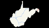
In the U.S. state
of West Virginia
, Interstate 81 (I-81) crosses the Eastern Panhandle
region, linking Virginia to Maryland. The Interstate Highway
, completed in 1966, spans 26 miles (41.8 km) through Berkeley County
, paralleling U.S. Route 11
(US 11) for its entire length. I-81 enters the state near Ridgeway
and travels northeast, bypassing the city of Martinsburg
, and leaves the state at the Potomac River
, which serves as the state line. The first solicitations for the construction of I-81 were published in 1959, with the first 6 miles (9.7 km) of freeway being opened in 1963, and the full length was completed by 1966. On average between 45 and 60 thousand vehicles use the freeway though the panhandle per day.
, paralleling US 11 (also known as the Valley Pike
). The highway passes through some light farmland before entering a wooded area, north of Ridgeway. A welcome center for northbound travelers is passed before the woodlands give way to a light urban setting. As the highway approaches the community of Inwood
, a diamond interchange
with West Virginia Route 51 (WV 51) provides access to the community, as well as Gerrardstown
to the west of the freeway, and Charles Town
to the east. A small business park is passed by before I-81 intersects County Route 32, providing access to Arden
, the Eastern WV Regional Airport
and Tablers Station
. The freeway turns more towards the north as it approaches Martinsburg, intersecting WV 45, County Route 15 and Dry Run Road while in the city limits. I-81 bypasses downtown, running along the western border of town while US 11 continues through the town.
Just northeast of Martinsburg the freeway passes over a CSX Transportation
rail line while a cloverleaf interchange
with WV 9 provides access back to Martinsburg and to Hedgesville
. As the freeway curves back east, it intersects WV 901 between Hainesville
and Falling Waters
. WV 901 is a short connector route back to US 11. North of Falling Waters and south of Marlowe
, US 11 intersects the freeway and continues north while I-81 turns east towards the Maryland state line at the Potomac River. Just south of the river is a welcome center intended for southbound travelers from Maryland.
Out of the six states that I-81 passes through, the segment in West Virginia is the second shortest, only longer than the Maryland segment. Every year the West Virginia Department of Transportation
(WVDOT) conducts a series of surveys on its highways in the state to measure traffic volume. This is expressed in terms of average annual daily traffic (AADT), which is a measure of traffic volume for any average day of the year. In 2009, WVDOT calculated that as few as 45,000 vehicles traveled along the highway at the Virginia state line, and as many as 62,500 vehicles used the freeway between County Routes 15 and 13 in Martinsburg. As part of the Interstate Highway System
, the entire route is listed on the National Highway System
, a system of roads that are important to the nation's economy, defense and mobility.
Bids for construction of I-81 by WVDOT were published in 1959, with a budget of about $10.6 million to complete the highway. Completion of I-81 in Virginia up to the West Virginia state line was completed by the Virginia Department of Transportation
in November 1965. The first 6 miles (9.7 km) of the highway through West Virginia were completed between 1959 and 1963. The construction of the remaining 20 miles (32.2 km) of Interstate Highway through the Eastern Panhandle was completed by 1966. Since then, there have been no major realignments, and the highway continues on its original path.
U.S. state
A U.S. state is any one of the 50 federated states of the United States of America that share sovereignty with the federal government. Because of this shared sovereignty, an American is a citizen both of the federal entity and of his or her state of domicile. Four states use the official title of...
of West Virginia
West Virginia
West Virginia is a state in the Appalachian and Southeastern regions of the United States, bordered by Virginia to the southeast, Kentucky to the southwest, Ohio to the northwest, Pennsylvania to the northeast and Maryland to the east...
, Interstate 81 (I-81) crosses the Eastern Panhandle
Eastern Panhandle of West Virginia
The Eastern Panhandle of West Virginia is a narrow stretch of territory in the northeast of the state, bordering Maryland and Virginia, United States. The Eastern Panhandle Board of Realtors and other local civic organizations consider only the three Easternmost counties, Jefferson, Berkeley and...
region, linking Virginia to Maryland. The Interstate Highway
Interstate Highway System
The Dwight D. Eisenhower National System of Interstate and Defense Highways, , is a network of limited-access roads including freeways, highways, and expressways forming part of the National Highway System of the United States of America...
, completed in 1966, spans 26 miles (41.8 km) through Berkeley County
Berkeley County, West Virginia
Berkeley County is a county located in the Eastern Panhandle region of the U.S. state of West Virginia. As of 2010, the population is 104,169, making it the second-most populous county in West Virginia, behind Kanawha...
, paralleling U.S. Route 11
U.S. Route 11 in West Virginia
In the U.S. state of West Virginia, U.S. Route 11 spans across the Eastern Panhandle region. US 11 enters the state near Ridgeway, and crosses into Maryland just south of Williamsport...
(US 11) for its entire length. I-81 enters the state near Ridgeway
Ridgeway, West Virginia
Ridgeway is an unincorporated town in Berkeley County, West Virginia. It lies off U.S. Highway 11 on Specks Run Road near the Virginia state line....
and travels northeast, bypassing the city of Martinsburg
Martinsburg, West Virginia
Martinsburg is a city in the Eastern Panhandle region of West Virginia, United States. The city's population was 14,972 at the 2000 census; according to a 2009 Census Bureau estimate, Martinsburg's population was 17,117, making it the largest city in the Eastern Panhandle and the eighth largest...
, and leaves the state at the Potomac River
Potomac River
The Potomac River flows into the Chesapeake Bay, located along the mid-Atlantic coast of the United States. The river is approximately long, with a drainage area of about 14,700 square miles...
, which serves as the state line. The first solicitations for the construction of I-81 were published in 1959, with the first 6 miles (9.7 km) of freeway being opened in 1963, and the full length was completed by 1966. On average between 45 and 60 thousand vehicles use the freeway though the panhandle per day.
Route description
I-81 enters the Eastern Panhandle of West Virginia just west of RidgewayRidgeway, West Virginia
Ridgeway is an unincorporated town in Berkeley County, West Virginia. It lies off U.S. Highway 11 on Specks Run Road near the Virginia state line....
, paralleling US 11 (also known as the Valley Pike
Valley Pike
Valley Pike or Valley Turnpike is the traditional name given for the Indian trail and roadway which now is designated as U.S. Highway 11 in the Shenandoah Valley of Virginia....
). The highway passes through some light farmland before entering a wooded area, north of Ridgeway. A welcome center for northbound travelers is passed before the woodlands give way to a light urban setting. As the highway approaches the community of Inwood
Inwood, West Virginia
Inwood is a census-designated place in Berkeley County, West Virginia, United States, located south of Martinsburg. The population was 2,954 at the 2010 census. It is located on U.S...
, a diamond interchange
Diamond interchange
A diamond interchange is a common type of road junction, used where a freeway crosses a minor road. The freeway itself is grade-separated from the minor road, one crossing the other over a bridge...
with West Virginia Route 51 (WV 51) provides access to the community, as well as Gerrardstown
Gerrardstown, West Virginia
Gerrardstown is an unincorporated village located along West Virginia Route 51 in Berkeley County in the U.S. state of West Virginia's Eastern Panhandle. It was laid out in 1784 by David Gerrard and served as the site of the first Baptist church west of the Blue Ridge Mountains...
to the west of the freeway, and Charles Town
Charles Town, West Virginia
Charles Town is a city in and the county seat of Jefferson County, West Virginia, United States. The population was 2,907 at the 2000 census. Due to its similar name, travelers have sometimes confused this city with the state's capital, Charleston.-History:...
to the east. A small business park is passed by before I-81 intersects County Route 32, providing access to Arden
Arden, Berkeley County, West Virginia
Arden is an unincorporated hamlet located between Martinsburg and Inwood in Berkeley County, West Virginia, in the United States. Arden is the location of a number of historic sites including the Arden United Methodist Church, Trinity Church, and Ar-Qua Springs, which is listed on the National...
, the Eastern WV Regional Airport
Eastern WV Regional Airport
Eastern WV Regional Airport , also known as Shepherd Field, is a joint civil-military public airport located four miles south of the central business district of Martinsburg, a city in Berkeley County, West Virginia, USA....
and Tablers Station
Tablers Station, West Virginia
Tablers Station is an unincorporated town in Berkeley County, West Virginia. It lies on County Route 32 south of Martinsburg off U.S. Highway 11 near Eastern West Virginia Regional Airport....
. The freeway turns more towards the north as it approaches Martinsburg, intersecting WV 45, County Route 15 and Dry Run Road while in the city limits. I-81 bypasses downtown, running along the western border of town while US 11 continues through the town.
Just northeast of Martinsburg the freeway passes over a CSX Transportation
CSX Transportation
CSX Transportation operates a Class I railroad in the United States known as the CSX Railroad. It is the main subsidiary of the CSX Corporation. The company is headquartered in Jacksonville, Florida, and owns approximately 21,000 route miles...
rail line while a cloverleaf interchange
Cloverleaf interchange
A cloverleaf interchange is a two-level interchange in which left turns, reverse direction in left-driving regions, are handled by ramp roads...
with WV 9 provides access back to Martinsburg and to Hedgesville
Hedgesville, West Virginia
Hedgesville is a town in Berkeley County in the U.S. state of West Virginia's Eastern Panhandle. The population was 240 at the 2000 census. The Town of Hedgesville was laid out in 1832 along the old Warm Springs Road and named for the prominent local Hedges family...
. As the freeway curves back east, it intersects WV 901 between Hainesville
Hainesville, Berkeley County, West Virginia
Hainesville is an unincorporated town on U.S. Route 11 in Berkeley County, West Virginia.- See also :*Battle of Hoke's Run...
and Falling Waters
Falling Waters, West Virginia
Falling Waters is an unincorporated census-designated place on the Potomac River in Berkeley County, West Virginia. It is located along Williamsport Pike north of Martinsburg. According to the 2010 census, Falling Waters has a population of 876....
. WV 901 is a short connector route back to US 11. North of Falling Waters and south of Marlowe
Marlowe, West Virginia
Marlowe is an unincorporated town on U.S. Route 11 in Berkeley County, West Virginia, United States.Sites on the National Register of Historic Places located near Marlowe are: the Charles Downs II House, Harmony Cemetery, Marlowe Consolidated School, and Power Plant and Dam No. 5....
, US 11 intersects the freeway and continues north while I-81 turns east towards the Maryland state line at the Potomac River. Just south of the river is a welcome center intended for southbound travelers from Maryland.
Out of the six states that I-81 passes through, the segment in West Virginia is the second shortest, only longer than the Maryland segment. Every year the West Virginia Department of Transportation
West Virginia Department of Transportation
The West Virginia Department of Transportation is the state agency responsible for transportation in West Virginia. The Department of Transportation serves an umbrella organization for seven subsidiary agencies which are directly responsible for different areas of the state's...
(WVDOT) conducts a series of surveys on its highways in the state to measure traffic volume. This is expressed in terms of average annual daily traffic (AADT), which is a measure of traffic volume for any average day of the year. In 2009, WVDOT calculated that as few as 45,000 vehicles traveled along the highway at the Virginia state line, and as many as 62,500 vehicles used the freeway between County Routes 15 and 13 in Martinsburg. As part of the Interstate Highway System
Interstate Highway System
The Dwight D. Eisenhower National System of Interstate and Defense Highways, , is a network of limited-access roads including freeways, highways, and expressways forming part of the National Highway System of the United States of America...
, the entire route is listed on the National Highway System
National Highway System (United States)
The National Highway System is a network of strategic highways within the United States, including the Interstate Highway System and other roads serving major airports, ports, rail or truck terminals, railway stations, pipeline terminals and other strategic transport facilities.Individual states...
, a system of roads that are important to the nation's economy, defense and mobility.
History
I-81 roughly parallels the Warrior Path, an old Indian trail which connected New York to the Carolina Piedmont via Virginia and West Virginia. A series of roads linking Virginia to Maryland through Martinsburg were present on maps as early as 1873.Bids for construction of I-81 by WVDOT were published in 1959, with a budget of about $10.6 million to complete the highway. Completion of I-81 in Virginia up to the West Virginia state line was completed by the Virginia Department of Transportation
Virginia Department of Transportation
The Virginia Department of Transportation is the agency of state government responsible for transportation in the state of Virginia in the United States. Headquartered in Downtown Richmond, VDOT is responsible for building, maintaining, and operating the roads, bridges and tunnels in the...
in November 1965. The first 6 miles (9.7 km) of the highway through West Virginia were completed between 1959 and 1963. The construction of the remaining 20 miles (32.2 km) of Interstate Highway through the Eastern Panhandle was completed by 1966. Since then, there have been no major realignments, and the highway continues on its original path.
Exit list
External links
- Interstate 81 in West Virginia on AA Roads