
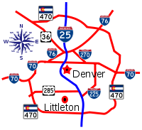
Interstate 25 in Colorado
Encyclopedia
In the U.S. state
of Colorado
, Interstate 25
follows the north–south corridor through Colorado Springs
and Denver
. It replaced U.S. Highway 87 and most of U.S. Highway 85 for through traffic.
Historical nicknames for this route have included the Valley Highway (through Denver
), Monument Valley Highway (through Colorado Springs
), and the Pueblo Freeway (through Pueblo). Within El Paso County
, the route has been dedicated as the Ronald Reagan Highway. In Pueblo County, the route is called John F. Kennedy Memorial Highway.
Interstate 25 is also considered to be part of the unofficial Pan-American Highway
.
 Following the Santa Fe Trail
from New Mexico
, Interstate 25 enters Colorado
as a typical two-lane Interstate Highway, where its entire route in Colorado lies close to the east side of the Rocky Mountains
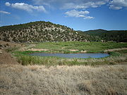
. The route turns from north to west-northwest as I-25 serves Wootton. After leaving Wootton, I-25 turns back up north and bypasses near the east side of the Trinidad Lake State Park
, home of the Trinidad Lake.
Trinidad
, a city near the Trinidad Lake, is the first major city that lies along I-25. For the next 30 miles (48.3 km), I-25 continues north through the rural areas of Colorado until it reaches the small city of Walsenburg
, where the business route - I-25 Bus. - junctions with U.S. Highway 160. I-25 then continues in a north-northwest direction until it bypasses the Orlando Reservoir, then turns north from there until it reaches Colorado City
. In Colorado City, I-25 interchanges with the east end of the Frontier Pathways Scenic and Historic Byway (SH 165
) at exit 74.
After leaving the city, I-25 follows in a north-northeast orientation until it reaches the St. Charles Reservoir just before entering the city of Pueblo
, with the first exit within the southern city limits of Pueblo at exit 94. The Arkansas River
in Pueblo serves as a feeder to the Lake Pueblo State Park
, home of the Pueblo Lake, which is located to the west of the western city limits of Pueblo.
 After leaving Pueblo
, I-25 continues up north with the Union Pacific Railroad
line paralleling closely to the route on the right side after interchanging with Porter Draw at exit 106. By exit 119, the Fountain Creek
joins along and travels parallel with I-25, and continues all the way to the Fountain Creek Regional Park in Widefield. I-25 gradually turns from a general north direction to the north-northwest and serves the census-designated place
of Buttes at exit 122.
 As soon as US 85 leaves I-25 at exit 128, I-25 enters the city limits of Fountain
. Basically, I-25 serves as the border between the western city limits of Fountain on the east side of I-25 and Fort Carson on the west side. Exit 132 (SH 16) serves the north side of the Fountain Creek Regional Park as well as the entrance to Fort Carson. At exit 135, Academy Boulevard serves Pikes Peak Community College
's Centennial campus. By the time I-25 reaches exit 138, the route enters the city limits of Colorado Springs
, where the interchange with US 24 at exit 139 serves the Evergreen Cemetery and Prospect Lake. I-25 turns west at exit 140, along with the Fountain Creek
, where it interchanges with US 85, US 87, and I-25 Bus. I-25 again turns back north again by exit 141. Exit 142 serves downtown Colorado Springs, and to the north of the city lies the Colorado College
, and is served at exit 143 - Uintah Street. After leaving Colorado Springs, I-25 enters the United States Air Force Academy
from exits 150 to 156, and goes through the east side of the territory.
 I-25 leaves El Paso County
and enters Douglas County
at the county line at exit 163. I-25 then continues north through more rural areas east of the Rocky Mountains
until reaching Castle Rock
at exit 181. I-25 continues through a variety of suburban communities until interchanging with E-470
, the partial beltway of Denver
as the toll road serves the Centennial Airport
and the much larger Denver International Airport
.
After entering Arapahoe County
, I-25 interchanges with I-225, a spur that detours motorists to I-70
, at exit 200. I-25, then goes around in a general northwest direction before interchanging with US 6 at exit 209. Then I-25 curves around the west side of downtown Denver
, where it can be accessed by I-70 Bus. at exit 210. I-25 then interchanges with I-70
at exit 213 right before leaving the City and County of Denver
.
, and the Denver-Boulder Turnpike (US 36). Due to the complexity of this triangle-shaped interchange, it was known to be one of many malfunction junctions
throughout the United States
. Beyond that interchange and exit 220, I-25 slips its way through a narrow path between the Badding Reservoir (west side) and the Croke Lake (east side).
At exit 228, I-25 interchanges with the northern termini of E-470
and Northwest Parkway
at a stack interchange
, with the Larkridge Mall just to the north, served by 160th Avenue (SH 7
). As I-25 continues north, it passes through a medley of lakes and reservoirs to the east and north of Fort Collins
. Afterwards, the interstate gradually makes a north-northeast turn as it heads for the Wyoming
state line.
as early as 1944, well before the national movement toward an Interstate Highway system
.
State Highway 1
, an unpaved road, was completed between Denver
and Pueblo
by 1919. Average travel time between Pueblo and Colorado Springs
on this route was approximately 2.5 hours (or a full 8.5 hours from Pueblo to Denver). This route was upgraded with the help of the federal government to become US 85 and US 87 by 1930, now paved in concrete and shortening the travel time between Pueblo and Colorado Springs to just one hour.
The cities of Denver (in 1948) and Pueblo (in 1949) were first to begin building multi-lane highway segments along the route of what would eventually become Interstate 25. Construction follows an earlier segment of the Colorado and Southern Railway
. Denver's segment was originally known as the Valley Highway and was completed by 1958. The city of Colorado Springs followed a similar theme with their Monument Valley Freeway, begun in 1955 and completed by July 1960. Pueblo's section — the Pueblo Freeway - was complete by July 1959.
began to take shape, actual "inter-state" connections began to be made. Wyoming
came first in 1964, building a 9 miles (14.5 km) link north to Cheyenne
that was connected to Colorado
's 17 miles (27.4 km) stretch.
Linking to New Mexico
in the south would prove more problematic as the planned route had to stretch over Raton Pass
, and its accompanying 1800 feet (548.6 m) elevation change, within just 13 miles (20.9 km). Once again, US 85 and US 87 were used, but it had to be re-graded in places to meet Interstate design guidelines. Construction began in 1960, with a link to the city of Trinidad
completed by 1963. The Trinidad Segment (as CDOT now calls the Raton Pass
span) was not fully completed until 1968.
The final segment of the Colorado
portion of Interstate 25, connecting the cities of Walsenburg
and Trinidad
, was completed during 1969. This meant that four lanes of high-speed, nonstop freeway were finally open for a full 305 miles (490.8 km) from New Mexico
north to Wyoming
.
has planned and completed major improvements for the city corridors along I-25.
 The first of these was Transportation Expansion
(T-REX), which widened and expanded nearly 17 miles (27.4 km) of both I-25 and the I-225 bypass in the Denver Metropolitan Area as well as adding various pedestrian and aesthetic improvements. T-REX was also instrumental in expanding Denver's RTD light rail lines to connect outlying communities beyond the city and county of Denver
, adding 19 miles (30.6 km) of new routes.
Starting in early 2004, the T-REX project was completed during 2006 at a cost of US$1.67 billion, under its projected budget and two years ahead of its originally scheduled conclusion. It has been hailed as a "model for other cities to follow" and "ahead of the curve nationally" by federal transportation and transit authorities.
 As T-REX began to wrap up, CDOT's next major effort began with Colorado Springs Metro Interstate Expansion (COSMIX). It could be argued that COSMIX was even more important to Colorado's interests than T-REX had been, since the Colorado Springs corridor of I-25 had seen immense growth over the past four decades. Originally carrying around 8500 vehicles per day in 1960, usage of the former Monument Valley Freeway had grown to an average of 100,000 vehicles per day by 2005.
The major goals of COSMIX, which began in 2005 and was completed during December 2007, were a general expansion and widening of the corridor to three lanes in each direction throughout the city, as well as the reconstruction of two main interchanges (at Bijou Street near downtown Colorado Springs
, and at Rockrimmon Boulevard and North Nevada Avenue in the city's growing north side).
Though CDOT's role in COSMIX was complete, the City of Colorado Springs continued its own independent project to rebuild the Cimarron Street (US 24) bridge and interchange. This work was functionally complete (allowing limited traffic) by May 2008, with full completion achieved by September 2008.
has begun work toward expanding the I-25 corridor between Colorado Springs
and Denver
, as well as the corridor between Denver and the city of Fort Collins
(the "North Forty" project, in reference to the 40 miles (64.4 km) of highway north of Denver that are affected). In both cases, growth of suburbs and smaller communities (such as Castle Rock
and Longmont
) have necessitated expansion much like that of T-REX or COSMIX (though on a less ambitious scale).
Reconstruction of the aging Trinidad Segment is also underway, aimed mainly at rebuilding bridges and upgrading the highway to modern Interstate design standards. Construction began with demolition and reconstruction of the bridges during 2007, and the remaining viaduct reconstruction is currently scheduled to be completed by August 2009.
A New Pueblo Freeway project is in the planning stages. Currently, the draft includes an expansion to six lanes (three each direction), numerous interchange improvements, and enhancements to pedestrian routes and public parks along the corridor. Public review of the final plan is scheduled for the Fall of 2008.
|-
!County
!Location
!Mile
!#
!Destinations
!Notes
|-
|rowspan=13|Las Animas
|
|2.134
|2
|Wootton
|
|-
|
|5.597
|6
|Gallinas
|
|-
|
|7.529
|8
|Springcreek
|
|-
|
|11.013
|11
|Santa Fe Trail
– Starkville
|
|-
|rowspan=4|Trinidad
|13.000
|13A
|Van Buren Street
|
|-
|13.311
|13B
|
|
|-
|13.906
|14
|Commercial Street
|
|-
|14.859
|15
|- Goddard Avenue, Kit Carson Trail
|South end of US 160 overlap
|-
|
|17.728
|18
|El Moro Road
|
|-
|
|22.906
|23
|Hoehne Road
|
|-
|
|26.858
|27
|Ludlow
|
|-
|
|30.464
|30
|Aguilar Road
|
|-
|
|34.090
|34
|Aguilar
(I-25 Bus. west)
|
|-
|rowspan=11|Huerfano
|
|40.485
|41
|Rugby Road
|
|-
|
|41.930
|42
|Pryor
|
|-
|Walsenburg
|49.000
|49
|
|
|-
|
|50.054
|50
|
|North end of US 160 overlap
|-
|
|52.321
|52
|
|
|-
|
|55.000
|55
|Airport Road – Spanish Peaks Airfield
|
|-
|
|56.000
|56
|Redrock Road
|
|-
|
|58.727
|59
|Butte Road
|
|-
|
|60.084
|60
|Huerfano
|
|-
|
|64.046
|64
|Lascar Road
|
|-
|
|66.749
|67
|Apache
|
|-
|rowspan=25|Pueblo
|rowspan=2|Colorado City
|71.264
|71
|Graneros Road
|
|-
|74.367
|74
|
|
|-
|
|77.267
|77
|Abbey Road, Hatchet Ranch Road
|
|-
|
|83.461
|83
|(unnamed road)
|
|-
|
|86.938
|87
|Verde Road
|
|-
|
|87.921
|88
|Burnt Mill Road
|
|-
|
|90.625
|91
|Stem Beach
|
|-
|rowspan=12|Pueblo
|94.769
|94
|
|
|-
|95.901
|96
|Minnequa Avenue, Indiana Avenue
|
|-
|96.673
|97A
|Central Avenue
|
|-
|97.447
|97B
|Abriendo Avenue
|
|-
|97.691
|98A
|
|
|-
|98.545
|98B
|
|
|-
|98.806
|99A
|
|Southbound exit and northbound entrance
|-
|99.334
|99B
|13th Street, Santa Fe Avenue
|
|-
|99.950
|100A
|
|South end of US 50 overlap
|-
|100.681
|100B
|29th Street
|
|-
|101.389
|101
|
|North end of US 50 overlap
|-
|102.160
|102
|Eagleridge Boulevard
|
|-
|
|103.896
|104
|Eden
|
|-
|
|106.075
|106
|Porter Draw
|
|-
|Pueblo West
|108.000
|108
|Purcell Boulevard – Pueblo West
|
|-
|
|110.238
|110
|Pinon
|
|-
|
|114.000
|114
|Young Hollow
|
|-
|
|115.831
|116
|County Line Road
|
|-
|rowspan=26|El Paso
|
|118.843
|119
|Rancho Colorado Boulevard
|
|-
|
|121.459
|122
|Pikes Peak International Raceway
|-
|
|123.189
|123
|(unnamed road)
|
|-
|
|124.564
|125
|Ray Nixon Road
|
|-
|rowspan=2|Fountain
|127.860
|128
|
|North end of US 85 overlap
|-
|131.653
|132
|
|
|-
|Security-Widefield
|135.262
|135
|
|
|-
|rowspan=14|Colorado Springs
|137.752
|138
|
|
|-
|138.742
|139
|, Colorado Springs Municipal Airport
|South end of US 24 overlap
|-
|139.747-
139.869
|140
| (Nevada Avenue, Tejon Street)
|
|-
|141.139
|141
|
|North end of US 24 overlap
|-
|141.849
|142
|Bijou Street – Downtown Colorado Springs
|
|-
|142.832
|143
|Uintah Street
|
|-
|143.520
|144
|Fontanero Street
|
|-
|144.622
|145
|
|
|-
|146.074
|146
|Garden of the Gods Road
|
|-
|148.030
|148
|Nevada Avenue, Corporate Drive, Rockrimmon Boulevard
|
|-
|148.830
|149
|Woodmen Road
|
|-
|150.303
|150
|
|
|-
|151.660
|151
|Briargate Parkway
|
|-
|152.899
|153
|Interquest Parkway
|
|-
|rowspan=2|Air Force Academy
|155.930
|156A
|North Gate Boulevard
|
|-
|155.930
|156B
|North Entrance Air Force Academy
|
|-
|
|158.199
|158
|Baptist Road
|
|-
|Monument
|160.763
|161
|
|
|-
|rowspan=2|
|rowspan=2|163.321
|rowspan=2|163
|rowspan=2|County Line Road – Palmer Lake
|rowspan=2|
|-
|rowspan=14|Douglas
|-
|
|167.464
|167
|Greenland
|
|-
|
|171.820
|172
|Upper Lake Gulch Road
|
|-
|
|172.307
|173
|Larkspur
|Southbound exit and northbound entrance
|-
|
|173.791
|174
|Tomah Road
|
|-
|rowspan=3|Castle Rock
|180.808
|181
|Plum Creek Parkway
|
|-
|181.853
|182
|Wilcox Street, Wolfensberger Road
|
|-
|184.212
|184
|
|North end of US 85 overlap
|-
|
|186.935
|187
|Happy Canyon Road
|
|-
|
|188.486
|188
|Castle Pines Parkway
|
|-
|rowspan=4|Lone Tree
|192.096
|192
|RidgeGate Parkway
|Opened on May 20, 2009
|-
|192.990
|193
|Lincoln Avenue
|
|-
|194.314
|194
|
|
|-
|rowspan=2|195.130
|rowspan=2|195
|rowspan=2|County Line Road
|rowspan=2|
|-
|rowspan=5|Arapahoe
|rowspan=3|Centennial
|-
|196.141
|196
|Dry Creek Road
|
|-
|197.188
|197
|
|South end of SH 88 overlap
|-
|rowspan=2|Greenwood Village
|198.292
|198
|Orchard Road
|
|-
|199.384
|199
|
|North end of SH 88 overlap
|-
|rowspan=20|Denver
|rowspan=20|Denver
|200.093
|200
|
|
|-
|201.578
|201
|
 US 285
south / SH 30
east (Hampden Avenue)
|
|-
|202.640
|202
|Yale Avenue
|
|-
|203.537
|203
|Evans Avenue
|
|-
|204.037
|204
|
|
|-
|205.057
|205
|University Boulevard
|
|-
|205.919
|206
|Downing Street, Washington Street, Emerson Street
|
|-
|206.968
|207A
|Lincoln Street, Broadway
|
|-
|207.488
|207B
|
|South end of US 85 overlap
|-
|207.641-
207.990
|208
|
|Northbound exit is via exit 207B
|-
|209.210
|209
|
|South end of US 6 overlap. Signed as exits 209A-B.
|-
|209.479
|209C
|8th Avenue
|
|-
|210.310
|210A
|
|
|-
|210.415
|210C
|Auraria Parkway
|Northbound exit and southbound entrance
|-
|210.532
|210B
|17th Avenue
|Southbound exit (to 20th Avenue) is via exit 211
|-
|211.109
|211
|23rd Avenue
|
|-
|211.464
|212
|Speer Boulevard – Downtown Denver
|Signed as exits 212A (south) and 212B (north)
|-
|212.096
|212C
|20th Street
|
|-
|212.769
|213
|Park Avenue, West 38th Avenue
|
|-
|213.625-
213.739
|214A
|
|North end of US 6 / US 85 overlap
|-
|rowspan=12|Adams
|
|213.964
|214B
|48th Avenue
|Southbound exit only
|-
|
|215.244
|215
|58th Avenue
|
|-
|
|216.301-
216.397
|216
|
|Signed as exits 216A (east) and 216B (west)
|-
|
|216.779
|216B
|70th Avenue
|Northbound exit and southbound entrance
|-
|
|217.006
|217
|
|Signed as exits 217A-B southbound
|-
|rowspan=2|Thornton
|218.463
|219
|84th Avenue – Federal Heights
|
|-
|219.815
|220
|Thornton Parkway
|
|-
|rowspan=2|Northglenn
|221.027
|221
|104th Avenue – Northglenn
|Former SH 44
|-
|rowspan=2|223.049
|rowspan=2|223
|rowspan=2|
|rowspan=2|
|-
|rowspan=3|Westminster
|-
|225.000
|225
|136th Avenue
|
|-
|226.085
|226
|144th Avenue
|
|-
|rowspan=2|Broomfield
|rowspan=2|Broomfield
|227.745
|228
|
|
|-
|229.107
|229
|
|
|-
|rowspan=7|Weld
|
|232.094
|232
|Dacono
, Erie
|
|-
|
|235.114
|235
|
|-
|
|240.114
|240
|
|
|-
|
|243.148
|243
|
|
|-
|Mead
|245.217
|245
|Mead
|
|-
|rowspan=2|Johnstown
|250.241
|250
|
|
|-
|252.261
|252
|
|
|-
|rowspan=13|Larimer
|
|254.216
|254
|
|
|-
|
|255.272
|255
|
|
|-
|
|257.305
|257
|
|
|-
|Loveland
|259.309
|259
|Crossroads Boulevard- Fort Collins-Loveland Airport
|
|-
|
|262.298
|262
|
|
|-
|rowspan=5|Fort Collins
|265.314
|265
|Harmony Road
|-
|268.475
|268
|Prospect Road
|
|-
|269.370
|269A
|
|
|-
|269.570
|269B
|
|
|-
|271.373
|271
|Mountain Vista Drive
|-
|Wellington
|277.884
|278
|
|-
|
|281.338
|281
|Owl Canyon Road
|
|-
|
|287.550
|288
|Buckeye Road
|
|-
|Weld
|
|292.583
|293
|Carr
|
U.S. state
A U.S. state is any one of the 50 federated states of the United States of America that share sovereignty with the federal government. Because of this shared sovereignty, an American is a citizen both of the federal entity and of his or her state of domicile. Four states use the official title of...
of Colorado
Colorado
Colorado is a U.S. state that encompasses much of the Rocky Mountains as well as the northeastern portion of the Colorado Plateau and the western edge of the Great Plains...
, Interstate 25
Interstate 25
Interstate 25 is an Interstate Highway in the western United States. It is primarily a north–south highway. I-25 stretches from Interstate 10 at Las Cruces, New Mexico, , to Interstate 90 in Buffalo, Wyoming, .Interstate 25 is the main north–south expressway through...
follows the north–south corridor through Colorado Springs
Colorado Springs, Colorado
Colorado Springs is a Home Rule Municipality that is the county seat and most populous city of El Paso County, Colorado, United States. Colorado Springs is located in South-Central Colorado, in the southern portion of the state. It is situated on Fountain Creek and is located south of the Colorado...
and Denver
Denver, Colorado
The City and County of Denver is the capital and the most populous city of the U.S. state of Colorado. Denver is a consolidated city-county, located in the South Platte River Valley on the western edge of the High Plains just east of the Front Range of the Rocky Mountains...
. It replaced U.S. Highway 87 and most of U.S. Highway 85 for through traffic.
Historical nicknames for this route have included the Valley Highway (through Denver
Denver, Colorado
The City and County of Denver is the capital and the most populous city of the U.S. state of Colorado. Denver is a consolidated city-county, located in the South Platte River Valley on the western edge of the High Plains just east of the Front Range of the Rocky Mountains...
), Monument Valley Highway (through Colorado Springs
Colorado Springs, Colorado
Colorado Springs is a Home Rule Municipality that is the county seat and most populous city of El Paso County, Colorado, United States. Colorado Springs is located in South-Central Colorado, in the southern portion of the state. It is situated on Fountain Creek and is located south of the Colorado...
), and the Pueblo Freeway (through Pueblo). Within El Paso County
El Paso County, Colorado
El Paso County is the most populous of the 64 counties of the state of Colorado of the United States, now more populous than Denver County. The United States Census Bureau concluded that the county population was 622,371 in 2010. In recent years, the population had come closer to that of Denver...
, the route has been dedicated as the Ronald Reagan Highway. In Pueblo County, the route is called John F. Kennedy Memorial Highway.
Interstate 25 is also considered to be part of the unofficial Pan-American Highway
Pan-American Highway
The Pan-American Highway is a network of roads measuring about in total length. Except for an rainforest break, called the Darién Gap, the road links the mainland nations of the Americas in a connected highway system. According to Guinness World Records, the Pan-American Highway is the world's...
.
New Mexico state line to Pueblo
Santa Fe Trail
The Santa Fe Trail was a 19th-century transportation route through central North America that connected Missouri with Santa Fe, New Mexico. Pioneered in 1822 by William Becknell, it served as a vital commercial and military highway until the introduction of the railroad to Santa Fe in 1880...
from New Mexico
New Mexico
New Mexico is a state located in the southwest and western regions of the United States. New Mexico is also usually considered one of the Mountain States. With a population density of 16 per square mile, New Mexico is the sixth-most sparsely inhabited U.S...
, Interstate 25 enters Colorado
Colorado
Colorado is a U.S. state that encompasses much of the Rocky Mountains as well as the northeastern portion of the Colorado Plateau and the western edge of the Great Plains...
as a typical two-lane Interstate Highway, where its entire route in Colorado lies close to the east side of the Rocky Mountains
Rocky Mountains
The Rocky Mountains are a major mountain range in western North America. The Rocky Mountains stretch more than from the northernmost part of British Columbia, in western Canada, to New Mexico, in the southwestern United States...
. The route turns from north to west-northwest as I-25 serves Wootton. After leaving Wootton, I-25 turns back up north and bypasses near the east side of the Trinidad Lake State Park
Trinidad Lake State Park
Trinidad Lake State Park is a state park near Trinidad, Colorado, United States. The park protects Trinidad Lake, a dammed reservoir. There are hiking trails, and camping and boating opportunities. The park features historical attractions such as the coal mining ruins at Cokedale...
, home of the Trinidad Lake.
Trinidad
Trinidad, Colorado
The historic City of Trinidad is a Home Rule Municipality that is the county seat and the most populous city of Las Animas County, Colorado, United States...
, a city near the Trinidad Lake, is the first major city that lies along I-25. For the next 30 miles (48.3 km), I-25 continues north through the rural areas of Colorado until it reaches the small city of Walsenburg
Walsenburg, Colorado
The City of Walsenburg or Los Leones is a Statutory City that is the county seat and the most populous city of Huerfano County, Colorado, United States...
, where the business route - I-25 Bus. - junctions with U.S. Highway 160. I-25 then continues in a north-northwest direction until it bypasses the Orlando Reservoir, then turns north from there until it reaches Colorado City
Colorado City, Colorado
Colorado City is a census-designated place in Pueblo County, Colorado, United States. It is part of the Pueblo Metropolitan Statistical Area. The population was 2,193 at the 2010 census...
. In Colorado City, I-25 interchanges with the east end of the Frontier Pathways Scenic and Historic Byway (SH 165
Colorado State Highway 165
State Highway 165 is a long state highway in southern Colorado.-Route description:SH 165 begins in the west at a junction with State Highway 96 roughly fifteen miles east of Silver Cliff. From there the road proceeds to the southeast through portions of San Isabel National Forest...
) at exit 74.
After leaving the city, I-25 follows in a north-northeast orientation until it reaches the St. Charles Reservoir just before entering the city of Pueblo
Pueblo, Colorado
Pueblo is a Home Rule Municipality that is the county seat and the most populous city of Pueblo County, Colorado, United States. The population was 106,595 in 2010 census, making it the 246th most populous city in the United States....
, with the first exit within the southern city limits of Pueblo at exit 94. The Arkansas River
Arkansas River
The Arkansas River is a major tributary of the Mississippi River. The Arkansas generally flows to the east and southeast as it traverses the U.S. states of Colorado, Kansas, Oklahoma, and Arkansas. The river's initial basin starts in the Western United States in Colorado, specifically the Arkansas...
in Pueblo serves as a feeder to the Lake Pueblo State Park
Lake Pueblo State Park
Lake Pueblo State Park is a state park located in Pueblo County, Colorado. It includes of shoreline and of land. Activities it offers include two full-service marinas, recreational fishing, hiking, camping and swimming at a special swim beach.-Lake Pueblo:...
, home of the Pueblo Lake, which is located to the west of the western city limits of Pueblo.
Pueblo to Denver
Pueblo, Colorado
Pueblo is a Home Rule Municipality that is the county seat and the most populous city of Pueblo County, Colorado, United States. The population was 106,595 in 2010 census, making it the 246th most populous city in the United States....
, I-25 continues up north with the Union Pacific Railroad
Union Pacific Railroad
The Union Pacific Railroad , headquartered in Omaha, Nebraska, is the largest railroad network in the United States. James R. Young is president, CEO and Chairman....
line paralleling closely to the route on the right side after interchanging with Porter Draw at exit 106. By exit 119, the Fountain Creek
Fountain Creek
Fountain Creek is a stream in El Paso and Pueblo counties, in Colorado in the United States.-Geography:From its source near the city of Woodland Park north of Pikes Peak, the creek flows southeast through the communities of Green Mountain Falls and Chipita Park to the town of Cascade. It...
joins along and travels parallel with I-25, and continues all the way to the Fountain Creek Regional Park in Widefield. I-25 gradually turns from a general north direction to the north-northwest and serves the census-designated place
Census-designated place
A census-designated place is a concentration of population identified by the United States Census Bureau for statistical purposes. CDPs are delineated for each decennial census as the statistical counterparts of incorporated places such as cities, towns and villages...
of Buttes at exit 122.
Fountain, Colorado
The city of Fountain is a Home Rule Municipality located in El Paso County, Colorado, United States. Fountain is located just ten miles south of Colorado Springs and just east of Fort Carson. Fountain and the Colorado Springs suburbs Security and Widefield make up the "Fountain Valley" community....
. Basically, I-25 serves as the border between the western city limits of Fountain on the east side of I-25 and Fort Carson on the west side. Exit 132 (SH 16) serves the north side of the Fountain Creek Regional Park as well as the entrance to Fort Carson. At exit 135, Academy Boulevard serves Pikes Peak Community College
Pikes Peak Community College
Pikes Peak Community College is a community college located in Colorado Springs, Colorado, and is the largest institution of higher education in the Pikes Peak region. PPCC offers more than 150 programs in liberal arts and sciences transfer and career technical education...
's Centennial campus. By the time I-25 reaches exit 138, the route enters the city limits of Colorado Springs
Colorado Springs, Colorado
Colorado Springs is a Home Rule Municipality that is the county seat and most populous city of El Paso County, Colorado, United States. Colorado Springs is located in South-Central Colorado, in the southern portion of the state. It is situated on Fountain Creek and is located south of the Colorado...
, where the interchange with US 24 at exit 139 serves the Evergreen Cemetery and Prospect Lake. I-25 turns west at exit 140, along with the Fountain Creek
Fountain Creek
Fountain Creek is a stream in El Paso and Pueblo counties, in Colorado in the United States.-Geography:From its source near the city of Woodland Park north of Pikes Peak, the creek flows southeast through the communities of Green Mountain Falls and Chipita Park to the town of Cascade. It...
, where it interchanges with US 85, US 87, and I-25 Bus. I-25 again turns back north again by exit 141. Exit 142 serves downtown Colorado Springs, and to the north of the city lies the Colorado College
Colorado College
The Colorado College is a private liberal arts college in Colorado Springs, Colorado, United States, in the foothills of the Rocky Mountains. It was founded in 1874 by Thomas Nelson Haskell...
, and is served at exit 143 - Uintah Street. After leaving Colorado Springs, I-25 enters the United States Air Force Academy
United States Air Force Academy
The United States Air Force Academy is an accredited college for the undergraduate education of officer candidates for the United States Air Force. Its campus is located immediately north of Colorado Springs in El Paso County, Colorado, United States...
from exits 150 to 156, and goes through the east side of the territory.
El Paso County, Colorado
El Paso County is the most populous of the 64 counties of the state of Colorado of the United States, now more populous than Denver County. The United States Census Bureau concluded that the county population was 622,371 in 2010. In recent years, the population had come closer to that of Denver...
and enters Douglas County
Douglas County, Colorado
Douglas County is the eighth most populous of the 64 counties of the state of Colorado, in the United States. The county is located midway between Colorado's two largest cities: Denver and Colorado Springs...
at the county line at exit 163. I-25 then continues north through more rural areas east of the Rocky Mountains
Rocky Mountains
The Rocky Mountains are a major mountain range in western North America. The Rocky Mountains stretch more than from the northernmost part of British Columbia, in western Canada, to New Mexico, in the southwestern United States...
until reaching Castle Rock
Castle Rock, Colorado
The Town of Castle Rock is the county seat of Douglas County, Colorado, United States and is named for the prominent castle tower-shaped butte near the center of town. It is part of Colorado's Front Range Urban Corridor and is located roughly 28 miles south of Denver and 37 miles north of...
at exit 181. I-25 continues through a variety of suburban communities until interchanging with E-470
E-470
E-470 is a 46-mile limited-access tollway traversing the eastern portion of the Denver-Aurora Metropolitan Area in Colorado. The toll road is not a state highway, but is instead maintained by the E-470 Public Highway Authority.-Route description:...
, the partial beltway of Denver
Denver, Colorado
The City and County of Denver is the capital and the most populous city of the U.S. state of Colorado. Denver is a consolidated city-county, located in the South Platte River Valley on the western edge of the High Plains just east of the Front Range of the Rocky Mountains...
as the toll road serves the Centennial Airport
Centennial Airport
Centennial Airport is located in Dove Valley, an unincorporated portion of Arapahoe County near Denver, Colorado. The airport’s runways also extend into neighboring Douglas County. The airport opened on May 12, 1967 as Arapahoe County Airport, and was renamed on July 13, 1984...
and the much larger Denver International Airport
Denver International Airport
Denver International Airport , often referred to as DIA, is an airport in Denver, Colorado. By land size, at , it is the largest international airport in the United States, and the third largest international airport in the world after King Fahd International Airport and Montréal-Mirabel...
.
After entering Arapahoe County
Arapahoe County, Colorado
As of the census of 2000, there were 487,967 people, 190,909 households, and 125,809 families residing in the county. The population density was 608 people per square mile . There were 196,835 housing units at an average density of 245 per square mile...
, I-25 interchanges with I-225, a spur that detours motorists to I-70
Interstate 70 in Colorado
Interstate 70 is a transcontinental Interstate Highway in the United States, stretching from Cove Fort, Utah to Baltimore, Maryland. In Colorado, the highway traverses an east–west route across the center of the state. In western Colorado, the highway connects the metropolitan areas of Grand...
, at exit 200. I-25, then goes around in a general northwest direction before interchanging with US 6 at exit 209. Then I-25 curves around the west side of downtown Denver
Denver, Colorado
The City and County of Denver is the capital and the most populous city of the U.S. state of Colorado. Denver is a consolidated city-county, located in the South Platte River Valley on the western edge of the High Plains just east of the Front Range of the Rocky Mountains...
, where it can be accessed by I-70 Bus. at exit 210. I-25 then interchanges with I-70
Interstate 70 in Colorado
Interstate 70 is a transcontinental Interstate Highway in the United States, stretching from Cove Fort, Utah to Baltimore, Maryland. In Colorado, the highway traverses an east–west route across the center of the state. In western Colorado, the highway connects the metropolitan areas of Grand...
at exit 213 right before leaving the City and County of Denver
Denver, Colorado
The City and County of Denver is the capital and the most populous city of the U.S. state of Colorado. Denver is a consolidated city-county, located in the South Platte River Valley on the western edge of the High Plains just east of the Front Range of the Rocky Mountains...
.
Denver to Wyoming state line
As I-25 leaves Denver, the route continues up north and interchanges with I-76, I-270Interstate 270 (Colorado)
Interstate 270 is a long highway in the northeastern part of the Denver–Aurora Metropolitan Area in the U.S. state of Colorado. It overlaps U.S. Highway 36 for its entire length. The western terminus of I-270 is at the interchange with I-25 and US 36...
, and the Denver-Boulder Turnpike (US 36). Due to the complexity of this triangle-shaped interchange, it was known to be one of many malfunction junctions
Malfunction Junction
Malfunction Junction is a derisive nickname given by motorists to a confusing, dangerous, or otherwise problematic interchange.-Alabama:*Interstates in Birmingham. This interchange is the busiest in Alabama, and has been the site of many accidents, including roadway punctures and two fiery...
throughout the United States
United States
The United States of America is a federal constitutional republic comprising fifty states and a federal district...
. Beyond that interchange and exit 220, I-25 slips its way through a narrow path between the Badding Reservoir (west side) and the Croke Lake (east side).
At exit 228, I-25 interchanges with the northern termini of E-470
E-470
E-470 is a 46-mile limited-access tollway traversing the eastern portion of the Denver-Aurora Metropolitan Area in Colorado. The toll road is not a state highway, but is instead maintained by the E-470 Public Highway Authority.-Route description:...
and Northwest Parkway
Northwest Parkway
The Northwest Parkway is an toll road running from the intersection of I-25 and E-470 to US 36 at 96th Street. Both termini are in Broomfield, Colorado, northwest of Denver. In combination with E-470 and SH 470 , the Northwest Parkway forms a partial beltway of approximately around the...
at a stack interchange
Stack interchange
A stack interchange is a free-flowing grade separated junction between two roads.In countries where one drives on the right, left turns are handled by semi-directional flyover/under ramps...
, with the Larkridge Mall just to the north, served by 160th Avenue (SH 7
Colorado State Highway 7
State Highway 7 in the U.S. state of Colorado is a state highway. Approximately long, it is located in the north-central portion of the state, traversing the mountains on the east of the continental divide south of Estes Park as well as portions of the Colorado Piedmont north of Denver...
). As I-25 continues north, it passes through a medley of lakes and reservoirs to the east and north of Fort Collins
Fort Collins, Colorado
Fort Collins is a Home Rule Municipality situated on the Cache La Poudre River along the Colorado Front Range, and is the county seat and most populous city of Larimer County, Colorado, United States. Fort Collins is located north of the Colorado State Capitol in Denver. With a 2010 census...
. Afterwards, the interstate gradually makes a north-northeast turn as it heads for the Wyoming
Wyoming
Wyoming is a state in the mountain region of the Western United States. The western two thirds of the state is covered mostly with the mountain ranges and rangelands in the foothills of the Eastern Rocky Mountains, while the eastern third of the state is high elevation prairie known as the High...
state line.
Ancestors and early freeways
Colorado had begun planning of a modern inter-city route along the Front RangeFront Range
The Front Range is a mountain range of the Southern Rocky Mountains of North America located in the north-central portion of the U.S. State of Colorado and southeastern portion of the U.S. State of Wyoming. It is the first mountain range encountered moving west along the 40th parallel north across...
as early as 1944, well before the national movement toward an Interstate Highway system
Interstate Highway System
The Dwight D. Eisenhower National System of Interstate and Defense Highways, , is a network of limited-access roads including freeways, highways, and expressways forming part of the National Highway System of the United States of America...
.
State Highway 1
Colorado State Highway 1
State Highway 1 is a state highway in the U.S. state of Colorado. Approximately long, it is located in northeastern Larimer County and runs between U.S. Highway 287 and State Highway 14 just north of the city line of Fort Collins, northeast of Interstate 25 at Wellington.-Route:The road passes...
, an unpaved road, was completed between Denver
Denver, Colorado
The City and County of Denver is the capital and the most populous city of the U.S. state of Colorado. Denver is a consolidated city-county, located in the South Platte River Valley on the western edge of the High Plains just east of the Front Range of the Rocky Mountains...
and Pueblo
Pueblo, Colorado
Pueblo is a Home Rule Municipality that is the county seat and the most populous city of Pueblo County, Colorado, United States. The population was 106,595 in 2010 census, making it the 246th most populous city in the United States....
by 1919. Average travel time between Pueblo and Colorado Springs
Colorado Springs, Colorado
Colorado Springs is a Home Rule Municipality that is the county seat and most populous city of El Paso County, Colorado, United States. Colorado Springs is located in South-Central Colorado, in the southern portion of the state. It is situated on Fountain Creek and is located south of the Colorado...
on this route was approximately 2.5 hours (or a full 8.5 hours from Pueblo to Denver). This route was upgraded with the help of the federal government to become US 85 and US 87 by 1930, now paved in concrete and shortening the travel time between Pueblo and Colorado Springs to just one hour.
The cities of Denver (in 1948) and Pueblo (in 1949) were first to begin building multi-lane highway segments along the route of what would eventually become Interstate 25. Construction follows an earlier segment of the Colorado and Southern Railway
Colorado and Southern Railway
The Colorado and Southern Railway was a railroad company in the western United States that operated independently from 1898 to 1908, then as part of the Chicago, Burlington and Quincy Railroad until it was absorbed into the Burlington Northern Railroad in 1981.The railway began as the...
. Denver's segment was originally known as the Valley Highway and was completed by 1958. The city of Colorado Springs followed a similar theme with their Monument Valley Freeway, begun in 1955 and completed by July 1960. Pueblo's section — the Pueblo Freeway - was complete by July 1959.
Interstate completion
As the national Interstate Highway SystemInterstate Highway System
The Dwight D. Eisenhower National System of Interstate and Defense Highways, , is a network of limited-access roads including freeways, highways, and expressways forming part of the National Highway System of the United States of America...
began to take shape, actual "inter-state" connections began to be made. Wyoming
Wyoming
Wyoming is a state in the mountain region of the Western United States. The western two thirds of the state is covered mostly with the mountain ranges and rangelands in the foothills of the Eastern Rocky Mountains, while the eastern third of the state is high elevation prairie known as the High...
came first in 1964, building a 9 miles (14.5 km) link north to Cheyenne
Cheyenne, Wyoming
Cheyenne is the capital and most populous city of the U.S. state of Wyoming and the county seat of Laramie County. It is the principal city of the Cheyenne, Wyoming, Metropolitan Statistical Area which encompasses all of Laramie County. The population is 59,466 at the 2010 census. Cheyenne is the...
that was connected to Colorado
Colorado
Colorado is a U.S. state that encompasses much of the Rocky Mountains as well as the northeastern portion of the Colorado Plateau and the western edge of the Great Plains...
's 17 miles (27.4 km) stretch.
Linking to New Mexico
New Mexico
New Mexico is a state located in the southwest and western regions of the United States. New Mexico is also usually considered one of the Mountain States. With a population density of 16 per square mile, New Mexico is the sixth-most sparsely inhabited U.S...
in the south would prove more problematic as the planned route had to stretch over Raton Pass
Raton Pass
Raton Pass is a mountain pass on the Santa Fe Trail along the Colorado-New Mexico border in the United States. Raton Pass is a federally designated National Historic Landmark...
, and its accompanying 1800 feet (548.6 m) elevation change, within just 13 miles (20.9 km). Once again, US 85 and US 87 were used, but it had to be re-graded in places to meet Interstate design guidelines. Construction began in 1960, with a link to the city of Trinidad
Trinidad, Colorado
The historic City of Trinidad is a Home Rule Municipality that is the county seat and the most populous city of Las Animas County, Colorado, United States...
completed by 1963. The Trinidad Segment (as CDOT now calls the Raton Pass
Raton Pass
Raton Pass is a mountain pass on the Santa Fe Trail along the Colorado-New Mexico border in the United States. Raton Pass is a federally designated National Historic Landmark...
span) was not fully completed until 1968.
The final segment of the Colorado
Colorado
Colorado is a U.S. state that encompasses much of the Rocky Mountains as well as the northeastern portion of the Colorado Plateau and the western edge of the Great Plains...
portion of Interstate 25, connecting the cities of Walsenburg
Walsenburg, Colorado
The City of Walsenburg or Los Leones is a Statutory City that is the county seat and the most populous city of Huerfano County, Colorado, United States...
and Trinidad
Trinidad, Colorado
The historic City of Trinidad is a Home Rule Municipality that is the county seat and the most populous city of Las Animas County, Colorado, United States...
, was completed during 1969. This meant that four lanes of high-speed, nonstop freeway were finally open for a full 305 miles (490.8 km) from New Mexico
New Mexico
New Mexico is a state located in the southwest and western regions of the United States. New Mexico is also usually considered one of the Mountain States. With a population density of 16 per square mile, New Mexico is the sixth-most sparsely inhabited U.S...
north to Wyoming
Wyoming
Wyoming is a state in the mountain region of the Western United States. The western two thirds of the state is covered mostly with the mountain ranges and rangelands in the foothills of the Eastern Rocky Mountains, while the eastern third of the state is high elevation prairie known as the High...
.
Modern expansion
As both population and traffic increased in Colorado during the 1990s and 2000s, the Colorado Department of TransportationColorado Department of Transportation
The Colorado Department of Transportation is the agency of state government responsible for transportation in the State of Colorado of the United States. CDOT is responsible for maintaining 9,144 mile highway system, including 3,429 bridges with over 28 billion vehicle miles of travel per year...
has planned and completed major improvements for the city corridors along I-25.
T-REX (Denver)
Colorado T-REX Project (TRansportation EXpansion)
The Transportation Expansion Project or T-REX was a $1.67 billion venture that had a goal of transforming the way people in the metro Denver area commute within the areas of Interstates 25 and 225, then the country's 14th busiest intersection...
(T-REX), which widened and expanded nearly 17 miles (27.4 km) of both I-25 and the I-225 bypass in the Denver Metropolitan Area as well as adding various pedestrian and aesthetic improvements. T-REX was also instrumental in expanding Denver's RTD light rail lines to connect outlying communities beyond the city and county of Denver
Denver, Colorado
The City and County of Denver is the capital and the most populous city of the U.S. state of Colorado. Denver is a consolidated city-county, located in the South Platte River Valley on the western edge of the High Plains just east of the Front Range of the Rocky Mountains...
, adding 19 miles (30.6 km) of new routes.
Starting in early 2004, the T-REX project was completed during 2006 at a cost of US$1.67 billion, under its projected budget and two years ahead of its originally scheduled conclusion. It has been hailed as a "model for other cities to follow" and "ahead of the curve nationally" by federal transportation and transit authorities.
COSMIX (Colorado Springs)
The major goals of COSMIX, which began in 2005 and was completed during December 2007, were a general expansion and widening of the corridor to three lanes in each direction throughout the city, as well as the reconstruction of two main interchanges (at Bijou Street near downtown Colorado Springs
Colorado Springs, Colorado
Colorado Springs is a Home Rule Municipality that is the county seat and most populous city of El Paso County, Colorado, United States. Colorado Springs is located in South-Central Colorado, in the southern portion of the state. It is situated on Fountain Creek and is located south of the Colorado...
, and at Rockrimmon Boulevard and North Nevada Avenue in the city's growing north side).
Though CDOT's role in COSMIX was complete, the City of Colorado Springs continued its own independent project to rebuild the Cimarron Street (US 24) bridge and interchange. This work was functionally complete (allowing limited traffic) by May 2008, with full completion achieved by September 2008.
Future
Since 2006, the Colorado Department of TransportationColorado Department of Transportation
The Colorado Department of Transportation is the agency of state government responsible for transportation in the State of Colorado of the United States. CDOT is responsible for maintaining 9,144 mile highway system, including 3,429 bridges with over 28 billion vehicle miles of travel per year...
has begun work toward expanding the I-25 corridor between Colorado Springs
Colorado Springs, Colorado
Colorado Springs is a Home Rule Municipality that is the county seat and most populous city of El Paso County, Colorado, United States. Colorado Springs is located in South-Central Colorado, in the southern portion of the state. It is situated on Fountain Creek and is located south of the Colorado...
and Denver
Denver, Colorado
The City and County of Denver is the capital and the most populous city of the U.S. state of Colorado. Denver is a consolidated city-county, located in the South Platte River Valley on the western edge of the High Plains just east of the Front Range of the Rocky Mountains...
, as well as the corridor between Denver and the city of Fort Collins
Fort Collins, Colorado
Fort Collins is a Home Rule Municipality situated on the Cache La Poudre River along the Colorado Front Range, and is the county seat and most populous city of Larimer County, Colorado, United States. Fort Collins is located north of the Colorado State Capitol in Denver. With a 2010 census...
(the "North Forty" project, in reference to the 40 miles (64.4 km) of highway north of Denver that are affected). In both cases, growth of suburbs and smaller communities (such as Castle Rock
Castle Rock, Colorado
The Town of Castle Rock is the county seat of Douglas County, Colorado, United States and is named for the prominent castle tower-shaped butte near the center of town. It is part of Colorado's Front Range Urban Corridor and is located roughly 28 miles south of Denver and 37 miles north of...
and Longmont
Longmont, Colorado
Longmont is a Home Rule Municipality in Boulder and Weld counties in the U.S. state of Colorado. Longmont is located in Northern Colorado. Longmont is the 13th most populous city in the State of Colorado. The word "Longmont" comes from Longs Peak, a prominent mountain named for explorer Stephen H....
) have necessitated expansion much like that of T-REX or COSMIX (though on a less ambitious scale).
Reconstruction of the aging Trinidad Segment is also underway, aimed mainly at rebuilding bridges and upgrading the highway to modern Interstate design standards. Construction began with demolition and reconstruction of the bridges during 2007, and the remaining viaduct reconstruction is currently scheduled to be completed by August 2009.
A New Pueblo Freeway project is in the planning stages. Currently, the draft includes an expansion to six lanes (three each direction), numerous interchange improvements, and enhancements to pedestrian routes and public parks along the corridor. Public review of the final plan is scheduled for the Fall of 2008.
Exit list
{| class="wikitable"|-
!County
!Location
!Mile
!#
Exit number
An exit number is a number assigned to a road junction, usually an exit from a freeway. It is usually marked on the same sign as the destinations of the exit, as well as a sign in the gore....
!Destinations
!Notes
|-
|rowspan=13|Las Animas
Las Animas County, Colorado
Las Animas County has the largest area of the 64 counties of the State of Colorado of the United States. Las Animas County takes its name from the Mexican Spanish name of the Purgatoire River, originally called El Río de las Ánimas Perdidas en Purgatorio, which means "River of the Lost Souls in...
|
|2.134
|2
|Wootton
|
|-
|
|5.597
|6
|Gallinas
|
|-
|
|7.529
|8
|Springcreek
|
|-
|
|11.013
|11
|Santa Fe Trail
Santa Fe Trail
The Santa Fe Trail was a 19th-century transportation route through central North America that connected Missouri with Santa Fe, New Mexico. Pioneered in 1822 by William Becknell, it served as a vital commercial and military highway until the introduction of the railroad to Santa Fe in 1880...
– Starkville
Starkville, Colorado
Starkville is a Statutory Town in Las Animas County, Colorado, United States...
|
|-
|rowspan=4|Trinidad
Trinidad, Colorado
The historic City of Trinidad is a Home Rule Municipality that is the county seat and the most populous city of Las Animas County, Colorado, United States...
|13.000
|13A
|Van Buren Street
|
|-
|13.311
|13B
|
|
|-
|13.906
|14
|Commercial Street
|
|-
|14.859
|15
|- Goddard Avenue, Kit Carson Trail
|South end of US 160 overlap
|-
|
|17.728
|18
|El Moro Road
|
|-
|
|22.906
|23
|Hoehne Road
|
|-
|
|26.858
|27
|Ludlow
Ludlow, Colorado
Ludlow is a ghost town in Las Animas County, Colorado, United States. It was famous as the site of the Ludlow Massacre in 1914. The town site is nestled at the entrance to a canyon in the foothills of the Sangre de Cristo Mountains. It is located along the western side of Interstate 25...
|
|-
|
|30.464
|30
|Aguilar Road
|
|-
|
|34.090
|34
|Aguilar
Aguilar, Colorado
The Town of Aguilar is a Statutory Town located in Las Animas County, Colorado, United States. Cattleman and prominent pioneer José Ramón Aguilar founded the town in 1894...
(I-25 Bus. west)
|
|-
|rowspan=11|Huerfano
Huerfano County, Colorado
Huerfano County is one of the 64 counties of the State of Colorado of the United States. The county was named for the Huerfano Butte, a local landmark. The county population was 7,862 at U.S. Census 2000...
|
|40.485
|41
|Rugby Road
|
|-
|
|41.930
|42
|Pryor
|
|-
|Walsenburg
Walsenburg, Colorado
The City of Walsenburg or Los Leones is a Statutory City that is the county seat and the most populous city of Huerfano County, Colorado, United States...
|49.000
|49
|
|
|-
|
|50.054
|50
|
|North end of US 160 overlap
|-
|
|52.321
|52
|
|
|-
|
|55.000
|55
|Airport Road – Spanish Peaks Airfield
Spanish Peaks Airfield
Spanish Peaks Airfield is a public general aviation airport located 5 miles north of the central business district of the city of Walsenburg in Huerfano County, Colorado, United States. The airport is owned by Huerfano County...
|
|-
|
|56.000
|56
|Redrock Road
|
|-
|
|58.727
|59
|Butte Road
|
|-
|
|60.084
|60
|Huerfano
|
|-
|
|64.046
|64
|Lascar Road
|
|-
|
|66.749
|67
|Apache
|
|-
|rowspan=25|Pueblo
Pueblo County, Colorado
Pueblo County is the tenth most populous of the 64 counties of the state of Colorado of the United States. The county was named for the historic city of Pueblo which took its name from the Spanish language word meaning "town" or "village". The United States Census Bureau estimates that the...
|rowspan=2|Colorado City
Colorado City, Colorado
Colorado City is a census-designated place in Pueblo County, Colorado, United States. It is part of the Pueblo Metropolitan Statistical Area. The population was 2,193 at the 2010 census...
|71.264
|71
|Graneros Road
|
|-
|74.367
|74
|
|
|-
|
|77.267
|77
|Abbey Road, Hatchet Ranch Road
|
|-
|
|83.461
|83
|(unnamed road)
|
|-
|
|86.938
|87
|Verde Road
|
|-
|
|87.921
|88
|Burnt Mill Road
|
|-
|
|90.625
|91
|Stem Beach
Stem Beach, Colorado
-References:...
|
|-
|rowspan=12|Pueblo
Pueblo, Colorado
Pueblo is a Home Rule Municipality that is the county seat and the most populous city of Pueblo County, Colorado, United States. The population was 106,595 in 2010 census, making it the 246th most populous city in the United States....
|94.769
|94
|
|
|-
|95.901
|96
|Minnequa Avenue, Indiana Avenue
|
|-
|96.673
|97A
|Central Avenue
|
|-
|97.447
|97B
|Abriendo Avenue
|
|-
|97.691
|98A
|
|
|-
|98.545
|98B
|
|
|-
|98.806
|99A
|
|Southbound exit and northbound entrance
|-
|99.334
|99B
|13th Street, Santa Fe Avenue
|
|-
|99.950
|100A
|
|South end of US 50 overlap
|-
|100.681
|100B
|29th Street
|
|-
|101.389
|101
|
|North end of US 50 overlap
|-
|102.160
|102
|Eagleridge Boulevard
|
|-
|
|103.896
|104
|Eden
|
|-
|
|106.075
|106
|Porter Draw
|
|-
|Pueblo West
Pueblo West, Colorado
Pueblo West is a census-designated place in Pueblo County, Colorado, United States. It is part of the Pueblo Metropolitan Statistical Area. The population was 16,899 at the 2000 census...
|108.000
|108
|Purcell Boulevard – Pueblo West
Pueblo West, Colorado
Pueblo West is a census-designated place in Pueblo County, Colorado, United States. It is part of the Pueblo Metropolitan Statistical Area. The population was 16,899 at the 2000 census...
|
|-
|
|110.238
|110
|Pinon
|
|-
|
|114.000
|114
|Young Hollow
|
|-
|
|115.831
|116
|County Line Road
|
|-
|rowspan=26|El Paso
El Paso County, Colorado
El Paso County is the most populous of the 64 counties of the state of Colorado of the United States, now more populous than Denver County. The United States Census Bureau concluded that the county population was 622,371 in 2010. In recent years, the population had come closer to that of Denver...
|
|118.843
|119
|Rancho Colorado Boulevard
|
|-
|
|121.459
|122
|Pikes Peak International Raceway
Pikes Peak International Raceway
Pikes Peak International Raceway, also known as PPIR, is a participant focused racetrack located in Fountain, Colorado, south of Colorado Springs and north of Pueblo...
|-
|
|123.189
|123
|(unnamed road)
|
|-
|
|124.564
|125
|Ray Nixon Road
|
|-
|rowspan=2|Fountain
Fountain, Colorado
The city of Fountain is a Home Rule Municipality located in El Paso County, Colorado, United States. Fountain is located just ten miles south of Colorado Springs and just east of Fort Carson. Fountain and the Colorado Springs suburbs Security and Widefield make up the "Fountain Valley" community....
|127.860
|128
|
|North end of US 85 overlap
|-
|131.653
|132
|
|
|-
|Security-Widefield
Security-Widefield, Colorado
Security-Widefield is a census-designated place in El Paso County, Colorado, United States. The population was 29,845 at the 2000 census.-Geography:Security-Widefield is located at ....
|135.262
|135
|
|
|-
|rowspan=14|Colorado Springs
Colorado Springs, Colorado
Colorado Springs is a Home Rule Municipality that is the county seat and most populous city of El Paso County, Colorado, United States. Colorado Springs is located in South-Central Colorado, in the southern portion of the state. It is situated on Fountain Creek and is located south of the Colorado...
|137.752
|138
|
|
|-
|138.742
|139
|,
Colorado Springs Municipal Airport|South end of US 24 overlap
|-
|139.747-
139.869
|140
| (Nevada Avenue, Tejon Street)
|
|-
|141.139
|141
|
|North end of US 24 overlap
|-
|141.849
|142
|Bijou Street – Downtown Colorado Springs
|
|-
|142.832
|143
|Uintah Street
|
|-
|143.520
|144
|Fontanero Street
|
|-
|144.622
|145
|
|
|-
|146.074
|146
|Garden of the Gods Road
|
|-
|148.030
|148
|Nevada Avenue, Corporate Drive, Rockrimmon Boulevard
|
|-
|148.830
|149
|Woodmen Road
|
|-
|150.303
|150
|
|
|-
|151.660
|151
|Briargate Parkway
|
|-
|152.899
|153
|Interquest Parkway
|
|-
|rowspan=2|Air Force Academy
Air Force Academy, Colorado
Air Force Academy is a census-designated place in El Paso County, Colorado, United States. The CDP includes a large portion of the grounds of the United States Air Force Academy, including the cadet housing facilities. The population was 6,680 at the 2010 census...
|155.930
|156A
|North Gate Boulevard
|
|-
|155.930
|156B
|North Entrance Air Force Academy
United States Air Force Academy
The United States Air Force Academy is an accredited college for the undergraduate education of officer candidates for the United States Air Force. Its campus is located immediately north of Colorado Springs in El Paso County, Colorado, United States...
|
|-
|
|158.199
|158
|Baptist Road
|
|-
|Monument
Monument, Colorado
Monument is a growing town situated on the Rampart Range in El Paso County, Colorado, United States. Monument is bordered by Pike National Forest on the west, Colorado Springs and the United States Air Force Academy to the south, foothills and rock outcroppings to the north and rolling plains to...
|160.763
|161
|
|
|-
|rowspan=2|
|rowspan=2|163.321
|rowspan=2|163
|rowspan=2|County Line Road – Palmer Lake
Palmer Lake, Colorado
Palmer Lake is a Statutory Town in El Paso County, Colorado, United States. The population was 2,179 at the 2000 census. Palmer Lake was founded by General William Jackson Palmer in 1871. The town was soon incorporated in 1889....
|rowspan=2|
|-
|rowspan=14|Douglas
Douglas County, Colorado
Douglas County is the eighth most populous of the 64 counties of the state of Colorado, in the United States. The county is located midway between Colorado's two largest cities: Denver and Colorado Springs...
|-
|
|167.464
|167
|Greenland
Greenland, Colorado
Greenland is an unincorporated community in Douglas County, Colorado, United States. Greenland is located off Exit 167 on Interstate 25. The largest nearby incorporated towns are Larkspur and Monument: Larkspur lies about 7 miles northeast and Monument about 13 miles south of the community. The U.S...
|
|-
|
|171.820
|172
|Upper Lake Gulch Road
|
|-
|
|172.307
|173
|Larkspur
Larkspur, Colorado
The Town of Larkspur is a Home Rule Municipality in Douglas County, Colorado, United States. The population was 234 at the 2000 census. Each year on weekends in June and July, the Colorado Renaissance Festival is held in the hills just west of the town...
|Southbound exit and northbound entrance
|-
|
|173.791
|174
|Tomah Road
|
|-
|rowspan=3|Castle Rock
Castle Rock, Colorado
The Town of Castle Rock is the county seat of Douglas County, Colorado, United States and is named for the prominent castle tower-shaped butte near the center of town. It is part of Colorado's Front Range Urban Corridor and is located roughly 28 miles south of Denver and 37 miles north of...
|180.808
|181
|Plum Creek Parkway
|
|-
|181.853
|182
|Wilcox Street, Wolfensberger Road
|
|-
|184.212
|184
|
|North end of US 85 overlap
|-
|
|186.935
|187
|Happy Canyon Road
|
|-
|
|188.486
|188
|Castle Pines Parkway
|
|-
|rowspan=4|Lone Tree
Lone Tree, Colorado
Lone Tree is a Home Rule Municipality in Douglas County, Colorado, United States. The population was 4,873 at the 2000 census.-Geography:Lone Tree is located at . It is on the northern border of Douglas County, and directly adjacent to Arapahoe County...
|192.096
|192
|RidgeGate Parkway
|Opened on May 20, 2009
|-
|192.990
|193
|Lincoln Avenue
|
|-
|194.314
|194
|
|
|-
|rowspan=2|195.130
|rowspan=2|195
|rowspan=2|County Line Road
|rowspan=2|
|-
|rowspan=5|Arapahoe
Arapahoe County, Colorado
As of the census of 2000, there were 487,967 people, 190,909 households, and 125,809 families residing in the county. The population density was 608 people per square mile . There were 196,835 housing units at an average density of 245 per square mile...
|rowspan=3|Centennial
Centennial, Colorado
The city of Centennial is a Home Rule City located in Arapahoe County, Colorado, United States, and part of the Denver-Aurora metropolitan area. The city was to have a total population of 100,377 in 2010 census. Centennial is the tenth-most populous municipality in the state of Colorado and its...
|-
|196.141
|196
|Dry Creek Road
|
|-
|197.188
|197
|
|South end of SH 88 overlap
|-
|rowspan=2|Greenwood Village
Greenwood Village, Colorado
The city of Greenwood Village is a prominent suburb of the Denver-Aurora Metropolitan Statistical Area and a Home Rule Municipality located in Arapahoe County, Colorado, United States...
|198.292
|198
|Orchard Road
|
|-
|199.384
|199
|
|North end of SH 88 overlap
|-
|rowspan=20|Denver
|rowspan=20|Denver
|200.093
|200
|
|
|-
|201.578
|201
|
US 285U.S. Route 285
U.S. Route 285 is a north–south United States highway, running 845 miles through the states of Texas, New Mexico and Colorado. The highway's northern terminus is in Denver, Colorado, at exit 201 on Interstate 25. Its southern terminus is in Sanderson, Texas at an intersection with U.S....
south / SH 30
Colorado State Highway 30
Colorado State Highway 30, alternatively known as Hampden Avenue, is a state route in the independent city of Denver and Arapahoe County. Its west end is at Interstate 25 and US 285 in Denver and its east end is at Quincy Avenue east of Aurora....
east (Hampden Avenue)
|
|-
|202.640
|202
|Yale Avenue
|
|-
|203.537
|203
|Evans Avenue
|
|-
|204.037
|204
|
|
|-
|205.057
|205
|University Boulevard
|
|-
|205.919
|206
|Downing Street, Washington Street, Emerson Street
|
|-
|206.968
|207A
|Lincoln Street, Broadway
|
|-
|207.488
|207B
|
|South end of US 85 overlap
|-
|207.641-
207.990
|208
|
|Northbound exit is via exit 207B
|-
|209.210
|209
|
|South end of US 6 overlap. Signed as exits 209A-B.
|-
|209.479
|209C
|8th Avenue
|
|-
|210.310
|210A
|
|
|-
|210.415
|210C
|Auraria Parkway
|Northbound exit and southbound entrance
|-
|210.532
|210B
|17th Avenue
|Southbound exit (to 20th Avenue) is via exit 211
|-
|211.109
|211
|23rd Avenue
|
|-
|211.464
|212
|Speer Boulevard – Downtown Denver
|Signed as exits 212A (south) and 212B (north)
|-
|212.096
|212C
|20th Street
|
|-
|212.769
|213
|Park Avenue, West 38th Avenue
|
|-
|213.625-
213.739
|214A
|
|North end of US 6 / US 85 overlap
|-
|rowspan=12|Adams
Adams County, Colorado
Adams County is the fifth most populous of the 64 counties of the state of Colorado of the United States. The United States Census Bureau estimates that the county population was 441,603 in 2010 census, a 21.4% increase since 2000 census. Adams County is named for Alva Adams, Governor of the...
|
|213.964
|214B
|48th Avenue
|Southbound exit only
|-
|
|215.244
|215
|58th Avenue
|
|-
|
|216.301-
216.397
|216
|
|Signed as exits 216A (east) and 216B (west)
|-
|
|216.779
|216B
|70th Avenue
|Northbound exit and southbound entrance
|-
|
|217.006
|217
|
|Signed as exits 217A-B southbound
|-
|rowspan=2|Thornton
Thornton, Colorado
The city of Thornton is a Home Rule Municipality in Adams and Weld counties in the U.S. state of Colorado and a suburb of the Denver-Aurora-Broomfield, CO Metropolitan Statistical Area. Thornton is northeast of the state's capital, Denver. The United States Census Bureau that the city population...
|218.463
|219
|84th Avenue – Federal Heights
Federal Heights, Colorado
The city of Federal Heights is a Statutory City located in Adams County, Colorado, United States. As of 2005, the city is estimated to have a total population of 11,706.-Geography:Federal Heights is located at ....
|
|-
|219.815
|220
|Thornton Parkway
|
|-
|rowspan=2|Northglenn
Northglenn, Colorado
Northglenn is a Home Rule Municipality in Adams and Weld counties in the U.S. state of Colorado. The United States Census Bureau estimates that the city population was 33,697 in 2008.-Geography:Northglenn is located at ....
|221.027
|221
|104th Avenue – Northglenn
Northglenn, Colorado
Northglenn is a Home Rule Municipality in Adams and Weld counties in the U.S. state of Colorado. The United States Census Bureau estimates that the city population was 33,697 in 2008.-Geography:Northglenn is located at ....
|Former SH 44
Colorado State Highway 44
State Highway 44 is a highway in Adams County, Colorado.-Route description:SH 44 runs , starting at a junction with Colorado State Highway 2, heading west across the South Platte River and ending at Colorado Boulevard in Thornton...
|-
|rowspan=2|223.049
|rowspan=2|223
|rowspan=2|
|rowspan=2|
|-
|rowspan=3|Westminster
Westminster, Colorado
Westminster is a Home Rule Municipality in Adams and Jefferson counties in the U.S. state of Colorado. Westminster is a northwest suburb of Denver. The Westminster Municipal Center is located north-northwest of the Colorado State Capitol. The United States Census Bureau that the city population...
|-
|225.000
|225
|136th Avenue
|
|-
|226.085
|226
|144th Avenue
|
|-
|rowspan=2|Broomfield
|rowspan=2|Broomfield
Broomfield, Colorado
The City and County of Broomfield is a prominent suburb and tier of the Denver metropolitan area in the State of Colorado of the United States. Broomfield has a consolidated city and county government which operates under Article XX, Sections 10-13 of the Constitution of the State of Colorado. The...
|227.745
|228
|
|
|-
|229.107
|229
|
|
|-
|rowspan=7|Weld
Weld County, Colorado
As of the census of 2000, there were 180,936 people, 63,247 households, and 45,221 families residing in the county. The population density was 45 people per square mile . There were 66,194 housing units at an average density of 17 per square mile...
|
|232.094
|232
|Dacono
Dacono, Colorado
The City of Dacono is a Home Rule Municipality located in Weld County, Colorado, United States. The population was 3,015 at the 2000 census.-History:...
, Erie
Erie, Colorado
Erie is a Statutory Town in Boulder and Weld counties in the U.S. state of Colorado. The estimated population according to the 2010 US Census is 18,135 and was recorded as 6,291 at the 2000 census. The Town of Erie is located just west of I-25 for easy access to I-70, Denver International Airport...
|
|-
|
|235.114
|235
|
|-
|
|240.114
|240
|
|
|-
|
|243.148
|243
|
|
|-
|Mead
Mead, Colorado
Mead is a Statutory Town in Weld County, Colorado, United States. The population was 2,017 at the 2000 census.Mead was mentioned as the origin of a silver dolphin pendant in Bones, Season 2, Episode 11....
|245.217
|245
|Mead
Mead, Colorado
Mead is a Statutory Town in Weld County, Colorado, United States. The population was 2,017 at the 2000 census.Mead was mentioned as the origin of a silver dolphin pendant in Bones, Season 2, Episode 11....
|
|-
|rowspan=2|Johnstown
Johnstown, Colorado
Johnstown is a Home Rule Municipality in Larimer and Weld counties in the U.S. state of Colorado. The population was 3,827 at the 2000 census. As of 2010 the US Census Bureau estimates the population of Johnstown at 9,887.-Geography:...
|250.241
|250
|
|
|-
|252.261
|252
|
|
|-
|rowspan=13|Larimer
Larimer County, Colorado
Larimer County is the seventh most populous and the ninth most extensive of the 64 counties of the State of Colorado of the United States. The county is located at the northern end of the Front Range, at the edge of the Colorado Eastern Plains along the border with Wyoming...
|
|254.216
|254
|
|
|-
|
|255.272
|255
|
|
|-
|
|257.305
|257
|
|
|-
|Loveland
Loveland, Colorado
Loveland is a Home Rule Municipality that is the second most populous city in Larimer County, Colorado, United States. Loveland is situated north of the Colorado State Capitol in Denver. Loveland is the 14th most populous city in Colorado. The United States Census Bureau that in 2010 the...
|259.309
|259
|Crossroads Boulevard- Fort Collins-Loveland Airport
|
|-
|
|262.298
|262
|
|
|-
|rowspan=5|Fort Collins
Fort Collins, Colorado
Fort Collins is a Home Rule Municipality situated on the Cache La Poudre River along the Colorado Front Range, and is the county seat and most populous city of Larimer County, Colorado, United States. Fort Collins is located north of the Colorado State Capitol in Denver. With a 2010 census...
|265.314
|265
|Harmony Road
|-
|268.475
|268
|Prospect Road
|
|-
|269.370
|269A
|
|
|-
|269.570
|269B
|
|
|-
|271.373
|271
|Mountain Vista Drive
|-
|Wellington
Wellington, Colorado
Wellington is a Statutory Town in Larimer County, Colorado, United States. The population was 6,289 at the 2010 census.-Geography:Wellington is located at ....
|277.884
|278
|
|-
|
|281.338
|281
|Owl Canyon Road
|
|-
|
|287.550
|288
|Buckeye Road
|
|-
|Weld
Weld County, Colorado
As of the census of 2000, there were 180,936 people, 63,247 households, and 45,221 families residing in the county. The population density was 45 people per square mile . There were 66,194 housing units at an average density of 17 per square mile...
|
|292.583
|293
|Carr
Carr, Colorado
Carr is an unincorporated town and U.S. Post Office in Weld County, Colorado, United States. The ZIP Code of the Carr Post Office is 80612.-History:...
|