

Interstate 29 in Iowa
Encyclopedia
In the U.S. state
of Iowa
, Interstate 29
(I-29) is a north–south Interstate Highway which closely parallels the Missouri River
. I-29 enters Iowa from Missouri
near Hamburg
and heads to the north-northwest through the Omaha-Council Bluffs
and the Sioux City
areas. It exits the state by crossing the Big Sioux River
into South Dakota
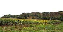
. For its entire distance through the state, it runs on the flat land between the Missouri River and the Loess Hills
.
I-29 was built in sections over a period of 15 years. When there was a shortage of male workers, female workers stepped in to build a 20 miles (32.2 km) section near Missouri Valley
. Between Council Bluffs and Sioux City, I-29 replaced U.S. Route 75
(US 75) as the major route in western Iowa. As a result of I-29's creation, US 75 south of Sioux City was relocated into Nebraska
.
. The interstate heads northwest, where it meets Iowa Highway 333
(Iowa 333) at a diamond interchange
. From Hamburg, I-29 continues to the northwest for 7 miles (11.3 km) where it meets Iowa 2 3 miles (4.8 km) east of Nebraska City, Nebraska
. North of the Iowa 2 interchange, the interstate straightens out to the north; interchanges serving Percival, Thurman
, and Bartlett
are spaced out every 4+1/2 mi. Near Pacific Junction
, I-29 is joined
by US 34 for 3 miles (4.8 km). At the same interchange where US 34 splits away near Glenwood
, I-29 is joined by US 275
.
 North of Glenwood, I-29 / US 275 continue north towards Council Bluffs
. The two routes meet Iowa 370
, which crosses into Nebraska
providing access to Offutt Air Force Base
in Bellevue, Nebraska
. Near Lake Manawa, US 275 splits away from I-29 at the Iowa 92 interchange. 3/4 mi north of the split, the interstate is joined from the east by Interstate 80. The two interstates head west together through southern Council Bluffs for 3 miles (4.8 km). When the two interstates split at a Y interchange
, I-80 immediately crosses the Missouri River
into Nebraska, and I-29 immediately turns to the north. Two miles (3.2 km) to the north is a modified Y interchange with US 6 and the eastern end of I-480.
North of Council Bluffs, I-29 is joined by I-680 near Crescent
. The two interstates travel north together for 9 miles (14.5 km) before I-680 splits off to the east near Loveland. I-29 continues north for 4 miles (6.4 km) to Missouri Valley
, where it intersects US 30. North of Missouri Valley, the interstate turns to the northeast towards Modale
and then straightens out again south of Mondamin
, where I-29 meets the western end of Iowa 127
. From Mondamin, it travels north for 23 miles (37 km) to the Iowa 175
interchange at Onawa
, passing Little Sioux
and Blencoe
.
 North of Onawa, I-29 continues northwest for 15 miles (24.1 km) towards Sloan
, where it meets the western end of Iowa 141
. As it approaches the Sioux City
metro area
, it passes the Sioux Gateway Airport
at Sergeant Bluff
. At the Singing Hills Boulevard interchange, northbound is joined by southbound U.S. Route 75 Business (US 75 Bus.). One mile (1.6 km) later, US 75 Bus. ends at the cloverleaf interchange
with US 20 / US 75, which is also the eastern end of Interstate 129
.
For the next 3 miles (4.8 km) north of the I-129 interchange, I-29 runs closely, as close as 200 feet (61 m), to the Missouri River. The interstate follows the curve of the river and turns to the west. It meets Gordon Drive, which carries US 20 Bus. US 20 Bus. traffic is directed onto the interstate for 1/2 mi before it exits via a volleyball interchange
which represents the national northern end of U.S. Route 77. I-29 continues west along the Missouri River, and after the Big Sioux River
converges into the Missouri, I-29 follows the Big Sioux. Shortly before it crosses the Big Sioux into South Dakota
, Iowa 12 splits away to the north.
to the then-US 20 / US 77
bridge across the Missouri River
, opened around October 1, 1958. In September 1961, I-29 was extended across the Big Sioux River to South Dakota
. On April 1, 1962, one of the directional spans collapsed 4 feet (1.2 m) as a result of flooding, but did not fall into the river.
North of Council Bluffs
, a 20 miles (32.2 km) section to Missouri Valley
opened in November 1958. By December 1967, the two sections were connected, creating 100 miles (160.9 km) of continuous interstate highway. Due to a shortage of male workers, at least 20 women were enlisted to help build this section of I-29. The women were paid $2.00 hourly ($ hourly in dollars), the same wage as men would have earned.
Construction of I-29 in the Council Bluffs area was completed in 1970 and the route was open to Glenwood
in the same year. Additional interchanges were added in the Sioux City and Council Bluffs areas between 1970 and 1971. The last 30 miles (48.3 km) of interstate were constructed and opened in sections over the next two years; the last section opened on December 15, 1972.
In 1973, US 34 was expanded to four lanes near Glenwood, which resulted in US 34 being rerouted onto I-29 for 3 miles (4.8 km). In 2003, US 275
was rerouted onto I-29 from the same interchange near Glenwood northward to Iowa 92 at Council Bluffs. The former US 275 alignment was turned over
to Mills
and Pottawattamie Counties
.
Much of I-29 was built next to existing highways, most notably US 75. When the section of I-29 opened between Council Bluffs and Missouri Valley, US 75 was rerouted onto I-29. When construction connecting the Sioux City and Council Bluffs segments was completed, US 75 was again rerouted onto I-29. In the mid-1980s, US 75, from Council Bluffs to Sioux City, was completely rerouted out of Iowa, instead extending up the former US 73 corridor in Nebraska
.
!County
!Location
!Mile
!Exit
!Destinations
!Notes
|-
|rowspan=6|Fremont
|rowspan=2|Hamburg
|align=right|0.000
|align=center|
|
|
|-
|align=right|1.811
|align=center|1
|
|
|-
|rowspan=2|Benton Township
|align=right|10.144
|align=center|10
|, Nebraska City
|
|-
|align=right|15.458
|align=center|15
|
|
|-
|rowspan=2|Scott Township
|align=right|19.917
|align=center|20
|
|
|-
|align=right|24.447
|align=center|24
|
|Connects to Fremont CR J10
|-
|rowspan=3|Mills
|rowspan=2|Pacific Junction
|align=right|32.386
|align=center|32
|, Plattsmouth
|South end of US 34 overlap; connects to Mills CR L35
|-
|align=right|35.477
|align=center|35
|
|North end of US 34 overlap; south end of US 275 overlap
|-
|Saint Marys Township
|align=right|42.805
|align=center|42
| – Bellevue
|Serves Offutt Air Force Base
; connects to Mills CR H10
|-
|rowspan=16|Pottawattamie
|rowspan=12|Council Bluffs
|align=right|47.865
|align=center|47
|
|North end of US 275 overlap.
|-
|align=right|48.526
|align=center|48
|
|South end of I-80 overlap
|-
|align=right|49.230
|align=center|3
|
|
|-
|align=right|50.683
|align=center|1B
|South 24th Street
|
|-
|align=right|51.644
|align=center|51
| – Omaha
|North end of I-80 overlap
|-
|align=right|52.378
|align=center|52
|Nebraska Avenue
|
|-
|align=right|53.199
|align=center|53A
|9th Avenue, Harrah's Boulevard
|
|-
|align=right|53.777
|align=center|53B
| – Omaha
|Northbound left exit; no exit to US 6 east; serves Eppley Airfield
|-
|align=right|54.204
|align=center|54A
|Avenue G
|Southbound exit and entrance only
|-
|align=right|54.623
|align=center|54B
|North 35th Street
|Northbound exit and entrance only
|-
|align=right|55.715
|align=center|55
|North 25th Street
|
|-
|align=right|56.917
|align=center|56
|
|Southbound left exit and northbound entrance only.
|-
|Crescent
|align=right|61.966
|align=center|61
| – North Omaha
|South end of I-680 overlap; signed as exits 61A (east) and 61B (west)
|-
|Honey Creek
|align=right|66.465
|align=center|66
|Honey Creek
|
|-
|rowspan=2|Loveland
|align=right|71.623
|align=center|71
|
|North end of I-680 overlap
|-
|align=right|71.988
|align=center|72
|Loveland
|Pottawattamie CR G12 (west) and G14 (east)
|-
|rowspan=4|Harrison
|Missouri Valley
|align=right|75.786
|align=center|75
|, Blair
|
|-
|Modale
|align=right|82.088
|align=center|82
|
|
|-
|Mondamin
|align=right|89.309
|align=center|89
|
|
|-
|Little Sioux
|align=right|95.714
|align=center|95
|
|
|-
|rowspan=3|Monona
|Blencoe
|align=right|105.347
|align=center|105
|
|
|-
|Onawa
|align=right|112.326
|align=center|112
|, Decatur
|
|-
|Whiting
|align=right|120.210
|align=center|120
|
|
|-
|rowspan=12|Woodbury
|Sloan
|align=right|127.571
|align=center|127
|
|
|-
|rowspan=2|Salix
|align=right|133.970
|align=center|134
|Salix
|Woodbury CR K25
|-
|align=right|135.708
|align=center|135
|Port Neal Landing
|Woodbury CR D51
|-
|Sergeant Bluff
|align=right|141.194
|align=center|141
|
|
|-
|rowspan=8|Sioux City
|align=right|143.413
|align=center|143
|
|
|-
|align=right|144.473
|align=center|144
|, South Sioux City
|Signed as exits 144A (east/north) and 144B (west/south)
|-
|align=right|147.476
|align=center|147A
|Floyd Boulevard
|
|-
|align=right|148.050
|align=center|147B
|
|
|-
|align=right|148.493
|align=center|148
| – South Sioux City
|Northbound exit only
|-
|align=right|149.081
|align=center|149
| – South Sioux City
|Southbound exit only for US 20 Bus./US 77
|-
|align=right|151.365
|align=center|151
|
|
|-
|align=right|151.826
|align=center|
|
|
|-
U.S. state
A U.S. state is any one of the 50 federated states of the United States of America that share sovereignty with the federal government. Because of this shared sovereignty, an American is a citizen both of the federal entity and of his or her state of domicile. Four states use the official title of...
of Iowa
Iowa
Iowa is a state located in the Midwestern United States, an area often referred to as the "American Heartland". It derives its name from the Ioway people, one of the many American Indian tribes that occupied the state at the time of European exploration. Iowa was a part of the French colony of New...
, Interstate 29
Interstate 29
Interstate 29 is an Interstate Highway in the Midwestern United States. I-29 runs from Kansas City, Missouri, at a junction with Interstate 35 and Interstate 70 to the Canadian border near Pembina, North Dakota, where it connects with Manitoba Highway 75 via the short Manitoba Highway 29.-Route...
(I-29) is a north–south Interstate Highway which closely parallels the Missouri River
Missouri River
The Missouri River flows through the central United States, and is a tributary of the Mississippi River. It is the longest river in North America and drains the third largest area, though only the thirteenth largest by discharge. The Missouri's watershed encompasses most of the American Great...
. I-29 enters Iowa from Missouri
Missouri
Missouri is a US state located in the Midwestern United States, bordered by Iowa, Illinois, Kentucky, Tennessee, Arkansas, Oklahoma, Kansas and Nebraska. With a 2010 population of 5,988,927, Missouri is the 18th most populous state in the nation and the fifth most populous in the Midwest. It...
near Hamburg
Hamburg, Iowa
Hamburg is a city in Fremont County, Iowa, United States, along the Nishnabotna River. The population was 1,240 at the 2000 census.-Geography:According to the United States Census Bureau, the city has a total area of , all of it land.-Demographics:...
and heads to the north-northwest through the Omaha-Council Bluffs
Omaha-Council Bluffs metropolitan area
The Omaha-Council Bluffs metropolitan area is a metropolitan area comprising the cities of Omaha, Nebraska, Council Bluffs, Iowa, and surrounding areas. The Omaha-Council Bluffs metropolitan area has a population of 865,350 . The metropolitan area, as defined by the Office of Management and Budget,...
and the Sioux City
Sioux City, Iowa
Sioux City is a city in Plymouth and Woodbury counties in the western part of the U.S. state of Iowa. The population was 82,684 in the 2010 census, a decline from 85,013 in the 2000 census, which makes it currently the fourth largest city in the state....
areas. It exits the state by crossing the Big Sioux River
Big Sioux River
The Big Sioux River is a tributary of the Missouri River, long, in eastern South Dakota and northwestern Iowa in the United States. The United States Board on Geographic Names settled on "Big Sioux River" as the stream's name in 1961....
into South Dakota
South Dakota
South Dakota is a state located in the Midwestern region of the United States. It is named after the Lakota and Dakota Sioux American Indian tribes. Once a part of Dakota Territory, South Dakota became a state on November 2, 1889. The state has an area of and an estimated population of just over...
. For its entire distance through the state, it runs on the flat land between the Missouri River and the Loess Hills
Loess Hills
The Loess Hills are a formation of wind-deposited loess soil in the westernmost part of Iowa and Missouri along the Missouri River.-Geology:The Loess Hills are generally located between 1 and east of the Missouri River channel...
.
I-29 was built in sections over a period of 15 years. When there was a shortage of male workers, female workers stepped in to build a 20 miles (32.2 km) section near Missouri Valley
Missouri Valley, Iowa
Missouri Valley is a city in Harrison County, Iowa, United States. The population was 2,992 at the 2000 census.-Geography:Missouri Valley's longitude and latitude coordinatesin decimal form are 41.558912, -95.893926...
. Between Council Bluffs and Sioux City, I-29 replaced U.S. Route 75
U.S. Route 75
U.S. Route 75 is a north–south U.S. Highway. The highway's northern terminus is in Kittson County, Minnesota, at the Canadian border, where it continues as Manitoba Highway 75 on the other side of a closed border crossing. Its southern terminus is at Interstate 30 and Interstate 45 in Dallas,...
(US 75) as the major route in western Iowa. As a result of I-29's creation, US 75 south of Sioux City was relocated into Nebraska
Nebraska
Nebraska is a state on the Great Plains of the Midwestern United States. The state's capital is Lincoln and its largest city is Omaha, on the Missouri River....
.
Route description
Interstate 29 enters Iowa south of HamburgHamburg, Iowa
Hamburg is a city in Fremont County, Iowa, United States, along the Nishnabotna River. The population was 1,240 at the 2000 census.-Geography:According to the United States Census Bureau, the city has a total area of , all of it land.-Demographics:...
. The interstate heads northwest, where it meets Iowa Highway 333
Iowa Highway 333
Iowa Highway 333 is a short highway in southwestern Iowa. It serves as a connector route between Interstate 29 and U.S. Route 275 in the town of Hamburg, Iowa...
(Iowa 333) at a diamond interchange
Diamond interchange
A diamond interchange is a common type of road junction, used where a freeway crosses a minor road. The freeway itself is grade-separated from the minor road, one crossing the other over a bridge...
. From Hamburg, I-29 continues to the northwest for 7 miles (11.3 km) where it meets Iowa 2 3 miles (4.8 km) east of Nebraska City, Nebraska
Nebraska City, Nebraska
Nebraska City is a city in Otoe County, Nebraska, United States. The population was 7,228 at the 2000 census. It is the county seat of Otoe County...
. North of the Iowa 2 interchange, the interstate straightens out to the north; interchanges serving Percival, Thurman
Thurman, Iowa
Thurman is a city in Fremont County, Iowa, United States. The population was 236 at the 2000 census.-Geography:Thurman is located at .According to the United States Census Bureau, the city has a total area of , all of it land....
, and Bartlett
Bartlett, Iowa
Bartlett is an unincorporated community in Fremont County, Iowa, United States. It is located at the intersection of County Road L31 and Western Avenue, near Interstate 29 and the Missouri River. It is five miles northwest of Thurman, at 40.887295N -95.7950145W.-History:Bartlett was named after...
are spaced out every 4+1/2 mi. Near Pacific Junction
Pacific Junction, Iowa
Pacific Junction is a city in Mills County, Iowa, United States. The population was 507 at the 2000 census.-History:"PJ" was established by the railroad in 1871 to serve as the western terminus of the Burlington and Missouri River Railroad, the eastern terminus of the Nebraska Burlington & Missouri...
, I-29 is joined
Concurrency (road)
A concurrency, overlap, or coincidence in a road network is an instance of one physical road bearing two or more different highway, motorway, or other route numbers...
by US 34 for 3 miles (4.8 km). At the same interchange where US 34 splits away near Glenwood
Glenwood, Iowa
Glenwood is a city in and the county seat of Mills County, Iowa, United States. The population was 5,269 in the 2010 census, a decline from 5,358 in the 2000 census. -History:...
, I-29 is joined by US 275
U.S. Route 275
U.S. Route 275 is a north–south United States highway. It is a branch of US 75, originally terminating at that route in Council Bluffs, Iowa. The highway's northern terminus is in O'Neill, Nebraska, at an intersection with U.S. Highway 20 and U.S. Highway 281. Its southern terminus is near...
.
Council Bluffs, Iowa
Council Bluffs, known until 1852 as Kanesville, Iowathe historic starting point of the Mormon Trail and eventual northernmost anchor town of the other emigrant trailsis a city in and the county seat of Pottawattamie County, Iowa, United States and is on the east bank of the Missouri River across...
. The two routes meet Iowa 370
Iowa Highway 370
Iowa Highway 370 is a state highway which connects Nebraska Highway 370 to Interstate 29 south of Council Bluffs. Iowa 370 crosses the Bellevue Bridge over the Missouri River at Bellevue, Nebraska. The entire route is within of Council Bluffs and downtown Omaha, Nebraska.-Route description:Iowa...
, which crosses into Nebraska
Nebraska
Nebraska is a state on the Great Plains of the Midwestern United States. The state's capital is Lincoln and its largest city is Omaha, on the Missouri River....
providing access to Offutt Air Force Base
Offutt Air Force Base
Offutt Air Force Base is a U.S. Air Force installation near Omaha, and lies adjacent to Bellevue in Sarpy County, Nebraska. It is the headquarters of the U.S...
in Bellevue, Nebraska
Bellevue, Nebraska
Bellevue is a city in Sarpy County, Nebraska, United States. The population was 50,137 at the 2010 census. Eight miles south of Omaha, Bellevue is part of the Omaha-Council Bluffs metropolitan area. Originally settled in the 1830s, It was the first state capitol. Bellevue was incorporated in...
. Near Lake Manawa, US 275 splits away from I-29 at the Iowa 92 interchange. 3/4 mi north of the split, the interstate is joined from the east by Interstate 80. The two interstates head west together through southern Council Bluffs for 3 miles (4.8 km). When the two interstates split at a Y interchange
Interchange (road)
In the field of road transport, an interchange is a road junction that typically uses grade separation, and one or more ramps, to permit traffic on at least one highway to pass through the junction without directly crossing any other traffic stream. It differs from a standard intersection, at which...
, I-80 immediately crosses the Missouri River
Missouri River
The Missouri River flows through the central United States, and is a tributary of the Mississippi River. It is the longest river in North America and drains the third largest area, though only the thirteenth largest by discharge. The Missouri's watershed encompasses most of the American Great...
into Nebraska, and I-29 immediately turns to the north. Two miles (3.2 km) to the north is a modified Y interchange with US 6 and the eastern end of I-480.
North of Council Bluffs, I-29 is joined by I-680 near Crescent
Crescent, Iowa
Crescent is a city in Pottawattamie County, Iowa, United States. The population was 537 at the 2000 census.-Geography:Crescent is located at ....
. The two interstates travel north together for 9 miles (14.5 km) before I-680 splits off to the east near Loveland. I-29 continues north for 4 miles (6.4 km) to Missouri Valley
Missouri Valley, Iowa
Missouri Valley is a city in Harrison County, Iowa, United States. The population was 2,992 at the 2000 census.-Geography:Missouri Valley's longitude and latitude coordinatesin decimal form are 41.558912, -95.893926...
, where it intersects US 30. North of Missouri Valley, the interstate turns to the northeast towards Modale
Modale, Iowa
Modale is a city in Harrison County, Iowa, United States. The population was 303 at the 2000 census.Modale just stands for "Missouri-dale", a reference to the nearby Missouri River.-Geography:Modale is located at ....
and then straightens out again south of Mondamin
Mondamin, Iowa
Mondamin is a city in Harrison County, Iowa, United States. The population was 423 at the 2000 census.-Geography:Mondamin is located at .According to the United States Census Bureau, the city has a total area of , all of it land....
, where I-29 meets the western end of Iowa 127
Iowa Highway 127
Iowa Highway 127 is an east–west highway in western Iowa. It has a length of . It lies entirely in Harrison County. Iowa Highway 127's western terminus is at Interstate 29 near Mondamin, while its eastern terminus is in Logan at U.S...
. From Mondamin, it travels north for 23 miles (37 km) to the Iowa 175
Iowa Highway 175
Iowa Highway 175 is a main east–west route in the northern portion of the state. The highway has a length of . Iowa Highway 175 enters the state by a Missouri River crossing between Decatur, Nebraska and Onawa. The highway continues westward as Nebraska Highway 51. Iowa 175's eastern...
interchange at Onawa
Onawa, Iowa
Onawa is a city in Monona County, Iowa, United States. The population was 3,091 at the 2000 census. It is the county seat of Monona County. It is the largest town on the Iowa side of the Missouri River between Council Bluffs and Sioux City....
, passing Little Sioux
Little Sioux, Iowa
Little Sioux is a city in Harrison County, Iowa, United States. The population was 217 at the 2000 census. The city is most known for Little Sioux Scout Ranch of the Boy Scouts of America.-Geography:Little Sioux is located at ....
and Blencoe
Blencoe, Iowa
Blencoe is a city in Monona County, Iowa, United States. The population was 231 at the 2000 census.-Geography:Blencoe is located at .According to the United States Census Bureau, the city has a total area of , all of it land....
.
Sloan, Iowa
Sloan is a city in Woodbury County, Iowa, United States. It is part of the Sioux City, IA–NE–SD Metropolitan Statistical Area. The population was 1,032 at the 2000 census.-Economy:...
, where it meets the western end of Iowa 141
Iowa Highway 141
Iowa Highway 141 is a major east–west highway in the western and central portions of the state. It is the most direct link between Sioux City and Des Moines. It also serves as a freeway link between Des Moines and the outlying communities of Perry, Granger, and Grimes. Iowa 141's western...
. As it approaches the Sioux City
Sioux City, Iowa
Sioux City is a city in Plymouth and Woodbury counties in the western part of the U.S. state of Iowa. The population was 82,684 in the 2010 census, a decline from 85,013 in the 2000 census, which makes it currently the fourth largest city in the state....
metro area
Metro Area
Metro Area is a Brooklyn-based dance music production team composed of Morgan Geist and Darshan Jesrani.- History :Geist grew up in Wayne, New Jersey, while Jesrani is from upstate New York...
, it passes the Sioux Gateway Airport
Sioux Gateway Airport
-History:The construction of Sioux City Army Air Base began in March 1942, about three months after the Japanese attack on Pearl Harbor. Opened on 5 July 1942, it became a major training center during World War II for crew members of B-24 Liberators and B-17 Flying Fortresses...
at Sergeant Bluff
Sergeant Bluff, Iowa
As of the census of 2000, there were 3,321 people, 1,137 households, and 891 families residing in the city. The population density was 1,668.7 people per square mile . There were 1,176 housing units at an average density of 590.9 per square mile...
. At the Singing Hills Boulevard interchange, northbound is joined by southbound U.S. Route 75 Business (US 75 Bus.). One mile (1.6 km) later, US 75 Bus. ends at the cloverleaf interchange
Cloverleaf interchange
A cloverleaf interchange is a two-level interchange in which left turns, reverse direction in left-driving regions, are handled by ramp roads...
with US 20 / US 75, which is also the eastern end of Interstate 129
Interstate 129
Interstate 129 is an auxiliary Interstate Highway which connects South Sioux City to Interstate 29 in Sioux City, Iowa. Opened in 1976, I-129 is a long route, running in Nebraska. At , Interstate 129 is the shortest highway in the state of Iowa...
.
For the next 3 miles (4.8 km) north of the I-129 interchange, I-29 runs closely, as close as 200 feet (61 m), to the Missouri River. The interstate follows the curve of the river and turns to the west. It meets Gordon Drive, which carries US 20 Bus. US 20 Bus. traffic is directed onto the interstate for 1/2 mi before it exits via a volleyball interchange
Volleyball interchange
A three-level diamond interchange is a type of highway interchange where through traffic on both main roads is grade-separated from intersections which handle transferring traffic...
which represents the national northern end of U.S. Route 77. I-29 continues west along the Missouri River, and after the Big Sioux River
Big Sioux River
The Big Sioux River is a tributary of the Missouri River, long, in eastern South Dakota and northwestern Iowa in the United States. The United States Board on Geographic Names settled on "Big Sioux River" as the stream's name in 1961....
converges into the Missouri, I-29 follows the Big Sioux. Shortly before it crosses the Big Sioux into South Dakota
South Dakota
South Dakota is a state located in the Midwestern region of the United States. It is named after the Lakota and Dakota Sioux American Indian tribes. Once a part of Dakota Territory, South Dakota became a state on November 2, 1889. The state has an area of and an estimated population of just over...
, Iowa 12 splits away to the north.
History
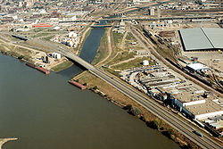
Construction of Interstate 29 began in the late 1950s in the Sioux City area. The first section to open, a 3 miles (4.8 km) long stretch from the Big Sioux RiverBig Sioux River
The Big Sioux River is a tributary of the Missouri River, long, in eastern South Dakota and northwestern Iowa in the United States. The United States Board on Geographic Names settled on "Big Sioux River" as the stream's name in 1961....
to the then-US 20 / US 77
U.S. Route 77
U.S. Route 77 is a north–south United States highway. It is unsigned in and around Dallas, Texas. Its historic segment through South Dakota and Minnesota was decommissioned with the advent of Interstate 29 but otherwise the route has been spared the decommissioning that has shortened other US...
bridge across the Missouri River
Missouri River
The Missouri River flows through the central United States, and is a tributary of the Mississippi River. It is the longest river in North America and drains the third largest area, though only the thirteenth largest by discharge. The Missouri's watershed encompasses most of the American Great...
, opened around October 1, 1958. In September 1961, I-29 was extended across the Big Sioux River to South Dakota
South Dakota
South Dakota is a state located in the Midwestern region of the United States. It is named after the Lakota and Dakota Sioux American Indian tribes. Once a part of Dakota Territory, South Dakota became a state on November 2, 1889. The state has an area of and an estimated population of just over...
. On April 1, 1962, one of the directional spans collapsed 4 feet (1.2 m) as a result of flooding, but did not fall into the river.
North of Council Bluffs
Council Bluffs, Iowa
Council Bluffs, known until 1852 as Kanesville, Iowathe historic starting point of the Mormon Trail and eventual northernmost anchor town of the other emigrant trailsis a city in and the county seat of Pottawattamie County, Iowa, United States and is on the east bank of the Missouri River across...
, a 20 miles (32.2 km) section to Missouri Valley
Missouri Valley, Iowa
Missouri Valley is a city in Harrison County, Iowa, United States. The population was 2,992 at the 2000 census.-Geography:Missouri Valley's longitude and latitude coordinatesin decimal form are 41.558912, -95.893926...
opened in November 1958. By December 1967, the two sections were connected, creating 100 miles (160.9 km) of continuous interstate highway. Due to a shortage of male workers, at least 20 women were enlisted to help build this section of I-29. The women were paid $2.00 hourly ($ hourly in dollars), the same wage as men would have earned.
Construction of I-29 in the Council Bluffs area was completed in 1970 and the route was open to Glenwood
Glenwood, Iowa
Glenwood is a city in and the county seat of Mills County, Iowa, United States. The population was 5,269 in the 2010 census, a decline from 5,358 in the 2000 census. -History:...
in the same year. Additional interchanges were added in the Sioux City and Council Bluffs areas between 1970 and 1971. The last 30 miles (48.3 km) of interstate were constructed and opened in sections over the next two years; the last section opened on December 15, 1972.
In 1973, US 34 was expanded to four lanes near Glenwood, which resulted in US 34 being rerouted onto I-29 for 3 miles (4.8 km). In 2003, US 275
U.S. Route 275
U.S. Route 275 is a north–south United States highway. It is a branch of US 75, originally terminating at that route in Council Bluffs, Iowa. The highway's northern terminus is in O'Neill, Nebraska, at an intersection with U.S. Highway 20 and U.S. Highway 281. Its southern terminus is near...
was rerouted onto I-29 from the same interchange near Glenwood northward to Iowa 92 at Council Bluffs. The former US 275 alignment was turned over
Decommissioned highway
A decommissioned highway is a highway that has been removed from service, shut down or has had its authorization as a federal or state highway removed. Decommissioning can include the complete or partial demolition or abandonment of an old highway structure because the old roadway has lost its...
to Mills
Mills County, Iowa
-2010 census:The 2010 census recorded a population of 15,059 in the county, with a population density of . There were 6,109 housing units, of which 5,605 were occupied.-2000 census:...
and Pottawattamie Counties
Pottawattamie County, Iowa
Pottawattamie County is a county located in the U.S. state of Iowa. The population was 93,158 in the 2010 census, an increase from 87,704 in the 2000 census and is the second largest county by area in Iowa. The Pottawattamie county seat is located at Council Bluffs. It is one of three Iowa...
.
Much of I-29 was built next to existing highways, most notably US 75. When the section of I-29 opened between Council Bluffs and Missouri Valley, US 75 was rerouted onto I-29. When construction connecting the Sioux City and Council Bluffs segments was completed, US 75 was again rerouted onto I-29. In the mid-1980s, US 75, from Council Bluffs to Sioux City, was completely rerouted out of Iowa, instead extending up the former US 73 corridor in Nebraska
Nebraska
Nebraska is a state on the Great Plains of the Midwestern United States. The state's capital is Lincoln and its largest city is Omaha, on the Missouri River....
.
Exit list
{| class=wikitable!County
!Location
!Mile
!Exit
!Destinations
!Notes
|-
|rowspan=6|Fremont
Fremont County, Iowa
-2010 census:The 2010 census recorded a population of 7,441 in the county, with a population density of . There were 3,431 housing units, of which 3,064 were occupied.-2000 census:...
|rowspan=2|Hamburg
Hamburg, Iowa
Hamburg is a city in Fremont County, Iowa, United States, along the Nishnabotna River. The population was 1,240 at the 2000 census.-Geography:According to the United States Census Bureau, the city has a total area of , all of it land.-Demographics:...
|align=right|0.000
|align=center|
|
|
|-
|align=right|1.811
|align=center|1
|
|
|-
|rowspan=2|Benton Township
|align=right|10.144
|align=center|10
|, Nebraska City
Nebraska City, Nebraska
Nebraska City is a city in Otoe County, Nebraska, United States. The population was 7,228 at the 2000 census. It is the county seat of Otoe County...
|
|-
|align=right|15.458
|align=center|15
|
|
|-
|rowspan=2|Scott Township
|align=right|19.917
|align=center|20
|
|
|-
|align=right|24.447
|align=center|24
|
|Connects to Fremont CR J10
|-
|rowspan=3|Mills
Mills County, Iowa
-2010 census:The 2010 census recorded a population of 15,059 in the county, with a population density of . There were 6,109 housing units, of which 5,605 were occupied.-2000 census:...
|rowspan=2|Pacific Junction
Pacific Junction, Iowa
Pacific Junction is a city in Mills County, Iowa, United States. The population was 507 at the 2000 census.-History:"PJ" was established by the railroad in 1871 to serve as the western terminus of the Burlington and Missouri River Railroad, the eastern terminus of the Nebraska Burlington & Missouri...
|align=right|32.386
|align=center|32
|, Plattsmouth
Plattsmouth, Nebraska
Plattsmouth is a city in and the county seat of Cass County, Nebraska, United States, which was founded in 1855. The population was 6,887 at the 2000 census.-History:...
|South end of US 34 overlap; connects to Mills CR L35
|-
|align=right|35.477
|align=center|35
|
|North end of US 34 overlap; south end of US 275 overlap
|-
|Saint Marys Township
|align=right|42.805
|align=center|42
| – Bellevue
Bellevue, Nebraska
Bellevue is a city in Sarpy County, Nebraska, United States. The population was 50,137 at the 2010 census. Eight miles south of Omaha, Bellevue is part of the Omaha-Council Bluffs metropolitan area. Originally settled in the 1830s, It was the first state capitol. Bellevue was incorporated in...
|Serves Offutt Air Force Base
Offutt Air Force Base
Offutt Air Force Base is a U.S. Air Force installation near Omaha, and lies adjacent to Bellevue in Sarpy County, Nebraska. It is the headquarters of the U.S...
; connects to Mills CR H10
|-
|rowspan=16|Pottawattamie
Pottawattamie County, Iowa
Pottawattamie County is a county located in the U.S. state of Iowa. The population was 93,158 in the 2010 census, an increase from 87,704 in the 2000 census and is the second largest county by area in Iowa. The Pottawattamie county seat is located at Council Bluffs. It is one of three Iowa...
|rowspan=12|Council Bluffs
Council Bluffs, Iowa
Council Bluffs, known until 1852 as Kanesville, Iowathe historic starting point of the Mormon Trail and eventual northernmost anchor town of the other emigrant trailsis a city in and the county seat of Pottawattamie County, Iowa, United States and is on the east bank of the Missouri River across...
|align=right|47.865
|align=center|47
|
|North end of US 275 overlap.
|-
|align=right|48.526
|align=center|48
|
|South end of I-80 overlap
|-
|align=right|49.230
|align=center|3
|
|
|-
|align=right|50.683
|align=center|1B
|South 24th Street
|
|-
|align=right|51.644
|align=center|51
| – Omaha
Omaha, Nebraska
Omaha is the largest city in the state of Nebraska, United States, and is the county seat of Douglas County. It is located in the Midwestern United States on the Missouri River, about 20 miles north of the mouth of the Platte River...
|North end of I-80 overlap
|-
|align=right|52.378
|align=center|52
|Nebraska Avenue
|
|-
|align=right|53.199
|align=center|53A
|9th Avenue, Harrah's Boulevard
|
|-
|align=right|53.777
|align=center|53B
| – Omaha
Omaha, Nebraska
Omaha is the largest city in the state of Nebraska, United States, and is the county seat of Douglas County. It is located in the Midwestern United States on the Missouri River, about 20 miles north of the mouth of the Platte River...
|Northbound left exit; no exit to US 6 east; serves Eppley Airfield
|-
|align=right|54.204
|align=center|54A
|Avenue G
|Southbound exit and entrance only
|-
|align=right|54.623
|align=center|54B
|North 35th Street
|Northbound exit and entrance only
|-
|align=right|55.715
|align=center|55
|North 25th Street
|
|-
|align=right|56.917
|align=center|56
|
|Southbound left exit and northbound entrance only.
|-
|Crescent
Crescent, Iowa
Crescent is a city in Pottawattamie County, Iowa, United States. The population was 537 at the 2000 census.-Geography:Crescent is located at ....
|align=right|61.966
|align=center|61
| – North Omaha
North Omaha, Nebraska
North Omaha is a community area in Omaha, Nebraska, USA. It is bordered by Cuming and Dodge Streets on the south, Interstate 680 on the north, North 72nd Street on the west and the Missouri River and Carter Lake, Iowa on the east, as defined by the University of Nebraska at Omaha and the Omaha...
|South end of I-680 overlap; signed as exits 61A (east) and 61B (west)
|-
|Honey Creek
|align=right|66.465
|align=center|66
|Honey Creek
|
|-
|rowspan=2|Loveland
|align=right|71.623
|align=center|71
|
|North end of I-680 overlap
|-
|align=right|71.988
|align=center|72
|Loveland
|Pottawattamie CR G12 (west) and G14 (east)
|-
|rowspan=4|Harrison
Harrison County, Iowa
-2010 census:The 2010 census recorded a population of 14,928 in the county, with a population density of . There were 6,731 housing units, of which 5,987 were occupied.-2000 census:...
|Missouri Valley
Missouri Valley, Iowa
Missouri Valley is a city in Harrison County, Iowa, United States. The population was 2,992 at the 2000 census.-Geography:Missouri Valley's longitude and latitude coordinatesin decimal form are 41.558912, -95.893926...
|align=right|75.786
|align=center|75
|, Blair
Blair, Nebraska
Blair is a city in and the county seat of Washington County, Nebraska, United States. The population was 7,990 at the 2000 census. Blair is a part of the Omaha-Council Bluffs Metropolitan Statistical Area.- History :...
|
|-
|Modale
Modale, Iowa
Modale is a city in Harrison County, Iowa, United States. The population was 303 at the 2000 census.Modale just stands for "Missouri-dale", a reference to the nearby Missouri River.-Geography:Modale is located at ....
|align=right|82.088
|align=center|82
|
|
|-
|Mondamin
Mondamin, Iowa
Mondamin is a city in Harrison County, Iowa, United States. The population was 423 at the 2000 census.-Geography:Mondamin is located at .According to the United States Census Bureau, the city has a total area of , all of it land....
|align=right|89.309
|align=center|89
|
|
|-
|Little Sioux
Little Sioux, Iowa
Little Sioux is a city in Harrison County, Iowa, United States. The population was 217 at the 2000 census. The city is most known for Little Sioux Scout Ranch of the Boy Scouts of America.-Geography:Little Sioux is located at ....
|align=right|95.714
|align=center|95
|
|
|-
|rowspan=3|Monona
Monona County, Iowa
-2010 census:The 2010 census recorded a population of 9,243 in the county, with a population density of . There were 4,697 housing units, of which 4,050 were occupied.-2000 census:...
|Blencoe
Blencoe, Iowa
Blencoe is a city in Monona County, Iowa, United States. The population was 231 at the 2000 census.-Geography:Blencoe is located at .According to the United States Census Bureau, the city has a total area of , all of it land....
|align=right|105.347
|align=center|105
|
|
|-
|Onawa
Onawa, Iowa
Onawa is a city in Monona County, Iowa, United States. The population was 3,091 at the 2000 census. It is the county seat of Monona County. It is the largest town on the Iowa side of the Missouri River between Council Bluffs and Sioux City....
|align=right|112.326
|align=center|112
|, Decatur
Decatur, Nebraska
Decatur is a village in Burt County, Nebraska, United States. The population was 618 at the 2000 census. This town is named after one of its incorporators, Stephen Decatur, who claimed to be the nephew of war hero Stephen Decatur, Jr....
|
|-
|Whiting
Whiting, Iowa
Whiting is a city in Monona County, Iowa, United States. The population was 707 at the 2000 census.-Geography:Whiting is located at .According to the United States Census Bureau, the city has a total area of , all of it land....
|align=right|120.210
|align=center|120
|
|
|-
|rowspan=12|Woodbury
Woodbury County, Iowa
-2010 census:The 2010 census recorded a population of 102,172 in the county, with a population density of . There were 41,454 housing units, of which 39,052 were occupied.-2000 census:...
|Sloan
Sloan, Iowa
Sloan is a city in Woodbury County, Iowa, United States. It is part of the Sioux City, IA–NE–SD Metropolitan Statistical Area. The population was 1,032 at the 2000 census.-Economy:...
|align=right|127.571
|align=center|127
|
|
|-
|rowspan=2|Salix
Salix, Iowa
Salix is a city in Woodbury County, Iowa, United States. It is part of the Sioux City, IA–NE–SD Metropolitan Statistical Area. The population was 370 at the 2000 census.-Geography:Salix is located at ....
|align=right|133.970
|align=center|134
|Salix
Salix, Iowa
Salix is a city in Woodbury County, Iowa, United States. It is part of the Sioux City, IA–NE–SD Metropolitan Statistical Area. The population was 370 at the 2000 census.-Geography:Salix is located at ....
|Woodbury CR K25
|-
|align=right|135.708
|align=center|135
|Port Neal Landing
|Woodbury CR D51
|-
|Sergeant Bluff
Sergeant Bluff, Iowa
As of the census of 2000, there were 3,321 people, 1,137 households, and 891 families residing in the city. The population density was 1,668.7 people per square mile . There were 1,176 housing units at an average density of 590.9 per square mile...
|align=right|141.194
|align=center|141
|
|
|-
|rowspan=8|Sioux City
Sioux City, Iowa
Sioux City is a city in Plymouth and Woodbury counties in the western part of the U.S. state of Iowa. The population was 82,684 in the 2010 census, a decline from 85,013 in the 2000 census, which makes it currently the fourth largest city in the state....
|align=right|143.413
|align=center|143
|
|
|-
|align=right|144.473
|align=center|144
|, South Sioux City
South Sioux City, Nebraska
-2000 Census:As of the census of 2000, there were 11,925 people, 4,304 households, and 2,961 families residing in the city. Of the 11,925 people, 48.6% are male and 51.4% are female. The population density was 2,431.6 people per square mile . There were 4,557 housing units at an average density of...
|Signed as exits 144A (east/north) and 144B (west/south)
|-
|align=right|147.476
|align=center|147A
|Floyd Boulevard
|
|-
|align=right|148.050
|align=center|147B
|
|
|-
|align=right|148.493
|align=center|148
| – South Sioux City
South Sioux City, Nebraska
-2000 Census:As of the census of 2000, there were 11,925 people, 4,304 households, and 2,961 families residing in the city. Of the 11,925 people, 48.6% are male and 51.4% are female. The population density was 2,431.6 people per square mile . There were 4,557 housing units at an average density of...
|Northbound exit only
|-
|align=right|149.081
|align=center|149
| – South Sioux City
South Sioux City, Nebraska
-2000 Census:As of the census of 2000, there were 11,925 people, 4,304 households, and 2,961 families residing in the city. Of the 11,925 people, 48.6% are male and 51.4% are female. The population density was 2,431.6 people per square mile . There were 4,557 housing units at an average density of...
|Southbound exit only for US 20 Bus./US 77
|-
|align=right|151.365
|align=center|151
|
|
|-
|align=right|151.826
|align=center|
|
|
|-