
Interstate 70 in Maryland
Encyclopedia
Interstate 70 is a part of the Interstate Highway System
that runs from Cove Fort, Utah
to Baltimore, Maryland. In Maryland
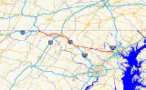
, the Interstate Highway runs 93.62 miles (150.7 km) from the Pennsylvania
state line in Hancock
east to the Interstate's eastern terminus near its junction with I-695
at a park and ride
in Baltimore. I-70 is the primary east–west Interstate in Maryland; the Interstate Highway connects Baltimore—and Washington
via I-270
—with Western Maryland
. The Interstate serves Frederick
and Hagerstown
directly and provides access to Cumberland
via its junction with I-68
at Hancock. I-70 runs concurrently
with its predecessor highway, U.S. Route 40
(US 40), from Hancock to Indian Springs
in Washington County
and from Frederick to West Friendship
in Howard County
.
I-70's route from Frederick to West Friendship was constructed as a divided highway relocation of US 40 in the early to mid-1950s and a freeway bypass of Frederick in the late 1950s. The first section of the Interstate to be marked as I-70 was an upgrade of US 40 near Hancock in the early 1960s. The remainder of the Interstate highway in Maryland west of Frederick was built on a new alignment in the mid- to late 1960s. I-70 was constructed from West Friendship to its present terminus in Baltimore in the late 1960s. The highway from Bartonsville in Frederick County
to West Friendship was upgraded to Interstate standards in the mid-1970s. The final non-limited access portion of I-70 between Frederick and Bartonsville was eliminated in the mid-1980s. The Interstate is presently being upgraded through Frederick in a series of projects that began in the late 1990s.
I-70 was intended to enter Baltimore as an east–west freeway that had been proposed since the 1940s. Around 1960, I-70 was planned passing through a pair of parks and several neighborhoods in West Baltimore to end at an interchange with I-95
and I-83
at the Inner Harbor
in Downtown Baltimore
. A subsequent proposal based on a review of the 1960 plan moved I-70 to a new alignment that triggered community opposition, which resulted in a new design process in the late 1960s. A new plan was introduced around 1970 that would have moved I-70's eastern terminus to Southwest Baltimore. However, community opposition to the Interstate's planned route through the city parks resulted in I-70 being removed from city plans in the early 1980s.
from Washington to San Francisco
in which President Dwight D. Eisenhower
participated, an ordeal that served as one of his inspirations for the Interstate Highway System. All of I-70 in Frederick County was designated the Korean War Veterans Memorial Highway by the Maryland General Assembly
in 2002. Large stone markers featuring reliefs of the Korean Peninsula
were erected in the median of I-70 in Myersville
and Mount Airy
in 2004. Along its concurrency with US 40 from I-270 in Frederick to east of West Friendship, I-70 is known as Baltimore National Pike. The Interstate is unnamed from US 40 near West Friendship to its eastern terminus in Baltimore. Like all mainline Interstates, I-70 is a part of the National Highway System
for its entire length.
from Fulton County, Pennsylvania
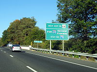
north of the town of Hancock. Just south of the state line, the four-lane freeway has a full Y interchange with I-68 and US 40, which head west toward Cumberland as the National Freeway. US 40 begins to run concurrently with I-70 just as US 522 leaves I-70 at another full Y interchange through which I-70 curves to the east. US 522 heads south, providing access to downtown Hancock before crossing the Potomac River
into West Virginia
. I-70 heads east and gains a lane in each direction to climb a ridge that separates the interchanges from the valley of Tonoloway Creek
. The third lane eastbound ends at the top of the ridge and the third lane westbound begins just west of the Interstate's partial interchange with MD 144
(Main Street), which lacks a ramp from MD 144 to westbound I-70.
 East of MD 144, I-70 parallels the Western Maryland Rail Trail
, Chesapeake and Ohio Canal
, and the Potomac River while heading east along a narrow corridor between the river and several north–south ridges. Within this corridor, the freeway has a pair of partial interchanges with MD 615
(Millstone Road). West of Indian Springs, the valley opens up and US 40 leaves the Interstate at a partial interchange just west of Licking Creek
. I-70 continues to parallel the canal and rail trail at a distance until its diamond interchange
with MD 56
(Big Pool Road) at Big Pool
, where the freeway curves away from the Potomac River and passes to the south of Stone Quarry Ridge and Boyd Mountain. Just south of Clear Spring
, I-70 crosses Toms Run within its diamond interchange with MD 68
(Clear Spring Road). Signs on westbound I-70 prior to the MD 68 interchange remind motorists they should remain on I-70 to access I-68.
I-70 continues east through the Hagerstown Valley
, where the highway crosses over Little Conococheague Creek
, Meadow Brook Creek, and Conococheague Creek
before reaching a diamond interchange with MD 63
(Greencastle Pike) south of Huyett
. As the Interstate approaches Hagerstown, it crosses a branch of Conococheague Creek and CSX
's Lurgan Subdivision
ahead of its cloverleaf interchange
with I-81
(Maryland Veterans Memorial Highway). I-70 heads southeast through the interchange, which has collector-distributor lanes in both directions that separate the individual ramps from the main roadways of both Interstates. The freeway traverses US 11
(Virginia Avenue) and the Winchester and Western Railroad
before it curves to the east again. The Interstate has partial cloverleaf interchanges with MD 632
(Downsville Pike) and MD 65
(Sharpsburg Pike) around a crossing of Norfolk Southern Railway
's Hagerstown District rail line. I-70 crosses over Antietam Creek
and US 40 Alternate (Boonsboro Pike) south of Funkstown
.
(Mapleville Road) near Beaver Creek
. I-70 crosses Beaver Creek and Black Rock Creek and gains an eastbound climbing lane as the highway ascends South Mountain
and passes through Greenbrier State Park
. At the top of the mountain, the Interstate passes under US 40 and the Appalachian Trail
and enters Frederick County. I-70 has a pair of rest area
s on the east side of the mountain, one per direction. The westbound rest area is where the Beltway snipers
, John Allen Mohammed and Lee Boyd Malvo
, were apprehended by police in October 2002.
I-70's eastbound climbing lane disappears and the Interstate has a westbound climbing lane from the top of the mountain southeast to a diamond interchange with MD 17
(Myersville Middletown Road) south of Myersville, where the freeway enters the Middletown Valley
. Within the valley, the Interstate crosses Catoctin Creek
and Little Catoctin Creek. I-70 gains an eastbound climbing lane as it climbs Braddock Mountain
, on top of which the freeway passes under a concrete arch bridge carrying Ridge Road. Westbound I-70 has a climbing lane as the highway descends Braddock Mountain and has partial interchanges with US 40 (National Pike) and US 40 Alternate (Old National Pike). The first interchange is a pair of flyover ramps from eastbound I-70 to eastbound US 40 and from westbound US 40 to westbound I-70. The second interchange is a half diamond interchange with an exit ramp from US 40 Alternate westbound I-70 and an entrance ramp to eastbound I-70.
After entering the Frederick Valley, I-70's speed limit drops from 65 miles per hour (104.6 km/h) to 55 miles per hour (88.5 km/h). The Interstate passes under MD 180
(Jefferson Pike) and has a partial interchange with Jefferson National Pike, a freeway that carries US 15
and US 340
; eastbound I-70 has ramps to both eastbound and westbound US 15 / US 340, while westbound I-70 has only a flyover ramp to westbound Jefferson National Pike. Eastbound I-70 receives a ramp from MD 180 and MD 351
and crosses over the state highway before reaching a directional interchange with I-270 and US 40. I-270 heads south toward Washington as Eisenhower Memorial Highway, taking over the name from I-70, while US 40 (Frederick Freeway) exits to the north and joins I-70 in a concurrency. I-70 heads east as a six-lane freeway and meets MD 85
(Buckeystown Pike) at a single-point urban interchange
south of downtown Frederick. MD 85 is used to access MD 355
(Urbana Pike). The Interstate reduces to four lanes before it crosses over the Frederick Branch of CSX's Old Main Line Subdivision. On the east side of Frederick, I-70 has a four-ramp partial cloverleaf interchange with South Street and a partial diamond interchange with MD 144 (Patrick Street).
I-70 heads east from the Frederick area as a six-lane freeway with a speed limit of 65 miles per hour (104.6 km/h). The Interstate crosses over the Monocacy River
and Long Spring Branch ahead of a partial interchange with MD 144 (Old National Pike), which includes ramps from westbound I-70 to westbound MD 144 and eastbound MD 144 to eastbound I-70. County-maintained Old National Pike parallels the north side of the Interstate east to Mount Airy via New Market
, where I-70 has a diamond interchange with MD 75
(Green Valley Road). East of New Market, the freeway is also paralleled by the Old Main Line Subdivision as the highways and rail line follow the valley of Bush Creek to just west of Mount Airy. I-70 veers southeast for its partial cloverleaf interchange with MD 27
(Ridge Road) at the top of Parr's Ridge
on the Frederick–Carroll
county line.
near its headwaters. MD 144 leaves the vicinity of I-70, which meets MD 94
(Woodbine Road) at a diamond interchange in Lisbon
and MD 97
(Roxbury Mills Road) at another diamond interchange near Cooksville
. East of their diamond interchange with MD 32
(Sykesville Road), I-70 and US 40 split at a partial interchange. I-70 heads east as a four-lane freeway toward Baltimore while US 40 heads east as four-lane Baltimore National Pike to serve Ellicott City
. Just east of the US 40 split, the Interstate has a partial interchange with Marriottsville Road that allows westbound I-70 to access US 40.
North of Ellicott City, I-70 has a cloverleaf interchange with US 29
(Columbia Pike) just south of the U.S. highway's northern terminus at MD 99
(Old Frederick Road) and Rogers Avenue, which heads south toward the Ellicott City Historic District
. The interchange includes a flyover ramp from westbound I-70 to southbound US 29. The Interstate continues east as a six-lane freeway through Patapsco Valley State Park
, where the highway crosses the Patapsco River and the Old Main Line Subdivision again and enters Baltimore County
. As the freeway approaches the suburb of Woodlawn
, the speed limit decreases to 55 miles per hour (88.5 km/h). The westbound direction has a mileage sign with approximate values for Columbus
, St. Louis
, Denver
, and the small town of Cove Fort, Utah
at the opposite end of I-70. This sign, which was intended as a test of Clearview
typeface, was installed in 2004.
A sign on eastbound I-70 incorrectly informs motorists that I-70 ends at its four-level stack interchange
with I-695 (Baltimore Beltway). West of the interchange, the freeway has an average annual daily traffic value of 94,221 vehicles. East of the interchange, I-70 continues as a four-lane highway for local traffic that averages 25,300 vehicles per day. The Interstate's speed limit reduces to 40 miles per hour (64.4 km/h) and then 25 miles per hour (40.2 km/h) as it passes through its final interchange, a partial cloverleaf junction with MD 122
(Security Boulevard), which continues southeast into Baltimore as Cooks Lane. Just east of the interchange, I-70 enters the city of Baltimore and the freeway's median expands into a park and ride facility that is accessed at the Interstate's eastern terminus at a U-turn adjacent to Leakin Park. Eastbound I-70 traffic wishing to access Cooks Lane must make a U-turn at the terminus and exit from a westbound loop ramp. The very short section of I-70 in the city of Baltimore is maintained by the Baltimore City Department of Transportation instead of the Maryland State Highway Administration
(MDSHA).
 I-70 was planned to follow the US 40 corridor from Hancock east to Frederick, where the Interstate Highway designation split. I-70N would continue following US 40 east to Baltimore while I-70S would follow US 240
southeast toward Washington. In 1974, the suffixed designations were eliminated; I-70N became an eastward extension of I-70 while I-70S was designated I-270.
The remainder of Baltimore National Pike from Ridgeville to the Monocacy River was constructed in four sections simultaneously starting in 1953. The first three sections were from 0.5 mile (0.80467 km) west of the Carroll–Frederick county line to the highway's crossing of the Baltimore & Ohio Railroad's main line at a site called Plane No. 4, from there to New Market, and between New Market and Ijamsville Road in Bartonsville. The fourth section was constructed to closely parallel the existing alignment of US 40 from Ijamsville Road in Bartonsville to just east of the Monocacy River. All four sections opened as a divided highway with a macadam
surface in 1955. The following year, Baltimore National Pike from Ridgeville to the Monocacy River was completed with an asphalt surface. The final section of Baltimore National Pike, from east of the Monocacy River to the east end of Patrick Street near modern Exit 56, was expanded to a divided highway in 1953 with the exception of the Monocacy River crossing. Engineering work on a second bridge across the Monocacy River began in 1954. The new bridge, which would complement the existing bridge that had been constructed in 1944 to replace the historic Jug Bridge, opened in 1956, completing the Baltimore National Pike.
The western end of Baltimore National Pike was planned to tie into both Patrick Street and the eastern end of the Frederick Freeway, which would serve as a US 40 freeway bypass of downtown Frederick between its two interchanges with Patrick Street. Construction on the east–west US 40 portion of the Frederick Freeway began in 1954 and was completed by 1958. Old US 40 through downtown Frederick later became part of MD 144. The freeway's original interchanges along what is now I-70 included a partial interchange with Patrick Street east of Frederick, the present interchange at South Street, folded diamond interchanges at MD 355 and New Design Road, and a partial interchange with Washington National Pike (now I-270), where the Frederick Freeway curved north to cloverleaf interchanges with US 340 and the western end of Patrick Street. The north–south portion of the Frederick Freeway was completed in 1959 and became part of US 15. The Frederick Freeway was marked with exit numbers in 1963; the portion that is part of I-70 started from Exit 1 at MD 144 east of Frederick and went to Exit 4 at New Design Road.
I-70 was constructed on a new alignment from east of West Friendship to Baltimore. The Interstate opened in 1967 from US 29 to I-695, concurrent with US 29's northward extension from US 40 to MD 99. I-70 opened from US 40 in West Friendship to US 29 and from I-695 to Security Boulevard just west of the Baltimore city line in 1969. I-70 was upgraded to Interstate standards from Bartonsville to West Friendship around 1974. Diamond interchanges were constructed to replace at-grade intersections with MD 94 and MD 75; for the latter interchange, MD 75 was relocated east of New Market. The existing interchanges at MD 32 and MD 97 were converted from two-way connector ramps to diamond interchanges. I-70's interchange with MD 27 was expanded from a four-ramp partial cloverleaf to a six-ramp partial cloverleaf in 1977. Exit numbers were added east of Frederick in 1978; however, these exit numbers were each 2 less than the present numbers, which were marked in 1983. I-70 was relocated away from the original alignment of US 40 between its junctions with MD 144 in Frederick and Bartonsville around 1987; the old highway became an eastern extension of MD 144. Outside of the reconstruction of the Interstate through Frederick beginning in the 1990s, there have been two interchanges revised or added, both near Hagerstown. A direct ramp was added from eastbound I-70 to southbound MD 65 in 1995; this interchange had four ramps, including two loop ramps with eastbound I-70, from at least 1968. I-70's interchange with MD 632 opened in 1999.
The first project involved I-70's interchange with US 15 and US 340, which was constructed with two ramps, one from westbound I-70 to southbound US 15 and one from northbound US 15 to eastbound I-70, in 1969. In this project completed in 1997, two ramps were added from eastbound I-70 to both directions of US 15; a long ramp was added that started from northbound US 15 and eastbound US 40 at their interchange to provide access to westbound I-70; and a loop ramp from MD 180 and MD 351 to eastbound I-70 between I-70's interchanges with US 15 and I-270. The second project filled in a pair of missing connections to the I-70–I-270 interchange last updated in 1969. Ramps were added from westbound I-70 to southbound I-270 and from northbound I-270 to eastbound I-70; in addition, New Design Road received a new bridge over I-70 and I-270. After the second project was completed in 2002, traffic between I-70 from the east and I-270 from the south no longer needed to use MD 355
and MD 85 to make the connections.
The third project was the replacement of I-70's interchange with MD 355, a four-ramp partial cloverleaf interchange constructed in 1956. In 2001, westbound I-70's ramps with MD 355 were closed and replaced with temporary ramps to and from Stadium Drive, which connected the freeway with the state highway. In 2005, as part of a related project, the MD 85–MD 355 intersection was reconstructed and MD 85 was extended to a temporary terminus east of MD 355 at a pair of ramps with eastbound I-70. Eastbound I-70's existing ramps at MD 355 were closed. As part of the project, East Street was extended south from downtown Frederick to I-70's single-point urban interchange with MD 85, which was completed in 2009. Once the new interchange opened, the temporary ramps between westbound I-70 and Stadium Drive were removed.
The fourth project to upgrade I-70 through Frederick, which will upgrade the interchanges at South Street and MD 144 built in 1956, began in autumn 2010. Eastbound I-70's ramps with Reichs Ford Road, which leads to South Street, will be reconstructed. The westbound ramps serving South Street will be removed. The missing movements on the eastern end of Frederick will be provided by reconstruction of westbound I-70's ramps with MD 144. A ramp from MD 144 to westbound I-70 will be added; both that ramp and the exit ramp from westbound I-70 will meet MD 144 at a roundabout
. Once the interchanges are reconstructed, I-70 will be expanded to six lanes from east of MD 144 to I-270. The fifth and final project to upgrade I-70 through Frederick will expand I-70 to six lanes between Mount Philip Road and I-270.
to I-70, the state highway's junction with I-70 will be reconstructed from a diamond interchange to a partial cloverleaf design that will allow free-flowing traffic from both directions of MD 32 onto I-70. In Howard County, a study is underway concerning improvements to the portion of I-70 between MD 32 and US 29; between the US 40 split and US 29, I-70 is only four lanes. The study will look at widening the Interstate to six or eight lanes as well as possible improvements on US 29 and Marriottsville Road at their respective interchanges with I-70. Finally, in Frederick County, MDSHA will study whether to upgrade I-70's partial interchange with MD 144 in Bartonsville, which presently only has ramps from westbound I-70 to westbound MD 144 and from eastbound MD 144 to eastbound I-70.
In response to the new sense of urgency, the head of Baltimore's Department of Planning, Philip Darling, put together a 1960 report titled A Study for an East–West Expressway. Darling proposed I-70N pass through Leakin Park and Gwynns Falls Park, pass through the Rosemont
neighborhood, and head east between Franklin Street and Mulberry Street. The East–West Expressway would turn south near Pine Street and turn east again to follow an elevated highway just south of Pratt Street, between the central business district and the Inner Harbor. At the east end of the Inner Harbor, at approximately the modern intersection of President Street and Eastern Avenue, I-70N would reach its terminus at a four-way interchange with I-83 (Jones Falls Expressway) and I-95 (Southwestern Expressway). I-95 would cross the Inner Harbor on a 50 feet (15.2 m) high bridge immediately to the southwest of the interchange.
Despite the major opposition, the initiation of federal funding allowed the city to start acquiring property in the Franklin–Mulberry corridor in 1966 to clear the way for construction of the stretch of freeway that did get built between Pulaski Street and Martin Luther King Jr. Boulevard. That same year, the city of Baltimore decided to resolve the deadlock on the 10-D System by forming another consulting group, Urban Design Concept Associates, to work with various experts and stakeholders to come up with a new, less disruptive freeway system proposal for Baltimore. In 1969, the city adopted the group's proposal for the 3-A System. I-70N would pass through Leakin Park and Gwynns Falls Park, then follow Gwynns Falls south to an interchange with the modern alignment of I-95 east of Caton Avenue. Another freeway, later designated I-170, would be constructed in the Franklin–Mulberry corridor to connect I-70 with the west side of the central business district.
However, many of the civic groups still opposed I-70 passing through Leakin Park; the groups used litigation and political will to indefinitely delay the construction of I-70 through the park. In 1981, the city cancelled the portion of I-70 from its current eastern terminus through Leakin and Gwynns Falls parks to the Interstate's interchange with I-170. I-170 and the portion of proposed freeway south to I-95 remained part of plans with a new designation for the L-shaped freeway, I-595. However, in 1983, I-595 was cancelled as well due to escalating costs; saving funds for the original I-595 freeway would detract from more pressing needs like maintenance of city streets and rapid transit. I-595 was later used as an unsigned designation
for the upgrade of US 50
between the Capital Beltway
and Annapolis
. With the abandonment of I-70's extension further into the city, the Baltimore City Department of Transportation converted the Interstate's stub end east of Security Boulevard into a park and ride facility that opened in September 1985.
I-70 would have continued southeast along Gwynns Falls and what is now CSX's Hanover Subdivision
. The Interstate would have met the western end of I-170
at a directional T interchange where Baltimore Street and the Amtrak Northeast Corridor cross over Gwynns Falls. I-170 would have headed northeast closely paralleling the Amtrak Northeast Corridor before veering east at the West Baltimore station
on MARC
's Penn Line
to join the constructed portion of I-170, which is now part of US 40. I-70 would have continued southeast to a partial interchange with MD 144 (Frederick Avenue) that would have allowed access to and from the direction of I-95. The Interstate would have passed under US 1
(Wilkens Avenue) before reaching its terminus at I-95. I-70's junction with I-95 would have been a directional T interchange constructed over a rail yard on the Mount Clare Branch of CSX's Baltimore Terminal Subdivision. When I-95 was completed from Caton Avenue to Russell Street in February 1978, the highway was paralleled by extended ramps east from the Caton Avenue interchange that would have allowed connections between I-70 and Caton Avenue (US 1 Alternate) and segregated I-70 and Caton Avenue traffic from the partial interchange with Washington Boulevard just to the east.
, Montgomery County
and I-70 in the city of Frederick in Frederick County. It consists of the 32.6 miles (52.5 km) mainline as well as a 2.1 miles (3.4 km) spur that provides access to and from southbound I-495. I-270 is known as the Dwight D. Eisenhower Memorial Highway as well as the Washington National Pike. Most of the southern part of the route in Montgomery County passes through suburban areas around Rockville
and Gaithersburg
that are home to many biotech firms. This portion of I-270 is up to twelve lanes wide and consists of a local-express lane
configuration as well as high-occupancy vehicle lane
s that are in operation during peak travel times. North of the Gaithersburg area, the road continues through the northern part of Montgomery County, passing Germantown and Clarksburg
as a six- to eight-lane highway with a HOV lane in the northbound direction only. North of here, I-270 continues through rural areas into Frederick County and toward the city of Frederick as a four-lane freeway.
lot at the Shady Grove
station on the Red Line
of the Washington Metro
. Despite the number, I-370 does not connect to I-70 itself. The road continues to the west of I-270 as Sam Eig Highway, a surface road. Along the way, I-370 has an interchanges with MD 355 and Shady Grove Road. The freeway was completed in the late 1980s to connect I-270 to the Shady Grove Metro station. I-370 was part of the larger Intercounty Connector, but was the only segment to be built at the time. MD 200 east of I-370 to MD 28
(Norbeck Road) opened on February 23, 2011, resulting in the truncation of I-370 to the interchange with MD 200 and the redesignation of the road leading into the Shady Grove Metro station as MD 200A.
Interstate Highway System
The Dwight D. Eisenhower National System of Interstate and Defense Highways, , is a network of limited-access roads including freeways, highways, and expressways forming part of the National Highway System of the United States of America...
that runs from Cove Fort, Utah
Cove Fort, Utah
Cove Fort is a fort and historical site located in Millard County, Utah. It was founded in 1867 by Ira Hinckley at the request of Brigham Young. One of its distinctive features is the use of volcanic rock in the construction of the walls, rather than the wood used in many mid-19th century...
to Baltimore, Maryland. In Maryland
Maryland
Maryland is a U.S. state located in the Mid Atlantic region of the United States, bordering Virginia, West Virginia, and the District of Columbia to its south and west; Pennsylvania to its north; and Delaware to its east...
, the Interstate Highway runs 93.62 miles (150.7 km) from the Pennsylvania
Pennsylvania
The Commonwealth of Pennsylvania is a U.S. state that is located in the Northeastern and Mid-Atlantic regions of the United States. The state borders Delaware and Maryland to the south, West Virginia to the southwest, Ohio to the west, New York and Ontario, Canada, to the north, and New Jersey to...
state line in Hancock
Hancock, Maryland
Hancock is a town in Washington County, Maryland, United States. The population was 1,725 at the 2000 census. The Western Maryland community is notable for being located at the narrowest part of the state...
east to the Interstate's eastern terminus near its junction with I-695
Interstate 695 (Maryland)
Interstate 695 is a -long full beltway Interstate Highway extending around Baltimore, Maryland, USA. I-695 is officially designated the McKeldin Beltway, but is colloquially referred to as either the Baltimore Beltway or 695...
at a park and ride
Park and ride
Park and ride facilities are car parks with connections to public transport that allow commuters and other people wishing to travel into city centres to leave their vehicles and transfer to a bus, rail system , or carpool for the rest of their trip...
in Baltimore. I-70 is the primary east–west Interstate in Maryland; the Interstate Highway connects Baltimore—and Washington
Washington, D.C.
Washington, D.C., formally the District of Columbia and commonly referred to as Washington, "the District", or simply D.C., is the capital of the United States. On July 16, 1790, the United States Congress approved the creation of a permanent national capital as permitted by the U.S. Constitution....
via I-270
Interstate 270 (Maryland)
Interstate 270 is a auxiliary Interstate Highway in the U.S. state of Maryland that travels between Interstate 495 just north of Bethesda, Montgomery County and Interstate 70 in the city of Frederick in Frederick County. It consists of the mainline as well as a spur that provides access to and...
—with Western Maryland
Western Maryland
Western Maryland is the portion of the U.S. state of Maryland that consists of Frederick, Washington, Allegany, and Garrett counties. The region is bounded by the Mason-Dixon line to the north, Preston County, West Virginia to the west, and the Potomac River to the south. There is dispute over the...
. The Interstate serves Frederick
Frederick, Maryland
Frederick is a city in north-central Maryland. It is the county seat of Frederick County, the largest county by area in the state of Maryland. Frederick is an outlying community of the Washington-Arlington-Alexandria, DC-VA-MD-WV Metropolitan Statistical Area, which is part of a greater...
and Hagerstown
Hagerstown, Maryland
Hagerstown is a city in northwestern Maryland, United States. It is the county seat of Washington County, and, by many definitions, the largest city in a region known as Western Maryland. The population of Hagerstown city proper at the 2010 census was 39,662, and the population of the...
directly and provides access to Cumberland
Cumberland, Maryland
Cumberland is a city in the far western, Appalachian portion of Maryland, United States. It is the county seat of Allegany County, and the primary city of the Cumberland, MD-WV Metropolitan Statistical Area. At the 2010 census, the city had a population of 20,859, and the metropolitan area had a...
via its junction with I-68
Interstate 68
Interstate 68 is a Interstate highway in the U.S. states of West Virginia and Maryland, connecting in Morgantown to in Hancock. is also Corridor E of the Appalachian Development Highway System. From 1965 until the freeway's construction was completed in 1991, it was designated as...
at Hancock. I-70 runs concurrently
Concurrency (road)
A concurrency, overlap, or coincidence in a road network is an instance of one physical road bearing two or more different highway, motorway, or other route numbers...
with its predecessor highway, U.S. Route 40
U.S. Route 40 in Maryland
U.S. Route 40 in the U.S. state of Maryland runs from western Maryland to Cecil County in the state's northeastern corner. With a total length of over , it is the longest numbered highway in Maryland. Almost half of the road overlaps with Interstate 68 or Interstate 70, while the old alignment...
(US 40), from Hancock to Indian Springs
Indian Springs, Maryland
Indian Springs is an unincorporated community in western Washington County, Maryland, United States.-Geography:Indian Springs lies along U.S. Route 40 and Maryland Route 56 between Clear Spring and Hancock; it is located north of Fort Frederick State Park...
in Washington County
Washington County, Maryland
Washington County is a county located in the western part of the U.S. state of Maryland, bordering southern Pennsylvania to the north, northern Virginia to the south, and the Eastern Panhandle of West Virginia to the south and west. As of the 2010 Census, its population is 147,430...
and from Frederick to West Friendship
West Friendship, Maryland
West Friendship is an affluent semi-rural community in western Howard County, Maryland. West Friendship is located at the junction of Interstate 70/U.S. Highway 40/Maryland Route 144 and Maryland Route 32.- History :...
in Howard County
Howard County, Maryland
-2010:Whereas according to the 2010 U.S. Census Bureau:*62.2% White*17.5% Black*0.3% Native American*14.4% Asian*0.0% Native Hawaiian or Pacific Islander*3.6% Two or more races*2.0% Other races*5.8% Hispanic or Latino -2000:...
.
I-70's route from Frederick to West Friendship was constructed as a divided highway relocation of US 40 in the early to mid-1950s and a freeway bypass of Frederick in the late 1950s. The first section of the Interstate to be marked as I-70 was an upgrade of US 40 near Hancock in the early 1960s. The remainder of the Interstate highway in Maryland west of Frederick was built on a new alignment in the mid- to late 1960s. I-70 was constructed from West Friendship to its present terminus in Baltimore in the late 1960s. The highway from Bartonsville in Frederick County
Frederick County, Maryland
Frederick County is a county located in the western part of the U.S. state of Maryland, bordering the southern border of Pennsylvania and the northeastern border of Virginia. As of the 2010 Census, the population was 233,385....
to West Friendship was upgraded to Interstate standards in the mid-1970s. The final non-limited access portion of I-70 between Frederick and Bartonsville was eliminated in the mid-1980s. The Interstate is presently being upgraded through Frederick in a series of projects that began in the late 1990s.
I-70 was intended to enter Baltimore as an east–west freeway that had been proposed since the 1940s. Around 1960, I-70 was planned passing through a pair of parks and several neighborhoods in West Baltimore to end at an interchange with I-95
Interstate 95 in Maryland
Interstate 95 in Maryland is a major highway that runs diagonally from northeast to southwest, from Maryland's border with Delaware, to the Woodrow Wilson Bridge, briefly entering the District of Columbia before reaching Virginia...
and I-83
Interstate 83
Interstate 83 is an Interstate Highway in the eastern United States. Its southern terminus is in Baltimore, Maryland at the Fayette Street exit; its northern terminus is in Harrisburg, Pennsylvania at Interstate 81....
at the Inner Harbor
Inner Harbor
The Inner Harbor is a historic seaport, tourist attraction, and iconic landmark of the City of Baltimore, Maryland, United States. Described by the Urban Land Institute in 2009 as “the model for post-industrial waterfront redevelopment around the World.” The Inner Harbor is actually the end of the...
in Downtown Baltimore
Downtown Baltimore
Downtown Baltimore is the section of Baltimore traditionally bounded by Martin Luther King, Jr. Boulevard to the west, Mt. Royal Avenue to the north, President Street to the east and the Inner Harbor area to the south. It consists of four neighborhoods: Westside, City Centre, Inner Harbor, and...
. A subsequent proposal based on a review of the 1960 plan moved I-70 to a new alignment that triggered community opposition, which resulted in a new design process in the late 1960s. A new plan was introduced around 1970 that would have moved I-70's eastern terminus to Southwest Baltimore. However, community opposition to the Interstate's planned route through the city parks resulted in I-70 being removed from city plans in the early 1980s.
Route description
I-70 has several official designations along its course through Maryland. The Interstate Highway is designated Eisenhower Memorial Highway from the Pennsylvania state line east to I-270 in Frederick. The highway received this designation from a 1973 act of Congress commemorating the route of the 1919 U.S. Army convoyTranscontinental Motor Convoy
The Transcontinental Motor Convoys were early 20th century vehicle convoys, including three US Army truck trains, that crossed the United States to the west coast...
from Washington to San Francisco
San Francisco, California
San Francisco , officially the City and County of San Francisco, is the financial, cultural, and transportation center of the San Francisco Bay Area, a region of 7.15 million people which includes San Jose and Oakland...
in which President Dwight D. Eisenhower
Dwight D. Eisenhower
Dwight David "Ike" Eisenhower was the 34th President of the United States, from 1953 until 1961. He was a five-star general in the United States Army...
participated, an ordeal that served as one of his inspirations for the Interstate Highway System. All of I-70 in Frederick County was designated the Korean War Veterans Memorial Highway by the Maryland General Assembly
Maryland General Assembly
The Maryland General Assembly is the state legislature of the U.S. state of Maryland. It is a bicameral body. The upper chamber, the Maryland State Senate, has 47 representatives and the lower chamber, the Maryland House of Delegates, has 141 representatives...
in 2002. Large stone markers featuring reliefs of the Korean Peninsula
Korean Peninsula
The Korean Peninsula is a peninsula in East Asia. It extends southwards for about 684 miles from continental Asia into the Pacific Ocean and is surrounded by the Sea of Japan to the south, and the Yellow Sea to the west, the Korea Strait connecting the first two bodies of water.Until the end of...
were erected in the median of I-70 in Myersville
Myersville, Maryland
Myersville is a town in Frederick County, Maryland, United States. The population was 1,382 at the 2000 census.-History:The Peter of P. Grossnickel Farm was listed on the National Register of Historic Places in 1998.-Geography:...
and Mount Airy
Mount Airy, Maryland
Mount Airy is a town in Carroll, Frederick, Howard, and Montgomery counties in the U.S. state of Maryland.-Geography:According to the United States Census Bureau, the town has a total area of , all of it land.-History:...
in 2004. Along its concurrency with US 40 from I-270 in Frederick to east of West Friendship, I-70 is known as Baltimore National Pike. The Interstate is unnamed from US 40 near West Friendship to its eastern terminus in Baltimore. Like all mainline Interstates, I-70 is a part of the National Highway System
National Highway System (United States)
The National Highway System is a network of strategic highways within the United States, including the Interstate Highway System and other roads serving major airports, ports, rail or truck terminals, railway stations, pipeline terminals and other strategic transport facilities.Individual states...
for its entire length.
Hancock to Hagerstown
I-70 enters Washington County, Maryland concurrent with US 522U.S. Route 522 in Maryland
U.S. Route 522 is a part of the U.S. Highway System that runs from Powhatan, Virginia to Selinsgrove, Pennsylvania. In Maryland, it runs from the West Virginia state line at the Potomac River north to the Pennsylvania state line within Hancock in western Washington County...
from Fulton County, Pennsylvania
Fulton County, Pennsylvania
Fulton County is a county located in the U.S. state of Pennsylvania. As of 2010, the population was 14,845.Fulton County was created on April 19, 1850, from part of Bedford County and named for inventor Robert Fulton.Its county seat is McConnellsburg....
north of the town of Hancock. Just south of the state line, the four-lane freeway has a full Y interchange with I-68 and US 40, which head west toward Cumberland as the National Freeway. US 40 begins to run concurrently with I-70 just as US 522 leaves I-70 at another full Y interchange through which I-70 curves to the east. US 522 heads south, providing access to downtown Hancock before crossing the Potomac River
Potomac River
The Potomac River flows into the Chesapeake Bay, located along the mid-Atlantic coast of the United States. The river is approximately long, with a drainage area of about 14,700 square miles...
into West Virginia
West Virginia
West Virginia is a state in the Appalachian and Southeastern regions of the United States, bordered by Virginia to the southeast, Kentucky to the southwest, Ohio to the northwest, Pennsylvania to the northeast and Maryland to the east...
. I-70 heads east and gains a lane in each direction to climb a ridge that separates the interchanges from the valley of Tonoloway Creek
Tonoloway Creek
Tonoloway Creek, also known as Great Tonoloway Creek, is a tributary stream of the Potomac River in the U.S. states of Maryland and Pennsylvania.Tonoloway Creek empties into the Potomac River at Hancock, Maryland.-Tributaries:...
. The third lane eastbound ends at the top of the ridge and the third lane westbound begins just west of the Interstate's partial interchange with MD 144
Maryland Route 144
Maryland Route 144 is a collection of state highways in the U.S. state of Maryland. These highways are sections of old alignment of U.S. Route 40 between Cumberland and Baltimore...
(Main Street), which lacks a ramp from MD 144 to westbound I-70.
Western Maryland Rail Trail
The Western Maryland Rail Trail is a long shared-use asphalt-paved rail trail from Fort Frederick to Pearre Station, Maryland, United States, that is suitable for walkers, joggers, bikers, rollerbladers and, weather permitting, cross country skiing....
, Chesapeake and Ohio Canal
Chesapeake and Ohio Canal
The Chesapeake and Ohio Canal, abbreviated as the C&O Canal, and occasionally referred to as the "Grand Old Ditch," operated from 1831 until 1924 parallel to the Potomac River in Maryland from Cumberland, Maryland to Washington, D.C. The total length of the canal is about . The elevation change of...
, and the Potomac River while heading east along a narrow corridor between the river and several north–south ridges. Within this corridor, the freeway has a pair of partial interchanges with MD 615
Maryland Route 615
Maryland Route 615 is a state highway in the U.S. state of Maryland. The state highway runs from Interstate 70 and U.S. Route 40 east of Hancock north to the Pennsylvania state line in western Washington County. MD 615 has two sections, an east–west frontage road that parallels I-70 and...
(Millstone Road). West of Indian Springs, the valley opens up and US 40 leaves the Interstate at a partial interchange just west of Licking Creek
Licking Creek
Licking Creek is a tributary of the Potomac River in Pennsylvania and Maryland in the United States.Licking Creek is born on the west slope of Tuscarora Mountain, near Cowans Gap State Park, flows through eastern Fulton County and a corner of Franklin County in Pennsylvania, and then enters...
. I-70 continues to parallel the canal and rail trail at a distance until its diamond interchange
Diamond interchange
A diamond interchange is a common type of road junction, used where a freeway crosses a minor road. The freeway itself is grade-separated from the minor road, one crossing the other over a bridge...
with MD 56
Maryland Route 56
Maryland Route 56 is a state highway in the U.S. state of Maryland. Known as Big Pool Road, the state highway runs from Interstate 70 in Big Pool east to MD 68 near Pinesburg in western Washington County. MD 56, which features a pair of one-lane bridges, provides access to Fort Frederick State...
(Big Pool Road) at Big Pool
Big Pool, Maryland
Big Pool is an unincorporated community in western Washington County, Maryland, United States. It is between Clear Spring, Maryland and Hancock, Maryland along U.S. Route 40 and is officially a part of the Hagerstown Metropolitan Area....
, where the freeway curves away from the Potomac River and passes to the south of Stone Quarry Ridge and Boyd Mountain. Just south of Clear Spring
Clear Spring, Maryland
Clear Spring is a town in Washington County, Maryland, United States. The population was 461 as of the 2008 United States Census Bureau estimates.-Geography:Clear Spring is located at ....
, I-70 crosses Toms Run within its diamond interchange with MD 68
Maryland Route 68
Maryland Route 68 is a state highway in the U.S. state of Maryland. The state highway runs from U.S. Route 40 in Clear Spring east to US 40 Alternate in Boonsboro. MD 68 crosses central Washington County to the south of Hagerstown, connecting Clear Spring and Boonsboro with Williamsport, where...
(Clear Spring Road). Signs on westbound I-70 prior to the MD 68 interchange remind motorists they should remain on I-70 to access I-68.
I-70 continues east through the Hagerstown Valley
Hagerstown Valley
Hagerstown Valley is located in Maryland in the United States. It is part of the Great Appalachian Valley, which continues northward as Cumberland Valley in Pennsylvania, and southward as Shenandoah Valley in West Virginia and Virginia....
, where the highway crosses over Little Conococheague Creek
Little Conococheague Creek
Little Conococheague Creek is a tributary stream of the Potomac River in the U.S. states of Maryland and Pennsylvania. The stream rises on Two Top Mountain, west of the Whitetail Ski Resort in Franklin County, Pennsylvania, and proceeds south into Washington County, Maryland. It empties into the...
, Meadow Brook Creek, and Conococheague Creek
Conococheague Creek
Conococheague Creek, a tributary of the Potomac River, is a free-flowing stream that originates in Pennsylvania and empties into the Potomac River near Williamsport, Maryland. It is in length, with in Pennsylvania and in Maryland...
before reaching a diamond interchange with MD 63
Maryland Route 63
Maryland Route 63 is a state highway in the U.S. state of Maryland. The state highway runs from MD 65 in Fairplay north to the Pennsylvania state line near Cearfoss, where the highway continues as Pennsylvania Route 163 . MD 63 is an L-shaped route that passes through central Washington County...
(Greencastle Pike) south of Huyett
Huyett, Maryland
Huyett is an unincorporated community not considered as a census-designated place in western Washington County, Maryland, United States. It is north of Williamsport, Maryland on Maryland Route 63 and on U.S. Route 40 west of Hagerstown, Maryland and east of Clear Spring, Maryland...
. As the Interstate approaches Hagerstown, it crosses a branch of Conococheague Creek and CSX
CSX Transportation
CSX Transportation operates a Class I railroad in the United States known as the CSX Railroad. It is the main subsidiary of the CSX Corporation. The company is headquartered in Jacksonville, Florida, and owns approximately 21,000 route miles...
's Lurgan Subdivision
Lurgan Subdivision
The Lurgan Subdivision is a railroad line owned and operated by CSX Transportation in the U.S. states of Pennsylvania, Maryland, and West Virginia. The line runs from Chambersburg, Pennsylvania, south to Hagerstown, Maryland, and west to Cherry Run, West Virginia, along a former Western Maryland...
ahead of its cloverleaf interchange
Cloverleaf interchange
A cloverleaf interchange is a two-level interchange in which left turns, reverse direction in left-driving regions, are handled by ramp roads...
with I-81
Interstate 81 in Maryland
Interstate 81 is a part of the Interstate Highway System that runs from Dandridge, Tennessee to Fishers Landing, New York. In Maryland, the Interstate highway runs from the West Virginia state line at the Potomac River in Williamsport north to the Pennsylvania state line near Maugansville...
(Maryland Veterans Memorial Highway). I-70 heads southeast through the interchange, which has collector-distributor lanes in both directions that separate the individual ramps from the main roadways of both Interstates. The freeway traverses US 11
U.S. Route 11 in Maryland
U.S. Route 11 is a part of the U.S. Highway System that runs from New Orleans, Louisiana to Rouses Point, New York. In Maryland, the federal highway runs from the West Virginia state line at the Potomac River in Williamsport north to the Pennsylvania state line near Maugansville...
(Virginia Avenue) and the Winchester and Western Railroad
Winchester and Western Railroad
The Winchester and Western Railroad is a shortline railroad operating from Gore through Winchester, Virginia and West Virginia to Hagerstown, Maryland. It also operates several lines in southern New Jersey, connecting to Conrail Shared Assets Operations at Millville and Vineland...
before it curves to the east again. The Interstate has partial cloverleaf interchanges with MD 632
Maryland Route 632
Maryland Route 632 is a state highway in the U.S. state of Maryland. Known as Downsville Pike, the state highway runs from MD 63 in Downsville north to Maryland Avenue in Hagerstown. MD 632 was constructed along the path of a former turnpike in the late 1930s...
(Downsville Pike) and MD 65
Maryland Route 65
Maryland Route 65 is a state highway in the U.S. state of Maryland. Known for most of its length as Sharpsburg Pike, the state highway runs from MD 34 in Sharpsburg north to the southern end of Hagerstown, where the highway continues north as Potomac Street toward the downtown area...
(Sharpsburg Pike) around a crossing of Norfolk Southern Railway
Norfolk Southern Railway
The Norfolk Southern Railway is a Class I railroad in the United States, owned by the Norfolk Southern Corporation. With headquarters in Norfolk, Virginia, the company operates 21,500 route miles in 22 eastern states, the District of Columbia and the province of Ontario, Canada...
's Hagerstown District rail line. I-70 crosses over Antietam Creek
Antietam Creek
Antietam Creek is a tributary of the Potomac River located in south central Pennsylvania and western Maryland in the United States, a region known as the Hagerstown Valley...
and US 40 Alternate (Boonsboro Pike) south of Funkstown
Funkstown, Maryland
Funkstown is a town in Washington County, Maryland, United States. The population was 983 at the 2000 census.-History:Originally were sold to Henry Funk by Frederick Calvert in 1754 and settled as Jerusalem.Funck’s Jerusalem Town...
.
Hagerstown to Mount Airy
I-70 meets US 40 (National Pike) at a cloverleaf interchange as the two highways leave the suburban area surrounding Hagerstown. The Interstate curves to the southeast and has a diamond interchange with MD 66Maryland Route 66
Maryland Route 66 is a state highway in the U.S. state of Maryland. Known for most of its length as Mapleville Road, the state highway runs from U.S. Route 40 Alternate in Boonsboro north to MD 64 near Smithsburg...
(Mapleville Road) near Beaver Creek
Beaver Creek, Maryland
Beaver Creek is an unincorporated community in eastern Washington County, Maryland, United States. It is located southeast of Hagerstown and north of Boonsboro near U.S. Route 40 and Maryland Route 66...
. I-70 crosses Beaver Creek and Black Rock Creek and gains an eastbound climbing lane as the highway ascends South Mountain
South Mountain (Maryland and Pennsylvania)
South Mountain is the northern extension of the Blue Ridge Mountain range in Maryland and Pennsylvania. From the Potomac River near Knoxville, Maryland in the south, to Dillsburg, Pennsylvania in the north, the long range separates the Hagerstown and Cumberland valleys from the Piedmont regions of...
and passes through Greenbrier State Park
Greenbrier State Park
Greenbrier State Park is a Maryland state park on South Mountain in Washington County.-External links:* - official site...
. At the top of the mountain, the Interstate passes under US 40 and the Appalachian Trail
Appalachian Trail
The Appalachian National Scenic Trail, generally known as the Appalachian Trail or simply the AT, is a marked hiking trail in the eastern United States extending between Springer Mountain in Georgia and Mount Katahdin in Maine. It is approximately long...
and enters Frederick County. I-70 has a pair of rest area
Rest area
A rest area, travel plaza, rest stop, or service area is a public facility, located next to a large thoroughfare such as a highway, expressway, or freeway at which drivers and passengers can rest, eat, or refuel without exiting on to secondary roads...
s on the east side of the mountain, one per direction. The westbound rest area is where the Beltway snipers
Beltway sniper attacks
The Washington sniper attacks took place during three weeks in October 2002 in Washington, D.C., Maryland, and Virginia. Ten people were killed and three others critically injured in various locations throughout the Washington Metropolitan Area and along Interstate 95 in Virginia...
, John Allen Mohammed and Lee Boyd Malvo
Lee Boyd Malvo
Lee Boyd Malvo , is a spree killer convicted, along with John Allen Muhammad, of murders in connection with the Beltway sniper attacks, which took place in the Washington Metropolitan Area over a three-week period in October 2002...
, were apprehended by police in October 2002.
I-70's eastbound climbing lane disappears and the Interstate has a westbound climbing lane from the top of the mountain southeast to a diamond interchange with MD 17
Maryland Route 17
Maryland Route 17 is a state highway in the U.S. state of Maryland. The state highway begins at the Virginia state line at the Potomac River in Brunswick, where the highway continues south as Virginia State Route 287 . MD 17 runs north from the Brunswick Bridge to the Frederick–Washington...
(Myersville Middletown Road) south of Myersville, where the freeway enters the Middletown Valley
Middletown Valley
Middletown Valley, also historically known as Catoctin Valley, is a valley in western Frederick County in the state of Maryland.-Geography:...
. Within the valley, the Interstate crosses Catoctin Creek
Catoctin Creek (Maryland)
Catoctin Creek is a tributary of the Potomac River in Frederick County, Maryland, USA. Its source is formed in the Myersville, MD area and flows directly south for the entire length of the stream. Catoctin Creek enters the Potomac River east of Brunswick. The stream flows through Catoctin Creek...
and Little Catoctin Creek. I-70 gains an eastbound climbing lane as it climbs Braddock Mountain
Catoctin Mountain
Catoctin Mountain, along with the geologically associated Bull Run Mountains, comprises the easternmost mountain ridge of the Blue Ridge Mountains, which are in turn a part of the Appalachian Mountains range...
, on top of which the freeway passes under a concrete arch bridge carrying Ridge Road. Westbound I-70 has a climbing lane as the highway descends Braddock Mountain and has partial interchanges with US 40 (National Pike) and US 40 Alternate (Old National Pike). The first interchange is a pair of flyover ramps from eastbound I-70 to eastbound US 40 and from westbound US 40 to westbound I-70. The second interchange is a half diamond interchange with an exit ramp from US 40 Alternate westbound I-70 and an entrance ramp to eastbound I-70.
After entering the Frederick Valley, I-70's speed limit drops from 65 miles per hour (104.6 km/h) to 55 miles per hour (88.5 km/h). The Interstate passes under MD 180
Maryland Route 180
Maryland Route 180 is a state highway in the U.S. state of Maryland. Known for most of its length as Jefferson Pike, the state highway runs from U.S. Route 340 in Knoxville east to MD 351 and Interstate 70 in Frederick. MD 180 is the old alignment of US 340 through Knoxville, Petersville, and...
(Jefferson Pike) and has a partial interchange with Jefferson National Pike, a freeway that carries US 15
U.S. Route 15 in Maryland
U.S. Route 15 is a part of the U.S. Highway System that runs from Walterboro, South Carolina to Painted Post, New York. In Maryland, the highway runs from the Virginia state line at the Potomac River in Point of Rocks north to the Pennsylvania state line near Emmitsburg. US 15 is...
and US 340
U.S. Route 340 in Maryland
U.S. Route 340 is a part of the U.S. Highway System that runs from Greenville, Virginia to Frederick, Maryland. In Maryland, the U.S. highway runs from the Virginia state line at the Potomac River at Sandy Hook east to its northern terminus at US 15 and US 40 in Frederick...
; eastbound I-70 has ramps to both eastbound and westbound US 15 / US 340, while westbound I-70 has only a flyover ramp to westbound Jefferson National Pike. Eastbound I-70 receives a ramp from MD 180 and MD 351
Maryland Route 351
Maryland Route 351 is a state highway in the U.S. state of Maryland. Known as Ballenger Creek Pike, the state highway runs from the beginning of state maintenance near Adamstown north to MD 180 and Interstate 70 in Frederick. MD 351 connects Frederick with its suburb of Ballenger Creek and the...
and crosses over the state highway before reaching a directional interchange with I-270 and US 40. I-270 heads south toward Washington as Eisenhower Memorial Highway, taking over the name from I-70, while US 40 (Frederick Freeway) exits to the north and joins I-70 in a concurrency. I-70 heads east as a six-lane freeway and meets MD 85
Maryland Route 85
Maryland Route 85 is a state highway in the U.S. state of Maryland. Known as Buckeystown Pike, the state highway runs from MD 28 in Tuscarora north to the Frederick city limit north of Interstate 70 , where the highway continues north as East Street. MD 85 connects Tuscarora and Buckeystown in...
(Buckeystown Pike) at a single-point urban interchange
Single-point urban interchange
A single-point urban interchange , also called a single-point interchange or single-point diamond interchange , is a type of highway interchange...
south of downtown Frederick. MD 85 is used to access MD 355
Maryland Route 355
Maryland Route 355 is a north–south road in western central Maryland in the United States. The southern terminus of the route is at the Washington, D.C. border in Friendship Heights, Montgomery County, where it continues south as Wisconsin Avenue into Washington. The northern terminus is...
(Urbana Pike). The Interstate reduces to four lanes before it crosses over the Frederick Branch of CSX's Old Main Line Subdivision. On the east side of Frederick, I-70 has a four-ramp partial cloverleaf interchange with South Street and a partial diamond interchange with MD 144 (Patrick Street).
I-70 heads east from the Frederick area as a six-lane freeway with a speed limit of 65 miles per hour (104.6 km/h). The Interstate crosses over the Monocacy River
Monocacy River
The Monocacy River is a free-flowing tributary of the Potomac River, which empties into the Atlantic Ocean via the Chesapeake Bay. The river is long, with a drainage area of about...
and Long Spring Branch ahead of a partial interchange with MD 144 (Old National Pike), which includes ramps from westbound I-70 to westbound MD 144 and eastbound MD 144 to eastbound I-70. County-maintained Old National Pike parallels the north side of the Interstate east to Mount Airy via New Market
New Market, Maryland
New Market is a town in Frederick County, Maryland, United States. The population was 427 at the 2000 census. The town bills itself as the "Antiques capital of Maryland".-Geography:New Market is located at ....
, where I-70 has a diamond interchange with MD 75
Maryland Route 75
Maryland Route 75 is a state highway in the U.S. state of Maryland. Known for most of its length as Green Valley Road, the state highway runs from MD 355 near Hyattstown north to MD 31 in New Windsor...
(Green Valley Road). East of New Market, the freeway is also paralleled by the Old Main Line Subdivision as the highways and rail line follow the valley of Bush Creek to just west of Mount Airy. I-70 veers southeast for its partial cloverleaf interchange with MD 27
Maryland Route 27
Maryland Route 27 is a state highway in the central part of the U.S. state of Maryland.-Route description:MD 27, also known as Ridge Road and Manchester Road , begins in Germantown at MD 355...
(Ridge Road) at the top of Parr's Ridge
Parr's Ridge
Parr's Ridge is a ridge which forms the summit of the Piedmont Plateau region in the U.S. state of Maryland.The ridge, a gentle summit by contrast to Maryland's Appalachian ridges to the west, extends from southwest to northeast through Montgomery, Howard and Carroll counties...
on the Frederick–Carroll
Carroll County, Maryland
Carroll County is a county located in the U.S. state of Maryland. In 2010, its population was 167,134. It was named for Charles Carroll of Carrollton , signer of the American Declaration of Independence. Its county seat is Westminster....
county line.
Mount Airy to Baltimore
I-70 is closely paralleled by MD 144 (Frederick Road) on its eastbound side as the freeway briefly passes through Carroll County. The Interstate enters Howard County when it traverses the South Branch of the Patapsco RiverPatapsco River
The Patapsco River is a river in central Maryland which flows into Chesapeake Bay. The river's tidal portion forms the harbor for the city of Baltimore...
near its headwaters. MD 144 leaves the vicinity of I-70, which meets MD 94
Maryland Route 94
Maryland Route 94 is a state highway in the U.S. state of Maryland. Known as Woodbine Road, the state highway runs from the Montgomery–Howard county line at the Patuxent River north to Old Frederick Road near Lisbon. MD 94 originally extended into southern Carroll County in addition to...
(Woodbine Road) at a diamond interchange in Lisbon
Lisbon, Maryland
Lisbon is a town located in western Howard County in the state of Maryland in the United States, located roughly between Baltimore and Frederick and north of Washington, D.C.. It is roughly one square mile. Lisbon is located along Interstate 70 and Maryland Route 144 and is home to the first...
and MD 97
Maryland Route 97
Maryland Route 97 is a state highway in the U.S. state of Maryland. The route runs from U.S. Route 29 in Silver Spring, Montgomery County north to the Pennsylvania border in Carroll County, where the road continues into that state as Pennsylvania Route 97...
(Roxbury Mills Road) at another diamond interchange near Cooksville
Cooksville, Maryland
Cooksville is an unincorporated community in Howard County, Maryland, United States. Roberts Inn was listed on the National Register of Historic Places in 1973.-References:...
. East of their diamond interchange with MD 32
Maryland Route 32
Maryland Route 32 is a state highway in the U.S. state of Maryland. The state highway runs from Interstate 97 and MD 3 in Millersville west and north to Washington Road in Westminster. The east–west portion of MD 32 is the Patuxent Freeway, a four- to six-lane...
(Sykesville Road), I-70 and US 40 split at a partial interchange. I-70 heads east as a four-lane freeway toward Baltimore while US 40 heads east as four-lane Baltimore National Pike to serve Ellicott City
Ellicott City, Maryland
Ellicott City is an unincorporated community and census-designated place in Howard County, Maryland, United States. It is part of the Baltimore-Washington Metropolitan Area. The population was 65,834 at the 2010 census. It is the county seat of Howard County...
. Just east of the US 40 split, the Interstate has a partial interchange with Marriottsville Road that allows westbound I-70 to access US 40.
North of Ellicott City, I-70 has a cloverleaf interchange with US 29
U.S. Route 29 in Maryland
U.S. Route 29 is a north–south United States highway that runs for from the western suburbs of Baltimore, Maryland, to Pensacola, Florida. In the U.S. state of Maryland, US 29 is a major highway that emerges from Washington D.C. and runs north into eastern Montgomery County, stretching...
(Columbia Pike) just south of the U.S. highway's northern terminus at MD 99
Maryland Route 99
Maryland Route 99 is a state highway in the U.S. state of Maryland. Known as Old Frederick Road, the state highway runs from MD 32 near West Friendship east to U.S. Route 29 in Ellicott City. MD 99 parallels the north side of Interstate 70 through a rural and suburban area in northeastern...
(Old Frederick Road) and Rogers Avenue, which heads south toward the Ellicott City Historic District
Ellicott City Historic District
Ellicott City Historic District is a national historic district in Ellicott City, Howard County, Maryland. It may include Doughoregan Manor and/or Ellicott City Station, which are two National Historic Landmarks in Ellicott City....
. The interchange includes a flyover ramp from westbound I-70 to southbound US 29. The Interstate continues east as a six-lane freeway through Patapsco Valley State Park
Patapsco Valley State Park
Patapsco Valley State Park is located in Maryland, USA and extends along 32 miles of the Patapsco River, encompassing and five developed recreational areas. Recreational opportunities include hiking, fishing, camping, canoeing, horseback riding and mountain bike trails, as well as picnicking for...
, where the highway crosses the Patapsco River and the Old Main Line Subdivision again and enters Baltimore County
Baltimore County, Maryland
Baltimore County is a county located in the northern part of the US state of Maryland. In 2010, its population was 805,029. It is part of the Baltimore-Washington Metropolitan Area. Its county seat is Towson. The name of the county was derived from the barony of the Proprietor of the Maryland...
. As the freeway approaches the suburb of Woodlawn
Woodlawn, Baltimore County, Maryland
Woodlawn is an unincorporated community and a census-designated place in Baltimore County, Maryland, United States. The population was 36,079 at the 2000 census. It is home to both the headquarters of the Social Security Administration as well as the Centers for Medicare and Medicaid Services...
, the speed limit decreases to 55 miles per hour (88.5 km/h). The westbound direction has a mileage sign with approximate values for Columbus
Columbus, Ohio
Columbus is the capital of and the largest city in the U.S. state of Ohio. The broader metropolitan area encompasses several counties and is the third largest in Ohio behind those of Cleveland and Cincinnati. Columbus is the third largest city in the American Midwest, and the fifteenth largest city...
, St. Louis
St. Louis, Missouri
St. Louis is an independent city on the eastern border of Missouri, United States. With a population of 319,294, it was the 58th-largest U.S. city at the 2010 U.S. Census. The Greater St...
, Denver
Denver, Colorado
The City and County of Denver is the capital and the most populous city of the U.S. state of Colorado. Denver is a consolidated city-county, located in the South Platte River Valley on the western edge of the High Plains just east of the Front Range of the Rocky Mountains...
, and the small town of Cove Fort, Utah
Cove Fort, Utah
Cove Fort is a fort and historical site located in Millard County, Utah. It was founded in 1867 by Ira Hinckley at the request of Brigham Young. One of its distinctive features is the use of volcanic rock in the construction of the walls, rather than the wood used in many mid-19th century...
at the opposite end of I-70. This sign, which was intended as a test of Clearview
Clearview (typeface)
Clearview, also known as Clearview Hwy, is the name of a humanist sans-serif typeface family for guide signs on roads in the United States. It was developed by independent researchers with the help of the Texas Transportation Institute and the Pennsylvania Transportation Institute, under the...
typeface, was installed in 2004.
A sign on eastbound I-70 incorrectly informs motorists that I-70 ends at its four-level stack interchange
Stack interchange
A stack interchange is a free-flowing grade separated junction between two roads.In countries where one drives on the right, left turns are handled by semi-directional flyover/under ramps...
with I-695 (Baltimore Beltway). West of the interchange, the freeway has an average annual daily traffic value of 94,221 vehicles. East of the interchange, I-70 continues as a four-lane highway for local traffic that averages 25,300 vehicles per day. The Interstate's speed limit reduces to 40 miles per hour (64.4 km/h) and then 25 miles per hour (40.2 km/h) as it passes through its final interchange, a partial cloverleaf junction with MD 122
Maryland Route 122
Maryland Route 122 , better known locally as Security Boulevard, is a six-lane highway that runs near the Social Security Administration complex located in Woodlawn in western Baltimore County, Maryland...
(Security Boulevard), which continues southeast into Baltimore as Cooks Lane. Just east of the interchange, I-70 enters the city of Baltimore and the freeway's median expands into a park and ride facility that is accessed at the Interstate's eastern terminus at a U-turn adjacent to Leakin Park. Eastbound I-70 traffic wishing to access Cooks Lane must make a U-turn at the terminus and exit from a westbound loop ramp. The very short section of I-70 in the city of Baltimore is maintained by the Baltimore City Department of Transportation instead of the Maryland State Highway Administration
Maryland State Highway Administration
The Maryland State Highway Administration is the state agency responsible for maintaining Maryland numbered highways outside of Baltimore City...
(MDSHA).
History
U.S. Route 240
U.S. Route 240 is a defunct designation for a short, but once very important, segment of highway between Frederick, Maryland and Washington, D.C.-Route description:...
southeast toward Washington. In 1974, the suffixed designations were eliminated; I-70N became an eastward extension of I-70 while I-70S was designated I-270.
Baltimore National Pike and Frederick Freeway
The first section of I-70 in Maryland was constructed as Baltimore National Pike, a four-lane divided highway relocation and reconstruction of US 40 from the Pine Orchard community west of Ellicott City west to the east end of Patrick Street in Frederick. US 40 was constructed from Pine Orchard to MD 32 in West Friendship between 1949 and 1951. An overpass of MD 32 and two-way ramp connection between the two highways were constructed in 1951 and 1952. An overpass and connecting ramp were also constructed at MD 97, which was included in the portion of US 40 constructed from West Friendship to Morgan Station Road west of Cooksville between 1950 and 1952. The third section of Baltimore National Pike was built from Morgan Station Road into Carroll County just west of the Patapsco River in 1952 and 1953. The next section of relocated US 40, from west of the Patapsco River through the Ridgeville section of Mount Airy into Frederick County 0.5 mile (0.80467 km) west of MD 27, broke ground in 1953 and was completed by 1955. An interchange with MD 27 in Ridgeville was constructed in 1953 and 1954.The remainder of Baltimore National Pike from Ridgeville to the Monocacy River was constructed in four sections simultaneously starting in 1953. The first three sections were from 0.5 mile (0.80467 km) west of the Carroll–Frederick county line to the highway's crossing of the Baltimore & Ohio Railroad's main line at a site called Plane No. 4, from there to New Market, and between New Market and Ijamsville Road in Bartonsville. The fourth section was constructed to closely parallel the existing alignment of US 40 from Ijamsville Road in Bartonsville to just east of the Monocacy River. All four sections opened as a divided highway with a macadam
Macadam
Macadam is a type of road construction pioneered by the Scotsman John Loudon McAdam in around 1820. The method simplified what had been considered state-of-the-art at that point...
surface in 1955. The following year, Baltimore National Pike from Ridgeville to the Monocacy River was completed with an asphalt surface. The final section of Baltimore National Pike, from east of the Monocacy River to the east end of Patrick Street near modern Exit 56, was expanded to a divided highway in 1953 with the exception of the Monocacy River crossing. Engineering work on a second bridge across the Monocacy River began in 1954. The new bridge, which would complement the existing bridge that had been constructed in 1944 to replace the historic Jug Bridge, opened in 1956, completing the Baltimore National Pike.
The western end of Baltimore National Pike was planned to tie into both Patrick Street and the eastern end of the Frederick Freeway, which would serve as a US 40 freeway bypass of downtown Frederick between its two interchanges with Patrick Street. Construction on the east–west US 40 portion of the Frederick Freeway began in 1954 and was completed by 1958. Old US 40 through downtown Frederick later became part of MD 144. The freeway's original interchanges along what is now I-70 included a partial interchange with Patrick Street east of Frederick, the present interchange at South Street, folded diamond interchanges at MD 355 and New Design Road, and a partial interchange with Washington National Pike (now I-270), where the Frederick Freeway curved north to cloverleaf interchanges with US 340 and the western end of Patrick Street. The north–south portion of the Frederick Freeway was completed in 1959 and became part of US 15. The Frederick Freeway was marked with exit numbers in 1963; the portion that is part of I-70 started from Exit 1 at MD 144 east of Frederick and went to Exit 4 at New Design Road.
Interstate construction and upgrades
The next section of US 40 and future I-70 to be upgraded was east of Hancock. US 40 was reconstructed as a divided highway from Tonoloway Creek at the eastern end of Hancock parallel to the Potomac River to the community of Millstone at what is now the southern terminus of MD 615 in 1961. This piece of highway became the first completed section of highway in Maryland to be marked as I-70 in 1962. In 1964, construction began on I-70 from the western end of the existing highway to the Pennsylvania state line. This project happened concurrently with the construction of US 40 (now I-68) west from I-70 to MD 144 west of Hancock; both projects were completed in 1966. Construction of I-70 from Hancock to Frederick was fully underway in an eastward direction by 1965. The Interstate opened from MD 615 to MD 56 in 1965; from MD 56 to MD 68 in 1966; from MD 68 to I-81 in 1967; from I-81 to US 40 east of Hagerstown in 1968; and from US 40 to the Frederick Freeway in 1969. When the interchange between the Frederick Freeway and Washington National Pike was reconstructed to add I-70 toward Hagerstown in 1969, the freeway's interchange with New Design Road was removed. Exit numbers were added to I-70 from Hancock to Frederick in 1974.I-70 was constructed on a new alignment from east of West Friendship to Baltimore. The Interstate opened in 1967 from US 29 to I-695, concurrent with US 29's northward extension from US 40 to MD 99. I-70 opened from US 40 in West Friendship to US 29 and from I-695 to Security Boulevard just west of the Baltimore city line in 1969. I-70 was upgraded to Interstate standards from Bartonsville to West Friendship around 1974. Diamond interchanges were constructed to replace at-grade intersections with MD 94 and MD 75; for the latter interchange, MD 75 was relocated east of New Market. The existing interchanges at MD 32 and MD 97 were converted from two-way connector ramps to diamond interchanges. I-70's interchange with MD 27 was expanded from a four-ramp partial cloverleaf to a six-ramp partial cloverleaf in 1977. Exit numbers were added east of Frederick in 1978; however, these exit numbers were each 2 less than the present numbers, which were marked in 1983. I-70 was relocated away from the original alignment of US 40 between its junctions with MD 144 in Frederick and Bartonsville around 1987; the old highway became an eastern extension of MD 144. Outside of the reconstruction of the Interstate through Frederick beginning in the 1990s, there have been two interchanges revised or added, both near Hagerstown. A direct ramp was added from eastbound I-70 to southbound MD 65 in 1995; this interchange had four ramps, including two loop ramps with eastbound I-70, from at least 1968. I-70's interchange with MD 632 opened in 1999.
Reconstruction through Frederick
In 1984, MDSHA completed the I-70 Corridor Planning Study, which examined the 5.3 miles (8.5 km) segment of I-70 from the Mount Philip Road overpass between Braddock Mountain and Frederick to just east of MD 144 at the western end of the project underway to relocate the Interstate through Bartonsville. The study proposed a series of projects to upgrade I-70 through Frederick, much of which had been constructed as the Frederick Freeway in the late 1950s, to Interstate standards. The four-lane freeway was plagued with closely spaced interchanges with substandard acceleration and deceleration lanes and curve radii. Many of the interchanges were missing important movements between highways. For instance, travellers aiming to move from southbound US 15 to westbound I-70 needed to use US 40 through Frederick's heavily commercialized Golden Mile to join I-70 at Exit 48.The first project involved I-70's interchange with US 15 and US 340, which was constructed with two ramps, one from westbound I-70 to southbound US 15 and one from northbound US 15 to eastbound I-70, in 1969. In this project completed in 1997, two ramps were added from eastbound I-70 to both directions of US 15; a long ramp was added that started from northbound US 15 and eastbound US 40 at their interchange to provide access to westbound I-70; and a loop ramp from MD 180 and MD 351 to eastbound I-70 between I-70's interchanges with US 15 and I-270. The second project filled in a pair of missing connections to the I-70–I-270 interchange last updated in 1969. Ramps were added from westbound I-70 to southbound I-270 and from northbound I-270 to eastbound I-70; in addition, New Design Road received a new bridge over I-70 and I-270. After the second project was completed in 2002, traffic between I-70 from the east and I-270 from the south no longer needed to use MD 355
Maryland Route 355
Maryland Route 355 is a north–south road in western central Maryland in the United States. The southern terminus of the route is at the Washington, D.C. border in Friendship Heights, Montgomery County, where it continues south as Wisconsin Avenue into Washington. The northern terminus is...
and MD 85 to make the connections.
The third project was the replacement of I-70's interchange with MD 355, a four-ramp partial cloverleaf interchange constructed in 1956. In 2001, westbound I-70's ramps with MD 355 were closed and replaced with temporary ramps to and from Stadium Drive, which connected the freeway with the state highway. In 2005, as part of a related project, the MD 85–MD 355 intersection was reconstructed and MD 85 was extended to a temporary terminus east of MD 355 at a pair of ramps with eastbound I-70. Eastbound I-70's existing ramps at MD 355 were closed. As part of the project, East Street was extended south from downtown Frederick to I-70's single-point urban interchange with MD 85, which was completed in 2009. Once the new interchange opened, the temporary ramps between westbound I-70 and Stadium Drive were removed.
The fourth project to upgrade I-70 through Frederick, which will upgrade the interchanges at South Street and MD 144 built in 1956, began in autumn 2010. Eastbound I-70's ramps with Reichs Ford Road, which leads to South Street, will be reconstructed. The westbound ramps serving South Street will be removed. The missing movements on the eastern end of Frederick will be provided by reconstruction of westbound I-70's ramps with MD 144. A ramp from MD 144 to westbound I-70 will be added; both that ramp and the exit ramp from westbound I-70 will meet MD 144 at a roundabout
Roundabout
A roundabout is the name for a road junction in which traffic moves in one direction around a central island. The word dates from the early 20th century. Roundabouts are common in many countries around the world...
. Once the interchanges are reconstructed, I-70 will be expanded to six lanes from east of MD 144 to I-270. The fifth and final project to upgrade I-70 through Frederick will expand I-70 to six lanes between Mount Philip Road and I-270.
Future projects
There are two other projects planned for I-70 and two studies that may lead to projects on the Interstate in the future. In Washington County, MDSHA will reconstruct and widen I-70's bridges over Conococheague Creek starting in summer 2012. In Howard County, as part of the upgrade of MD 32 to a freeway from MD 108Maryland Route 108
Maryland Route 108 is a suburban state highway in the central part of the U.S. state of Maryland, starting in Damascus and ending near Columbia.-Route description:...
to I-70, the state highway's junction with I-70 will be reconstructed from a diamond interchange to a partial cloverleaf design that will allow free-flowing traffic from both directions of MD 32 onto I-70. In Howard County, a study is underway concerning improvements to the portion of I-70 between MD 32 and US 29; between the US 40 split and US 29, I-70 is only four lanes. The study will look at widening the Interstate to six or eight lanes as well as possible improvements on US 29 and Marriottsville Road at their respective interchanges with I-70. Finally, in Frederick County, MDSHA will study whether to upgrade I-70's partial interchange with MD 144 in Bartonsville, which presently only has ramps from westbound I-70 to westbound MD 144 and from eastbound MD 144 to eastbound I-70.
Early freeway plans for Baltimore
Nine plans for a Baltimore city freeway system were put together by Baltimore city planners between 1942 and 1957. The most influential of these plans was portrayed in the Smith Report of 1945, which heavily influenced future proposals, including the proposal that would be included in the General Location of National System of Interstate Highways, also known as the Yellow Book, in 1955. None of the plans gained traction due to either decision makers figuring the freeways were not needed or opposition to the east–west freeway passing straight through the central business district or immediately to the north of the central business district. For instance, a 1957 proposal had the east–west freeway following Biddle Street through the northern part of downtown Baltimore. However, by the late 1950s, Baltimore was starting to suffer from the flight of its commercial and industrial concerns and residents to the suburbs in response to the easy access provided by the developing Baltimore Beltway.In response to the new sense of urgency, the head of Baltimore's Department of Planning, Philip Darling, put together a 1960 report titled A Study for an East–West Expressway. Darling proposed I-70N pass through Leakin Park and Gwynns Falls Park, pass through the Rosemont
Rosemont, Baltimore
Rosemont is a neighborhood in the western part of Baltimore, Maryland. Located below North Avenue, above Franklintown Road, East of Hilton Parkway, and West of Bloomingdale Avenue it is a working class African American neighborhood. It is immediately adjacent to Walbrook Junction and Leakin Park...
neighborhood, and head east between Franklin Street and Mulberry Street. The East–West Expressway would turn south near Pine Street and turn east again to follow an elevated highway just south of Pratt Street, between the central business district and the Inner Harbor. At the east end of the Inner Harbor, at approximately the modern intersection of President Street and Eastern Avenue, I-70N would reach its terminus at a four-way interchange with I-83 (Jones Falls Expressway) and I-95 (Southwestern Expressway). I-95 would cross the Inner Harbor on a 50 feet (15.2 m) high bridge immediately to the southwest of the interchange.
The 10-D and 3-A systems
Darling's outreach with various civic groups meant there was little opposition to the proposed route of the East–West Expressway. The last obstacle before the freeway could receive federal funding was a review by independent consultants. A group of three consulting firms that came together as Expressway Consultants reviewed Darling's plan and made major changes without consulting the civic groups Darling had engaged. As a result, when the consultants released their 10-D System in 1962, the plan faced widespread opposition. In the 10-D System, I-70N would follow roughly the same route as in the Darling Plan east to Fremont Avenue. There, the freeway would follow Fremont Avenue south to a junction with I-95 at Hamburg Street. The route of the East–West Expressway in the 10-D System would require condemning a greater number of properties compared to Darling's plan due to I-70N and I-95 passing through several residential neighborhoods south of the central business district. Several of the civic groups with which Darling had compromised opposed Expressway Consultants's uncompromising position toward their route through Leakin Park.Despite the major opposition, the initiation of federal funding allowed the city to start acquiring property in the Franklin–Mulberry corridor in 1966 to clear the way for construction of the stretch of freeway that did get built between Pulaski Street and Martin Luther King Jr. Boulevard. That same year, the city of Baltimore decided to resolve the deadlock on the 10-D System by forming another consulting group, Urban Design Concept Associates, to work with various experts and stakeholders to come up with a new, less disruptive freeway system proposal for Baltimore. In 1969, the city adopted the group's proposal for the 3-A System. I-70N would pass through Leakin Park and Gwynns Falls Park, then follow Gwynns Falls south to an interchange with the modern alignment of I-95 east of Caton Avenue. Another freeway, later designated I-170, would be constructed in the Franklin–Mulberry corridor to connect I-70 with the west side of the central business district.
However, many of the civic groups still opposed I-70 passing through Leakin Park; the groups used litigation and political will to indefinitely delay the construction of I-70 through the park. In 1981, the city cancelled the portion of I-70 from its current eastern terminus through Leakin and Gwynns Falls parks to the Interstate's interchange with I-170. I-170 and the portion of proposed freeway south to I-95 remained part of plans with a new designation for the L-shaped freeway, I-595. However, in 1983, I-595 was cancelled as well due to escalating costs; saving funds for the original I-595 freeway would detract from more pressing needs like maintenance of city streets and rapid transit. I-595 was later used as an unsigned designation
Interstate 595 (Maryland)
Interstate 595 is an unsigned number for a section of the John Hanson Highway from Interstate 495 east of Washington, D.C. to Maryland Route 70 at Annapolis, Maryland....
for the upgrade of US 50
U.S. Route 50 in Maryland
U.S. Route 50 is a major east–west route of the U.S. Highway system, stretching just over from Ocean City, Maryland on the Atlantic Ocean to West Sacramento, California. In the U.S. state of Maryland, US 50 exists in two sections. The longer of these serves as a major route connecting...
between the Capital Beltway
Interstate 495 (Capital Beltway)
Interstate 495 is a Interstate Highway that surrounds the United States' capital of Washington, D.C., and its inner suburbs in adjacent Maryland and Virginia. I-495 is widely known as the Capital Beltway or simply the Beltway, especially when the context of Washington, D.C., is clear...
and Annapolis
Annapolis, Maryland
Annapolis is the capital of the U.S. state of Maryland, as well as the county seat of Anne Arundel County. It had a population of 38,394 at the 2010 census and is situated on the Chesapeake Bay at the mouth of the Severn River, south of Baltimore and about east of Washington, D.C. Annapolis is...
. With the abandonment of I-70's extension further into the city, the Baltimore City Department of Transportation converted the Interstate's stub end east of Security Boulevard into a park and ride facility that opened in September 1985.
Route description of I-70 in the 3-A System
Had I-70 been constructed as planned in the 3-A System, I-70 would have continued east from its present terminus just east of the Baltimore city limits near Security Boulevard. The Interstate would curve to the northeast and traverse Dead Run and Franklintown Road, then pass through a short tunnel underneath a hill in Leakin Park. I-70 would curve east through Gwynns Falls Park, where the freeway would cross over Dead Run and Franklintown Road again just south of the stream's confluence with Gwynns Falls. The Interstate would parallel Gwynns Falls southeast to an interchange with Hilton Parkway, a four-lane divided highway that connects the portions of Hilton Street on either side of the Gwynns Falls valley. The Directional T interchange would provide access from both directions of I-70 to northbound Hilton Parkway and from southbound Hilton Parkway to I-70. I-70 would continue south while paralleling Hilton Parkway on the east until the freeway's underpass of US 40 (Edmondson Avenue).I-70 would have continued southeast along Gwynns Falls and what is now CSX's Hanover Subdivision
Hanover Subdivision
The Hanover Subdivision is a railroad line owned and operated by CSX Transportation in the U.S. states of Maryland and Pennsylvania. The line runs from Baltimore, Maryland west to Hagerstown, Maryland along several former Western Maryland Railway lines...
. The Interstate would have met the western end of I-170
Interstate 170 (Maryland)
Interstate 170 is the former designation for a freeway in Baltimore, Maryland that is now designated as part of US 40...
at a directional T interchange where Baltimore Street and the Amtrak Northeast Corridor cross over Gwynns Falls. I-170 would have headed northeast closely paralleling the Amtrak Northeast Corridor before veering east at the West Baltimore station
West Baltimore (MARC station)
West Baltimore Station is a station on the MARC Penn Line located in the western part of Baltimore City along the Amtrak Northeast Corridor. It is located at 400 North Smallwood Street at the intersections of Mulberry and Franklin Streets...
on MARC
MARC Train
MARC , known prior to 1984 as Maryland Rail Commuter Service, is a regional rail system comprising three lines in the Baltimore-Washington Metropolitan Area. MARC is administered by the Maryland Transit Administration , a Maryland Department of Transportation agency, and is operated under contract...
's Penn Line
Penn Line (MARC)
The Penn Line is a MARC commuter rail line running from Union Station, Washington D.C. to Perryville, Maryland via Penn Station, Baltimore, Maryland on Amtrak's Northeast Corridor. It is MARC's busiest and only electric line. Currently the line is the fastest commuter rail line in the country, with...
to join the constructed portion of I-170, which is now part of US 40. I-70 would have continued southeast to a partial interchange with MD 144 (Frederick Avenue) that would have allowed access to and from the direction of I-95. The Interstate would have passed under US 1
U.S. Route 1 in Maryland
U.S. Route 1 is the easternmost and longest of the major north–south routes of the United States Numbered Highway System, running from Key West, Florida to Fort Kent, Maine. In the U.S...
(Wilkens Avenue) before reaching its terminus at I-95. I-70's junction with I-95 would have been a directional T interchange constructed over a rail yard on the Mount Clare Branch of CSX's Baltimore Terminal Subdivision. When I-95 was completed from Caton Avenue to Russell Street in February 1978, the highway was paralleled by extended ramps east from the Caton Avenue interchange that would have allowed connections between I-70 and Caton Avenue (US 1 Alternate) and segregated I-70 and Caton Avenue traffic from the partial interchange with Washington Boulevard just to the east.
Exit list
Auxiliary routes
I-70 has two auxiliary Interstate Highways in Maryland.Interstate 270
I-270 is a 34.7 miles (55.8 km) auxiliary Interstate Highway in the U.S. state of Maryland that travels between I-495 (Capital Beltway) just north of BethesdaBethesda, Maryland
Bethesda is a census designated place in southern Montgomery County, Maryland, United States, just northwest of Washington, D.C. It takes its name from a local church, the Bethesda Meeting House , which in turn took its name from Jerusalem's Pool of Bethesda...
, Montgomery County
Montgomery County, Maryland
Montgomery County is a county in the U.S. state of Maryland, situated just to the north of Washington, D.C., and southwest of the city of Baltimore. It is one of the most affluent counties in the United States, and has the highest percentage of residents over 25 years of age who hold post-graduate...
and I-70 in the city of Frederick in Frederick County. It consists of the 32.6 miles (52.5 km) mainline as well as a 2.1 miles (3.4 km) spur that provides access to and from southbound I-495. I-270 is known as the Dwight D. Eisenhower Memorial Highway as well as the Washington National Pike. Most of the southern part of the route in Montgomery County passes through suburban areas around Rockville
Rockville, Maryland
Rockville is the county seat of Montgomery County, Maryland, United States. It is a major incorporated city in the central part of Montgomery County and forms part of the Baltimore-Washington Metropolitan Area. The 2010 U.S...
and Gaithersburg
Gaithersburg, Maryland
Gaithersburg is a city in Montgomery County, Maryland, United States. The city had a population of 59,933 at the 2010 census, making it the fourth largest incorporated city in the state, behind Baltimore, Frederick, and Rockville...
that are home to many biotech firms. This portion of I-270 is up to twelve lanes wide and consists of a local-express lane
Local-express lanes
A Local-express lane system is an arrangement of roadways within a major highway providing one of more roadways for express lanes with a limited number of entrances and exits and also separate roadways for local or collector lanes which provide access to all interchanges...
configuration as well as high-occupancy vehicle lane
High-occupancy vehicle lane
In transportation engineering and transportation planning, a high-occupancy vehicle lane is a lane reserved for vehicles with a driver and one or more passengers...
s that are in operation during peak travel times. North of the Gaithersburg area, the road continues through the northern part of Montgomery County, passing Germantown and Clarksburg
Clarksburg, Maryland
Clarksburg is a census-designated place and an unincorporated area in Northern Montgomery County, Maryland, United States, located along the Interstate 270 technology corridor about 4 miles north of Germantown, MD. As of Census 2010 its population is 13,766....
as a six- to eight-lane highway with a HOV lane in the northbound direction only. North of here, I-270 continues through rural areas into Frederick County and toward the city of Frederick as a four-lane freeway.
Interstate 370
I-370 is a 2.54 miles (4.1 km) Interstate Highway spur route off I-270 in Gaithersburg to the western end of MD 200 (Intercounty Connector) at an interchange that provides access to the park and ridePark and ride
Park and ride facilities are car parks with connections to public transport that allow commuters and other people wishing to travel into city centres to leave their vehicles and transfer to a bus, rail system , or carpool for the rest of their trip...
lot at the Shady Grove
Shady Grove (Washington Metro)
Shady Grove is an island platformed Washington Metro station in Derwood, Maryland, United States. The station was opened on December 15, 1984, and is operated by the Washington Metropolitan Area Transit Authority . Serving as the northwestern terminus of the Red Line, it is the station most distant...
station on the Red Line
Red Line (Washington Metro)
The Red Line of the Washington Metro is a rail rapid transit service operating between 27 stations in Montgomery County, Maryland and the District of Columbia, United States. It is a primary line through downtown Washington, and the oldest and busiest line in the system...
of the Washington Metro
Washington Metro
The Washington Metro, commonly called Metro, and unofficially Metrorail, is the rapid transit system in Washington, D.C., United States, and its surrounding suburbs. It is administered by the Washington Metropolitan Area Transit Authority , which also operates Metrobus service under the Metro name...
. Despite the number, I-370 does not connect to I-70 itself. The road continues to the west of I-270 as Sam Eig Highway, a surface road. Along the way, I-370 has an interchanges with MD 355 and Shady Grove Road. The freeway was completed in the late 1980s to connect I-270 to the Shady Grove Metro station. I-370 was part of the larger Intercounty Connector, but was the only segment to be built at the time. MD 200 east of I-370 to MD 28
Maryland Route 28
Maryland Route 28 is a state highway in the U.S. state of Maryland. The state highway runs from U.S. Route 15 in Point of Rocks east to MD 182 in Norwood. The western portion of MD 28 is a rural highway connecting several villages in southern Frederick County and western Montgomery County...
(Norbeck Road) opened on February 23, 2011, resulting in the truncation of I-370 to the interchange with MD 200 and the redesignation of the road leading into the Shady Grove Metro station as MD 200A.