
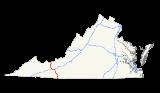
Interstate 77 in Virginia
Encyclopedia
In the U.S. state
of Virginia
, Interstate 77 is a north–south along the U.S. Route 52 corridor, serving Hillsville, Wytheville, and Bland
. Along I-77's 67 miles (107.8 km) length in Virginia, it passes through the Big Walker Mountain Tunnel
and East River Mountain Tunnel
, the latter on the West Virginia
state line and one of only two land vehicular tunnels to cross a state line.
and form a wrong-way concurrency. Interstate 77 north is signed with Interstate 81
south and vice-versa.
The southernmost 7 miles involve a steep grade, up for northbound and down for southbound traffic. The southbound side has 2 runaway truck ramps. The lower end of the grade coincides with the North Carolina
border, where the road exits the Appalachian Mountain region and levels out.
The entire length of I-77 in Virginia is also part of the proposed Interstate 74
.
I-77 crosses the following mountains:
U.S. state
A U.S. state is any one of the 50 federated states of the United States of America that share sovereignty with the federal government. Because of this shared sovereignty, an American is a citizen both of the federal entity and of his or her state of domicile. Four states use the official title of...
of Virginia
Virginia
The Commonwealth of Virginia , is a U.S. state on the Atlantic Coast of the Southern United States. Virginia is nicknamed the "Old Dominion" and sometimes the "Mother of Presidents" after the eight U.S. presidents born there...
, Interstate 77 is a north–south along the U.S. Route 52 corridor, serving Hillsville, Wytheville, and Bland
Bland, Virginia
Bland is a census-designated place in and the county seat of Bland County, Virginia, United States. Bland was originally known as Bland Court House. The population as of the 2010 Census was 409....
. Along I-77's 67 miles (107.8 km) length in Virginia, it passes through the Big Walker Mountain Tunnel
Big Walker Mountain Tunnel
The Big Walker Mountain Tunnel is a vehicular tunnel in the Appalachian Mountains of Southwest Virginia that carries Interstate 77 through/under Big Walker Mountain...
and East River Mountain Tunnel
East River Mountain Tunnel
The East River Mountain Tunnel is a vehicular tunnel that carries Interstate 77 and U.S. Route 52 through East River Mountain between the communities of Bluefield, West Virginia, and Rocky Gap, Virginia.-History:...
, the latter on the West Virginia
West Virginia
West Virginia is a state in the Appalachian and Southeastern regions of the United States, bordered by Virginia to the southeast, Kentucky to the southwest, Ohio to the northwest, Pennsylvania to the northeast and Maryland to the east...
state line and one of only two land vehicular tunnels to cross a state line.
Route description
For eight miles (13 km), Interstate 77 and Interstate 81 share pavementConcurrency (road)
A concurrency, overlap, or coincidence in a road network is an instance of one physical road bearing two or more different highway, motorway, or other route numbers...
and form a wrong-way concurrency. Interstate 77 north is signed with Interstate 81
Interstate 81
Interstate 81 is an Interstate Highway in the eastern part of the United States. Its southern terminus is at Interstate 40 in Dandridge, Tennessee; its northern terminus is on Wellesley Island at the Canadian border, where the Thousand Islands Bridge connects it to Highway 401, the main freeway...
south and vice-versa.
The southernmost 7 miles involve a steep grade, up for northbound and down for southbound traffic. The southbound side has 2 runaway truck ramps. The lower end of the grade coincides with the North Carolina
North Carolina
North Carolina is a state located in the southeastern United States. The state borders South Carolina and Georgia to the south, Tennessee to the west and Virginia to the north. North Carolina contains 100 counties. Its capital is Raleigh, and its largest city is Charlotte...
border, where the road exits the Appalachian Mountain region and levels out.
The entire length of I-77 in Virginia is also part of the proposed Interstate 74
Interstate 74
Interstate 74 is an Interstate Highway in the Midwestern and Southeastern United States. Its western end is at an intersection with Interstate 80 in Davenport, Iowa; the eastern end of its Midwest segment is at an intersection with Interstate 75 in Cincinnati, Ohio...
.
I-77 crosses the following mountains:
- Blue Ridge MountainsBlue Ridge MountainsThe Blue Ridge Mountains are a physiographic province of the larger Appalachian Mountains range. This province consists of northern and southern physiographic regions, which divide near the Roanoke River gap. The mountain range is located in the eastern United States, starting at its southern-most...
at Fancy Gap - Poplar Camp Mountain at Poplar Camp
- Big Walker Mountain through the Big Walker Mountain TunnelBig Walker Mountain TunnelThe Big Walker Mountain Tunnel is a vehicular tunnel in the Appalachian Mountains of Southwest Virginia that carries Interstate 77 through/under Big Walker Mountain...
- Brushy Mountains near Bastain
- East River Mountain through the East River Mountain TunnelEast River Mountain TunnelThe East River Mountain Tunnel is a vehicular tunnel that carries Interstate 77 and U.S. Route 52 through East River Mountain between the communities of Bluefield, West Virginia, and Rocky Gap, Virginia.-History:...
Exit list
| County | Location | # Exit number An exit number is a number assigned to a road junction, usually an exit from a freeway. It is usually marked on the same sign as the destinations of the exit, as well as a sign in the gore.... |
Destinations | Notes | |
|---|---|---|---|---|---|
| Carroll Carroll County, Virginia As of the census of 2000, there were 29,245 people, 12,186 households, and 8,786 families residing in the county. The population density was 61 people per square mile . There were 14,680 housing units at an average density of 31 per square mile... |
Hillsville Hillsville, Virginia Hillsville is a town in Carroll County, Virginia, United States. The population was 2,607 at the 2000 census. It is the county seat of Carroll County.-Geography:Hillsville is located at .... |
0.94 | 1 | ||
| 8.57 | 8 | ||||
| 14.85 | 14 | ||||
| 19.03 | 19 | ||||
| 24.06 | 24 | ||||
| Wythe Wythe County, Virginia As of the census of 2000, there were 27,599 people, 11,511 households, and 8,103 families residing in the county. The population density was 60 people per square mile . There were 12,744 housing units at an average density of 28 per square mile... |
Ft. Chiswell Fort Chiswell, Virginia Fort Chiswell is a census-designated place in Wythe County, Virginia, United States. The population was 911 at the 2000 census.Fort Chiswell is unincorporated, but gains its importance from being used as a control city for Interstate 77 throughout North Carolina. Fort Chiswell is located at the... |
32.14 | 32 | South end of I-81/US 11 overlap | |
| 33.07 | 80 | South end of US 52 overlap | |||
| 35.38 | 77 | Service Road | |||
| Wytheville Wytheville, Virginia Wytheville is a town in Wythe County, Virginia, United States. The population was 8,211 at the 2010 census. It is the county seat of Wythe County. The town is home to a Chautauqua Festival, held the third weekend in June every year since 1985... |
38.68 | 73 | North end of US 11 overlap | ||
| 39.97 | 40 | North end of I-81/US 52 overlap | |||
| 40.28 | 41 | ||||
| Bland Bland County, Virginia As of the census of 2000, there were 6,871 people, 2,568 households, and 1,908 families residing in the county. The population density was 19 people per square mile . There were 3,161 housing units at an average density of 9 per square mile... |
Bland Bland, Virginia Bland is a census-designated place in and the county seat of Bland County, Virginia, United States. Bland was originally known as Bland Court House. The population as of the 2010 Census was 409.... |
45.77 | 47 | ||
| 51.22 | 52 | ||||
| 57.33 | 58 | ||||
| 61.27 | 62 | ||||
| Rocky Gap Rocky Gap, Virginia Rocky Gap is an unincorporated community that is located in Bland County in the U.S. state of Virginia. Rocky Gap's center sits at a high elevation of around 2,887 ft. In the year of 2009, there was an estimate that there were a total of 75 people living in Rocky Gap. Rocky Gap has one zip code... |
63.24 | 64 | |||
| 65.57 | 66 | South end of US 52 overlap |