
Interstate 95 in Florida
Encyclopedia
Interstate 95
(I-95) is the main Interstate Highway on the east coast of the United States
; it serves the Atlantic coast
of Florida. It begins at a partial interchange
with U.S. Highway 1
just south of downtown Miami, and heads north past Daytona Beach
and Jacksonville
to the Georgia
state line at the St. Marys River.
 Interstate 95 runs for 382.083 miles (614.9 km), the southernmost 12.848 miles (20.7 km) of which are unsigned
as State Road 9A. The highway splits from U.S. Highway 1
near 32nd Road in southern Miami. It quickly interchange
s with the Rickenbacker Causeway
via the short unsigned SR 913, and then heads north into downtown. The short SR 970 freeway, mostly unsigned, distributes traffic to several downtown streets. On the north side of downtown, at the Midtown Interchange
, Interstate 395
heads east to the MacArthur Causeway
, and the tolled SR 836 heads west to Miami International Airport
. Throughout Miami-Dade County, I-95 is designated the North–South Expressway according to some maps.
After crossing I-395 and SR 836, I-95 begins to head north roughly along the alignment of Northwest 6th Avenue, lying one block east of Northwest 7th Avenue (U.S. Highway 441/SR 7). Just north of 36th Street (U.S. Highway 27/SR 25
), at what has been called the 36th Street Interchange, I-95 crosses Interstate 195
, which goes east over the Julia Tuttle Causeway to Miami Beach
, and SR 112, a toll road west to the airport. A two-way high-occupancy vehicle (HOV) roadway in the median begins at I-195 and SR 112, formed by ramps to and from SR 112. I-95 continues north, crossing and interchanging with many surface roads, most of which are State Roads, before reaching the Golden Glades Interchange
.
The complicated Golden Glades Interchange provides access between I-95 and two other freeways — the original section of Florida's Turnpike
(SR 91), since bypassed by the Homestead Extension
(SR 821), and the Palmetto Expressway (SR 826). Ramps are also provided to and from several surface streets - SR 826 east on 167th Street to Sunny Isles Beach
, U.S. Highway 441 (SR 7) south on Northwest 7th Avenue and north on Northwest 2nd Avenue, and SR 9 southwest on a limited-access roadway to Northwest 27th Avenue. I-95 north to West Palm Beach
, as well as SR 9 southwest to 27th Avenue, runs parallel to the South Florida Rail Corridor, used by CSX Transportation
for freight and Tri-Rail
for commuter rail. At the Golden Glades Interchange, SR 9 merges with I-95, and I-95 is unsigned as State Road 9 for the remainder of its length.
 North of Miami, I-95 continues on to Ft. Lauderdale
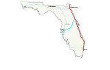
, where it interchanges with I-595
, providing access to Fort Lauderdale-Hollywood International Airport
and Port Everglades
to the east, and Broward County's western suburbs as well as I-75 northbound (via Alligator Alley
) across the peninsula to the Gulf Coast
to the west. In West Palm Beach, I-95 provides direct access to Palm Beach International Airport
as well as downtown West Palm Beach and Palm Beach Island via SR 704 (Okeechobee Blvd.). North of West Palm Beach, I-95 literally runs beside Florida's Turnpike for several miles, before the freeways eventually go separate ways north of Fort Pierce
(I-95 continues directly along the coast; Florida's Turnpike turns west toward Orlando
).
After an interchange with State Road 70 providing access to the Turnpike, the highway narrows to two lanes in each direction. The road soon enters Indian River County and the next major exit is with State Road 60 providing access to Vero Beach
. The highway soon enters Brevard County and the Space Coast of Florida. In Palm Bay, the road widens to three lanes in each direction and continues north passing Melbourne, Viera, and Cocoa. The next major junction is State Road 528 with tolled access to Orlando, Cocoa Beach, and Cape Canaveral. The road then narrows to two lanes in each direction and approaches the city of Titusville
. I-95 continues north and enters Volusia County and the city of Daytona Beach shortly afterwards. At the junction with Interstate 4, the road widens to three lanes in each direction. The highway passes through Flagler and St. Johns counties before it enters Duval County and the city of Jacksonville.
I-95 then continues directly through the center of downtown Jacksonville, with several major interchanges: I-295
/SR 9A, several miles south of the city; I-10 just south of downtown, and I-295/SR 9A once again several miles north of the city (the two highways provide a western and eastern bypass, respectively, around the city). Between exits 349 and 350A, I-95 is concurrent
with U.S. Route 1
and its unsigned designation SR 5. The Fuller Warren Bridge, which carries I-95 over the St. Johns River
just south of I-10, was rebuilt in 2002, and a new intersection between I-95 and I-10 was completed in September 2010
. Just north of I-295, I-95 provides access to Jacksonville International Airport
. From this point, I-95 continues north several miles before crossing into Nassau County with an exit for State Road A1A and then into Georgia, just north of mile marker 380.
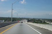
lanes, with two lanes in each direction. Prices vary based on congestion and peak hours and tolls are collected electronically, while registered travelers with 3 or more passengers and hybrid vehicles can drive the toll lanes for free. Both HOT lanes have been completed in both directions from I-395 to the Golden Glades Interchange (including toll gantries).
in 1956 touted the construction of what would become I-95 in Miami as a "...slum clearance program." Most of the construction was focused between Jacksonville and Daytona Beach in the early 1960s. At the end of the decade, the highway was complete from U.S. 17
, just south of the Georgia
state line to SR 60 near Vero Beach
(Georgia had not completed their portion of I-95 at the time of Florida's completion). Also by 1970, the segment from Ft. Lauderdale to Miami was complete. By 1976, most of the highway was complete from the Georgia State Line to Ft. Pierce as well as Palm Beach Gardens to Miami.
In 2002, I-95, along with most of Florida's interstates, switched over from a sequential exit numbering system to a mileage based exit numbering system.
north to SR 70 in Ft. Pierce in the 1950s. In the mid-1960s, the State Road Department authorized traffic counts be conducted to determine if the separation of Interstate 95 from the Turnpike was feasible, with arguments that using a concurrent alignment was costing Florida money for Federal Highway funding, but not without the concern of losing toll revenue. Interstate 95 was given a separate alignment from Florida's Turnpike
in 1973.
Over time, the interstate adopted a separate route closer to U.S. Route 1, including parallel with the turnpike between Stuart and Palm Beach Gardens and was originally scheduled to be completed in 1972. However, resistance by Martin County
officials due to environmental and unwanted growth concerns delayed the highway's completion for 15 years, requiring those who wanted to travel through the Treasure Coast
to take either the slower US 1 or the tolled Turnpike. This section opened to traffic on December 19, 1987, with I-95 running uninterrupted from Miami to the state line.
 The stretch of road between Exit 173 (SR 514) and Exit 220 (SR 406) in Brevard County
is in the process of being widened from four to six lanes, and where a new interchange will be constructed where the Pineda Causeway is to be extended to the interstate in Melbourne
.
!County
!Location
!Mile
!Exit
!Destinations
!Notes
|-
|rowspan=25|Miami-Dade
|rowspan=12|Miami
|bgcolor=#ffdddd|0.000
|bgcolor=#ffdddd|
|bgcolor=#ffdddd|
|bgcolor=#ffdddd|Southbound exit and northbound entrance
|-
|bgcolor=#ffdddd|0.469
|bgcolor=#ffdddd|1A
|bgcolor=#ffdddd|
|bgcolor=#ffdddd|Southbound exit and northbound entrance
|-
|1.558
|1B
|
|
|-
|2.026
|2A
| – Downtown
|
|-
|bgcolor=#ffdddd|2.026
|bgcolor=#ffdddd|2C
|bgcolor=#ffdddd|Miami Avenue – Downtown Miami
|bgcolor=#ffdddd|No northbound exit
|-
|bgcolor=#ffdddd|3.186
|bgcolor=#ffdddd|2B
|bgcolor=#ffdddd|Northwest 2nd Street – Miami Arena
, AmericanAirlines Arena
|bgcolor=#ffdddd|Northbound exit and southbound entrance
|-
|bgcolor=#ffdddd|3.186
|bgcolor=#ffdddd|3B
|bgcolor=#ffdddd|Northwest 8th Street – Port of Miami
, Miami Ballpark
|bgcolor=#ffdddd|Southbound exit and northbound entrance
|-
|3.186
|2D
|
|
|-
|3.186
|3A
|
|
|-
|4.844
|4
|
|Signed as exits 4A (east) and 4B (west) northbound
|-
|6.227
|6A
|Northwest 62nd Street, Dr. Martin Luther King Jr. Boulevard
|
|-
|bgcolor=#ffdddd|6.608
|bgcolor=#ffdddd|6B
|bgcolor=#ffdddd|Northwest 69th Street
|bgcolor=#ffdddd|Southbound exit and northbound entrance
|-
|
|7.329
|7
|
|
|-
|
|8.285
|8A
|Northwest 95th Street, Rev. Dr. A. Jackson Jr. Boulevard
|
|-
|
|8.794
|8B
|
|
|-
|
|bgcolor=#ffdddd|9.799
|bgcolor=#ffdddd|9
|bgcolor=#ffdddd|
|bgcolor=#ffdddd|Northbound exit and southbound entrance
|-
|rowspan=2|North Miami
|10.176
|10A
|
|
|-
|10.854
|10B
|
|
|-
|
|bgcolor=#ffdddd|11.827
|bgcolor=#ffdddd|11
|bgcolor=#ffdddd|Northwest 151st Street
|bgcolor=#ffdddd|Northbound exit and southbound entrance
|-
|
|12.848
|12A
|
|Southbound exit is part of exit 12
|-
|
|12.848
|12B
|
|Southbound exit is part of exit 12
|-
|
|bgcolor=#ffdddd|12.848
|bgcolor=#ffdddd|12C
|bgcolor=#ffdddd|
|bgcolor=#ffdddd|Northbound exit and southbound entrance
|-
|
|bgcolor=#ffdddd|12.848
|bgcolor=#ffdddd|12
|bgcolor=#ffdddd|
|bgcolor=#ffdddd|North end of SR 9A overlap; south end of SR 9 overlap; southbound exit and northbound entrance
|-
|North Miami Beach
|14.377
|14
|
|
|-
|Ives Estates
|16.574
|16
|Ives Dairy Road, Northeast 203rd Street
|Former SR 854
|-
|rowspan=21|Broward
|rowspan=2|Hallandale Beach
|18.025
|18
|
|
|-
|rowspan=2|18.794
|rowspan=2|19
|rowspan=2|
|rowspan=2|
|-
|rowspan=4|Hollywood
|-
|19.816
|20
|
|
|-
|21.384
|21
|
|
|-
|rowspan=2|22.416
|rowspan=2|22
|rowspan=2|
|rowspan=2|
|-
|rowspan=2|Dania Beach
|-
|23.433
|23
|
|
|-
|rowspan=5|Fort Lauderdale
|24.803
|24
|
|Signed as exits 26C (east) and 26D (west) southbound. Also known as the Rainbow Interchange
.
|-
|25.245
|25
|
|
|-
|26.500
|26
|
|Former exit 26CD southbound
|-
|27.531
|27
|
|
|-
|28.553
|29
|
|Signed as exits 29A (east) and 29B (west) northbound
|-
|rowspan=3|Oakland Park
|30.713
|31
|
|Signed as exits 31A (east) and 31B (west) northbound
|-
|32.339
|32
|
|
|-
|33.553
|33
|Cypress Creek Road
|Signed as exits 33A (east) and 33B (west) northbound
|-
|rowspan=2|Pompano Beach
|35.635
|36
|
|Signed as exits 36A (east) and 36B (west) southbound
|-
|37.694
|38
|Copans Road
|Signed as exits 38A (east) and 38B (west) southbound
|-
|
|38.840
|39
|
|
|-
|rowspan=2|Deerfield Beach
|40.922
|41
|
|
|-
|41.883
|42
|
|Signed as exits 42A (east) and 42B (west) northbound
|-
|rowspan=25|Palm Beach
|rowspan=4|Boca Raton
|44.130
|44
|Palmetto Park Road
|
|-
|45.361
|45
|
|
|-
|47.818
|48
|
|Signed as exits 48A (east) and 48B (west) northbound
|-
|49.677
|50
|Congress Avenue
|
|-
|rowspan=2|Delray Beach
|50.969
|51
|Linton Boulevard
|
|-
|52.509
|52
|
|
|-
|rowspan=3|Boynton Beach
|56.344
|56
|Woolbright Road
|
|-
|57.339
|57
|
|
|-
|58.853
|59
|Gateway Boulevard
|
|-
|rowspan=2|Lantana
|60.343
|60
|Hypoluxo Road
|
|-
|61.377
|61
|
|
|-
|rowspan=2|Lake Worth
|62.868
|63
|6th Avenue South
|
|-
|64.178
|64
|10th Avenue North
|
|-
|rowspan=6|West Palm Beach
|66.087
|66
|
|
|-
|67.539
|68
|
|
|-
|68.558
|69
|Belvedere Road – Palm Beach International Airport
|Signed as exits 69A (Belvedere Road) and 69B (Airport) southbound
|-
|69.760
|70
|
|
|-
|71.015
|71
|Palm Beach Lakes Boulevard
|
|-
|73.799
|74
|
|
|-
|Riviera Beach
|75.549
|76
|
|
|-
|rowspan=3|Palm Beach Gardens
|77.307
|77
|
|
|-
|79.503
|79
|
|Signed as exits 79A (east) and 79B (west) northbound
|-
|bgcolor=#ffdddd|79.904
|bgcolor=#ffdddd|79C
|bgcolor=#ffdddd|
|bgcolor=#ffdddd|Southbound exit and northbound entrance
|-
|
|82.909
|83
|Donald Ross Road
|
|-
|Jupiter
|86.704
|87
|
|Signed as exits 87A (east) and 87B (west)
|-
|rowspan=4|Martin
|
|96.064
|96
|
|
|-
|
|100.836
|101
|
|
|-
|
|102.435
|102
|
|
|-
|
|110.253
|110
|
|
|-
|rowspan=8|St. Lucie
|rowspan=5|Port St. Lucie
|113.662
|113
|Becker Road
|Completed July 30, 2009
|-
|117.745
|118
|Gatlin Boulevard / Tradition Parkway
|
|-
|119.977
|120
|Crosstown Parkway
|
|-
|121.195
|121
|St. Lucie West Boulevard
|
|-
|125.593
|126
|
|
|-
|rowspan=2|Fort Pierce
|128.858
|129
|
|
|-
|131.089
|131
|
|Signed as exits 131A (east) and 131B (west)
|-
|
|137.561
|138
|
|
|-
|rowspan=2|Indian River
|
|146.825
|147
|
|
|-
|
|155.960
|156
|
|
|-
|rowspan=17|Brevard
|rowspan=2|Palm Bay
|173.203
|173
|
|
|-
|176.191
|176
|
|
|-
|rowspan=4|Melbourne
|180.592
|180
|
|2011 daily traffic between 192 and Malabar Road was 48,500 vehicles
|-
|183.457
|183
|
|
|-
|188.447
|188
|
|Opened May 2, 2011
|-
|191.093
|191
|
|
|-
|rowspan=1|Rockledge
|195.714
|195
|
|
|-
|rowspan=2|Cocoa
|201.360
|201
|
|2011 daily traffic between 520 and 192 was 78,000 vehicles
|-
|202.531
|202
|
|
|-
|
|205.309
|205
|, Canaveral AFS
|2011 daily traffic between 520 and 528 was 36,500 vehicles
|-
|
|208.208
|208
|Port St. John Parkway - Port St. John
|
|-
|
|bgcolor=#ffdddd|211.832
|bgcolor=#ffdddd|212
|bgcolor=#ffdddd|
|bgcolor=#ffdddd|Northbound exit and southbound entrance
|-
|
|bgcolor=#ffdddd|211.832
|bgcolor=#ffdddd|212
|bgcolor=#ffdddd|
|bgcolor=#ffdddd|Southbound exit and northbound entrance
|-
|rowspan=2|Titusville
|215.528
|215
|
|
|-
|219.976
|220
|
|
|-
|
|223.605
|223
|
|
|-
|
|231.178
|231
|
|
|-
|rowspan=8|Volusia
|Edgewater
|244.042
|244
|
|
|-
|New Smyrna Beach
|248.887
|249
|
|Signed as exits 249A (east) and 249B (west) southbound
|-
|Port Orange
|255.875
|256
|
|
|-
|rowspan=3|Daytona Beach
|260.427
|260
|
|Signed as exits 260A (east) and 260B (west)
|-
|261.717
|261
|
|Signed as exits 261A (east) and 261B (west) southbound
|-
|265.206
|265
|
|
|-
|rowspan=2|Ormond Beach
|267.871
|268
|
|
|-
|273.447
|273
|
|
|-
|rowspan=3|Flagler
|rowspan=3|Palm Coast
|278.396
|278
|Old Dixie Highway
, Marco Polo Road
|
|-
|283.647
|284
|
|
|-
|289.444
|289
|Palm Coast Parkway - Palm Coast
|
|-
|rowspan=6|St. Johns
|
|298.056
|298
|
|
|-
|
|305.227
|305
|
|
|-
|Vermont Heights
|310.923
|311
|
|
|-
|
|317.560
|318
|
|
|-
|
|323.250
|323
|International Golf Parkway
|
|-
|
|329.143
|329
|
|
|-
|rowspan=34|Duval
|rowspan=34|Jacksonville
|335.306
|335
|St. Augustine Road
|
|-
|337.232
|337
|, Jacksonville Beaches
|
|-
|338.530
|339
|
|
|-
|bgcolor=#ffdddd|339.342
|bgcolor=#ffdddd|340
|bgcolor=#ffdddd|
|bgcolor=#ffdddd|Northbound exit and southbound entrance
|-
|341.263
|341
|
|
|-
|343.594
|344
| – Jacksonville Beaches
|
|-
|bgcolor=#ffdddd|345.044
|bgcolor=#ffdddd|345
|bgcolor=#ffdddd|Bowden Road
|bgcolor=#ffdddd|Northbound exit and southbound entrance
|-
|345.420
|346
|
|Signed as exits 346A (east) and 346B (west); northbound exit is via exit 345
|-
|347.227
|347
|
|
|-
|bgcolor=#ffdddd|348.694
|bgcolor=#ffdddd|348
|bgcolor=#ffdddd|
|bgcolor=#ffdddd|Southbound exit and northbound entrance
|-
|bgcolor=#ffdddd|349.060
|bgcolor=#ffdddd|349
|bgcolor=#ffdddd| – Jacksonville Beaches
|bgcolor=#ffdddd|Southbound exit and northbound entrance
|-
|bgcolor=#ffdddd|349.492
|bgcolor=#ffdddd|350A
|bgcolor=#ffdddd|Riverside Avenue (SR 228 via SR 13 north), Mary Street, Prudential Drive (SR 13 south), Main Street (US 1
north, US 90 west, SR 5 north, SR 10 west)
|bgcolor=#ffdddd|Northbound exit and southbound entrance
|-
|bgcolor=#ffdddd|349.833
|bgcolor=#ffdddd|350B
|bgcolor=#ffdddd|San Marco Boulevard
|bgcolor=#ffdddd|Southbound exit and northbound entrance
|-
|colspan=5 align=center|Fuller Warren Bridge over St. Johns River
|-
|bgcolor=#ffdddd|351.234
|bgcolor=#ffdddd|351A
|bgcolor=#ffdddd|Park Street
|bgcolor=#ffdddd|Northbound exit and southbound entrance
|-
|bgcolor=#ddffdd|351.234
|bgcolor=#ddffdd|351B
|bgcolor=#ddffdd|
|bgcolor=#ddffdd|South end of US 17 overlap
|-
|bgcolor=#ffdddd|351.234
|bgcolor=#ffdddd|351C
|bgcolor=#ffdddd|Stockton Street
|bgcolor=#ffdddd|Northbound exit is via exit 351B; southbound exit was formerly separate (as exit 351D) but is now via exit 351A
|-
|bgcolor=#ffdddd|352.035
|bgcolor=#ffdddd|352A
|bgcolor=#ffdddd|Forest Street
|bgcolor=#ffdddd|Southbound exit and northbound entrance
|-
|bgcolor=#ffdddd|352.035
|bgcolor=#ffdddd|352B
|bgcolor=#ffdddd|Forsyth Street
|bgcolor=#ffdddd|No northbound entrance; southbound exit is via exit 353A
|-
|352.035
|352C
|Monroe Street
|Southbound exit is via exit 353A
|-
|bgcolor=#ffdddd|352.535
|bgcolor=#ffdddd|353A
|bgcolor=#ffdddd|Church Street
|bgcolor=#ffdddd|Southbound exit only
|-
|bgcolor=#ddffdd|352.535
|bgcolor=#ddffdd|353B
|bgcolor=#ddffdd|, Sports Complex
|bgcolor=#ddffdd|North end of US 17 overlap
|-
|352.535
|353C
|
|
|-
|353.374
|353D
|
|
|-
|353.977
|354
| – Amtrak station
|Signed as exits 354A (south) and 354B (north)
|-
|354.591
|355
|
|
|-
|355.890
|356
|
|Signed as exits 356A (south) and 356B (north) northbound
|-
|356.666
|357
|
|
|-
|357.755
|358A
|
|
|-
|358.037
|358B
|Broward Road
|
|-
|359.524
|360
|
|
|-
|361.618
|362
| – Blount Island
, Jacksonville Beaches
|Signed as exits 362A (SR 9A) and 362B (I-295)
|-
|363.155
|363
| – Jacksonville International Airport
|Signed as exits 363A (east) and 363B (west) northbound
|-
|365.731
|366
|Pecan Park Road
|
|-
|rowspan=2|Nassau
|Hero
|372.863
|373
|
|
|-
|Becker
|379.481
|380
|, Kingsland, GA
|
|-
|colspan=7 align=center|I-95 crosses the St. Mary's River
and continues north into Georgia
Interstate 95
Interstate 95 is the main highway on the East Coast of the United States, running parallel to the Atlantic Ocean from Maine to Florida and serving some of the most populated urban areas in the country, including Boston, Providence, New Haven, New York City, Newark, Philadelphia, Baltimore,...
(I-95) is the main Interstate Highway on the east coast of the United States
East Coast of the United States
The East Coast of the United States, also known as the Eastern Seaboard, refers to the easternmost coastal states in the United States, which touch the Atlantic Ocean and stretch up to Canada. The term includes the U.S...
; it serves the Atlantic coast
Atlantic Coast
The Atlantic Coast is any coast fronting the Atlantic Ocean. The term differentiates the coasts of countries or continents with coastlines on more than one body of water, such as North America, South America, Africa and Europe.-See also:*Indian Ocean...
of Florida. It begins at a partial interchange
Interchange (road)
In the field of road transport, an interchange is a road junction that typically uses grade separation, and one or more ramps, to permit traffic on at least one highway to pass through the junction without directly crossing any other traffic stream. It differs from a standard intersection, at which...
with U.S. Highway 1
U.S. Route 1 in Florida
U.S. Route 1 in Florida runs along the state's east coast from Key West to its crossing of the St. Marys River into Georgia north of Boulogne, and south of Folkston. US 1 was designated through Florida when the U.S. Highway System was established in 1926.US 1 runs in the state of Florida, and...
just south of downtown Miami, and heads north past Daytona Beach
Daytona Beach, Florida
Daytona Beach is a city in Volusia County, Florida, USA. According to 2008 U.S. Census Bureau estimates, the city has a population of 64,211. Daytona Beach is a principal city of the Deltona – Daytona Beach – Ormond Beach, Florida Metropolitan Statistical Area, which the census bureau estimated had...
and Jacksonville
Jacksonville, Florida
Jacksonville is the largest city in the U.S. state of Florida in terms of both population and land area, and the largest city by area in the contiguous United States. It is the county seat of Duval County, with which the city government consolidated in 1968...
to the Georgia
Georgia (U.S. state)
Georgia is a state located in the southeastern United States. It was established in 1732, the last of the original Thirteen Colonies. The state is named after King George II of Great Britain. Georgia was the fourth state to ratify the United States Constitution, on January 2, 1788...
state line at the St. Marys River.
Route description
Unsigned highway
An unsigned highway is a highway that has been assigned a route number, but does not bear conventional road markings that would normally be used to identify the route with that number...
as State Road 9A. The highway splits from U.S. Highway 1
U.S. Route 1 in Florida
U.S. Route 1 in Florida runs along the state's east coast from Key West to its crossing of the St. Marys River into Georgia north of Boulogne, and south of Folkston. US 1 was designated through Florida when the U.S. Highway System was established in 1926.US 1 runs in the state of Florida, and...
near 32nd Road in southern Miami. It quickly interchange
Interchange (road)
In the field of road transport, an interchange is a road junction that typically uses grade separation, and one or more ramps, to permit traffic on at least one highway to pass through the junction without directly crossing any other traffic stream. It differs from a standard intersection, at which...
s with the Rickenbacker Causeway
Rickenbacker Causeway
The Rickenbacker Causeway connects Miami, Florida, United States to the barrier islands of Virginia Key and Key Biscayne across Biscayne Bay.-Background:...
via the short unsigned SR 913, and then heads north into downtown. The short SR 970 freeway, mostly unsigned, distributes traffic to several downtown streets. On the north side of downtown, at the Midtown Interchange
Midtown Interchange
The Midtown Interchange, located in the Civic Center neighborhood of Miami, Florida, USA, is the convergence of three major motorways: I-95, I-395 , and the Dolphin Expressway ....
, Interstate 395
Interstate 395 (Florida)
Interstate 395 is a long, elevated Interstate Highway that connects Interstate 95 in the west with the MacArthur Causeway in the east in the Miami area via the Midtown Interchange...
heads east to the MacArthur Causeway
MacArthur Causeway
The General Douglas MacArthur Causeway is a six-lane causeway which connects Downtown, Miami, Florida and South Beach, Miami Beach via Biscayne Bay....
, and the tolled SR 836 heads west to Miami International Airport
Miami International Airport
Miami International Airport , also known as MIA and historically Wilcox Field, is the primary airport serving the South Florida area...
. Throughout Miami-Dade County, I-95 is designated the North–South Expressway according to some maps.
After crossing I-395 and SR 836, I-95 begins to head north roughly along the alignment of Northwest 6th Avenue, lying one block east of Northwest 7th Avenue (U.S. Highway 441/SR 7). Just north of 36th Street (U.S. Highway 27/SR 25
Florida State Road 25
State Road 25 is a state highway in the U.S. state of Florida.It is mainly signed as U.S. Highways:*U.S. Highway 27 from Miami to Lady Lake and Belleview to Ocala*U.S. Highway 301 from Belleview to near Sparr...
), at what has been called the 36th Street Interchange, I-95 crosses Interstate 195
Interstate 195 (Florida)
Interstate 195 is a spur expressway connecting Interstate 95 in the west with Miami Beach in the east, crossing Biscayne Bay by traveling over the Julia Tuttle Causeway, named after Miami founder Julia Tuttle....
, which goes east over the Julia Tuttle Causeway to Miami Beach
Miami Beach, Florida
Miami Beach is a coastal resort city in Miami-Dade County, Florida, United States, incorporated on March 26, 1915. The municipality is located on a barrier island between the Atlantic Ocean and Biscayne Bay, the latter which separates the Beach from Miami city proper...
, and SR 112, a toll road west to the airport. A two-way high-occupancy vehicle (HOV) roadway in the median begins at I-195 and SR 112, formed by ramps to and from SR 112. I-95 continues north, crossing and interchanging with many surface roads, most of which are State Roads, before reaching the Golden Glades Interchange
Golden Glades Interchange
The Golden Glades Interchange, located in Miami Gardens and North Miami Beach, Florida, United States, is the confluence of five major roads serving eastern and southern Florida.-Description:The five highways the come together at the interchange are U.S...
.
The complicated Golden Glades Interchange provides access between I-95 and two other freeways — the original section of Florida's Turnpike
Florida's Turnpike
Florida's Turnpike , designated as the Ronald Reagan Turnpike, and originally known as the Sunshine State Parkway is a north–south toll road that runs through 11 counties in the Florida peninsula, from U.S...
(SR 91), since bypassed by the Homestead Extension
Homestead Extension of Florida's Turnpike
Homestead Extension of Florida's Turnpike , designated as the Ronald Reagan Turnpike, and originally known as the West Dade Expressway is a north–south free-flow toll road southern extension of the tolled Florida's Turnpike...
(SR 821), and the Palmetto Expressway (SR 826). Ramps are also provided to and from several surface streets - SR 826 east on 167th Street to Sunny Isles Beach
Sunny Isles Beach, Florida
Sunny Isles Beach is a city located on a barrier island in northeast Miami-Dade County, Florida, United States. The City is bounded by the Atlantic Ocean on the east and the Intracoastal Waterway on the west...
, U.S. Highway 441 (SR 7) south on Northwest 7th Avenue and north on Northwest 2nd Avenue, and SR 9 southwest on a limited-access roadway to Northwest 27th Avenue. I-95 north to West Palm Beach
West Palm Beach, Florida
West Palm Beach, is a city located on the Atlantic coast in southeastern Florida and is the most populous city in and county seat of Palm Beach County, the third most populous county in Florida with a 2010 population of 1,320,134. The city is also the oldest incorporated municipality in South Florida...
, as well as SR 9 southwest to 27th Avenue, runs parallel to the South Florida Rail Corridor, used by CSX Transportation
CSX Transportation
CSX Transportation operates a Class I railroad in the United States known as the CSX Railroad. It is the main subsidiary of the CSX Corporation. The company is headquartered in Jacksonville, Florida, and owns approximately 21,000 route miles...
for freight and Tri-Rail
Tri-Rail
Tri-Rail is a commuter rail line linking Miami, Fort Lauderdale, and West Palm Beach, Florida, United States. It is run by the South Florida Regional Transportation Authority. The system has 18 stations along the South Florida coast...
for commuter rail. At the Golden Glades Interchange, SR 9 merges with I-95, and I-95 is unsigned as State Road 9 for the remainder of its length.
Fort Lauderdale, Florida
Fort Lauderdale is a city in the U.S. state of Florida, on the Atlantic coast. It is the county seat of Broward County. As of the 2010 census, the city had a population of 165,521. It is a principal city of the South Florida metropolitan area, which was home to 5,564,635 people at the 2010...
, where it interchanges with I-595
Interstate 595 (Florida)
Interstate 595 , also known as the Port Everglades Expressway and as the unsigned State Road 862, is a Interstate highway that connects Interstate 75 and Alligator Alley in the west with Florida's Turnpike, Interstate 95, Fort Lauderdale-Hollywood International Airport, US 1, and SR A1A before...
, providing access to Fort Lauderdale-Hollywood International Airport
Fort Lauderdale-Hollywood International Airport
Fort Lauderdale – Hollywood International Airport is an international commercial airport located in unincorporated Broward County, Florida, three miles southwest of the central business district of Fort Lauderdale...
and Port Everglades
Port Everglades
Port Everglades is a port in Broward County, Florida. As one of South Florida's leading economic powerhouses, Port Everglades is the gateway for international trade and cruise vacations. Already one of the three busiest cruise ports worldwide, Port Everglades is also one of Florida's leading...
to the east, and Broward County's western suburbs as well as I-75 northbound (via Alligator Alley
Alligator Alley
Alligator Alley is a section of Interstate 75 and State Road 84 extending from Naples on the west coast of Florida to Weston on the east...
) across the peninsula to the Gulf Coast
Gulf of Mexico
The Gulf of Mexico is a partially landlocked ocean basin largely surrounded by the North American continent and the island of Cuba. It is bounded on the northeast, north and northwest by the Gulf Coast of the United States, on the southwest and south by Mexico, and on the southeast by Cuba. In...
to the west. In West Palm Beach, I-95 provides direct access to Palm Beach International Airport
Palm Beach International Airport
Palm Beach International Airport is a public airport located 3 nautical miles west of Palm Beach, Florida, in West Palm Beach, Florida, and serves Palm Beach County. The airport is operated and maintained by Palm Beach County Department of Airports. Road access to the airport is available...
as well as downtown West Palm Beach and Palm Beach Island via SR 704 (Okeechobee Blvd.). North of West Palm Beach, I-95 literally runs beside Florida's Turnpike for several miles, before the freeways eventually go separate ways north of Fort Pierce
Fort Pierce, Florida
Fort Pierce, also spelled Ft. Pierce, is a city in St. Lucie County, Florida, USA. It is known as The Sunrise City. The population was 37,959 at the 2004 census. As of 2008, the population recorded by the U.S. Census Bureau is 41,000. It is the county seat of St. Lucie County.Fort Pierce is part...
(I-95 continues directly along the coast; Florida's Turnpike turns west toward Orlando
Orlando, Florida
Orlando is a city in the central region of the U.S. state of Florida. It is the county seat of Orange County, and the center of the Greater Orlando metropolitan area. According to the 2010 US Census, the city had a population of 238,300, making Orlando the 79th largest city in the United States...
).
After an interchange with State Road 70 providing access to the Turnpike, the highway narrows to two lanes in each direction. The road soon enters Indian River County and the next major exit is with State Road 60 providing access to Vero Beach
Vero Beach, Florida
Vero Beach is a city in Indian River County, Florida, USA. According to the U.S. Census Bureau's 2006 estimates, the city had a population of 16,939. It is the county seat of Indian River County...
. The highway soon enters Brevard County and the Space Coast of Florida. In Palm Bay, the road widens to three lanes in each direction and continues north passing Melbourne, Viera, and Cocoa. The next major junction is State Road 528 with tolled access to Orlando, Cocoa Beach, and Cape Canaveral. The road then narrows to two lanes in each direction and approaches the city of Titusville
Titusville, Florida
Titusville is a city in Brevard County, Florida in the United States. It is the county seat of Brevard County. Nicknamed Space City, USA, Titusville is on the Indian River, west of Merritt Island and the Kennedy Space Center and south-southwest of the Canaveral National Seashore...
. I-95 continues north and enters Volusia County and the city of Daytona Beach shortly afterwards. At the junction with Interstate 4, the road widens to three lanes in each direction. The highway passes through Flagler and St. Johns counties before it enters Duval County and the city of Jacksonville.
I-95 then continues directly through the center of downtown Jacksonville, with several major interchanges: I-295
Interstate 295 (Florida)
Interstate 295 , an auxiliary route of Interstate 95, is a bypass route around central Jacksonville, Florida, which is currently signed on the western half for...
/SR 9A, several miles south of the city; I-10 just south of downtown, and I-295/SR 9A once again several miles north of the city (the two highways provide a western and eastern bypass, respectively, around the city). Between exits 349 and 350A, I-95 is concurrent
Concurrency (road)
A concurrency, overlap, or coincidence in a road network is an instance of one physical road bearing two or more different highway, motorway, or other route numbers...
with U.S. Route 1
U.S. Route 1
U.S. Route 1 is a major north–south U.S. Highway that serves the East Coast of the United States. It runs 2,377 miles from Fort Kent, Maine at the Canadian border south to Key West, Florida. U.S. 1 generally parallels Interstate 95, though it is significantly farther west between...
and its unsigned designation SR 5. The Fuller Warren Bridge, which carries I-95 over the St. Johns River
St. Johns River
The St. Johns River is the longest river in the U.S. state of Florida and its most significant for commercial and recreational use. At long, it winds through or borders twelve counties, three of which are the state's largest. The drop in elevation from the headwaters to the mouth is less than ;...
just south of I-10, was rebuilt in 2002, and a new intersection between I-95 and I-10 was completed in September 2010
September 2010
September 2010 was the ninth month of that year. It began on a Wednesday and concluded after 30 days on a Thursday.-International holidays and observances:* 1: Constitution Day * 1: Independence Day...
. Just north of I-295, I-95 provides access to Jacksonville International Airport
Jacksonville International Airport
Jacksonville International Airport is a joint civil-military public airport located 13 miles north of downtown Jacksonville, a city in Duval County, Florida...
. From this point, I-95 continues north several miles before crossing into Nassau County with an exit for State Road A1A and then into Georgia, just north of mile marker 380.
Express toll lanes
The current HOV lanes in both directions between I-395 in Miami and I-595 in Davie are converted to High Occupancy tollHigh occupancy/toll and express toll lanes
High occupancy/toll lanes is a road pricing scheme that gives motorists in single-occupant vehicles access to high-occupancy vehicle lanes . Sometimes, entire roads are designated for the use of HOVs. Tolls are collected either by manned toll booths, automatic number plate recognition, or...
lanes, with two lanes in each direction. Prices vary based on congestion and peak hours and tolls are collected electronically, while registered travelers with 3 or more passengers and hybrid vehicles can drive the toll lanes for free. Both HOT lanes have been completed in both directions from I-395 to the Golden Glades Interchange (including toll gantries).
History
Interstate 95 was initially signed in 1959, and the first section to be opened to traffic was in Jacksonville in 1960. A year later, a short section just north of the current I-195 in Miami opened. The Miami NewsThe Miami News
The Miami News was the dominant evening newspaper in Miami, Florida for most of the 20th century, its chief concurrent competitor being the morning-edition of The Miami Herald. The paper started publishing in May 1896 as a weekly called The Miami Metropolis. The Metropolis had become a daily paper...
in 1956 touted the construction of what would become I-95 in Miami as a "...slum clearance program." Most of the construction was focused between Jacksonville and Daytona Beach in the early 1960s. At the end of the decade, the highway was complete from U.S. 17
U.S. Route 17 in Florida
U.S. Route 17 in Florida is a north–south United States Highway. It runs from the Punta Gorda, Florida Metropolitan Statistical Area northeast to the Greater Jacksonville Metropolitan Area....
, just south of the Georgia
Georgia (U.S. state)
Georgia is a state located in the southeastern United States. It was established in 1732, the last of the original Thirteen Colonies. The state is named after King George II of Great Britain. Georgia was the fourth state to ratify the United States Constitution, on January 2, 1788...
state line to SR 60 near Vero Beach
Vero Beach, Florida
Vero Beach is a city in Indian River County, Florida, USA. According to the U.S. Census Bureau's 2006 estimates, the city had a population of 16,939. It is the county seat of Indian River County...
(Georgia had not completed their portion of I-95 at the time of Florida's completion). Also by 1970, the segment from Ft. Lauderdale to Miami was complete. By 1976, most of the highway was complete from the Georgia State Line to Ft. Pierce as well as Palm Beach Gardens to Miami.
In 2002, I-95, along with most of Florida's interstates, switched over from a sequential exit numbering system to a mileage based exit numbering system.
Missing Treasure Coast Link
The Bureau of Public Roads approved an Interstate 95 alignment that used 41 miles (66 km) of the Turnpike from PGA Boulevard (SR 786) in Palm Beach GardensPalm Beach Gardens, Florida
Palm Beach Gardens is a city in Palm Beach County in the U.S. state of Florida. The city is in the center of a rapidly-developing area north of West Palm Beach in the northern part of the county and the South Florida metropolitan area. , the population was 48,452...
north to SR 70 in Ft. Pierce in the 1950s. In the mid-1960s, the State Road Department authorized traffic counts be conducted to determine if the separation of Interstate 95 from the Turnpike was feasible, with arguments that using a concurrent alignment was costing Florida money for Federal Highway funding, but not without the concern of losing toll revenue. Interstate 95 was given a separate alignment from Florida's Turnpike
Florida's Turnpike
Florida's Turnpike , designated as the Ronald Reagan Turnpike, and originally known as the Sunshine State Parkway is a north–south toll road that runs through 11 counties in the Florida peninsula, from U.S...
in 1973.
Over time, the interstate adopted a separate route closer to U.S. Route 1, including parallel with the turnpike between Stuart and Palm Beach Gardens and was originally scheduled to be completed in 1972. However, resistance by Martin County
Martin County, Florida
Martin County is a county in the U.S. state of Florida. As of 2000, the population was 126,731. The U.S. Census Bureau 2008 estimate for the county is 138,660. Its county seat is Stuart, Florida.- History :...
officials due to environmental and unwanted growth concerns delayed the highway's completion for 15 years, requiring those who wanted to travel through the Treasure Coast
Treasure Coast
The Treasure Coast is a region in the U.S. state of Florida, generally considered to include Indian River, St. Lucie, and Martin counties. The area stretches from Hobe Sound in the south to north of Sebastian in the north and includes the cities of Stuart, Port St. Lucie, Fort Pierce, and Vero Beach...
to take either the slower US 1 or the tolled Turnpike. This section opened to traffic on December 19, 1987, with I-95 running uninterrupted from Miami to the state line.
Future
Brevard County, Florida
Brevard County is a county located in the U.S. state of Florida, along the coast of the Atlantic Ocean. As of 2007 U.S. Census Bureau estimates, the population is 536,521, making it the 10th most populous county in the state. Influenced by the presence of the John F. Kennedy Space Center, Brevard...
is in the process of being widened from four to six lanes, and where a new interchange will be constructed where the Pineda Causeway is to be extended to the interstate in Melbourne
Melbourne, Florida
Melbourne is a city in Brevard County, Florida, United States. As of 2009, the population estimated by the U.S. Census Bureau is 78,323. The municipal area is the second largest by size and by population in the county. Melbourne is a principal city of the Palm Bay – Melbourne – Titusville, Florida...
.
Exit list
{|class=wikitable!County
!Location
!Mile
!Exit
Exit number
An exit number is a number assigned to a road junction, usually an exit from a freeway. It is usually marked on the same sign as the destinations of the exit, as well as a sign in the gore....
!Destinations
!Notes
|-
|rowspan=25|Miami-Dade
Miami-Dade County, Florida
Miami-Dade County is a county located in the southeastern part of the state of Florida. As of 2010 U.S. Census, the county had a population of 2,496,435, making it the most populous county in Florida and the eighth-most populous county in the United States...
|rowspan=12|Miami
Miami, Florida
Miami is a city located on the Atlantic coast in southeastern Florida and the county seat of Miami-Dade County, the most populous county in Florida and the eighth-most populous county in the United States with a population of 2,500,625...
|bgcolor=#ffdddd|0.000
|bgcolor=#ffdddd|
|bgcolor=#ffdddd|
|bgcolor=#ffdddd|Southbound exit and northbound entrance
|-
|bgcolor=#ffdddd|0.469
|bgcolor=#ffdddd|1A
|bgcolor=#ffdddd|
|bgcolor=#ffdddd|Southbound exit and northbound entrance
|-
|1.558
|1B
|
|
|-
|2.026
|2A
| – Downtown
|
|-
|bgcolor=#ffdddd|2.026
|bgcolor=#ffdddd|2C
|bgcolor=#ffdddd|Miami Avenue – Downtown Miami
|bgcolor=#ffdddd|No northbound exit
|-
|bgcolor=#ffdddd|3.186
|bgcolor=#ffdddd|2B
|bgcolor=#ffdddd|Northwest 2nd Street – Miami Arena
Miami Arena
The Miami Arena was an indoor arena in Miami, Florida.-History:Completed in 1988, at a cost of $52.5 million, its opening took business away from the Hollywood Sportatorium and eventually led to its demise...
, AmericanAirlines Arena
AmericanAirlines Arena
The AmericanAirlines Arena is a sports and entertainment arena located in Downtown Miami, Florida along Biscayne Bay. It was constructed beginning in 1998 as a replacement for the Miami Arena and was designed by the architecture firms Arquitectonica and 360 Architecture. The Arena is home to the...
|bgcolor=#ffdddd|Northbound exit and southbound entrance
|-
|bgcolor=#ffdddd|3.186
|bgcolor=#ffdddd|3B
|bgcolor=#ffdddd|Northwest 8th Street – Port of Miami
Port of Miami
The Dante B. Fascell Port of Miami is a seaport located in Biscayne Bay in Miami, Florida, United States. It is connected to Downtown Miami by Port Boulevard, a bridge over the Intracoastal Waterway. The port is located on Dodge Island, which is the combination of three historic islands that have...
, Miami Ballpark
|bgcolor=#ffdddd|Southbound exit and northbound entrance
|-
|3.186
|2D
|
|
|-
|3.186
|3A
|
|
|-
|4.844
|4
|
|Signed as exits 4A (east) and 4B (west) northbound
|-
|6.227
|6A
|Northwest 62nd Street, Dr. Martin Luther King Jr. Boulevard
|
|-
|bgcolor=#ffdddd|6.608
|bgcolor=#ffdddd|6B
|bgcolor=#ffdddd|Northwest 69th Street
|bgcolor=#ffdddd|Southbound exit and northbound entrance
|-
|
|7.329
|7
|
|
|-
|
|8.285
|8A
|Northwest 95th Street, Rev. Dr. A. Jackson Jr. Boulevard
|
|-
|
|8.794
|8B
|
|
|-
|
|bgcolor=#ffdddd|9.799
|bgcolor=#ffdddd|9
|bgcolor=#ffdddd|
|bgcolor=#ffdddd|Northbound exit and southbound entrance
|-
|rowspan=2|North Miami
North Miami, Florida
North Miami is a suburban city located in northeast Miami-Dade County, Florida, United States, about north of Miami. The city lies on Biscayne Bay and hosts the Biscayne Bay Campus of Florida International University, and the North Miami campus of Johnson & Wales University...
|10.176
|10A
|
|
|-
|10.854
|10B
|
|
|-
|
|bgcolor=#ffdddd|11.827
|bgcolor=#ffdddd|11
|bgcolor=#ffdddd|Northwest 151st Street
|bgcolor=#ffdddd|Northbound exit and southbound entrance
|-
|
|12.848
|12A
|
|Southbound exit is part of exit 12
|-
|
|12.848
|12B
|
|Southbound exit is part of exit 12
|-
|
|bgcolor=#ffdddd|12.848
|bgcolor=#ffdddd|12C
|bgcolor=#ffdddd|
|bgcolor=#ffdddd|Northbound exit and southbound entrance
|-
|
|bgcolor=#ffdddd|12.848
|bgcolor=#ffdddd|12
|bgcolor=#ffdddd|
|bgcolor=#ffdddd|North end of SR 9A overlap; south end of SR 9 overlap; southbound exit and northbound entrance
|-
|North Miami Beach
North Miami Beach, Florida
North Miami Beach is a Miami suburban city in Miami-Dade County, Florida, United States. Originally named Fulford in 1926 after Captain William H. Fulford of the United States Coast Guard, the city was incorporated in 1927 as Fulford, but was renamed North Miami Beach in 1931. The population was...
|14.377
|14
|
|
|-
|Ives Estates
Ives Estates, Florida
Ives Estates is a census-designated place in Miami-Dade County, Florida, United States. The population was 17,586 at the 2000 census.-Geography:Ives Estates is located at ....
|16.574
|16
|Ives Dairy Road, Northeast 203rd Street
|Former SR 854
|-
|rowspan=21|Broward
Broward County, Florida
-2000 Census:As of the census of 2000, there were 1,623,018 people, 654,445 households, and 411,645 families residing in the county. The population density was 1,346 people per square mile . There were 741,043 housing units at an average density of 615 per square mile...
|rowspan=2|Hallandale Beach
Hallandale Beach, Florida
Hallandale Beach is a city in Broward County, Florida, United States. The city is named after Luther Halland, a worker for Henry Flagler's Florida East Coast Railroad. As of the 2010 census, the population was 37,113...
|18.025
|18
|
|
|-
|rowspan=2|18.794
|rowspan=2|19
|rowspan=2|
|rowspan=2|
|-
|rowspan=4|Hollywood
Hollywood, Florida
-Demographics:As of 2000, there were 59,673 households out of which 24.9% had children under the age of 18 living with them, 41.5% were married couples living together, 11.9% had a female householder with no husband present, and 42.2% were non-families. 34.4% of all households were made up of...
|-
|19.816
|20
|
|
|-
|21.384
|21
|
|
|-
|rowspan=2|22.416
|rowspan=2|22
|rowspan=2|
|rowspan=2|
|-
|rowspan=2|Dania Beach
Dania Beach, Florida
Dania Beach is a city in Broward County, Florida, United States. As of the 2010 census, the city's population was 29,639. It is part of the South Florida metropolitan area, which was home to 5,564,635 people at the 2010 census. Dania Beach is the location of one of the largest jai alai frontons in...
|-
|23.433
|23
|
|
|-
|rowspan=5|Fort Lauderdale
Fort Lauderdale, Florida
Fort Lauderdale is a city in the U.S. state of Florida, on the Atlantic coast. It is the county seat of Broward County. As of the 2010 census, the city had a population of 165,521. It is a principal city of the South Florida metropolitan area, which was home to 5,564,635 people at the 2010...
|24.803
|24
|
|Signed as exits 26C (east) and 26D (west) southbound. Also known as the Rainbow Interchange
Rainbow Interchange
One of two named interchanges in southeastern Florida , the Rainbow Interchange is a four-level stack interchange near Fort Lauderdale-Hollywood International Airport in Fort Lauderdale, Florida...
.
|-
|25.245
|25
|
|
|-
|26.500
|26
|
|Former exit 26CD southbound
|-
|27.531
|27
|
|
|-
|28.553
|29
|
|Signed as exits 29A (east) and 29B (west) northbound
|-
|rowspan=3|Oakland Park
Oakland Park, Florida
Oakland Park is a city in Broward County, Florida, United States. Originally named Floranada , the town was forced into bankruptcy after the hurricane of 1926. When the town reincorporated, residents chose the name Oakland Park. As of the 2010 census, the population was 41,363, mainly due to...
|30.713
|31
|
|Signed as exits 31A (east) and 31B (west) northbound
|-
|32.339
|32
|
|
|-
|33.553
|33
|Cypress Creek Road
|Signed as exits 33A (east) and 33B (west) northbound
|-
|rowspan=2|Pompano Beach
Pompano Beach, Florida
Pompano Beach ) is a city in Broward County, Florida, along the coast of the Atlantic Ocean just to the north of Fort Lauderdale. The nearby Hillsboro Inlet forms part of the Atlantic Intracoastal Waterway. As of the 2010 census, the city's population was 99,845...
|35.635
|36
|
|Signed as exits 36A (east) and 36B (west) southbound
|-
|37.694
|38
|Copans Road
|Signed as exits 38A (east) and 38B (west) southbound
|-
|
|38.840
|39
|
|
|-
|rowspan=2|Deerfield Beach
Deerfield Beach, Florida
Deerfield Beach is a city in Broward County, Florida, USA. The city is named for the numerous deer that once roamed the area. As of the 2010 United States Census, the population was 75,018...
|40.922
|41
|
|
|-
|41.883
|42
|
|Signed as exits 42A (east) and 42B (west) northbound
|-
|rowspan=25|Palm Beach
Palm Beach County, Florida
Palm Beach County is the largest county in the state of Florida in total area, and third in population. As of 2010, the county's estimated population was 1,320,134, making it the twenty-eighth most populous in the United States...
|rowspan=4|Boca Raton
Boca Raton, Florida
Boca Raton is a city in Palm Beach County, Florida, USA, incorporated in May 1925. In the 2000 census, the city had a total population of 74,764; the 2006 population recorded by the U.S. Census Bureau was 86,396. However, the majority of the people under the postal address of Boca Raton, about...
|44.130
|44
|Palmetto Park Road
|
|-
|45.361
|45
|
|
|-
|47.818
|48
|
|Signed as exits 48A (east) and 48B (west) northbound
|-
|49.677
|50
|Congress Avenue
|
|-
|rowspan=2|Delray Beach
Delray Beach, Florida
Delray Beach is a city in Palm Beach County, Florida, USA. As of the 2000 census, the city had a total population of 60,020. As of 2004, the population estimated by the U.S...
|50.969
|51
|Linton Boulevard
|
|-
|52.509
|52
|
|
|-
|rowspan=3|Boynton Beach
Boynton Beach, Florida
Boynton Beach is a city in Palm Beach County, Florida, United States. The population was 60,389 at the 2000 census. As of 2006, the city had a population of 66,714 according to the University of Florida, Bureau of Economic and Business Research...
|56.344
|56
|Woolbright Road
|
|-
|57.339
|57
|
|
|-
|58.853
|59
|Gateway Boulevard
|
|-
|rowspan=2|Lantana
Lantana, Florida
Lantana is a town in Palm Beach County, Florida, United States. The population was 9,437 at the 2000 census. As of 2004, the population recorded by the U.S. Census Bureau is 10,389.-History:...
|60.343
|60
|Hypoluxo Road
|
|-
|61.377
|61
|
|
|-
|rowspan=2|Lake Worth
Lake Worth, Florida
Lake Worth is a city in Palm Beach County, Florida, which takes its name from the body of water along its eastern border, originally called "Lake Worth", and now generally known as the Lake Worth Lagoon. The lake itself was named for General William J. Worth, who led U.S. forces during the last...
|62.868
|63
|6th Avenue South
|
|-
|64.178
|64
|10th Avenue North
|
|-
|rowspan=6|West Palm Beach
West Palm Beach, Florida
West Palm Beach, is a city located on the Atlantic coast in southeastern Florida and is the most populous city in and county seat of Palm Beach County, the third most populous county in Florida with a 2010 population of 1,320,134. The city is also the oldest incorporated municipality in South Florida...
|66.087
|66
|
|
|-
|67.539
|68
|
|
|-
|68.558
|69
|Belvedere Road – Palm Beach International Airport
Palm Beach International Airport
Palm Beach International Airport is a public airport located 3 nautical miles west of Palm Beach, Florida, in West Palm Beach, Florida, and serves Palm Beach County. The airport is operated and maintained by Palm Beach County Department of Airports. Road access to the airport is available...
|Signed as exits 69A (Belvedere Road) and 69B (Airport) southbound
|-
|69.760
|70
|
|
|-
|71.015
|71
|Palm Beach Lakes Boulevard
|
|-
|73.799
|74
|
|
|-
|Riviera Beach
Riviera Beach, Florida
Riviera Beach is a city in Palm Beach County, Florida, U.S.A. which was incorporated September 29, 1922. Because of where its eastern boundary lies, it is also the easternmost municipality in the South Florida metropolitan area. The population was 29,884 at the 2000 census. As of 2004, the...
|75.549
|76
|
|
|-
|rowspan=3|Palm Beach Gardens
Palm Beach Gardens, Florida
Palm Beach Gardens is a city in Palm Beach County in the U.S. state of Florida. The city is in the center of a rapidly-developing area north of West Palm Beach in the northern part of the county and the South Florida metropolitan area. , the population was 48,452...
|77.307
|77
|
|
|-
|79.503
|79
|
|Signed as exits 79A (east) and 79B (west) northbound
|-
|bgcolor=#ffdddd|79.904
|bgcolor=#ffdddd|79C
|bgcolor=#ffdddd|
|bgcolor=#ffdddd|Southbound exit and northbound entrance
|-
|
|82.909
|83
|Donald Ross Road
|
|-
|Jupiter
Jupiter, Florida
Jupiter is a town located in Palm Beach County, Florida. As of the 2000 census, the town had a total population of 39,328. The estimate population for 2009 is 50,606. As of 2006, the population had grown to 50,028, according to the University of Florida, Bureau of Economic and Business Research....
|86.704
|87
|
|Signed as exits 87A (east) and 87B (west)
|-
|rowspan=4|Martin
Martin County, Florida
Martin County is a county in the U.S. state of Florida. As of 2000, the population was 126,731. The U.S. Census Bureau 2008 estimate for the county is 138,660. Its county seat is Stuart, Florida.- History :...
|
|96.064
|96
|
|
|-
|
|100.836
|101
|
|
|-
|
|102.435
|102
|
|
|-
|
|110.253
|110
|
|
|-
|rowspan=8|St. Lucie
St. Lucie County, Florida
St. Lucie County is a county located in the state of Florida. The county seat is the city of Fort Pierce. In the year 2000, the population was 192,695. As of the year 2010, the United States Census Bureau sets the population at 277,789.- History :...
|rowspan=5|Port St. Lucie
Port St. Lucie, Florida
Port St. Lucie is a city in St. Lucie County, Florida, United States. The population of Port St. Lucie was 88,769 at the 2000 census but grew rapidly during the 2000s. In 2009 the State of Florida estimated the City's population at 155,251. Port St. Lucie forms part of a metropolitan area called...
|113.662
|113
|Becker Road
|Completed July 30, 2009
|-
|117.745
|118
|Gatlin Boulevard / Tradition Parkway
|
|-
|119.977
|120
|Crosstown Parkway
|
|-
|121.195
|121
|St. Lucie West Boulevard
|
|-
|125.593
|126
|
|
|-
|rowspan=2|Fort Pierce
Fort Pierce, Florida
Fort Pierce, also spelled Ft. Pierce, is a city in St. Lucie County, Florida, USA. It is known as The Sunrise City. The population was 37,959 at the 2004 census. As of 2008, the population recorded by the U.S. Census Bureau is 41,000. It is the county seat of St. Lucie County.Fort Pierce is part...
|128.858
|129
|
|
|-
|131.089
|131
|
|Signed as exits 131A (east) and 131B (west)
|-
|
|137.561
|138
|
|
|-
|rowspan=2|Indian River
Indian River County, Florida
Indian River County is a county located in the Treasure Coast region in the U.S. state of Florida. As of 2000, the population was 112,947. The U.S. Census Bureau 2005 estimate for the county is 128,594...
|
|146.825
|147
|
|
|-
|
|155.960
|156
|
|
|-
|rowspan=17|Brevard
Brevard County, Florida
Brevard County is a county located in the U.S. state of Florida, along the coast of the Atlantic Ocean. As of 2007 U.S. Census Bureau estimates, the population is 536,521, making it the 10th most populous county in the state. Influenced by the presence of the John F. Kennedy Space Center, Brevard...
|rowspan=2|Palm Bay
Palm Bay, Florida
Palm Bay is a city in Brevard County, Florida, United States. The U.S. Census Bureau estimated the city's population as 100,786 on 1 July 2008; it is the most populous city in the county...
|173.203
|173
|
|
|-
|176.191
|176
|
|
|-
|rowspan=4|Melbourne
Melbourne, Florida
Melbourne is a city in Brevard County, Florida, United States. As of 2009, the population estimated by the U.S. Census Bureau is 78,323. The municipal area is the second largest by size and by population in the county. Melbourne is a principal city of the Palm Bay – Melbourne – Titusville, Florida...
|180.592
|180
|
|2011 daily traffic between 192 and Malabar Road was 48,500 vehicles
|-
|183.457
|183
|
|
|-
|188.447
|188
|
|Opened May 2, 2011
|-
|191.093
|191
|
|
|-
|rowspan=1|Rockledge
Rockledge, Florida
Rockledge is the oldest city in Brevard County, Florida, United States. The population was 20,170 at the 2000 census. As of 2008, the estimated population according to the U.S. Census Bureau is 24,747. It is part of the Palm Bay–Melbourne–Titusville Metropolitan Statistical...
|195.714
|195
|
|
|-
|rowspan=2|Cocoa
Cocoa, Florida
Cocoa is a city in Brevard County, Florida, United States. The population was 16,412 at the 2000 census. As of 2008, the estimated population according to the U.S. Census Bureau was 16,478. It is part of the Palm Bay–Melbourne–Titusville Metropolitan Statistical Area.-History:Cocoa was...
|201.360
|201
|
|2011 daily traffic between 520 and 192 was 78,000 vehicles
|-
|202.531
|202
|
|
|-
|
|205.309
|205
|, Canaveral AFS
|2011 daily traffic between 520 and 528 was 36,500 vehicles
|-
|
|208.208
|208
|Port St. John Parkway - Port St. John
Port St. John, Florida
Port St. John is a census-designated place located between Titusville and Cocoa in Brevard County, Florida, United States. The population was 12,112 at the 2000 census. It is part of the Palm Bay–Melbourne–Titusville Metropolitan Statistical Area....
|
|-
|
|bgcolor=#ffdddd|211.832
|bgcolor=#ffdddd|212
|bgcolor=#ffdddd|
|bgcolor=#ffdddd|Northbound exit and southbound entrance
|-
|
|bgcolor=#ffdddd|211.832
|bgcolor=#ffdddd|212
|bgcolor=#ffdddd|
|bgcolor=#ffdddd|Southbound exit and northbound entrance
|-
|rowspan=2|Titusville
Titusville, Florida
Titusville is a city in Brevard County, Florida in the United States. It is the county seat of Brevard County. Nicknamed Space City, USA, Titusville is on the Indian River, west of Merritt Island and the Kennedy Space Center and south-southwest of the Canaveral National Seashore...
|215.528
|215
|
|
|-
|219.976
|220
|
|
|-
|
|223.605
|223
|
|
|-
|
|231.178
|231
|
|
|-
|rowspan=8|Volusia
Volusia County, Florida
Volusia County is a county located in the state of Florida. The U.S. Census Bureau 2010 official county's population was 494,593 . Its county seat is DeLand, and its most populous city is currently Deltona....
|Edgewater
Edgewater, Volusia County, Florida
Edgewater is a city in Volusia County, Florida, in the United States. As of the 2000 census, the city population was 18,668. As of 2004, the population recorded by the U.S. Census Bureau is 20,271.-Geography:Edgewater is located at ....
|244.042
|244
|
|
|-
|New Smyrna Beach
New Smyrna Beach, Florida
New Smyrna Beach is a city in Volusia County, Florida, United States. The population was 20,048 according to the 2000 census. As of 2007, the population recorded by the U.S. Census Bureau is 23,161.-History:...
|248.887
|249
|
|Signed as exits 249A (east) and 249B (west) southbound
|-
|Port Orange
Port Orange, Florida
Port Orange is a city in Volusia County, Florida, United States. In 2006, the U.S. Census Bureau estimated the city's population as 52,793. The city is part of the Deltona-Daytona Beach-Ormond Beach, Florida Metropolitan Statistical Area; the metropolitan area's 2006 population was estimated at...
|255.875
|256
|
|
|-
|rowspan=3|Daytona Beach
Daytona Beach, Florida
Daytona Beach is a city in Volusia County, Florida, USA. According to 2008 U.S. Census Bureau estimates, the city has a population of 64,211. Daytona Beach is a principal city of the Deltona – Daytona Beach – Ormond Beach, Florida Metropolitan Statistical Area, which the census bureau estimated had...
|260.427
|260
|
|Signed as exits 260A (east) and 260B (west)
|-
|261.717
|261
|
|Signed as exits 261A (east) and 261B (west) southbound
|-
|265.206
|265
|
|
|-
|rowspan=2|Ormond Beach
Ormond Beach, Florida
Ormond Beach is a city in Volusia County, Florida, United States. The population was 36,301 at the 2000 census. As of 2004, the population recorded by the U.S. Census Bureau is 37,929. Ormond Beach is the northern neighbor of Daytona Beach and is home to Tomoka State Park.-History:Ormond Beach was...
|267.871
|268
|
|
|-
|273.447
|273
|
|
|-
|rowspan=3|Flagler
Flagler County, Florida
Flagler County was created in 1917 from portions of Saint Johns and Volusia counties. It was named for Henry Morrison Flagler, a famous railroad builder who built the Florida East Coast Railway. Bunnell is the county seat of Flagler County....
|rowspan=3|Palm Coast
Palm Coast, Florida
Palm Coast is a city in Flagler County, Florida. As of the 2010 census, the population was 75,180; it is the most populous city or town in Flagler County. Palm Coast is a principal town of the Palm Coast, Florida Metropolitan Statistical Area, designated in 2007...
|278.396
|278
|Old Dixie Highway
Dixie Highway
The Dixie Highway was a United States automobile highway, first planned in 1914 to connect the US Midwest with the Southern United States. It was part of the National Auto Trail system, and grew out of an earlier Miami to Montreal highway. The final result is better understood as a small network of...
, Marco Polo Road
|
|-
|283.647
|284
|
|
|-
|289.444
|289
|Palm Coast Parkway - Palm Coast
Palm Coast, Florida
Palm Coast is a city in Flagler County, Florida. As of the 2010 census, the population was 75,180; it is the most populous city or town in Flagler County. Palm Coast is a principal town of the Palm Coast, Florida Metropolitan Statistical Area, designated in 2007...
|
|-
|rowspan=6|St. Johns
St. Johns County, Florida
St. Johns County is a county located in northeastern Florida. As of the 2010 census, the population was 190,039. The county seat is St. Augustine. Due to the inclusion of Ponte Vedra Beach, it is one of the highest-income counties in the United States....
|
|298.056
|298
|
|
|-
|
|305.227
|305
|
|
|-
|Vermont Heights
Vermont Heights, Florida
Vermont Heights is a small unincorporated community in St. Johns County, Florida, United States. It is located on State Road 207, west of I-95.-Geography:Vermont Heights is located at ....
|310.923
|311
|
|
|-
|
|317.560
|318
|
|
|-
|
|323.250
|323
|International Golf Parkway
|
|-
|
|329.143
|329
|
|
|-
|rowspan=34|Duval
Duval County, Florida
Duval County is a county located in the U.S. state of Florida. As of 2010, the population was 864,263. Its county seat is Jacksonville, with which the Duval County government has been consolidated since 1968...
|rowspan=34|Jacksonville
Jacksonville, Florida
Jacksonville is the largest city in the U.S. state of Florida in terms of both population and land area, and the largest city by area in the contiguous United States. It is the county seat of Duval County, with which the city government consolidated in 1968...
|335.306
|335
|St. Augustine Road
|
|-
|337.232
|337
|, Jacksonville Beaches
Jacksonville Beaches
The Jacksonville Beaches, known locally as the "Beaches" or simply the "Beach", is the collective name for the towns and communities on the northern half of an unnamed barrier island on Florida's First Coast, all of which are suburbs or parts of the city of Jacksonville. These communities are...
|
|-
|338.530
|339
|
|
|-
|bgcolor=#ffdddd|339.342
|bgcolor=#ffdddd|340
|bgcolor=#ffdddd|
|bgcolor=#ffdddd|Northbound exit and southbound entrance
|-
|341.263
|341
|
|
|-
|343.594
|344
| – Jacksonville Beaches
Jacksonville Beaches
The Jacksonville Beaches, known locally as the "Beaches" or simply the "Beach", is the collective name for the towns and communities on the northern half of an unnamed barrier island on Florida's First Coast, all of which are suburbs or parts of the city of Jacksonville. These communities are...
|
|-
|bgcolor=#ffdddd|345.044
|bgcolor=#ffdddd|345
|bgcolor=#ffdddd|Bowden Road
|bgcolor=#ffdddd|Northbound exit and southbound entrance
|-
|345.420
|346
|
|Signed as exits 346A (east) and 346B (west); northbound exit is via exit 345
|-
|347.227
|347
|
|
|-
|bgcolor=#ffdddd|348.694
|bgcolor=#ffdddd|348
|bgcolor=#ffdddd|
|bgcolor=#ffdddd|Southbound exit and northbound entrance
|-
|bgcolor=#ffdddd|349.060
|bgcolor=#ffdddd|349
|bgcolor=#ffdddd| – Jacksonville Beaches
Jacksonville Beaches
The Jacksonville Beaches, known locally as the "Beaches" or simply the "Beach", is the collective name for the towns and communities on the northern half of an unnamed barrier island on Florida's First Coast, all of which are suburbs or parts of the city of Jacksonville. These communities are...
|bgcolor=#ffdddd|Southbound exit and northbound entrance
|-
|bgcolor=#ffdddd|349.492
|bgcolor=#ffdddd|350A
|bgcolor=#ffdddd|Riverside Avenue (SR 228 via SR 13 north), Mary Street, Prudential Drive (SR 13 south), Main Street (US 1
U.S. Route 1 in Florida
U.S. Route 1 in Florida runs along the state's east coast from Key West to its crossing of the St. Marys River into Georgia north of Boulogne, and south of Folkston. US 1 was designated through Florida when the U.S. Highway System was established in 1926.US 1 runs in the state of Florida, and...
north, US 90 west, SR 5 north, SR 10 west)
|bgcolor=#ffdddd|Northbound exit and southbound entrance
|-
|bgcolor=#ffdddd|349.833
|bgcolor=#ffdddd|350B
|bgcolor=#ffdddd|San Marco Boulevard
|bgcolor=#ffdddd|Southbound exit and northbound entrance
|-
|colspan=5 align=center|Fuller Warren Bridge over St. Johns River
St. Johns River
The St. Johns River is the longest river in the U.S. state of Florida and its most significant for commercial and recreational use. At long, it winds through or borders twelve counties, three of which are the state's largest. The drop in elevation from the headwaters to the mouth is less than ;...
|-
|bgcolor=#ffdddd|351.234
|bgcolor=#ffdddd|351A
|bgcolor=#ffdddd|Park Street
|bgcolor=#ffdddd|Northbound exit and southbound entrance
|-
|bgcolor=#ddffdd|351.234
|bgcolor=#ddffdd|351B
|bgcolor=#ddffdd|
|bgcolor=#ddffdd|South end of US 17 overlap
|-
|bgcolor=#ffdddd|351.234
|bgcolor=#ffdddd|351C
|bgcolor=#ffdddd|Stockton Street
|bgcolor=#ffdddd|Northbound exit is via exit 351B; southbound exit was formerly separate (as exit 351D) but is now via exit 351A
|-
|bgcolor=#ffdddd|352.035
|bgcolor=#ffdddd|352A
|bgcolor=#ffdddd|Forest Street
|bgcolor=#ffdddd|Southbound exit and northbound entrance
|-
|bgcolor=#ffdddd|352.035
|bgcolor=#ffdddd|352B
|bgcolor=#ffdddd|Forsyth Street
|bgcolor=#ffdddd|No northbound entrance; southbound exit is via exit 353A
|-
|352.035
|352C
|Monroe Street
|Southbound exit is via exit 353A
|-
|bgcolor=#ffdddd|352.535
|bgcolor=#ffdddd|353A
|bgcolor=#ffdddd|Church Street
|bgcolor=#ffdddd|Southbound exit only
|-
|bgcolor=#ddffdd|352.535
|bgcolor=#ddffdd|353B
|bgcolor=#ddffdd|, Sports Complex
|bgcolor=#ddffdd|North end of US 17 overlap
|-
|352.535
|353C
|
|
|-
|353.374
|353D
|
|
|-
|353.977
|354
| – Amtrak station
Jacksonville (Amtrak station)
Jacksonville Amtrak station is a passenger train station in Jacksonville, Florida, United States. It is served by Amtrak's Silver Meteor, Silver Star, and Thruway Motorcoach to Lakeland...
|Signed as exits 354A (south) and 354B (north)
|-
|354.591
|355
|
|
|-
|355.890
|356
|
|Signed as exits 356A (south) and 356B (north) northbound
|-
|356.666
|357
|
|
|-
|357.755
|358A
|
|
|-
|358.037
|358B
|Broward Road
|
|-
|359.524
|360
|
|
|-
|361.618
|362
| – Blount Island
Blount Island
Blount Island is an island of approximately on the St. Johns River in Jacksonville, Florida, nine nautical miles west of the Atlantic Ocean. One of three public cargo facilities at the Port of Jacksonville is located there, and it is also the site of the United States Marine Corps Blount Island...
, Jacksonville Beaches
Jacksonville Beaches
The Jacksonville Beaches, known locally as the "Beaches" or simply the "Beach", is the collective name for the towns and communities on the northern half of an unnamed barrier island on Florida's First Coast, all of which are suburbs or parts of the city of Jacksonville. These communities are...
|Signed as exits 362A (SR 9A) and 362B (I-295)
|-
|363.155
|363
| – Jacksonville International Airport
Jacksonville International Airport
Jacksonville International Airport is a joint civil-military public airport located 13 miles north of downtown Jacksonville, a city in Duval County, Florida...
|Signed as exits 363A (east) and 363B (west) northbound
|-
|365.731
|366
|Pecan Park Road
|
|-
|rowspan=2|Nassau
Nassau County, Florida
Nassau County is a county located in the state of Florida. As of 2000, the population was 57,663. The U.S. Census Bureau 2008 estimate for the county was 69,835. Its county seat is Fernandina Beach, Florida....
|Hero
|372.863
|373
|
|
|-
|Becker
Becker, Florida
Becker is an unincorporated community in Nassau County, Florida, United States. It is located on U.S. Route 17, in the southwestern part of the county.-Geography:Becker is located at ....
|379.481
|380
|, Kingsland, GA
Kingsland, Georgia
Kingsland is a city in Camden County, Georgia, United States. The population was 10,506 at the 2000 census.The City of Kingsland hosts an annual Catfish Festival on Labor Day weekend each year.-Geography:Kingsland is located at ....
|
|-
|colspan=7 align=center|I-95 crosses the St. Mary's River
St. Marys River (Florida/Georgia)
The St. Marys River is a river in the southeastern United States. It is named after the Irish Saint Mary. From near its source in the Okefenokee Swamp, to its mouth at the Atlantic Ocean, it forms a portion of the border between the U.S. states of Georgia and Florida...
and continues north into Georgia
Georgia (U.S. state)
Georgia is a state located in the southeastern United States. It was established in 1732, the last of the original Thirteen Colonies. The state is named after King George II of Great Britain. Georgia was the fourth state to ratify the United States Constitution, on January 2, 1788...