Interstate 474
Encyclopedia
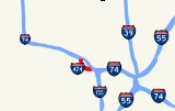
Interstate 474 is an Interstate Highway loop route that provides a southern bypass around the north central Illinois
city of Peoria
. I-474's parent interstate is I-74
. As the first digit of the interstate's number is even, it follows the established convention of providing a loop around a city. Interstate 474 is 14.88 miles (23.95 km) long. I-474 is the highest numbered route in the state of Illinois.
 Interstate 474 is a modern, Interstate-standard four-lane freeway for its entire length. Prior to 2006, thru truck traffic on I-74 was instructed to use I-474. This is because prior to its 2004-2007 reconstruction, Interstate 74 was significantly below Interstate standard, having numerous 15 mi/h onramps and offramps, extremely short merging space for onramps (some less than 500 feet (152 m) in length), and a 50 mi/h speed limit through downtown Peoria.
The Illinois Route 116
access interchange at Maxwell Road has been indicated as the eastern terminus for the Quincy to Peoria expressway now known as the Illinois Route 336
project.
The western terminus of the interstate is at I-74, exit #87A. The eastern terminus of the route is at I-74, exit #100. North of the western terminus, the route continues as Illinois Route 6
with a new series of exit numbers.
Illinois
Illinois is the fifth-most populous state of the United States of America, and is often noted for being a microcosm of the entire country. With Chicago in the northeast, small industrial cities and great agricultural productivity in central and northern Illinois, and natural resources like coal,...
city of Peoria
Peoria, Illinois
Peoria is the largest city on the Illinois River and the county seat of Peoria County, Illinois, in the United States. It is named after the Peoria tribe. As of the 2010 census, the city was the seventh-most populated in Illinois, with a population of 115,007, and is the third-most populated...
. I-474's parent interstate is I-74
Interstate 74
Interstate 74 is an Interstate Highway in the Midwestern and Southeastern United States. Its western end is at an intersection with Interstate 80 in Davenport, Iowa; the eastern end of its Midwest segment is at an intersection with Interstate 75 in Cincinnati, Ohio...
. As the first digit of the interstate's number is even, it follows the established convention of providing a loop around a city. Interstate 474 is 14.88 miles (23.95 km) long. I-474 is the highest numbered route in the state of Illinois.
Route description

The Illinois Route 116
Illinois Route 116
Illinois Route 116 is a cross-state rural state highway that runs from U.S. Route 34 by Gladstone east to the intersection of U.S. Route 45 and Old U.S. Route 45, on the north side of Ashkum...
access interchange at Maxwell Road has been indicated as the eastern terminus for the Quincy to Peoria expressway now known as the Illinois Route 336
Illinois Route 336
Illinois Route 336 is a four-lane freeway/expressway combination that serves western Illinois. It is also used to refer to the name of a future project to connect the cities of Quincy and Peoria via underserved Macomb....
project.
The western terminus of the interstate is at I-74, exit #87A. The eastern terminus of the route is at I-74, exit #100. North of the western terminus, the route continues as Illinois Route 6
Illinois Route 6
Illinois Route 6 is a 4-lane freeway in central Illinois. It begins as a northern extension of Interstate 474 at Interstate 74 west of Peoria, and ends at Illinois Route 29 in Mossville, south of Chillicothe...
with a new series of exit numbers.
History
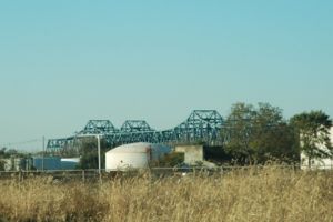
I-474 was constructed through the mid 1970s. The now-named Shade-Lohmann Bridge was erected in 1973. During that year, $30.1 million was allocated for acquisition of right-of-way, grading work and overpass/bridge construction across the whole length of the highway.Exit list
| County | Location | Mile | # Exit number An exit number is a number assigned to a road junction, usually an exit from a freeway. It is usually marked on the same sign as the destinations of the exit, as well as a sign in the gore.... |
Destinations | Notes |
|---|---|---|---|---|---|
| Peoria Peoria County, Illinois Peoria County is a county located in the U.S. state of Illinois. According to the 2010 census, it has a population of 186,494, which is an increase of 1.7% from 183,433 in 2000. Its county seat is Peoria.... |
Peoria Peoria, Illinois Peoria is the largest city on the Illinois River and the county seat of Peoria County, Illinois, in the United States. It is named after the Peoria tribe. As of the 2010 census, the city was the seventh-most populated in Illinois, with a population of 115,007, and is the third-most populated... |
Continuation beyond I-74 | |||
| 0.00 | , Indianapolis Indianapolis, Indiana Indianapolis is the capital of the U.S. state of Indiana, and the county seat of Marion County, Indiana. As of the 2010 United States Census, the city's population is 839,489. It is by far Indiana's largest city and, as of the 2010 U.S... |
Westbound exit and eastbound entrance; signed as exits A (east) and B (west) | |||
| Bellevue Bellevue, Illinois Bellevue is a village in Peoria County, Illinois, United States. The population was 1,887 at the 2000 census. Bellevue is a suburb of Peoria and is part of the Peoria, Illinois Metropolitan Statistical Area.-Geography:... |
3.78 | 3A | |||
| Peoria Peoria, Illinois Peoria is the largest city on the Illinois River and the county seat of Peoria County, Illinois, in the United States. It is named after the Peoria tribe. As of the 2010 census, the city was the seventh-most populated in Illinois, with a population of 115,007, and is the third-most populated... |
5.34 | 5 | Airport Rd | ||
| Bartonville Bartonville, Illinois Bartonville is a village in Peoria County, Illinois, United States. The population was 6,310 at the 2000 census. Bartonville is a suburb of Peoria and is part of the Peoria, Illinois Metropolitan Statistical Area.-Geography:... |
7.09 | 6 | Signed as exits 6A (west) and 6B (east) westbound | ||
| Tazewell Tazewell County, Illinois Tazewell County is a county located in the U.S. state of Illinois. According to the 2010 census, it has a population of 135,394, which is an increase of 5.4% from 128,485 in 2000. Its county seat and largest city is Pekin. The majority of the population live in the suburbs and bedroom communities... |
Marquette Heights | 9 | |||
| 14.88 | 15 | , Indianapolis Indianapolis, Indiana Indianapolis is the capital of the U.S. state of Indiana, and the county seat of Marion County, Indiana. As of the 2010 United States Census, the city's population is 839,489. It is by far Indiana's largest city and, as of the 2010 U.S... |
Eastbound exit and westbound entrance; signed as exits 15A (east) and 15B (west) |

