
.gif)
Highway 29 (Wisconsin)
Encyclopedia
- For the pre-1926 Highway 29, see Highway 29 (Wisconsin 1917).
State Trunk Highway 29 (often called Highway 29, STH 29 or WIS 29) is a state highway running east–west across central Wisconsin
Wisconsin
Wisconsin is a U.S. state located in the north-central United States and is part of the Midwest. It is bordered by Minnesota to the west, Iowa to the southwest, Illinois to the south, Lake Michigan to the east, Michigan to the northeast, and Lake Superior to the north. Wisconsin's capital is...
. It is a major east–west corridor connecting the Twin Cities and the Chippewa Valley with Wausau
Wausau, Wisconsin
Wausau is a city in and the county seat of Marathon County, Wisconsin, United States. The Wisconsin River divides the city. The city is adjacent to the town of Wausau.According to the 2000 census, Wausau had a population of 38,426 people...
and Green Bay
Green Bay, Wisconsin
Green Bay is a city in and the county seat of Brown County in the U.S. state of Wisconsin, located at the head of Green Bay, a sub-basin of Lake Michigan, at the mouth of the Fox River. It has an elevation of above sea level and is located north of Milwaukee. As of the 2010 United States Census,...
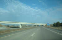
. A multi-year project to upgrade the corridor to a four-lane freeway/expressway
Limited-access road
A limited-access road known by various terms worldwide, including limited-access highway, dual-carriageway and expressway, is a highway or arterial road for high-speed traffic which has many or most characteristics of a controlled-access highway , including limited or no access to adjacent...
from Elk Mound
Elk Mound, Wisconsin
Elk Mound is a village in Dunn County, Wisconsin, United States. The population was 785 at the 2000 census. The village, named for Elk Mound, is located within the Town of Elk Mound.-Geography:Elk Mound is located at ....
to Green Bay was completed in 2005. The expansion served to improve safety on the route, which was over capacity as a two-lane road. The remainder of WIS 29 is two-lane surface road or urban multi-lane road.
Route description
Prescott to Elk Mound
WIS 29 passes through PiercePierce County, Wisconsin
Pierce County is a county located in the U.S. state of Wisconsin. As of 2010, the population was 41,019. Its county seat is Ellsworth. Pierce County is part of the Minneapolis-St. Paul-Bloomington, MN-WI Metropolitan Statistical Area .-Geography:...
, St Croix
St. Croix County, Wisconsin
St. Croix County is a county in the U.S. state of Wisconsin. As of 2010, the population was 84,345. Its county seat is Hudson. St. Croix County is part of the Minneapolis-St. Paul Metropolitan Statistical Area . It is the fastest growing county in Wisconsin.-Geography:According to the U.S...
and Dunn Counties in this section. The highway begins at its western terminus at U.S. Route 10, on the north side of Prescott
Prescott, Wisconsin
Prescott is a city in Pierce County, Wisconsin at the confluence of the St. Croix River and Mississippi River. The population was 4,258 at the 2010 census, making it the second-largest city in the county after River Falls, and the largest entirely within Pierce County.Prescott was home to the...
. From this point, Highway 29 follows WIS 35 northeast to River Falls
River Falls, Wisconsin
River Falls is a city in Pierce and St. Croix counties in the U.S. state of Wisconsin. The population was 15,000 at the 2010 census, making it the second largest city in the Twin Cities Wisconsin suburbs, which is the eighth largest metropolitan area in the state...
, passing the University of Wisconsin–River Falls campus. At the junction with WIS 65, WIS 35 turns northbound with WIS 65 while WIS 29 continues east. WIS 29 joins briefly with US 63 west of Spring Valley
Spring Valley, Wisconsin
Spring Valley is a city in Pierce and St. Croix Counties in the U.S. state of Wisconsin. The population was 1,189 at the 2000 census. The village is located mostly within the Town of Spring Lake in Pierce County. Small portions also lie in the Town of Gilman, also in Pierce County, and the Town of...
and turns eastbound upon its split one mile (1.6 km) south to head into Spring Valley. Upon leaving Spring Valley and Pierce county, the route heads northward into St Croix County and turns east towards Menomonie
Menomonie, Wisconsin
Two other spellings of the name appear elsewhere, see Menomonee and Menominee. For the town, see Menomonie .Menomonie is a city in and the county seat of Dunn County in the western part of the U.S. state of Wisconsin. The city's population was 16,264 as of the 2010 census...
. WIS 29 does not pass through any municipalities while in this county, but it does cross WIS 128.
Upon entering Dunn County, the route passes through rural terrain and enters Menomonie's west side as Hudson Rd. The route turns northward onto Main street and passes west and north of the University of Wisconsin–Stout campus. WIS 29 turns east onto Stout Road along with US 12
U.S. Route 12 in Wisconsin
In the U.S. state of Wisconsin, U.S. Route 12 runs east–west across the western to southeast portions of the state...
and leaves the city to the east. The two routes proceed east for about 9 miles (14.5 km) and junction with Interstate 94
Interstate 94
Interstate 94 is the northernmost east–west Interstate Highway, connecting the Great Lakes and Intermountain regions of the United States. I-94's western terminus is in Billings, Montana at a junction with Interstate 90; its eastern terminus is the U.S...
. This interchange is the westernmost point of the multi-lane WIS 29 corridor. It is also the westernmost point of WIS 29 as a backbone route in Corridors 2020.
Elk Mound to Wausau
Between Elk Mound and WausauWausau, Wisconsin
Wausau is a city in and the county seat of Marathon County, Wisconsin, United States. The Wisconsin River divides the city. The city is adjacent to the town of Wausau.According to the 2000 census, Wausau had a population of 38,426 people...
, WIS 29 passes through Dunn, Chippewa
Chippewa County, Wisconsin
Chippewa County is a county located in the U.S. state of Wisconsin. As of 2000, the population was 55,195. Its county seat is Chippewa Falls. The United States Census Bureau's Eau Claire Metropolitan Statistical Area includes all of Chippewa County...
, Clark and Marathon
Marathon County, Wisconsin
Marathon County is a county located in the U.S. state of Wisconsin. It is part of the Wausau, WI, Metropolitan Statistical Area. As of 2010, the population was 134,063. Its county seat is Wausau.-Geography:...
counties. West of CTH T, the route is an expressway. The route passes into the Chippewa Valley
Eau Claire-Chippewa Falls metropolitan area
The Eau Claire-Chippewa Falls metropolitan area refers loosely to the urbanized area along the Chippewa and Eau Claire Rivers, in west-central Wisconsin, with its primary center at Eau Claire and secondary centers at Chippewa Falls and Altoona....
metropolitan area and south of Chippewa Falls
Chippewa Falls, Wisconsin
Chippewa Falls is a city located on the Chippewa River in Chippewa County in the U.S. state of Wisconsin. The population was 13,661 at the 2010 census. Incorporated as a city in 1869, it is the county seat of Chippewa County....
as a Freeway and crosses U.S. Route 53
U.S. Route 53
U.S. Route 53 is a north–south U.S. highway that runs for 403 miles from La Crosse, Wisconsin to northern Minnesota. It is the primary north–south route in northwestern Wisconsin, serving as a vital link between I-94 at Eau Claire, Wisconsin and the city of Duluth, Minnesota...
at a cloverleaf interchange in Lake Hallie
Lake Hallie, Wisconsin
The population in 2006 was estimated at 6,320, giving the village a population density of 438.9 per square mile . In 2003, the village had 1,704 households. As of 2006, over half the village's area remained rural.- Sports and recreation :...
. WIS 29 junctions with the southern terminus of WIS 178 southeast of Chippewa Falls then passes to the south of Lake Wissota State Park
Lake Wissota State Park
Lake Wissota State Park is a Wisconsin state park near the town of Chippewa Falls. The park is situated on the northeast shore of Lake Wissota, a reservoir on the Chippewa River. Camping, boating, and fishing are the most popular activities. Park lands are covered in a mix of pine/hardwood...
before crossing under Wisconsin Highway 27 in Cadott
Cadott, Wisconsin
Cadott is a village in Chippewa County in the U.S. state of Wisconsin. The population was 1,345 at the 2000 census.-History:Originally named "Cadotte Falls", It was founded in 1875 by Robert Marriner a Pinoeer Enterpriser. Marriner named it after Jean Baptiste Cadotte, son of French Canadian fur...
. WIS 29 passes south of Boyd
Boyd, Wisconsin
Boyd is a village in Chippewa County in the U.S. state of Wisconsin. The population was 680 at the 2000 census.-Geography:Boyd is located at ....
and Stanley
Stanley, Wisconsin
Stanley is a city in Chippewa and Clark counties in the U.S. state of Wisconsin. The population was 1,898 at the 2000 census.- History :Stanley was settled and platted in 1881 when the Wisconsin Central Railway built its line through the area...
before exiting the county to the east.
In Clark County, WIS 29 meets WIS 73 in Thorp
Thorp, Wisconsin
Thorp is a city in Clark County in the U.S. state of Wisconsin. The population was 1,536 at the 2000 census. The city is located partially within the Town of Thorp and partially within the Town of Withee.-Geography:...
. the two routes exit the village to the east concurrently and WIS 73 splits to the south in Withee
Withee, Wisconsin
Withee is a village in Clark County in the U.S. state of Wisconsin. As of the 2000 census, the village population was 508. There is also the Town of Withee, which is also in Clark County several miles west of the village...
about 10 miles (16.1 km) east. WIS 29 continues east and passes south of Owen
Owen, Wisconsin
Owen is a city in Clark County in the U.S. state of Wisconsin. The population was 936 at the 2000 census, but was 982 as of 2008. Owen is located directly east of the village of Withee, which is about half the size of Owen.-Geography:...
and Curtiss
Curtiss, Wisconsin
Curtiss is a village in Clark County in the U.S. state of Wisconsin. The population was 198 at the 2000 census.-Geography:Curtiss is located at ....
. At Abbotsford
Abbotsford, Wisconsin
Abbotsford is a city in Clark and Marathon counties in the U.S. state of Wisconsin. It is part of the Wausau, Wisconsin Metropolitan Statistical Area. The population was 2,310 at the 2010 census...
, WIS 29 and WIS 13 meet at a partial cloverleaf interchange between Abbotsford and Colby
Colby, Wisconsin
Colby is a city in Clark and Marathon counties in the U.S. state of Wisconsin. It is part of the Wausau, Wisconsin Metropolitan Statistical Area. The population was 1,616 at the 2000 census...
on the Clark and Marathon county line. Twelve miles east of Abbotsford, WIS 29 and WIS 97 meet at a diamond interchange. This is a key route for travelers between Wausau and Marshfield
Marshfield, Wisconsin
Marshfield is a city in Marathon and Wood counties in the U.S. state of Wisconsin. It is the largest city in Wood County. The small portion of the city that extends into Marathon County is part of the Wausau Metropolitan Statistical Area. The population was 18,800 at the 2000 census. Marshfield is...
. East of this junction, WIS 29 follows a straight route that passes Edgar
Edgar, Wisconsin
Edgar is a village in Marathon County, Wisconsin, United States. It is part of the Wausau, Wisconsin Metropolitan Statistical Area. The population was 1,386 at the 2000 census...
and meets WIS 107 at a diamond interchange on the north side of Marathon City
Marathon, Wisconsin
Marathon is a town in Marathon County, Wisconsin, United States. It is part of the Wausau, Wisconsin Metropolitan Statistical Area. The population was 1,085 at the 2000 census...
, approximately 8 miles west of Wausau. WIS 29 enters Wausau as a freeway, junctions with the western terminus of WIS 52 approx. 1/2 mile west of US 51
U.S. Route 51 in Wisconsin
In the U.S. state of Wisconsin, U.S. Route 51 runs north–south down the central part of the state...
at an eastbound off/westbound on style half-interchange. WIS 29 then immediately enters the new US 51
U.S. Route 51 in Wisconsin
In the U.S. state of Wisconsin, U.S. Route 51 runs north–south down the central part of the state...
interchange, and turns south onto and follows US 51
U.S. Route 51 in Wisconsin
In the U.S. state of Wisconsin, U.S. Route 51 runs north–south down the central part of the state...
for five miles (8 km), bypassing the downtown area to the south.
Wausau to Green Bay
Shawano County, Wisconsin
Shawano County is a county located in the U.S. state of Wisconsin. As of 2000, the population was 40,664. Its county seat is Shawano.-History:...
, Outagamie
Outagamie County, Wisconsin
Outagamie is a county in the northeast region of the U.S. state of Wisconsin. Its county seat is Appleton. As of the 2009 census estimate, its population was 177,155....
and Brown Counties. South of Wausau, WIS 29 turns off US 51 to the east at the northern terminus of I-39
Interstate 39
Interstate 39 is a highway in the midwestern United States. I-39 runs from Normal, Illinois at Interstate 55 to Highway 29 in Rothschild, Wisconsin, approximately six miles south of Wausau. I-39 was designed to replace US Highway 51, which in the early 1980s was one of the busiest two-lane...
and continues as freeway, passing through the villages of Rothschild
Rothschild, Wisconsin
Rothschild is a village in Marathon County, Wisconsin, United States. It is part of the Wausau, Wisconsin Metropolitan Statistical Area. The population was 4,970 at the 2000 census. Rothschild is the northern terminus of Interstate 39, which starts in Normal, Illinois.-Geography:Rothschild is...
and Weston
Weston, Wisconsin
Weston is a village in Marathon County, Wisconsin, United States. It is part of the Wausau, WI Metropolitan Statistical Area. The population was 14,868 at the 2010 census.- History :...
. The freeway section ends at Ringle
Ringle, Wisconsin
Ringle is a town in Marathon County, Wisconsin, United States. It is part of the Wausau, WI Metropolitan Statistical Area. The population was 1,408 at the 2000 census...
. As an expressway, the highway passes just south of Hatley
Hatley, Wisconsin
Hatley is a village in Marathon County, Wisconsin, United States. It is part of the Wausau, Wisconsin Metropolitan Statistical Area. The population was 476 at the 2000 census.-Geography:Hatley is located at ....
and turns southeast for about four miles (6 km) before turning east again at the northern terminus of WIS 49.
The highway enters Shawano County about one mile (1.6 km) east of this junction. WIS 29 passes north and around Wittenberg
Wittenberg, Wisconsin
Wittenberg is a village in Shawano County, Wisconsin, Wisconsin, United States. The population was 1,177 at the 2000 census. The village is located within the Town of Wittenberg.-Geography:Wittenberg is located at ....
. US 45
U.S. Route 45 in Wisconsin
In the U.S. state of Wisconsin, U.S. Route 45 runs north–south through the eastern and northern portions of the state.-Route description:...
joins with the highway north of Wittenberg and the two routes run concurrently to where US 45 splits to the south at about two miles (3 km) east of the village. WIS 29 bypasses Tilleda
Tilleda, Wisconsin
Tilleda is an unincorporated census-designated place in the town of Seneca in Shawano County, Wisconsin, United States. The community is located on County Highway A less than one mile north of Wisconsin Highway 29. The community uses the 54978 ZIP code...
and Thornton
Thornton, Wisconsin
Thornton is a census-designated place in the town of Richmond, Shawano County, Wisconsin, United States. Its population was 65 as of the 2010 census....
on the way towards Shawano
Shawano, Wisconsin
Shawano is a city in Shawano County, Wisconsin, United States. The population was 9,305 at the 2010 census. It is the county seat of Shawano County...
At Shawano, the expressway becomes a freeway at the junction with CTH MMM (WIS 29 Business) and turns southeast to bypass Shawano to the south, diamond interchanges link the highway with WIS 22 and WIS 47 North / WIS 55 North as it pass south of the city. WIS 47 South and WIS 55 South follow WIS 29 east. WIS 47 splits to the south at the diamond interchange junction with WIS 117 south of Bonduel
Bonduel, Wisconsin
Bonduel is a village in Shawano County, Wisconsin, United States. The population was 1,416 at the 2000 census.-History:The village is named after a Jesuit missionary, the Rev...
. WIS 29 (along with WIS 55) then returns to an expressway at the junction with CTH BE (WIS 29's former route). WIS 55 splits to the south at the diamond interchange junction with WIS 160 at Angelica
Angelica, Wisconsin
Angelica is a town in Shawano County, Wisconsin, United States. The population was 1,635 at the 2000 census. The unincorporated communities of Angelica, Frazer Corners, Krakow, and Zachow are located partially in the town.-Geography:...
and WIS 29 heads southeast to its junction with WIS 156 at the Brown County line.
About one mile (1.6 km) into Brown County, WIS 29 collects WIS 32 eastbound at the diamond interchange with CTH Y. WIS 29 very briefly(approx 1/2 mile!) passes through the northeast corner of Outagamie County and enters the village of Howard
Howard, Wisconsin
Howard is a village in Brown and Outagamie counties in the U.S. state of Wisconsin. The population was 17,399 at the 2010 census. It is part of the Green Bay Metropolitan Statistical Area....
. The multilane expressway and the Backbone Corridor route end at US 41
U.S. Route 41 in Wisconsin
In the U.S. state of Wisconsin, U.S. Highway 41 runs north–south the eastern side of the state. It enters from Illinois at Pleasant Prairie, and runs north to its northern terminus at the Michigan border at Marinette, WI.-Route description:US-41 is a freeway for nearly 70% of its route...
. WIS 32 turns south onto US 41 as WIS 29 continues into Green Bay
Green Bay, Wisconsin
Green Bay is a city in and the county seat of Brown County in the U.S. state of Wisconsin, located at the head of Green Bay, a sub-basin of Lake Michigan, at the mouth of the Fox River. It has an elevation of above sea level and is located north of Milwaukee. As of the 2010 United States Census,...
as Shawano Avenue.
Green Bay to Kewaunee
This section of the highway passes through Brown and Kewaunee Counties. In downtown Green Bay, WIS 29 turns north onto South Monroe Avenue for 4 blocks, joining with WIS 54 and turns east onto Main Street, splitting from WIS 54 and joining US 141 to leave the city to the southeast. The highways passes over I-43Interstate 43
Interstate 43 is a intrastate Interstate Highway located entirely within the U.S. state of Wisconsin, connecting Interstate 39 and Interstate 90 in Beloit with Milwaukee and U.S. Route 41 and U.S. Route 141 in Green Bay. I-43 is the 5th longest intrastate Interstate Highway of the Interstate...
without an interchange. WIS 29 splits to the east from US 141 at about 1 miles (1.6 km) north of US 141's southern terminus at I-43 in Bellevue
Bellevue, Wisconsin
Bellevue is a village in Brown County, Wisconsin, United States. It was a town until incorporating as a village on February 14, 2003. The population of the area that became the village was 11,828 in 2000...
. This provides the only access from I-43 to WIS 29. The highway passes through Poland
Poland, Wisconsin
Poland is an unincorporated community in Brown County, Wisconsin, United States. The community is located at the intersection of County T and Wisconsin Highway 29 several miles east of Green Bay, in the town of Eaton. It is located at latitude 44-26-37N and longitude 87-49-34W.-References:...
and Henrysville
Henrysville, Wisconsin
Henrysville is an unincorporated community located in the town of Eaton, Brown County, Wisconsin, United States. Henrysville is located at the junction of Wisconsin Highway 29 and County Highway P east-southeast of Green Bay....
as it exits Brown County to the east. In Kewaunee County, WIS 29 passes due east through Pilsen
Pilsen, Wisconsin
Pilsen is a town in Bayfield County, Wisconsin, United States. The population was 203 at the 2000 census. The unincorpoarted community of Moquah is located in the town.-Geography:...
and north of Krok
Krok, Wisconsin
Krok is an unincorporated community located in the town of West Kewaunee, in Kewaunee County, Wisconsin. Krok is situated near the origin of the East Twin River and its tributary Krok Creek. Unincorporated Krok is located just west of East Krok and can be accessed via Krok road. In a westward...
as a two lane road. The highway ends in downtown Kewaunee
Kewaunee, Wisconsin
Kewaunee is a city in Kewaunee County, Wisconsin, United States. The population was 2,806 at the 2000 census. Located on the northwestern shore of Lake Michigan, the city is the county seat of Kewaunee County....
at WIS 42 on the shores of Lake Michigan
Lake Michigan
Lake Michigan is one of the five Great Lakes of North America and the only one located entirely within the United States. It is the second largest of the Great Lakes by volume and the third largest by surface area, after Lake Superior and Lake Huron...
.
History
Prior to 1926, Highway 29 was numbered Highway 116 from Minnesota to Chippewa Falls, Highway 16 from Chippewa Falls to Bellevue, and Highway 146 from Bellevue to Kewaunee. Highway 16 continued southeast from Bellevue along what became U.S. Highway 141 in 1926 to Manitowoc. What had been Highway 29 before 1926 became U.S. Highway 16 across the state.Highway 29 has long been known as "Bloody 29" because of the prevalence of grisly fatal traffic crashes along significant portions of the highway. In 1988, a study was commissioned to examine upgrading the highway to a 4-lane divided highway
Divided Highway
Divided Highway is a compilation album by American rock band The Doobie Brothers, released in 2003. . All tracks are taken from the albums Cycles and Brotherhood .-Track listing:...
. The changes would be made along 203 miles (326.7 km) of road from I-94, 2 miles (3.2 km) west of Elk Mound, to US 41 in Howard
Howard, Wisconsin
Howard is a village in Brown and Outagamie counties in the U.S. state of Wisconsin. The population was 17,399 at the 2010 census. It is part of the Green Bay Metropolitan Statistical Area....
(suburban Green Bay
Green Bay, Wisconsin
Green Bay is a city in and the county seat of Brown County in the U.S. state of Wisconsin, located at the head of Green Bay, a sub-basin of Lake Michigan, at the mouth of the Fox River. It has an elevation of above sea level and is located north of Milwaukee. As of the 2010 United States Census,...
). The final segment of the highway, connecting the east side of Chippewa Falls with the segment running north of Eau Claire
Eau Claire, Wisconsin
Eau Claire is a city located in the west-central part of the U.S. state of Wisconsin. The population was 65,883 as of the 2010 census, making it the largest municipality in the northwestern portion of the state, and the 9th largest in the state overall. It is the county seat of Eau Claire County,...
, was opened to traffic on August 16, 2005. Of the total length, about 65 miles (104.6 km) of the highway meets Interstate standards. Most of the expansion was able to be completed with only minor additions to the already-existing easements, and as a result, the expanded roadway almost exactly matches the highway's original course. While traffic crashes have declined significantly, numerous memorials to those who lost their lives on the road still dot the route.
Highway 29 is the only Wisconsin state highway in WisDOT's Corridors 2020 Backbone Routes system.
The portion of WIS 29 between Chippewa Falls and Abbotsford roughly follows what used to be the Yellowstone Trail
Yellowstone Trail
The Yellowstone Trail was the first transcontinental automobile highway through the upper tier of states in the United States. It ran from Massachusetts to Seattle. It was conceived by J.W. Parmley of Ipswich, South Dakota in 1912. Originally, Parmley and his business colleagues wanted a good road...
In 2007, the improvements to Highway 29 won a Wonders of Wisconsin Engineering Award from the American Council of Engineering Companies, Wisconsin Chapter. Four firms (Ayres Associates, Strand Associates, CH2M Hlll and Earth Tech) were honored for their work on the project in the chapter's 50th anniversary award program.
Current status
Highway 29 is nearing completion on upgrades in Wausau as a part of the US 51/WIS 29 project. This project has expanded the portions of Highway 29 that are co-signed with US 51 from 4 lanes to 6 lanes and reconstructed interchanges along the route to allow for higher bridge clearances, and higher capacity on.off ramps. The southern interchange where Highway 29 turns east off from US 51 was completed in late 2006.The northern interchange where WIS 29 turns west off of US 51 is now fully open to traffic. On September 17th, 2010, the final ramp connecting WIS 29 Eastbound to US 51 northbound opened to traffic.
Over the past few years, corridor preservation studies have been underway to plan for the eventual conversion of WIS 29 to full freeway standards. Areas are being studied in Marathon, Shawano, and Brown Counties. Specifically between Abbotsford and Wausau in western Marathon County, as well as from Ringle in east central Marathon County through Shawano County to CTH J in the Village of Howard in Brown County near Green Bay.
Beginning in 2011, WIS 29 will be upgraded in Brown County, beginning at CTH J in the Village Of Howard, proceeding east to US 41. The WIS 29/US 41 Interchange will be upgraded to a "free-flow" freeway-to-freeway style interchange to allow for uninterrupted travel between the two highways. The upgrades will also include an interchange at CTH EB/Packerland Dr./Cardinal Ln; and a grade separated overpass at CTH J. This project is expected to last until 2015.
Prescott to Elk Mound
Elk Mound to Green Bay
| County | Location | # Exit number An exit number is a number assigned to a road junction, usually an exit from a freeway. It is usually marked on the same sign as the destinations of the exit, as well as a sign in the gore.... |
Destinations | Notes | |
|---|---|---|---|---|---|
| WIS 29 west along with US 12 west continue as a 2-lane road to Menomonie Menomonie, Wisconsin Two other spellings of the name appear elsewhere, see Menomonee and Menominee. For the town, see Menomonie .Menomonie is a city in and the county seat of Dunn County in the western part of the U.S. state of Wisconsin. The city's population was 16,264 as of the 2010 census... |
|||||
| Dunn | Elk Mound Elk Mound, Wisconsin Elk Mound is a village in Dunn County, Wisconsin, United States. The population was 785 at the 2000 census. The village, named for Elk Mound, is located within the Town of Elk Mound.-Geography:Elk Mound is located at .... |
60A-B | , St Paul | Shown here as a terminus to the 4-lane expressway. WIS 29 is surface street here with a combo diamond/trumpet interchange with I-94. | |
| 61 | US 12 West follow WIS 29 West. | ||||
| Chippewa Chippewa County, Wisconsin Chippewa County is a county located in the U.S. state of Wisconsin. As of 2000, the population was 55,195. Its county seat is Chippewa Falls. The United States Census Bureau's Eau Claire Metropolitan Statistical Area includes all of Chippewa County... |
Chippewa Falls Chippewa Falls, Wisconsin Chippewa Falls is a city located on the Chippewa River in Chippewa County in the U.S. state of Wisconsin. The population was 13,661 at the 2010 census. Incorporated as a city in 1869, it is the county seat of Chippewa County.... |
69 | |||
| 72 | |||||
| 75A-B | Lake Hallie use Exit 75A; Chippewa Falls use Exit 75B To WIS 124 use Exit 75A |
||||
| 79 | Seymour Cray Sr Blvd use Exit 79 | ||||
| Lake Wissota Lake Wissota, Wisconsin Lake Wissota is a census-designated place in the town of Lafayette in Chippewa County in the U.S. state of Wisconsin. The population was 2,738 at the 2010 census... |
80 | ||||
Lake Wissota State Park
Lake Wissota State Park is a Wisconsin state park near the town of Chippewa Falls. The park is situated on the northeast shore of Lake Wissota, a reservoir on the Chippewa River. Camping, boating, and fishing are the most popular activities. Park lands are covered in a mix of pine/hardwood...
| Westbound entrance; Eastbound exit only
|-
| 81
|
| Westbound exit; Eastbound entrance only
|-
| 87
| — Lake Wissota State Park
Lake Wissota State Park
Lake Wissota State Park is a Wisconsin state park near the town of Chippewa Falls. The park is situated on the northeast shore of Lake Wissota, a reservoir on the Chippewa River. Camping, boating, and fishing are the most popular activities. Park lands are covered in a mix of pine/hardwood...
| Eastbound omits Lake Wissota State Park
|-
| Cadott
Cadott, Wisconsin
Cadott is a village in Chippewa County in the U.S. state of Wisconsin. The population was 1,345 at the 2000 census.-History:Originally named "Cadotte Falls", It was founded in 1875 by Robert Marriner a Pinoeer Enterpriser. Marriner named it after Jean Baptiste Cadotte, son of French Canadian fur...
| 91
|
|
|-
| Boyd
Boyd, Wisconsin
Boyd is a village in Chippewa County in the U.S. state of Wisconsin. The population was 680 at the 2000 census.-Geography:Boyd is located at ....
| 97
|
|
|-
| Stanley
Stanley, Wisconsin
Stanley is a city in Chippewa and Clark counties in the U.S. state of Wisconsin. The population was 1,898 at the 2000 census.- History :Stanley was settled and platted in 1881 when the Wisconsin Central Railway built its line through the area...
| 101
|
|
|-
| rowspan=6|Clark
| Thorp
Thorp, Wisconsin
Thorp is a city in Clark County in the U.S. state of Wisconsin. The population was 1,536 at the 2000 census. The city is located partially within the Town of Thorp and partially within the Town of Withee.-Geography:...
| 108
|
|
|-
| Withee
Withee, Wisconsin
Withee is a village in Clark County in the U.S. state of Wisconsin. As of the 2000 census, the village population was 508. There is also the Town of Withee, which is also in Clark County several miles west of the village...
| 118
|
|Greenwood use Exit 118
|-
| rowspan=2 | Owen
Owen, Wisconsin
Owen is a city in Clark County in the U.S. state of Wisconsin. The population was 936 at the 2000 census, but was 982 as of 2008. Owen is located directly east of the village of Withee, which is about half the size of Owen.-Geography:...
| none
|
|at-grade intersection
|-
| 122
|
|-
| Curtiss
Curtiss, Wisconsin
Curtiss is a village in Clark County in the U.S. state of Wisconsin. The population was 198 at the 2000 census.-Geography:Curtiss is located at ....
| 127
|
|
|-
| rowspan=4|Abbotsford
Abbotsford, Wisconsin
Abbotsford is a city in Clark and Marathon counties in the U.S. state of Wisconsin. It is part of the Wausau, Wisconsin Metropolitan Statistical Area. The population was 2,310 at the 2010 census...
| 131
|
| Eastbound exit; Westbound entrance only
Hiline Ave use Exit 131
|-
| rowspan=22|Marathon
Marathon County, Wisconsin
Marathon County is a county located in the U.S. state of Wisconsin. It is part of the Wausau, WI, Metropolitan Statistical Area. As of 2010, the population was 134,063. Its county seat is Wausau.-Geography:...
| 132
|
| Marshfield
Marshfield, Wisconsin
Marshfield is a city in Marathon and Wood counties in the U.S. state of Wisconsin. It is the largest city in Wood County. The small portion of the city that extends into Marathon County is part of the Wausau Metropolitan Statistical Area. The population was 18,800 at the 2000 census. Marshfield is...
, Medford
Medford, Wisconsin
Medford is a city in Taylor County, in north-central Wisconsin, United States. The population was 4,326 at the 2010 census. The city is located mostly within the boundaries of the Town of Medford.- Geography :Medford is located at Medford is a city in Taylor County, in north-central Wisconsin,...
use Exit 132 (Marshfield only signed eastbound)
|-
| 134
|
| Eastbound entrance; Westbound exit only
Maple Rd use Exit 134
|-
| none
|
| At-grade intersection
|-
| rowspan=2 | Wien
Wien, Wisconsin
Wien is a town in Marathon County, Wisconsin, United States. It is part of the Wausau, Wisconsin Metropolitan Statistical Area. The population was 712 at the 2000 census...
| 145
|
| Stratford
Stratford, Wisconsin
Stratford is a village in Marathon County, Wisconsin, United States. It is part of the Wausau, Wisconsin Metropolitan Statistical Area. The population was 1,523 at the 2000 census.-History:...
use Exit 145
|-
| none
|
| At-grade intersection
|-
| rowspan=2 | Edgar
Edgar, Wisconsin
Edgar is a village in Marathon County, Wisconsin, United States. It is part of the Wausau, Wisconsin Metropolitan Statistical Area. The population was 1,386 at the 2000 census...
| 150
|
|
|-
| none
|
| At-grade intersection
|-
| Marathon City
Marathon City, Wisconsin
Marathon City is a village in Marathon County, Wisconsin, United States. It is part of the Wausau, Wisconsin Metropolitan Statistical Area. The population was 1,640 at the 2000 census. The village was incorporated from a part of the original area of the Town of Marathon...
| 156
|
|
|-
| rowspan=4|Wausau
Wausau, Wisconsin
Wausau is a city in and the county seat of Marathon County, Wisconsin, United States. The Wisconsin River divides the city. The city is adjacent to the town of Wausau.According to the 2000 census, Wausau had a population of 38,426 people...
| 162
| 72nd Ave
|
|-
| 164 A-B
|
| WIS 52/Stewart Ave, Downtown Wausau/UW Marathon County use Exit 164-A
US 51 North to Merrill use Exit 164-B
*Note* WIS 52 is Eastbound exit, Westbound entrance only.
Exit ramp is two lanes wide; WIS 52/Stewart Ave use left lane, US 51 North to Merrill use right lane.
|-
!colspan=4|WIS 29 East follow US 51 South
|-
| 191
(US 51)
| Sherman Street
| Northbound exit; Southbound entrance only.
|-
| rowspan=4|Rib Mountain
Rib Mountain, Wisconsin
Rib Mountain is a town in Marathon County, Wisconsin, United States. The population was 7,556 at the 2000 census. Rib Mountain is part of the Wausau Metropolitan Statistical Area. It is a suburb of Wausau and part of the Wausau Metropolitan Area...
| 190
(US 51)
|
| .
|-
| 188
(US 51)
|
|
|-
!colspan=4|WIS 29 West follow US 51 North
|-
| 170
|
| Westbound only
WIS 29 Eastbound (US 51 SB)use Exit 187 towards Weston/Green Bay to continue East on WIS 29.
|-
| Rothschild
Rothschild, Wisconsin
Rothschild is a village in Marathon County, Wisconsin, United States. It is part of the Wausau, Wisconsin Metropolitan Statistical Area. The population was 4,970 at the 2000 census. Rothschild is the northern terminus of Interstate 39, which starts in Normal, Illinois.-Geography:Rothschild is...
| 171
|
|
|-
| rowspan=2|Weston
Weston, Wisconsin
Weston is a village in Marathon County, Wisconsin, United States. It is part of the Wausau, WI Metropolitan Statistical Area. The population was 14,868 at the 2010 census.- History :...
| 173
|
|
|-
| 177
|
|
|-
| Ringle
Ringle, Wisconsin
Ringle is a town in Marathon County, Wisconsin, United States. It is part of the Wausau, WI Metropolitan Statistical Area. The population was 1,408 at the 2000 census...
| 181
|
|
|-
| Hatley
Hatley, Wisconsin
Hatley is a village in Marathon County, Wisconsin, United States. It is part of the Wausau, Wisconsin Metropolitan Statistical Area. The population was 476 at the 2000 census.-Geography:Hatley is located at ....
| 185
|
|
|-
| Elderon
Elderon, Wisconsin
Elderon is a village in Marathon County, Wisconsin, United States. It is part of the Wausau, Wisconsin Metropolitan Statistical Area. The population was 189 at the 2000 census.-Geography:Elderon is located at ....
| none
|
| at-grade intersection
|-
| rowspan=15|Shawano
Shawano County, Wisconsin
Shawano County is a county located in the U.S. state of Wisconsin. As of 2000, the population was 40,664. Its county seat is Shawano.-History:...
| rowspan=4|Wittenberg
Wittenberg, Wisconsin
Wittenberg is a village in Shawano County, Wisconsin, Wisconsin, United States. The population was 1,177 at the 2000 census. The village is located within the Town of Wittenberg.-Geography:Wittenberg is located at ....
| 195
|
| US 45 South follows WIS 29 East
|-
| 196
|
| Eastbound entrance; Westbound exit only
|-
| 198
|
| Eastbound signs omits Bus WIS 29, CTH Q, and Wittenberg
US 45 North follows WIS 29 West
|-
| none
|
| At-grade intersection
|-
| rowspan=3|Tilleda
Tilleda, Wisconsin
Tilleda is an unincorporated census-designated place in the town of Seneca in Shawano County, Wisconsin, United States. The community is located on County Highway A less than one mile north of Wisconsin Highway 29. The community uses the 54978 ZIP code...
| none
|
| At-grade intersection
|-
| none
|
|-
| none
|
| At-grade intersection
|-
| rowspan=2|Thornton
Thornton, Wisconsin
Thornton is a census-designated place in the town of Richmond, Shawano County, Wisconsin, United States. Its population was 65 as of the 2010 census....
| none
|
| At-grade intersection
|-
| none
|
| At-grade intersection
|-
| rowspan=2|Shawano
Shawano, Wisconsin
Shawano is a city in Shawano County, Wisconsin, United States. The population was 9,305 at the 2010 census. It is the county seat of Shawano County...
| 225
|
|
|-
| 227
|
| WIS 47 South / WIS 55 South follow WIS 29 East
|-
| rowspan=2|Bonduel
Bonduel, Wisconsin
Bonduel is a village in Shawano County, Wisconsin, United States. The population was 1,416 at the 2000 census.-History:The village is named after a Jesuit missionary, the Rev...
| 234
|
| WIS 47 North follow WIS 29 West
|-
| none
|
| At-grade intersection - Formerly Highway 29
|-
| rowspan=2|Angelica
Angelica, Wisconsin
Angelica is a town in Shawano County, Wisconsin, United States. The population was 1,635 at the 2000 census. The unincorporated communities of Angelica, Frazer Corners, Krakow, and Zachow are located partially in the town.-Geography:...
| none
|
| At-grade intersection
|-
| none
|
| Angelica
Angelica, Wisconsin
Angelica is a town in Shawano County, Wisconsin, United States. The population was 1,635 at the 2000 census. The unincorporated communities of Angelica, Frazer Corners, Krakow, and Zachow are located partially in the town.-Geography:...
use Exit 242
WIS 55 North follow WIS 29 West
|-
| rowspan=7|Brown
| Pittsfield
Pittsfield, Wisconsin
Pittsfield is a town in Brown County in the U.S. state of Wisconsin. The population was 2,433 at the 2000 census. The unincorporated communities of Anston, Kunesh, and Mill Center are located in the town...
| none
|
| At-grade intersection
|-
| rowspan=2|Oneida
Oneida, Wisconsin
Oneida is an unincorporated community and former census-designated place in the town of Oneida, Outagamie County, Wisconsin, United States. The population was 1,070 at the 2000 census. At the census, part of the CDP lay within the town of Hobart, which has since incorporated as a village, in...
| 249
|
| WIS 32 South follow WIS 29 East
|-
| none
|
| At-grade intersection
|-
| rowspan=4|Green Bay
Green Bay, Wisconsin
Green Bay is a city in and the county seat of Brown County in the U.S. state of Wisconsin, located at the head of Green Bay, a sub-basin of Lake Michigan, at the mouth of the Fox River. It has an elevation of above sea level and is located north of Milwaukee. As of the 2010 United States Census,...
| none
|
| At-grade intersection
|-
| none
| Greenfield Ave
| At-grade intersection
|-
| none
|
| At-grade intersection
|-
| none
|
| WIS 32 North follow WIS 29 West
Shown here as a terminus to the 4-lane expressway. WIS 29 is surface street here with a diamond interchange with the US 41 Freeway.
|-
!colspan=6| WIS 32 follows US 41 south.
|}
Green Bay to Kewaunee
Future plans
WisDOT is studying options for Highway 29 conversions to Interstate standards in three sections.The section between I-94 and County Highway X's eastern exit is already designated as a freeway by WisDOT - despite the existence of several at-grade intersections between U.S. Highway 53 and I-94. WisDOT is studying options for upgrade of these intersections as part of the study. In addition, upgrades to the I-94 interchange with Highway 29 are also being considered. WisDOT is also studying options for upgrades to the highway to a freeway further east to Bruce Mound Ave. in Clark County.
The second section - between Wittenberg (U.S. Highway 45) and Green Bay (U.S. Highway 41) is also undergoing a study for planned upgrades of the highway to freeway standards. As it stands now, the Shawano
Shawano, Wisconsin
Shawano is a city in Shawano County, Wisconsin, United States. The population was 9,305 at the 2010 census. It is the county seat of Shawano County...
bypass is the only section that is a freeway. The study is geared toward upgrading the rest of the section to Interstate standards.
The third section - between Ringle (County Highway Q) and Wittenberg (U.S. Highway 45) is at the preliminary stages for freeway upgrades. WisDOT is currently focusing on preserving right of way access for future upgrades.
To date, WisDOT has no published plans for the segments from Bruce Mound Ave. to Abbotsford (Badger Ave.) and from Abbotsford to Wausau (72nd Ave.)
Bannered routes
WIS 29 has four business routeBusiness route
A business route in the United States and Canada is a short special route connected to a parent numbered highway at its beginning, then routed through the central business district of a nearby city or town, and finally reconnecting with the same parent numbered highway again at its...
s:
- Business WIS 29 in Chippewa Falls
- Business WIS 29 in Abbotsford
- Business WIS 29 in Wittenberg
- Business WIS 29 in Shawano