

Interstate 696
Encyclopedia
Interstate 696 is an intrastate Interstate Highway entirely within the US state of Michigan
. I-696 is also known as the Walter P. Reuther Freeway, named for a prominent figure in early automobile factory labor union activity. I-696 is a spur route, partially circling the city of Detroit
, but traveling entirely through Detroit's northern suburb
s. It starts by branching off of Interstate 96
and Interstate 275
at the west end and ends by merging into Interstate 94
on the east end. It has 6–8 lanes for most of its length and is approximately 10 miles (16.1 km) north of downtown Detroit. It is a major morning and evening commute
route, bringing many people living west of Detroit into the suburbs north of the city and into downtown Detroit via other Michigan highways such as M-10
("The Lodge" freeway) and M-39
(The Southfield freeway). Some local residents affectionately call this freeway "The Autobahn of Detroit."
 I-696 is part of the original Interstate Highway System
as outlined in 1956-58. The first portion built was the western third of the completed freeway, from the western junction
with I-96 in Novi
east to the Lodge Freeway in Southfield
, which opened in 1963-1964. The eastern third between I-75 in Royal Oak
and I-94 in St. Clair Shores
was completed in early 1979, followed by the middle portion between Telegraph Road and I-75 in December 1989. I-696 is a full freeway along its entire length.
For a short time in the 1970s, M-6
was used in place of the routing for the segment under construction east of I-75. It was unclear whether the lawsuits would force the center segment to be canceled, which would have left the I-696 freeway discontiguous. M-6 signs were erected on both the frontage roads and the divided road of 11 Mile at Mound Road.
Construction of the Reuther took much longer than expected and went over budget. The major contributors to this were the Pleasant Ridge
and Detroit Zoo
lawsuits to stop construction of the freeway. Another was the fact that the eastern end of the Reuther ran through built-up neighborhoods, many of which were less than 10–15 years in age. In fact, some of the neighborhoods in the Hoover and Van Dyke area were under construction at the same time as the I-696 project which led to confrontations between the two construction projects, costing freeway developers more than anticipated to purchase the land.
As part of the overall rehabilitation to the "Mixing Bowl" interchange (where the freeway crosses both US-24 and M-10
in Southfield), a new partial interchange at Franklin Road was constructed. An exit ramp from I-696 eastbound to American Drive opened in April 2006. An entrance ramp from Franklin Road to I-696 westbound opened in July 2006. The Franklin Road overpass, which had been closed during this time, re-opened in October 2006.
St. Clair Shores mayor Eugene Ellison (1961–1965) was instrumental in blocking plans to extend I-696 east of I-94 and dividing the St Clair Shores neighborhoods.
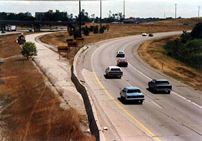
.png) I-696 begins in the west near the city of Novi as a left exit branching off of I-96 as a portion of the I-96/I-696/I-275/M-5 interchange, the largest freeway interchange in the world. It collects traffic from northbound I-275 as it treks east through Farmington Hills
I-696 begins in the west near the city of Novi as a left exit branching off of I-96 as a portion of the I-96/I-696/I-275/M-5 interchange, the largest freeway interchange in the world. It collects traffic from northbound I-275 as it treks east through Farmington Hills
and Southfield on its way to the "Mixing Bowl", where it encounters M-10 and Telegraph Rd. at the former temporary end as another complicated interchange. If one wishes to access U.S. 24, it can only be done via the M-10 exit. After this interchange, 11 Mile Road straddles I-696. Further east, just after the Southfield Road exit, the interstate makes an "S" shape just prior to the Greenfield Road exit and leaves 11 Mile Road. After Greenfield Road, 10 Mile Road then straddles the freeway and continues east to M-1 and I-75. After a four-level stack interchange
with I-75, I-696 jogs northeast, leaving 10 Mile Road and again is straddled by 11 Mile Road. The freeway then encounters Mound Road in another stack
(in anticipation of the construction of the southern "missing link" of the M-53
Freeway), making a slight bend to the south. Its last exit is M-3 just west of the eastern terminus at I-94 in Macomb County. The road continues going due east over I-94 as 11 Mile Road to Jefferson Avenue, St. Clair Shores, and Lake St.Clair
.
The segment of the Reuther located between the "Mixing Bowl" and I-75 is known for its extensive use of retaining walls and three large landscaped caps forming short tunnels for freeway traffic. The caps were constructed as plazas with respect to the local Orthodox Jewish communities in need of the most direct route to weekly temple services, which the freeway's route as originally planned was seen to interrupt. Negotiations related to the plazas were the primary reason the completion of this section of the Reuther was delayed until 1989. As a consequence of those beautification features, explosive flammable cargoes are banned on that segment.
I-696's western terminus is also the northern terminus of I-275
, making this junction one of the few points that is the terminus of two three-digit Interstate Highways with different parents.
Michigan
Michigan is a U.S. state located in the Great Lakes Region of the United States of America. The name Michigan is the French form of the Ojibwa word mishigamaa, meaning "large water" or "large lake"....
. I-696 is also known as the Walter P. Reuther Freeway, named for a prominent figure in early automobile factory labor union activity. I-696 is a spur route, partially circling the city of Detroit
Detroit, Michigan
Detroit is the major city among the primary cultural, financial, and transportation centers in the Metro Detroit area, a region of 5.2 million people. As the seat of Wayne County, the city of Detroit is the largest city in the U.S. state of Michigan and serves as a major port on the Detroit River...
, but traveling entirely through Detroit's northern suburb
Suburb
The word suburb mostly refers to a residential area, either existing as part of a city or as a separate residential community within commuting distance of a city . Some suburbs have a degree of administrative autonomy, and most have lower population density than inner city neighborhoods...
s. It starts by branching off of Interstate 96
Interstate 96
Interstate 96 is an intrastate Interstate Highway that is entirely within the US state of Michigan. Its western terminus is at an interchange with US Highway 31 and Business US Highway 31 , on the western boundary of Norton Shores southeast of Muskegon. Its eastern terminus is at I-75 near the...
and Interstate 275
Interstate 275 (Michigan)
Interstate 275 in the US state of Michigan is an Interstate Highway that functions as a western bypass of the Detroit metropolitan area. The Michigan Department of Transportation maintains it as a component of the larger state trunkline highway system. The freeway runs through the western suburbs...
at the west end and ends by merging into Interstate 94
Interstate 94 in Michigan
Interstate 94 is a part of the Interstate Highway System that runs from Billings, Montana, to the Lower Peninsula of the US state of Michigan. In Michigan, it is a state trunkline highway that enters the state south of New Buffalo...
on the east end. It has 6–8 lanes for most of its length and is approximately 10 miles (16.1 km) north of downtown Detroit. It is a major morning and evening commute
Commuting
Commuting is regular travel between one's place of residence and place of work or full time study. It sometimes refers to any regular or often repeated traveling between locations when not work related.- History :...
route, bringing many people living west of Detroit into the suburbs north of the city and into downtown Detroit via other Michigan highways such as M-10
M-10 (Michigan highway)
M-10, is a state trunkline route in the US state of Michigan. The southernmost portion follows Jefferson Avenue in downtown Detroit, and the southern terminus is at the intersection of Jefferson and Randolph Street leading to the entrance to the Detroit–Windsor Tunnel...
("The Lodge" freeway) and M-39
M-39 (Michigan highway)
M-39 is a state highway in the US state of Michigan that runs from Lincoln Park to Southfield. The southern terminus of M-39 is at the corner of Southfield Road and Lafayette Boulevard in Lincoln Park, one block southeast of the junction of I-75 and two blocks northwest of M-85...
(The Southfield freeway). Some local residents affectionately call this freeway "The Autobahn of Detroit."
History
Interstate Highway System
The Dwight D. Eisenhower National System of Interstate and Defense Highways, , is a network of limited-access roads including freeways, highways, and expressways forming part of the National Highway System of the United States of America...
as outlined in 1956-58. The first portion built was the western third of the completed freeway, from the western junction
Junction (road)
A road junction is a location where vehicular traffic going in different directions can proceed in a controlled manner designed to minimize accidents. In some cases, vehicles can change between different routes or directions of travel.-Origins:...
with I-96 in Novi
Novi, Michigan
Novi is a city in Oakland County in the U.S. state of Michigan. As of the 2010 census, the population was 55,224, an increase over the 2000 census count of 47,386. The city is located approximately northwest of the center of Detroit, and northeast of the center of Ann Arbor. The city is located...
east to the Lodge Freeway in Southfield
Southfield, Michigan
According to the United States Census Bureau, the city has a total area of , of which 0.04% is water. The main branch of the River Rouge runs through Southfield. The city is bounded to the south by Eight Mile Road, its western border is Inkster Road, and to the east it is bounded by Greenfield Road...
, which opened in 1963-1964. The eastern third between I-75 in Royal Oak
Royal Oak, Michigan
Royal Oak is a city in Oakland County of the U.S. state of Michigan. It is a suburb of Detroit. As of the 2010 census, the city had a total population of 57,236. It should not be confused with Royal Oak Charter Township, a separate community located nearby....
and I-94 in St. Clair Shores
St. Clair Shores, Michigan
St. Clair Shores is a suburban city bordering Lake St. Clair in Macomb County of the U.S. state of Michigan. It forms a part of the Metro Detroit area, and is located approximately northeast of downtown Detroit. As of the 2010 census, the city had a total population of 59,715. The current mayor is...
was completed in early 1979, followed by the middle portion between Telegraph Road and I-75 in December 1989. I-696 is a full freeway along its entire length.
For a short time in the 1970s, M-6
M-6 (Michigan highway)
M-6, or the Paul B. Henry Freeway, is a freeway and state trunkline highway in the United States that serves portions of southern Kent and eastern Ottawa counties south of Grand Rapids, Michigan. Although the freeway is named for Paul B. Henry, local residents and the press continue to use the...
was used in place of the routing for the segment under construction east of I-75. It was unclear whether the lawsuits would force the center segment to be canceled, which would have left the I-696 freeway discontiguous. M-6 signs were erected on both the frontage roads and the divided road of 11 Mile at Mound Road.
Construction of the Reuther took much longer than expected and went over budget. The major contributors to this were the Pleasant Ridge
Pleasant Ridge, Michigan
Pleasant Ridge is a city in Oakland County in the U.S. state of Michigan. The population was 2,526 at the 2010 census.-Geography:According to the United States Census Bureau, the city has a total area of , all land.-History:...
and Detroit Zoo
Detroit Zoo
The Detroit Zoological Park, commonly known as the Detroit Zoo, is located about north of the Detroit city limits at the intersection of Woodward Avenue, 10 Mile Road, and Interstate 696 in Royal Oak and Huntington Woods, Michigan, USA...
lawsuits to stop construction of the freeway. Another was the fact that the eastern end of the Reuther ran through built-up neighborhoods, many of which were less than 10–15 years in age. In fact, some of the neighborhoods in the Hoover and Van Dyke area were under construction at the same time as the I-696 project which led to confrontations between the two construction projects, costing freeway developers more than anticipated to purchase the land.
As part of the overall rehabilitation to the "Mixing Bowl" interchange (where the freeway crosses both US-24 and M-10
M-10 (Michigan highway)
M-10, is a state trunkline route in the US state of Michigan. The southernmost portion follows Jefferson Avenue in downtown Detroit, and the southern terminus is at the intersection of Jefferson and Randolph Street leading to the entrance to the Detroit–Windsor Tunnel...
in Southfield), a new partial interchange at Franklin Road was constructed. An exit ramp from I-696 eastbound to American Drive opened in April 2006. An entrance ramp from Franklin Road to I-696 westbound opened in July 2006. The Franklin Road overpass, which had been closed during this time, re-opened in October 2006.
St. Clair Shores mayor Eugene Ellison (1961–1965) was instrumental in blocking plans to extend I-696 east of I-94 and dividing the St Clair Shores neighborhoods.
Route description
Farmington Hills, Michigan
Farmington Hills is a community in southeastern Michigan. It is the largest city in Oakland County in the U.S. state of Michigan. Its population was 79,740 at the 2010 census...
and Southfield on its way to the "Mixing Bowl", where it encounters M-10 and Telegraph Rd. at the former temporary end as another complicated interchange. If one wishes to access U.S. 24, it can only be done via the M-10 exit. After this interchange, 11 Mile Road straddles I-696. Further east, just after the Southfield Road exit, the interstate makes an "S" shape just prior to the Greenfield Road exit and leaves 11 Mile Road. After Greenfield Road, 10 Mile Road then straddles the freeway and continues east to M-1 and I-75. After a four-level stack interchange
Stack interchange
A stack interchange is a free-flowing grade separated junction between two roads.In countries where one drives on the right, left turns are handled by semi-directional flyover/under ramps...
with I-75, I-696 jogs northeast, leaving 10 Mile Road and again is straddled by 11 Mile Road. The freeway then encounters Mound Road in another stack
Stack interchange
A stack interchange is a free-flowing grade separated junction between two roads.In countries where one drives on the right, left turns are handled by semi-directional flyover/under ramps...
(in anticipation of the construction of the southern "missing link" of the M-53
M-53 (Michigan highway)
M-53 is a gateway route to The Thumb region of the US state of Michigan, carrying vacationers to the many cottages and resorts located on Saginaw Bay and Lake Huron in the vicinity of Caseville and Port Austin. This highway is also used to transport agricultural and manufactured products from the...
Freeway), making a slight bend to the south. Its last exit is M-3 just west of the eastern terminus at I-94 in Macomb County. The road continues going due east over I-94 as 11 Mile Road to Jefferson Avenue, St. Clair Shores, and Lake St.Clair
Lake Saint Clair (North America)
Lake St. Clair is a fresh-water lake named after Clare of Assisi that lies between the Province of Ontario and the State of Michigan, and its midline also forms the boundary between Canada and the United States of America. Lake St. Clair includes the Anchor Bay along the Metro Detroit coastline...
.
The segment of the Reuther located between the "Mixing Bowl" and I-75 is known for its extensive use of retaining walls and three large landscaped caps forming short tunnels for freeway traffic. The caps were constructed as plazas with respect to the local Orthodox Jewish communities in need of the most direct route to weekly temple services, which the freeway's route as originally planned was seen to interrupt. Negotiations related to the plazas were the primary reason the completion of this section of the Reuther was delayed until 1989. As a consequence of those beautification features, explosive flammable cargoes are banned on that segment.
I-696's western terminus is also the northern terminus of I-275
Interstate 275 (Michigan)
Interstate 275 in the US state of Michigan is an Interstate Highway that functions as a western bypass of the Detroit metropolitan area. The Michigan Department of Transportation maintains it as a component of the larger state trunkline highway system. The freeway runs through the western suburbs...
, making this junction one of the few points that is the terminus of two three-digit Interstate Highways with different parents.