
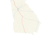
Interstate 75 in Georgia
Encyclopedia
In the U.S. state
of Georgia
, Interstate 75
runs north–south along the U.S. Route 41 corridor on the western side of the state, passing through the cities of Valdosta, Macon
and Atlanta. It is also designated — but not signed — as State Route 401. In downtown Atlanta, I-75 joins with Interstate 85 as the Downtown Connector
.
near Valdosta, and it continues northward through the towns of Tifton and Cordele until it reaches the Macon
area, where it intersects with Interstate 16
eastbound towards Savannah
. For northbound traffic wishing to avoid potential congestion in Macon, Interstate 475
provides a relatively straight bypass west of that city and Interstate 75's route. After Macon it passes the small town of Forsyth. The freeway reaches no major junctions again until in the Atlanta metropolitan area. The first metropolitan freeway met is Interstate 675
, then followed by the Atlanta "Perimeter" bypass, Interstate 285
. It crosses inside the Perimeter and heads northeast several miles towards the Atlanta city center. Interstate 75 is then duplexed with Interstate 85
due north over the Downtown Connector
through the central business district of Atlanta. After the two Interstates split, Interstate 75 makes a beeline northwest, crossing outside the Interstate 285 Perimeter and heading towards the major suburban city of Marietta
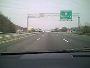
. This section of Interstate 75 just north of Interstate 285 has 15 through lanes, making it the widest roadway anywhere in the Interstate Highway System. North of Marietta, the final major junction in the Atlanta metropolitan area is the Interstate 575
spur. Interstate 75 then traverses the hilly northwestern Georgia terrain as it travels towards Chattanooga, Tennessee
.
The 180-mile section of I-75 from I-475
to Interstate 24
in Chattanooga is one of the longest continuous six-lane freeways in the United States (some segments along this corridor have as many as 16 lanes).
Due to recent widening in south Georgia, the only four-lane section of I-75 in Georgia is bypassed by six-lane I-475; along this route there are at least six lanes from Florida's Turnpike
in Wildwood, Florida
to I-24
in Chattanooga
.
northward to the Tennessee state line was named the Larry McDonald
Memorial Highway. Larry McDonald, a conservative Democratic representative to Congress was aboard Korean Air Lines Flight 007 when it was shot down by the Soviets on Sept. 1, 1983. He was the only sitting Congressman to be reportedly killed by the Soviets during the Cold War.
Until 2000, the state of Georgia used the sequential interchange numbering system on all of its Interstate Highways. The first exit on each highway would begin with the number "1" and increase numerically with each exit. In 2000, the Georgia Department of Transportation switched to a mileage-based exit system, in which the exit number corresponded to the nearest milepost.
In March 2007, I-75 in Atlanta (the HOV ramp serving Northside Drive) was the site of the 2007 Atlanta I-75 Charter Bus Accident.
U.S. state
A U.S. state is any one of the 50 federated states of the United States of America that share sovereignty with the federal government. Because of this shared sovereignty, an American is a citizen both of the federal entity and of his or her state of domicile. Four states use the official title of...
of Georgia
Georgia (U.S. state)
Georgia is a state located in the southeastern United States. It was established in 1732, the last of the original Thirteen Colonies. The state is named after King George II of Great Britain. Georgia was the fourth state to ratify the United States Constitution, on January 2, 1788...
, Interstate 75
Interstate 75
Interstate 75 is a major north–south Interstate Highway in the Great Lakes and Southeastern regions of the United States. It travels from State Road 826 and State Road 924 in Hialeah, Florida to Sault Ste. Marie, Michigan, at the Ontario, Canada, border...
runs north–south along the U.S. Route 41 corridor on the western side of the state, passing through the cities of Valdosta, Macon
Macon, Georgia
Macon is a city located in central Georgia, US. Founded at the fall line of the Ocmulgee River, it is part of the Macon metropolitan area, and the county seat of Bibb County. A small portion of the city extends into Jones County. Macon is the biggest city in central Georgia...
and Atlanta. It is also designated — but not signed — as State Route 401. In downtown Atlanta, I-75 joins with Interstate 85 as the Downtown Connector
Downtown Connector
In Atlanta, Georgia, the Downtown Connector or 75/85 is the concurrent section of Interstate 75 and Interstate 85 through the core of the city. Beginning at the I-85/Langford Parkway interchange, the Downtown Connector runs generally due north, meeting the east-west Interstate 20 in the middle....
.
Route description
Interstate 75 enters GeorgiaGeorgia (U.S. state)
Georgia is a state located in the southeastern United States. It was established in 1732, the last of the original Thirteen Colonies. The state is named after King George II of Great Britain. Georgia was the fourth state to ratify the United States Constitution, on January 2, 1788...
near Valdosta, and it continues northward through the towns of Tifton and Cordele until it reaches the Macon
Macon, Georgia
Macon is a city located in central Georgia, US. Founded at the fall line of the Ocmulgee River, it is part of the Macon metropolitan area, and the county seat of Bibb County. A small portion of the city extends into Jones County. Macon is the biggest city in central Georgia...
area, where it intersects with Interstate 16
Interstate 16
Interstate 16 , also known as Jim Gillis Historic Savannah Parkway or State Route 404 , is an intrastate Interstate Highway located entirely within the state of Georgia, United States...
eastbound towards Savannah
Savannah, Georgia
Savannah is the largest city and the county seat of Chatham County, in the U.S. state of Georgia. Established in 1733, the city of Savannah was the colonial capital of the Province of Georgia and later the first state capital of Georgia. Today Savannah is an industrial center and an important...
. For northbound traffic wishing to avoid potential congestion in Macon, Interstate 475
Interstate 475 (Georgia)
Interstate 475 is a long Interstate highway in Georgia, splitting off from Interstate 75 and bypassing Macon, Georgia. It is also unsigned State Route 408...
provides a relatively straight bypass west of that city and Interstate 75's route. After Macon it passes the small town of Forsyth. The freeway reaches no major junctions again until in the Atlanta metropolitan area. The first metropolitan freeway met is Interstate 675
Interstate 675 (Georgia)
Interstate 675 was built in southeast metro Atlanta during the mid-1980s to alleviate Interstate 75 to the west, for traffic bound to Interstate 285 east. It is 11.04 miles in length, running from I-75 in the south from the city of Stockbridge to I-285 at its north end...
, then followed by the Atlanta "Perimeter" bypass, Interstate 285
Interstate 285
Interstate 285 is an Interstate Highway loop encircling Atlanta, Georgia, for . I-285 is also known as unsigned State Route 407 and is colloquially referred to as the Perimeter. Suburban sprawl has made it one of the most heavily traveled roadways in the United States, and portions of the highway...
. It crosses inside the Perimeter and heads northeast several miles towards the Atlanta city center. Interstate 75 is then duplexed with Interstate 85
Interstate 85
Interstate 85 is a major interstate highway in the Southeastern United States. Its current southern terminus is at an interchange with Interstate 65 in Montgomery, Alabama; its northern terminus interchanges with Interstate 95 in Petersburg, Virginia, near Richmond...
due north over the Downtown Connector
Downtown Connector
In Atlanta, Georgia, the Downtown Connector or 75/85 is the concurrent section of Interstate 75 and Interstate 85 through the core of the city. Beginning at the I-85/Langford Parkway interchange, the Downtown Connector runs generally due north, meeting the east-west Interstate 20 in the middle....
through the central business district of Atlanta. After the two Interstates split, Interstate 75 makes a beeline northwest, crossing outside the Interstate 285 Perimeter and heading towards the major suburban city of Marietta
Marietta, Georgia
Marietta is a city located in central Cobb County, Georgia, United States, and is its county seat.As of the 2010 census, the city had a total population of 56,579, making it one of metro Atlanta's largest suburbs...
. This section of Interstate 75 just north of Interstate 285 has 15 through lanes, making it the widest roadway anywhere in the Interstate Highway System. North of Marietta, the final major junction in the Atlanta metropolitan area is the Interstate 575
Interstate 575
Interstate 575 is an Interstate Highway spur route in the United States, which branches off Interstate 75 in Kennesaw and connects the metro Atlanta area with the north Georgia mountains. I-575 is also the unsigned State Route 417 and is cosigned as SR 5...
spur. Interstate 75 then traverses the hilly northwestern Georgia terrain as it travels towards Chattanooga, Tennessee
Tennessee
Tennessee is a U.S. state located in the Southeastern United States. It has a population of 6,346,105, making it the nation's 17th-largest state by population, and covers , making it the 36th-largest by total land area...
.
The 180-mile section of I-75 from I-475
Interstate 475 (Georgia)
Interstate 475 is a long Interstate highway in Georgia, splitting off from Interstate 75 and bypassing Macon, Georgia. It is also unsigned State Route 408...
to Interstate 24
Interstate 24
Interstate 24 is an Interstate Highway in the Midwestern and Southeastern United States. It runs diagonally from Interstate 57 to Chattanooga, Tennessee, at Interstate 75....
in Chattanooga is one of the longest continuous six-lane freeways in the United States (some segments along this corridor have as many as 16 lanes).
Due to recent widening in south Georgia, the only four-lane section of I-75 in Georgia is bypassed by six-lane I-475; along this route there are at least six lanes from Florida's Turnpike
Florida's Turnpike
Florida's Turnpike , designated as the Ronald Reagan Turnpike, and originally known as the Sunshine State Parkway is a north–south toll road that runs through 11 counties in the Florida peninsula, from U.S...
in Wildwood, Florida
Wildwood, Florida
Wildwood is a city in Sumter County, Florida, United States. The population was 3,924 at the 2000 census. According to the U.S. Census Bureau's 2004 estimates, the city had a population of 3,598.-Geography:Wildwood is located at ....
to I-24
Interstate 24 in Tennessee
In the U.S. state of Tennessee, Interstate 24 runs from Clarksville to Chattanooga via Nashville. Just west of Chattanooga, I-24 drops into Georgia's Dade County for before reentering Tennessee....
in Chattanooga
Chattanooga, Tennessee
Chattanooga is the fourth-largest city in the US state of Tennessee , with a population of 169,887. It is the seat of Hamilton County...
.
Lane configurations
- Total lane mileage in Georgia is 2,144.71 miles (3,451.58 km)
- from Florida State line to milepost 103 near CordeleCordele, GeorgiaCordele, also known as The Watermelon Capital of the World, is a city in Crisp County, Georgia, United States. The population was 11,608 at the 2000 census. The city is the county seat of Crisp County...
(3 lanes each way) - from milepost 103 to I-475Interstate 475 (Georgia)Interstate 475 is a long Interstate highway in Georgia, splitting off from Interstate 75 and bypassing Macon, Georgia. It is also unsigned State Route 408...
(Exit 156) (3 lanes each way, undergoing widening from Sardis Church Road overpass to I-475) - from I-475 to I-16Interstate 16Interstate 16 , also known as Jim Gillis Historic Savannah Parkway or State Route 404 , is an intrastate Interstate Highway located entirely within the state of Georgia, United States...
(Exit 165) (3 lanes each way) - from I-16 to I-475 (Exit 177) (2 lanes each way)
- from I-475 (Exit 177) to the southern city limits of ForsythForsyth, GeorgiaForsyth is a city in Monroe County, Georgia, United States. The population was 3,776 at the 2000 census. This number was corrected to read 4,300. The city is the county seat of Monroe County.Forsyth is part of the Macon Metropolitan Statistical Area...
(4 NB, 3 SB) - within Forsyth (4 lanes each way)
- from the northern city limits of Forsyth to I-675Interstate 675 (Georgia)Interstate 675 was built in southeast metro Atlanta during the mid-1980s to alleviate Interstate 75 to the west, for traffic bound to Interstate 285 east. It is 11.04 miles in length, running from I-75 in the south from the city of Stockbridge to I-285 at its north end...
(Exit 227) (3 lanes each way) - from I-675 to I-285Interstate 285Interstate 285 is an Interstate Highway loop encircling Atlanta, Georgia, for . I-285 is also known as unsigned State Route 407 and is colloquially referred to as the Perimeter. Suburban sprawl has made it one of the most heavily traveled roadways in the United States, and portions of the highway...
(Exit 238) (4 lanes each way) - from I-285 to I-85Interstate 85Interstate 85 is a major interstate highway in the Southeastern United States. Its current southern terminus is at an interchange with Interstate 65 in Montgomery, Alabama; its northern terminus interchanges with Interstate 95 in Petersburg, Virginia, near Richmond...
/Langford Pkwy interchange (mile 242) (5 lanes each way, including HOV) - I-75/85 Common Section or "Downtown ConnectorDowntown ConnectorIn Atlanta, Georgia, the Downtown Connector or 75/85 is the concurrent section of Interstate 75 and Interstate 85 through the core of the city. Beginning at the I-85/Langford Parkway interchange, the Downtown Connector runs generally due north, meeting the east-west Interstate 20 in the middle....
" (7-8 lanes each way, including HOV) - from I-85/Brookwood Interchange (mile 251) to I-285 (Exit 259) (5 lanes each way, including HOV)
- from I-285 to I-575Interstate 575Interstate 575 is an Interstate Highway spur route in the United States, which branches off Interstate 75 in Kennesaw and connects the metro Atlanta area with the north Georgia mountains. I-575 is also the unsigned State Route 417 and is cosigned as SR 5...
(Exit 268) (5-7 lanes each way, more closer to 285, with 8 NB lanes just north of Windy Hill Road (exit 260)) - from I-575 to Barrett ParkwayBarrett ParkwayErnest W. Barrett Parkway is a major thoroughfare in northwest metro Atlanta between western and northern Cobb County, Georgia. It runs from southwest of Marietta, to the north and then northeast near Kennesaw, and continues on in both directions under other names. The portion of Barrett Parkway...
/KennesawKennesaw, GeorgiaKennesaw is a city in Cobb County, Georgia, United States. It had a population of 29,783 according to the 2010 census. It is part of the Atlanta metropolitan area. Founded in 1887, Kennesaw has a past surrounded with railroad history...
(Exit 269) (4 lanes each way) - from Barrett ParkwayBarrett ParkwayErnest W. Barrett Parkway is a major thoroughfare in northwest metro Atlanta between western and northern Cobb County, Georgia. It runs from southwest of Marietta, to the north and then northeast near Kennesaw, and continues on in both directions under other names. The portion of Barrett Parkway...
/KennesawKennesaw, GeorgiaKennesaw is a city in Cobb County, Georgia, United States. It had a population of 29,783 according to the 2010 census. It is part of the Atlanta metropolitan area. Founded in 1887, Kennesaw has a past surrounded with railroad history...
to Tennessee State line (3 lanes each way, a few climbing lanes on longer hills)
- from Florida State line to milepost 103 near Cordele
Auxiliary routes
- Interstate 175Georgia State Route 300State Route 300, also called the Georgia-Florida Parkway, is a long route that runs from Florida State Road 57 at the Florida-Georgia state line south of Thomasville in Thomas County, north to I-75 in Cordele in Crisp County.-Route description:...
was a proposed spur from CordeleCordele, GeorgiaCordele, also known as The Watermelon Capital of the World, is a city in Crisp County, Georgia, United States. The population was 11,608 at the 2000 census. The city is the county seat of Crisp County...
southwest to AlbanyAlbany, GeorgiaAlbany is a city in and the county seat of Dougherty County, Georgia, United States, in the southwestern part of the state. It is the principal city of the Albany, Georgia metropolitan area and the southwest part of the state. The population was 77,434 at the 2010 U.S. Census, making it the...
. The road was built, but not as a freeway; it is State Route 300Georgia State Route 300State Route 300, also called the Georgia-Florida Parkway, is a long route that runs from Florida State Road 57 at the Florida-Georgia state line south of Thomasville in Thomas County, north to I-75 in Cordele in Crisp County.-Route description:...
, the Georgia-Florida Parkway. - Interstate 475Interstate 475 (Georgia)Interstate 475 is a long Interstate highway in Georgia, splitting off from Interstate 75 and bypassing Macon, Georgia. It is also unsigned State Route 408...
is a western bypass of MaconMacon, GeorgiaMacon is a city located in central Georgia, US. Founded at the fall line of the Ocmulgee River, it is part of the Macon metropolitan area, and the county seat of Bibb County. A small portion of the city extends into Jones County. Macon is the biggest city in central Georgia...
, shortening the trip for through I-75 traffic. - Interstate 575 is a spur from near MariettaMarietta, GeorgiaMarietta is a city located in central Cobb County, Georgia, United States, and is its county seat.As of the 2010 census, the city had a total population of 56,579, making it one of metro Atlanta's largest suburbs...
north to NelsonNelson, GeorgiaNelson is a city partly in Pickens and mostly in Cherokee counties in the U.S. state of Georgia. As of the 2000 census, the city had a total population of 1314.City of Nelson - Pickens County...
. - Interstate 675Interstate 675 (Georgia)Interstate 675 was built in southeast metro Atlanta during the mid-1980s to alleviate Interstate 75 to the west, for traffic bound to Interstate 285 east. It is 11.04 miles in length, running from I-75 in the south from the city of Stockbridge to I-285 at its north end...
is a cutoff from I-75 south of AtlantaAtlanta, GeorgiaAtlanta is the capital and most populous city in the U.S. state of Georgia. According to the 2010 census, Atlanta's population is 420,003. Atlanta is the cultural and economic center of the Atlanta metropolitan area, which is home to 5,268,860 people and is the ninth largest metropolitan area in...
north to Interstate 285 - Atlanta's perimeterPerimeterA perimeter is a path that surrounds an area. The word comes from the Greek peri and meter . The term may be used either for the path or its length - it can be thought of as the length of the outline of a shape. The perimeter of a circular area is called circumference.- Practical uses :Calculating...
- east of I-75.
History
In 1998, The portion of I-75 that runs from the Chattahoochee RiverChattahoochee River
The Chattahoochee River flows through or along the borders of the U.S. states of Georgia, Alabama, and Florida. It is a tributary of the Apalachicola River, a relatively short river formed by the confluence of the Chattahoochee and Flint Rivers and emptying into Apalachicola Bay in the Gulf of...
northward to the Tennessee state line was named the Larry McDonald
Larry McDonald
Lawrence Patton McDonald, M.D. was an American politician and a member of the United States House of Representatives, representing the seventh congressional district of Georgia as a Democrat...
Memorial Highway. Larry McDonald, a conservative Democratic representative to Congress was aboard Korean Air Lines Flight 007 when it was shot down by the Soviets on Sept. 1, 1983. He was the only sitting Congressman to be reportedly killed by the Soviets during the Cold War.
Until 2000, the state of Georgia used the sequential interchange numbering system on all of its Interstate Highways. The first exit on each highway would begin with the number "1" and increase numerically with each exit. In 2000, the Georgia Department of Transportation switched to a mileage-based exit system, in which the exit number corresponded to the nearest milepost.
In March 2007, I-75 in Atlanta (the HOV ramp serving Northside Drive) was the site of the 2007 Atlanta I-75 Charter Bus Accident.